issues and opportunities report - city of whittlesea · the purpose of this issues and...
TRANSCRIPT
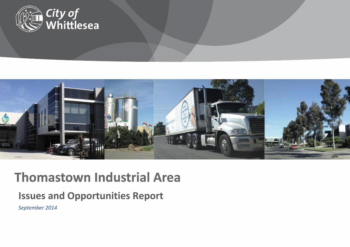
FRONT COVER
Issues and Opportunities Report September 2014

Contents Introduction ............................................................................................................................................................................................................................................................... 3
PURPOSE AND STRUCTURE .................................................................................................................................................................................................................................... 4
PROJECT STAGES .................................................................................................................................................................................................................................................... 4
The study area ............................................................................................................................................................................................................................................................ 6
Issues and Opportunities ........................................................................................................................................................................................................................................... 9
ECONOMIC CONTEXT ............................................................................................................................................................................................................................................. 9
LAND USE ............................................................................................................................................................................................................................................................. 11
URBAN DESIGN: BUILT FORM AND VISUAL AMENITY ......................................................................................................................................................................................... 13
TRANSPORT, ACCESS AND INFRASTRUCTURE ...................................................................................................................................................................................................... 16
THE NATURAL ENVIRONMENT ............................................................................................................................................................................................................................. 20
What’s next? ............................................................................................................................................................................................................................................................ 23

Introduction The Thomastown Industrial Area is located in the southernmost part of the City of Whittlesea and is one of the largest consolidated areas of industrial zoned land in the municipality and in the wider region. The industrial area extends over 600 hectares and includes over 2,300 properties.
Situated next to the Metropolitan Ring Road and the Hume Freeway, the area has easy access to the Melbourne Central Business District (CBD), Melbourne Airport and the Port of Melbourne. Businesses are ideally located for local, national and international distribution networks as well as a local catchment of workers, and benefit from co-location with complementary manufacturers, service and catchment-based industries, major wholesalers and distributors.
The area is an important local employment precinct, and plays a substantial role in providing business and employment opportunities for Melbourne’s broader northern region:
§ An estimated 1,800 businesses operate in the precinct.
§ These businesses contribute an estimated $1.1B to the economy.
§ Approximately 11,000 people are employed in the precinct.
Accordingly the area is recognised as being of State significance in the recently published Metropolitan Strategy Plan Melbourne, where it is identified as being part of the Northern Industrial Precinct.
There is a wide range of businesses operating in the area from small start-up firms to major international companies. The importance of the precinct as a manufacturing area and opportunities to promote a greater diversity of industrial and employment uses are significant. The changes that are currently occurring in the broader economic environment however will have an impact on how the area evolves and develops in the future. In order to remain strong and competitive the area must be adaptable to industry and employment trends, and cater for new and diverse economic and employment activity to ensure its continued viability and vitality.
Some parts of the industrial precinct have changed considerably in the last two decades, and some areas are poorly maintained. Integral to attracting investment will be improving the visual amenity of the area and providing a functional public realm that imparts a positive impression and acts as an attractive gateway for the municipality.
While the area has an industrial employment focus, pressure to rezone parts of the area to non-industrial uses has also been experienced. To date very little strategic work has been undertaken for the area and as a result there is a lack of policy direction available to inform responses to such requests and guide planning decisions.

Land use planning is one part of a variety of economic development initiatives that can enable Council to direct and attract investment and provide increased employment opportunities for the community. While there is the ability to influence land uses and attract certain industries to particular locations via zones and overlays, and through the preparation and delivery of land use strategies, there will also be a need to link the initiatives identified to Council’s broader economic development portfolio.
PURPOSE AND STRUCTURE
The purpose of this Issues and Opportunities Report is to summarise these findings and present an overview of potential policy directions for the Strategy. These are broken down under the following broad themes:
§ Economic Context
§ Land Use
§ Urban Design
§ Transport, Access and Infrastructure
§ The Natural Environment
This report will form the basis for preparing a draft Strategy for the Thomastown Industrial Area. The opportunities presented will be considered with a range of stakeholders to ensure that the recommendations in the Strategy are robust, realistic, and in keeping with the overarching objectives of the project.
PROJECT STAGES
In this context, the purpose of the project is to develop a strategy that sets a clear framework with respect to land use, urban design and environmental sustainability. The Thomastown Industrial Area project is being undertaken in three stages as per the table at right.
Extensive research and review was undertaken by Council throughout Stage 1 to inform the Background Report and this Issues and Opportunities Report. This included stakeholder consultation, detailed investigations of existing conditions, and specialist input on matters such as urban design and economic and market analysis. The findings of this have been presented in detail in the Background Report.

Attractive façade treatment on new commercial building
This Issues and Opportunities Report has been prepared based on the Background Report, as well as further research and stakeholder input and review following the completion of Stage 1.
Stage 1
Background research and review
Understanding and assessing existing conditions, trends and policy influences
Targeted consultation with Government, key industries and businesses
Assembling key findings and influences
Preparation of Background Report and technical studies
Stage 2
Issues and Opportunities – CURRENT STAGE
Establishing issues and opportunities to be investigated
Preparation of Issues and Opportunities Report
Testing of key principles and directions through range of consultation stakeholders
Preparation of further technical reports

Stage 3
Preparation of Strategy
Drafting of Strategy
Adoption by Council for public exhibition of draft
Consideration of submissions
Consideration by Council for adoption of final Strategy
The study areaThe Thomastown Industrial Area occupies approximately 6 square kilometres of land, generally located between the Metropolitan Ring Road and Mahoneys Road / Keon Parade in the southernmost part of the City of Whittlesea.
It is one of several industrial hubs in Metropolitan Melbourne, which include Campbellfield immediately to the west, as well as Moorabbin, Clayton and Altona. It has easy access to the Melbourne CBD, ports and airports via the Ring
New office / warehouse development on Heyington Avenue

Road, Hume Freeway and the arterial road network. Public transport provision is also extensive, including the South Morang rail line and Keon Park station which sit within the precinct. Within the region, the area also benefits from close proximity to La Trobe and RMIT Universities, the future Melbourne Wholesale Markets, and the Thomastown neighbourhood activity centre.
The area is a major economic generator for the municipality and the northern region, and is a key location for employment and commercial activity. Accordingly the vast majority of the industrial area is zoned Industrial 1, with two pockets of Commercial 2 Zone (plus small parcels of other various zones such as Public Use). The surrounding land is predominantly residential, but the industrial area is largely buffered from this sensitive use by major roads and utilities easements. Lot sizes vary from less than 500 square metres to over 2 hectares, with limited availability of vacant sites.
The arterial roads, utilities infrastructure and creeks have the effect of creating discrete precincts within the industrial area, each with their own characteristics in terms of land use and built form.
QUICK FACTS
The Thomastown Industrial Area …
§ Occupies around 6 square kilometres of land
§ Contains an estimated 1,800 businesses and over 30% of these are in manufacturing
§ Has low vacancy rates for premises at around 5% (typical vacancy rates are 6-12%)
§ Is estimated to employ over 11,000 people and contribute $1.1 billion to the economy
§ Is a major local employment hub: 72% of workers are from the northern region and 40% are City of Whittlesea residents.
§ The area forms part of a major food manufacturing precinct across Whittlesea and Hume, with over 150 businesses employing around 6,000 people.

MA P: KEY FEAT UR E S

Issues and Opportunities ECONOMIC CONTEXT
1 .1 Ov er arc hi ng dem og r aphi c c hang es
The City of Whittlesea is experiencing high ongoing rates of population growth, a trend which has been consistent for several years as one of the country’s fastest-growing municipalities. Access to local job opportunities provides a wide range of positive social and environmental outcomes for the community. To respond to this growth, Whittlesea has a policy to seek to attract or create one job in the municipality for every household.
The Thomastown Industrial Area plays a vital role in providing local employment opportunities for Whittlesea residents and the northern region, but will need to be resilient and adaptable to respond to changing economic and demographic trends. Most significantly, the occupations of City of Whittlesea residents are changing rapidly over time from generally blue collar (labourers, trade workers etc.) to a more white collar profile. At the same time, industrial market analysis indicates that low-skilled manufacturers with high international competition are likely to decline in favour of those producing specialised, high technology products, so the skills profile of the labour force will need to change accordingly.
The area benefits from an engaged business community who are strongly committed to the area and have good ideas for how the area could be improved as it changes over time. These range from the detailed and pragmatic to the broad-ranging and visionary, and help to provide direction to Council throughout the development of the Thomastown Industrial Area Strategy.
E1. Develop a strategy that positions the Thomastown Industrial Area to adapt to broader economic trends, whilst ensuring that the skills of the local workforce are appropriate, relevant and up-to-date.
E2. Investigate opportunities to actively target growth industries and work to facilitate their location within the Thomastown Industrial Area.
Responding to a changing economy
Economic and property market forces are driving change in the industrial area, and will continue to do so into the future. Manufacturing businesses report that due to the need to stay ahead of competitors, their work has evolved from being almost entirely focused on manufacturing, to an increased role for in-house research, design and product development. At the same time, many businesses are being ‘squeezed’ out of more inner-urban areas (such as Darebin and Moreland) as both land value and rezoning pressure increase, and being drawn to lower-cost areas in outer suburbs. The Victorian Government’s 2013 zoning reforms have also removed restrictions on office space on industrially zoned sites, providing increased flexibility for land and business owners to diversify the types of commercial uses provided on industrial land. These factors provide greater opportunities for attracting a broad range of businesses and could generate greater turnover and renewal of businesses and built form in the Thomastown Industrial Area over time.

E3. Ensure that the industrial area continues to provide a range of industrial premises to accommodate businesses affected by rezoning in inner-urban commercial precincts.
E4. Facilitate the provision of flexible commercial spaces that can be adapted as business needs change over time.
1 .2 B ui l di ng on s t r engths
The industrial area hosts a large number of businesses (upwards of 1,800) in a diverse range of industries including but not limited to manufacturing, warehousing, distribution, wholesale trade, and automotive repair. It has excellent access to the arterial road network, very low vacancy rates, and affordable premises. Despite these strengths, limited work has been undertaken to date to actively attract businesses seeking a location from which to base their activities, or to promote businesses within the precinct to potential markets. At the same time there are opportunities to better connect businesses within the precinct to government, industry bodies, and research institutions such as local universities.
E5. Undertake a proactive approach to promoting the area and its profile, including consideration for the development of a new brand identity for the precinct.
E6. Build relationships between business, industry bodies and government to improve networking and trade relationships, deliver services for business and employees, and promote local business to the broader community.
Commercial development on Lipton Drive

The Metropolitan Ring Road provides excellent road transport access for businesses in the precinct
LAND USE
Employment funct ion The Thomastown Industrial Area is the largest consolidated area of industrial land in the City of Whittlesea, a strength it shares with the Campbellfield precinct to the west in the City of Hume. The size of the precinct (around 6 square kilometres) and significant buffers afforded by major roads, utilities easements, and large vacant sites means that there are few sensitive interfaces, providing the opportunity for a wide variety of industrial uses to locate in the precinct without negative impacts on surrounding uses. At the same time, small-lot subdivision and pressure to rezone land for alternative uses has the potential to dilute the industrial/employment function of the precinct, reduce employment densities, and threaten the viability of buffer-dependent industry. These threats need to be balanced with the need to adapt to a changing economy and demographic trends away from blue-collar occupations towards a more professional / service-oriented skills base.
L1. Identify areas with opportunities for increased employment densities to facilitate a wider range and mix of employment uses.
L2. Investigate rezoning opportunities to reflect the specific mix of uses that will support increased employment densities, whilst protecting the area’s primarily industrial/employment function.
1 .3 R ev i ew i ng buf fer s to s ens i t i v e us es
Although the majority of the precinct is buffered from sensitive uses, there are still some small areas of the industrial area with close or direct abuttal to residential properties (e.g. Alison Street and Spencer Street west of Dalton Road, and in the east of the precinct adjacent to the former quarry site). It may be appropriate to consider rezoning and/or other planning controls, such as DDO, for these areas to provide a better interface to residential land. At the same time, any rezoning should seek to maintain the primary focus of the precinct as an industrial / employment area, and avoid zones which introduce the potential further encroachment of sensitive uses such
as residential.

L3. Consider whether rezoning of areas in close proximity to residential uses is needed to reduce land use conflicts.
1 .4 N on- i ndus tr i a l us es
Industrial areas inevitably play host to a variety of non-industrial uses in addition to their primary role. This can have valuable benefits for the amenity and function of the precinct: some uses, such as food and drinks premises and medical services provide benefits for employees and reduce the need to travel outside the precinct to access them (though Thomastown is not well served by these uses). Similarly, there can be operational benefits for businesses if co-located with supply chain partners and professional services. Other uses attracted to industrial areas can include ‘destination-based’ uses such as leisure, retail (such as bulky goods and manufacturing sales), and places of worship. These uses can be attracted by the generally larger sites and cheaper rents offered by industrial areas compared to activity centres, or may have been pushed out of inner industrial areas as they evolve to accommodate higher-value uses. These uses can change the character of industrial areas and increase pressure to rezone sites, further entrenching associated issues such as on-street parking congestion and reduced employment densities. In Thomastown in particular these uses are not always successful – several bulky goods developments for example appear to be performing poorly, with access issues and vacant tenancies.
L4. Consider policy to direct certain types of non-industrial uses to preferred locations.
L5. Maintain the industrial area’s primary function as an employment precinct, and avoid the encroachment of sensitive uses which may impact on this function.
1 .5 B ul ky g oods
Numerous bulky goods-based developments have emerged in the industrial area, particularly in the vicinity of Dalton Road. Whilst these uses benefit from exposure to this main road, some are vacant or appear to be underperforming. In addition their design can result in poor presentation to the street and the creation of barriers for pedestrian movements through the presence of at-grade parking at the street frontage. The co-location of these businesses on Dalton Road has created a defined bulky-goods precinct and this land use profile is unlikely to shift substantially in the short to medium term.
L6. Review the zoning to enable a range of uses that would support bulky goods and assist to better define these precincts.
L7. Develop design guidelines for bulky goods retailing to promote increased landscaping and integration of built form with the street frontage, and improved connectivity.
1 .6 Ur ban r enew al
The new Metropolitan Planning Strategy, Plan Melbourne, identifies Keon Park Station and the surrounding land as an investigation area for potential urban renewal. Land to the south of the station (in the City of Darebin) may be most suited to this urban renewal given the constraints associated with the land north of Keon Parade, including the Ausnet Services terminal station, and the risk of the encroachment of sensitive uses into a primarily industrial/employment-based precinct. It is recommended that such encroachment be limited in order to minimise the risk of operational constraints for existing businesses. There may also be potential for non-industrial employment uses to locate on High Street, given the accessibility to both Keon Park and Thomastown Stations, and the lack of access to the Metropolitan Ring Road making the area less suitable for businesses reliant on transport and logistics.
L8. Explore opportunities for a greater intensity of development around Keon Park Station.

L9. Explore intensification of employment uses in High Street corridor.
1 .7 Moni tor i ng dev el opment ac t iv i ty ov er t i me
Development in the Thomastown Industrial Area for employment purposes has occurred primarily since the 1960s (with some exceptions such as Fowler Pottery which established in the precinct in 1927). In the earlier period of the industrial area’s development, most construction occurred on large lots of 5,000 sqm or more. Since that time, development has occurred on progressively smaller lots, with most development activity since 2000 occurring on small lots of less than 500 square metres for uses such as warehousing and small factories. If this trend continues unchecked the area may see a decline in both business diversity and employment densities.
L10. Investigate establishing precincts which retain a large lot subdivision pattern to ensure a variety and range of businesses can locate in the industrial area.
L11. Set up a monitoring framework for development activity to understand and establish trends to enable informed decisions about the future direction of the area.
Bulky goods signage on Dalton Road
Many businesses as they expand are finding that they cannot easily adapt their premises to suit their needs. This combined with the high cost of relocation can result in front setback areas being given over to storage of materials and waste, resulting in poor presentation to the public realm, and displacement of on-site parking leading to on-street parking pressure. Some buildings (both new and old) have been poorly designed with limited consideration for appearance and functionality, with detrimental impacts on building users and streetscape amenity.
URBAN DESIGN: BUILT FORM AND VISUAL AMENITY
Design qual i ty

Well-designed buildings and urban areas are longer lasting, less expensive to operate and maintain, and have highly practical amenity. They are designed to be flexible and adaptable, have good presentation, and provide an effective interface to adjacent buildings and public realm. They should be future-proofed as far as possible to ensure longevity in the face of changing economic and environmental conditions
UD1. Develop design guidelines for industrial areas to ensure functional and attractive layouts in new development, the use of high-quality materials, and encourage more flexible and adaptable industrial formats.
1 .8 Sus ta i nabl e des i g n
To date there has been minimal consideration given to sustainable design for new development in the Thomastown Industrial Area, and very few buildings are designed to achieve good outcomes for energy efficiency or stormwater management for example. There are however tangible benefits associated with sustainable buildings in addition to their environmental performance, including reduced ongoing energy costs, improved comfort for occupiers, and the ability to attract quality tenants seeking higher amenity facilities.
Several Victorian Councils are seeking to implement consistent and transparent sustainable design assessment processes aimed at promoting these qualities within urban developments. This process is highly applicable to urban renewal areas and could be readily adapted to the Thomastown industrial precinct.
UD2. Consider the inclusion of sustainable design provisions as part of municipal wide or place-specific design guidelines for industrial areas.
High quality landscaping and mature street trees on Northgate Drive
unappealing for clients and businesses considering locating in the area. Factors include poor presentation of individual buildings (due to design / materials selection, lack of
1 .9 Str eets c ape am eni ty
The appearance of the Thomastown Industrial Area is a concern for many business operators within the precinct, who perceive the area as looking run-down and

maintenance, untidy front setbacks, graffiti and high fencing), as well as public realm issues such as powerlines, and lack of street trees. Consultation and market analysis undertaken in Stage 1 of the project suggest that the current appearance of the Thomastown Industrial Area may act as a deterrent to larger firms seeking to establish in a high-amenity location.
UD3. Improve the presentation of the area through the design of private developments, and improvements to the public realm, including streetscapes and open space.
UD4. Explore opportunities to enhance the appearance of key streets including Mahoneys Road / Keon Parade, Edgars Road, High Street, Settlement Road, Dalton Road
1 .1 0 G atew ays
The Thomastown Industrial Area occupies the majority of the City of Whittlesea’s southern border with the Cities of Darebin and Hume, and flanks two key entry points to the municipality from the south at High Street and Dalton Road. However the visual impression created by the industrial area, particularly at these points, provides a stark and unappealing first impression of the municipality. At the precinct scale, despite being a geographically contained area there is little to visually identify or ‘brand’ the Thomastown Industrial Area as a precinct or destination e.g. through signage, streetscape treatments, or gateways.
UD5. Investigate different gateway treatment opportunities – such as signage, built form treatments, landscaping, or public art – to improve the amenity of these areas.
Entrance to the City of Whittlesea from the south via High Street
Open space qual i ty
The quality and availability of open space within the precinct is limited. Consultation participants reported this as a key issue, with many employers reporting the need for improved open space to provide amenity and recreation opportunities for their employees. The City of Whittlesea owns several parcels of land throughout the industrial area, however these are generally poorly located and with the exception of Charnfield Court Park have not been enhanced with any facilities (such as seating, toilets,
sporting areas etc.). The development of better connected, better located and more usable open space has the potential to substantially improve the area as an employment destination, and may be achievable through land sales, swaps or purchases.
UD6. Review Council’s Open Space Strategy, and pursue opportunities for functional and high-amenity open space in accessible locations, such as on corner sites or adjacent to creek corridors.
Safety and cr ime The Thomastown Industrial Area is affected by several factors that may contribute to reduced perceptions of safety, as well as low level property crime. Poor surveillance is the most significant of these, caused by low levels of through-traffic, poor visibility and passive surveillance between commercial premises and the street, and low levels of night-time activity due to the predominantly day time use of the precinct. Whilst it is not clear whether this has to date contributed to crimes against people (such as assault), there is a clear link between this and crimes against property in the precinct such as graffiti, vandalism, hoon driving, and illegal dumping of waste. The area is particularly vulnerable to graffiti given the large number of blank walls (e.g. tilt slab) in the industrial precinct.
UD7. Investigate using design guidelines to apply the principles of Crime Prevention through Environmental Design (CPTED) in the design of new developments.
UD8. Investigate using design guidelines to improve the presentation of the area and deter graffiti, particularly in visually prominent locations such as adjacent to the Metropolitan Ring Road.
1 .1 1 A dv er t i s i ng s ig ns
Although advertising signage is important to the success of businesses, signage throughout the area at present is inconsistent and cluttered and often detracts from the appearance of the streetscape. Investigation of best practice design may be beneficial to inform new policy on this matter.
UD9. Consider developing guidelines for advertising signs to provide better exposure and promotion of businesses while improving amenity.
TRANSPORT, ACCESS AND INFRASTRUCTURE
Exist ing networks A key strength of the industrial area is its access to the arterial road and freeway networks. Interspersed between these however, the local road network consists almost exclusively of loops and cul-de-sacs. The existing road infrastructure is becoming somewhat dated, and is expected to face increasing difficulty in accommodating larger vehicles (B-doubles and B-triples) and rising numbers of vehicle movements. Over time this may impact on the area’s viability.
Overall the precinct is a disconnected and unsafe environment for pedestrians and cyclists, with poor accessibility, busy roads, lack of infrastructure, and poor surveillance. While improvements to the street network may require restructuring of private land, established corridors including creeks and utilities easements hold significant potential for improving connectivity.
T1. Undertake further investigation into the capacity of the existing road network to accommodate the precinct’s changing road transport needs into the future.

T2. Explore opportunities to improve connectivity throughout the industrial area particularly for cycling and walking, via private land (restructuring), and adaptive reuse of existing creek corridors and utility easements.
1 .1 2 T r ans por t and l and us e
The presence of a number of common land uses in the industrial area has implications for movement through the precinct by all modes of transport. As noted previously the clusters of automotive repair businesses impact on on-street parking. In Lawson Street the parking has been reorganised and the footpath removed to increase the number of spaces, however this area is still congested. In other cases, parking issues are caused by changes of use in premises originally designed for uses with lower car parking requirements, e.g. warehouses being later occupied by manufacturing, or manufacturing businesses adding direct-to-public sales requiring customer parking.
Bulky goods uses can result in issues for pedestrians, having large areas of at-grade parking at the street frontage which impedes pedestrian access to and through these sites, and contributes to an uninteresting street environment.
Conversely, it is likely that land uses are directly affected by the road transport network, as not all local streets in the precinct have permits for B-doubles and other heavy vehicles. Businesses which rely heavily on road transport and logistics will have a requirement to locate their premises on streets which allow these vehicles.
T3. Ensure that any strategy and/or guidelines formulated for the Thomastown Industrial Area have regard to the relationship between land use, urban design and transport in the precinct.
T4. Review car parking requirements for certain business / land use types to ensure appropriate parking provision in new development.
T5. Reconsider how development applications are assessed, to plan for the car parking impact of potential future changes of use over the life of the development.
Shared pedestrian and cycle path on Dalton Road

1 .1 3 Pedes tr i an am enity
Footpaths are provided in most areas of the precinct but there are some notable exceptions. Dalton Road has particularly poor amenity for pedestrians given its wide cross-section, unconstructed footpaths and missing crossings, and large roundabouts. In other areas the footpath has been sacrificed to increase on-street parking, and in others space for pedestrians has been entirely left out of the subdivision design. This hinders opportunities for visitation by potential clients and customers as well as sustainable transport options for workers in the precinct.
T6. Review and identify streets requiring completion of or upgrade to the footpath network.
T8. Expand the shared path network via the Metropolitan Ring Road, utilities easements, and creek corridors.
T7. Ensure that urban design guidelines have regard to the impact of built form on the pedestrian environment. 1 .1 4 Safer c yc l i ng
Business owners responding to the first round of consultation for the Thomastown Industrial Area project indicated that whilst the vast majority of their employees drove to work, many would be interested in cycling instead if it was easier and safer. Few roads through the precinct provide on-road cycle lanes and as noted earlier connectivity within and between precincts is an issue. Significant traffic moves not just to, but through the Thomastown Industrial Area on the arterial roads, with associated safety concerns for cyclists caused by fast-moving vehicles and high numbers of trucks. Expansion of the off-road network may provide safer cycling opportunities not only for people travelling to the industrial area, but for the broader community.
The former Maroondah Aqueduct may provide opportunities for increased pedestrian and cycling connectivity and linear open space

1 .1 5 Publ i c t r ans por t
Public transport accessibility in the Thomastown Industrial Area is varied. The area is served by both Keon Park and Thomastown Stations and several bus routes along the main arterials, however the disconnected local road network limits pedestrian access from public transport stops into the precinct, and bus service frequency is generally low.
The vast majority of employees in the precinct drive to work as a result, with business stakeholders reporting that this limits their ability to hire staff without drivers’ licenses, such as young people.
T9. Investigate opportunities to improve servicing of the Thomastown Industrial Area by public transport (and particularly bus services), including changes to routes and/or service frequency.
T11. Investigate improvements to infrastructure, such as on-road bicycle lanes, priority signalling for bicycles, buses etc., grade separations and level crossings or even undergrounding of the rail line.
1 .1 7 Phy si c a l i n f r as t r uc tur e needs
Some infrastructure within parts the Thomastown Industrial Area, including drainage systems and pavement, is old and run down. As more land is developed and redeveloped in the precinct, with the potential for greater site coverage, there is the need to ensure that key infrastructure has the capacity to cope with this additional pressure. There will also be the need to ensure that drainage infrastructure in particular has the ability to withstand the more intense rain events that are predicted to eventuate as a result of climate change, and adapt accordingly.
T12. Assess the capacity of key infrastructure in the Thomastown Industrial Area to cope with existing and future demand.
T13. Consider the development of a Drainage Strategy for the Thomastown Industrial Area.
1 .1 8 T el ec om m unic at i ons & tec hnol ogy
1 .1 6 C onf l ic ts betw een v ehi c l es
Inter-vehicle conflict is evident in the area in various forms. Issues relating to car parking are among the biggest concerns reported to Council through both day-to-day complaints and during the initial consultation process for the Thomastown Industrial Area Strategy. A lack of on-street car parking is a significant issue in some areas, particularly where there are clusters of automotive repair businesses, or in areas where businesses use their on-site car parking areas for storage, resulting in spill-over to the street. Many businesses also report difficulty for trucks gaining access to their sites and loading areas due to obstruction by illegally parked cars. There are also several dangerous intersections in the precinct where collisions between cars, trucks, cyclists and pedestrians are common according to VicRoads statistics. The rail line through the precinct also creates a barrier to movement, particularly at level crossings where traffic congestion is common at peak times.
T10. Explore opportunities for innovative treatments for roads, intersections and the public realm to address vehicle and parking conflicts

As businesses modernise and seek to compete in the global market, the need for fast and up-to-date digital communications capabilities is now essential. While the National Broadband Network (NBN) is being rolled out on a large scale, progress is slow, and in the meantime many businesses in the Thomastown Industrial Area report difficulties accessing even existing standard broadband services such as ADSL2. Upgrades to this infrastructure will be a key step to ensure the area’s ongoing viability and attractiveness for new and existing businesses.
T14. Explore opportunities through advocacy and partnerships to ensure the timely rollout of fast broadband to the Thomastown Industrial Area.
THE NATURAL ENVIRONMENT
1 .1 9 Heal thy c r eeks
There are four creeks that border and run through the industrial area: Merri Creek to the west, Central Creek near the Hume Freeway interchange, Edgars Creek between Edgars Road and High Street, and Darebin Creek in the north-east of the precinct. At present they are generally underutilised and neglected, with issues including a lack of infrastructure, poor maintenance, and inaccessibility caused by fragmented ownership especially on Edgars Creek.
The creeks are also affected by environmental pressures including weed infestation and issues caused by stormwater runoff from the industrial area, where the high proportion of paved surfaces leads to contamination and increased runoff volumes contributing to turbidity and downstream flooding. These corridors have enormous potential however as open space, habitat links and as a means of providing off-road connectivity through the precinct for pedestrians and cyclists.
N1. Improve stream health and habitat opportunities through rehabilitation and revegetation of creeks
N2. Explore opportunities for improving access to sections of creek corridors currently in private ownership
1 .2 0 Dev el opm ent i m pac ts
There is a direct relationship between the built form and business activity in the industrial area and impacts on the environment, particularly the creeks. Research undertaken by Council and water authorities suggests that businesses with clear and efficient operational systems are likely to have less negative environmental impacts (such as chemical spills) than less well-organised businesses.
N3. Investigate opportunities for mitigating stormwater runoff and pollution by applying water sensitive urban design and integrated water management principles to building design and infrastructure upgrades.
N4. Consider opportunities to work with businesses to promote the business efficiency opportunities and environmental benefits of lean manufacturing practices.

21
Thomastown Industrial Area Issues and Opportunities Report
MA P: I SSUES

22
Thomastown Industrial Area Issues and Opportunities Report
MA P: OPPORT UN IT IES

23
Thomastown Industrial Area Issues and Opportunities Report
What’s next? The existing strengths of the Thomastown Industrial Area, as well as the issues facing the precinct as detailed in the Background Report and this Issues and Opportunities Report, highlight the importance of developing strong local policy guidance to safeguard the ongoing viability of the precinct. The Strategy ultimately developed will seek to ensure that the area can secure investment, attract and retain a diverse mix of high employment-generating businesses, and provide a high-amenity environment for employees, visitors and the broader community.
To progress the project:
§ Feedback based on this report and the Background Report will be considered.
§ Council will consider and test the feasibility of opportunities identified to date.
§ The results of this work will be used to guide the preparation of the draft Strategy.
§ Council will invite comment on the draft Strategy from the community and stakeholders, and use this feedback to finalise the Strategy for endorsement.
Research officers monitor pollutants in stormwater drains

24
Thomastown Industrial Area Issues and Opportunities Report