gis data driven decisions
TRANSCRIPT

GIS Data Driven
DecisionsTodd Copeland, GIS Coordinator
Ryan Elvrum, GIS Analyst
Moorhead Public Service
Data Driven Decisions
• Moorhead Public Service (MPS) GIS
• MPS GIS Value
• Challenges
• Future Endeavors

Moorhead Public Service
• Moorhead Public Service (MPS) is a consumer-owned electric and
water utility, serving more than 13,000 customers within a community
of over 32,000.
Geographic Information System
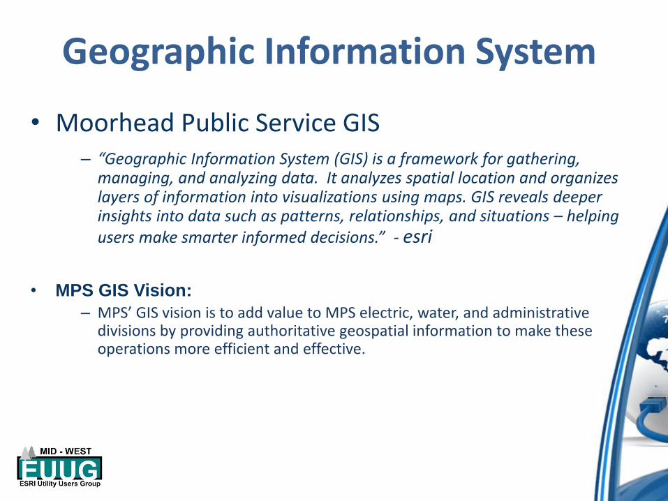
• Moorhead Public Service GIS– “Geographic Information System (GIS) is a framework for gathering,
managing, and analyzing data. It analyzes spatial location and organizes layers of information into visualizations using maps. GIS reveals deeper insights into data such as patterns, relationships, and situations – helping users make smarter informed decisions.” - esri
• MPS GIS Vision:
– MPS’ GIS vision is to add value to MPS electric, water, and administrative divisions by providing authoritative geospatial information to make these operations more efficient and effective.

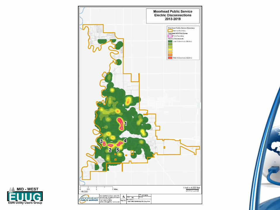
• Value– Water
• Water Asset Management Plan
• Water Leaks
– Electric• Electric Master Plan
• Electric Outages & Reliability Projects
– Admin / Finance• AMI
• Facility Planning
– MPS GIS Data Analytics Solve Problems
GIS Value

Water Asset Management Plan


Water Leak Reporting


Electric Master Plan
• Electric Master Plan
– Develop Electric Network Model
• Identified need from previous GIS Master Plan
– DGR Engineering Review and Development of MPS’ 10 Year Electric Master Plan
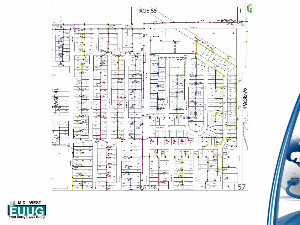

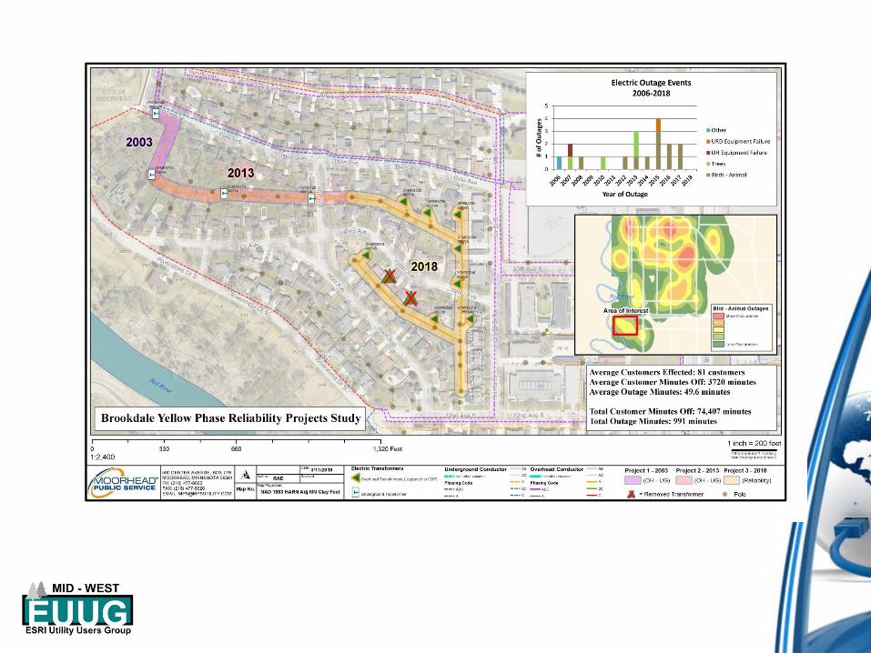
Electric Outage and Reliability Project Support


Advanced Metering Infrastructure
(AMI) Project Support

Facility Planning


GIS Data Analytics Solves Problems
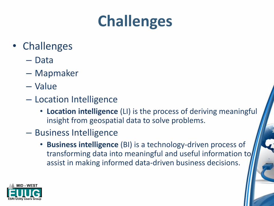
Challenges
• Challenges– Data
– Mapmaker
– Value
– Location Intelligence• Location intelligence (LI) is the process of deriving meaningful
insight from geospatial data to solve problems.
– Business Intelligence• Business intelligence (BI) is a technology-driven process of
transforming data into meaningful and useful information to assist in making informed data-driven business decisions.

MPS GIS Review
• Moorhead Public Service GIS Vision– MPS’ GIS vision is to add value to MPS electric, water, and administrative
divisions by providing authoritative geospatial information to make these operations more efficient and effective.
• Review– Water (WAMP, Water Leaks Reporting)
– Electric (Electric Master Plan, Outage Reporting)
– Admin / Finance (AMI, Facility Planning)
– GIS Data Analytics Solves Problems

MPS GIS – To Infinity & Beyond
• Future Endeavors
– Business Intelligence Integrations
• SCADA / GIS
• CIS
• CMMS

Questions??Todd Copeland, GIS Coordinator, Moorhead Public Service [email protected]
Ryan Elvrum, GIS Analyst, Moorhead Public Service [email protected]