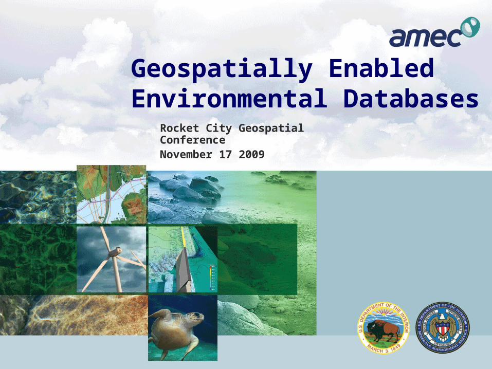
geospatially enabled environmental databases rocket city geospatial conference november 17 2009
Post on 21-Dec-2015
222 views
TRANSCRIPT
Geospatially Enabled Environmental Databases
Rocket City Geospatial ConferenceNovember 17 2009
2
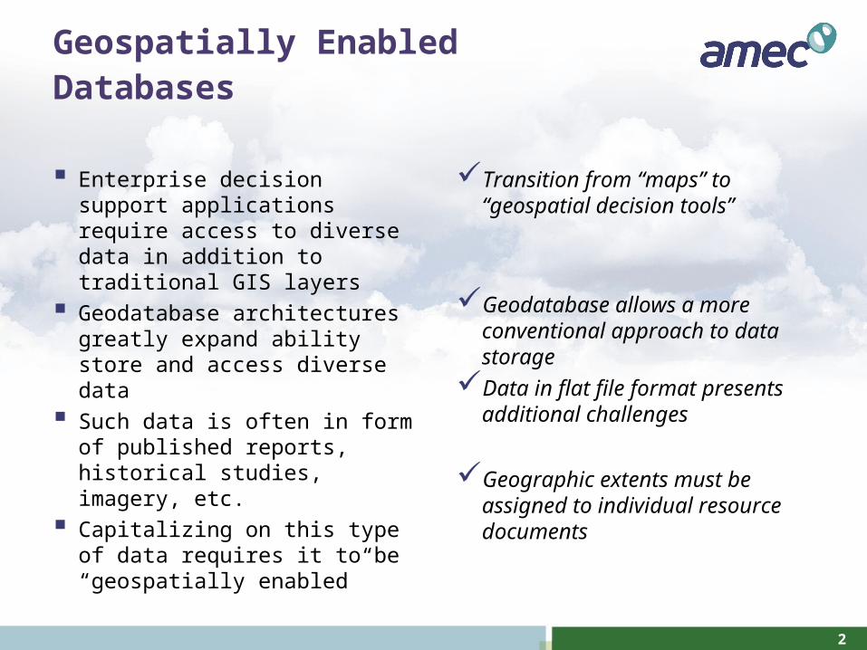
Geospatially Enabled Databases
Enterprise decision support applications require access to diverse data in addition to traditional GIS layers
Geodatabase architectures greatly expand ability store and access diverse data
Such data is often in form of published reports, historical studies, imagery, etc.
Capitalizing on this type of data requires it to be “geospatially enabled”
Transition from “maps” to “geospatial decision tools”
Geodatabase allows a more conventional approach to data storage
Data in flat file format presents additional challenges
Geographic extents must be assigned to individual resource documents
3
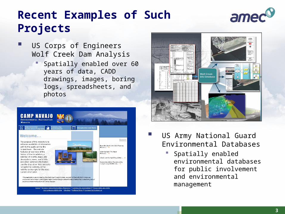
Recent Examples of Such Projects
US Corps of Engineers Wolf Creek Dam Analysis Spatially enabled over 60 years of
data, CADD drawings, images, boring logs, spreadsheets, and photos
US Army National Guard Environmental Databases Spatially enabled environmental
databases for public involvement and environmental management
4
Department of Interior Ecospatial Information Database (ESID)
Department of Interior Minerals Management Service manages leasing in the Outer Continental Shelf Non-renewable (oil and gas) Renewable (wind, wave, current) energy sources
ESID Project goals Support ecosystem-based management of activities permitted by MMS in
the MMS Atlantic Planning Areas. Compile georeferenced ecological information resources and associated
metadata into a searchable geospatial database. Provide compatible data for the MMS Multipurpose Marine Cadastre (MMC)
system.
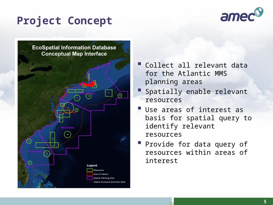
5
Project Concept
Collect all relevant data for the Atlantic MMS planning areas
Spatially enable relevant resources Use areas of interest as basis for
spatial query to identify relevant resources
Provide for data query of resources within areas of interest
6
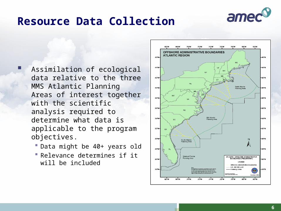
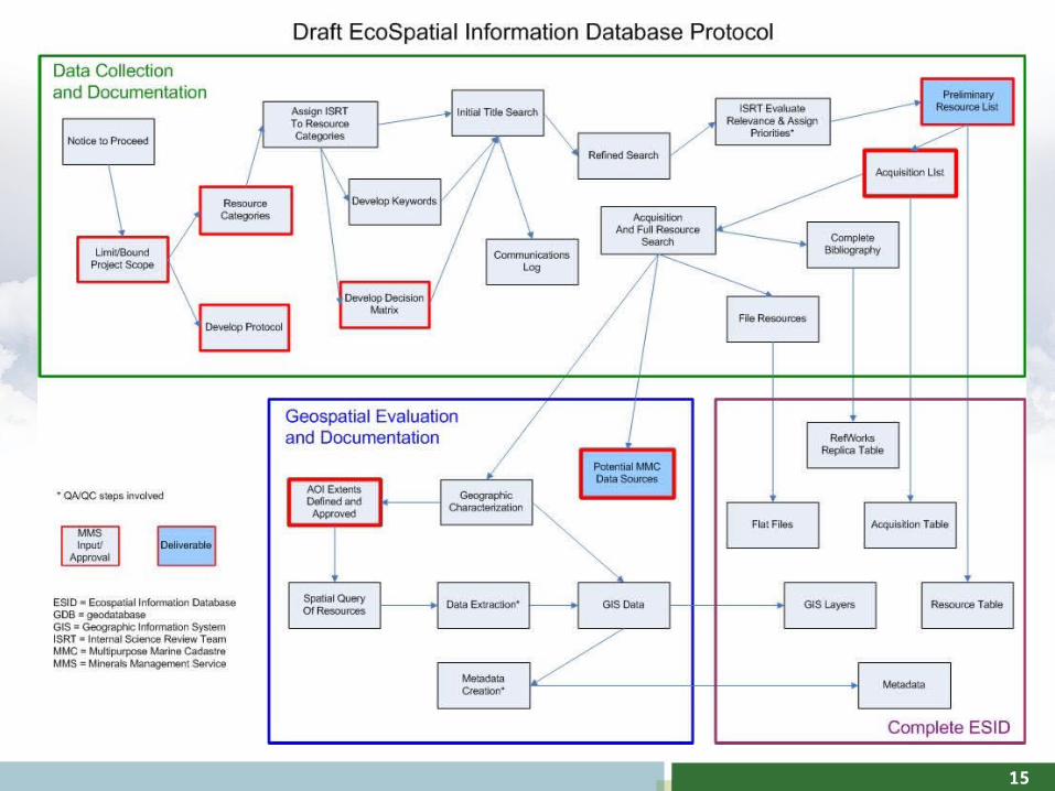
Resource Data Collection
Assimilation of ecological data relative to the three MMS Atlantic Planning Areas of interest together with the scientific analysis required to determine what data is applicable to the program objectives. Data might be 40+ years old Relevance determines if it will be
included
7
Resource Categories
Geology (including seafloor features, sediments) Meteorology/climate Air quality Water quality (including contaminants) Acoustic environment/underwater noise Pelagic ecology (plankton, nekton, Sargassum, etc.) Benthic ecology
Seafloor features Infauna, meiofauna Demersal fishes Corals and hard/live bottom communities Seagrass beds (state waters)
Incidental topics (included but not the focus of this study) Marine mammals Sea turtles Marine and coastal birds
8
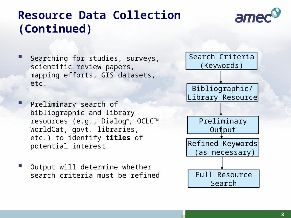
Resource Data Collection (Continued)
Searching for studies, surveys, scientific review papers, mapping efforts, GIS datasets, etc.
Preliminary search of bibliographic and library resources (e.g., Dialog®, OCLCTM WorldCat, govt. libraries, etc.) to identify titles of potential interest
Output will determine whether search criteria must be refined
Search Criteria (Keywords)
Bibliographic/ Library Resource
Preliminary Output
Refined Keywords (as necessary)
Full Resource Search
9
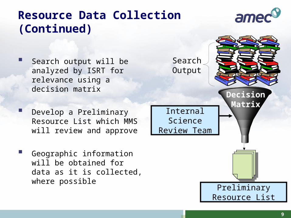
Resource Data Collection (Continued)
Search output will be analyzed by ISRT for relevance using a decision matrix
Develop a Preliminary Resource List which MMS will review and approve
Geographic information will be obtained for data as it is collected, where possible
Internal Science Review Team
Decision Matrix
Preliminary Resource List
Search Output
10
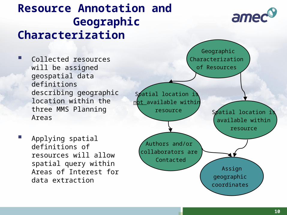
Resource Annotation and Geographic Characterization
Collected resources will be assigned geospatial data definitions describing geographic location within the three MMS Planning Areas
Applying spatial definitions of resources will allow spatial query within Areas of Interest for data extraction
Geographic
Characterization
of Resources
Spatial location is
available within
resource
Assign
geographic
coordinates
Authors and/or
collaborators are
Contacted
Spatial location is
not available within
resource
11
Resource Data Extraction Within Areas of Interest
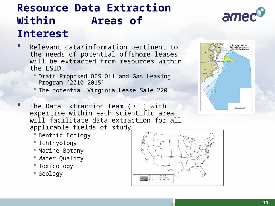
Relevant data/information pertinent to the needs of potential offshore leases will be extracted from resources within the ESID. Draft Proposed OCS Oil and Gas Leasing Program
(2010-2015) The potential Virginia Lease Sale 220
The Data Extraction Team (DET) with expertise within each scientific area will facilitate data extraction for all applicable fields of study Benthic Ecology Ichthyology Marine Botany Water Quality Toxicology Geology
12
Resource Data Extraction Within Areas of Interest (Continued)
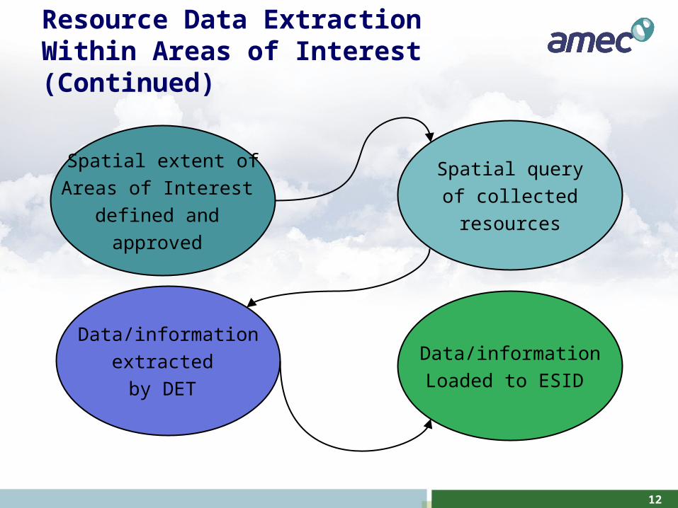
Spatial extent of
Areas of Interest
defined and
approved
Spatial query
of collected
resources
Data/information
extracted
by DET
Data/information
Loaded to ESID
13
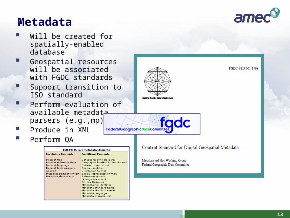
Metadata Will be created for spatially-
enabled database Geospatial resources will be
associated with FGDC standards
Support transition to ISO standard
Perform evaluation of available metadata parsers (e.g.,mp)
Produce in XML Perform QA
14
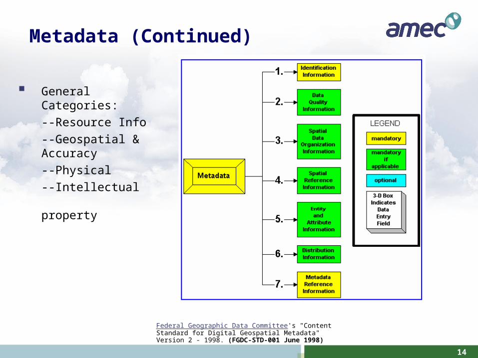
Metadata (Continued)
Federal Geographic Data Committee's "Content Standard for Digital Geospatial Metadata" Version 2 - 1998. (FGDC-STD-001 June 1998)
General Categories:
--Resource Info
--Geospatial & Accuracy
--Physical
--Intellectual property
15
16
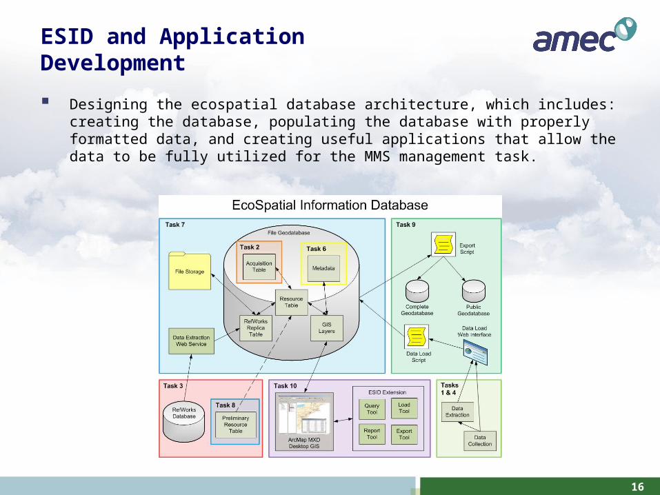
ESID and Application Development
Designing the ecospatial database architecture, which includes: creating the database, populating the database with properly formatted data, and creating useful applications that allow the data to be fully utilized for the MMS management task.
17
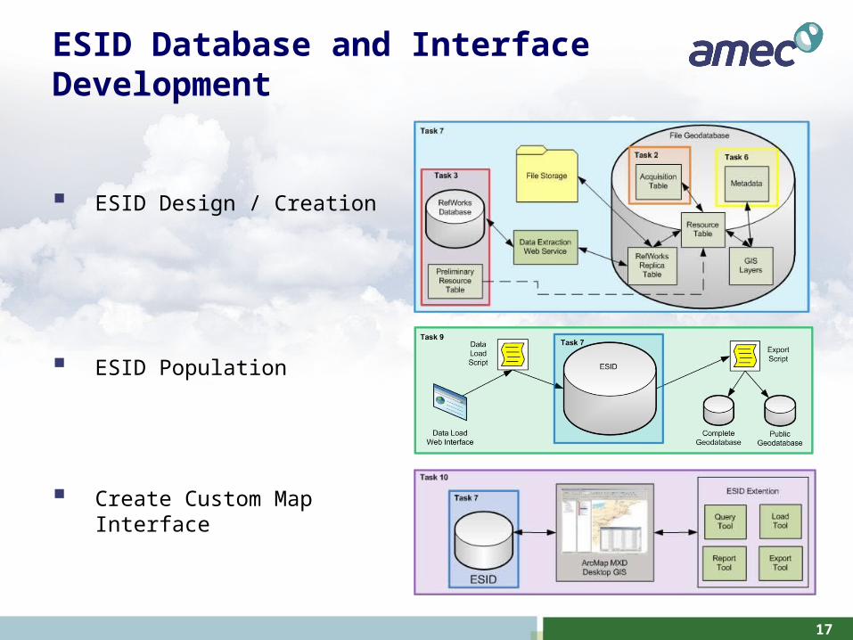
ESID Database and Interface Development
ESID Design / Creation
ESID Population
Create Custom Map Interface
18
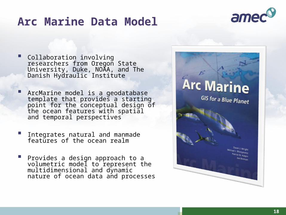
Arc Marine Data Model
Collaboration involving researchers from Oregon State University, Duke, NOAA, and The Danish Hydraulic Institute
ArcMarine model is a geodatabase template that provides a starting point for the conceptual design of the ocean features with spatial and temporal perspectives
Integrates natural and manmade features of the ocean realm
Provides a design approach to a volumetric model to represent the multidimensional and dynamic nature of ocean data and processes
19
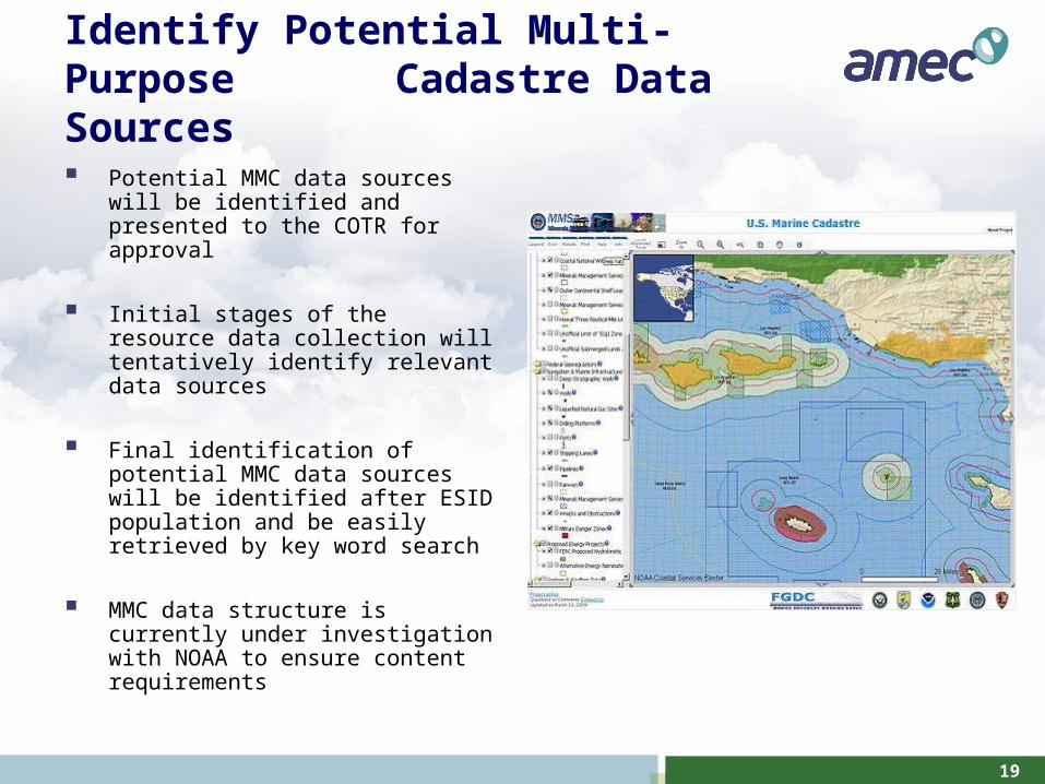
Identify Potential Multi-Purpose Cadastre Data Sources
Potential MMC data sources will be identified and presented to the COTR for approval
Initial stages of the resource data collection will tentatively identify relevant data sources
Final identification of potential MMC data sources will be identified after ESID population and be easily retrieved by key word search
MMC data structure is currently under investigation with NOAA to ensure content requirements

20
Questions
21
Contacts
DOI/MMS Program Manager- Mr. James Sinclair, (504) 736-2789, [email protected]
AMEC Technical Project Manager- Mr. Brett Fritze, (615)-333-0630, [email protected]
AMEC Program Manager- Mr. Lonnie Hearne, (615)-333-0630, [email protected]