trends in government€¦ · geospatial trends in government 5 geospatial value proposition...
TRANSCRIPT
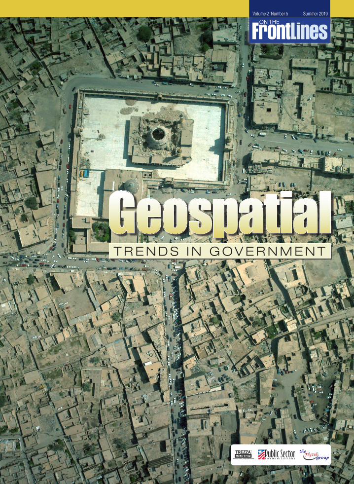
Volume 2 Number 5 Summer 2010
T R E N D S I N G O V E R N M E N T
GeospatialTrendsinGovernment 3
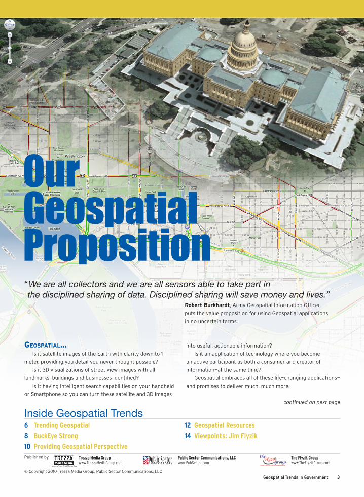
Our Geospatial Proposition
6 Trending Geospatial
8 BuckEye Strong
10 Providing Geospatial Perspective
12 Geospatial Resources
14 Viewpoints: Jim Flyzik
Inside Geospatial Trends
Published by
“��We�are�all�collectors�and�we�are�all�sensors�able�to�take�part�in��the�disciplined�sharing�of�data.�Disciplined�sharing�will�save�money�and�lives.”�
Robert Burkhardt, Army Geospatial Information Officer,
puts the value proposition for using Geospatial applications
in no uncertain terms.
Trezza Media Group www.TrezzaMediaGroup.com
Public Sector Communications, LLC www.PubSector.com
The Flyzik Group www.TheFlyzikGroup.com
Geospatial…Is it satellite images of the Earth with clarity down to 1
meter, providing you detail you never thought possible?
Is it 3D visualizations of street view images with all
landmarks, buildings and businesses identified?
Is it having intelligent search capabilities on your handheld
or Smartphone so you can turn these satellite and 3D images
into useful, actionable information?
Is it an application of technology where you become
an active participant as both a consumer and creator of
information—at the same time?
Geospatial embraces all of these life-changing applications—
and promises to deliver much, much more.
continued on next page
© Copyright 2010 Trezza Media Group, Public Sector Communications, LLC
4 GeospatialTrendsinGovernment
For example, some applications—like using your Smartphone
to search and locate the nearest java hut—are embraced by
users millions of times a day right now.
Others—like having a full 3D visualization of all
existing infrastructure including gas, electricity, water and
communications layered on one map—while available, are just
starting to ramp up.
These topics—along with demonstrations designed to get
you involved—are what the Army’s Geospatial Information
Officer and Google, Autodesk, GeoEye and DLT Solutions
experts discussed with government and industry during
GeoSpatial Day in Washington, DC this past June.
Life Changing Applications
Robert Burkhardt is the Army Geospatial Information
Officer (GIO) and Director of the U.S. Army’s Geospatial Center
in Alexandria, Virginia.
He told the audience many agencies are facing challenges
accessing Geospatial data and then once they get it, finding the
best way of deploying the data.
“Data of all kinds—text, video, voice, imagery—is streaming
through networks right now at blazing speeds. In fact, there is
so much data being created and transmitted at all levels, that
many feel we are flat overwhelmed,” said Burkhardt.
But rather than be overwhelmed, Burkhardt urged the
audience to look at the positive side; that the worlds of
Geospatial, 3D visualization, storage and communications are
converging—and you are the beneficiary.
“This overwhelmingly has a good side. We have greater
detail and 3D imagery and you can pick it up on your iPhone,
Droid or Blackberry,” said Burkhardt. “This is revolutionary and
will change the way we do our normal business.”
One big change Burkhardt mentioned is in the area of
data availability. “We want to separate the data from all the
applications, from the software, and hardware. We want to
make it independent; then you can write apps based on data,
not the proprietary hardware or software you may be using.”
This is a key concept for standards and necessary to cut costs.
Convergence: The Enabler
Geoff Zeiss from Autodesk was extremely upbeat as he
explained the ongoing convergence of Geospatial, engineering
design and 3D visualization technologies. This involves
intelligent models such as BIM (Building Information Modeling),
which not only enable better design, but also sustainable
design. In the future these capabilities will be used to help
model and design entire sustainable cities.
“This is what this makes this stuff exciting. It makes it
possible to prepare simulations showing the impact of a project
and explain complex ideas clearly to people who are non-
technical,” explained Zeiss.
“If you are a city, state or the federal government, if you
want to be able to convey to non-technical or the public what
the implications are, a two minute video is much more effective
than a 1,000 AutoCAD drawings.”
Geospatial makes interaction with the government
more transparent and it is much easier for government
administrators to explain and show to people what is happening
with key projects added Zeiss.
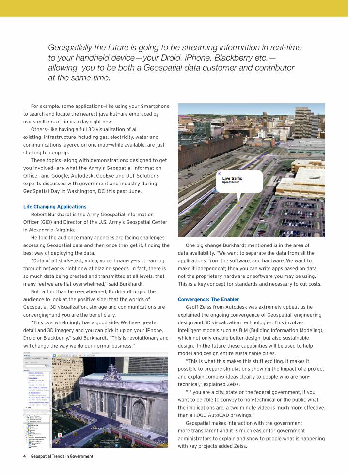
Geospatially the future is going to be streaming information in real-time to your handheld device—your Droid, iPhone, Blackberry etc.— allowing you to be both a Geospatial data customer and contributor at the same time.
GeospatialTrendsinGovernment 5
Geospatial Value Proposition
“Geospatially the future is going to be streaming
information in real-time to handheld devices—my Droid or
iPhone--making local information relevant when you are
standing on a street corner,” said Google Earth Product
Specialist Mike Evanoff.
“Another geospatial driver is the mass participation and
mass adoption, which was not possible not that long ago,”
noted Evanoff. “Millions of people around the world now are not
only consumers of GIS but are also contributors adding data
and updating information.
“For example, using Google MapMaker—within 72 hours
after the Haiti earthquake—citizen contributors starting adding
roads, streets and other points of interest; within a short
amount of time you have a fully populated outstanding quality
map of Port Au Prince,” said Evanoff.
GeoEye owns two satellites and provides much of Geospatial’s
raw materials. Web delivery tools are GeoEye’s fastest growing
delivery systems and it has changed the dynamic.
Steve Miller from GeoEye noted you used to have to have a
data custodian to enter and extract data from a system. “With
web delivery tools and services platforms that complement
the efforts of Google, now you have the ability to deliver
information and you don’t have to be a professional to use it,
you just have to be a consumer.”
DLT’s Jim Helou urged the audience to not let “what you
perceive the technology is today be a limit as to what you want
to do tomorrow.” There are lots of creative minds building
today’s tools and tomorrow’s building blocks. “Let’s not let the
tools and how they are packaged today to be limiting, we need
open communication and creativity to break new barriers.”
Army GIO Burkhardt stated the GeoSpatial value proposition
in no uncertain terms.
“We are all collectors and we are all sensors able to take
part in the “disciplined sharing of data,” declared Burkhardt.
“Disciplined sharing will save money and lives.” n
During Geospatial Day in June, Geospatial experts from
Google, Autodesk and GeoEye held a panel discussion hosted
by Jim Flyzik of The Flyzik Group. Of course, the conversation
turned to the bottom line for Geospatial: What is in it for me?
Here’s what the panelists said.
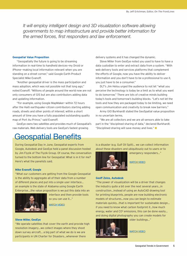
Mike Evanoff, Google
“What our customers are getting from the Google Geospatial
is the ability to aggregate all of their data from a number
of different places and put into a single user interface…
an example is the state of Alabama using Google Earth
Enterprise….the value proposition is we put this data into an
interface and then provide tools
so you can use it…”
Steve Miller, GeoEye
“We operate satellites that cover the earth and provide high
resolution imagery…we collect images where they shoot
down survey aircraft… a big part of what we do is we are
participants in UN Charter for Disasters…whenever there
is a disaster (e.g. Gulf Oil Spill)… we can collect information
about these disasters and ubiquitously out to users or to
emergency responders…”
Geoff Zeiss, Autodesk
“The power of visualization will be a driver that changes
the industry quite a bit over the next several years…in
construction…instead of using an AutoCAD drawing tool
for printing blueprints, people are now building electronic
models of structures…now you can begin to estimate
materials quickly…that is important for sustainable design…
if you need to know what carbon footprint it…how much
energy, water and CO2 emissions, this can be done easily…
and doing digital photography you can create models for
older buildings…”
It will employ intelligent design and 3D visualization software allowing governments to map infrastructure and provide better information for the armed forces, first responders and law enforcement.
Geospatial Benefits
WATCH VIDEO
WATCH VIDEO
WATCH VIDEO
By Jeff Erlichman, Editor, On The FrontLines
6 GeospatialTrendsinGovernment
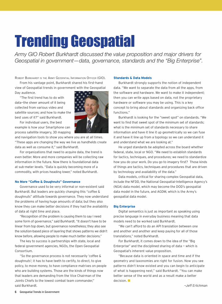
Trending GeospatialArmy GIO Robert Burkhardt discussed the value proposition and major drivers for Geospatial in government—data, governance, standards and the “Big Enterprise”.
RobeRt buRkhaRdt is the aRmy Geospatial infoRmation officeR (GIO).
From his vantage point, Burkhardt shared his first-hand
view of Geospatial trends in government with the Geospatial
Day audience.
“The first trend has to do with
data—the sheer amount of it being
collected from various video and
satellite sources; and how to make the
best uses of it?” said Burkhardt.
For individual users, the best
example is how your Smartphone can
process satellite imagery, 3D mapping
and navigation tools to show you where you are at all times.
“These apps are changing the way we live as handhelds create
data as well as consume it,” said Burkhardt.
For organizations that need to acquire data, the trend is
even better. More and more companies will be collecting raw
information in the future. Now there is foundational data
at sub-meter levels. “Data is quickly becoming more of a
commodity, with prices heading lower,” noted Burkhardt.
No More “Coffee & Doughnuts” Governance
Governance used to be very informal or non-existent said
Burkhardt. But leaders are quickly changing this “coffee &
doughnuts” attitude towards governance. They now understand
the problems of having huge amounts of data; but they also
know they can make better decisions if they had the availability
of data at right time and place.
“Recognition of the problem is causing them to say I need
some form of governance,” said Burkhardt. “It doesn’t have to be
linear from top down, but governance nonetheless; they also see
the solution-based piece of layering that shows patterns we didn’t
know before, allowing people to make much better decisions.”
The key to success is partnerships with state, local and
federal government agencies, NGOs, the Open Geospatial
Consortium.
“So the governance process is not necessarily ‘coffee &
doughnuts’; it has to have teeth to certify, to direct, to give
policy, to move money, to have compliance matrixes on people
who are building systems. Those are the kinds of things now
that leaders are demanding from the Vice Chairman of the
Joints Chiefs to the lowest combat team commander,”
said Burkhardt.
Standards & Data Models
Burkhardt strongly supports the notion of independent
data. “We want to separate the data from all the apps, from
the software and hardware. We want to make it independent;
then you can write apps based on data, not the proprietary
hardware or software you may be using. This is a key
concept to bring about standards and organizing back office
functions.”
Burkhardt is looking for the “sweet spot” on standards. “We
want to find that sweet spot of the minimum set of standards;
what is the minimum set of standards necessary to share
information and have it line it up geometrically so we can fuse
it and have it line up from a topology so we can understand it
and understand what we are looking at.”
He urged standards be adopted across the board whether
federal, state, local or NGO. “We need to establish standards
for tactics, techniques, and procedures; we need to standardize
how you do your work. Do you go to imagery first? Those kinds
of things are tactics, techniques and procedures that are driven
by technology and availability of the data.”
Data models, critical for sharing complex Geospatial data,
include the NFDD, the National Geospatial-Intelligence Agency’s
(NGA) data model, which may become the DOD’s geospatial
data model in the future, and AGDM, which is the Army’s
geospatial data model.
Big Enterprise
Digital semantics is just as important as speaking using
precise language in everyday business meaning that data
models need to be worked said Burkhardt.
“We can’t afford to do an API translation between one
and another and another and keep paying for all of those
translations,” noted Burkhardt.
For Burkhardt, it comes down to the idea of the “Big
Enterprise” and the disciplined sharing of data — which is
Geospatial’s inherent value proposition.
“Because data is oriented in space and time and if the
geometry and taxonomies are right for fusion. Now you see
patterns didn’t know existed and you can begin to anticipate
of what is happening next,” said Burkhardt. “You can make
better sense of the world and as a result make a better
decision. n
—Jeff Erlichman

As the Master Government Reseller, DLT Solutions partners with Autodesk to provide the Public Sector with integrated digital design mapping/ GIS solutions that increase productivity, sustainability and accountability.
Designed to bridge the gap between CAD and GIS systems, our solutions include:
• 2D and 3D digital design and engineering software• Model-based design featuring mapping and management tools • And more at www.dlt.com/autodesk
Want to learn more? View educational webcasts around geospatial and digital design at www.dlt.com/geo-design
8 GeospatialTrendsinGovernment
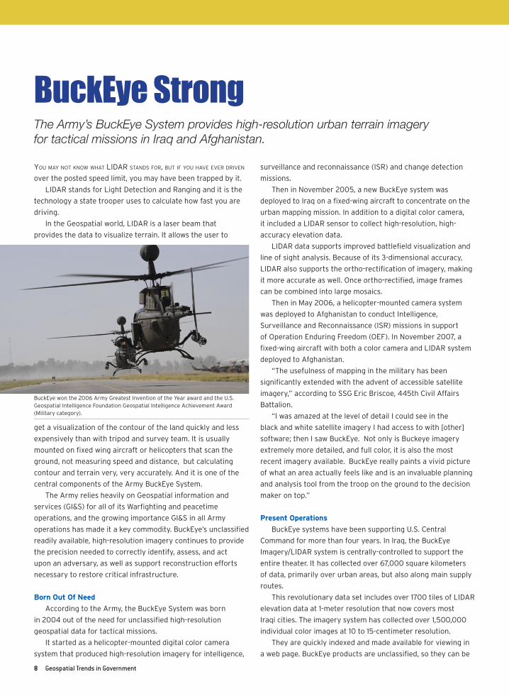
BuckEye StrongThe Army’s BuckEye System provides high-resolution urban terrain imagery for tactical missions in Iraq and Afghanistan.
You maY not know what LIDaR stanDs foR, but If You have eveR DRIven
over the posted speed limit, you may have been trapped by it.
LIDAR stands for Light Detection and Ranging and it is the
technology a state trooper uses to calculate how fast you are
driving.
In the Geospatial world, LIDAR is a laser beam that
provides the data to visualize terrain. It allows the user to
get a visualization of the contour of the land quickly and less
expensively than with tripod and survey team. It is usually
mounted on fixed wing aircraft or helicopters that scan the
ground, not measuring speed and distance, but calculating
contour and terrain very, very accurately. And it is one of the
central components of the Army BuckEye System.
The Army relies heavily on Geospatial information and
services (GI&S) for all of its Warfighting and peacetime
operations, and the growing importance GI&S in all Army
operations has made it a key commodity. BuckEye’s unclassified
readily available, high-resolution imagery continues to provide
the precision needed to correctly identify, assess, and act
upon an adversary, as well as support reconstruction efforts
necessary to restore critical infrastructure.
Born Out Of Need
According to the Army, the BuckEye System was born
in 2004 out of the need for unclassified high-resolution
geospatial data for tactical missions.
It started as a helicopter-mounted digital color camera
system that produced high-resolution imagery for intelligence,
surveillance and reconnaissance (ISR) and change detection
missions.
Then in November 2005, a new BuckEye system was
deployed to Iraq on a fixed-wing aircraft to concentrate on the
urban mapping mission. In addition to a digital color camera,
it included a LIDAR sensor to collect high-resolution, high-
accuracy elevation data.
LIDAR data supports improved battlefield visualization and
line of sight analysis. Because of its 3-dimensional accuracy,
LIDAR also supports the ortho-rectification of imagery, making
it more accurate as well. Once ortho-rectified, image frames
can be combined into large mosaics.
Then in May 2006, a helicopter-mounted camera system
was deployed to Afghanistan to conduct Intelligence,
Surveillance and Reconnaissance (ISR) missions in support
of Operation Enduring Freedom (OEF). In November 2007, a
fixed-wing aircraft with both a color camera and LIDAR system
deployed to Afghanistan.
“The usefulness of mapping in the military has been
significantly extended with the advent of accessible satellite
imagery,” according to SSG Eric Briscoe, 445th Civil Affairs
Battalion.
“I was amazed at the level of detail I could see in the
black and white satellite imagery I had access to with [other]
software; then I saw BuckEye. Not only is Buckeye imagery
extremely more detailed, and full color, it is also the most
recent imagery available. BuckEye really paints a vivid picture
of what an area actually feels like and is an invaluable planning
and analysis tool from the troop on the ground to the decision
maker on top.”
Present Operations
BuckEye systems have been supporting U.S. Central
Command for more than four years. In Iraq, the BuckEye
Imagery/LIDAR system is centrally-controlled to support the
entire theater. It has collected over 67,000 square kilometers
of data, primarily over urban areas, but also along main supply
routes.
This revolutionary data set includes over 1700 tiles of LIDAR
elevation data at 1-meter resolution that now covers most
Iraqi cities. The imagery system has collected over 1,500,000
individual color images at 10 to 15-centimeter resolution.
They are quickly indexed and made available for viewing in
a web page. BuckEye products are unclassified, so they can be
BuckEye won the 2006 Army Greatest Invention of the Year award and the U.S. Geospatial Intelligence Foundation Geospatial Intelligence Achievement Award (Military category).
GeospatialTrendsinGovernment 9
Soldiers of the 25th Brigade know that having the right
Geospatial data can save their lives.
At Geospatial Day, Army GIO Robert Burkhardt recounted
how in 2004-2005, the 25th Brigade
was being deployed to Mosul, Iraq—what
they thought was a calm, not chaotic
environment.
“What they thought they were going
into a week before deployment changed
dramatically,” said Burkhardt. “All police
disappeared; all the police stations
were taken over by Al Qaeda. It didn’t
look like a calm environment, it looked
like a combat environment. Everything
they thought they knew they didn’t know any longer. It was a
peaceful area and now it was immensely chaotic.”
To be sure, the 25th had people providing them
information from various stovepipes. They had sensors;
they had LIDAR. What they didn’t have were the Geospatial
tools to find the information they were looking for to quell
the insurgency.
The 25th turned to the Army’s Geospatial Center for help.
“They asked us for help. But before we could help them, they
had to put in a clear taxonomy on the
way they described things,” explained
Burkhardt.
“With that we were able to give
them a simple web tool to track the
trends and the things they needed to
know such as whom the Imam is and
who is selling gas.”
The commander used that simple
tool go after his critical pieces of
information. “I want to know about
X and platoon leaders would find that out. That exposed
patterns they could use to protect themselves. Plus it
not only prepared the 25th, but the transition to the unit
from Alaska that came behind them was the smoothest
transition ever and that sharing information actually
saved lives.” n
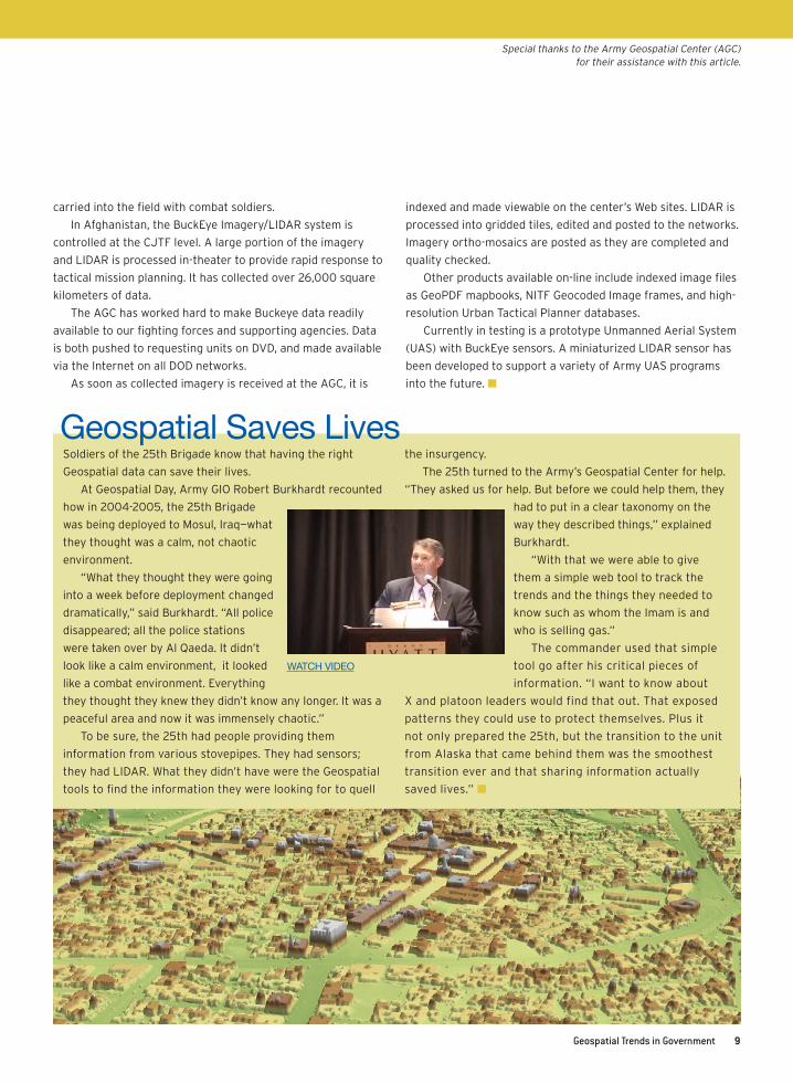
Geospatial Saves Lives
WATCH VIDEO
carried into the field with combat soldiers.
In Afghanistan, the BuckEye Imagery/LIDAR system is
controlled at the CJTF level. A large portion of the imagery
and LIDAR is processed in-theater to provide rapid response to
tactical mission planning. It has collected over 26,000 square
kilometers of data.
The AGC has worked hard to make Buckeye data readily
available to our fighting forces and supporting agencies. Data
is both pushed to requesting units on DVD, and made available
via the Internet on all DOD networks.
As soon as collected imagery is received at the AGC, it is
indexed and made viewable on the center’s Web sites. LIDAR is
processed into gridded tiles, edited and posted to the networks.
Imagery ortho-mosaics are posted as they are completed and
quality checked.
Other products available on-line include indexed image files
as GeoPDF mapbooks, NITF Geocoded Image frames, and high-
resolution Urban Tactical Planner databases.
Currently in testing is a prototype Unmanned Aerial System
(UAS) with BuckEye sensors. A miniaturized LIDAR sensor has
been developed to support a variety of Army UAS programs
into the future. n
Special thanks to the Army Geospatial Center (AGC) for their assistance with this article.
10 GeospatialTrendsinGovernment
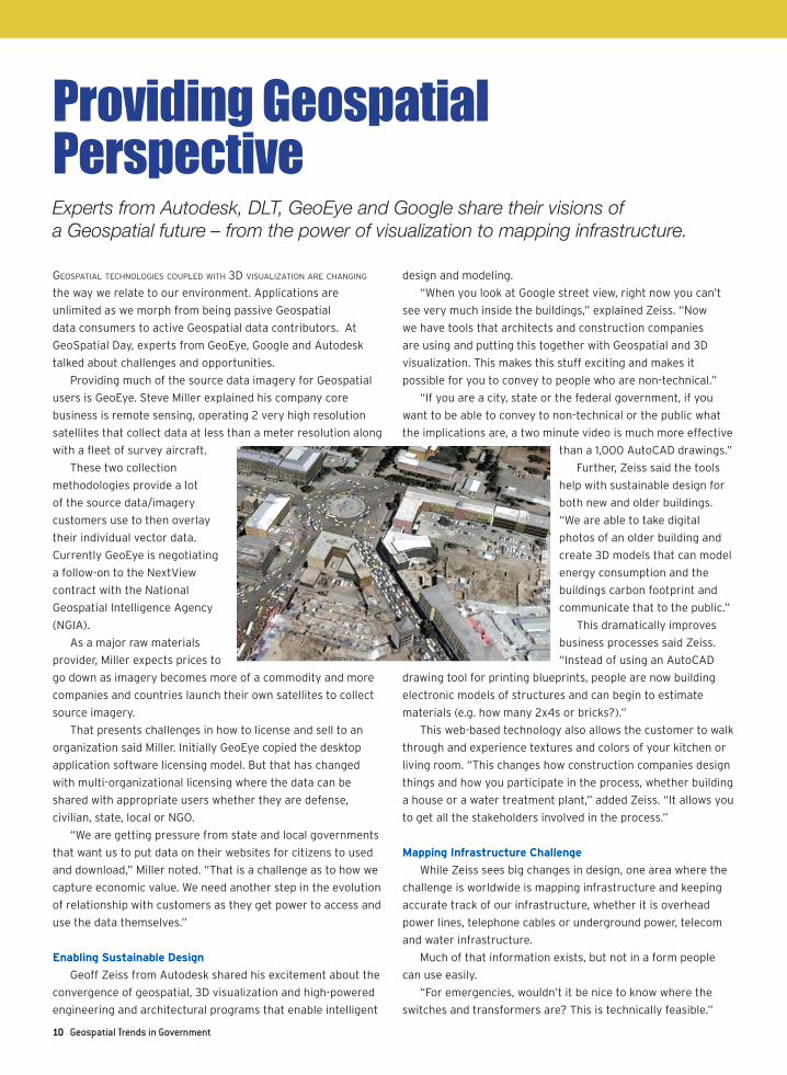
Providing Geospatial PerspectiveExperts from Autodesk, DLT, GeoEye and Google share their visions of a Geospatial future – from the power of visualization to mapping infrastructure.
Geospatial technoloGies coupled with 3d visualization aRe chanGinG
the way we relate to our environment. Applications are
unlimited as we morph from being passive Geospatial
data consumers to active Geospatial data contributors. At
GeoSpatial Day, experts from GeoEye, Google and Autodesk
talked about challenges and opportunities.
Providing much of the source data imagery for Geospatial
users is GeoEye. Steve Miller explained his company core
business is remote sensing, operating 2 very high resolution
satellites that collect data at less than a meter resolution along
with a fleet of survey aircraft.
These two collection
methodologies provide a lot
of the source data/imagery
customers use to then overlay
their individual vector data.
Currently GeoEye is negotiating
a follow-on to the NextView
contract with the National
Geospatial Intelligence Agency
(NGIA).
As a major raw materials
provider, Miller expects prices to
go down as imagery becomes more of a commodity and more
companies and countries launch their own satellites to collect
source imagery.
That presents challenges in how to license and sell to an
organization said Miller. Initially GeoEye copied the desktop
application software licensing model. But that has changed
with multi-organizational licensing where the data can be
shared with appropriate users whether they are defense,
civilian, state, local or NGO.
“We are getting pressure from state and local governments
that want us to put data on their websites for citizens to used
and download,” Miller noted. “That is a challenge as to how we
capture economic value. We need another step in the evolution
of relationship with customers as they get power to access and
use the data themselves.”
Enabling Sustainable Design
Geoff Zeiss from Autodesk shared his excitement about the
convergence of geospatial, 3D visualization and high-powered
engineering and architectural programs that enable intelligent
design and modeling.
“When you look at Google street view, right now you can’t
see very much inside the buildings,” explained Zeiss. “Now
we have tools that architects and construction companies
are using and putting this together with Geospatial and 3D
visualization. This makes this stuff exciting and makes it
possible for you to convey to people who are non-technical.”
“If you are a city, state or the federal government, if you
want to be able to convey to non-technical or the public what
the implications are, a two minute video is much more effective
than a 1,000 AutoCAD drawings.”
Further, Zeiss said the tools
help with sustainable design for
both new and older buildings.
“We are able to take digital
photos of an older building and
create 3D models that can model
energy consumption and the
buildings carbon footprint and
communicate that to the public.”
This dramatically improves
business processes said Zeiss.
“Instead of using an AutoCAD
drawing tool for printing blueprints, people are now building
electronic models of structures and can begin to estimate
materials (e.g. how many 2x4s or bricks?).”
This web-based technology also allows the customer to walk
through and experience textures and colors of your kitchen or
living room. “This changes how construction companies design
things and how you participate in the process, whether building
a house or a water treatment plant,” added Zeiss. “It allows you
to get all the stakeholders involved in the process.”
Mapping Infrastructure Challenge
While Zeiss sees big changes in design, one area where the
challenge is worldwide is mapping infrastructure and keeping
accurate track of our infrastructure, whether it is overhead
power lines, telephone cables or underground power, telecom
and water infrastructure.
Much of that information exists, but not in a form people
can use easily.
“For emergencies, wouldn’t it be nice to know where the
switches and transformers are? This is technically feasible.”
GeospatialTrendsinGovernment 11
Much of this important information about building
interiors is on paper stashed in government vaults. “There are
blueprints for permitting process; afterwards they end up in the
basement,” said Zeiss. “This is an area for convergence; being
able to bring all this information together. It already exists
and we need to make available through Google so it can be
visualized and made accessible.”
Shrink Wrapped Apps
Mike Evanoff explained that Google Enterprise looks at
technologies you might use on the Internet and then figures
out “how can we shrink wrap it and bundle it and put it on your
network?”
“What our customers are getting from the Google is the
ability to aggregate all of their data from a number of different
places and put into a single user interface.”
As an example, Evanoff described what is happening in
Alabama, where they have 63 counties each with its own
system and independent contracts to get aerial imagery. “What
they did with Google Earth Enterprise is create one interface
they can present back to those counties, thus eliminating all
the duplication of effort.”
One of the keys to the Google value proposition is their
ability to take different silos of information (e.g. traffic and
weather layers) from different sources and present them in one
single interface without having to compress data.
“We go out and get different data sources simultaneously
and display it clearly for our customers and their customers
and their customers,” said Evanoff.
Clearly these three industry leaders agree that the power
of visualization is going to be the driver that changes how you
interact with your environment in the coming decade. n
If you think about Geospatial imagery today, you have
satellites taking high resolution photos. With high resolution
you have massive files using lots of storage and need lots of
processing to make them usable.
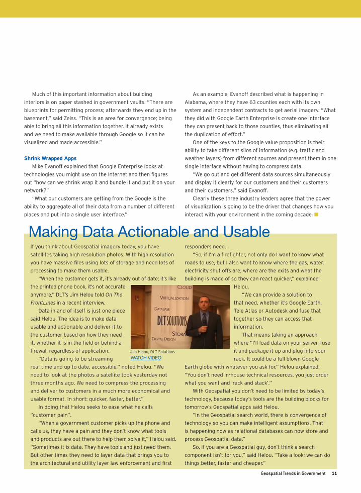
“When the customer gets it, it’s already out of date; it’s like
the printed phone book, it’s not accurate
anymore,” DLT’s Jim Helou told On The
FrontLines in a recent interview.
Data in and of itself is just one piece
said Helou. The idea is to make data
usable and actionable and deliver it to
the customer based on how they need
it, whether it is in the field or behind a
firewall regardless of application.
“Data is going to be streaming
real time and up to date, accessible,” noted Helou. “We
need to look at the photos a satellite took yesterday not
three months ago. We need to compress the processing
and deliver to customers in a much more economical and
usable format. In short: quicker, faster, better.”
In doing that Helou seeks to ease what he calls
“customer pain”.
“When a government customer picks up the phone and
calls us, they have a pain and they don’t know what tools
and products are out there to help them solve it,” Helou said.
“Sometimes it is data. They have tools and just need them.
But other times they need to layer data that brings you to
the architectural and utility layer law enforcement and first
responders need.
“So, if I’m a firefighter, not only do I want to know what
roads to use, but I also want to know where the gas, water,
electricity shut offs are; where are the exits and what the
building is made of so they can react quicker,” explained
Helou.
“We can provide a solution to
that need, whether it’s Google Earth,
Tele Atlas or Autodesk and fuse that
together so they can access that
information.
That means taking an approach
where “I’ll load data on your server, fuse
it and package it up and plug into your
rack. It could be a full blown Google
Earth globe with whatever you ask for,” Helou explained.
“You don’t need in-house technical resources, you just order
what you want and ‘rack and stack’.”
With Geospatial you don’t need to be limited by today’s
technology, because today’s tools are the building blocks for
tomorrow’s Geospatial apps said Helou.
“In the Geospatial search world, there is convergence of
technology so you can make intelligent assumptions. That
is happening now as relational databases can now store and
process Geospatial data.”
So, if you are a Geospatial guy, don’t think a search
component isn’t for you,” said Helou. “Take a look; we can do
things better, faster and cheaper.”
Making Data Actionable and Usable
WATCH VIDEOJim Helou, DLT Solutions
12 GeospatialTrendsinGovernment
WebsitesNational Geospatial-Intelligence Agencyhttps://www1.nga.mil/Pages/Default.aspxNGA provides timely, relevant and accurate geospatial intelligence in sup-port of national security objectives. The term “geospatial intelligence” (GEOINT) means the exploitation and analysis of imagery and geospatial information to describe, assess and visually depict physical features and geo-graphically referenced activities on the Earth. Geospatial intel-ligence consists of imagery, imagery intelligence and geospatial (e.g., mapping, charting and geodesy) information.
USGS National Geospatial Programhttp://www.usgs.gov/ngpo/The National Geospatial Program provides leadership for USGS geospatial coordination, production and service activities. The Program engages part-ners to develop standards and produce consistent and accurate data through its Geospatial Liaison Network. Operational support is provided by the National Geospatial Technical Operations Center. These and other Program activities that are essential to the National Spatial Data Infrastructure (NSDI) are managed as a unified portfolio that benefits geospatial information users throughout the Nation.
Open Spatial Consortiumhttp://www.opengeospatial.org/The Open Geospatial Consortium, Inc.® (OGC) is a non-profit, international, voluntary consensus standards organi-zation that is leading the development of standards for geospatial and location based services.
The Geospatial Information & Technology Associationhttp://www.gita.org/GITA is the professional association and leading advocate for anyone using geospatial technology to help operate, maintain, and protect the infrastruc-ture, which includes organizations such as utilities, telecommunication compa-nies, and the public sector. Through industry-leading confer-ences—along with research initiatives, chapters, membership, and other programs—GITA provides education and professional best practices.
The Geospatial Data Gatewayhttp://datagateway.nrcs.usda.gov/GDG is the One Stop Source for environ-mental and natural resources data, at anytime, from anywhere, to anyone. The Gateway allows you to choose your area of interest, browse and select data from our catalog, customize the format, and have it downloaded or shipped on CD or DVD.
Geodata.govhttp://gos2.geodata.gov/wps/portal/gosGeodata.gov is your one stop for finding and using geographic data and will help you: Find Data or Map Services; Make a Map; Browse Community Information; Cooperate on Data Acquisitions; Publish your Data and Map Services
nationalatlas.gov™http://nationalatlas.gov/ If a picture is worth a thousand words, then a map is worth ten thousand. This is not like any atlas you remember. This is nationalatlas.gov™, and it shows us where we are. It allows you to use your imagination and, by probing and ques-tioning, to choose the facts that fit your needs as you explore the American story.
Center of Excellence for Geospatial Information Science (CEGIS)http://cegis.usgs.gov/In January 2006, the U.S. Geological Survey (USGS) Center of Excellence for Geospatial Information Science (CEGIS) was established. The CEGIS vision is to conduct, lead, and influence the research and innovative solutions required by the National Spatial Data Infrastructure (NSDI) and the emerging GeoSpatial Web.
White Papers/Special ReportsThe National Geospatial Intelligence Agency-PathFinder Magazine
AutoCAD Map 3D & MapGuide Enterprise-Open GIS (Autodesk)
Earth Knowledge (Google Enterprise & Maps)
Washington DC Safeguards (Google Enterprise & Maps)
Geospatial Solutions (Autodesk)
Maritime Geospatial Solutions (GeoEye)
VideosGeoSpatial Leaders Forecast “What’s The Next Big Thing?”Mike Evanoff, Google
Geoff Zeiss, Autodesk
Steve Miller, GeoEye
Conferences:Geospatial Conference 2010 October 19-21, 2010, Athens, GA
FOSS4G 2010 September 6-9, Barcelona, Spain
GIS for National Security October 24-27, 2010, Abu Dhabi, UAE
ResourcesLink to every Website, White Paper, Special Report and Video at www.onthefrontlines.net/geospatial.
WATCH VIDEO
WATCH VIDEO
WATCH VIDEO
14 GeospatialTrendsinGovernment
we’ve all heaRd the phRase, “a pictuRe is woRth a thousand woRds”.
Geospatial Information Systems (GIS) are proving that old
adage to be true plus much, much more.
It is remarkable how fast GIS systems have proliferated
across all segments of industry. The uses are limitless and
there is no end in sight. The use of visualization is rapidly
becoming the way requirements are defined and specified and
a key component of the applications that are being built. In the
late 1980’s, early 1990’s, GIS was largely about digitized maps
and integration of satellite imagery. Today,
GIS is about mapping locations of objects,
placing intelligence into the objects and
the ability to derive knowledge from such
objects.
It is not possible in this article to discuss
all the ways GIS are being used to support
business processes. To name but a few
as listed in Wikipedia, GIS systems are
used in cartography, remote sensing, land
surveying, utility management, natural
resource management, photogrammetry,
geography, urban planning, emergency
management, navigation, and localized
search engines.
Why have such systems grown so
quickly?
First, there are hundreds of examples of
positive ROI’s and significant cost savings being derived from
GIS applications. A simple example would be the ability to re-
route vehicles to avoid traffic congestion for on-time deliveries.
Second, GIS allows for better understanding, better
education, and more knowledge sharing. Think of the wealth
of information about the geography of the world, weather
patterns and navigation that can be gotten with a few clicks of
a mouse.
Third, GIS enhances communication and decision-making;
questions about where to live, work, and play can easily be
discussed and answered by seeing visual imagery of locations.
Fourth, early on in GIS developments, certain common
gateway interfaces were agreed to and many open standards
were adopted. This allows object use and reuse by anyone that
can access the object on the network. There is no need for
every application to rewrite code to add intelligence to objects.
And in my humble opinion, the biggest reason visualization
growth will remain on the fast track is the elimination of
ambiguity associated with text. Images are easy to understand.
Try to describe a complex Satellite Image of the Gulf oil spill
and the multitudes of scenarios that weather patterns can
create without use of imagery. Can you create that picture in
text in less than a thousand words?
What constraints still need to be overcome to reach even
higher levels with GIS? I would argue the
remaining challenges are associated with
wireless bandwidth, wire-line infrastructure,
and skilled resources. Wireless broadband
communications continue to get better
and expand but we still lack the speed
and coverage in many areas around the
world to have efficient use of complex
GIS on wireless devices. And in many
land-line networks around the world, the
communications infrastructure equipment
(routers, gateways, switches, etc.) are
still old and outdated and need to be
modernized to support these advanced
technologies. And finally, trained
experts in designing GIS applications
and understanding the best ways to
apply visualization techniques to current
business systems are still relatively scarce. It is rare to find
organizations with a lot of depth and bench strength in these
skills.
Visualization has been identified by great thinkers as an
important concept for a long time.
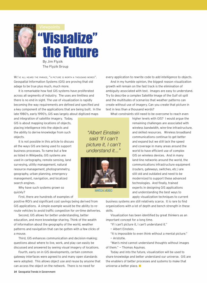
“If I can’t picture it, I can’t understand it.”
— Albert Einstein.
“It is impossible to even think without a mental picture.”
— Aristotle.
“Man’s mind cannot understand thoughts without images
of them.” — Thomas Aquinas.
Today and into the future, visualization will be used to
share knowledge and better understand our universe. GIS are
the enablers of better processes and systems to make that
universe a better place. n
“ Visualize” the Future
“Albert Einstein said ‘If I can’t
picture it, I can’t understand it...”
Viewpoints
By Jim FlyzikThe Flyzik Group
WATCH VIDEO
Dedicated to Advancing Innovation & Best Practices In Government
Sign up for this new series of digital magazines
dedicated to advancing innovation and best
practices in government.
Sign-up and download pictured issues
at www.pubsector.com/onthefrontlines.
On The FrontLines is published by
Sponsorship opportunities available: Contact Tom Trezza at 201-670-8153 or [email protected].
Department of Homeland Security
IT Product and Services Contract Guide
Upcoming Editions
August - Geospatial Trends in Government
August - Government Cloud Computing
August - Healthcare IT in Government
September - Cybersecurity Solutions
October - DHS EAGLE/First Source
November - The Greening of Government
December - Government Cloud Computing
The Greening of
2nd in a series Fall 2009
3rd in a series Winter 2010
Government Cloud Computing
Cyber Security 1
4th in a series Winter 2010
Securing Government Assets
Cyber Security
Schedule subject to change at any notice.
www.dlt.com • 877-385-3581 • [email protected]
DLT Solutions’ portfolio of Geospatial products enables Government Agencies to make GIS data readily accessible to share and utilize the information. Our Geospatial capabilities include:
• Satellite Imagery • Geospatial Services and Integration• Remote Sensing• Digital Elevation Model (DEM)• LIDAR• And more...
Visit www.dlt.com/gds to learn more.
More DLT partners are available at: www.dlt.com/brands