comprehensive land use plan (clup) volume ii
DESCRIPTION
Comprehensive Land Use Plan (CLUP) Volume II taguigTRANSCRIPT

TAGUIG CITY COMPREHENSIVE LAND USE & ZONING PLAN 1
PHYSICAL & SOCIO-ECONOMIC PROFILE
physical environment
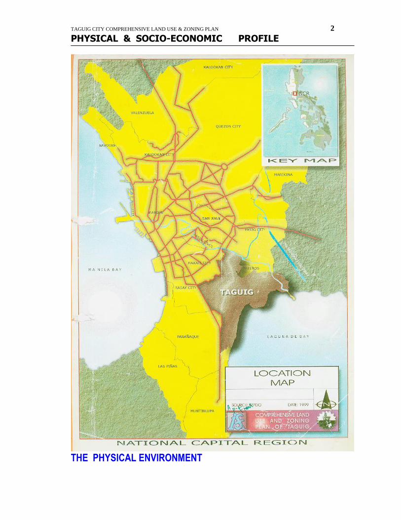
TAGUIG CITY COMPREHENSIVE LAND USE & ZONING PLAN 2
PHYSICAL & SOCIO-ECONOMIC PROFILE
THE PHYSICAL ENVIRONMENT
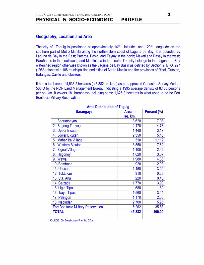
TAGUIG CITY COMPREHENSIVE LAND USE & ZONING PLAN 3
PHYSICAL & SOCIO-ECONOMIC PROFILE
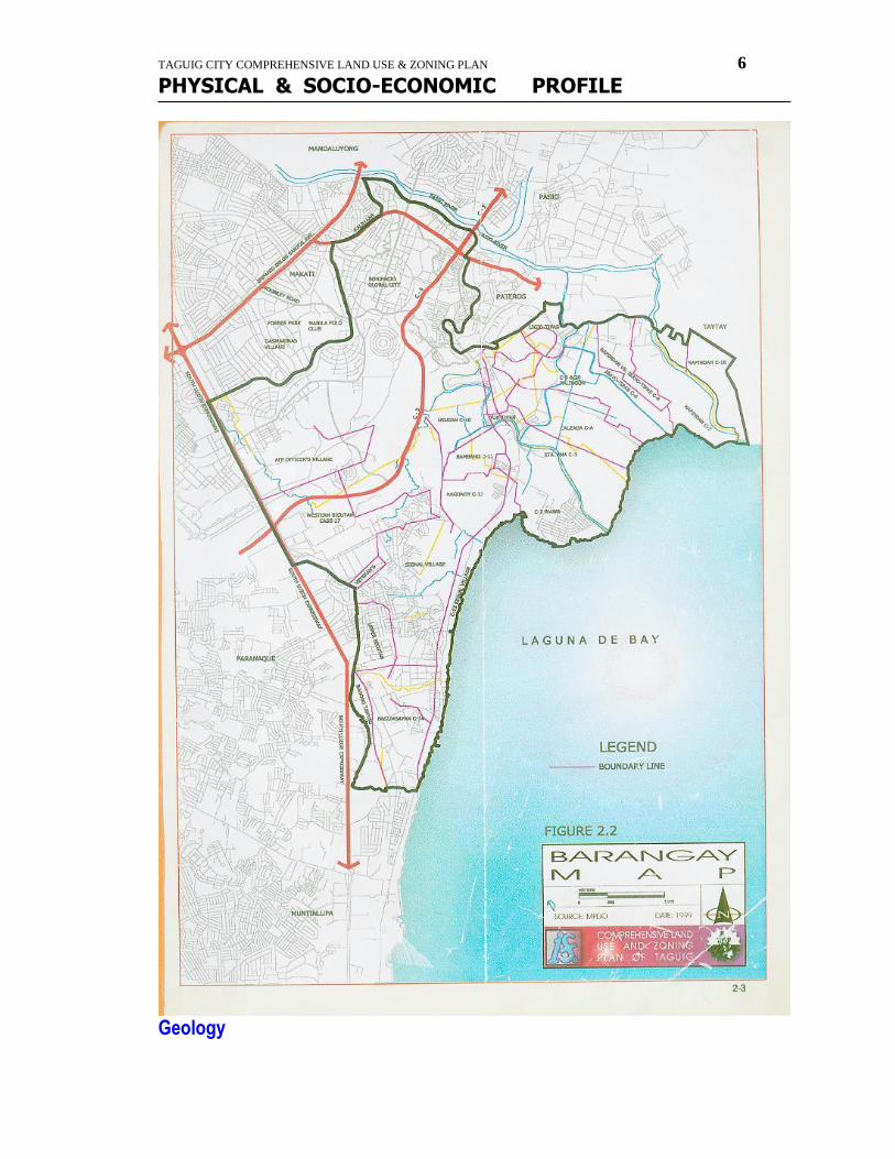
Geography, Location and Area The city of Taguig is positioned at approximately 14 latitude and 120 longitude on the southern part of Metro Manila along the northeastern coast of Laguna de Bay. It is bounded by Laguna de Bay in the East; Pateros, Pasig and Taytay in the north; Makati and Pasay in the west; Parañaque in the southwest; and Muntinlupa in the south. The city belongs to the Laguna de Bay watershed region otherwise known as the Laguna de Bay Basin as defined by Section 2, E. O. 927 (1983) along with 108 municipalities and cities of Metro Manila and the provinces of Rizal, Quezon, Batangas, Cavite and Quezon. It has a total area of 4,538.2 hectares ( 45.382 sq. km. ) as per approved Cadastral Survey Mcdam 500 D by the NCR Land Management Bureau indicating a 1995 average density of 8,403 persons per sq. km. It covers 18 barangays including some 1,626.2 hectares in what used to be he Fort Bonifacio Military Reservation.
Area Distribution of Taguig
Barangays Area in sq. km.
Percent (%)
1. Bagumbayan 3,620 7.98
2. Bagong Tanyag 2,170 4.78
3. Upper Bicutan 1,440 3.17
4. Lower Bicutan 2,350 5.18
5. Maharlika Village 510 1.112
6. Western Bicutan 3,550 7.82
7. Signal Village 1,100 2.42
8. Hagonoy 1,620 3.57
9. Wawa 1,980 4.36
10. Bambang 920 2.03
11. Ususan 1,450 3.20
12. Tuktukan 310 0.68
13. Sta. Ana 220 0.48
14. Calzada 1,770 3.90
15. Ligid-Tipas 680 1.50
16. Ibayo-Tipas 1,560 3.44
17. Palingon 1,170 2.58
18. Napindan 2,700 5.95
Fort Bonifacio Military Reservation 16,262 35.83
TOTAL 45,382 100.00
SOURCE : City Development Planning Office

TAGUIG CITY COMPREHENSIVE LAND USE & ZONING PLAN 4
PHYSICAL & SOCIO-ECONOMIC PROFILE
TAGUIG CITY COMPREHENSIVE LAND USE & ZONING PLAN 5
PHYSICAL & SOCIO-ECONOMIC PROFILE
TAGUIG CITY COMPREHENSIVE LAND USE & ZONING PLAN 6
PHYSICAL & SOCIO-ECONOMIC PROFILE
Geology
TAGUIG CITY COMPREHENSIVE LAND USE & ZONING PLAN 7
PHYSICAL & SOCIO-ECONOMIC PROFILE
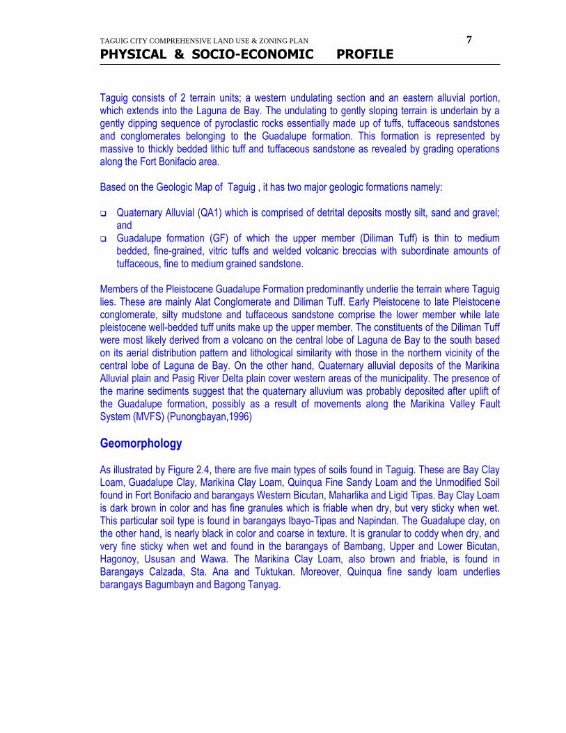
Taguig consists of 2 terrain units; a western undulating section and an eastern alluvial portion, which extends into the Laguna de Bay. The undulating to gently sloping terrain is underlain by a gently dipping sequence of pyroclastic rocks essentially made up of tuffs, tuffaceous sandstones and conglomerates belonging to the Guadalupe formation. This formation is represented by massive to thickly bedded lithic tuff and tuffaceous sandstone as revealed by grading operations along the Fort Bonifacio area. Based on the Geologic Map of Taguig , it has two major geologic formations namely: Quaternary Alluvial (QA1) which is comprised of detrital deposits mostly silt, sand and gravel;
and Guadalupe formation (GF) of which the upper member (Diliman Tuff) is thin to medium
bedded, fine-grained, vitric tuffs and welded volcanic breccias with subordinate amounts of tuffaceous, fine to medium grained sandstone.
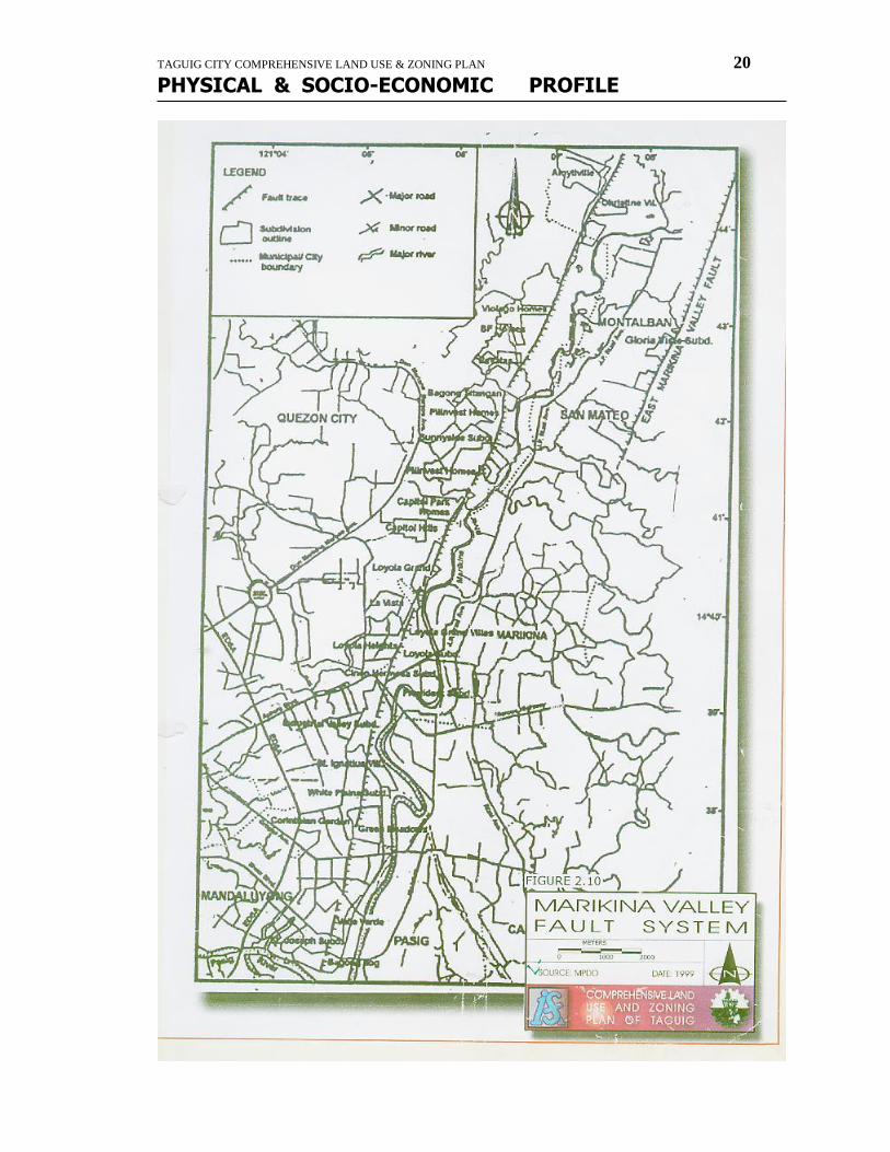
Members of the Pleistocene Guadalupe Formation predominantly underlie the terrain where Taguig lies. These are mainly Alat Conglomerate and Diliman Tuff. Early Pleistocene to late Pleistocene conglomerate, silty mudstone and tuffaceous sandstone comprise the lower member while late pleistocene well-bedded tuff units make up the upper member. The constituents of the Diliman Tuff were most likely derived from a volcano on the central lobe of Laguna de Bay to the south based on its aerial distribution pattern and lithological similarity with those in the northern vicinity of the central lobe of Laguna de Bay. On the other hand, Quaternary alluvial deposits of the Marikina Alluvial plain and Pasig River Delta plain cover western areas of the municipality. The presence of the marine sediments suggest that the quaternary alluvium was probably deposited after uplift of the Guadalupe formation, possibly as a result of movements along the Marikina Valley Fault System (MVFS) (Punongbayan,1996)
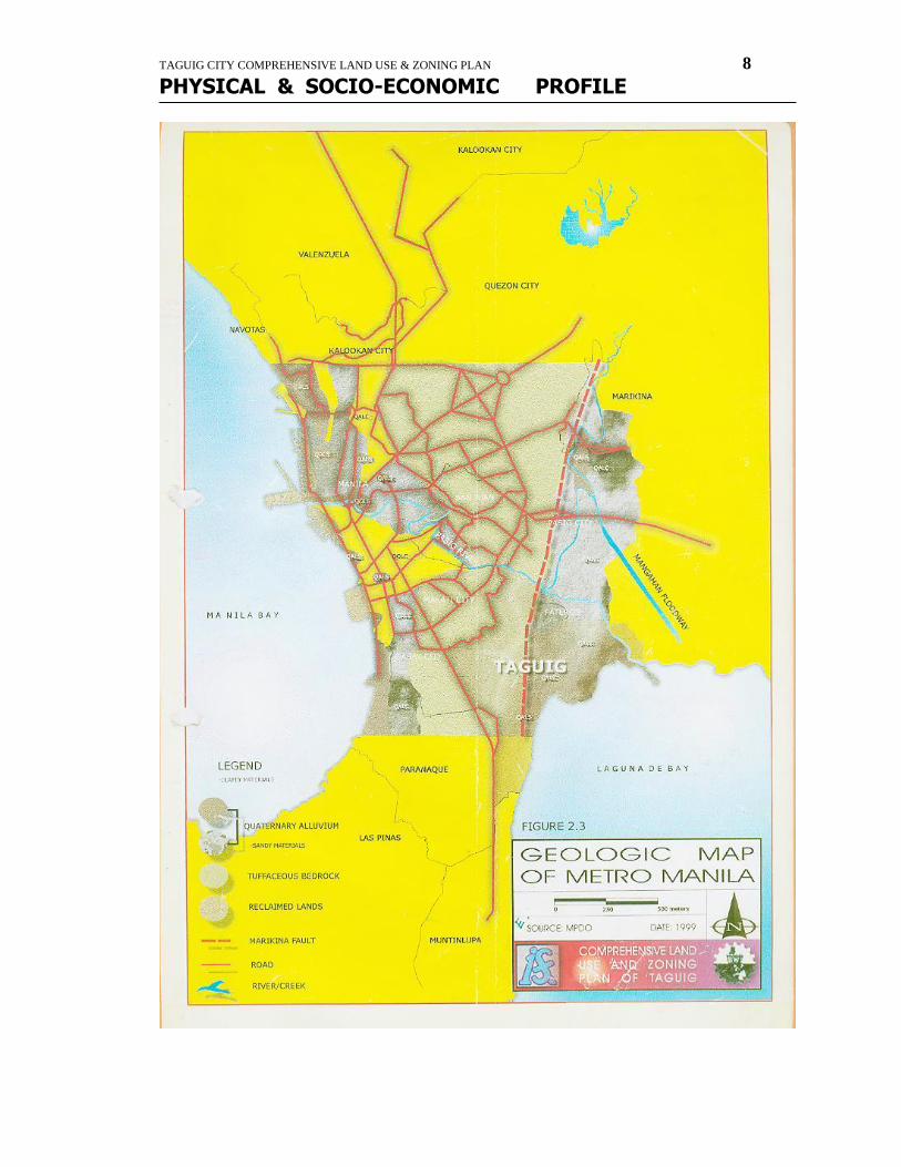
Geomorphology As illustrated by Figure 2.4, there are five main types of soils found in Taguig. These are Bay Clay Loam, Guadalupe Clay, Marikina Clay Loam, Quinqua Fine Sandy Loam and the Unmodified Soil found in Fort Bonifacio and barangays Western Bicutan, Maharlika and Ligid Tipas. Bay Clay Loam is dark brown in color and has fine granules which is friable when dry, but very sticky when wet. This particular soil type is found in barangays Ibayo-Tipas and Napindan. The Guadalupe clay, on the other hand, is nearly black in color and coarse in texture. It is granular to coddy when dry, and very fine sticky when wet and found in the barangays of Bambang, Upper and Lower Bicutan, Hagonoy, Ususan and Wawa. The Marikina Clay Loam, also brown and friable, is found in Barangays Calzada, Sta. Ana and Tuktukan. Moreover, Quinqua fine sandy loam underlies barangays Bagumbayn and Bagong Tanyag.
TAGUIG CITY COMPREHENSIVE LAND USE & ZONING PLAN 8
PHYSICAL & SOCIO-ECONOMIC PROFILE
TAGUIG CITY COMPREHENSIVE LAND USE & ZONING PLAN 9
PHYSICAL & SOCIO-ECONOMIC PROFILE
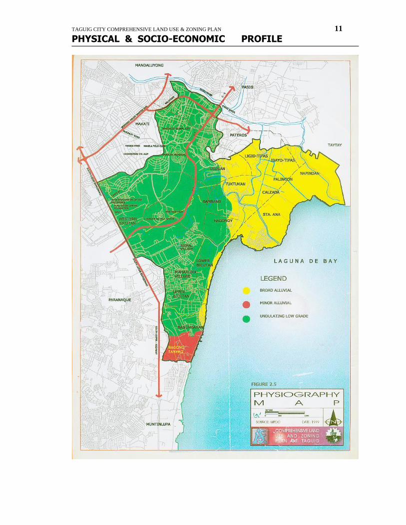
Physiography
TAGUIG CITY COMPREHENSIVE LAND USE & ZONING PLAN 10
PHYSICAL & SOCIO-ECONOMIC PROFILE
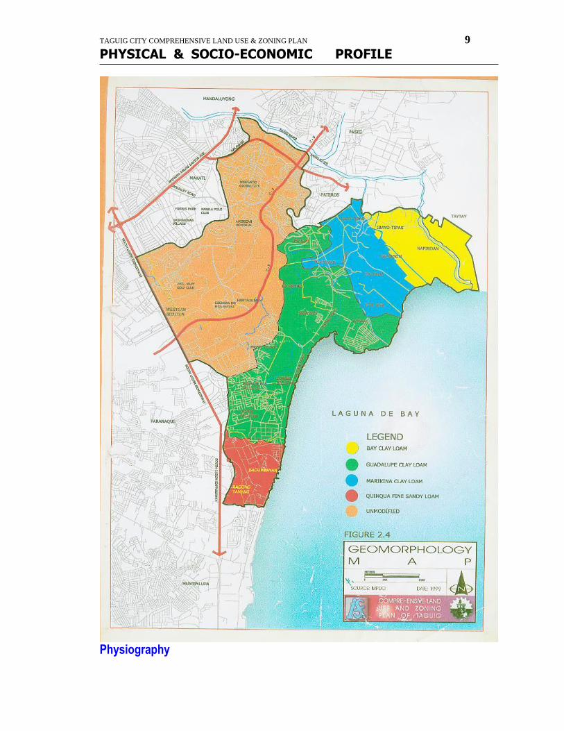
Based on the Physiography Map of Taguig, extensive portion of Taguig covering the former Military Camp of Fort Bonifacio is composed of undulating low graded tuff. On the other hand, an area bordered by Pateros, Pasig and Laguna de Bay is made of broad alluvial deposits, while the smallest southwestern portion towards Muntinlupa is mainly composed of minor alluvial deposits.
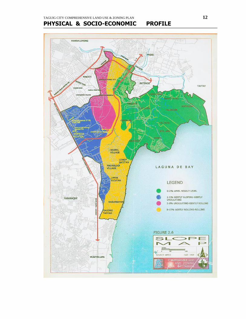
Topography, Elevation and Slope About sixty-five percent of the land in Taguig is level while the rest are rolling to hilly. It is characterized by coastal plains and hilly areas extending in the north-south direction along the Manila Bay. Surface elevation ranges from 0-10 meters above the mean sea level on the coastal plains and 20-70 meters on the hills. As per the Slope Map of Taguig, the following is the indicated slope distribution.
Slope Distribution
Category Slope Description
A 0-2% Level to nearly level
B 2-5% Gently sloping to gently undulating
C 5-8% Undulating to gently rolling
D 8-15% Gently rolling to rolling SOURCE of raw data : BSWM
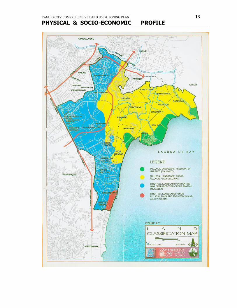
Land and Associated Soil Characteristics As per Metro Manila Land Resource Evaluation Project by BSWM, Taguig has the following land and soil characteristics : Freshwater Marshes (Alluvial Landscape) Fresh water marshes of Taguig are found on its southwstern lake coast. The soil is relatively fine loamy (silty clay loam, sandy loam to loamy sand), poorly to very poorly drained and with a general vegetation of grasses, water hyacinths and reeds. However, during the dry season when water recedes, some areas are also devoted to agricultural use. This land system has an average elevation of 4 meters with a water table depth of 60 cm. It is severely flooded and has a soil classification of Typic Tropaquept. Broad Alluvial Plain (Alluvial Landscape) This represents the vast expanse of contiguous, nearly level to gently undulating recent floodplains, levees and backswamp having slope of 0-2% particular among the central
TAGUIG CITY COMPREHENSIVE LAND USE & ZONING PLAN 11
PHYSICAL & SOCIO-ECONOMIC PROFILE
TAGUIG CITY COMPREHENSIVE LAND USE & ZONING PLAN 12
PHYSICAL & SOCIO-ECONOMIC PROFILE
TAGUIG CITY COMPREHENSIVE LAND USE & ZONING PLAN 13
PHYSICAL & SOCIO-ECONOMIC PROFILE
TAGUIG CITY COMPREHENSIVE LAND USE & ZONING PLAN 14
PHYSICAL & SOCIO-ECONOMIC PROFILE
barangays of the city. The area where Taguig lies has a land facet characterized by fine to very fine clayey somewhat poorly drained. Its soil texture is primarily clay and has effective depth of more than 150 cm. Soil drainage is somewhat poor with an inherent fertility ranging from high to very high. Average elevation is 11 meters with water table depth of 120 cm. Soil classification is Aeric Tropaquept. Minor Alluvial Plain and Isolated Inland Valley (Alluvial Landscape) This land system is dominant along coastal zones of Laguna Lake. They are usually seen along the deltas of rivers that drain into the Lake. The soil is relatively fine loam (silty clay loam, sandy loam to loamy sand), poorly to very poorly drained. It has average elevation of 25 meters, slightly eroded, but well drained. Undulating Low Degraded Tuffaceous Plateau (Foothill Landscape) It is composed of slightly elevated tuffaceous plateau with very shallow soils. It extends from Muntinlupa in the south, towards Quezon City in the north and Valenzuela in the northwest. It covers the eastern part of the city including the Fort Bonifacio Military Reservation Area. Soil is about 10 to 15 cm. deep; very dark grayish brown, silty clay with pale brown partially weathered volcanic tuff usually encountered below 10-20% rolling sideslopes and isolated low hills.
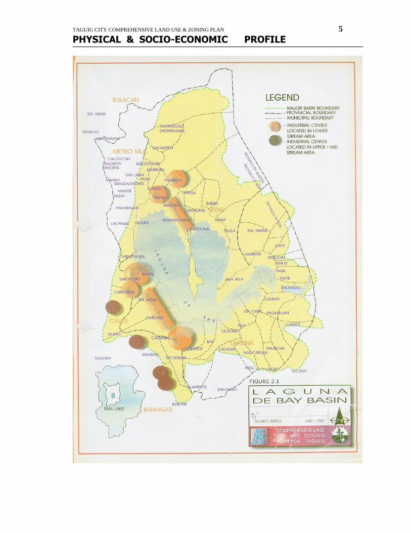
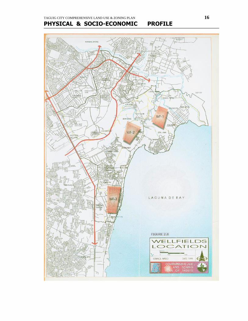
Water Resources Characteristics Surface Waters Taguig has two major rivers that feed Laguna de Bay, namely, the Taguig River and the Napindan Channel which is linked to the eastern portion of the Pasig River itself. The Napindan River normally flows from Laguna de Bay to the Pasig River, but can also flow in the opposite direction, depending on the river itself, the water table in the lake, the tidal stage in Manila Bay, and the annual evaporatin from the lake. Minor rivers include: Bagumbayan River, Mauling Creek/Tabacuhan Creek, Hagonoy River, Tipas River/Labasan River and Santa Ana River. These rivers are fed by 23 other tributaries namely: Daang Paa Creek, Bambang na Malaki, Sukol Creek/Daang Manunuso, Mabato Creek, Katwiran Creek, Daang Kalabaw Creek, Labasan Creek, Panday Creek, Sapa ni Beho, Palingon Creek, Bambang na Putol, Tipas River, Pagadling Creek, Napindan River, Lumang Ilog Creek, Ilog Clemencia, Daang Banca Creek, Sapang Ususan, Sapang Malaki, Hagonoy Creek, Maricaban Creek, Bambang ni Peles, and Daang Kalabaw Creek. As per data from Laguna Lake Development Authority (LLDA), the lake has a totalk area of 90,000 hectares with an average depth of 2.8 m. Aquaculture covers around 15,000 hectares, 10,000 for fishpens and 5,000 for fish cages. Groundwater Taguig is situated within a groundwater basin containing several connected and interrelated aquifers, composed of tuffaceous sandstone and conglomerates belonging to the Guadalupe
TAGUIG CITY COMPREHENSIVE LAND USE & ZONING PLAN 15
PHYSICAL & SOCIO-ECONOMIC PROFILE
Formation. The rocks as observed from Fort Bonifacio Global City conform from sedimentary facets of the Guadalupe formation and generally dip gently to its western portion. Its thickness is approximately 1,300 to 1,200 meters. Almost 2000 wells have been drilled in the aquifers of the Guadalupe Formation for the commercial and residential users some of which go as deep as 300 meters. In 1990, total pumpage reached 339.6 million cubic meters. There are already 124 wells that have been drilled south of Fort Bonifacio yielding 24.25 million cubic meters of water that supply 7% of the total population of Metro Manila. Based on a feasibilty study for the bulk water supply conducted through MWSS in 1996, locations of well fields within Taguig are indicated in figure 2.8. Water Quality A water quality monitoring conducted in January 1999 by Seastems, Inc. for the Fort Bonifacio Global City indicated very high coliform levels of 24,000 MPN/100 ml in the two stations observed. The values obtained exceeded the DENR standards of 5,000 MPN/100 ml for class C waters. The high figures is an indication of wastewater intrusion coming from domestic sources discharging sewerage. The table below show the details of the sampling results.
Water Sampling Results, 1999
Parameters Station 1 Station 2 DENR Std. For Class C Waters
BOD (mg/L) 10.4 9.5 7
Color (PCU) 26 17 *
Oil and Grease (mg/L) ND ND 2.0
Nitrate (mg/L) 6.3 6.9 -
PH 7.2 - 6.5-8.5
Total Phosphate (mg/L) 6.1 1.2 -
Total Suspended Solids (mg/L) 27 14 **
Coliform (MPN/100 ml) 24000 24000 5000
The pH value of 7.2 in station 1 is still within the range of 6.5 to 8.5. Moreover, oil and grease were not detected in both stations. However, the two stations yielded BOD concentrations of 10.4 mg/L and 9.5mg/L, both exceeding DENR limits.
TAGUIG CITY COMPREHENSIVE LAND USE & ZONING PLAN 16
PHYSICAL & SOCIO-ECONOMIC PROFILE

TAGUIG CITY COMPREHENSIVE LAND USE & ZONING PLAN 17
PHYSICAL & SOCIO-ECONOMIC PROFILE
Atmospheric Characteristic
TAGUIG CITY COMPREHENSIVE LAND USE & ZONING PLAN 18
PHYSICAL & SOCIO-ECONOMIC PROFILE
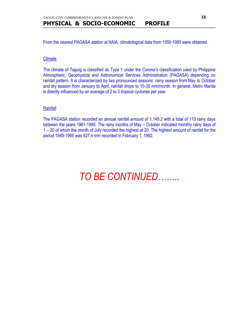
From the nearest PAGASA atation at NAIA, climatological data from 1950-1995 were obtained. Climate The climate of Taguig is classified as Type 1 under the Corona’s classification used by Philippine Atmospheric, Geophysical and Astronomical Services Administration (PAGASA) depending on rainfall pattern. It is characterized by two pronounced seasons: rainy season from May to October and dry season from January to April, rainfall drops to 10-30 mm/month. In general, Metro Manila is directly influenced by an average of 2 to 3 tropical cyclones per year. Rainfall The PAGASA station recorded an annual rainfall amount of 1,149.2 with a total of 113 rainy days between the years 1961-1995. The rainy months of May – October indicated monthly rainy days of 1 – 20 of which the month of July recorded the highest at 20. The highest amount of rainfall for the period 1949-1995 was 427.4 mm recorded in February 1, 1962.
TO BE CONTINUED……..

TAGUIG CITY COMPREHENSIVE LAND USE & ZONING PLAN 19
PHYSICAL & SOCIO-ECONOMIC PROFILE
more maps
TAGUIG CITY COMPREHENSIVE LAND USE & ZONING PLAN 20
PHYSICAL & SOCIO-ECONOMIC PROFILE

TAGUIG CITY COMPREHENSIVE LAND USE & ZONING PLAN 21
PHYSICAL & SOCIO-ECONOMIC PROFILE
``````````````````````````````````````````````````````````````````````````````````````````````````````````````` `````````````````````````````````````
TAGUIG CITY COMPREHENSIVE LAND USE & ZONING PLAN 22
PHYSICAL & SOCIO-ECONOMIC PROFILE
TAGUIG CITY COMPREHENSIVE LAND USE & ZONING PLAN 23
PHYSICAL & SOCIO-ECONOMIC PROFILE
TAGUIG CITY COMPREHENSIVE LAND USE & ZONING PLAN 24
PHYSICAL & SOCIO-ECONOMIC PROFILE
history & landmarks
HISTORY and LANDMARKS TAGUIG, RICH IN HERITAGE:
A BRIEF HISTORY
TAGUIG CITY COMPREHENSIVE LAND USE & ZONING PLAN 25
PHYSICAL & SOCIO-ECONOMIC PROFILE
A PROFILE:
TAGUIG, a municipality of Metropolitan Manila, is situated at the northwestern shore of the picturesque Laguna de Bay, at the upper mouth of the legendary Pasig River also known as the Napindan Channel through which Laguna drains its floodwaters.
It is bounded on the North by the town of Pateros and City of Pasig of Metropolitan Manila; on the East by the town of Taytay of the province of Rizal and the Laguna Lake, on the South by the Laguna Lake and the City of Muntilnlupa of Metropolitan Manila; and on the West by the cities of Parañaque, Makati, Pasay City and all of Metropolitan Manila.
It consists of 44,538.20 hectares (45.38 square kilometers) as shown by the recent cadastral survey Mcdam 594 D by the Bureau of Lands National capital Region. Except for the hilly portion on the western and southern ends, Taguig is a vast agricultural plain with about seven and a half (71/2) kilometer shoreline along the Laguna Lake.
In the 2000 Census of Population conducted, Taguig was shown to have a total population of 467,375 and with 102,723 households, distributed in the eighteen Barangays that comprise the municipality.
It has fast become urbanized from the original rural set-up. The increase in industries, development and socio-economic growth during the last two decades have raised Taguig to the level of a FIRST CLASS-A CITY.
TOPOGRAPHY
The topography of the land is about 65% levels, the rest rolling or hilly. Being an inland town, it is accessible by land transportation from the other towns bordering the Laguna Lake. It is fifteen (15) kilometers east of the City of Manila.
HYDROGRAPHY
It has two (2) major rivers that feed the Laguna Lake, namely:
1. Taguig River 2. Napindan Channel connected to a portion of Pasig River itself.
Five (5) minor rivers with tributaries:
1. Bagumbayan River 2. Mauling Creek/Tabacuhan Creek 3. Hagonoy River 4. Tipas River/Labasan River 5. Sta. Ana River
Tributaries are as follows:
1. Daang Paa Creek 13. Bambang ni Chapa 2. Bambang na Malaki 14. Ilog Clemencia 3. Sukol Creek 15. Daang Banca Creek 4. Mabato Creek 16. Daaang Kalabaw Creek (Bambang)
5. Katuwiran Creek 17. Sapang Ususan 6. Daang Kalabaw Creek (Ibayo-Tipas) 18. Maricaban Creek 7. Panday Creek 19. Bambang ni Peles 8. Sapa ni Beho 20. Daang Kalabaw Creek (Hagonoy) 9. Palingon Creek 10. Bambang na Putol 11. Pagadling Creek 12. Lumang Ilog Creek
CLIMATE AND WEATHER
The Climate is characterized by two types of season:
1. Dry season from November to April 2. Wet season from May to October
Rainfall is less evenly distributed. Maximum rainfall usually occurs from June to September. The average annual rainfall is 2,000 millimeters with a peak of 400 mm. In August and a low of 4 mm. In March. Lowest temperature usually occurs during the month of January. Predominant wind direction is south westerly from October to April, north easterly from June to September and predominantly northerly during the month of may. The average relative humidity is 81%.
WHAT’S IN A NAME?
TAGUIG CITY COMPREHENSIVE LAND USE & ZONING PLAN 26
PHYSICAL & SOCIO-ECONOMIC PROFILE
The early inhabitants of Taguig were farmers and fishermen. They became popularly known among neighboring villages as skilled “palay” threshers or “TAGA-GIIK”, so that the place where they live came to be known as “TAGIIK”. Then, Spaniards came and ruled over the place. They found difficulty in pronouncing “TAGIIK” and so they named the place “TAGUIIG”, and later “TAGUIG” that is today the official name of the city.
Transmitted by word of mouth from generations to generations the name given by Filipinos to significant events and characteristics of the places had been the sources of the names given to the thirteen original barrios that comprise Taguig.
Believed to be the first settlement by the side of the Taguig river, which divide Taguig, is barrio STA. ANA which was so named in honor of the town’s patron saint.
Early Tagalogs call the source of river upstream as “wawa”, the banks of rivers as “bambang”, the place were people wash clothes as “tuktukan’, and the area where the river drain or slide as “ususan”. And so when settlements grow in the areas along the Taguig River, the inhabitants called their barrios as WAWA, BAMBANG, TUKTUKAN and USUSAN.
Almost parallel to the Taguig River at about two kilometers to the northeast is the Tipas River which had a loop at the middle of it’s length. This is joined by the Sta. Ana River at the said loop. People following the course of the loop, detour or in Tagalog “tumitipas” or “lumiligid”. Early settlers were said to be from Pasig who escaped from the harsh policy of their ruler. The settlement was then called TIPAS. Tagalog also call the other side of a river as “ibayo’. When a community grew at the other side of Tipas, they called the settlement or barrio as IBAYO-TIPAS.
There was a time the faithful of Tipas were disgruntled over the administration of an assigned priest of Taguig. They preferred to be under Pasig. The parochial jurisdiction over Tipas had to be settled through the sound of the bells which rang simultaneously from the churches of Pasig and Taguig. The inhabitants from a portion of Tipas first heard the sound of the bell from taguig and turned their heads. To Tagalogs to turn one’s head is “lumilingon”. The place where they lived was later called PALINGON. A road to Tagalog is “Calzada”. When the road linking Tipas to Sta. Ana became populated, they named the barrio CALZADA.
To Tagalogs, being pierced through is “napindang”. At the northeastern tip of Taguig, the periodical action of the Laguna Lake Floods, created a channel piercing through the land area. The barrio, as channel piercing through the land area. The barrio, as well as the channel, were later called NAPINDAN.
In olden days a particular kind of plant called “hagunoy” aabound in area south of Wawa. The place later came to be known as HAGUNOY.
The Tagalog term of digging for treasure is “bikot”. South of barrio Hagunoy was a wooded area known to be the hiding place of robbers and pirates. When the area was cleared of robbers and pirates it was rumored that there were buried treasures left in the area. Many inhabitants started to dig for treasures. The place came to known as BICUTAN.
To Tagalogs, new is “bago” and the settlement was established at the unpopulated southern portion of Taguig, the same was called BAGUMBAYAN.
HISTORY PRE SPANISH PERIOD
Taguig has its beginning in the history of every village and barrio in the remote pre-historic past as reconstructed for us by geologists, archeologists and historians. People of varied cultures and racial types, came to Philippines in migratory waves from twenty five or thirty years ago unto the 14th century.
The first to come were the primitive men, as proven by unearthed stone implements and fossil remains. The Pygmies, forebears of the Aetas, came next, crossing land links from the Asian mainland to the Philippines. Choosing the valleys where they could engage in agriculture, the Indonesians followed the Proto-Malays. The last group of people to settle in the Rizal area were called the Porcelain Age Folks. They struggled against one another for supremacy and possession of rich land. Those of lower cultures were driven to the mountains. The Malays prove to be the dominant race.
Tagalog authorities claim, the name Tagalog may mean “taga-ilog” which is a term indicative of the habitation of these people. It is, therefore, probable that the first homes of the Tagalogs were the river areas and banks. The rivers and the Laguna Lake offered the pioneer of Taguig, fresh water for drinking ablutions and irrigation; protection against attack of enemies; and easy means of travel by bancas or native boats. Thus, along the Taguig River, Tipas River and the Napindan Channel, Malay settlement sprang up and grew into populous barrios, a fact which the Spanish conquistadors found when they came during the last quarter of the 16th century.
SPANISH PERIOD
TAGUIG CITY COMPREHENSIVE LAND USE & ZONING PLAN 27
PHYSICAL & SOCIO-ECONOMIC PROFILE
Taguig was already a thriving community long before the Spaniards came. It was once part of the Kingdom of Tondo ruled by Rajah Soliman. During the early Spanish colonization, Taguig was given as an encomienda to one Captain Vergara, while the Augustinian Order provided religious instructions.
THE FOUNDATION DAY
On April 25, 1587 it was made a “pueblo” of the province of Manila. During the uprising led by Magat Salamat (1587-1588), Juan Basi, who was the town chieftain fought against the Spaniards, and gave his life along with Agustin Legaspi, a nephew of Lakandula, and son-in law of the Sultan of Borneo, and the chieftain of Tondo, Pandacan, Kandaba, Navotas and Polo. When it became a pueblo, it was ruled by a curate and a governadorcillo. It had a tribunal, a primary school and a church served by a regular priest whose missionary work extended to as far as the town of Angono. It produced much rice, but little sugar cane. Besides farming, the men lived by fishing. The women wove cotton cloth and “sawali” from bamboo strips. Since boats from the lake towns passed by on the way to manila, the town carried active commerce in agriculture and manufactured products.
The “gobernadorcillo”, popularly called “capitan” was assisted by some minor officials. At the beginning, the gobernadorcillo was elected annually by the married natives of the locality, subject, however to the final approval of the superior government in Manila. He acted as judge in civil cases where small sums were involved He was aided by constables called “vilangos”, a notary, and the “cabeza de barangay”.
Pursuant to the “Reales Ordenanzas Formados Por El Superior Gobierno Y Real Acuerdo” by then Governor Raon in 1768, and in accordance with the Municipal Reform Law of 1847, improvements in the municipal government including changes in the manner of electing the gobernadorcillo were effected: a candidate must be able to read and write Spanish. Instead of being elected by all married natives, he was elected by a board of electors composed of retiring “gobernadorcillos” and twelve “cabezas de barangay” and chosen in order of senior ity. Actually, they were chosen by plurarity vote through the secret ballot, and their names, together with some recommendations of the “alcalde mayor” or gobernador and often of the friar, were forwarded to the central government in Manila, where the man for the position would finally be singled out.
In conformity with the election law of 1847, also elected to assist the gobernadorcillo, were the “teniente mayor” who was actually the vice alcalde; “juez de sementera” who handled real property cases; “juez de policia” who handled criminal cases; aand “juez de ganados” who handled cases on large cattles.
No complete record can be found of those who served as head of the town previous to 1856. The term of office of the Gobernadorcillo or Capitan Municipal was for one year until 1862 to 1897 is as follows:
1856- Domingo Franco 1857-1858 Vicente Azores 1859- Juan B. Labao
1860- Domingo Guevarra
1861- Venancio Sandoval
1862- Leonardo Labao
1863-1864 Salvador Esguerra 1865-1866 Tomas Cruz 1867-1868 Ciriaco Labao 1869-1870 Domingo Guerero 1871-1872 Augustin Rayos 1873-1874 Leoncio Pagkalinawan 1875-1876 Clemente Labao 1877-1878
1879-1880 Jose Natividad 1881-1882 Feliciano Pagkalinawan 1887-1888 Miguel Aquino 1889-1890
1891-1892 Jose Natividad 1893-1894 Marcos Lontoc 1895-1897 Jose Natividad
SHORTLIVED PHILIPPINE REPUBLIC
Andres Bonifacio during his youth often visited his relatives in Sta. Ana, especially during the town fiestas of Taguig. When he founded the Katipunan, it was easy for him to gain followers from Taguig.
Among those who held leadership in the movement were: Domingo Motas Cruz, who had risen to the rank of “Marsical de Ocampo” until his death in the Battle of Zapote; “Commandantes” Pablo E. santos, Pantaleon Roldan, Felipe Rayos del Sol, Baltazar Capistrano, Leocadio T.
TAGUIG CITY COMPREHENSIVE LAND USE & ZONING PLAN 28
PHYSICAL & SOCIO-ECONOMIC PROFILE
Mariano, “Capitanes” Honorio Musni, Lino Labao, Marcelo de la Paz, Simplicio Tolentino, Juan Cruz, Gregorio Guerero, “Tenientes” Gregorio Natividad, Fortunato Dinguinbayan, Dionisio Capistrano, Higino Perez, Canuto Pascual, Juan Natividad, Esteban Estacio and many others.
When shortlived Philippine Independence was proclaimed on June 12, 1898, Taguig was administered by the following:
Baltazar Capistrano : “Pangulo ng Bayan”
Jacinto Manalo : “Kalihim”
Pablo B. Santos : “Ingat-Yaman”
Baltazar landrito : “Puno ng Pulisya”
And thirteen;
Pangulo ng Nayon:
Juan Cruz - Bagumbayan
Liberato Mariano – Bicutan
Claro Cuevas – Hagonoy
Marcelo Manuel – Wawa
Isabelo Bautista – Bambang
Antonio Cruz – Sta Ana
Pantelon Roldan – Tuktukan
Silvestre Buenaventura – Ususan
Hermogenes San Juan – Calzada
Mateo San Pedro - Palingon
Leocadio T. Mariano – Tipas
Pedro Esguerra – Napindan.
The “Pangulo ng Nayon” acted as “Councilor” and were assisted by the “Tiniente” appointed by him in his barrio.
Although the Treaty of Paris of December 10, 1898 concluded the Spanish-American War, it never the less sanctioned the American occupation of the Philippines and transfer of sovereignty from the Spain to the United States. The agreement between President Emilio Aguinaldo and the U.S. authorities failed and so the Filipinos fought against the American Forces. The “Revolucionaries” of Taguig joined the command of Gen. Pio del Pilar. After the San Juan Bridge incident on February 4, 1899, the Americans expanded their occupation of Manila to the neighboring towns, which fell one after another due to their superior arms.
It was recorded that on February 16, 1899, the Filipino forces dislodged Americans positioned in the hills of Taguig (now a portion of Ft. Bonifacio) and Pateros causing many casualties among Americans. Actions continued and positions changed hand from then on. On May 15, the tide turned in favor of the Americans so that 500 “Revolucionaries” were captured and taken prisoners. Taguig fell finally to a cotigent of the First Washington volunteer Infantry led by Col. Wholley on March 16, 1899. In its defense, seventy five revolucionaries died.
AMERICAN REGIME
On March 29, 1900 at the start of American reign, Taguig was established as an independent municipality by virtue of General Order No. 40. On June 14, 1901, Taguig was made a part of the Province of Rizal by virtue of Act. 137 of the Philippine Commission which was a consolidation of a portion of the Province of Manila and the Province of Morong. Taguig then was classified as a fourth class municipality with 6, 397 populace. The name Rizal was a suggestion of Dr. Trinidad H. Pardo de Tevera at the historic meeting held at the Pasig Catholic Church on June 5, 1901 in the presence of the Second Philippine Commission and presided over by its President/Chairman, William Howard Taft.
By virtue of Act. No. 942 of the Philippine Commission, Taguig was joined with Pateros and Muntinlupa on October 12, 1903 with seat of government at Pateros. About one and a half month later, Muntinlupa was segregated from Taguig and made a part of Biñan, Laguna by virtue of Act. No. 1008 dated November 25, 1903, but was however, returned as part again of Taguig on March 22, 1905 by Virtue of Act. No. 1308 of the Philippine commission with seat of government at Taguig.
Pateros was eventually separated from Taguig and both became independent municipalities of Rizal Province on June 01, 1908 by virtue of Executive Order No. 20, dated February 20, 1908 upon petition of the residents of Pateros and recommendation of the Provincial Board of the Province of Rizal. Muntinlupa was separated from Taguig and became an independent municipality of Rizal Province on January 1, 1918 by virtue of Executive Order No. 108, dated December 19, 1917. From 1903 to 1917 when Pateros and Muntinlupa were joined with Taguig, those elected into office as President Municipal were all residents of Taguig.
Except for one Vice-Presidente who succeeded in his Presidente Municipal for the unexpired term, the following administered the municipality of Taguig during the American regime:
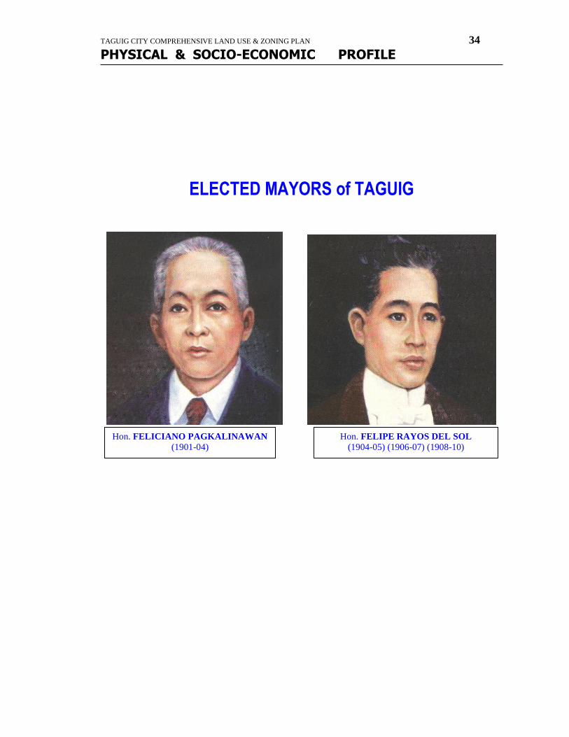
(1901-1903) – Feliciano Pagkalinawan
(1904-1905), (1906-1907), (1908-1909) (1910) – Felipe Rayos del Sol

TAGUIG CITY COMPREHENSIVE LAND USE & ZONING PLAN 29
PHYSICAL & SOCIO-ECONOMIC PROFILE
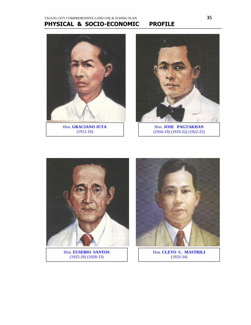
(1911 Oct..15, 1912) – Braullio Pagkalinawan
(1912-1916) – Graciano Juta
(1916-1919), (1919-1922), (1922-1925) – Jose Pagtakhan
(1925-1928), (1928-1931) – Eusebio Santos
(1931-1934) – Cleto Mastrili.
The first Municipal Council of Taguig under the American regime was composed of the following:
Feliciano Pagkalinawan – President
Pantaleon Franco – Vice-President
Antonio Cruz - Consejales
Damaso Dionisio - Consejales
Juan Cuevas - Consejales
Sivestre Buenaventura - Consejales
Victoriano Estacio - Consejales
Tomas Monsod - Consejales
Nicolas Mozo - Consejales
BernabeSta. Teresa – Secretario
Elected as Vice-President with Feliciano Pagkalinawan in 1903 was Pantelon Franco and the “Consejales” were: Basilio Guerrero, Antonio Cruz, Tomas San Pedro, Juan Cuevas, Simeon San Juan, Silvestre Buenaventura and Andres Pagkalinawan; Bernie Sta. Teresa, secretario.
Those elected with Felipe Rayos del Sol during his first term (1904-1905) were: Francisco de Borja, Vice-President, while as Consejales were: Agapito sulit, Nicasio Manalo, Pedro Mendiola, Simeon San Juan, Antonio Cruz, Pablo B. Santos, Jose de Leon, Hipolito Francisco and Juan Cuevas.
Those who served with Felipe Rayos del Sol during his third term (1908-1909) were: Lorenzo Rosales, Vice-President; M
ariano Garcia, Antonio Cruz, Jose de Leon, Simplicio Manalo, Hipolito Francisco, Pantaleon de Borja, Fortunato D. del Sol, Braullio Pagkalinawan, Diego Cuevas, Juan Mozo, Consejales; Luis Sta. Ana, Secretario. When Pateros was separated from taguig on June 01, 1908, Jose de Leon and Simplicio Manalo both residents of Pateros were re-assigned to their home town.
Those who were elected with Felipe Rayos del Sol on his fourth term 91910-1912) were: Braiullio Pagkalinawan, Vice-Presidente, Marcelino Elias, Mariano Baltazar, Nicolas Mozo, Mariano Reyes, Antonio Cruz, Hermogenes SanJuan, Uldorico Yumping, Diego Cuevas, Cayetano Victoria, Consejales. After serving for one year (1910), the election of Felipe Rayos del Sol was voided. The election law at the time allowed only three continuous terms. The exclusion of Pateros did not matter and his fourth re-election was counted against him. His Vice-Presidente Braullio Pagkalinawan was appointed to succeed him while Marcelino Elias was appointed by the Provincial Board of Rizal to succeed as Vice-Presidente.
Those who served with Graciano Juta from October16, 1912 to October 15, 1916 were: Juan Cuevas, Vice-Presidente, and Francisco Roldan, Francisco Pili, Rafael Pagkalinawan, Serapio Balderama, Jose Carlos, Silvestre Buenaventura, Donato Cruz, Mariano Baltazar, as Consejales and Dionisio Capistrano, “Secretario”.
With Jose Pagtakhan from October 16, 1916 to October 15, 1919 were Antero Ignacio, Vice-Presidente, and as “ consejales” were; Jose Aquino, Ponciano Capistrano, Anastacio Yamson, Eugenio Papa, Servillano Manalo, Benito Garcia, Genero Espeleta, and Vidal Joaquin and Marcos Franco “Secretario”.
When Muntilnlupa was segregated from taguig in 1918 Graciano Juta and fortunate Dinguinbayan were appointed to replace Genero Espeleta and Vidal Joaquin who were residents of Muntinlupa.
With Jose Pagtakhan during his second term from October 16,1919 to October 15, 1922 were re-electionist Vice-Presidente Antero Ignacio, and “consejales” Jose Aquino, Simon Sebatian, Raymundo Cruz, Mariano Sarmiento, Servillano Manalo, Eugenio Papa, and marcelino L. Estacio. The latter resigned in January, 1920 aand his place Ramon Ramos was appointed. Leonardo Bautista remained as ”Secretario Municipal”.
A native of Taguig, Pedro Magsalin, was elected and served as Member of the Provincial Board of Rizal under Provincial Governors Andres Gabriel and Arcadio Santos from 1919-1922, representing the First District of Rizal Province.
On August 26, 1920 political leaders and residents of the five barrios of Calzada, Palingon-Tipas, Ibayo-Tipas, and Napindan filed a petition to the Governor General of the Philippines through the Provincial Board of Rizal to separate from Taguig proper and be formed as an independent municipality. Among the signatories were leaders of the Partido Nacionalista, Partido Democrata and Independientes, namely: Pedro Natividad, Tomas San Pedro, Francisco Estacio, Prospero Polintan, Monico Tanyag, Fortunato Dinguinbayan, Francisco Balderrama, Necomedes Bunyi, Victor Cruz, Hilario Bernie, Anastacio Mariano, Lazaro Lontoc, Luciano Santos, Angel Juta, Telesporo Balderama, Vicente Esguerra, Gabriel
TAGUIG CITY COMPREHENSIVE LAND USE & ZONING PLAN 30
PHYSICAL & SOCIO-ECONOMIC PROFILE
Mendiola, Manuel Manalo, Pascual Dimaguila, Ricardo Maglipon, Esteban Sta. Ana, and others. The petition was not granted because it was found out that the proposed municipality lacked the financial and economic capability. Moreover, it would have weakened the mother municipality of Taguig.
On the third term of Jose Pagtakhan from October 26, 1922 to October 15, 1925 those who served in his municipal council were: Fortunato Dinguinbayan, Vice-Presidente; Fausto Alano, Leocadio Ignacio, Engracio Dionisio, Julian Dionisio, Mariano Sarmiento, Isidoro Fermin, Marcelo Reyes and Juan San Pedro; and Leonardo Bautista, “Secretario”.
Those who served in the municipal council during the first term of Eusebio Santos from October 16, 1925 to October 15, 1928 were Ciriaco Tiñga as Vice-Presidente, and Fausto Alano, Leocadio Ignacio, Julian Dionisio, Mariano Sarmiento, Eugenio Papa, Felix A. Bernie, Ramon Ramos, and Banito E. Garcia as “Consejales”, and during his second term from October 16, 1928 to October 15, 1931 were Vice-Presidente Tomas San Pedro and Consejales Leocadio Ignacio, Leoncio Dionisio, Severino Santos, Felipe A Bernie, Ciriaco Quilatan, and Patricio Lucas, and Leonardo Bautista, “Secretario”.
In the election for the house of representative of the 9th Legislature Oct. 16, 1931 to Nov. 15, 1935 Pedro Magsalin, a native of Taguig was elected to represent the First district of the province of Rizal.
Those who served with Cleto Mastrili from October 16, 1931 to October 15, 1934 were Exequiel Labao as vice-Presidente, Eustaquio Ordonez, Teotimo Cuevas, Cesario Magsalin, Elino Cruz, Apolonio Ramos, Antonio Cruz, “Consejales”, and Gerardo Manalo as “Secretario”.
Also elected for the same term (1931-1934) I the Provincial Board of Rizal under Governor Francisco Sevilla was Leodovico Labao, a native of Tipas, Taguig representing the First district of Rizal. He was again re-elected to the same position for the next term (1931-191937).
Earlier in July of 1934 an election was also held for delegates to the constitutional convention to draft the Philippine Constitution. Elected to represent the first District of Rizal Province was again a native son of Taguig in the person of Castor T. Cruz.
THE COMMONWEALTH PERIOD
Under the Tydings-McDuffe Law, the United States granted the Philippines a ten-year transition period from 1936 to 1945 known as the Commonwealth. Although interrupted by the Japanese occupation of the Philippines during the Second World War, the following served as Alcaldes Municipal : (1934-1937) (1937-1940) (1941-1942) – Artemio Natividad. Natividad refused to serve under the Japanese government and therefore resigned. In his stead Vice-Alcalde Leocadio de Leon was appointed by the Provincial Board of Rizal. De Leon served from January, 1943 to February 17, 1945.
In the election for the First National Assembly, Pedro Magsalin was again elected to represent the First District of the Province of Rizal (1935-1938).
Those who served with Presidente Municipal Artemio Natividad from October 16, 1934 to October 15, 1937 were Teotimo Cuevas, Vice-Presidente: Francisco de la Rosa,
Sancho Mansod, Francisco Guingcangco, Jose Gerpnimo, Jose Ramos, and Mateo Gregorio, Consejales, and Gerardo Manalo, Secretario.
During the second term of Artemio Natividad as Alcalde municipal from January 1, 1938 to December 31, 1940 the following served within him: Ciriaco Tiñga, Vice-Alcalde; Marcelo Reyes, Juan Capistrano, Tomas Cruz, Melencio Santos, Claro Ramirez, and Jorge Ramos, Consejales, and Gerardo Manalo, Secretario.
On the third term pf Artemio Natividad as Alcalde Municipal which was interrupted by the Japanese occupation, January 1, 1941 to December 3, 1942, the following composed the municipal council: Leocadio de Leon, Vice-Alcalde; Marcelo Reyes, George Ramos, Aniceto Roldan, Mariano Paac, Cirilo Santos and Carlo Dionisio, Consejales. When Artemio Natividad resigned as Alcalde municipal in 1942, Leocadio de Leon succeede him and served the original council without a Vice-Alcalde from January 1, 1943 to February 17, 1945. The council remained the same but Maximino Dionisio served as “Secretario”.
JAPANESE INTERLUDE
On January 1, 1942, Manila was declared as an open city as the US-Philippine forces (USAFFE) retreated to Bataan and Corregidor. Automatically, Rizal Province fell under the rule of the Japanese Forces. The latter set foot in Taguig in the evening of January 2, 1942.
Among the natives of Taguig who were officers and saw action in the defense of the country against the army were Daniel Victoria, Marcos Estacio, Ricardo G. Papa, Miguel Capistrano and castor Buenaflor. They joined the Death march from Samal, Bataan to Capas, Tarlac after the fall of Bataan and Corregidor on April 9, 1942.
Many among the patriotic people particularly the professionals and government employees refused to serve under the Japanese Government and returned to fishing, farming and commerce for their livelihood awaiting the promised return of Gen. Douglas MacArthur. Many joined the underground movements in 1942 such as Hunters ROTC guerillas and the Markings’ Fil-American Irregular Troops.
The Japanese conducted zonification of all male citizens, twice for the whole town, and separately for each of the thirteen barrios. Suspected guerillas were tortured and sent ot garrisons at Antipolo and Fort Santiago, but the most tragic was the last conducted in the barrio of Tipas on December 1, 1944 where more than 500 men, intellectuals and professionals, were taken and never returned. Among them were Mayor Artemio Natividad, speaker of the Mayors ‘League of Rizal, ex-Prov. Board Member Lodovico Labao, Col. Marcos Estacio, Atty. Carlos Natividad, Dr. Francisco Sta. Ana, Dr. Amado Balderama and a host of others. A marker in honor of these martys inaugurated by then Congressman Ferdinand E. Marcos on February 4, 1949 now stands in Tipas, Taguig, (Rizal), M.Mla.
TAGUIG CITY COMPREHENSIVE LAND USE & ZONING PLAN 31
PHYSICAL & SOCIO-ECONOMIC PROFILE
On the evening of February 5, 1945, Japanese navy soldiers burned all the houses and buildings of barrio Ususan, and would have burned the town proper but for the intercession of one Capitan Kawagutsi, the Japanese Army Commander assigned to Taguig.
At noontime of February 17, 1945, a small contingent, advance scouts of the 11th Airborne Division together with some guerillas penetrated Barrio Wawa and in a brief skirmish at the Taguig River wounded and captured Captain Kawagutsi.
Taguig was liberated on February 23, 1945 after the defeat of the Japanese in the battle of Kay Patag Hills in the barrios of Bicutan and Bagumbayan on February 22, 1945.
From February 17, 1945 the ROTC Hunter Guerillas of Taguig took over the Municipal Hall and established an emergency provisionary local government until June 30, 1945 with their officers interchangeably acting as Alkalde starting with Aquilino Sarmiento with Gonzalo with Gonzalo Magsalin as secretary. Later Pedro D. Cruz took over during the last six months of the commonwealth (July 1-Dec. 31, 1945).
With Pedro D. Cruz in the council were Bonifacio Relon, Vice-Alcalde; Irene A. Cruz, Pio Felipe, Mateo Gregorio, Benito Garcia, Jorge Ramos, Cornelio Carlos, Consejales, and Ireneo Bunyi, Secretary.
Among the officers of the resistance movement and recognized as such were: (ROTC Hunter Guerillas) Lt. Col. Pedro D. Cruz; Majors Guillermo Casa, Ramon Domingo, Francisco Villar; Captains Cirilo de Jesus, Aquilino Sarmiento, Dominadr Realon, Gonzalo Magsalin; Lieutenants Jose Bernie, Generoso Yumping, Mauricio Balagtas, Segundo Santos, Sebastian Marcelo, Marcos Dionisio, Avelino Tanyag, Felipe Gregorio, Marcelo Estacio, Jose Reyes, Ramon Ramos Jr., Gregorio Dionisio, Silvestre Pascual, Benito Flores, Paterno Pagtakhan, Filemon Cipriano, Antonio Manalo, Jose Concepcion, Nicanor Papa, Glicerio Herrera, Melquides Juta, Delfin Buenaventura, Ruben Quilatan, Marcelino Beltran; (Markings Guerilla) Col. Francisco Adriano, Capt. Domingo Marcelino, Lieutenants Gaudencio Lecente, Ireneo Reyes, Saturnino Pagsisihan, Romeo Berdin, Jose Borja, and many others whose names cannot be recalled as of this writing.
REPUBLIC OF THE PHILIPPINES
When civil government was restored, Leocadio de Leon resumed office from Jan. 9, to May 31, 1946. However when Presidential Election of April, 1946, Pedro D. Cruz was appointed Alcalde and served until the first regular election (June-December 31, 1947).
Pres. Roxas appointed a son of Taguig, Former Assemblyman Pedros Magsalin, a member of his Cabinet as secretary of Labor.
Those who served from January to May, 1946 with Leocadio de Leon were: Ciriaco Tiñga, Vice-Alcalde, Mateo Gregorio, George Ramos, Benito Garcia, Eduardo Dionisio, Councilors, and Ireneo Bunyi, Secretary.
The Municipal Council of Taguig who served with Pedro D. Cruz from June 1946 to December 1947 were: Isidro Fermin, Vice-Alcalde; Ireneo A. Cruz, Benito Flores, Simeon Sebastian, Jose Aquino, Anacleto Ocol, Segundo Cruz, councilors, and Ireneo Bunyi, Secretary.
Those who were elected and served as chief executives of the municipality after the proclamation of independence on July 4, 1946 under the Republic of the Philippines were 1948-1951) – Nicanor P. Cruz; (1952-1955) – Bonifacio A. Relon; (1956-2959)(1960-19630)(1964-1967) (1968-1971) – (1972-April 13, 1976) – Monico C. Tanyag; (April 14- August 3, 1976, O.I.C.) August 4, 1976 – March 2, 1980 as Acting Mayor March 3, 1980 – February 1986 as elected Mayor) – Levi B. Mariano.
Elected with Nicanor P. Cruz in the Municipal Council (1948-1951) were: Tiburcio Santos, Vice-Alcalde; Lucio Sanga, Igmidio Pagkalinawan, Alfonso Sarmiento, Benito Flores, Arsenio Javier, Patricio Lucas, Councilors. Ireneo Bunyi was the municipal secretary serving with Bonifacio Relon in the Municipal Council (1952-1955) were Isidro Fermin, Vice-Alcalde, Amalio D. Bernie, Melquiades D. Santos, Conrado B. carlos, Moises P. cruz, Pio T. Felipe, and Claudio Marcelo as Councilors. The Latter resigned and was replaced by Benito Garcia. Leocadio Pagkalinawan served as secretary. Later he was replaced by Nicanor M. Patricio. Conrado Carlos resigned on Sept. 18, 1955 while Moises Cruz also resigned on Aug. 21, 1955; and in their place Herminigildo Caseres and Roque Rodolfo were appointed, respectively.
During the first term of Monico C. Tanyag (1956-1959) the following were elected with him: Alfonso C. Roldan, Vice-Alcalde; Juan Capistrano, Ramon Marcelino, Severo Pagkalinawan, Niceas Ordonez, Francisco Tortosa, Tomas Cruz, Councilors. The Municipal Secretary was Eufracio D. Santos. When the latter resigned, Miss Zosima Polintan took over.
During the second term of Monico C. Tanyag (1960-1963) the following were elected with him: Augusto M. Garcia, Vice-Mayor, Luciano Lontoc, Donato Estacio, Jose Pili, Niceas Olazo, Angel Santos, and Ramon Marcelino, Councilors. Benedicto R. Esguerra acted as municipal secretary. Atty. Levi B. Mariano was Legal Adviser to the Mayor.
On the third term of Monico C. tanyag (1964-1967) the following composed the Municipal Council: Jose C. Bernie, Vice-Mayor; Teodoro Arriola, Benedicto Cruz, Felipe Dones, Jose Mendiola, Miguel Olazo, Serapio Sta. Ana, and Benjamin Mariano, Councilors. Benedicto R. Esguerra was the Secretary.
During the Presidency of Diosdado Macapagal two of the major commands of the Armed Forces of the Philippine Army and the Philippine Air Force were placed in the hands of two of Taguig sons, namely: Brig. Gen. Ricardo G. Papa, and Brig. Gen. Jonas Victoria, respectively. Later, President Marcos promoted another son of Taguig, Brig. Gen. Castor Buenaflor, Inspector General of the AFP.
During the fourth term of Monico C. Tanyag (1968-1971) the following were elected with him: Alvaro P. Villar, Vice-Mayor; Rolando Garcia, Pedro Olazo, Pascual Sarmiento,
Rufino Dacumos, Benedicto R. Cruz, Felino Marcelino, Renato Quilatan and Ricardo R. Cruz. Benedicto R. Esguerre served as Municipal Secretary.
During the fifth term of Monico C. Tanyag (1972-1975) the following were elected with him: Nicanor C. Garcia, Vice-Mayor, Pascual Sarmiento, Pedro Olazo, Mariano Maglipon, Francisco Borja, Euleterio Candaza, Pacifico Santos, Leo Pagkalinawan and Crispin Reyes, The last two however, resigned during the first two years of the term.
TAGUIG CITY COMPREHENSIVE LAND USE & ZONING PLAN 32
PHYSICAL & SOCIO-ECONOMIC PROFILE
MARTIAL LAW YEARS
On September 21, 1972 by virtue of proclamation No. 1081, President Ferdinad Marcos declared martial law in the Philippines.
On November 7, 1975 Metropolitan Manila was created consisting of four (4) cities and thirteen municipalities under the administration of the Metropolitan manila Commission by virtue of Presidential Decree No. 824 the municipality of Taguig was segregated from the province of Rizal and made a part of Metropolitan Manila.
The Municipal Council of Taguig was dissolved by virtue of PD 824 on November 7, 1975 but the incumbent Council members were included in a Sangguniang Bayan whose membership also involved nine Sectoral representatives and seven Barangay captains and representative of Kabataang Barangay. As constituted, the Sangguniang Bayan of taguig was composed of: Levi B. Mariano, Presiding Officer; Nicanor B. Garcia, President Pro-Tempore, Francisco Borja, Rolando Dionisio, Pascual Sarmiento, Mariano Maglipon, Pedro Olazo, Eleuterio Candaza, Pacifico Osano, Francisco de la Cruz, Eliseo D. Santos, Manuel Pascual, Mercindo Mendoza, Marcelo Lucas, Augustin Lagangan, Donato Estacio, Domingo Tengco, Bernardino Elias, Isidro Garcia, Emmanuel Mulawin, Eusebio Sta. Barbara and Virgilio Eustaquio.
When Monico C. Tanyag fell ill, Atty. Levi B. Mariano was appointed Officer In-Charge of the Mayor’s Office on April 14, 1976. When Mayor Tanyag died on July 21, 1976, Mariano was appointed Acting Mayor of Taguig effective August 4, 1976 and held post throughout the Marcos years until the Edsa People Power Revolution of February, 1986.
By virtue of Presidential Decree No. 557 dated September 20, 1974 all newly created barrios and citizens assemblies under PD 86, as amended were declared Barangays and all references to the barrio in and existing law henceforth were understood and referred to as barangay.
The Minucipalty of Taguig now comprising of eighteen (18) barangays with corresponding area in hectars, namely: Bagumbayan – 362 has, Bagong Tanyag – 217 has., Upper Bicutan – 144 has., Lower Bicutan - 235 has., Western Bicutan – 355 has., Maharlika Village – 51 – has., Signal Village has., Hagonoy – 162 has., Wawa – 198 has., Bambang – 92 has., Ususan – 145 has., Tuktukan – 31 has., Sta. Ana – 22 has., Calzada –177 has., Palingon – 117 has., Ligid-Tipas – 68 has., Ibayo-Tipas – 68 156 has., and Napindan – 270 has.
The remaining balance of 1,626.2 hectares are within Ft. Bonifacio Military Reservation.
THE POST EDSA PEOPLE POWER REVOLUTION:
With the restoration of Philippine Democracy and the start of the Administration of President Corazon C. Aquino on February, 1986, Isidro Garcia was appointed O.I.C.-Mayor and Donato L. Estacio replaced Garcia as O.I.C.-Mayor and served until 1988 when local elections were held and a new mayor was elected. During the Incumbency of Garcia and Estacio, no members of the Municipal Council were appointed and the municipal executive at the time was assisted by a management committee composed of heads of offices.
In the election of May, 1988, Rodolfo de Guzman was elected Mayor and Pacifico Santos, Vice-Mayor and held offices effective October, 1988, the delay of which was caused by a prolonged electoral protest. After the elections of 1988, it was only on October 10, 1988 that the elected Mayor Rodolfo de Guzman took over the reins of government of the municipality. The other elected officials were: Pacifico Santos, Vice-Mayor and Agapito R. Cruz, Jr., Dionisio G. Papa, Herminia C. Perez, Vivencio B. Estacio, Martin D. Casas, Mario C. Reyes, Daniel M. Castillo, Danilo C. Rayos del Sol, Rufino J. Mamonong and Rene G. Labuntog, Councilors. Delio J. Santos represented the ABC in the Council.
Ricardo G. Papa Jr. was elected Mayor for 1992-1995. Elected with Mayor Papa were: Daniel M. Castillo, Vice-Mayor and Allan Peter S. Cayetano, Allan Paul C. Cruz, Ricardo S. Cruz, Jr., Mario C. Reyes, Philip D. Pagkalinawan, Danilo C. Rayos del Sol, Ricardo J. Jordan, Danilo G. Castro, Marisse L. Balina and Gualberto M. Roa, councilors.
For 1995 – 1998, Isidro Garcia was first proclaimed Mayor and Dra. Loida-Alzona as Vice-Mayor. However, during the later part of 1997, Mayor Ricardo G. Papa, Jr. was proclaimed the duly elected Mayor of the municipality. Before the end of the Administrative year 1995 – 1995, Alan Peter S. Cayetano was also proclaimed as the elected Vice-Mayor. Elected councilors were Allan Paul Cruz, Jr., Robert S. Dionisio, Gamaliel N. San Pedro, Philip D. Pagkalinawan, Milagros F. Valencia, Marisse Balina-Eron, Ricardo j. Jordan, Leo M. Aguilar, Danilo G. Castro, Jr., and Valencio T. Osano.
Venacio T. Osano was replaced by his wife Lolita G. Osano who was appointed by the party after the former died.
For 1998-2001, the incumbent, Ricardo D. Papa, Jr. was reelected Mayor. Also elected were: Dra. Loida Labao-Alzona, Vice-Mayor, and Danilo G. Castro, Ricardo D. Cruz, Jr., George A. Elias, Reynaldo C. Flores,Robert S. Dionisio, Gamaliel N. San Pedro, Elpidio Javier, Noel Dizon, Carlos Catacio, Milagros F. Valencia, Ricardo J. Jordan and Leo M. Aguilar, Councilors. Atty. Henry I Dueñas as ABC President and Ryanne Gutierez as SK Federation President represented ABC and SK Federation, respectively, in the Council.
Si Bonifacio Anak ng Taguig at ang Parola ng Himagsikang Taga-Ilog
Alam ng karaniwang Pilipino na si Andres Bonifacio ay isnilang sa Tondo, Maynila. Ang di nila alam, ang ama niyang si si Santiago Bonifacio ay mula sa bayan ng Taguig na nasa bukana ng Ilog Pasig sa Laguna de bay. May kabuhayan ito sa Maynila kaya tumira sa Tondo, ngunit lagging paroo’t parito, kasama si Andres. Samakatuwid, ang nagtatag ng at Supremo ng katipunan, ang Ama ng Bansa na inuluwal sa liyab ng Himagsikan noong 1896, ay isang anak ng Taguig. Ngunit hindi ito nalalaman ng mga Pilipino o ng kahit ng kasalukuyang mga taga-Taguig.
May dalawa pang mahalagang kaugnayan si Gat Andres sa Taguig, particular pa sa nayon ng Napindan na may isang parola o bantayan sa hangganan ng ilog at ng lawa. May praktikal at simbolikong papel ang paroling iyon sa katipunan at sa Himagsikan.

TAGUIG CITY COMPREHENSIVE LAND USE & ZONING PLAN 33
PHYSICAL & SOCIO-ECONOMIC PROFILE
Ang lupaing nakapaligid sa lumang parola ay ginamit na sentro ng koordinasyon at komunikasyon ng Katipunan. Halimbawa, pagbalik pa ni Dr. Pio Valenzuela matapos niyang makausap si Dr. Jose P. Rizal sa Dapitan, nag-ulat siya kay Bonifacio sa may lumang parola ng Napindan. Maraming pinag-aralan at pinagpasyahang usapin sa liwanag ng parola, ng buwan at mga bituin. Kapag may dumarating na patrolya ng guardia civil, ang mga Katipunero’y biglaaang naglalaho sa dilim. Mulang pagkabata ay kabisado na ni Bonifacio ang pasikot-sikot doon.
Ang ipinangalan nina Bonifacio sa bansang isinisilang doon ng Rebolusyon ay “Katagalugan”. Karamihan kasi ng mga komunidad sa buong kapuluan ay nakatira sa may mga ilog, at katunaya’y kasingkahulugan ng katagang “taga-ilog” ang mga katagang “I-loocan” (Ilokano0, “ibanag”, “kapampangan”, “taga-agusan’, “suba-non” (kasing ugat ng “sugbuhanon”) at ng “taausug”. Daloy ng ilog ang tumutuhog sa pagkakahawig ito na binuklod ng mga pamayanang ito na binuklod ng Katipunan bilang isang bansa noong (1892-96). Tunay nga, ang ilog ay angkop na sagisag ng ating pagkabansa.
Sa Katipunan, ang apoy, araw at liwanag ay mga simbolo naman ng Katotohanan at Katuwiran.
Sa parola ng Napindan, ang mga simbolo ng ilog at ng liwanag ay pinagsanib. Kinatawan nito ang malalim na pilosopiyang binuo nina Bonifacio at tinaglay ng mga Katipunero, kasabay ng mga simulating magpakatao at makipagkapwa-tao na nakahnay sa labing-apat na aral na nasa Kartilya ng Katipunan.
Mula pa noong 1992, nagpupunyagi na ang Kamalaysayan (Kampanya para sa Kamalayan sa Kasaysayan) na masaliksik at maipalaganp ang mga katotohanan ukol sa malalim na diwa at pilosopiya ng Katipunan, upang hindi puro tapang at galit lamang ng mga Katipunero ang makilala ng sambayanang Pilipino. Mahalagang ambag ang mga pananaliksik ni Jose Eduardo Doroteo Velasquez, sa tulong ng mga historian ng Pasig na sina Dr. Carlos Tech at Dr. Luciano Santiago. Si Velasquez ang pangalawang director-tagapagpaganap ng kamalaysayan at tagapag-ugnay nito sa buong saklaw ng silangang Metro Manila at lalawigang Rizal. Marami nang makasaysayan pook ang nililinagng ng Kamalaysayan sa kamalyan ng madla, tulad ng Kuweba ng Pamitinan sa Montalban, “bahay-Kuwago” at “Bitukang Manok” sa Pasig, at ito ngang Pook ng Parola sa Napindan, Taguig.
Ang Papel ng Taguig sa Katipunan at Rebolusyon
Hunyo,1896,Pook ng Parola,Nayon ng Napindan, Bayan ng Taguig
Pagkagaling sa bayan ng Dapitan, lalawigan ng Zamboanga, iniulat ngayon ni Dr. Pio Valenzuela sa Supremo Andres Bonifacio ng naging palagay ni Dr. Jose Rizal tungkol sa binabalak na paghihimagsik ng mga Anak ng Bayan. Ang pag-uulat ni Dr. Valenzuela ay alinsunod sa atas ng Asamblea Magna Kataas-taasang, Kagalang-galangan, Katipunan ng mga Anak ng Bayan na isinagawa nitong nakalipas na unang lingo ng Mayo sa Bitukang Manok, bayan ng Pasig.
Habang nagkakasayahan ang mga kapatid sa kanilang paglangoy sa malinaw at malayang anod ng tubig papalabas ng lawa ng Bai, kasabay ng lagaslas ng kaiga-igayang agos, inihayag ni Dr. Valenzuela ang pagtingin ni Rizal sa napipintong pagsiklab ng himagsikan. Anya, hindi nais tangkilikin ni Rizal ang isang pag-aalsang binalak nang lingid sa kanyang kaalaman. Gayunman nagbigay si Rizal ng ilang payo… “Tiyakin ang suporta ng malalaking mangangalakal at ng mga kinkikilalang indio”… “Tiyaking sapat ang kahandaan ng mamamayan”… “Dapat makuha ang suporta ng mga gubyerno ng ibang bansa”… “Isama ninyo si Antonio Luna. Magaling siya.”
TAGUIG CITY COMPREHENSIVE LAND USE & ZONING PLAN 34
PHYSICAL & SOCIO-ECONOMIC PROFILE
ELECTED MAYORS of TAGUIG
Hon. FELICIANO PAGKALINAWAN
(1901-04)
Hon. FELIPE RAYOS DEL SOL
(1904-05) (1906-07) (1908-10)
(
TAGUIG CITY COMPREHENSIVE LAND USE & ZONING PLAN 35
PHYSICAL & SOCIO-ECONOMIC PROFILE
Hon. GRACIANO JUTA
(1912-16)
Hon. JOSE PAGTAKHAN
(1916-19) (1919-22) (1922-25)
Hon. EUSEBIO SANTOS
(1925-28) (1928-33)
Hon. CLETO C. MASTRILI
(1933-34)
TAGUIG CITY COMPREHENSIVE LAND USE & ZONING PLAN 36
PHYSICAL & SOCIO-ECONOMIC PROFILE
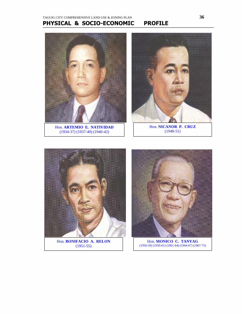
Hon. ARTEMIO E. NATIVIDAD
(1934-37) (1937-40) (1940-42)
Hon. BONIFACIO A. RELON
(1951-55)
Hon. MONICO C. TANYAG (1956-59) (1959-61) (1961-64) (1964-67) (1967-75)
Hon. NICANOR P. CRUZ
(1948-51)

TAGUIG CITY COMPREHENSIVE LAND USE & ZONING PLAN 37
PHYSICAL & SOCIO-ECONOMIC PROFILE
Hon. LEVI B. MARIANO
(1976-79) (1980-86)
Hon. RODOLFO DE GUZMAN
(1988-92)
Hon. RICARDO D. PAPA, JR.
(1992-95) (1995-98) (1998-2001)
TAGUIG CITY COMPREHENSIVE LAND USE & ZONING PLAN 38
PHYSICAL & SOCIO-ECONOMIC PROFILE
APPOINTED MAYORS OF TAGUIG
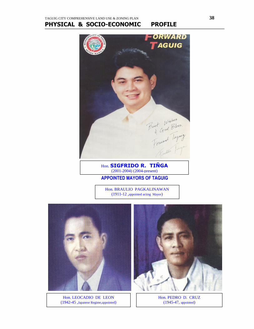
Hon. SIGFRIDO R. TIÑGA
(2001-2004) (2004-present)
Hon. PEDRO D. CRUZ
(1945-47, appointed)
Hon. LEOCADIO DE LEON
(1942-45 ,Japanese Regime,appointed)
Hon. BRAULIO PAGKALINAWAN
(1911-12 ,appointed acting Mayor)
TAGUIG CITY COMPREHENSIVE LAND USE & ZONING PLAN 39
PHYSICAL & SOCIO-ECONOMIC PROFILE
taguig
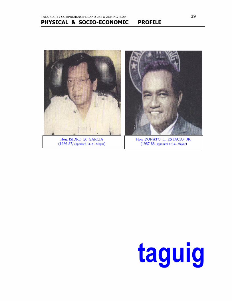
Hon. ISIDRO B. GARCIA
(1986-87, appointed O.I.C. Mayor)
Hon. DONATO L. ESTACIO, JR.
(1987-88, appointed O.I.C. Mayor)

TAGUIG CITY COMPREHENSIVE LAND USE & ZONING PLAN 40
PHYSICAL & SOCIO-ECONOMIC PROFILE
strategic concept
plan
TAGUIG STRATEGIC CONCEPT PLAN FINAL REPORT
Vision :
“One of the Premier Cities in Asia”
Taguig’s Image Taguig’s image of rural-ness and isolation has been challenged by the city’s dramatic vision for its future. The Taguig Strategic Concept Study is a step in translating that vision into reality. Taguig is already remarkable-internationally-for its social and visual diversity. From its western boundary with Forbes Park to Laguna de Bay, Taguig presents a rich palette of contrast: low-rise housing with a view of a 50-storey towers; dense neighborhoods looking out into open fields, Ian historic old town and a 21st century business district, the American memorial that is a focus of international tourism, and the lakeside barangay of Napindan, currently
well outside the tourist orbit.
LAGUNA DE BAY MASTER PLAN This plan sets out a strategy for land and water resource management to balance regional development and environmental resource protection around Laguna de bay. In this plan the Taguig project area is zoned for urban and industrial uses. The plan suggests a number of development possibilities which might be applicable to Taguig including fisheries, cottage industries, power generation, and water supply. In addition the plan advocates the establishment of a variety of institutions for research, education, environmental monitoring and management, and trade that might be suitably located in Taguig.
LAGUNA LAKE DEVELOPMENT AUTHORITY, RESOLUTION 23.
TAGUIG CITY COMPREHENSIVE LAND USE & ZONING PLAN 41
PHYSICAL & SOCIO-ECONOMIC PROFILE
This measures puts severe limitations on the use of lands below an elevation of 12.5 meters, which would include nearly 70% of Taguig. While this is of grave concern for development opportunities, there are a few mitigating factors: 1) Flood control measures may allow the restrictions to be relaxed or changed. 2) The Board of LLDA may choose to overlook this measure in regards to development in Taguig. 3) Development contributions on “the regional scale” may also be allowed.
DEMOGRAPHICS
The demographic survey of Taguig confirms that it is experiencing rapid growth, primarily due to immigration from other areas of the Philippines. Over the last ten years, Taguig has sustained an annual growth rate of 7%, much higher than neighboring Makati (2%) or even Metro Manila as a whole (3.5%). With a comparatively low population density (8,000 persons/sq.km. versus Manila’s 12,500), there is more space for expansion. Also, the relative cost of a home in Taguig is low compared to Makati.
Homeownership in taguig is high (76%) but lot ownership is comparatively low (58%). 28% of residents are occupying, land for free, reflecting the occurrence of squatting. Single-detached homes comprise 69% of the housing supply.
The population of Taguig is younger and less well educated, and more likely to be employed in unskilled or daily-wage jobs than the Metro Manlia average. Unemployment is low (9%), gainful employment is high (80%), and the jobs breakdown indicates a high concentration of craft-oriented and plant/machine operations work. It is notable that the only 1% of the total work force in Taguig is engaged in farming and fishing. This is comparable to Manila as a whole.
OTHER IMPORTANT INFORMATION:
Household size average 5.0 members.
Only 43% of household get their water from a faucet; the rest get it from deep well and peddlers.
14% of household have no electricity.
The garbage collection system in Taguig serves only 39% of its households.
Only 2% of households have a telephone.
Only 7% of households own a vehicle.
There is a marked for need for improvements in utililities, including drinking water supply, electricity supply, garbage collection, and telephone service. In survey conducted July 1995 for all of Metro Manila, the leading concerns of Taguig residents were flooding, drug addiction, unemployment, water supply, garbage collection, and traffic.
Critical Issues
FLOOD CONTROL
Flooding is the major obstacle to future successful development in Taguig, with over half of the municipality within the flood zone. Site the “hinge” between Laguna de Bay and the Pasig River, Taguig suffers the consequences of a low elevation, poor soil permeability, altered natural drainage (via the Napindan hydraulic control gate), and water runoff from a large geographical area, which has been further aggravated by recent developments. Taguig has a water elevation of 10.00m. Laguna Lake’s only outlet is the Pasig River and its overflow water inundates 66% of the municipality area from Ibayo, Napindan, Palingon, Ususan, Tuktukan, Calzada, Sta. Ana, Bambang, Wawa, Hagonoy, down to lower Bicutan and Bagumbayan.
TRANSPORTATION
At present Taguig is served only by South Super Highway to the west and R4 to the north with C5 in-between. There is limited access to all three from the most populated regions of the city. Given Taguig’s large area and population, theses few links to regional travel routes are far from sufficient. Within Taguig, only one substandard roadway connects most of the barangays, and most streets are too narrow to handle the current traffic load.
TAGUIG CITY COMPREHENSIVE LAND USE & ZONING PLAN 42
PHYSICAL & SOCIO-ECONOMIC PROFILE
HOUSING
Taguig’s population is swelling at a tremendous rate, with an essential 380,000 people in 1995, and current growth rate of over 7%. As an official reception point for immigrants to the Metropolitan area, Taguig’s already insufficient infrastructure has been burdened by an even greater demand for basic needs. Foremost among there is housing along with associated social services.
WATER, SEWAGE and SOLID WASTE MANAGEMENT
The municipality suffers from inadequate water supply, sewage treatment, and garbage collection systems. Basic improvements to this infrastructure is crucial for future development. From this dynamic base, Taguig will become even more diverse in the coming years. Probably no other city in the Philippines will experience greater change over the next decade than Taguig. The areas around Bonifacio and the Food Terminal will be transformed completely. At a 7% growth rate, population will double. And the improvements called for by this study can make Taguig into a crossroads of Metro Manila – and one of the premier cities in Asia.
Taguig’s Vision
Taguig in the 21st Century, the municipality’s documents, is thoughtful and specific. It begins with a plausible premise and proceeds logically and efficiently through the municipal actions necessary to achieve goals. It declares Taguig’s intent to become “one of the premiere cities in Asia” over the next quarter-century. This is possible because the community has a beautiful natural setting, is still largely undeveloped transportation center (with proximity to both the airport and a network of new highways) and is adjacent to the nation’s business centers. Moreover, Taguig’s overall guiding vision is three-fold: this is to become a city with (1) an international business focus: (2) superior residential environments for everyone: and (3) a national recreational attraction.
HOW THE VISION BECOMES REALITY
While the municipal actions in Taguig in the 21st Century are presented in an a la carte fashion, the Strategic Concepts Study incorporates them in a comprehensive approach. The Concept Study prioritizes the issues and seeks solutions that play multiple roles in the context of the city’s goals. Some of the actions are critical to the city; stability and growth. This is why, for example, this report places so much emphasis on implementation of flood control measures and traffic improvements. The plan also combines development ideas. For example, what we call Old Taguig –the area around around and cast of the municipality hall –is an historically and visually important environment. One can expect more retail, food and entertainment venues to locate here in the near future.
This will create a draw based on both the visual environment and the level of the activity, which is the formula for districts like Ermita and Malate, Chinatown in Singapore and vancouver’s Gastown. Such a district will provide a convenient lunch and after-hours destination for business people in Bonifacio as well as entertainment area for residents of the community. It will also support the recreational attractions developed along Laguna de Bay and elsewhere in Taguig. The purpose of this study is to provide an integrated strategy for executing the vision, making it a reality. It is very important to note that this Strategy Concept Study provides a framework for what is to done. It does not specify how the “what” is to be done. That is policy decision for Taguig.
SCOPE and INTENT
The Taguig Concept study has attempted to take a broad view of both the problems and potential solutions. While not a detailed investigation, this study has tried to take into account a wide range of factors and to propose strategies that have both clarity of vision and a far reaching effect. The Concept Plan recommends short term improvements of living environment, traffic, and infrastructure, and provides long term conceptual development strategies to realize the growth objectives set out by the Municipality and to complement the development of Bonifacio. This is an urban design study, and while the physical planning strategies proposed here have strong implications for the social and economic future of Taguig, they must be complemented by programs and
TAGUIG CITY COMPREHENSIVE LAND USE & ZONING PLAN 43
PHYSICAL & SOCIO-ECONOMIC PROFILE
policies in other realms that are beyond the scope of this study. The intent of this study is to provide a vision and direction for physical change needed to meet the challenges of the future. While this plan does contain some practical and pragmatic steps, it is not a blueprint for Taguig’s future, nor an exact picture of the city at some future date. It is meant as a tool to be used by Taguig leaders, to clarify their own vision, and so to help steer a course towards a new and promising future. More detailed studies will be needed to execute this vision.
RESEARCH & ANALYSIS
As the first step in our Concept Study, we gathered information to put together an accurate picture of Taguig today. This information came from both public and private sector sources, and was sometimes anecdotal, sometimes rigorously scientific. What emerged was a portrait of the problems and potentials of the municipality.
SOURCES
TEXT:
North Laguna Lakeshore Urgent Flood Control and Drainage Project
Laguna de Bay Master Plan
Laguna Lake Development Authority, Resolution 23
Demographic Information
Zoning Ordinance Of The National Capital Region
GRAPHIC:
Municipality Location Plans in Regional
Municipality Plan Showing Accurate Boundaries
Municipality Plan Showing All Major Roadway and Building Footprints
Aerial Photos of Municipality
Existing Land Use Plan
Proposed Land Use Plan
FINDINGS:
Detailed Engineering Design of the North Laguna Lakeshore Urgent Flood Control and Drainage Project (Design Report)
This document describes a plan for a flood control dike along the northern shore of Laguna de bay, which extends into the project area. The C6 highway will not follows this dike. Other flood control improvements will also be constructed, including river improvements, drainage canals, regulation ponds, pumping stations, floodgates, and bridges. Construction of the improvements is
expected to start in 1997 and be completed in 5 years.
CIVIC EXPRESSIONS
IDENTITY:
A successful plan must do more than provide spaces for activities to occur; it must also given them an identity. For example, a large vacant parcel of land and Rizal Park are both open spaces. While they are technically the same thing-open space-they are nevertheless very different. One is merely space. The other has been developed following a design scheme, and is programmed for a great civic delebrations: it has high symbolic importance to Filipinos. The difference between the two is the application of creativity, of civic expressions to an open space.
On a large scale, cities the world over are comprised of residential, commercial, civic and industrial districts. Yet every city has its own character. For instance, we think of both Singapore and Hong Kong as business centers. Yet they look and operate very differently. Singapore sees itself as a “garden city”, why this is scarely any landscape in the built-up sections of Hong Kong. Both cities can successfully argue the appropriateness of their approach civic expression. Singapore can say that a pleasant, orderly environment is attractive to international business. Hong Kong can counter that a dense commercial concentration is attractive to international business. Clearly, both are right.
TAGUIG CITY COMPREHENSIVE LAND USE & ZONING PLAN 44
PHYSICAL & SOCIO-ECONOMIC PROFILE
According to its town policy document (Taguig in the 21st Century), Taguig is best characterized as “friendly”, so we need to understand exactly what choices that implies. We can develop appropriate directions for Taguig by placing the overall goals within the context of expectations.
EXPECTATIONS
To create ‘”one of the century’s premiere leisure destinations” one should expect: (1) employment of the Laguna de Bay lakefront; (2) support from existing areas like Old Taguig; (3) new venues; and (4) a planning scheme that ties everything together in a unique way.
To be “friendly”, an attraction should be an absolutely unique environment, with scenic beauty, imaginative design and expectational programming. The notion of a mix of theseelements is important, since The Philippines is blessed with scenic beauty that even the outstanding setting of Laguna de Bay, by itself, might not qualify as a national attraction. Likewise, good access, while important to any attraction, would not be enough. And even an excellent marina and beach facilities, again, while potentially important ingredients to a more complete attraction, are, of course, not unique in the Philippines. Approach that is innovative and visionary is called for.
USEFUL DEVELOPMENT MODELS
It is important to consider some other, comparable development models. Among many such attractions, world-wide, two may be of special value as possible models for Taguig. These are Jones Beach, built in the late 1920’s on New York’s Long Island; and the Gloria-Flamengo Botafogo landfill developed in Rio de Janeiro in the early 1950’s.
Jones Beach-Innovative Expression
When Jones beach opened in 1929, there was noting like in the world. At a time when beach bathhouses were typically little more than wooden sheds, Jones Beach featured two immense stone-and-break bathhouses, each with 10,000 lockers. These were sited nearby a kilometer and a half apart and linked by an expansive boardwalk. The dramatic 60 meter high water tower was not a metal tank on slits, as was typical, but a stone tower based upon one in Venice. You arrived from New York City on a dedicated, grade-separated parkway, which ended, at a 10,000- car-parking slot (soon expanded). Jones Beach was an immediate and continuing success as an attraction, and drew extensive and highly-favorable international press coverage. While the scale and architectural qualities of Jones Beach are impressive, two other are more important to Taguig. One of these is its attention to detail; the other is its openness to all.
ATTENTION TO DETAIL- Jones beach carried a nautical theme down to the smallest detail. Boardwalk railings were ship’s railings; water fountains were turned on and off ship’s pilot wheels camouflaged trashcan camouflaged in ship’s funnels. Marine symbols like maps and compasses were set into concrete sidewalks, and employees were dressed as sailors. Even the buttons of employee uniforms were engraved with a seahorse, the symbol of Jones Beach. A trip to Jones Beach was an experience of continuos visual discovery.
This was a remarkable environment because it was so consistent at every level of detail. Because of this, the Jones Beach experience was far more than just a trip to the beach. The lesson for Taguig’s national attraction is that there should be a consistency at all levels of such a development, from the site plan, to the architecture, programming, staffing and site details. As is so often the case, it is the things that make the difference.
OPENNESS TO ALL- There was a large choice of activities at Jones beach, in addition to lying on the sand and swimming in the ocean. Many of these were free or nominal in cost. These included pitch & putt, tennis, archery, and diving. Games along the boardwalk were ships games: shuffle board, quoits, deck tennis, and ping-pong. There was something for everyone, and the
TAGUIG CITY COMPREHENSIVE LAND USE & ZONING PLAN 45
PHYSICAL & SOCIO-ECONOMIC PROFILE
symbolism was very important: “everyone is welcome here” in food service, too, there was something for everyone, from extremely inexpensive cafes for families of very modest incomes, to luxurious, 8,200 seat open air dinner theater, where the famed Guy Lombardo’s orchestra played well into the night for upper crust patrons. You might arrive on a motorcycle or by limousine, but you always felt welcome at Jones Beach. A national attraction in Taguig would need to make everyone feel welcome. The basic formula is as follows: (1) the major element of the attraction – the view of Laguna de Bay – should be accessible to all without significant cost; (2) there should be a full (economic) range of activities, goods and food service; and (3) these should be provided in relative balance – not dominated by any economic or age group.
Gloria Flamingo-Botafogo Landfill-Visionary Expression
The “Gloria Embankment” landfill project is very similar in scale to the landfill proposed under this Strategic Concept study, Like Taguig, the pre 1950’s bayfront neighborhoods of Rio – barangays were interconnected only by a 2-lane road of about the same capacity as Bagumbayan/Manuel Quezon; this was the only direct connection between downtown and the airport on the north, and Rio’s vibrant international tourism districts to the south.
The Gloria Flamengo-Botafogo landfill development program contains a number of elements, which are comparable to elements in and around Taguig. These include a north-south connector highway similar in scale to the proposed C-6; the airport, a national Museum of Modern Art and a national War Memorial; regional elements such as a marina and city garden; and neighborhood scale improvements like seating areas, game courts and playfields.
While this is very complete development program, even by international standards, what makes the Gloria-Flamengo-Botafogo landfill unique is that it is executed under a master design? Thus it reds as a single environment:
DEVELOPMENT CONCEPTS
To have meaningful development in the Municipality of Taguig, the above-listed critical issues must be approached strategically. The Strategic Concept Plan’s approach establishes infrastructure as an organizational framework and the suggests land uses which compliment existing uses and future areas of growth.
FLOOD CONTROL
The Strategic Concept Plan’s innovative strategy incorporates the flood control system of canals and greenopenspaces that serve as retention areas for floodwater. The objective is to turn the water, once a flooding hazard, into an idenfiable amenity feature.
PROPOSED DIKE
Currently there is a plan for a long dike, which will run roughly along the perimeter of the lake, beginning in Taguig and continuing North into Pasig. Also there is a plan for a new circumferential highway, the C6. While the exact position has yet to be determined the possibility exists either to combine these two or to run them parallel to each other.
The flooding problem, however, cannot be solved simply by building a dike. A dike may prevent the water of the lake from intruding upon Taguig, but it will also prevent land in Taguig from draining into the lake, a natural process, which is necessary any time, it rains. Run-off from new developments may exacerbate this problem. A large dike will also be a physical and visual barrier to the main natural amenity of the site, Laguna de Bay.
TAGUIG CITY COMPREHENSIVE LAND USE & ZONING PLAN 46
PHYSICAL & SOCIO-ECONOMIC PROFILE
CANALS, FLOOD GATES, and RETENTION PONDS
The Strategic Concept Plan seeks to create a system canals, levees, and small lakes –the water level of which will be controlled by floodgates in a scaled down version of the proposed dike. The new waterways will be connected to existing creeks and rivers, and to a new spillway running out to Manila Bay. Through a piping and pumping system the system will be any overflow from Laguna de Bay through the spillway to Manila de Bay. Flood control will not aid only Taguig, but all those communities around Laguna de Bay that suffer from flooding. The canals will also serve as waterways for small boats, providing a secondary transportation network.
To minimize flooding, the proposed drainage works will include:
Reinforced concrete pipe culverts for higher areas (upper Taguig)
Reinforced concrete covered canal for low lying areas particularly near the Bay
Improvement and/or dredging of existing outfalls
Provide outlet6 protection works and/or energy dissipation at the outlet to the river/bay
Revetment wall along the shoreline
Retention basins
Improvement at the discharge points of the flood drainage system should be provided with flap gates, to prevent floodwater during heavy downpour. Retention basin for additional outfall during heavy downpour will be incorporated.
The overall effect is to bring in water in a carefully controlled manner that will eliminate flooding while providing recreation and transport for the municipality. In the future this system may even tourists.
OPEN SPACE
The new small lakes and ponds will serve a water retention function but will serve a water retention function but will also be an amenity lined with a network of open spaces. The open space system will be incorporated into the flood control system with a green edge lining many of the new waterways. This open space network will serve to connect major centers of activity (including the Bonifacio area) and will serve to break up/organize the land to smaller, water-oriented tracts for development by individual developers.
TRANSPORTATION
Transportation is already a problem within Taguig, with narrow streets, a lack of through-roads, and heavy traffic loads. The growing population and new development will only further burden and an already inadequate system. The Strategic Concept Plan recommends a series of improvements, both long term and short term, with the goal of having a well integrated and hierarchally differentiated road network. Better public transportation system with connections to other parts of the metropolitan region are also proposed.
SHORT TERM
Short term improvements transit stations, road improvements, and key new roads. Established at key junctures, transit stations serve as nodes on public transportation routes, and facilitate interchanges between routes. In the long term, a better public transportation system will give people more commuting options and thus reduce the total number of vehicles on the road. The widening and upgrading of certain roads is also a vital short term step. Lastly, the creation of several new connectors will case some of the current congestion problem. The most important of this is a road parallel to the existing North South Bagumbayan/Manuel
TAGUIG CITY COMPREHENSIVE LAND USE & ZONING PLAN 47
PHYSICAL & SOCIO-ECONOMIC PROFILE
Quezon road, connecting through the older part of Taguig to the Bonifacio area. With east-west connectors between the two this new road will work in conjunction with the improvements to the existing road and allow for the possibility of creating paired one – way routes. Existing interchanges on the South Super-Highway should also be upgraded, especially at the Food Terminal. Due to the town’s elevation of 11.32 which is below the maximum flood level of 14.62m as recorded in 1990 the roads are flood prone and therefore should be elevated.
STRATEGIC CONCEPT PLAN
The proposed C6, along with the dike, is the backbone of the Strategic Concept Plan recommends that the new highway run about 400m east of the existing North South road (Bagumbayan, Manuel Quezon). In this way, the construction impact on the existing community will be minimized and the final result will be a parallel north-south road system. This parallel system has greater long-term capacity because through traffic will be separated from local traffic. Without this separation, both through and the local traffic flow will be compromised and C6 will not fulfill its circumferential function. With C6, the entire Metro Manila region stands to benefit from this new traffic system.
In addition to the new C6, the Strategic Concept Plan seeks to create more east-west connections, starting with the extension of R4 in the north and the upgrade of Sucat Road in the south. These will create better external connections between Taguig and the surrounding cities. New internal roads will also connect C-6 to interchanges currently being planned along C-5: Heritage, Commando, and Upper East Gate. These new connections will dramatically reduce the travel time between Bonifacio and central Taguig.
The long-term objective is to create a complete network of roads with medium-sized roads forming a lattice around smaller through –
roads. The creation of the C6 highway, R4 extension, and upgrading of key internal routes will allow Taguig to act as a crucial
transportation link, while facilitating internal circulation.
HOUSING
Housing, is a crucial need in Taguig, but should also be seen as an opportunity to direct community development and provide a focus for infrastructure development of social services. Residential development should be the primary focus for new development areas, and range from lower to higher end.
Several focus areas for housing development should be identified, and a program to provide medium term housing for the immigrant population established with federal assistance. New neighborhoods should be coordinated with social services and other community-building programs. These developments will serve as focal points for the extension and improvement of water, sewage, and public transportation and other infrastructure systems. The Strategic Concept Plan envisions clusters of small residential street grids integrated into the road and canal network, and centered on local commercial centers providing daily goods and services.
In addition to meeting this immediate housing need the opportunity arises to provide higher-end housing along the new lake shoreline. With flood control measures in place, this real state would be a prized location for lower density, middle and upperend. Given certain key infrastructure improvement, it is hoped that market demand will be high enough to assure that this housing is built.
UTILITIES
The water, sewage and solid waste infrastructure systems can be developed in conjunction with the road and water framework in an efficient manner. New areas designated for community-oriented housing should be dispersed throughout the municipality yet of sufficient critical mass to support needed infrastructure expansion and development.
TAGUIG CITY COMPREHENSIVE LAND USE & ZONING PLAN 48
PHYSICAL & SOCIO-ECONOMIC PROFILE
WATER SUPPLY
Like Fort Bonifacio, Taguig in the 21st century will have a dual water supply system consisting of drinking water and recycled supply systems. The drinking water system supplies high quality water to meet the expectations of the international business community. Initial water supply would be from MWSS, and in the longer term, from a water treatment plant and supply from Laguna de Bay. To minimize the use of higher quality drinking water supply, the, the recycled water system will supply water for toilet flushes and other recycled water uses such as path hosing, watering of lawns, and washing cars. Water for this supply will ultimately be recycled water from the proposed sewage treatment plant.
The population of the municipality of Taguig for the year 1995 is 381,350; with a growth rate of 6.93%, the predicted population for the year 2020 is 2,019,710. With a water consumption of 40 gallons (151 liter) per capital per day, a water treatment plant is proposed with a capacity of 306,000 cu m. per day, to treat the water impounding reservoirs to store water from Laguna de Bay as a source of supply. Pumping stations with storage and distribution networks would be provided and should coordinated with the laying of other services and road construction. The pumping station would be integrated into utilities centers, with wastewater, power, and emergency power generating facilities.
SEWERAGE
The installation of the sewerage collection and disposal system for the whole municipality of Taguig and a sewage treatment plant to treat domestic/institutional waste water before disposal is necessity in order to prevent pollution of natural water resources. Taguig in the 21st century will also be served system with sewage treatment plant for recycling waste water/sewage. The total discharge is estimated to be 26601/s and would be pumped to the proposed sewage treatment plant for conversion into recycled water. Wastewater and sewage would be collected by sewers and flow by gravity to pumping stations located at strategic points to suit the general contour of the land. The lift stations would be integrated into designated utilities centers and each would be provided with emergency power.
The expected wastewater to be produced by the population for the year 2020 is taken as 75% of the water consumption (306,000 cu.m./day) and the required capacity of the proposed sewage treatment plant is 229,500 cu.m.per day.
The recycled delivery system will consist of a storage tank and a pump station at the sewage treatment plant. Recycled water is pumped from sewage treatment via a force main to the recycled water reservoir. The recycled water system will operate as a pumped system with the pump station drawing from the recycled water reservoir and feeding supply into the distribution system.
Under normal conditions all storm water drainage would be in underground pipes and culverts.
SOLID WASTE
For solid waste disposal, the assumed unit is taken as 0.5 kg. capita per day. For the predicted population, total solid waste is estimated to be 1009ton/day. Localized collection of solid waste could be provided by the municipality or a private service contractor may be employed. Collected waste would be carried to a waste would be compacted and loaded into containers for transfer to sanitary landfill sites. The municipal officials are amenable to the installation of a transfer site and to delivering the solid waste disposal areas, such as the Cardona and San Mateo disposal area. Education and training on classifying, sorting, storage, and disposal could be provided through the municipal health and sanitation departments.
POWER SUPPLY
Power upgrading and development of the Taguig power system by Meralco will be made tandem to the development of Bonifacio Global City part of Taguig. Existing overhead power lines of Napocor and Meralco will be changed to underground system in the Taguig area. New and Upgraded main power lines (high voltage and medium voltage) will be run underground) along the new C5 and C6 highway that run across Taguig. New substations will be provided and existing substation will be upgraded to meet the power demands of Taguig as a City.
TAGUIG CITY COMPREHENSIVE LAND USE & ZONING PLAN 49
PHYSICAL & SOCIO-ECONOMIC PROFILE
COMMUNICATIONS
PLDT and new telecommunication companies like SMART are starting to provide Taguig with new telephone lines. New telecom centers, fiber opties communication networks, and satellite links will also provided to meet the communication requirements of Taguig.
LAND USE
The philosophy behind the Strategic Concept Plan is that existing areas should remain undisturbed except for gradual upgrading of streets and facilities. New land uses will arise out of those areas made secure from the flood control system, agricultural land, and the proposed reclamation on the southern half of the municipality. With these areas, residential population could reach 800,000 (including 250,000 in Bonifacio Global City) by the year 2015. These numbers are derived by using World Bank planning standards. The scenario is dependent on the resolution of flooding and the development of adequate transportation systems. It is important that other areas of Taguig, develop land uses that compliment those in Bonifacio, thus knitting them together.
LAND RECLAMATION
With a new C6 running parallel to the existing north-south Bagumbayan/Manuel Quezon road, the potentially valuable land adjacent to the lake will be eliminated. The Strategic Concept Plan recommends that some area (a strip of some 1000-1500m width) be reclaimed from the lake to alleviate this problem. Because this new area will benefit from both easy access (close proximity to C6) and lakefront views it will be extremely valuable, and an arrangement might be made to subsidize the development of the C6 with profits from the development of this new reclaimed land.
RESIDENTIAL AREAS
The areas of Taguig outside of Bonifacio Global City are poised to become a middle density of good living quality. The land use concept is to provide middle-class residential units, mixed with open space, retail, and community facilities in every Barangay. New communities will be developed within the network, and clustered around small local commercial areas.
COMMERCIAL and MIXED USE AREAS
Regional commercial development will be concentrated in the Old Taguig area and the existing FTI location, as well as a new waterfront oriented area. Anchored by municipal offices and historic buildings, Old Taguig should be developed as a mixed-use center with small-scale commercial, office, and residential spaces. At the northern edge of the new reclamation, a waterfront commercial area will take advantage of the Laguna de Bay setting. With a marina for small boats and a pedestrian boardwalk, this development area would be ideal for restaurants, shopping, and other commercial activities. Both Old Taguig and the New Marina should be developed with the intent of attracting tourism.
RECREATIONAL
TAGUIG CITY COMPREHENSIVE LAND USE & ZONING PLAN 50
PHYSICAL & SOCIO-ECONOMIC PROFILE
Given its setting, Taguig has the opportunity to create a metropolitan scale recreational center without national precedent. The area cast of the proposed C6/extended R4 interchange could serve some regional use, such as a sports center. This could include an arena or small stadium that would serve as a regional attraction. Near
this golf course could be integrated into both residential housing development and the canal and
open space network. In addition to these centers, the open-space canal network presents numerous recreational opportunities for both existing and new residents.
LIGHT INDUSTRIAL
Major employment centers of light industry will be located along the South Super Highway to take advantage of the highway, the existing railway, and proximity to the airport. The area just south of the R4 extension could also serve as an R&D type lower density office area, taking advantage of easy connections to the Bonifacio Global City, and filling a market need not met by Bonifacio.
ZONING OVERLAYS
One tool cities to assist completing their plan is zoning overlays. The idea of a zoning overlay is fairly simple; additional layers of zoning restrictions are added to the basic permitted uses and densities in response to different situations within the same zoning district.
For example, the famous Mayo Clinic near Minneapolis is an immerse institutional campus in a relatively small town of about 50,000 population. The campus spans nearly 2 kilometers by one kilometer in extreme dimensions, with a spot density/floor area ratio of almost 14:1. The immediately adjacent downtown is developed to a density of less than 3:1. Because of the extreme differences of scale and activity between Mayo and the rest of the city, no single zoning ordinance could be applied universally. The solution was to device a zoning ordinance which provided a flat, permitted use for everyone, and then increased densities and uses for poverty owners who undertook to self-provide such features as centralized receiving, a comprehensive parking program, and integrated pedestrian movement through a system tunnels and skywalks. While this ordinance was written to accommodate Mayo, it applied to anyone who satisfied the code’s provisions.
A similar situation now exist in Taguig, where this is also a need to accommodate actual, existing conditions that frustrate typical ordinances. Specifically, the cooperation of landowners will be necessary to carry out a successful flood prevention strategy. Underlying a concern that it may be “too late” to undertake essential flood control are reports that land speculators are buying up large portions of Taguig. The presumption is that these speculators will be unwilling to cooperate with the city in undertaking flood control. Whether or not this is true, the city can develop an ordinance that provides a basic low-density residential permitted use for everyone. Overlays can be added that increase uses and/or densities for properties that do cooperate in the flood control efforts.
NEXT STEPS
DEVELOPMENT STRATEGY
Development in Taguig will require a close partnership between public infrastructure and private entrepreneurship. While infrastructure can be seen as a framework for development, it is development that can provide impetus for infrastructure. The two must be implemented in conjunction. For example, a system of flood control is vial to encourage private development of new residential areas. These new communities can in turn become the catalyst for further road and sewer improvement.
Development in Taguig will have a national impact. The role it plays as a source for all Metro Manila is crucial for economic competitiveness. It serves also as an opportunity to demonstrate solutions that can be applied elsewhere in the Philippines. The Strategic Concept Plan suggest the physical nature solutions, but much more is required to put these plans into action Implementation of this plan will require coordination among various governmental agencies, and between local and federal governments. A clearly articulated Action Plan must be developed and sufficient funding allocated to realize its goals.
FURTHER STUDIES
TAGUIG CITY COMPREHENSIVE LAND USE & ZONING PLAN 51
PHYSICAL & SOCIO-ECONOMIC PROFILE
The Strategic Concept Plan should be understood as the first step in a comprehensive planning process. The approaches contained in The Strategic Concept Plan are very general in nature, and must be refined and revised as they move towards realization. The first step in implementing the Strategic Concept Plan will be to undertake more detailed examination of key areas. It is recommended that Flood Control be given the highest priority, and that a detailed study be undertaken, including plans for a complete flood control system.
FUNDING SOURCES
It is also recommended that a full range of funding sources be explored and evaluated. These would include grants or loans from such as the Federal Government, the World Bank, the Asian Development Bank, U.S. Trade Development Agency, private foundations, or public-private partnerships. Given the wider regional implications surrounding Laguna de Bay of both flood control and transportation infrastructure, these projects would be attractive to such institutions.
URGENCY
Dynamic cities like Taguig often face new plans with ambivalence. On the one hand, there is excitement about the new direction –positive change –contained in the plan. On the other hand, there is regret that it is too late, that too much has already occurred in the area covered by the plan to ever fully achieve their goals. This is very common concern.
Some cities undertaking a new plan will take a view long view, reasoning that a city is forever, while individual properties change all of the time. Eventually, so this reasoning goes, the plan will be implemented. This approach works best in mature cities experiencing very little current growth, and which also have a very long “civic memory”.
Cities characterized by rapid change, like Taguig, cannot wait for generations to complete their plans. Time is not a luxury for them because they must be able to respond rapidly to ongoing transformation.
It must be emphasized that much of this plan is dependent on implementation of flood control measures, and cannot move forward without them.
LEGISLATIVE
There are a variety options at both a local and national level. Full government support should be given to making flood control the foremost priority. The C6 highway schedule also be pushed forward. Legislation that advances either of these projects would be a boon. Additionally, housing could become a focus of legislative action, particularly as Taguig has been designated as an official receiving points for new housing, and government support given to residential projects in those areas. This would likely involve a high degree of Federal-Local government cooperation.
SYMBOLS of CHANGE
It is important that residents of Taguig as those issues which are the highest priority (flood control, C6) will be implemented over a longer time period, it is also recommended that a smaller-scale high-visibility project be undertaken. One option for focus would be road from a C5 interchange near Bonifacio to the center ofTtaguig (Old Taguig). This would address one of the major traffic congestion areas and immediately begin to forgesties between the development of Bonifacio and the rest of the municipality.
TAGUIG CITY COMPREHENSIVE LAND USE & ZONING PLAN 52
PHYSICAL & SOCIO-ECONOMIC PROFILE
CONCLUSION
Taguig faces demanding and complex problems. But it faces them armed with a strong vision and tremendous potential. The Strategic Concept Plan is the first step towards articulating that vision and realizing its potential. The plan provides the outlines of an imaginative, efficient, and integrated solution to flood control, transportation, housing, and infrastructure development.
With or without this plan. Taguig will undergo unparalleled change over the next decade. The people of Taguig must guide this change. This will take dedicated leadership, careful coordination and teamwork, and the support and energy of many people. Working with the spirit of community that inspired this plan, Taguig can create a truly superior public environment for the Filipino people.
One can imagine, on the year 2020, taking a ferry down one of the canals from the high-rises of Bonifacio, past historic Old Taguig, through neighborhoods and parks before coming to Laguna de Bay. And then, perhaps at sunset, one could slip out onto the lake, look back on the lights of the city, and marvel at all that has changed.
TAGUIG CITY COMPREHENSIVE LAND USE & ZONING PLAN 53
PHYSICAL & SOCIO-ECONOMIC PROFILE
Bonifacio
Global City
BONIFACIO GLOBAL CITY MASTER PLAN
EXPLORING DESIGN OPTION
Facts, when combined with ideas, constitute the greatest force in the world.
The design process began with several geometries and strategies for the site’s framework. Initial explorations included an organic framework, which would flow with the topography and create unique design responses to the land, but would also lead to less efficient land uses and a city which would lack “urbanity”.
A second design incorporated the grid pattern seen in most big cities, like New York. It made more efficient use of the land but had more intersections and created a static and boring city pattern.
A third exploration went in the direction of a geometric framework, like Paris, which creates focal elements throughout the site by using circular or octagonal patterns, giving the city a powerful image and identity. The drawback would be the problematic roadway system and inefficient use of land.
These initial explorations led to a design, which would synthesize the best elements of each pattern.
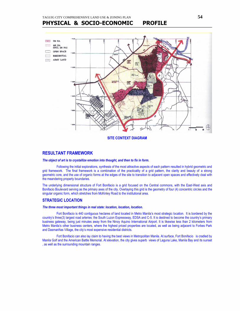
TAGUIG CITY COMPREHENSIVE LAND USE & ZONING PLAN 54
PHYSICAL & SOCIO-ECONOMIC PROFILE
SITE CONTEXT DIAGRAM
RESULTANT FRAMEWORK
The object of art is to crystallize emotion into thought, and then to fix in form.
Following the initial explorations, synthesis of the most attractive aspects of each pattern resulted in hybrid geometric and grid framework. The final framework is a combination of the practicality of a grid pattern, the clarity and beauty of a strong geometric core, and the use of organic forms at the edges of the site to transition to adjacent open spaces and effectively deal with the meandering property boundaries.
The underlying dimensional structure of Fort Bonifacio is a grid focused on the Central commons, with the East-West axis and Bonifacio Boulevard serving as the primary axes of the city. Overlaying this grid is the geometry of four (4) concentric circles and the singular organic form, which stretches from McKinley Road to the institutional area.
STRATEGIC LOCATION
The three most important things in real state: location, location, location.
Fort Bonifacio is 440 contiguous hectares of land located in Metro Manila’s most strategic location. It is bordered by the country’s three(3) largest road arteries: the South Luzon Expressway, EDSA and C-5. It is destined to become the country’s primary business gateway, being just minutes away from the Ninoy Aquino International Airport. It is likewise less than 2 kilometers from Metro Manila’s other business centers, where the highest priced properties are located, as well as being adjacent to Forbes Park and Dasmariñas Village, the city’s most expensive residential districts.
Fort Bonifacio can also lay claim to having the best views in Metropolitan Manila. At surface, Fort Bonifacio is cradled by Manila Golf and the American Battle Memorial. At elevation, the city gives superb views of Laguna Lake, Manila Bay and its sunset , as well as the surrounding mountain ranges.
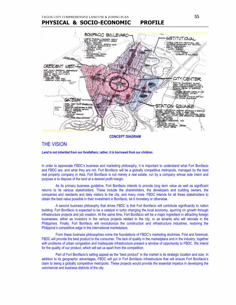
TAGUIG CITY COMPREHENSIVE LAND USE & ZONING PLAN 55
PHYSICAL & SOCIO-ECONOMIC PROFILE
CONCEPT DIAGRAM
THE VISION
Land is not inherited from our forefathers; rather, it is borrowed from our children.
In order to appreciate FBDC’s business and marketing philosophy, it is important to understand what Fort Bonifacio and FBDC are, and what they are not. Fort Bonifacio will be a globally competitive metropolis, managed by the best real property company in Asia. Fort Bonifacio is not merely a real estate, run by a company whose sole intent and purpose is to dispose of the land at a desired profit margin.
As its primary business guideline, Fort Bonifacio intends to provide long term value as well as significant returns to its various stakeholders. These include the shareholders, the developers and building owners, the companies and residents and daily visitors to the city, and many more. FBDC intends for all these stakeholders to obtain the best value possible in their investment in Bonifacio, be it monetary or otherwise.
A second business philosophy that drives FBDC is that Fort Bonifacio will contribute significantly to nation building. Fort Bonifacio is expected to be a catalyst in turbo changing the local economy, spurring on growth through infrastructure projects and job creation. At the same time, Fort Bonifacio will be a major ingredient in attracting foreign businesses, either as investors in the various projects related to the city, or as tenants who will relocate in the Philippines. Finally, Fort Bonifacio will revolutionize the construction and infrastructure industries, restoring the Philippine’s competitive edge in the international marketplace.
From these business philosophies come the foundations of FBDC’s marketing doctrines. First and foremost, FBDC will provide the best product to the consumer. The lack of quality in the marketplace and in the industry, together with problems of urban congestion and inadequate infrastructure present a window of opportunity to FBDC. We intend for the quality of our product, which will set us apart from the competition.
Part of Fort Bonifacio’s selling appeal as the “best product” in the market is its strategic location and size. In addition to its geographic advantages, FBDC will put in Fort Bonifacio infrastructure that will ensure Fort Bonifacio’s claim to being a globally competitive metropolis. These projects would provide the essential impetus in developing the commercial and business districts of the city.
TAGUIG CITY COMPREHENSIVE LAND USE & ZONING PLAN 56
PHYSICAL & SOCIO-ECONOMIC PROFILE
The second marketing doctrine for FBDC is costumer intimacy. Both the price of the product and the quality that we seek will tend to limit the number of prospects. This allows FBDC to adopt a focused marketing approach, and to address the specific needs of the market we are targeting.
Finally, Fort Bonifacio will be reasonably and competitively priced. All Fort Bonifacio’s great features and costumer insight will not mean a thing if FBDC prices its products out of the market.
Following these guidelines, Fort Bonifacio is expected to become the nucleus of the Philippine progress in the 21st century.
THE DEAL OF THE CENTURY
In the orchard of opportunity, it is better to pick the fruit than to wait for it to fall
The last few years have allowed the world to witness a major economic phenomenon… East Asia. The region is home to the world’s fastest growing economies, as well as the site of what will be the globe’s six largest cities. East Asia, in the last few decades, has been transformed into a market of incredible size and potential.
At the geographic center of this region lies the Philippines. Once a focal point of International trade, it had been buffeted by economic and political upheavals, which left the country in the doldrums, while its Asian neighbors surged ahead with their tiger economies. This was the story of the region… until now.
Key political and business reforms have put the Philippines back on track. These magazine featured President Fidel V. Ramos and the country’s “magnificent” economic turnaround. Forbes magazine called the Philippines a dragon in the making.
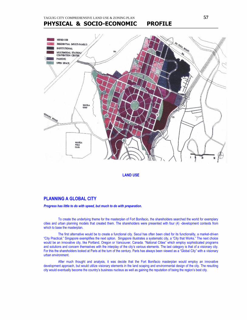
TAGUIG CITY COMPREHENSIVE LAND USE & ZONING PLAN 57
PHYSICAL & SOCIO-ECONOMIC PROFILE
LAND USE
PLANNING A GLOBAL CITY
Progress has little to do with speed, but much to do with preparation.
To create the underlying theme for the masterplan of Fort Bonifacio, the shareholders searched the world for exemplary cities and urban planning models that created them. The shareholders were presented with four (4) -development contexts from which to base the masterplan.
The first alternative would be to create a functional city. Seoul has often been cited for its functionality, a market-driven “City Practical.” Singapore exemplifies the next option. Singapore illustrates a systematic city, a “City that Works.” The next choice would be an innovative city, like Portland, Oregon or Vancouver, Canada. “National Cities” which employ sophisticated programs and solutions and concern themselves with the interplay of the city’s various elements. The last category is that of a visionary city. For this the shareholders looked at Paris at the turn of the century. Paris has always been viewed as a “Global City” with a visionary urban environment.
After much thought and analysis, it was decide that the Fort Bonifacio masterplan would employ an innovative development approach, but would utilize visionary elements in the land scaping and environmental design of the city. The resulting city would eventually become the country’s business nucleus as well as gaining the reputation of being the region’s best city.

TAGUIG CITY COMPREHENSIVE LAND USE & ZONING PLAN 58
PHYSICAL & SOCIO-ECONOMIC PROFILE
-----oOo-------
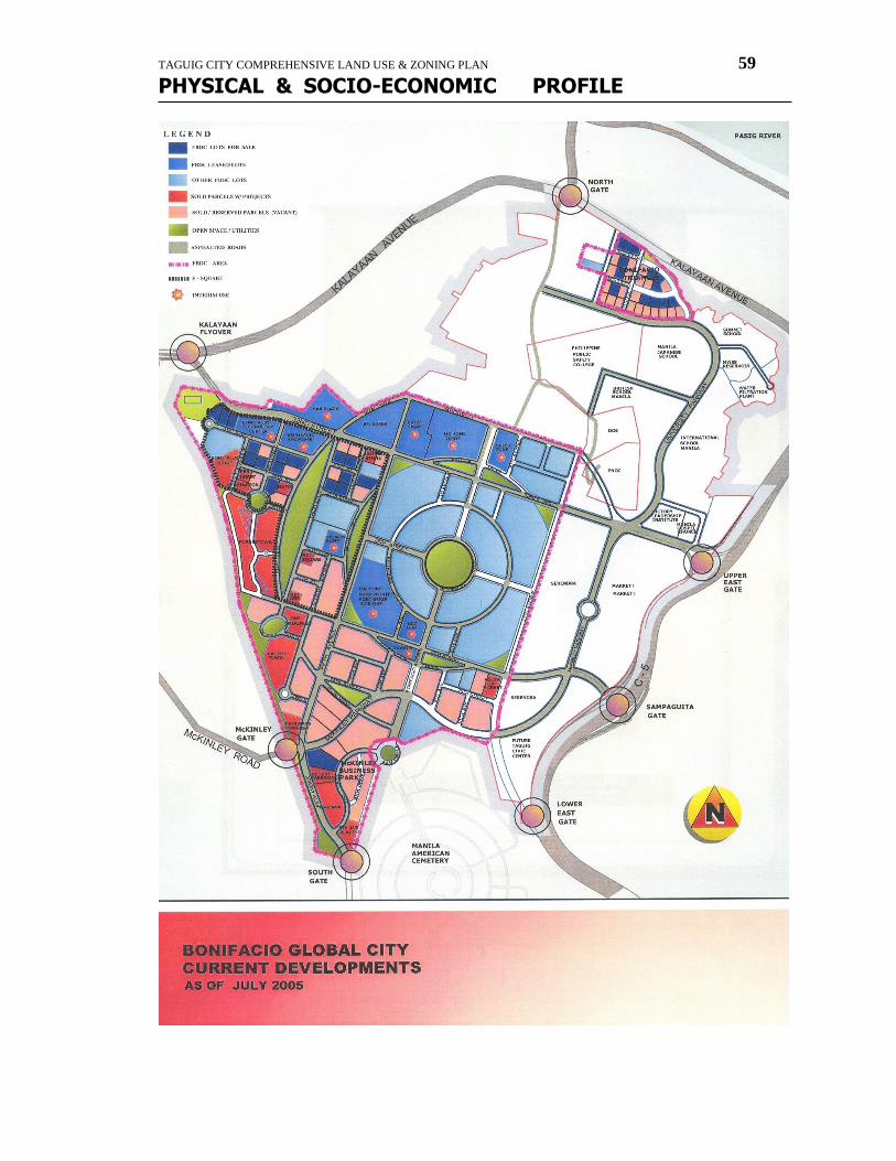
TAGUIG CITY COMPREHENSIVE LAND USE & ZONING PLAN 59
PHYSICAL & SOCIO-ECONOMIC PROFILE
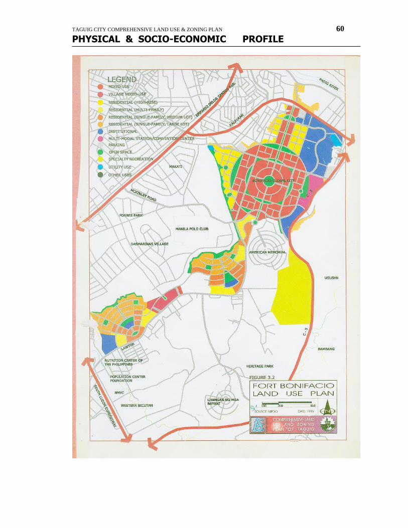
TAGUIG CITY COMPREHENSIVE LAND USE & ZONING PLAN 60
PHYSICAL & SOCIO-ECONOMIC PROFILE
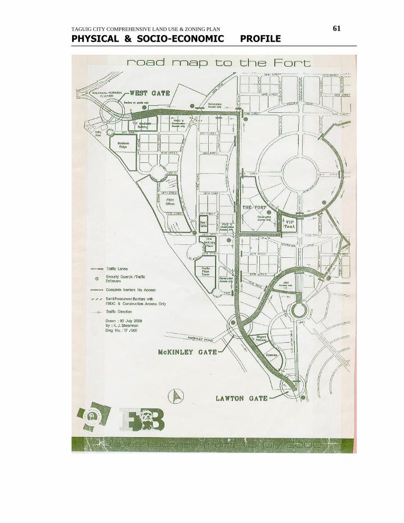
TAGUIG CITY COMPREHENSIVE LAND USE & ZONING PLAN 61
PHYSICAL & SOCIO-ECONOMIC PROFILE
TAGUIG CITY COMPREHENSIVE LAND USE & ZONING PLAN 62
PHYSICAL & SOCIO-ECONOMIC PROFILE
land use
plan
The Taguig Comprehensive Land Use Plan (2000 - 2020 )
TAGUIG CITY COMPREHENSIVE LAND USE & ZONING PLAN 63
PHYSICAL & SOCIO-ECONOMIC PROFILE
The CLUP translates the City's Vision to be an "environmentally-sustainable city" into a set of development policies, strategies, programs and projects. The realization of this vision is through a set of interrelated Economic, Social, Infrastructure, Environmental, Administrative and Investment development strategies. These strategies are integrated into a city Land Use Plan, which in turn, is implemented through the LUGS which is one of the principal instruments for the achievement of the city's vision. The Land Use Plan complements the other delivery mechanisms available to the City Government such as Socio-Economic Development Programs, Infrastructure Development and Fiscal Incentives. It should be understood that the Land Use Plan focuses on land use or development are to be found in the other strategies and policy devices that are adopted by the City Government from time to time.
Land Use Strategy The land use strategy of Taguig employs a two-layered framework. The first is through a Structure Plan that outlines the skeletal future configuration of the growth of Taguig. It pinpoints critical Growth Centers (centers of employment and services) and defines their most probable functions and how they will likely affect the city's growth. Their functional interrelationships to the overall urban fabric of Taguig, along with the required internal and external linkages are also provided. Major Growth Centers, or those that provide employment and service opportunities either for the whole of Taguig or to a much larger (regional) clientele, have been designated. These are further sub-classified into two: Mixed Use Centers and Industrial centers. Mixed Use centers have been identified to provide for the equitable distribution of development opportunities in Taguig. Mixed-use centers are distributed in the northern, central and southern parts of the city. Individually and collectively, their potentials to service business and employment requirements at a regional scale are expected to have significantly positive impacts to the development of the other areas in the city. These centers shall have functions beyond being central business districts as they shall be directly supported by complete community facilities and amenities such as residences, schools, recreation and others. The Northern Mixed Use Center is the Global City which has regionally significant development impacts. This center also includes the 25-hectare city-owned area beside the BHIT. The Central Mixed Use Center, on the other hand, includes the DMCI Mixed-Use Project in the Bambang-Hagonoy area. Finally, the Southern Growth Center includes the FTI Complex which has long been a significant center of employment and is being planned for conversion into a mixed-use development area. Given these centers' enormous growth generating potential, these have to be properly interconnected in order to generate maximum access opportunities thereby benefiting the entire city. Three significant industrial centers, along with the smaller area occupied by the RSBS Industrial estate, complement the Northern, Central and southern Mixed use Centers. These significant centers include the Northeastern Industrial Center Napindan), Central Industrial Center (BCDA IT Park), and Southern Industrial Center (Bagong Tanyag - Bagumbayan). The long-term objective for these centers is for the development of light and information technology-based industries. As in the Mixed Use Centers, these have to be physically linked with the rest of Taguig in order to enhance the inter-dependent movement of people, goods and services.
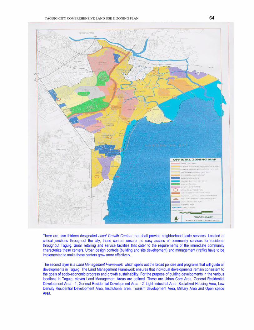
TAGUIG CITY COMPREHENSIVE LAND USE & ZONING PLAN 64
PHYSICAL & SOCIO-ECONOMIC PROFILE
There are also thirteen designated Local Growth Centers that shall provide neighborhood-scale services. Located at critical junctions throughout the city, these centers ensure the easy access of community services for residents throughout Taguig. Small retailing and service facilities that cater to the requirements of the immediate community characterize these centers. Urban design controls (building and site development) and management (traffic) have to be implemented to make these centers grow more effectively. The second layer is a Land Management Framework which spells out the broad policies and programs that will guide all developments in Taguig. The Land Management Framework ensures that individual developments remain consistent to the goals of socio-economic progress and growth sustainability. For the purpose of guiding developments in the various locations in Taguig, eleven Land Management Areas are defined. These are Urban Core Area, General Residential Development Area - 1, General Residential Development Area - 2, Light Industrial Area, Socialized Housing Area, Low Density Residential Development Area, Institutional area, Tourism development Area, Military Area and Open space Area.
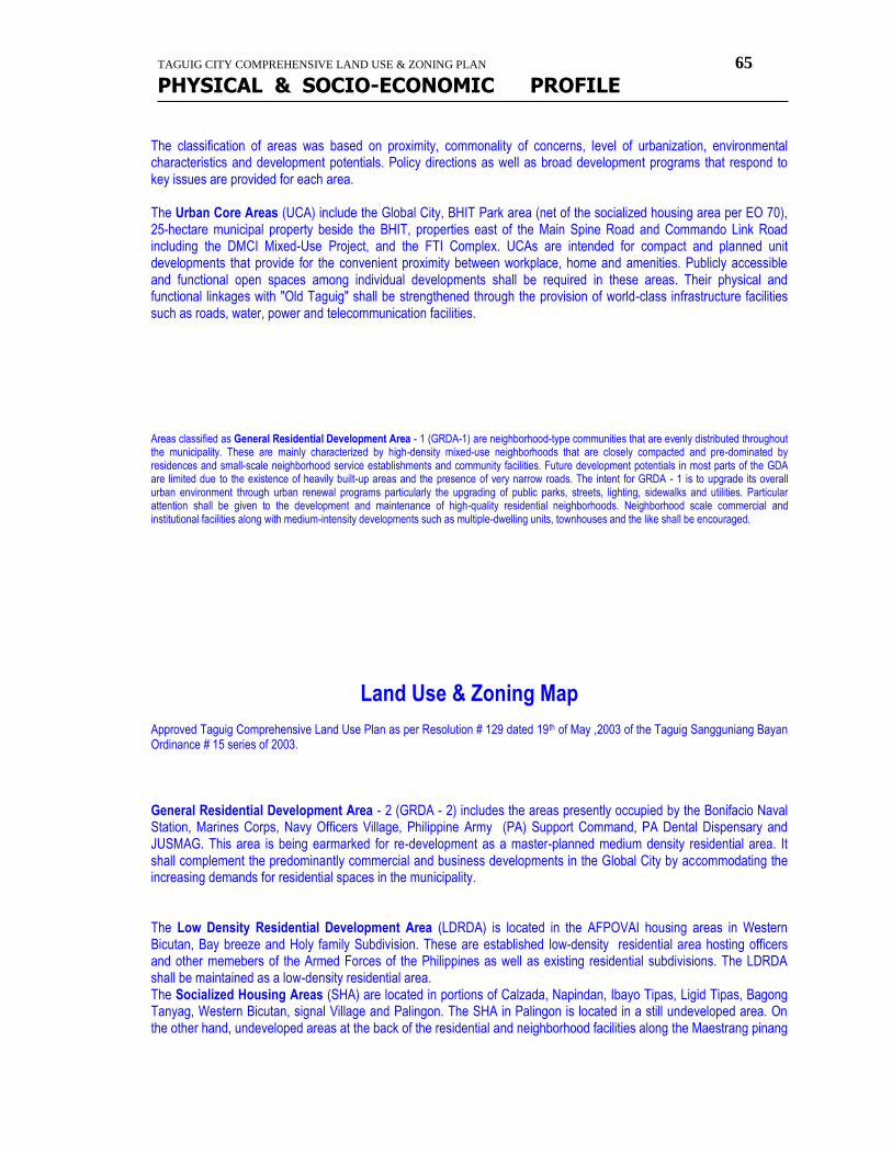
TAGUIG CITY COMPREHENSIVE LAND USE & ZONING PLAN 65
PHYSICAL & SOCIO-ECONOMIC PROFILE
The classification of areas was based on proximity, commonality of concerns, level of urbanization, environmental characteristics and development potentials. Policy directions as well as broad development programs that respond to key issues are provided for each area. The Urban Core Areas (UCA) include the Global City, BHIT Park area (net of the socialized housing area per EO 70), 25-hectare municipal property beside the BHIT, properties east of the Main Spine Road and Commando Link Road including the DMCI Mixed-Use Project, and the FTI Complex. UCAs are intended for compact and planned unit developments that provide for the convenient proximity between workplace, home and amenities. Publicly accessible and functional open spaces among individual developments shall be required in these areas. Their physical and functional linkages with "Old Taguig" shall be strengthened through the provision of world-class infrastructure facilities such as roads, water, power and telecommunication facilities. Areas classified as General Residential Development Area - 1 (GRDA-1) are neighborhood-type communities that are evenly distributed throughout the municipality. These are mainly characterized by high-density mixed-use neighborhoods that are closely compacted and pre-dominated by residences and small-scale neighborhood service establishments and community facilities. Future development potentials in most parts of the GDA are limited due to the existence of heavily built-up areas and the presence of very narrow roads. The intent for GRDA - 1 is to upgrade its overall urban environment through urban renewal programs particularly the upgrading of public parks, streets, lighting, sidewalks and utilities. Particular attention shall be given to the development and maintenance of high-quality residential neighborhoods. Neighborhood scale commercial and institutional facilities along with medium-intensity developments such as multiple-dwelling units, townhouses and the like shall be encouraged.
Land Use & Zoning Map Approved Taguig Comprehensive Land Use Plan as per Resolution # 129 dated 19th of May ,2003 of the Taguig Sangguniang Bayan Ordinance # 15 series of 2003.
General Residential Development Area - 2 (GRDA - 2) includes the areas presently occupied by the Bonifacio Naval Station, Marines Corps, Navy Officers Village, Philippine Army (PA) Support Command, PA Dental Dispensary and JUSMAG. This area is being earmarked for re-development as a master-planned medium density residential area. It shall complement the predominantly commercial and business developments in the Global City by accommodating the increasing demands for residential spaces in the municipality. The Low Density Residential Development Area (LDRDA) is located in the AFPOVAI housing areas in Western Bicutan, Bay breeze and Holy family Subdivision. These are established low-density residential area hosting officers and other memebers of the Armed Forces of the Philippines as well as existing residential subdivisions. The LDRDA shall be maintained as a low-density residential area. The Socialized Housing Areas (SHA) are located in portions of Calzada, Napindan, Ibayo Tipas, Ligid Tipas, Bagong Tanyag, Western Bicutan, signal Village and Palingon. The SHA in Palingon is located in a still undeveloped area. On the other hand, undeveloped areas at the back of the residential and neighborhood facilities along the Maestrang pinang
TAGUIG CITY COMPREHENSIVE LAND USE & ZONING PLAN 66
PHYSICAL & SOCIO-ECONOMIC PROFILE
Road may be found in the Ibayo Tipas SHA. It also includes areas covered by EO 70 specifically a portion of the Bonifacio Housing and Information Technology Zone, Lupang katuparan, Pamayanang Diego Silang and Philippine Centennial Village. The Institutional Area (IA) includes the designated institutional site in the Global City. Along the East service Road, it includes the facilities of the Technological Education skills & Development Authority (TESDA), Nutrition Center of the Philippines, Population Center Foundation and the Technological University of the Philippines. Along General Santos Avenue, it includes the properties of the Department of Public Works and Highway, National Science and Technology Authority and the NRCP as well as the Camp Bagong Diwa. The IA shall be maintained and developed for institutional purposes. The Tourism Development Area (TDA) is located east of Manuel L. Quezon Avenue and road Dike from the Muntinglupa boundary up to M. De Leon street. It also includes portions of Laguna Lake within the jurisdiction of Taguig. TDAs are characterized by their orientation to the Lake thus possessing high amenity values. TDAs shall be developed as low intensity development areas with close consideration towards enhancing lake-oriented tourism activities. Environmental conservation and preservation shall guide all developments in these areas. Developments shall be required to provide and maintain public visual and/or physical access to the lake. Building and site development design restrictions on new developments shall be implemented to ensure minimal obstructions to the lake. The development of public facilities that can provide access to the lake shall be encouraged. The Light Industrial Areas (LIA) include the BCDA Information Technology (IT) Park, existing industrial areas in Napindan, portions of Ibayo Napindan, portions of Ibayo tipas, portions of FTI, Veterans, RSBS industrial Estate (IE) and the Mañalac IE. Light industrial establishments and information technology-based facilities shall be encouraged in the LIA. The maintenance of adequate environmental management measures in all industrial facilities shall be ensured. The Entertainment Area is a one-hectare city-owned property located in Barangay Ususan. This area shall host "Pink Light" establishments such as videoke bars, day & night clubs and massage parlors. Structures shall be made of permanent materials. Particular attention shall be given to noise attenuation designs as well as the provision of adequate parking spaces. The Military Area (MA) includes the Armed Forces of the Philippines' retention area within Fort Bonifacio and shall be for the exclusive use of the AFP. Open Space Areas (OSA) include the American memorial, Libingan ng mga Bayani, Heritage park and philippine Navy golf Club and a 20-meter strip to the west of C-5 from the East Service Road to the Libingan ng mga Bayani. These also include the mandated 10-meter easement along Pasig river and its tributaries as mandated by Metro Manila Development Authority Ordinance No. 81-01 and the easement provisions of the Philippine Water Code. The OSA shall be maintained as functional open spaces with proper landscaping and park amenities and facilities. There are also designated Special Development Areas (SDA) in order to achieve specific objectives of urban planning and management. Within the context of the Land use Plan, these areas are governed by more specific policies such as the minimization of roadside friction along major roads, encouragement of compact developments within the UCCA are provided to realize these policies. These requirements are intended to support the policies specified for the Land Management Areas to which individual properties are classified. Four categories of SDAs are hereby provided. The Urban Corridor SDA (UCSDA) is defined by all properties that have direct access to c-5 and R-4. The objective for the UCSDA is to minimize roadside friction to alleviate vehicular traffic conditions along C-5 and R-4. All developments within the UCSDA shall observe the following: (1) No parking facilities shall be located directly fronting C-5 or R-4 but shall be located at the back of each building/property; and (2) Abutments of buildings on property lines along C-5 or R-4 shall be allowed subject to the requirements of the National Building Code. The thirteen Local Growth Centers define the Local Growth Center Special Development Areas (LGCSDA). Properties that will fall under LGCSDA classification are defined as follows: (1) for intersections, the limits shall be defined as properties having direct access to the concerned roads that are within 500 meters in all road directions
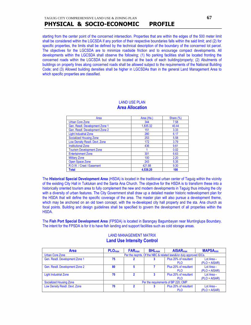
TAGUIG CITY COMPREHENSIVE LAND USE & ZONING PLAN 67
PHYSICAL & SOCIO-ECONOMIC PROFILE
starting from the center point of the concerned intersection. Properties that are within the edges of the 500 meter limit shall be considered within the LGCSDA if any portion of their respective boundaries falls within the said limit; and (2) for specific properties, the limits shall be defined by the technical description of the boundary of the concerned lot parcel. The objectives for the LGCSDA are to minimize roadside friction and to encourage compact developments. All developments within the LGCSDA shall observe the following; (1) No parking facilities shall be located fronting the concerned roads within the LGCSDA but shall be located at the back of each building/property; (2) Abutments of buildings on property lines along concerned roads shall be allowed subject to the requirements of the National Building Code; and (3) Allowed building densities shall be higher in LGCSDAs than in the general Land Management Area to which specific properties are classified.
LAND USE PLAN
Area Allocation
Area Area (Ha.) Share (%)
Urban Core Zone 344 7.58
Gen. Resdl. Development Zone 1 1,835.32 40.44
Gen. Resdl. Development Zone 2 151 3.33
Light Industrial Zone 280 6.17
Socialized Housing Zone 253 5.58
Low Density Resdl. Devt. Zone 172 3.79
Institutional Zone 436 9.61
Tourism Development Zone 1 0.02
Entertainment Zone 301 6.63
Military Zone 100 2.20
Open Space Zone 243 5.35
R.O.W. / Creel / Easement 421.88 9.30
Total 4,538.20 100
The Historical Special Development Area (HSDA) is located in the traditional urban center of Taguig within the vicinity of the existing City Hall in Tuktukan and the Santa Ana Church. The objective for the HSDA is to transform these into a historically oriented tourism area to fully complement the new and modern developments in Taguig thus imbuing the city with a diversity of urban features. The City Government shall draw up a detailed master historic redevelopment plan for the HSDA that will define the specific coverage of the area. The master plan will also pursue a development theme, which may be anchored on an old town concept, with the re-developed city hall property and the sta. Ana church as focal points. Building and design guidelines shall be specified to govern the development of all properties within the HSDA. The Fish Port Special Development Area (FPSDA) is located in Barangay Bagumbayan near Muntinglupa Boundary. The intent for the FPSDA is for it to have fish landing and support facilities such as cold storage areas.
LAND MANAGEMENT MATRIX
Land Use Intensity Control
Area PLOmax FARmax BHLmax AISARmax MAPSAmin Urban Core Zone Per the reqmts. Of the NBC & related laws&/or duly approved IDCs.
Gen. Resdl. Development Zone 1 75 2 3 Plus 20% of resultant PLO
Lot Area - (PLO + AISAR)
Gen. Resdl. Development Zone 2 80 5 7 Plus 20% of resultant PLO
Lot Area - (PLO + AISAR)
Light Industrial Zone 70 2 3 Plus 20% of resultant PLO
Lot Area - (PLO + AISAR)
Socialized Housing Zone Per the requirements of BP 220; CMP
Low Density Resdl. Devt. Zone 70 2 3 Plus 20% of resultant PLO
Lot Area - (PLO + AISAR)

TAGUIG CITY COMPREHENSIVE LAND USE & ZONING PLAN 68
PHYSICAL & SOCIO-ECONOMIC PROFILE
Institutional Zone 75 3 4 Plus 20% of resultant PLO
Lot Area - (PLO + AISAR)
Tourism Development Zone 70 3 4 Plus 20% of resultant PLO
Lot Area - (PLO + AISAR)
Entertainment Zone 70 2 3 Plus 20% of resultant PLO
Lot Area - (PLO + AISAR)
Military Zone Per the reqmts. Of the NBC & related laws &/or the AFP
Open Space Zone Per the reqmts. Of the NBC & related laws&/or duly approved IDCs.
*** Taguig Sangguniang Bayan Zoning Ordinance # 15 series of 2003.
development investment
plan
TAGUIG CITY COMPREHENSIVE LAND USE & ZONING PLAN 69
PHYSICAL & SOCIO-ECONOMIC PROFILE
LOCAL GOVERNMENT FISCAL ASSESSMENT HISTORICAL PERFORMANCE Revenues and Receipts
The municipality of Taguig was under the two local government administrations for the fiscal period of 1995 to 1999. It should be noted, however, that the change in administration and local leadership did not affect the municipal government's fiscal performance. In fact. It has been growing steadily and has shown no signs of waning. During the period reviewed, the LGU generated a remarkable average revenue of P286.405 million. The impact of the mid-1997 Asian Financial Crisis that collapsed many industries was apparently hardly noticed in the LGU's revenues and receipts. Overall, its revenues grew at an average rate of 22.8%, which were largely generated from real property taxes and municipal business taxes. These items constitute an annual average collection of P70.482 million and P75.653 million, respectively. Non-taxed items, on the other hand, have also become chief sources of revenues. While showing an irregular trend, non-tax revenues provided a yearly average collection of P42.736 million. The combined collections from these three major sources constitute 65.9% of the local government revenues. In what seems to be the principal reason behind the sustainability of its financial resources are the various regular revenue accounts charged on transactions in its locality. In all, the local government has 50 local revenue and receipts accounts of which 16 were classified as tax-based revenues while 34 accounts were non-taxed revenues. All these suggest that the local government has been creative in looking for alternative sources from which it can generate revenues. The revenue accounts are listed as follows: Tax-Based Revenues
Real Property Taxes-Current Real Property Taxes-previous Real Property Taxes-Penalty Transfer Tax Municipal Business Tax Occupation Tax Franchise Tax Community Tax-A&B Community Tax -C&C1 Community Tax A&B - Penalty Community Tax C&C1- Penalty Share from MMDA Tax on Delivery Van Tax on Signboard Tax on Weight and Measures Non-Tax Revenues: Mayor's Permit Garbage Fee Share from BCDA
TAGUIG CITY COMPREHENSIVE LAND USE & ZONING PLAN 70
PHYSICAL & SOCIO-ECONOMIC PROFILE
Building Permit Annual Inspection Fee Miscellaneous Revenues Electrical Permit Alien Registration Fee Sanitary Inspection Fee Secretary's Fee Mechanical Permit Marriage License Fee Burial Permit Exhumation Fee Bicycle/Tricycle Registration Police Clearance Mayor's Clearance Certificate of Occupancy Land Use Zoning Fee Plumbing Permit Health Laboratory Excavation Permit 3% Supervision Fee Amusement Tax Rental Receipts from Market Market Stall Rental Electrical Fees-Talipapa Receipts from Cemetery Tricycle Supervision Fee Pedicab Registration Municipal Share from LLDA Cultural Fees Interests on Deposits
The IRA is also an important revenue item of the local government as this is used to subsidize the devolved national government functions. About 20% of the IRA allotment is automatically appropriated to municipal development projects. As noted, the municipality has been receiving a significant share of the IRA since the implementation of R.A.7160 in 1992. The department of Budget and Management used 50% of the factor in computing the IRA based on the population of the LGU while 25% is based on the land area and the remaining 25% is from an equally allocated share that every municipality nationwide received. The town's large population contributes to its higher share on IRA. From 1995 to 1999, the LGU of Taguig received an average of P90.355 million per year. It exceeded the P100.0 million ceiling in 1998 and reached P130.827 million in 1999. In fact, it is possible for taguig's IRA to reach the billion peso mark before the end of the planning horizon of 20 years.
TAGUIG CITY COMPREHENSIVE LAND USE & ZONING PLAN 71
PHYSICAL & SOCIO-ECONOMIC PROFILE
Expenditures Excluding the capital outlay, the share of regular expenditure against the total revenues is within the acceptable ceiling. The bulk of the capital outlay was due to personnel services in diffeent local government offices which grew annually by 15.1% from 1995 to 1999. While growing at an annual rate of 21.7% the maintenance and other operating expense (MOOE) in the office only share 15.3% of the revenue. It was the MOOE on non-office expenditures that showed significant growth over this fiscal period. The large portions included the regular appropriations for 5% MMDA Contribution, garbage collection and the clean and green program. Occasionally, the 5% calamity fund shares the large amount in non-office expenditures. The local government also has an existing loan of which P22.248 million was used as payment in 1999. What could be noted further within the same period was that the LGU never exceeded its expenses against its total revenues. Fund surplus is prominent in their yearly operation despite the fact that the LGU has undergone the transition period brought about by the turnover of leadership in local administration. The assessment suggests that the people behind the fiscal management of the local foffers under the two local administrations were exercising due diligence in their assigned tasks. Such quality of local leadership should be maintained in order to sustain the development of Taguig over the long-term. Fund Surplus The fact that the present administration and its predecessor never experienced deficit from their operations is a good indication that the implementation of development programs and projects for taguig will succeed. Moreover, the healthy fiscal posotion of the local government coffers should be maintained as this builds up confidence in prospective investors. While representing 8.5% of the total revenues, the yearly increase in surplus funds is impressive. On the average, the local government has maintained a surplus amount of P24.288 million after deducting the investment for capital outlay.
FINANCIAL RESOURCE MOBILIZATION
The consistent generation of fund surplus by the local government of Taguig suggests that its financial resources are being managed in conservative fashion. All cash that it had generated are deposited in banks and government financial institutions. From 1995 to 1999, as summarized below, the local government has had multi-million cash holdings after paying all its obligations at every year end of each fiscal period.
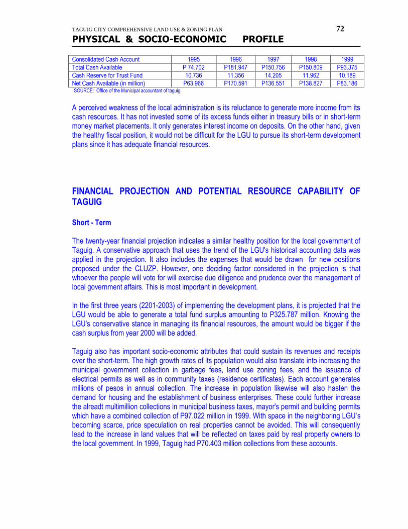
TAGUIG CITY COMPREHENSIVE LAND USE & ZONING PLAN 72
PHYSICAL & SOCIO-ECONOMIC PROFILE
Consolidated Cash Account 1995 1996 1997 1998 1999
Total Cash Available P 74.702 P181.947 P150.756 P150.809 P93.375
Cash Reserve for Trust Fund 10.736 11.356 14.205 11.962 10.189
Net Cash Available (in million) P63.966 P170.591 P136.551 P138.827 P83.186 SOURCE: Office of the Municipal accountant of taguig
A perceived weakness of the local administration is its reluctance to generate more income from its cash resources. It has not invested some of its excess funds either in treasury bills or in short-term money market placements. It only generates interest income on deposits. On the other hand, given the healthy fiscal position, it would not be difficult for the LGU to pursue its short-term development plans since it has adequate financial resources.
FINANCIAL PROJECTION AND POTENTIAL RESOURCE CAPABILITY OF TAGUIG Short - Term The twenty-year financial projection indicates a similar healthy position for the local government of Taguig. A conservative approach that uses the trend of the LGU's historical accounting data was applied in the projection. It also includes the expenses that would be drawn for new positions proposed under the CLUZP. However, one deciding factor considered in the projection is that whoever the people will vote for will exercise due diligence and prudence over the management of local government affairs. This is most important in development. In the first three years (2201-2003) of implementing the development plans, it is projected that the LGU would be able to generate a total fund surplus amounting to P325.787 million. Knowing the LGU's conservative stance in managing its financial resources, the amount would be bigger if the cash surplus from year 2000 will be added. Taguig also has important socio-economic attributes that could sustain its revenues and receipts over the short-term. The high growth rates of its population would also translate into increasing the municipal government collection in garbage fees, land use zoning fees, and the issuance of electrical permits as well as in community taxes (residence certificates). Each account generates millions of pesos in annual collection. The increase in population likewise will also hasten the demand for housing and the establishment of business enterprises. These could further increase the alreadt multimillion collections in municipal business taxes, mayor's permit and building permits which have a combined collection of P97.022 million in 1999. With space in the neighboring LGU's becoming scarce, price speculation on real properties cannot be avoided. This will consequently lead to the increase in land values that will be reflected on taxes paid by real property owners to the local government. In 1999, Taguig had P70.403 million collections from these accounts.
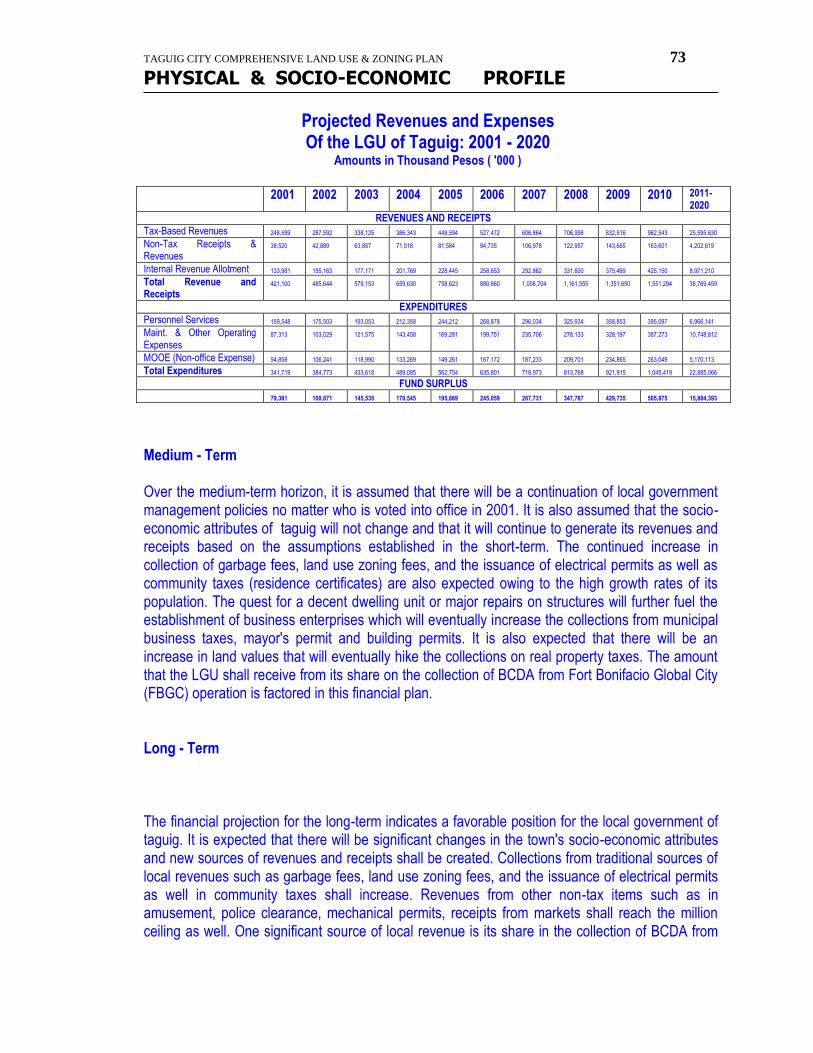
TAGUIG CITY COMPREHENSIVE LAND USE & ZONING PLAN 73
PHYSICAL & SOCIO-ECONOMIC PROFILE
Projected Revenues and Expenses Of the LGU of Taguig: 2001 - 2020
Amounts in Thousand Pesos ( '000 )
2001 2002 2003 2004 2005 2006 2007 2008 2009 2010 2011-2020
REVENUES AND RECEIPTS
Tax-Based Revenues 248,599 287,592 338,125 386,343 448,594 527,472 606,864 706,998 832,516 962,543 25,595,630
Non-Tax Receipts & Revenues
38,520 42,889 63,857 71,518 81,584 94,735 106,978 122,957 143,665 163,601 4,202,619
Internal Revenue Allotment 133,981 155,163 177,171 201,769 228,445 258,653 292,862 331,600 375,469 425,150 8,971,210
Total Revenue and Receipts
421,100 485,644 579,153 659,630 758,623 880,860 1,006,704 1,161,555 1,351,650 1,551,294 38,769,459
EXPENDITURES
Personnel Services 159,548 175,503 193,053 212,358 244,212 268,878 296,034 325,934 358,853 395,097 6,966,141
Maint. & Other Operating Expenses
87,313 103,029 121,575 143,458 169,281 199,751 235,706 278,133 328,197 387,273 10,748,812
MOOE (Non-office Expense) 94,858 106,241 118,990 133,269 149,261 167,172 187,233 209,701 234,865 263,049 5,170,113
Total Expenditures 341,719 384,773 433,618 489,085 562,754 635,801 718,973 813,768 921,915 1,045,419 22,885,066
FUND SURPLUS
79,381 100,871 145,535 170,545 195,869 245,059 287,731 347,787 429,735 505,875 15,884,393
Medium - Term Over the medium-term horizon, it is assumed that there will be a continuation of local government management policies no matter who is voted into office in 2001. It is also assumed that the socio-economic attributes of taguig will not change and that it will continue to generate its revenues and receipts based on the assumptions established in the short-term. The continued increase in collection of garbage fees, land use zoning fees, and the issuance of electrical permits as well as community taxes (residence certificates) are also expected owing to the high growth rates of its population. The quest for a decent dwelling unit or major repairs on structures will further fuel the establishment of business enterprises which will eventually increase the collections from municipal business taxes, mayor's permit and building permits. It is also expected that there will be an increase in land values that will eventually hike the collections on real property taxes. The amount that the LGU shall receive from its share on the collection of BCDA from Fort Bonifacio Global City (FBGC) operation is factored in this financial plan. Long - Term The financial projection for the long-term indicates a favorable position for the local government of taguig. It is expected that there will be significant changes in the town's socio-economic attributes and new sources of revenues and receipts shall be created. Collections from traditional sources of local revenues such as garbage fees, land use zoning fees, and the issuance of electrical permits as well in community taxes shall increase. Revenues from other non-tax items such as in amusement, police clearance, mechanical permits, receipts from markets shall reach the million ceiling as well. One significant source of local revenue is its share in the collection of BCDA from
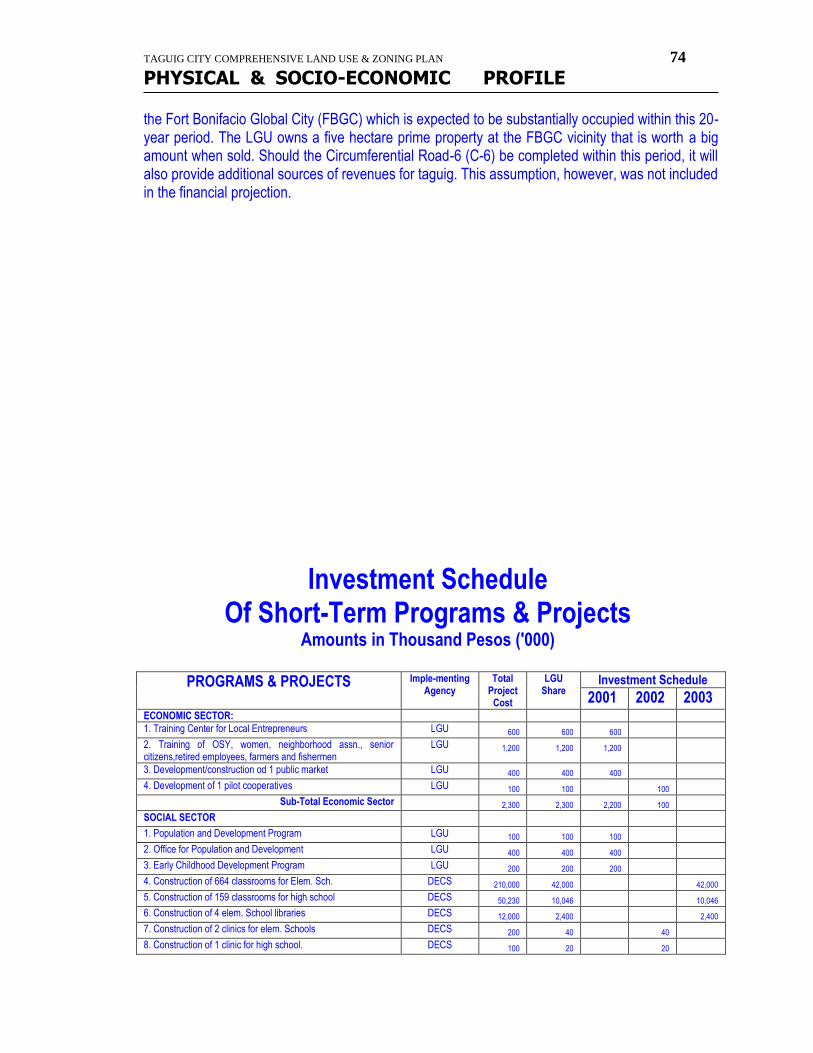
TAGUIG CITY COMPREHENSIVE LAND USE & ZONING PLAN 74
PHYSICAL & SOCIO-ECONOMIC PROFILE
the Fort Bonifacio Global City (FBGC) which is expected to be substantially occupied within this 20-year period. The LGU owns a five hectare prime property at the FBGC vicinity that is worth a big amount when sold. Should the Circumferential Road-6 (C-6) be completed within this period, it will also provide additional sources of revenues for taguig. This assumption, however, was not included in the financial projection.
Investment Schedule Of Short-Term Programs & Projects
Amounts in Thousand Pesos ('000)
PROGRAMS & PROJECTS Imple-menting Agency
Total Project
Cost
LGU Share
Investment Schedule
2001 2002 2003 ECONOMIC SECTOR:
1. Training Center for Local Entrepreneurs LGU 600 600 600
2. Training of OSY, women, neighborhood assn., senior citizens,retired employees, farmers and fishermen
LGU 1,200 1,200 1,200
3. Development/construction od 1 public market LGU 400 400 400
4. Development of 1 pilot cooperatives LGU 100 100 100
Sub-Total Economic Sector 2,300 2,300 2,200 100
SOCIAL SECTOR
1. Population and Development Program LGU 100 100 100
2. Office for Population and Development LGU 400 400 400
3. Early Childhood Development Program LGU 200 200 200
4. Construction of 664 classrooms for Elem. Sch. DECS 210,000 42,000 42,000
5. Construction of 159 classrooms for high school DECS 50,230 10,046 10,046
6. Construction of 4 elem. School libraries DECS 12,000 2,400 2,400
7. Construction of 2 clinics for elem. Schools DECS 200 40 40
8. Construction of 1 clinic for high school. DECS 100 20 20
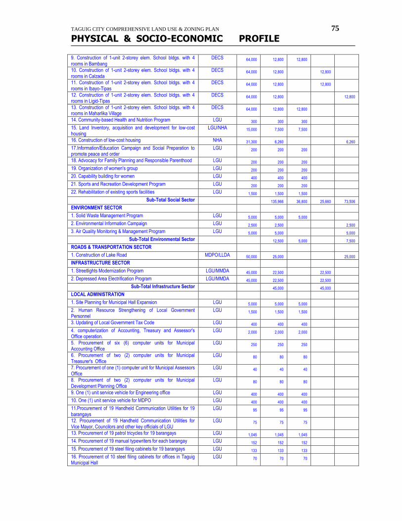
TAGUIG CITY COMPREHENSIVE LAND USE & ZONING PLAN 75
PHYSICAL & SOCIO-ECONOMIC PROFILE
9. Construction of 1-unit 2-storey elem. School bldgs. with 4 rooms in Bambang
DECS 64,000 12,800 12,800
10. Construction of 1-unit 2-storey elem. School bldgs. with 4 rooms in Calzada
DECS 64,000 12,800 12,800
11. Construction of 1-unit 2-storey elem. School bldgs. with 4 rooms in Ibayo-Tipas
DECS 64,000 12,800 12,800
12. Construction of 1-unit 2-storey elem. School bldgs. with 4 rooms in Ligid-Tipas
DECS 64,000 12,800 12,800
13. Construction of 1-unit 2-storey elem. School bldgs. with 4 rooms in Maharlika Village
DECS 64,000 12,800 12,800
14. Community-based Health and Nutrition Program LGU 300 300 300
15. Land Inventory, acquisition and development for low-cost housing
LGU/NHA 15,000 7,500 7,500
16. Construction of low-cost housing NHA 31,300 6,260 6,260
17.Information/Education Campaign and Social Preparation to promote peace and order
LGU 200 200 200
18. Advocacy for Family Planning and Responsible Parenthood LGU 200 200 200
19. Organization of women's group LGU 200 200 200
20. Capability building for women LGU 400 400 400
21. Sports and Recreation Development Program LGU 200 200 200
22. Rehabilitation of existing sports facilities LGU 1,500 1,500 1,500
Sub-Total Social Sector 135,966 36,800 25,660 73,506
ENVIRONMENT SECTOR
1. Solid Waste Management Program LGU 5,000 5,000 5,000
2. Environmental Information Campaign LGU 2,500 2,500 2,500
3. Air Quality Monitoring & Management Program LGU 5,000 5,000 5,000
Sub-Total Environmental Sector 12,500 5,000 7,500
ROADS & TRANSPORTATION SECTOR
1. Construction of Lake Road MDPO/LLDA 50,000 25,000 25,000
INFRASTRUCTURE SECTOR
1. Streetlights Modernization Program LGU/MMDA 45,000 22,500 22,500
2. Depressed Area Electrification Program LGU/MMDA 45,000 22,500 22,500
Sub-Total Infrastructure Sector 45,000 45,000
LOCAL ADMINISTRATION
1. Site Planning for Municipal Hall Expansion LGU 5,000 5,000 5,000
2. Human Resource Strengthening of Local Government Personnel
LGU 1,500 1,500 1,500
3. Updating of Local Government Tax Code LGU 400 400 400
4. computerization of Accounting, Treasury and Assessor's Office operation.
LGU 2,000 2,000 2,000
5. Procurement of six (6) computer units for Municipal Accounting Office
LGU 250 250 250
6. Procurement of two (2) computer units for Municipal Treasurer's Office
LGU 80 80 80
7. Procurement of one (1) computer unit for Municipal Assessors Office
LGU 40 40 40
8. Procurement of two (2) computer units for Municipal Development Planning Office
LGU 80 80 80
9. One (1) unit service vehicle for Engineering office LGU 400 400 400
10. One (1) unit service vehicle for MDPO LGU 400 400 400
11.Procurement of 19 Handheld Communication Utilities for 19 barangays
LGU 95 95 95
12. Procurement of 19 Handheld Communication Utilities for Vice Mayor, Councilors and other key officials of LGU
LGU 75 75 75
13. Procurement of 19 patrol tricycles for 19 barangays LGU 1,045 1,045 1,045
14. Procurement of 19 manual typewriters for each barangay LGU 152 152 152
15. Procurement of 19 steel filing cabinets for 19 barangays LGU 133 133 133
16. Procurement of 10 steel filing cabinets for offices in Taguig Municipal Hall
LGU 70 70 70
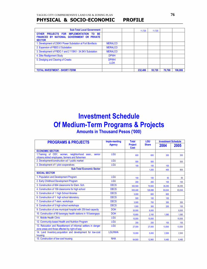
TAGUIG CITY COMPREHENSIVE LAND USE & ZONING PLAN 76
PHYSICAL & SOCIO-ECONOMIC PROFILE
Sub-Total Local Government 11,720 11,720
OTHER PROJECTS FOR IMPLEMENTATION TO BE FINANCED BY NATIONAL GOVERNMENT OR PRIVATE SECTOR
1. Development of 230KV Power Substation at Fort Bonifacio MERALCO
2. Expansion of FBDC-2 Substation MERALCO
3. Development of FBDC-1 and 2 115KV - 34.5KV Substation MERALCO
4. Dike Realignment Study DPWH
5. Dredging and Clearing of Creeks DPWH/ LLDA
TOTAL INVESTMENT - SHORT-TERM 232,486 55,720 70,760 106,006
Investment Schedule Of Medium-Term Programs & Projects
Amounts in Thousand Pesos ('000)
PROGRAMS & PROJECTS Imple-menting Agency
Total Project
Cost
LGU Share
Investment Schedule
2004 2005
ECONOMIC SECTOR:
1.Training of OSY, women, neighborhood assn., senior citizens,retired employees, farmers and fishermen
LGU 600 600 300 300
2. Development/construction od 1 public market LGU 500 500 500
3. Development of 1 pilot cooperatives LGU 100 100 100
Sub-Total Economic Sector 1,200 400 800
SOCIAL SECTOR
1. Population and Development Program LGU 100 100 50 50
2. Early Childhood Development Program LGU 200 200 100 100
3. Construction of 664 classrooms for Elem. Sch. DECS 352,500 70,500 35,250 35,250
4. Construction of 159 classrooms for high school DECS 630,440 126,088 63,044 63,044
5. Construction of 1 high School libraries DECS 3,000 600 600
6. Construction of 1 high school laboratory. DECS 500 100 100
7. Construction of 7 elem. workshops DECS 3,500 700 350 350
8. Construction of 3 high school workshops DECS 1,500 300 200 100
9. Construction of one municipal hospital with 250-bed capacity DOH 30,000 6,000 6,000
10. Construction of 90 barangay health stations in 18 barangays DOH 10,800 2,160 1,080 1,080
11. Mobile Health Clinic LGU 15,000 15,000 15,000
12. Community-based Health and Nutrition Program LGU 200 200 100 100
13. Relocation and Resettlement of Informal settlers in danger zone areas and those affected by right-of-way
LGU 27,000 27,000 13,500 13,500
14. Land Inventory,acquisition and development for low-cost housing
LGU/NHA 10,000 5,000 2,500 2,500
15. Construction of low-cost housing NHA 64,800 12,960 6,480 6,480
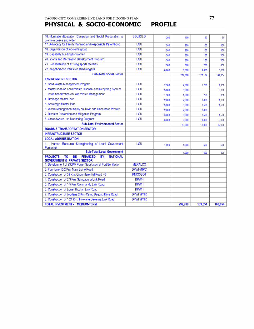
TAGUIG CITY COMPREHENSIVE LAND USE & ZONING PLAN 77
PHYSICAL & SOCIO-ECONOMIC PROFILE
16.Information/Education Campaign and Social Preparation to promote peace and order
LGU/DILG 200 100 50 50
17. Advocacy for Family Planning and responsible Parenthood LGU 200 200 100 100
18. Organization of women's group LGU 200 200 100 100
19. Capability building for women LGU 300 300 150 150
20. sports and Recreation Development Program LGU 300 300 150 150
21. Rehabilitation of existing sports facilities LGU 500 500 250 250
22. neighborhood Parks for 18 barangays LGU 6,000 6,000 3,000 3,000
Sub-Total Social Sector 274,508 127,154 147,354
ENVIRONMENT SECTOR
1. Solid Waste Management Program LGU 2,500 2,500 1,250 1,250
2. Master Plan on Local Waste Disposal and Recycling System LGU 3,000 3,000 3,000
3. Institutionalization of Solid Waste Management LGU 1,500 1,500 750 750
4. Drainage Master Plan LGU 2,000 2,000 1,000 1,000
5. Sewerage Master Plan LGU 3,000 3,000 1,500 1,500
6. Waste Management Study on Toxic and Hazardous Wastes LGU 2,000 2,000 2,000
7. Disaster Prevention and Mitigation Program LGU 3,000 3,000 1,500 1,500
8. Groundwater Use Monitoring Program LGU 6,000 6,000 3,000 3,000
Sub-Total Environmental Sector 23,000 11,000 12,000
ROADS & TRANSPORTATION SECTOR
INFRASTRUCTURE SECTOR
LOCAL ADMINISTRATION
1. Human Resource Strengthening of Local Government Personnel
LGU 1,000 1,000 500 500
Sub-Total Local Government 1,000 500 500
PROJECTS TO BE FINANCED BY NATIONAL GOVERNMENT & PRIVATE SECTOR
1. Development of 230KV Power Substation at Fort Bonifacio MERALCO
2. Four-lane 15.2 Km. Main Spine Road DPWH/NPC
3. Construction of 39 Km. Circumferential Road - 6 PNCC/BOT
4. Construction of 2.3 Km. Sampaguita Link Road DPWH
5. Construction of 1.5 Km. Commando Link Road DPWH
6. Construction of Lower Bicutan Link Road DPWH
7. Construction of two-lane 2 Km. Camp Bagong Diwa Road DPWH/PNR
8. Construction of 1.24 Km. Two-lane Severina Link Road DPWH/PNR
TOTAL INVESTMENT - MEDIUM-TERM 299,708 139,054 160,654
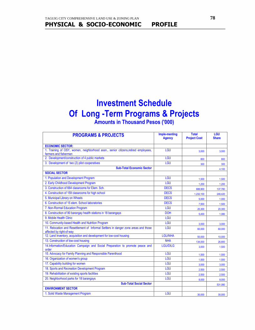
TAGUIG CITY COMPREHENSIVE LAND USE & ZONING PLAN 78
PHYSICAL & SOCIO-ECONOMIC PROFILE
Investment Schedule Of Long -Term Programs & Projects
Amounts in Thousand Pesos ('000)
PROGRAMS & PROJECTS Imple-menting Agency
Total Project Cost
LGU Share
ECONOMIC SECTOR:
1. Training of OSY, women, neighborhood assn., senior citizens,retired employees, farmers and fishermen
LGU 3,000 3,000
2. Development/construction of 4 public markets LGU 800 800
3. Development of two (2) pilot cooperatives LGU 300 300
Sub-Total Economic Sector 4,100
SOCIAL SECTOR
1. Population and Development Program LGU 1,500 1,500
2. Early Childhood Development Program LGU 1,200 1,200
3. Construction of 664 classrooms for Elem. Sch. DECS 688,900 137,780
4. Construction of 159 classrooms for high school DECS 1,232,100 246,420
5. Municipal Library on Wheels DECS 5,000 1,000
6. Construction of 15 elem. School laboratories DECS 7,500 1,500
7. Non-Rormal Education Program LGU 20,300 20,300
8. Construction of 90 barangay health stations in 18 barangays DOH 5,400 1,080
9. Mobile Health Clinic LGU
10. Community-based Health and Nutrition Program LGU 3,000 3,000
11. Relocation and Resettlement of Informal Settlers in danger zone areas and those affected by right-of-way
LGU 60,000 60,000
12. Land Inventory, acquisition and development for low-cost housing LGU/NHA 50,000 10,000
13. Construction of low-cost housing NHA 134,000 26,800
14.Information/Education Campaign and Social Preparation to promote peace and order
LGU/DILG 3,000 1,500
15. Advocacy for Family Planning and Responsible Parenthood LGU 1,500 1,500
16. Organization of women's group LGU 1,500 1,500
17. Capability building for women LGU 3,000 3,000
18. Sports and Recreation Development Program LGU 2,500 2,500
19. Rehabilitation of existing sports facilities LGU 2,500 2,500
20. Neighborhood parks for 18 barangays LGU 8,000 8,000
Sub-Total Social Sector 531,080
ENVIRONMENT SECTOR
1. Solid Waste Management Program LGU 30,000 30,000
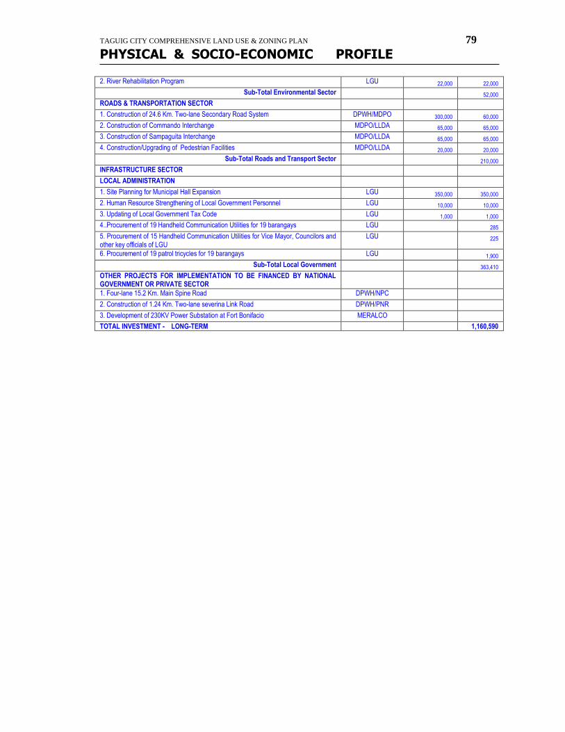
TAGUIG CITY COMPREHENSIVE LAND USE & ZONING PLAN 79
PHYSICAL & SOCIO-ECONOMIC PROFILE
2. River Rehabilitation Program LGU 22,000 22,000
Sub-Total Environmental Sector 52,000
ROADS & TRANSPORTATION SECTOR
1. Construction of 24.6 Km. Two-lane Secondary Road System DPWH/MDPO 300,000 60,000
2. Construction of Commando Interchange MDPO/LLDA 65,000 65,000
3. Construction of Sampaguita Interchange MDPO/LLDA 65,000 65,000
4. Construction/Upgrading of Pedestrian Facilities MDPO/LLDA 20,000 20,000
Sub-Total Roads and Transport Sector 210,000
INFRASTRUCTURE SECTOR
LOCAL ADMINISTRATION
1. Site Planning for Municipal Hall Expansion LGU 350,000 350,000
2. Human Resource Strengthening of Local Government Personnel LGU 10,000 10,000
3. Updating of Local Government Tax Code LGU 1,000 1,000
4..Procurement of 19 Handheld Communication Utilities for 19 barangays LGU 285
5. Procurement of 15 Handheld Communication Utilities for Vice Mayor, Councilors and other key officials of LGU
LGU 225
6. Procurement of 19 patrol tricycles for 19 barangays LGU 1,900
Sub-Total Local Government 363,410
OTHER PROJECTS FOR IMPLEMENTATION TO BE FINANCED BY NATIONAL GOVERNMENT OR PRIVATE SECTOR
1. Four-lane 15.2 Km. Main Spine Road DPWH/NPC
2. Construction of 1.24 Km. Two-lane severina Link Road DPWH/PNR
3. Development of 230KV Power Substation at Fort Bonifacio MERALCO
TOTAL INVESTMENT - LONG-TERM 1,160,590
TAGUIG CITY COMPREHENSIVE LAND USE & ZONING PLAN 80
PHYSICAL & SOCIO-ECONOMIC PROFILE
population dynamics
Taguig 2000
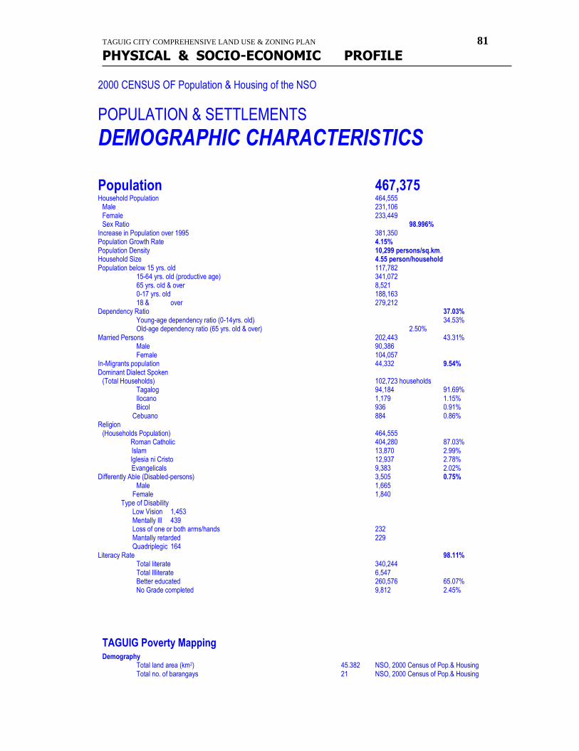
TAGUIG CITY COMPREHENSIVE LAND USE & ZONING PLAN 81
PHYSICAL & SOCIO-ECONOMIC PROFILE
2000 CENSUS OF Population & Housing of the NSO
POPULATION & SETTLEMENTS
DEMOGRAPHIC CHARACTERISTICS
Population 467,375 Household Population 464,555 Male 231,106 Female 233,449 Sex Ratio 98.996% Increase in Population over 1995 381,350 Population Growth Rate 4.15% Population Density 10,299 persons/sq.km. Household Size 4.55 person/household Population below 15 yrs. old 117,782 15-64 yrs. old (productive age) 341,072
65 yrs. old & over 8,521 0-17 yrs. old 188,163 18 & over 279,212 Dependency Ratio 37.03% Young-age dependency ratio (0-14yrs. old) 34.53% Old-age dependency ratio (65 yrs. old & over) 2.50% Married Persons 202,443 43.31% Male 90,386 Female 104,057 In-Migrants population 44,332 9.54% Dominant Dialect Spoken (Total Households) 102,723 households Tagalog 94,184 91.69% Ilocano 1,179 1.15% Bicol 936 0.91% Cebuano 884 0.86% Religion (Households Population) 464,555 Roman Catholic 404,280 87.03% Islam 13,870 2.99% Iglesia ni Cristo 12,937 2.78% Evangelicals 9,383 2.02% Differently Able (Disabled-persons) 3,505 0.75% Male 1,665 Female 1,840 Type of Disability Low Vision 1,453 Mentally Ill 439 Loss of one or both arms/hands 232 Mantally retarded 229 Quadriplegic 164 Literacy Rate 98.11% Total literate 340,244 Total Illiterate 6,547 Better educated 260,576 65.07% No Grade completed 9,812 2.45%
TAGUIG Poverty Mapping Demography
Total land area (km2) 45.382 NSO, 2000 Census of Pop.& Housing Total no. of barangays 21 NSO, 2000 Census of Pop.& Housing
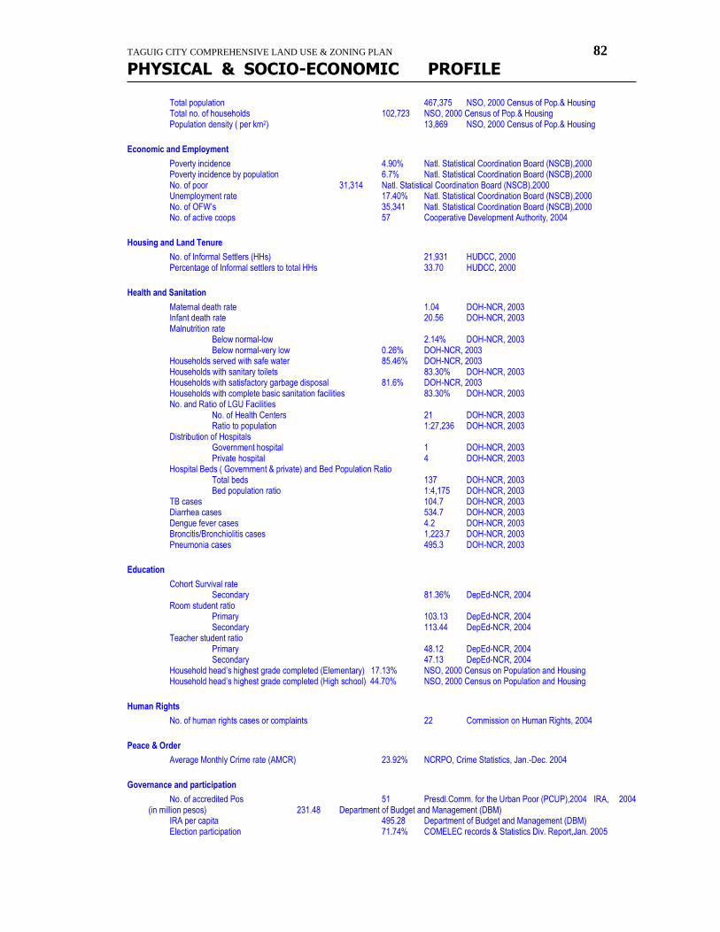
TAGUIG CITY COMPREHENSIVE LAND USE & ZONING PLAN 82
PHYSICAL & SOCIO-ECONOMIC PROFILE
Total population 467,375 NSO, 2000 Census of Pop.& Housing Total no. of households 102,723 NSO, 2000 Census of Pop.& Housing Population density ( per km2) 13,869 NSO, 2000 Census of Pop.& Housing
Economic and Employment
Poverty incidence 4.90% Natl. Statistical Coordination Board (NSCB),2000 Poverty incidence by population 6.7% Natl. Statistical Coordination Board (NSCB),2000 No. of poor 31,314 Natl. Statistical Coordination Board (NSCB),2000 Unemployment rate 17.40% Natl. Statistical Coordination Board (NSCB),2000
No. of OFW’s 35,341 Natl. Statistical Coordination Board (NSCB),2000 No. of active coops 57 Cooperative Development Authority, 2004
Housing and Land Tenure
No. of Informal Settlers (HHs) 21,931 HUDCC, 2000 Percentage of Informal settlers to total HHs 33.70 HUDCC, 2000
Health and Sanitation
Maternal death rate 1.04 DOH-NCR, 2003 Infant death rate 20.56 DOH-NCR, 2003 Malnutrition rate Below normal-low 2.14% DOH-NCR, 2003 Below normal-very low 0.26% DOH-NCR, 2003 Households served with safe water 85.46% DOH-NCR, 2003 Households with sanitary toilets 83.30% DOH-NCR, 2003 Households with satisfactory garbage disposal 81.6% DOH-NCR, 2003 Households with complete basic sanitation facilities 83.30% DOH-NCR, 2003 No. and Ratio of LGU Facilities No. of Health Centers 21 DOH-NCR, 2003 Ratio to population 1:27,236 DOH-NCR, 2003 Distribution of Hospitals Government hospital 1 DOH-NCR, 2003 Private hospital 4 DOH-NCR, 2003 Hospital Beds ( Government & private) and Bed Population Ratio Total beds 137 DOH-NCR, 2003 Bed population ratio 1:4,175 DOH-NCR, 2003 TB cases 104.7 DOH-NCR, 2003 Diarrhea cases 534.7 DOH-NCR, 2003 Dengue fever cases 4.2 DOH-NCR, 2003 Broncitis/Bronchiolitis cases 1,223.7 DOH-NCR, 2003 Pneumonia cases 495.3 DOH-NCR, 2003
Education
Cohort Survival rate Secondary 81.36% DepEd-NCR, 2004
Room student ratio Primary 103.13 DepEd-NCR, 2004 Secondary 113.44 DepEd-NCR, 2004 Teacher student ratio Primary 48.12 DepEd-NCR, 2004 Secondary 47.13 DepEd-NCR, 2004 Household head’s highest grade completed (Elementary) 17.13% NSO, 2000 Census on Population and Housing Household head’s highest grade completed (High school) 44.70% NSO, 2000 Census on Population and Housing
Human Rights
No. of human rights cases or complaints 22 Commission on Human Rights, 2004
Peace & Order
Average Monthly Crime rate (AMCR) 23.92% NCRPO, Crime Statistics, Jan.-Dec. 2004
Governance and participation
No. of accredited Pos 51 Presdl.Comm. for the Urban Poor (PCUP),2004 IRA, 2004 (in million pesos) 231.48 Department of Budget and Management (DBM) IRA per capita 495.28 Department of Budget and Management (DBM)
Election participation 71.74% COMELEC records & Statistics Div. Report,Jan. 2005
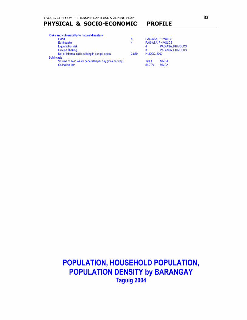
TAGUIG CITY COMPREHENSIVE LAND USE & ZONING PLAN 83
PHYSICAL & SOCIO-ECONOMIC PROFILE
Risks and vulnerability to natural disasters Flood 5 PAG-ASA, PHIVOLCS Earthquake 4 PAG-ASA, PHIVOLCS Liquefaction risk 4 PAG-ASA, PHIVOLCS Ground shaking 3 PAG-ASA, PHIVOLCS No. of informal settlers living in danger areas 2,869 HUDCC, 2000 Solid waste Volume of solid waste generated per day (tons per day) 149.1 MMDA Collection rate 56.79% MMDA
POPULATION, HOUSEHOLD POPULATION, POPULATION DENSITY by BARANGAY
Taguig 2004
TAGUIG CITY COMPREHENSIVE LAND USE & ZONING PLAN 84
PHYSICAL & SOCIO-ECONOMIC PROFILE
**PROJECTED**
BARANGAY POPULATION # OF HOUSEHOLD
POPULATION ESTIMATED
AREA (SQ.KM.)
POPULATION DENSITY
(PERSON/SQ. KM.)
1. Bagong Tanyag 37,761 7,552 2.17 17,401
2. Bagumbayan 31,847 6,369 3.62 8,798
3. Bambang 6,244 1,248 0.92 6,787
4. Calzada 11,910 2,382 1.77 6,729
5. Hagunoy 19,816 3,963 1.62 12,232
6. Ibayo-Tipas 15,981 3,196 1.56 10.244
7. Ligid-Tipas 7,548 1,509 0.68 11,100
8. Lower Bicutan 74,406 14,881 2.35 31,662
9. Maharlika Village 15,134 3,026 0.51 29,674
10. Napindan 11,476 2,295 2.70 4,250
11. Palingon 8,428 1,685 1.17 7,203
12. Sta. Ana 15,140 3,028 0.22 68,818
13. Signal Village 97,423 19,484 1.10 88,566
14. Tuktukan 8,390 1,678 0.31 27,065
15. Upper Bicutan 57,517 11,503 1.44 39,942
16. Ususan 16,328 3,265 1.45 11,261
17. Wawa 8,450 1,690 1.98 4,268
18. Western Bicutan 106,336 21,267 19.91 5,341
TOTAL 550,135 110,027 45.382 12,122 SOURCE: City Planning and Development Office NOTE: Figures computed by Planning Office based on the NSO Census 2000
POPULATION, HOUSEHOLD POPULATION, POPULATION DENSITY by BARANGAY
Taguig 2005
TAGUIG CITY COMPREHENSIVE LAND USE & ZONING PLAN 85
PHYSICAL & SOCIO-ECONOMIC PROFILE
**PROJECTED**
BARANGAY POPULATION # OF HOUSEHOLD ESTIMATED
AREA (SQ.KM.)
POPULATION DENSITY
(PERSON/SQ. KM.)
1. Bagong Tanyag 39,310 8,640 2.17 18,115
2. Bagumbayan 33,158 7,287 3.62 9,160
3. Bambang 6,500 1,429 0.92 7,065
4. Calzada 12,400 2,725 1.77 7,006
5. Hagunoy 20,633 4,535 1.62 12,736
6. Ibayo-Tipas 16,637 3,657 1.56 10,665
7. Ligid-Tipas 7,858 1,727 0.68 11,556
8. Lower Bicutan 77,466 17,025 2.35 32,964
9. Maharlika Village 15,756 3,463 0.51 30,894
10. Napindan 11,949 2,626 2.70 4,426
11. Palingon 8,773 1,928 1.17 7,498
12. Sta. Ana 15,763 3,464 0.22 71,650
13. Signal Village 101,425 22,291 1.10 92,205
14. Tuktukan 8,736 1,920 0.31 28,181
15. Upper Bicutan 59,882 13,161 1.44 41,585
16. Ususan 16,999 3,736 1.45 11,723
17. Wawa 8,799 1,934 1.98 4,444
18. Western Bicutan 110,703 24,330 19.91 5,560
TOTAL 572,747 125,878 45.382 12,621 SOURCE: City Planning and Development Office NOTE : Figures computed by Planning Office based on NSO Census 2000 using 4.15% growth rate..
POPULATION, HOUSEHOLD POPULATION, POPULATION DENSITY by BARANGAY
Taguig 2005 **PROJECTED**
TAGUIG CITY COMPREHENSIVE LAND USE & ZONING PLAN 86
PHYSICAL & SOCIO-ECONOMIC PROFILE
BARANGAY POPULATION # OF HOUSEHOLD ESTIMATED AREA
(SQ.KM.)
POPULATION DENSITY
(PERSON/SQ. KM.)
1. Bagong Tanyag 52,123 10,827 2.17 24,020
2. Bagumbayan 38,159 7,927 3.62 10,541
3. Bambang 7,552 1,569 0.92 8,209
4. Calzada 11,031 2,292 1.77 6,232
5. Hagunoy 20,168 4,190 1.62 12,449
6. Ibayo-Tipas 17,440 3,623 1.56 11,179
7. Ligid-Tipas 7,858 1,632 0.68 11,556
8. Lower Bicutan 80,363 16,694 2.35 34,197
9. Maharlika Village 18,406 3,824 0.51 36,090
10. Napindan 10,830 2,250 2.70 4,011
11. Palingon 9,939 2,065 1.17 8,495
12. Sta. Ana 14,132 2,936 0.22 64,236
13. Signal Village 114,824 23,852 1.10 104,385
14. Tuktukan 10,655 2,213 0.31 34,371
15. Upper Bicutan 76,838 15,961 1.44 53,360
16. Ususan 20,558 4,271 1.45 14,178
17. Wawa 11,269 2,341 1.98 5,691
18. Western Bicutan 100,765 20,932 19.91 5,061
TOTAL 622,910 102,723 45.382 13,726 SOURCE: City Planning and Development Office NOTE : Figures computed by Planning Office based on the 1995 Census-Based City/Municipal Population Projection of Taguig City for the year 2005.
TAGUIG HOUSEHOLD POPULATION By Age Group, and Sex
NSO Census May 01, 2000
Age Group and City Both Sexes Male Female All Ages 464,555 231,106 233,449
TAGUIG CITY COMPREHENSIVE LAND USE & ZONING PLAN 87
PHYSICAL & SOCIO-ECONOMIC PROFILE
Under 1 13,705 7,090 6,615
1-4 50,412 25,927 24,485
5-9 53,647 27,474 26,173
10-14 45,079 22,661 22,418
15-19 43,422 20,841 22,581
20-24 50,113 23,477 26,636
25-29 47,393 23,139 24,254
30-34 41,764 20,910 20,854
35-39 34,167 17,168 16,999
40-44 28,207 14,343 13,864
45-49 20,227 10,544 9,683
50-54 13,856 7,092 6,764
55-59 7,855 3,905 3,950
60-64 6,206 2,946 3,260
65-69 3,707 1,656 2,051
70-74 2,311 1,057 1,254
75-79 1,328 525 803
80 & over 1,156 351 805
0-17 187,748 95,225 92,523
18 & over 276,807 135,881 140,926
65 & over 8,502 3,589 4,913
TAGUIG CITY TOTAL POPULATION BY AGE GROUP
& BY BARANGAY PROJECTED 2005
BARANGAY 0-04 05-09 10-14 15-19 20-24 25-29 30-34 SUBTOTAL
Bagong Tanyag 5,469 4,613 3,390 3,556 4,929 4,468 3,771 24,623
Bagumbayan 4,601 3,635 3,282 2,989 3,461 3,351 3,040 19,877
Bambang 907 719 685 621 668 587 572 4,431
Calzada 1,685 1,630 1,317 1,140 1,234 1,132 1,309 7,489
Hagonoy 2,911 2,453 2,065 1,881 2,013 1,889 1,764 12,221
Ibayo-Tipas 2,278 1,970 1,645 1,569 1,705 1,555 1,520 9,990
Ligid-Tipas 1,103 792 745 764 803 824 699 4,675
Lower Bicutan 10,259 8,973 7,289 7,213 7,963 7,566 6,532 45,531
Maharlika Village 2,139 1,662 1,380 1,322 1,790 1,957 1,561 9,633
Napindan 1,656 1,422 1,262 1,152 1,205 1,128 1,070 7,286
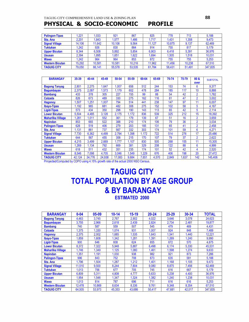
TAGUIG CITY COMPREHENSIVE LAND USE & ZONING PLAN 88
PHYSICAL & SOCIO-ECONOMIC PROFILE
Palingon-Tipas 1,221 1,033 921 867 825 778 713 5,188
Sta. Ana 2,201 1,843 1,577 1,486 1,717 1,431 1,358 9,473
Signal Village 14,106 11,642 10,106 9,564 11,127 10,875 9,137 62,469
Tuktukan 1,242 926 830 864 914 755 817 5,179
Upper Bicutan 8,344 6,508 5,892 5,854 6,903 6,418 5,391 36,976
Ususan 2,394 1,895 1,651 1,622 1,694 1,505 1,518 10,031
Wawa 1,242 964 964 853 872 755 755 5,253
Western Bicutan 15,292 10,581 10,581 10,216 11,962 11,456 10,238 67,510
TAGUIG CITY 79,050 66,141 55,578 53,535 61,784 58,431 51,491 347,835
BARANGAY 35-39 40-44 45-49 50-54 55-59 60-64 65-69 70-74 75-79 80 & over
SUBTOTAL
Bagong Tanyag 2,801 2,275 1,647 1,007 658 512 244 153 74 6 9,377
Bagumbayan 2,375 2,087 1,573 1,179 602 478 284 185 117 10 8,888
Bambang 433 378 305 227 155 99 88 54 42 2 1,782
Calzada 826 673 489 330 275 162 116 81 47 2 3,002
Hagonoy 1,507 1,251 1,007 794 514 441 238 147 97 11 6,007
Ibayo-Tipas 1,192 965 681 482 308 275 152 102 58 5 4,187
Ligid-Tipas 573 434 350 298 190 143 113 65 42 5 2,114
Lower Bicutan 5,504 4,485 3,128 2,175 1,172 836 539 325 212 15 18,392
Maharlika Village 1,281 1,011 552 361 179 139 67 51 16 2 3,659
Napindan 853 665 522 388 210 174 106 79 36 2 3,034
Palingon-Tipas 628 519 406 279 203 185 131 65 41 2 2,458
Sta. Ana 1,131 861 737 567 332 303 174 101 59 6 4,271
Signal Village 7,730 6,362 4,499 2,794 1,398 1,172 722 514 276 17 25,486
Tuktukan 644 567 455 358 215 170 107 79 37 2 2,622
Upper Bicutan 4,215 3,499 2,669 1,777 1,107 830 505 268 155 11 15,305
Ususan 1,269 1,134 792 669 381 329 208 122 88 6 4,999
Wawa 618 511 432 351 235 174 101 52 42 4 2,520
Western Bicutan 8,546 7,098 4,705 3,046 1,549 1,229 676 406 198 20 27,472
TAGUIG CITY 42,124 34,776 24,938 17,083 9,684 7,651 4,570 2,849 1,637 142 145,406
Prrojected/Computed by CDPO using 4.15% growth rate of the actual 2000 NSO Census.
TAGUIG CITY TOTAL POPULATION BY AGE GROUP
& BY BARANGAY ESTIMATED 2000
BARANGAY 0-04 05-09 10-14 15-19 20-24 25-29 30-34 TOTAL Bagong Tanyag 4,463 3,745 2,767 2,902 4,022 3,646 3,078 24,623
Bagumbayan 3,755 2,966 2,618 2,439 2,824 2,734 2,481 19,877
Bambang 740 587 559 507 545 479 469 4,431
Calzada 1,375 1,330 1,074 931 1,007 924 848 7,489
Hagonoy 2,375 2,002 1,685 1,535 1,643 1,541 1,440 12,221
Ibayo-Tipas 1,859 1,608 1,342 1,281 1,391 1,269 1,240 9,990
Ligid-Tipas 900 646 608 624 655 672 570 4,675
Lower Bicutan 8,372 7,322 5,948 5,887 6,498 6,174 5,330 45,531
Maharlika Village 1,746 1,349 1,125 1,080 1,461 1,598 1,274 9,633
Napindan 1,351 1,191 1,030 938 982 921 873 7,286
Palingon-Tipas 996 843 752 708 673 635 581 5,188
Sta. Ana 1,796 1,504 1,287 1,212 1,401 1,168 1,105 9,473
Signal Village 11,510 9,500 8,244 7,804 9,080 8,875 7,456 62,469
Tuktukan 1,013 756 677 705 745 616 667 5,179
Upper Bicutan 6,809 5,311 4,808 4,777 5,633 5,238 4,400 36,976
Ususan 1,954 1,546 1,347 1,324 1,382 1,240 1,238 10,031
Wawa 1,013 814 787 696 711 616 616 5,253
Western Bicutan 12,478 10,869 8,634 8,336 9,761 9,348 8,354 67,510
TAGUIG CITY 64,505 53,973 45,353 43,686 50,417 47,681 42,017 347,835
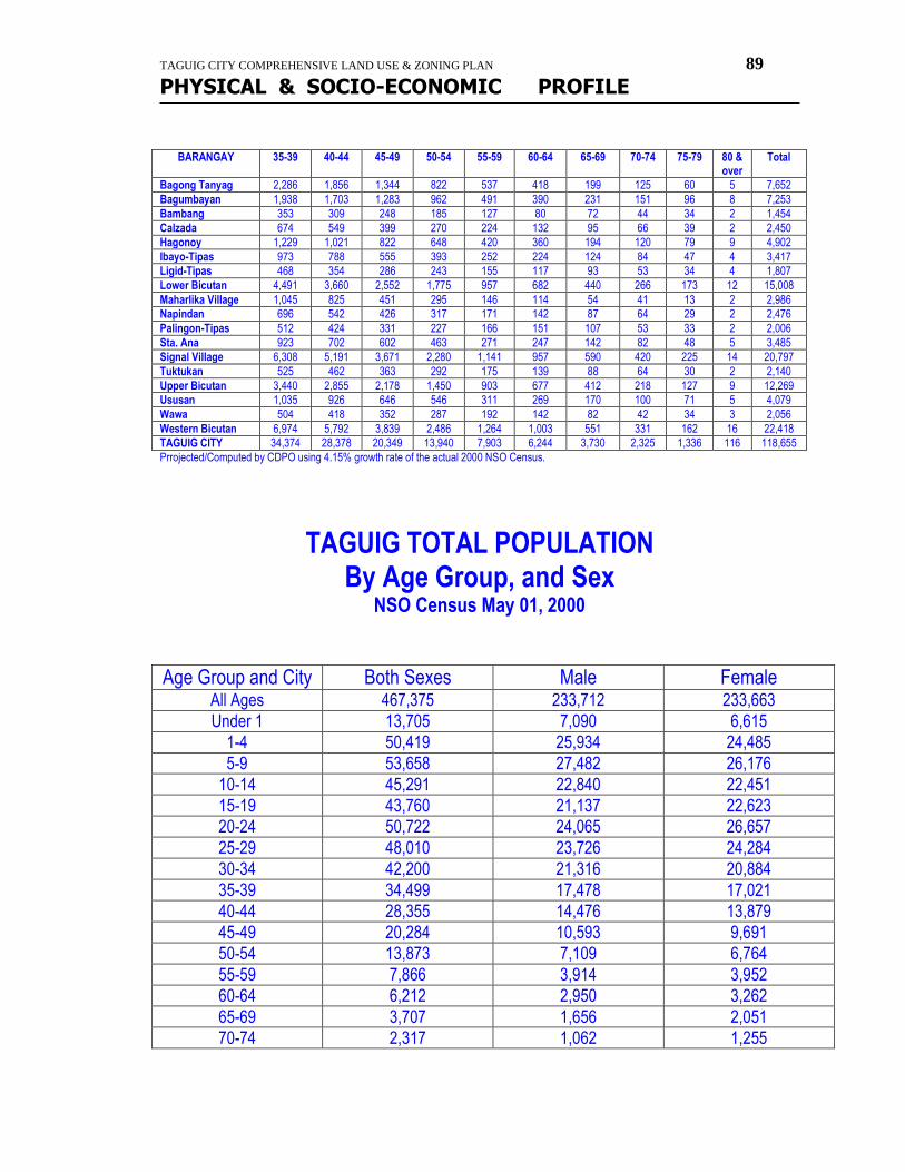
TAGUIG CITY COMPREHENSIVE LAND USE & ZONING PLAN 89
PHYSICAL & SOCIO-ECONOMIC PROFILE
BARANGAY 35-39 40-44 45-49 50-54 55-59 60-64 65-69 70-74 75-79 80 & over
Total
Bagong Tanyag 2,286 1,856 1,344 822 537 418 199 125 60 5 7,652
Bagumbayan 1,938 1,703 1,283 962 491 390 231 151 96 8 7,253
Bambang 353 309 248 185 127 80 72 44 34 2 1,454
Calzada 674 549 399 270 224 132 95 66 39 2 2,450
Hagonoy 1,229 1,021 822 648 420 360 194 120 79 9 4,902
Ibayo-Tipas 973 788 555 393 252 224 124 84 47 4 3,417
Ligid-Tipas 468 354 286 243 155 117 93 53 34 4 1,807
Lower Bicutan 4,491 3,660 2,552 1,775 957 682 440 266 173 12 15,008
Maharlika Village 1,045 825 451 295 146 114 54 41 13 2 2,986
Napindan 696 542 426 317 171 142 87 64 29 2 2,476
Palingon-Tipas 512 424 331 227 166 151 107 53 33 2 2,006
Sta. Ana 923 702 602 463 271 247 142 82 48 5 3,485
Signal Village 6,308 5,191 3,671 2,280 1,141 957 590 420 225 14 20,797
Tuktukan 525 462 363 292 175 139 88 64 30 2 2,140
Upper Bicutan 3,440 2,855 2,178 1,450 903 677 412 218 127 9 12,269
Ususan 1,035 926 646 546 311 269 170 100 71 5 4,079
Wawa 504 418 352 287 192 142 82 42 34 3 2,056
Western Bicutan 6,974 5,792 3,839 2,486 1,264 1,003 551 331 162 16 22,418
TAGUIG CITY 34,374 28,378 20,349 13,940 7,903 6,244 3,730 2,325 1,336 116 118,655
Prrojected/Computed by CDPO using 4.15% growth rate of the actual 2000 NSO Census.
TAGUIG TOTAL POPULATION
By Age Group, and Sex NSO Census May 01, 2000
Age Group and City Both Sexes Male Female All Ages 467,375 233,712 233,663
Under 1 13,705 7,090 6,615
1-4 50,419 25,934 24,485
5-9 53,658 27,482 26,176
10-14 45,291 22,840 22,451
15-19 43,760 21,137 22,623
20-24 50,722 24,065 26,657
25-29 48,010 23,726 24,284
30-34 42,200 21,316 20,884
35-39 34,499 17,478 17,021
40-44 28,355 14,476 13,879
45-49 20,284 10,593 9,691
50-54 13,873 7,109 6,764
55-59 7,866 3,914 3,952
60-64 6,212 2,950 3,262
65-69 3,707 1,656 2,051
70-74 2,317 1,062 1,255
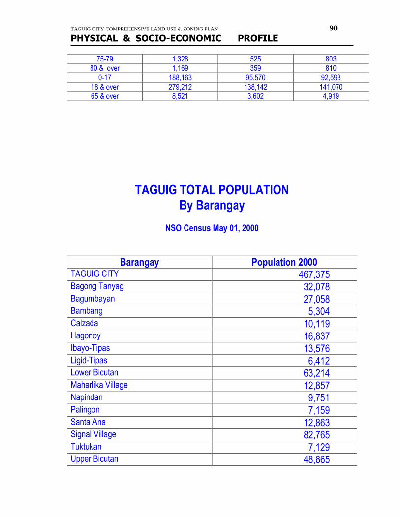
TAGUIG CITY COMPREHENSIVE LAND USE & ZONING PLAN 90
PHYSICAL & SOCIO-ECONOMIC PROFILE
75-79 1,328 525 803
80 & over 1,169 359 810
0-17 188,163 95,570 92,593
18 & over 279,212 138,142 141,070
65 & over 8,521 3,602 4,919
TAGUIG TOTAL POPULATION By Barangay
NSO Census May 01, 2000
Barangay Population 2000 TAGUIG CITY 467,375 Bagong Tanyag 32,078 Bagumbayan 27,058 Bambang 5,304 Calzada 10,119 Hagonoy 16,837 Ibayo-Tipas 13,576 Ligid-Tipas 6,412 Lower Bicutan 63,214 Maharlika Village 12,857 Napindan 9,751 Palingon 7,159 Santa Ana 12,863 Signal Village 82,765 Tuktukan 7,129 Upper Bicutan 48,865
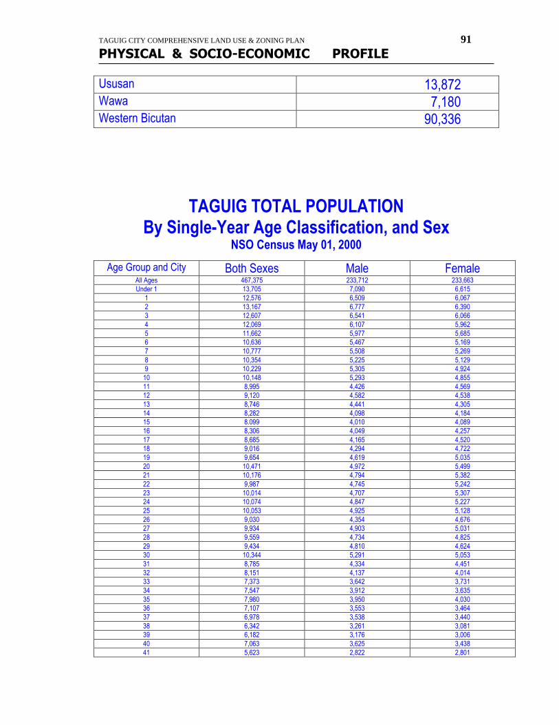
TAGUIG CITY COMPREHENSIVE LAND USE & ZONING PLAN 91
PHYSICAL & SOCIO-ECONOMIC PROFILE
Ususan 13,872 Wawa 7,180 Western Bicutan 90,336
TAGUIG TOTAL POPULATION By Single-Year Age Classification, and Sex
NSO Census May 01, 2000
Age Group and City Both Sexes Male Female All Ages 467,375 233,712 233,663
Under 1 13,705 7,090 6,615
1 12,576 6,509 6,067
2 13,167 6,777 6,390
3 12,607 6,541 6,066
4 12,069 6,107 5,962
5 11,662 5,977 5,685
6 10,636 5,467 5,169
7 10,777 5,508 5,269
8 10,354 5,225 5,129
9 10,229 5,305 4,924
10 10,148 5,293 4,855
11 8,995 4,426 4,569
12 9,120 4,582 4,538
13 8,746 4,441 4,305
14 8,282 4,098 4,184
15 8.099 4,010 4,089
16 8,306 4,049 4,257
17 8,685 4,165 4,520
18 9,016 4,294 4,722
19 9,654 4,619 5,035
20 10,471 4,972 5,499
21 10,176 4,794 5,382
22 9,987 4,745 5,242
23 10,014 4,707 5,307
24 10,074 4,847 5,227
25 10,053 4,925 5,128
26 9,030 4,354 4,676
27 9,934 4,903 5,031
28 9,559 4,734 4,825
29 9,434 4,810 4,624
30 10,344 5,291 5,053
31 8,785 4,334 4,451
32 8,151 4,137 4,014
33 7,373 3,642 3,731
34 7,547 3,912 3,635
35 7,980 3,950 4,030
36 7,107 3,553 3,464
37 6,978 3,538 3,440
38 6,342 3,261 3,081
39 6,182 3,176 3,006
40 7,063 3,625 3,438
41 5,623 2,822 2,801
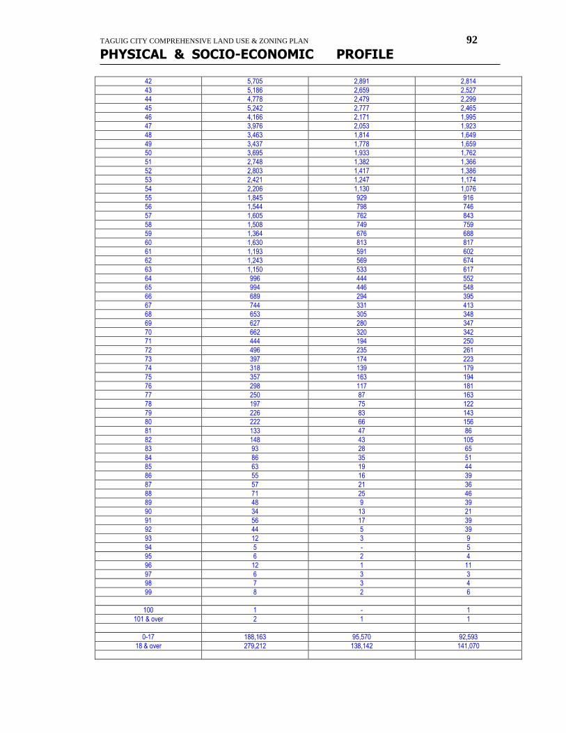
TAGUIG CITY COMPREHENSIVE LAND USE & ZONING PLAN 92
PHYSICAL & SOCIO-ECONOMIC PROFILE
42 5,705 2,891 2,814
43 5,186 2,659 2,527
44 4,778 2,479 2,299
45 5,242 2,777 2,465
46 4,166 2,171 1,995
47 3,976 2,053 1,923
48 3,463 1,814 1,649
49 3,437 1,778 1,659
50 3,695 1,933 1,762
51 2,748 1,382 1,366
52 2,803 1,417 1,386
53 2,421 1,247 1,174
54 2,206 1,130 1,076
55 1,845 929 916
56 1,544 798 746
57 1,605 762 843
58 1,508 749 759
59 1,364 676 688
60 1,630 813 817
61 1,193 591 602
62 1,243 569 674
63 1,150 533 617
64 996 444 552
65 994 446 548
66 689 294 395
67 744 331 413
68 653 305 348
69 627 280 347
70 662 320 342
71 444 194 250
72 496 235 261
73 397 174 223
74 318 139 179
75 357 163 194
76 298 117 181
77 250 87 163
78 197 75 122
79 226 83 143
80 222 66 156
81 133 47 86
82 148 43 105
83 93 28 65
84 86 35 51
85 63 19 44
86 55 16 39
87 57 21 36
88 71 25 46
89 48 9 39
90 34 13 21
91 56 17 39
92 44 5 39
93 12 3 9
94 5 - 5
95 6 2 4
96 12 1 11
97 6 3 3
98 7 3 4
99 8 2 6
100 1 - 1
101 & over 2 1 1
0-17 188,163 95,570 92,593
18 & over 279,212 138,142 141,070
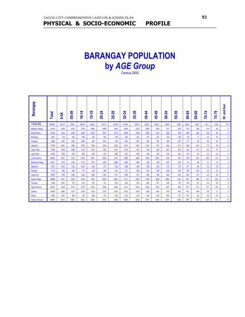
TAGUIG CITY COMPREHENSIVE LAND USE & ZONING PLAN 93
PHYSICAL & SOCIO-ECONOMIC PROFILE
BARANGAY POPULATION
by AGE Group Census 2000
Bar
ang
ay
To
tal
0-04
05-0
9
10-1
4
15-1
9
20-2
4
25-2
9
30-3
4
35-3
9
40-4
4
45-4
9
50-5
4
55-5
9
60-6
4
65-6
9
70-7
4
75-7
9
80 a
nd
0ve
r
TAGUIG 464555 64117 53647 45079 43422 50113 47393 41764 34167 28207 20227 13856 7855 6206 3707 2311 1328 115
Bagong Tanyag 32146 4436 3742 2750 2884 3998 3624 3059 2272 1845 1336 817 534 415 198 124 60 5
Bagumbayan 27043 3732 2948 2662 2424 2807 2718 2466 1926 1693 1276 956 488 388 230 150 95 8
Bambang 5331 736 583 556 504 542 476 464 351 307 247 184 126 80 71 44 34 2
Calzada 9902 1367 1322 1068 925 1001 918 843 670 546 397 268 223 131 94 66 38 2
Hagonoy 17106 2361 1990 1675 1526 1633 1532 1431 1222 1015 817 644 417 358 193 119 79 9
Ibayo-Tipas 13390 1848 1598 1334 1273 1383 1261 1233 967 783 552 391 250 223 123 83 47 4
Ligid-Tipas 6482 895 642 604 620 651 668 567 465 352 284 242 154 116 92 53 34 4
Lower Bicutan 60287 8321 7278 5912 5851 6459 6137 5298 4464 3638 2537 1764 951 678 437 264 172 12
Maharlika Village 12571 1735 1348 1119 1073 1452 1588 1266 1039 820 448 293 145 113 54 41 13 2
Napindan 9731 1343 1183 1024 934 977 915 868 692 539 423 315 170 141 86 64 29 2
Palingon 7175 990 838 747 703 669 631 577 509 421 329 226 165 150 106 53 33 2
Santa Ana 12930 1785 1495 1279 1205 1393 1161 1098 917 698 598 460 269 246 141 82 48 5
Signal Village 82898 11441 9443 8194 7757 9025 8821 7411 6270 5160 3649 2266 1134 951 586 417 224 14
Tuktukan 7298 1007 751 673 701 741 612 663 522 460 361 290 174 138 87 64 30 2
Upper Bicutan 49037 6768 5279 4779 4748 5599 5206 4373 3419 2838 2165 1441 899 673 410 217 126 9
Ususan 14068 1942 1537 1339 1316 1374 1221 1231 1029 920 642 543 309 267 169 99 71 5
Wawa 7295 1007 809 782 692 707 612 612 501 415 350 285 191 141 82 42 34 3
Western Bicutan 89865 12403 10861 8582 8286 9702 9292 8304 6932 5757 3816 2471 1256 997 548 329 161 16
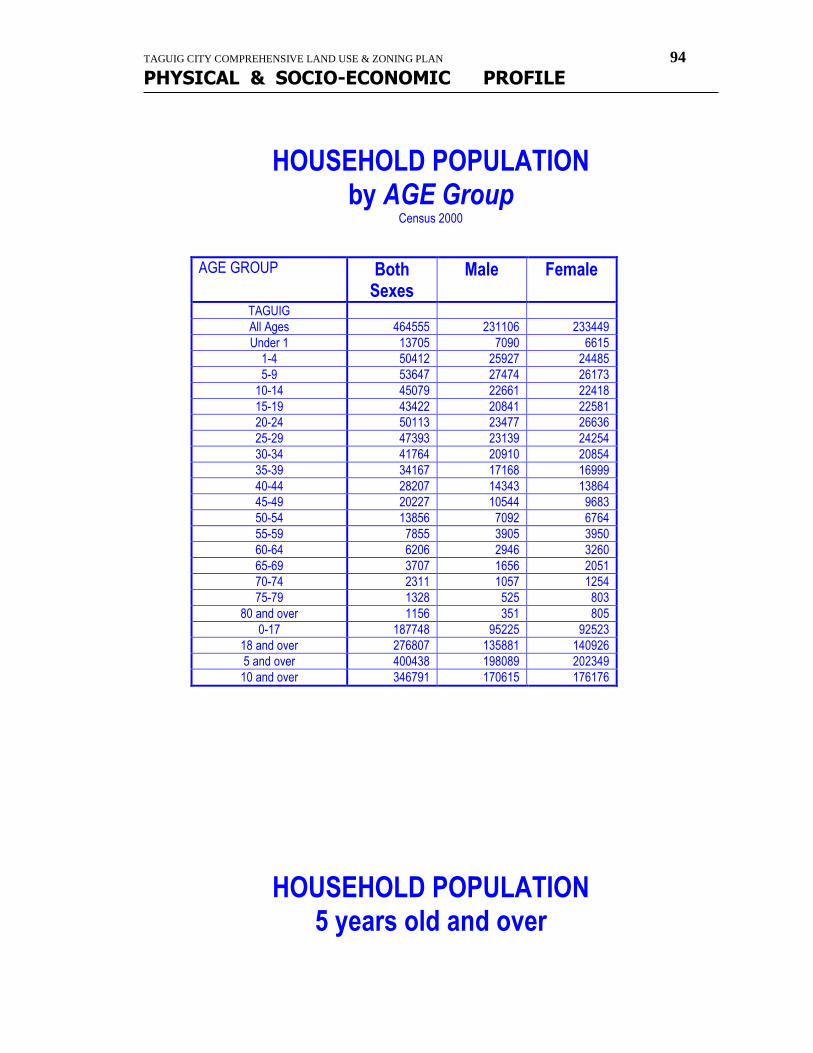
TAGUIG CITY COMPREHENSIVE LAND USE & ZONING PLAN 94
PHYSICAL & SOCIO-ECONOMIC PROFILE
HOUSEHOLD POPULATION by AGE Group
Census 2000
AGE GROUP Both Sexes
Male Female
TAGUIG
All Ages 464555 231106 233449
Under 1 13705 7090 6615
1-4 50412 25927 24485
5-9 53647 27474 26173
10-14 45079 22661 22418
15-19 43422 20841 22581
20-24 50113 23477 26636
25-29 47393 23139 24254
30-34 41764 20910 20854
35-39 34167 17168 16999
40-44 28207 14343 13864
45-49 20227 10544 9683
50-54 13856 7092 6764
55-59 7855 3905 3950
60-64 6206 2946 3260
65-69 3707 1656 2051
70-74 2311 1057 1254
75-79 1328 525 803
80 and over 1156 351 805
0-17 187748 95225 92523
18 and over 276807 135881 140926
5 and over 400438 198089 202349
10 and over 346791 170615 176176
HOUSEHOLD POPULATION 5 years old and over
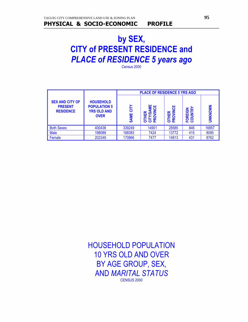
TAGUIG CITY COMPREHENSIVE LAND USE & ZONING PLAN 95
PHYSICAL & SOCIO-ECONOMIC PROFILE
by SEX, CITY of PRESENT RESIDENCE and PLACE of RESIDENCE 5 years ago
Census 2000
SEX AND CITY OF PRESENT
RESIDENCE
HOUSEHOLD POPULATION 5 YRS OLD AND
OVER
PLACE OF RESIDENCE 5 YRS AGO
SA
ME
CIT
Y
OT
HE
R
CIT
Y/S
AM
E
PR
OV
INC
E
OT
HE
R
PR
OV
INC
E
FO
RE
IGN
CO
UN
TR
Y
UN
KN
OW
N
Both Sexes 400438 339249 14901 28585 846 16857
Male 198089 168383 7424 13772 415 8095
Female 202349 170866 7477 14813 431 8762
HOUSEHOLD POPULATION 10 YRS OLD AND OVER BY AGE GROUP, SEX, AND MARITAL STATUS
CENSUS 2000
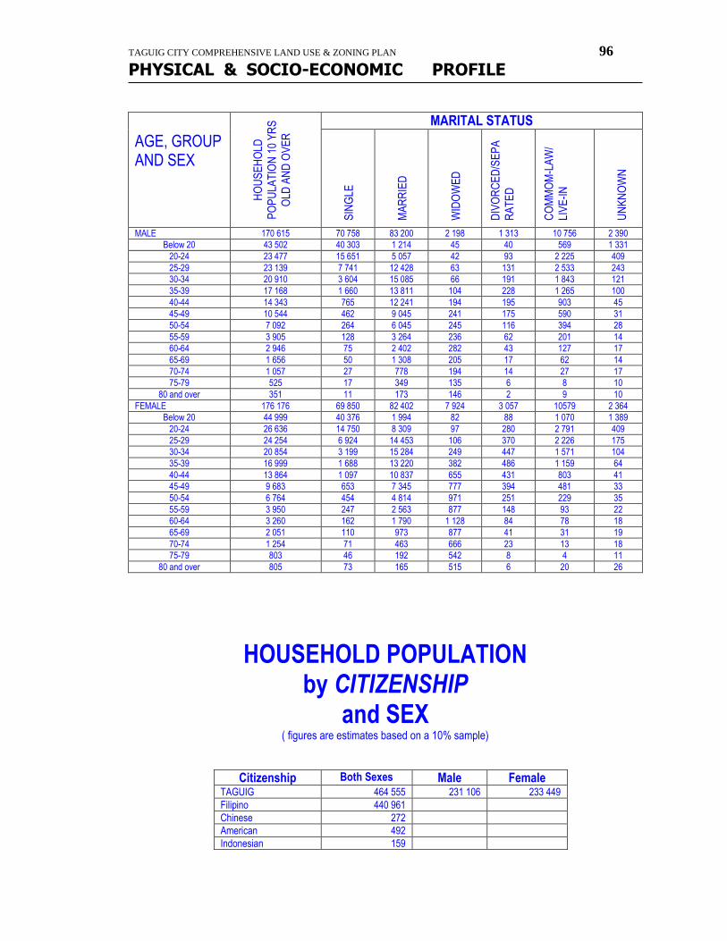
TAGUIG CITY COMPREHENSIVE LAND USE & ZONING PLAN 96
PHYSICAL & SOCIO-ECONOMIC PROFILE
AGE, GROUP AND SEX
HO
US
EH
OLD
PO
PU
LAT
ION
10
YR
S
OLD
AN
D O
VE
R
MARITAL STATUS
SIN
GLE
MA
RR
IED
WID
OW
ED
DIV
OR
CE
D/S
EP
A
RA
TE
D
CO
MM
OM
-LA
W/
LIV
E-I
N
UN
KN
OW
N
MALE 170 615 70 758 83 200 2 198 1 313 10 756 2 390
Below 20 43 502 40 303 1 214 45 40 569 1 331
20-24 23 477 15 651 5 057 42 93 2 225 409
25-29 23 139 7 741 12 428 63 131 2 533 243
30-34 20 910 3 604 15 085 66 191 1 843 121
35-39 17 168 1 660 13 811 104 228 1 265 100
40-44 14 343 765 12 241 194 195 903 45
45-49 10 544 462 9 045 241 175 590 31
50-54 7 092 264 6 045 245 116 394 28
55-59 3 905 128 3 264 236 62 201 14
60-64 2 946 75 2 402 282 43 127 17
65-69 1 656 50 1 308 205 17 62 14
70-74 1 057 27 778 194 14 27 17
75-79 525 17 349 135 6 8 10
80 and over 351 11 173 146 2 9 10
FEMALE 176 176 69 850 82 402 7 924 3 057 10579 2 364
Below 20 44 999 40 376 1 994 82 88 1 070 1 389
20-24 26 636 14 750 8 309 97 280 2 791 409
25-29 24 254 6 924 14 453 106 370 2 226 175
30-34 20 854 3 199 15 284 249 447 1 571 104
35-39 16 999 1 688 13 220 382 486 1 159 64
40-44 13 864 1 097 10 837 655 431 803 41
45-49 9 683 653 7 345 777 394 481 33
50-54 6 764 454 4 814 971 251 229 35
55-59 3 950 247 2 563 877 148 93 22
60-64 3 260 162 1 790 1 128 84 78 18
65-69 2 051 110 973 877 41 31 19
70-74 1 254 71 463 666 23 13 18
75-79 803 46 192 542 8 4 11
80 and over 805 73 165 515 6 20 26
HOUSEHOLD POPULATION by CITIZENSHIP
and SEX ( figures are estimates based on a 10% sample)
Citizenship Both Sexes Male Female TAGUIG 464 555 231 106 233 449
Filipino 440 961
Chinese 272
American 492
Indonesian 159
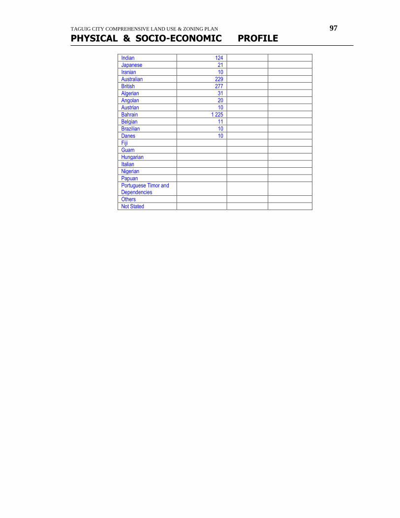
TAGUIG CITY COMPREHENSIVE LAND USE & ZONING PLAN 97
PHYSICAL & SOCIO-ECONOMIC PROFILE
Indian 124
Japanese 21
Iranian 10
Australian 229
British 277
Algerian 31
Angolan 20
Austrian 10
Bahrain 1 225
Belgian 11
Brazilian 10
Danes 10
Fiji
Guam
Hungarian
Italian
Nigerian
Papuan
Portuguese Timor and Dependencies
Others
Not Stated

TAGUIG CITY COMPREHENSIVE LAND USE & ZONING PLAN 98
PHYSICAL & SOCIO-ECONOMIC PROFILE
education
LISTS OF SCHOOLS
SCHOOLS
LOCATION/ BRGY.
LOT
AREA Occupied (SQ.M.)
TYPE
PU
BL
IC
PR
IVA
TE
Day Care Centers/Kinder/Prep/Elementary (E.S.) 158 69 89 Bagong Tanyag ES Bagong Tanyag 10,530 @
North Daang-hari ES 3,724 @
Purok 11 Elementary School Annex B @
Purok 14 Elementary School Annex A @
Purok 2 DCC @
North Daang Hari DCC @
St. Helena Academy ---Perpetual Village @
Our Lourdes of Academy @
BATAHAI (Prep-Schoolers) @
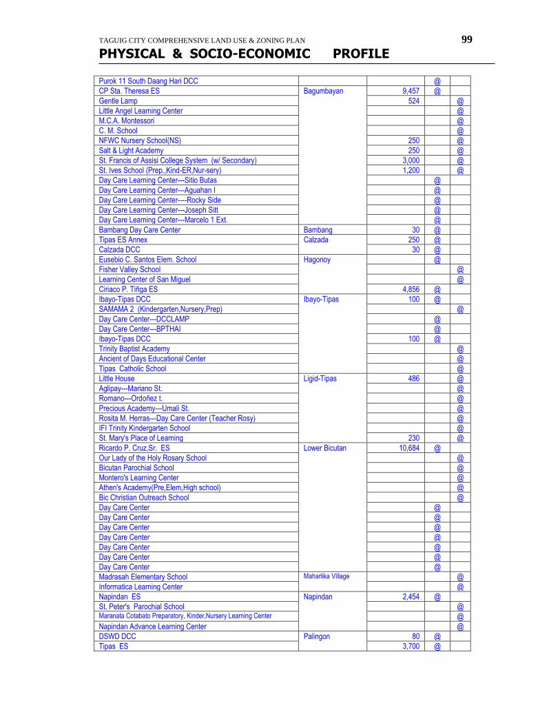
TAGUIG CITY COMPREHENSIVE LAND USE & ZONING PLAN 99
PHYSICAL & SOCIO-ECONOMIC PROFILE
Purok 11 South Daang Hari DCC @
CP Sta. Theresa ES Bagumbayan 9,457 @
Gentle Lamp 524 @
Little Angel Learning Center @
M.C.A. Montessori @
C. M. School @
NFWC Nursery School(NS) 250 @
Salt & Light Academy 250 @
St. Francis of Assisi College System (w/ Secondary) 3,000 @
St. Ives School (Prep.,Kind-ER,Nur-sery) 1,200 @
Day Care Learning Center---Sitio Butas @
Day Care Learning Center---Aguahan I @
Day Care Learning Center----Rocky Side @
Day Care Learning Center---Joseph Sitt @
Day Care Learning Center---Marcelo 1 Ext. @
Bambang Day Care Center Bambang 30 @
Tipas ES Annex Calzada 250 @
Calzada DCC 30 @
Eusebio C. Santos Elem. School Hagonoy @
Fisher Valley School @
Learning Center of San Miguel @
Ciriaco P. Tiñga ES 4,856 @
Ibayo-Tipas DCC Ibayo-Tipas 100 @
SAMAMA 2 (Kindergarten,Nursery,Prep) @
Day Care Center---DCCLAMP @
Day Care Center---BPTHAI @
Ibayo-Tipas DCC 100 @
Trinity Baptist Academy @
Ancient of Days Educational Center @
Tipas Catholic School @
Little House Ligid-Tipas 486 @
Aglipay---Mariano St. @
Romano---Ordoñez t. @
Precious Academy---Umali St. @
Rosita M. Herras---Day Care Center (Teacher Rosy) @
IFI Trinity Kindergarten School @
St. Mary's Place of Learning 230 @
Ricardo P. Cruz,Sr. ES Lower Bicutan 10,684 @
Our Lady of the Holy Rosary School @
Bicutan Parochial School @
Montero's Learning Center @
Athen's Academy(Pre,Elem,High school) @
Bic Christian Outreach School @
Day Care Center @
Day Care Center @
Day Care Center @
Day Care Center @
Day Care Center @
Day Care Center @
Day Care Center @
Madrasah Elementary School Maharlika Village @
Informatica Learning Center @
Napindan ES Napindan 2,454 @
St. Peter's Parochial School @ Maranata Cotabato Preparatory, Kinder,Nursery Learning Center @
Napindan Advance Learning Center @
DSWD DCC Palingon 80 @
Tipas ES 3,700 @
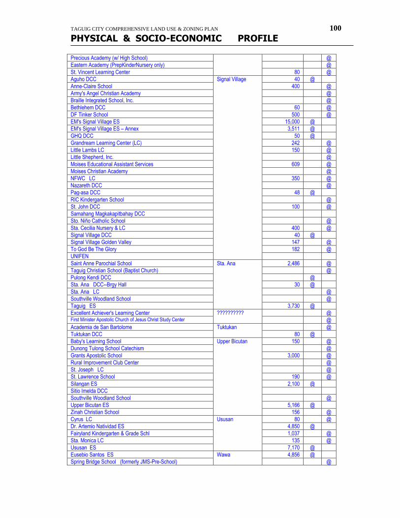
TAGUIG CITY COMPREHENSIVE LAND USE & ZONING PLAN 100
PHYSICAL & SOCIO-ECONOMIC PROFILE
Precious Academy (w/ High School) @
Eastern Academy (PrepKinderNursery only) @
St. Vincent Learning Center 80 @
Aguho DCC Signal Village 40 @
Anne-Claire School 400 @
Army's Angel Christian Academy @
Braille Integrated School, Inc. @
Bethlehem DCC 60 @
DF Tinker School 500 @
EM's Signal Village ES 15,000 @
EM's Signal Village ES – Annex 3,511 @
GHQ DCC 50 @
Grandream Learning Center (LC) 242 @
Little Lambs LC 150 @
Little Shepherd, Inc. @
Moises Educational Assistant Services 609 @
Moises Christian Academy @
NFWC LC 350 @
Nazareth DCC @
Pag-asa DCC 48 @
RIC Kindergarten School @
St. John DCC 100 @
Samahang Magkakapitbahay DCC
Sto. Niño Catholic School @
Sta. Cecilia Nursery & LC 400 @
Signal Village DCC 40 @
Signal Village Golden Valley 147 @
To God Be The Glory 182 @
UNIFEN
Saint Anne Parochial School Sta. Ana 2,486 @
Taguig Christian School (Baptist Church) @
Pulong Kendi DCC @
Sta. Ana DCC--Brgy Hall 30 @
Sta. Ana LC @
Southville Woodland School @
Taguig ES 3,730 @
Excellent Achiever's Learning Center ?????????? @ First Minister Apostolic Church of Jesus Christ Study Center @
Academia de San Bartolome Tuktukan @
Tuktukan DCC 80 @
Baby's Learning School Upper Bicutan 150 @
Dunong Tulong School Catechism @
Grants Apostolic School 3,000 @
Rural Improvement Club Center @
St. Joseph LC @
St. Lawrence School 190 @
Silangan ES 2,100 @
Sitio Imelda DCC
Southville Woodland School @
Upper Bicutan ES 5,166 @
Zinah Christian School 156 @
Cyrus LC Ususan 80 @
Dr. Artemio Natividad ES 4,850 @
Fairyland Kindergarten & Grade Schl 1,037 @
Sta. Monica LC 135 @
Ususan ES 7,170 @
Eusebio Santos ES Wawa 4,856 @
Spring Bridge School (formerly JMS-Pre-School) @
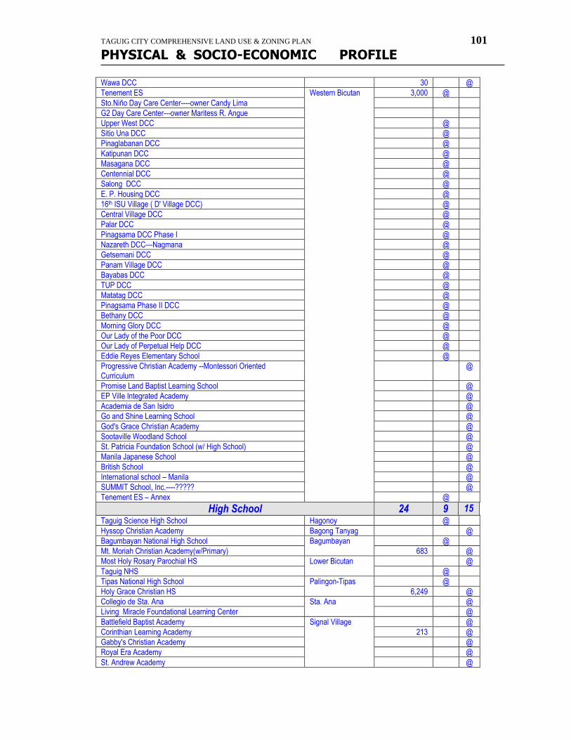
TAGUIG CITY COMPREHENSIVE LAND USE & ZONING PLAN 101
PHYSICAL & SOCIO-ECONOMIC PROFILE
Wawa DCC 30 @
Tenement ES Western Bicutan 3,000 @
Sto.Niño Day Care Center----owner Candy Lima
G2 Day Care Center---owner Maritess R. Angue
Upper West DCC @
Sitio Una DCC @
Pinaglabanan DCC @
Katipunan DCC @
Masagana DCC @
Centennial DCC @
Salong DCC @
E. P. Housing DCC @
16th ISU Village ( D' Village DCC) @
Central Village DCC @
Palar DCC @
Pinagsama DCC Phase I @
Nazareth DCC---Nagmana @
Getsemani DCC @
Panam Village DCC @
Bayabas DCC @
TUP DCC @
Matatag DCC @
Pinagsama Phase II DCC @
Bethany DCC @
Morning Glory DCC @
Our Lady of the Poor DCC @
Our Lady of Perpetual Help DCC @
Eddie Reyes Elementary School @
Progressive Christian Academy --Montessori Oriented Curriculum
@
Promise Land Baptist Learning School @
EP Ville Integrated Academy @
Academia de San Isidro @
Go and Shine Learning School @
God's Grace Christian Academy @
Sootaville Woodland School @
St. Patricia Foundation School (w/ High School) @
Manila Japanese School @
British School @
International school – Manila @
SUMMIT School, Inc.----????? @
Tenement ES – Annex @
High School 24 9 15 Taguig Science High School Hagonoy @
Hyssop Christian Academy Bagong Tanyag @
Bagumbayan National High School Bagumbayan @
Mt. Moriah Christian Academy(w/Primary) 683 @
Most Holy Rosary Parochial HS Lower Bicutan @
Taguig NHS @
Tipas National High School Palingon-Tipas @
Holy Grace Christian HS 6,249 @
Collegio de Sta. Ana Sta. Ana @
Living Miracle Foundational Learning Center @
Battlefield Baptist Academy Signal Village @
Corinthian Learning Academy 213 @
Gabby's Christian Academy @
Royal Era Academy @
St. Andrew Academy @
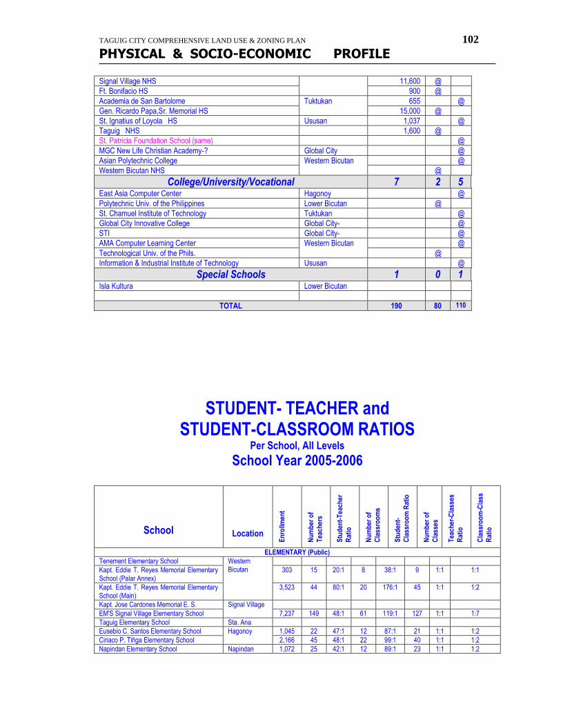
TAGUIG CITY COMPREHENSIVE LAND USE & ZONING PLAN 102
PHYSICAL & SOCIO-ECONOMIC PROFILE
Signal Village NHS 11,600 @
Ft. Bonifacio HS 900 @
Academia de San Bartolome Tuktukan 655 @
Gen. Ricardo Papa,Sr. Memorial HS 15,000 @
St. Ignatius of Loyola HS Ususan 1,037 @
Taguig NHS 1,600 @
St. Patricia Foundation School (same) @
MGC New Life Christian Academy-? Global City @
Asian Polytechnic College Western Bicutan @
Western Bicutan NHS @
College/University/Vocational 7 2 5 East Asia Computer Center Hagonoy @
Polytechnic Univ. of the Philippines Lower Bicutan @
St. Chamuel Institute of Technology Tuktukan @
Global City Innovative College Global City- @
STI Global City- @
AMA Computer Learning Center Western Bicutan @
Technological Univ. of the Phils. @
Information & Industrial Institute of Technology Ususan @
Special Schools 1 0 1 Isla Kultura Lower Bicutan
TOTAL 190 80 110
STUDENT- TEACHER and STUDENT-CLASSROOM RATIOS
Per School, All Levels
School Year 2005-2006
School
Location
En
rollm
ent
Nu
mb
er o
f
Tea
cher
s
Stu
den
t-T
each
er
Rat
io
Nu
mb
er o
f
Cla
ssro
om
s
Stu
den
t-
Cla
ssro
om
Rat
io
Nu
mb
er o
f
Cla
sses
Tea
cher
-Cla
sses
Rat
io
Cla
ssro
om
-Cla
ss
Rat
io
ELEMENTARY (Public)
Tenement Elementary School Western Bicutan
Kapt. Eddie T. Reyes Memorial Elementary School (Palar Annex)
303 15 20:1 8 38:1 9 1:1 1:1
Kapt. Eddie T. Reyes Memorial Elementary School (Main)
3,523 44 80:1 20 176:1 45 1:1 1:2
Kapt. Jose Cardones Memorial E. S. Signal Village
EM'S Signal Village Elementary School 7,237 149 48:1 61 119:1 127 1:1 1:7
Taguig Elementary School Sta. Ana
Eusebio C. Santos Elementary School Hagonoy 1,045 22 47:1 12 87:1 21 1:1 1:2
Ciriaco P. Tiñga Elementary School 2,166 45 48:1 22 99:1 40 1:1 1:2
Napindan Elementary School Napindan 1,072 25 42:1 12 89:1 23 1:1 1:2
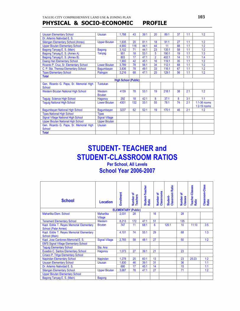
TAGUIG CITY COMPREHENSIVE LAND USE & ZONING PLAN 103
PHYSICAL & SOCIO-ECONOMIC PROFILE
Ususan Elementary School Ususan 1,788 43 39:1 20 89:1 37 1:1 1:2
Dr. Artemio Natividad E. S.
Silangan Elementary School (Annex) Upper Bicutan 1,635 20 81:1 18 91:1 27 1:1 1:2
Upper Bicutan Elementary School 4,900 116 44:1 44 11 88 1:1 1:2
Bagong Tanyag E. S. (Main) Bagong Tanyag
3,102 71 44:1 23 135:1 58 1:1 1:2
Bagong Tanyag E. S. (Annex A) 951 18 53:1 5 190:1 19 1:1 1:3
Bagong Tanyag E. S. (Annex B) 803 17 47:1 2 402:1 14 1:1 1:4
Daang Hari Elementary School 1,900 42 45:1 16 119:1 35 1:1 1:2
Ricardo P. Cruz, Sr. Elementary School Lower Bicutan 3,789 78 56:1 34 112:1 68 1:1 1:2
C. P. Sta. Theresa Elementary School Bagumbayan 3,836 78 49:1 33 116:1 67 1:1 1:2
Tipas Elementary School Palingon 3,216 68 47:1 25 129:1 56 1:1 1:2
Total
High School (Public)
Gen. Ricardo G. Papa, Sr. Memorial High School
Tuktukan
Western Bicutan National High School Western Bicutan
4139 78 53:1 19 218:1 38 2:1 1:2
Taguig Science High School Hagonoy 292 18 42:1 8 37:1 8 3:1 1:1
Taguig National High School Lower Bicutan 4301 132 33:1 55 78:1 74 2:1 1:1-36 rooms 1:2-19 rooms
Bagumbayan National High School Bagumbayan 3237 62 52:1 19 170:1 46 2:1 1:2
Tipas National High School Tipas
Signal Village National High School Signal Village
Upper Bicutan National High School Upper Bicutan
Gen. Ricardo G. Papa, Sr. Memorial High School
Ususan
Total
STUDENT- TEACHER and STUDENT-CLASSROOM RATIOS
Per School, All Levels
School Year 2006-2007
School
Location
En
rollm
ent
Nu
mb
er o
f
Tea
cher
s
Stu
den
t-T
each
er
Rat
io
Nu
mb
er o
f C
lass
roo
ms
Stu
den
t-
Cla
ssro
om
Rat
io
Nu
mb
er o
f C
lass
es
Tea
cher
-Cla
sses
R
atio
Cla
ssro
om
-Cla
ss
Rat
io ELEMENTARY (Public)
Maharlika Elem. School Maharlika Village
2,031 28 16 28
Tenement Elementary School Western Bicutan
8,213 172 47:1 51 135
Kapt. Eddie T. Reyes Memorial Elementary School (Palar Annex)
747 11 68:1 6 125:1 10 11:10 3:5
Kapt. Eddie T. Reyes Memorial Elementary School (Main)
4,101 74 55:1 29 68 1:3
Kapt. Jose Cardones Memorial E. S. Signal Village 2,765 58 48:1 27 50 1:2
EM'S Signal Village Elementary School
Taguig Elementary School Sta. Ana
Eusebio C. Santos Elementary School Hagonoy 1,073 27 39:1 21 23
Ciriaco P. Tiñga Elementary School
Napindan Elementary School Napindan 1,278 25 60:1 13 23 25:23 1:2
Ususan Elementary School Ususan 1,830 46 39:1 31 36 1:1
Dr. Artemio Natividad E. S. 690 17 45:1 14 15 1:1
Silangan Elementary School Upper Bicutan 3,687 78 47:1 27 71 1:2
Upper Bicutan Elementary School
Bagong Tanyag E. S. (Main) Bagong
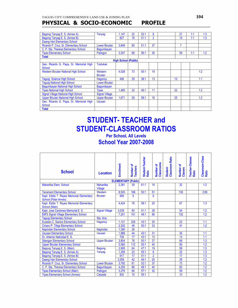
TAGUIG CITY COMPREHENSIVE LAND USE & ZONING PLAN 104
PHYSICAL & SOCIO-ECONOMIC PROFILE
Bagong Tanyag E. S. (Annex A) Tanyag 1,147 22 52:1 8 21 1:1 1:3
Bagong Tanyag E. S. (Annex B) 827 16 51:1 2 15 1:1 1:3
Daang Hari Elementary School
Ricardo P. Cruz, Sr. Elementary School Lower Bicutan 3,649 80 51:1 37 7
C. P. Sta. Theresa Elementary School Bagumbayan
Tipas Elementary School Palingon 3,307 68 56:1 30 59 1:1 1:2
Total
High School (Public)
Gen. Ricardo G. Papa, Sr. Memorial High School
Tuktukan
Western Bicutan National High School Western Bicutan
4,028 73 55:1 19 1:2
Taguig Science High School Hagonoy 456 29 38:1 13 13 1:1
Taguig National High School Lower Bicutan
Bagumbayan National High School Bagumbayan
Tipas National High School Tipas 1,485 32 46:1 11 22 1:2
Signal Village National High School Signal Village
Upper Bicutan National High School Upper Bicutan 1,671 29 58:1 16 25 1:2
Gen. Ricardo G. Papa, Sr. Memorial High School
Ususan
Total
STUDENT- TEACHER and STUDENT-CLASSROOM RATIOS
Per School, All Levels
School Year 2007-2008
School
Location
En
rollm
ent
Nu
mb
er o
f
Tea
cher
s
Stu
den
t-T
each
er
Rat
io
Nu
mb
er o
f C
lass
roo
ms
Stu
den
t-
Cla
ssro
om
Rat
io
Nu
mb
er o
f C
lass
es
Tea
cher
-Cla
sses
R
atio
Cla
ssro
om
-Cla
ss
Rat
io
ELEMENTARY (Public)
Maharlika Elem. School Maharlika Village
2,381 39 61:1 16 32 1:2
Tenement Elementary School Western Bicutan
8,505 168 50:1 51 135 2:65
Kapt. Eddie T. Reyes Memorial Elementary School (Palar Annex)
909 9 6
Kapt. Eddie T. Reyes Memorial Elementary School (Main)
4,424 76 58:1 25 67 1:3
Kapt. Jose Cardones Memorial E. S. Signal Village 3,035 60 51:1 28 54 1:2
EM'S Signal Village Elementary School 7,201 151 48:1 66 132 1:2
Taguig Elementary School Sta. Ana
Eusebio C. Santos Elementary School Hagonoy 1,121 226 43:1 20 22 1:1
Ciriaco P. Tiñga Elementary School 2,302 46 50:1 33 41 1:2
Napindan Elementary School Napindan 1,390 26
Ususan Elementary School Ususan 1,888 44 43:1 31 35 1:1
Dr. Artemio Natividad E. S. 728 17 43:1 13 14 1:1
Silangan Elementary School Upper Bicutan 3,804 76 50:1 27 69 1:3
Upper Bicutan Elementary School 5,560 112 50:1 45 90 1:2
Bagong Tanyag E. S. (Main) Bagong Tanyag
2,995 64 47:1 19 58 1:3
Bagong Tanyag E. S. (Annex A) 1,259 23 55:1 8 22 1:3
Bagong Tanyag E. S. (Annex B) 917 17 51:1 2 17 1:3
Daang Hari Elementary School 2,055 42 49:1 20 35 1:2
Ricardo P. Cruz, Sr. Elementary School Lower Bicutan 3,792 81 52:1 37 73 1:2
C. P. Sta. Theresa Elementary School Bagumbayan 4,293 86 48:1 40 83 1:2
Tipas Elementary School (Main) Palingon 3,276 66 57:1 32 59 1:2
Tipas Elementary School (Annex) Calzada 832 15 55:1 10 1:2
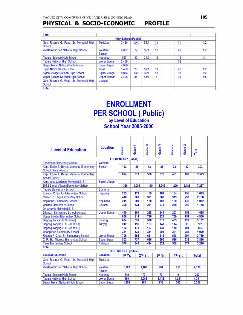
TAGUIG CITY COMPREHENSIVE LAND USE & ZONING PLAN 105
PHYSICAL & SOCIO-ECONOMIC PROFILE
Total
High School (Public)
Gen. Ricardo G. Papa, Sr. Memorial High School
Tuktukan 3,486 123 56:1 31 62 1:2
Western Bicutan National High School Western Bicutan
4,002 72 56:1 19 48 1:2
Taguig Science High School Hagonoy 537 30 34:1 12 16 1:1
Taguig National High School Lower Bicutan 2,469 52
Bagumbayan National High School Bagumbayan 4,086
Tipas National High School Tipas 1,480 29 51:1 11 22 1:2
Signal Village National High School Signal Village 8,874 135 66:1 53 98 1:2
Upper Bicutan National High School Upper Bicutan 2,408 34 43:1 5 33 5:5
Gen. Ricardo G. Papa, Sr. Memorial High School
Ususan
Total
ENROLLMENT
PER SCHOOL ( Public) by Level of Education
School Year 2005-2006
Level of Education
Location
Gra
de
I
Gra
de
II
Gra
de
III
Gra
de
IV
Gra
de
V
Gra
de
VI
To
tal
ELEMENTARY (Public)
Tenement Elementary School Western Bicutan
Kapt. Eddie T. Reyes Memorial Elementary School (Palar Annex)
143 46 43 26 23 22 303
Kapt. Eddie T. Reyes Memorial Elementary School (Main)
824 613 560 576 461 489 3,523
Kapt. Jose Cardones Memorial E. S. Signal Village
EM'S Signal Village Elementary School 1,358 1,081 1,159 1,242 1,209 1,188 7,237
Taguig Elementary School Sta. Ana
Eusebio C. Santos Elementary School Hagonoy 233 178 159 163 154 158 1,045
Ciriaco P. Tiñga Elementary School 418 381 391 360 319 297 2,166
Napindan Elementary School Napindan 219 200 168 187 160 138 1,072
Ususan Elementary School Ususan 320 334 291 278 278 290 1,788
Dr. Artemio Natividad E. S.
Silangan Elementary School (Annex) Upper Bicutan 440 301 298 241 203 152 1,635
Upper Bicutan Elementary School 956 814 786 824 769 751 4,900
Bagong Tanyag E. S. (Main) Bagong Tanyag
604 551 538 517 463 429 3,102
Bagong Tanyag E. S. (Annex A) 242 196 167 149 114 83 951
Bagong Tanyag E. S. (Annex B) 154 178 127 130 110 104 803
Daang Hari Elementary School 381 335 311 298 291 284 1,900
Ricardo P. Cruz, Sr. Elementary School Lower Bicutan 706 654 621 616 598 594 3,789
C. P. Sta. Theresa Elementary School Bagumbayan 803 737 636 590 536 533 3,836
Tipas Elementary School Palingon 570 545 494 522 508 577 3,216
Total
HIGH SCHOOL (Public)
Level of Education Location 1st Yr. 2nd Yr. 3rd Yr. 4th Yr. Total Gen. Ricardo G. Papa, Sr. Memorial High School
Tuktukan
Western Bicutan National High School Western Bicutan
1,102 1,163 964 910 4,139
Taguig Science High School Hagonoy 149 70 73 0 292
Taguig National High School Lower Bicutan 850 1,082 1,118 1,251 4,301
Bagumbayan National High School Bagumbayan 1,308 985 738 206 3,237
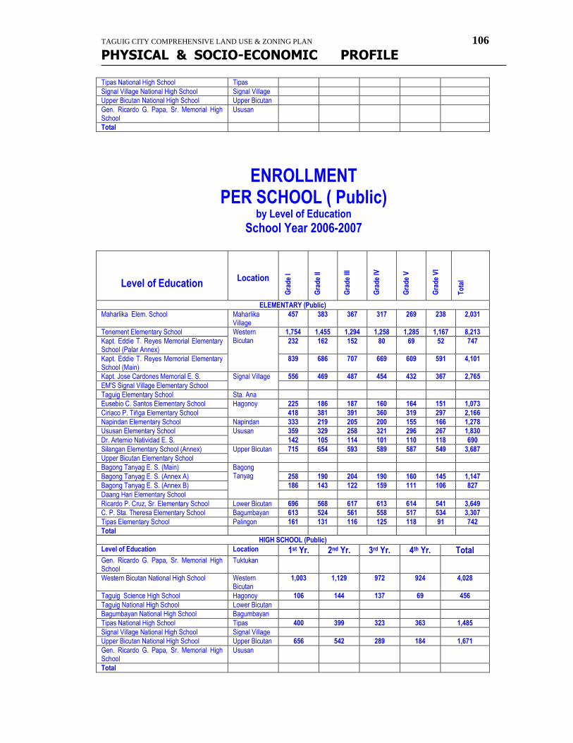
TAGUIG CITY COMPREHENSIVE LAND USE & ZONING PLAN 106
PHYSICAL & SOCIO-ECONOMIC PROFILE
Tipas National High School Tipas
Signal Village National High School Signal Village
Upper Bicutan National High School Upper Bicutan
Gen. Ricardo G. Papa, Sr. Memorial High School
Ususan
Total
ENROLLMENT
PER SCHOOL ( Public) by Level of Education
School Year 2006-2007
Level of Education
Location G
rad
e I
Gra
de
II
Gra
de
III
Gra
de
IV
Gra
de
V
Gra
de
VI
To
tal
ELEMENTARY (Public)
Maharlika Elem. School Maharlika Village
457 383 367 317 269 238 2,031
Tenement Elementary School Western Bicutan
1,754 1,455 1,294 1,258 1,285 1,167 8,213
Kapt. Eddie T. Reyes Memorial Elementary School (Palar Annex)
232 162 152 80 69 52 747
Kapt. Eddie T. Reyes Memorial Elementary School (Main)
839 686 707 669 609 591 4,101
Kapt. Jose Cardones Memorial E. S. Signal Village 556 469 487 454 432 367 2,765
EM'S Signal Village Elementary School
Taguig Elementary School Sta. Ana
Eusebio C. Santos Elementary School Hagonoy 225 186 187 160 164 151 1,073
Ciriaco P. Tiñga Elementary School 418 381 391 360 319 297 2,166
Napindan Elementary School Napindan 333 219 205 200 155 166 1,278
Ususan Elementary School Ususan 359 329 258 321 296 267 1,830
Dr. Artemio Natividad E. S. 142 105 114 101 110 118 690
Silangan Elementary School (Annex) Upper Bicutan 715 654 593 589 587 549 3,687
Upper Bicutan Elementary School
Bagong Tanyag E. S. (Main) Bagong Tanyag
Bagong Tanyag E. S. (Annex A) 258 190 204 190 160 145 1,147
Bagong Tanyag E. S. (Annex B) 186 143 122 159 111 106 827
Daang Hari Elementary School
Ricardo P. Cruz, Sr. Elementary School Lower Bicutan 696 568 617 613 614 541 3,649
C. P. Sta. Theresa Elementary School Bagumbayan 613 524 561 558 517 534 3,307
Tipas Elementary School Palingon 161 131 116 125 118 91 742
Total
HIGH SCHOOL (Public)
Level of Education Location 1st Yr. 2nd Yr. 3rd Yr. 4th Yr. Total Gen. Ricardo G. Papa, Sr. Memorial High School
Tuktukan
Western Bicutan National High School Western Bicutan
1,003 1,129 972 924 4,028
Taguig Science High School Hagonoy 106 144 137 69 456
Taguig National High School Lower Bicutan
Bagumbayan National High School Bagumbayan
Tipas National High School Tipas 400 399 323 363 1,485
Signal Village National High School Signal Village
Upper Bicutan National High School Upper Bicutan 656 542 289 184 1,671
Gen. Ricardo G. Papa, Sr. Memorial High School
Ususan
Total
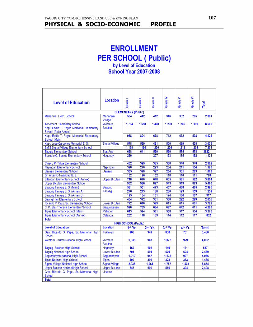
TAGUIG CITY COMPREHENSIVE LAND USE & ZONING PLAN 107
PHYSICAL & SOCIO-ECONOMIC PROFILE
ENROLLMENT
PER SCHOOL ( Public) by Level of Education
School Year 2007-2008
Level of Education
Location
Gra
de
I
Gra
de
II
Gra
de
III
Gra
de
IV
Gra
de
V
Gra
de
VI
To
tal
ELEMENTARY (Public)
Maharlika Elem. School Maharlika Village
584 442 412 346 332 265 2,381
Tenement Elementary School Western Bicutan
1,784 1,558 1,408 1,290 1,266 1,199 8,505
Kapt. Eddie T. Reyes Memorial Elementary School (Palar Annex)
Kapt. Eddie T. Reyes Memorial Elementary School (Main)
958 804 678 712 672 598 4,424
Kapt. Jose Cardones Memorial E. S. Signal Village 578 559 491 500 469 438 3,035
EM'S Signal Village Elementary School 1,168 1,164 1,230 1,226 1,212 1,201 7,201
Taguig Elementary School Sta. Ana 668 641 550 590 575 578 3622
Eusebio C. Santos Elementary School Hagonoy 220 207 193 175 152 1,121
Ciriaco P. Tiñga Elementary School 462 399 385 368 340 348 2,302
Napindan Elementary School Napindan 328 270 223 204 211 154 1,390
Ususan Elementary School Ususan 365 328 327 254 331 283 1,888
Dr. Artemio Natividad E. S. 162 126 102 118 110 111 728
Silangan Elementary School (Annex) Upper Bicutan 718 670 648 605 581 582 3,804
Upper Bicutan Elementary School 962 986 827 943 919 823 5,460
Bagong Tanyag E. S. (Main) Bagong Tanyag
581 551 473 457 468 465 2,995
Bagong Tanyag E. S. (Annex A) 276 243 188 200 193 159 1,259
Bagong Tanyag E. S. (Annex B) 195 164 161 124 166 107 917
Daang Hari Elementary School 454 372 331 308 292 299 2,055
Ricardo P. Cruz, Sr. Elementary School Lower Bicutan 722 640 599 615 615 601 3,792
C. P. Sta. Theresa Elementary School Bagumbayan 920 739 684 697 642 611 4,293
Tipas Elementary School (Main) Palingon 613 524 561 558 517 534 3,276
Tipas Elementary School (Annex) Calzada 202 148 139 114 112 117 832
Total
HIGH SCHOOL (Public)
Level of Education Location 1st Yr. 2nd Yr. 3rd Yr. 4th Yr. Total Gen. Ricardo G. Papa, Sr. Memorial High School
Tuktukan 968 949 838 731 3,486
Western Bicutan National High School Western Bicutan
1,038 963 1,072 929 4,002
Taguig Science High School Hagonoy 162 102 140 131 537
Taguig National High School Lower Bicutan 704 591 570 604 2,469
Bagumbayan National High School Bagumbayan 1,010 947 1,132 997 4,086
Tipas National High School Tipas 400 399 323 363 1,485
Signal Village National High School Signal Village 2,036 1,964 1,757 1,478 8,874
Upper Bicutan National High School Upper Bicutan 848 690 566 304 2,408
Gen. Ricardo G. Papa, Sr. Memorial High School
Ususan
Total

TAGUIG CITY COMPREHENSIVE LAND USE & ZONING PLAN 108
PHYSICAL & SOCIO-ECONOMIC PROFILE
TOTAL NUMBER OF TEACHERS Per School by Levels (Public)
School Year 2005-2006
School
Location
Gra
de
I
Gra
de
II
Gra
de
III
Gra
de
IV
Gra
de
V
Gra
de
VI
To
tal
ELEMENTARY (Public)
Tenement Elementary School Western Bicutan
Kapt. Eddie T. Reyes Memorial Elementary School (Palar Annex)
3 2 2 2 3 3 15
Kapt. Eddie T. Reyes Memorial Elementary School (Main)
8 9 7 8 6 6 44
Kapt. Jose Cardones Memorial E. S. Signal Village
EM'S Signal Village Elementary School 22 21 21 21 32 32 149
Taguig Elementary School Sta. Ana
Eusebio C. Santos Elementary School Hagonoy 3 3 3 3 5 5 22
Ciriaco P. Tiñga Elementary School 8 7 7 6 9 8 45
Napindan Elementary School Napindan 5 4 4 4 4 4 25
Ususan Elementary School Ususan 7 7 6 6 9 9 43
Dr. Artemio Natividad E. S.
Silangan Elementary School (Annex) Upper Bicutan 5 5 2 3 3 2 18
Upper Bicutan Elementary School 17 18 14 20 25 22 116
Bagong Tanyag E. S. (Main) Bagong Tanyag
13 12 10 10 13 14 71
Bagong Tanyag E. S. (Annex A) 4 3 3 3 2 3 18
Bagong Tanyag E. S. (Annex B) 3 3 2 2 3 3 17
Daang Hari Elementary School 7 6 6 6 9 8 42
Ricardo P. Cruz, Sr. Elementary School Lower Bicutan 13 12 11 11 15 16 78
C. P. Sta. Theresa Elementary School Bagumbayan 14 12 11 9 17 15 78
Tipas Elementary School Palingon 11 9 9 9 15 15 68
Total
HIGH SCHOOL (Public)
Level of Education Location 1st Yr. 2nd Yr. 3rd Yr. 4th Yr. Total Gen. Ricardo G. Papa, Sr. Memorial High School
Tuktukan
Western Bicutan National High School Western Bicutan
20 21 21 16 78
Taguig Science High School Hagonoy 9 5 4 0 18
Taguig National High School Lower Bicutan 33 29 35 35 132
Bagumbayan National High School Bagumbayan 24 18 14 6 62
Tipas National High School Tipas
Signal Village National High School Signal Village
Upper Bicutan National High School Upper Bicutan
Gen. Ricardo G. Papa, Sr. Memorial High School
Ususan
Total
TOTAL NUMBER OF TEACHERS
Per School by Levels (Public) School Year 2006-2007
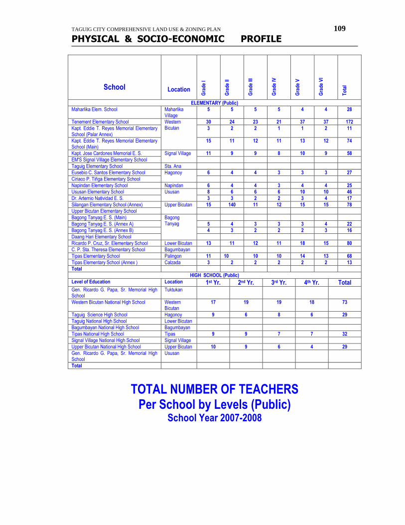
TAGUIG CITY COMPREHENSIVE LAND USE & ZONING PLAN 109
PHYSICAL & SOCIO-ECONOMIC PROFILE
School
Location
Gra
de
I
Gra
de
II
Gra
de
III
Gra
de
IV
Gra
de
V
Gra
de
VI
To
tal
ELEMENTARY (Public)
Maharlika Elem. School Maharlika Village
5 5 5 5 4 4 28
Tenement Elementary School Western Bicutan
30 24 23 21 37 37 172
Kapt. Eddie T. Reyes Memorial Elementary School (Palar Annex)
3 2 2 1 1 2 11
Kapt. Eddie T. Reyes Memorial Elementary School (Main)
15 11 12 11 13 12 74
Kapt. Jose Cardones Memorial E. S. Signal Village 11 9 9 8 10 9 58
EM'S Signal Village Elementary School
Taguig Elementary School Sta. Ana
Eusebio C. Santos Elementary School Hagonoy 6 4 4 3 3 3 27
Ciriaco P. Tiñga Elementary School
Napindan Elementary School Napindan 6 4 4 3 4 4 25
Ususan Elementary School Ususan 8 6 6 6 10 10 46
Dr. Artemio Natividad E. S. 3 3 2 2 3 4 17
Silangan Elementary School (Annex) Upper Bicutan 15 140 11 12 15 15 78
Upper Bicutan Elementary School
Bagong Tanyag E. S. (Main) Bagong Tanyag
Bagong Tanyag E. S. (Annex A) 5 4 3 3 3 4 22
Bagong Tanyag E. S. (Annex B) 4 3 2 2 2 3 16
Daang Hari Elementary School
Ricardo P. Cruz, Sr. Elementary School Lower Bicutan 13 11 12 11 18 15 80
C. P. Sta. Theresa Elementary School Bagumbayan
Tipas Elementary School Palingon 11 10 10 10 14 13 68
Tipas Elementary School (Annex ) Calzada 3 2 2 2 2 2 13
Total
HIGH SCHOOL (Public)
Level of Education Location 1st Yr. 2nd Yr. 3rd Yr. 4th Yr. Total Gen. Ricardo G. Papa, Sr. Memorial High School
Tuktukan
Western Bicutan National High School Western Bicutan
17 19 19 18 73
Taguig Science High School Hagonoy 9 6 8 6 29
Taguig National High School Lower Bicutan
Bagumbayan National High School Bagumbayan
Tipas National High School Tipas 9 9 7 7 32
Signal Village National High School Signal Village
Upper Bicutan National High School Upper Bicutan 10 9 6 4 29
Gen. Ricardo G. Papa, Sr. Memorial High School
Ususan
Total
TOTAL NUMBER OF TEACHERS Per School by Levels (Public)
School Year 2007-2008
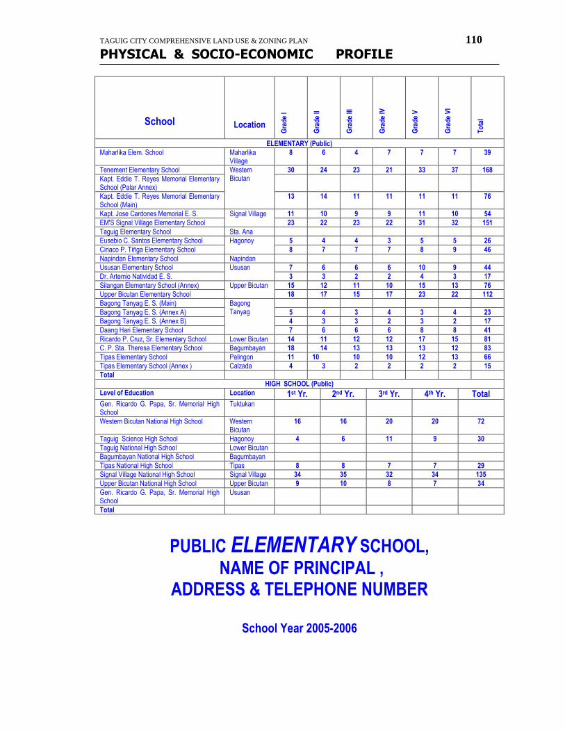
TAGUIG CITY COMPREHENSIVE LAND USE & ZONING PLAN 110
PHYSICAL & SOCIO-ECONOMIC PROFILE
School
Location
Gra
de
I
Gra
de
II
Gra
de
III
Gra
de
IV
Gra
de
V
Gra
de
VI
To
tal
ELEMENTARY (Public)
Maharlika Elem. School Maharlika Village
8 6 4 7 7 7 39
Tenement Elementary School Western Bicutan
30 24 23 21 33 37 168
Kapt. Eddie T. Reyes Memorial Elementary School (Palar Annex)
Kapt. Eddie T. Reyes Memorial Elementary School (Main)
13 14 11 11 11 11 76
Kapt. Jose Cardones Memorial E. S. Signal Village 11 10 9 9 11 10 54
EM'S Signal Village Elementary School 23 22 23 22 31 32 151
Taguig Elementary School Sta. Ana
Eusebio C. Santos Elementary School Hagonoy 5 4 4 3 5 5 26
Ciriaco P. Tiñga Elementary School 8 7 7 7 8 9 46
Napindan Elementary School Napindan
Ususan Elementary School Ususan 7 6 6 6 10 9 44
Dr. Artemio Natividad E. S. 3 3 2 2 4 3 17
Silangan Elementary School (Annex) Upper Bicutan 15 12 11 10 15 13 76
Upper Bicutan Elementary School 18 17 15 17 23 22 112
Bagong Tanyag E. S. (Main) Bagong Tanyag
Bagong Tanyag E. S. (Annex A) 5 4 3 4 3 4 23
Bagong Tanyag E. S. (Annex B) 4 3 3 2 3 2 17
Daang Hari Elementary School 7 6 6 6 8 8 41
Ricardo P. Cruz, Sr. Elementary School Lower Bicutan 14 11 12 12 17 15 81
C. P. Sta. Theresa Elementary School Bagumbayan 18 14 13 13 13 12 83
Tipas Elementary School Palingon 11 10 10 10 12 13 66
Tipas Elementary School (Annex ) Calzada 4 3 2 2 2 2 15
Total
HIGH SCHOOL (Public)
Level of Education Location 1st Yr. 2nd Yr. 3rd Yr. 4th Yr. Total Gen. Ricardo G. Papa, Sr. Memorial High School
Tuktukan
Western Bicutan National High School Western Bicutan
16 16 20 20 72
Taguig Science High School Hagonoy 4 6 11 9 30
Taguig National High School Lower Bicutan
Bagumbayan National High School Bagumbayan
Tipas National High School Tipas 8 8 7 7 29
Signal Village National High School Signal Village 34 35 32 34 135
Upper Bicutan National High School Upper Bicutan 9 10 8 7 34
Gen. Ricardo G. Papa, Sr. Memorial High School
Ususan
Total
PUBLIC ELEMENTARY SCHOOL,
NAME OF PRINCIPAL , ADDRESS & TELEPHONE NUMBER
School Year 2005-2006

TAGUIG CITY COMPREHENSIVE LAND USE & ZONING PLAN 111
PHYSICAL & SOCIO-ECONOMIC PROFILE
SCHOOL ADDRESS PHONE NUMBER
NAME OF PRINCIPAL
Tenement Elementary School
Kapt. Eddie T. Reyes Memorial Elementary School (Palar Annex)
Kapt. Eddie T. Reyes Memorial Elementary School (Main)
Kapt. Jose Cardones Memorial E. S.
EM'S Signal Village Elementary School
Taguig Elementary School
Eusebio C. Santos Elementary School
Ciriaco P. Tiñga Elementary School
Napindan Elementary School
Ususan Elementary School
Dr. Artemio Natividad E. S.
Silangan Elementary School (Annex)
Upper Bicutan Elementary School
Bagong Tanyag E. S. (Main)
Bagong Tanyag E. S. (Annex A)
Bagong Tanyag E. S. (Annex B)
Daang Hari Elementary School
Ricardo P. Cruz, Sr. Elementary School
C. P. Sta. Theresa Elementary School
Tipas Elementary School
PUBLIC HIGH SCHOOL,
NAME OF PRINCIPAL , ADDRESS & TELEPHONE NUMBER
School Year 2005-2006
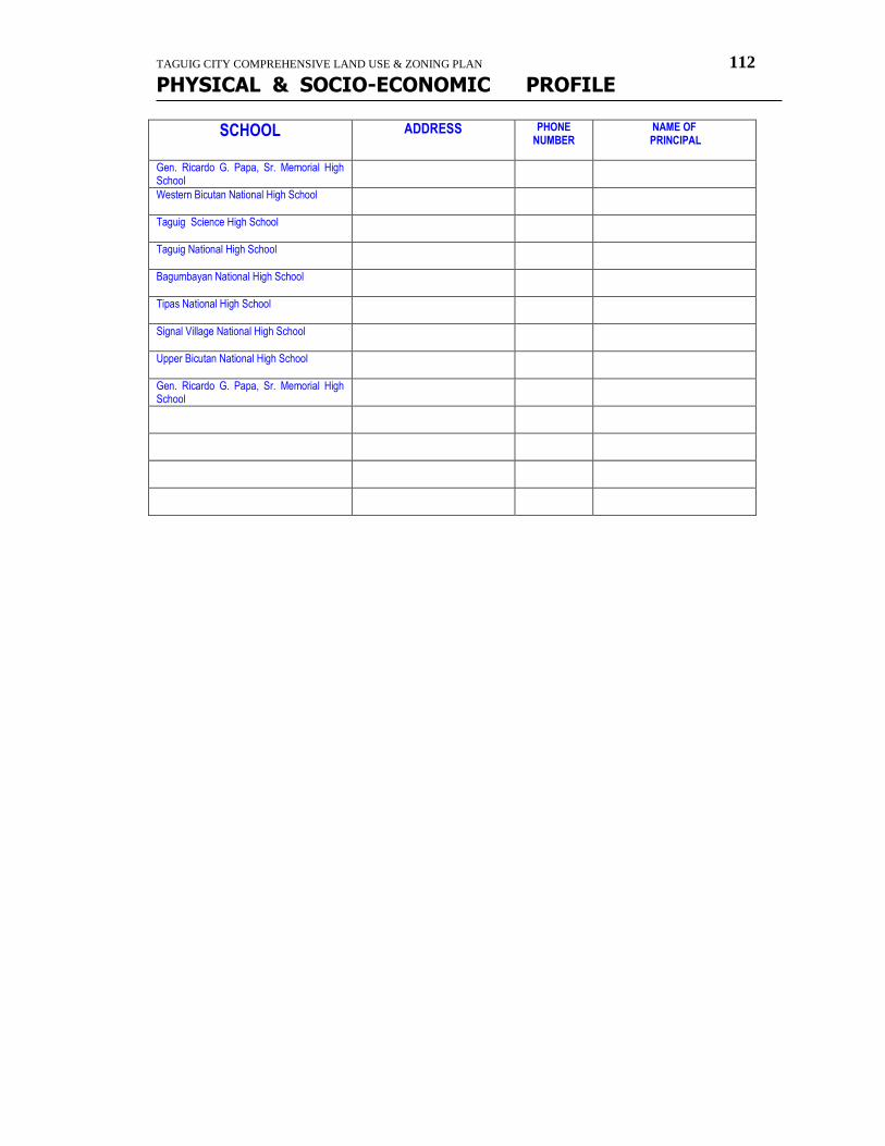
TAGUIG CITY COMPREHENSIVE LAND USE & ZONING PLAN 112
PHYSICAL & SOCIO-ECONOMIC PROFILE
SCHOOL ADDRESS PHONE NUMBER
NAME OF PRINCIPAL
Gen. Ricardo G. Papa, Sr. Memorial High School
Western Bicutan National High School
Taguig Science High School
Taguig National High School
Bagumbayan National High School
Tipas National High School
Signal Village National High School
Upper Bicutan National High School
Gen. Ricardo G. Papa, Sr. Memorial High School

TAGUIG CITY COMPREHENSIVE LAND USE & ZONING PLAN 113
PHYSICAL & SOCIO-ECONOMIC PROFILE
health
HOSPITAL / CLINIC / HEALTH CENTER HOSPITAL/CLINIC/HEALTH CENTER LOCATION Cruz-Rabe Maternity & Gen. Hospital Tuktukan Herrera-Luz Mother & Child Clinic Tuktukan Lying-in Clinic & Rehydration Center Tuktukan Bagong Lipunan Health Center Tuktukan Family Planning Clinic Tuktukan Brgy. Tuktukan Health Center Tuktukan Taguig-Pateros District Hospital Western Bicutan Doctor's Polyclinic Maternity Lying In Western Bicutan Gallo Medical Clinic Western Bicutan Sitio 3 Health Center Western Bicutan East Service Road Health Center Western Bicutan De Jesus Dental/Medical Clinic Wawa Brgy. Wawa Health Center Wawa Brgy. Bambang Health Center Bambang Bambang Clinic Bambang Clinica Palma Bambang Clinica Palma Upper Bicutan Lifeline Clinic Palingon Tipas Doctors Specialist & Lying-in Tipas
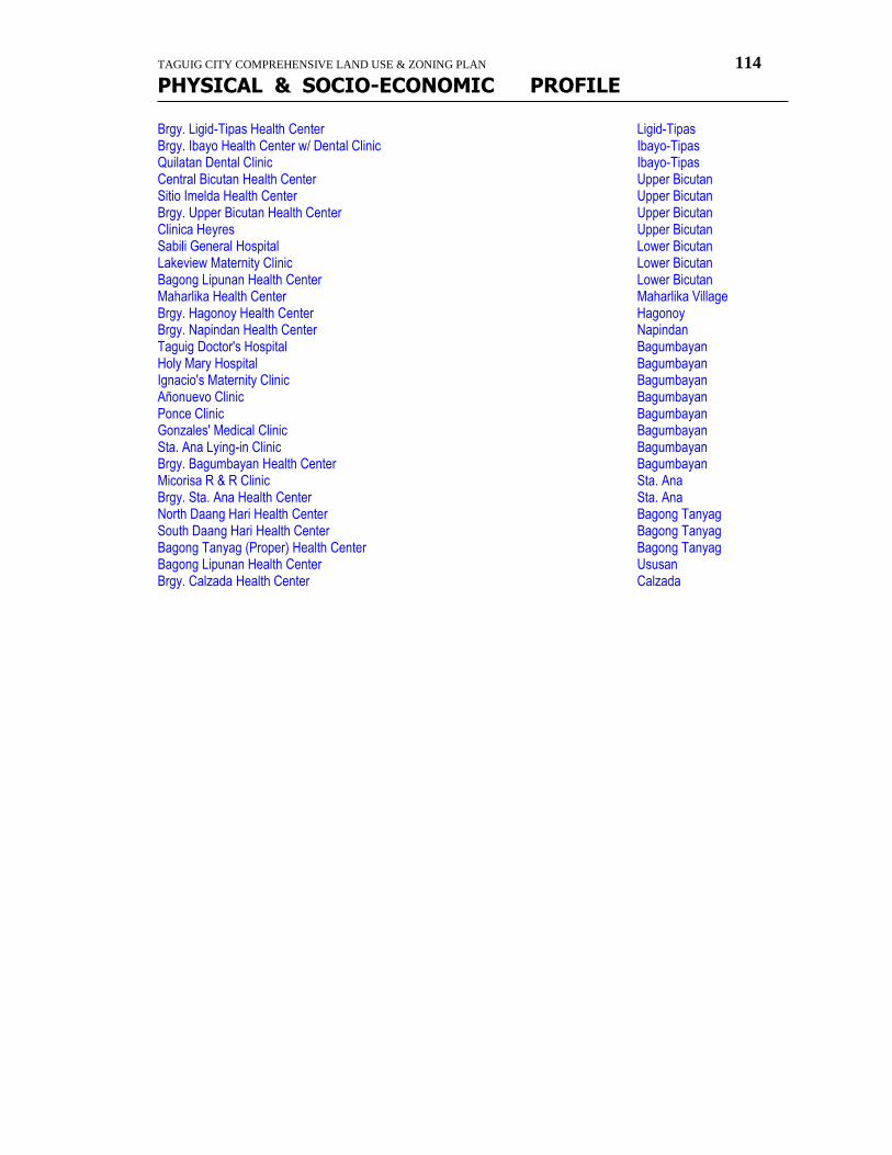
TAGUIG CITY COMPREHENSIVE LAND USE & ZONING PLAN 114
PHYSICAL & SOCIO-ECONOMIC PROFILE
Brgy. Ligid-Tipas Health Center Ligid-Tipas Brgy. Ibayo Health Center w/ Dental Clinic Ibayo-Tipas Quilatan Dental Clinic Ibayo-Tipas Central Bicutan Health Center Upper Bicutan Sitio Imelda Health Center Upper Bicutan Brgy. Upper Bicutan Health Center Upper Bicutan Clinica Heyres Upper Bicutan Sabili General Hospital Lower Bicutan Lakeview Maternity Clinic Lower Bicutan Bagong Lipunan Health Center Lower Bicutan Maharlika Health Center Maharlika Village Brgy. Hagonoy Health Center Hagonoy Brgy. Napindan Health Center Napindan Taguig Doctor's Hospital Bagumbayan Holy Mary Hospital Bagumbayan Ignacio's Maternity Clinic Bagumbayan Añonuevo Clinic Bagumbayan Ponce Clinic Bagumbayan Gonzales' Medical Clinic Bagumbayan Sta. Ana Lying-in Clinic Bagumbayan Brgy. Bagumbayan Health Center Bagumbayan Micorisa R & R Clinic Sta. Ana Brgy. Sta. Ana Health Center Sta. Ana North Daang Hari Health Center Bagong Tanyag South Daang Hari Health Center Bagong Tanyag Bagong Tanyag (Proper) Health Center Bagong Tanyag Bagong Lipunan Health Center Ususan Brgy. Calzada Health Center Calzada
TAGUIG CITY COMPREHENSIVE LAND USE & ZONING PLAN 115
PHYSICAL & SOCIO-ECONOMIC PROFILE
Other
listings
List of Existing Non-Government Organization (NGO)
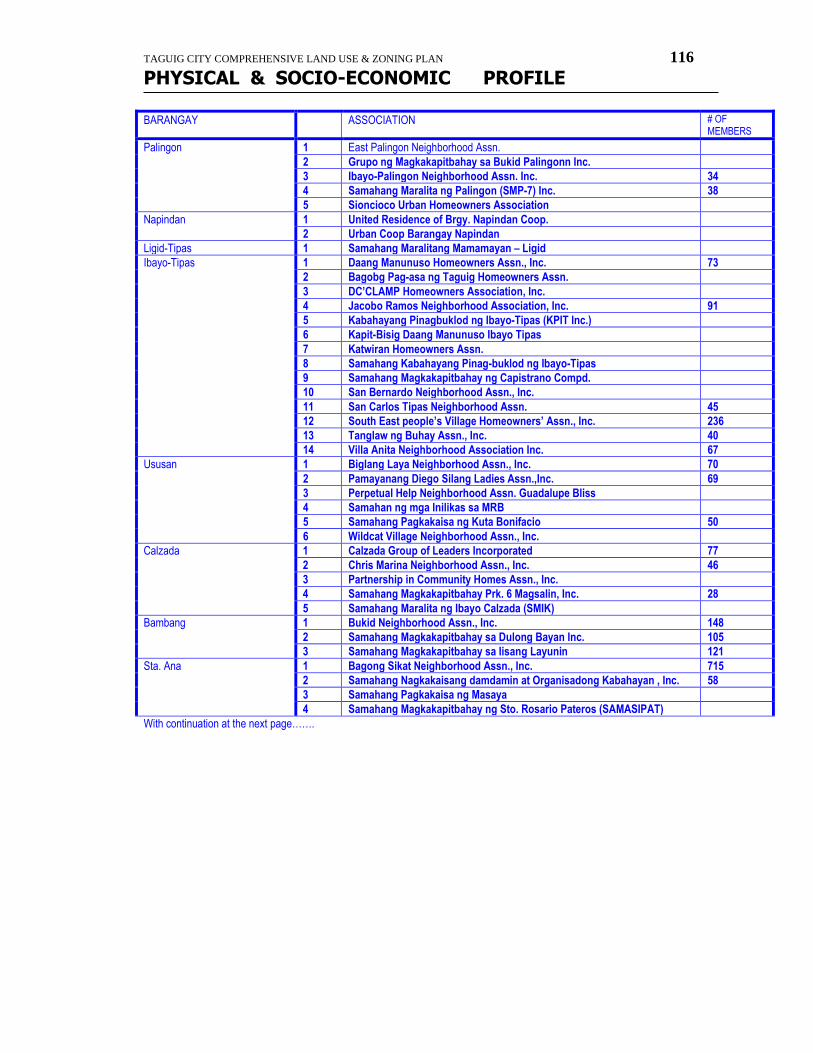
TAGUIG CITY COMPREHENSIVE LAND USE & ZONING PLAN 116
PHYSICAL & SOCIO-ECONOMIC PROFILE
BARANGAY ASSOCIATION # OF MEMBERS
Palingon 1 East Palingon Neighborhood Assn.
2 Grupo ng Magkakapitbahay sa Bukid Palingonn Inc.
3 Ibayo-Palingon Neighborhood Assn. Inc. 34
4 Samahang Maralita ng Palingon (SMP-7) Inc. 38
5 Sioncioco Urban Homeowners Association
Napindan 1 United Residence of Brgy. Napindan Coop.
2 Urban Coop Barangay Napindan
Ligid-Tipas 1 Samahang Maralitang Mamamayan – Ligid
Ibayo-Tipas 1 Daang Manunuso Homeowners Assn., Inc. 73
2 Bagobg Pag-asa ng Taguig Homeowners Assn.
3 DC’CLAMP Homeowners Association, Inc.
4 Jacobo Ramos Neighborhood Association, Inc. 91
5 Kabahayang Pinagbuklod ng Ibayo-Tipas (KPIT Inc.)
6 Kapit-Bisig Daang Manunuso Ibayo Tipas
7 Katwiran Homeowners Assn.
8 Samahang Kabahayang Pinag-buklod ng Ibayo-Tipas
9 Samahang Magkakapitbahay ng Capistrano Compd.
10 San Bernardo Neighborhood Assn., Inc.
11 San Carlos Tipas Neighborhood Assn. 45
12 South East people’s Village Homeowners’ Assn., Inc. 236
13 Tanglaw ng Buhay Assn., Inc. 40
14 Villa Anita Neighborhood Association Inc. 67
Ususan 1 Biglang Laya Neighborhood Assn., Inc. 70
2 Pamayanang Diego Silang Ladies Assn.,Inc. 69
3 Perpetual Help Neighborhood Assn. Guadalupe Bliss
4 Samahan ng mga Inilikas sa MRB
5 Samahang Pagkakaisa ng Kuta Bonifacio 50
6 Wildcat Village Neighborhood Assn., Inc.
Calzada 1 Calzada Group of Leaders Incorporated 77
2 Chris Marina Neighborhood Assn., Inc. 46
3 Partnership in Community Homes Assn., Inc.
4 Samahang Magkakapitbahay Prk. 6 Magsalin, Inc. 28
5 Samahang Maralita ng Ibayo Calzada (SMIK)
Bambang 1 Bukid Neighborhood Assn., Inc. 148
2 Samahang Magkakapitbahay sa Dulong Bayan Inc. 105
3 Samahang Magkakapitbahay sa Iisang Layunin 121
Sta. Ana 1 Bagong Sikat Neighborhood Assn., Inc. 715
2 Samahang Nagkakaisang damdamin at Organisadong Kabahayan , Inc. 58
3 Samahang Pagkakaisa ng Masaya
4 Samahang Magkakapitbahay ng Sto. Rosario Pateros (SAMASIPAT)
With continuation at the next page…….
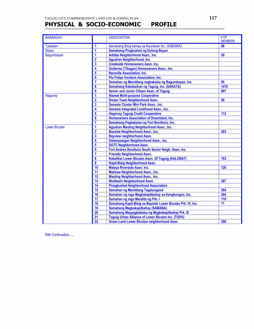
TAGUIG CITY COMPREHENSIVE LAND USE & ZONING PLAN 117
PHYSICAL & SOCIO-ECONOMIC PROFILE
BARANGAY ASSOCIATION # OF MEMBERS
Tuktukan 1 Samahang Bisig kamay sa Kaunlaran Inc. (SABISKA) 88
Wawa 1 Samahang Pingbuklod ng Dulong Bayan
Bagumbayan 1 Adidas Neighborhood Assn., Inc. 30
2 Aguahan Neighborhood, Inc.
3 Creekside Homeowners Assn. Inc.
4 Gutierrez (Tibagan) Homeowners Assn., Inc.
5 Naraville Association, Inc.
6 Pio Felipe Vendors Association, Inc.
7 Samahan ng Maralitang nagkakaisa ng Bagumbayan, Inc. 95
8 Samahang Kababaihan ng Taguig, Inc. (SAKATA) 1476
9 Senior and Junior Citizen Assn. of Taguig 891
Hagunoy 1 Alamat Multi-purpose Cooperative
2 Dream Team Neighborhood Assn. 50
3 Genesis Cluster Mini Park Assn., Inc.
4 Genesis Integrated Livelihood Assn., Inc.
5 Hagonoy Taguig Credit Cooperative 112
6 Homeowners Association of Dreamland, Inc.
7 Samahang Pagkakaisa ng Fort Bonifacio, Inc.
Lower Bicutan 1 Aguahan Mauling Neighborhood Assn., Inc.
2 Bayside Neighborhood Assn., Inc. 283
3 Bayview neighborhood Assn.
4 Dalampasigan Neighborhood Assn., Inc.
5 DOTC Neighborhood Assn.
6 Fort Andres Bonifacio South Sector Neigh. Assn. Inc
7 Friendly Neighborhood Assn.
8 Kabalikat Lower Bicutan Assn. Of Taguig (KALOBAT) 193
9 Kapit-Bisig Neighborhood Assn.
10 Malaya Riverside Assn. Inc. 120
11 Malinaw Neighborhood Assn., Inc.
12 Mauling Neighborhood Assn., Inc.
13 Mudlawin Neighborhood Assn. 307
14 Pinagbuklod Neighborhood Association
15 Samahan ng Maralitang Tagalungsod 264
16 Samahan ng mga Magkakapitbahay sa Kangkungan, Inc. 264
17 Samahan ng mga Maralita ng Prk. I 110
18 Samahang Kapit-Bisig sa Bayside Lower Bicutan Prk. IV, Inc. 71
19 Samahang Magkakapitbahay (SAMABA)
20 Samahang Maypagkakaisa ng Magkakapitbahay Prk. III
21 Taguig Urban Alliance of Lower Bicutan Inc. (TUPA)
22 Green Land Lower Bicutan neighborhood Assn. 300
With Continuation…..
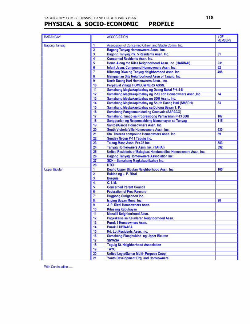
TAGUIG CITY COMPREHENSIVE LAND USE & ZONING PLAN 118
PHYSICAL & SOCIO-ECONOMIC PROFILE
BARANGAY ASSOCIATION # OF MEMBERS
Bagong Tanyag 1 Association of Concerned Citizen and Stable Comm. Inc.
2 Bagong Tanyag Homeowners Assn., Inc.
3 Bagong Tanyag Prk. 5 Residents Assn. Inc. 81
4 Concerned Residents Assn. Inc.
5 Home Along the Riles Neighborhood Assn. Inc. (HARINAI) 231
6 Infant Jesus Compound Homeowners Assn. Inc. 62
7 Kilusang Diwa ng Tanyag Neighborhood Assn. Inc. 408
8 Manggahan Site Neighborhood Assn of Taguig, Inc.
9 North Daang Hari Homeowners Assn., Inc.
10 Perpetual Village HOMEOWNERS ASSN.
11 Samahang Magkakapitbahay ng Daang Bakal Prk 4-8
12 Samahang Magkakapitbahay ng P-10 sdh Homeowners Assn.,Inc 74
13 Samahang Magkakapitbahay ng SDH Assn., Inc.
14 Samahang Magkakapitbahay ng South Daang Hari (SMSDH) 83
15 Samahang Magkakapitbahay sa Dulong Bayan T. P.
16 Samahang Pangkomunidad ng Cocovale (SAPACO)
17 Samahang Tungo sa Progresibong Pamayanan P-13 SDH 187
18 Sanggunian ng Responsableng Mamamayan sa Tanyag 115
19 Santos/Garcia Homeowners Assn. Inc.
20 South Victoria Ville Homeowners Assn. Inc. 530
21 Sta. Theresa compound Homeowners Assn. Inc. 59
22 Sunday Group P-11 Taguig Inc.
23 Talang-Masa Assn. Prk.33 Inc. 383
24 Tanyag Homeowners Assn. Inc. (TAHAI) 392
25 United Residents of Balagbas Handonedline Homeowners Assn. Inc.
26 Bagong Tanyag Homeowners Association Inc.
27 SDH – Samahang Magkakapitbahay Inc.
28 DTCI
Upper Bicutan 1 Deaño Upper Bicutan Neighborhood Assn. Inc. 105
2 Buklod ng J. P. Rizal
3 Burguis
4 C. I. M.
5 Concerned Parent Council
6 Federation of Free Farmers
7 Hugpong Surigaonon Inc.
8 Isiping Bayan Muna, Inc. 90
9 J. P. Rizal Homeowners Assn.
10 Kilusang Kabuhayan
11 Manalili Neighborhood Assn.
12 Pagkakaisa sa Kaunlaran Neighborhood Assn.
13 Purok 1 Homeowners Assn.
14 Purok 2 UBWASA
15 Rd. Lot Residents Assn. Inc.
16 Samahang Pinagbuklod ng Upper Bicutan
17 SIWASA
18 Taguig St. Neighborhood Association
19 TAYO
20 United Leyte/Samar Multi- Purpose Coop.
21 Youth Development Org. and Homeowners
With Continuation…..
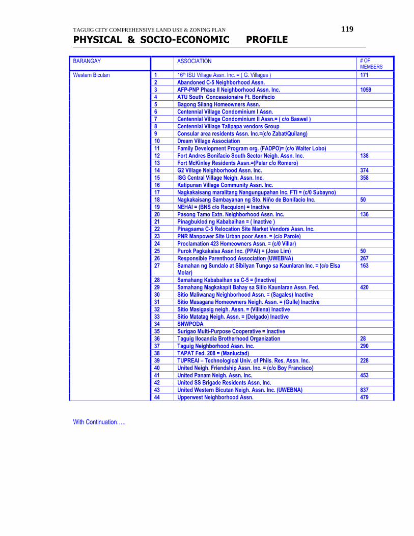
TAGUIG CITY COMPREHENSIVE LAND USE & ZONING PLAN 119
PHYSICAL & SOCIO-ECONOMIC PROFILE
BARANGAY ASSOCIATION # OF MEMBERS
Western Bicutan 1 16th ISU Village Assn. Inc. = ( G. Villages ) 171
2 Abandoned C-5 Neighborhood Assn.
3 AFP-PNP Phase II Neighborhood Assn. Inc. 1059
4 ATU South Concessionaire Ft. Bonifacio
5 Bagong Silang Homeowners Assn.
6 Centennial Village Condominium I Assn.
7 Centennial Village Condominium II Assn.= ( c/o Baswel )
8 Centennial Village Talipapa vendors Group
9 Consular area residents Assn. Inc.=(c/o Zabat/Quilang)
10 Dream Village Association
11 Family Development Program org. (FADPO)= (c/o Walter Lobo)
12 Fort Andres Bonifacio South Sector Neigh. Assn. Inc. 138
13 Fort McKinley Residents Assn.=(Palar c/o Romero)
14 G2 Village Neighborhood Assn. Inc. 374
15 ISG Central Village Neigh. Assn. Inc. 358
16 Katipunan Village Community Assn. Inc.
17 Nagkakaisang maralitang Nangungupahan Inc. FTI = (c/0 Subayno)
18 Nagkakaisang Sambayanan ng Sto. Niño de Bonifacio Inc. 50
19 NEHAI = (BNS c/o Racquion) = Inactive
20 Pasong Tamo Extn. Neighborhood Assn. Inc. 136
21 Pinagbuklod ng Kababaihan = ( Inactive )
22 Pinagsama C-5 Relocation Site Market Vendors Assn. Inc.
23 PNR Manpower Site Urban poor Assn. = (c/o Parole)
24 Proclamation 423 Homeowners Assn. = (c/0 Villar)
25 Purok Pagkakaisa Assn Inc. (PPAI) = (Jose Lim) 50
26 Responsible Parenthood Association (UWEBNA) 267
27 Samahan ng Sundalo at Sibilyan Tungo sa Kaunlaran Inc. = (c/o Elsa Molar)
163
28 Samahang Kababaihan sa C-5 = (Inactive)
29 Samahang Magkakapit Bahay sa Sitio Kaunlaran Assn. Fed. 420
30 Sitio Maliwanag Neighborhood Assn. = (Sagales) Inactive
31 Sitio Masagana Homeowners Neigh. Assn. = (Gulle) Inactive
32 Sitio Masigasig neigh. Assn. = (Villena) Inactive
33 Sitio Matatag Neigh. Assn. = (Delgado) Inactive
34 SNWPODA
35 Surigao Multi-Purpose Cooperative = Inactive
36 Taguig Ilocandia Brotherhood Organization 28
37 Taguig Neighborhood Assn. Inc. 290
38 TAPAT Fed. 208 = (Manluctad)
39 TUPREAI – Technological Univ. of Phils. Res. Assn. Inc. 228
40 United Neigh. Friendship Assn. Inc. = (c/o Boy Francisco)
41 United Panam Neigh. Assn. Inc. 453
42 United SS Brigade Residents Assn. Inc.
43 United Western Bicutan Neigh. Assn. Inc. (UWEBNA) 837
44 Upperwest Neighborhood Assn. 479
With Continuation…..
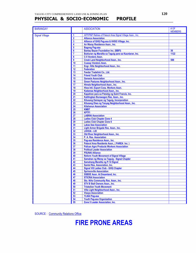
TAGUIG CITY COMPREHENSIVE LAND USE & ZONING PLAN 120
PHYSICAL & SOCIO-ECONOMIC PROFILE
BARANGAY ASSOCIATION # OF MEMBERS
Signal Village 1 AFP/PNP Retires of Palacol Area Signal Village Assn., Inc.
2 Alliance Association
3 Alliance of GHQ Pag-asa & HHSG Village, Inc.
4 An Waray Residence Assn., Inc.
5 Bagong Pag-asa
6 Bantay Bayan Foundation Inc. (BBFI) 36
7 Bukluran ng Maralita sa Taguig para sa Kaunlaran, Inc. 1122
8 C-5 Vendors Assn.
9 Creek Land Neighborhood Assn., Inc. 588
10 Cuasay Vendors Assn.
11 Engr. Hills Neighborhood Assn., Inc.
12 Federation
13 Feedar Tradelink Co., Ltd.
14 Friend Youth Club
15 Genesis Association
16 Green Pastures Neighborhood Assn., Inc.
17 Himala Neighborhood Assn., Inc.
18 Hiwa Intl. Export Corp. Workers Assn.
19 Kadamas Neighborhood Assn., Inc.
20 Kapatiran para sa Patubig ng Saint Francis, Inc.
21 Katilingban Burawagon Res. Assn., Inc.
22 Kilusang Damayan ng Taguig, Incorporation
23 Kilusang Diwa ng Tanyag Neighborhood Assn., Inc.
24 Kitahanun Association
25 KMBT
26 KPTFI
27 LABRAI Association
28 Ladies Club Chapter Zone 4
29 Ladies Club Chapter Zone 6
30 Lakas Ilaw Association
31 Light Armor Brigade Res. Assn., Inc.
32 LKHOA - LDI
33 Old River Neighborhood Assn., Inc.
34 P. A. Res. Association
35 Pag-asa Residence Assn., Inc.
36 Palacol Area Residents Assn., ( PAREA Inc. )
37 Palican Agro Products Workers Association
38 Political Leader Association
39 PSUNAI Alliance
40 Reform Youth Movement of Signal Village
41 Samahan ng Waray sa Taguig - Signal Chapter
42 Samahang Maralita ng P-14 Signal
43 Santol Res. Association, Inc.
44 Signal Vill Ladies Club - GHQ Chapter
45 Sprinxnville Association
46 SSBDE Assn. At Dreamland, Inc.
47 STICRAI Association
48 Sto. Niño Community Res. Assn., Inc.
49 STV B Stall Owners Assn., Inc.
50 Triskelion Youth Movement
51 Villa Light Neighborhood Assn., Inc.
52 Visaya Association
53 YLNAI Pag-asa
54 Youth Pag-asa Organization
55 Zone 5 Leader Association, Inc.
SOURCE : Community Relations Office
FIRE PRONE AREAS
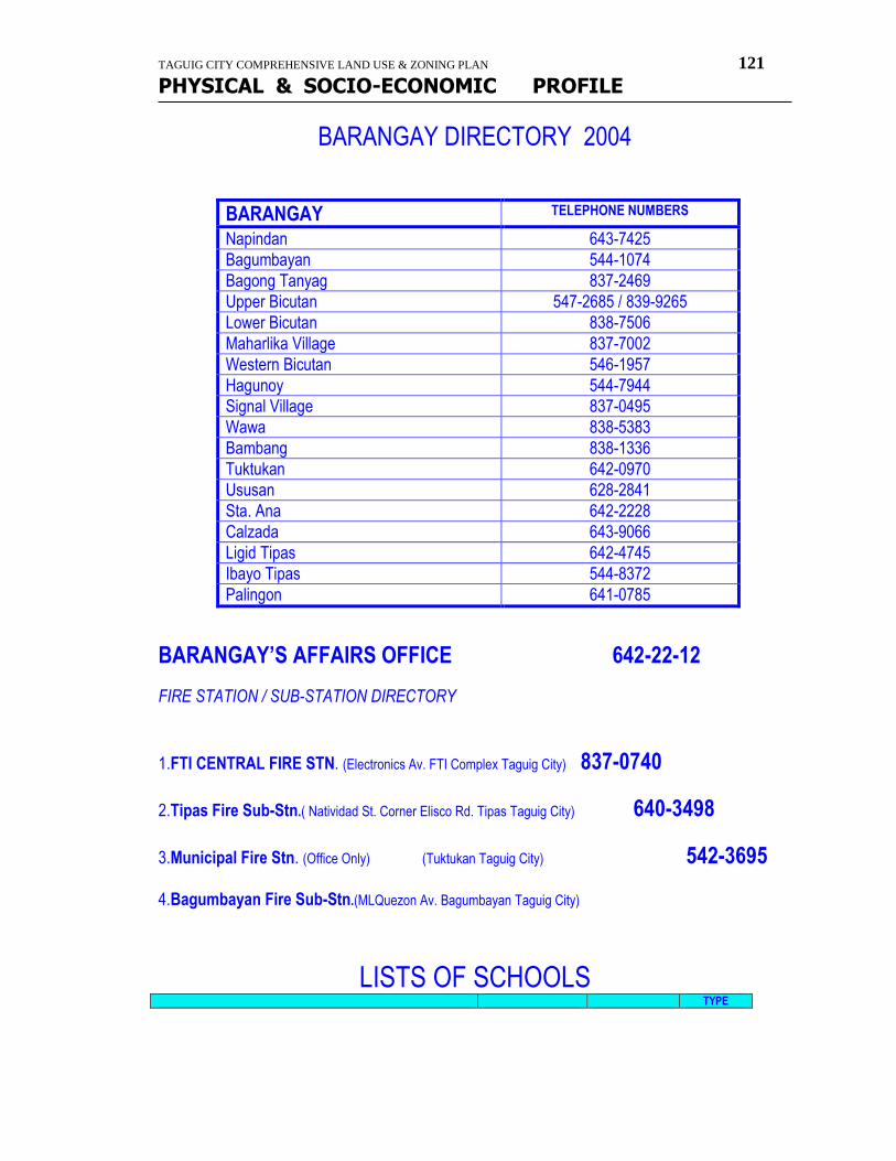
TAGUIG CITY COMPREHENSIVE LAND USE & ZONING PLAN 121
PHYSICAL & SOCIO-ECONOMIC PROFILE
BARANGAY DIRECTORY 2004
BARANGAY TELEPHONE NUMBERS
Napindan 643-7425
Bagumbayan 544-1074
Bagong Tanyag 837-2469
Upper Bicutan 547-2685 / 839-9265
Lower Bicutan 838-7506
Maharlika Village 837-7002
Western Bicutan 546-1957
Hagunoy 544-7944
Signal Village 837-0495
Wawa 838-5383
Bambang 838-1336
Tuktukan 642-0970
Ususan 628-2841
Sta. Ana 642-2228
Calzada 643-9066
Ligid Tipas 642-4745
Ibayo Tipas 544-8372
Palingon 641-0785
BARANGAY’S AFFAIRS OFFICE 642-22-12
FIRE STATION / SUB-STATION DIRECTORY
1.FTI CENTRAL FIRE STN. (Electronics Av. FTI Complex Taguig City) 837-0740
2.Tipas Fire Sub-Stn.( Natividad St. Corner Elisco Rd. Tipas Taguig City) 640-3498
3.Municipal Fire Stn. (Office Only) (Tuktukan Taguig City) 542-3695 4.Bagumbayan Fire Sub-Stn.(MLQuezon Av. Bagumbayan Taguig City)
LISTS OF SCHOOLS TYPE
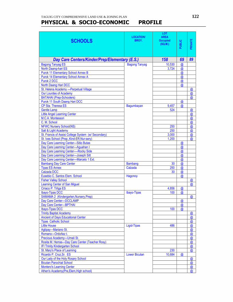
TAGUIG CITY COMPREHENSIVE LAND USE & ZONING PLAN 122
PHYSICAL & SOCIO-ECONOMIC PROFILE
SCHOOLS
LOCATION/
BRGY.
LOT AREA
Occupied (SQ.M.)
PU
BL
IC
PR
IVA
TE
Day Care Centers/Kinder/Prep/Elementary (E.S.) 158 69 89 Bagong Tanyag ES Bagong Tanyag 10,530 @
North Daang-hari ES 3,724 @
Purok 11 Elementary School Annex B @
Purok 14 Elementary School Annex A @
Purok 2 DCC @
North Daang Hari DCC @
St. Helena Academy ---Perpetual Village @
Our Lourdes of Academy @
BATAHAI (Prep-Schoolers) @
Purok 11 South Daang Hari DCC @
CP Sta. Theresa ES Bagumbayan 9,457 @
Gentle Lamp 524 @
Little Angel Learning Center @
M.C.A. Montessori @
C. M. School @
NFWC Nursery School(NS) 250 @
Salt & Light Academy 250 @
St. Francis of Assisi College System (w/ Secondary) 3,000 @
St. Ives School (Prep.,Kind-ER,Nur-sery) 1,200 @
Day Care Learning Center---Sitio Butas @
Day Care Learning Center---Aguahan I @
Day Care Learning Center----Rocky Side @
Day Care Learning Center---Joseph Sitt @
Day Care Learning Center---Marcelo 1 Ext. @
Bambang Day Care Center Bambang 30 @
Tipas ES Annex Calzada 250 @
Calzada DCC 30 @
Eusebio C. Santos Elem. School Hagonoy @
Fisher Valley School @
Learning Center of San Miguel @
Ciriaco P. Tiñga ES 4,856 @
Ibayo-Tipas DCC Ibayo-Tipas 100 @
SAMAMA 2 (Kindergarten,Nursery,Prep) @
Day Care Center---DCCLAMP @
Day Care Center---BPTHAI @
Ibayo-Tipas DCC 100 @
Trinity Baptist Academy @
Ancient of Days Educational Center @
Tipas Catholic School @
Little House Ligid-Tipas 486 @
Aglipay---Mariano St. @
Romano---Ordoñez t. @
Precious Academy---Umali St. @
Rosita M. Herras---Day Care Center (Teacher Rosy) @
IFI Trinity Kindergarten School @
St. Mary's Place of Learning 230 @
Ricardo P. Cruz,Sr. ES Lower Bicutan 10,684 @
Our Lady of the Holy Rosary School @
Bicutan Parochial School @
Montero's Learning Center @
Athen's Academy(Pre,Elem,High school) @
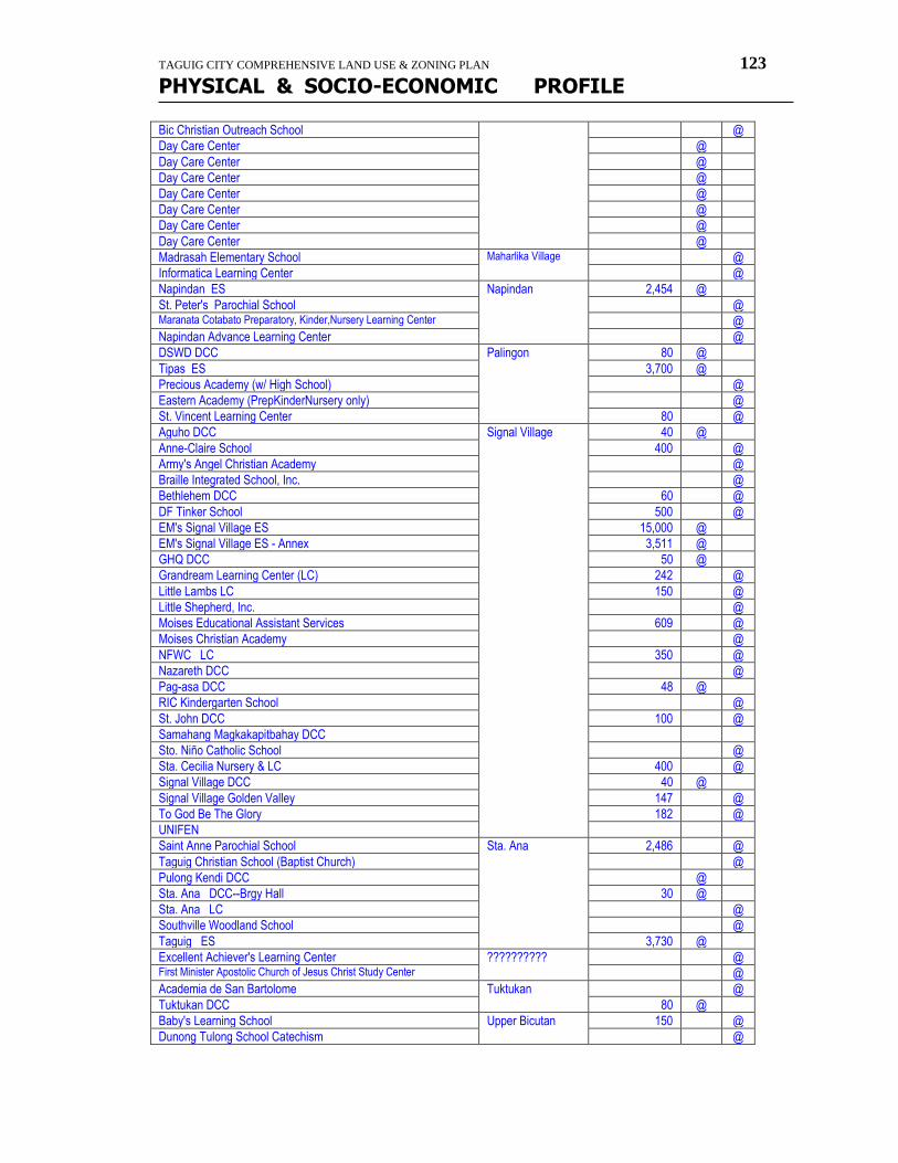
TAGUIG CITY COMPREHENSIVE LAND USE & ZONING PLAN 123
PHYSICAL & SOCIO-ECONOMIC PROFILE
Bic Christian Outreach School @
Day Care Center @
Day Care Center @
Day Care Center @
Day Care Center @
Day Care Center @
Day Care Center @
Day Care Center @
Madrasah Elementary School Maharlika Village @
Informatica Learning Center @
Napindan ES Napindan 2,454 @
St. Peter's Parochial School @ Maranata Cotabato Preparatory, Kinder,Nursery Learning Center @
Napindan Advance Learning Center @
DSWD DCC Palingon 80 @
Tipas ES 3,700 @
Precious Academy (w/ High School) @
Eastern Academy (PrepKinderNursery only) @
St. Vincent Learning Center 80 @
Aguho DCC Signal Village 40 @
Anne-Claire School 400 @
Army's Angel Christian Academy @
Braille Integrated School, Inc. @
Bethlehem DCC 60 @
DF Tinker School 500 @
EM's Signal Village ES 15,000 @
EM's Signal Village ES - Annex 3,511 @
GHQ DCC 50 @
Grandream Learning Center (LC) 242 @
Little Lambs LC 150 @
Little Shepherd, Inc. @
Moises Educational Assistant Services 609 @
Moises Christian Academy @
NFWC LC 350 @
Nazareth DCC @
Pag-asa DCC 48 @
RIC Kindergarten School @
St. John DCC 100 @
Samahang Magkakapitbahay DCC
Sto. Niño Catholic School @
Sta. Cecilia Nursery & LC 400 @
Signal Village DCC 40 @
Signal Village Golden Valley 147 @
To God Be The Glory 182 @
UNIFEN
Saint Anne Parochial School Sta. Ana 2,486 @
Taguig Christian School (Baptist Church) @
Pulong Kendi DCC @
Sta. Ana DCC--Brgy Hall 30 @
Sta. Ana LC @
Southville Woodland School @
Taguig ES 3,730 @
Excellent Achiever's Learning Center ?????????? @ First Minister Apostolic Church of Jesus Christ Study Center @
Academia de San Bartolome Tuktukan @
Tuktukan DCC 80 @
Baby's Learning School Upper Bicutan 150 @
Dunong Tulong School Catechism @
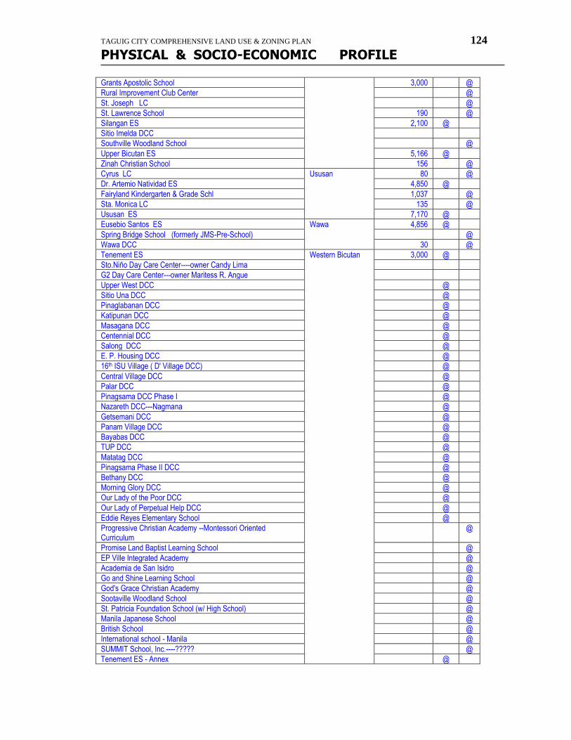
TAGUIG CITY COMPREHENSIVE LAND USE & ZONING PLAN 124
PHYSICAL & SOCIO-ECONOMIC PROFILE
Grants Apostolic School 3,000 @
Rural Improvement Club Center @
St. Joseph LC @
St. Lawrence School 190 @
Silangan ES 2,100 @
Sitio Imelda DCC
Southville Woodland School @
Upper Bicutan ES 5,166 @
Zinah Christian School 156 @
Cyrus LC Ususan 80 @
Dr. Artemio Natividad ES 4,850 @
Fairyland Kindergarten & Grade Schl 1,037 @
Sta. Monica LC 135 @
Ususan ES 7,170 @
Eusebio Santos ES Wawa 4,856 @
Spring Bridge School (formerly JMS-Pre-School) @
Wawa DCC 30 @
Tenement ES Western Bicutan 3,000 @
Sto.Niño Day Care Center----owner Candy Lima
G2 Day Care Center---owner Maritess R. Angue
Upper West DCC @
Sitio Una DCC @
Pinaglabanan DCC @
Katipunan DCC @
Masagana DCC @
Centennial DCC @
Salong DCC @
E. P. Housing DCC @
16th ISU Village ( D' Village DCC) @
Central Village DCC @
Palar DCC @
Pinagsama DCC Phase I @
Nazareth DCC---Nagmana @
Getsemani DCC @
Panam Village DCC @
Bayabas DCC @
TUP DCC @
Matatag DCC @
Pinagsama Phase II DCC @
Bethany DCC @
Morning Glory DCC @
Our Lady of the Poor DCC @
Our Lady of Perpetual Help DCC @
Eddie Reyes Elementary School @
Progressive Christian Academy --Montessori Oriented Curriculum
@
Promise Land Baptist Learning School @
EP Ville Integrated Academy @
Academia de San Isidro @
Go and Shine Learning School @
God's Grace Christian Academy @
Sootaville Woodland School @
St. Patricia Foundation School (w/ High School) @
Manila Japanese School @
British School @
International school - Manila @
SUMMIT School, Inc.----????? @
Tenement ES - Annex @
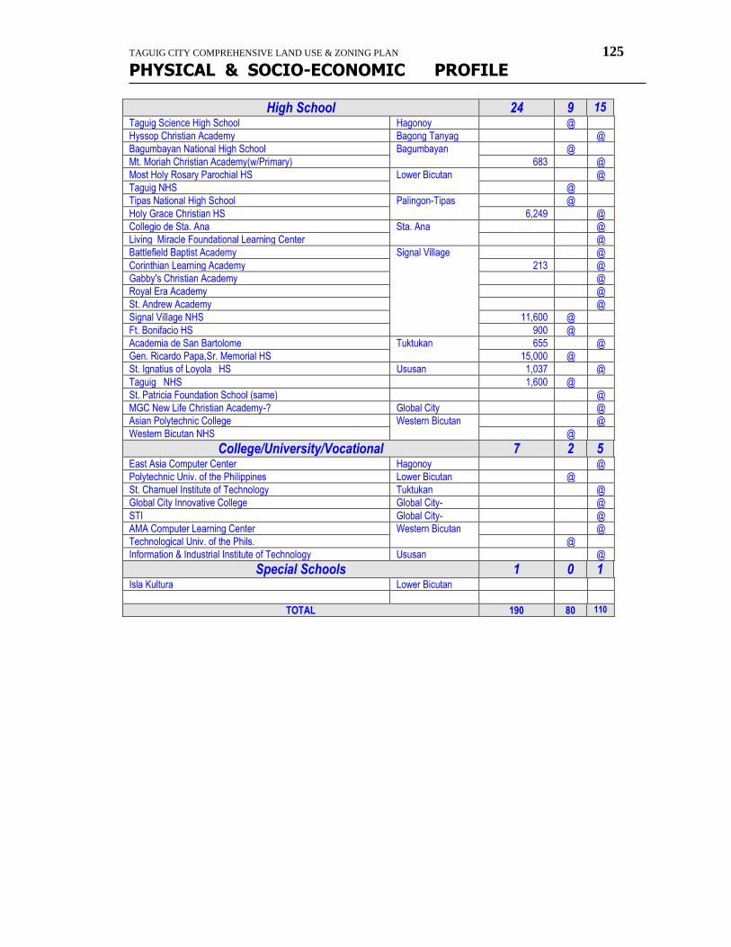
TAGUIG CITY COMPREHENSIVE LAND USE & ZONING PLAN 125
PHYSICAL & SOCIO-ECONOMIC PROFILE
High School 24 9 15 Taguig Science High School Hagonoy @
Hyssop Christian Academy Bagong Tanyag @
Bagumbayan National High School Bagumbayan @
Mt. Moriah Christian Academy(w/Primary) 683 @
Most Holy Rosary Parochial HS Lower Bicutan @
Taguig NHS @
Tipas National High School Palingon-Tipas @
Holy Grace Christian HS 6,249 @
Collegio de Sta. Ana Sta. Ana @
Living Miracle Foundational Learning Center @
Battlefield Baptist Academy Signal Village @
Corinthian Learning Academy 213 @
Gabby's Christian Academy @
Royal Era Academy @
St. Andrew Academy @
Signal Village NHS 11,600 @
Ft. Bonifacio HS 900 @
Academia de San Bartolome Tuktukan 655 @
Gen. Ricardo Papa,Sr. Memorial HS 15,000 @
St. Ignatius of Loyola HS Ususan 1,037 @
Taguig NHS 1,600 @
St. Patricia Foundation School (same) @
MGC New Life Christian Academy-? Global City @
Asian Polytechnic College Western Bicutan @
Western Bicutan NHS @
College/University/Vocational 7 2 5 East Asia Computer Center Hagonoy @
Polytechnic Univ. of the Philippines Lower Bicutan @
St. Chamuel Institute of Technology Tuktukan @
Global City Innovative College Global City- @
STI Global City- @
AMA Computer Learning Center Western Bicutan @
Technological Univ. of the Phils. @
Information & Industrial Institute of Technology Ususan @
Special Schools 1 0 1 Isla Kultura Lower Bicutan
TOTAL 190 80 110
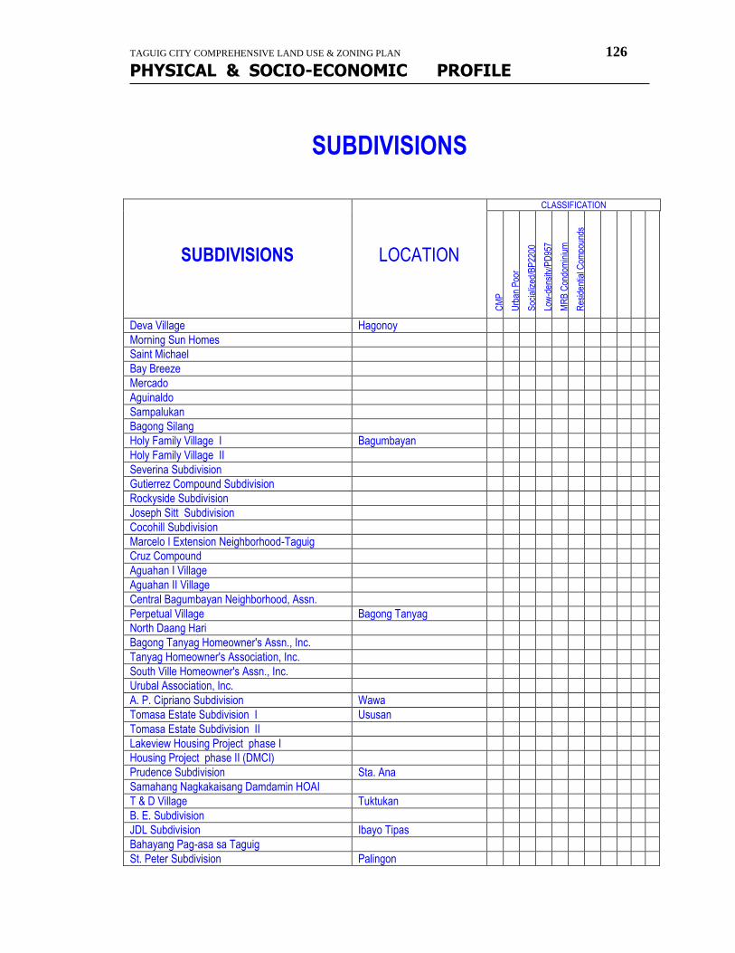
TAGUIG CITY COMPREHENSIVE LAND USE & ZONING PLAN 126
PHYSICAL & SOCIO-ECONOMIC PROFILE
SUBDIVISIONS
SUBDIVISIONS
LOCATION
CLASSIFICATION
CM
P
Urb
an P
oor
Soc
ializ
ed/B
P22
00
Low
-den
sity
/PD
957
MR
B C
ondo
min
ium
Res
iden
tial C
ompo
unds
Deva Village Hagonoy
Morning Sun Homes
Saint Michael
Bay Breeze
Mercado
Aguinaldo
Sampalukan
Bagong Silang
Holy Family Village I Bagumbayan
Holy Family Village II
Severina Subdivision
Gutierrez Compound Subdivision
Rockyside Subdivision
Joseph Sitt Subdivision
Cocohill Subdivision
Marcelo I Extension Neighborhood-Taguig
Cruz Compound
Aguahan I Village
Aguahan II Village
Central Bagumbayan Neighborhood, Assn.
Perpetual Village Bagong Tanyag
North Daang Hari
Bagong Tanyag Homeowner's Assn., Inc.
Tanyag Homeowner's Association, Inc.
South Ville Homeowner's Assn., Inc.
Urubal Association, Inc.
A. P. Cipriano Subdivision Wawa
Tomasa Estate Subdivision I Ususan
Tomasa Estate Subdivision II
Lakeview Housing Project phase I
Housing Project phase II (DMCI)
Prudence Subdivision Sta. Ana
Samahang Nagkakaisang Damdamin HOAI
T & D Village Tuktukan
B. E. Subdivision
JDL Subdivision Ibayo Tipas
Bahayang Pag-asa sa Taguig
St. Peter Subdivision Palingon
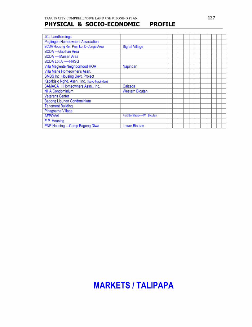
TAGUIG CITY COMPREHENSIVE LAND USE & ZONING PLAN 127
PHYSICAL & SOCIO-ECONOMIC PROFILE
JCL Landholdings
Paglingon Homeowners Association BCDA Housing Rel. Proj. Lot D-Conga Area Signal Village
BCDA ---Gabihan Area
BCDA ----Maisan Area
BCDA Lot A -----HHSG
Villa Maglente Neighborhood HOA Napindan
Villa Marie Homeowner's Assn.
SMBS Inc. Housing Devt. Project
Kapitbisig Nghd. Assn., Inc. (Ibayo-Napindan)
SAMACA II Homeowners Assn., Inc. Calzada
NHA Condominium Western Bicutan
Veterans Center
Bagong Lipunan Condominium
Tenement Building
Pinagsama Village
AFPOVAI Fort Bonifacio----W. Bicutan
E.P. Housing
PNP Housing ---Camp Bagong Diwa Lower Bicutan
MARKETS / TALIPAPA
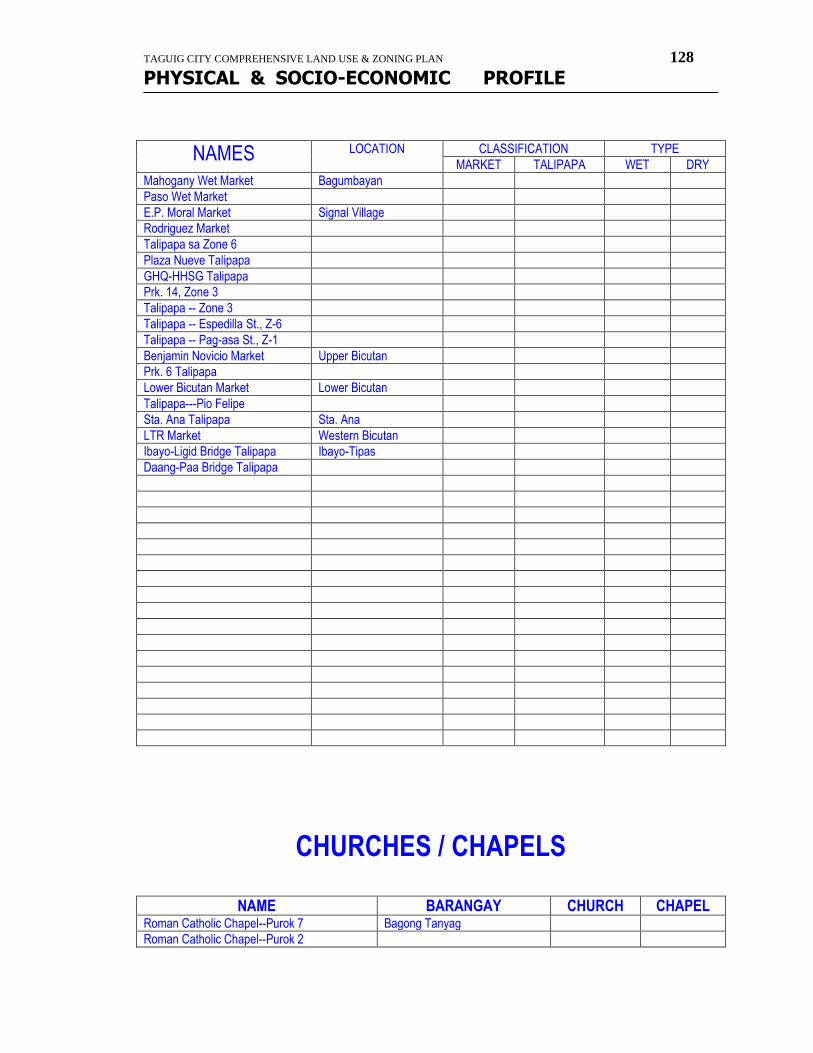
TAGUIG CITY COMPREHENSIVE LAND USE & ZONING PLAN 128
PHYSICAL & SOCIO-ECONOMIC PROFILE
NAMES LOCATION CLASSIFICATION TYPE
MARKET TALIPAPA WET DRY
Mahogany Wet Market Bagumbayan
Paso Wet Market
E.P. Moral Market Signal Village
Rodriguez Market
Talipapa sa Zone 6
Plaza Nueve Talipapa
GHQ-HHSG Talipapa
Prk. 14, Zone 3
Talipapa -- Zone 3
Talipapa -- Espedilla St., Z-6
Talipapa -- Pag-asa St., Z-1
Benjamin Novicio Market Upper Bicutan
Prk. 6 Talipapa
Lower Bicutan Market Lower Bicutan
Talipapa---Pio Felipe
Sta. Ana Talipapa Sta. Ana
LTR Market Western Bicutan
Ibayo-Ligid Bridge Talipapa Ibayo-Tipas
Daang-Paa Bridge Talipapa
CHURCHES / CHAPELS
NAME BARANGAY CHURCH CHAPEL Roman Catholic Chapel--Purok 7 Bagong Tanyag
Roman Catholic Chapel--Purok 2
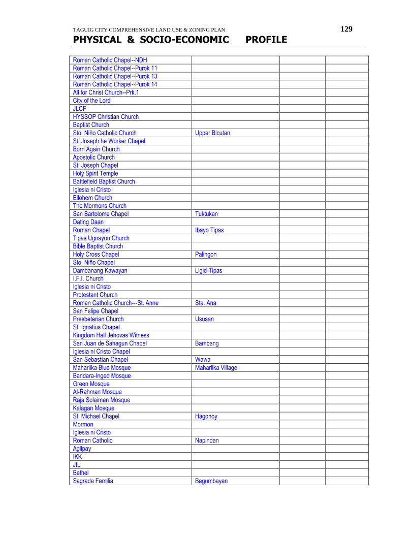
TAGUIG CITY COMPREHENSIVE LAND USE & ZONING PLAN 129
PHYSICAL & SOCIO-ECONOMIC PROFILE
Roman Catholic Chapel--NDH
Roman Catholic Chapel--Purok 11
Roman Catholic Chapel--Purok 13
Roman Catholic Chapel--Purok 14
All for Christ Church--Prk.1
City of the Lord
JLCF
HYSSOP Christian Church
Baptist Church
Sto. Niño Catholic Church Upper Bicutan
St. Joseph he Worker Chapel
Born Again Church
Apostolic Church
St. Joseph Chapel
Holy Spirit Temple
Battlefield Baptist Church
Iglesia ni Cristo
Eilohem Church
The Mormons Church
San Bartolome Chapel Tuktukan
Dating Daan
Roman Chapel Ibayo Tipas
Tipas Ugnayon Church
Bible Baptist Church
Holy Cross Chapel Palingon
Sto. Niño Chapel
Dambanang Kawayan Ligid-Tipas
I.F.I. Church
Iglesia ni Cristo
Protestant Church
Roman Catholic Church---St. Anne Sta. Ana
San Felipe Chapel
Presbeterian Church Ususan
St. Ignatius Chapel
Kingdom Hall Jehovas Witness
San Juan de Sahagun Chapel Bambang
Iglesia ni Cristo Chapel
San Sebastian Chapel Wawa
Maharlika Blue Mosque Maharlika Village
Bandara-Inged Mosque
Green Mosque
Al-Rahman Mosque
Raja Solaiman Mosque
Kalagan Mosque
St. Michael Chapel Hagonoy
Mormon
Iglesia ni Cristo
Roman Catholic Napindan
Aglipay
IKK
JIL
Bethel
Sagrada Familia Bagumbayan
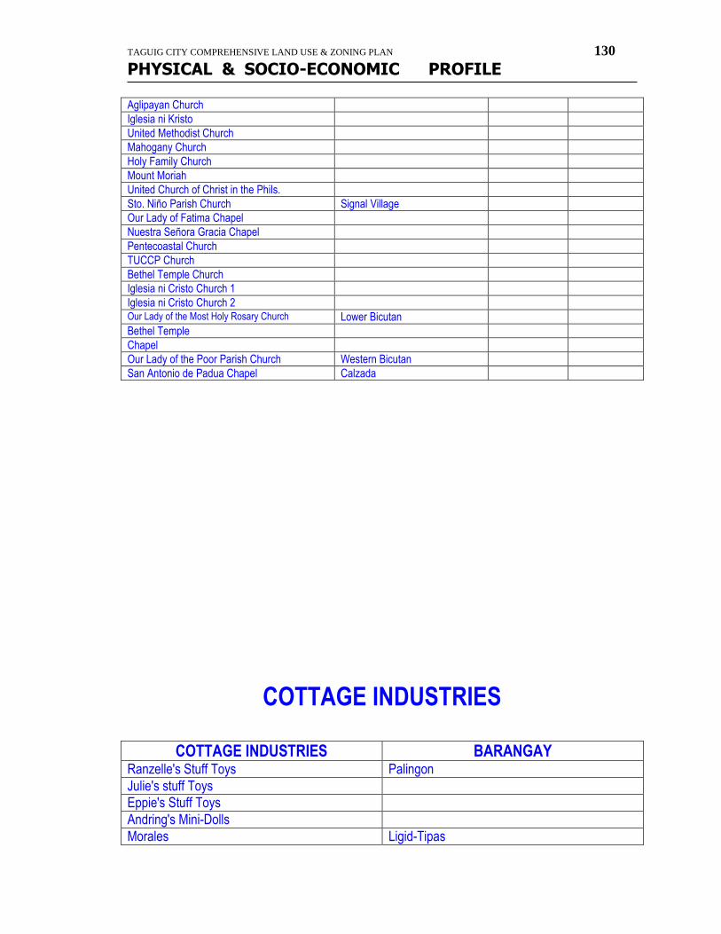
TAGUIG CITY COMPREHENSIVE LAND USE & ZONING PLAN 130
PHYSICAL & SOCIO-ECONOMIC PROFILE
Aglipayan Church
Iglesia ni Kristo
United Methodist Church
Mahogany Church
Holy Family Church
Mount Moriah
United Church of Christ in the Phils.
Sto. Niño Parish Church Signal Village
Our Lady of Fatima Chapel
Nuestra Señora Gracia Chapel
Pentecoastal Church
TUCCP Church
Bethel Temple Church
Iglesia ni Cristo Church 1
Iglesia ni Cristo Church 2 Our Lady of the Most Holy Rosary Church Lower Bicutan
Bethel Temple
Chapel
Our Lady of the Poor Parish Church Western Bicutan
San Antonio de Padua Chapel Calzada
COTTAGE INDUSTRIES
COTTAGE INDUSTRIES BARANGAY
Ranzelle's Stuff Toys Palingon
Julie's stuff Toys
Eppie's Stuff Toys
Andring's Mini-Dolls
Morales Ligid-Tipas
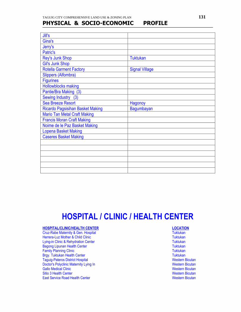
TAGUIG CITY COMPREHENSIVE LAND USE & ZONING PLAN 131
PHYSICAL & SOCIO-ECONOMIC PROFILE
Jill's
Gina's
Jerry's
Patric's
Rey's Junk Shop Tuktukan
Gil's Junk Shop
Rotella Garment Factory Signal Village
Slippers (Alfombra)
Figurines
Hollowblocks making
Pantie/Bra Making (3)
Sewing Industry (3)
Sea Breeze Resort Hagonoy
Ricardo Pagsisihan Basket Making Bagumbayan
Mario Tan Metal Craft Making
Francis Moran Craft Making
Noime de le Paz Basket Making
Lopena Basket Making
Caseres Basket Making
HOSPITAL / CLINIC / HEALTH CENTER HOSPITAL/CLINIC/HEALTH CENTER LOCATION Cruz-Rabe Maternity & Gen. Hospital Tuktukan Herrera-Luz Mother & Child Clinic Tuktukan Lying-in Clinic & Rehydration Center Tuktukan Bagong Lipunan Health Center Tuktukan Family Planning Clinic Tuktukan Brgy. Tuktukan Health Center Tuktukan Taguig-Pateros District Hospital Western Bicutan Doctor's Polyclinic Maternity Lying In Western Bicutan Gallo Medical Clinic Western Bicutan Sitio 3 Health Center Western Bicutan East Service Road Health Center Western Bicutan
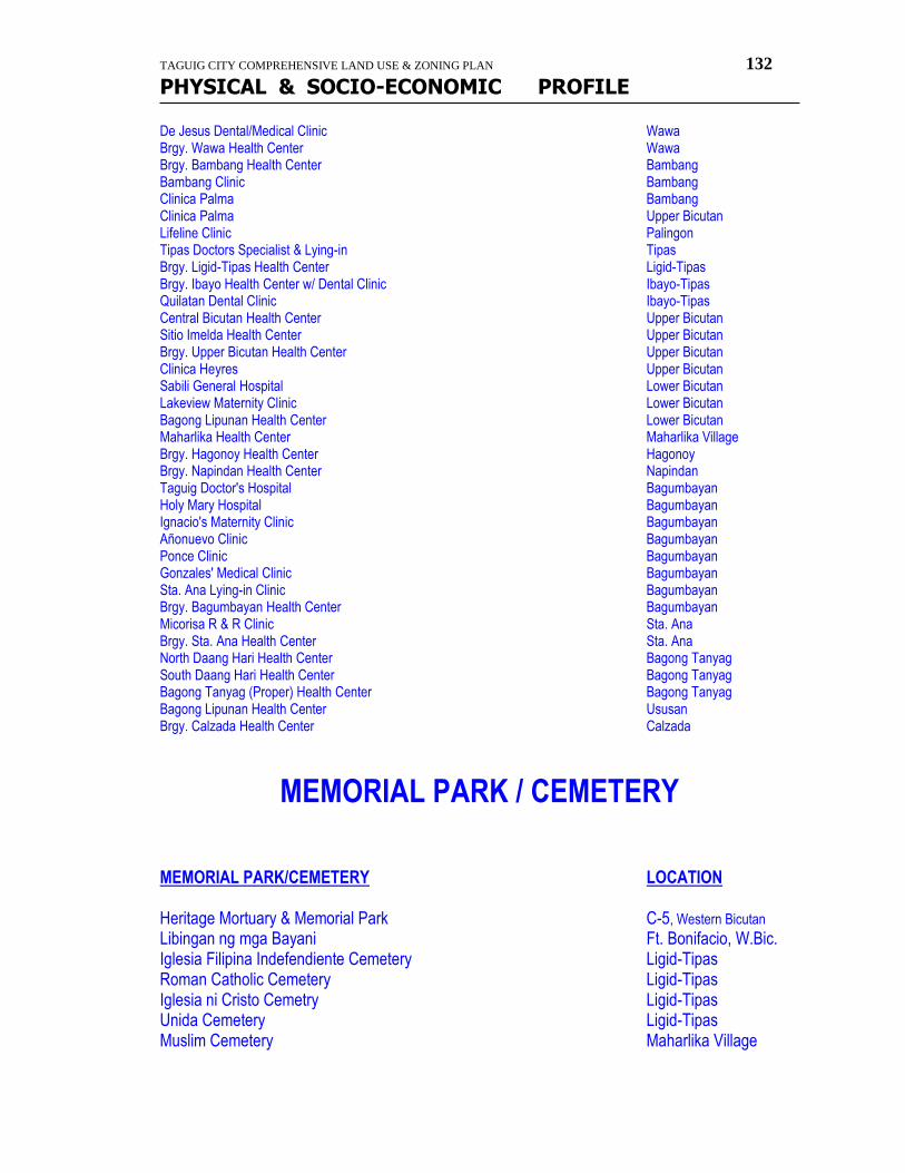
TAGUIG CITY COMPREHENSIVE LAND USE & ZONING PLAN 132
PHYSICAL & SOCIO-ECONOMIC PROFILE
De Jesus Dental/Medical Clinic Wawa Brgy. Wawa Health Center Wawa Brgy. Bambang Health Center Bambang Bambang Clinic Bambang Clinica Palma Bambang Clinica Palma Upper Bicutan Lifeline Clinic Palingon Tipas Doctors Specialist & Lying-in Tipas Brgy. Ligid-Tipas Health Center Ligid-Tipas Brgy. Ibayo Health Center w/ Dental Clinic Ibayo-Tipas Quilatan Dental Clinic Ibayo-Tipas Central Bicutan Health Center Upper Bicutan Sitio Imelda Health Center Upper Bicutan Brgy. Upper Bicutan Health Center Upper Bicutan Clinica Heyres Upper Bicutan Sabili General Hospital Lower Bicutan Lakeview Maternity Clinic Lower Bicutan Bagong Lipunan Health Center Lower Bicutan Maharlika Health Center Maharlika Village Brgy. Hagonoy Health Center Hagonoy Brgy. Napindan Health Center Napindan Taguig Doctor's Hospital Bagumbayan Holy Mary Hospital Bagumbayan Ignacio's Maternity Clinic Bagumbayan Añonuevo Clinic Bagumbayan Ponce Clinic Bagumbayan Gonzales' Medical Clinic Bagumbayan Sta. Ana Lying-in Clinic Bagumbayan Brgy. Bagumbayan Health Center Bagumbayan Micorisa R & R Clinic Sta. Ana Brgy. Sta. Ana Health Center Sta. Ana North Daang Hari Health Center Bagong Tanyag South Daang Hari Health Center Bagong Tanyag Bagong Tanyag (Proper) Health Center Bagong Tanyag Bagong Lipunan Health Center Ususan Brgy. Calzada Health Center Calzada
MEMORIAL PARK / CEMETERY
MEMORIAL PARK/CEMETERY LOCATION Heritage Mortuary & Memorial Park C-5, Western Bicutan
Libingan ng mga Bayani Ft. Bonifacio, W.Bic. Iglesia Filipina Indefendiente Cemetery Ligid-Tipas Roman Catholic Cemetery Ligid-Tipas Iglesia ni Cristo Cemetry Ligid-Tipas Unida Cemetery Ligid-Tipas Muslim Cemetery Maharlika Village
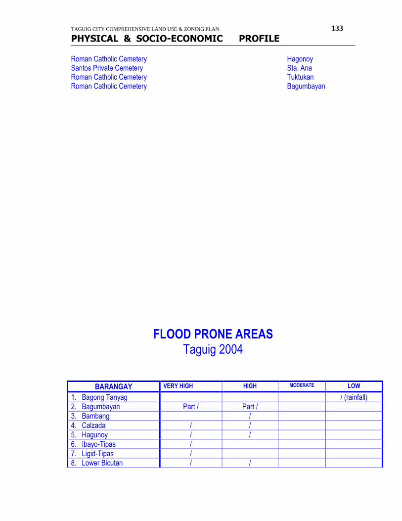
TAGUIG CITY COMPREHENSIVE LAND USE & ZONING PLAN 133
PHYSICAL & SOCIO-ECONOMIC PROFILE
Roman Catholic Cemetery Hagonoy Santos Private Cemetery Sta. Ana Roman Catholic Cemetery Tuktukan Roman Catholic Cemetery Bagumbayan
FLOOD PRONE AREAS Taguig 2004
BARANGAY VERY HIGH HIGH MODERATE LOW
1. Bagong Tanyag / (rainfall)
2. Bagumbayan Part / Part /
3. Bambang /
4. Calzada / /
5. Hagunoy / /
6. Ibayo-Tipas /
7. Ligid-Tipas /
8. Lower Bicutan / /
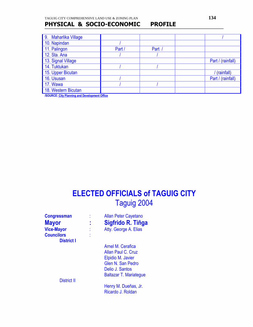
TAGUIG CITY COMPREHENSIVE LAND USE & ZONING PLAN 134
PHYSICAL & SOCIO-ECONOMIC PROFILE
9. Maharlika Village /
10. Napindan /
11. Palingon Part / Part /
12. Sta. Ana / /
13. Signal Village Part / (rainfall)
14. Tuktukan / /
15. Upper Bicutan / (rainfall)
16. Ususan / Part / (rainfall)
17. Wawa / /
18. Western Bicutan /SOURCE: City Planning and Development Office
ELECTED OFFICIALS of TAGUIG CITY Taguig 2004
Congressman : Allan Peter Cayetano
Mayor : Sigfrido R. Tiñga Vice-Mayor : Atty. George A. Elias Councilors : District I Arnel M. Cerafica Allan Paul C. Cruz Elpidio M. Javier Glen N. San Pedro Delio J. Santos Baltazar T. Mariategue District II Henry M. Dueñas, Jr. Ricardo J. Roldan
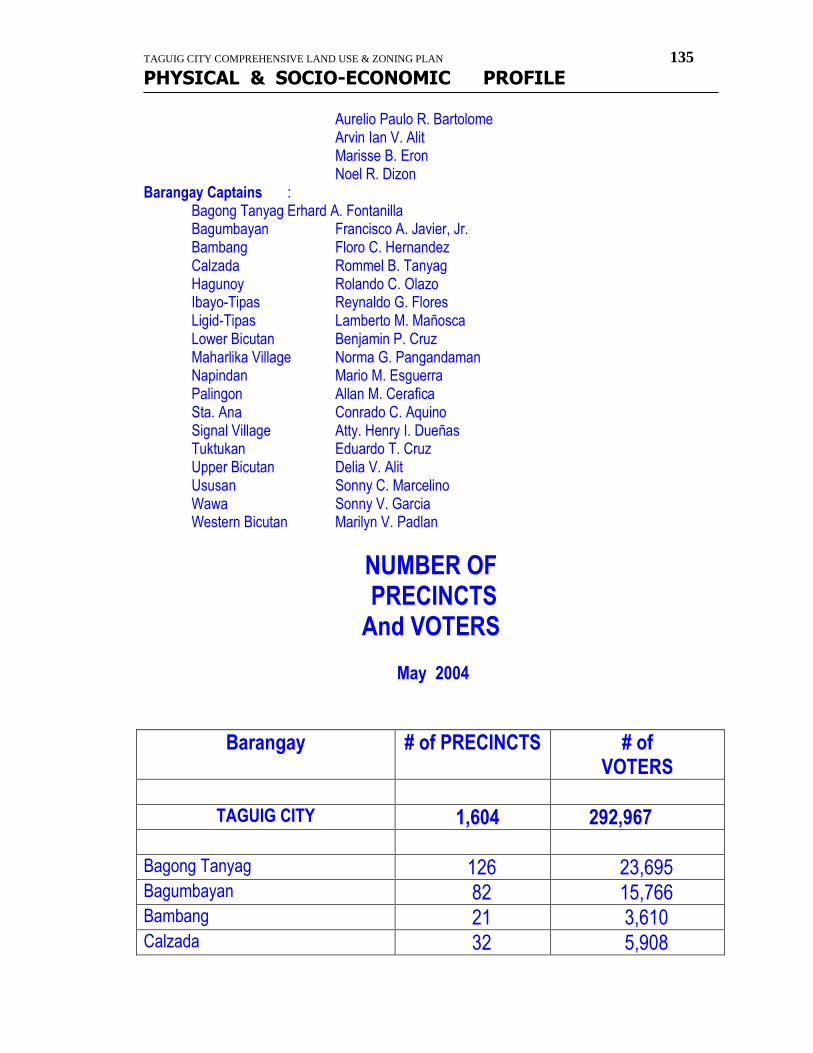
TAGUIG CITY COMPREHENSIVE LAND USE & ZONING PLAN 135
PHYSICAL & SOCIO-ECONOMIC PROFILE
Aurelio Paulo R. Bartolome Arvin Ian V. Alit Marisse B. Eron Noel R. Dizon Barangay Captains : Bagong Tanyag Erhard A. Fontanilla Bagumbayan Francisco A. Javier, Jr. Bambang Floro C. Hernandez Calzada Rommel B. Tanyag Hagunoy Rolando C. Olazo Ibayo-Tipas Reynaldo G. Flores Ligid-Tipas Lamberto M. Mañosca Lower Bicutan Benjamin P. Cruz Maharlika Village Norma G. Pangandaman Napindan Mario M. Esguerra Palingon Allan M. Cerafica Sta. Ana Conrado C. Aquino Signal Village Atty. Henry I. Dueñas
Tuktukan Eduardo T. Cruz Upper Bicutan Delia V. Alit Ususan Sonny C. Marcelino Wawa Sonny V. Garcia Western Bicutan Marilyn V. Padlan
NUMBER OF PRECINCTS And VOTERS
May 2004
Barangay # of PRECINCTS # of VOTERS
TAGUIG CITY 1,604 292,967
Bagong Tanyag 126 23,695 Bagumbayan 82 15,766 Bambang 21 3,610 Calzada 32 5,908
TAGUIG CITY COMPREHENSIVE LAND USE & ZONING PLAN 136
PHYSICAL & SOCIO-ECONOMIC PROFILE
Hagonoy 52 9,247 Ibayo-Tipas 41 7,595 Ligid-Tipas 23 4,337 Lower Bicutan 173 32,841 Maharlika Village 101 17,450 Napindan 28 5,262 Palingon 25 4,743 Sta. Ana 44 7,477 Signal Village 272 49,581 Tuktukan 32 5,179 Upper Bicutan 185 34,751 Ususan 47 8,875 Wawa 32 5,003 Western Bicutan 288 51,647
SUBDIVISIONS
SUBDIVISION LOCATION CLASSIFICATION 1.St. Peter Triangle (c/oSamahang Magkakapitbahay Bambang CMP/Urban Poor Sa Dulong Bayan, Inc.) 2.Matapat Urban Poor Urban Poor 3.Villa Mendiola-Villegas NHOAI Urban Poor 4. Tanyag Homeowners Assn.,Inc. Phase I & II Bagong Tanyag CMP 5. Fort Bonifacio Global City Phase 2 Western Bicutan Commercial 6.Southeast people's Village HOAI DM,Ibayo-Tipas CMP/Urban Poor 7. Baybreeze Subdivision Phase II-A Hagonoy PD 957 8. Antonio Dinguinbayan Dreamville I HOA Ligid-Tipas CMP/Urban poor 9. Tambalan neighborhood Assn., Inc. CMP/Urban Poor 10. Samahang Magkakapitbahay sa Dulong Bayan, Inc. Bambang CMP 11. BCDA Housing and Relocation Project Signal Village BP 220 (Lot D)Conga Area & Lakas-Ilaw 12. BCDA Heritage Memorial Park Western Bicutan PD 957 13. Central Bagumbayan Neighborhood, Assn. Bagumbayan CMP/Urban Poor 14. BCDA Heritage Memorial Park Western Bicutan Memorial Park 15. Samahang Nagkakaisang Damdamin HOAI Sta. Ana CMP/Urban poor 16. BCDA Housing & Relocation Project Signal Village BP 220 Lot B Gabihan Area 17. BCDA Housing & Relocation Project BP 220 Lot C Maisan Area 18. SAMACA 2 HOAI Calzada CMP 19. 1.17 Hectare Kalayaan Housing Relocation Project PD 957 20. Kapitbisig Neighborhood Assn., Inc. Ibayo-Napindan CMP/Urban Poor 21. Villa Maglente Nghd. HOA Napindan CMP/Urban Poor
TAGUIG CITY COMPREHENSIVE LAND USE & ZONING PLAN 137
PHYSICAL & SOCIO-ECONOMIC PROFILE
22. Marcelo I extension Neighborhood Assn. Bagumbayan CMP 23. Paglingon homeowners Association Palingon CMP 24. Cocohill Homeowners Assn. Bagumbayan CMP/Urban Poor 25. Megaworld Forbestown Center Western Bicutan Commercial 26. Eastwind Homes PD 957 27. BCDA 1.17 Ha. Kalayaan Alteration of D.P. 28. BCDA Lot D Conga Area Alteration of DP 29. Golden Harvest Homeownres Assn., Inc. Calzada CMP/Urban Poor 30. Nabuhay Homeowners assn. Calzada CMP/Urban poor 31. Sagrada Familia nghd. Assn., Inc. Bagumbayan CMP/Urban poor 32. Mc Kinley Hill Subdivision Phase I C-5 Ususan Comml/Resdl. Subdv. 33. San Bernardo Residential Devt. Ibayo Socialized Housing 34. Habitat for Humanity Foundation (5-units MRB) Western Bicutan MRB Proj. Habitat 35. Mc Kinley Hill Phase II C-5 Ususan Comml/Resdl subdv. 36. Spring Lane II Hagonoy PD 957 37. Forbes Town Center Phase I Western Bicutan Commercial/Resdl. 38. Mahogany Forest Nghd. Assn., Inc. Calzada CMP 39. Forbes Town Center Phase II Western Bicutan Comml/Resdl 40. Serendra District I Section B & C Western Bicutan Comml/Resdl 41. Serendra District II Section B & C Western Bicutan Comml./Resdl.
TELECOMMUNICATION TOWER ( CELL SITE )
COMPANY: LOCATION: Digital Telecommunication Phils, Inc. Signal Village Digital Telecommunication Phils, Inc. 417-A Sta. Teresa Compd., Bagong Tanyag Digital Telecommunication Phils, Inc. Ismael & Ishaq Bldg., Rogan St., Maharlika Village Digital Telecommunication Phils, Inc. Sunshine Mall, DBP Ave., FTI Complex, Western Bicutan Smart Communication, Inc. BCDA Housing, Diego Silang, C-5 Digital Telecommunication Phils, Inc. Seabreeze St., Hagonoy Digital Telecommunication Phils, Inc. 1101 E. Rodriguez, Jr., Bagumbayan DMCI Compd., Bagong Calzada, Ususan, Taguig City Smart Communication, Inc. 9 Mariano St., Palingon-Tipas Digital Telecommunication Phils, Inc. Megaworld Bldg., Fort Bonifacio Global city Digital Telecommunication Phils, Inc. NAMRIA Compound, McKinley Rd., Fort Bonifacio Smart Communication, Inc. NAMRIA Compound, Lawton Avenue, FBGC. Globe Telecom, Inc. 510 Bagong Calzada, Ususan Globe Telecom, Inc. 246 M.L.Quezon St., Lower Bicutan Globe Telecom, Inc. L1 B25 P2 EP Housing, Western Bicutan Globe Telecom, Inc. L2 B60 P2a, Upper Bicutan Digital Telecommunication Phils, Inc. BCDA Lot, Lawton avenue, Fort Bonifacio Smart Communication, Inc. SAMAMA 2, Katwiran Rd., Ibayo-Tipas Globe Telecom, Inc. St. Michael Subdv., Hagonoy
TAGUIG CITY COMPREHENSIVE LAND USE & ZONING PLAN 138
PHYSICAL & SOCIO-ECONOMIC PROFILE
Globe Telecom, Inc. 2144 Elisco Rd., Ibayo-Tipas Globe Telecom, Inc. 26 Umali St., Ligid-Tipas Globe Telecom, Inc. Napindan, Taguig City Digital Telecommunication Phils, Inc. Marcelo 2 St., Bagumbayan, Taguig City Globe Telecom, Inc. Bonifacio Tech. Center, 31st St., Crescent Park West, FBGC. Smart Communication, Inc. ML Quezon St., Hagonoy, Taguig City Globe Telecom, Inc. 100 P. Mariano St., Ususan, taguig City Globe Telecom, Inc. 49 B-4, Sitio 2, Z-7A, Pasong Tamo, Western Bicutan Globe Telecom, Inc. Sunshine Mall, FTI Complex ( San Pedro Laguna St.) Globe Telecom, Inc. C.P. Tiñga St., Brgy. Hagonoy, Taguig City Globe Telecom, Inc. Malik's Building, L21 B47 Maharlika Village Globe Telecom, Inc. 8th St., Signal Village

TAGUIG CITY COMPREHENSIVE LAND USE & ZONING PLAN 139
PHYSICAL & SOCIO-ECONOMIC PROFILE
barangay profile
TAGUIG CITY COMPREHENSIVE LAND USE & ZONING PLAN 140
PHYSICAL & SOCIO-ECONOMIC PROFILE
Profile Of
Brgy. Bagong Tanyag HISTORY
In 1950 - 1960 the territorial jurisdiction of Bagong Tanyag is form and partial of Barangay Bagumbayan until the time of Mayor Monico Tanyag was elected. During his incumbency in office a Presidential Decree was enacted declaring the aforesaid land as Public Domain. Due to the migration of group of people from Manila and Makati and different provinces, the Barangay Bagong Tanyag accumulated sufficient number of residents to established separate and distinct Barangay. Since the same was happened during his term of office, as immemorial practice his surname was adopted and used as the name of the subject Barangay and the word "Bagong" was originated from the word "Bagumbayan". Barangay Bagong Tanyag is composed three distincts sitio's: Bagong Tanyag (Proper), North Daang Hari and South Daang Hari. The Barangay Bagong Tanyag (Proper) was formerly owned and managed by Philippine National Railroad Company until they decided to abandon the same.
GEOGRAPHY / PHYSICAL CHARACTERISTICS MAPPING, LOCATION and BOUNDARIES Location Situated on the Southwest part of Taguig, and Southeast part of Metro Manila. Boundary North: The Department of Science and Technology---Bicutan Branch South: Daughters of Charity, Parañaque City East: Barangay Bagumbayan West: South Superhighway
POLITICAL SUBDIVISIONS / ZONING Bagong Tanyag (Proper) North Daang Hari South Daang Hari
LAND AREAS / WATER BODIES Land Area = 2.17 sq. km. Water Bodies :
NATURAL RESOURCES
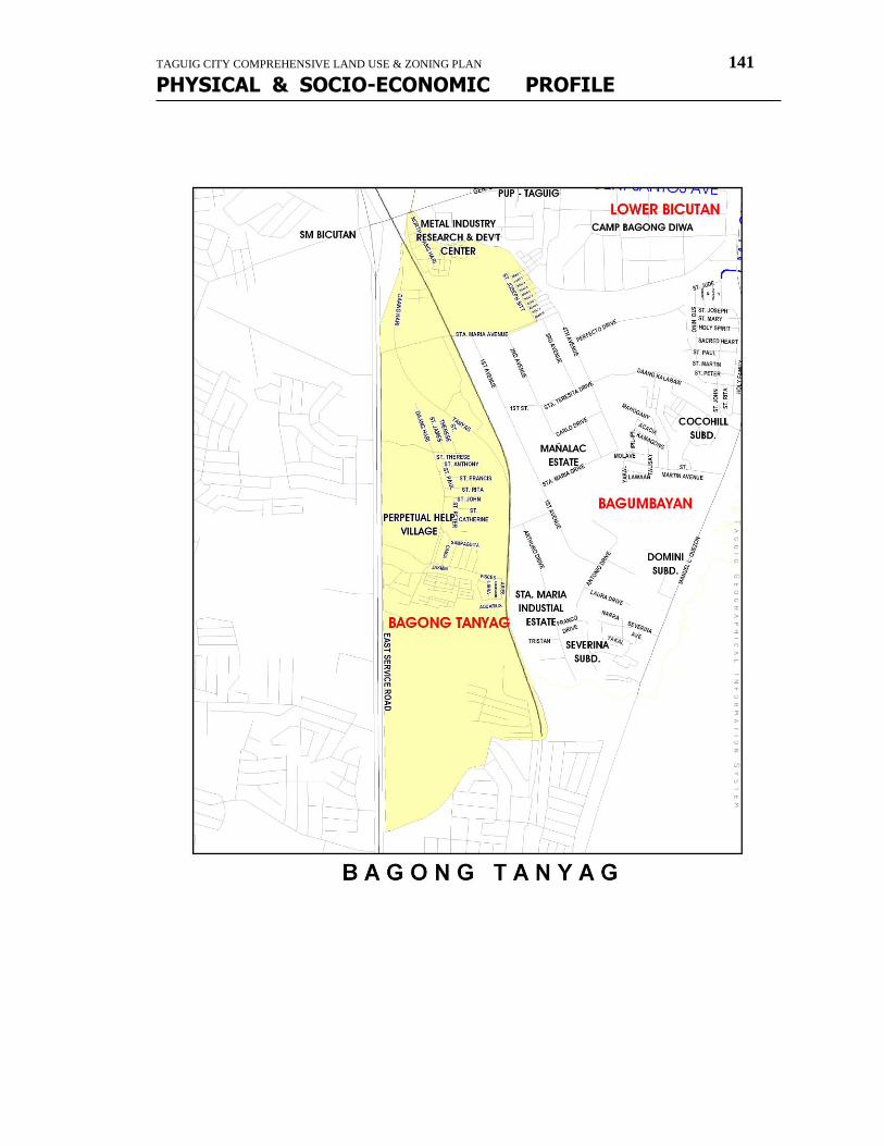
TAGUIG CITY COMPREHENSIVE LAND USE & ZONING PLAN 141
PHYSICAL & SOCIO-ECONOMIC PROFILE
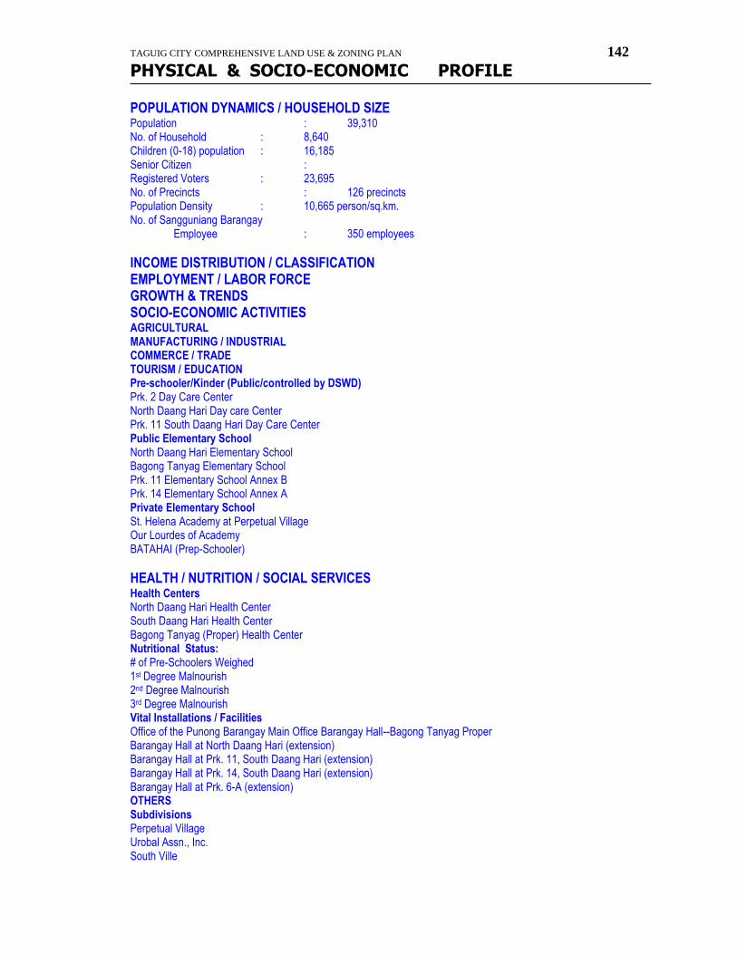
TAGUIG CITY COMPREHENSIVE LAND USE & ZONING PLAN 142
PHYSICAL & SOCIO-ECONOMIC PROFILE
POPULATION DYNAMICS / HOUSEHOLD SIZE Population : 39,310 No. of Household : 8,640 Children (0-18) population : 16,185 Senior Citizen : Registered Voters : 23,695 No. of Precincts : 126 precincts Population Density : 10,665 person/sq.km. No. of Sangguniang Barangay Employee : 350 employees
INCOME DISTRIBUTION / CLASSIFICATION EMPLOYMENT / LABOR FORCE GROWTH & TRENDS SOCIO-ECONOMIC ACTIVITIES
AGRICULTURAL MANUFACTURING / INDUSTRIAL COMMERCE / TRADE TOURISM / EDUCATION Pre-schooler/Kinder (Public/controlled by DSWD) Prk. 2 Day Care Center North Daang Hari Day care Center Prk. 11 South Daang Hari Day Care Center Public Elementary School North Daang Hari Elementary School Bagong Tanyag Elementary School Prk. 11 Elementary School Annex B Prk. 14 Elementary School Annex A Private Elementary School St. Helena Academy at Perpetual Village Our Lourdes of Academy BATAHAI (Prep-Schooler)
HEALTH / NUTRITION / SOCIAL SERVICES Health Centers North Daang Hari Health Center South Daang Hari Health Center Bagong Tanyag (Proper) Health Center Nutritional Status: # of Pre-Schoolers Weighed 1st Degree Malnourish 2nd Degree Malnourish
3rd Degree Malnourish Vital Installations / Facilities Office of the Punong Barangay Main Office Barangay Hall--Bagong Tanyag Proper Barangay Hall at North Daang Hari (extension) Barangay Hall at Prk. 11, South Daang Hari (extension) Barangay Hall at Prk. 14, South Daang Hari (extension) Barangay Hall at Prk. 6-A (extension)
OTHERS Subdivisions Perpetual Village Urobal Assn., Inc. South Ville
TAGUIG CITY COMPREHENSIVE LAND USE & ZONING PLAN 143
PHYSICAL & SOCIO-ECONOMIC PROFILE
LISTING / PROFILE OF ESTABLISHMENTS LIST of ORGANIZATIONS/NGO Association of Concerned Citizen and Stable Comm. Inc. Bagong Tanyag Homeowners Assn., Inc. Bagong Tanyag Prk. 5 Residents Assn. Inc. Concerned Residents Assn. Inc. Home Along the Riles Neighborhood Assn. Inc. (HARINAI) Infant Jesus Compound Homeowners Assn. Inc. Kilusang Diwa ng Tanyag Neighborhood Assn. Inc. Manggahan Site Neighborhood Assn of Taguig, Inc. North Daang Hari Homeowners Assn., Inc. Perpetual Village HOMEOWNERS ASSN. Samahang Magkakapitbahay ng Daang Bakal Prk 4-8 Samahang Magkakapitbahay ng P-10 sdh Homeowners Assn.,Inc Samahang Magkakapitbahay ng SDH Assn., Inc. Samahang Magkakapitbahay ng South Daang Hari (SMSDH) Samahang Magkakapitbahay sa Dulong Bayan T. P. Samahang Pangkomunidad ng Cocovale (SAPACO) Samahang Tungo sa Progresibong Pamayanan P-13 SDH Sanggunian ng Responsableng Mamamayan sa Tanyag Santos/Garcia Homeowners Assn. Inc. South Victoria Ville Homeowners Assn. Inc. Sta. Theresa compound Homeowners Assn. Inc. Sunday Group P-11 Taguig Inc. Talang-Masa Assn. Prk.33 Inc. Tanyag Homeowners Assn. Inc. (TAHAI) United Residents of Balagbas Handonedline Homeowners Assn. Inc. Bagong Tanyag Homeowners Association Inc. SDH – Samahang Magkakapitbahay Inc.
South Daang Hari Taguig Cooperative DTCI
TAGUIG CITY COMPREHENSIVE LAND USE & ZONING PLAN 144
PHYSICAL & SOCIO-ECONOMIC PROFILE
Profile Of
Brgy. Ibayo - Tipas HISTORY Maikling Kasaysayan
Ang Barangay Ibayo-Tipas ay isa sa mga bumubuo ng orihinal na kanayunan ng Tipas sa bayan ng Taguig. Ito ay dating bahagi ng Barrio Tipas. Ang mga unang taong naninirahan, sa kabilang dako ng Tipas o sa kabila nang kailugan ng Tipas ay tinagurian ng mga Tagalog na Ibayo. Nang lumaon, ang Ibayo ay lumawak at umunlad, ito ay nakilala na sa tawag na Ibayo-Tipas.
Sinasabi sa kasaysayan, na noong unang panahon ay nag-iisa lamang ang naturang lugar na ito. Malaki ang
Tipas at maraming tao. Noong 1974, panahon ng dating Punong bayan Monico C. Tanyag, sa pamamagitan ng isang Municipal Resolution na panukala ni Konsehal Pascual Sarmiento, napagkaisahan ng Sangguniang Bayan na hatiin ang Tipas sa apat na Barangay. Ang iba pang barangay ay ang Ligid, Palingon, at Calzada.
Maraming mga propesyunal ang Barangay Ibayo tulad ng doctor, nurses, abogado, CPA, guro, Inhenyero (
Civil, Electrical, Chemical, Computer at Mechanical ) at mga Chemist. Ang ilan sa mga ito ay nagtungo sa ibang bansa tulad ng Amerika, australia, Canada, Alemanya at Saudi Arabia.
Ibat-ibang uri ang hanapbuhay ng mga tao rito. Mayroon din nga magsasaka at mangingisda. Marami ang
namamasukan sa pamahalaan at pribadong sector. Sa ngayon patuloy na umuunlad ang Barangay Ibayo, ang mga lupain na dating sinasaka ng lehitimong taga
Ibayo ay tinayuan ng ibat-ibang negosyo at pagawaan / pabrika na pinagkukunan ng kabuhayan ng mamamayan. Umaabot sa 100 small and medium scale industries / negosyo at 165 sari-sari ang nakatayo rito. Isa ang Tipas Bakery na gumagawa ng bantog na tipas Hopia na pag-aari ng pamilyang Flores. Ang produktong ito ay nakakarating sa lahat ng bahagi ng Pilipinas. Ito ay maituturing na isa sa maunlad na barangay sa bayan ng Taguig dala ng ibayong kasipagan ng mga mamamayan.
GEOGRAPHY / PHYSICAL CHARACTERISTICS MAPPING, LOCATION and BOUNDARIES
Location Situated on the North Eastern part of Taguig Boundaries North: Manunuso Creek ( Brgy. Kalawaan, Pasig ) South: Tipas Labasan River ( Palingon ) East: Mabato Creek and Sapang Katwiran, now Mabato road and Katwiran St. West: Ilog Tipas ( Ligid Tipas )
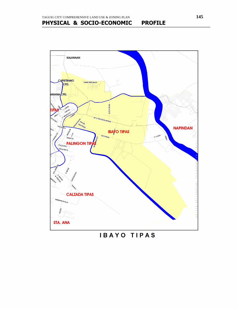
TAGUIG CITY COMPREHENSIVE LAND USE & ZONING PLAN 145
PHYSICAL & SOCIO-ECONOMIC PROFILE
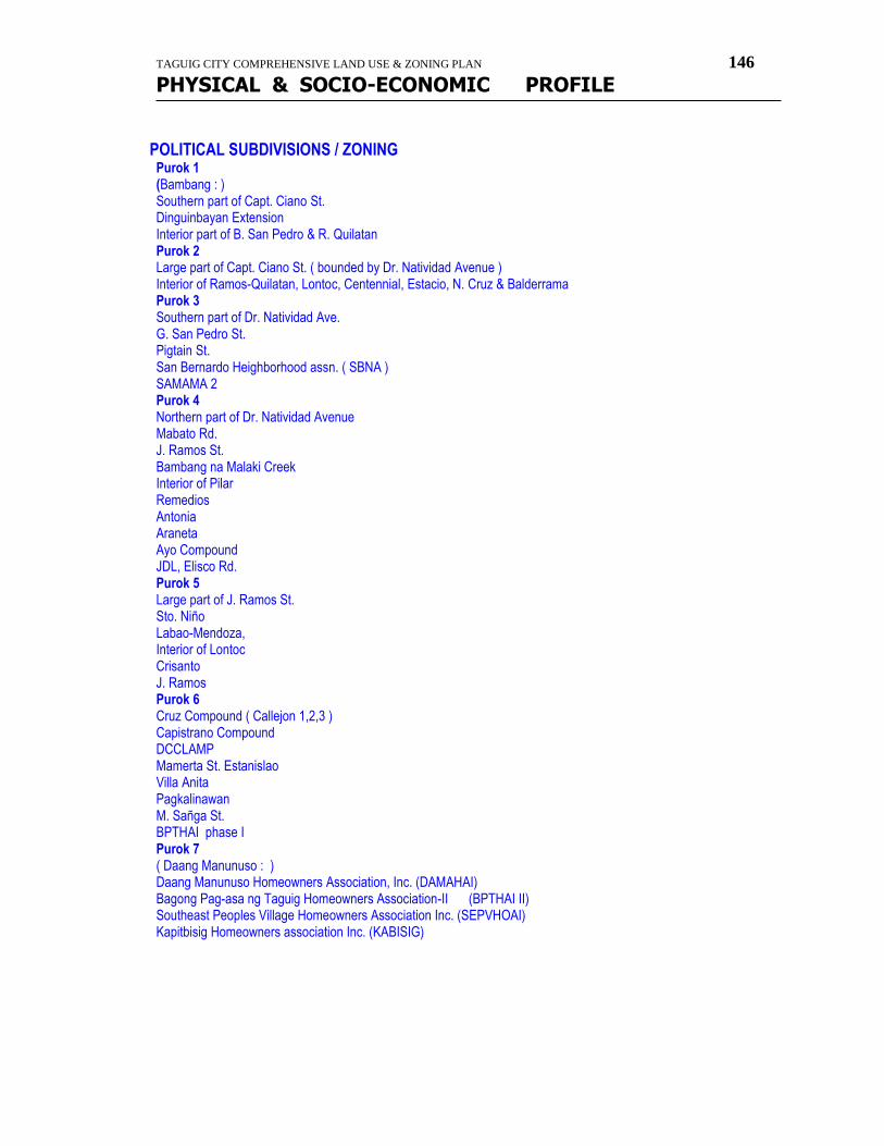
TAGUIG CITY COMPREHENSIVE LAND USE & ZONING PLAN 146
PHYSICAL & SOCIO-ECONOMIC PROFILE
POLITICAL SUBDIVISIONS / ZONING
Purok 1 (Bambang : ) Southern part of Capt. Ciano St. Dinguinbayan Extension Interior part of B. San Pedro & R. Quilatan Purok 2 Large part of Capt. Ciano St. ( bounded by Dr. Natividad Avenue ) Interior of Ramos-Quilatan, Lontoc, Centennial, Estacio, N. Cruz & Balderrama Purok 3 Southern part of Dr. Natividad Ave. G. San Pedro St. Pigtain St. San Bernardo Heighborhood assn. ( SBNA ) SAMAMA 2 Purok 4 Northern part of Dr. Natividad Avenue Mabato Rd. J. Ramos St. Bambang na Malaki Creek Interior of Pilar Remedios Antonia Araneta Ayo Compound JDL, Elisco Rd. Purok 5 Large part of J. Ramos St. Sto. Niño Labao-Mendoza, Interior of Lontoc Crisanto J. Ramos Purok 6 Cruz Compound ( Callejon 1,2,3 ) Capistrano Compound DCCLAMP Mamerta St. Estanislao Villa Anita Pagkalinawan M. Sañga St. BPTHAI phase I Purok 7 ( Daang Manunuso : ) Daang Manunuso Homeowners Association, Inc. (DAMAHAI) Bagong Pag-asa ng Taguig Homeowners Association-II (BPTHAI II) Southeast Peoples Village Homeowners Association Inc. (SEPVHOAI) Kapitbisig Homeowners association Inc. (KABISIG)
TAGUIG CITY COMPREHENSIVE LAND USE & ZONING PLAN 147
PHYSICAL & SOCIO-ECONOMIC PROFILE
LAND AREAS / WATER BODIES Land Area = 1.56 sq. km. Water Bodies : Manunuso Creek
Tipas Labasan River Mabato Creek Sapang Katwiran Ilog- Tipas
NATURAL RESOURCES POPULATION DYNAMICS / HOUSEHOLD SIZE
Population : 16,637 Male : Female : Senior Citizen : Children(18 & below) : 7,204 No. of Registered Voters : 7,595 No. of Polling Precincts : 41 No. of Household/Families : 3,657 Average size of family : 4.55 Population Growth Rate : Population Density/hectare : 10,665 person/sq.km.
INCOME DISTRIBUTION / CLASSIFICATION
EMPLOYMENT / LABOR FORCE
GROWTH & TRENDS
SOCIO-ECONOMIC ACTIVITIES AGRICULTURAL MANUFACTURING / INDUSTRIAL/COMMERCE / TRADE
NATURE OF BUSINESS # of ESTABLISHMENTS
Manufacturer/Batching Plant/Warehouse 38 companies Junkshop 7 Bakery 20 Carinderia/Eatery 19 Computer Shop/Video Games 3 Gift shop/Gen. Merchandising 4 Hardware 5 Drugstore/Pharmacy 1 Distilled Water Dealer 1 Beauty parlor/Barbershop 2 Sari-sari Store 165 Market/Talipapa 2 Banks 0
TAGUIG CITY COMPREHENSIVE LAND USE & ZONING PLAN 148
PHYSICAL & SOCIO-ECONOMIC PROFILE
TOURISM / EDUCATION Education Kindergarten, Nursery, Prep. ----Private School---SAMAMA 2 HEALTH / NUTRITION / SOCIAL SERVICES Health Center Brgy. Ibayo Health Center Nutritional Status: # of Pre-Schoolers Weighed 1st Degree Malnourish 2nd Degree Malnourish 3rd Degree Malnourish Dental Clinic Brgy. Ibayo Health Center Quilatan Dental Clinic Barangay Hall Ibayo Tipas Brgy. Hall Day Care Centers Ibayo Tipas Day Care Center Capistrano Day Care Center Manunuso Day Care Center BPTHAI 2 Day Care Center DCCLAMP Day Care Center BSF Outpost Ibayo Tipas Brgy. Hall Capistrano BSF Outpost J. Ramos BSF Outpost Daang Manunuso BSF Outpost
OTHERS Religious Establishments Ugnayon ng Ibayo Tipas San Isidro Labrador Chapel--BPTHAI 2 San Isidro Labrador Chapel--DCCLAMP Bible Baptist--JDL Comp. Christian Fellowship Parks & Recreational Facilities Lakeshore Dike--Ilog Labasan/Laguna Lake
Brgy. Hall Children Playground Basketball Court Open Court---Ayo Comp. Covered Court--SEPVHOA Comp. Half Court----Cruz Comp. Half Court----BPTHAI 1 Multi Purpose Hall Open Court----Daang Manunuso Subdivisions JDL Compound-----Elisco Road BPTHAI 1------HRCapistrano St. BPTHAI 2-----Daang Manunuso Comp. Cruz Compound Capistrano Compound Pagkalinawan Compound C. S. Mendoza Compound Southeast People Village (SEPVHOA) San Bernardo Compound SAMAMA 2
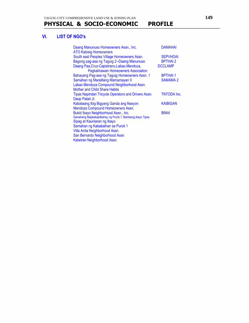
TAGUIG CITY COMPREHENSIVE LAND USE & ZONING PLAN 149
PHYSICAL & SOCIO-ECONOMIC PROFILE
VI. LIST OF NGO's Daang Manunuso Homeowners Assn., Inc. DAMAHAI ATO Kabisig Homeowners South east Peoples Village Homeowners Assn. SEPVHOAI Bagong pag-asa ng Taguig 2--Daang Manunuso BPTHAI 2 Daang Paa,Cruz-Capistrano,Labao,Mendoza, DCCLAMP Pagkalinawan Homeowners Association Bahayang Pag-asa ng Taguig Homeowners Assn. 1 BPTHAI 1 Samahan ng Maralitang Mamamayan II SAMAMA 2 Labao Mendoza Compound Neighborhood Assn. Mother and Child Share Habits Tipas Napindan Tricycle Operators and Drivers Assn. TNTODA Inc. Daop Palad Jr. Kabataang Ibig Bigyang Ganda ang Nasyon KAIBIGAN Mendoza Compound Homeowners Assn. Bukid Ibayo Neighborhood Assn., Inc. BINAI Samahang Magkakapitbahay ng Purok 1, Bambang,Ibayo Tipas
Sipag at Kaunlaran ng Ibayo Samahan ng Kababaihan sa Purok 1 Villa Anita Neighborhood Assn. San Bernardo Neighborhood Assn Katwiran Neighborhood Assn.
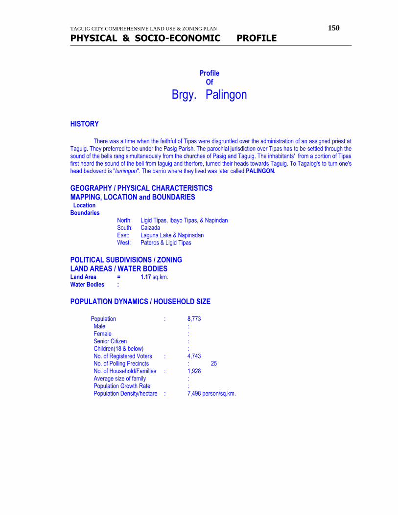
TAGUIG CITY COMPREHENSIVE LAND USE & ZONING PLAN 150
PHYSICAL & SOCIO-ECONOMIC PROFILE
Profile
Of
Brgy. Palingon HISTORY
There was a time when the faithful of Tipas were disgruntled over the administration of an assigned priest at
Taguig. They preferred to be under the Pasig Parish. The parochial jurisdiction over Tipas has to be settled through the sound of the bells rang simultaneously from the churches of Pasig and Taguig. The inhabitants' from a portion of Tipas first heard the sound of the bell from taguig and therfore, turned their heads towards Taguig. To Tagalog's to turn one's head backward is "lumingon". The barrio where they lived was later called PALINGON.
GEOGRAPHY / PHYSICAL CHARACTERISTICS MAPPING, LOCATION and BOUNDARIES Location Boundaries
North: Ligid Tipas, Ibayo Tipas, & Napindan South: Calzada East: Laguna Lake & Napinadan West: Pateros & Ligid Tipas
POLITICAL SUBDIVISIONS / ZONING LAND AREAS / WATER BODIES Land Area = 1.17 sq.km. Water Bodies :
POPULATION DYNAMICS / HOUSEHOLD SIZE
Population : 8,773 Male : Female : Senior Citizen : Children(18 & below) :
No. of Registered Voters : 4,743 No. of Polling Precincts : 25 No. of Household/Families : 1,928 Average size of family : Population Growth Rate : Population Density/hectare : 7,498 person/sq.km.
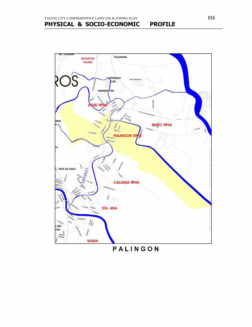
TAGUIG CITY COMPREHENSIVE LAND USE & ZONING PLAN 151
PHYSICAL & SOCIO-ECONOMIC PROFILE
TAGUIG CITY COMPREHENSIVE LAND USE & ZONING PLAN 152
PHYSICAL & SOCIO-ECONOMIC PROFILE
SOCIO-ECONOMIC ACTIVITIES
AGRICULTURAL MANUFACTURING / INDUSTRIAL/COMMERCE / TRADE TOURISM / EDUCATION
Education Public School Tipas Elementary School Tipas National High School Private School St. Vincent Learning Center Precious Academy Eastern Academy
HEALTH / NUTRITION / SOCIAL SERVICES
Health Center Brgy. Palingon Health Center Barangay Hall Brgy. Palingon Brgy. Hall Day Care Centers Palingon Tipas Day Care Center OTHERS Religious Establishments Holy Cross Chapel Sto. Niño Chapel Christian Fellowship Parks & Recreational Facilities
Palingon Mini-Park & Playground Basketball Court Dinguinbayan Basketball Court-Private
Covered Court--Estacio St. (Public) Subdivisions St. Peter Subdivision
LIST OF NGO's Barangay Palingon Disaster Brigade East Palingon Neighborhood Assn. ESPANA Ibayo Palingon Neighborhood Assn., Inc. IPNAI Nagdamayang Magkakapitbahay NADAMA Grupo ng Magkakapitbahay Holy Grace Neighborhood Assn., Inc. Samahang Maralita ng Palingon (SMP-7), Inc. Sinchioco Urban Homeowners Assn., Inc. SUHAI
TAGUIG CITY COMPREHENSIVE LAND USE & ZONING PLAN 153
PHYSICAL & SOCIO-ECONOMIC PROFILE
Profile Of
Brgy. Western Bicutan HISTORY
Due to sizes of Bicutan and Bagumbayan, the Municipal Council of Taguig per Resolution No. 51 dated July 15, 1971, created Barangay by splitting Bicutan, and one of this is Western Bicutan. It was 1965 when the Tenement Housing Project of the late-President diosdado Macapagal was finished and awarded to people. This was the place where most of the known pioneer members of this Barangay comprised of. The housing project has seven (7) floors with 96 rooms apartment per floor. The mailing address of this was Tenement Housing Fort Bonifacio, Makati Rizal. With the supervision of Gen. Espino and Gen. Balbanero, there was an appointed Kapitan Del Barrio for Tenement Housing. It was in the person of Kapitan Gutierrez. After the election in 1975, the elected Barangay Captain was Mr. Eddie Reyes. With the cadastral map of DENR, it was known that the Tenement Housing was legally part of Taguig. In the administration of late-President Ferdinand E. Marcos, another housing project was built. The Bagong Lipunan Condominium (BLC) was constructed with the supervision of The First Lady Imelda R. Marcos. The Mayor of Taguig then was Hon. Levi V. Mariano and the Barangay Captain was still Mr. Reyes - both of them for almost twenty years in office because of the Martial Law. At those times, President Marcos organized a Metro Manila Commission and one of the provisions was - Taguig which used to be part of Rizal province should be part of Metro Manila and National Capital Region (NCR). The Barangay Western Bicutan, Taguig, Metro Manila then stand as an independent strong Barangay with a budget of only P55,000.00. With that cost, Mr. Reyes and his Chief Tanod were killed with unknown cause. Assigned to replace Mr. Reyes was Mr. Perez, who with unknown cause was also killed. Former Congressman of Taguig then was Dante O. Tiñga, and he assigned Mr. Carlos Catacio to be the next Barangay captain and his Secretary was Mr. Loreto Añonuevo and Treasurer was Mrs. Linda Padlan. In the Barangay Election in 1989, the candidate who gained highest vote was Mr. Carlos Catacio. The next higher pointers were Ben Bedoya, Rudy Guiyab, Armando Lopez, Ruben Mercado, Jun Carmen,Jr., Rico Reyes. Assigned Secretary was still Mr. Añonuevo. In 1992, Mr. Catacio and Mr. Rico Reyes filed candidacy for Councilor of Taguig. Municipal Mayor Ricky Papa appointed Mr. Filomino Togono as Barangay Captain and Mr. Jimmy Vasquez as Kagawad.
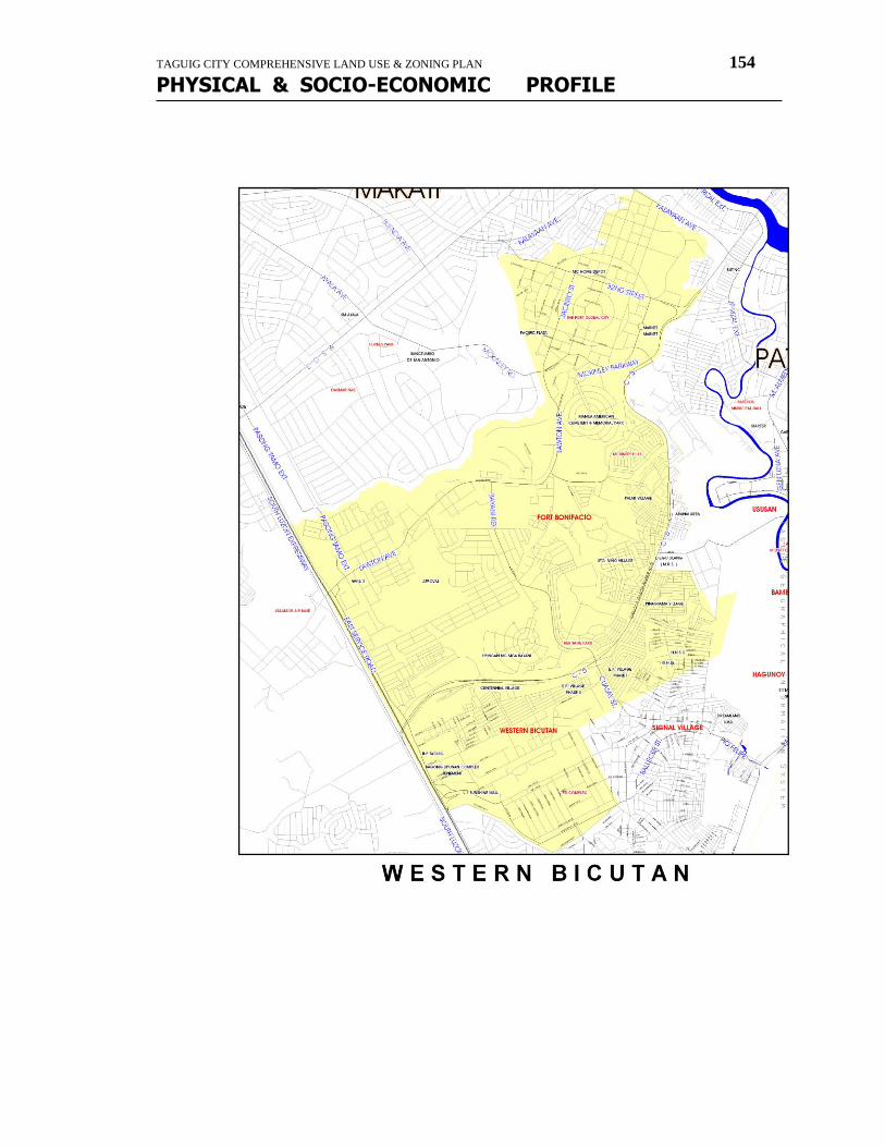
TAGUIG CITY COMPREHENSIVE LAND USE & ZONING PLAN 154
PHYSICAL & SOCIO-ECONOMIC PROFILE
TAGUIG CITY COMPREHENSIVE LAND USE & ZONING PLAN 155
PHYSICAL & SOCIO-ECONOMIC PROFILE
The revenue collection of Barangay Western Bicutan went good that time. Another Barangay Captain handled the post, in the person of Mr. Ben Bedoya, and during his time the first 2-storey Barangay hall was built. Western Bicutan now is the number one among the 18 barangays of the City of Taguig, in terms of revenue. It is because of the business establishments that are now in the area of jurisdiction of Western Bicutan. The Global City which is known as the "milking cow" of City of Taguig due to big companies and businesses arising, is also here at Western Bicutan. In terms of number of people, this the most populated barangay and the biggest area of jurisdiction. This is truly the "Sleeping Giant" as stated by the Municipal treasurer's Office because of the estimated income last year 2004. It has a revenue of P38,000.00 and more, and this will continue to rise this CY 2005.
GEOGRAPHY / PHYSICAL CHARACTERISTICS MAPPING, LOCATION and BOUNDARIES
Location
Boundaries North: Makati and Mandaluyong South: Parañaque and Brgy. Upper Bicutan East: Parañaque West: Brgy. Signal Village
POLITICAL SUBDIVISIONS / ZONING
Zone 1 - TUP, Tenement Bldg., Lower and Upper Bagong Lipunan Condominium Zone 2 - PNR Site FTI Compound Zone 3 - Sampaguita, Kabuyao, Gumamela Goco, Kasoy, Sampaloc, Champaca, Sahing Salong, Block 10 Bato, Iriga, Baao, Balatan, Kalamansi, Manggahan, Kakawati, LRT Eucalyptus, Kakaw, Kalamansi, Sambong, Makabuhay, Kabline, Kalantas Zone 4-A - EP Village Phase II Zone 4-B - EP Village Phase I Zone 5 - Pinagsama Village Phase I, Pinagsama Vilage Phase II Zone 6 - Sitio Matatag, Sitio Masagana, Sitio Masigasig II, Sitio Masigasig I, Purok II Dita St. Purok 3 Albutra, Purok 4 Champaca, Purok 9 PNR ESR, Sitio Maliwanag, Katipunan Village, AFPOVAI Zone 7-A - Sitio I, II, III, IV, V, VI Zone 7-B - Sitio Pinaglabanan, Sitio Pagkakaisa, Sitio Kaunlaran, Sitio Glitz Zone 7-C - BNS Fort Bonifacio Zone 8 - Consular Area Zone 9 - SS Brigade Village Zone 10 - BCDA Centennial Village Zone 11 - Upper West, ISG Central, Panam Village Zone 12-A - G-2 Village, 16th ISU, Palar Village Zone 12-B - Palar Zone 13 - JUSMAG
LAND AREAS / WATER BODIES
Land Area = 19.91 sq. km. Water Bodies :
TAGUIG CITY COMPREHENSIVE LAND USE & ZONING PLAN 156
PHYSICAL & SOCIO-ECONOMIC PROFILE
POPULATION DYNAMICS / HOUSEHOLD SIZE
Population : 110,703 Male : Female : Senior Citizen : Children(18 & below) :
No. of Registered Voters : 51,647 No. of Polling Precincts : 288 No. of Household/Families : 24,330 Average size of family : Population Growth Rate : Population Density/hectare : 5,560 person/sq.km.
SOCIO-ECONOMIC ACTIVITIES AGRICULTURAL MANUFACTURING / INDUSTRIAL/COMMERCE / TRADE NATURE OF BUSINESS # of ESTABLISHMENTS TOURISM / EDUCATION Education College--Public Technological Institute of Technology (TUP) College--Private AMA Computer Learning Center High School--Public Western Bicutan National High School High School--Private Asian Polytechnic College Elementary--Public Tenement Elementary School Eddie Reyes Elementary School Elementary w/ Kindergarten/Nursery--Private Patricia Foundation school Promise Land Baptist Learning school EP Ville Integrated Academy Academia de San Isidro Go and shine Learning School Sootaville Woodland School Progressive Christian Academy--Montessori Oriented Curriculum HEALTH / NUTRITION / SOCIAL SERVICES Hospitals Taguig-Pateros Disrict Hospital Lying-in Clinic Doctor's Polyclinic Maternity Lying in Gallo Medical Clinic Health Center East service Road Health Center Nutritional Status: # of Pre-Schoolers Weighed 1st Degree Malnourish 2nd Degree Malnourish 3rd Degree Malnourish
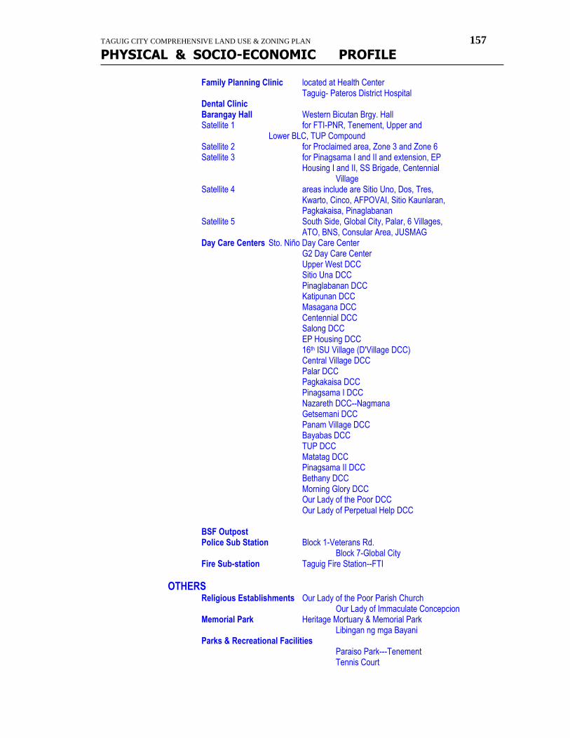
TAGUIG CITY COMPREHENSIVE LAND USE & ZONING PLAN 157
PHYSICAL & SOCIO-ECONOMIC PROFILE
Family Planning Clinic located at Health Center Taguig- Pateros District Hospital Dental Clinic Barangay Hall Western Bicutan Brgy. Hall Satellite 1 for FTI-PNR, Tenement, Upper and Lower BLC, TUP Compound Satellite 2 for Proclaimed area, Zone 3 and Zone 6 Satellite 3 for Pinagsama I and II and extension, EP Housing I and II, SS Brigade, Centennial Village Satellite 4 areas include are Sitio Uno, Dos, Tres, Kwarto, Cinco, AFPOVAI, Sitio Kaunlaran, Pagkakaisa, Pinaglabanan Satellite 5 South Side, Global City, Palar, 6 Villages, ATO, BNS, Consular Area, JUSMAG Day Care Centers Sto. Niño Day Care Center G2 Day Care Center Upper West DCC Sitio Una DCC Pinaglabanan DCC Katipunan DCC Masagana DCC Centennial DCC Salong DCC EP Housing DCC 16th ISU Village (D'Village DCC) Central Village DCC Palar DCC Pagkakaisa DCC Pinagsama I DCC Nazareth DCC--Nagmana Getsemani DCC Panam Village DCC Bayabas DCC TUP DCC Matatag DCC Pinagsama II DCC Bethany DCC Morning Glory DCC Our Lady of the Poor DCC Our Lady of Perpetual Help DCC BSF Outpost Police Sub Station Block 1-Veterans Rd. Block 7-Global City Fire Sub-station Taguig Fire Station--FTI
OTHERS Religious Establishments Our Lady of the Poor Parish Church Our Lady of Immaculate Concepcion Memorial Park Heritage Mortuary & Memorial Park Libingan ng mga Bayani Parks & Recreational Facilities Paraiso Park---Tenement Tennis Court
TAGUIG CITY COMPREHENSIVE LAND USE & ZONING PLAN 158
PHYSICAL & SOCIO-ECONOMIC PROFILE
Baseball Court Swimming Pool Basketball Court Open Court---Sitio Una Covered Court--EP Housing I Covered Court--EP Housing II Covered Court--Pinagsama Village Covered Court--Sitio Una Open Court----G2 Village Subdivisions Bagong Lipunan Condominium (BLC) EP Village phase I EP Village phase II Pinagsama Village MRB Habitat Tenement Building Veterans center NHA Condominium
LIST OF NGO's Block 84 & 85 Homeowners Assn. Una Neighborhood Assn., Inc. Bagong Silang Vendors Assn., Inc. TUP Residence Assn., Inc. Fort Andres Bonifacio South Sector Nghd. Assn., Inc. Enlisted Personnel of AFP Nghd. Assn., Inc, Samahang Magkakapitbahay Asso., Inc. Taguig Nghd. Assn., Inc. SMTFM SMTFM Consumer Cooperative Inc. Association of Democratic Labor Organic Dyne-Sym Employee Devt. Nagkakaisang Maralitang Nangungupahan Inc. Samahan ng mga Naninirahan sa Lot 1 & 2 Boundary Homeowners assn., Inc. Kabuhayan Kaunlaran ng Kanahon ng Sto. Niño Western Bicutan Neighborhood Assn., Inc. Mondragon Foundation inc. Urban Poor Institute for Community Bldg. Inc.----UPICOB
LISTING / PROFILE OF ESTABLISHMENTS Business Establishments Triumph International Phil., Inc. Estrella Foods Products Special Construction Products MML Development Corporation Traffic Control Products Corp. Hon-fil Agri-Development Veterans Electronics Aspimex Griffith Laboratory Philippines, Inc. Baltimore Spice Philippines Felipe Bacani (Commerce/Retailer) Tierra factors (Wholesaler) Manila Banking Corporation Philippine National Bank
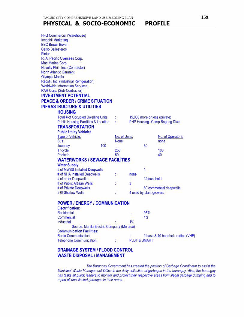
TAGUIG CITY COMPREHENSIVE LAND USE & ZONING PLAN 159
PHYSICAL & SOCIO-ECONOMIC PROFILE
Hi-Q Commercial (Warehouse) Incophil Marketing BBC Brown Boveri Celso Ballesteros Pintar R. A. Pacific Overseas Corp. Mae Marine Corp. Novelty Phil., Inc. (Contractor) North Atlantic Garment Olympia Manila Recofil, Inc. (Industrial Refrigeration) Worldwide Information Services RAH Corp. (Sub-Contractor)
INVESTMENT POTENTIAL PEACE & ORDER / CRIME SITUATION INFRASTRUCTURE & UTILITIES HOUSING Total # of Occupied Dwelling Units : 15,000 more or less (private) Public Housing Facilities & Location : PNP Housing--Camp Bagong Diwa
TRANSPORTATION Public Utility Vehicles Type of Vehicle: No. of Units: No. of Operators: Bus None none Jeepney 100 80 Tricycle 250 100 Pedicab 50 40
WATERWORKS / SEWAGE FACILITIES Water Supply: # of MWSS Installed Deepwells : 1 # of NHA Installed Deepwells : none # of other Deepwells : 1/household # of Public Artisan Wells : 3 # of Private Deepwells : 50 commercial deepwells # 0f Shallow Wells : 4 used by plant growers
POWER / ENERGY / COMMUNICATION Electrification: Residential : 95% Commercial : 4% Industrial : 1% Source: Manila Electric Company (Meralco) Communication Facilities: Radio Communication : 1 base & 40 handheld radios (VHF) Telephone Communication : PLDT & SMART
DRAINAGE SYSTEM / FLOOD CONTROL WASTE DISPOSAL / MANAGEMENT
The Barangay Government has created the position of Garbage Coordinator to assist the Municipal Waste Management Office in the daily collection of garbages in the barangay. Also, the barangay has tasks all purok leaders to monitor and protect their respective areas from illegal garbage dumping and to report all uncollected garbages in their areas.
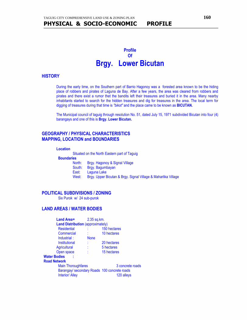
TAGUIG CITY COMPREHENSIVE LAND USE & ZONING PLAN 160
PHYSICAL & SOCIO-ECONOMIC PROFILE
Profile
Of
Brgy. Lower Bicutan HISTORY
During the early time, on the Southern part of Barrio Hagonoy was a forested area known to be the hiding place of robbers and pirates of Laguna de Bay. After a few years, the area was cleared from robbers and pirates and there exist a rumor thet the bandits left their treasures and buried it in the area. Many nearby inhabitants started to search for the hidden treasures and dig for treasures in the area. The local term for digging of treasures during that time is "bikot" and the place came to be known as BICUTAN. The Municipal council of taguig through resolution No. 51, dated July 15, 1971 subdivided Bicutan into four (4) barangays and one of this is Brgy. Lower Bicutan.
GEOGRAPHY / PHYSICAL CHARACTERISTICS MAPPING, LOCATION and BOUNDARIES
Location Situated on the North Eastern part of Taguig
Boundaries North: Brgy. Hagonoy & Signal Village South: Brgy. Bagumbayan East: Laguna Lake West: Brgy. Upper Bicutan & Brgy. Signal Village & Maharlika Village
POLITICAL SUBDIVISIONS / ZONING Six Purok w/ 24 sub-purok
LAND AREAS / WATER BODIES
Land Area = 2.35 sq.km. Land Distribution (approximately) Residential : 150 hectares Commercial : 10 hectares Industrial : None Institutional : 20 hectares Agricultural : 5 hectares Open space : 15 hectares
Water Bodies : Road Network Main Thoroughfares 3 concrete roads Barangay/ secondary Roads 100 concrete roads Interior/ Alley 120 alleys
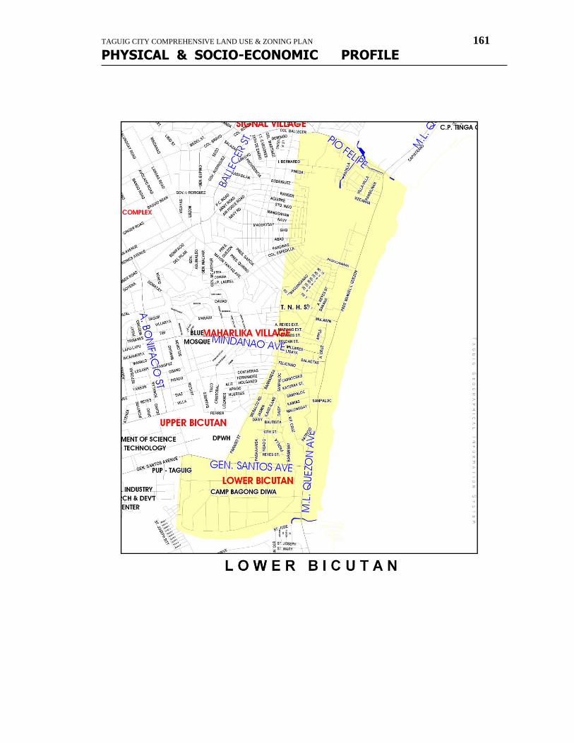
TAGUIG CITY COMPREHENSIVE LAND USE & ZONING PLAN 161
PHYSICAL & SOCIO-ECONOMIC PROFILE
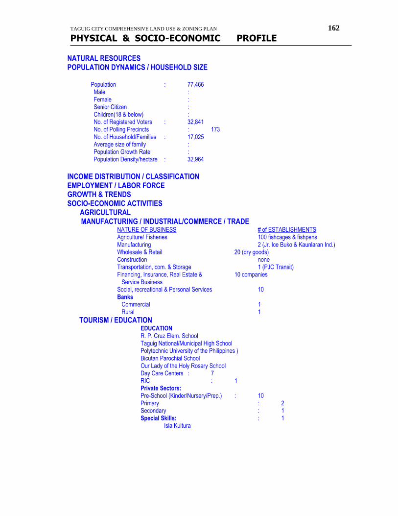
TAGUIG CITY COMPREHENSIVE LAND USE & ZONING PLAN 162
PHYSICAL & SOCIO-ECONOMIC PROFILE
NATURAL RESOURCES POPULATION DYNAMICS / HOUSEHOLD SIZE
Population : 77,466 Male : Female : Senior Citizen : Children(18 & below) :
No. of Registered Voters : 32,841 No. of Polling Precincts : 173 No. of Household/Families : 17,025 Average size of family : Population Growth Rate : Population Density/hectare : 32,964
INCOME DISTRIBUTION / CLASSIFICATION EMPLOYMENT / LABOR FORCE GROWTH & TRENDS SOCIO-ECONOMIC ACTIVITIES AGRICULTURAL MANUFACTURING / INDUSTRIAL/COMMERCE / TRADE NATURE OF BUSINESS # of ESTABLISHMENTS Agriculture/ Fisheries 100 fishcages & fishpens Manufacturing 2 (Jr. Ice Buko & Kaunlaran Ind.) Wholesale & Retail 20 (dry goods) Construction none Transportation, com. & Storage 1 (PJC Transit) Financing, Insurance, Real Estate & 10 companies Service Business Social, recreational & Personal Services 10 Banks Commercial 1 Rural 1
TOURISM / EDUCATION EDUCATION R. P. Cruz Elem. School Taguig National/Municipal High School Polytechnic University of the Philippines ) Bicutan Parochial School Our Lady of the Holy Rosary School Day Care Centers : 7 RIC : 1 Private Sectors: Pre-School (Kinder/Nursery/Prep.) : 10 Primary : 2 Secondary : 1 Special Skills: : 1 Isla Kultura
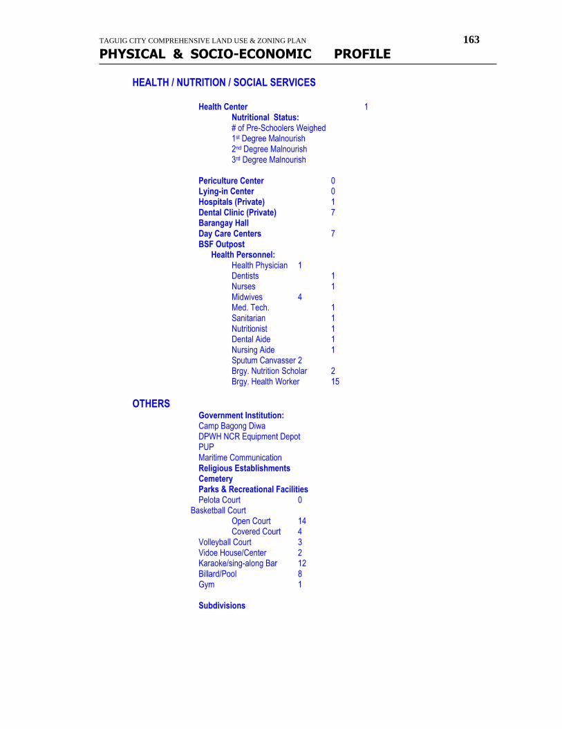
TAGUIG CITY COMPREHENSIVE LAND USE & ZONING PLAN 163
PHYSICAL & SOCIO-ECONOMIC PROFILE
HEALTH / NUTRITION / SOCIAL SERVICES Health Center 1 Nutritional Status: # of Pre-Schoolers Weighed 1st Degree Malnourish 2nd Degree Malnourish 3rd Degree Malnourish Periculture Center 0 Lying-in Center 0 Hospitals (Private) 1 Dental Clinic (Private) 7 Barangay Hall Day Care Centers 7 BSF Outpost Health Personnel:
Health Physician 1 Dentists 1 Nurses 1 Midwives 4 Med. Tech. 1 Sanitarian 1 Nutritionist 1 Dental Aide 1 Nursing Aide 1 Sputum Canvasser 2 Brgy. Nutrition Scholar 2 Brgy. Health Worker 15
OTHERS Government Institution: Camp Bagong Diwa DPWH NCR Equipment Depot PUP Maritime Communication Religious Establishments Cemetery Parks & Recreational Facilities Pelota Court 0 Basketball Court Open Court 14 Covered Court 4 Volleyball Court 3 Vidoe House/Center 2 Karaoke/sing-along Bar 12 Billard/Pool 8 Gym 1 Subdivisions
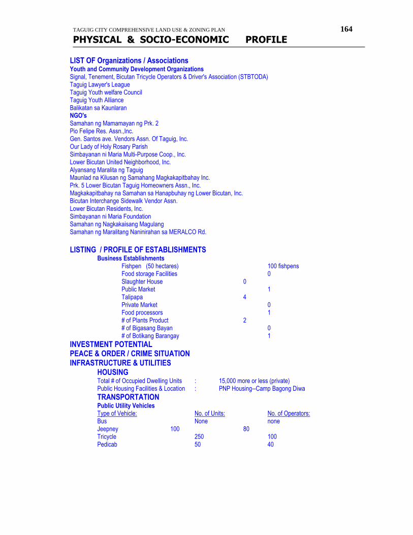
TAGUIG CITY COMPREHENSIVE LAND USE & ZONING PLAN 164
PHYSICAL & SOCIO-ECONOMIC PROFILE
LIST OF Organizations / Associations Youth and Community Development Organizations Signal, Tenement, Bicutan Tricycle Operators & Driver's Association (STBTODA) Taguig Lawyer's League Taguig Youth welfare Council Taguig Youth Alliance Balikatan sa Kaunlaran NGO's Samahan ng Mamamayan ng Prk. 2 Pio Felipe Res. Assn.,Inc. Gen. Santos ave. Vendors Assn. Of Taguig, Inc. Our Lady of Holy Rosary Parish Simbayanan ni Maria Multi-Purpose Coop., Inc. Lower Bicutan United Neighborhood, Inc. Alyansang Maralita ng Taguig Maunlad na Kilusan ng Samahang Magkakapitbahay Inc. Prk. 5 Lower Bicutan Taguig Homeowners Assn., Inc. Magkakapitbahay na Samahan sa Hanapbuhay ng Lower Bicutan, Inc. Bicutan Interchange Sidewalk Vendor Assn. Lower Bicutan Residents, Inc. Simbayanan ni Maria Foundation Samahan ng Nagkakaisang Magulang Samahan ng Maralitang Naninirahan sa MERALCO Rd.
LISTING / PROFILE OF ESTABLISHMENTS Business Establishments
Fishpen (50 hectares) 100 fishpens Food storage Facilities 0 Slaughter House 0 Public Market 1 Talipapa 4 Private Market 0 Food processors 1 # of Plants Product 2 # of Bigasang Bayan 0 # of Botikang Barangay 1 INVESTMENT POTENTIAL PEACE & ORDER / CRIME SITUATION INFRASTRUCTURE & UTILITIES HOUSING Total # of Occupied Dwelling Units : 15,000 more or less (private) Public Housing Facilities & Location : PNP Housing--Camp Bagong Diwa
TRANSPORTATION Public Utility Vehicles Type of Vehicle: No. of Units: No. of Operators: Bus None none Jeepney 100 80 Tricycle 250 100 Pedicab 50 40
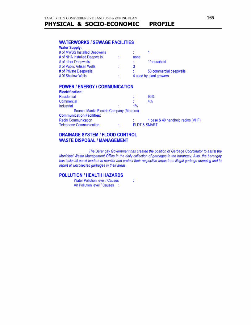
TAGUIG CITY COMPREHENSIVE LAND USE & ZONING PLAN 165
PHYSICAL & SOCIO-ECONOMIC PROFILE
WATERWORKS / SEWAGE FACILITIES Water Supply: # of MWSS Installed Deepwells : 1 # of NHA Installed Deepwells : none # of other Deepwells : 1/household # of Public Artisan Wells : 3 # of Private Deepwells : 50 commercial deepwells # 0f Shallow Wells : 4 used by plant growers
POWER / ENERGY / COMMUNICATION Electrification: Residential : 95% Commercial : 4% Industrial : 1% Source: Manila Electric Company (Meralco) Communication Facilities: Radio Communication : 1 base & 40 handheld radios (VHF) Telephone Communication : PLDT & SMART
DRAINAGE SYSTEM / FLOOD CONTROL WASTE DISPOSAL / MANAGEMENT
The Barangay Government has created the position of Garbage Coordinator to assist the Municipal Waste Management Office in the daily collection of garbages in the barangay. Also, the barangay has tasks all purok leaders to monitor and protect their respective areas from illegal garbage dumping and to report all uncollected garbages in their areas.
POLLUTION / HEALTH HAZARDS Water Pollution level / Causes : Air Pollution level / Causes :
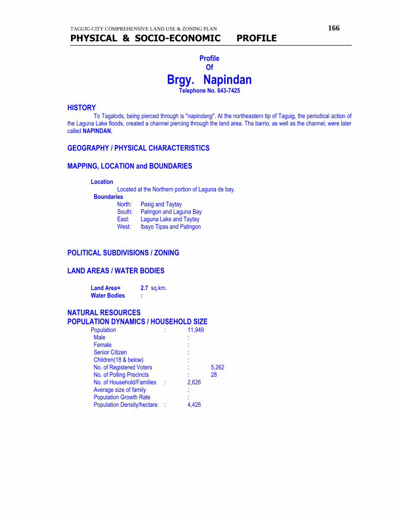
TAGUIG CITY COMPREHENSIVE LAND USE & ZONING PLAN 166
PHYSICAL & SOCIO-ECONOMIC PROFILE
Profile Of
Brgy. Napindan Telephone No. 643-7425
HISTORY To Tagalods, being pierced through is "napindang". At the northeastern tip of Taguig, the periodical action of the Laguna Lake floods, created a channel piercing through the land area. Tha barrio, as well as the channel, were later called NAPINDAN.
GEOGRAPHY / PHYSICAL CHARACTERISTICS
MAPPING, LOCATION and BOUNDARIES Location Located at the Northern portion of Laguna de bay.
Boundaries North: Pasig and Taytay South: Palingon and Laguna Bay East: Laguna Lake and Taytay West: Ibayo Tipas and Palingon
POLITICAL SUBDIVISIONS / ZONING
LAND AREAS / WATER BODIES
Land Area = 2.7 sq.km. Water Bodies :
NATURAL RESOURCES POPULATION DYNAMICS / HOUSEHOLD SIZE
Population : 11,949 Male : Female : Senior Citizen : Children(18 & below) :
No. of Registered Voters : 5,262 No. of Polling Precincts : 28 No. of Household/Families : 2,626 Average size of family : Population Growth Rate : Population Density/hectare : 4,426

TAGUIG CITY COMPREHENSIVE LAND USE & ZONING PLAN 167
PHYSICAL & SOCIO-ECONOMIC PROFILE
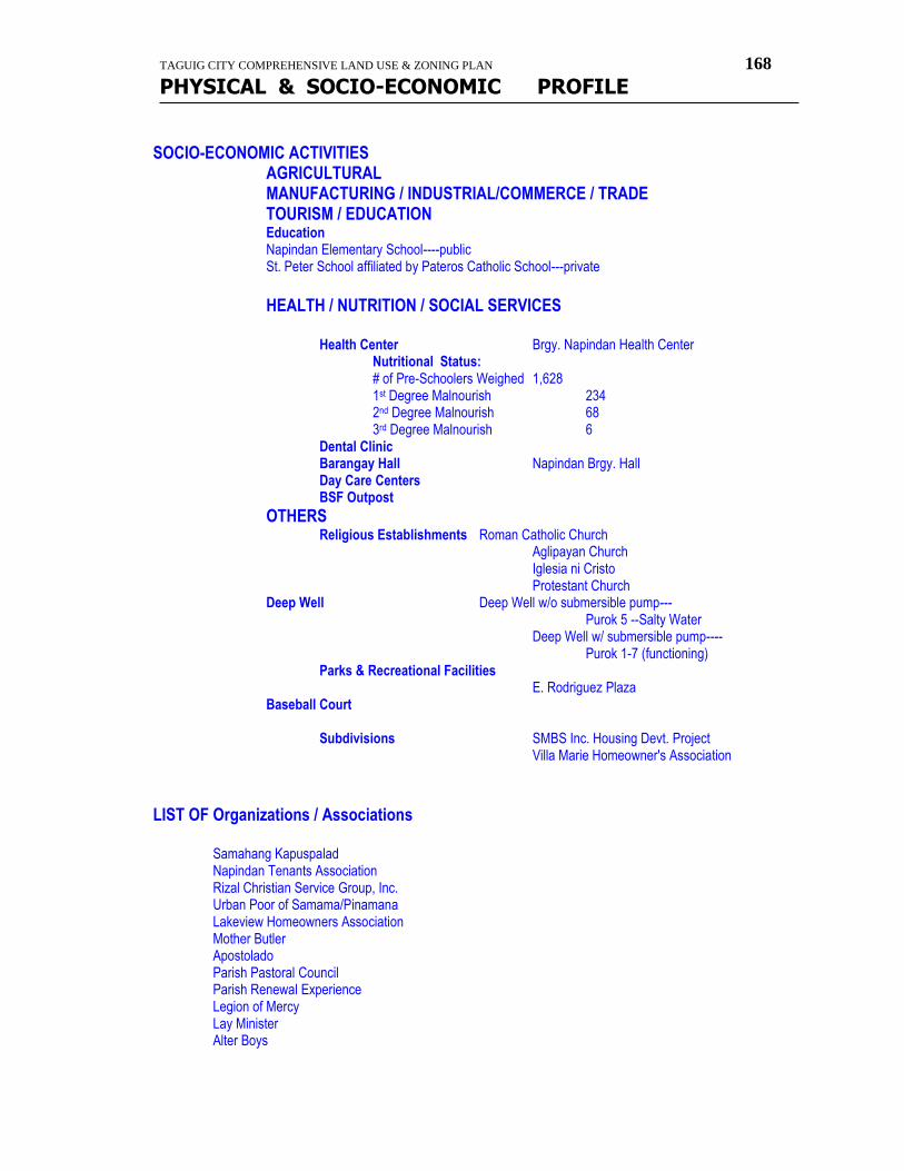
TAGUIG CITY COMPREHENSIVE LAND USE & ZONING PLAN 168
PHYSICAL & SOCIO-ECONOMIC PROFILE
SOCIO-ECONOMIC ACTIVITIES AGRICULTURAL MANUFACTURING / INDUSTRIAL/COMMERCE / TRADE TOURISM / EDUCATION Education Napindan Elementary School----public St. Peter School affiliated by Pateros Catholic School---private HEALTH / NUTRITION / SOCIAL SERVICES Health Center Brgy. Napindan Health Center Nutritional Status: # of Pre-Schoolers Weighed 1,628 1st Degree Malnourish 234 2nd Degree Malnourish 68 3rd Degree Malnourish 6 Dental Clinic Barangay Hall Napindan Brgy. Hall Day Care Centers BSF Outpost
OTHERS Religious Establishments Roman Catholic Church Aglipayan Church Iglesia ni Cristo
Protestant Church Deep Well Deep Well w/o submersible pump--- Purok 5 --Salty Water
Deep Well w/ submersible pump---- Purok 1-7 (functioning) Parks & Recreational Facilities E. Rodriguez Plaza Baseball Court Subdivisions SMBS Inc. Housing Devt. Project Villa Marie Homeowner's Association LIST OF Organizations / Associations Samahang Kapuspalad Napindan Tenants Association Rizal Christian Service Group, Inc. Urban Poor of Samama/Pinamana Lakeview Homeowners Association Mother Butler Apostolado Parish Pastoral Council Parish Renewal Experience Legion of Mercy Lay Minister Alter Boys
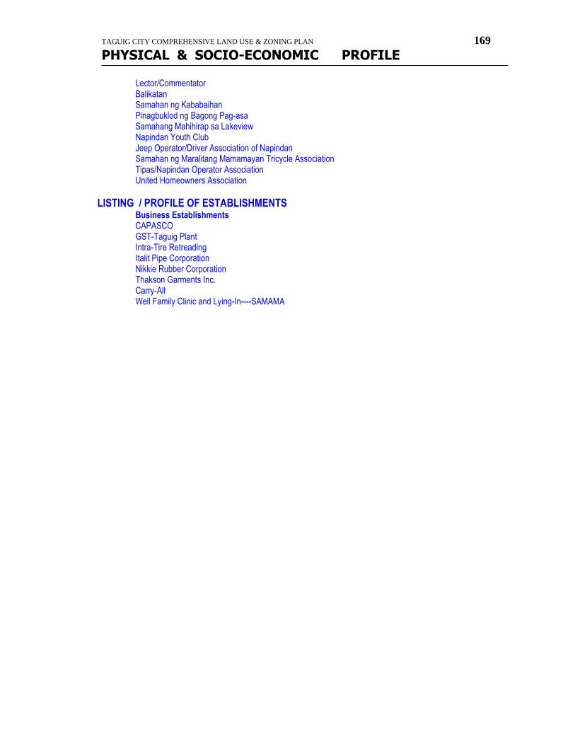
TAGUIG CITY COMPREHENSIVE LAND USE & ZONING PLAN 169
PHYSICAL & SOCIO-ECONOMIC PROFILE
Lector/Commentator Balikatan Samahan ng Kababaihan Pinagbuklod ng Bagong Pag-asa Samahang Mahihirap sa Lakeview Napindan Youth Club Jeep Operator/Driver Association of Napindan Samahan ng Maralitang Mamamayan Tricycle Association Tipas/Napindan Operator Association United Homeowners Association
LISTING / PROFILE OF ESTABLISHMENTS Business Establishments CAPASCO GST-Taguig Plant Intra-Tire Retreading Italit Pipe Corporation Nikkie Rubber Corporation Thakson Garments Inc. Carry-All Well Family Clinic and Lying-In----SAMAMA
TAGUIG CITY COMPREHENSIVE LAND USE & ZONING PLAN 170
PHYSICAL & SOCIO-ECONOMIC PROFILE
Profile Of
Brgy. Bagumbayan HISTORY What's in a name? New is "bago" while settlement is "bayan". When a new settlement was established at the unpopulated southern portion of Taguig, the barrio came to be known as BAGUMBAYAN. Historical Background During the Spanish time, the barangay was one of the remote areas of the Municipality of Taguig. Nobody wants to live in this place, except for the Tanyag and Garcia family from Tipas. When people started to live here, the Spaniards call it the Barangay ng Bayan ng Taguig. And later on it was permanently called Bagumbayan. Mrs. Serena San Juan was first elected as the Cabeza de Barangay, and then it was followed by the following, Tadoy Sta. Teresa, Liza Sta. Teresa, Cepruto Marcelo. During that time, they were call Cabeza de Barangay or Tenyente del Barrio. After the Spanish regime, the American and the Japanese takes place. Mr. Laureano Garcia was elected as the cabeza de Barangay then it was followed by the following, Elino cruz, Benito Garcia, Cerilo P. Santos, Claudio Marcelo and Rufino Dacumos. In 1958, this Barangay was called by many as the sleeping town. The improvement was slow the people have no enough income, and they only depend on fishing and farming as their source of income. But through the effort of the Barangay officials the economy of Barangay Bagumbayan become progressive. In the 1958, the prices of vacant lot become higher. South Super highway was built by the National Government. And from thet time, many corporation and small businessman, starts to put up their own business. Factories and other source of income start to grow. People from different area start to live here. During that time, Taguig was under the leadership of Mr. Augusto M. Garcia as the Bise-Alkalde. At present, Barangay Bagumbayan is one of the most improved Barangay in Taguig.
MAPPING, LOCATION and BOUNDARIES Boundaries North: Lower Bicutan and Bagong Tanyag South: Sucat, Muntinlupa East: Laguna Bay West: Laguna Bay and Bagong Tanyag
LAND AREAS / WATER BODIES
Land Area = 3.62 sq.km.
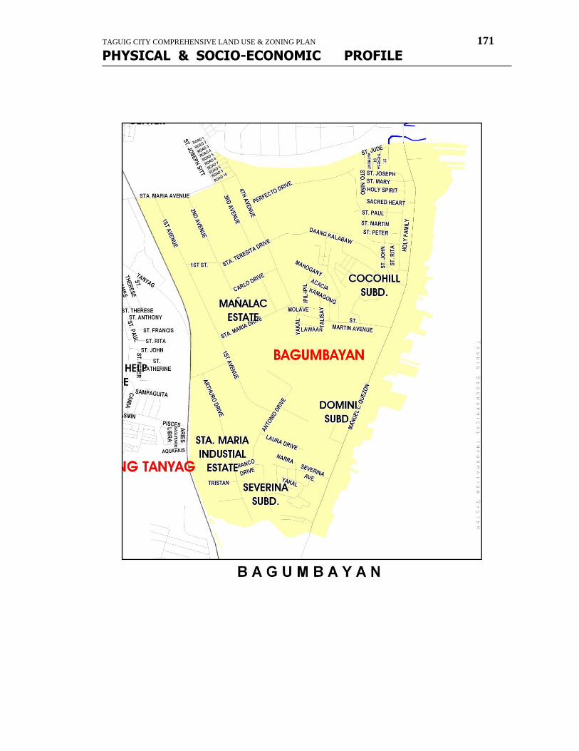
TAGUIG CITY COMPREHENSIVE LAND USE & ZONING PLAN 171
PHYSICAL & SOCIO-ECONOMIC PROFILE
TAGUIG CITY COMPREHENSIVE LAND USE & ZONING PLAN 172
PHYSICAL & SOCIO-ECONOMIC PROFILE
POPULATION DYNAMICS / HOUSEHOLD SIZE
Population : 33,158 No. of Registered Voters : 15,766
No. of Polling Precincts : 82 No. of Household/Families : 7,287 Population Density/hectare : 9,160 person/sq.km.
SOCIO-ECONOMIC ACTIVITIES TOURISM / EDUCATION Education C. P. Sta. Teresa Elementary School -Public -Primary Bagumbayan National High School -Public -Secondary St. Francis of Assisi College System -Private -Primary & Secondary St. Ives School -Private -Primary & Secondary Little Angel Learning Center -Private -Primary M.C.A. Montessori -Private -Primary Salt & Light Academy -Private -Primary Mt. Moriah Christian Academy -Private-Primary & Secondary C.M. School, Inc, -Private -Primary
HEALTH / NUTRITION / SOCIAL SERVICES Hospitals Taguig Doctor's Hospital Holy Mary Hospital Private Clinics Añonuevo Clinic Ponce Clinic Ignacio's Maternity Clinic Gonzales Maternity Clinic Sta. Ana Lying-In Clinic Health Center Brgy. Health Center Barangay Hall Bagumbayan Brgy. Hall Day Care Centers Sitio Butas DCC Aguahan 1 DCC Rocky Side DCC Joseph Sitt DCC Marcelo 1 Ext. DCC
OTHERS Religious Establishments Sagrada Familia Parish Iglesia Filipina Independiente
United Church of Christ in the Phils. El Shaddai Dating Daan Jesus the Lord and Savior Church City of the Lord Salt and Light Community church Free Mission Phis Bagumbayan Christian Church Blessed Rock Church Mt. Moriah Christian Church Christ Liveth in Me
TAGUIG CITY COMPREHENSIVE LAND USE & ZONING PLAN 173
PHYSICAL & SOCIO-ECONOMIC PROFILE
Subdivisions/ CMP/ Urban Poor Central Bagumbayan Nghd. Assn. Marcelo I extension Nghd. Assn. Sagrada Familia Nghd. Assn., Inc. Holy Family Village I & II Severina Subdivision Gutierrez Compound Subdivision Rockyside Subdivision Joseph Sitt Subdivision Palayan Village Creekside Nghd. Assn. Cocohills Subdivision Marcelo Butas nghd. Assn. Aguahan I & II Village
LIST OF ORGANIZATION Veterans President Aguahan 2 Neighborhood Association Aguahan 1 Neighborhood Association Joseph Sitt Homeowners Association Gutierrez Comp. Homeowners Association Severina Ext. Neighborhood Association Palayan Village Neighborhood Association Marcelo 1 Ext. Neighborhood Association Severina Subd. Homeowners Association Sagrada Familia Homeowners Association Creekside Neighborhood Association Rockyside Village Homeowners Association Cocohills Neighborhood Association Marcelo Butas Neighborhood Association Holy Family Village homeowners Association
TAGUIG CITY COMPREHENSIVE LAND USE & ZONING PLAN 174
PHYSICAL & SOCIO-ECONOMIC PROFILE
Profile Of
Brgy. Ligid-Tipas HISTORY What's in a name? Almost parallel to the Taguig River at about 2 km. To the northeast is the Tipas River which had a loop at the middle of its length between ist mouth at Laguna Lake and its outfall at the Pasig River. This is joined by the Sta. Ana River at the said loop, detour or in Tagalog "tumipas" or "lumigid". Early settlers were said to be from Pasig who escaped from the harsh policy of their ruler. The settlers were then called LIGID-TIPAS. Historical Background
GEOGRAPHY / PHYSICAL CHARACTERISTICS MAPPING, LOCATION and BOUNDARIES
Location Boundaries
North: Pasig South: Palingon East: Ibayo-Tipas West: Pateros
POLITICAL SUBDIVISIONS / ZONING LAND AREAS / WATER BODIES
Land Area = 68 hectares = 0.68 sq.km. Water Bodies :
NATURAL RESOURCES POPULATION DYNAMICS / HOUSEHOLD SIZE
Population : 7,858 Male : Female : Senior Citizen : Children(18 & below) : No. of Registered Voters : 4,337
No. of Polling Precincts : 23 No. of Household/Families : 1,727 Average size of family : Population Growth Rate : Population Density/hectare : 11,556 person/sq.km.
INCOME DISTRIBUTION / CLASSIFICATION EMPLOYMENT / LABOR FORCE GROWTH & TRENDS SOCIO-ECONOMIC ACTIVITIES AGRICULTURAL MANUFACTURING / INDUSTRIAL/COMMERCE / TRADE NATURE OF BUSINESS # of ESTABLISHMENTS
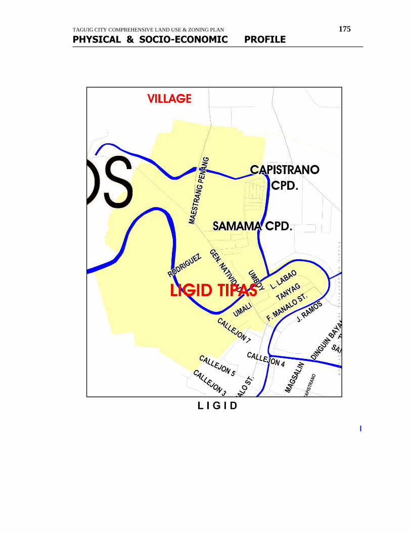
TAGUIG CITY COMPREHENSIVE LAND USE & ZONING PLAN 175
PHYSICAL & SOCIO-ECONOMIC PROFILE
I
TAGUIG CITY COMPREHENSIVE LAND USE & ZONING PLAN 176
PHYSICAL & SOCIO-ECONOMIC PROFILE
TOURISM / EDUCATION Education Aglipay -private -kindergarten,nursery,preparatory Romano -private -kindergarten,nursery,preparatory Teacher Rosy -private -kindergarten,nursery,preparatory Precious Academy -private -kindergarten,nursery,preparatory Tipas National High School -public -secondary
HEALTH / NUTRITION / SOCIAL SERVICES Hospitals Private Clinics Health Center Brgy. Health Center Nutritional Status: # of Pre-Schoolers Weighed 1,213 1st Degree Malnourish 13 (1st & 2nd degree) 2nd Degree Malnourish 3rd Degree Malnourish 2 Barangay Hall Ligid-Tipas Brgy. Hall Day Care Centers SAMAMA Compound DCC Dreamville Subdivision DCC
OTHERS Religious Establishments Iglesia Filipina Independiente/Aglipayan Roman Catholic--Dambanang Kawayan Iglesia ni Cristo Unida/ Protestant Church Ang Dating Daan Cemetery Iglesia Filipina Indefendeniente Cemetery Roman Catholic Cemetery Iglesia ni Cristo Cemetery Unida Cemetery/Protestant Cemetery Parks & Recreational Facilities Plaza Bonifacio---Ordoñez St. Basketball Court Cayetano Multi-purpose Covered Court--- M. Pinang st. SAMAMA Covered Court ---SAMAMA Compd.
Tourist Attraction Dambanang Kawayan Bamboo Altar
Subdivisions Dreamville Subdivision phase I Dreamville Subdivision phase II SAMAMA LIST OF ORGANIZATION Samahan ng Maralitang Mamamayan I Home Owners Association Dreamville Homeowners Association phase I Dreamville Homeowners Association phase II
TAGUIG CITY COMPREHENSIVE LAND USE & ZONING PLAN 177
PHYSICAL & SOCIO-ECONOMIC PROFILE
Profile
Of
Brgy. Upper Bicutan HISTORY
Due to the sizes of Bicutan & Bagumbayan, the Municipal Council of Taguig per resolution No. 51 dated July
15,1971, created additional barangays by splitting bicutan and one of this is UPPER BICUTAN.
GEOGRAPHY / PHYSICAL CHARACTERISTICS
MAPPING, LOCATION and BOUNDARIES Location
Boundaries North: Western Bicutan & Signal Village South: Bagong Tanyag East: Maharlika Village & Lower Bicutan West: United Parañaque
POLITICAL SUBDIVISIONS / ZONING
LAND AREAS / WATER BODIES
Land Area = 1.44 sq. km. Water Bodies : NATURAL RESOURCES
POPULATION DYNAMICS / HOUSEHOLD SIZE
Population : 59,882 No. of Registered Voters : 34,751
No. of Polling Precincts : 185 No. of Household/Families : 13,161 families Population Density/hectare : 41,585 person/sq. km.
TAGUIG CITY COMPREHENSIVE LAND USE & ZONING PLAN 178
PHYSICAL & SOCIO-ECONOMIC PROFILE
TAGUIG CITY COMPREHENSIVE LAND USE & ZONING PLAN 179
PHYSICAL & SOCIO-ECONOMIC PROFILE
SOCIO-ECONOMIC ACTIVITIES TOURISM / EDUCATION Schools Huckleberry Montessori School Upper Bicutan Elementary School Silangan Elementary School Polytechnic University of the Philippines Apostolic School Dunong Tulong School Catechism Grants Apostolic School Rural Improvement Club Center St. Joseph Learning Center St. Lawrence School Southville Woodland School Zinah Christian School
HEALTH / NUTRITION / SOCIAL SERVICES Health Center Brgy. Upper Bicutan Health Center Central Bicutan Health Center Sitio Imelda Health Center Nutritional Status: # of Pre-Schoolers Weighed 1st Degree Malnourish 2nd Degree Malnourish 3rd Degree Malnourish Dental Clinic Medical Clinic Clinica Heyres Barangay Hall Brgy. Hall Day Care Centers Sitio Imelda Day Care Center
OTHERS Religious Establishments (Churches/Chapels) Sto. Niño Catholic Church St. Joseph the Worker Chapel Born Again Church Apostolic Church St. Joseph Chapel Holy Spirit Temple Battlefield Baptist Church Iglesia ni Cristo Eilohem Church The Mormons Church Parks & Recreational Facilities Mini Parks Institutional Dept. of Science and Technology (DOST) Markets/Talipapa Benjamin Novicio Market Prk. 6 Talipapa
TAGUIG CITY COMPREHENSIVE LAND USE & ZONING PLAN 180
PHYSICAL & SOCIO-ECONOMIC PROFILE
LIST OF NGO's Deaño Upper Bicutan neighborhood assn., Inc. Buklod ng J. P. Rizal Burguis C. I. M. Concerned Parent Council Federation of Free Farmers Hugpong Surigaonon inc. Isiping bayan muna, Inc. J. P. Rizal Homeowners Assn. Kilusang Kabuhayan Manalili Neighborhood Assn. Pagkakaisa sa kaunlaran Neighborhood Assn. Purok 1 Homeowners Assn. Purok 2 UBWASA Rd. Lot Residents Assn., Inc. Samahang Pinagbuklod ng Upper Bicutan SIWASA Taguig St. neighborhood Assn. TAYO United Leyte/Samar Multi-Purpose Coop. Youth Development Org. and Homeowners Katuparan Assn., Inc. Prk 1 Upper Bicutan Talipapa Vendors assn., Inc. Blk. 55, 56 & 57 Electrification Project Gen. Santos Vendors Assn., Inc. Upper Bicutan Multi-Purpose Cooperative Inc. Central Bicutan Youth Club
TAGUIG CITY COMPREHENSIVE LAND USE & ZONING PLAN 181
PHYSICAL & SOCIO-ECONOMIC PROFILE
Profile
Of
Brgy. Calzada-Tipas HISTORY
What's in a name? A road to Tagalog is "Calzada". When the road linking Tipas to Sta. Ana became populated, they named the barrio CALZADA.
MAPPING, LOCATION and BOUNDARIES
Boundaries
North: Palingon South: Sta. Ana East: Laguna de Bay West: Tuktukan
LAND AREAS / WATER BODIES
Land Area = 1.77 sq. km.
POPULATION DYNAMICS / HOUSEHOLD SIZE
Population : 12,400 No. of Registered Voters : 5,908 No. of Polling Precincts : 32 No. of Household/Families : 2,725 Population Density/hectare : 7,006 person/sqkm
SOCIO-ECONOMIC ACTIVITIES TOURISM / EDUCATION Schools Tipas Elementary School Annex
HEALTH / NUTRITION / SOCIAL SERVICES Health Center Brgy. Calzada Health Center Barangay Hall Brgy. Hall Day Care Centers Calzada Day Care Center BSF Outpost
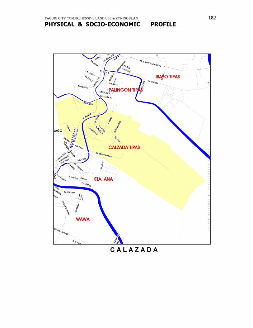
TAGUIG CITY COMPREHENSIVE LAND USE & ZONING PLAN 182
PHYSICAL & SOCIO-ECONOMIC PROFILE
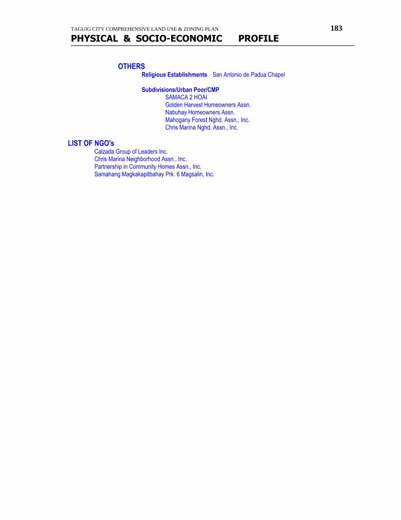
TAGUIG CITY COMPREHENSIVE LAND USE & ZONING PLAN 183
PHYSICAL & SOCIO-ECONOMIC PROFILE
OTHERS Religious Establishments San Antonio de Padua Chapel Subdivisions/Urban Poor/CMP SAMACA 2 HOAI Golden Harvest Homeowners Assn. Nabuhay Homeowners Assn. Mahogany Forest Nghd. Assn., Inc. Chris Marina Nghd. Assn., Inc.
LIST OF NGO's Calzada Group of Leaders Inc. Chris Marina Neighborhood Assn., Inc. Partnership in Community Homes Assn., Inc. Samahang Magkakapitbahay Prk. 6 Magsalin, Inc.
TAGUIG CITY COMPREHENSIVE LAND USE & ZONING PLAN 184
PHYSICAL & SOCIO-ECONOMIC PROFILE
Profile
Of
Brgy. Sta. Ana HISTORY
MAPPING, LOCATION and BOUNDARIES
Boundaries
North: Calzada South: Wawa East: Laguna Bay West: Tuktukan & Bambang
LAND AREAS / WATER BODIES
Land Area = 22 hectares/ 0.22 sq. km.
POPULATION DYNAMICS / HOUSEHOLD SIZE
Population : 15,763 No. of Registered Voters : 7,477
No. of Polling Precincts : 44 No. of Household/Families : 3,464 families Population Density/hectare : 71,650 person/sq.km.
SOCIO-ECONOMIC ACTIVITIES TOURISM / EDUCATION Schools Taguig Elementary School -primary -public Collegio de Sta. Ana -secondary -private
Sta. Ana Day Care Center -preparatory -public
Pulong Kendi Day Care Center -preparatory -public Sta. Ana Learning Center Southville Woodland School Living Miracle Foundational Learning Center
HEALTH / NUTRITION / SOCIAL SERVICES Private Clinic Micorisa Clinic Sandoval Clinic Health Center Brgy. Health Center Barangay Hall Brgy. Hall Day Care Centers Sta. Ana Day Care Center Pulong Kendi Day Care Center
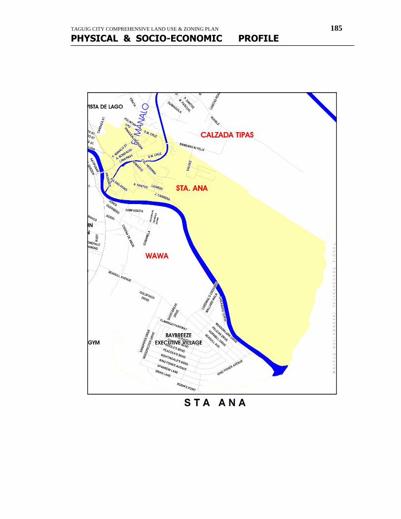
TAGUIG CITY COMPREHENSIVE LAND USE & ZONING PLAN 185
PHYSICAL & SOCIO-ECONOMIC PROFILE
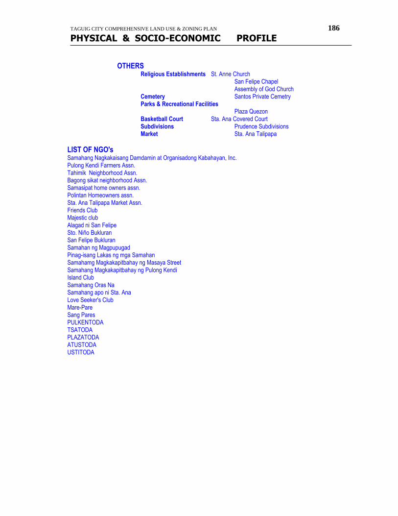
TAGUIG CITY COMPREHENSIVE LAND USE & ZONING PLAN 186
PHYSICAL & SOCIO-ECONOMIC PROFILE
OTHERS Religious Establishments St. Anne Church San Felipe Chapel Assembly of God Church Cemetery Santos Private Cemetry Parks & Recreational Facilities Plaza Quezon Basketball Court Sta. Ana Covered Court Subdivisions Prudence Subdivisions Market Sta. Ana Talipapa
LIST OF NGO's Samahang Nagkakaisang Damdamin at Organisadong Kabahayan, Inc. Pulong Kendi Farmers Assn. Tahimik Neighborhood Assn. Bagong sikat neighborhood Assn. Samasipat home owners assn. Polintan Homeowners assn. Sta. Ana Talipapa Market Assn. Friends Club Majestic club Alagad ni San Felipe Sto. Niño Bukluran San Felipe Bukluran Samahan ng Magpupugad Pinag-isang Lakas ng mga Samahan Samahamg Magkakapitbahay ng Masaya Street Samahang Magkakapitbahay ng Pulong Kendi Island Club Samahang Oras Na Samahang apo ni Sta. Ana Love Seeker's Club Mare-Pare Sang Pares PULKENTODA TSATODA PLAZATODA ATUSTODA USTITODA
TAGUIG CITY COMPREHENSIVE LAND USE & ZONING PLAN 187
PHYSICAL & SOCIO-ECONOMIC PROFILE
Profile Of
Brgy. Wawa HISTORY
Early Tagalog call the source of river upstream as "wawa". And so when settlement grew in the said areas along the Taguig river, the inhabitants called their barrio as WAWA.
MAPPING, LOCATION and BOUNDARIES Boundaries
North: Bambang & Sta. Ana South: Hagonoy & Laguna Bay East: Sta. Ana & Laguna Bay West: Bambang & Hagonoy
LAND AREAS / WATER BODIES
Land Area = 1.98 sq. km.
POPULATION DYNAMICS / HOUSEHOLD SIZE
Population : 8,799 No. of Registered Voters : 5,003 No. of Polling Precincts : 32 No. of Household/Families : 1,934 families Population Density/hectare : 4,444 person/sq.km.
SOCIO-ECONOMIC ACTIVITIES AGRICULTURAL Honorio San Gabriel (Baklad)
TOURISM / EDUCATION Schools Eusebio Santos Elementary School Spring Bridge School
HEALTH / NUTRITION / SOCIAL SERVICES Health Center Brgy. Health Center Dental Clinic De Jesus Dental/Medical Clinic Barangay Hall Wawa Brgy. Hall Day Care Centers Wawa Day Care Center
OTHERS Religious Establishments San Sebastian Chapel Subdivisions A. P. Cipriano Subdivision Deepwell with Submersible Pump (not functioning)
LIST OF NGO's Samahang Pinagbuklod ng Dulong Bayan
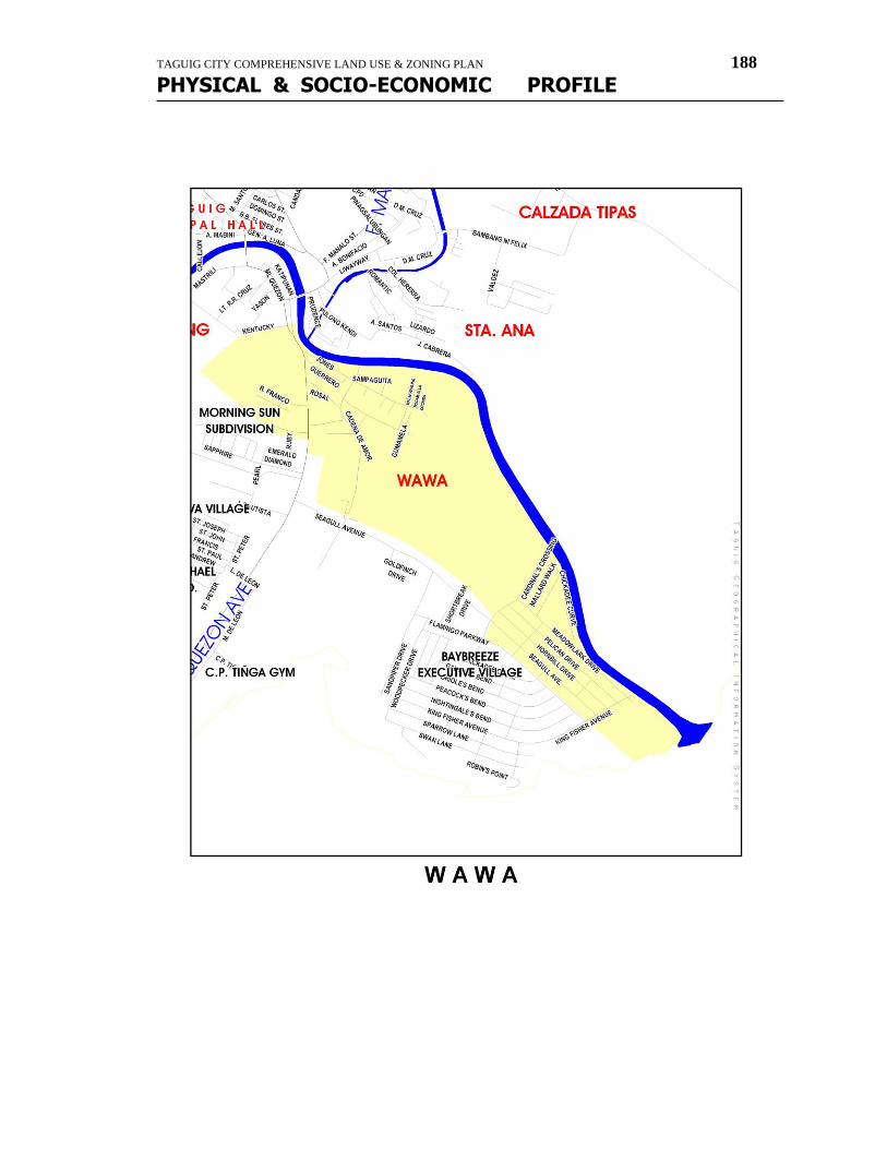
TAGUIG CITY COMPREHENSIVE LAND USE & ZONING PLAN 188
PHYSICAL & SOCIO-ECONOMIC PROFILE
TAGUIG CITY COMPREHENSIVE LAND USE & ZONING PLAN 189
PHYSICAL & SOCIO-ECONOMIC PROFILE
Profile Of
Brgy. Hagonoy HISTORY
In older days,a particular kind of plant called "hagunoy" abound in an area south of Wawa. The place later came to be known as HAGONOY.
MAPPING, LOCATION and BOUNDARIES
Boundaries North: Wawa and Bambang South: Signal Village, Lower Bicutan & Laguna Bay East: Laguna Bay & Wawa West: Fort Bonifacio & Signal Village
LAND AREAS / WATER BODIES
Land Area = 1.62 sq. km.
POPULATION DYNAMICS / HOUSEHOLD SIZE
Population : 20,168 No. of Registered Voters : 9,247
No. of Polling Precincts : 52 No. of Household/Families : 4,190 Population Density/hectare : 12,449
SOCIO-ECONOMIC ACTIVITIES TOURISM / EDUCATION Schools Fisher Valley School -private Eusebio C. Santos Elementary School -public Ciriaco P. Tiñga Elementary School -public Learning Center of San Miguel -private Taguig Science High School -public East Asia Computer Center -private
HEALTH / NUTRITION / SOCIAL SERVICES Health Center Brgy. Health Center Dental Clinic Barangay Hall Brgy. Hall Day Care Centers Day Care Center
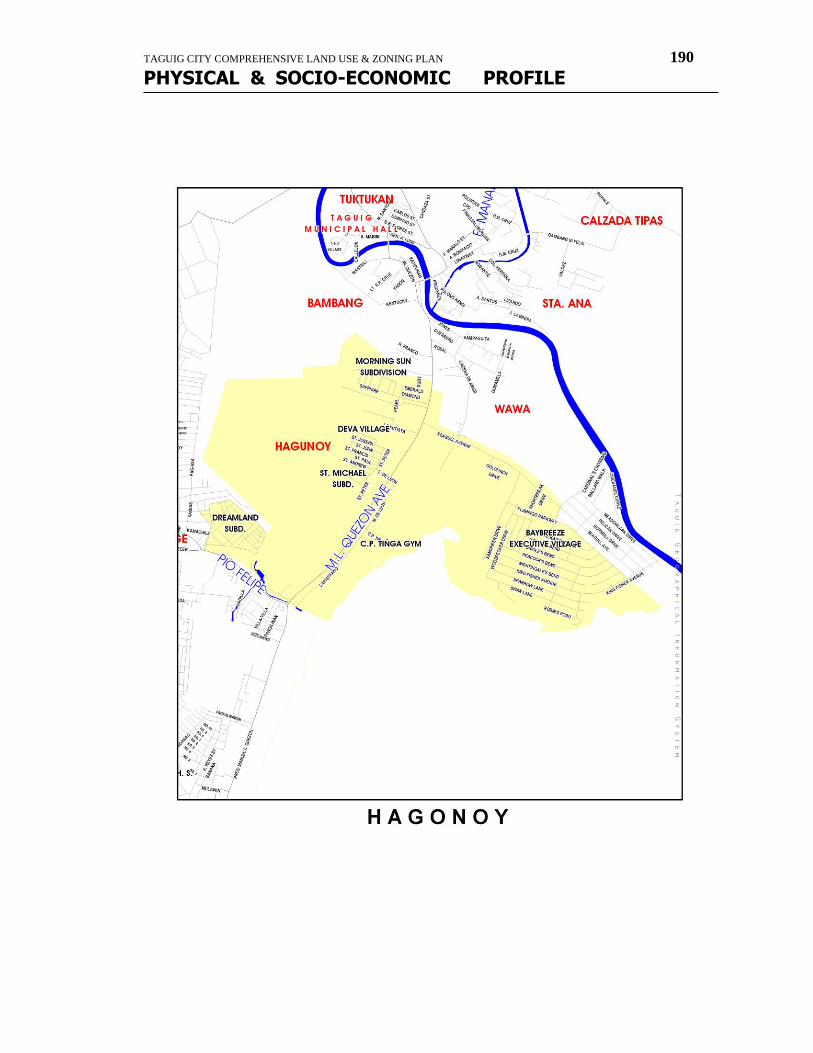
TAGUIG CITY COMPREHENSIVE LAND USE & ZONING PLAN 190
PHYSICAL & SOCIO-ECONOMIC PROFILE
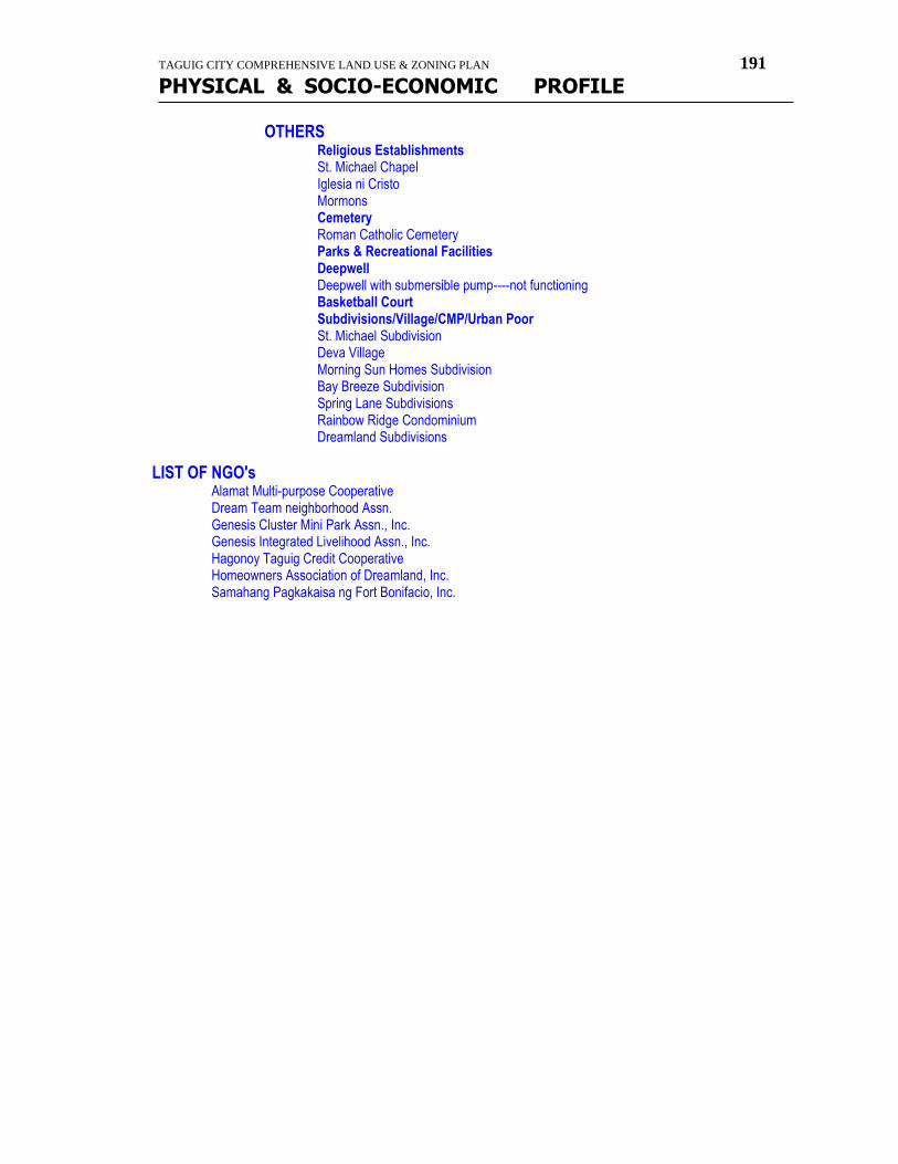
TAGUIG CITY COMPREHENSIVE LAND USE & ZONING PLAN 191
PHYSICAL & SOCIO-ECONOMIC PROFILE
OTHERS Religious Establishments St. Michael Chapel Iglesia ni Cristo Mormons Cemetery Roman Catholic Cemetery Parks & Recreational Facilities Deepwell Deepwell with submersible pump----not functioning Basketball Court Subdivisions/Village/CMP/Urban Poor St. Michael Subdivision Deva Village Morning Sun Homes Subdivision Bay Breeze Subdivision Spring Lane Subdivisions Rainbow Ridge Condominium Dreamland Subdivisions
LIST OF NGO's Alamat Multi-purpose Cooperative Dream Team neighborhood Assn. Genesis Cluster Mini Park Assn., Inc. Genesis Integrated Livelihood Assn., Inc. Hagonoy Taguig Credit Cooperative Homeowners Association of Dreamland, Inc. Samahang Pagkakaisa ng Fort Bonifacio, Inc.
TAGUIG CITY COMPREHENSIVE LAND USE & ZONING PLAN 192
PHYSICAL & SOCIO-ECONOMIC PROFILE
Profile
Of
Brgy. Bambang HISTORY
What's in a name? Early Taglogs call the banks of rivers as "bambang". And so when settlements grew in that area along the Taguig river, the inhabitants called their barrio as BAMBANG.
MAPPING, LOCATION and BOUNDARIES
Boundaries North: Tuktukan & Ususan South: Hagonoy East: Sta. Ana & Wawa West: Western Bicutan
LAND AREAS / WATER BODIES
Land Area = 0.92 sq. km.
POPULATION DYNAMICS / HOUSEHOLD SIZE
Population : 7,552 No. of Registered Voters : 3,610 No. of Polling Precincts : 21 No. of Household/Families : 1,569 Population Density/hectare : 8,209
SOCIO-ECONOMIC ACTIVITIES HEALTH / NUTRITION / SOCIAL SERVICES Health Center Brgy. Health Center Medical Clinic Clininca Palma Bambang Clinic Barangay Hall Brgy. Hall Day Care Centers Bambang Day Care Center
OTHERS Religious Establishments San Juan de Sahagun Chapel Iglesia ni Cristo Chapel Subdivisions/CMP/Urban Poor
St. Peter Triangle Samahang Magkakapitbahay sa Dulong Bayan, Inc.
LIST OF NGO's Bukid Neighborhood Assn., Inc. Samahang Magkakapitbahay sa Dulong Bayan Inc. Samahang Magkakapitbahay sa Iisang Layunin
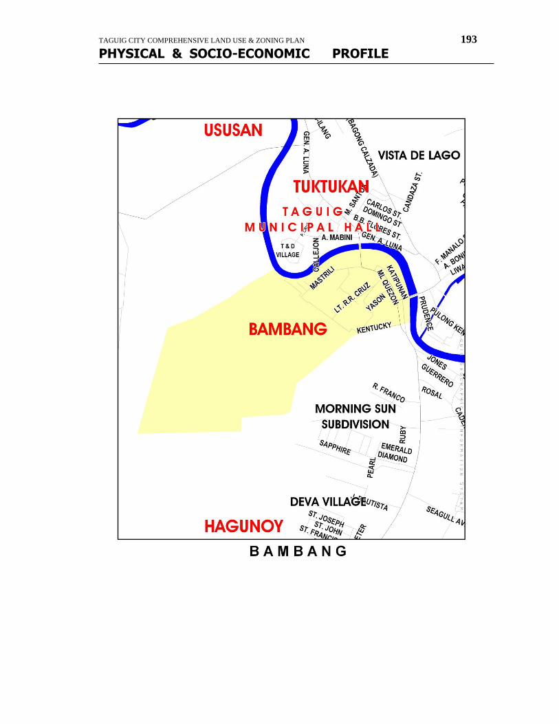
TAGUIG CITY COMPREHENSIVE LAND USE & ZONING PLAN 193
PHYSICAL & SOCIO-ECONOMIC PROFILE
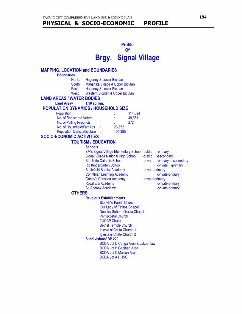
TAGUIG CITY COMPREHENSIVE LAND USE & ZONING PLAN 194
PHYSICAL & SOCIO-ECONOMIC PROFILE
Profile
Of
Brgy. Signal Village MAPPING, LOCATION and BOUNDARIES
Boundaries North: Hagonoy & Lower Bicutan South: Maharlika Village & Upper Bicutan East: Hagonoy & Lower Bicutan West: Western Bicutan & Upper Bicutan
LAND AREAS / WATER BODIES Land Area = 1.10 sq. km.
POPULATION DYNAMICS / HOUSEHOLD SIZE Population : 114,824 No. of Registered Voters : 49,581
No. of Polling Precincts : 272 No. of Household/Families : 23,852 Population Density/hectare : 104,385
SOCIO-ECONOMIC ACTIVITIES TOURISM / EDUCATION Schools EM's Signal Village Elementary School -public -primary Signal Village National High School -public -secondary Sto. Niño Catholic School -private -primary to secondary Ric Kindergarten School -private -primary Battlefield Baptist Academy -private-primary Corinthian Learning Academy -private-primary Gabby's Christian Academy -private-primary Royal Era Academy -private-primary St. Andrew Academy -private-primary
OTHERS Religious Establishments Sto. Niño Parish Church Our Lady of Fatima Chapel Nuestra Señora Gracia Chapel Pentecostal Church TUCCP Church Bethel Temple Church Iglesia ni Cristo Church 1 Iglesia ni Cristo Church 2 Subdivisions/ BP 220 BCDA Lot D Conga Area & Lakas-Ilaw BCDA Lot B Gabihan Area BCDA Lot C Maisan Area BCDA Lot A HHSG

TAGUIG CITY COMPREHENSIVE LAND USE & ZONING PLAN 195
PHYSICAL & SOCIO-ECONOMIC PROFILE
TAGUIG CITY COMPREHENSIVE LAND USE & ZONING PLAN 196
PHYSICAL & SOCIO-ECONOMIC PROFILE
LIST OF NGO's
AFP/PNP Retires of Palacol Area Signal Village Assn., Inc. Alliance Association Alliance of GHQ Pag-asa & HHSG Village, Inc. An Waray Residence Assn., Inc. Bagong Pag-asa Bantay Bayan Foundation Inc. (BBFI) Bukluran ng Maralita sa Taguig para sa Kaunlaran, Inc. C-5 Vendors Assn. Creek Land Neighborhood Assn., Inc. Cuasay Vendors Assn. Engr. Hills Neighborhood Assn., Inc. Federation Feedar Tradelink Co., Ltd. Friend Youth Club Genesis Association Green Pastures Neighborhood Assn., Inc. Himala Neighborhood Assn., Inc. Hiwa Intl. Export Corp. Workers Assn. Kadamas Neighborhood Assn., Inc. Kapatiran para sa Patubig ng Saint Francis, Inc. Katilingban Burawagon Res. Assn., Inc. Kilusang Damayan ng Taguig, Incorporation Kilusang Diwa ng Tanyag Neighborhood Assn., Inc. Kitahanun Association KMBT KPTFI LABRAI Association Ladies Club Chapter Zone 4 Ladies Club Chapter Zone 6 Lakas Ilaw Association Light Armor Brigade Res. Assn., Inc. LKHOA - LDI Old River Neighborhood Assn., Inc. P. A. Res. Association Pag-asa Residence Assn., Inc. Palacol Area Residents Assn., ( PAREA Inc. ) Palican Agro Products Workers Association Political Leader Association PSUNAI Alliance Reform Youth Movement of Signal Village Samahan ng Waray sa Taguig - Signal Chapter Samahang Maralita ng P-14 Signal Santol Res. Association, Inc. Signal Vill Ladies Club - GHQ Chapter Sprinxnville Association SSBDE Assn. At Dreamland, Inc. STICRAI Association Sto. Niño Community Res. Assn., Inc. STV B Stall Owners Assn., Inc. Triskelion Youth Movement Villa Light Neighborhood Assn., Inc. Visaya Association YLNAI Pag-asa Youth Pag-asa Organization Zone 5 Leader Association, Inc.
TAGUIG CITY COMPREHENSIVE LAND USE & ZONING PLAN 197
PHYSICAL & SOCIO-ECONOMIC PROFILE
Profile Of
Brgy. Tuktukan HISTORY
Early Tagalog call the place where people wash clothes as "tuktukan" And so when settlements grew in the said areas along the Taguig River, the inhabitants called their barrio as TUKTUKAN.
GEOGRAPHY / PHYSICAL CHARACTERISTICS
MAPPING, LOCATION and BOUNDARIES Location
Boundaries North: Calzada & Ususan South: Bambang & Ususan East: Sta. Ana West: Ususan
POLITICAL SUBDIVISIONS / ZONING
LAND AREAS / WATER BODIES
Land Area = Water Bodies : NATURAL RESOURCES
POPULATION DYNAMICS / HOUSEHOLD SIZE
Population : Male : Female : Senior Citizen : Children(18 & below) :
No. of Registered Voters : No. of Polling Precincts : No. of Household/Families : Average size of family : Population Growth Rate : Population Density/hectare :
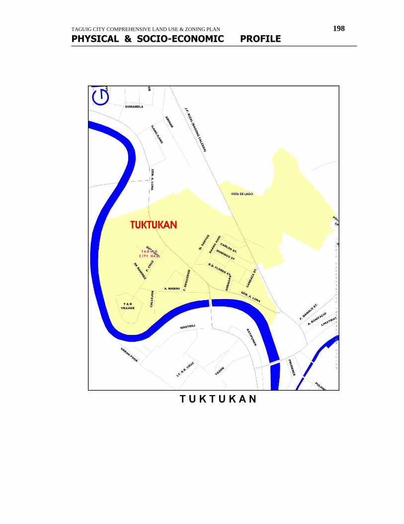
TAGUIG CITY COMPREHENSIVE LAND USE & ZONING PLAN 198
PHYSICAL & SOCIO-ECONOMIC PROFILE

TAGUIG CITY COMPREHENSIVE LAND USE & ZONING PLAN 199
PHYSICAL & SOCIO-ECONOMIC PROFILE
INCOME DISTRIBUTION / CLASSIFICATION
EMPLOYMENT / LABOR FORCE
GROWTH & TRENDS
SOCIO-ECONOMIC ACTIVITIES AGRICULTURAL MANUFACTURING / INDUSTRIAL/COMMERCE / TRADE NATURE OF BUSINESS # of ESTABLISHMENTS
Manufacturer/Batching Plant/Warehouse Junkshop Bakery Carinderia/Eatery Computer Shop/Video Games
Gift shop/Gen. Merchandising Hardware Drugstore/Pharmacy Distilled Water Dealer Beauty parlor/Barbershop Sari-sari Store Market/Talipapa Banks
TOURISM / EDUCATION Education Gen. Ricardo G. Papa Memorial High school -public -secondary Academia de San Bartolome -private -primary to secondary
HEALTH / NUTRITION / SOCIAL SERVICES Hospital-Private Cruz-Rabe Gen. Hospital
Medical Clinic Lying-in Clinic & Rehydration Center Family Planning Clinic Health Center Bagong Lipunan Health Center Nutritional Status: # of Pre-Schoolers Weighed 1st Degree Malnourish 2nd Degree Malnourish 3rd Degree Malnourish Dental Clinic City Hall Taguig City Hall Barangay Hall Brgy. Hall Day Care Centers Day Care Center Fire Station Taguig Fire Station Police Station Taguig Police Station BSF Outpost
TAGUIG CITY COMPREHENSIVE LAND USE & ZONING PLAN 200
PHYSICAL & SOCIO-ECONOMIC PROFILE
OTHERS Religious Establishments Roman Catholic Chapel Cemetery Roman Catholic Cemetery Parks & Recreational Facilities Deepwell Deepwell with Submersible Pump--- no longer functioning Basketball Court Subdivisions B. E. Subdivision T & D Village Vista de Lago (& Condominiums)
LIST OF NGO's LISTING / PROFILE OF ESTABLISHMENTS Business Establishments Ace Hollow Blocks Country Rural Bank INVESTMENT POTENTIAL PEACE & ORDER / CRIME SITUATION INFRASTRUCTURE & UTILITIES HOUSING TRANSPORTATION WATERWORKS / SEWAGE FACILITIES POWER / ENERGY / COMMUNICATION Communication Facilities:
DRAINAGE SYSTEM / FLOOD CONTROL WASTE DISPOSAL / MANAGEMENT POLLUTION / HEALTH HAZARDS
Profile
TAGUIG CITY COMPREHENSIVE LAND USE & ZONING PLAN 201
PHYSICAL & SOCIO-ECONOMIC PROFILE
Of
Brgy. Ususan HISTORY
Early Tagalog called the area where the river drain or slide as "ususan". And so when settlements grew in the said areas along the Taguig River, the inhabitants called their barrio as USUSAN.
GEOGRAPHY / PHYSICAL CHARACTERISTICS
MAPPING, LOCATION and BOUNDARIES Location
Boundaries North: Pateros South: Tuktukan & Bambang East: Calzada & Ligid-Tipas West: Fort Bonifacio
POLITICAL SUBDIVISIONS / ZONING
LAND AREAS / WATER BODIES
Land Area = Water Bodies : NATURAL RESOURCES
POPULATION DYNAMICS / HOUSEHOLD SIZE
Population : Male : Female : Senior Citizen : Children(18 & below) :
No. of Registered Voters : No. of Polling Precincts : No. of Household/Families : Average size of family : Population Growth Rate : Population Density/hectare :
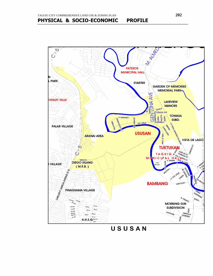
TAGUIG CITY COMPREHENSIVE LAND USE & ZONING PLAN 202
PHYSICAL & SOCIO-ECONOMIC PROFILE

TAGUIG CITY COMPREHENSIVE LAND USE & ZONING PLAN 203
PHYSICAL & SOCIO-ECONOMIC PROFILE
INCOME DISTRIBUTION / CLASSIFICATION
EMPLOYMENT / LABOR FORCE
GROWTH & TRENDS
SOCIO-ECONOMIC ACTIVITIES AGRICULTURAL MANUFACTURING / INDUSTRIAL/COMMERCE / TRADE NATURE OF BUSINESS # of ESTABLISHMENTS
Manufacturer/Batching Plant/Warehouse Junkshop Bakery Carinderia/Eatery Computer Shop/Video Games
Gift shop/Gen. Merchandising Hardware Drugstore/Pharmacy Distilled Water Dealer Beauty parlor/Barbershop Sari-sari Store Market/Talipapa Banks
TOURISM / EDUCATION Education Fairyland Kindergarten & Grade School -private St. Ignatius of Loyola High school -private Gen. Ricardo G. Papa Memorial High School -public Ususan Elementary School -public Dr. a. Natividad Elementary School -public
HEALTH / NUTRITION / SOCIAL SERVICES Health Center Brgy. Health Center Nutritional Status: # of Pre-Schoolers Weighed 1,213 1st Degree Malnourish 13 (1st & 2nd degree) 2nd Degree Malnourish 3rd Degree Malnourish 2 Dental Clinic Barangay Hall Brgy. Hall Day Care Centers Day Care Center

TAGUIG CITY COMPREHENSIVE LAND USE & ZONING PLAN 204
PHYSICAL & SOCIO-ECONOMIC PROFILE
Day Care Center Day Care Center Day Care Center Day Care Center BSF Outpost
OTHERS Religious Establishments Roman Catholic Chapel Kingdom Hall Jehovas Witness Parks & Recreational Facilities Basketball Court Tennis Court Deepwell Deepwell with submersible pump-----not functioning Subdivisions Tomas Estate Subdivision Phase I & II
LIST OF NGO's People's Economic Council of Taguig, Inc. Bahay Bagong Buhay Drug Rehabilitation Foundation, Inc.
LISTING / PROFILE OF ESTABLISHMENTS Business Establishments Daniel Castillo (Retailer) INVESTMENT POTENTIAL PEACE & ORDER / CRIME SITUATION INFRASTRUCTURE & UTILITIES HOUSING TRANSPORTATION WATERWORKS / SEWAGE FACILITIES POWER / ENERGY / COMMUNICATION Communication Facilities:
DRAINAGE SYSTEM / FLOOD CONTROL WASTE DISPOSAL / MANAGEMENT POLLUTION / HEALTH HAZARDS
TAGUIG CITY COMPREHENSIVE LAND USE & ZONING PLAN 205
PHYSICAL & SOCIO-ECONOMIC PROFILE
Profile Of
Brgy. Maharlika Village HISTORY
A portion of Upper Bicutan was declared segregated by the President and named as MAHARLIKA VILLAGE which was made a settlement of the Muslim community in Metro Manila.
GEOGRAPHY / PHYSICAL CHARACTERISTICS
MAPPING, LOCATION and BOUNDARIES Location
Boundaries North: Signal Village & Upper Bicutan South: Upper Bicutan East: Lower Bicutan West: Upper Bicutan
POLITICAL SUBDIVISIONS / ZONING
LAND AREAS / WATER BODIES
Land Area = Water Bodies : NATURAL RESOURCES
POPULATION DYNAMICS / HOUSEHOLD SIZE
Population : Male : Female : Senior Citizen : Children(18 & below) :
No. of Registered Voters : No. of Polling Precincts : No. of Household/Families : Average size of family : Population Growth Rate : Population Density/hectare :
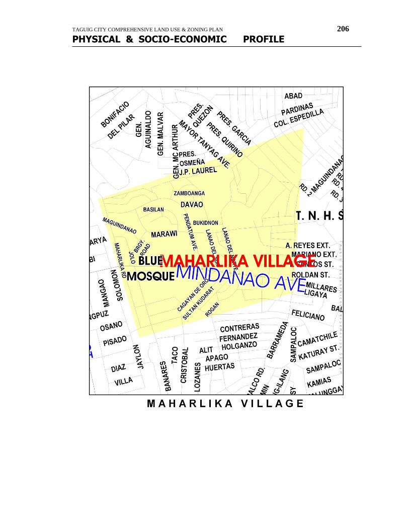
TAGUIG CITY COMPREHENSIVE LAND USE & ZONING PLAN 206
PHYSICAL & SOCIO-ECONOMIC PROFILE
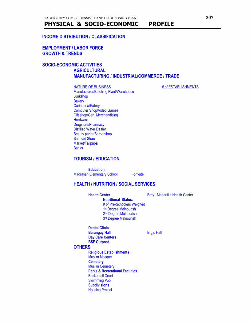
TAGUIG CITY COMPREHENSIVE LAND USE & ZONING PLAN 207
PHYSICAL & SOCIO-ECONOMIC PROFILE
INCOME DISTRIBUTION / CLASSIFICATION
EMPLOYMENT / LABOR FORCE GROWTH & TRENDS
SOCIO-ECONOMIC ACTIVITIES AGRICULTURAL MANUFACTURING / INDUSTRIAL/COMMERCE / TRADE NATURE OF BUSINESS # of ESTABLISHMENTS
Manufacturer/Batching Plant/Warehouse Junkshop Bakery Carinderia/Eatery Computer Shop/Video Games
Gift shop/Gen. Merchandising Hardware Drugstore/Pharmacy Distilled Water Dealer Beauty parlor/Barbershop Sari-sari Store Market/Talipapa Banks
TOURISM / EDUCATION Education Madrasah Elementary School -private
HEALTH / NUTRITION / SOCIAL SERVICES Health Center Brgy. Maharlika Health Center Nutritional Status: # of Pre-Schoolers Weighed 1st Degree Malnourish 2nd Degree Malnourish 3rd Degree Malnourish Dental Clinic Barangay Hall Brgy. Hall Day Care Centers BSF Outpost
OTHERS Religious Establishments Muslim Mosque Cemetery Muslim Cemetery Parks & Recreational Facilities Basketball Court Swimming Pool Subdivisions Housing Project
TAGUIG CITY COMPREHENSIVE LAND USE & ZONING PLAN 208
PHYSICAL & SOCIO-ECONOMIC PROFILE
LIST OF NGO's Maharlika Village Islamic Foundation, Inc. Taguig Federation of tricycle Organization, Inc.
LISTING / PROFILE OF ESTABLISHMENTS Business Establishments
INVESTMENT POTENTIAL PEACE & ORDER / CRIME SITUATION INFRASTRUCTURE & UTILITIES HOUSING TRANSPORTATION WATERWORKS / SEWAGE FACILITIES POWER / ENERGY / COMMUNICATION Communication Facilities:
DRAINAGE SYSTEM / FLOOD CONTROL WASTE DISPOSAL / MANAGEMENT POLLUTION / HEALTH HAZARDS
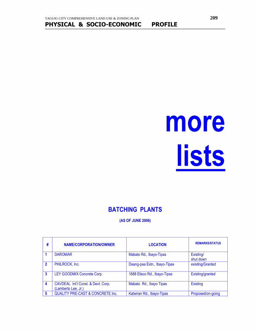
TAGUIG CITY COMPREHENSIVE LAND USE & ZONING PLAN 209
PHYSICAL & SOCIO-ECONOMIC PROFILE
more lists
BATCHING PLANTS
(AS OF JUNE 2006)
#
NAME/CORPORATION/OWNER
LOCATION
REMARKS/STATUS
1 DAROMAR Mabato Rd., Ibayo-Tipas Existing/ shut down
2 PHILROCK, Inc.
Daang-paa Extn., Ibayo-Tipas existing/Granted
3 LEY GOODMIX Concrete Corp.
1688 Elisco Rd., Ibayo-Tipas Existing/granted
4 CAVDEAL Int’l Const. & Devt. Corp. (Lamberto Lee, Jr.)
Mabato Rd., Ibayo Tipas Existing
5 QUALITY PRE-CAST & CONCRETE Inc. Katwiran Rd., Ibayo-Tipas Proposed/on-going
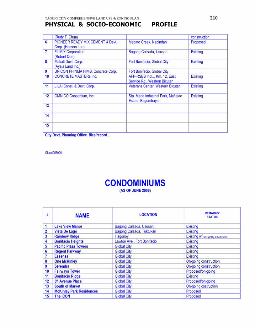
TAGUIG CITY COMPREHENSIVE LAND USE & ZONING PLAN 210
PHYSICAL & SOCIO-ECONOMIC PROFILE
(Rudy T. Chua) construction
6 PIONEER READY MIX CEMENT & Devt. Corp. (Henson Lee)
Mabato Creek, Napindan Proposed
7 FILMIX Corporation (Robert Que)
Bagong Calzada, Ususan Existing
8 Makati Devt. Corp. (Ayala Land Inc.)
Fort Bonifacio, Global City Existing
9 UNICON PHINMA HIMB, Concrete Corp. Fort Bonifacio, Global City
10 CONCRETE MASTERs Inc. AFP-RSBS Indl.., Km. 12, East Service Rd., Western Bicutan
Existing
11 LILAI Const. & Devt. Corp.
Veterans Center, Western Bicutan Existing
12 OMNICO Consortium, Inc. Sta. Maria Industrial Park, Mañalac Estate, Bagumbayan
Existing
13
14
15
City Devt. Planning Office files/record…. Gissel053006
CONDOMINIUMS (AS OF JUNE 2006)
#
NAME
LOCATION
REMARKS/
STATUS
1 Lake View Manor Bagong Calzada, Ususan Existing
2 Vista De Lago Bagong Calzada, Tuktukan Existing
3 Rainbow Ridge Hagonoy Existing w/ on-going expansion
4 Bonifacio Heights Lawton Ave., Fort Bonifacio Existing
5 Pacific Plaza Towers Global City Existing
6 Regent Parkway Global City Existing
7 Essensa Global City Existing
8 One McKinley Global City On-going construction
9 Serendra Global City On-going construction
10 Fairways Tower Global City Proposed/on-going
11 Bonifacio Ridge Global City Existing
12 5th Avenue Place Global City Proposed/on-going
13 South of Market Global City On-going costruction
14 McKinley Park Residences Global City Proposed
15 The ICON Global City Proposed
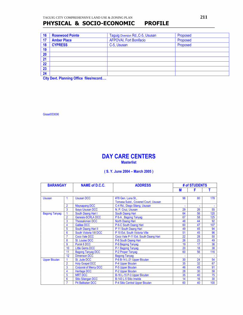
TAGUIG CITY COMPREHENSIVE LAND USE & ZONING PLAN 211
PHYSICAL & SOCIO-ECONOMIC PROFILE
16 Rosewood Pointe Taguig Diversion Rd.,C-5, Ususan Proposed
17 Amber Place AFPOVAI, Fort Bonifacio Proposed
18 CYPRESS C-5, Ususan Proposed
19
20
21
22
23
24
City Devt. Planning Office files/record…. Gissel053006
DAY CARE CENTERS Masterlist
( S. Y. June 2004 – March 2005 )
BARANGAY NAME of D.C.C. ADDRESS # of STUDENTS
M F T
Ususan 1 Ususan DCC #78 Gen. Luna St., Tomasa Subd., Covered Court, Ususan
98 80 178
2 Maysapang DCC C-4 Rd., Diego Silang, Ususan - - -
3 Ibayo Ususan DCC N. P. Cruz, Ususan 29 26 55
Bagong Tanyag 1 South Daang Hari I South Daang Hari 64 56 120
2 Genesis-SCRLA DCC P 6-A , Bagong Tanyag 67 58 125
3 Thessalonian DCC North Daang Hari 48 44 92
4 Galilee DCC P-6-C South Daang Hari 60 47 107
5 South Daang Hari II P 11 South Daang Hari 49 45 94
6 South Victoria Vill DCC P 10 Ext. South Victoria Ville 51 45 96
7 Coco Vale DCC Coco Vale P-11 Ext. South Daang Hari 22 28 50
8 St. Louise DCC P-6 South Daang Hari 26 23 49
9 Purok 6 DCC P-6 Bagong Tanyag 19 17 36
10 Little Gems DCC P-1 Bagong Tanyag 20 18 38
11 Bagong Tanyag DCC P-2 Proper Tanyag 60 56 116
12 Dimenson DCC Bagong Tanyag - - -
Upper Bicutan 1 St. Jude DCC P-6 B-14 L-21 Upper Bicutan 30 24 54
2 Holy Gospel DCC P-4 Upper Bicutan 35 32 67
3 Corporal of Mercy DCC P-5 Upper Bicutan 46 45 91
4 Heritage DCC P-2 Upper Bicutan 28 30 58
5 MRT DCC B-16 L-15 P-3 Upper Bicutan 35 40 75
6 Sitio Silangan DCC B-143 L-5 Sitio Imelda 14 16 30
7 P4 Balikatan DCC P-4 Sitio Central Upper Bicutan 60 40 100
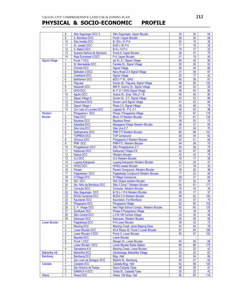
TAGUIG CITY COMPREHENSIVE LAND USE & ZONING PLAN 212
PHYSICAL & SOCIO-ECONOMIC PROFILE
8 Sitio Saguingan DCC II Sitio Saguingan, Upper Bicutan 24 30 54
9 A. Bonifacio DCC Purok I Upper Bicutan 28 30 58
10 Sitio Imelda DCC B-128 L-31 P-6 20 15 35
11 St. Joseph DCC B-63 L-50 P-5 17 18 35
12 A. Mabini DCC B-9 L-14 P-3 16 17 33
13 Nuestra Señora de Salvacion Purok 6, Upper Bicutan 38 37 75
14 Raja Sumakwel II DCC P-4, Upper Bicutan 21 19 40
Signal Village 1 Purok 7 DCC Ipil St. Z-1 Signal Village 48 42 90
2 St. Bernadette DCC Famela St., Signal Village 20 32 52
3 Orchids DCC Signal Village 36 44 80
4 Balikatan 2 DCC Navy Road Z-4 Signal Village 31 36 67
5 Creekland DCC Signal Village 25 17 42
6 Bethlehem DCC #233 7th St., GHQ 45 36 81
7 Pag-asa Durian St., Pag-asa, Signal Village 68 65 133
8 Nazareth DCC #84 R. Quirino St., Signal Village 30 25 55
9 GHQ DCC B-17 Z-1 GHQ Signal Village 36 44 80
10 Aguho DCC Acacia St., Engr. Hills Z-1-B 45 40 85
11 Signal Village II Durian St., Z-7, Signal Village 33 33 66
12 Dreamland DCC Dream Land Signal Village 41 43 84
13 Signal Village I Plaza 2-3, Signal Village 30 48 78
14 Our Lady of Lourdes DCC Legaspi St., P-2, Z-1 46 52 98
Western Bicutan
1 Pinagsama I DCC Phase I Pinagsama Village 52 67 119
2 Palar DCC Block 10 Western Bicutan 73 61 134
3 Bayabas DCC Bayabas Street 38 35 73
4 Kabalikat DCC Masagana Village Western Bicutan 38 27 65
5 Sitio Una DCC Sitio Una Z-7 31 39 70
6 Gethsemane DCC PNR FTI Western Bicutan 85 66 151
7 TUPREAI DCC TUP Compound 29 34 63
8 Glorious DCC Pinagsama II Western Bicutan 43 41 84
9 PNR DCC PNR-FTI, Western Bicutan 34 36 70
10 Pinaglabanan DCC Sitio Pinaglabanan Z-7 39 36 75
11 Katipunan DCC Katipunan Village Z-6 42 47 89
12 Nabua DCC Western Bicutan 42 34 76
13 G-2 DCC G-2 Western Bicutan 18 17 35
14 Lupang Katuparan Lupang Katuparan Western Bicutan 24 23 47
15 HHSG DCC HHSG wester Bicutan 17 18 35
16 Panam Panam Compound, Western Bicutan 18 20 38
17 Pagkakaisa I DCC Pagkakaisa Compound Western Bicutan 17 23 40
18 D’Village DCC D’Village Compound 29 31 60
19 ISG DCC ISG Chapel western Bicutan 37 32 39
20 Sto. Niño de Bonifacio DCC Sitio 3 Zone 7 Western Bicutan 93 81 171
21 Consular DCC Consular, Western Bicutan 19 16 35
22 Sitio Saguingan DCC B-79 L-1 P-6 Western Bicutan 20 17 37
23 BCDA Centenial DCC BCDA C-5 Western Bicutan 58 62 120
24 Kaunlaran DCC Kaunlaran, Fort Bonifacio 33 37 70
25 Pinagsama DCC Pinagsama Village 52 50 102
26 E. P. Village DCC Nat’l High School Compd., Western Bicutan 65 60 125
27 Sunflower DCC Phase II Pinagsama Village 19 16 35
28 Sitio Central DCC L-4 B-145 Central Village 23 25 48
29 Damayan DCC Damayan, Western Bicutan 30 26 56
Lower Bicutan 1 Pagkakaisa DCC P-6 Lower Bicutan 39 33 72
2 Mauling DCC Mauling Creek, camp Bagong Diwa 35 43 78
3 Lower Bicutan DCC #3-A Reyes St. Purok 3 Lower Bicutan 97 83 180
4 Lower Bicutan II DCC Purok 5, Lower Bicutan 55 47 102
5 Bayside DCC Lower Bicutan - - -
6 Purok 1 DCC Ranger St., Lower Bicutan 45 39 84
7 Lower Bicutan I DCC Lower Bicutan Radio Station 89 86 175
8 Samabana K-9 Mauling Creek, Lower Bicutan 22 20 42
Maharlika Vill 1 Maharlika DCC Zamboanga, Maharlika Village 35 32 67
Bambang 1 Bambang DCC Brgy. Hall 32 34 66
2 San Juan de Sahagun DCC Mastrili St., Bambang 35 27 62
Calzada 1 Calzada DCC Calzada Brgy. Hall 62 58 120
2 San Antonio de Padua Ibayo-Calzada Tipas 46 45 91
3 SAMACA II DCC Virata St., Calzada Tipas 20 22 42
Wawa 1 Wawa DCC Wawa Old Brgy. Hall 56 60 116
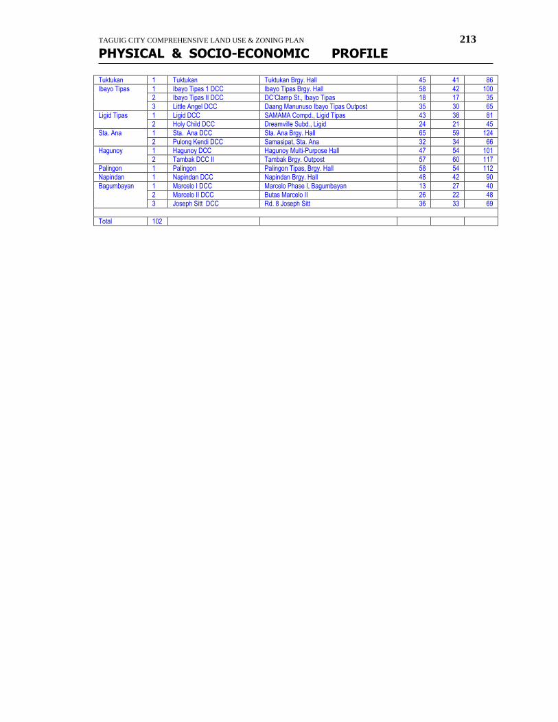
TAGUIG CITY COMPREHENSIVE LAND USE & ZONING PLAN 213
PHYSICAL & SOCIO-ECONOMIC PROFILE
Tuktukan 1 Tuktukan Tuktukan Brgy. Hall 45 41 86
Ibayo Tipas 1 Ibayo Tipas 1 DCC Ibayo Tipas Brgy. Hall 58 42 100
2 Ibayo Tipas II DCC DC’Clamp St., Ibayo Tipas 18 17 35
3 Little Angel DCC Daang Manunuso Ibayo Tipas Outpost 35 30 65
Ligid Tipas 1 Ligid DCC SAMAMA Compd., Ligid Tipas 43 38 81
2 Holy Child DCC Dreamville Subd., Ligid 24 21 45
Sta. Ana 1 Sta. Ana DCC Sta. Ana Brgy. Hall 65 59 124
2 Pulong Kendi DCC Samasipat, Sta. Ana 32 34 66
Hagunoy 1 Hagunoy DCC Hagunoy Multi-Purpose Hall 47 54 101
2 Tambak DCC II Tambak Brgy. Outpost 57 60 117
Palingon 1 Palingon Palingon Tipas, Brgy. Hall 58 54 112
Napindan 1 Napindan DCC Napindan Brgy. Hall 48 42 90
Bagumbayan 1 Marcelo I DCC Marcelo Phase I, Bagumbayan 13 27 40
2 Marcelo II DCC Butas Marcelo II 26 22 48
3 Joseph Sitt DCC Rd. 8 Joseph Sitt 36 33 69
Total 102
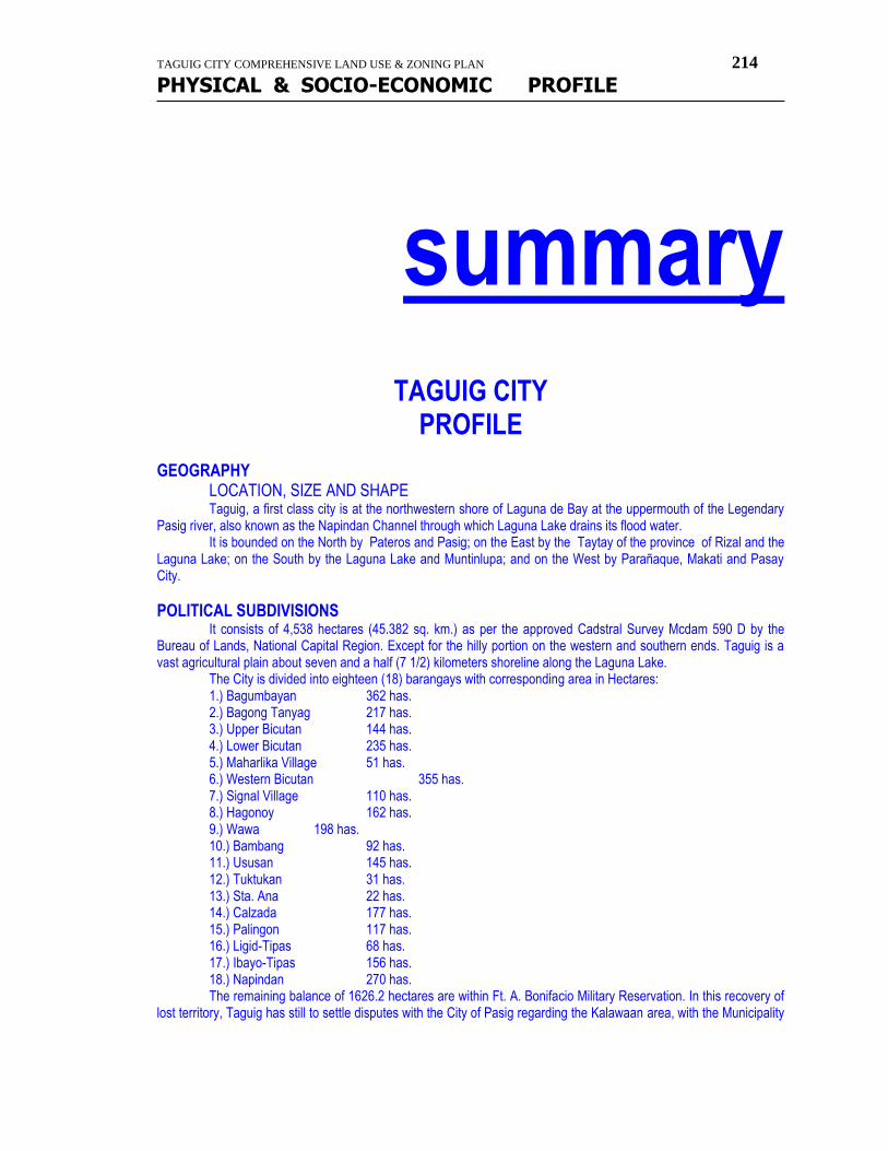
TAGUIG CITY COMPREHENSIVE LAND USE & ZONING PLAN 214
PHYSICAL & SOCIO-ECONOMIC PROFILE
summary
TAGUIG CITY PROFILE
GEOGRAPHY
LOCATION, SIZE AND SHAPE Taguig, a first class city is at the northwestern shore of Laguna de Bay at the uppermouth of the Legendary Pasig river, also known as the Napindan Channel through which Laguna Lake drains its flood water. It is bounded on the North by Pateros and Pasig; on the East by the Taytay of the province of Rizal and the Laguna Lake; on the South by the Laguna Lake and Muntinlupa; and on the West by Parañaque, Makati and Pasay City.
POLITICAL SUBDIVISIONS It consists of 4,538 hectares (45.382 sq. km.) as per the approved Cadstral Survey Mcdam 590 D by the Bureau of Lands, National Capital Region. Except for the hilly portion on the western and southern ends. Taguig is a vast agricultural plain about seven and a half (7 1/2) kilometers shoreline along the Laguna Lake. The City is divided into eighteen (18) barangays with corresponding area in Hectares: 1.) Bagumbayan 362 has. 2.) Bagong Tanyag 217 has. 3.) Upper Bicutan 144 has. 4.) Lower Bicutan 235 has. 5.) Maharlika Village 51 has. 6.) Western Bicutan 355 has. 7.) Signal Village 110 has. 8.) Hagonoy 162 has. 9.) Wawa 198 has. 10.) Bambang 92 has. 11.) Ususan 145 has. 12.) Tuktukan 31 has. 13.) Sta. Ana 22 has. 14.) Calzada 177 has. 15.) Palingon 117 has. 16.) Ligid-Tipas 68 has. 17.) Ibayo-Tipas 156 has. 18.) Napindan 270 has. The remaining balance of 1626.2 hectares are within Ft. A. Bonifacio Military Reservation. In this recovery of lost territory, Taguig has still to settle disputes with the City of Pasig regarding the Kalawaan area, with the Municipality
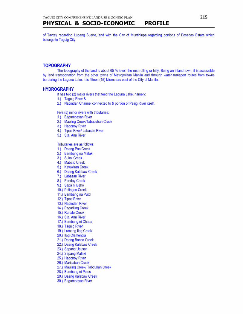
TAGUIG CITY COMPREHENSIVE LAND USE & ZONING PLAN 215
PHYSICAL & SOCIO-ECONOMIC PROFILE
of Taytay regarding Lupang Suerte, and with the City of Muntinlupa regarding portions of Posadas Estate which belongs to Taguig City.
TOPOGRAPHY
The topography of the land is about 65 % level, the rest rolling or hilly. Being an inland town, it is accessible by land transportation from the other towns of Metropolitan Manila and through water transport routes from towns bordering the Laguna Lake. It is fifteen (15) kilometers east of the City of Manila.
HYDROGRAPHY
It has two (2) major rivers that feed the Laguna Lake, namely: 1.) Taguig River & 2.) Napindan Channel connected to & portion of Pasig River itself. Five (5) minor rivers with tributaries: 1.) Bagumbayan River 2.) Mauling Creek/Tabacuhan Creek 3.) Hagonoy River 4.) Tipas River/ Labasan River 5.) Sta. Ana River Tributaries are as follows: 1.) Daang Paa Creek 2.) Bambang na Malaki 3.) Sukol Creek 4.) Mabato Creek 5.) Katuwiran Creek 6.) Daang Kalabaw Creek 7.) Labasan River 8.) Panday Creek 9.) Sapa ni Beho 10.) Palingon Creek 11.) Bambang na Putol 12.) Tipas River 13.) Napindan River 14.) Pagadling Creek 15.) Ruhale Creek 16.) Sta. Ana River 17.) Bambang ni Chapa 18.) Taguig River 19.) Lumang Ilog Creek 20.) Ilog Clemencia 21.) Daang Banca Creek 22.) Daang Kalabaw Creek 23.) Sapang Ususan 24.) Sapang Malaki 25.) Hagonoy River 26.) Maricaban Creek 27.) Mauling Creek/ Tabcuhan Creek 28.) Bambang ni Peles 29.) Daang Kalabaw Creek 30.) Bagumbayan River
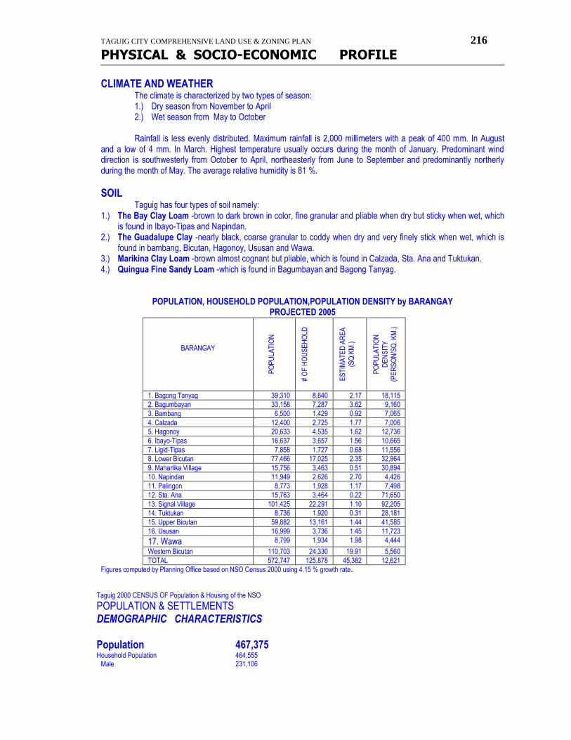
TAGUIG CITY COMPREHENSIVE LAND USE & ZONING PLAN 216
PHYSICAL & SOCIO-ECONOMIC PROFILE
CLIMATE AND WEATHER
The climate is characterized by two types of season: 1.) Dry season from November to April 2.) Wet season from May to October Rainfall is less evenly distributed. Maximum rainfall is 2,000 millimeters with a peak of 400 mm. In August
and a low of 4 mm. In March. Highest temperature usually occurs during the month of January. Predominant wind direction is southwesterly from October to April, northeasterly from June to September and predominantly northerly during the month of May. The average relative humidity is 81 %.
SOIL
Taguig has four types of soil namely: 1.) The Bay Clay Loam -brown to dark brown in color, fine granular and pliable when dry but sticky when wet, which
is found in Ibayo-Tipas and Napindan. 2.) The Guadalupe Clay -nearly black, coarse granular to coddy when dry and very finely stick when wet, which is
found in bambang, Bicutan, Hagonoy, Ususan and Wawa. 3.) Marikina Clay Loam -brown almost cognant but pliable, which is found in Calzada, Sta. Ana and Tuktukan. 4.) Quingua Fine Sandy Loam -which is found in Bagumbayan and Bagong Tanyag.
POPULATION, HOUSEHOLD POPULATION,POPULATION DENSITY by BARANGAY PROJECTED 2005
BARANGAY
PO
PU
LAT
ION
# O
F H
OU
SE
HO
LD
ES
TIM
AT
ED
AR
EA
(SQ
.KM
.)
PO
PU
LAT
ION
DE
NS
ITY
(P
ER
SO
N/S
Q. K
M.)
1. Bagong Tanyag 39,310 8,640 2.17 18,115
2. Bagumbayan 33,158 7,287 3.62 9,160
3. Bambang 6,500 1,429 0.92 7,065
4. Calzada 12,400 2,725 1.77 7,006
5. Hagonoy 20,633 4,535 1.62 12,736
6. Ibayo-Tipas 16,637 3,657 1.56 10,665
7. Ligid-Tipas 7,858 1,727 0.68 11,556
8. Lower Bicutan 77,466 17,025 2.35 32,964
9. Maharlika Village 15,756 3,463 0.51 30,894
10. Napindan 11,949 2,626 2.70 4,426
11. Palingon 8,773 1,928 1.17 7,498
12. Sta. Ana 15,763 3,464 0.22 71,650
13. Signal Village 101,425 22,291 1.10 92,205
14. Tuktukan 8,736 1,920 0.31 28,181
15. Upper Bicutan 59,882 13,161 1.44 41,585
16. Ususan 16,999 3,736 1.45 11,723
17. Wawa 8,799 1,934 1.98 4,444
Western Bicutan 110,703 24,330 19.91 5,560
TOTAL 572,747 125,878 45,382 12,621
Figures computed by Planning Office based on NSO Census 2000 using 4.15 % growth rate..
Taguig 2000 CENSUS OF Population & Housing of the NSO
POPULATION & SETTLEMENTS DEMOGRAPHIC CHARACTERISTICS Population 467,375 Household Population 464,555 Male 231,106
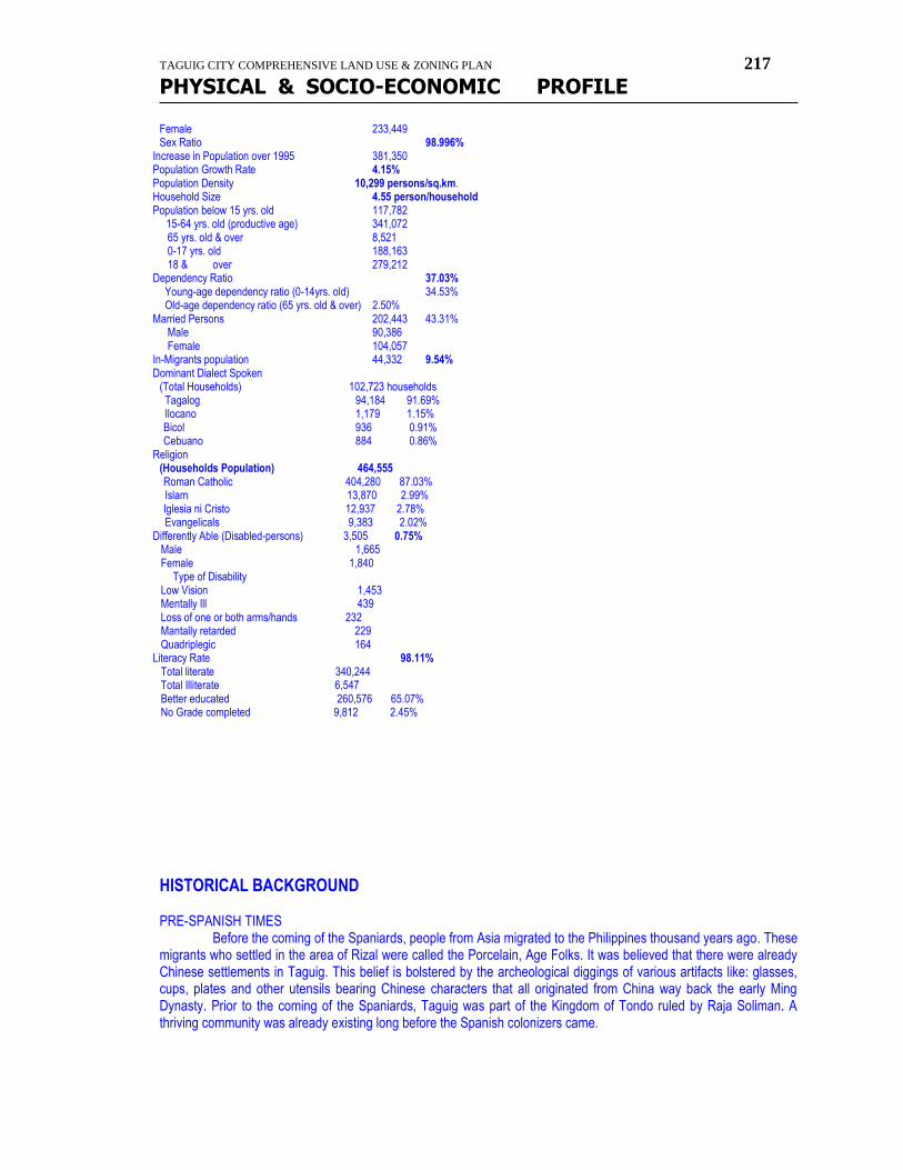
TAGUIG CITY COMPREHENSIVE LAND USE & ZONING PLAN 217
PHYSICAL & SOCIO-ECONOMIC PROFILE
Female 233,449 Sex Ratio 98.996% Increase in Population over 1995 381,350 Population Growth Rate 4.15% Population Density 10,299 persons/sq.km. Household Size 4.55 person/household Population below 15 yrs. old 117,782 15-64 yrs. old (productive age) 341,072
65 yrs. old & over 8,521 0-17 yrs. old 188,163 18 & over 279,212 Dependency Ratio 37.03% Young-age dependency ratio (0-14yrs. old) 34.53% Old-age dependency ratio (65 yrs. old & over) 2.50% Married Persons 202,443 43.31% Male 90,386 Female 104,057 In-Migrants population 44,332 9.54% Dominant Dialect Spoken (Total Households) 102,723 households Tagalog 94,184 91.69% Ilocano 1,179 1.15% Bicol 936 0.91% Cebuano 884 0.86% Religion (Households Population) 464,555 Roman Catholic 404,280 87.03% Islam 13,870 2.99% Iglesia ni Cristo 12,937 2.78% Evangelicals 9,383 2.02% Differently Able (Disabled-persons) 3,505 0.75% Male 1,665 Female 1,840 Type of Disability Low Vision 1,453 Mentally Ill 439 Loss of one or both arms/hands 232 Mantally retarded 229 Quadriplegic 164 Literacy Rate 98.11% Total literate 340,244 Total Illiterate 6,547 Better educated 260,576 65.07% No Grade completed 9,812 2.45%
HISTORICAL BACKGROUND PRE-SPANISH TIMES Before the coming of the Spaniards, people from Asia migrated to the Philippines thousand years ago. These migrants who settled in the area of Rizal were called the Porcelain, Age Folks. It was believed that there were already Chinese settlements in Taguig. This belief is bolstered by the archeological diggings of various artifacts like: glasses, cups, plates and other utensils bearing Chinese characters that all originated from China way back the early Ming Dynasty. Prior to the coming of the Spaniards, Taguig was part of the Kingdom of Tondo ruled by Raja Soliman. A thriving community was already existing long before the Spanish colonizers came.

TAGUIG CITY COMPREHENSIVE LAND USE & ZONING PLAN 218
PHYSICAL & SOCIO-ECONOMIC PROFILE
SPANISH-ERA At the early stage of Spanish colonization, Taguig was given as an "encomienda" to one Captain Vergara. In the same period the Augustinian order provided religious instruction. In 1587, Taguig was established as separate "Pueblo" (town) of the Province of Manila about 402 years ago, according to Father Gaspar San Agustin. The town then had nine (9) barrios: Bagumbayan, Hagonoy, Wawa, Bambang, Tuktukan, Ususan, Sta. Ana, Palingon and Tipas. The population at that time was 3,200 and they paid one-half of the prescribed tributes. During the year 1587-1588 the chief Captain of Taguig was Juan Basi. He fought against the Spaniards and gave his life along with agustin de Legaspi, a nephew of Lakandula. The town produced much rice and little sugar cane. Besides farming, the men lived by fishing. The women wove cotton cloth and "sawali" from bamboo strips. During the revolt against Spain, historians told of frequent visit by Andres Bonifacio, the founder of Katipunan, many followers from taguig joined the uprising. AMERICAN REGIME Sovereignty over the Philippines was transferred from Spain to the United States after the Spanish-American war under provisions of the Treaty of Paris. Again, Filpinos fought against the American forces and "revolutionarios" of Taguig join the command of Gen. Pio del Pilar. It was recorded thet on Feb. 06, 1989, the Filpino forces dislodged American positions in the hills of Taguig, now portion of Pateros and Fort Bonifacio. The Americans, by sheer superiority in armaments and training repulsed the "revolutionarios". Taguig finally fell to a contingent of the First Washington Volunteer Infantry led by Col. Wholley. Seventy five (75) Taguig "revolutionarios" died in the battlefield. At the start of the American regime, Taguig was joined with Pateros and Muntinlupa on October 12, 1903, with the seat of government in Pateros. About some month later, Muntinlupa was segragated from Taguig and made part of Biñan, Laguna by virtue of Act 1008, dated November 25, 1903. However, Muntinlupa was returned as part of Taguig again on March 22, 1905 by virtue of Act 1308 of the Phil. Commission, with seat of government in Taguig. Eventually Pateros was separated from Taguig and both became independent municipalities of Rizal province on January 01, 1918. COMMONWEALTH PERIOD
The United States granted the Philippines a ten (10) year transition period from 1936-1945 which is known as the Commonwealth government prior to declaration of independence. During this period two (2) alcaldes municipal served the town. They were Dr. Artemio Natividad and Leocadio de Leon, the latter was appointed by the Provincial Board upon the resignation of the former. JAPANESE INTERLUDE On January 1, 1942, Manila was declared an Open City as the U. S. Phil. Forces retreated to Bataan and Corregidor and during this time, Japanese forces occupied Taguig in the evening of January 04,1942 and established their garrisons. The patriotic people of Taguig refused to serve the Japanes forces. Many joined the underground movements from 1942-1945 such as the Hunters-ROTC guerillas and the markings' Fil-American Irregular Troops. LIBERATION Taguig was liberated on Feb. 03, 1945 by the joint forces of the 13th Airborne Batallion of the U.S. Army and the Hunters ROTC guerillas. Political normally was achieved with the liberation of Manila and neighboring towns by end of 1945 and after which civil government was restored. When civil government was restored following are the mayors of Taguig in the order of their terms of office: Feliciano Pagkalinawan -1901-1904 Felipe Rayos del Sol -1904-1910
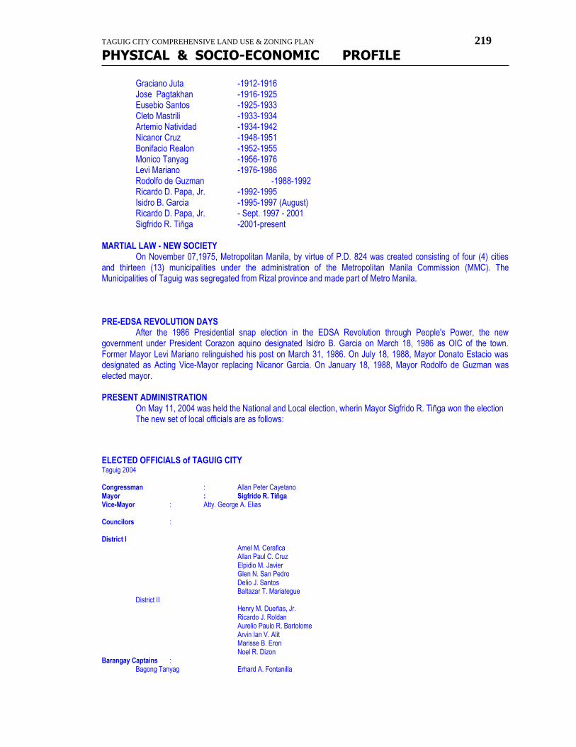
TAGUIG CITY COMPREHENSIVE LAND USE & ZONING PLAN 219
PHYSICAL & SOCIO-ECONOMIC PROFILE
Graciano Juta -1912-1916 Jose Pagtakhan -1916-1925 Eusebio Santos -1925-1933 Cleto Mastrili -1933-1934 Artemio Natividad -1934-1942 Nicanor Cruz -1948-1951 Bonifacio Realon -1952-1955 Monico Tanyag -1956-1976 Levi Mariano -1976-1986 Rodolfo de Guzman -1988-1992 Ricardo D. Papa, Jr. -1992-1995 Isidro B. Garcia -1995-1997 (August) Ricardo D. Papa, Jr. - Sept. 1997 - 2001 Sigfrido R. Tiñga -2001-present MARTIAL LAW - NEW SOCIETY On November 07,1975, Metropolitan Manila, by virtue of P.D. 824 was created consisting of four (4) cities and thirteen (13) municipalities under the administration of the Metropolitan Manila Commission (MMC). The Municipalities of Taguig was segregated from Rizal province and made part of Metro Manila. PRE-EDSA REVOLUTION DAYS After the 1986 Presidential snap election in the EDSA Revolution through People's Power, the new government under President Corazon aquino designated Isidro B. Garcia on March 18, 1986 as OIC of the town. Former Mayor Levi Mariano relinguished his post on March 31, 1986. On July 18, 1988, Mayor Donato Estacio was designated as Acting Vice-Mayor replacing Nicanor Garcia. On January 18, 1988, Mayor Rodolfo de Guzman was elected mayor. PRESENT ADMINISTRATION On May 11, 2004 was held the National and Local election, wherin Mayor Sigfrido R. Tiñga won the election The new set of local officials are as follows: ELECTED OFFICIALS of TAGUIG CITY Taguig 2004 Congressman : Allan Peter Cayetano Mayor : Sigfrido R. Tiñga Vice-Mayor : Atty. George A. Elias Councilors : District I Arnel M. Cerafica Allan Paul C. Cruz Elpidio M. Javier Glen N. San Pedro Delio J. Santos Baltazar T. Mariategue District II Henry M. Dueñas, Jr. Ricardo J. Roldan Aurelio Paulo R. Bartolome Arvin Ian V. Alit Marisse B. Eron Noel R. Dizon Barangay Captains : Bagong Tanyag Erhard A. Fontanilla
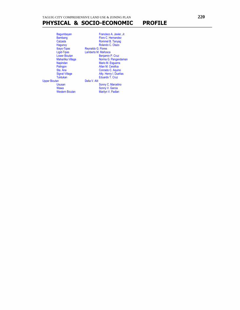
TAGUIG CITY COMPREHENSIVE LAND USE & ZONING PLAN 220
PHYSICAL & SOCIO-ECONOMIC PROFILE
Bagumbayan Francisco A. Javier, Jr. Bambang Floro C. Hernandez Calzada Rommel B. Tanyag Hagunoy Rolando C. Olazo Ibayo-Tipas Reynaldo G. Flores Ligid-Tipas Lamberto M. Mañosca Lower Bicutan Benjamin P. Cruz Maharlika Village Norma G. Pangandaman Napindan Mario M. Esguerra Palingon Allan M. Cerafica Sta. Ana Conrado C. Aquino Signal Village Atty. Henry I. Dueñas
Tuktukan Eduardo T. Cruz Upper Bicutan Delia V. Alit
Ususan Sonny C. Marcelino Wawa Sonny V. Garcia Western Bicutan Marilyn V. Padlan

TAGUIG CITY COMPREHENSIVE LAND USE & ZONING PLAN 221
PHYSICAL & SOCIO-ECONOMIC PROFILE