uvcsp15module13.2
TRANSCRIPT

Urban Planning
A R T 1 0 0
U n d e r s t a n d i n g V i s u a l C u l t u r e

agenda 3.23.15
the origins of modern planning
Frederick Law Olmsted in NY and Chicago
Haussmann in Paris
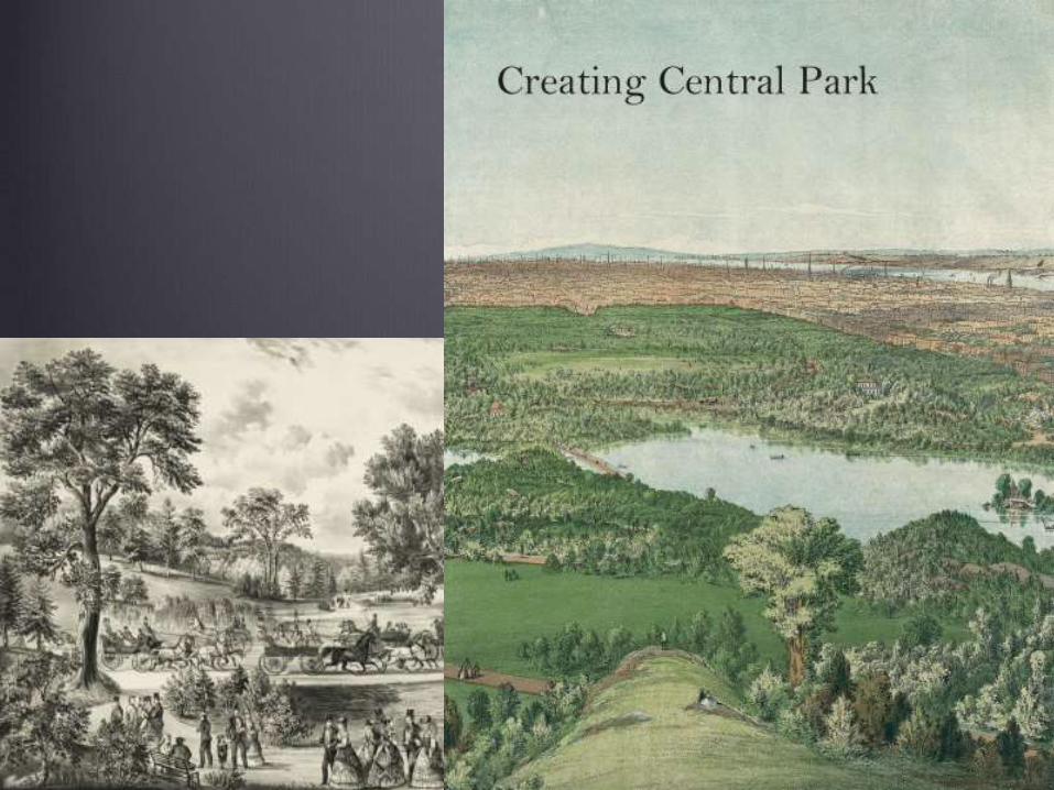
a case study of modern planning: NYC
two visions of the city
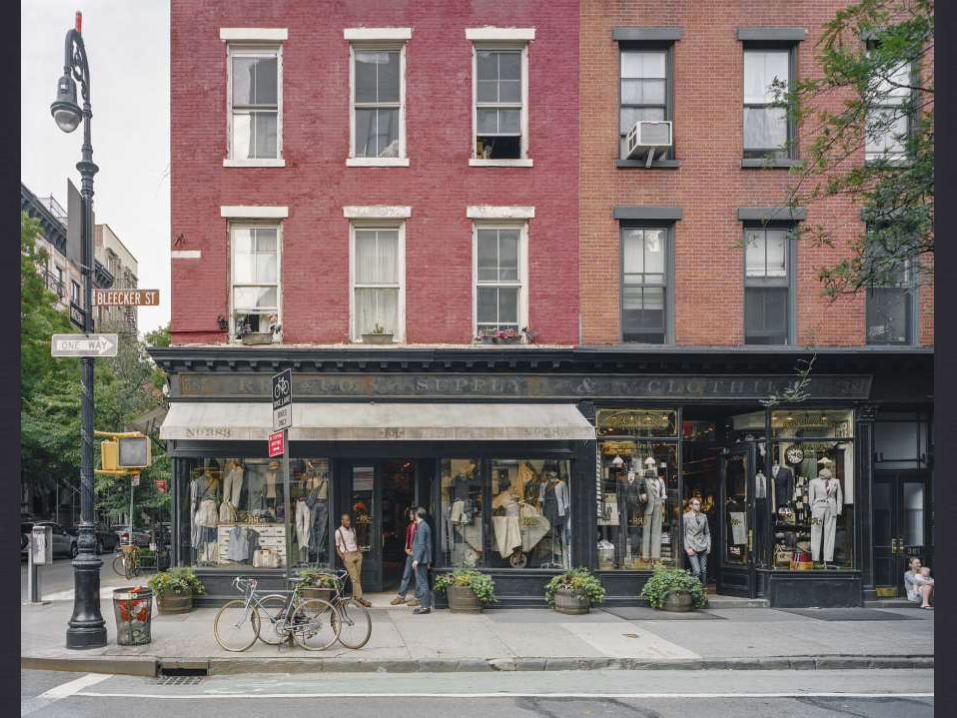
the New Urbanism
"the smart code"
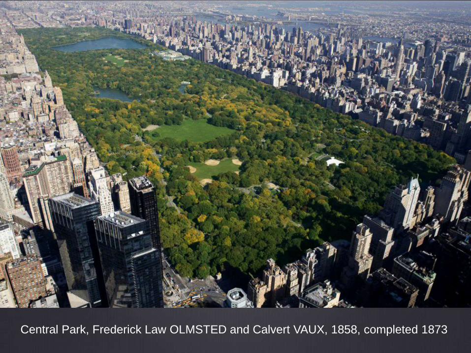
Central Park, Frederick Law OLMSTED and Calvert VAUX, 1858, completed 1873

aerial photograph, Manhattan, NYC

Chicago Parks
The west park system of Chicago was established in 1869.
Douglas, Garfield, and Humboldt parks and their connecting
boulevards were laid out by architect William LeBaron
Jenney in 1871.
At Garfield, originally known as Central Park, Jenney’s plan
was built-out slowly over the next three decades:
• east lagoon,
• suspension bridge
• small conservatory
• Victorian bandstand
• horse racing track

William LeBaron JENNEY, Garfield Park Suspension Bridge

William LeBaron JENNEY, Humboldt Park, 1870-1906

William LeBaron JENNEY, Humboldt Park, 1870-1906

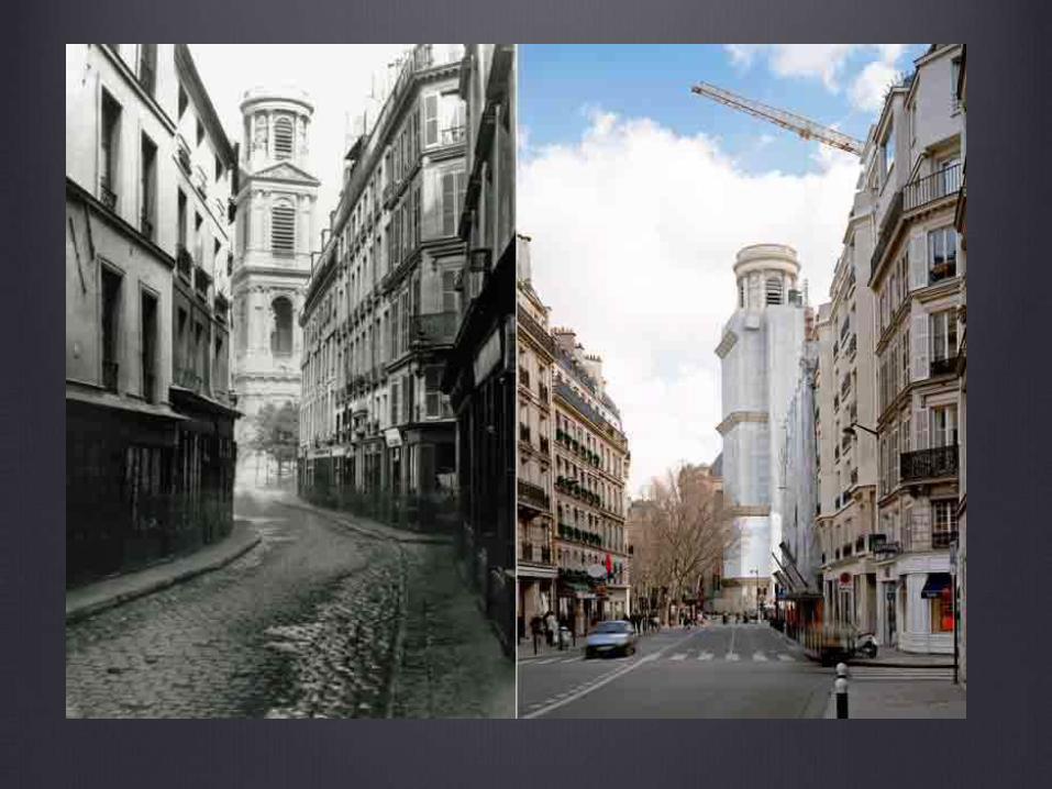
Paris

Paris,
before
urban
planning
Charles MARVILLE,
Rue des Trois Canettes
1865-8
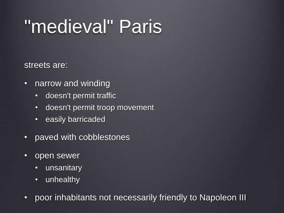
"medieval" Paris
streets are:
• narrow and winding
• doesn't permit traffic
• doesn't permit troop movement
• easily barricaded
• paved with cobblestones
• open sewer
• unsanitary
• unhealthy
• poor inhabitants not necessarily friendly to Napoleon III

Unidentified photographer
[Barricades during the Paris Commune]
1871 © Det Kongelige Bibliotek
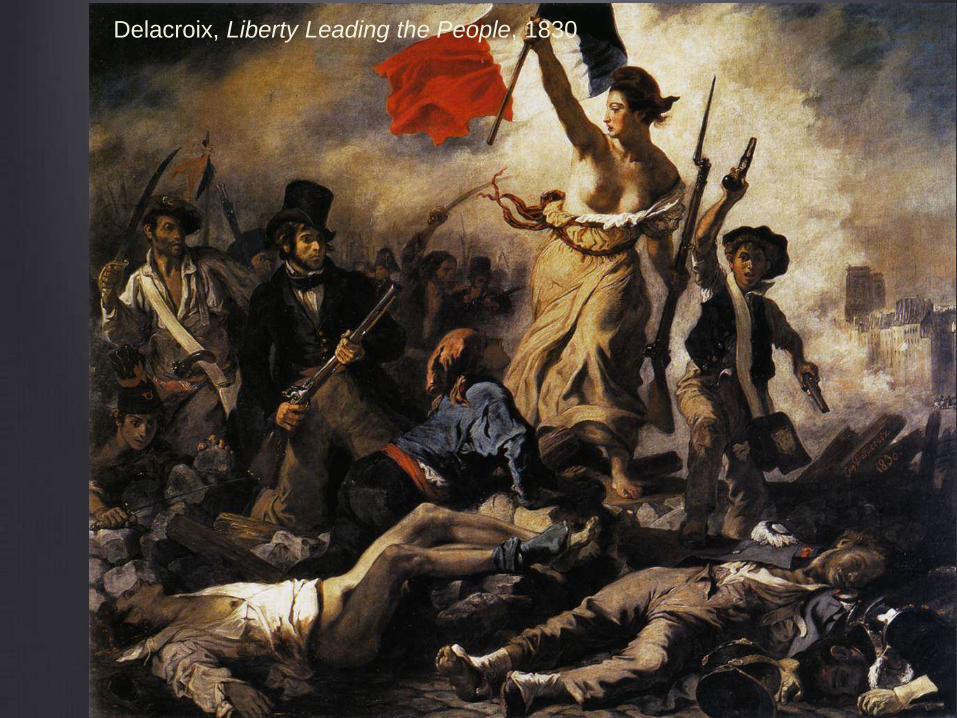
Delacroix, Liberty Leading the People, 1830
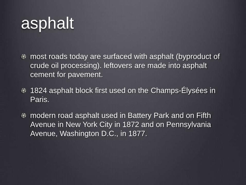
asphalt
most roads today are surfaced with asphalt (byproduct of
crude oil processing). leftovers are made into asphalt
cement for pavement.
1824 asphalt block first used on the Champs-Élysées in
Paris.
modern road asphalt used in Battery Park and on Fifth
Avenue in New York City in 1872 and on Pennsylvania
Avenue, Washington D.C., in 1877.

Charles Marville
In 1862 Marville became the official photographer for the city
of Paris.
His job: to document the city, both the quarters marked for
destruction and the grand boulevards that replaced them.
Although his charge was to show that the existing urban
fabric was "not worth saving," many drew the opposite
conclusion from the archive he created.
The entire body of his work burned in the destruction of the
Hôtel de Ville during the Commune. Fortunately Marville had
carefully stored his negatives and was able to replace the
prints.

from Le Vieux Paris by Louis Blanc in Paris-guide, par
les principaux écrivains et artistes de la France,
Librairie Internationale, 1867.
“The time has come to clean up the insalubrious streets
and create more wide-open spaces! The time has come to
let the sun stream into the shady districts, to give Paris the
lungs to breathe as it should; not for reasons of trend or
fashion, but for the sake of hygiene and progress! Yet
wherever the interests of public health, wherever the
inevitable growth of civilization do not require Parisian
dignitaries to display their relentless determination, mercy
for the old streets of Paris! Mercy for the visible vestiges of
the past that the present is so intent on destroying in every
way...! Mercy! If only for a few warts and stains beloved of
Montaigne!”

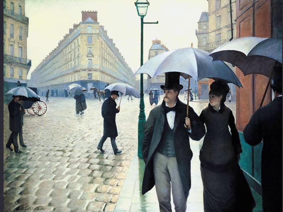
Under Napoleon III
• Haussmann undertook what many consider the first modern
urban works project, demolishing many existing neighborhoods
to make way for grand boulevards and parks.
• He installed a sewer system.
• Gas lighting was placed in major public places.
• He hired photographers to document the medieval streets he
was plowing under.

Camille PISSARRO, Boulevard Montmartre, 1897, 29.1 × 36.5 in
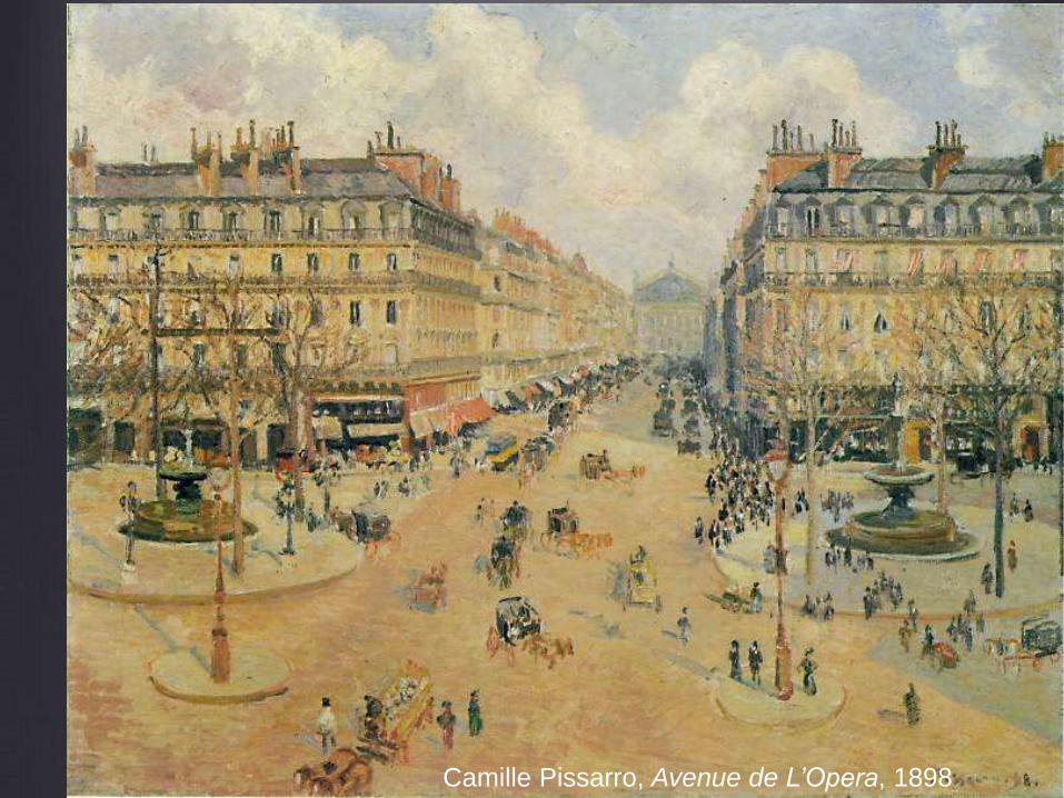
Camille Pissarro, Avenue de L’Opera, 1898
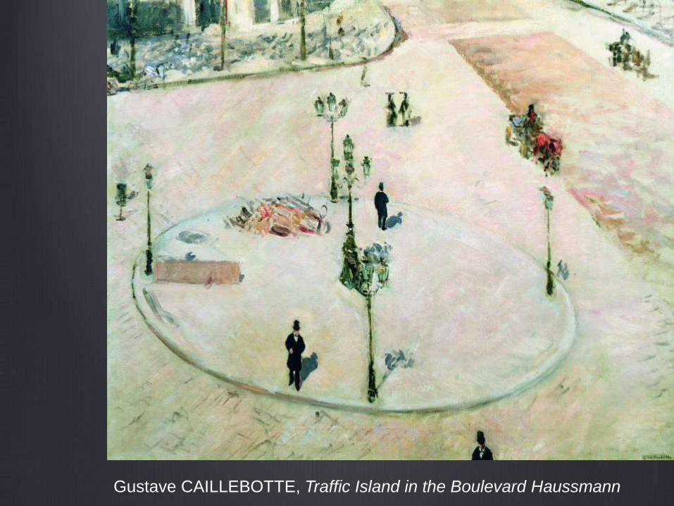
Gustave CAILLEBOTTE, Traffic Island in the Boulevard Haussmann


Charles Garnier, Paris Opera, built from 1860 to 1875

Marville, L’Avenue de l’Opera

razing the Butte des Moulins during
construction of the Paris Opera house
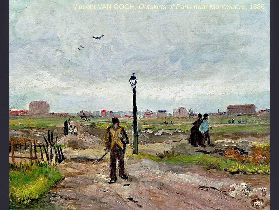
Vincent VAN GOGH, Outskirts of Paris near Montmartre, 1886

Urban planning, NY style
“I’d like to see the planner who can remove
a ghetto without displacing some people,
just like I’d like to see the chef who can
make an omelette without breaking some
eggs.”
—Robert Moses, New York City planner
and nemesis of Jane Jacobs

“creative destruction”Joseph Schumpeter
Capitalism, Socialism and Democracy (1942)

Robert
Moses,
with the
map of
the Five
Boroughs
of New York
City
behind him

Robert Moses (1888-1981)
a variety of unelected roles in New York State and New
York City
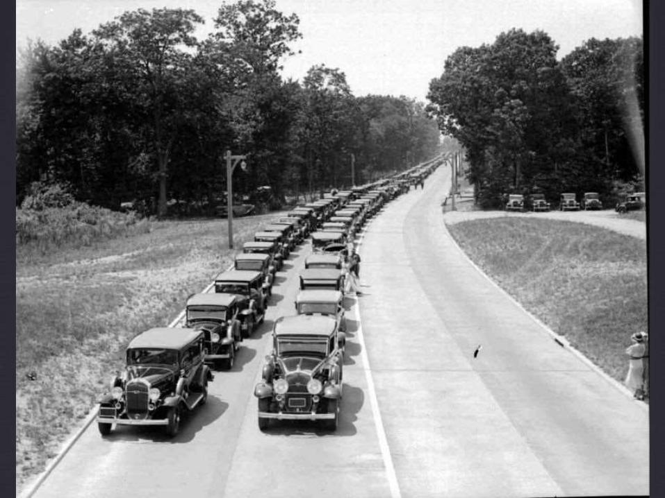
built parkways, beaches and bridges in and around New
York in the 1930s, using New Deal funds
postwar period, attention turned to expressways; he built a
number of them but failed to build the Lower Manhattan
Expressway

Moses projects
parkways: Northern State, Southern State, Wantaugh
Parkway, Meadowbrook Parkway
beaches: Jones Beach
pools: throughout the five boroughs
bridges: Triborough Bridge, Brooklyn-Battery Tunnel,
Throgs Neck, the Bronx-Whitestone, the Henry Hudson,
and the Verrazano–Narrows bridges.
expressways: I-278 (the Brooklyn-Queens Expressway
and Staten Island Expressway), Cross-Bronx Expressway,
developed Shea Stadium, Lincoln Center, and contributed
to the United Nations headquarters.
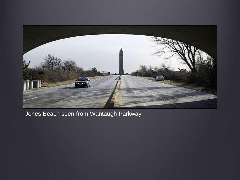
Jones Beach seen from Wantaugh Parkway


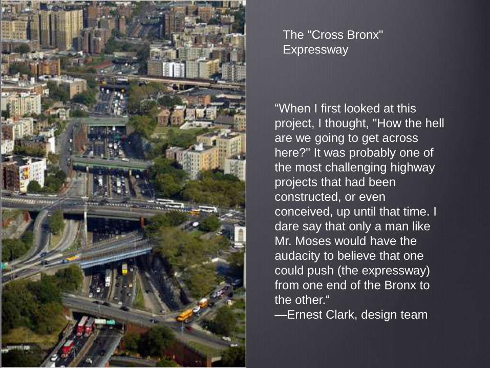
“When I first looked at this
project, I thought, "How the hell
are we going to get across
here?" It was probably one of
the most challenging highway
projects that had been
constructed, or even
conceived, up until that time. I
dare say that only a man like
Mr. Moses would have the
audacity to believe that one
could push (the expressway)
from one end of the Bronx to
the other.“
—Ernest Clark, design team
The "Cross Bronx"
Expressway
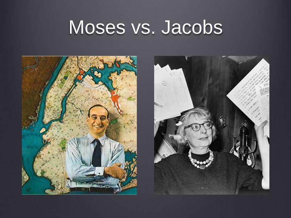
Moses vs. Jacobs


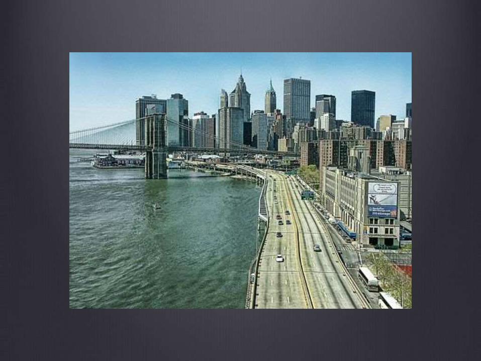
The Cross-Bronx Expressway, today


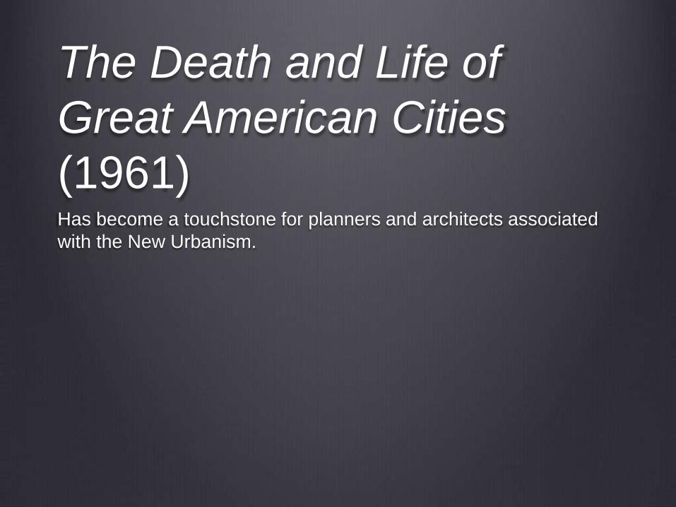
The Death and Life of
Great American Cities
(1961)Has become a touchstone for planners and architects associated
with the New Urbanism.

Jacobs, p. 8
“Specifically, in the case of planning for cities, it is clear
that a large number of good and earnest people do care
deeply about building and renewing. Despite some
corruption, and considerable greed for the other man's
vineyard, the intentions going into the messes we make
are, on the whole, exemplary.”
Jacobs, p. 8
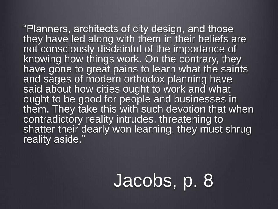
“Planners, architects of city design, and those they have led along with them in their beliefs are not consciously disdainful of the importance of knowing how things work. On the contrary, they have gone to great pains to learn what the saints and sages of modern orthodox planning have said about how cities ought to work and what ought to be good for people and businesses in them. They take this with such devotion that when contradictory reality intrudes, threatening to shatter their dearly won learning, they must shrug reality aside.”

Her proposal:
Let’s study healthy streets and blocks and
develop a set of principles they share in
common.
We can use those principles to guide new
development.

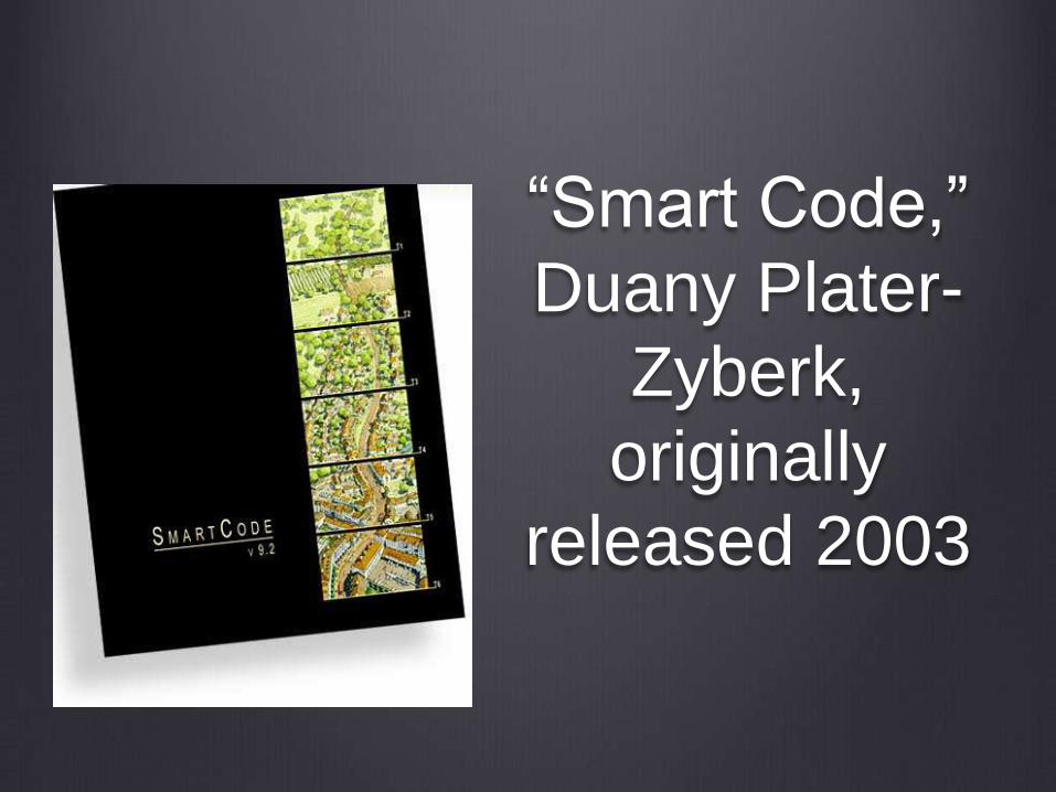
“Smart Code,”
Duany Plater-
Zyberk,
originally
released 2003

“Smart Code” v. 9.2
Consider the most-loved towns of North America. They were
either carefully planned, or they evolved as compact, mixed
use places because of their geography and the limits of the
transportation and economics of their time. However, over
the past sixty years, places have evolved in a completely
different pattern. They have spread loosely along highways
and haphazardly across the country- side, enabled by the
widespread ownership of automobiles, by cheap petroleum
and cheap land, and by generalized wealth.

Such patterns are enabled by zoning codes that separate
dwellings from work- places, shops, and schools. These
codes include design standards that favor the automobile
over the pedestrian, and are unable to resist the
homogenizing effects of globalization.
These practices have produced banal housing subdivisions,
business parks, strip shopping, big box stores, enormous
parking lots, and sadly gutted downtowns. They have caused
the proliferation of drive-by eateries and billboards. They
have made walking or cycling dangerous or unpleasant.
They have made children, the elderly, and the poor utterly
dependent on those who can drive, even for ordinary daily
needs. They have caused the simultaneous destruction of
both towns and open space -- the 20th century phenomenon
known as sprawl.
The form of our built environment needs a 21st century
correction. But in most places it is actually illegal to build in a
traditional neighborhood pattern. The existing codes prevent
it. In most places people do not have a choice between
sprawl and traditional urbanism. Codes favor sprawl and
isolated residential sub- divisions. It is not a level playing
field.

The SmartCode was created to deal with this problem at the point of decisive impact -- the intersection of law and design. It is a form-based code, meaning it envisions and encourages a certain physical outcome --the form of the region, community, block, and/or building. Form-based codes are fundamentally different from conventional codes that are based primarily on use and statistics -- none of which envision or require any particular physical outcome.
The SmartCode is a tool that guides the form of the built environment in order to create and protect development patterns that are compact, walkable, and mixed use. These traditional neighborhood patterns tend to be stimulating, safe, and ecologically sustainable. The SmartCode requires a mix of uses within walking distance of dwellings, so residents aren’t forced to drive everywhere. It supports a connected network to relieve traffic congestion. At the same time, it preserves open lands, as it operates at the scale of the region as well as the community.
A primary task of all urban architecture and
landscape design is the physical definition of
streets and public spaces as places of shared use.

Individual architectural projects should be
seamlessly linked to their surroundings. This issue
transcends style.
(see Vincent Scully, “The Death of the Street”)
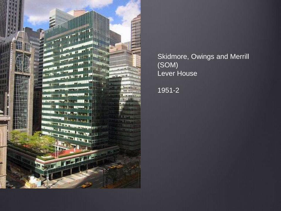
Skidmore, Owings and Merrill
(SOM)
Lever House
1951-2

view down Park Avenue, showing the relationship between the older buildings
and the street

New York Racquet and Tennis Club, 370 Park Avenue
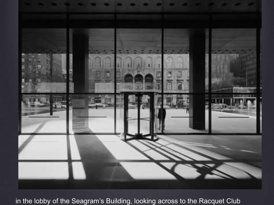
in the lobby of the Seagram’s Building, looking across to the Racquet Club
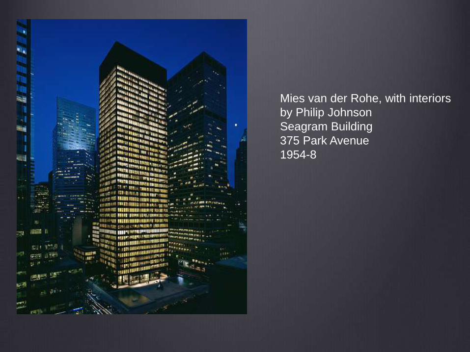
Mies van der Rohe, with interiors
by Philip Johnson
Seagram Building
375 Park Avenue
1954-8

The revitalization of urban places depends
on safety and security. The design of streets and buildings
should reinforce safe environments, but not at the expense
of accessibility and openness.

In the contemporary metropolis, development
must adequately accommodate automobiles. It
should do so in ways that respect the pedestrian and the
form of public space.


NYC bike path

reconfigured intersection, NYC


“Curbana” under construction, June 2014

Streets and squares should be safe, comfortable, and
interesting to the pedestrian. Properly configured, they
encourage walking and enable neighbors to know each other
and protect their communities.

Union Square, NYC
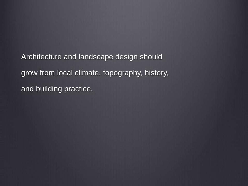
Architecture and landscape design should
grow from local climate, topography, history,
and building practice.

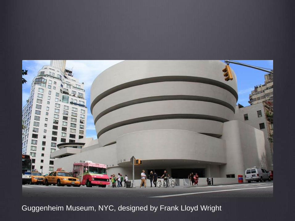
Guggenheim Museum, NYC, designed by Frank Lloyd Wright

Guggenheim Museum, Bilbao, Spain, designed by Frank Gehry

Civic buildings and public gathering places
require important sites to reinforce community
identity and the culture of democracy. They
deserve distinctive form, because their role is
different from that of other buildings and places that
constitute the fabric of the city.


All buildings should provide their inhabitants
with a clear sense of location, weather and time.
Natural methods of heating and cooling can be
more resource-efficient than mechanical systems.

Preservation and renewal of historic buildings,
districts, and landscapes affirm the continuity and evolution
of urban society.

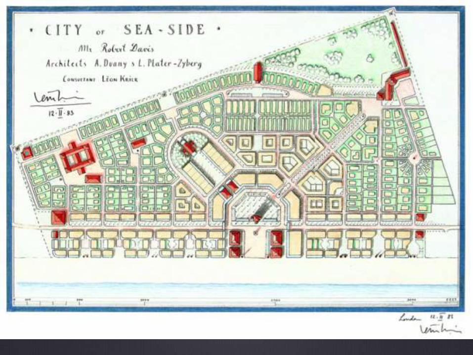
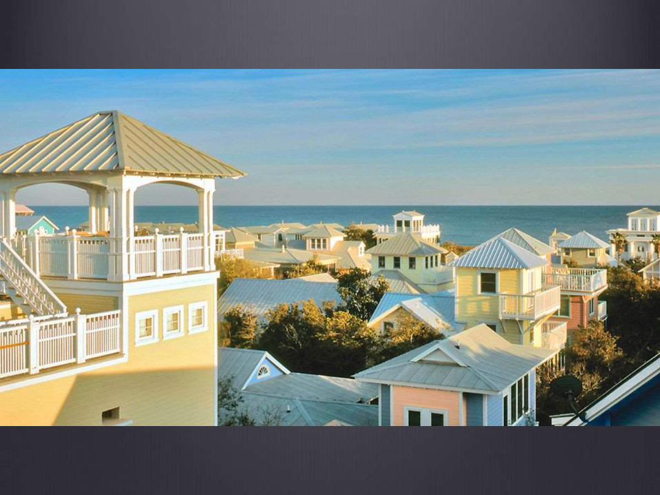
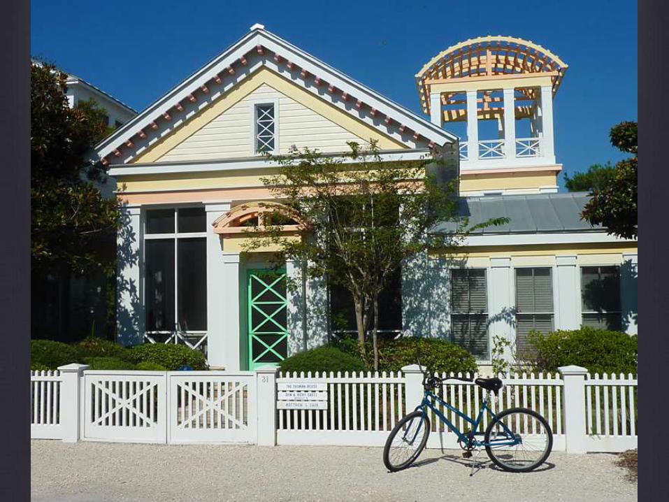
Seaside, FL 1985
In 1978 after Robert Davis inherited an 80 acre plot of land in
the Florida Panhandle. Robert and his wife Daryl set out to build
a “livable” resort town in the “Redneck Riviera” and create a
haven for those who missed the communities that were
developed when cars were not the dominant form of
transportation.
Andrés Duany and Elizabeth Plater-Zyberk, a husband and wife
team from the prestigious architectural firm Arquitectonica.
(They later formed their own firm, DPZ.) The four of them, along
with European classicist and town planner Léon Krier, set out to
design the kind of place that had been overlooked in
contemporary American town planning. The kind of community
we all wish we could be from.


Seaside, Florida, 1982, Robert Davis, Andres Duany and Elizabeth Plater-Zyberk
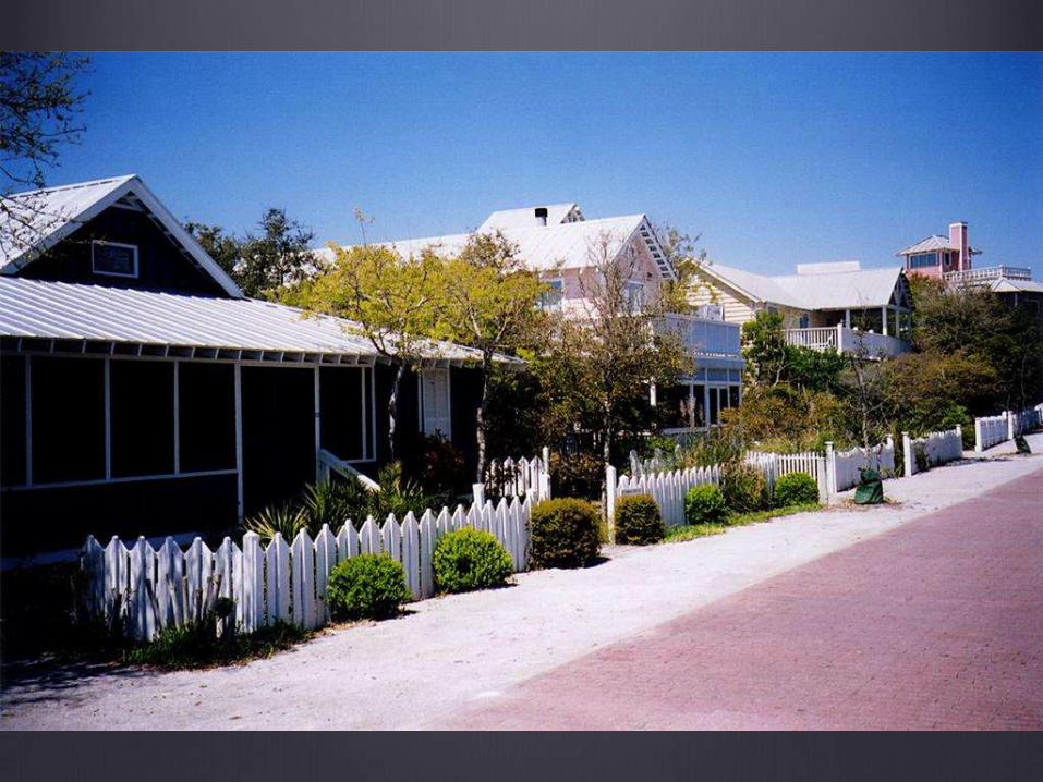


Note the golfcart.


The Truman Show (1998),
dir. Peter Weir
Was filmed in Seaside, Florida,
which the director felt perfectly
expressed the set of reality
television show.

http://inframanage.com/urbanization-1950-2050-economist-magazine-interactive-
timeline-infrastructure-management-perspective/