rectas rectas: profile isi a. ikhuoria executive director, rectas, ile-ife, nigeria e-mail:...
TRANSCRIPT

RECTAS RECTAS www.rectas.orgwww.rectas.org
RECTAS: Profile
Isi A. IkhuoriaExecutive Director,
RECTAS, Ile-Ife, Nigeriae-mail: [email protected]
+234 803 371 2799+234 803 371 2799

The CentreThe Centre
• RECTAS was established on 21st October 1972 under the auspices of the United Nations Economic Commission for Africa (UNECA).
• A joint Institution of African countries. The current participating countries are Benin, Burkina, Cameroon, Ghana, Mali, Niger, Nigeria (host country) and Senegal.
- Interested countries may apply for admission

Evolution of Critical Capacity Training at RECTASEvolution of Critical Capacity Training at RECTAS
Produced 1,522 traineesfrom 28 countries
(1973-2010)
No of Students = 60
Distribution of Students
Students enrolment at RECTAS
Francophone40%
Anglophone60%
0
2
4
6
8
10
12
14
16
18
20
Technician Technologist Post Graduate
No o
f Stu
dent
s
Anglophone
Francophone

RECTAS Management Staff
International Trainees
Academic Block
Auditorium
International Workshop
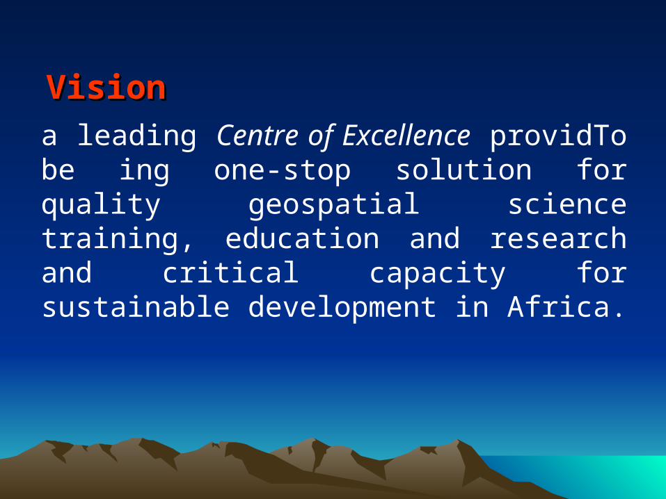
VisionVision
a leading Centre of Excellence providTo be ing one-stop solution for quality geospatial science training, education and research and critical capacity for sustainable development in Africa.

MissionMission
To contribute to rapid development of member states in particular and Africa in general, through capacity building for timely delivery and responsible use of appropriate geospatial information.

Objectives:Objectives:
• provide theoretical and practical training in Geoinformatics and applications
• conduct seminars and courses
• carry out studies and research
• provide advisory and consultancy services

Conceptual Framework
• There is inadequacy of manpower needs in the mapping sciences in Africa (Ihemadu, 1987 and 1992; Ikhuoria, 1995 and Ayeni, 1996).
• The capacity development and adoption of Geoinformatics is examined under the concepts of professionalism & innovation diffusion in Africa.
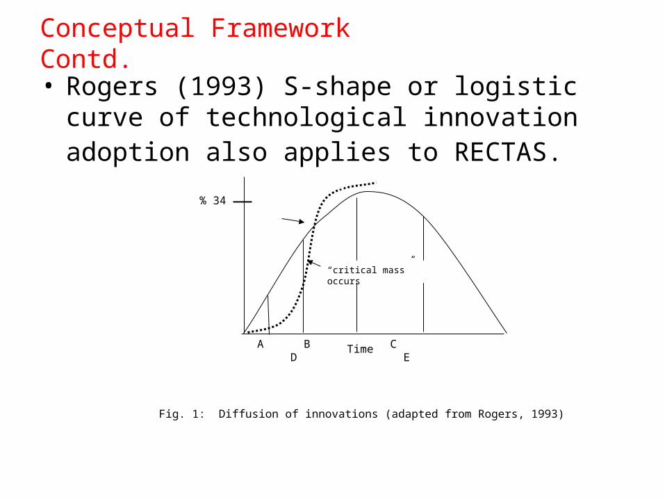
Conceptual Framework Contd.
• Rogers (1993) S-shape or logistic curve of technological innovation adoption also applies to RECTAS.
% 34
A B C D E
Rate of adoption of Geoinformatics
Time
“critical mass” occurs
Where: A= innovators (venturesome, 2.5%); B= Early adopters (respectable, 13.5%)
C= Early majority (deliberate, 34%); D= Late majority (skeptical 34%); E= Laggards (traditional, 16%).
Fig. 1: Diffusion of innovations (adapted from Rogers, 1993)

In fulfillment of the vision and objectives of the Centre, the following academic programmes and qualifications are offered:
Department of Photogrammetry & Remote Sensing
• Professional Master (PM) degree in Geoinformation Production & Management (English & French)
• MSc degree in Photogrammetry & Remote Sensing (English & French)
• PhD degree in Photogrammetry & Remote Sensing (English & French)

Dept of Geographic Information Science•Technologist Diploma (TD) in Geoinformation Production & Management (English & French)
•Executive Master (EM) degree in Geoinformation & Environmental Mgt (English only) Note: weekend programme. Venue is Abuja, Nigeria.
•MSc degree in Geographic Information Science (French)
•Master of Technology (M.Tech) degree in Geoinformation Technology (English)
•PhD degree in Geographic Information Science (English & French)

Department of Cartography
•Professional Master (PM) degree in Cartography & Geospatial Techniques (English & French)
•M.Sc degree in Cartography & Geospatial Sciences (English & French)
•PhD degree in Cartography & Geospatial Sciences (English & French)

Levels of Levels of ProfessionalismProfessionalism in Africa in Africa
• Technical: technicians with <2 years practical training.
• Technological: technologist 2-3 years theoretical & practical training.
• Professional: university graduates (involved
in management and policy decisions).

Equip graduates of various disciplines with adequate technical capability in GIS, remote sensing and usage of geospatial data and infrastructure for environmental management.
Strategies of Education and Training (3)

Institutional and sub-regional synergy and collaborations for capacity training, research & applications of geoinformatics.
Expertise: • Research,• Capacity building,• national institutions- AGIS, NFIS, Edo- Lagos State, Ondo- Nasarawa State.- ECOWAS
Prospects

Expertise: • Research,• Capacity building,• International institutions- RCMRD, GSDI, GMES-Africa- GARNET-E, IAEA-FGN,- CODIST, AFREF, etc.
International & regional networks and partnerships for capacity building, research & GI applications.
Prospects:
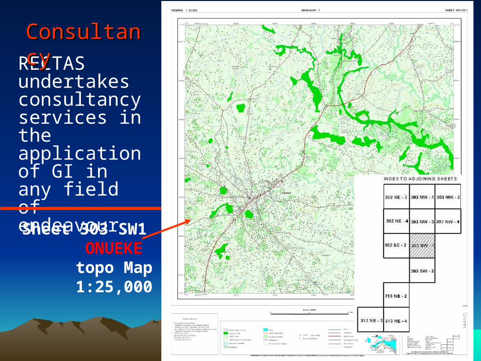
RECTAS undertakes consultancy services in the application of GI in any field of endeavour.
ConsultancyConsultancy
Sheet 303 SW1ONUEKE topo Map1:25,000
1818 RECTAS
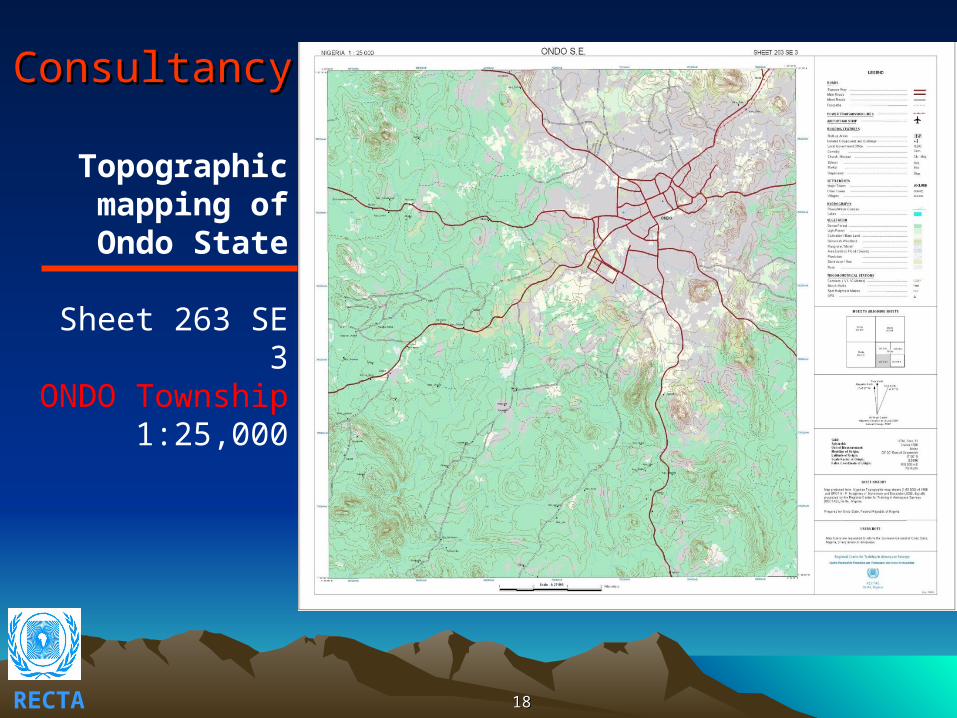
ConsultancyConsultancy
Topographic mapping of Ondo State
Sheet 263 SE 3ONDO Township
1:25,000

Consultancy:Consultancy:
provision of provision of Satellite images, Satellite images, digital photos, digital photos, etc.etc.
Quickbird Quickbird image of image of Akure Akure
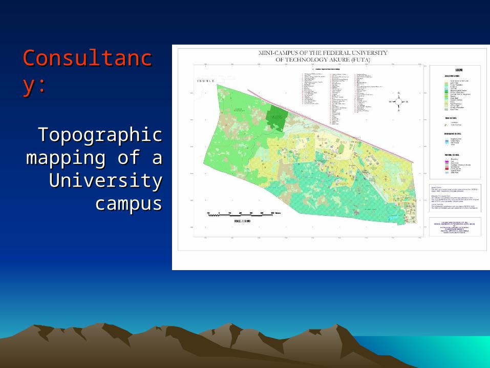
Consultancy:Consultancy:
Topographic Topographic mapping of a mapping of a
University University campuscampus

Short courses:Short courses:
– modular formats of 3 weeks duration– customised formats of 1-3 weeks duration
Examples are:• RS/GIS applications military operations • RS/GIS applications in geology/mineral resources
exploration (Mines & Steel Dev.)• Space-based technologies in Disaster Management
(NEMA)• GIS-Day seminar (11 Dec. 2008)• AFREF workshop (2-5 Aug. 2009)• AFREF workshop (9-11 Feb. 2010)

AdvisoryAdvisory
• GI applications missions• RS/GIS lab installations• software licence & satellite Image acquisition• instruments maintenance, etc.
Examples are:
Installation of GIS laboratory in UniversitiesUN-SPIDER missions (Lome - June, 2009; Dakar - Dec, 2009
Cameroon, 2010)

Sustenance Sustenance • Biennial Budget – shared by member countries - Nigeria 29.%
- Ghana 14%- Cameroon 10%- Senegal 06%- Niger 04%- Mali 03%- Benin 03%- Burkina 03%
- RECTAS 28.0%
• Capital budget for Infrastructures by Nigeria (2008 – 2013 = $5.3m)
• Internally Generation Revenue & Donors
