north carolina lidar acquisition - federal … · north carolina lidar acquisition . ... •the...
TRANSCRIPT

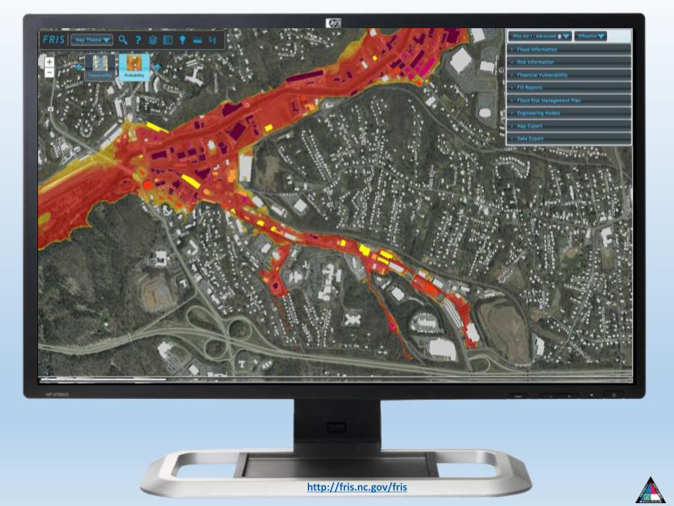
North Carolina Lidar Acquisition

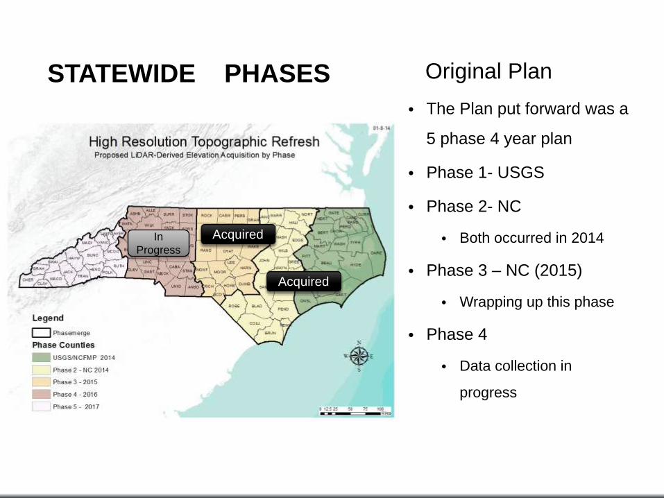
Original Plan
• The Plan put forward was a
5 phase 4 year plan
• Phase 1- USGS
• Phase 2- NC
• Both occurred in 2014
• Phase 3 – NC (2015)
• Wrapping up this phase
• Phase 4
• Data collection in
progress
Acquired
STATEWIDE PHASES
In
Progress
Acquired
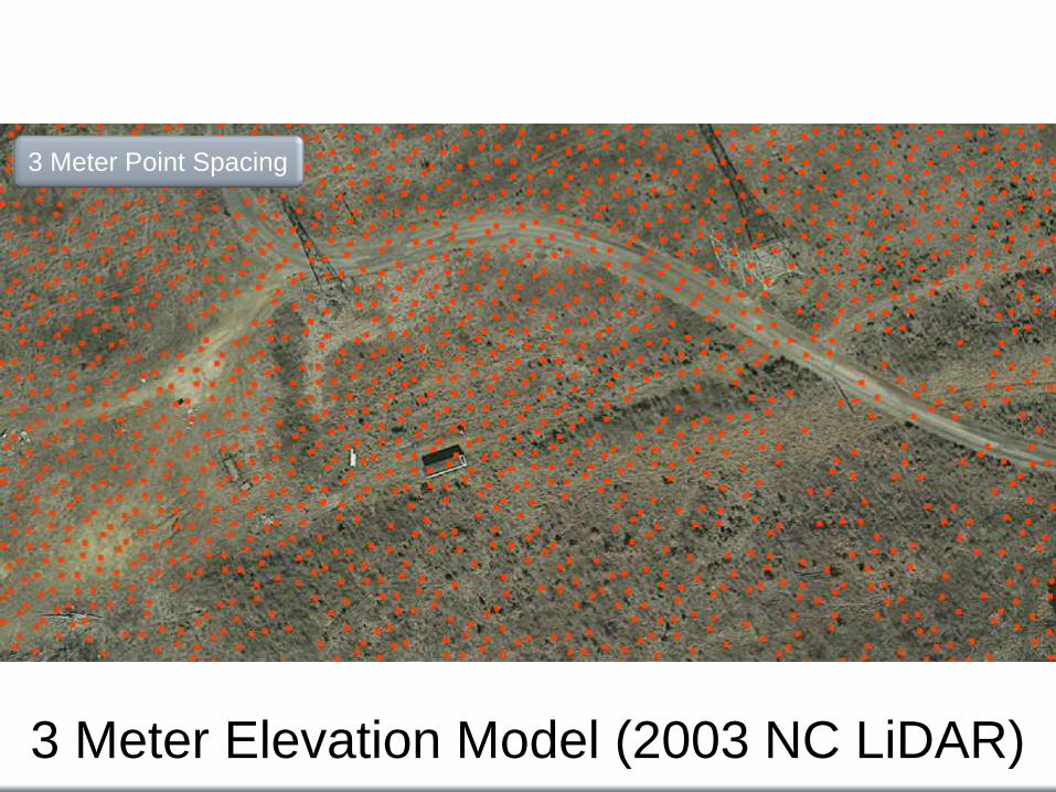
3 Meter Elevation Model (2003 NC LiDAR)
3 Meter Point Spacing

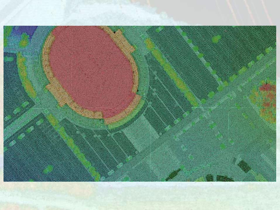
QL2 Elevation Model
0.3 Meter Point Spacing

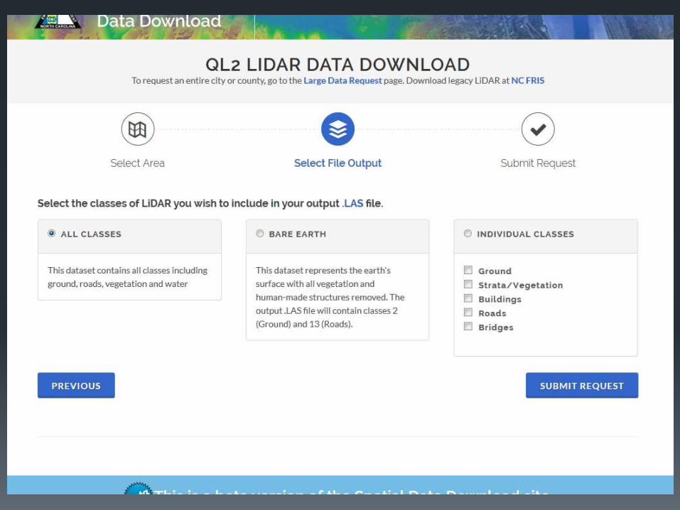
• Pilot test area in Mecklenburg County.
• 20 points per square meter with nominal post spacing of 0.7 meters.
• 8 ppm deliverable at same or
reduced cost.
• Data collected will support a 9.25 cm (3.36 inches) RMSEz.
Geiger Mode Sensor
2016 Data Collection


Original Plan
• The Plan put forward was a
5 phase 4 year plan
• Phase 1- USGS
• Phase 2- NC
• Both occurred in 2014
• Phase 3 – NC (2015)
• Wrapping up this phase
• Phase 4
• Data collection in
progress
Acquired
STATEWIDE PHASES
In
Progress
Acquired

Questions?
Mailing address: Building (shipping) address:
Gary W. Thompson, PLS NC Geodetic Survey 4298 Mail Service Center Raleigh, NC 27699-4298
Gary W. Thompson, PLS NC Geodetic Survey Bowers Building NC National Guard complex 4105 Reedy Creek Rd Raleigh, NC 27607
Gary W. Thompson, PLS
Office: 919-733-3836
Direct: 919-948-7844
Email: [email protected]