minerals south 2018 update -...
TRANSCRIPT

October 2018 Page 1 of 17
MINING: GOOD NEIGHBOUR AND PROVIDER TO THE WORLD WWW.CMEBC.COM
MINERALS SOUTH 2018 UPDATE
This year the Short Course, to be held on November 20 at the Best Western Columbia River Hotel, will be an “Exploration
Toolkit” which is a compilation of some of the valuable tools available for us now that we are not all familiar with. The
tools covered are XRF, LiDAR, Advances in Geochemistry, Age Dating, Isotope Geochemistry, Hyperspectral Technology,
Laser Ablation and ICP MS. There will be presentations on each subject along with discussion on field application and how
to best use these technologies. Presenters are Rob Lee from MDRU, Chris Gallagher of Terralogic, Lloyd Hume of Eagle
Mapping and Erin Looby of Corescan. That evening the Icebreaker will be held at the same location.
The main conference on November 21 and 22 will be held at the Trail Arena Complex where at the gymnasium there will
be a trade show with booths, displays and posters that we will be advertising as open to the public and having school
classes come through. Also at the arena, in the MacIntyre Room, there will be a varied list of technical talks including a few
presentations about the Teck Smelter and how to ship your ore, several company project presentations and government
technical presentations along with a variety of other informative talks.
On November 21 the Banquet will be held at the “RiverBelle” Trail’s full service, fully licensed catering facility and will
feature entertainment by the “Boom Town Garter Girls” from nearby Rossland. This is all happening a few short blocks
from the main conference.
There will be a field trip to the Teck Smelter on November 23 which will include lunch.
There are still some sponsorship opportunities as well. When a company sponsors something they will have their logo
displayed on posters and on other screens around the conference so we require a high definition copy of the logo for
when it appears on the big screen. Sponsors logos will also appear in the program as well as our monthly Motherlode
Newsletter. Any profits that may be realized from the conference will go towards keeping the Chamber of Mines of
Eastern BC open to the public five days a week advocating for mining and doing public outreach. We are a volunteer, not
for profit organization, so help if you can. We now have it so you can register online at http://cmebc.com/minerals-south-
2018/ or for more information call the chamber at 250-352-5242. With the possibility of a mail strike, please email a
copy of your registration forms, PayPal is working now so you can even pay with a credit card.
If you want to be there or be be involved in some way don’t wait for us to call you, contact the chamber at 250-352-5242

October 2018 Page 2 of 17
MINING: GOOD NEIGHBOUR AND PROVIDER TO THE WORLD WWW.CMEBC.COM
Minerals South 2018 We are excited to announce the dates for our Minerals South 2018 Conference
and Trade-Show.
November 20th – 23rd, 2018
Trail, BC.
Click below for the Minerals South 2018 Registration Forms.
http://cmebc.com/wp-content/uploads/2018/10/RegMemAccomm.pdf
There are many sponsorship opportunities and we will be contacting companies soon! Booths, talks, short course and banquet!
Contact the Chamber at 250-352-5242 or email [email protected]

October 2018 Page 3 of 17
MINING: GOOD NEIGHBOUR AND PROVIDER TO THE WORLD WWW.CMEBC.COM
New Research to Boost Interest in Historical Kootenay-Boundary District Mining Region
September 27, 2018
A new geological map and data released by Geoscience BC today is the latest in a series of research projects to encourage mineral exploration in the Regional District of Kootenay Boundary in southern
British Columbia.
The 1:50,000 scale Geology of the Greenwood Map Area (NTS 082E/02), Boundary District, Southern British Columbia map provides an updated understanding of the relationships between different rock
types and their ages around Greenwood, where there has been significant gold, silver, copper, lead and zinc mining since the late 1880s.
Geoscience BC Vice-President of Minerals and Mining Bruce Madu said: "This new research funded by Geoscience BC should bolster the recent revival of mineral exploration activity in the Greenwood area."
Highway 3 runs along the southern edge of the 800 km2 area covered by the Greenwood map, passing through towns founded on mining such as Grand Forks, Greenwood, Midway and Rock Creek. With 26 'past producing' mines in the Greenwood area, and more than 38 tonnes (1.2 million ounces) of gold
and over 270,000 tonnes of copper mined in the area to date*, the new map will improve understandings of the geology that hosts deposits, and where development might be appropriate in the
future.
Project lead Trygve Höy said: "Greenwood is one of BC's larger mining areas. This map provides data and information about new opportunities as well as existing deposits, knowing that new approaches
could make them viable targets again."
The new research combines field mapping by Trygve Höy and rock dating by the University of British Columbia to untangle the complex relationships between rock types and when mineral deposits were
formed in the project area.
It is hoped that the research will also provide clues to how and when other deposits have formed across British Columbia. "This area could hold the key to a better understanding of mineral deposits that
formed during key geological events that span almost 200 million years," said Madu.
All data and maps from the new research are publicly available, with the aim of encouraging exploration, economic activity and informed land use decisions.

October 2018 Page 4 of 17
MINING: GOOD NEIGHBOUR AND PROVIDER TO THE WORLD WWW.CMEBC.COM
The research is the latest in a series of new mapping in the area funded by Geoscience BC. This has included:
Almond Mountain Map Sheet NTS 082E/07 Christian Valley map sheet NTS 082E/10
Deer Park Map Sheet NTS 082E/08 Burrell Creek map sheet NTS 082E/09 Grand Forks Map Sheet NTS 082E/01
A new compilation map for the east-half of the Penticton map sheet (NTS sheet 082E) will be published
in early 2019.
Accessing Information
To view reports and maps for this project, visit the project page below or use our Earth Science Viewer
online mapping application.
*http://www.empr.gov.bc.ca/Mining/Geoscience/MINFILE/ProductsDownloads/PublicationsList/Pages/greenwd.aspx

October 2018 Page 5 of 17
MINING: GOOD NEIGHBOUR AND PROVIDER TO THE WORLD WWW.CMEBC.COM
Currie Rose Resources Inc. Surface sample Results. October 2, 2018
Currie Rose Resources Inc. is pleased to provide shareholders with the results of recently sampled outcrop and historic mine dump (grab) material from the Rossland Gold Project (the “Project”) located
in central southern British Columbia.
Highlights:
A total of 18 samples were collected from 7 locations within the northern section of the Rossland Gold Project (Table 1);
Two Samples (rock chip) from the Eleanor Prospect, returned 130.5g/t Au, 5.8g/t Ag 4720ppm Cobalt confirming previous historic sampling;
Two rock chip samples from the Novelty Claim returned 15.8g/t and 4.04g/t gold confirming previous historic sampling;
All 6 grab samples from the recently acquired former Crown Claim “Cons. St Elmo” returned significant copper results between 2.23% - 5.73% with associated gold between 0.45g/t and 1.38g/t and silver
between 71.6g/t and >100g/t.
A total of 18 samples (Table 1) were collected from 7 locations within the northern section of the Rossland Gold Project. Eleven of the samples were collected from historic mining dumps (grab samples) and seven samples were rock chip samples of known surface mineralisation. Note that grab samples are selected samples and are not necessarily representative of the mineralization hosted on the property.
The assay results in Table 1 show, high-grade gold, high-grade silver, high-grade copper, high-grade cobalt with high sulphide and arsenic. Significant molybdenum was also confirmed in the north-west
part of the package at “Golden Queen” and anomalous tungsten was also reported from “Con St Elmo”.
Michael Griffiths, Currie’s President and CEO, commented;
“We are very encouraged by these results which have confirmed historic sample results, bringing greater confidence to our approach. The copper results from “Con. St Elmo” were completely
unexpected but further highlight the potential mineral endowment of the project. This preliminary information has added to the historic
gold mining records from previously mined areas (outside out current permits) and we now look
forward to drilling these areas to provide confirmation.”
The Rossland Gold Project is situated 10km from the Trail Zinc Smelter in south-central British Columbia. The Rossland Mining Camp produced more than 2.7 million ounces of gold, 3.5 million
ounces of silver and 71 tonnes of copper between 1894 and 1941 and ranks as the third largest lode gold camp in British Columbia.

October 2018 Page 6 of 17
MINING: GOOD NEIGHBOUR AND PROVIDER TO THE WORLD WWW.CMEBC.COM
The Rossland gold camp is situated in the south western part of the Kootenay Arc and locally consists of a sequence carbonaceous siltstone, quartzite and slates of the Mt Roberts Formation which
unconformably overlie Lower Jurassic volcanic flows and tuffs of the Rossland Formation (Little 1982). Contemporaneous with the volcanism noted above were intrusive augite porphyry sills and these rocks have been further intruded by the Rossland monzonite and Nelson plutonic suite rocks that are closely
associated with the ore deposits in the area. Major structural features include an east-west set of shears steeply dipping to the north and a north-south shear set, dipping steeply east.
Table 1 – Rossland Gold Project Assay Results
Note: ALS Global - Assay by multi-element: Code ME-ICP61, Gold (50gm charge) by Code AA26 & GRA22, Silver/Copper/Molybdenum by Code ME- OG62
http://www.currierose.com/cms/resources/admin/8exploration-results-release-2018-10-01.pdf

October 2018 Page 7 of 17
MINING: GOOD NEIGHBOUR AND PROVIDER TO THE WORLD WWW.CMEBC.COM
PRIZE MINING PROVIDES AN UPDATE ON THE KENA/TOUGHNUT GOLD-
SILVER DRILL PROGRAM October 16, 2018
Kena-Toughnut Gold Silver Project
Diamond drilling at the Toughnut Gold-Silver properties in southeastern British Columbia is well underway in its second phase of this season and is going well. Phase II will focus on testing two target areas: (1) The Gold Eagle Showing – best historical intercepts include a 2010 hole, VTN10-008, which
returned 4.02g/t Au over 24.3m (including 14.47g/t Au over 4.0m). Strike extension drilling by Prize in 2017 returned intercepts of 2.95g/t Au over 5.5m (hole TN17006) and 1.0g/t Au over 17.7m (TN17009).
Intercepts to date indicate over 750m of mineralized strike length that is open to the northwest, southeast and down-dip; and (2) The Toughnut Crown Grant workings — this trend of historical pits,
adits and shafts exposes a high-grade polymetallic quartz vein system that has never been drill tested. Grab samples by Pacific Sentinel in 1989 returned up to 32.8g/t Au, 212.5g/t Ag, 2.6% Pb, and 5.9% Zn
from quartz veins in volcanic host rocks.
Our start-up for Phase II was delayed slightly due to forestry activity in the project area, however, this has since been resolved and drill crews are making good steady progress. Core recovery has been
excellent and the target zones have been intersected in all holes so far.
https://prizemining.com/2018/10/16/prize-mining-appoints-new-exploration-manager-and-provides-an-update-on-the-kena-
toughnut-gold-silver-and-manto-negro-copper-drill-programs/
October 2018 Page 8 of 17
MINING: GOOD NEIGHBOUR AND PROVIDER TO THE WORLD WWW.CMEBC.COM
Chamber report by Brad Gretchev:
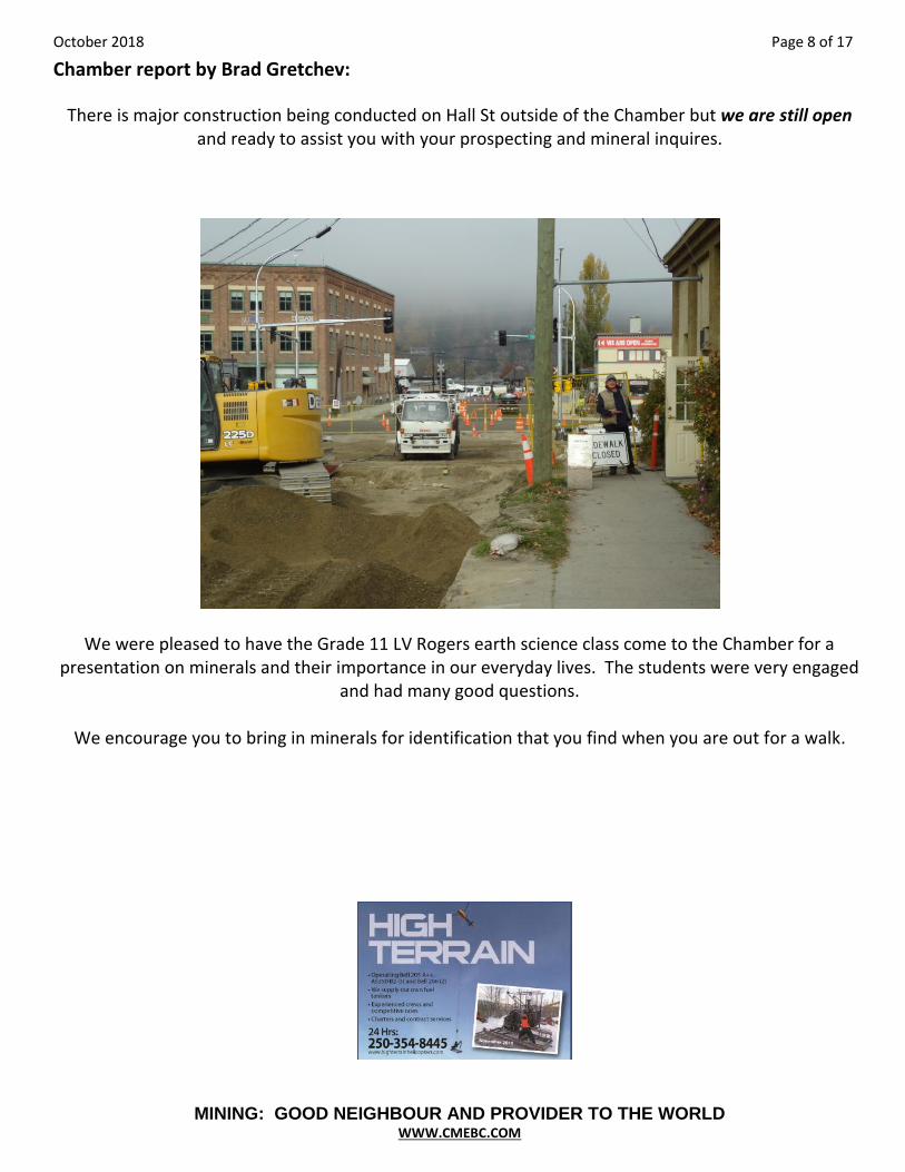
There is major construction being conducted on Hall St outside of the Chamber but we are still open and ready to assist you with your prospecting and mineral inquires.
We were pleased to have the Grade 11 LV Rogers earth science class come to the Chamber for a presentation on minerals and their importance in our everyday lives. The students were very engaged
and had many good questions.
We encourage you to bring in minerals for identification that you find when you are out for a walk.

October 2018 Page 9 of 17
MINING: GOOD NEIGHBOUR AND PROVIDER TO THE WORLD WWW.CMEBC.COM
Taranis Submits Joint Application for Mines Act & Environmental Permitting Act for 10,000 t Bulk Sample at Thor
October 15th
, 2018
Taranis Resources Inc. enthusiastically announces a major development milestone at Thor. The
Company has filed a Joint Application under the Mines Act and Environmental Management Act (the “Joint Application”) with the Ministry of Energy and Mines. Approval of the Joint Application will
position Taranis to become the next producing mine in the Kootenay area of British Columbia, and unique in the application of on-site ore concentration in Western Canada.
The Joint Application outlines detailed plans to construct a processing facility onsite that will pre-concentrate polymetallic ore from the Resource. Pre-concentration of ore drastically reduces the
amount of material that must be transported from the mine site for subsequent upgrading. High-grade concentrates will be processed at a hydrometallurgical plant for further upgrading before being sent to
a smelter for refining. The concentrate will contain silver, gold, lead, zinc, copper and indium. Processing 9,500 tonnes of polymetallic ore plus 500 tonnes of monometallic gold ore are expected to
yield enough valuable data to move forward into full-scale mining at Thor.
Metallurgical testing of the polymetallic Resource has determined that it is suitable for upgrading by gravity. Gravity concentration technologies have evolved rapidly in the past decade and have unique applicability to mining operations at Thor. The proposed facility exhibits 95% conservation of water
resources and has minimal footprint on the environment.

October 2018 Page 10 of 17
MINING: GOOD NEIGHBOUR AND PROVIDER TO THE WORLD WWW.CMEBC.COM
There have been two historic operating mines at Thor, and both operations sought to fully process ore directly on-site. Taranis has opted to take a radically different approach using new technology that incorporates minimal infrastructure on-site. The process is also expected to have a major impact on
Resource calculation, as the system can process low-grade ore and upgrade it directly on-site. Some key elements that have been undertaken for the Joint Application include:
Periodic water chemistry and stream sediment baseline sampling in the True Fissure and Broadview Creek watersheds commencing in 2017.
• Topographic and geophysical surveys over the proposed location of the Millsite (the old True Fissure mill site).
• Two years of weather station monitoring to examine long-term local weather trends that play a role in mining and engineering operations.
• Extensive metallurgical and environmental testing of ore from two available stockpiles on the property that will be processed in the gravity separation plant.
• Engineering considerations of design and plant site location selection and water management.
• Engineering design of on-site storage facilities for waste rock.
https://www.jjgmining.com/uploads/2/7/0/2/27029932/taranis_nr_10_15_2018_v4.pdf

October 2018 Page 11 of 17
MINING: GOOD NEIGHBOUR AND PROVIDER TO THE WORLD WWW.CMEBC.COM
Rokmaster Receives Duncan Lake Zinc Project Assay Results September 28, 2018
Rokmaster Resources Corp. is pleased to announce that final assay results have been received from two additional rock samples taken from a location 2.5 km north of the newly discovered zinc-lead
occurrence (see NR-07-2018 and NR-08-2018) and about 300 m south of the central part of the historic No. 3 Zone.
Prospecting was in a recently clear cut logged area located on the Duncan Anticline, approximately 1.4 kilometers north of the No. 2 Zone and 7 kilometers south of the Jubilee Point drill target area. Two grab samples were analyzed; one sample of float slabs in one area, and one sample of bedrock in an unknown hand trench (1925-26 vintage, re-exposed by the recent logging activity) of dolomite and
limestone containing visible strata bound sulphide mineralization with sphalerite and galena (zinc and lead sulphide minerals) over a 2.5 km length of the Duncan anticline. In addition, results from a recently completed geochemical soil sample survey taken over a 4.5 km long section of the Duncan anticline are
being tabulated and interpreted. Maps of the soil sample survey and rock sampling, with assay and geochemical results plotted, will soon be posted on the Company website.
An excavator trenching and channel sampling program is being planned and permitted for the area.
Rock sample assay results are tabulated and described briefly in the table below:
Sample #
Location Type Chip/Grab*
Sample Description
Silver (g/t)
Lead (%)
Zinc (%)
5651 40m east of No. 2.5 Zone
grab-float dolomitic limestone with fine grained sp-gl-py
4.0 3.81 5.42
5485 South of No. 3 Zone
1.0 m grab along old 5.0 m hand trench
siliceous dolo breccia with semi-mass sp-gl-py
23.0 12.57 21.44
*The reader is cautioned that grab samples are selective spot samples which are typically constrained to visibly mineralized areas and are not intended to be representative of the amount of material sampled.
All rock samples were dried, crushed to 70% passing 2mm, then split to 250g, then pulverized to 85% passing 75um, at MS Analytical Labs (an Accredited Laboratory, ISO 9001:2015 Certified) in Langley, BC. A portion of the resulting pulps were then assayed by multi-element ICP-240 by 4-acid Ore Grade ICP-AES. Two granite blanks and two Standard blanks were inserted for quality control purposes. Sample No. 5485 was duplicated for check assay with comparable results. Sample rejects and left over pulps will be stored in a secure sea-container at a Company storage facility in Salmo, BC.

October 2018 Page 12 of 17
MINING: GOOD NEIGHBOUR AND PROVIDER TO THE WORLD WWW.CMEBC.COM
GGX Gold Initiates Trenching Program On the Gold Drop Property Southern British Columbia
Oct 17, 2018
GGX Gold Corp is pleased to announce it has commenced the fall 2018 trenching program on the Gold Drop property near Greenwood, southern British Columbia. Trenching is being conducted in the east
region of the property in the area of gold bearing veins. Property highlights include:
• Gold and silver bearing veins in various region of the property with recent and historic samples exceeding 1 oz./ ton gold.
• Positive results from recent drilling the COD and Everest gold bearing veins including intersections of 50.1 g/t gold over 2.05m and 54.9 g/t gold over 1.47m.
• Excellent infrastructure with property bordering the town of Greenwood. • Several mills in the district within trucking distance of the property.
The focus of the fall 2018 trenching program is the Silent Friend and Ken gold bearing veins near the
Gold Drop and North Star gold and silver bearing vein systems. Most of the historic work and
production has occurred at the Gold Drop and North Star vein systems. The 2017 prospecting program
yielded significant results including 297 grams per tonne gold (g/t) and 1290 g/t silver sampled in dump
pile quartz from what is believed to be the southern Silent Friend showing. Samples from a mineshaft
dump pile north of this exposure assayed 6.98 g/t gold and 38.6 g/t silver. Samples collected from a
mineshaft to the south, speculated to be the Ken mineshaft, assayed 4.47 g/t gold and 23.0 g/t tonne
silver (News release November 8, 2017).

October 2018 Page 13 of 17
MINING: GOOD NEIGHBOUR AND PROVIDER TO THE WORLD WWW.CMEBC.COM
Visible gold in Silent Friend dump pile
(297 g/t Gold and 1290 g/t Silver)
The objective of the program is to locate and trace the quartz veins in between the historical workings. Modern trenching has proven to be useful on the Gold Drop Property by extending veins where
historical trenches failed. An example is the recent discovery of the Gold Drop extension south of historic workings (News Release of September 20, 2018).
http://ggxgold.com/ggx-gold-initiates-trenching-program-on-the-gold-drop-property-southern-british-columbia

October 2018 Page 14 of 17
MINING: GOOD NEIGHBOUR AND PROVIDER TO THE WORLD WWW.CMEBC.COM
Braveheart Signs Definitive Agreement to Acquire Purcell Basin Minerals Inc. October 18, 2018
Braveheart Resources Inc. is pleased to announce that it has entered into a definitive agreement to acquire the shares of Purcell Basin Minerals Inc. This is an arm’s length transaction. The Plan was
finalized and signed on October 11, 2018 and remains subject to approval by the creditors of Purcell and by the Supreme Court of British Columbia. Braveheart expects all necessary approvals will have
been obtained by November 19, 2018.
Ian Berzins, CEO and Director for Braveheart commented, "We are very pleased with the opportunity to acquire Purcell's Gallowai Bul River Mine. Upon completion of this acquisition we intend to renew the permitting process wherein we will be seeking an amendment to the current mine permit to allow for
tailings deposition on surface and in the underground and for an increase in the mill throughput rate to optimize the current mill infrastructure." For the complete news release and more information go to
http://www.braveheartresourcesinc.com/

October 2018 Page 15 of 17
MINING: GOOD NEIGHBOUR AND PROVIDER TO THE WORLD WWW.CMEBC.COM
Westhaven Drills 17.77 Metres of 24.50 g/t Gold, Including 6.78M of 50.76 g/t Gold at Shovelnose
October 17, 2018
Westhaven Ventures Inc. is pleased to report further results from its recently completed drill campaign at its 15,542 hectare Shovelnose gold property, located within the prospective Spences Bridge Gold
Belt, which borders the Coquihalla Highway 30 kilometres south of Merritt, British Columbia.
Recent Highlights Include:
SN18-14: 17.77 metres (m) of 24.50 g/t gold (Au) and 107.92 g/t silver (Ag), including 6.78m of 50.76 g/t Au and 203.54 g/t Ag.
SN18-12: 175.00m of 0.65 g/t Au and 2.08 g/t Ag, including 4.00m of 11.82 g/t Au and 10.92 g/t Ag.
20-metre quartz vein encountered in hole SN18-15, assays pending. The strike length of the South Zone is 700 metres and open to southeast.
Gareth Thomas, President & CEO of Westhaven stated, “We are pleased to report the widest high-grade drill intercept at Shovelnose, which consists of 17.77m of 24.50 g/t Au and 107.92 g/t Ag,
including 6.78m of 50.76 g/t Au and 203.54 g/t Ag (hole SN18-14). It is important to highlight that hole SN18-14 is 300 metres to the southeast of hole SN18-12, (previously announced October 2, 2018) which contains 1.65m of 175.00 g/t Au and 249.55 g/t Ag, including 0.65m of 285.00 g/t Au and 255.00 g/t Ag.
Assays pending include hole SN18-15 which is 100 metres to the southeast of hole SN18-14 and contains visible gold. We are initiating a fully financed, follow-up drill campaign to begin in early
November as we look to advance this important new discovery."
SOUTH ZONE DRILLING
Hole From (m) To (m) Interval (m) Au (g/t) Ag (g/t)
SN18-10 100.00 111.74 11.74 1.29 7.50
225.00 225.50 0.50 5.62 34.50
241.45 242.00 0.55 4.84 9.64
313.75 314.15 0.40 5.69 33.70
SN18-11 402.00 403.00 1.00 2.00 7.30
433.00 433.85 0.85 5.20 10.50
SN18-12 123.80 125.35 1.55 0.60 1.60
125.35 125.00 1.65 175.00 249.55
incl 125.35 126.00 0.65 285.00 255.00
incl 126.00 127.00 1.00 103.50 246.00
127.00 302.00 175.00 0.65 2.08

October 2018 Page 16 of 17
MINING: GOOD NEIGHBOUR AND PROVIDER TO THE WORLD WWW.CMEBC.COM
incl 284.00 288.00 4.00 11.82 10.92
SN18-14 210.23 228.00 17.77 24.50 107.92
incl 218.00 224.78 6.78 50.76 203.54
SN18-15 ASSAYS PENDING
SN18-16 ASSAYS PENDING
SN18-17 ASSAYS PENDING
Drilling to date is limited so true widths cannot be definitively determined. However, based on the geology of the vein zone with a steep
dip to the west, true widths are estimated to be about 80-90% of reported interval lengths.
Peter Fischl, Exploration Manager goes on to add, “Drilling continues to define a horizon of stronger gold mineralization. This hole targeted the shallower portions of the vein system above deeper weakly mineralized vein intersections in holes SN18-09 and SN18-11. Mineralization over the 700m long strike
length now appears to be strongest along a horizon centred at about 1200m elevation. Follow-up drilling will test the vertical range and strike length of this horizon.”
Shovelnose Gold Property Overview
There is evidence of a significant mineralized alteration system within the property. Recent drilling intersected 17.77 metres of 24.50 g/t Au, including 6.78 metres of 50.76 g/t Au. For further information
on the Shovelnose Gold Property, please visit: http://westhavenventures.com/projects/shovelnose-gold/details/
The Spences Bridge Gold Belt (SBGB)
Westhaven owns a 100%-interest in 4 properties covering over 35,000 hectares within the prospective SBGB, which is situated within a geological setting like those which host other significant epithermal
gold-silver systems. It is close to major transportation routes and infrastructure allowing for cost-effective exploration. The SBGB is a 110-kilometre northwest-trending belt of intermediate to felsic volcanic rocks dominated by the Cretaceous Spences Bridge Group. Sable Resources and Westhaven
have a combined control of 86% of the SBGB (225,000ha). Any ground staked by Sable within 5-kilometre of Westhaven's existing projects will be subject to a 2.5% NSR. In addition, Westhaven has a 30 day Right of First Refusal (ROFR) for a three-year period for any properties within this 5-kilometre
radius.
http://westhavenventures.com/news-and-media/news/news-display/index.php?content_id=207

October 2018 Page 17 of 17
MINING: GOOD NEIGHBOUR AND PROVIDER TO THE WORLD WWW.CMEBC.COM
WE RELY ON THE SUPPORT OF OUR MEMBERS. PLEASE REMEMBER TO RENEW YOUR MEMBERSHIP.
215 HALL STREET NELSON, BC V1L 5X4 PHONE (250) 352-5242
Membership Application form For the Year 2017 - 2018
YOUR SUPPORT IS ESSENTIAL TO THE LIFE OF THE CHAMBER
PLEASE COMPLETE SO THAT WE CAN UPDATE OUR FILES.
NAME: __________________________________ COMPANY ____________________________________
STREET ADDRESS: _________________________________________________________________________
CITY/PROVINCE/POSTAL CODE: ______________________________________________________________
PHONE: AREA CODE: _________ PHONE: ____________________________ FAX: ______________________
Email: ___________________________________________________________________________________
INDIVIDUAL MEMBERSHIP $ 40.00 ___________
SMALL CORP MEMBERSHIP (2-10 EMPLOYEES) $100.00 ___________
SMALL CORP MEMBERSHIP (11-30 EMPLOYEES) $200.00 ___________
MEDIUM CORP MEMBERSHIP (31-50 EMPLOYEES) $300.00 ___________
LARGE CORP MEMBERSHIP (51+ EMPLOYEES) $500.00 ___________
Date………………………………………………………. $___________
THANKS FOR YOUR SUPPORT ----- Chamber of Mines of Eastern BC