hawk: an unmanned mini helicopter-based aerial wireless kit for localization zhongli liu, umass...
TRANSCRIPT
HAWK: An unmanned mini Helicopter-based Aerial
Wireless Kit for localization
Zhongli Liu, UMass LowellYinjie Chen, UMass Lowell
Benyuan Liu, UMass LowellChengyu Cao, University of Connecticut
Xinwen Fu, UMass Lowell
CS@UML
Outline Introduction
HAWK - a mini Helicopter-based Aerial Wireless Kit
Evaluation
Conclusion
2
CS@UML
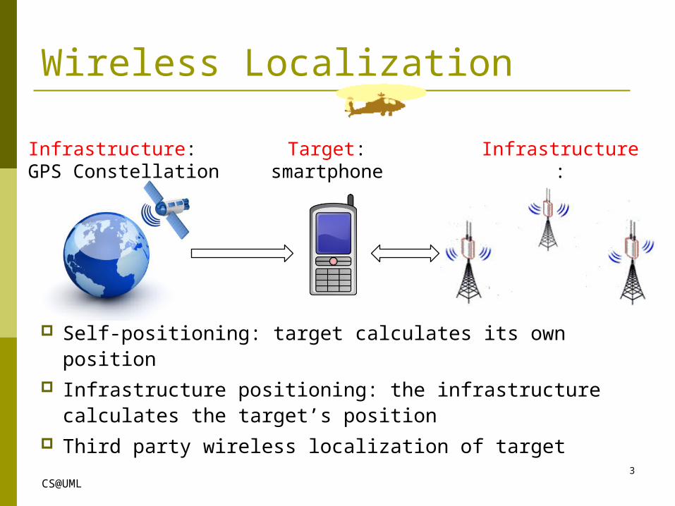
Wireless Localization
Infrastructure:GPS Constellation
Target:smartphone
Infrastructure:WiFi Access Points
3
Self-positioning: target calculates its own position Infrastructure positioning: the infrastructure
calculates the target’s position Third party wireless localization of target
CS@UML
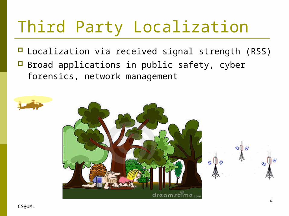
Third Party Localization Localization via received signal strength (RSS) Broad applications in public safety, cyber
forensics, network management
4
CS@UML
Outline Introduction
HAWK - a mini Helicopter-based Aerial Wireless Kit
Evaluation
Conclusion
5
CS@UML
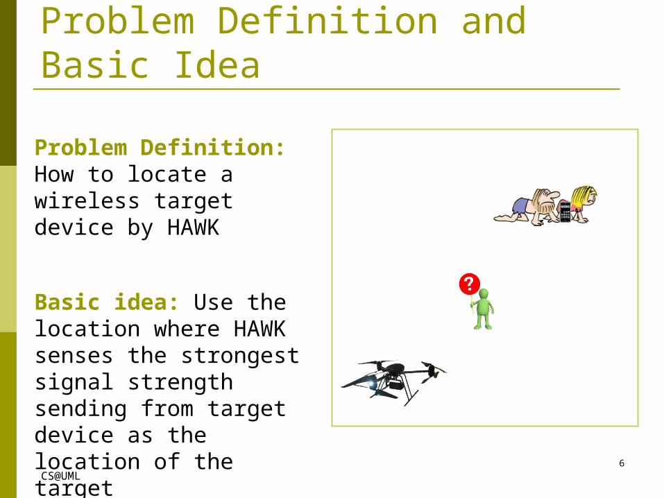
Problem Definition and Basic Idea
Problem Definition: How to locate a wireless target device by HAWK
Basic idea: Use the location where HAWK senses the strongest signal strength sending from target device as the location of the target
6
CS@UML
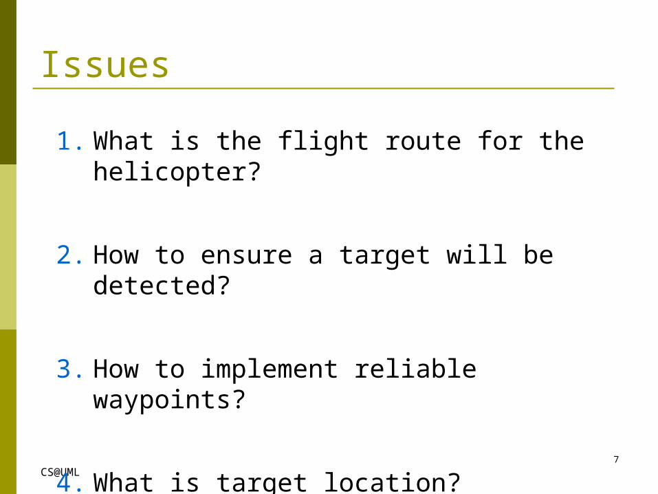
Issues
1. What is the flight route for the helicopter?
2. How to ensure a target will be detected?
3. How to implement reliable waypoints?
4. What is target location?
7
CS@UML
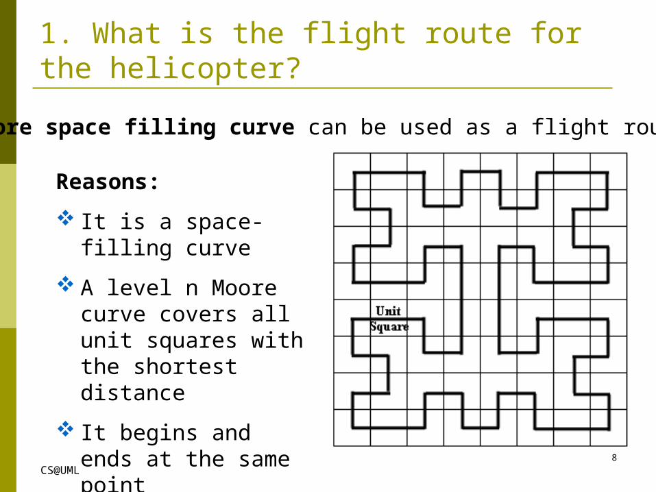
1. What is the flight route for the helicopter?
Reasons:
It is a space-filling curve
A level n Moore curve covers all unit squares with the shortest distance
It begins and ends at the same point
Moore space filling curve can be used as a flight route
8
CS@UML
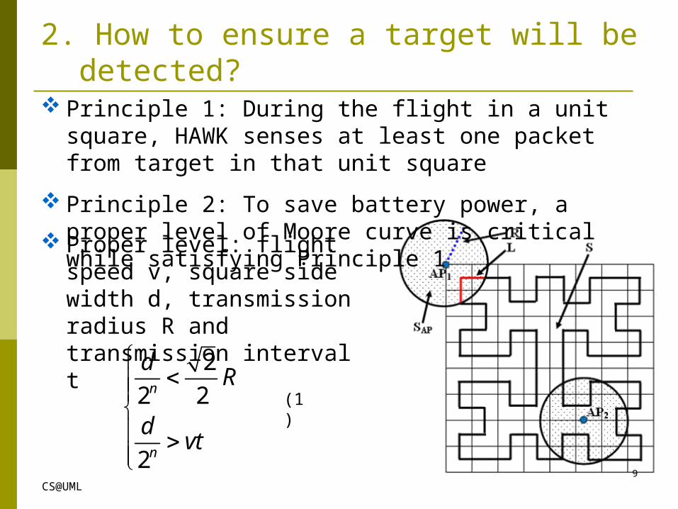
Proper level: flight speed v, square side width d, transmission radius R and transmission interval t
Principle 1: During the flight in a unit square, HAWK senses at least one packet from target in that unit square
Principle 2: To save battery power, a proper level of Moore curve is critical while satisfying Principle 1
2
2 2
2
n
n
dR
dvt
(1)
2. How to ensure a target will be detected?
9
CS@UML
0( ) ( )
t
p iu k e t k e t dt
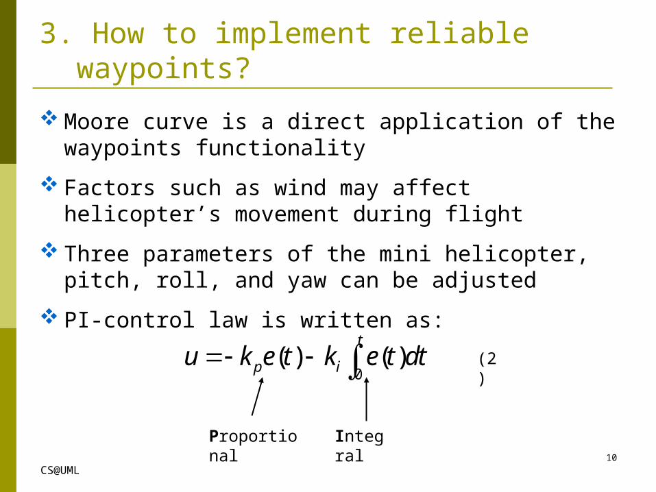
Moore curve is a direct application of the waypoints functionality
Factors such as wind may affect helicopter’s movement during flight
Three parameters of the mini helicopter, pitch, roll, and yaw can be adjusted
PI-control law is written as:
Proportional Integral
3. How to implement reliable waypoints?
(2)
10
CS@UML
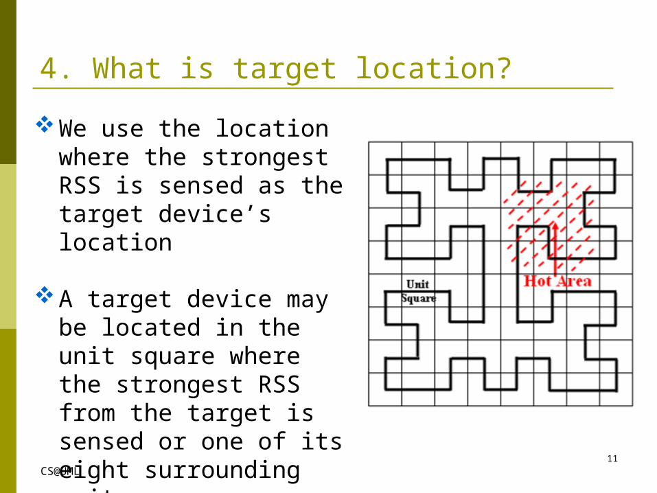
We use the location where the strongest RSS is sensed as the target device’s location
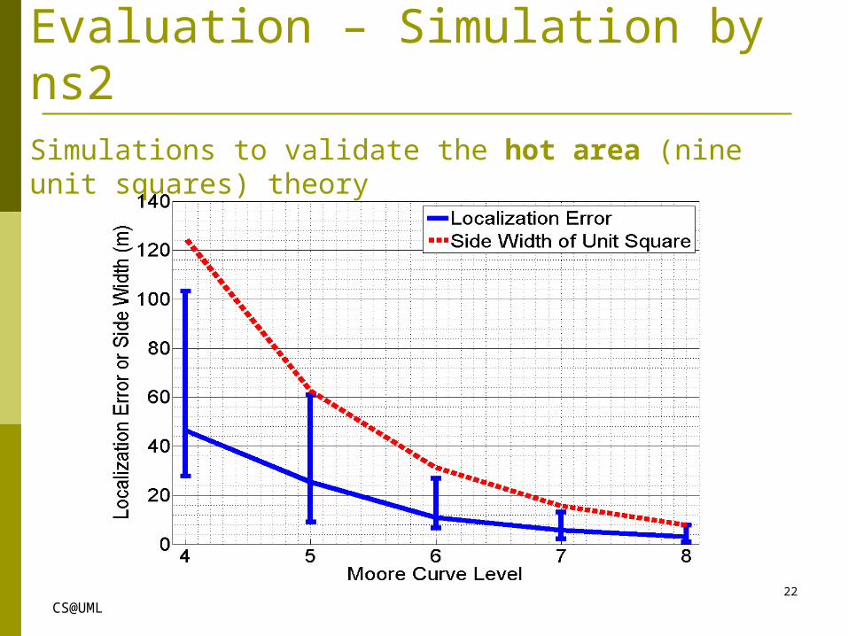
A target device may be located in the unit square where the strongest RSS from the target is sensed or one of its eight surrounding unit squares
4. What is target location?
11
CS@UML
Outline Introduction
HAWK - a mini Helicopter-based Aerial Wireless Kit
Evaluation
Conclusion
12

CS@UML
Prototype of HAWK Helicopter: Draganflyer X6 with GPS Wireless sniffer: Nokia N900 Handheld controller: emergency controller Software controller on a laptop: control takeoff and flight
and receive telemetry including GPS from helicopter Locator on the laptop: show route on Google map in real
time, and download data from N900 for location calculation
13
CS@UML
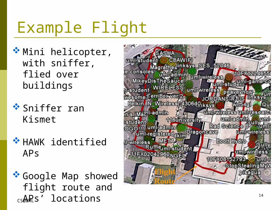
Example Flight Mini helicopter, with
sniffer, flied over buildings
Sniffer ran Kismet
HAWK identified APs
Google Map showed flight route and APs’ locations
14

CS@UML
Real World ExperimentsExperiments to locate 12smart phones on track field
One Nokia N900 with Kismet
Warwalking on the tracks and three different flight routes
Result:
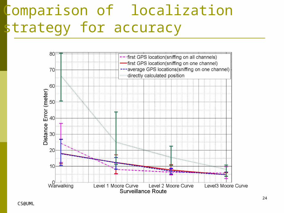
Five meters localization accuracy on average for a level 3 Moore curve
15

CS@UML
Demo http://www.youtube.com/watch?v=ju86xnHbEq0
16
CS@UML
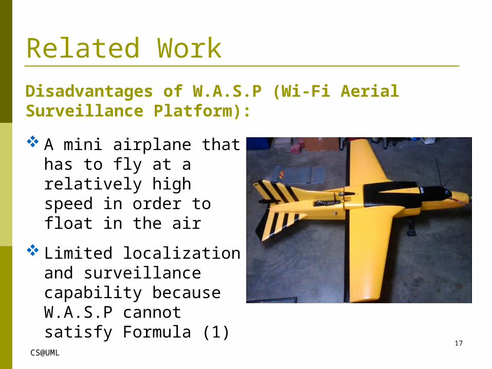
Related WorkDisadvantages of W.A.S.P (Wi-Fi Aerial Surveillance Platform):
A mini airplane that has to fly at a relatively high speed in order to float in the air
Limited localization and surveillance capability because W.A.S.P cannot satisfy Formula (1)
17
CS@UML
Outline Introduction
HAWK - a mini Helicopter-based Aerial Wireless Kit
Evaluation
Conclusion
18
CS@UML
Conclusion Developed a fully functional Mini Helicopter-based Aerial
Wireless Kit (HAWK)
Proposed a suite of theories for HAWK conducting accurate localization
Moore curve based flight route, considering flight velocity, target transmission interval and target transmission range
Customized PI control laws for reliable navigation
Conducted extensive real-world experiments to validate the feasibility of HAWK for localization
19

CS@UML
Student Research Competition Silver Medal at Mobicom 2011
20

CS@UML21/15
Thank you!
CS@UML
Evaluation – Simulation by ns2Simulations to validate the hot area (nine unit squares) theory
22

CS@UML
Related WorkDisadvantages of W.A.S.P (Wi-Fi Aerial Surveillance Platform):
A mini airplane that has to fly at a relatively high speed in order to float in the air
Limited localization and surveillance capability because W.A.S.P cannot satisfy Formula (1)
23
CS@UML
Comparison of localization strategy for accuracy
24