use of mobile lidar for asset management€¦ · •light detection and ranging • position of the...
TRANSCRIPT

Use of Mobile LiDAR for Asset Management: How MassDOT Took an Innovative Approach to Sign Assessment Inventory of Sign Assets
Mark DayDirector of Application Development

About Greenman-Pedersen, Inc (GPI)
• Multi-discipline engineering firm• Established in 1966• 1100 employees• 20 offices • Transportation Asset
Management

Project Overview
• Traffic Sign Asset Management Project
- Massachusetts DOT
- Inventory of all signage on state-owned routes (6,000 Centerline Miles)
- Night-time Retro-reflectivity condition
- Implement Asset Management System
- Tie into existing Maximo system
- 2 Year Project

GPI Proposal
• GPI has completed over 50 similar projects
• Use high-res LiDAR / high-res imagesto conduct inventory
• Value Added Proposition. Drive it once
1. Additional Assets2. Visualization3. Survey Grade Areas
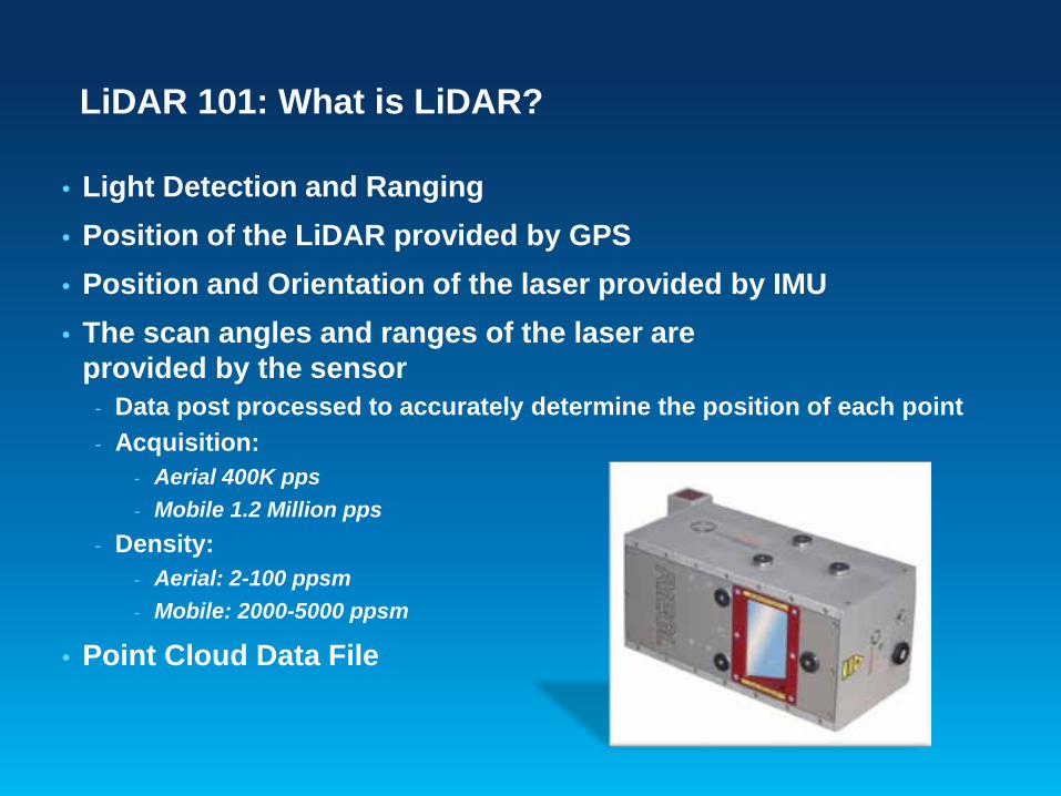
LiDAR 101: What is LiDAR?
• Light Detection and Ranging• Position of the LiDAR provided by GPS• Position and Orientation of the laser provided by IMU• The scan angles and ranges of the laser are
provided by the sensor- Data post processed to accurately determine the position of each point- Acquisition:
- Aerial 400K pps- Mobile 1.2 Million pps
- Density:- Aerial: 2-100 ppsm- Mobile: 2000-5000 ppsm
• Point Cloud Data File

Types of LiDAR
Terrestrial Airborne
Mobile• Survey Grade• Mapping Grade

Data Collection
NIKON D810• 36 MP Highest
Resolution ML Calibrated Video/Still
• Mapping Camera
RIEGL VMX450• 1,100,000
measurements per second
• Dual 360 FOV Scanners• 5000 points per sq.
meter
NIKON D800
RIEGL VMX450

Mobile LiDAR for Roadways
Survey Grade Scanners
Riegl VMX 450
High Scan Rate = Very large data files
Result: Complex / adoption is limited

“Survey Grade Scanners”
Accuracy
Relative
Absolute

Project Overview
VueWorksLidar files
Photos
Amazon EC2 Cloud (Virginia)
• Drive Limits• Route Priority• High Resolution Areas• Drive Schedule
Drive Plan
• LiDAR /Camera Array• Data Delivery to GPI
Data Collection• HyRoad• Daytime Condition• Load to VUEWorks
Extraction
• Comparison Panels• Nightrider
Retroreflectivity
Maximo Export
GISRoad Construction
Project Schedule
MassDOT priority

Data Details
• Inventory approximately 250,000 signs
• Dataset is over 50 TB
• 40 TB LiDAR
• How to deal with it?

The Old Way
• Data Extractors navigate through imagery to find assets.
• Work in small sections
• Cut cross sections
• Perform measurements / assessment
• Time consuming / Unorganized

Wouldn’t it be nice to….Navigate seamlessly through the point cloud

Wouldn’t it be nice to….View imagery and LiDAR in concert

Wouldn’t it be nice to….Speed up extraction

Wouldn’t it be nice to….ILMF

Solution
• Worked with gaming company to develop a Programming Interface
• Developed Custom Extraction software: HyRoad

HyRoad Software Demonstration
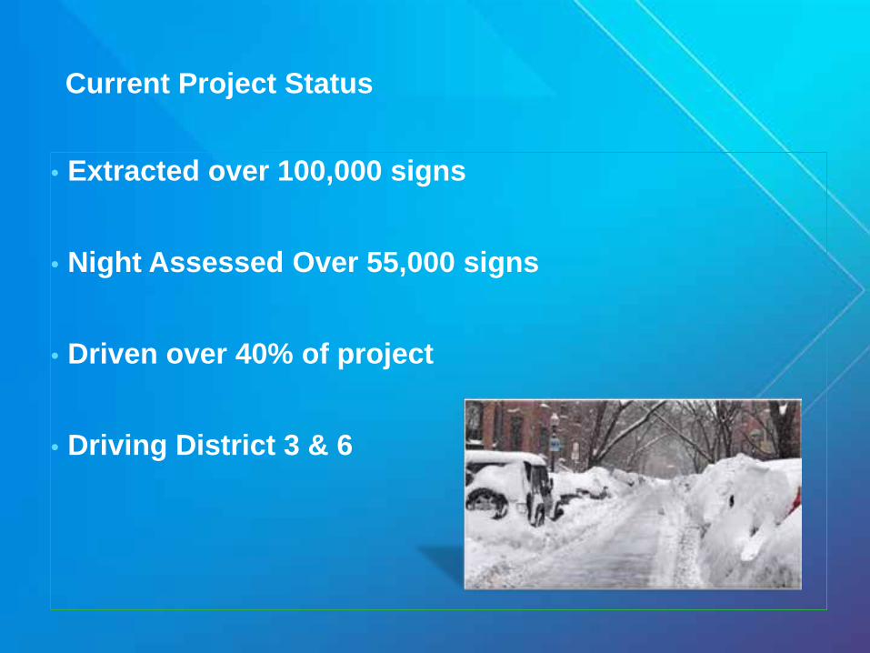
Current Project Status
• Extracted over 100,000 signs
• Night Assessed Over 55,000 signs
• Driven over 40% of project
• Driving District 3 & 6

Realized Benefits
• Ease of locating signs in point cloud
• Increased extraction accuracy
• Can view entire dataset in a single project
• 20:1 Compression at 3cm
• Opened several possibilities for data visualization

Lessons Learned
• Compression allows for new horizons
• 50 TB is easy to say
• Processing….Procedures need to be altered
• Work with good partners

Demo
688,978,485,040,032 points so far…

Questions
Mark Day Director of Application Development
Greenman-Pedersen, Inc.Engineering and Construction Services
325 West Main Street, Babylon, NY 11702d [email protected]