unclassified navy applications of goes-r richard crout, phd naval meteorology and oceanography...
TRANSCRIPT

UNCLASSIFIED
Navy Applications ofGOES-R
Navy Applications ofGOES-R
Richard Crout, PhDNaval Meteorology and Oceanography Command
Satellite Programs
Presented to 3rd GOES-R Conference12 May 2004
UNCLASSIFIED
OUTLINEOUTLINE
Current Use of Geostationary Information
Advantages of GOES-R for Navy Potential Uses of GOES-R for Navy Navy Issues
Current Use of Geostationary Information
Advantages of GOES-R for Navy Potential Uses of GOES-R for Navy Navy Issues

UNCLASSIFIED
Current Use of Geostationary Data
Current Use of Geostationary Data
Regional Centers collect real-time downlinkPearl Harbor, San Diego, Norfolk, Rota, Bahrain, Yokosuka

UNCLASSIFIED
Current Use of Geostationary Data
Current Use of Geostationary Data
Regional Centers collect real-time downlink GOES-E, GOES-W, GOES-9, METEOSAT-5, and
METEOSAT-7 Imagery is looped to derive mesoscale “weather” Used in conjunction with other data to produce:
Annotated Imagery Products
Super Rapid Scan Ops Thunderstorm evolution
Regional Centers collect real-time downlink GOES-E, GOES-W, GOES-9, METEOSAT-5, and
METEOSAT-7 Imagery is looped to derive mesoscale “weather” Used in conjunction with other data to produce:
Annotated Imagery Products
Super Rapid Scan Ops Thunderstorm evolution
UNCLASSIFIED
Current Use of Geostationary Data
Current Use of Geostationary Data
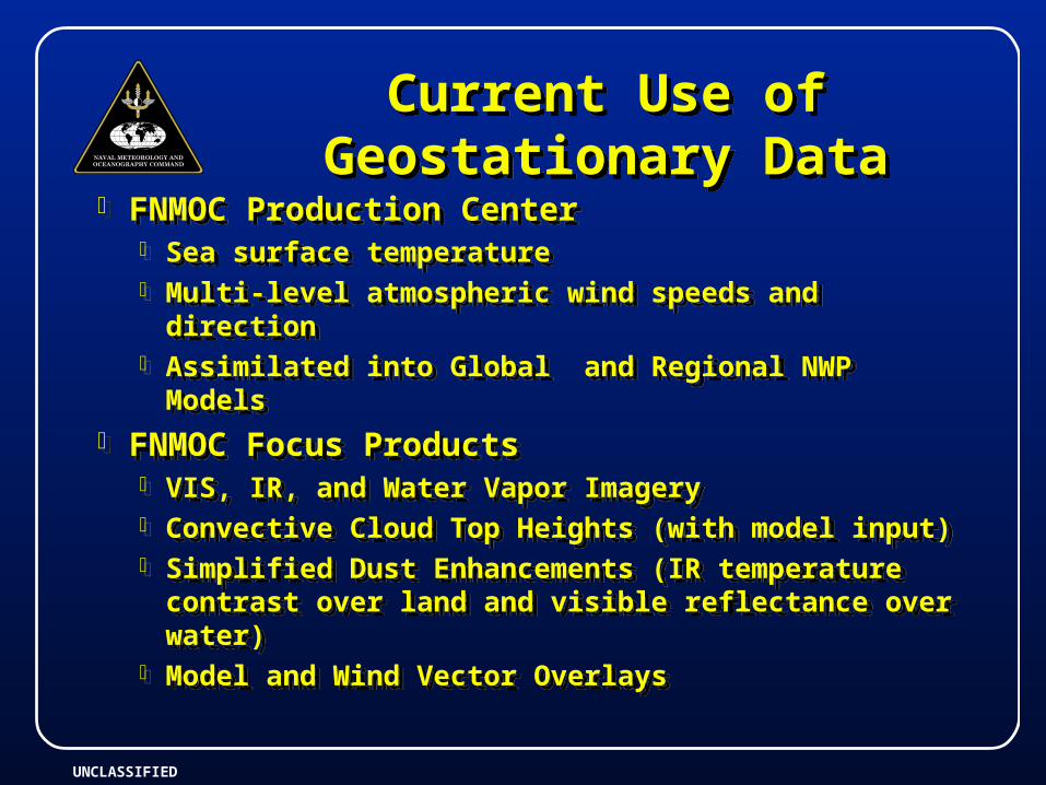
FNMOC Production Center Sea surface temperature Multi-level atmospheric wind speeds and direction Assimilated into Global and Regional NWP Models
FNMOC Focus Products VIS, IR, and Water Vapor Imagery Convective Cloud Top Heights (with model input) Simplified Dust Enhancements (IR temperature
contrast over land and visible reflectance over water)
Model and Wind Vector Overlays

UNCLASSIFIED
Current Use of Geostationary Data
Current Use of Geostationary Data
Joint Typhoon Warning Center Tropical cyclone location, intensity determination,
and current path
Naval Oceanographic Office Multi-channel Sea Surface Temperature (MCSST)
Assimilated into Global and Regional Ocean Models
Ocean Features Analysis (OFA)
National Ice Center Great Lakes and US East Coast Ice coverage

UNCLASSIFIED
Advantages of GOES-R for Navy
Advantages of GOES-R for Navy
Advantages Advanced Baseline Imager (ABI) AND Hyperspectral
Environmental Suite (HES) Multispectral ABI Sensor
16 channels => true color capability (w/green channel) Cloud/ice discrimination Dust/cloud discrimination Fog
Hyperspectral sounder for atmospheric profiling Resolutions to 0.5 km visible and 2.0 km infrared Fifteen minute refresh over Western Hemisphere
Temporal and Spatial variability of the coastal environment

UNCLASSIFIED
Potential Uses of GOES-R ABI and HES
Potential Uses of GOES-R ABI and HES
UNCLASSIFIED
Potential Uses of GOES-R ABI and HES
Potential Uses of GOES-R ABI and HES
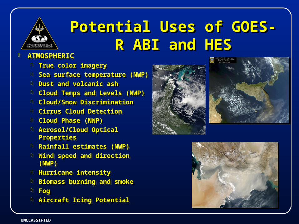
ATMOSPHERIC True color imagery Sea surface temperature (NWP) Dust and volcanic ash Cloud Temps and Levels (NWP) Cloud/Snow Discrimination Cirrus Cloud Detection Cloud Phase (NWP) Aerosol/Cloud Optical Properties Rainfall estimates (NWP) Wind speed and direction (NWP) Hurricane intensity Biomass burning and smoke Fog Aircraft Icing Potential
ATMOSPHERIC True color imagery Sea surface temperature (NWP) Dust and volcanic ash Cloud Temps and Levels (NWP) Cloud/Snow Discrimination Cirrus Cloud Detection Cloud Phase (NWP) Aerosol/Cloud Optical Properties Rainfall estimates (NWP) Wind speed and direction (NWP) Hurricane intensity Biomass burning and smoke Fog Aircraft Icing Potential

UNCLASSIFIED
Potential Uses of GOES-R ABI and HES
Potential Uses of GOES-R ABI and HES
OCEANOGRAPHIC True color imagery Sea Surface Temperature Ocean optical parameters
Diver Visibility River Discharge Sediment plumes Chlorophyll Colored Dissolved
Organic Matter (CDOM) Relationship to salinity
Bathymetry
OCEANOGRAPHIC True color imagery Sea Surface Temperature Ocean optical parameters
Diver Visibility River Discharge Sediment plumes Chlorophyll Colored Dissolved
Organic Matter (CDOM) Relationship to salinity
Bathymetry

UNCLASSIFIED
NAVOCEANO Production Center Sea Surface Temperature
Assimilated into Navy Layered Ocean Model (NLOM), Navy Coupled Ocean Model (NCOM), and Modular Ocean Data Assimilation System (MODAS)
MODAS to Tactical Decision Aids
Ocean Color Properties Warfighting Support Center Product Suite
Water Clarity - Diver Visibility Laser Performance River Discharge/Plumes Biologics
Potential Uses of GOES-R ABI and HES
Potential Uses of GOES-R ABI and HES
UNCLASSIFIED
GOES-R Navy IssuesGOES-R Navy Issues
Downlink Communications Architecture Support at Naval Air Stations from Aviation
Hubs at Norfolk and San Diego Southern Hemisphere Support Navy R&D Risk Reduction for Future Geostationary
Systems
Downlink Communications Architecture Support at Naval Air Stations from Aviation
Hubs at Norfolk and San Diego Southern Hemisphere Support Navy R&D Risk Reduction for Future Geostationary
Systems