goes-r nowcasting initiatives - wmo.int · goes-r nowcasting initiatives dr ... 14-15 august, 2014...
TRANSCRIPT

1
GOES-R Nowcasting Initiatives
Dr. Steven Goodman GOES-R Program Chief Scientist
NOAA/NESDIS
WGNR Meeting Montreal, Canada
14-15 August, 2014

Mission Objectives - Why GOES-R?
Visual & IR Imagery Lightning Mapping Space Weather Monitoring
Solar Imaging
The GOES-R Series will provide significant improvements in the detection and observations
of meteorological phenomena that directly impact public safety, protection of property, and our Nation’s economic health and prosperity
Improves hurricane track & intensity forecasts
Increases thunderstorm & tornado warning lead time
Improves aviation flight route planning Data for long-term climate variability
studies
Improves solar flare warnings for communications and navigation disruptions
More accurate monitoring of energetic particles responsible for radiation hazards to humans and spacecraft
Better monitoring of Coronal Mass Ejections to improve geomagnetic storm forecasting
2
29
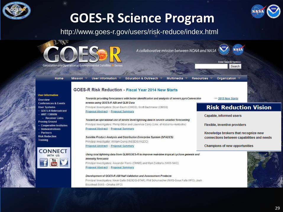
http://www.goes-r.gov/users/risk-reduce/index.html GOES-R Science Program
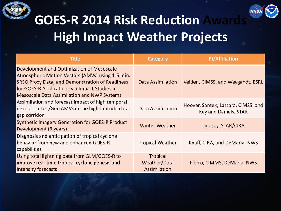
GOES-R 2014 Risk Reduction Awards High Impact Weather Projects
Title Category PI/Affiliation
Development and Optimization of Mesoscale Atmospheric Motion Vectors (AMVs) using 1-5 min. SRSO Proxy Data, and Demonstration of Readiness for GOES-R Applications via Impact Studies in Mesoscale Data Assimilation and NWP Systems
Data Assimilation Velden, CIMSS, and Weygandt, ESRL
Assimilation and forecast impact of high temporal resolution Leo/Geo AMVs in the high-latitude data-gap corridor
Data Assimilation Hoover, Santek, Lazzara, CIMSS, and Key and Daniels, STAR
Synthetic Imagery Generation for GOES-R Product Development (3 years) Winter Weather Lindsey, STAR/CIRA
Diagnosis and anticipation of tropical cyclone behavior from new and enhanced GOES-R capabilities
Tropical Weather Knaff, CIRA, and DeMaria, NWS
Using total lightning data from GLM/GOES-R to improve real-time tropical cyclone genesis and intensity forecasts
Tropical Weather/Data Assimilation
Fierro, CIMMS, DeMaria, NWS

GOES-R 2014 Risk Reduction Awards High Impact Weather Projects
Title Category PI/Affiliation
Development of GOES-R ABI Hail Validation and Assessment Products Land Surface / Fire Gallo, STAR/EMB
Enhancing NCEP-NAM Weather Forecasts via Assimilating Real-time GOES-R Observations of Land Surface Temperature and Green Vegetation Fraction
Land Surface/ Data Assimilation
Zhan, Fang, Hain, Ek, Zheng, CICS/STAR/NCEP
Development of a Near Real-time Satellite Verification and Forecaster Guidance System for the High-Resolution Rapid Refresh (HRRR) Model
Clouds/Aerosols Otkin and Sieglaff, CIMSS
Towards providing forecasters with better identification and analysis of severe pyro-Convection events using GOES-R ABI and GLM Data
Clouds/Aerosols Baum, SSEC, Bachmeier, CIMSS

GOES-R 2014 Risk Reduction Awards High Impact Weather Projects
Title Category PI/Affiliation
Development of real time all-weather layer precipitable water products in AWIPS-2 by fusing the GOES-R and NWP for local forecasters
Hydrological Monitoring Li, Gerth, Li, Bachmeier, CIMSS
Improving Real-time GOES-R Rainfall Rate Estimates through Infusion of Ground Radar and Gauge Data and Evaluating the Impacts on NWS Flash and River Flood Prediction
Hydrological Monitoring Zhang, NWS/OHD, Kuligowski, STAR, Gourley, NSSL
Developing Integrated Satellite and Gauge-Radar-Satellite-Model Fused Precipitation Estimates for Real-time Weather, Hydrometeorology and Hazards Monitoring
Hydrological Monitoring Xie, NWS/CPC
Improving Coastal Precipitation Forecast through Direct Assimilation of GOES-R ABI Radiances in GSI-NAM/HWRF
Data Assimilation Weng, STAR
Toward an operational use of stroke level lightning data in severe weather forecasting Convection and Nowcasting Bitzer, UAH
Applications of concurrent super rapid sampling from GOES-14 SRSOR, radar and lightning data
Convection and Nowcasting Rabin and McGorman, NSSL, Schmit, STAR, Calhoun, CIMMS

GOES-R 2013 Risk Reduction Continuation High Impact Weather Projects
Title Category PI/Affiliation GOES-R Future Capability Proposal: Advancement of Satellite-Detected Overshooting Top (OT) Decision Support Products
Convection and Nowcasting Velden, CIMSS
GOES-R Future Capability: Fog and Low Cloud Detection and Characterization
Convection and Nowcasting Pavolonis, STAR
RGB Product development in AWIPS-2 Convection and Nowcasting SPoRT, CIRA, CIMSS, Jedlovec, DeMaria, Schmit
The GOES-R GLM Lightning Jump Algorithm: A National Field Test for Operational Readiness
Convection and Nowcasting UAH, Carey; OU-CIMMS, Kuhlman,
Convective Initiation and 0-6 hr Storm Nowcasting for GOES-R
Convection and Nowcasting UAH, Mecikalski; Weygandt, GSD
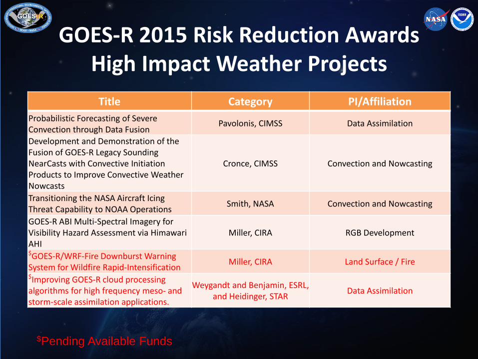
GOES-R 2015 Risk Reduction Awards High Impact Weather Projects
Title Category PI/Affiliation Probabilistic Forecasting of Severe Convection through Data Fusion
Pavolonis, CIMSS Data Assimilation
Development and Demonstration of the Fusion of GOES-R Legacy Sounding NearCasts with Convective Initiation Products to Improve Convective Weather Nowcasts
Cronce, CIMSS Convection and Nowcasting
Transitioning the NASA Aircraft Icing Threat Capability to NOAA Operations Smith, NASA Convection and Nowcasting
GOES-R ABI Multi-Spectral Imagery for Visibility Hazard Assessment via Himawari AHI
Miller, CIRA RGB Development
$GOES-R/WRF-Fire Downburst Warning System for Wildfire Rapid-Intensification Miller, CIRA Land Surface / Fire $Improving GOES-R cloud processing algorithms for high frequency meso- and storm-scale assimilation applications.
Weygandt and Benjamin, ESRL, and Heidinger, STAR Data Assimilation
$Pending Available Funds

Introducing NWS Forecasters to Prototype GOES-R Products
• Synthetic GOES-R products ABI products are being demonstrated at NOAA testbeds and GOES-R Proving Ground
• Synthetic GOES-R ABI products help forecaster readiness on day one
• Facilitates user training
CAPE- an example of Derived Stability Indices indicates a strong instability axis extending into the high plains east of the Rockies.
Simulated ABI bands in AWIPS
9

10
Tool to Generate GOES-R ABI Synthetic Aerosol Products
WRF-CMAQ simulated aerosol fields were provided as input to CRTM (Community Radiative Transfer Model) to generate top of the atmosphere radiances at 6 ABI bands.
Simulated radiances at 6 ABI bands are provided as input to aerosol retrieval algorithm to
generate aerosol optical depth (AOD) and aerosol detection
products
ABI AOD 16UTC July 4, 2012
High AOD due to smoke from fires in Colorado Haze in the
southeast US

11
May 20, 2014
May 21, 2014
May 22, 2014
May 23, 2014
GOES-R ABI Aerosol Detection Algorithm Testing on VIIRS Data for
a Multi-day Fire Event in Alaska
Thick Smoke
Thin Smoke
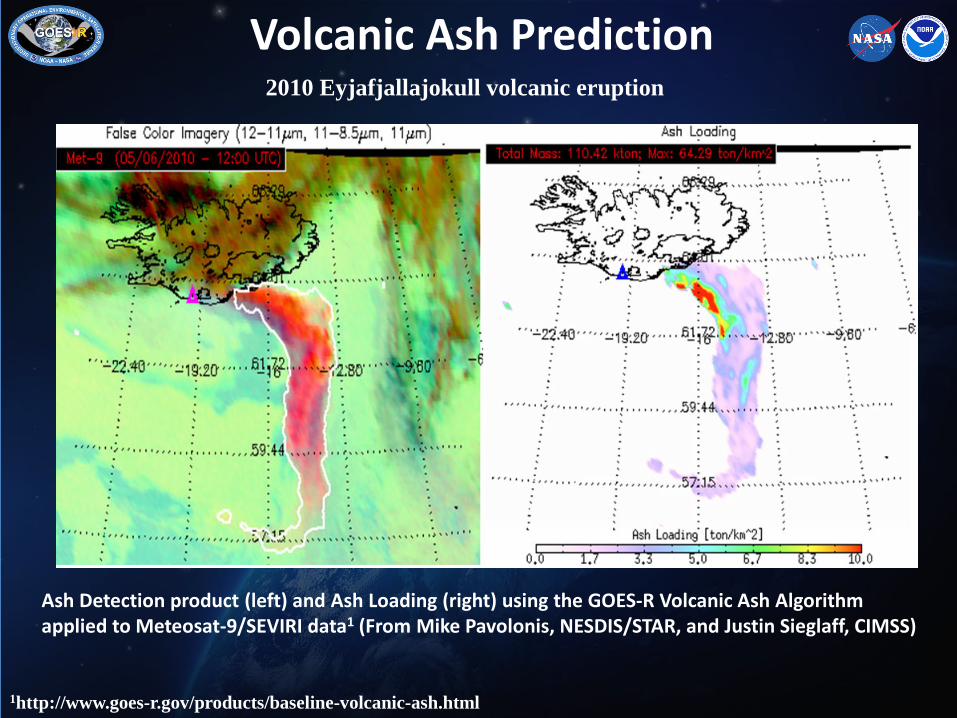
Volcanic Ash Prediction
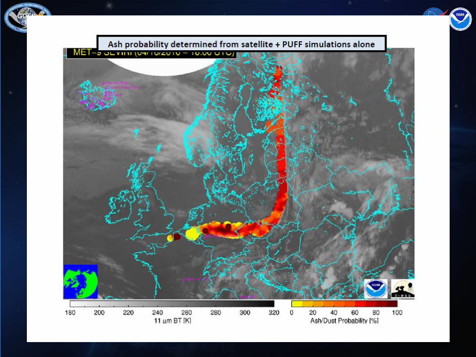
Ash Detection product (left) and Ash Loading (right) using the GOES-R Volcanic Ash Algorithm applied to Meteosat-9/SEVIRI data1 (From Mike Pavolonis, NESDIS/STAR, and Justin Sieglaff, CIMSS)
1http://www.goes-r.gov/products/baseline-volcanic-ash.html
2010 Eyjafjallajokull volcanic eruption

13
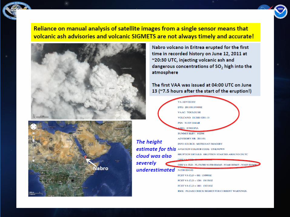
M. Pavolonis gave the NOAA perspective; the VAACs in Washington and Anchorage have responsibility for large areas. NOAA also operates Met Watch Offices. Algorithm development at NOAA aims at exploiting all sensors in orbit, that is, for volcanic ash detection, both LEO and GEObased instrumentation is being used based on an optimal estimation approach, including Bayesian classifiers and general cost function. In addition, a near-real time volcanic eruption alert system is in place, exploiting the presence of rapidly changing gradients in satellite imagery during an eruption. M. Pavolonis indicated that, internationally, the biggest single weakness with VAACs was that major eruptions could occur and remain undetected for hours, especially in unexpected places.
WMO SCOPE Nowcasting: Volcanic Ash

14
• Chile's Puyehue-Cordón Caulle Volcano erupted on June 4, 2011, forming a tall ash plume above the Andes Mountains
• The GOES-R Proving Ground provides near real-time volcanic ash retrieval products (using Meteosat SEVIRI data as a proxy for the GOES-R Advanced Baseline Imager) to identify a significant volcanic ash plume emerging over the Atlantic Ocean impacting aviation operations with many cancelled flights.
• Similar data was provided to the London Volcanic Ash Advisory Center (VAAC) during the eruption of Eyjafjallajökull in Iceland in May 2010.
• GOES-R VolAsh algorithm implemented at JMA in 2013 in preparation for Himawari 8.
14
Aviation Baseline Product: Volcanic Ash Product Suite
15

16

17

18

19
20

27 Apr ‘14 2038 Z
Blo
win
g D
ust c
ourte
sy o
f S. M
mille
r
New RGB Recipe for Discriminating Blowing Dust

Photo from Eastern Colorado midday on 29 April
23
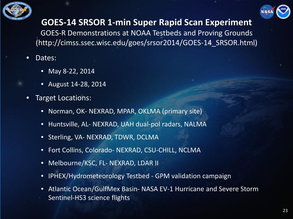
GOES-14 SRSOR 1-min Super Rapid Scan Experiment GOES-R Demonstrations at NOAA Testbeds and Proving Grounds
(http://cimss.ssec.wisc.edu/goes/srsor2014/GOES-14_SRSOR.html)
• Dates:
• May 8-22, 2014
• August 14-28, 2014
• Target Locations:
• Norman, OK- NEXRAD, MPAR, OKLMA (primary site)
• Huntsville, AL- NEXRAD, UAH dual-pol radars, NALMA
• Sterling, VA- NEXRAD, TDWR, DCLMA
• Fort Collins, Colorado- NEXRAD, CSU-CHILL, NCLMA
• Melbourne/KSC, FL- NEXRAD, LDAR II
• IPHEX/Hydrometeorology Testbed - GPM validation campaign
• Atlantic Ocean/GulfMex Basin- NASA EV-1 Hurricane and Severe Storm Sentinel-HS3 science flights

-24 GOES-R MOR April 2014
Standard (15-min)
RSO (5-7 min)
SRSOR (1-min)

25
GOES-14 1-min Imagery
Click to animate hyperlink

26
GOES-14, SRSOR 1-min Imagery
27 27
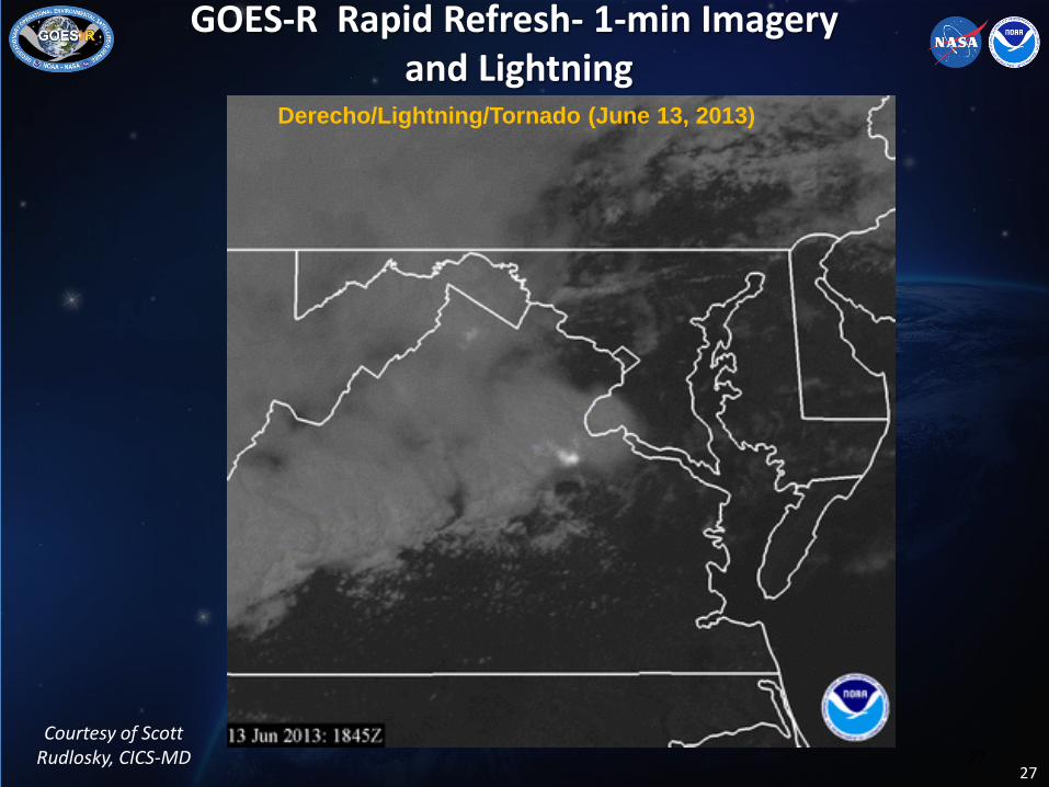
Derecho/Lightning/Tornado (June 13, 2013)
GOES-R Rapid Refresh- 1-min Imagery
and Lightning
Courtesy of Scott Rudlosky, CICS-MD
28
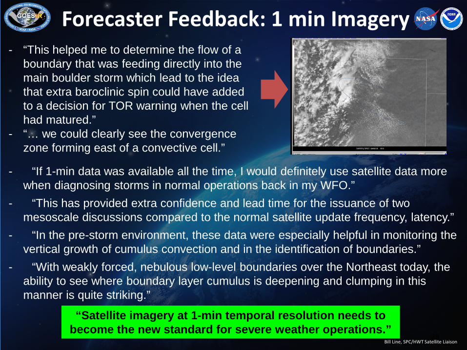
- “This helped me to determine the flow of a boundary that was feeding directly into the main boulder storm which lead to the idea that extra baroclinic spin could have added to a decision for TOR warning when the cell had matured.”
- “… we could clearly see the convergence zone forming east of a convective cell.”
Bill Line, SPC/HWT Satellite Liaison
Forecaster Feedback: 1 min Imagery
- “If 1-min data was available all the time, I would definitely use satellite data more when diagnosing storms in normal operations back in my WFO.”
- “This has provided extra confidence and lead time for the issuance of two mesoscale discussions compared to the normal satellite update frequency, latency.”
- “In the pre-storm environment, these data were especially helpful in monitoring the vertical growth of cumulus convection and in the identification of boundaries.”
- “With weakly forced, nebulous low-level boundaries over the Northeast today, the ability to see where boundary layer cumulus is deepening and clumping in this manner is quite striking.”
“Satellite imagery at 1-min temporal resolution needs to become the new standard for severe weather operations.”

29
GOES-14 SRSOR Intensive Observation Period GOES-R Proving Ground Demonstrations at Aviation Weather Center
and Hazardous Weather Testbed • Dates: 11 August - 8 September, 2014
• Objectives: Optimal use of ABI scan modes, rapid refresh imagery and products, blended ABI-GLM, satellite, radar, NWP
• Target Locations:
• Norman, OK- NEXRAD, MPAR, OKLMA (primaryl site)
• Huntsville, AL- NEXRAD, UAH dual-pol radars, NALMA
• Sterling, VA- NEXRAD, TDWR, DCLMA
• Fort Collins, Colorado- NEXRAD, CSU-CHILL, NCLMA
• Melbourne/KSC, FL- NEXRAD, LDAR II
• Atlantic Ocean/GulfMex Basin- NASA EV-1 Hurricane and Severe Storm Sentinel-HS3 science flights 29
AMVs in High Impact Weather
• Adapt the GOES-R AMV tracking algorithm to focus on the smaller (meso) scales for AMV derivation, quality control, and applications and coincident with periods of GOES rapid-scan operations.
• Optimize the algorithm settings, tuning, and AMV derivation path to increase the data density and improve the ultimate quality.
• Run the refined GOES-R AMV algorithm using proxy datasets, such as available from routine GOES RSO/SRSO periods, and from recent special GOES-14 1-min scanning periods (i.e. Hurricane Sandy). Prepare the AMV datasets for trial assimilation into operational regional models.
• Collaborate with national centers of expertise in regional data assimilation and NWP (NCEP-EMC, JCSDA, ESRL) to conduct AMV impact experiments on jointly-selected cases of interest (high-impact weather events, model forecast busts, tropical cyclones, etc.).
• Post-launch real-time demonstrations in Year 3 C. Velden (CIMSS)

GOES-13 Winds Using GOES-R Clear-Sky Mask, Cloud and
Derived Motion Winds (DMW) Algorithms
Significance: Early demonstration of GOES-R algorithms using current operational GOES imagers. Plans and work in place to replace existing operational GOES cloud and DMW algorithms with GOES-R algorithms.
High-Level 100-400 mb Mid-Level 400-700 mb Low-Level >700 mb
Cloud-drift winds derived from 15-minute GOES-13 LWIR (11um) imagery over Hurricane
Sandy (4-day loop)
31
Cloud-drift winds derived from 15-min GOES-13 11um imagery 1000 UTC 22 April 2012 – 0800 UTC 23 April
2012
Nor’Easter
Low-Level >700 mb Mid-Level 400-700 mb High-Level 100-400 mb
Hurricane Sandy
Courtesy of Chris Velden, CIMSS
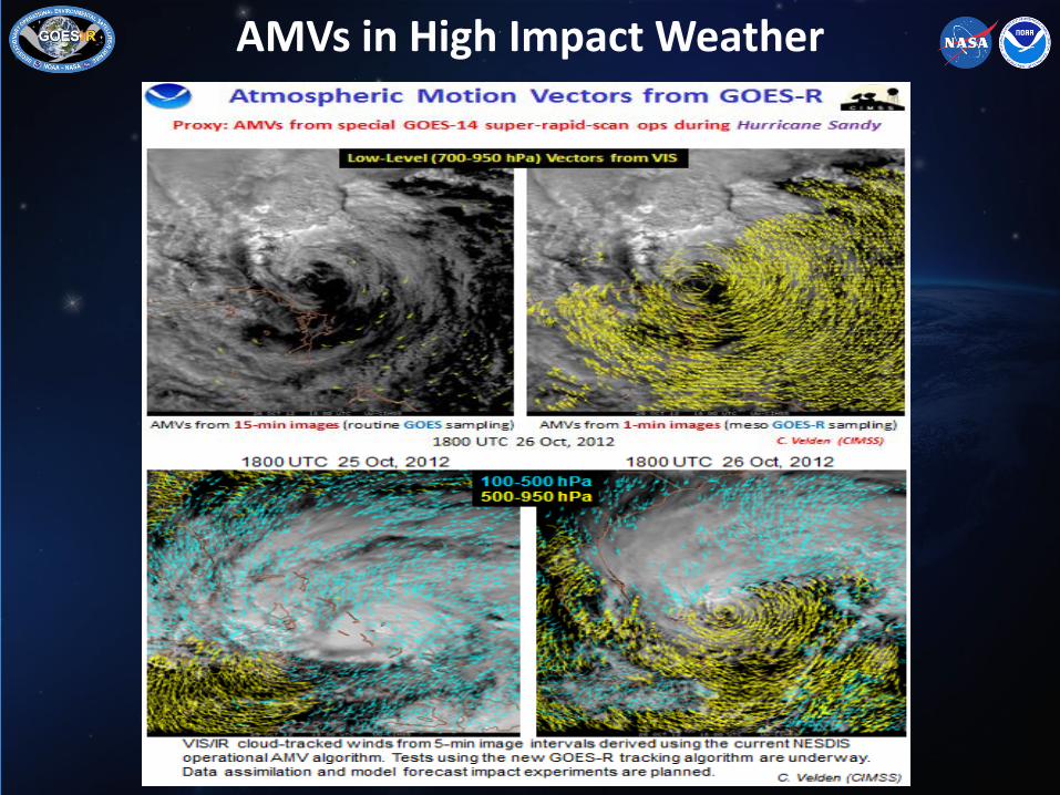
AMVs in High Impact Weather
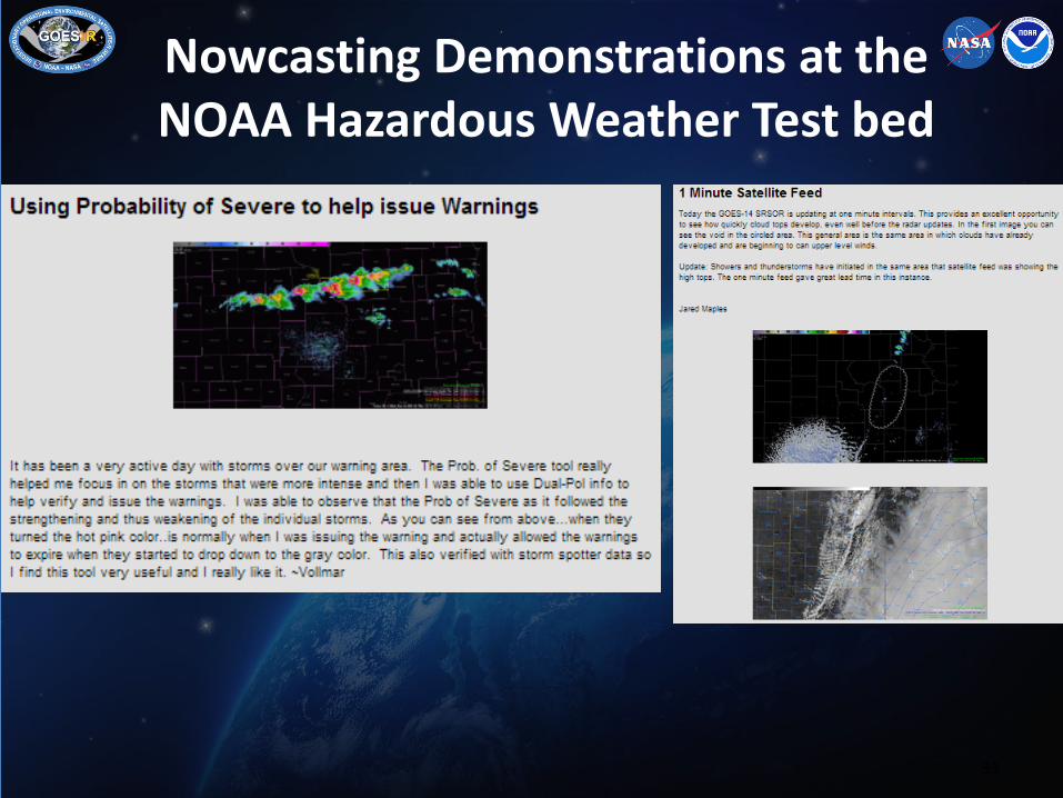
Nowcasting Demonstrations at the NOAA Hazardous Weather Test bed
33

34 34
1-min Imagery
• Integrated 1-minute imagery (when available), CTC, OTD and NearCast into SPC operations (at least 11 MD’s).
• Forecasters have used these products in their decision-making, and have provided me with operational examples.
“DISCUSSION...TRENDS IN REGIONAL RADAR IMAGERY...LIGHTNING DATA...AND CIMSS GOES-R CLOUD TOP COOLING AND OVERSHOOTING TOP PRODUCTS INDICATED CONVECTION AND EMBEDDED TSTMS CONTINUING TO INCREASE IN COVERAGE AND INTENSITY SINCE 1930Z ACROSS NORTHEAST TX TO SWRN AR.”
35 35
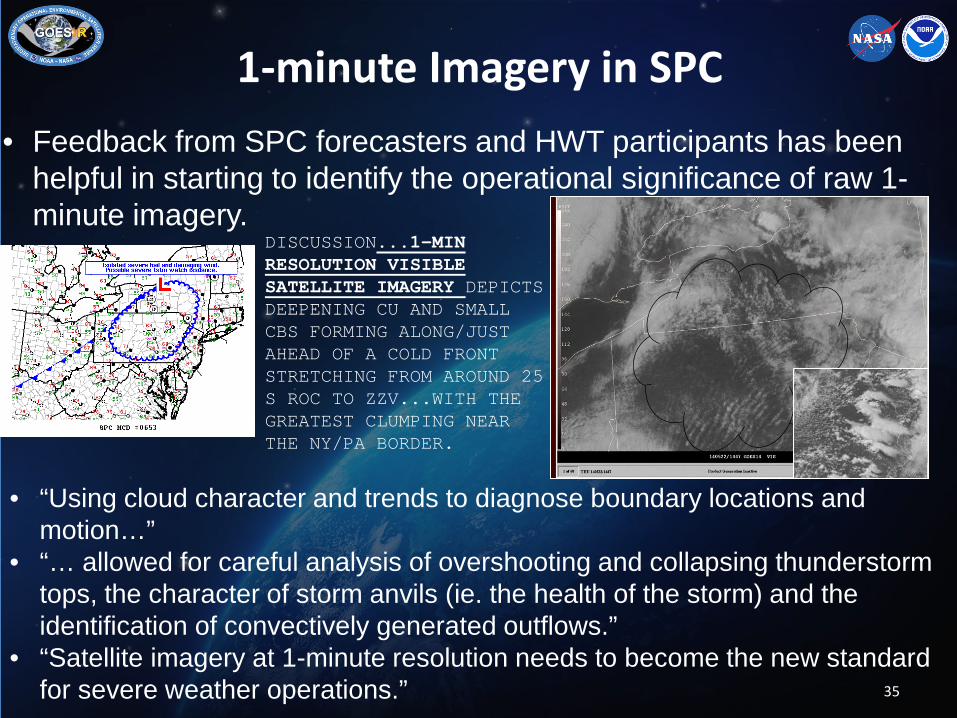
1-minute Imagery in SPC • Feedback from SPC forecasters and HWT participants has been
helpful in starting to identify the operational significance of raw 1-minute imagery.
DISCUSSION...1-MIN RESOLUTION VISIBLE SATELLITE IMAGERY DEPICTS DEEPENING CU AND SMALL CBS FORMING ALONG/JUST AHEAD OF A COLD FRONT STRETCHING FROM AROUND 25 S ROC TO ZZV...WITH THE GREATEST CLUMPING NEAR THE NY/PA BORDER.
• “Using cloud character and trends to diagnose boundary locations and motion…”
• “… allowed for careful analysis of overshooting and collapsing thunderstorm tops, the character of storm anvils (ie. the health of the storm) and the identification of convectively generated outflows.”
• “Satellite imagery at 1-minute resolution needs to become the new standard for severe weather operations.”

36 36
Nowcast Challenges
• Water cannon of data • Not just satellite (radar, NWP, etc) • Must display data in an understandable manner so
forecasters can more easily assimilate it into their decision-making process
• Must identify satellite products that add information not already available to the forecaster
• Plans to incorporate JPSS and other polar data into
SPC operations- and blend with geostationary satellite data offers additional application opportunities
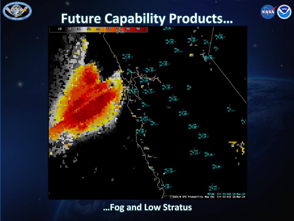
Future Capability Products…
…Fog and Low Stratus

Future Capability Products…
…Fog and Low Stratus

Future Capability Products…
…Probability of Convective Initiation (i.e., 35 dBZ)

Future Capability Products…
…Probability of Convective Initiation (i.e., 35 dBZ)
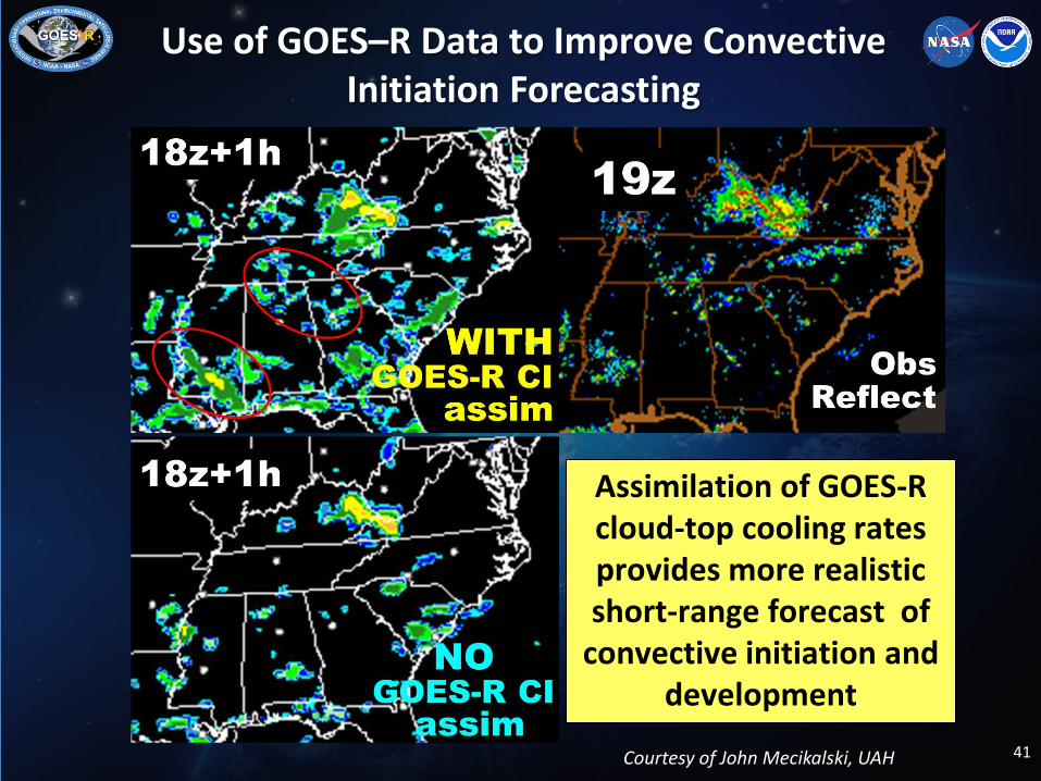
Use of GOES–R Data to Improve Convective Initiation Forecasting
41
Assimilation of GOES-R cloud-top cooling rates provides more realistic short-range forecast of
convective initiation and development
Courtesy of John Mecikalski, UAH
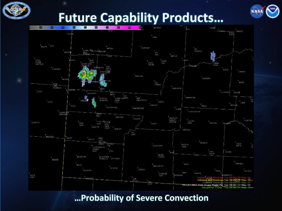
Future Capability Products…
…Probability of Severe Convection

Future Capability Products…
…Probability of Severe Convection

ProbSevere, Test Warnings, & Dual-Pol Variables
(20 May 2138 UTC)

ProbSevere, Test Warnings, & MRMS Composite Z (20 May 2142 UTC)
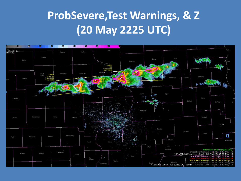
ProbSevere,Test Warnings, & Z (20 May 2225 UTC)

Future Capability Products…
…Overshooting Top Detection

2014 HWT Takeaways http://hwt.nssl.noaa.gov/ewp/
• Products with limitations this week
– GOES-R Convective Initiation • Had to “calibrate to” each day • Many false alarms amidst cumulus field
– vLAPS • Tended to overestimate Composite Z • CAPE fields were generally accurate predictors over
land
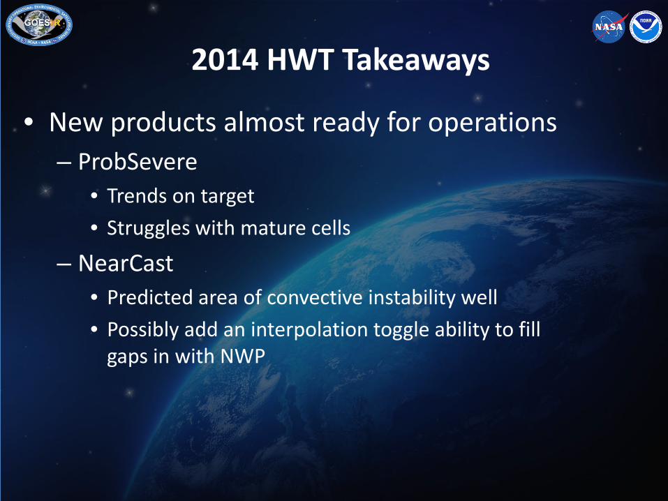
• New products almost ready for operations – ProbSevere
• Trends on target • Struggles with mature cells
– NearCast • Predicted area of convective instability well • Possibly add an interpolation toggle ability to fill
gaps in with NWP
2014 HWT Takeaways

• Get this to my office “yesterday”! – Lightning Flashes & Lightning Jump Algorithm
• Increases confidence in severity of storms • Provided information about updraft health
– Super-Rapid Scan Operations (SRSOR) Imagery • Used to observe key storm-scale features; 1-min
temporal resolution made this possible
– Simulated Satellite Imagery • Comparison to reality raised or lowered confidence
in using model • When on-track, predicted areas of storm
development
2014 HWT Takeaways

Summary • Launch Readiness Date- 1st Quarter 2016
• User Readiness Components-
• User System
• Risk Reduction
• Proving Ground
• Training
• Products available for testing 40 days after launch, available to users for science assessment/validation
• Program studying request for GOES-R operations following PLT
• JARS and BAMS describe SRSOR 2012, 2013 experiments
• 1-min Super Rapid Scan 2014 Experiment- May 14-25, August 14-28
http://cimss.ssec.wisc.edu/goes/srsor2013/GOES-14_SRSOR.html
Thank you!
For more information visit www.goes-r.gov
52