the importance of cartographic design - esri · pdf filecartographic design ... ing style....
TRANSCRIPT

NMCA ALarge Scale
NMCA BLarge Scale
NMCA XLarge Scale
INSPIRE DataSpeci�cation
INSPIRE conformDownload Services
FutureEuroGeographics
Products
INSPIRE conformView Services
New Products& Services
ELF DataSpeci�cation
EuroBoundaryMap
EuroRegionalMap
EuroGlobalMap
54 au Winter 2012 esri.com
The Importance of Cartographic DesignIn the SDI environmentBy Karen Richardson, Esri Writer
ESDIN data specifi cations
Dr. Anja Hopfstock
Esri writer Karen Richardson sat down with Dr. Anja
Hopfstock to ask a few questions about cartographic
design in the spatial data infrastructure (SDI) environ-
ment. Hopfstock is an executive offi cer with the Federal
Agency for Cartography and Geodesy, known as BKG, for
the Federal Republic of Germany and technical manager
for EuroRegionalMap, a Pan-European reference dataset
from EuroGeographics located in Brussels, Belgium. Her
doctoral thesis, “A User-Oriented Map Design in the SDI
Environment Using the Example of a European Reference
Map at Medium Scale,” deals with this topic.

Source Material
Inventory ComparitiveStudy
Map LegendsMap Features
Map contentClassi�cation
ParametersMethods of Portrayal Symbol
AssignmentRules
DrawingOrder
Symbols Generalisation
EuropeanReference MapSpeci�cation
TestImplementation
EuropeanLand CoverInformation
EuropeanTopographicReference
Data
EuropeanDigital
ElevationModel
TopoMaps
RoadMaps
55esri.com Winter 2012 au
The cartographic reverse-engineering approach aiming at the optimal cartographic design for a European reference map.
Special Section
Th e visualization of geospatial data has a key function for data discovery and evaluation, because the data becomes easier to un-derstand and interpret if presented in the appropriate context. Currently, SDI geoportals provide a marketplace for users to access SDI data collections. Discovery and view, download, and transforma-tion services assist users to fi nd, locate, and transform the data for their task-specifi c aims. So far, the presentation of geospatial data has only been considered at a basic level. However, the user’s accept-ance in terms of usability depends on a useful graphical presentation of the geospatial data. A comprehensive access service to the underlying geospatial data should not be limited to simple discovery, view, and download func-tionalities but should include graphical presentations that consider the user’s capabilities and abilities to handle geospatial data. Th is means that the visual component of the data is used in the data supply chain so that the graphic presentation enables a communica-tive, map-based acquisition of geographic information that stimu-lates the visual reasoning of users and, ultimately, supports decision making.
Richardson: Tell me about your experiences working with the INSPIRE group and helping national mapping organizations comply with INSPIRE.Hopfstock: As a EuroGeographics expert, I was a member of the Th ematic Working Group, setting up the data specifi cation for the INSPIRE Annex I theme Hydrography. For the last two and a half years, I have led the working group, elaborating how to migrate the existing EuroGeographics [www.eurogeographics.org] products into the INSPIRE framework. Th e European Spatial Data Infrastructure with a Best Practice Network (ESDIN) [www.esdin.eu] project, cofunded by the European Commission, had an ambitious mission to provide best practices in creating harmonized data across Europe to help countries meet their INSPIRE obligations. ESDIN has gone beyond this to lay the
Richardson: You have focused quite a bit of your doctoral work on the advantages and disadvantages of a common cartographic representation of European topographic data that can be shared among countries. Tell me why you feel this is such an important topic to address.Hopfstock: Similar to the national level, good governance across Europe requires relevant, harmonized, and quality geographic in-formation for the formulation, implementation, monitoring, and evaluation of European Community policies. Today, Pan-European datasets, such as the EuroGeographics products EuroBoundaryMap, EuroRegionalMap, and EuroGlobalMap, provide a continuous, seam-less, and object-based description of the European landscape. Built from national contributions, they fulfi ll the INSPIRE [Infrastructure for Spatial Information in Europe] principles and can be regarded as elements of the European SDI [spatial data infrastructure] data col-lection. However, the international cooperation currently focuses solely on the harmonization of feature and attribute concepts. Based on the understanding that geographic information is the result of human geospatial information processing, it is argued that cartography is essential in the SDI context to achieve the overall objec-tives of SDI. My thesis aimed at exploring the concept of user-oriented map design in relation to SDI and elaborating a methodology for creat-ing eff ective cartographic representations for SDI-relevant user types.
Richardson: How can SDI be used successfully by the many different types of users you are serving?Hopfstock: In general, two main groups of SDI end users can be distinguished, considering their abilities and capabilities to handle geospatial data: expert users [e.g., spatial planners] and nonexpert users [e.g., decision makers and the general public].

56 au Winter 2012 esri.com
foundations for the European Location Framework of data and services. It has created an inte-grated data model and successfully transformed the existing EuroGeographics products into a dataset for Pan-European harmonization. ESDIN has proposed extensions to the INSPIRE specifications which enable the interoperability of topographic, administrative, and cadas-tral reference data to comply with the INSPIRE Directive and other user requirements at the European level. Conformance to these specifications will enable national mapping organiza-tions to fulfill INSPIRE requirements.
Richardson: How do you see the INSPIRE Directive helping ensure that proper symbology and understanding of geographic data permeates throughout Europe?Hopfstock: Member states of the European Union are obliged to make geospatial datasets available in conformance with the INSPIRE data specification through services that allow visualization, overlay, or spatial and temporal analysis of spatial information from different sources. The INSPIRE Implementing Rules for View Services recommend that “datasets belonging to the same theme shall be rendered following the same portrayal rules, in a default render-ing style. This style shall be defined for each layer across Europe.” The current version of INSPIRE Data Specifications for Annex I themes (v3.0) defines only a basic default style per spatial object type despite the recommendations on how to establish the portrayal rules. These are given in section A.11, Portrayal of the INSPIRE methodology for the development of data specifications:• The symbology should be chosen in order to have cartographically correct data
representation.• Portrayal rules in INSPIRE should be built upon existing cartographic experience and
upon common traditions, if they exist.• If, for a given theme, harmonized rules about portrayal already exist, they should be
adopted by INSPIRE data specifications.• With respect to the current and future availability and usability of geospatial data, there
are certain doubts that spatial datasets provided for INSPIRE from different member states can be used directly for the production of a reference map at a certain scale. A thorough analysis of metadata and data quality will be required to evaluate the data fitness for use.
Richardson: Tell me how you developed a map design specification to meet this challenge.Hopfstock: The development of the map design specification for a European reference map at a scale of 1:250,000 was approached by evaluating and comparing existing map products to achieve an optimal cartographic design. Using a cartographic reverse-engineering ap-proach, an inventory and comparative study of 24 European topographic and commercial road maps were carried out. The inventory gave a general overview about the map content and the bandwidth of car-tographic representations used in Europe today. The comparative study then offered an insight into the basic principles and elements of their map composition. For the test imple-mentation, three different source datasets were acquired from European SDI stakeholders: EuroRegionalMap, EuroDEM, and Image2000. The gap analysis of the EuroRegionalMap dataset against the proposed map content concept revealed a high overlap. The preparation of the other two source datasets required extensive preparation and preprocessing to trans-form the data into cartographic representations according to their intended usage.
Different design variants for the European reference map at medium scale
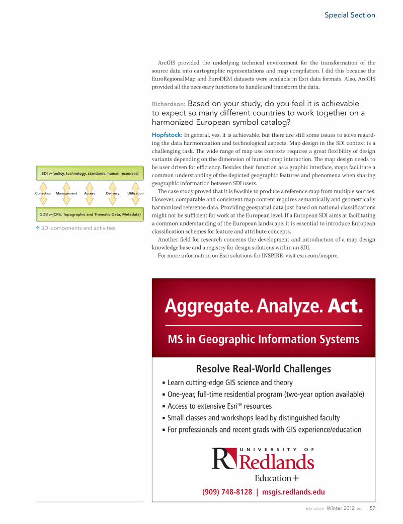
SDI :={policy, technology, standards, human resources}
GDB :={CRS, Topographic and Thematic Data, Metadata}
Collection Management Access Delivery Utilization
57esri.com Winter 2012 au
Special Section
ArcGIS provided the underlying technical environment for the transformation of the source data into cartographic representations and map compilation. I did this because the EuroRegionalMap and EuroDEM datasets were available in Esri data formats. Also, ArcGIS provided all the necessary functions to handle and transform the data.
Richardson: Based on your study, do you feel it is achievable to expect so many different countries to work together on a harmonized European symbol catalog?Hopfstock: In general, yes, it is achievable, but there are still some issues to solve regard-ing the data harmonization and technological aspects. Map design in the SDI context is a challenging task. Th e wide range of map use contexts requires a great fl exibility of design variants depending on the dimension of human-map interaction. Th e map design needs to be user driven for effi ciency. Besides their function as a graphic interface, maps facilitate a common understanding of the depicted geographic features and phenomena when sharing geographic information between SDI users. Th e case study proved that it is feasible to produce a reference map from multiple sources. However, comparable and consistent map content requires semantically and geometrically harmonized reference data. Providing geospatial data just based on national classifi cations might not be suffi cient for work at the European level. If a European SDI aims at facilitating a common understanding of the European landscape, it is essential to introduce European classifi cation schemes for feature and attribute concepts. Another fi eld for research concerns the development and introduction of a map design knowledge base and a registry for design solutions within an SDI. For more information on Esri solutions for INSPIRE, visit esri.com/inspire.
SDI components and activities