n. douglas schneider & associates, inc
TRANSCRIPT

N. Douglas Schneider & Associates, Inc. Professional Civil Engineers & Land Surveyors
N. Douglas Schneider, P.E.. P.L.S. David M. Davignon, P.E. Christopher Costa, P.L.S. Matthew Leone. P.L.S. Octobe r? , 2015
D E P A R T M E N T OF E N V I R O N M E N T A L PROTECTION W A T E R W A Y S R E G U L A T I O N P R O G R A M
Notice of License Application Pursuant to M.G.L. Chapter 91 Waterways License Application Number W15-4486
Site Location: 12 Fish Island, New Bedford Owner/Applicant: Bridge Real Estate Investors, LLC
Pursuant to 310 CMR 9.13( I )(a), the Applicant is required to provide this notification, along with a copy of the project site plans submitted with the Waterways License Application, to the appropriate municipal officials, regulatory agencies and abutters to the project for their review and comment (see mailing list below). The applicant shall send the notice of license or permit application by certified mail to the attached list of abutters and notify the Department when completed.
CERTIFIED MAILING LIST
City of New Bedford City Council 133 William Street - Room 215 New Bedford. MA 02740
City of New Bedford Planning Board i 33 William Street - Room 303 New Bedford, MA 02740
City of New Bedford Conservation Commission DEPFi le No. 49-716 133 William Street - Room 304 New Bedford. MA 02740
City of New Bedford Zoning Board of Appeals i 33 William Street - Room 303 New Bedford, MA 02740
City of New Bedford Harbormaster David Condon 52 Fisherman's Wharf, P.O. Box 50899 New Bedford, MA 02745
Coastal Zone Management 251 Causeway Street Suite 800 Boston. MA 02114
Division of Fish & Wildlife & Law Enforcement Field Headquarters - Attn: Jon Regosin. Ph. D. i Rabbit Hill Road Westboro, MA 01581
Division of Marine Fisheries 1213 Purchase Street, 3'" Floor New Bedford, MA 02740 Attn: Environmental Reviewer
Massachusetts Historical Commission 220 Morrissey Blvd., Columbia Point Boston. MA 02125
Map #60, Lot #29 Fish Island Properties, LLC 4 Fish Island, New Bedford, MA 02740
cc: File 2592 DEP- Waterways Dept. Riek Miller 171 Mendell Road Rochester. MA 02770
Lars Vinjerud 20 Blackmer Street New Bedford. MA 02744-2614
\y Road, P.O. Box 480. Mattapoisett, MA 02739 Phone i-508-758-7866 Fax 1-508-758-6493
Page i of i

DEPARTMENT OF ENVIRONMENTAL PROTECTION WATERWAYS REGULATION PROGRAM
Notice of License Application Pursuant to M.G.L. Chapter 91 Waterways License Application Number W15-4486
Bridge Real Estate Investors, L L C
NOTIFICATION DATE: October 8, 2015
Public notice is hereby given of the waterways application by Bridge Real Estate Investors, LLC to construct and maintain a pile supported pier at 12 Fish Island, in the municipality of New Bedford, in and over flowed tidelands of Acushnet River. The proposed project has been determined to be water-dependent.
The Department will consider all written comments on this Waterwavs application received within 30 davs subsequent to the "Notification Date". Failure of any aggrieved person or group of ten citizens or more, with at least five of the ten residents residing in the municipality(s) in which the license or permitted activity is located, to submit written comments to the Waterways Regulation Program by the Public Comment Deadline will result in the waiver of any right to an adjudicatory hearing in accordance with 310 CMR 9.13(4)(c).
Additional information regarding this application may be obtained by contacting the Waterways Regulation Program at (508) 946-2748. Project plans and documents tor this application are on tile with the Waterways Regulation Program tor public viewing, by appointment only, at the address below.
Written comments must be addressed to: Carlos T.B. Fragata, Environmental Analyst, DEP Waterways Regulation Program, 20 Riverside Drive, Lakeville, MA 02347.

X266922
Important: When filling out forms on the computer, use only the tab key to move your cursor - do not use the return key.
Massachusetts Department of Environmental Protection Bureau of Resource Protection - Waterways Regulation Program Chapter 91 Waterways License Application - 3 1 0 CMR 9 0 0 Water-Dependent, Nonwater-Dependent, Amendment
A. Application information (Check one) NOTE: For Chapter 91 Simplified License application form and information see the Self Licensing Package for BRP WW06.
(fj 1 tab S S
For assistance in completing this application, please see the "Instructions".
Name (Complete Application Sections) Check One Fee Application #
WATER-DEPENDENT -
General (A-H) • Residential with < 4 units $215.00 BRPWWOIa
3 Other $330.00 BRPWWOIb
• Extended Term $3,350.00 BRPWWOIc
Amendment (A-H) • Residential with < 4 units $100.00 BRP WW03a
• Other $125.00 BRP WW03b
NONWATER-DEPENDENT -
Full (A-H) • Residential with < 4 units $665.00 BRP WW15a
• Other $2,005.00 BRP WW15b
• Extended Term $3,350.00 BRP WW15C
Partial (A-H) • Residential with < 4 units $665.00 BRP WW14a
• Other $2,005.00 BRP WW14b
O Extended Term $3,350.00 BRP WW14C
Municipal Harbor Plan (A-H) • Residential with < 4 units $665.00 BRPWW16a
• Other $2,005.00 BRP WW16b
• Extended Term $3,350.00 BRP WW 16c
Joint MEPA/EIR (A-H) • Residential with < 4 units $665.00 BRP WW17a
• Other $2,005.00 BRP WW17b
• Extended Term $3,350.00 BRP WW17C
Amendment (A-H) • Residential with < 4 units $530.00 BRP WW03C
• Other $1,000.00 BRP WW03d
• Extended Term $1,335.00 BRP WW03e
CH91App.doc • Rev. 08/13 Page 1 of 13

X266922 Massachusetts Department of Environmental Protection Bureau of Resource Protection - Waterways Regulation Program ^ , , _ . , , . . 1 . . Transmittal No.
Chapter 91 Waterways License Application - 3 1 0 CMR 9.00 Water-Dependent, Nonwater-Dependent, Amendment
Note: Please refer to the "Instructions'
B. Applicant Information Proposed Project/Use information
1 . Applicant:
Bridge Real Estate Investors, LLC p i g S i
Name
20 Blackmer Street E-mail Address
Mailing Address
New Bedford MA 02744-2614 City/Town
(508) 965-0010 State Zip Code
Telephone Number Fax Number
2. Authorized Agent (if any):
David M. Davignon, P.E. dsquared3368 @ yahoo.com Name
N. Douglas Schneider & Associates, Inc., P.O. Box 480 E-mail Address
Mailing Address
Mattapoisett MA 02739 City/Town
(508) 758-7866 State
(508) 758-6493 Zip Code
Telephone Number Fax Number
C. Proposed Project/Use Information
1. Property Information (all information must be provided):
same as applicant Owner Name (if different from applicant)
Map #60, Lot #1 N41-38-19.5" Tax Assessor's Map and Parcel Numbers
12 Fish Island, New Bedford Latitude
MA Street Address and City/Town State
2. Registered Land 3 Yes • No
3. Name of the water body where the project site is located:
Acushnet River
W70-55'-12.3"
02740 Zip Code
4. Description of the water body in which the project site is located (check all that apply):
Tyee
• Nontidal river/stream
3 Flowed tidelands
• Filled tidelands
• Great Pond
• Uncertain
Nature
3 Natural
• Enlarged/dammed
• Uncertain
Designation
• Area of Critical Environmental Concern
• Designated Port Area
• Ocean Sanctuary
3 Uncertain
CH91 App.doG • Rev. 08/13 Page 2 of 13

Massachusetts Department of Environmental Protection Bureau of Resource Protection - Waterways Regulation Program Chapter 91 Waterways L icense Appiication - 3 1 0 CMR 9 00 Water-Dependent, Nonwater-Dependent, Amendment
X266922 Transmittal No.
C. Proposed Project/Use information (cent.) Select use(s) from Project Type Table on pg. 2 of the "Instructions"
5. Proposed Use/Activity description
The Applicant proposes to construct a pile supported pier facility to provide access to the waters of the Acushnet River and New Bedford Harbor for commercial fishing boats.
6. What is the estimated total cost of proposed work (including materials & labor)?
$900.000
7. List the name & complete mailing address of each abutter (attach additional sheets, if necessary). An abutter is defined as the owner of land that shares a common boundary with the project site, as well as the owner of land that lies within 50' across a waterbody from the project.
Lot #29: Fish island 4 Fish Island, New Bedford, MA 02740 Properties, LLC Address Lot #30: Same as Lot #29 Name Address
Name Address
D. Project Pians
1. I have attached plans tor my project in accordance with the instructions contained in (check one):
3 Appendix A (License plan) • Appendix B (Permit plan)
2. Other State and Local Approvals/Certifications
• 401 Water Quality Certificate Date ot issuance
3 Wetlands Pending File Number
• Jurisdictional Determination JD^ Fiie Number
• MEPA Fiie Number
• EOEA Secretary Certificate Date
• 21E Waste Site Cleanup RTN Number
CH91App.doc • Rev. 08/13 Page 3 of 13
Massachusetts Department of Environmental Protection Bureau of Resource Protection - Waterways Regulation Program _X266922
X J. I • * 1 . X . Transmittal No,
Chapter 91 Waterways License Application - 3 1 0 C M R 9 00 Water-Dependent, Nonwater-Dependent, Amendment
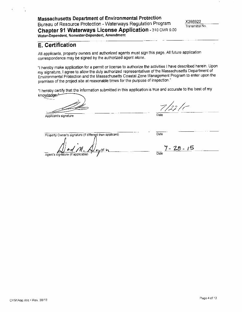
E. Certification
All applicants, property owners and authorized agents must sign this page. All future application correspondence may be signed by the authorized agent alone.
"I hereby make application for a permit or license to authorize the activities I have described herein. Upon my signature, I agree to allow the duly authorized representatives of the Massachusetts Department of Environmental Protection and the Massachusetts Coastal Zone Management Program to enter upon the premises of the project site at reasonable times for the purpose of inspection."
"I hereby certify that the information submitted in this application is true and accurate to the best of my knowledger-
Applicant's signature Date
Property Owner's signature (if differec it than applicant) Date
^nMJri 7 - Z S - }B Agent's signature (if applicable)
CH91App.doc-Rev. 08/13 Page 4 of 13

Massachusetts Department of Environmental Protection Bureau of Resource Protection - Waterways Regulation Program 2 ^ ^ 9 2 2 Chapter 91 Waterways License Application - 3 1 0 C M R 9 0 0 ^ °
Water-Dependent, Nonwater-Dependent, Amendment
F. Waterways Dredging Addendum
1 . Provide a description of the dredging project • Maintenance Dredging (include last dredge date & permit no.) • Improvement Dredging
n/a Purpose of Dredging
2. What is the volume (cubic yards) of material to be dredged?
n/a
3. What method will be used to dredge?
• Hydraulic • Mechanical • Other
4. Describe disposal method and provide disposal location (include separate disposal site location map)
n/a
5. Provide copy of grain size analysis. If grain size is compatible for beach nourishment purposes, the Department recommends that the dredged material be used as beach nourishment for public beaches. Note: In the event beach nourishment is proposed for private property, pursuant to 310 C M R 9.40(4)(a)1, public access easements below the existing high water mark shall be secured by applicant and submitted to the Department.
CH91App.doc • Rev. 08/13 Page 5 of 13

Massachusetts Department of Environmental Protection Bureau of Resource Protection - Waterways Regulation Program X266922 Chapter 91 Waterways L icense Application - 3 1 0 C M R 9.00 Water-Dependent, Nonwater-Dependent, Amendment
G . Municipal Zoning Certificate
Bridge Real Estate Investors, LLC Name of Applicant
1 2 Fish Island Acushnet River New Bedford Project street address Waterway City/Town
Description of use or change in use:
The Applicant proposes to construct a pile supported pier facility to provide access to the waters of the Acushnet River and New Bedford Harbor for commercial fishing boats.
To be completed by municipal clerk or appropriate municipal official:
"I hereby certify that the project described above and more fully detailed in the applicant's waterways license application and plans is not in violation of local zoning ordinances and bylaws."
CH91App.doc 'Rev . 08/13 Page 6 of 13

Massachusetts Department of Environmental Protection Bureau of Resource Protection - Waterways Regulation Program Chapter 91 Waterways L icense Application - 3 1 0 C M R 9 0 0 Water-Dependent, Nonwater-Dependent, Amendment
X266922_ Transmittal No.
H. Municipal Planning Board Notification Notice to Applicant:
Section H should be completed and submitted along with the original application material.
Bridge Real Estate Investors, LLC Name of Applicant
1 2 Fish Island Project street address
Description of use or change in use:
Acushnet River Waterway
New Bedford City/Town
The Applicant proposes to construct a pile supported pier facility to provide access to the waters of the Acushnet River and New Bedford Harbor for commercial fishing boats.
To be completed by municipal clerk or appropriate municipal official:
"I hereby certify that the project described above and more fully detailed in the applicant's waterways license application and plans have been submitted by the applicant to the municipal planning board."
Printed Name of Municipal Official Date
Signafure of Municipal Officia Ur^rfA^ Official
Title City/Town
Note: Any comments, including but not limited to written comments, by the general public, applicant, municipality, and/or an interested party submitted after the close of the public comment period pertaining to this Appiication shall not be considered, and shall not constitute a basis for standing in any further appeal pursuant to 310 C M R 9.13(4) and/or 310 C M R 9.17.
CH91App.doc • Rev. 08/13 Page 7 of 13

Massachusetts Department of Environmental Protection Bureau of Resource Protection - Waterways Regulation Program x^66922 Chapter 91 Waterways L icense Application - 3 1 0 C M R 9.00 '
Water-Dependent, Nonwater-Dependent, Amendment
Appendix A: License Plan Checkl ist
General View 3 PE or RLS, as deemed appropriate by the Department, stamped and signed, in ink, each sheet
within 8 1/2 inch by 11 inch border
3 Format and dimensions conform to "Sample Plan" (attached)
3 Minimum letter size is 1/8 of an inch if freehand lettering, 1/10 of an inch if letter guides are used
3 Sheet number with total number in set on each sheet
3 Title sheet contains the following in lower left: Plans accompanying Petition of [Applicant's name, structures and/or fill or change in use, waterway and municipality]
3 North arrow
3 Scale is suitable to clearly show proposed structures and enough of shoreline, existing structures and roadways to define its exact location
3 Scale is stated & shown by graphic bar scale on each sheet
3 initial plans may be printed on bond; final plans due before License issuance must be on 3mil Mylar.
Structures and Fill
3 Ail Structures and Fill shown in full BLACK lines, clearly labeling which portions are existing, which are Proposed and indicating Existing Waterways Licenses
3 Cross Section Views show MHW* and MLW* and structure finish elevations
• Dredge or Fill, actual cubic yardage must be stated and typical cross sections shown
3 All Structures and Fill shown in full BLACK lines, clearly labeling which portions are existing, which are Proposed and indicating Existing Waterways Licenses
3 Cross Section Views show MHW* and MLW* and structure finish elevations
• Dredge or Fiil, actual cubic yardage must be stated and typical cross sections shown
3 Actual dimensions of structures(s) and or fill and the distance which they extend beyond MHW* or OHW*
• Change in Use of any structures on site must be stated
* See 310 CMR 9.02, Waterways Regulations definitions of High Water Mark, Historic High Water Mark, Historic Low Water Mark, and Low Water Mark. Note: DEP may, at its discretion, accept appropriately scaled preliminary pians in lieu of the plans described above, in general, DEP will accept preliminary plans only for non-water dependent projects and projects covered by MEPA to address site design components such as visual access, landscaping & site coverage. Anyone wishing to submit preliminary plans must obtain prior approval of the DEP Waterways Program before submitting them with their appiication.
CH91App.doc • Rev. 08/13 Page 8 of 13

Massachusetts Department of Environmental Protection Bureau of Resource Protection - Watenvays Regulation Program Chapter 91 Waterways L icense Application - 3 1 0 C M R 9 0 0 Water-Dependent, Nonwater-Dependent, Amendment
Appendix A: L icense Plan Checklist (cont.) Boundaries
3 Property lines, full black lines, — — , along with abutters' names and addresses
3 Mean High Water (MHW)* or Ordinary High Water (OHW)*, full black line —
3 Mean Low Water (MLW)*, black dotted line, ( )
• Historic MHW* or OHW* ( )
• Historic MLW* (..._..._..._)
3 State Harbor Lines, black dot-dash line ( - . - . - . - ) with indication of Chapter & Act establishing them (Ch. , Acts o f )
3 Reference datum is National Geodetic Vertical Datum (NGVD) or (NAVD).
3 Floodplain Boundaries according to most recent FEMA maps
• Proposed & Existing Easements described in metes & bounds
Water-Dependent Structures
• Distance from adjacent piers, ramps or floats (minimum distance of 25' from property line, where feasible)
• Distance from nearest opposite shoreline
• Distance from outside edge of any Navigable Channel
• Access stairs at MHW for lateral public passage, or 5 feet of clearance under structure at MHW.
Non Water-Dependent Structures
• Depict extent of 'Water-dependent Use Zone".
See Waterways Regulations at 310 CMR 9.51-9.53 for additional standards for non water-dependent use projects.
Note: Final Mylar project site plans will be required upon notice from the Department, prior to issuance of the Chapter 91 Waterways License.
X266922 Transmittal No.
CH91App.doc • Rev. 08/13 Page 9 of 13

Massachusetts Department of Environmental Protection Bureau of Resource Protection - Waterways Regulation Program Chapter 91 Waterways L icense Application - 3 1 0 C M R 9 0 0 Water-Dependent, Nonwater-Dependent, Amendment
X266922 Transmittal No.
Appendix A: License Plan Checklist Cont.
•31/2 inches-
-1 "-
LP
00
Registry Statement
-5 inches-
o
Locus Map
First Sheet Only
3/8"
•21/4 inche
Sample Plan
-8 1/2 inches-
Plan Accompanying ~X~ Petition of...
¥
•3 3/4 inch es-
DEP Stamp
First Sheet Only
3/4 "Border
ZITr a
CD o
CO
CH91App.doc • Rev. 08/13 Page 10 of 13
Massachusetts Department of Environmental Protection Bureau of Resource Protection - Waterways Regulation Program X266922^
. _ . . , . . . . . Transmittal No.
Chapter 91 Waterways L icense Application - 3 1 0 C M R 9 00 Water-Dependent, Nonwater-Dependent, Amendment
Appendix B: Dredging Permit Plan Checklist
For projects applying for dredging permits only, enclose drawings with the General Waterways Application that include the following information:
General View
• Submit one original of all drawings. Submit the fewest number of sheets necessary to adequately illustrate the project on 8-1/2 inch X 11 inch paper.
• A 1-inch margin should be left at the top edge of each drawing for purposes of reproduction and binding. A 1/2 inch margin is required in the three other edges.
• A complete title block on each drawing submitted should identify the project and contain: the name of the waterway; name of the applicant; number of the sheet and total number of sheets in the set; and the date the drawing was prepared.
• Use only dot shading, hatching, and dashed or dotted line to show or indicate particular features of the site on the drawings.
• if deemed appropriate by the Department, certification by the Registered Professional Engineer or Land Surveyor is included.
Plan View
• North Arrow
• Locus Map
• Standard engineering scale.
• Distances from channel lines and structures if appropriate.
• Mean high water and mean low water shorelines (see definitions of "High Water Mark" and "Low Water Mark" at 310 OMR 9.02, C. 91 Regulations).
• Dimensions of area proposed to be dredged or excavated.
• Notation or indication of disposal site.
• Volume of proposed dredging or excavation.
• Ordinary high water, proposed drawdown level, and natural (historic) high water (for projects lowering waters of Great Ponds).
Section Views
• Existing bottom and bank profiles.
• Vertical and/or horizontal scales.
• Proposed and existing depths relative to an indicated datum.
• Elevation and details of control structure (for projects lowering waters of Great Ponds).
CH91App.doc • Rev. 08/13 Page 11 of 13
Massachusetts Department of Environmental Protection Bureau of Resource Protection - Waterways Regulation Program X266922 Chapter 91 Waterways L icense Application - 3 1 0 C M R 9.00 ^ ™ ^ ° Water-Dependent, Nonwater-Dependent, Amendment
Appendix C: Appiication Completeness Checklist Please answer ail questions in the General Waterways Appiication form. If a question does not apply to your project write "not applicable" (n/a) in that block. Please print or type all information provided on the form. Use black ink (blue ink or pencil are not easily reproducible, therefore, neither will be accepted). If additional space is needed, attach extra 8-1/2" x 11" sheets of paper.
• Proper Public Purpose: For nonwater-dependent projects, a statement must be included that explains how the project serves a proper public purpose that provides greater benefit than detriment to public rights in tidelands or great ponds and the manner in which the project meets the applicable standards. If the project is a nonwater-dependent project located in the coastal zone, the statement should explain how the project complies with the standard governing consistency of the policies of the Massachusetts Coastal Zone Management Program, according to 310 OMR 9.54. If the project is located in an area covered by a Municipal Harbor Plan, the statement should describe how the project conforms to any applicable provisions of such plan pursuant to 310 OMR 9.34(2).
3 Plans: Prepared in accordance with the applicable instructions contained in Appendix A-B of this application. For initial filing, meet the requirements of 310 OMR 9.11(2)(b)(3).
3 Applicant Certification: Ail applications must be signed by "the landowner if other than the applicant. In lieu of the landowner's signature, the applicant may provide other evidence of legal authority to submit an appiication for the project site." If the project is entirely on land owned by the Commonwealth (e.g. most areas below the current low water mark in tidelands and below the historic high water mark of Great Ponds), you may simply state this in lieu of the "landowner's signature".
• Municipal Zoning Certification: If required, applicants must submit a completed and signed Section E of this application by the municipal clerk or appropriate municipal official or, for the initial filing, an explanation of why the form is not included with the initial application. If the project is a public service project subject to zoning but will not require any municipal approvals, submit a certification to that effect pursuant to 310 OMR 9.34(1).
• Municipal Planning Board Notification: Applicants must submit a copy of this application to the municipal planning board for the municipality where the project is located. Submittal of the complete appiication to DEP must include Section H signed by the municipal clerk, or appropriate municipal official for the town where the work is to be performed, except in the case of a proposed bridge, dam, or similar structure across a river, cove, or inlet, in which case it must be certified by every municipality into which the tidewater of said river, cove, or inlet extends.
• Final Order of Conditions: A copy of one of the following three documents is required with the filing of a General Waterways Application: (1) the Final Order of Conditions (with accompanying plan) under the Wetlands Protection Act; (2) a final Determination of Applicability under that Act stating that an Order of Conditions is not required for the project; or (3) the Notice of Intent for the initial filing (if the project does not trigger review under MEPA).
• Massachusetts Environmental Protection Act (MEPA): MGL 30, subsections 61-61A and 301 OMR 11.00, submit as appropriate: a copy of the Environmental Notification Form (ENF) and a Certificate of the Secretary of Environmental Affairs thereon, or a copy of the final Environmental Impact Report (FIR) and Certificate of the Secretary stating that it adequately and properly complies with MEPA; and any subsequent Notice of Project change and any determination issued thereon in accordance with MEPA. For the initial filing, only a copy of the ENF and the Certificate of the Secretary thereon must be submitted.
Note: If the project Is subject to MEPA, the Chapter 91 Public Notice must also be submitted to MEPA for publication in the "Environmental Monitor". MEPA filing deadlines are the 15* and 30* of each month.
CH91App.doc 'Rev . 08/13 Page 12 of 13

Massachusetts Department of Environmental Protection Bureau of Resource Protection - Waterways Regulation Program X266922^
, _ . . , . « . . . Transmittal No.
Chapter 91 Waterways L icense Application - 3 1 0 CMR 9 00 Water-Dependent, Nonwater-Dependent, Amendment
Appendix C: Application Completeness Checklist (cont.) • Water Quality Certificate: if applicable, pursuant to 310 CMR 9.33, is included.
• Other Approvals: as applicable pursuant to 310 CMR 9.33 or, for the initial filing, a list of such approvals which must be obtained.
Projects Involving dredging:
• The term "dredging" means the removal of materials including, but not limited to, rocks, bottom sediments, debris, sand, refuse, plant or animal matter, in any excavating, clearing, deepening, widening or lengthening, either permanently or temporarily, of any flowed tidelands, rivers, streams, ponds or other waters of the Commonwealth. Dredging includes improvement dredging, maintenance dredging, excavating and backfilling or other dredging and subsequent refilling. Included is a completed and signed copy of Part F of the application.
Filing your Completed General Waterways Application: 3 For all Water-Dependent applications - submit a completed General Waterways Appiication
and all required documentation with a photocopy of both payment check and DEP's Transmittal Form tor Permit Application & Payment to the appropriate DEP Boston or regionai office (please refer to Pg. 10 of the "Instructions" for the addresses of DEP Regional Offices).
• For all Non Water-Dependent applications - submit a completed General Waterways Application and ail required documentation with a photocopy of both payment check and DEP's Transmittal Form tor Permit Appiication & Payment to DEP's Boston office.
Department of Environmental Protection Waterways Regulation Program One Winter Street Boston, MA 02108
• Application Fee Payment for ALL Waterwavs Applications: Send the appropriate Appiication fee* (please refer to Page 1 of the "Application"), in the form of a check or money order, along with DEP's Transmittal Form tor Permit Appiication & Payment.
Department of Environmental Protection P.O. Box 4062 Boston, MA 02211
* Under extreme circumstances, DEP grants extended time periods for payment of license and permit application fees. If you qualify, check the box entitles "Hardship Request" on the Transmittal Form tor Permit Application & Payment. See 310 CMR 4.04(3)(c) to identify procedures for making a hardship request. Send hardship request and supporting documentation to the above address.
NOTE: You may be subject to a douWe application fee if your application for Chapter 91 authorization results from an enforcement action by the Department or another agency of the Commonwealth or its subdivisions, or if your appiication seeks authorization for an existing unauthorized structure or use.
CHSIApp.doc • Rev, 08/13 Page 13 of 13