lidar
TRANSCRIPT

[LiDAR]

Contents:-
What is LiDAR?
How it was developed?
Why to use LiDAR?
How does a LiDAR works (Block Diagram)?
Advantages and disadvantages?
Applications?
Conclusion and future scope?
What is LiDAR?1. LiDAR is an active laser remote sensing sensor.
2. It is used to measure the distance of an object and form an virtual image of that object by using the laser beam.
3. The basic principle of reflection is used to form the virtual image of an object.
4. The time taken by reflected beam provides us the actual distance of an object.
History of LiDAR:-
1. LiDAR was invented in the early 1960’s, shortly after the invention of the laser.
2. The general public became aware of the accuracy and usefulness of LiDAR systems in 1971 during the Apollo 15 mission.
3. When astronauts used a laser altimeter to map the surface of the moon in Apollo 15 mission.
Why to use LiDAR?
1. The speed and accuracy of laser is too much.
2. Just by using a computer a Precise, Three-Dimensional information about the shape of the object and its surface characteristics can be obtained.

How does a LiDAR works (Block Diagram)?
Laser.Scanner and
optics.
Photodetector and receiver electronics.
Position and navigation
systems.
Laser:-1. A laser of 600 to 1000 nm wavelength is used for non-
scientific applications and 1500 nm lasers are most common for scientific applications.
2. These lasers are inexpensive for geological survey companies.
Scanner and optics:-1. How fast images can be developed depends on the
speed at which objects are scanned.
2. The function of optics is to manage angular resolution and the range that can be detected.

Photo-detector and receiver electronics:-1. Photo detectors are the sensors that detect light and
produces some signal as its output.
2. Two types of Photo detectors used in LiDAR are:-
Solid State Photo detector and
Photo-multiplier Photo detector
3. Receiver electronic circuits stores the co-ordinates of reflected beam.
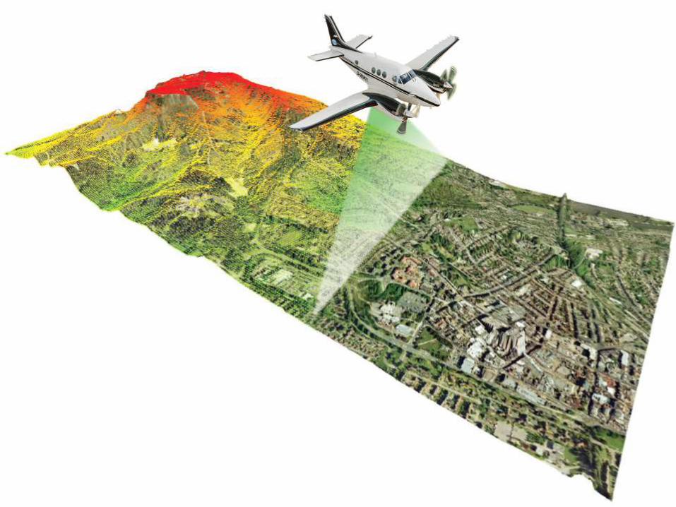
Position and navigation system:-1. Lidar sensors can be mounted on mobile platforms
such as airplanes or satellites.
2. Hence it is necessary to determine the absolute position and orientation of the sensor.
3. This can be achieved by using navigation system like GPS(Global positioning system) and
IMU(Inertial Measurement Unit)


Advantages:-1. Higher accuracy
2. Higher data density
3. Fast acquisition and processing
4. Minimum human dependence
5. Reliable
Disadvantages:-
1. In some applications a powerful laser beam needs to
be used, which might harm human eye.
Applications:-
1. Measure distance
2. Measure speed
3. Measure rotation
4. Measure chemical composition And concentration
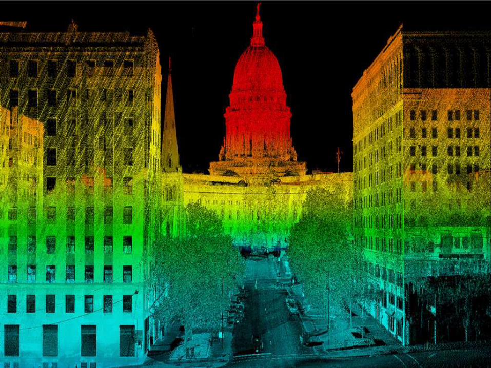
5. In developing high-resolution maps
6.3-D Modelling and visualization
7.Forestry

Discussion? Questions?

Thank You.