if walls could talk - windham textile and history museum walls could talk: researching the history...
TRANSCRIPT

If Walls Could Talk: Researching the History of Your House:
A Guide for Beginners
Jamie H. Eves Windham Textile and History Museum
2011

So You’re Curious About That New House You Just Bought….
Tax Assessor’s Database
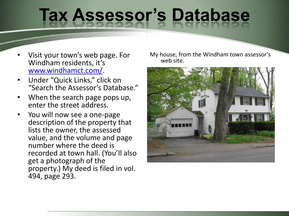
• Visit your town’s web page. For Windham residents, it’s www.windhamct.com/.
• Under “Quick Links,” click on “Search the Assessor’s Database.”
• When the search page pops up, enter the street address.
• You will now see a one-page description of the property that lists the owner, the assessed value, and the volume and page number where the deed is recorded at town hall. (You’ll also get a photograph of the property.) My deed is filed in vol. 494, page 293.
My house, from the Windham town assessor’s web site.

Land Records
Whenever real estate is sold, mortgaged, devised, or otherwise transferred or encumbered, state law requires that the parties file copies of the relevant “instruments” in the Land Records/Registry of Deeds for the community where the property is located.

Land Records
In Connecticut, the Land Records are filed in the towns where the properties are located. In Windham, they are located in the large, walk-in vault adjacent to the Town Clerk’s office on the first floor of the Windham Town Hall, at the corner of Main and High streets.

Land Records
In Massachusetts, Maine, New Hampshire, and most other states, the Land Records are filed in the counties where the properties are located, so visit the local county courthouse.
In Vermont, they are kept in the state capital at Montpelier.
Lincoln County Courthouse, Wiscasset, Maine

Land Records
No matter which town or county, however, each registry is set up pretty much the same. Begin with the bound indexes. (The most recent Windham indexes are also on a computer.)
Indexes are usually stored laying on their sides, on rollers. (They can be very heavy.)

Land Records
The indexes are arranged chronologically, with each volume covering all of the transactions filed during a particular span of years, such as 1939-50. There are separate indexes for grantors (those giving up property) and grantees (those acquiring property). Within each volume, the names of the grantors or grantees are arranged alphabetically. Look up your own name in the grantee index for the year you bought your house.

Land Records
The index will give you the volume and page number where you will find a copy of your deed, the date your deed was filed, the location of the property, and the type of deed (“WD” stands for “warranty deed,” “QCD” for “quit claim deed,” “MD” for “mortgage deed,” “R of M” for “release of mortgage,” etc.). My deed is filed in vol. 494, page 293.
Recent deeds
are photo-
copied.

Land Records
In Windham, the land records take up more than 500 volumes, beginning when the town was incorporated in the 1600s and continuing to the present. Not all of the volumes look alike. The oldest are large, heavy, folio-sized tomes bound in rich red leather, often with protective canvas covers.
Like the indexes, the older volumes of the Land Records are usually stored horizontally, on rollers.
Land Records
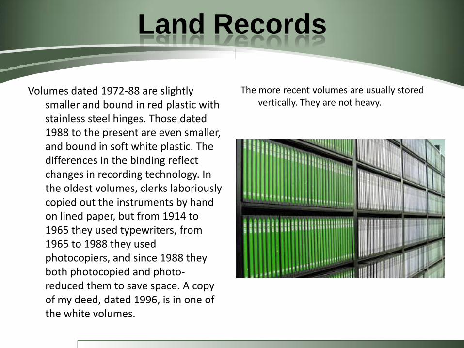
Volumes dated 1972-88 are slightly smaller and bound in red plastic with stainless steel hinges. Those dated 1988 to the present are even smaller, and bound in soft white plastic. The differences in the binding reflect changes in recording technology. In the oldest volumes, clerks laboriously copied out the instruments by hand on lined paper, but from 1914 to 1965 they used typewriters, from 1965 to 1988 they used photocopiers, and since 1988 they both photocopied and photo-reduced them to save space. A copy of my deed, dated 1996, is in one of the white volumes.
The more recent volumes are usually stored vertically. They are not heavy.

Land Records
Deeds are legal documents conveying property from one party to another. Typically, deeds give the names and residences (by town) of the grantor and grantee, along with the location and a description of the property being conveyed. Older deeds often record the purchase price. Deeds normally provide a reference to the previous deed, whereby the grantor had originally acquired the property.
Land Records
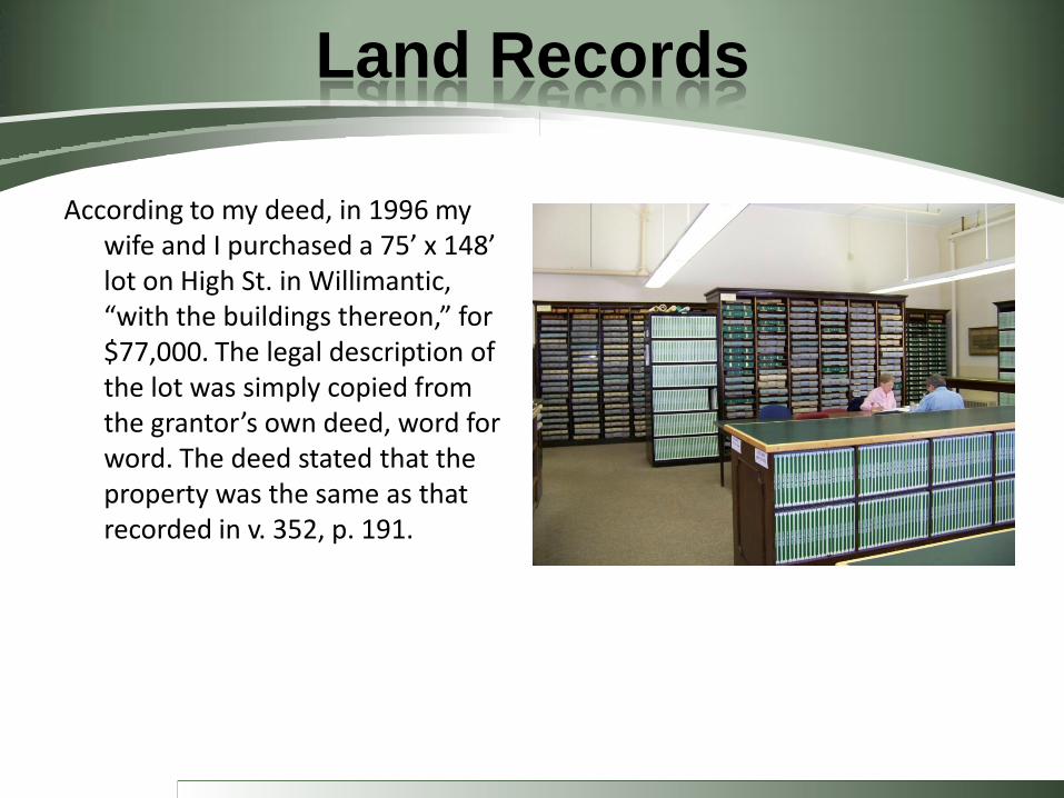
According to my deed, in 1996 my wife and I purchased a 75’ x 148’ lot on High St. in Willimantic, “with the buildings thereon,” for $77,000. The legal description of the lot was simply copied from the grantor’s own deed, word for word. The deed stated that the property was the same as that recorded in v. 352, p. 191.
Land Records
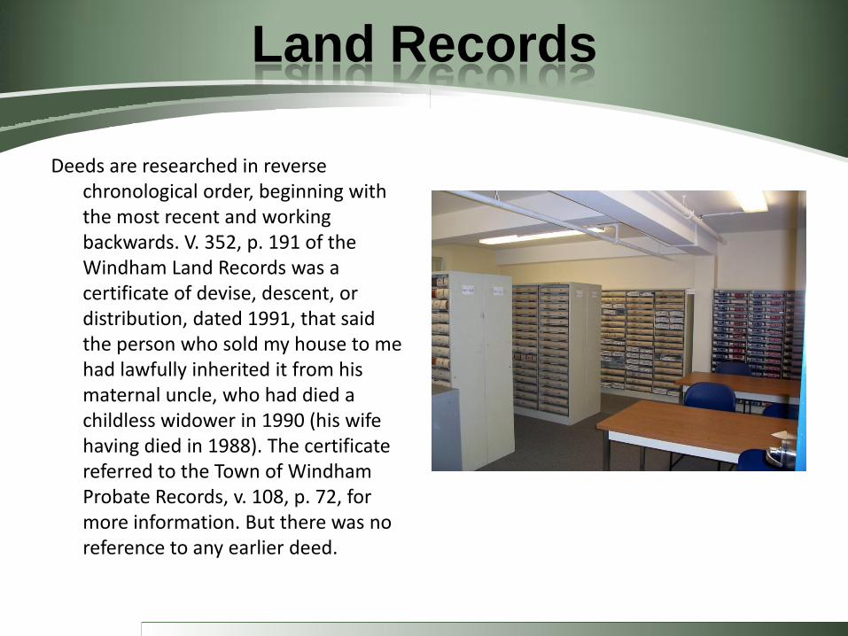
Deeds are researched in reverse chronological order, beginning with the most recent and working backwards. V. 352, p. 191 of the Windham Land Records was a certificate of devise, descent, or distribution, dated 1991, that said the person who sold my house to me had lawfully inherited it from his maternal uncle, who had died a childless widower in 1990 (his wife having died in 1988). The certificate referred to the Town of Windham Probate Records, v. 108, p. 72, for more information. But there was no reference to any earlier deed.

Land Records
Returning to the grantee index, it was possible to look up the name of the deceased uncle. I found his deed in v. 206, p. 70. He and his wife had purchased the house in 1965 from John and Katherine Spillane. The mortgage deed (recorded right after the warranty deed) was for $12,000. The deed revealed that the uncle and his wife had previously lived at 227 Church St. in Willimantic. It also said that the Spillanes’ deed was recorded in v. 168, p. 57. That deed revealed that the Spillanes had bought the house in 1953 from John and Celia Lynch, also of Windham. Hypothesis: only two owners in four decades – no wonder the house had not changed much.

Land Records
The Lynches had purchased the property only the year before, in 1952. Their deed stated that it came “with no buildings situated thereon,” and stipulated that the grantor, William Sledjeski, was to remove any structures within 60 days. Looking through the indexes, it was apparent that John Lynch also owned other properties in Willimantic in the late 1940s and early 1950s. There was also recorded a 1949 mechanic’s lien, for landscaping work he had done on West Main St., but hadn’t been paid. Hypothesis: Lynch was a builder who had bought the High St. property as a vacant lot in 1952, constructed a house on it, and then sold it in 1953 to the Spillanes for a profit.

Street Directories
Before there were telephone books, there were street directories – alphabetical listings of all of the residents of a community, along with their addresses and occupations. Willimantic street directories range from 1877 to 1989. The Windham Textile and History Museum has about 80% of them. The Willimantic Public Library has some, too. According to the 1952 Willimantic street directory, John and Celia Lynch lived at 18 Pearl Street, and John was a contractor. Hypothesis confirmed.

Land Records
William Sledjeski had acquired the property in 1943 for $10 from the estate of Alice Crane. The Land Records indexes revealed that Sledjeski also owned about a dozen other properties in Willimantic. Hypothesis: he, too, was an entrepreneur.
Sledjeski’s deed contained some interesting language. In addition to the land itself, it gave Sledjeski the right to use “all utilities facilities” (which it stated were sewer, water, and electricity) “subject to the installation by the grantee of required meters.” Hypothesis: there was a building (or buildings) on the land when Sledjeski bought it – and something more substantial than a shed or barn. But the structure was not a house. What could it have been?
Newspapers
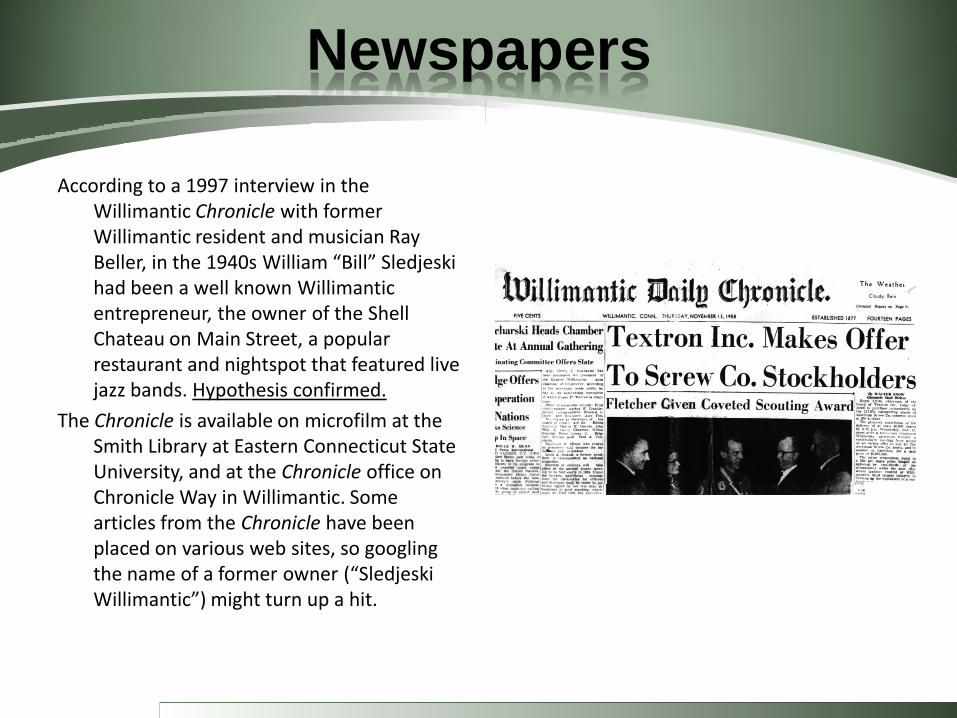
According to a 1997 interview in the Willimantic Chronicle with former Willimantic resident and musician Ray Beller, in the 1940s William “Bill” Sledjeski had been a well known Willimantic entrepreneur, the owner of the Shell Chateau on Main Street, a popular restaurant and nightspot that featured live jazz bands. Hypothesis confirmed.
The Chronicle is available on microfilm at the Smith Library at Eastern Connecticut State University, and at the Chronicle office on Chronicle Way in Willimantic. Some articles from the Chronicle have been placed on various web sites, so googling the name of a former owner (“Sledjeski Willimantic”) might turn up a hit.
Land Records
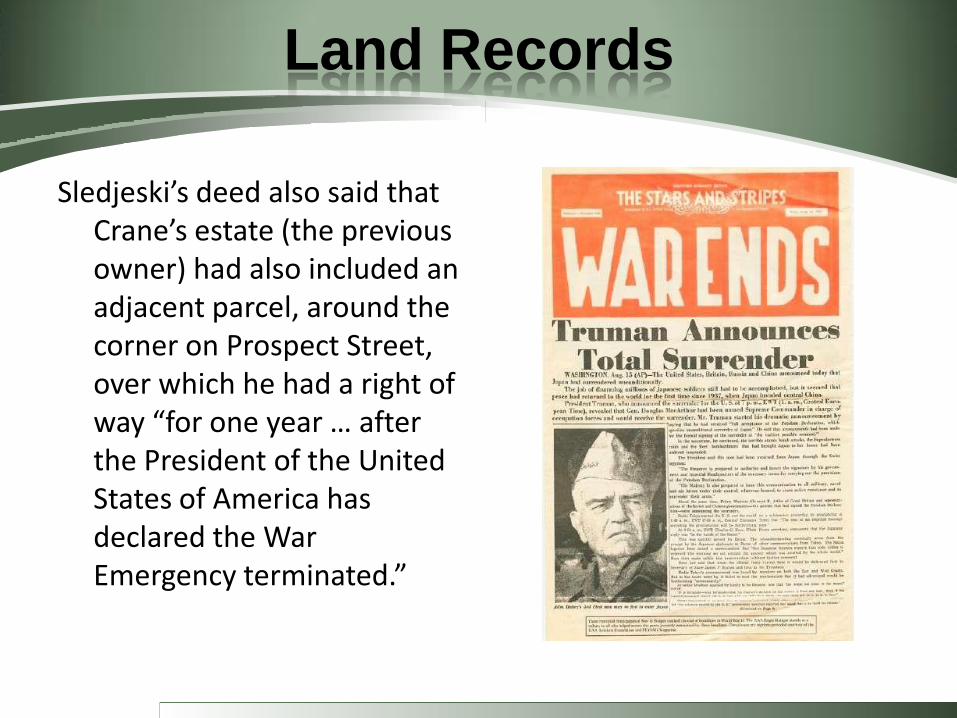
Sledjeski’s deed also said that Crane’s estate (the previous owner) had also included an adjacent parcel, around the corner on Prospect Street, over which he had a right of way “for one year … after the President of the United States of America has declared the War Emergency terminated.”

Street Directories
The 1942 and 1944 Willimantic street directories list William and Sophie Sledjeski as living at 215 Windham Road and owning a restaurant at 725 Main Street. Also living at 215 Windham Road were Bronislaw and Christine Sledjeski. Bronislaw was a “counterman” at Bill Sledjeski’s restaurant. Christine was a hairdresser, employed at 670 Main Street.

Land Records
Sledjeski’s deed implied that the utilities on the High St. parcel were metered together with the utilities at Alice Crane’s other property, a large, stately Victorian mansion at 283 Prospect St. (Today, the mansion is divided into ECSU student apartments.) In its day, the mansion was an elegant home, with stained glass windows and a high square tower.
Crane’s deed said that she purchased the mansion in 1921 from Myra Reed and Helen Elmore, both of Boston. Earlier, in the late 1800s, it had been the home of Origen Sessions, a wealthy merchant.

Land Records
According to her death certificate (filed in the land records), Alice Crane died in 1932. She seems to have fallen on hard times – both the town of Windham and the city of Willimantic filed numerous tax liens against her, and more liens were filed on the estate after her death. Crane’s original deed to the Prospect St. property contained incorrect boundary measurements, necessitating a second deed in 1923. According to this corrected deed, her lot included what is now the rear portion of my lot, where the cement slab is located. Hypothesis: the slab was the foundation of a barn or carriage house, now demolished.
Land Records
Another deed (v. 99, p. 153) showed that Crane had purchased the front portion of my lot in 1923 from Albert L. French of Windham, giving her altogether one large L-shaped lot that fronted on both High and Prospect streets, with two other properties on the corner. Why had she done this?

Panoramics
In addition to Land Records, old maps are another good source of information. Panoramics are especially useful, because they often contain drawings of buildings. This panoramic (available at the Museum and on the Library of Congress website, memory.loc.gov – the latter with a zoom feature) shows Willimantic in 1882.

Panoramics
This detail from the 1882 panoramic shows the area where my house is now located (Prospect Hill) is was a combination of forest and fields.
Panoramics
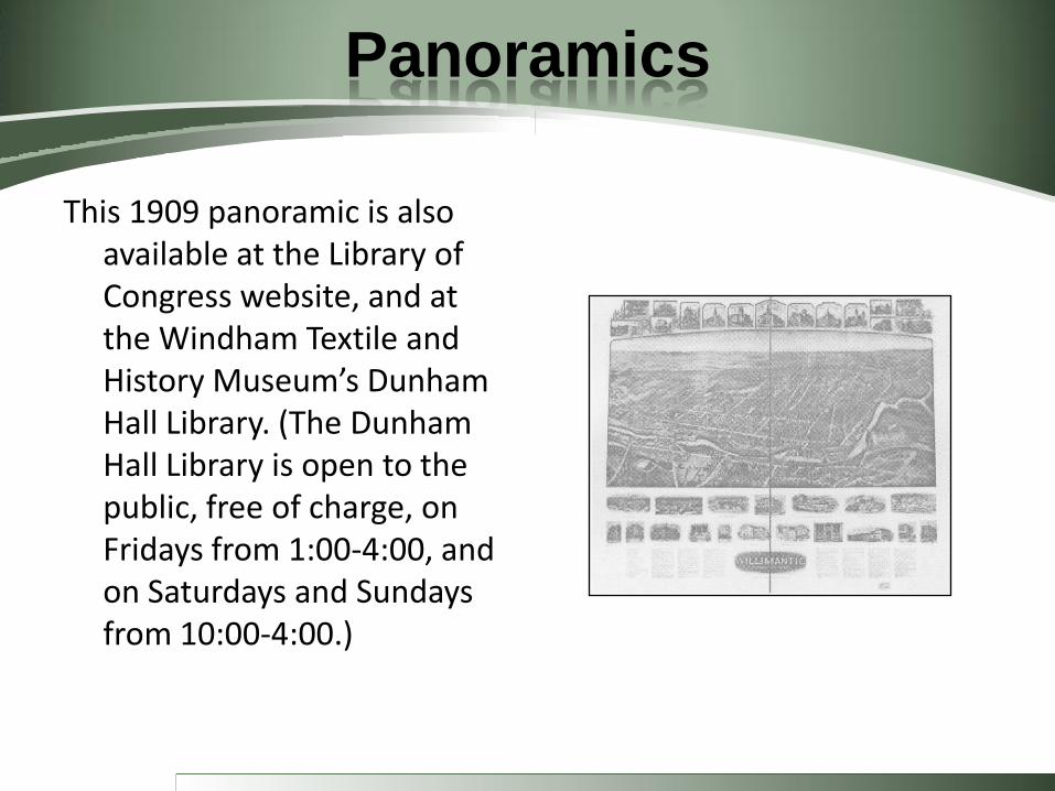
This 1909 panoramic is also available at the Library of Congress website, and at the Windham Textile and History Museum’s Dunham Hall Library. (The Dunham Hall Library is open to the public, free of charge, on Fridays from 1:00-4:00, and on Saturdays and Sundays from 10:00-4:00.)

Panoramics
Details from the 1909 panoramic show Crane’s Prospect Street mansion (with the tower on the wrong house), but nothing on High Street where my house would later be built.

Sanborn Insurance Maps
The Dunham Hall Library owns two original sets of Sanborn insurance maps for Willimantic. The Sanborn Company produced detailed, hand-drawn maps of most large towns and cities in the United States, from the late 1800s on. (The ECSU and UConn libraries have them, too, but on microfilm, not the original paper versions.) Sanborn maps showed every building, color coded to show the construction materials (yellow = wood). They also show lot lines. When changes in building occurred, Sanborn’s cartographers hand-drew corrections on scraps of paper, which they pasted atop the original. (On microfilmed versions, the older versions beneath the corrections are not visible, but the paper copies can be held up to the light to view what is underneath.) The Willimantic base maps were made in 1924; one set at the Museum is corrected to 1949, the other to 1963.

Sanborn Insurance Maps
According to the 1949 map, the High St. (front) half of my house lot was empty, but a structure existed on the back portion, where the cement slab is today. It was a two-story wooden building labeled “woodworking.” Apparently, someone had once operated a woodworking shop out of Crane’s barn.
In looking at the original map, it was obvious that the drawing of the woodworking building (along with the empty High St. area) had been made on a pasted-down scrap of paper. Holding the map up to the light, underneath was visible: (1) the barn (still labeled “woodworking”) with the additional notation “Charles L. Crane” (Alice’s heir and the executor of her estate when she died in 1939) and two structures along High St. One was small, one-story, made of wood, and labeled “A” (for “automobile garage”). The other was larger, two stories, wood-and-stone, and labeled “lumber storage” – and connected by a “bridge” to the woodworking building. These buildings had been there in either 1939 or 1943.

Street Directories
According to the 1936 Willimantic street directory, Charles L. Crane and his wife Alice M. Crane resided at 283 Prospect St. – as did Donald E. Crane, Charles’s employee, and his wife Edna. Charles Crane is listed as a building contractor, with a place of business at 147 High St. – essentially, where my house is today. He specialized in doors, sashes, and house trim. Charles Crane also purchased a small advertisement in the directory, which also mentioned millwork, metal ceilings, painting, decorating, and painters’ supplies – all at 147 High Street.
The photograph at right was later sent to me by Donald Crane’s children.

Sanborn Insurance Maps

Other Maps
• County wall maps and atlases (1850s)
• Maps in street directories
• USCGS topographical maps
• Mill maps
• Land Records

Aerial Photographs
The Connecticut State Library has a great collection of aerial photographs on its website, www.cslib.org/aerials. These photographs all have a zoom feature. The sets of aerial photos are dated 1934, 1951-52, 1965, 1970, 1975, 1980, 1985-86, 1990, 1995, and 2000. The photo at right is from 1934.

Probate Records
Probate records provide a lot of information about the people who lived in your house, and sometimes about the house itself. The older records are more detailed.

Postcards
Postcards were invented shortly after 1900. The Museum has a collection of vintage postcards for the Windham area.
The top postcard is the corner of Prospect and Church streets, the bottom one is Windham Road.

Mill Housing
The Museum has photographs, architectural drawings, and/or floor plans for most of the mill-owned housing in Willimantic.
• The Oaks
• Iverton
• Mansions
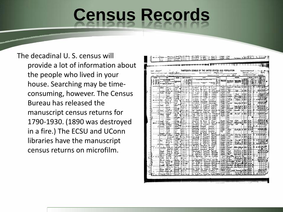
Census Records
The decadinal U. S. census will provide a lot of information about the people who lived in your house. Searching may be time-consuming, however. The Census Bureau has released the manuscript census returns for 1790-1930. (1890 was destroyed in a fire.) The ECSU and UConn libraries have the manuscript census returns on microfilm.
Other Local Sources
Jamie H. Eves, ed., A Builder’s Tale: Lloyd E. Baldwin’s Willimantic in 1850: Sketches of early Residences and Occupants (Willimantic: Windham Textile and History Museum, 2009). On sale at the Museum.
H. F. Dolan, The Willimantic Journal Souvenir Edition (Willimantic, CT: Hall and Bill, 1894).