gnss surveying technologies for the future - gps: the global … · 2012-02-18 · gnss surveying...
TRANSCRIPT

GNSS Surveying Technologies for the FutureGNSS Surveying Technologies for the Future
Knute A. Berstis, P.E.
Senior AdvisorSenior Advisor
National Coordination Office
For Space Based PNT
October 16, 2010
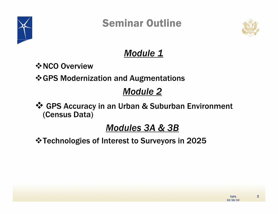
Seminar Outline
Module 1NCO OverviewNCO Overview
GPS Modernization and Augmentations
Module 2Module 2 GPS Accuracy in an Urban & Suburban Environment
(Census Data)
Modules 3A & 3BTechnologies of Interest to Surveyors in 2025
TSPS 10/16/10
2
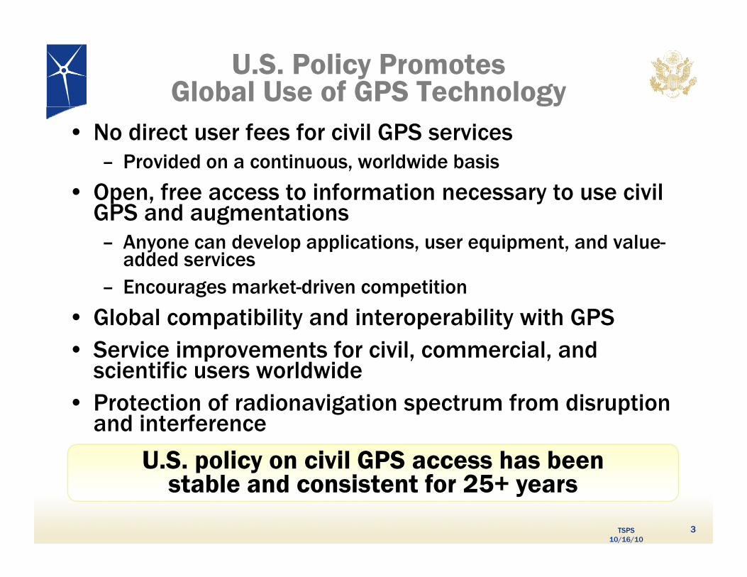
U.S. Policy Promotes Global Use of GPS Technology
• No direct user fees for civil GPS services– Provided on a continuous, worldwide basis
• Open, free access to information necessary to use civil GPS and augmentations– Anyone can develop applications, user equipment, and value-
dd d iy
added services– Encourages market-driven competition
• Global compatibility and interoperability with GPSGlobal compatibility and interoperability with GPS• Service improvements for civil, commercial, and
scientific users worldwideP t ti f di ig ti t f di ti • Protection of radionavigation spectrum from disruption and interference
U.S. policy on civil GPS access has been
TSPS 10/16/10
3
p ystable and consistent for 25+ years
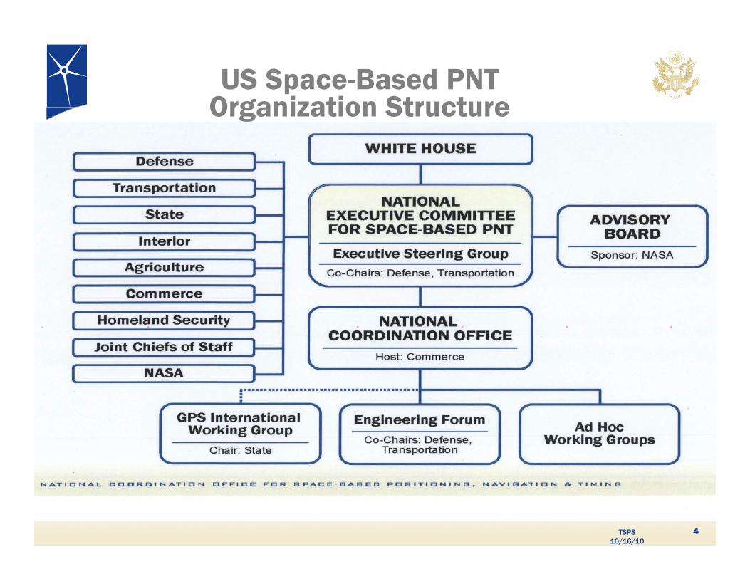
US Space-Based PNTOrganization StructureOrganization Structure
TSPS 10/16/10
44

NCO Staffing in 2010
• Director SES Department of Transportation
• DOT 1 PTE Department of Transportation
• DoD 2 FTE’s Department of Defense
• State 1 FTE Department of State
• DOC 2 PTE’s Department of Commerce
• DHS 1 FTE Department of Homeland SecuritySecurity
• DOI 1 PTE Department of Interior
• USDA 1 PTE Department of Agriculturep g
• NASA 1 PTE National Aeronautics and Space Administration
C t 2 FTE’S O l k & SAIC
TSPS 10/16/10
• Contr. 2 FTE’S Overlook & SAIC
5

NCO Activities
• Track presidential GPS budgets and liaison with congressional staff on legislative issues
• Review policy and provide recommendations
• Coordinate international outreach
• Review government presentations for national and international conferences and meetings
• Provide staffing support for Executive Steering Group (ESG) and EXCOM meetings
P l t d d t Fi Y Pl• Prepare yearly reports and update Five Year Plan
• Take NCO booth to national and international conferences
TSPS 10/16/10
conferences
6
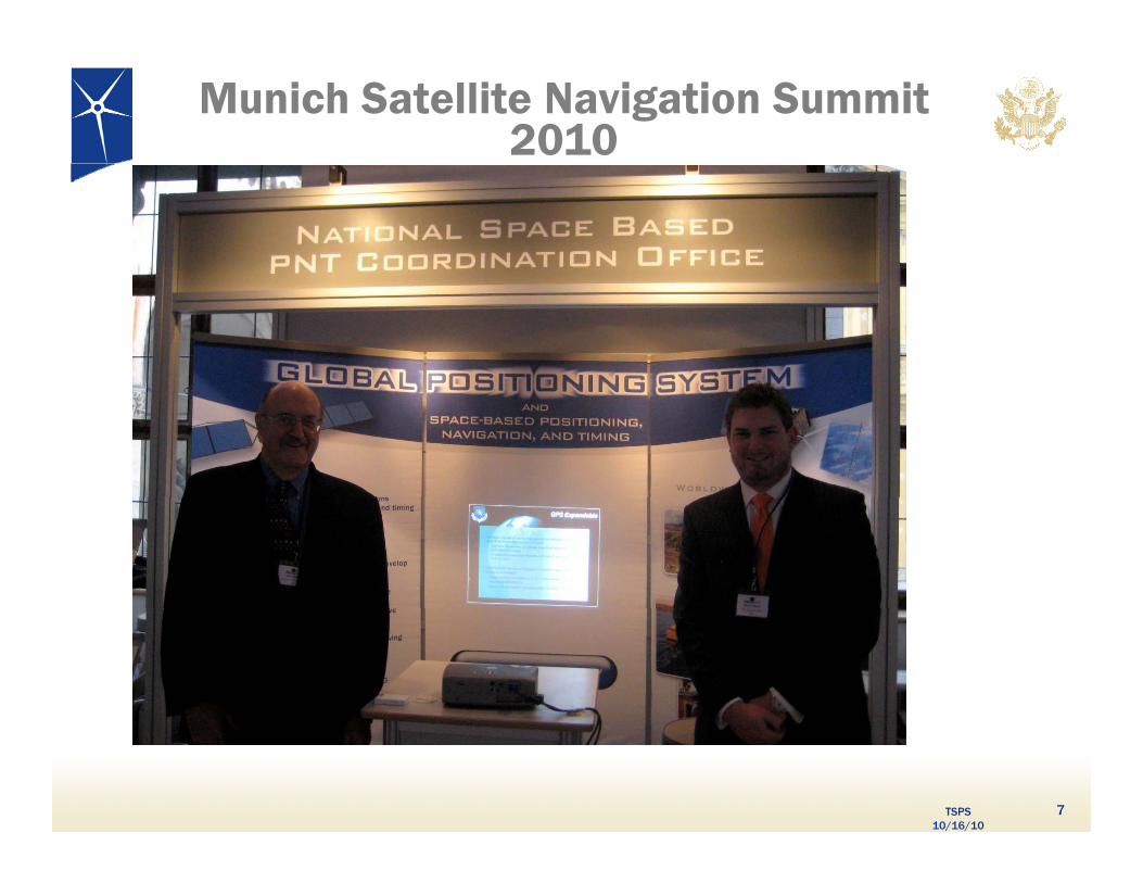
Munich Satellite Navigation Summit 2010
TSPS 10/16/10
7
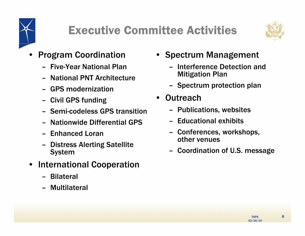
Executive Committee Activities
• Program Coordination– Five-Year National Plan
• Spectrum Management– Interference Detection and
Mitigation Plan– National PNT Architecture
– GPS modernization
– Civil GPS funding
Mitigation Plan
– Spectrum protection plan
• Outreachg
– Semi-codeless GPS transition
– Nationwide Differential GPS
Enhanced Loran
– Publications, websites
– Educational exhibits
– Conferences workshops – Enhanced Loran
– Distress Alerting Satellite System
I t r ti l C r ti
Conferences, workshops, other venues
– Coordination of U.S. message
• International Cooperation– Bilateral
– Multilateral
TSPS 10/16/10
8

GPS stimulates productivity and increases efficiency in our economy
SatelliteOperation
s
SatelliteOperation
sPower GridsPower Grids
Surveying & MappingSurveying & Mapping
Precision AgriculturePrecision Agriculture
G dsG ds
NextGenNextGenTransit
OperationsTransit
OperationsPrecision AgriculturePrecision Agriculture
Disease ControlDisease Control
TeleCommTeleCommIntelliDriveIntelliDrive
Trucking & Shipping
Trucking & ShippingPersonal
NavigationPersonal
Navigation
TSPS 10/16/10
Oil ExplorationOil Exploration Fishing & BoatingFishing & Boating9

Stock ATM
Extent of GPS Dependencies
Substations
Exchanges
Internet Banking
Networks
Energy Plants
Power Grids
Banks/ Nodes
g
GPS Supporting Power Grid Systems GPS Supporting Banking OperationsGPS
Wireless
Rail YardsSwitching Towers
& Signals
Internet
C2 Centers Comms
TSPS 10/16/10
GPS Supporting Transportation Systems
AccessGIS / Map
Air Traffic ControlShip Routing
Relay PositionTo 911 Dispatch
CommsNetworks
GPS Supporting Communications Systems
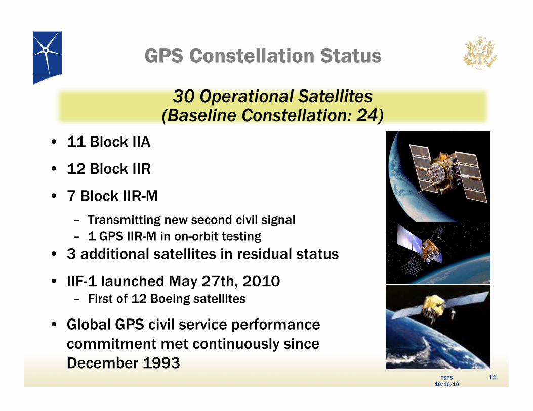
GPS Constellation Status
30 Operational Satellites(Baseline Constellation: 24)
• 11 Block IIA
• 12 Block IIR
• 7 Block IIR-M
– Transmitting new second civil signal1 GPS IIR M i bi i – 1 GPS IIR-M in on-orbit testing
• 3 additional satellites in residual status
• IIF-1 launched May 27th 2010IIF 1 launched May 27th, 2010– First of 12 Boeing satellites
• Global GPS civil service performance
TSPS 10/16/10
commitment met continuously since December 1993
11
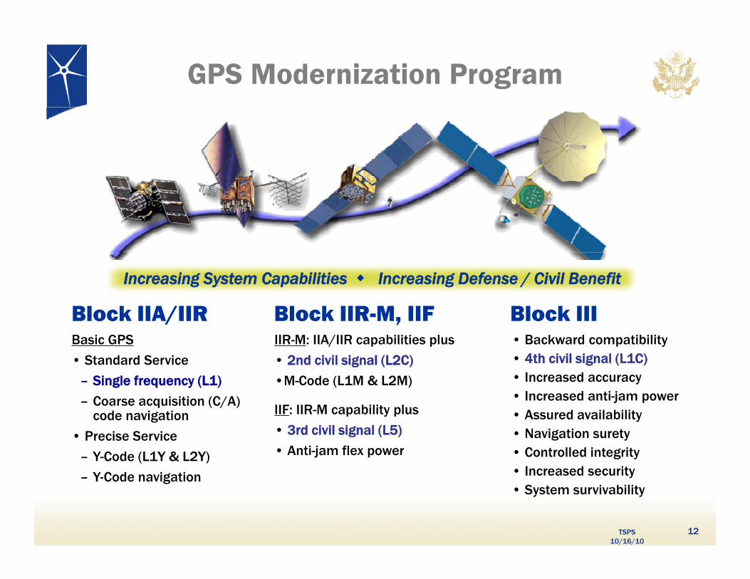
GPS Modernization Program
Block IIA/IIR Block IIIBlock IIR-M, IIF
Increasing System Capabilities Increasing Defense / Civil Benefit
• Backward compatibility• 4th civil signal (L1C)• Increased accuracy• Increased anti-jam power
IIR-M: IIA/IIR capabilities plus
• 2nd civil signal (L2C)
•M-Code (L1M & L2M)
Basic GPS
• Standard Service
– Single frequency (L1)
Coarse acquisition (C/A) Increased anti jam power• Assured availability• Navigation surety• Controlled integrity• Increased security
IIF: IIR-M capability plus
• 3rd civil signal (L5)
• Anti-jam flex power
– Coarse acquisition (C/A) code navigation
• Precise Service
– Y-Code (L1Y & L2Y)
Y C d i i
TSPS 10/16/10
• Increased security• System survivability
– Y-Code navigation
12
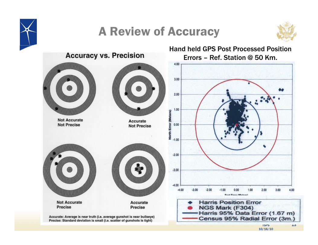
A Review of AccuracyHand held GPS Post Processed Position
Errors – Ref. Station @ 50 Km.
TSPS 10/16/10
13
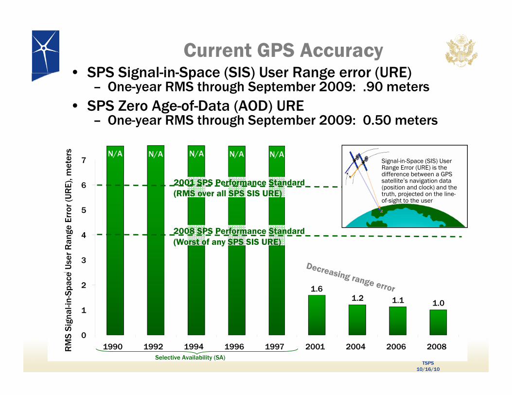
Current GPS Accuracy• SPS Signal-in-Space (SIS) User Range error (URE)• SPS Signal-in-Space (SIS) User Range error (URE)
– One-year RMS through September 2009: .90 meters• SPS Zero Age-of-Data (AOD) URE
– One-year RMS through September 2009: 0.50 metersOne year RMS through September 2009: 0.50 meters
N/A7
met
ers N/A N/A N/AN/A
Signal-in-Space (SIS) User Range Error (URE) is the diff b t GPS
5
6
m) Erro
r (U
RE)
, m 2001 SPS Performance Standard(RMS over all SPS SIS URE)
difference between a GPS satellite’s navigation data (position and clock) and the truth, projected on the line-of-sight to the user
3
4
MS
SIS
UR
E (m
e U
ser
Ran
ge
2008 SPS Performance Standard(Worst of any SPS SIS URE)
1.61.2 1.1 1.0
1
2
RM
gnal
-in-S
pace
TSPS 10/16/10
01990 1992 1994 1996 1997 2001 2004 2006 2008R
MS
Sig
Selective Availability (SA)
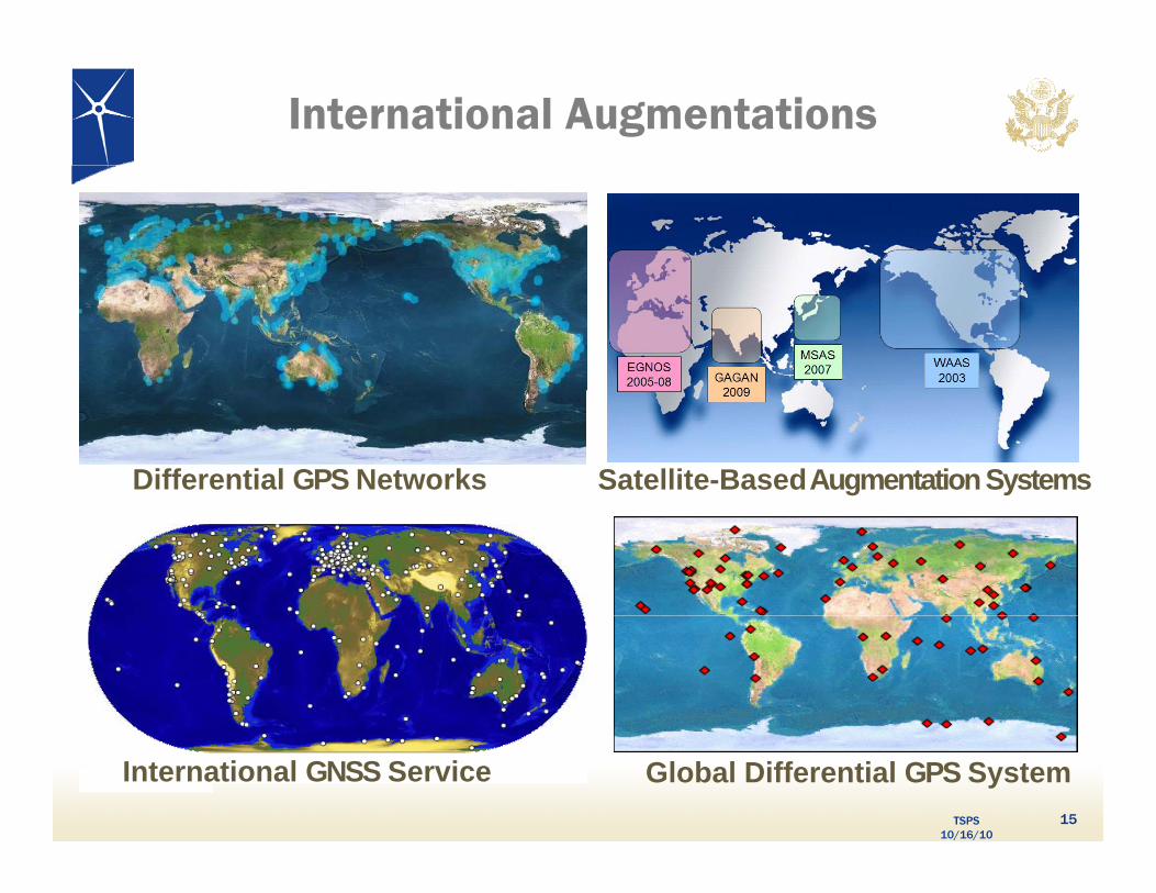
International Augmentations
Differential GPS Networks Satellite-Based Augmentation Systems
TSPS 10/16/10
15
International GNSS Service Global Differential GPS System
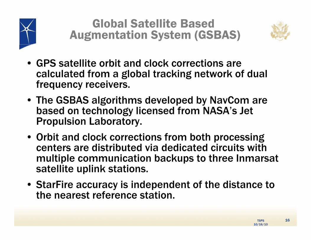
Global Satellite BasedAugmentation System (GSBAS)
• GPS satellite orbit and clock corrections are calculated from a global tracking network of dual calculated from a global tracking network of dual frequency receivers.
• The GSBAS algorithms developed by NavCom are g p ybased on technology licensed from NASA’s Jet Propulsion Laboratory.
Orbit and clock corrections from both processing • Orbit and clock corrections from both processing centers are distributed via dedicated circuits with multiple communication backups to three Inmarsat
t llit li k t tisatellite uplink stations.
• StarFire accuracy is independent of the distance to the nearest reference station
TSPS 10/16/10
the nearest reference station.
16
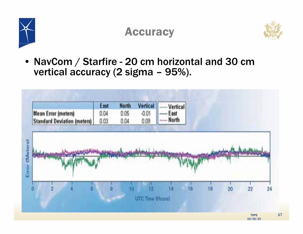
Accuracy
• NavCom / Starfire - 20 cm horizontal and 30 cm vertical accuracy (2 sigma – 95%)vertical accuracy (2 sigma – 95%).
TSPS 10/16/10
17
Canada-wide DGPS Service• GNSS augmentation initiated as a free public
service since October 2003 (CDGPS)
• North American footprint extends from Mexico • North American footprint extends from Mexico to 15 degrees north of the Arctic Circle
• The satellite provider broadcasting the The satellite provider broadcasting the CDGPS L-band signal will upgrade to next-generation satellites this year.
Thi d ld i i ifi • This upgrade would require a significant infrastructure investment to migrate to the new communications satellite
• As similar commercial services are available, Canada has decided to decommission CDGPS by 03/31/2011
TSPS 10/16/10
by 03/31/2011.
18
SVN-49 Issues
SVN-49 unlike other GPS IIR Satellites had L5 R&D Demonstration Payload Demo payload made use of
Auxiliary Payload portAuxiliary Payload port
• No impact on L1 and L2 signals was intended or expectedNo impact on L1 and L2 signals was intended or expected
• “Out of family” elevation angle dependent Pseudo Range Residuals (PRR) seen at monitor stations and by other GPS users world-wideusers world-wide
– Root cause studied and established Signals reflecting off L5 filter and transmitted through satellite antenna
– Installation method is unique to this satellite –other GPS satellites will not be affected
– SVN-49 signal is not compliant with IS-GPS-200 for the
TSPS 10/16/10
SVN 49 signal is not compliant with IS GPS 200 for the spurious transmission specification, but does meet all other specifications and requirements
19
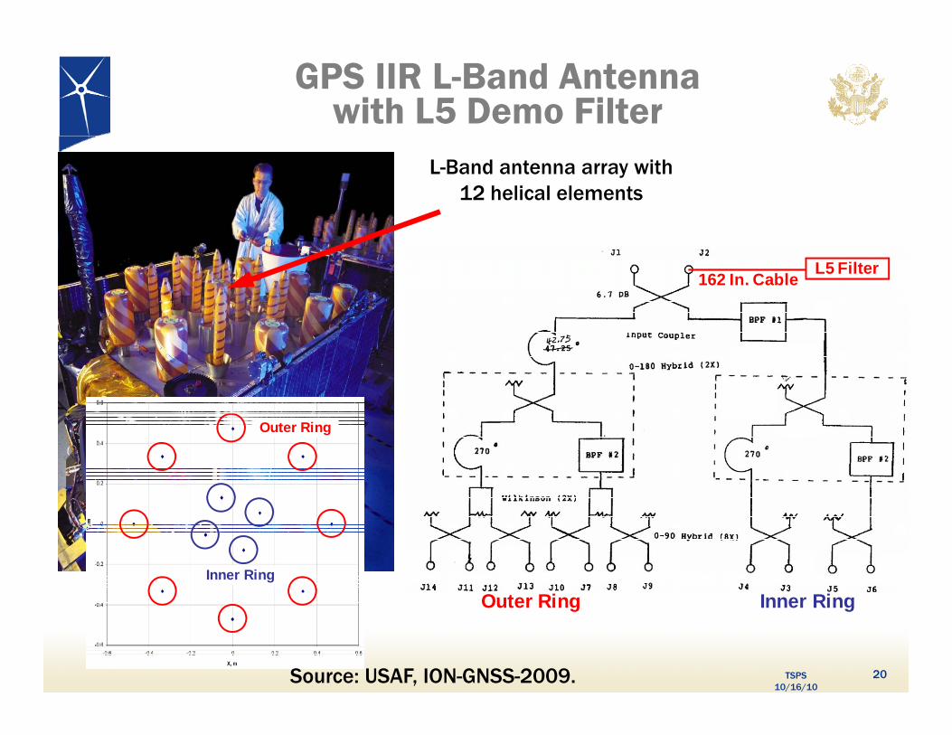
GPS IIR L-Band Antennawith L5 Demo Filter
L-Band antenna array with 12 helical elements
L5 Filter162 In. Cable
Outer Ring
Inner Ring
Outer Ring Inner Ring
TSPS 10/16/10
Outer Ring Inner Ring
Source: USAF, ION-GNSS-2009. 20
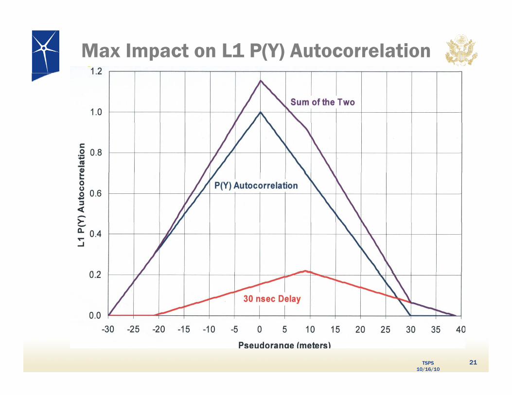
Max Impact on L1 P(Y) Autocorrelation
TSPS 10/16/10
21
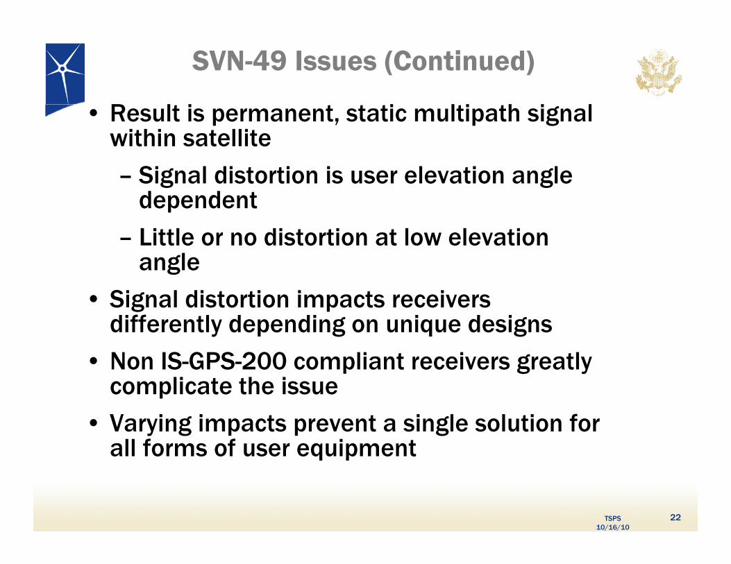
SVN-49 Issues (Continued)
R l i i l i h i l • Result is permanent, static multipath signal within satellite
Signal distortion is user elevation angle – Signal distortion is user elevation angle dependent
– Little or no distortion at low elevation angle
• Signal distortion impacts receivers diff tl d di g i d igdifferently depending on unique designs
• Non IS-GPS-200 compliant receivers greatly complicate the issuecomplicate the issue
• Varying impacts prevent a single solution for all forms of user equipment
TSPS 10/16/10
q p
22
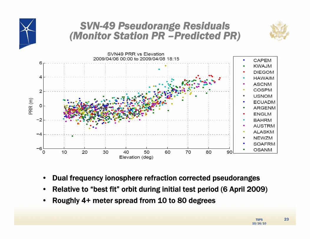
SVN-49 Pseudorange Residuals(Monitor Station PR –Predicted PR)
• Dual frequency ionosphere refraction corrected pseudoranges
• Relative to “best fit” orbit during initial test period (6 April 2009)
TSPS 10/16/10
• Roughly 4+ meter spread from 10 to 80 degrees
23
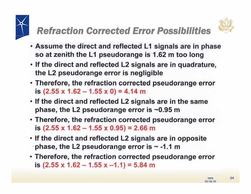
Refraction Corrected Error Possibilities
TSPS 10/16/10
24
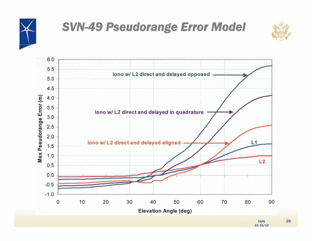
SVN-49 Pseudorange Error Model
TSPS 10/16/10
25
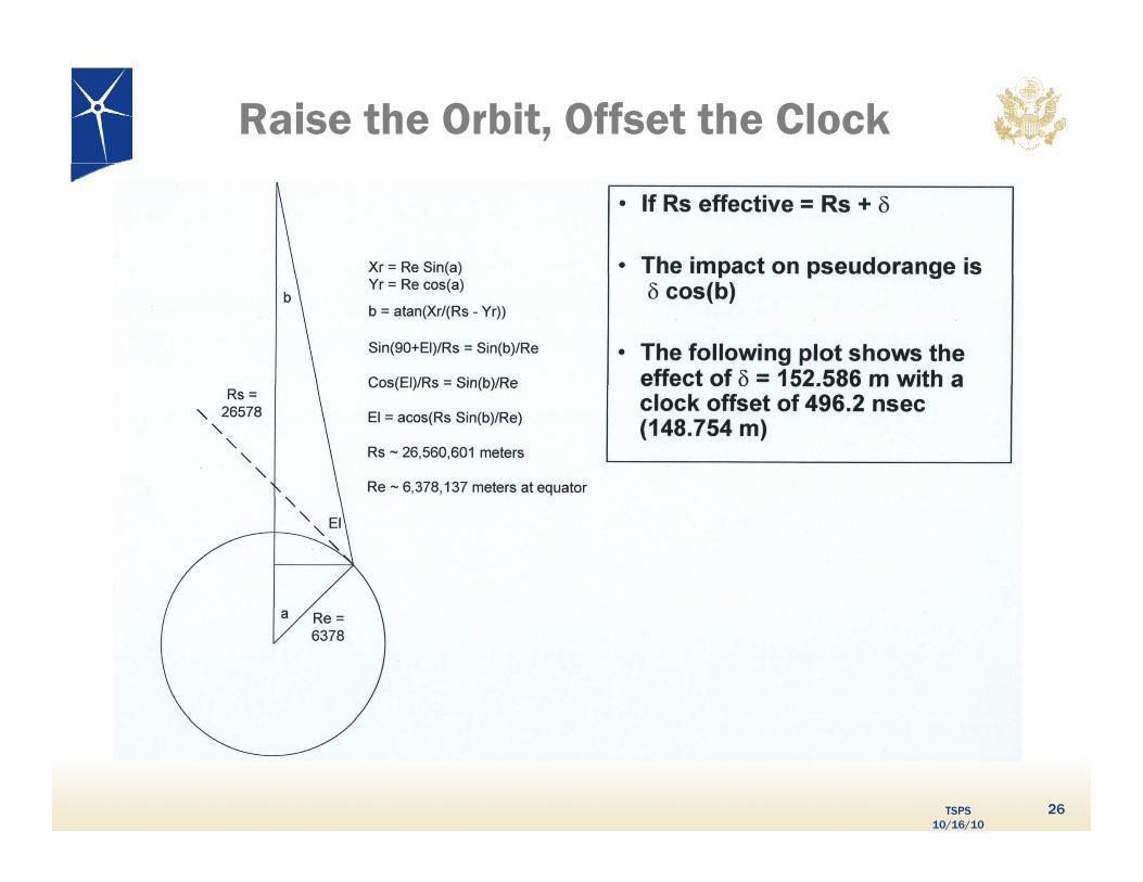
Raise the Orbit, Offset the Clock
TSPS 10/16/10
26

A Partial Fix
TSPS 10/16/10
27
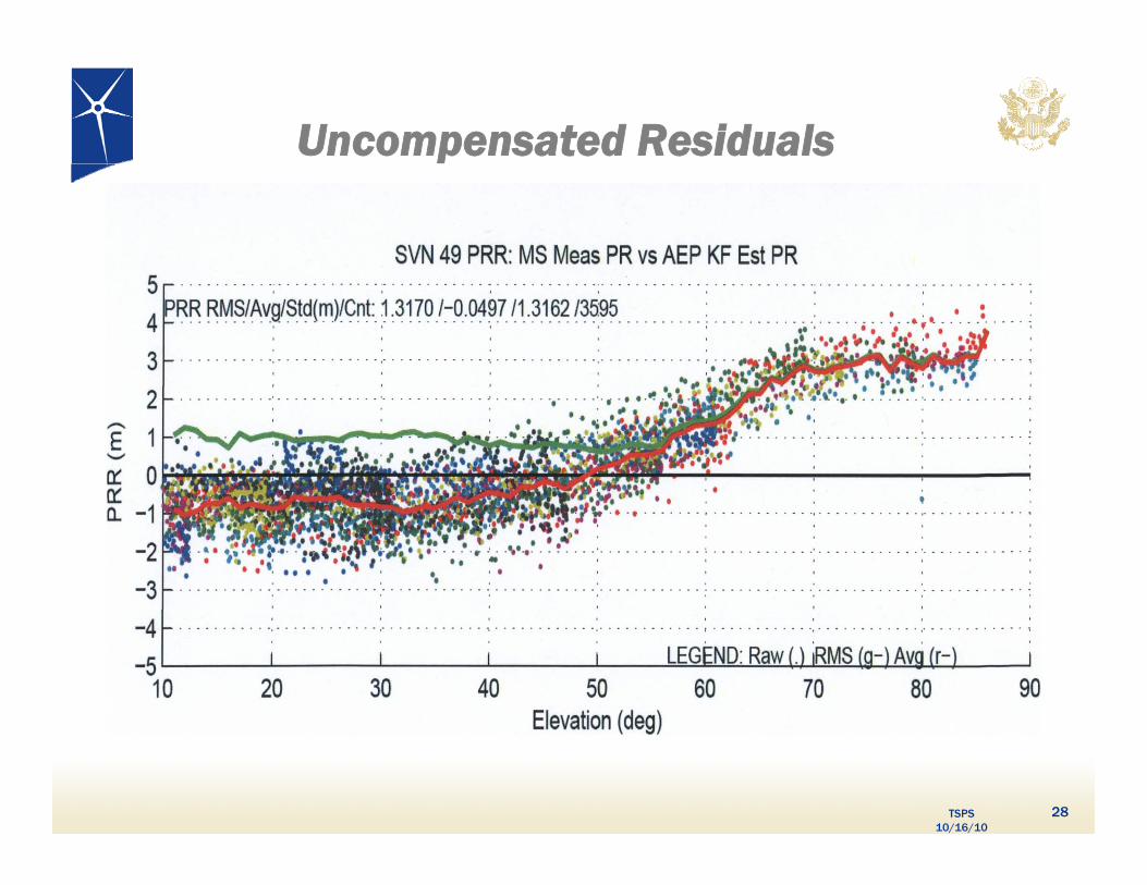
Uncompensated Residuals
TSPS 10/16/10
28
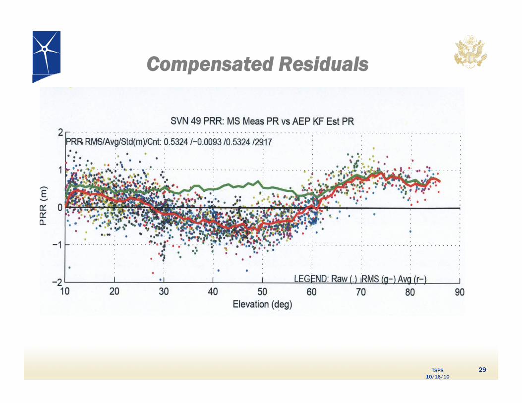
Compensated Residuals
TSPS 10/16/10
29
SVN-49 Optional Mitigations
• Set healthy with current 152m Antenna Phase Center (APC) and associated clock offsetsand associated clock offsets
• Set healthy with factory Antenna Phase Center (APC) offset
Users switch to multipath-resistant receivers p
Modify receiver software to use look-up table corrections
• Increase URA index to a minimum value of ‘3’
• Remove data modulation from L2 P(Y)-code
• Change L2C PRN code to a “unique sequence”
• Change SVN-49 from PRN-01 to PRN-32
• Use spare health code so future users could use SVN 49 despite unhealthy setting
TSPS 10/16/10
p y g
30
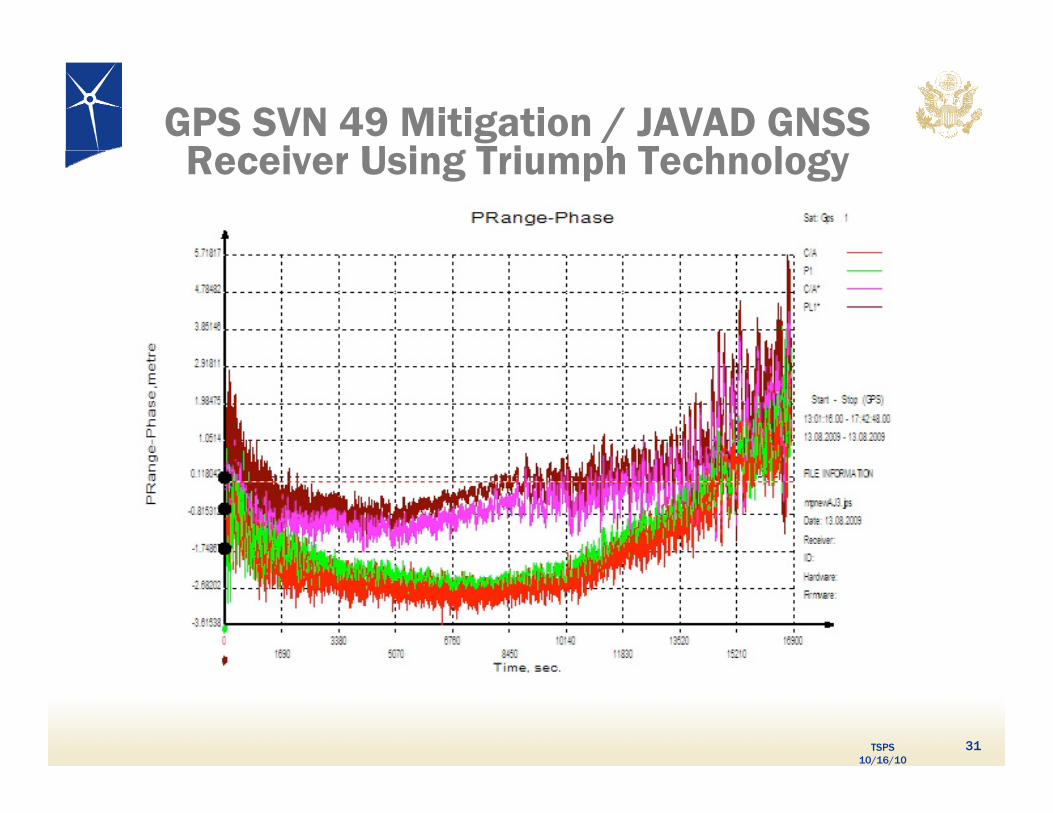
GPS SVN 49 Mitigation / JAVAD GNSS R i U i g T i h T h l gReceiver Using Triumph Technology
TSPS 10/16/10
31