global & national geodesy, gnss surveying & cors infrastructure · 2011-06-06 · global...
TRANSCRIPT
FIG Working Week 2011Bridging the Gap between CulturesMarrakech, Morocco, 18-22 May 2011 1
Global & National Geodesy, GNSS Surveying & CORS
Infrastructure
Chris RizosSchool of Surveying & Spatial Information SystemsUniversity of New South Wales, Sydney, Australia
President-elect, International Association of Geodesy (IAG)Member, Governing Board of International GNSS Service (IGS)
FIG Working Week, Marrakech, Morocco18-22 May 2011
FIG Working Week, Marrakech, Morocco, 18-22 May 2011
• Geodesy is the foundation for the representation of horizontal & vertical position (& its variation) in global or national reference frames, primarily to support societal needs of Spatial Data Infrastructure (mapping, etc.)… tasks often referred to as Operational Geodesy.
• Geodesy is also a fundamental Geoscience that uses a wide range of earth observation & space technologies (deployed across different platforms… satellite, aerial, vehicle, terrestrial) that contribute to our understanding of the “System Earth”, and in particular its dynamics and geometry/ gravity interactions.
The Dual Nature of Geodesy…
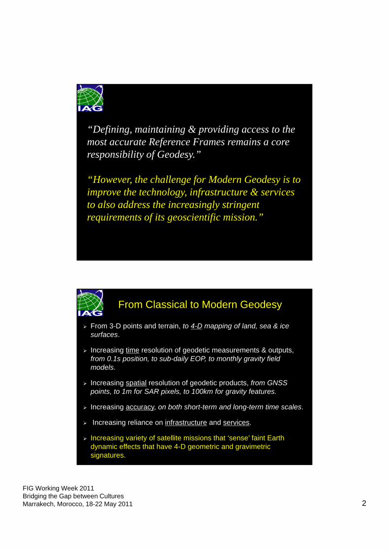
FIG Working Week 2011Bridging the Gap between CulturesMarrakech, Morocco, 18-22 May 2011 2
“Defining, maintaining & providing access to the most accurate Reference Frames remains a core responsibility of Geodesy.”
“However, the challenge for Modern Geodesy is to improve the technology, infrastructure & services to also address the increasingly stringent requirements of its geoscientific mission.”
From 3-D points and terrain, to 4-D mapping of land, sea & ice surfaces.
Increasing time resolution of geodetic measurements & outputs, from 0.1s position, to sub-daily EOP, to monthly gravity field models.
Increasing spatial resolution of geodetic products, from GNSS points, to 1m for SAR pixels, to 100km for gravity features.
Increasing accuracy, on both short-term and long-term time scales.
Increasing reliance on infrastructure and services.
Increasing variety of satellite missions that ‘sense’ faint Earth dynamic effects that have 4-D geometric and gravimetric signatures.
From Classical to Modern Geodesy
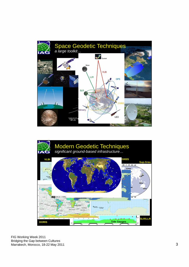
FIG Working Week 2011Bridging the Gap between CulturesMarrakech, Morocco, 18-22 May 2011 3
Space Geodetic Techniques a large toolkit…
VLBI
Tide GaugesSLR/LLR
GNSS
DORIS
Sup.Grav.
Abs.Grav.
significant ground-based infrastructure…Modern Geodetic Techniques
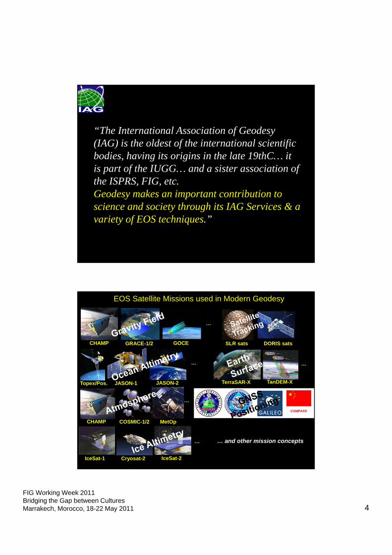
FIG Working Week 2011Bridging the Gap between CulturesMarrakech, Morocco, 18-22 May 2011 4
“The International Association of Geodesy (IAG) is the oldest of the international scientific bodies, having its origins in the late 19thC… it is part of the IUGG… and a sister association of the ISPRS, FIG, etc. Geodesy makes an important contribution to science and society through its IAG Services & a variety of EOS techniques.”
COMPASS
EOS Satellite Missions used in Modern Geodesy
CHAMP GRACE-1/2 GOCE
COSMIC-1/2
TerraSAR-XJASON-1 TanDEM-X
…
Topex/Pos. JASON-2
CHAMP
…
…
MetOp
IceSat-2IceSat-1 Cryosat-2
…
…
… and other mission concepts
SLR sats DORIS sats
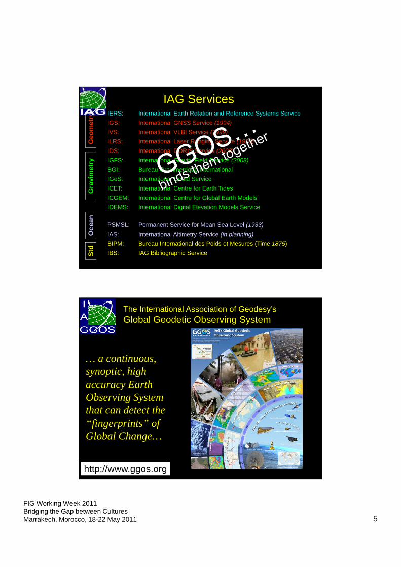
FIG Working Week 2011Bridging the Gap between CulturesMarrakech, Morocco, 18-22 May 2011 5
IAG ServicesIERS: International Earth Rotation and Reference Systems Service
IGS: International GNSS Service (1994)
IVS: International VLBI Service (1999)
ILRS: International Laser Ranging Service (1998)
IDS: International DORIS Service (2003)
IGFS: International Gravity Field Service (2008)
BGI: Bureau Gravimetrique International
IGeS: International Geoid Service
ICET: International Centre for Earth Tides
ICGEM: International Centre for Global Earth Models
IDEMS: International Digital Elevation Models Service
PSMSL: Permanent Service for Mean Sea Level (1933)
IAS: International Altimetry Service (in planning)
BIPM: Bureau International des Poids et Mesures (Time 1875)
IBS: IAG Bibliographic Service
Geo
met
ryG
ravi
met
ryO
cean
Std
The International Association of Geodesy’sGlobal Geodetic Observing System
http://www.ggos.org
… a continuous, synoptic, high accuracy Earth Observing System that can detect the “fingerprints” of Global Change…
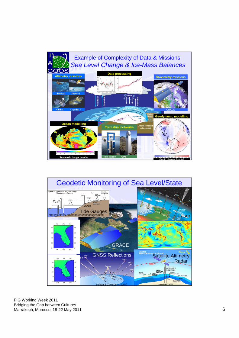
FIG Working Week 2011Bridging the Gap between CulturesMarrakech, Morocco, 18-22 May 2011 6
Example of Complexity of Data & Missions: Sea Level Change & Ice-Mass Balances
Glacial-isostaticadjustment
Altimetry missions
Envisat Jason-1
ICESat CryoSat II
Gravimetry missions
GRACE
Terrestrial networks
Tide gauge GPS
Ocean modelling
Sea-level change (mm/a)
Data processing
Geodynamic modelling
Geoid change (mm/a)
Geodetic Monitoring of Sea Level/State
http://sealevel.colorado.edu/tidegauges.htmlTide Gauges
GRACE
Laser
Radar Satellite Altimetry GNSS Reflections
Zufada & Zavorotny (2004)
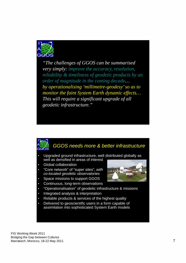
FIG Working Week 2011Bridging the Gap between CulturesMarrakech, Morocco, 18-22 May 2011 7
“The challenges of GGOS can be summarised very simply: improve the accuracy, resolution, reliability & timeliness of geodetic products by an order of magnitude in the coming decade… by operationalising ‘millimetre-geodesy’ so as to monitor the faint System Earth dynamic effects…This will require a significant upgrade of all geodetic infrastructure.”
• Upgraded ground infrastructure, well distributed globally as well as densified in areas of interest
• Global collaboration• “Core network” of “super sites”, with
co-located geodetic observatories• Space missions to support GGOS• Continuous, long-term observations• “Operationalisation” of geodetic infrastructure & missions• Integrated analysis & interpretation • Reliable products & services of the highest quality• Delivered to geoscientific users in a form capable of
assimilation into sophisticated System Earth models
GGOS needs more & better infrastructure
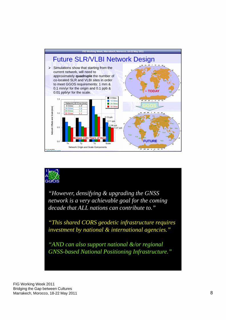
FIG Working Week 2011Bridging the Gap between CulturesMarrakech, Morocco, 18-22 May 2011 8
FIG Working Week, Marrakech, Morocco, 18-22 May 2011
Future SLR/VLBI Network Design Simulations show that starting from the
current network, will need to approximately quadruple the number of co-located SLR and VLBI sites in order to meet GGOS requirements: 1 mm & 0.1 mm/yr for the origin and 0.1 ppb & 0.01 ppb/yr for the scale. ~ TODAY
FUTURE
GGOS
“However, densifying & upgrading the GNSS network is a very achievable goal for the coming decade that ALL nations can contribute to.”
“This shared CORS geodetic infrastructure requires investment by national & international agencies.”
“AND can also support national &/or regional GNSS-based National Positioning Infrastructure.”
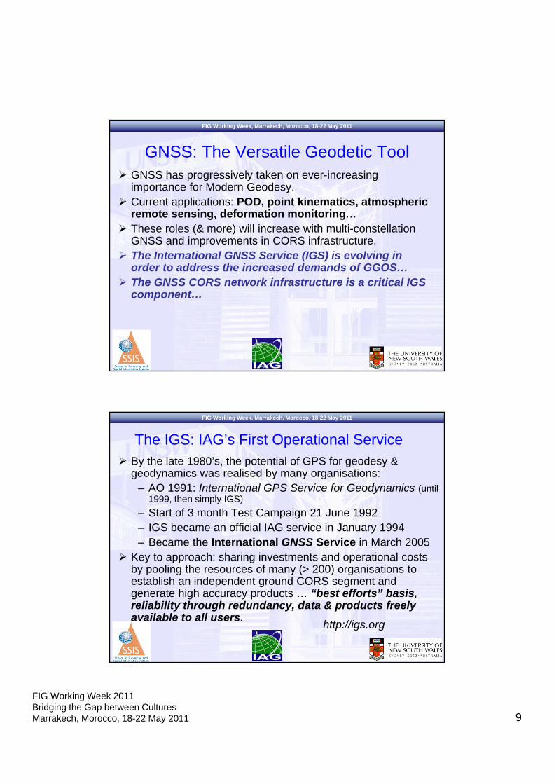
FIG Working Week 2011Bridging the Gap between CulturesMarrakech, Morocco, 18-22 May 2011 9
FIG Working Week, Marrakech, Morocco, 18-22 May 2011
GNSS has progressively taken on ever-increasing importance for Modern Geodesy.
Current applications: POD, point kinematics, atmospheric remote sensing, deformation monitoring…
These roles (& more) will increase with multi-constellation GNSS and improvements in CORS infrastructure.
The International GNSS Service (IGS) is evolving in order to address the increased demands of GGOS…
The GNSS CORS network infrastructure is a critical IGS component…
GNSS: The Versatile Geodetic Tool
FIG Working Week, Marrakech, Morocco, 18-22 May 2011
By the late 1980’s, the potential of GPS for geodesy & geodynamics was realised by many organisations:
– AO 1991: International GPS Service for Geodynamics (until 1999, then simply IGS)
– Start of 3 month Test Campaign 21 June 1992– IGS became an official IAG service in January 1994– Became the International GNSS Service in March 2005
Key to approach: sharing investments and operational costs by pooling the resources of many (> 200) organisations to establish an independent ground CORS segment and generate high accuracy products … “best efforts” basis, reliability through redundancy, data & products freely available to all users.
The IGS: IAG’s First Operational Service
http://igs.org
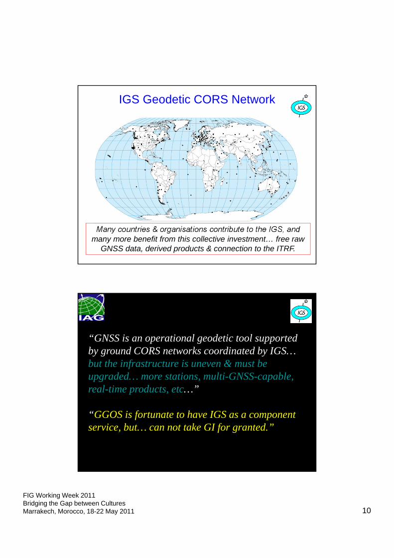
FIG Working Week 2011Bridging the Gap between CulturesMarrakech, Morocco, 18-22 May 2011 10
IGS Geodetic CORS Network
Many countries & organisations contribute to the IGS, and many more benefit from this collective investment… free raw
GNSS data, derived products & connection to the ITRF.
“GNSS is an operational geodetic tool supported by ground CORS networks coordinated by IGS… but the infrastructure is uneven & must be upgraded… more stations, multi-GNSS-capable, real-time products, etc…”
“GGOS is fortunate to have IGS as a component service, but… can not take GI for granted.”
FIG Working Week 2011Bridging the Gap between CulturesMarrakech, Morocco, 18-22 May 2011 11
IGS and Regional CORS
IGS network relies heavily on regional scientific and national reference frame networks.
Regional reference frame activities help to fill in gaps in global network coverage of stations that can be used in the generation of IGS products.
NOAA/CORSPBOSCIGN
EPN/EUPOS
SIRGAS
AFREFCMONOC
APREF
ARGN
CSRS
PositioNZNZGeonet
GEONET
The Value of Geodesy & GNSS to Society
Fundamental geoscience… solid earth geophysics, atmospheric, cryospheric & oceanographic processes, hydrology.
Global Change studies… climate change (causes & effects), water cycle & mass transport changes, sea level rise, mesoscale circulation, GIA, polar studies… long-term monitoring.
Geohazard research… seismic, volcanic, landslip, storms, sea state, flooding, tsunami, space weather… early warning systems.
Geodetic reference frames… ITRF, national datums/SDI, gravity, timing.
Engineering… RT precise positioning/navigation, atmospheric sounding, geo-referencing platforms (satellite & ground-based, POD), operational geodesy, radar & laser imaging, engineering geodesy.
Disaster management & decision-making… imaging & positioning satellites.
FIG Working Week 2011Bridging the Gap between CulturesMarrakech, Morocco, 18-22 May 2011 12
FIG Working Week, Marrakech, Morocco, 18-22 May 2011
Concluding Remarks (1)… Modern Geodesy is an EO science that uses sophisticated
geodetic infrastructure for studying “the System Earth”.
Improved accuracy, resolution, & reliability of future geodetic “products” will support the geosciences…through GGOS.
All GI must be upgraded to meet the requirements of geodesy’s (GGOS’s) more challenging role.
GI includes space missions (space agencies), ground infrastructure (national geodetic agencies), and collaborative frameworks (international & regional institutions, e.g. IAG, FIG).
GNSS is a versatile precise positioning tool…hence it forms both core GI and National Positioning Infrastructure.
FIG Working Week, Marrakech, Morocco, 18-22 May 2011
Concluding Remarks (2)… Need to determine balance of GNSS geodesy (Tier 1/2) and
GNSS surveying (Tier 3) CORS.
Need increased national & regional cooperation…esp. provision of GNSS CORS data to IGS (and others).
Leadership is needed to ensure the future multi-GNSS signals, real-time services, and CORS networks, continue to address core needs of GI and NPIs…at international & national levels.
The IGS will soon launch multi-GNSS “pilot project”, and real-time IGS services.
The IAG seeks to work closely with sister associations such as the FIG…to realise the GGOS goals, and to deliver Services that support NPIs.
FIG Working Week 2011Bridging the Gap between CulturesMarrakech, Morocco, 18-22 May 2011 13
FIG Working Week, Marrakech, Morocco, 18-22 May 2011
For further information & to register your interest visit:
www.iugg2011.com
Thank You!