geomatic - geomatics concept
TRANSCRIPT
7/23/2019 GEOMATIC - Geomatics Concept
http://slidepdf.com/reader/full/geomatic-geomatics-concept 1/50
1
www.uthm.edu.my
With Wisdom, We Explore
GEOMATIC CONCEPTS
Sr. Dr. Mustafa Bin Anjang AhmadB.Surv (UTM, Malaysia) Msc (UTM, Malaysia), Dr.E!, ( Sa!a Uiv., "apa)
(Geomati Di!ision"#au$t% o& Ci!i$ ' En!ironmenta$ Engineering
)ni!ersiti Tun *ussein Onn Ma$a%sia +,- Batu Pahat /ohor MA0A1SIA.
Phone 2 3,4-5,--67 3,6456+849,7 #a: 23,4-584,
E;mai$ 2 musta&a<uthm.edu.m%
=e>2 htt?2@@.&ass.uthm.edu.m%@
7/23/2019 GEOMATIC - Geomatics Concept
http://slidepdf.com/reader/full/geomatic-geomatics-concept 2/50
2
www.uthm.edu.my
With Wisdom, We Explore
Denition
• Geomatics engineering is rapidlydeveloping discipline that focuses on
spatial information (i.e. information thathas a location).
• Geomatics engineers apply engineeringprinciples to spatial & implement relational
data structures involving measurementsciences, thus using GEOMATICS andacting as spatial information engineers.
7/23/2019 GEOMATIC - Geomatics Concept
http://slidepdf.com/reader/full/geomatic-geomatics-concept 3/50
3
www.uthm.edu.my
With Wisdom, We Explore
GEOMATICS ;;;;
S)FE1ING • Geomatics is a new term incorporating the
older eld of S)FE1ING along with manyothers aspects of spatial data management.
– Following the advanced developments in digitaldata processing,
– nformation with a spatial position associated
with it !ecomes more critical to decision"ma#ing,
– $oth from a personal and a !usiness perspective,– %lso from a community and a large"scale
governmental viewpoint.
7/23/2019 GEOMATIC - Geomatics Concept
http://slidepdf.com/reader/full/geomatic-geomatics-concept 4/50
4
www.uthm.edu.my
With Wisdom, We Explore
• herefore, the geomatics engineers can!e involved in an e'tremely wide
variety of information gatheringactivities and applications.
• Geomatics engineers design, develop,and operate systems for collecting andanalying spatial information a!out theland, the oceans, natural resources, andmanmade features.
GEOMATICS ;;;;
S)FE1ING
7/23/2019 GEOMATIC - Geomatics Concept
http://slidepdf.com/reader/full/geomatic-geomatics-concept 5/50
5
www.uthm.edu.my
With Wisdom, We Explore
• Geomatics engineering applicationsinclude integrating science andtechnology from !oth new and traditionaldisciplines– Geodesy, also called geodetic science,
– *artography, computer & digital mapping,
– +emote sensing, photogrammetry,
– ydrography,
– -urveying,
– G- (Geographic nformation -ystems), and
– G- (Glo!al ositioning -ystems)
GEOMATICS ;;;;
S)FE1ING
7/23/2019 GEOMATIC - Geomatics Concept
http://slidepdf.com/reader/full/geomatic-geomatics-concept 6/50
6
www.uthm.edu.my
With Wisdom, We Explore
Denition o&Geomati
• Geomatics is an Hum>re$$a term fora cluster of activities and technologiesdealing with the locations andidentities of earth features.
• HGeo represent Hgeogra?h% " the
art and science of developing andinterpreting graphical representationsof the earth.
7/23/2019 GEOMATIC - Geomatics Concept
http://slidepdf.com/reader/full/geomatic-geomatics-concept 7/507
www.uthm.edu.my
With Wisdom, We Explore
• Hmati is drawn from either
Hmathemati or Hin&ormation,indicating that geomatic employs amethodical and technical approachto developing information a!out
earth features.
Denition o&Geomati
7/23/2019 GEOMATIC - Geomatics Concept
http://slidepdf.com/reader/full/geomatic-geomatics-concept 8/508
www.uthm.edu.my
With Wisdom, We Explore
• Geomati measurement can !edened as
“The science and art of making allessential measurements in space todetermine the relative positions and points or physical detail above, on, or
beneath the earth’s surface and todepict them in usable form, or to establishthe position of points or details”.
Denition o&Geomati
7/23/2019 GEOMATIC - Geomatics Concept
http://slidepdf.com/reader/full/geomatic-geomatics-concept 9/50
9
www.uthm.edu.my
With Wisdom, We Explore
AFEAS IN GEOMATIC
Mohd Efendi Daud (Dr. S"B.Surv (UTM, Malaysia) Msc (UTM, Malaysia), Dr.Sc, (#a!oya Uiv.,
"apa)
(Geomati Di!ision"
#au$t% o& Ci!i$ ' En!ironmenta$ Engineering)ni!ersiti Tun *ussein Onn Ma$a%sia +,- Batu Pahat
/ohor MA0A1SIA.Phone 2 3,4-5848,87 3,6J4+584-7 #a: 2
3,4-584,E;mai$ 2 efendi<uthm.edu.m%
=e>2 htt?2@@.&ass.uthm.edu.m%@
7/23/2019 GEOMATIC - Geomatics Concept
http://slidepdf.com/reader/full/geomatic-geomatics-concept 10/50
10
www.uthm.edu.my
With Wisdom, We Explore
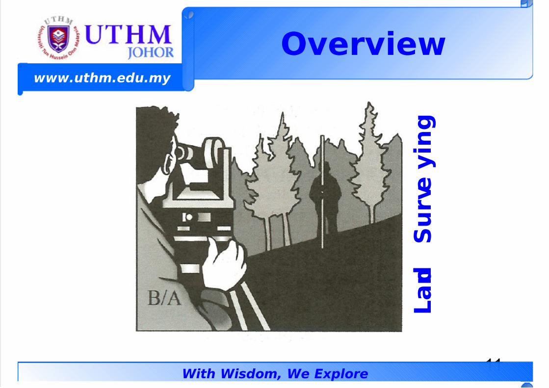
• 0and Sur!e%ing– s a traditional name applied to
measuring features directly in the eld
with tools such theodolites, tapes,electronic meters, levels, and level sta/.
– % common use of surveying today is tomap site in advance of a design for a
facility to !e constructed.– 0ther applications are for locating land
!oundaries and setting sta#es to guideconstruction.
O!er!ie
7/23/2019 GEOMATIC - Geomatics Concept
http://slidepdf.com/reader/full/geomatic-geomatics-concept 11/50
11
www.uthm.edu.my
With Wisdom, We Explore
O!er!ie
0 a n d
S u r ! e
% i n g
7/23/2019 GEOMATIC - Geomatics Concept
http://slidepdf.com/reader/full/geomatic-geomatics-concept 12/50
12
www.uthm.edu.my
With Wisdom, We Explore
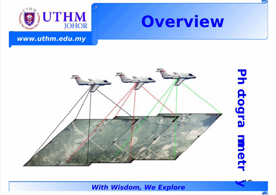
• Photogrammetr%
– s the science of measuring from photos
as opposed to direct eldmeasurements. 1ost photogrammetry isdone with aerial photos ta#en from anairplane with a precise mapping camera.
– 1ost topographic maps are made !yphotogrammetry today.
O!er!ie
7/23/2019 GEOMATIC - Geomatics Concept
http://slidepdf.com/reader/full/geomatic-geomatics-concept 13/50
13
www.uthm.edu.my
With Wisdom, We Explore
O!er!ie
Photog
ra
mmetr
%
7/23/2019 GEOMATIC - Geomatics Concept
http://slidepdf.com/reader/full/geomatic-geomatics-concept 14/50
14
www.uthm.edu.my
With Wisdom, We Explore
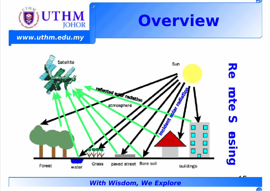
• Femote Sensing– s a general term a!out gathering
information a!out an o!2ect from a far"removed sensor.– n common usage, the term remote
sensing applies to the ac3uisition andanalysis of satellite imagery.
– 1apping satellite or!it the earth andsense the surface with a scanner,sending the sensed images to earth forfurther analysis.
O!er!ie
7/23/2019 GEOMATIC - Geomatics Concept
http://slidepdf.com/reader/full/geomatic-geomatics-concept 15/50
15
www.uthm.edu.my
With Wisdom, We Explore
O!er!ie
Fe
m oteS
ens
ing
7/23/2019 GEOMATIC - Geomatics Concept
http://slidepdf.com/reader/full/geomatic-geomatics-concept 16/50
16
www.uthm.edu.my
With Wisdom, We Explore
• Geodes%
– s the term applied to the study of
earth4s sie and shape. t is a highlymathematical and scientic study of theearth4s gravity eld along with methodsof positioning the latitude and longitude
of points.
O!er!ie
7/23/2019 GEOMATIC - Geomatics Concept
http://slidepdf.com/reader/full/geomatic-geomatics-concept 17/50
17
www.uthm.edu.my
With Wisdom, We Explore
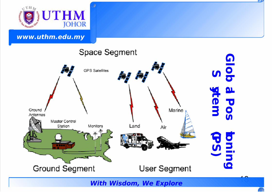
• The G$o>a$ Positioning S%stem(GPS"
– s a navigational system that uses aconstellation of satellites that wereinitially designed and launched !y thedefense department.
– *ivilian uses of G- are for hunting,shing, and vehicle navigation.
– recise surveying is done !y G-.
O!er!ie
7/23/2019 GEOMATIC - Geomatics Concept
http://slidepdf.com/reader/full/geomatic-geomatics-concept 18/50
18
www.uthm.edu.my
With Wisdom, We Explore
G$o>a$
Pos
itionin
g
S
%stem
(G PS"
7/23/2019 GEOMATIC - Geomatics Concept
http://slidepdf.com/reader/full/geomatic-geomatics-concept 19/50
19
www.uthm.edu.my
With Wisdom, We Explore
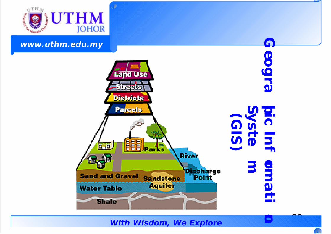
• Geogra?hi In&ormation S%stem(GIS"
– s a collection of computer hardwareand software used to house and analyedigital maps of the terrain along withinformation a!out the mapped o!2ects.
– 1ost government agencies have set upG- unit within the past several yearsinvolving large pu!lic e'penditure andgeomatic e'pertise.
O!er!ie
7/23/2019 GEOMATIC - Geomatics Concept
http://slidepdf.com/reader/full/geomatic-geomatics-concept 20/50
20
www.uthm.edu.my
With Wisdom, We Explore
Geo
gra
?hiIn
&orma
tio n
S%s
te
m
(GIS"
7/23/2019 GEOMATIC - Geomatics Concept
http://slidepdf.com/reader/full/geomatic-geomatics-concept 21/50
21
www.uthm.edu.my
With Wisdom, We Explore
T1PES O# GEOMATIC
MEAS)FEMENTMohd Efendi Daud (Dr. S"
B.Surv (UTM, Malaysia) Msc (UTM, Malaysia), Dr.Sc, (#a!oya Uiv., "apa)
(Geomati Di!ision"
#au$t% o& Ci!i$ ' En!ironmenta$ Engineering)ni!ersiti Tun *ussein Onn Ma$a%sia +,- Batu Pahat
/ohor MA0A1SIA.Phone 2 3,4-5848,87 3,6J4+584-7 #a: 2
3,4-584,E;mai$ 2 efendi<uthm.edu.m%
=e>2 htt?2@@.&ass.uthm.edu.m%@
7/23/2019 GEOMATIC - Geomatics Concept
http://slidepdf.com/reader/full/geomatic-geomatics-concept 22/50
22
www.uthm.edu.my
With Wisdom, We Explore
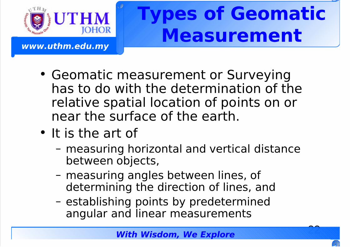
• Geomatic measurement or -urveyinghas to do with the determination of therelative spatial location of points on ornear the surface of the earth.
• t is the art of– measuring horiontal and vertical distance
!etween o!2ects,
– measuring angles !etween lines, ofdetermining the direction of lines, and
– esta!lishing points !y predeterminedangular and linear measurements
T%?es o& GeomatiMeasurement
7/23/2019 GEOMATIC - Geomatics Concept
http://slidepdf.com/reader/full/geomatic-geomatics-concept 23/50
23
www.uthm.edu.my
With Wisdom, We Explore
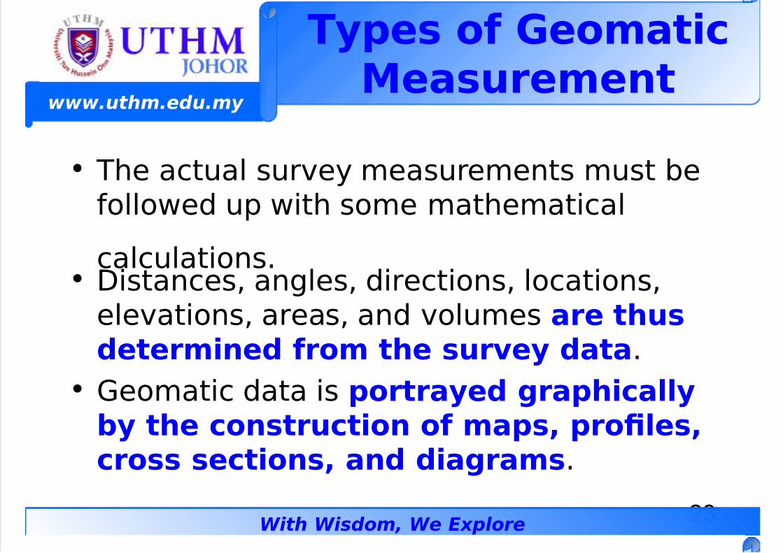
• he actual survey measurements must !efollowed up with some mathematical
calculations.• 5istances, angles, directions, locations,
elevations, areas, and volumes are thusdetermined &rom the sur!e% data.
• Geomatic data is ?ortra%ed gra?hia$$%>% the onstrution o& ma?s ?ro$esross setions and diagrams.
T%?es o& GeomatiMeasurement
7/23/2019 GEOMATIC - Geomatics Concept
http://slidepdf.com/reader/full/geomatic-geomatics-concept 24/50
24
www.uthm.edu.my
With Wisdom, We Explore
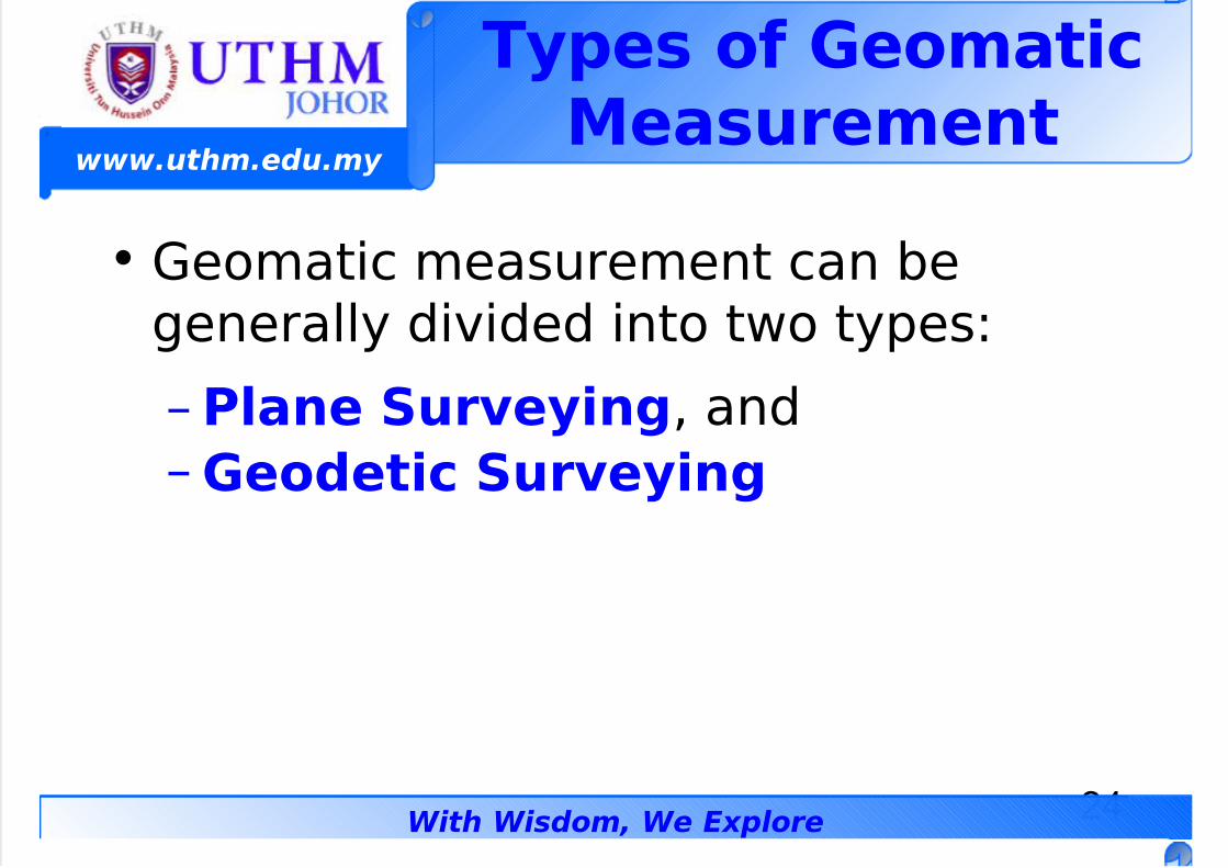
• Geomatic measurement can !egenerally divided into two types
– P$ane Sur!e%ing, and
– Geodeti Sur!e%ing
T%?es o& GeomatiMeasurement
7/23/2019 GEOMATIC - Geomatics Concept
http://slidepdf.com/reader/full/geomatic-geomatics-concept 25/50
25
www.uthm.edu.my
With Wisdom, We Explore
P$ane Sur!e%ing
• -implies the survey in that it treats thesurface of the earth as a Kat ?$ane.
• he purpose of this #ind of assumption isto reduce the comple'ity in thesu!se3uent processing of the survey data.
• his simplication of the earth does have
an indiret efet &or $arger ?rojets.• n such type of surveying, the e/ects of
earth ur!ature is neg$eted.
7/23/2019 GEOMATIC - Geomatics Concept
http://slidepdf.com/reader/full/geomatic-geomatics-concept 26/50
26
www.uthm.edu.my
With Wisdom, We Explore
• 6ncompasses the determination of the sieand shape of the earth and its gravity eld.
• *alculation are much more ela!orate
!ecause the surface upon which themeasurements are !eing made andreduced is a curved surface.
• +e3uired for $arge sa$e ?rojets where
the e/ects of the earth ur!ature areritia$.
• -urveying with GPS re3uires the engineerto thin# in a geodetic surveying mode.
GeodetiSur!e%ing
7/23/2019 GEOMATIC - Geomatics Concept
http://slidepdf.com/reader/full/geomatic-geomatics-concept 27/50
27
www.uthm.edu.my
With Wisdom, We Explore
BFANC*ES INGEOMATIC
MEAS)FEMENTMohd Efendi Daud (Dr. S"
B.Surv (UTM, Malaysia) Msc (UTM, Malaysia), Dr.Sc, (#a!oya Uiv., "apa)
(Geomati Di!ision"
#au$t% o& Ci!i$ ' En!ironmenta$ Engineering)ni!ersiti Tun *ussein Onn Ma$a%sia +,- Batu Pahat
/ohor MA0A1SIA.Phone 2 3,4-5848,87 3,6J4+584-7 #a: 2
3,4-584,E;mai$ 2 efendi<uthm.edu.m%
=e>2 htt?2@@.&ass.uthm.edu.m%@
Branhes in
7/23/2019 GEOMATIC - Geomatics Concept
http://slidepdf.com/reader/full/geomatic-geomatics-concept 28/50
28
www.uthm.edu.my
With Wisdom, We Explore
• Generally, surveys can !e classied!y names descriptive of their
&untions or ?ur?oses.• Functionally, surveys are classed as
engineering (construction),
topographic, and special surveys,such as cadastral survey (propertysurveys)
Branhes inGeomati
Measurement
Branhes in
7/23/2019 GEOMATIC - Geomatics Concept
http://slidepdf.com/reader/full/geomatic-geomatics-concept 29/50
29
www.uthm.edu.my
With Wisdom, We Explore
Branhes inGeomati
Measurement• 6ither plane or geodetic can !e classied
!y their purpose as follow
To?ogra?hi Sur!e%s hese are surveys where the physicalfeatures of the earth are measured. 1apsand plans can !e prepared to show their
relative positions !oth horiontally andvertically. 5epending upon the sie of thesurvey, they can !e geodetic or plane.
7/23/2019 GEOMATIC - Geomatics Concept
http://slidepdf.com/reader/full/geomatic-geomatics-concept 30/50
30
www.uthm.edu.my
With Wisdom, We Explore
• he wor# usually consists of the following– 6sta!lishing horiontal and vertical control that
will serve as the framewor# of the survey
– 5etermining enough horiontal locations andelevation of ground points to provide enoughdata for plotting when the map is prepared
– 7ocating natural and man"made features that
may !e re3uired !y the purpose of the survey.– *omputing distance, angles or !earing, and
elevations
– 5rawing the topographic map
To?ogra?hiSur!e%s
7/23/2019 GEOMATIC - Geomatics Concept
http://slidepdf.com/reader/full/geomatic-geomatics-concept 31/50
31
www.uthm.edu.my
With Wisdom, We Explore
To?ogra?hiSur!e%s
• he uses of topographic survey are for
– 6ngineering design,
– 8avigational,
– +ecreational,
– Geographical,
– Geological,
–1ilitary, and
– e'ploration
he map or plan produced in topographic survas scales ranging from 9:;,<<< to 99,<<<,<
Branhes in
7/23/2019 GEOMATIC - Geomatics Concept
http://slidepdf.com/reader/full/geomatic-geomatics-concept 32/50
32
www.uthm.edu.my
With Wisdom, We Explore
Engineering Sur!e%s
• 6ngineering surveys are conducted to
o!tain data essential for planning,estimating, locating, and layout for thevarious phases of construction activities orpro2ect.
• his type of survey includesreconnaissance, preliminary, location, andlayout surveys.
Branhes inGeomati
Measurement
7/23/2019 GEOMATIC - Geomatics Concept
http://slidepdf.com/reader/full/geomatic-geomatics-concept 33/50
33
www.uthm.edu.my
With Wisdom, We Explore
EngineeringSur!e%s
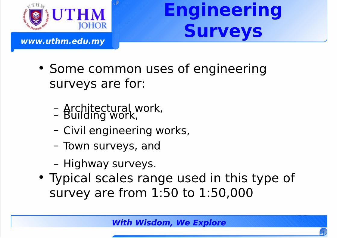
• -ome common uses of engineeringsurveys are for
– %rchitectural wor#,– $uilding wor#,
– *ivil engineering wor#s,
– own surveys, and
– ighway surveys.
• ypical scales range used in this type ofsurvey are from 9;< to 9;<,<<<
7/23/2019 GEOMATIC - Geomatics Concept
http://slidepdf.com/reader/full/geomatic-geomatics-concept 34/50
34
www.uthm.edu.my
With Wisdom, We Explore
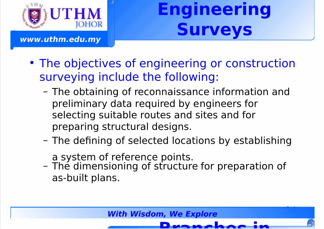
• he o!2ectives of engineering or constructionsurveying include the following
– he o!taining of reconnaissance information and
preliminary data re3uired !y engineers forselecting suita!le routes and sites and forpreparing structural designs.
– he dening of selected locations !y esta!lishing
a system of reference points.– he dimensioning of structure for preparation of
as"!uilt plans.
EngineeringSur!e%s
Branhes in
7/23/2019 GEOMATIC - Geomatics Concept
http://slidepdf.com/reader/full/geomatic-geomatics-concept 35/50
35
www.uthm.edu.my
With Wisdom, We Explore
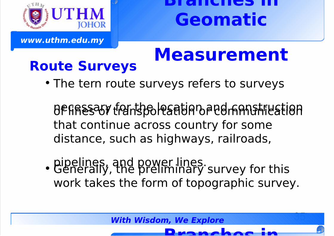
Foute Sur!e%s
• he tern route surveys refers to surveys
necessary for the location and constructionof lines of transportation or communicationthat continue across country for somedistance, such as highways, railroads,
pipelines, and power lines.• Generally, the preliminary survey for this
wor# ta#es the form of topographic survey.
Branhes inGeomati
Measurement
Branhes in
7/23/2019 GEOMATIC - Geomatics Concept
http://slidepdf.com/reader/full/geomatic-geomatics-concept 36/50
36
www.uthm.edu.my
With Wisdom, We Explore
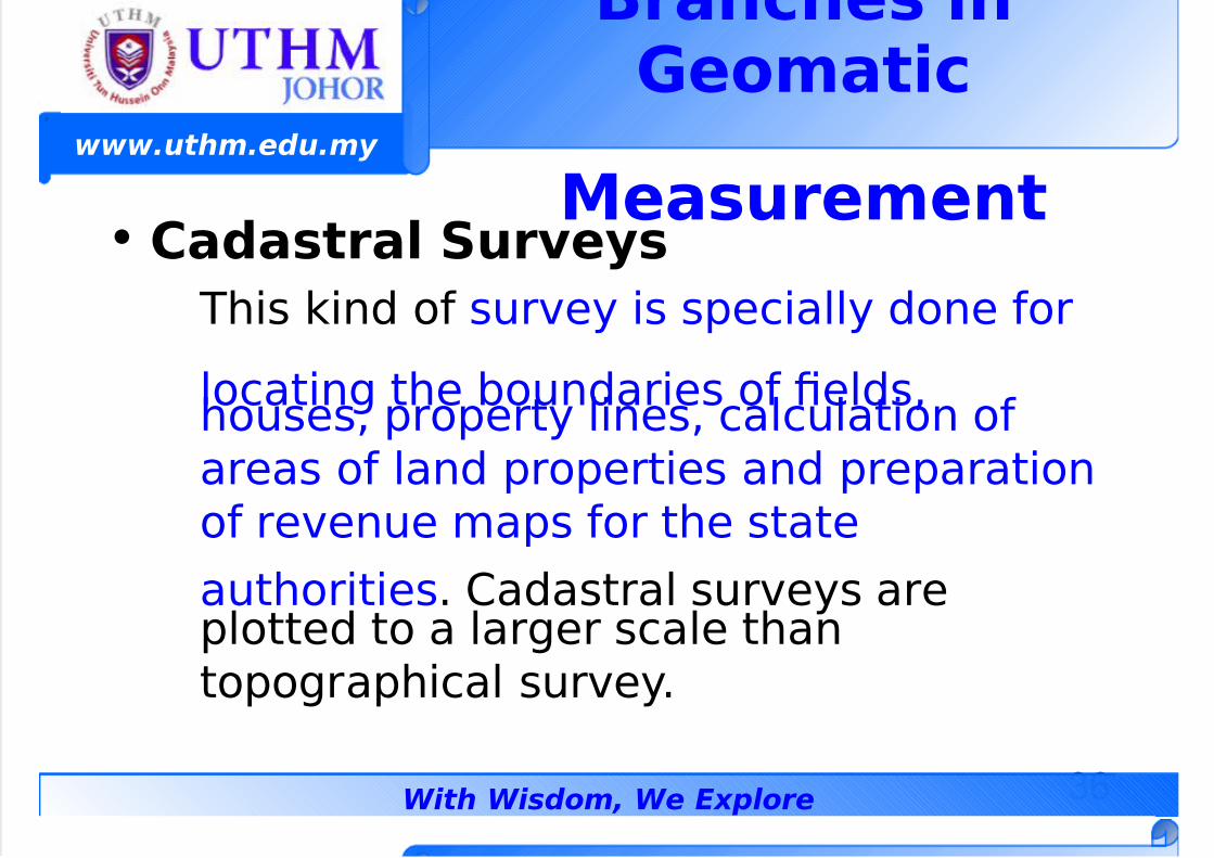
• Cadastra$ Sur!e%s
his #ind of survey is specially done for
locating the !oundaries of elds,houses, property lines, calculation ofareas of land properties and preparationof revenue maps for the state
authorities. *adastral surveys areplotted to a larger scale thantopographical survey.
Branhes inGeomati
Measurement
7/23/2019 GEOMATIC - Geomatics Concept
http://slidepdf.com/reader/full/geomatic-geomatics-concept 37/50
37
www.uthm.edu.my
With Wisdom, We Explore
Cadastra$ Sur!e%s
• resently, cadastral surveys generallyconsists of the following chores
– 6sta!lishing mar#ers or monuments to dene and
there!y preserve the !oundaries of land !elongingto a private concern, a corporation, or thegovernment.
– +elocating mar#ers of monuments legally
esta!lished !y original surveys.– *alculating areas, distances, and directions and
preparing the land map to portray the survey dataso that it can !e used as a permanent record.
7/23/2019 GEOMATIC - Geomatics Concept
http://slidepdf.com/reader/full/geomatic-geomatics-concept 38/50
38
www.uthm.edu.my
With Wisdom, We Explore
)NITS IN GEOMATIC
MEAS)FEMENTMohd Efendi Daud (Dr. S"
B.Surv (UTM, Malaysia) Msc (UTM, Malaysia), Dr.Sc, (#a!oya Uiv., "apa)
(Geomati Di!ision"
#au$t% o& Ci!i$ ' En!ironmenta$ Engineering)ni!ersiti Tun *ussein Onn Ma$a%sia +,- Batu Pahat
/ohor MA0A1SIA.Phone 2 3,4-5848,87 3,6J4+584-7 #a: 2
3,4-584,E;mai$ 2 efendi<uthm.edu.m%
=e>2 htt?2@@.&ass.uthm.edu.m%@
7/23/2019 GEOMATIC - Geomatics Concept
http://slidepdf.com/reader/full/geomatic-geomatics-concept 39/50
39
www.uthm.edu.my
With Wisdom, We Explore
)nit in GeomatiMeasurement
• he ma2or 3uantities measured in
geomatic are distanes and ang$e.
• hese are o!tained !y using thesurveying instruments and recordedin some measurement units=
– 5istance >nits– %ngular >nits
7/23/2019 GEOMATIC - Geomatics Concept
http://slidepdf.com/reader/full/geomatic-geomatics-concept 40/50
40
www.uthm.edu.my
With Wisdom, We Explore
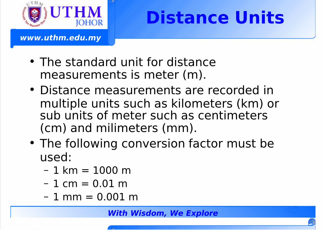
Distane )nits
• he standard unit for distancemeasurements is meter (m).
• 5istance measurements are recorded inmultiple units such as #ilometers (#m) orsu! units of meter such as centimeters(cm) and milimeters (mm).
• he following conversion factor must !eused– 9 #m ? 9<<< m
– 9 cm ? <.<9 m
– 9 mm ? <.<<9 m
7/23/2019 GEOMATIC - Geomatics Concept
http://slidepdf.com/reader/full/geomatic-geomatics-concept 41/50
41
www.uthm.edu.my
With Wisdom, We Explore
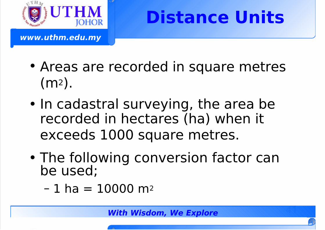
• %reas are recorded in s3uare metres(m:).
• n cadastral surveying, the area !erecorded in hectares (ha) when ite'ceeds 9<<< s3uare metres.
• he following conversion factor can!e used=
– 9 ha ? 9<<<< m:
Distane )nits
7/23/2019 GEOMATIC - Geomatics Concept
http://slidepdf.com/reader/full/geomatic-geomatics-concept 42/50
42
www.uthm.edu.my
With Wisdom, We Explore
Angu$ar )nits
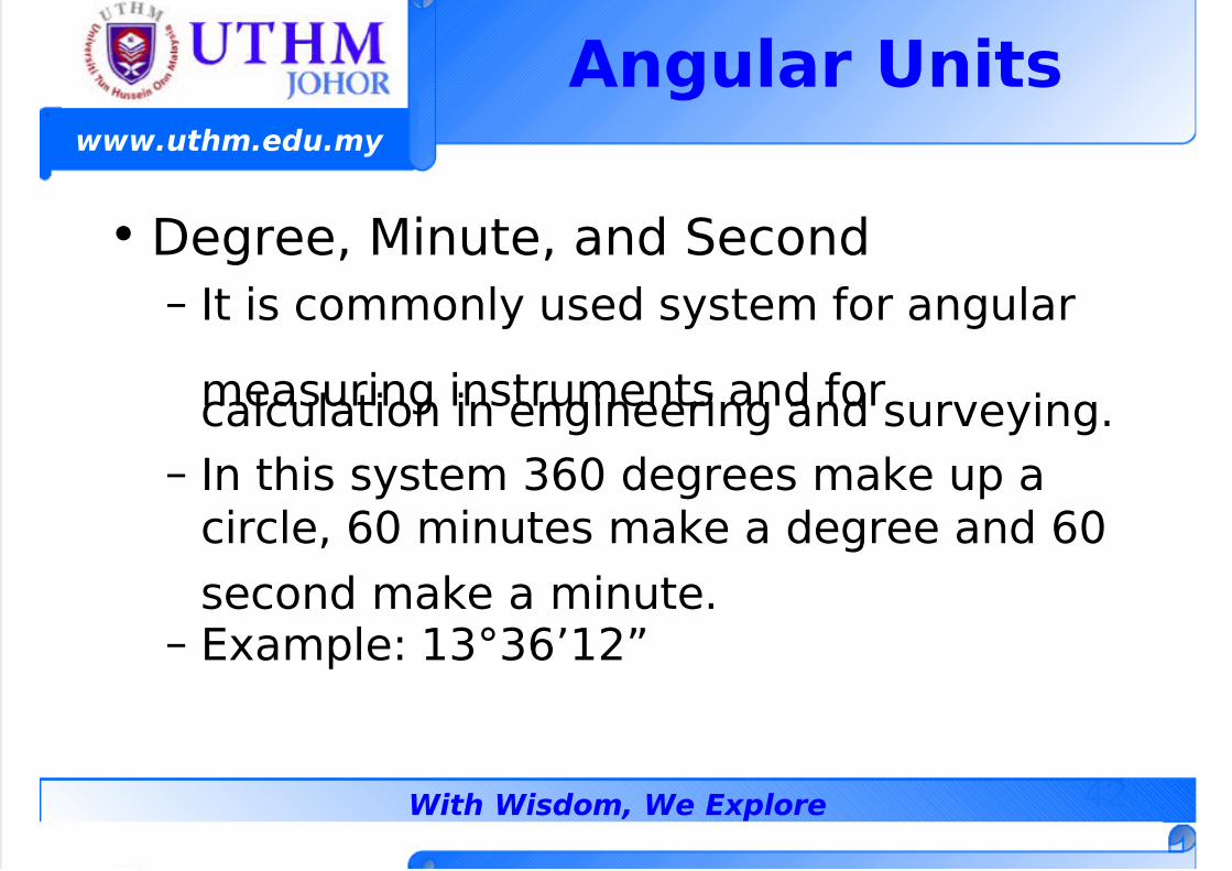
• 5egree, 1inute, and -econd
– t is commonly used system for angular
measuring instruments and forcalculation in engineering and surveying.
– n this system @A< degrees ma#e up acircle, A< minutes ma#e a degree and A<
second ma#e a minute.– 6'ample 9@B@A49:C
7/23/2019 GEOMATIC - Geomatics Concept
http://slidepdf.com/reader/full/geomatic-geomatics-concept 43/50
43
www.uthm.edu.my
With Wisdom, We Explore
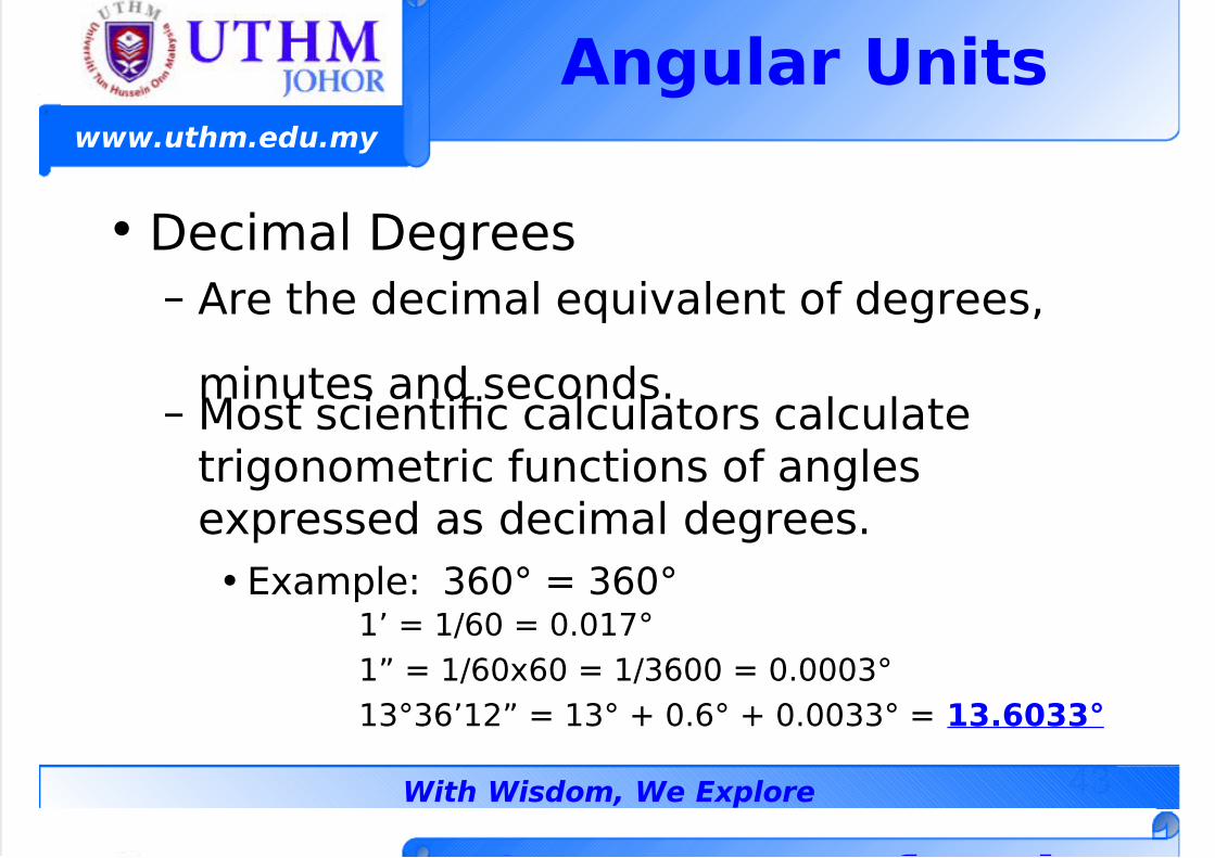
• 5ecimal 5egrees
– %re the decimal e3uivalent of degrees,
minutes and seconds.– 1ost scientic calculators calculate
trigonometric functions of anglese'pressed as decimal degrees.
• 6'ample @A<B ? @A<B94 ? 9DA< ? <.<9EB
9C ? 9DA<'A< ? 9D@A<< ? <.<<<@B
9@B@A49:C ? 9@B <.AB <.<<@@B ? 68.,88L
Angu$ar )nits
S & i
7/23/2019 GEOMATIC - Geomatics Concept
http://slidepdf.com/reader/full/geomatic-geomatics-concept 44/50
44
www.uthm.edu.my
With Wisdom, We Explore
Summar% o& )nitsin Geomati
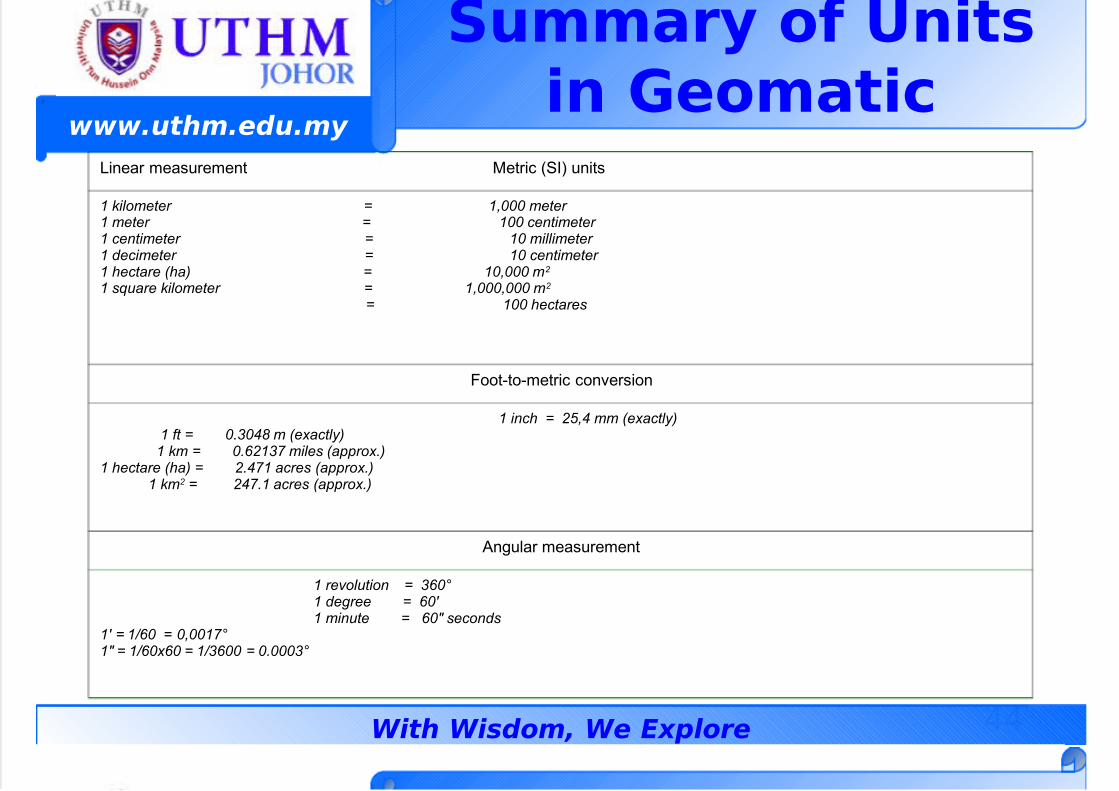
Linear measurement Metric (SI) units
1 kilometer = 1,000 meter 1 meter = 100 centimeter 1 centimeter = 10 millimeter 1 decimeter = 10 centimeter 1 hectare (ha) = 10,000 m2
1 square kilometer = 1,000,000 m2
= 100 hectares
Foot-to-metric conversion
1 inch = 25,4 mm (exactly) 1 ft = 0.304 m (exactly) 1 km = 0.!213" miles (a##rox.)1 hectare (ha) = 2.4"1 acres (a##rox.) 1 km2 = 24".1 acres (a##rox.)
n!u"ar measurement
1 re$olution = 3!0% 1 de&ree = !0' 1 minute = !0 seconds1' = 1!0 = 0,001"%1 = 1!0x!0 = 13!00 = 0.0003%
7/23/2019 GEOMATIC - Geomatics Concept
http://slidepdf.com/reader/full/geomatic-geomatics-concept 45/50
45
www.uthm.edu.my
With Wisdom, We Explore
SCA0ES IN GEOMATIC
MEAS)FEMENTSMohd Efendi Daud (Dr. S"
B.Surv (UTM, Malaysia) Msc (UTM, Malaysia), Dr.Sc, (#a!oya Uiv., "apa)
(Geomati Di!ision"
#au$t% o& Ci!i$ ' En!ironmenta$ Engineering)ni!ersiti Tun *ussein Onn Ma$a%sia +,- Batu Pahat
/ohor MA0A1SIA.Phone 2 3,4-5848,87 3,6J4+584-7 #a: 2
3,4-584,E;mai$ 2 efendi<uthm.edu.m%
=e>2 htt?2@@.&ass.uthm.edu.m%@
S $ i G ti
7/23/2019 GEOMATIC - Geomatics Concept
http://slidepdf.com/reader/full/geomatic-geomatics-concept 46/50
46
www.uthm.edu.my
With Wisdom, We Explore
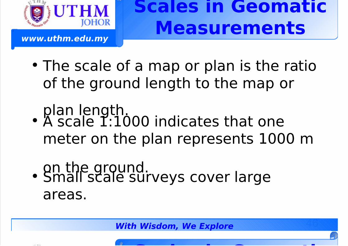
Sa$es in GeomatiMeasurements
• he scale of a map or plan is the ratioof the ground length to the map or
plan length.• % scale 99<<< indicates that one
meter on the plan represents 9<<< m
on the ground.• -mall scale surveys cover large
areas.
S $ i G ti
7/23/2019 GEOMATIC - Geomatics Concept
http://slidepdf.com/reader/full/geomatic-geomatics-concept 47/50
47
www.uthm.edu.my
With Wisdom, We Explore
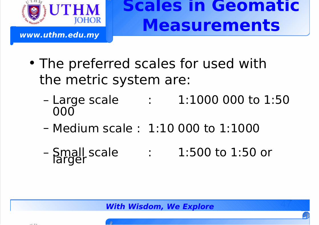
• he preferred scales for used with
the metric system are
– 7arge scale 99<<< <<< to 9;<<<<
– 1edium scale 99< <<< to 99<<<
– -mall scale 9;<< to 9;< orlarger
Sa$es in GeomatiMeasurements
7/23/2019 GEOMATIC - Geomatics Concept
http://slidepdf.com/reader/full/geomatic-geomatics-concept 48/50
48
www.uthm.edu.my
With Wisdom, We Explore
E:erise 6
• Give the e'act denition ofGeomatic 5iscuss !rieHy the various
disciplines in Geomatic.
7/23/2019 GEOMATIC - Geomatics Concept
http://slidepdf.com/reader/full/geomatic-geomatics-concept 49/50
49
www.uthm.edu.my
With Wisdom, We Explore
E:erise 9
• 6'plain the di/erence !etween lane-urvey and Geodetic -urvey with
respect to geomatic measurement.• Ihat is the signicant di/erence
!etween topographic survey and
engineering survey in terms of theiruses and scales.
7/23/2019 GEOMATIC - Geomatics Concept
http://slidepdf.com/reader/full/geomatic-geomatics-concept 50/50
www.uthm.edu.my
E:erise 8
• Ihat is the e3uivalent value of :<hectares in s3uare meters
• *onvert the angular units of@<B@;49;C to decimal degrees.
• % town map with the scale 99;<<< is
considered as what #ind of mapscale