geomatics prac 1
DESCRIPTION
ddTRANSCRIPT

OBJECTIVE :-
“To Study Map & Photographs in detail”
“
”
STANDARD SYMBOL :-
As the scale of map is too small, we cannot write the names of everything in the map. So, we
put a symbol for each of the things like forest, bridge, roads, rivers, streams etc. instead of
writing their names, These symbols are colourful. Some of the Standard symbols are as :-
To put a symbol on the map, we place the symbol such that it heads towards North direction
and the tail of the symbol coincides with its point of location.

STUDY OF TOPOGRAPHIC MAP
(MAP – 1)
For the purpose of study of a Topographic map of map number of “46 M”. Its
details are :-
Location
It is the map of Madhya Pradesh.
Its map number is “46 A”.
Latitude varies from 23 o0’ to 24 o0’.
Longitude varies from 75o 0’ to 76o 0’.
About the map (Scale= 1:250,000)
Area on map = 1816.30 sq.cm
Area on Earth Surface = 11351.88 sq. km

STUDY OF TOPOGRAPHIC MAP
(MAP – 2)
For the purpose of study of a Topographic map of number of “53 N/4”. Its details
are :-
Location
It is the map of Uttar Pradesh.
Its map number is “53 N/4”.
Latitude varies from 30 o00’ to 30 o15’.
Longitude varies from 79o 0’ to 79o 15’.
About the map (Scale= 1:50,000)
(Contour Interval = 40 m)
Area on map = 2665.46 sq.cm
Area on Earth Surface = 666.36 sq. km

Contours
The brown lines represent the contour, through which we denote height of
those points lying on the contour line itself.
The levels of the contour lines are represented by the dark brown numbers
at the boundary of the map.
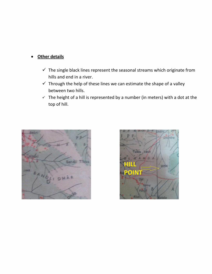
Other details
The single black lines represent the seasonal streams which originate from
hills and end in a river.
Through the help of these lines we can estimate the shape of a valley
between two hills.
The height of a hill is represented by a number (in meters) with a dot at the
top of hill.

STUDY OF PHOTOGRAPHS
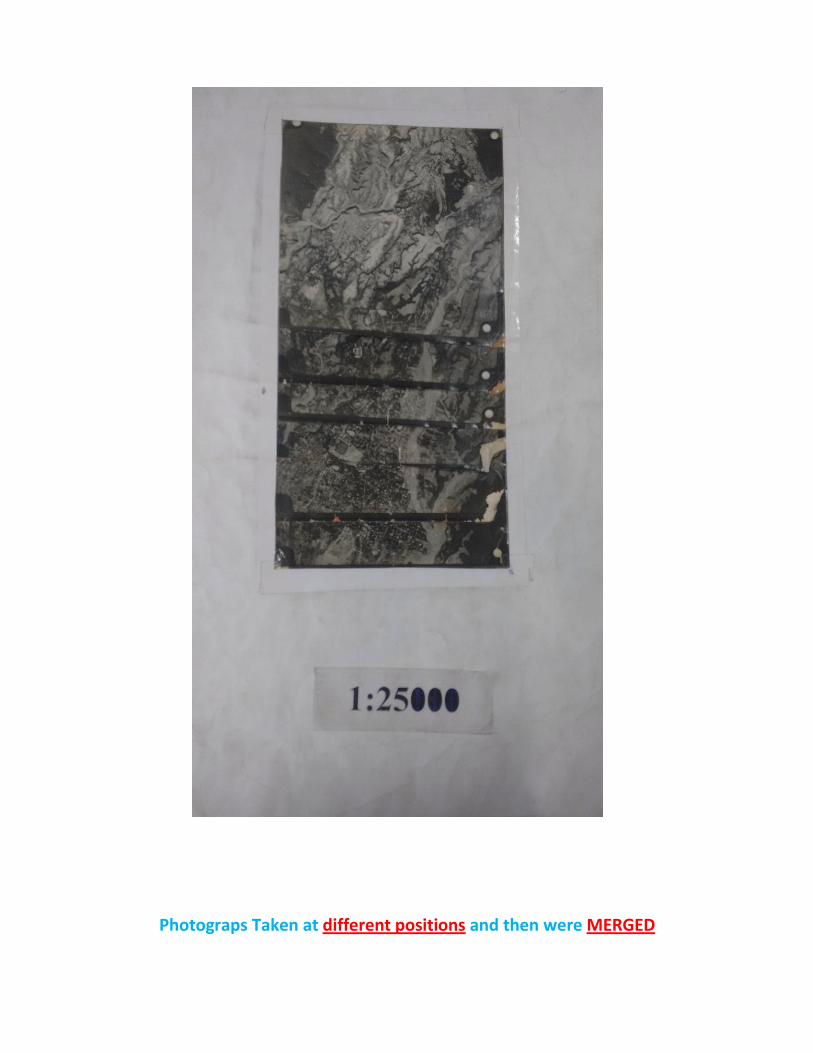
Photograps Taken at different positions and then were MERGED

PHOTOGRAPHS Vs MAPS
Photographs are the real view of earth surface of small scale.
Photographs contain more information then map.
Photographs lacks the description of various features on earth surface.
Photographs are just used for general reference, while maps are prepared for specific
purpose.
EXPERIENCE
From this activity i came to understand the importance of map in surveying.
By using symbols it is very easy to read a map.
We understand about the use of different scale at different time.
Map number is very important.
. From this i understand map drawing is not a simple task it requires patience