flh1
TRANSCRIPT

{
Socialization and Visualization of City Transport Using Google Maps API
Falahah
Dewi Rosmala
Abraham Mikhael Dolok

Traffic Jam
Common problem in metropolitan city
Public mass transportation

Population : 2.4 million
level of vehicle ownership is high at 146.73 Bandung / 1000
The average vehicle ownership is 101.29 / 1,000 people
36 route of small bus to serve the mobility of citizen
Fact : Bandung

Angkot Day
Bandung Trans Metro
School Bus
Government Program

Uncomfortable environment
Undisciplined drivers and passenger,
criminality problem
Route is not familiar
Need media to support promotion program of using public transportation among the citizen
The Problem

Display information about the route, tariff and distance for each route.
Make a travel plan, by simulate some alternative route and calculate the distance and tariff for each alternative
Display public place which are famous or relative important for the citizen such as mall, government office, hospital, and so on.
Administrator system can manage the master data such as route, tariff, road name, category, and public place.
General Requirement

GIS using Google Maps API It’s free It’s interactive Easy to embed into web
application
Proposed Solution

Main Panel
Choose the path
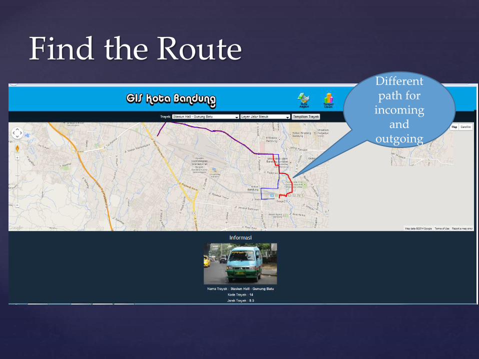
Find the RouteDifferent path for
incoming and
outgoing
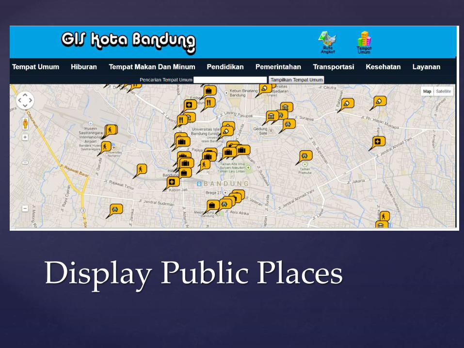
Display Public Places

Easy to Maintain Data

The system is developed to display public transportation which has some features such as display the route, calculate the tariff and distance between two places, display public places and help user to make a simple travel plan.
The system was designed to display only small bus type of public transportation since it is a main transportation mode in Bandung.
The system is supported by Google Maps API so it can operate interactively to find direction and tagging the place
The system need internet connection to operate well so the system performance is also depends on the quality of internet connection.
Conclusion

Thank You