enabling access to big geospatial data with locationtech and apache projects
TRANSCRIPT

Rob Emanuele
ENABLING ACCESS TO BIG GEOSPATIAL DATA WITH
&

What we’ll be covering…
LocationTech projects that geospatially enable Apache big data frameworks by providing spatial indexing.
Discuss how those four project approach indexing, focusing on the use of space filling curves.

STORING AND PROCESSING GEOSPATIAL DATA @ SCALE

STORING AND PROCESSING GEOSPATIAL DATA @ SCALE


WHAT IS ?


GEOJINNI(FORMERLY SPATIALHADOOP)


SPACE FILLING CURVES

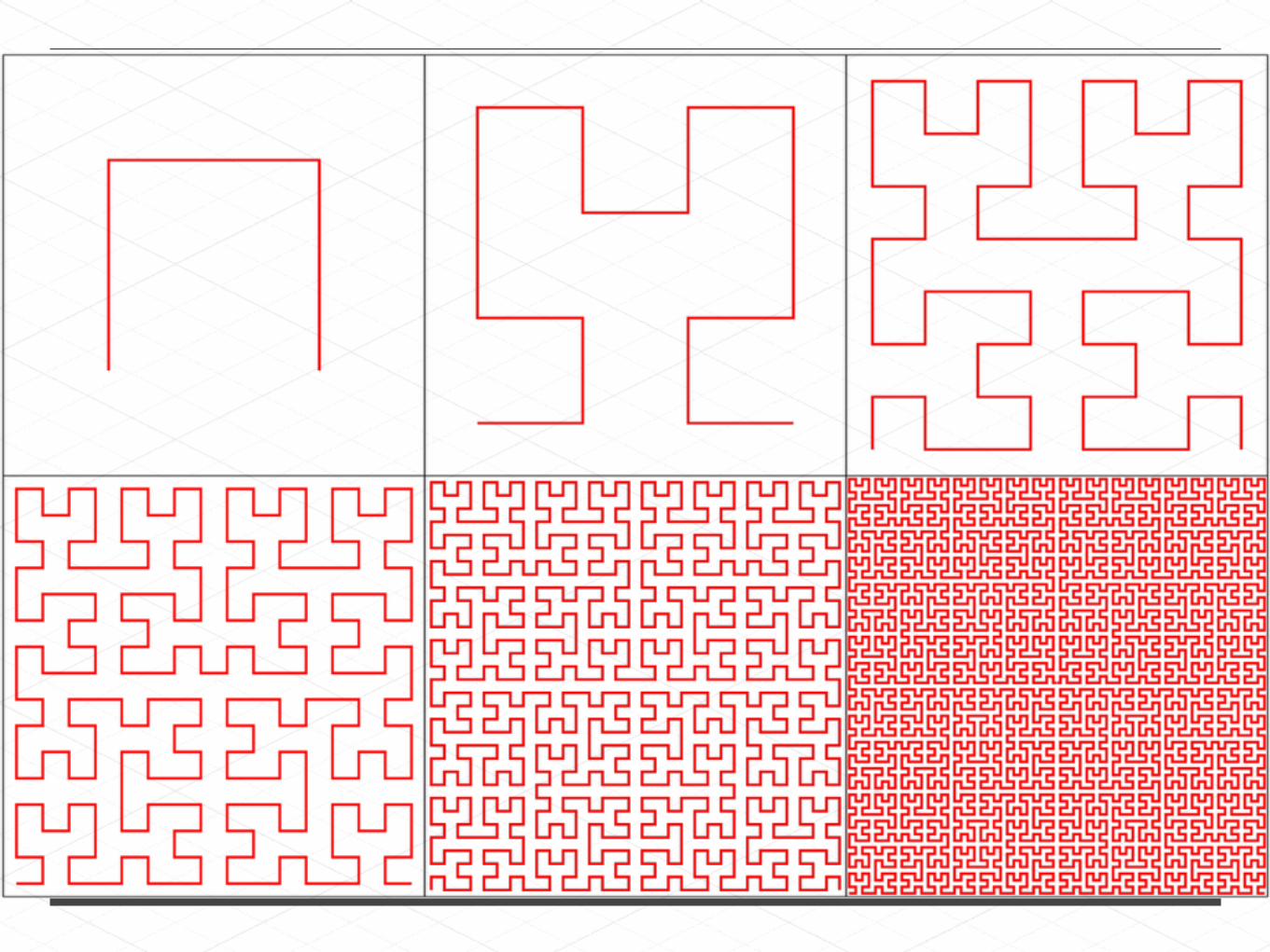

00 01
1011
10
11 00
01
11
10
00
01
Hilbert Index (52) = 11 01 00


Geo +
accessed through

Z curve

Z curve(also XZ)


Geo +
accessed through
GEOWAVE

Hilbert Curve

Range Decomposition
70 -> 75 92 -> 99 116 -> 121

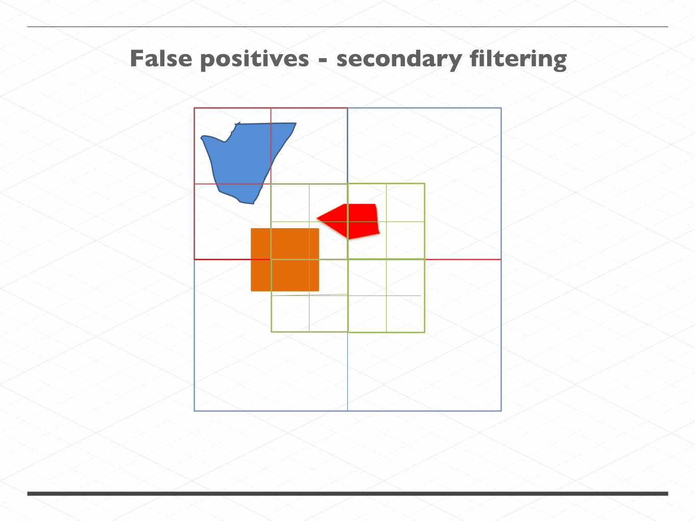
False positives - secondary filtering


Geo +
Rasters +


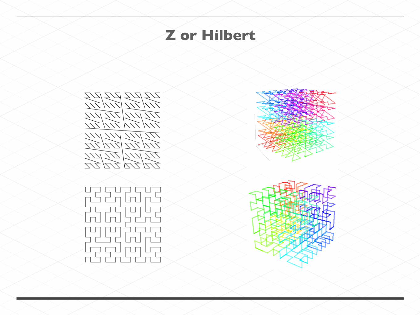
Z or Hilbert


Data Node
Data Node
Data Node
Name Node
Master
Tablet Server
Tablet Server
Tablet Server
Accumulo
BigTable clone (columnar database)
Records stored on HDFS
Lexicographically sorted table index


partitionid
splitid

splitid
partitionid

Tiered Indexing

Tiered Indexing
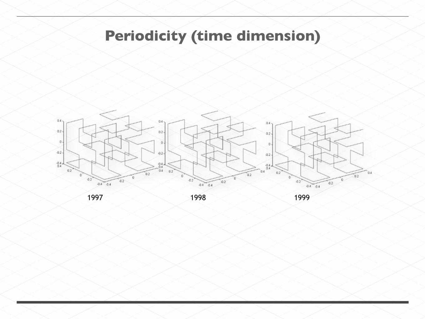
Periodicity (time dimension)
1997 1998 1999


Periodicity (arbitrary dimensions)
Time
Elevation
Velocity

Spatial index stored per file on HDFS
Z order (2D and 3D),Hilbert (N-Dimensional)
Z order (2D and 3D)Binned per week for spatiotemporal
N-Dimensional Hilbert witharbitrary binning and tiered indexing
Spatial Indexing


CQL

Future integration work
?

THANK YOU
@lossyrob
gitter.im/geotrellis/geotrellis
github.com/geotrellis/geotrellis

GeoMesa
GeoWave

Tiered Indexing