do now: while watching the movie clip answer the following: 25 maps that will change the way you see...
TRANSCRIPT

Do Now:
• While watching the movie clip answer the following: 25 Maps that will change the way you see the world
1)List three new things you learned from the clip
2)What countries do not have McDonalds?3)What countries do not use the Metric
System?4)How are maps used?

Aim: Why do Geographers use Maps and What do
Maps Tell Us?
Key Question:
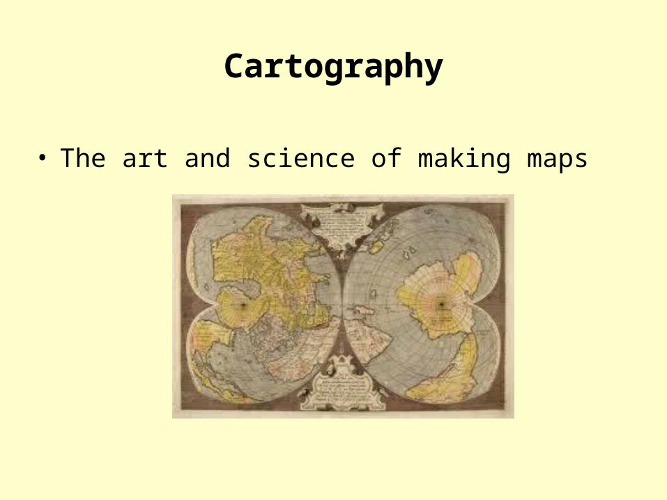
• The art and science of making maps
Cartography
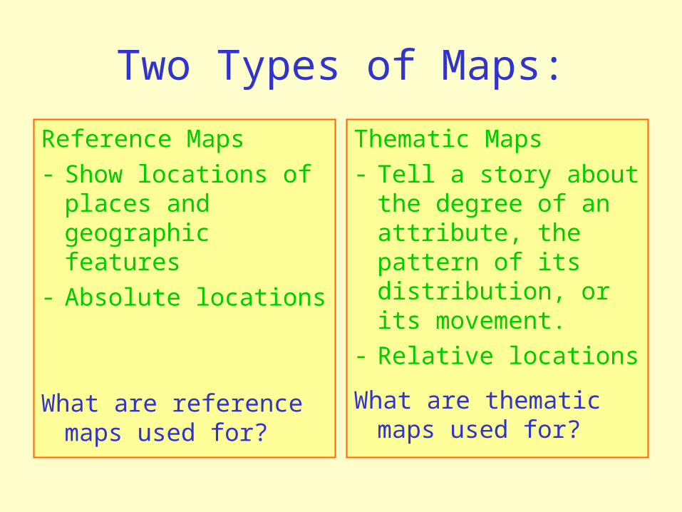
Two Types of Maps:
Reference Maps- Show locations of
places and geographic features
- Absolute locations
What are reference maps used for?
Thematic Maps- Tell a story about
the degree of an attribute, the pattern of its distribution, or its movement.
- Relative locations
What are thematic maps used for?

Reference Map
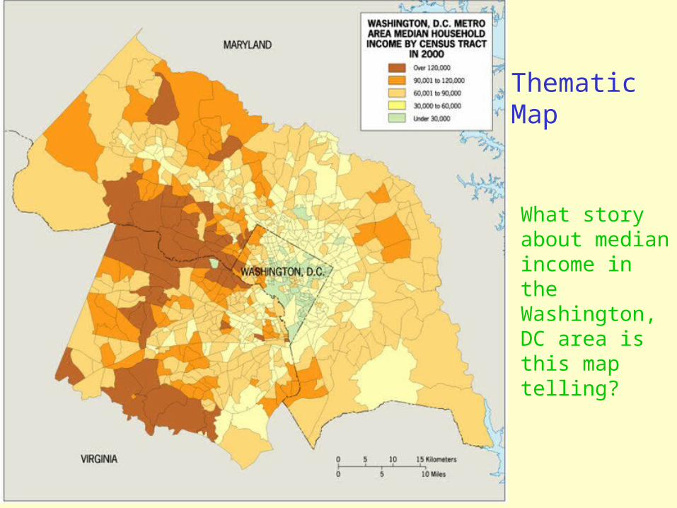
Thematic Map
What story about median income in the Washington, DC area is this map telling?

• Absolute locations do not change.• Relative locations are constantly
modified and change over time.
Why Do Geographers Use Maps, and What Do Maps Tell
Us?

Mental Maps: maps we carry in our minds of places we have been and places we have heard of.
can see: terra incognita, landmarks, paths,
and accessibility
Activity Spaces:the places we travel to routinely in our rounds of daily activity.
How are activity spaces and mental maps related?

© 2012 John Wiley & Sons, Inc. All rights reserved.
Why Do Geographers Use Maps, and What Do Maps Tell
Us?
• Generalized maps help us see trends.
Generalization in Maps

Remote Sensing and GIS
• Monitor Earth from a distance, using remote sensing technology that gathers data at a distance from Earth’s surface.
• Remotely sensed images can be incorporated in a map, and absolute locations can be studied over time by plotting change in remotely sensed imagery over time.

Geographic Information System:a collection of computer hardware and software that permits storage
and analysis of layers of spatial data.

Figure 1.12 Concepcion, Chile. Satellite image of the cities of Concepcion and Hualpen, Chile hours after an 8.8 magnitude earthquake occurred in 2010. The damage to the city is not noticeable in this satellite image except for the smoke plume from an oil refinery in the lower left corner.© 2012 John Wiley & Sons, Inc. All
rights reserved.

Remote Sensing: a method of collecting data by instruments that are physically distant from the area of study.
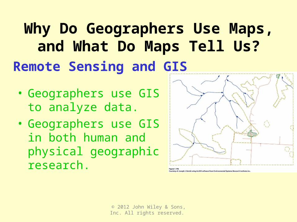
• Geographers use GIS to analyze data.
• Geographers use GIS in both human and physical geographic research.
© 2012 John Wiley & Sons, Inc. All rights reserved.
Remote Sensing and GIS
Why Do Geographers Use Maps, and What Do Maps Tell
Us?

Guest Field Note
Maui, Hawaii
The diffusion of diseases carried by vectors, such as the Aedes mosquito that transmits dengue, is not solely a result of the environmental factors in a place. I use disease ecology to understand the ways in which environmental, social, and cultural factors interact to produce disease in a place.
Through a combination of fieldwork and geographic information systems (GIS) modeling, I studied the environmental habitat of the Aedes mosquito in Hawaii and the social and cultural factors that stimulated the outbreak of dengue in Hawaii. When I went into the field in Hawaii, I observed the diversity of the physical geography of Hawaii, from deserts to rainforests. I saw the specific local environments of the dengue outbreak area, and I examined the puddles in streams (Fig. 1.15A) in which the mosquitoes likely bred during the 2001–2002 dengue outbreak.
© 2012 John Wiley & Sons, Inc. All rights reserved.

Figure 1.15B. Total annual precipitation Figure 1.15C. Average June Precipitation
Figure 1.15D. Average February minimum temperature
Figure 1.15E. Dengue potential areas
© 2012 John Wiley & Sons, Inc. All rights reserved.

Give a friend or family member a blank piece of paper. Ask the person to draw a detailed map of how he or she gets from home to the place where most of his or her weekdays are spent (work, school). Note the age of the person and the length of time he or she has lived in the place and traveled the route. Analyze the map for terra incognita, landmarks, paths, and accessibility. What does the map reveal about the person’s lifestyle and activity space?
Why are Geographers Concerned with Scale and
Connectedness?
Key Question:

Scale
Scale is the territorial extent of something.
The observations we make and the context
we see vary across scales, such as:- local- regional- national- global
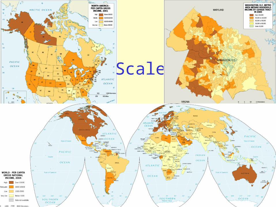
Scale

Scale is a powerful concept because:
- Processes operating at different scales influence one another.
- What is occurring across scales provides context for us to understand a phenomenon.
- People can use scale politically to change who is involved or how an issue is perceived.
- e.g. Zapatistas rescale their movement- e.g. laws jump scales, ignoring cultural differences

Regions
Formal region: defined by a commonality, typically a cultural linkage or a physical characteristic.
e.g. German speaking region of Europe
Functional region: defined by a set of social, political, or economic activities or the interactions that occur within it.
e.g. an urban area

Regions
Perceptual Region: ideas in our minds, based on accumulated knowledge of places and regions, that define an area of “sameness” or “connectedness.”
e.g. the Souththe Mid-Atlanticthe Middle East

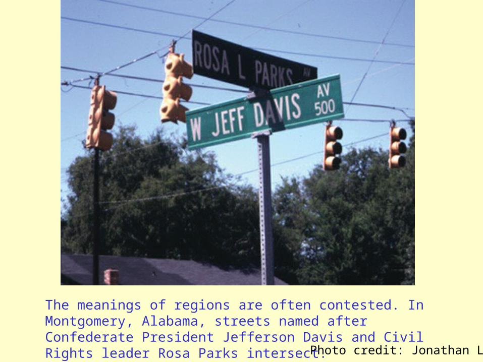
The meanings of regions are often contested. In Montgomery, Alabama, streets named after Confederate President Jefferson Davis and Civil Rights leader Rosa Parks intersect. Photo credit: Jonathan Leib
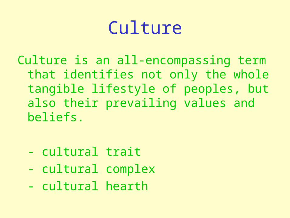
Culture
Culture is an all-encompassing term that identifies not only the whole tangible lifestyle of peoples, but also their prevailing values and beliefs.
- cultural trait- cultural complex- cultural hearth
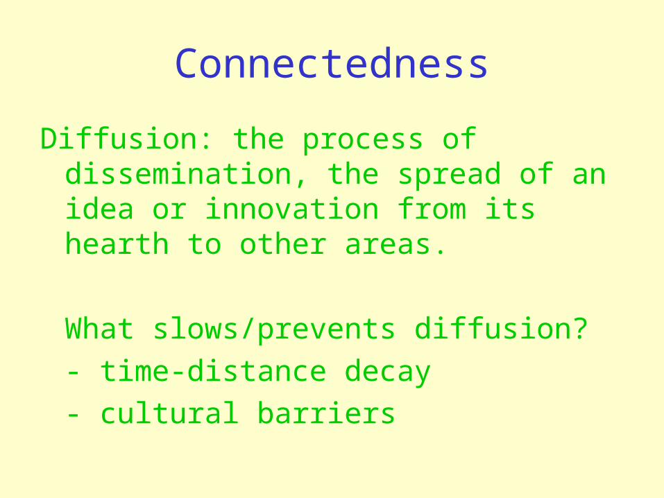
Connectedness
Diffusion: the process of dissemination, the spread of an idea or innovation from its hearth to other areas.
What slows/prevents diffusion?- time-distance decay- cultural barriers

Types of Diffusion
• Expansion Diffusion – idea or innovation spreads outward from the hearth• Contagious – spreads adjacently• Hierarchical – spreads to most linked people
or places first.• Stimulus – idea promotes a local experiment
or change in the way people do things.


Stimulus Diffusion
Because Hindus believe cows are holy, cows often roam the streets in villages and towns. The McDonalds restaurants in India feature veggie burgers.

Types of Diffusion
• Relocation diffusion – movement of individuals who carry an idea or innovation with them to a new, perhaps distant locale.
Photo credit: A.B. MurphyPhoto credit: H.J. de Blij
Kenya
Paris, France
Once you think about different types of diffusion, you will be tempted to figure out what kind of diffusion is taking place for all sorts of goods, ideas, or diseases. Please remember any good, idea or disease can diffuse in more than one way. Choose a good, idea, or disease as an example and describe how it diffused from its hearth across the globe, referring to at least three different types of diffusion.

What are Geographic Concepts, and How are they
used in Answering Geographic Questions?
Key Question:

Geographic Concepts
Ways of seeing the world spatially that are used by geographers in answering research questions.

Old Approaches to Human-Environment Questions:
• Environmental Determinism (has been rejected by almost all geographers)
• Possibilism (less accepted today)
New Approaches to Human-Environment Questions:
• Cultural ecology• Political ecology
Create a strong (false) statement about a people and their environment using either environmental determinism or possibilism. Determine how the statement you wrote is false, taking into consideration the roles of culture, politics, and economy in human-environment relations.