d pe b b l e r d e p k w y y v st e sloan canyon national ... · pe b b l e r d sunr i d g e h e i...
TRANSCRIPT

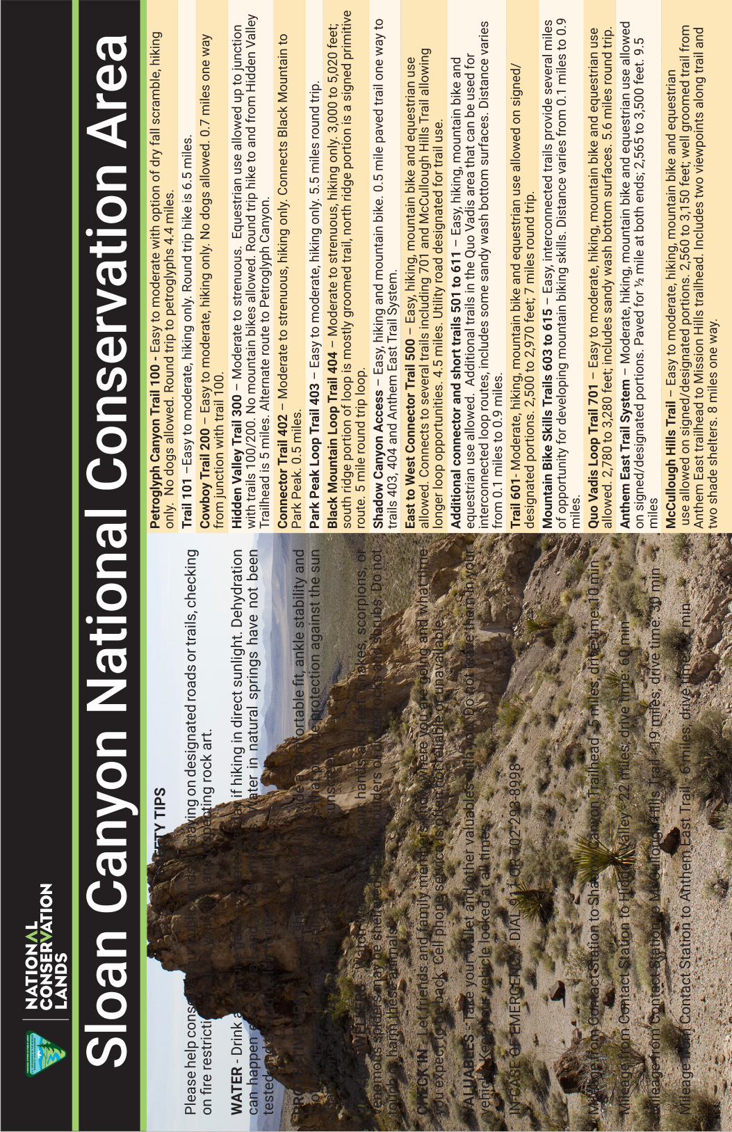
Sloan Canyon National Conservation Area
Executive Airport Dr
Volunteer Blvd
Via Firenze
Via
Fire
nze
Democracy
Naw
ghaw
Poa
101
500
300
404
100
601
701
604
McCullough Hills
607
501
605
504
611
403
506
200
606
704
603
402
609
508
Anthe
m Eas
t
507
401
615
W
Horizo
n Ridge Pkwy
E Pebble Rd
S Ea
ster
n Av
E Serene Av
Berm
uda
Rd
Anth em Pkwy
Paseo Verde Pkwy
S M
aryl
and
Pkw
y
E Silverado Ranch Blvd
Peb ble Rd
Sunridge Heights Pkwy
S Stephanie St
Sun City AnthemDr
E Horizon R
idge Pkwy
S Green Valley Pkw
y
S G
ibso
n R
d
Serene Av
E Horizon Dr
North McCullough
Copyright:© 2014 Esri, Sources: Esri, DeLorme, USGS, NPS
LegendLand Status
Bureau of Land Management
Private
National Conservation Area
BLM Wilderness
Sloan Canyon Trails
Sloan Canyon Trails
µ0 1 2 3 40.5
Miles
Æ_
BU UA A AARE E EFO L N N NDM MG TU.S. DEPARTMENTOFTHEINTERIOR
Æ_
Hidden ValleyTrailhead
Petroglyph CanyonTrailhead
Æ_Shadow CanyonTrailhead
Æ_
Anthem HillsTrailhead
Æ_Mission HillsTrailhead
Æ_Quo VadisTrailhead
Wilderness
Democracy Dr
No warranty is made by the Bureau of Land Managementas to the accuracy, reliability, or completeness of these datafor individual use or aggregate use with other data. Original data were compiled from various sources. This information may not meet National Map Accuracy Standards. This product was developed through digital means and may beupdated without notification.
Sloa
n Ca
nyon
Nat
iona
l Con
serv
atio
n A
rea
Mile
age
from
Con
tact
Sta
tion
to S
hado
w C
anyo
n Tr
ailh
ead
- 5 m
iles;
driv
e tim
e: 1
0 m
in
Mile
age
from
Con
tact
Sta
tion
to H
idde
n Va
lley
- 22
mile
s; d
rive
time:
60
min
Mile
age
from
Con
tact
Sta
tion
to M
cCul
loug
h H
ills
Trai
l - 1
9 m
iles;
driv
e tim
e: 3
0 m
in
Mile
age
from
Con
tact
Sta
tion
to A
nthe
m E
ast T
rail
- 6 m
iles;
driv
e tim
e: 1
2 m
in
SAFE
TY T
IPS
Plea
se h
elp
cons
erve
your
pub
lic la
nds
by s
tayi
ng o
n de
sign
ated
road
s or
trai
ls, c
heck
ing
on fi
re re
stric
tions
bef
ore
your
vis
it an
d re
spec
ting
rock
art
.
WAT
ER -
Drin
k ab
out o
ne g
allo
n of
wat
er p
er d
ay if
hik
ing
in d
irect
sun
light
. Deh
ydra
tion
can
happ
en e
ven
in f
all a
nd w
inte
r m
onth
s. W
ater
in n
atur
al s
prin
gs h
ave
not
been
te
sted
and
sho
uld
be le
ft fo
r use
by
wild
life.
PROT
ECTI
VE G
EAR
- Sel
ect s
hoes
that
will
pro
vide
a c
omfo
rtab
le fi
t, an
kle
stab
ility
and
pr
otec
tion
agai
nst c
actu
s sp
ines
. Wea
r clo
thes
that
pro
vide
pro
tect
ion
agai
nst t
he s
un
(hat
s, lo
ng s
leev
e, lo
ng p
ants
, etc
.) an
d ap
ply
suns
cree
n.
DESE
RT D
WEL
LERS
- W
atch
wer
e yo
u pu
t you
r han
ds a
nd fe
et. S
nake
s, s
corp
ions
, or
veno
mou
s sp
ider
s m
ay b
e sh
elte
red
behi
nd b
ould
ers
or u
nder
rock
s an
d sh
rubs
. Do
not
touc
h or
har
m th
ese
anim
als.
CHEC
K IN
- Le
t frie
nds
and
fam
ily m
embe
rs k
now
whe
re y
ou a
re g
oing
and
wha
t tim
e yo
u ex
pect
to b
e ba
ck. C
ell p
hone
ser
vice
is o
ften
not
relia
ble
or u
nava
ilabl
e.
VALU
ABL
ES -
Take
you
r wal
let a
nd o
ther
val
uabl
es w
ith y
ou. D
o no
t lea
ve th
em in
you
r ve
hicl
e. K
eep
your
veh
icle
lock
ed a
t all
times
.
IN C
ASE
OF
EMER
GEN
CY: D
IAL
911
OR
702-
293-
8998
Petr
ogly
ph C
anyo
n Tr
ail 1
00 -
Easy
to m
oder
ate
with
opt
ion
of d
ry fa
ll sc
ram
ble,
hik
ing
only
. N
o do
gs a
llow
ed. R
ound
trip
to p
etro
glyp
hs 4
.4 m
iles.
Trai
l 101
–Ea
sy to
mod
erat
e, h
ikin
g on
ly. R
ound
trip
hik
e is
6.5
mile
s.Co
wbo
y Tr
ail 2
00 –
Eas
y to
mod
erat
e, h
ikin
g on
ly. N
o do
gs a
llow
ed. 0
.7 m
iles
one
way
fr
om ju
nctio
n w
ith tr
ail 1
00.
Hid
den
Valle
y Tr
ail 3
00 –
Mod
erat
e to
stre
nuou
s. E
ques
tria
n us
e al
low
ed u
p to
junc
tion
with
trai
ls 1
00/2
00. N
o m
ount
ain
bike
s al
low
ed. R
ound
trip
hik
e to
and
from
Hid
den
Valle
y Tr
ailh
ead
is 5
mile
s. A
ltern
ate
rout
e to
Pet
rogl
yph
Cany
on.
Conn
ecto
r Tra
il 40
2 –
Mod
erat
e to
stre
nuou
s, h
ikin
g on
ly. C
onne
cts
Blac
k M
ount
ain
to
Park
Pea
k. 0
.5 m
iles.
Park
Pea
k Lo
op T
rail
403
– Ea
sy to
mod
erat
e, h
ikin
g on
ly. 5
.5 m
iles
roun
d tr
ip.
Blac
k M
ount
ain
Loop
Tra
il 40
4 –
Mod
erat
e to
stre
nuou
s, h
ikin
g on
ly. 3
,000
to 5
,020
feet
; so
uth
ridge
por
tion
of lo
op is
mos
tly g
room
ed tr
ail,
nort
h rid
ge p
ortio
n is
a s
igne
d pr
imiti
ve
rout
e. 5
mile
roun
d tr
ip lo
op.
Shad
ow C
anyo
n A
cces
s –
Easy
, hik
ing
and
mou
ntai
n bi
ke. 0
.5 m
ile p
aved
trai
l one
way
to
trails
403
, 404
and
Ant
hem
Eas
t Tra
il Sy
stem
. Ea
st to
Wes
t Con
nect
or T
rail
500
– Ea
sy, h
ikin
g, m
ount
ain
bike
and
equ
estr
ian
use
allo
wed
. Con
nect
s to
sev
eral
trai
ls in
clud
ing
701
and
McC
ullo
ugh
Hill
s Tr
ail a
llow
ing
long
er lo
op o
ppor
tuni
ties.
4.5
mile
s. U
tility
road
des
igna
ted
for t
rail
use.
A
dditi
onal
con
nect
or a
nd s
hort
trai
ls 5
01 to
611
– E
asy,
hiki
ng, m
ount
ain
bike
and
eq
uest
rian
use
allo
wed
. Ad
ditio
nal t
rails
in th
e Q
uo V
adis
are
a th
at c
an b
e us
ed fo
r in
terc
onne
cted
loop
rout
es, i
nclu
des
som
e sa
ndy
was
h bo
ttom
sur
face
s. D
ista
nce
varie
s fr
om 0
.1 m
iles
to 0
.9 m
iles.
Trai
l 601
- Mod
erat
e, h
ikin
g, m
ount
ain
bike
and
equ
estr
ian
use
allo
wed
on
sign
ed/
desi
gnat
ed p
ortio
ns. 2
,500
to 2
,970
feet
; 7 m
iles
roun
d tr
ip.
Mou
ntai
n Bi
ke S
kills
Tra
ils 6
03 to
615
– E
asy,
inte
rcon
nect
ed tr
ails
pro
vide
sev
eral
mile
s of
opp
ortu
nity
for d
evel
opin
g m
ount
ain
biki
ng s
kills
. Dis
tanc
e va
ries
from
0.1
mile
s to
0.9
m
iles.
Quo
Vad
is L
oop
Trai
l 701
– E
asy
to m
oder
ate,
hik
ing,
mou
ntai
n bi
ke a
nd e
ques
tria
n us
e al
low
ed. 2
,780
to 3
,280
feet
; inc
lude
s sa
ndy
was
h bo
ttom
sur
face
s. 5
.6 m
iles
roun
d tr
ip.
Anth
em E
ast T
rail
Syst
em –
Mod
erat
e, h
ikin
g, m
ount
ain
bike
and
equ
estr
ian
use
allo
wed
on
sig
ned/
desi
gnat
ed p
ortio
ns. P
aved
for ½
mile
at b
oth
ends
; 2,5
65 to
3,5
00 fe
et. 9
.5
mile
s M
cCul
loug
h H
ills
Trai
l – E
asy
to m
oder
ate,
hik
ing,
mou
ntai
n bi
ke a
nd e
ques
tria
n u
se a
llow
ed o
n si
gned
/des
igna
ted
port
ions
. 2,5
60 to
3,1
50 fe
et; w
ell g
room
ed tr
ail f
rom
An
them
Eas
t tra
ilhea
d to
Mis
sion
Hill
s tra
ilhea
d. In
clud
es tw
o vi
ewpo
ints
alo
ng tr
ail a
nd
two
shad
e sh
elte
rs. 8
mile
s on
e w
ay.