2011 transportation land use downtown community assets
TRANSCRIPT

Adopted by: Wasilla City Council (Ord. Ser. No. 11-11)Matanuska-Susitna Borough Assembly (Ord. Ser. No. 11-135)
C O M P R E H E N S I V E P L A N
Economic Vitality
Community Assets
Downtown
Land Use
Transportation
IntergovernmentalCoordination
2 0 1 1
CITY OF
W A S I L L A• ALASKA •

City CouncilLeone Harris
Taffina KatkusSteve Menard
Colleen Sullivan-LeonardDianne Woodruff
ACKNOWLEDGEMENTS
Planning CommissionAlvah Clark Buswell III, Chair
Doug Miller, Vice ChairSteve DeHart
Daniel Kelly, Jr.J. Dan King
Glenda LedfordRobert Webb
City StaffMarvin Yoder, Deputy
Administrator Tina Crawford, City PlannerTahirih Klein, Planning Clerk
Archie Giddings, Public Works Director
Kristie Smithers, City Clerk
MayorVerne E. Rupright
A special thank you to everyone at the City of Wasilla for their support and assistance with this planning effort:
We also would like to acknowledge all of the many interested community members who attended public meetings and provided input to the planning project.
And finally, thanks to residents who provided many of the great photos in this document, especially Mike Criss, Ron Day, Tracey Mendenhall, and Kay Petal.
Deputy MayorDoug Holler
Adopted 2011Wasilla Planning Commission – March 8, 2011
Wasilla City Council – June 13, 2011 (Ord. Ser. No. 11-11)
Matanuska-Susitna Borough Assembly – October 18, 2011 (Ord. Ser. No. 11-135)

Table of ContentsPrefaceMayor’s Message . . . . . . . . . . . . . . . . . . . . . . . . . . . . . . . . . . . . . . . . . . . . . . . . . . . . . . iComprehensive Plan Goals . . . . . . . . . . . . . . . . . . . . . . . . . . . . . . . . . . . . . . . . . . . . . . . . . . . . . . ii
1. Introduction1.1 Purpose. . . . . . . . . . . . . . . . . . . . . . . . . . . . . . . . . . . . . . . . . . . . . . . . . . . . . . . . . . . . . . . . . . . . . . . . . . . . . . 1-11.2 Planning Process . . . . . . . . . . . . . . . . . . . . . . . . . . . . . . . . . . . . . . . . . . . . . . . . . . . . . . . . . . . . . . . . . . . . . . . . 1-21.3 Consistency with other Adopted Plans . . . . . . . . . . . . . . . . . . . . . . . . . . . . . .. . . . . . . . . . . . . . . . . . . . . . . 1-6
2. Community Overview2.1 History . . . . . . . . . . . . . . . . . . . . . . . . . . . . . . . . . . . . . . . . . . . . . . . . . . . . . . . . . . . . . . . . . . . . . . . . . . . . . 2-12.2 Demographics and Forecasts . . . . . . . . . . . . . . . . . . . . . . . . . . . . . . . . . . . . . . . . . . . . . . . . . . . . . . . . . . . . . . . . . 2-32.3 Physical Context . . . . . . . . . . . . . . . . . . . . . . . . . . . . . . . . . . . . . . . . . . . . . . . . . . . . . . . . . . . . . . . . . . . . . . . . 2-12
3. Transportation3.1 Current Conditions and Trends . . . . . . . . . . . . . . . . . . . . . . . . . . . . . . . . . . . . . . . . . . . . . . . . . . . . . . . . . . . . . . 3-13.2 Desired Future Conditions . . . . . . . . . . . . . . . . . . . . . . . . . . . . . . . . . . . . . . . . . . . . . . . . . . . . . . . . . . . . . . . . 3-53.3 Goals, Objectives, and Actions . . . . . . . . . . . . . . . . . . . . . . . . . . . . . . . . . . . . . . . . . . . . . . . . . . . . . . . . . . . . . . . . 3-6
4. Land Use4.1 Current Conditions and Trends . . . . . . . . . . . . . . . . . . . . . . . . . . . . . . . . . . . . . . . . . . . . . . . . . . . . . . . . . . . . . . 4-14.2 Desired Future Conditions . . . . . . . . . . . . . . . . . . . . . . . . . . . . . . . . . . . . . . . . . . . . . . . . . . . . . . . . . . . . . . . . 4-54.3 Future Land Use . . . . . . . . . . . . . . . . . . . . . . . . . . . . . . . . . . . . . . . . . . . . . . . . . . . . . . . . . . . . . . . . . . . . . . . . 4-64.4 Goals, Objectives, and Actions . . . . . . . . . . . . . . . . . . . . . . . . . . . . . . . . . . . . . . . . . . . . . . . . . . . . . . . . . . . . . . 4-14
5. Downtown5.1 Current Conditions and Trends . . . . . . . . . . . . . . . . . . . . . . . . . . . . . . . . . . . . . . . . . . . . . . . . . . . . . . . . . . . . . . 5-15.2 Desired Future Conditions. . . . . . . . . . . . . . . . . . . . . . . . . . . . . . . . . . . . . . . . . . . . . . . . . . . . . . . . . . . . . . . . 5-55.3 Goals, Objectives, and Actions. . . . . . . . . . . . . . . . . . . . . . . . . . . . . . . . . . . . . . . . . . . . . . . . . . . . . . . . . . . . . . . 5-6
6. Community Assets6.1 Current Conditions and Trends . . . . . . . . . . . . . . . . . . . . . . . . . . . . . . . . . . . . . . . . . . . . . . . . . . . . . . . . . . . . . . 6-16.2 Desired Future Conditions. . . . . . . . . . . . . . . . . . . . . . . . . . . . . . . . . . . . . . . . . . . . . . . . . . . . . . . . . . . . . . . . 6-46.3 Goals, Objectives, and Actions . . . . . . . . . . . . . . . . . . . . . . . . . . . . . . . . . . . . . . . . . . . . . . . . . . . . . . . . . . . . . . . 6-5
7. Economic Vitality7.1 Current Conditions and Trends . . . . . . . . . . . . . . . . . . . . . . . . . . . . . . . . . . . . . . . . . . . . . . . . . . . . . . . . . . . . . . 7-17.2 Desired Future Conditions. . . . . . . . . . . . . . . . . . . . . . . . . . . . . . . . . . . . . . . . . . . . . . . . . . . . . . . . . . . . . . . . 7-37.3 Goals, Objectives, and Actions . . . . . . . . . . . . . . . . . . . . . . . . . . . . . . . . . . . . . . . . . . . . . . . . . . . . . . . . . . . . . . . 7-48. Intergovernmental Coordination8.1 Current Conditions and Trends . . . . . . . . . . . . . . . . . . . . . . . . . . . . . . . . . . . . . . . . . . . . . . . . . . . . . . . . . . . . . . 8-18.2 Desired Future Conditions. . . . . . . . . . . . . . . . . . . . . . . . . . . . . . . . . . . . . . . . . . . . . . . . . . . . . . . . . . . . . . . . 8-48.3 Goals, Objectives, and Actions . . . . . . . . . . . . . . . . . . . . . . . . . . . . . . . . . . . . . . . . . . . . . . . . . . . . . . . . . . . . . . . 8-59. Implementation9.1 Immediate Priorities . . . . . . . . . . . . . . . . . . . . . . . . . . . . . . . . . . . . . . . . . . . . . . . . . . . . . . . . . . . . . . . . . . . . . . . . 9-19.2 Measuring Outcomes . . . . . . . . . . . . . . . . . . . . . . . . . . . . . . . . . . . . . . . . . . . . . . . . . . . . . . . . . . . . . . . . . . . . . . . 9-2
Bibliography
AppendicesA. MapsFuture Transportation (11x17)Future Land Use (11x17)Community Assets (11x17)
B. Retail, Office, and Lodging Market Analysis Introduction . . . . . . . . . . . . . . . . . . . . . . . . . . . . . . . . . . . . . . . . . . . . . . . . . . . . . . . . . . . . . . B-1Trade Area Characteristics . . . . . . . . . . . . . . . . . . . . . . . . . . . . . . . . . . . . . . . . . . . . . . . . . . . . . . . . . . . . . . B-19Summary of Findings . . . . . . . . . . . . . . . . . . . . . . . . . . . . . . . . . . . . . . . . . . . . . . . . . . . . . . . . . . . . . . B-23Supporting Data . . . . . . . . . . . . . . . . . . . . . . . . . . . . . . . . . . . . . . . . . . . . . . . . . . . . . . . . . . . . . . B-28

Mission Statement:
“It is the mission of the City of Wasilla to provide optimum service levels to the public as cost effectively as possible to ensure a stable and thriving economy,
promote a healthy community, provide a safe environment and a quality lifestyle, and promote maximum citizen participation in government.”
Mayor’s MessageThe City of Wasilla offers attractive, livable residential neighborhoods and great retail and industrial development opportunities, but faces challenges. The City has been experiencing unprecedented growth pressures and is recognized as one of America’s fastest growing communities. The City’s updated Comprehensive Plan provides our community with an important tool for guiding community decision-making related to transportation, land use, capital improvements, and economic development.
The previous Comprehensive Plan was approved in April 1996. Due to the tremendous changes in the community since then, it has been my administration’s priority to update the Plan in order to re-evaluate our needs, issues, and opportunities. This Plan incorporates what we heard residents say are the critical priorities to address in our future.
p r e f a c e
i

Transportation Element Land Use Element Downtown Element
GOALS1) Provide for streets and
highways that promote mobility, connectivity and access for both present and future users.
2) Provide a streets and highway network that supports economic development and growth.
3) Support the City as a transportation hub that provides connecting highways, railroad, and expanded air service.
4) Provide a neighborhood street network that enhances the residents’ quality of life.
5) Maintain and improve City sidewalks and non-motorized pathways to increase walkability.
GOALS
1) Provide balanced land use patterns that support the community’s future growth.
2) Encourage development opportunities that support the City’s role as a regional commercial center.
3) Encourage a variety of residential housing opportunities.
4) Promote positive neighborhood identities and build a strong civic base to enhance resident’s quality of life.
5) Continue to expand the City’s borders as needed to allow economic development and growth in the future.
GOALS
1) Promote and encourage development and redevelopment within the Downtown area.
2) Build the partnerships and develop the community capacity required to transform Downtown.
Community Assets Element Economic Vitality ElementIntergovernmental
Coordination Element
GOALS
1) Provide essential services and facilities necessary to encourage new commercial, industrial, and manufacturing development.
2) Enhance educational opportunities.
3) Enhance recreational opportunities.
4) Preserve and enhance the City’s unique community assets.
GOALS
1) Continue to promote and enhance the City’s future as the region’s major center for commerce, services, visitor hospitality, culture and arts, transportation and industry.
2) Diversify the economic base and attract new employment generators.
GOALS
1) Foster and encourage intergovernmental coordination between the City and the cities of Palmer and Houston, the Matanuska-Susitna Borough, and regional, state, federal, and Native agencies.
2) Continue to promote the awareness and involvement of the residents in the planning processes for the City.
Comprehensive Plan GoalsThis Comprehensive Plan is intended to guide the City’s elected officials, commissioners, and City staff in decision-making related to transportation, land use, and growth. This Plan builds from previously adopted Plans and outlines goals and a course of action for six key elements that are critical to the City’s future growth and quality of life. The goals for each of the elements are as follows:
p r e f a c e
ii


I n t r o d u c t i o n
1 - 1W a s i l l a C o m p r e h e n s i v e P l a n
Chapter 1. Introduction
1.1 Purpose Plan Purpose and Organization
This Comprehensive Plan (“Plan”) is intended to guide the decision-making of the City’s elected officials, commissions, and staff regarding future development and community quality of life. It provides a flexible, forward-thinking road map for action, with findings and goals that address important community elements. The expected useful life of this Plan is ten years, 2011 through 2021, which could be extended with regular updates.
Comprehensive Plan Legal Basis
The State of Alaska’s statutes enabling planning (AS 29.40.020 and 29.40.030) requires creation and adoption of a comprehensive plan along with measures to implement the plan. AS 29.40.030(a) states:
“The comprehensive plan is a compilation of policy statements, goals, standards, and maps for guiding the physical, social, and economic development…”
The City has official powers governing land use planning within its boundaries. The City’s Land Development Code describes a Comprehensive Plan as:
“…a compilation of policies, plans, maps and associated materials that forms the basis for approvals under these regulations” (Wasilla Municipal Code 16.04.040).
The City’s Plan and Land Development Code (Title 16), together provide the legal basis for consistent development decisions. These serve as legal tools to uphold broad community interests, such as public health, safety, welfare and property rights. Revisions to the City’s Comprehensive Plan are reviewed by the City Planning Commission and then adopted by the City Council by ordinance. The Planning Commission periodically reviews the Comprehensive Plan and recommends updates as necessary. If any elements of the Plan conflict, the element most recently adopted shall govern (WMC 16.04.040).
Required for Funding Opportunities
The Plan is becoming a basic requirement of more and more funding agencies for awarding grants and other funding for infrastructure and economic development projects. For example, this Plan will fulfill the planning requirement for the Denali Commission and other funding agencies on the local, state and national levels as well as private organizations. It will also help the Matanuska-Susitna Borough (“Borough”) better coordinate with the City on community development and infrastructure funding proposals that require state and federal contributions.
Wasilla’s City Hall

C h a p t e r 1
1 - 2 W a s i l l a C o m p r e h e n s i v e P l a n
1.2 Planning ProcessPrevious Comprehensive Plans
This plan updates and builds from the City’s previous comprehensive planning efforts, while at the same time re-evaluating needs, issues, and opportunities based on current trends and conditions. The City’s most recent plan was adopted in April 1996 and was preceded by adopted plans in 1992, 1986, 1985 and 1982 (original plan).
Public Participation
The Plan was developed by engaging residents in discussions that considered the City’s past, present, and desired future conditions. Citizen involvement was a critical component of the planning process.
By coming together to discuss community concerns, residents learned about the issues affecting their city. Public officials benefited from community involvement and used input to shape the Plan to reflect the City’s desires and ideas. In terms of the specific public process to create this Plan, key dates and activities are listed in Table 1. A number of mechanisms and opportunities were used to engage the residents; these are outlined below.
Project Website
A project website was developed to enable residents to view draft plan documents and learn about upcoming meetings. The website also included a mechanism for providing input via email.
Public Meetings
Public workshops and meetings were conducted as part of the planning process. At the first workshop, July 2009, citizens identified the following issues and opportunities:
• Developing a library, museum, and theatre complex would be a catalyst for Downtown.
• Improving the City’s identity – minimize the strip mall appearance.
• The current appearance of buildings and streets, and the amount of traffic detracts from economic development potential.
• Need for additional sidewalks, curbs and stormwater drains.
• Economic development - creating good local job opportunities for residents.
Activity Date
Project Initiation May, 2009
Community Planning Workshop July 17, 2009
Wasilla Retail, Office, and Lodging Market Analysis September 2009
Downtown Charrette Workshops October 21-25, 2009
Community Survey Completed January 2010
Framework Plan March 25, 2010
Community Presentations & Dialogue with Planning Commission and City Staff
July - September 2010
Public Meeting October 23, 2010
Joint Planning Commission & City Council Work Session on Draft Goals, Objectives and Actions
January 11, 2011
Planning Commission Approval March 8, 2011
City Council Adoption June 13, 2011
Borough Adoption October 18, 2011
Table 1. Planning Process Timeline.
Planning Process Timeline

I n t r o d u c t i o n
1 - 3W a s i l l a C o m p r e h e n s i v e P l a n
• Financial resources - are people willing to pay for quality of life?
• Promoting tourism around Wasilla’s cultural and natural assets.
• City purchase of additional land for future community needs (e.g. road and utility expansion, Downtown redevelopment, parks).
The second public input event consisted of a week-long planning charrette focused around the Downtown area in late October 2009. The Downtown charrette included meetings with City officials, business leaders, walking tours, and three evening planning workshops with the public. In between meetings, concepts for the Downtown were sketched for presentation at the planning workshops (see figure 1).
The planning charrette defined the “built environment” business owner’s and resident’s desires for Downtown. The “built environment” includes buildings (height, setback, architectural design, etc.) and supporting infrastructure (roads, sidewalks, lighting, utilities, etc.).
Rough sketches were produced during the charrette to communicate these ideas. These ideas, presented below, would require incremental changes to the Downtown area. Workshop participants also expressed their desire for these qualities:
• Pedestrian friendly, with sidewalks and crosswalks at street intersections.
• Convenient, with on-street parking and easy access.
• Vibrant, attracting residents and tourists with a variety of specialty shops and activities that remain open in the evenings and on weekends.
• Attractive, with architectural design and landscaping suited to the Alaskan environment and that highlights Wasilla’s cultural and natural assets.
YENLO
Northbound One-Way
MAIN STREET
Southbound One-Way
Figure 1. Charrette concept generated during an open house in October 2009 creates a focused “core area of Downtown” and improves traffic flow. The former Post Office site becomes a landmark City building.
C h a p t e r 1
1 - 4 W a s i l l a C o m p r e h e n s i v e P l a n
Prior to the third and final public meeting, outreach presentations were made to local organizations and development interest groups. At the same time (summer – early fall 2010), discussions were held with City staff and the Planning Commission to identify goals and objectives to be incorporated into the Plan.
A final public workshop was held in October 2010 to ask for residents’ input focused on unresolved issues and potential goals. The meeting provided a useful venue for discussing options and ideas to include in the draft Plan.
Participants commented on the following issues:
• Future land use patterns and compatibility
• Future investments in roads, parks and infrastructure
• Future community identity and Downtown
Community Survey
The City conducted a survey to gather citizen input as part of this planning effort during winter 2009-2010. The survey was designed to obtain statistically valid results from households throughout the City. The survey was conducted using a combination of mail and phone calls. Leisure Vision worked with City officials and the project team to create the survey questionnaire. This allowed the survey to be tailored to issues of strategic importance to effectively plan for local needs.
Leisure Vision mailed surveys to a random sample of 1,750 households throughout the City. Approximately three days after the surveys were mailed each household that received a survey also received an automated voice message encouraging them to complete the survey. In addition, about two weeks after the surveys were mailed Leisure Vision began contacting households by phone. Those who indicated they had not returned the survey were given the option of completing it by phone.
The goal was to obtain at least 350 completed surveys from City households. This goal was accomplished, with the receipt of a total of 352 completed surveys. The results of the survey have a 95% level of confidence with a precision of at least +/-5.2%. See Figure 2 for results.
The following is a summary of major survey findings:
Most Important Interests for the City to Address. Based on the sum of their top four choices, the subjects of interest that households feel are most important for the City to address are: improved roadways and transportation (56%), more employment opportunities (47%), increased public safety (32%), and expanded school services (30%).
Level of Satisfaction with Major City Services. The major City services that the highest percentage of households are very or somewhat satisfied with are: public safety services (71%), parks and recreation programs/facilities (55%), customer service received from City employees (52%), and maintenance of City streets/facilities (52%).
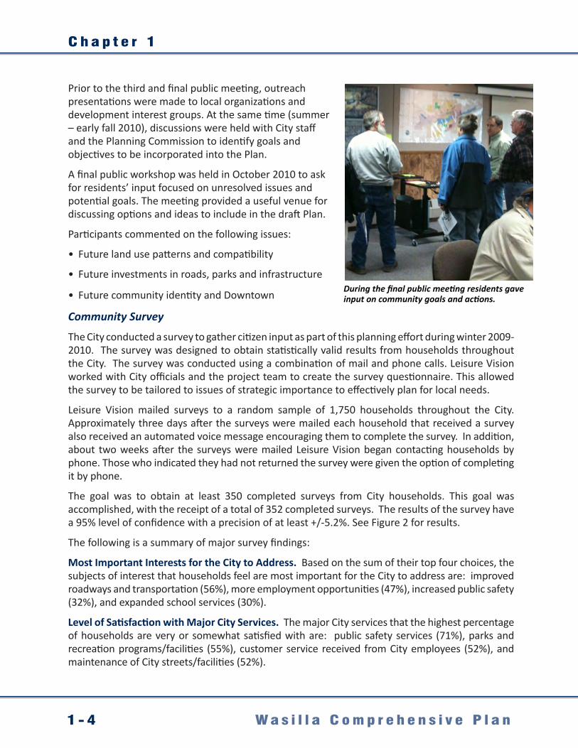
During the final public meeting residents gave input on community goals and actions.

I n t r o d u c t i o n
1 - 5W a s i l l a C o m p r e h e n s i v e P l a n
Future of Wasilla. Regarding the City’s future, the statements that the highest percentage of respondents strongly agree or disagree with are: The built environment should promote healthy and active living (74%), enhanced street connectivity (74%), maintain housing quality (69%), encourage pedestrian and bicycle movement on streets (68%), and maintain Downtown vitality (68%).
Level of Support for Various Economic Development Strategies. The survey results showed that 83% of respondents are either very supportive or somewhat supportive of creating or expanding new industrial and employment areas in Wasilla, and 74% are very or somewhat supportive of expanding areas for redevelopment and development.
Level of Support for Various Neighborhood and Housing Development Strategies. The survey indicated that 77% of respondents are either very supportive or somewhat supportive of having stricter code enforcement to clean up property in Wasilla, and 67% are very or somewhat supportive of redevelopment of the Downtown area to strengthen its role as a town center.
Figure 2. Statistical Survey City Priorities to Address (Source: Leisure Vision survey, January 2010). Graph figures represent Wasilla residents’ opinions regarding priorities to address in the City. Survey findings are statistically valid based on a random sample of 1,750 Wasilla residents, with 352 households responding (95% level of confidence) and have been used to guide recommendations in this plan.
66%60%
43%39%
43%45%
33%32%
28%33%37%
32%23%
19%18%
15%17%
27%28%
39%40%
35%32%
41%38%
40%32%27%
30%37%
37%38%
28%23%
3%4%
7%12%
10%14%
11%13%
12%11%16%
15%16%
17%21%
20%16%
4%7%
11%9%
11%9%
15%17%
20%25%
21%23%24%
27%23%
36%45%
Improved roadways and transportationMore employment opportunities
Increased public safetyImproved utilities/infrastructure
Maintain community identity & quality of lifeManage future growth and development pressure
Maintain neighborhood's residential characterImproved parks, recreation, open space
Increase commercial developmentImproved walking and biking trails
Expand school servicesMore affordable housing
Increased downtown revitalizationIncreased historic preservation
More water/sewer availabilityGreater diversification of housing types
Promote population growth
0% 20% 40% 60% 80% 100%Very Important Somewhat Important Not Sure Not Important
Q1. Importance of Various Subjects of Interests for Residents of the City of Wasilla
by percentage of respondents
Source: Leisure Vision/ETC Institute (Januaray 2010)
56%47%
32%30%
26%20%20%
17%17%16%
14%13%
10%9%
7%6%
3%6%
Improved roadways and transportationMore employment opportunities
Increased public safetyExpand school services
Manage future growth and development pressureImproved utilities/infrastructure
Maintain community identity & quality of lifeIncrease commercial development
More affordable housingImproved walking and biking trails
Improved parks, recreation, open spaceMaintain neighborhood's residential character
Increased downtown revitalizationIncreased historic preservation
More water/sewer availabilityPromote population growth
Greater diversification of housing typesOther
0% 10% 20% 30% 40% 50% 60%Most Important 2nd Most Important 3rd Most Important 4th Most Important
by percentage of respondents who selected the item as one of their top four choices
Source: Leisure Vision/ETC Institute (Januaray 2010)
Q2. Subjects of Interests That Are Most Important for the City of Wasilla to Address
Comprehensive Plan Survey for the City of Wasilla
Leisure Vision/ETC Institute Survey Results - 1

C h a p t e r 1
1 - 6 W a s i l l a C o m p r e h e n s i v e P l a n
Level of Support for Various Downtown Strategies. Survey results reflected that 72% of respondents are either very supportive or somewhat supportive of redevelopment of key blocks in the Downtown area to strengthen the Downtown commercial and residential markets, 72% are very or somewhat supportive of encouraging revitalization in Downtown and surrounding neighborhoods, and 69% are very or somewhat supportive of encouraging a mix of national and local retail and commercial space Downtown.
Level of Support for Various Parks and Recreation Strategies. Survey responses said that 76% of respondents are either very supportive or somewhat supportive of improving the Lake Lucille Park to serve the entire City, 75% are very or somewhat supportive of developing/renovating smaller neighborhood parks, and 72% are very or somewhat supportive of providing a system of recreational trails/linear parks to connect neighborhood and regional parks.
Other findings:
Half of the respondents are either very satisfied (10%) or satisfied (40%) with the overall quality of new commercial development in the City of Wasilla, compared to only 15% of respondents who are either dissatisfied (11%) or very dissatisfied (4%). The remaining respondents indicated “neutral” (30%) or “don’t know” (5%).
49% of the respondents are either very satisfied (12%) or satisfied (37%) with the quality of new neighborhood subdivisions in the City, compared to only 12% who are dissatisfied (7%) or very dissatisfied (5%). The remaining respondents indicated “neutral” (29%) or “don’t know” (10%).
58% percent of the respondents feel the condition of their neighborhood is staying about the same, 19% feel it’s getting better, and 19% feel it’s getting worse. The remaining respondents indicated “don’t know.”
1.3 Consistency with other Adopted PlansConsistency with other Local Plans
Comprehensive planning provides a future direction and road map for City action. Given the unknown factors that a City faces over the life of its Plan, its goals and recommendations are intentionally presented in broad and general terms. In order to fully implement this Plan, more detail-specific plans will need to be developed and regularly updated, consistent with the intent and goals of the Plan, including the Future Transportation and Future Land Use maps in this Plan’s appendices.
These supplementary plans provide a greater degree of specificity and detail, and can more accurately respond to changing needs and conditions within the City. Specific details can include capital planning, infrastructure network planning, design criteria, specifications, project development, special area and neighborhood plans, etc. Thus, developers and City officials need to consult current City codes (including this Plan) and other plans as a guide for decision-making.

I n t r o d u c t i o n
1 - 7W a s i l l a C o m p r e h e n s i v e P l a n
These include, but are not limited to, the following:
City of Wasilla Regulations and Plans• Title 16, Land Development Code• Official Streets and Highways Plan• Airport Master Plan• Parks Master Plan• Trails Plan• Water Master Plan• Sewer Master Plan• Stormwater Master Plan• Wasilla Area Plans (unadopted, area-specific
visioning for Downtown, South Wasilla Heights, Airport and Transportation Museum Area)
Consistency with other Regional Plans
This Plan for the City is part of the comprehensive development plan of the Matanuska-Susitna Borough under MSB Code 17.45. As a First Class City, Wasilla has accepted the Borough’s delegated land use regulatory authority, pursuant to Alaska Statutes 29.40.010(b). Although the City’s Plan governs land use decisions within the City, some powers currently remain with the Borough (e.g. platting).
Additionally, the Borough provides regional planning on a number of elements important to the City’s future. For these reasons, City officials and developers are advised to be aware of current Borough plans, including, but not limited to, the following:
Matanuska-Susitna Borough Areawide Plans• Long Range Transportation Plan• Official Streets and Highways Plan• Regional Aviation System Plan• Comprehensive Economic Development Strategy• Coastal Management Plan• Recreational Trails Plan• Borough-wide Comprehensive Plan
Consistency with State and Federal Plans
Although the Plan mainly focuses on local and community issues, State planning documents were consulted, particularly related to transportation (e.g. Parks Highway, Alaska Railroad). Other plans may also apply.
Wasilla Area Wasilla Area Plans PUBLIC REVIEW DRAFTAugust 2008
Prepared byURS Corporat ion 2700 Gambell, Suite 200 Anchorage, Alaska 99503 907. 562. 3366
The Wasilla Area Plans provide direction and public input on future development.

C o m m u n i t y O v e r v i e w
2 - 1W a s i l l a C o m p r e h e n s i v e P l a n
Chapter 2. Community Overview
2.1 History The City’s rich history and diversity of people and ideas are actively treasured and preserved. The community’s heritage includes the indigenous Athabaskan (Dena’ina) people, gold miners, and homesteaders, as well as contemporary entrepreneurs and wilderness enthusiasts.
The Dena’ina, the original inhabitants of the Wasilla area, called the area “Benteh,” meaning many lakes. The numerous lakes and streams provided ample fishing for indigenous populations and the area became a popular wintering ground for semi-permanent Native villages. Trails connected these villages to hunting grounds in the Susitna Valley and the Talkeetna Mountains, while others linked the villages to the Ahtna people east of the Matanuska Valley.
The town site of Wasilla is named after Chief Wasilla, a local Dena’ina chief and shaman who died in 1907. Prominent theories peg “Wasilla” as meaning “breath of air” in the Dena’ina Athabascan language; or an alternative theory is that Wasilla is derived from “Vassily,” a Russian name derived from trading post influences in Lower Cook Inlet (1741 to 1867).
Wasilla’s history as a community dates back to 1916 when the Alaska Engineering Commission constructed a work camp at the intersection of the Alaska Railroad and the Carle Wagon Trail (now known as the Wasilla-Fishhook Road), which linked the coastal community of Knik with the Willow Creek mining district. The work camp housed men engaged in surveying, clearing, and establishing the rail line that would eventually connect the port of Seward to Fairbanks.
After platting the town site in June 1917, the Alaska Engineering Commission auctioned off town site lots from the railroad platform in Wasilla. This new community led to the demise of the older settlement at Knik. Once established, Wasilla became the most important distribution point in the Valley.
Homesteading and the founding of the Matanuska Colony under President Roosevelt’s New Deal increased the
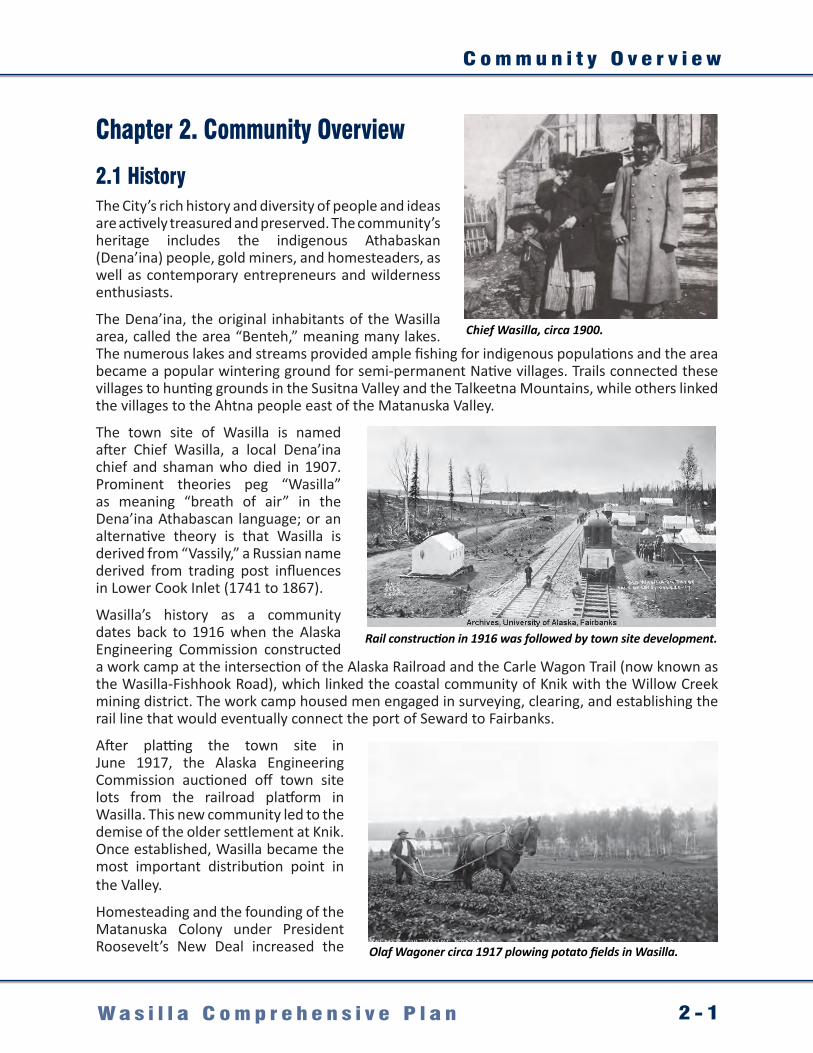
Chief Wasilla, circa 1900.
Rail construction in 1916 was followed by town site development.
Olaf Wagoner circa 1917 plowing potato fields in Wasilla.

C h a p t e r 2
2 - 2 W a s i l l a C o m p r e h e n s i v e P l a n
population in the area. Several colony farms were located near Wasilla. World War II ended the mining boom and drained workers from farms and businesses. However, economic activity increased during this period due to an influx of military personnel to area bases.
Construction of the George Parks Highway (“Parks Highway”) in the early 1970s provided direct access to and from Anchorage. This enabled workers and their families to live in the Wasilla area and commute to jobs in Anchorage. Support and service industries began to develop in the area to meet the needs of these new residents. The Parks Highway also became well used, serving Alaskans traveling between Anchorage and Fairbanks, and visitors traveling to Denali National Park.
The City was incorporated in 1974 as a second class city under Alaska statutes, and has continued to develop as the retail and commercial hub of the central Matanuska-Susitna Valley. It became a first class city in 1984.
By the 1990s, road improvements and Alaska’s economic growth, with good jobs on the North Slope and in Anchorage encouraged a new wave of commuters to make the City their home. Around the same time, proposals were seriously considered to move Alaska’s state capital to Wasilla, a more central location with greater land resources. By 2000 the region’s beauty and large-lot homes at a fraction of the cost of Anchorage attracted a growth boom that has shaped the area, and expanded population both within and surrounding the City.
Today the City is famous as headquarters for the Iditarod, home of the Iron Dog snow machine race, and hometown of the politically famous former City Mayor, Sarah Palin. The City has also maintained aspects of its rich history, including regional attractions such as the Dorothy Page Museum and Old Town Site Park and Museum of Alaska Transportation and Industry.
By 1931 Downtown Wasilla was a regional crossroads.
Displays at the Museum of Alaska Transportation and Industry tell the story of Alaska’s settlement and transportation modes.
Wasilla’s Old Town Site Park has preserved original historic relics.

C o m m u n i t y O v e r v i e w
2 - 3W a s i l l a C o m p r e h e n s i v e P l a n
2.2 Demographics and ForecastsGrowth Locally and Regionally
In Alaskan terms, Wasilla’s size is just right; large enough to have metropolitan amenities and a blossoming growth center for business, yet small enough to preserve the familiarity, charm, and security of small-town living. The active population enjoys affordable land and housing, unparalleled recreation, a thriving economy, and a responsive local government committed to assisting private development.
At the same time, the City is continuing to grow. Since the 1996 Comprehensive Plan was adopted, the City has been experiencing unprecedented growth pressures. Since the 2000 census, the City has experienced a 43% increase in population—up to 7,831 residents in 2010—and is recognized as one of America’s fastest growing communities. Although growth has generally enhanced the City, it also has added new challenges as the City seeks to respond to the demands and needs that new residents bring.
Moreover, growth within the City is just one aspect of a changing demographic story that is addressed in this Plan. The other aspect is the City’s role relative to regional growth. Population data shows that although the City is growing fast, residential areas to the City’s south and north are growing even faster. While the City’s growth is a critical factor in planning for the future, so is coming to terms with its role in meeting the needs and demands of a large and growing population adjacent to the City.
Regional figures show that the City is central to a fast growing population (Alaska Department of Labor and Workforce Development, Research and Analysis (ADLWD, 2010). As of 2010, around 44,000 residents live just outside the City limits, but generally rely on the City for some portion of their goods, services, community needs, and infrastructure.
As an example of this impact, the City has the third busiest library in the State of Alaska. According to 2008 data the majority of the library patronage (82%) comes from residents living outside the City (see table, page 10). Many of these non-residents are living the Alaskan dream of being “away from it all” but still desire urban services such as libraries. They have no organized community or government near their homes addressing these demands and the Borough’s libraries in Sutton or Big Lake are not close to their homes. The City is on their way to work, and near shopping—so they seek services from the City’s library.
A large and growing population outside City boundaries is using City services and facilities (library, roads, etc.).
Wasilla and areas surrounding the city are anticipated to grow in population at a 3.1% rate through 2034.

C h a p t e r 2
2 - 4 W a s i l l a C o m p r e h e n s i v e P l a n
Figure 3. Census population data from 2000 and 2010, showing the strong population growth in communities directly south and north of Wasilla. Data is for cities and Matanuska-Susitna Borough Community Council Areas.
2008 City of Wasilla Library Usage by Residents and Non-Residents.
MSB Road Service Area (RSA) 2008 RSA Population
Residents in RSA Using Wasilla’s Library
Percentage of Wasilla LibraryCheckouts
Big Lake 3,191 337 1.70%Bogard 8,249 3,786 14.44%Butte 3,939 271 0.82%
Caswell 3,216 243 0.58%Houston 1,755 355 1.10%
Knik/Fairview 12,990 10,694 23.77%Lazy Mountain 1,447 127 0.44%
Meadow Lakes/Goldtrails 14,324 11,068 25.37%Midway 4,473 2,310 5.66%
North Colony 768 42 0.10%Outside RSA/Other 2,316 405 1.15%
Palmer 5,559 289 1.37%South Colony 6,578 812 4.15%
Talkeetna 1,394 18 0.26%Trapper Creek 407 3 0.13%
Wasilla 7,176 5,823 18.06%Willow 1,428 61 0.85%Total 79,210 36,663 100%
Table 2. 2008 City library usage data. Source: City of Wasilla Library staff in-house report. Population figures from ADLWD.
City LimitsKEY Black Figures: 2000 Census Data
Red Figures: 2010 Census Data
1,658 Willow2,102
1,202 Houston1,912
4,819Meadow Lakes
7,570
4,933 Tanaina8,197
6,706N&S Lakes
8,3642,952
Gateway5,552
7,049 Knik/Fairview
14,923
2,635 Big Lake3,350
2,030Fishhook
4,679
5,469Wasilla7,831
2000 to 2009 Wasilla Region Population Growth.
Community Council Area 2010 Population
0 2,200 4,400 6,600 8,800 11,000 13,200 15,400
N
1,067Farm Loop
1,028
699Soapstone
855
4,533Palmer5,957

C o m m u n i t y O v e r v i e w
2 - 5W a s i l l a C o m p r e h e n s i v e P l a n
Increases in the regional population are expected to continue. A State analysis projects 3.1% annual growth through 2034 for the Borough (ADLWD, December 2010). If the State growth scenarios and economic assumptions are correct, the Borough population could increase to well over 100,000 residents over the next ten years.
In response to these trends, two points were raised during the public input for this planning process (which attracted both residents and non-residents):
• Many Valley residents live where they do now by choice because they want “to get away” from city life. Yet, they desire a balance and still want urban amenities such as services, goods, and social and cultural opportunities.
• Using commerce as a tax base, rather than property tax, allows the City to gain some resources from non-residents who visit the City for services, shopping, etc., which will help support their demands for services.
This planning effort found the City at a crossroads, with issues emerging in the community discussion over regional versus local needs and interests. Clearly, the City is beginning to come of age, emerging as a regional center. The City’s priorities and actions over the next decade in response to forecasted growth—with increasing demands for services by residents and non-residents—will play a large role in shaping how the City grows and changes.
The City’s challenge over the life of this Plan will be to constructively consider both local and regional demands, and then weigh carefully the advantages and costs of different service and cost recovery models. Using this approach it may be possible to enhance Wasilla both as a place to live and as a regional destination.
Serving local residents’ needs while expanding as a regional center will present challenges to the City.
Many Valley residents want to “escape city life” but still want urban amenities such as libraries.
© Ron Day

C h a p t e r 2
2 - 6 W a s i l l a C o m p r e h e n s i v e P l a n
City and Borough Demographics
The City’s population is currently estimated at 7,831 (2010 Census) and is expected to grow at a 3.1% rate over the next 25 years. As the population figures highlight in Table 3, this would basically double the population by 2034.
In terms of its demographic profile, according to the 2000 Census, 34% of Wasilla’s population is younger than 18, with a median age of 29.7 years. More recent Borough figures (ADLWD 2009) place the median age of the Borough area’s population at 34.5, one year older than the statewide median age and nearly four years older than the area’s median age in 2000: 6.7% of the City’s population is 65 years and older, compared with 5.7% at the State level.
Table 4 presents Borough-wide demographic and economic data averages from 2006 to 2009. Although not specific to the City, it highlights the region as attracting more families than the state average. There are more married couples and family households in the Borough than there are statewide, and those households are larger. The average family size in the Borough was 4.3, versus 3.4 statewide. Income, Education, and Employment
Median household income was $67,132—close to the statewide average, but 7% below Anchorage (see Table 4). Additionally, the Borough’s population is considerably less diverse than the State’s — 84.1% white versus 70.4% statewide. The ratio of men to women however is similar to the State average of 49%.
In socio-economic terms, City residents in the past have typically been on par with the average economic status of Alaskans generally, but with a lower unemployment rate, a smaller percentage of families below the poverty level, and a greater percentage of residents in the labor force (Draft Wasilla Area Plans, 2007). Extrapolating from 2009 Borough-wide data makes it hard to pinpoint current City-level income trends with any precision. However, 9.6% of the Borough’s residents are living in poverty compared with 9.5% of statewide residents and 7.6% of Anchorage residents.
In the 2000 census, the educational levels of 20 year olds indicated a higher percentage of City residents graduating from high school and attaining associate degrees than the state average. At the same time, a lower percentage attained college or graduate degrees compared with state figures.
City of Wasilla PopulationYear(s) Population
1917 – 1940 “Around 400”1950 961960 1121970 3001980 1,5591990 4,0282000 5,4692010 7,831
2014* 8,848*2024* 12,007*
2034* 16,294*
Table 3. City population 1917 - 2034 (Sources: Pre 1940, 1996 Wasilla Comprehensive Plan; 1950 - 2000 U.S. Census; 2009 and future estimates, 2010 Census and ADLWD ).
Wasilla’s population is generally young and family oriented, with a growing population of retirees.
© Ron Day

C o m m u n i t y O v e r v i e w
2 - 7W a s i l l a C o m p r e h e n s i v e P l a n
A Demographic Snapshot: Mat-Su Borough 2006 - 2009.Population MSB Anchorage Alaska
Total Population 82,485 278,716 681,235Born in Alaska 36.2% 33.5% 38.9%Veterans 15.6% 15.6% 14.7%
Type of householdsAverage family size 4.3 3.2 3.4Average household size 3.8 2.7 2.8
IncomeMedian household income $67,132 $72,137 $66,293Median family income $74,232 $84,443 $77,020Living in poverty* 9.6% 7.6% 9.5%
EmploymentLabor Force 66.2% 74.7% 72.3%Mean travel time to work in minutes 33.7 18.1 18.1
Educational Attainment (age 25)+)Less than ninth grade 2.6% 3.3% 3.6%Ninth to 12th grade, no diploma 7.8% 4.9% 5.8%High school graduate or equivalent 32.7% 23.7% 28.5%Some college, no degree 27.6% 27.4% 27.5%Associate’s degree 9.6% 8.3% 8.1%Bachelor’s degree 12.9% 20.7% 16.8%Graduate or professional degree 6.8% 11.6% 9.7%
HousingOwner-occupied housing units 80.6% 61.6% 64.1%Renter-occupied housing units 19.4% 38.4% 35.9%
Table 4. Borough Population Statistics, 2006-2009 (Source: U.S. Department of Commerce, Bureau of the Census, American Community Survey, 2006-2008; Three-Year Estimates).*Poverty is measured by cross classifying household size, composition, and the number of people under age 18.
Compared with other Alaskan regions the Borough attracts larger families, and more retirees and veterans.
© Ron Day

C h a p t e r 2
2 - 8 W a s i l l a C o m p r e h e n s i v e P l a n
Employment levels continue to grow in the Borough, even as they fell in the rest of Alaska for the first time in 21 years following the 2008 economic downturn. Although a number of job sectors contribute to the Borough’s economy, its most important stimulus is its status as a bedroom community — a place where people live while working elsewhere. This has supported many construction jobs related to the housing market; this industry grew 36% in the Borough between 2000 and 2009. An expanding tourism industry also plays a role. A growing tourism sector in the region has more than tripled bed tax receipts in the Borough area over the past five years while visitor growth in most of the State was muted. (ADLWD 2009)
Besides the housing market and tourism industry, other types of businesses that provide services to the rest of the State have brought new jobs into the Borough area. These include Job Corps, Alaska Department of Corrections, and GCI. Other examples include car dealers, greenhouses, farmer’s markets, and others that cater to the local population as well as to Anchorage residents.
One of the most important explanations for the Borough’s rapid employment growth, is that its businesses and institutions are providing a larger range of goods and services to the area’s burgeoning population. For example, between 2000 and 2009, health care employment doubled and retail added more than 1,000 jobs. Moreover, as new choices and improved options for spending arrive in the Borough, residents are spending more money locally.
The number of jobs in the Borough grew more than three times as fast as the rest of the state in the past decade, and this trend continues because residents spend a growing share of their income locally. Economists call this phenomenon import substitution, and it increases payroll as well as salaries. Growth in sales tax revenue in Wasilla is further evidence of the Borough capturing more of its residents’ consumption dollars. Between 2000 and 2009, collected sales tax more than doubled (even after adjustment for inflation).
According to ADLWD data, many residents continue to commute outside of the Borough on a daily basis. This data (which excludes federal, military, and self-employed workers) indicates that nearly one-third of the Borough’s residents work in Anchorage, and this hasn’t changed much over the years.
Unlike many areas that are home to a large population of commuters, the Borough also has many residents that travel to remote job sites. For example, in 2008, 8% of the area’s residents worked on the North Slope and another 5% held jobs in other distant places around the State.
City job growth is due to increased spending on local services and goods.
Commuter traffic levels are growing.

C o m m u n i t y O v e r v i e w
2 - 9W a s i l l a C o m p r e h e n s i v e P l a n
Over the past decade, the proportion of commuters and those who work locally has not changed much. In both 2000 and 2008, 45% commuted beyond the Borough’s boundaries. However, an interesting trend emerged: workers were taking more jobs farther away. The number of commuters working on the North Slope doubled between 2005 and 2008 — a reflection of the employment rebound in the state’s oil patch and the Borough area’s role as home to a large share of the state’s oil industry workforce. (ADLWD 2009)
The Borough supplies the second-largest group of oil industry workers to the North Slope, after Anchorage. There are many reasons why so many Borough residents commute, but two are paramount. The Borough offers a competitive housing market, and the State’s largest labor market (Anchorage) is within easy commute for most residents. (ADLWD 2009)
A large part of the Borough and City’s appeal is its affordable housing market. Other factors such as lifestyle and scenery play an important role, but they are more difficult to quantify. In 2010, the average sale price of a single-family home in the Borough was $239,572: just three-quarters of the price of a single-family home in Anchorage and significantly below the statewide average of $277,941. In addition, homes in the Borough are typically located on larger lots than Anchorage. Measuring how many wage earners it takes to pay the average mortgage also shows why an Anchorage worker might choose to live in the Borough area. It takes approximately 1.2 Anchorage wage earners to pay the average Borough mortgage versus 1.6 to pay the mortgage in Anchorage.
In terms of housing inventory and conditions, the majority of housing in the City can be characterized as single-family homes situated on large lots in a semi-rural environment (see Table 5). Generally the major residential areas are located north of the Parks Highway, the area
Housing characteristics for Wasilla compared to the MSB, Anchorage, and the State.Type of Housing Wasilla MSB Anchorage Alaska
Total Number of Housing Units 2,119 27,329 100,368 260,978
Number of Occupied Units 1,979 20,556 94,822 221,600
Number of Vacant Units 140 6,773 5,546 39,378
Seasonal, Recreational, Occasional 34 5,244 1,107 21,474
Percent of Occupied Housing 93.4% 75.2% 94.5% 84.9%
Number of Owner-Occupied Units 1,104 16,218 56,953 138,509
Number of Renter-Occupied Units 875 4,338 37,869 83,091
Percent of Owner-Occupied Units 55.8% 78.9% 60.1% 62.5%Table 5. 2007 City Housing Characteristics (Source: City of Wasilla, 2007).
City housing units are primarily single-family homes.

C h a p t e r 2
2 - 1 0 W a s i l l a C o m p r e h e n s i v e P l a n
Wasilla Housing Unit Detail, 2000.Rooms Number Percent1 room 69 3.32 rooms 125 5.93 rooms 296 14.04 rooms 501 23.75 rooms 351 16.66 rooms 329 15.57 rooms 190 9.08 rooms 131 6.29 rooms 126 5.9
Value Number PercentLess than $50,000 45 5.4
$50,000 to $99,000 108 12.9$100,000 to $149,999 367 44$150,000 to $199,999 216 25.9$200,000 to $299,999 85 10.2$300,000 to $499,999 13 1.6$500,000 to $999,999 0 0.0$1,000,000 or more 0 0.0
Table 6. City Housing Unit Details (Source: U.S. Census Bureau, 2000).
around Lake Lucille, and along Knik-Goose Bay Road. The majority of subdivided land is platted into lots 40,000 square feet and larger (City of Wasilla Public Works, 2011). Multi-family dwelling units are also present in the City, along major roadways, with duplexes generally interspersed within single-family neighborhoods.
As of 2007, the City had 2,119 housing units with a 93.4% occupancy rate. Newer figures (see Table 4, page 15) estimate that the Borough has a significantly higher rate of owner-occupied housing units, at 80.6%, compared with 61.6% in Anchorage and 64.1% statewide. Conversely, the percentage of renter-occupied housing units in the Borough is 19.4% compared with 38.4% in Anchorage and 35.9% statewide. Most residential structures (71%) were constructed between 1970 and 1989. More than half (53.4%) are single-family homes and 20.1% are multi-family unit structures (Wasilla Area Plan 2007).
Several housing developments supporting special needs populations also exist in the City. Examples include Williwa Manor, 32 private townhouse-style units that serve senior and disabled populations in a campus style development. Additionally, Yenlo Square, a planned unit development in the heart of Downtown has a mix of commercial and residential uses and provides housing for families, seniors, and people with special needs. Initial phases have been constructed with planned expansion as market conditions allow. These units benefit from proximity to the library, shopping and other Downtown destinations.
Multi-unit housing is generally sited along major roadways.
Yenlo Square is a new planned unit housing and retail development in the City.

C o m m u n i t y O v e r v i e w
2-11W a s i l l a C o m p r e h e n s i v e P l a n
In terms of future development, the City has a young building stock and significant land area to accommodate future growth. Table 7 highlights development trends in terms of permit applications received by the City over the past ten years. Although the number of development permit applications has varied from year to year over the last decade, new development is continually shaping the City.
In addition to steady housing growth, Table 7 highlights the City’s growing commercial sector. Large retailers in the City currently include Walmart, Fred Meyer, Carrs (Safeway), Sears and hardware giants Home Depot and Lowes. In the fall of 2008 Target opened their newly constructed store.
City Permit Applications 2000 - 2010.
Type of Permit
2000
2001
2002
2003
2004
2005
2006
2007
2008
2009
2010
Single Family Residence 41 30 41 44 28 99 68 33 25 31 19
Multi Family Residence 8 8 17 13 6 22 13 4 1 3 4
Subdivision 3 2 10 18 2 12 20 13 8 8 11
Commercial Development 35 20 11 23 17 27 23 15 17 12 8
Signs 13 14 10 10 2 14 10 22 13 20 7
Public Uses 4 5 2 2 0 0 0 0 0 0 0
Rezone 2 4 3 3 1 3 1 6 0 2 1
Variance/Amnesty 4 2 6 4 3 12 7 5 1 1 3
Towers 0 0 0 0 1 2 2 0 1 0 1
Total Applications 110 85 100 117 60 191 144 98 66 77 54
Table 7. 2000 - 2010 Permit Data (Source: City of Wasilla Planning Department).
The City has received permit applications for more than 200 commercial developments over the past decade, and has expanded its retail base to include several major national chains including Fred Meyer.
© Ron Day
© North Star Multimedia
© North Star Multimedia

C h a p t e r 2
2 - 1 2 W a s i l l a C o m p r e h e n s i v e P l a n
2.3 Physical ContextLocation and Setting
Wasilla offers the best of Alaska. A thriving crossroads with a booming economy, it is the heart of a diverse and dynamic region. Located in Alaska’s fastest growing area, the City serves as the region’s commercial and retail center.
Its advantageous location along the Parks Highway and the Alaska Railroad makes it a strategic link between Anchorage and Fairbanks, the largest population centers and transportation hubs of Southcentral and Interior Alaska. The 50-minute driving commute between the City and Anchorage is manageable and scenic and it is just 30 air miles north-northeast of Anchorage.
The location and natural features provide residents with a virtual outdoor playground, which includes access to some of Alaska’s most sought after year-round recreational spots. These include the Matanuska and Knik glaciers, Hatcher Pass, several State game refuges and recreation areas, world-class fishing rivers, and Denali National Park and Preserve. This unique locale appeals to those who seek an Alaskan lifestyle while raising a family, taking advantage of economic prospects, or retiring in comfort.
Natural Conditions - Geology and Soils
Within its majestic surroundings, the City sits between two river valleys carved by glaciers. The Matanuska and Susitna valleys are located in Southcentral Alaska, anchored between the Talkeetna Mountains and Cook Inlet. The City consists of approximately 13 square miles of land, generally consisting of undulating ridges of glacial till and flat benches of sand and gravel outwash. Elevations vary from 300 to 500 feet above sea level. The Downtown and Airport areas generally sit on a level plain between and surrounding Wasilla Lake and Lake Lucille. Area ridges and variations in topography provide sought after development sites with spectacular views that include Pioneer Peak in the Chugach Range to the south, and the Talkeetna Mountains to the north.
Soils are generally well-suited to development. The ground moraine is considered complex till stratigraphy with artesian aquifers and high water permeability. Predominant soils are well-graded to poorly-graded silty and sandy gravels. Intermittent areas have soils with a high water table, high silt content, and wetlands.
Valuable subsurface deposits are not known to exist within the City, except high-grade gravel and marl, a lime-rich deposit used on a small-scale for agriculture. However, the City does lie within the Matanuska Valley coal field that contains known deposits of coal.
The Parks Highway and rail line travel on a narrow strip of land between Wasilla Lake and Lake Lucille.
© North Star Multimedia

C o m m u n i t y O v e r v i e w
2-13W a s i l l a C o m p r e h e n s i v e P l a n
Figure 4. Regional Context Map. The City is located in southcentral Alaska, anchored between the Talkeetna Mountains, Cook Inlet, and the Matanuska and Susitna valleys. Major City features include area lakes, the Parks Highway and Alaska Railroad.
Lake Lucille
Wasilla Lake
Cottonwood Lake
Parks Hwy
Alaska Railroad
Jacobson Lake
Wasilla
N
Anchorage
Glenn Highway
Talkeetna
Mountains
N
PalmerWasilla
Cook Inlet
Knik River
Matanuska River
Big Lake
Willow
Houston
Butte
Chugach Mountains
Meadow Lakes
Core Area
PointMacKenzie
Parks Highway Northern Links:Denali National Park
Fairbanks and Alaska’s Interior
Susitna River
Eagle River
Glenn High
way
Parks Highway
Wasilla Lake and the ridgeline to its south are defining natural features of the City.
© North Star Multimedia
Palmer-
Was
illa H
wy

C h a p t e r 2
2 - 1 4 W a s i l l a C o m p r e h e n s i v e P l a n
One noteworthy geologic feature of the Matanuska Valley, especially to the City, is the Castle Mountain Fault. This fault runs in an east-west direction from Sutton to Houston and is a right lateral, strike-slip fault approximately 200 miles long. The fault is located 10 miles northwest of the City, and has potential for magnitude six and seven earthquakes, with a 700-year average occurrence.
The Matanuska Valley is on the southernmost edge of Alaska’s zone of discontinuous permafrost, but the Palmer/Wasilla area is generally free of permafrost.
Natural Conditions - Water and Drainages
Remnant lakes, wetlands, peat and bogs emerged as glaciers retreated, along with stream channels that traverse from the Talkeetna Mountains to Cook Inlet. Water covers less than one square mile of the City’s surface area, but is an important defining feature. Water and drainage systems help enhance Wasilla’s natural setting by providing aesthetic and scenic value, and supporting tremendous sport fishing and recreational opportunities close to home.
The City is nestled between two beautiful lakes, Wasilla Lake and Lake Lucille. These lakes have very different characteristics, but once were connected by waterflow, until construction of the Alaska Railroad line and road development, including the Parks Highway, effectively separated the watersheds.
Wasilla Lake, which shares its name with the City, is only partially within City limits. At 387 acres, it is one of largest lakes in Southcentral Alaska. The lake is part of the Cottonwood Creek drainage system, which eventually discharges into Knik Arm, and is also interconnected with other smaller lakes. Although much of the lakefront is ringed by houses that take advantage of the scenic backdrop, prime lakefront areas are taken up with commercial uses oriented to the Parks Highway and Palmer-Wasilla Highway. Newcomb Park provides a public access and beach, which supports swimming, small boats and fishing in the summer, and ice skating and other winter activities.
Wasilla Lake’s depth and water flow characteristics help recharge water and clean the lake. However, water quality is a community concern. Runoff from residential and commercial areas, and nearby roads have the potential to adversely affect water quality.
Wasilla Lake and other natural features in the City have strongly shaped the region’s development pattern and the location of transportation corridors. As a result, some land uses have oriented to face roads, with minimal connection to the adjacent lake.
© North Star Multimedia

C o m m u n i t y O v e r v i e w
2-15W a s i l l a C o m p r e h e n s i v e P l a n
Lake Lucille is another important community water feature. Although residential development and a hotel complex have located along this highly scenic lake, a number of factors have helped to retain a more rural quality to Lake Lucille that many residents value. This includes the limited amount of commercial development near the lake, the amount of undeveloped land along the lake, and the location of the rail line, which buffers the Parks Highway and helps limit access along the north shore.
Several City parks provide public recreational access including Carter Park and the Susitna Avenue Boat Launch on the east end of the lake. Lake Lucille Park to the south is owned by the Borough and operated by the City. Many recreational uses, including wildlife and waterbird viewing and floatplane access, are popular lake activities.
Unlike Wasilla Lake, Lake Lucille is shallow with an average depth of 5 ½ feet, and no creek feeding it. Lucille Creek is a small stream that drains out of the lake, into Meadow Creek, and then into Big Lake, 11.3 miles to the west. Lucille Creek’s stream flow and water circulation is slow.
Drainage into the lake, as with Wasilla Lake, is affected by adjacent land uses, although City sewer service has been provided to all lake side development to improve water quality (City of Wasilla Public Works, 2011). Despite this effort, there are ongoing concerns about this lake’s health. Mineral and organic rich waters, and decaying vegetation can lead to a seasonally deficient supply of oxygen, which impacts the lake’s health. In 1998, Lake Lucille was listed as an “impaired water body” by Alaska’s Department of Environmental Conservation, under Alaska’s Administrative Code 70 water quality standards. Since this time, the City has been working toward improving the lake’s water conditions and addressing stormwater quality issues from the Parks Highway, which travels along portions of the lake’s northern edge.
The Little Susitna River is just north of the City, with Cottonwood Creek to the west. Both are anadromous streams with sportfishing and recreational opportunities. These waterways are connected to Wasilla’s wetland systems; and altogether, provide value to the area in terms of regenerating groundwater, flood control, and wildlife habitat.
Wasilla Lake: retaining vegetation, use of setbacks, and limiting lawn chemicals helps support water quality.
© Kay Petal
View from the boardwalk at Lake Lucille Park: an important recreational asset in the community, providing lake access and camping for visitors.

C h a p t e r 2
2 - 1 6 W a s i l l a C o m p r e h e n s i v e P l a n
In 2007, the U.S. Fish and Wildlife Service mapped two wetland types in the Wasilla area using the Cowdarian classification system. These systems include Palustrine wetlands, often called bogs or marshes that function as inland freshwater systems dominated by trees, shrubs, and mosses or lichens. Lacustrine wetlands also are present and generally occur on river floodplains and along lake shores and are influenced by seasonal variations in groundwater levels.
There are implications for development near water bodies and in wetlands. Flooding is a minor concern since the City has a moderate to low flood hazard rating, with concerns primarily along Cottonwood Creek. Additionally, lands near water and wetlands have potential permitting requirements. As the City’s population density increases, stormwater management will become more regulated and require greater consideration for future development. Beyond supplying water, habitat, and intrinsic and scenic value for the area, they support transportation (float planes via lakes), recreation, and subsistence opportunities.
Vegetation and Wildlife
Vegetation in the City is diverse and characteristic of a boreal forest. White spruce provides canopy along with birch, aspen and cottonwood in drier areas. Black spruce is a common overstory species in wetland areas. Understory plants are diverse, particularly on undisturbed sites.
Wildlife in the area remains diverse. Common animals include small and large mammals, a diversity of birds, and several species of fish. Many animals are year round residents including moose, fox, rabbit and beaver. Other species are part-time residents or travel through on seasonal migration paths. These include loons, Canada geese, swans, and Arctic terns. Recreational bird viewing has become a popular activity in the region, particularly at area lakes.
Local waterways are home to a variety of important fish species, including all five species of Pacific salmon. Additionally, Dolly Varden, Steelhead and Cutthroat trout also use these waters. Cottonwood and Lucille creeks provide necessary migration corridors for these fish species, while pools within the creeks and Cottonwood Lake provide habitat for juvenile salmon. These species are an important resource for sport and subsistence anglers in the area. There are implications for development projects relating to wildlife in Wasilla, although there are currently no threatened or endangered species in the area. The Bald Eagle Protection Act and other wildlife habitat values on specific sites may require developers to seek permits or establish buffers prior to construction.
All five species of Pacific salmon, Dolly Varden, Steelhead, and Cutthroat trout are present in local waterways.
© Kay Petal
Although the City generally has good soils for development, some wetlands are present.

C o m m u n i t y O v e r v i e w
2-17W a s i l l a C o m p r e h e n s i v e P l a n
Retaining the wildlife and sport fish resources valued by the residents could be a challenge as the City grows and becomes more urban. At the regional level, voluntary tools are being explored to help preserve vegetation corridors for use by wildlife, and for trails and recreation (Borough’s Green Infrastructure Program). Also, in order to preserve water quality and fish stocks, alternative stormwater system designs such as “rain gardens” are being tested by the Borough and the Wasilla Soil and Water Conservation Service, to determine their effectiveness in cleaning and filtering parking lot runoff draining into lakes and streams, enhancing the habitat value for salmon and recreational fish stocks.
Climate
Situated at approximately 61° latitude, the City has a transitional climate, experiencing the mild wet conditions of the maritime climate, as well as the temperature extremes of continental climates. Its climate is moderated by its location, which is sheltered by the Alaska Range and the Talkeetna and Chugach mountains.
On average, the City has 115 days without frost. Like other high latitude communities, there are extremes in daylight from 5 hours to 19 hours on the winter and summer solstices, respectively. Temperature and precipitation averages and extremes are shown in Table 8.
Implications for development include the need for snow storage and removal, and the possibility of extreme weather events. In the past, the City has experienced 29 inches of snow in a 24-hour period. Additionally, it periodically experiences frigid and strong winter winds (30 to 80 miles per hour). Climate-responsive, northern design principles are tools for addressing energy and maintenance costs and helping residents to better adapt to and enjoy variable weather conditions.
Jan Feb Mar Apr May Jun Jul Aug Sep Oct Nov Dec Average
Record high 56 56 65 73 83 91 87 85 76 69 58 55 91
Average high 22.2 27.6 36.0 47.6 59.8 66.6 69.4 67.2 58.5 42.6 28.9 22.8 45.8
Daily mean 13.8 18.8 26.3 37.5 47.9 55.1 58.8 56.6 48.6 34.4 21.0 14.7 36.13
Average low 5.5 10.1 16.7 27.5 36.0 43.7 48.3 46.0 38.7 26.3 13.2 6.6 26.6
Record low -40 -41 -30 -16 8 27 -14 27 -14 -14 -25 -40 -41
Precipitation 0.8 0.9 0.5 0.7 0.8 1.6 2.5 2.7 2.7 1.8 1.2 1.0 17.2
Snowfall 8.4 8.9 5.8 2.5 0.1 0 0 0 0 4.7 8.7 12.8 52.1
Table 8. City Climate Data: Temperatures are in Fahrenheit (F°) and precipitation and snowfall are in inches (Source: National Weather Service).
Wasilla’s varied conditions support a range of outdoor activities.


T r a n s p o r t a t i o n
3 - 1W a s i l l a C o m p r e h e n s i v e P l a n
Chapter 3. Transportation
3.1 Current Conditions and TrendsRoad Networks
The City was founded as a regional crossroads, and is even more so today. It is where the Alaska Railroad, Parks Highway, and major arterial and collector roadways intersect, bringing together the State’s travelers, regional trade area traffic, commuters, and local residents.
As the region grows, demands on the City’s road networks are intensifying. Although widely dispersed land development patterns play a role, the City’s major lakes, ridges, and wetlands also tend to focus major transportation routes into confined corridors, creating bottlenecks, and significantly limiting grid connection opportunities. The Transportation Corridor Constraint Map on page 3-2 shows major elevation changes, waterways and wetland complexes, and land features, which can limit road development options or make costs prohibitive.
Because of these constraints, the City’s road network has taken the form of a hub with spokes, rather than a functional grid. This arrangement puts significant pressures on central Wasilla as the Parks Highway (“Parks Highway”) funnels 34,471 vehicles daily past Wasilla Lake and through the middle of the City (Mat-Su Valley Traffic Map 2009).
The Parks Highway is a critical transportation link that serves many users and needs. Current demands include:
• Long distance through-traffic, including Alaskan residents and the military traveling to Fairbanks.
• Freight traveling to local, regional, and statewide destinations.
• Greater Wasilla area residents (40,000+) seeking highway access for daily commutes.
• Seasonal tourism traffic, including visitors and Alaskans driving to Denali Park and Preserve.
• Local residents who have limited network options on daily trips seeking access to commercial nodes and community destinations.
Input from residents during this planning effort consistently ranked Parks Highway issues and roadway connectivity, capacity, and safety improvements—within the City, and within the greater Wasilla area—as the top priority for the City and this Plan to address.
Addressing these issues will be important, as roadway demands are projected to greatly increase over the life of this Plan. The State forecasts a growth rate of 3.1% from 2009 to 2034, which could add more than 75,000 new Borough residents. Growth in container and trailer movement from Anchorage north through the City is also increasing at an average of 2.5% per year, and new development projects (coal from Wishbone Hill, gas pipeline construction traffic) could also impact Parks Highway traffic.
34,471 vehicles pass daily through a traffic bottleneck, near the Parks and Palmer-Wasilla Highway intersection.
© North Star Multimedia

C h a p t e r 3
3 - 2 W a s i l l a C o m p r e h e n s i v e P l a n
Figure 5. Transportation Corridor Constraint Map. Map layers constraints (lakes, wetlands, and slope data) with 2009 Average Daily Traffic data for road segments to help illustrate the bottlenecks and physical challenges inherent in creating a functional transportation grid. (Sources ADOT&PF 2009; MSB 2011 Wetland GIS Data).
N
Lake Lucille
Wasilla Lake
Knik Goose Bay
Wetlands, Lakes and Drainages
KEYWasilla City Limits
George Parks Highway
26,34229,688
11,1
209,
570
14,000
19,18719,529
3,40
93,
555
2,1401,306
25,100
3,12
0
11,360 13,133
6,230
11,360
7,047
6,289
18,3
08
11,460
2,07
0
1,1351,310
490
2,720
9,32
0 8,9805,375
7,90
09,
385
Bogard
Was
illa Fi
shhook
Luci
lle
Chur
ch
Spruce
Sew
ard
M.
Seldon
P-W Hwy
3,0661,653 2,521 4,413
Traffic flow modeling for the Borough’s Long Range Transportation Plan indicates that unless major improvements and roadway linkages are planned and built prior to 2025, area roads will be at or well over capacity making gridlock and safety a major issue, particularly on the Parks Highway at key intersections.
In comprehensive planning terms, transportation often drives land use decisions, community form, and quality of life. In the City, the Parks Highway is “the elephant in the room.” Unless its issues are addressed, many of the desires for a more cohesive Downtown and enhanced aesthetic environment expressed during this planning effort will be hard to implement. For example by 2025, Borough Long Range Transportation Planning forecasts estimate a 12-lane highway will be needed through the City. If this expanded roadway comes to pass, the highway will move closer to the banks of Wasilla Lake and Lake Lucille, City parks will lose land for right-of-way and be impacted by traffic, and the roadway size and volume of traffic will make it very difficult to create an attractive, walkable Downtown. Alaska Department of Transportation (ADOT&PF) is currently planning for a future alternative Parks Highway corridor outside of the City, and the City needs to continue supporting this effort.
Historically, as residents have watched congestion intensify in the City, there have been mixed reactions. High volumes of traffic degrade the residents’ quality of life, contribute to air and water pollution, create transportation safety and pedestrian challenges, and make maintaining a “small town” difficult. At the same time, the City has benefited from the retail development that it attracts. For example, the commercial node at the Parks Highway and Palmer-Wasilla Highway intersection is bustling, and tax revenues currently fund public services.
Critical Bottlenecks
ADOT&PF Traffic Figures:2009 Daily Vehicle CountRed Text indicates highly constricted traffic flow
30,330 34,47127,520

T r a n s p o r t a t i o n
3 - 3W a s i l l a C o m p r e h e n s i v e P l a n
For decades a bypass route for the Parks Highway has been discussed as a way to alleviate congestion. Yet even when the last Plan was adopted in 1996, according to a long-term Planning Commissioner, business interests and the community at large were fearful that the loss of traffic would negatively impact the businesses along the Parks Highway. By 2011, although resistance certainly remains, particularly among property owners who may be impacted, input received as part of this planning process indicates that community sentiments have shifted.
There is a strong interest in relieving congestion; the City’s retail nodes are established enough as destinations that removing congestion now is expected to improve shopping. Moreover, 12 lanes through the middle of the City is not perceived as beneficial for either business or the residents—the scale and physical impact is too large.
Funding will be a significant challenge in making a bypass a reality. This and other critically needed roadway linkages are very expensive due to right-of-way acquisition and construction costs. Additionally, shrinking federal dollars have resulted in new ADOT&PF funding formulas that make rehabilitation and maintenance projects for already constructed roads a priority, making it almost impossible to fund new roadways and linkages.
This is a major issue for the City since it is one of the few areas in the State with a strong population growth. Consistently over the last decade, the Borough has identified the need for $1.2 billion in road projects in the Valley, but only received about $750 million annually—leaving most projects “on the books” for years with no action. Although the City has some resources to help maintain City-owned roads, state funding is critical to addressing the growing regional road capacity needs and fixing local roads that experience heavy through-traffic demands. Since funding formulas preclude success, one of the few mechanisms for addressing these needs (Anchorage has used this approach) may be a 10-year dedicated fund approach with a Memorandum of Understanding through the Governor’s office.
Railroad
The City was originally founded as a railroad town in 1917. Now owned and operated by the Alaska Railroad Corporation (ARRC), the railroad line through the City links Seward to Fairbanks and currently provides freight and tourism-related passenger service, with stops at the historic depot. Commuter service is being discussed, and an intermodal park and ride facility is currently in the design stages for the south side of Jacobson Lake at the City airport.
The rail line route follows the Parks Highway on the south side, which effectively divides the City and impacts traffic, access and land use patterns. Because of safety concerns and traffic backups at railroad crossings, the ARRC has explored rail line relocation and elevated rail options. Relocation is not currently economically feasible and the elevated railroad is not generally supported by residents for both aesthetic and City cohesiveness reasons (a several story elevated structure through town would more intensively divide the City and impact views).
The rail line physically divides the City and impacts traffic flow at key intersections.
© Mike Criss

C h a p t e r 3
3 - 4 W a s i l l a C o m p r e h e n s i v e P l a n
Public Transportation
As commuter travel has expanded, Mat-Su Valley Public Transportation buses and vehicle-share programs have provided important benefits to the region and users. Potential future commuter services and public transportation options may include new commuter rail and ferry options, a proposed Knik-Arm Bridge, and airport and commuter bus service expansions. Although some federal transportation dollars may help support the programs as a measure for reducing single-occupancy auto trips, the private sector is anticipated to play an important role in providing commuter services.
Air Transportation
The City owns and operates the Wasilla Airport, which is approximately three miles west of Downtown and has a 3,700-foot paved, lighted runway. Opened in 1993 on 370 acres of City-owned land, the airport is approved for general aviation for smaller aircraft (primarily single engine airplanes, small multi-engine planes, and helicopters). Recent Airport master planning has identified ways to enhance airport functionality, and gain benefit from this strategic City-owned asset, both in terms of intermodal connectivity (air, rail, road) and as a possible employment generator.
Pedestrian
Dispersed land use patterns, seasonal conditions, lack of maintained sidewalks and pathways, and the prevalent use of ATVs and snowmachines, are just some of the challenges pedestrians face in the City. The expense of building out sidewalks community wide using a “complete streets” approach is too great, both for the City and developers. That said, many residents would like priority areas to be enhanced for safe pedestrian access (Downtown, near schools and parks) and enhanced pedestrian linkages.
Multi-Use Trails
The City has a long tradition of using trails for transportation and recreation, and of embracing trail use modes ranging from walking, biking, and ATV/snowmachine use to horseback riding and cross country skiing. Existing multi-use trails are well-used in the City, however, limited connectivity, maintenance costs, and multi-modal sharing issues are concerns that the City needs to address.
Mat-Su Valley Public Transportation’s MASCOT currently provides bus service between Palmer, Wasilla, and Anchorage.
Sidewalks, pathways, and trails support a range of modes of access in the City and support important transportation and recreation values.
The City owns a 3,700-foot paved runway and other general amenities serving small airplanes

T r a n s p o r t a t i o n
3 - 5W a s i l l a C o m p r e h e n s i v e P l a n
3.2 Desired Future ConditionsIn the future a functional network of State and regional roads are funded and constructed including a Parks Highway bypass. This allows the existing Parks Highway to be re-scaled to fit community needs.Regional improvements take pressure off the local road system, which the City maintains to a consistently high standard.The railroad brings commuter rail online and serves new industrial users via the multi-modal node at the airport. Aesthetic, acceptable safety solutions are found for rail-vehicle conflicts.Public transportation options expand such as commuter rail, and community programs that reduce single-occupancy vehicle trips.The airport expands and becomes a regional hub for small jets and planes, while personal floatplane and small plane use safely flourishes. Pedestrians have safe routes for travel around schools and parks, and many neighborhoods feature sidewalks. Downtown has become pedestrian friendly. Multi-use trails are well-linked across the City. Motorized and non-motorized uses are separated allowing both uses to safely operate.
Transportation Element Supplementary DocumentsThis comprehensive plan chapter on transportation presents a broad vision, intended for incremental implementation over the next 10 or more years. Please consult other documents, including those listed below, for more specific and up to date information, priorities and projects:
City of Wasilla Official Streets and Highways PlanCity of Wasilla Trails PlanWasilla Municipal Code Title 12 Streets and Sidewalks Wasilla Municipal Code Title 16 16.16.050.A(7) City of Wasilla Airport Master Plan
Matanuska-Susitna Borough Areawide PlansLong Range Transportation PlanOfficial Streets and Highways PlanMSB Code Title 11 Roads, Streets, Sidewalks and TrailsMSB Code Title 27 Subdivisions
State of AlaskaStatewide Transportation Improvements Program (STIP) Needs List Statewide Long Range Transportation Policy PlanAlaska Aviation System PlanAlaska Railroad Corporation (ARRC) Studies and Comprehensive Program of Capital Improvements
City of Wasilla Resident Opinions Regarding Future Transportation
√ City residents ranked “improved roadways and transportation” the top priority for the city from a list of 17 specific issues. Below are the percentages and categories:
66% - “Very important”27% - “Somewhat important”3% - “Not Sure”4% - “Not important”
√ City residents generally agree that Wasilla should enhance street connectivity:
32% - Strongly Agree42% - Agree18% - Neutral4% - Disagree 4% - Strongly Disagree
√ Residents largely agree that pedestrian and bicycle movement should be enhanced:
33% - Strongly Agree35% - Agree19% - Neutral9% - Disagree4% - Strongly Disagree
Source: 2010 Community Survey (see page 1-4)
Rail crossing at Main and Knik Goose Bay Road.

C h a p t e r 3
3 - 6 W a s i l l a C o m p r e h e n s i v e P l a n
3.3 Goals, Objectives, and ActionsGoal 1. Provide for streets and highways that promote mobility, connectivity and access for both present and future users.
Objectives Actions
1.1 Develop strategies and partnerships to successfully fund regionally important road projects (e.g., STIP identified priority projects).
1.1.1 Work with Alaska’s Governor’s Office and regional partners to ensure that incremental funding can move forward critical projects over the next decade.
1.1.2 Aggressively pursue funding for transportation projects such as the Main Street Couplet and Knik Goose Bay Road improvements.
1.1.3 Coordinate with federal, state, and Borough government agencies to support and fund local and regional transportation needs, such as regional corridors, Parks Highway alternatives, and better street connectivity in and out of the City.
1.1.4 Consider creating development fees to be reserved and used for future transportation improvements where the expense should not be borne by a single developer or project, and is unlikely to be funded by state or federal programs.
1.2 Continue to improve and upgrade City-maintained streets and highways.
1.2.1 Update and maintain the City’s Streets and Highways Plan.
1.2.2 Set aside funds annually to maintain and improve the existing City roads.
1.3 Identify the major east/west and north/south roadway corridors and linkages needed to support future growth.
1.3.1 Seek alternatives to expanding and widening the Parks Highway through Downtown to alleviate current and future traffic.
1.3.2 Identify network options and negotiate right-of-way acquisition needed to speed up work on anticipated critical project linkages.
1.3.3 Work toward completing the region’s perimeter roads that allow residents north and south of the City to avoid major road networks and remove unnecessary traffic from congested areas.
1.4 Improve the City’s road system to meet projected growth.
1.4.1 Continue efforts to locate, design, and maintain roads based on their function and the community needs.
1.5 Strive to ensure safe and efficient traffic flow.
1.5.1 Work with ARRC to develop and maintain appropriate at-grade railroad crossings and to make improvements that address traffic flow impacts related to the railroad.
1.5.2 Minimize driveways and visual clutter within sight distance of intersections.
1.5.3 Identify ways to improve safety at high accident intersections.
1.5.4 Seek ways to reduce pedestrian and vehicle conflicts and make pedestrian crossings safer.

T r a n s p o r t a t i o n
3 - 7W a s i l l a C o m p r e h e n s i v e P l a n
Goal 2. Provide a streets and highway network that supports economic development and growth.
Objectives Actions
2.1 Create regulations that protect and improve the traffic flows on highways and arterials.
2.1.1 Promote access management along collector and arterial roadways.
2.1.2 Reserve sufficient room for major future roadway upgrades along collector and larger roads when developing new roads.
2.1.3 Revise right-of-way reservation requirements in City Land Development Code to accommodate four lanes or more.
2.1.4 Require new commercial developments to provide connectivity with adjoining commercial uses.
2.2 Ensure new development provides efficient roadway connections to existing street network.
2.2.1 Continue to provide voluntary pre-application conferences for developers that gives staff feedback regarding proposed access and circulation.
2.2.2 Ensure future street connectivity for new subdivisions during plat reviews by recommending connections between subdivisions and appropriate roadway alignments.
2.3 Maintain and enhance transportation infrastructure that accommodates future growth.
2.3.1 Use the Official Streets and Highways Plan to identify desired and required parcels and routes to support future infrastructure networks. As parcels come up for sale, and or are platted, work to acquire the needed land resources and rights.
2.3.2 Dedicate funding in the City budget, as available, to obtain needed rights-of-way, easements, and properties.
Goal 3. Support the City as a transportation hub that provides connecting highways, railroad, and expanded air service.
Objectives Actions
3.1 Continue to support improved aviation and an expanded airport.
3.1.1 Adopt, implement, and regularly update an Airport Master Plan to identify future aviation demand and supporting infrastructure and site development needs.
3.1.2 Explore opportunities and funding sources for preserving future opportunities to expand the airport runways.
3.2 Support improved rail service and linkages.
3.2.1 Coordinate with ARRC to plan and develop the linkages and infrastructure that will bring commuter service online and make the rail element of the multi-modal site capable of serving its anticipated broad range of users, which include the following:
• Industrial and commercial shipping• Commuters• Transit-oriented tourism with connectivity to
Downtown, the Museum of Alaska Transportation and Industry, and other potential attractions, including at Jacobson Lake.

C h a p t e r 3
3 - 8 W a s i l l a C o m p r e h e n s i v e P l a n
Goal 3. Support the City as a transportation hub that provides connecting highways, railroad, and expanded air service.
Objectives Actions
3.3 Improve road connectivity to the new multi-modal transportation node at the City airport.
3.3.1 Consider a Mack Drive with Clapp Road extension, with a major intersection that re-orients and links in Fairview Road for maximum safety and connectivity.
3.3.2 Consider a Museum Drive extension and new airport access road.
3.4 Ensure that land uses adjoining the multi-modal node support and utilize the strategic transportation linkages.
3.4.1 Create a prospectus outlining City plans, goals, lease terms, and inviting proposals from prospective industry and enterprise representatives to help attract a synergistic mix of uses.
3.4.2 Develop a conceptual site master plan for the transportation node and surrounding lands, which considers compatibility, connectivity, and buffering between non-compatible uses.
3.5 Encourage transportation options that minimize single-occupancy vehicle trips within the City and to major commuter destinations.
3.5.1 Support the public and private sector in establishing viable alternatives to single-occupancy vehicle trips, particularly for commuters.
Goal 4. Provide a neighborhood street network that enhances residents’ quality of life.
Objectives Actions
4.1 Minimize use of local streets as major traffic corridors.
4.1.1 Where through-traffic problems occur consider traffic calming measures or shifting road use and circulation patterns to address the issue.
4.1.2 Endeavor to retain the integrity of neighborhoods as the road network expands.
4.2 Continue to work with residents to identify and address priority transportation issues and needs that will improve day-to-day travel experiences, safety, and neighborhoods’ quality of life.
4.2.1 Encourage neighborhoods to develop plans and identify neighborhood-specific transportation improvement priorities.
4.3 Continue to pave, improve, and rehabilitate substandard neighborhood roads.
4.3.1 The City should encourage formation of LIDs by continuing to commit matching funds for neighborhood street improvements

T r a n s p o r t a t i o n
3 - 9W a s i l l a C o m p r e h e n s i v e P l a n
Goal 5. Maintain and improve City sidewalks and non-motorized pathways to increase walkability.
Objectives Actions
5.1 Create a safe pedestrian environment around community schools, parks, and neighborhoods.
5.1.1 Work with existing schools to identify major pedestrian/bike access routes, and undertake safety and circulation improvements. Use the “Safe Routes to School” program as a potential resource and source of funding.
5.1.2 Evaluate community parks and family attractions for pedestrian deficiencies and undertake safety and circulation improvements.
5.2 Enhance pedestrian connectivity between commercial establishments.
5.2.1 Require new commercial developments to provide basic pedestrian access to adjacent commercial uses.
5.3 Improve motorized and non-motorized pathway safety.
5.3.1 Develop signage and safety solutions for road crossings and sidewalks that attract multiple types of users (pedestrians, handicapped persons, bicycles, and ATV’s.
5.4 Improve existing walkways and create new walkways when possible.
5.4.1 Create and implement a maintenance plan for walkways that allows them to be used year-round.
5.4.2 Encourage sidewalk connections to public transit stops.
5.4.3 Create design standards for new sidewalks that require the developer to provide connectivity between uses that are pedestrian friendly.
5.4.4 Ensure that sufficient area for pathways is set aside for future pathways at time of development.
5.4.5 Enhance ADA accessibility on walkways.
5.4.6 Encourage use of low-impact lighting.
The City needs to ensure that sufficient area for pathways are set aside at time of development, even if funds are not available for construction or improvements.


L a n d U s e
4 - 1W a s i l l a C o m p r e h e n s i v e P l a n
Chapter 4. Land Use
4.1 Current Conditions and TrendsExisting Land Use PatternsThe City’s pattern of land use reflects more than 70 years of development based around the decisions of individuals, businesses and non-local government agencies. The City government was organized in 1974—long after the original 1917 town lots were sold and the Carle Wagon Road and rail line were constructed. Thus, it is only relatively recently that the City established the policy basis for fully implementing land use regulations, including comprehensive planning and Land Development Code (Title 16).
Because of the relatively recent use of land planning, pre-1970 community development patterns will persist within the City for some time. Original land patterns and buildings constructed long ago still make up much of the fabric of the City. As local historian, Mrs. Louise Potter wrote in A Study of a Frontier Town in Alaska: Wasilla to 1959:
“Whatever good things can be said about Wasilla—and I think myself there are a great many of them—no one can say it is a photographic village, nor can anyone pick out an architectural triumph. Not only does the place suffer from the temporary cabin idea of its early days, and the economic up and down of two wars, and a depression, it suffers very badly, and always will from the government surveyors who laid Wasilla out in narrow little 40 and 50 foot house lots where there was all of God’s country available.”
Because many developed parcels in the City pre-date zoning non-conforming uses and structures are prevalent. Understandably, enforcement of zoning code has not been applied vigorously, and the City historically has relied on a complaint driven process versus a proactive approach.
Despite this history, growth is re-shaping the City’s overall land use patterns and development forms. The City remains a land-rich community, with ample development sites. Population growth is promoting new development that will be shaped by this Plan and the City’s Land Development Code, Title 16. Only underutilized parcels with non-conforming development, particularly near the historic Downtown, are likely to persist in older patterns until redevelopment becomes cost effective as land becomes more scarce.
Community Values
Public input was sought during the revision process of this Plan regarding the desired land use planning and regulations for the future since comprehensive plans are intended to codify community values. A statistically valid survey indicated that a majority of residents are in support of the City taking a more active role in implementing land use planning. For example, 86% of residents either support or are neutral regarding “stricter code enforcement to clean up property in Wasilla.”
Land use patterns established by railroad surveyors in 1917 are highly visible today in the Downtown area.

C h a p t e r 4
4 - 2 W a s i l l a C o m p r e h e n s i v e P l a n
The survey also found that only a small minority of residents (9%) think it is not important for Wasilla to manage future growth and development pressure and only 7% of residents are against Wasilla strictly adhering to its Plan.
Over the course of this planning effort, many residents expressed at public meetings and in the survey, a desire for the City to more fully use land use planning tools to enhance the community. Some of the individual reasons cited for support of planning include:
• The strong population growth experienced by the City over the past decade has intensified land uses and created concern over “incompatible” forms of development, particularly in neighborhoods in areas zoned Rural Residential where large semi-industrial and commercial uses are allowed, and near the region’s expanding commercial and industrial land base.
• As residents make greater investments in properties, and build custom homes rather than the “temporary cabin” of Wasilla’s early days, they want to protect their property value and be assured of the future land uses and the quality of surrounding development.
• Many families are moving to the Valley seeking a higher quality of life than Anchorage provides in terms of scenic and wildlife values, larger lots, and separation from neighbors and more intensive land uses.
• As residents within a population grow older and consider where to retire, individuals (especially with challenged mobility) want communities with sidewalks and an attractive Downtown with housing options that meet their needs as empty-nesters.
Current Land Use and Future Growth
The City spans approximately thirteen square miles and the land area is dominated by private ownership. As of 2010, approximately 37.9% of the land within the City limits is undeveloped (see Figure 6). Some of these lands include wetlands or other unsuitable and expensive areas to develop (City of Wasilla Planning Department, 2010).
The major land use in the City is residential (32.7%), which includes a mix of low density rural residential and single family subdivisions. Approximately 4% contains more dense residential including townhouse, duplex, and multi-family.
During this planning effort City residents expressed support for enhancing community aesthetics, both to improve the community’s identity and also to compliment the area’s natural scenic qualities.
© North Star Multimedia

L a n d U s e
4 - 3W a s i l l a C o m p r e h e n s i v e P l a n
Commercial land use occupies a fairly limited land area (6.8%), although because of its high visibility and linear development along major roadways it is perceived as more dominant. Industrial uses comprise 1.6% and remaining uses, including institutional, parks and limited state and federal public parcels, comprise 16.6% of overall land use.
In the time since the previous Plan was updated in 1996, the City has almost doubled its population from 4,028 (1996) to 7,245 (2009) and greatly expanding its commercial base (ADLWD 2009). Over the life of this Plan, the City will be able to accommodate significant additional growth and development, particularly in terms of an expanding residential population and commercial development. There is an ample land base, with City sewer and water infrastructure able to accommodate full build out within current City limits with planned upgrades (City of
Figure 6. Future Development Areas - Undeveloped private parcels are highlighted in pink. Around one third of the City’s land supply remains undeveloped, although some of this land has natural challenges (wetlands, slope, etc.). Source: Borough tax parcel data.
10A
(3866)
3
WOODS
10
BUSINESS
(3)13
19
A9
1A
6
D6
(1024)
8 8
1
(4157)
13A
(1028)
(2210)8
DIV III
20
LANGDON
10
6
2
2
(3)
6
8
5
B24
JANNECK
11
WASILLA
12
7
10'
PUBL
IC U
SE E
SMT
1(1)
16
2729
(1014)
A18
6
30'R.O.W.
ESMT
(2495)
(2)
8
5
3
12
9
3
CEMETERY
14
7
26
1
3
31
IDITAWAY PARK
(1070)
TR B2
( 3 1 1 8 )
21
12
4
2
2
B20
7
13
7
(2500)
2 2
TRACT 7
WASILLA
1
8
TRACT A
1
(1353)
(1550)
(1)
22
2
LEASE
TR B-2
(1067)
12
5
24
10A4
12
10
96
(2076)
TRB
(1043)
13
8
27
2
3
(6)
12
6
1412
FRED
6
138
2
CRITTENDEN
1 0 ' R O W E S M T
(1086)
2
6
A1
(2600)
ACRES
MANEY ACRES NO.2
A15
EDLUND
(3283)
9
GARDENS
8
3537
GVC
12
(2325)
GVC II-DIV III
32
50' ROW EASEMENT
(2499)RADON
A-5
RADON DEVELOPMENT
30'R.O.W.
EASEMENT
EST
ADDN 2
(1014)
HOMESTEADST JOHN
7
6
14
(1277)
BAY VIEW
C15
7
A12
6
5
43
20
B2
A14
(1067)
13A
16
15
14
13
10
9
8
7
6
5
3
10A
4
3
2
(2)
1
A10
(10)
A13
(1092)
(1092)
EST
1312 11
2
(1070)
1 11
(1032)
(1032)
(1032 )
KENNEDY
ESTATES
(1032)
(1)
10
(1066)
10
10
9
8
7
54
3
(3997)
2
1A
1B
PARK
12
25
3
21
6
5
3
(2602)
10
(4)
(1)
(2)
(1)
14
13
12
11
1098
4
2A
10
9
8
7 13
12
11
7
25
10 9
8
7
6
20
5
1B
28
1A
2
4
(1637)4
21
13
(3)
3
2
5
4
2
1
(2)
1
1B
1
(5)21
2
(2095)
(2095)
TR B-1
TR A-1
25' PEDESTRIAN WAY
( 4)30
29
28
D5
A11A13
(3967)
(1)
(1020)(1020)
(10 20)
A19
D10
A17
A6
HAGEN AV
(TR A)
5 4 3
FLOYD
(3)
(2)(1)
(7)
10
9
7
6 5
2
4
3
2
1
2
10
6
9
7
16A
6
15
5
4
3
2
5
4
6-2
PARK
2
1
BUSINESS
(1070)
2(7)
8
(2479)
3
10
TR A1
TR A2
4
12A
1
(11)
(2842)
TR B1
6
5
11
17
(9010)
12
9
19
(2)
7
(2401)
(3)
(1)
LAKEWOOD
1
9
3
1A
(4134)
5
4
(4212)
(4133)
(1)7
7
(2095)
TR.A-1
6A
4A
TR 1-A
B17
(3124)
(2483)
(3675)
8A9A
A1
MALL
PH II
TR A2
4
9
(1524)
(1524)
DIV I
4
(1098)
RAVENSWOOD
11
5 3 2 1
DIV IIRAVENSWOOD
(2)14
13
9
7
6
53
1
10
6
9
7(2638)
WASILLA3A
(2483)RAVENSWOOD
(4229)
19
(1)
23
22PARK
191817
16
15
1A
(1040)
LANGDON
17
8
12
12
(1040)
1
9
16
15
13
12
11
9
2
8
1
7
5
4
7
1
(1)
9
4
4
3
2
1
5
43
5
1
B20
B15
2
ADDN1
2
11
6
(1277)
(1277)
9
8
(5)
(4)
11
ESTATES
10
9 8
21
1
(5)
A12
B11 B13
CREEK
COTTON
WOOD
(1319)
(1319)
PLEASANT
ESTATES
INDEPENDENCE
(2)
TR A
(1)
12
11
10
9
8
INDIAN HILLS I
54321
12 11 10 9
7
(2602)
6
5
4
29
32
(1079)
9
1
B25
6
43
21
5-1
4
P.U.D.
2
44
15
41
49A
B19
52A
B18
B29
16
TRAILWINTER
56A
(2398)
15 14
1210
3
(1014)
LAKE SIDE
(3391)
64
1
15
(1067)
WOODS
WASILLA
(1)
(1156)
3
2
1
(2)
3
KOHRING
14
9 8
65
10
4
1
1
4
2119
2
1
(1785)
ACRES
BAKER'S1
4
3
2
(3)
5
4
3
1
5
4
3
1
(3285)
WOODS
14D
14C
(2121)
MORRIE
4D
4C
4B
4A
6
2
10
(2884)
STONE
BRIDGE
3
TR A
CREEKSIDE
(2)
(1)
11
9
8
65
4
3
6
4
2 3 4A 6
9
10
11
12
13
3
10'
PUBL
IC U
SE E
SMT
8A
(1110) TR 3-A
3B
WASILLA
8D
8C
8B
8A
FORIS
CRESTE
(2)
4
3
2
24
1
3
4
15
(1025)
9
7
(1068)
26
5
19
PARK
WASILLA
11
28
(2)
1310
3
9
11
2
2
20
171513
9
1
8
22
7
6C
4
3
30
CREEKSIDE
1411A
(1084)
10
3
7
19
4
TR B-1
(1048)
(1)
2123
5
2526
2 16
TRACT G
28
NORTH SHORE
1716
E
1513
7
987521
1817
9
1513115
6431
(1358)
14A
9
11
87543
SCHOOL SITEIDITAROD ELEMENTARY
TRACT A(1043)
NELSON
TR.11
(2388)
PJC
NO. 1LOT
C4
TR B
(2894)
LACY LAINE
(1)
(2)
11
9
7
6
5
4
3
1 23
21
20
19
18
17
16
1514121110
97
5
4
3
1
TR A
WILLIWAW (13)
(15)
(10)
(4)
2
(1)
14
31
13
47
25
24
46
20
45
87
10
44
64
18
40
C2
15
C3C22
C21
4
C11
C18C13
9
19
3
3
6-1
2
(3759)
14A
10
12A
54
11A
9B
9A
51
50
61
4A
3A
1B
68
(3963)MIRON
56
NO.1
(1)
C2
(1851)
4
ADDN
3
4
5
10
ALASKA RAILROAD
6
(1032)
13
(2463)4A
69
(1032)
(1032)
(1032)
(1032)
14
5 5
11
(1066)
(1066)
2 0
(1066)
(1066)
17
(1066)
(1066)
25
C11 D5
DOUG NIELSON
19
(3498)TR A
125
TR B
(4)
(5)
9
C12
10
7
C3
(1261)
(1261)
9
10
CENTURY
1
27
(1)
(3)
(3)
26
24
2322
20
1917A161514
17
13
7
12
11
12A
4
9
8
6
5
4
3
6
2
3
29
6
27
29
30
26
TRACT
12
34
24 23
31
2221
28
191817
16
15
14
35
8
13 12
11
10
21
9
8
7
6
5
4
2
1
9
8
2
7
7
6
4 5
5
3
1
15
135
4
25
11
3 6
28
1512
2
14
18
2728
21
37
13
36
1
(3395)
7A
43
6A
TR B1
(2524)
4
CENTURY PARK 2
44
(3)
(1)
2
54
3
1
9
8
76
33
5 4
40
3
14
12
31
11
3
7
(11)
2
(2)
1-B
3
(3)
TRACT 1
5
6
(1010)CARTER SUB
2B
7
3
4
6
(2)
(1)
5
9
4
D3
33
34
C17
5 4
36
D2
14
C16C15
16
10
17
19
18
D4
54CARTER PARK
( 3)
(2323)
B3
48
1
CARTER
2
43
20
1211
(3310)
24
3A
B12
23
135
21
(1032)
KENNEDY ADDN
7
(14)
6
11
9
8
7
6
5
3
1
(13)
8
10
7
6
5
3
116
15
11
14
13
11
10
GGL I
9
46
16
8
1
(10)
13
4
(9)
(8)
2
1
7
8
2
4
1
14
(5)(6)
SPIRIT
10
4 3 2
17
1
1
1817
1615
11
11
63
10
13
7A
16
8
49
12
(4)
17
7
11
10
9
8 7
6
8
3
2
3
14
13
12
10
9
1 6
5
2A
3
2
1
8A
5A
4
2
18
8
6
5 4
3
2
1
(2666)
(3304)16A
(2523)
3A1A
5A
B22
B18B19(1191)
TRACTSINDUST.FOLLETT
TR B
910
65
21
31
(3225)
2
30
1
31 7
23
(1)10
(2641)
THOMAS(2)
(2959)
WASILLA
TR B1
TR A3
6
TR A1
9
29 27
11
2224 19
12
8
7
7
15
VIEW CREST
10
4
13
1
14
17
9
5
30
28
6
23
(1015)
(9009)
29
(1)
(1015)
(2E)
42
8
39
41
5
8A
4
34
77
12
EAST
73
(7)
2A
1A10A
9A
4A
49
TOWNSITEWASILLA
(4)
20
42
181716
37
12
11 10 9 8 7
5
6
(5)
222120191816
17
1512A
11 10 9
4 3
8
(6)
11 10 98 7 6
13
5 4 3 2 1
(3)
(1820)
SCHOOL1817
9
161514
LEATHERLEAF
13
10-1
17
9 3 2 1
(2)
17A
16
15
18
14
13
12
11 10
8
65
6
43
(1)
(8)8
7
6
3
ADDN
2
1514
25
(2)
C27C28
C5
C26
B2
C20
2
19
26
GVC II-DIV IV
23 22
13121110
10
17 16
8
7
1A
(1083)
THOMAS
1
2
10
1
(1004)
A-2
BIRCH
12
10
9
TRACT D
(1817)
5
4
1
10
8
3
5
5
A-1
2
DIV II(2)
(4)
RIDGE
15
18
7
43
12
6
2
1314
15
4
3
(9007)1A
10
(2292 )
A1
WILSONCARNEY-
4
3
10
10
12
ADDN 2
CREEKSIDE
12
9
3
CREEKSIDE
RAYMOND HOLTZ
ROSEWOOD
(2542)VIEW
(2)
TRACT A-1
1
HIGH SCHOOLWASILLA JR & SR
HIGH SCHOOL
WASILLA JR & SR
(4163)
1
4
5
8
1228
3233
(2246)
36 (1)
TERRACE
(1570)
40
4A
5B
5
2
45
48
EST
37
53A
17
2021
24
25
57A
60A61
1
13
(1045)
(2)
(1)
(1045)
COTTONWOOD
(1045)
COTTONWOOD
(1)
(2495)
(3)
5
2
1
22
11
20
(3)
3
9 8 5
3
15
14
13
1211
TR 10
(3)
(1046)
1
COTTONWOOD
TR F
(2758)
GVC II-DIV I
6B(2621) (2)
TR C
(1073)7A
(2186)
GVC II-DIV I
6
(2)
2
10
MALLTR A-1
7B
(1277)
33
'
SE
CT
IO
N
LI
NE
E
SM
T
8
1
(1)
1
(2)
1
(1)12
11
12
6
11
28
5
9
8
7
6
5
4
1
321
(2)7
5
4
3
216
(1081)
ADDN 1ESTATES
(3)
(4)7
5
2
1
2
1
(5224)
22
9
6
(2960)
2
7
4
(2699)
22
TRA
3A
18
14
16
LAKESHORE
4
15
8
6
3
2
1
(2131)
4-1
1
4-223
WILLIWAW
34
3332
3130
29
27
25
23
21
17
15
14
131210
9
8
14
7
6
TR B
9
5
4
(2832)
2
1
(9012)
1-A
A14
C2
2
1
4
13
VILLAGE
ELSINORE
( 2)(1)
11
12
8
7
(2)
6
5
4
3 2 1
10
9
8
6
5
3
TRACT H
1
(2345)
C1
3
5
PTSUNSHINE
8
TRACTF
(1058)
C14
9
TRACT D
10
1213
PARK
3
(2513)
11
8
6
7
EAST ADDNO.A. BERG EST.
16
17
A5
51
2
(2758)
EXTENSIONOLSON
CREEK
(1016)
2
6
6A9
(1069)
(1069)NO 2
NO 2
WILLIWAW
(19)
(18)
4
(17)
(16)
(14)
(12)
7-2
(9)(8)(7)
(6)
3-1
(5)
(5)
(4)
(1034)
(2)
(1)
1
1
1211
109
7
COTTONW OODC REEK
1110
98
5
1
4
32
35
A19
15
44
(1116)
(1116)PARK
OVERLOOK
(3)
TR 3
22
24
21
23
811
9
654
A20
3
2 13
12
11
1
3
LAKESHORE
9
1
87654
37
1
38
39
414243
1
454748
17
16
14
12118765
49
51
52
53
55
5758
8
5960626566
50
3
PH.III
21
67
10
321
7
14
7
(1)
65
4
16
15
12
1098
76
4
TRACT B
24
22A
21
17
(2)
16
151413
11
4
109
6
5
4
7
6
15
8
2
3
2
1
8
1
3
3
2
1
1
18
19
20
3
2
1
26
28
3
2
1
16 15 11 10
1332
33
ADDN 2
36
37
38
27
26
5
25
9
24 22 20 19
(1)
1
18 17 16
3 4 68 9 10
3112
2 3 57
RICHMOND VIEW
(3)
4
8 10
9
12
23 21 20
8
6
4 5
1
8
8
9
6
11
7
4
3
1
16
29
2625
20
22
24
33
32
30
27
26
40
18
38
35
14
7
6
23
5
32 2
5432
48474645
11
4139383635343230292827
26
25
24
22
21
20
19
(2312)
ESTATES
16
15
13
10
9
RICHMOND
6
5
6
4
6
1-A
33' SECTION LINE ESMT
(1122)
1
BK47
6 PG
619
PUB
LIC
USE
ESMT
34'
4-A
1-B
ROURICK
4
TRACT
4-B
1-A
(1192)
(3)
(1061)
(1)
3
8
7
5 4
2
(1034)
1
2
3
(3)
77
2-2
(2131)
2
1-A
PARK
VILLA
2
4
LAKESHORE
(3101)
1
1
21
14
6
10
2
984
5
3
3
6
D36
1
D39
(2271)
D13
(1)
D33
D19
10
10
98
D9
7
D24
65
4
TERRY
2
(2)
1
2
11
43
6
VALLEY VIEW
5
1B
4
TRACT 2
2
A7
(4213)
A1
SOUTHVIEW TERRACE
PH.III
61
17'ROW.ESMT
PHASE II
1
(3515)
11
(1124)
TRACT A
DIV I
(2913)
(3)
1
1
2
9
(4)
3
(2672)RIDGESPIRIT
16
14
13
6
(1106)
76
15
(3)
2
LONGBE
ACH
3
7269 8481
9
2
PARK
18
80
14
12A10
32
TRACT A-2
6865
15
1
4321
(1030)
21
(2293)
(2293)
GVC II-DIV II
HILLS II
(2)
(1)
24
14
12
11
10
9
8
7
15
12
3
11
10 7
ESTATES
5
5
19 16 15
TO
(2325)
(2513)
27
2322
21
20 18
VILLAGE
A7
3
3
DIV#2
10
VALLEY VIEW
2
A15
3
A14A16
(1082)
HEIGHTS
TRACT CTRACT B
(5)
3
13
ESTATES
LAKESHORE
VALLEY VIEW
1
2
11
TR F
(6)
7
4
8
153
12
4(9014)
(1)(5224)
2
WASILLA LAKE
(2)
13
11
TR D
9
8
1413
11
2
65
OUR
32
1A
(2)
1B2B(1)
1A
3
7
2(2139)
(2253)
FRED M. HURD
PHASE I
3
1
TR6-2
COLBERG
(3633)
7
5
1
(1)
9-5
11
C21
11
2
CREEK
TR6-1
(3099)
(1029)
2
17
9-3
REVISED
1
13
12
9-4
8-2
9-12
WASILLA LAKE
TR 9
(2)
9-2
TR 8
TR 7-1
TR 5-1
9-6
TRACT E
MANEY
6
12
16 20
7
12
(2758)
3
MALL
9
1
CREEK
8
4
TR E
TR B
4
A22
3A(3541)
3
(2887)
COTTONWOOD
TRD-1
D15
(2927)
C1
D14
(3)
(2)
7
1
543
2
13
12
11
D9
10 9
60 '
PUE
8
7
43
4A
2
532
50' PUBLIC R.O.W. EASEMENT
ALASKA
2A
D13
20
LONGBE
ACH
19
1815
13
12
7
8
8
(3108)
5
3
12
1
14
5
MORTGAGE PARK1
3A
54
4
10
A7
2
TR C
D7
LAKE
9D12
9
7
C13
ALCAN
2
McNEESE ADDN 33 6
(1)
2A
1
5
(3)10A(2548)
HILLS I
1B
RICHMOND
(1)
TRB
2
1511
10
8
(3)
(1)4
10
5
11
7
TR A
4
13
1611
FRED M. HURD
814A2
10
54
(2969)
PHASE1
LAKEHAVEN(1)
6
COTTONWOODC REEK
5
4
(1)
13
3
10
7
FRED M. HURD
9-1
9-11
9-13
43
9-14A
9-15A
9
6
5
8-1
3
2
9-7
9-9
9-8
LONGBEACH
PARK
(3)
1511
9
5
3
10
HILLS II
D9
A11
5
3
1
A6
TR 1A
(5)
ELEMENTARYC8
6-1
2-1
LAKEBROOK
D16
(3252)
5-14-1
(1)
1-24B
(3145)
(1053)
NOOK
SHADY
18' PUBLIC R.O.W. ESMT
5
4
3-1
2-1
TR A
11
13
13
10
3
6
D12
BMB
(1037)
(5)
521
TRACT 11
3B3A
2
6
15
3
16
7
14
42
10
A3
2
D11
6
(3749)2
TR 2
TRACT B-4
TRACT B-3
TRACT B-2
TRACT B-1
25' R.O.W. EASEMENT
4
50' R.O.W. ESMT
14
(1)
(1)
(2)
TERRY ESTATES
TRACT C
6
CARR-SMITH
(1023)
(1)
9
(1)
8753
8
5 4 3 2
4
(1023)
2322
(2377)
(1)
7
(3)
3
14
1
10
10
7
3
2
25
1
5
B7
4
4
(1106)
ESTATES
14
VALLEY VIEW
(2)5
43
13
9
8
7
5
7
6
4
2
2
4
12
(2954)(1)
13A
8
118
7
5
1
3 3 ' S E C T I O N L I N E E S M T
( 2)1413
12
104
21
64
VALLEY VIEW
(4)
RICHMOND
15
C4
HAPPY MOUNTAIN ESTATES
7 122
(1078)
ADDN 1
10A
VALLEY VIEW
16
(1061)
ESTATES
24 15
4
5
21
3
5
87
1
26
4
13
1
4
12
(1078)
SFLEET
EDLUND
42
31
(2)
5B
(1)
3
5
26
3
8
7
41
4
12
33'
AK.
STAT
E HI
GHWA
Y R.
O.W.
3 3 30
14
29A
TRACT 1
3 18
D34
6
D23
2
7
3
D21D18
1
A8
D14
D12D11 D20
(1516)
ESTATES
3
2
1
(2772)
PLACE
1
5A
(2421)
(1408)
ESTATES
14
A6A13
B20
NEWCOMB
(4219)
(4668)
(1248)
(4143)
(2)16
17
14
B22
54
1
32
50' PUBLIC R.O.W. EASEMENT
8 9
67
58
53
3
56
RESUBADDN #3
(1)7A
5A
ADDN #2
1
(1093)
4
10
5
DIV3
B1
4
(1019)
8-6
C12
9
1
8
11
(1042)
3 3 ' S E C T I O N L I N E E S M T
( 3)
(4)
15
6
2
3
1
12
11
TR D
1110
8
6
16
1
7
43
(1974)
1110
4
33'PUBLICR.O.W.ESMT
98
COTTEN
TR 3
24
7
54
1
17
16
13
7
5 14
19
1
16
B1
TR E
13
12
1110
14
2
(2703)
10
9
N SPRUCE
DR
PHASE I
(1)
9
11
(1342)
SUB
(1342)
B4
(3)
B2
B14
14
B10
B15
B18
8
E.W. ERVIN
1
(4491)
15
N COPPER
2 7 23
(1533)
19
ESTATES
17
11
(4324)
43
40
(1031)
5
3812
14A
NSEWARD
MERIDIAN
PARKWAY
3 6
D R
30' P.U. Esmt
EOLD
1 A
6
32
SAUGUST
CIR
2728A
ESA N
DI EGO
2225 23 21
16
N TANANA DR
9 11
NNOR
THSHORE
DR
N PIONEER PEAK DRIVE
1
(1892)
S MANEY DR
EC IR CLE
D R
(8)
4
6
S ADELE
9
MATANUS
KA RD
CREEK RD
WAY
2
NWESTMORELAND
DR
9
11
64
1
DR
S SHADY NOOK CR
E LAKE SHORE AVE
57
E JUDE DR
EFALLBROOKS
EANA
HEIM
DR
TRACT A
EKIBBYDR
AVE
60
TA
DR
E SUN MOUNTAIN AVE
(2)
NWESGLENNCR
E SENECA AVE
WASILLA
E ELDERBER
RY
12
MILLARD'S
(1017)
DR
E SOUTHV
IEW DR
LANE
1
E DANNY'S AVE
1
NHURD
NJESSICABROOKE
CR
E PALMER-WASILLA HWY
LAKE
(1)
MUD
E SNOHOMISH
66
E BEECH WAY
65
E CREEKSIDE
52
(2364)
50
ST
33'SECTIONLINEESMT
E WESTPOINT DR
TR8-13
(2)
(2365)
STOGIAKAVE
2A
E WESTPOINT
E U.S.A. CIR
EDELLWOOD
ST
SWASILLA
SILIAMNA
E ROSEWOOD DR
2B
NINDIANHILLCIR
E BLIND NICK DR
ESTJOHNCT
ESUSITNAAVE
E GARDNER WAY
(2569)
ST
SBAYVIEW
DR
TRACT
2
N KODIAK
NCHAT
NHELENLN
NVILLACIR
ST
AVE
33'SECTIONLINEEASEMENT
SCENTIME
NLEATHERLEAF
LP
E NORTHS TAR CIR
NYAKIMA
PHASE I
CIR
NWESTC
OVEDR
ADDN #3
EOLDMATANUSKARD
TRACT B
(1547)
CREST
2
E MARADEE CIR
SWOOD
S CARR ST
S CARR ST
E LEOTA ST
McNEESE
TR 4
ROCK
TR 5
TR 2
TR 1
E HYGRADE
ST
E SNOWBIRD
LN
LN
LP
E HARD
(1)TR C-1
(2)
6
3
9-10
NLUCILLEST
NIVYCIR
E FLAG CIR
E RAILROAD
NLUCILLEST
E ENTER PL
ST
ST
E DANNA AVE
SCHECK
(1791)
N LACY LOOP
DIV #1
33' SECTION LINE EASEMENT
12
(4)
(1551)
14
33'
PUBL
IC U
SE E
SMT
AVEE SUSITNA
10
ST
8
6
1
2
E.LAK
E
NBOUNDARY
2
56
(3224)
STALKEETNA
7
NLUCILLE
SKNIK
1C
ST
ST
E KOYUK CIR
E TOTEM ROAD
NYENLO
NWILLOW
(1067)
13A
N TANANA DR
(4440)
BLOCK 1E RESUB
4
(4574)
TRANQUILITY
(1)
(4509)
1
(4596)
53
4
(4545)
3 3 ' S E C T I O N L I N E E S M T
B12
CREEK
7
COTTONWOOD
4-2
1A
10
(1)
3 C10
D10
D4
D21
B24
33' SECTION LINE ESMT
D11
8-4
D12
1
5B
2
C15
D15
4
(4275)
(2211)
21
RAILROAD
3-1
TR C
4
2
1A
1
NSUNNYHILLCIR
8
1
1
CADWALLDER
(4692)
WOODS
EINDUSTRIAL
E.W. ERV
IN
E MYRTLE AVE
E MCKINLEY
1
N PIONEER PEAK DR
N/C
2
NE.W.
ERVIN
ST
12A
(4755)
DR
ESUN
EMcCAVIT
E ODSATHER CIR
(4751)
E COTTLE LP
(4818)
(4826)
(1)
8 7
DRIVE
5 3
1-B
SCANDYWINERD
PH.IV
DR
ST
CIR
SMOUNTAINVILLAGECIR
SSCOTTY
E BROADVIEW AVE
2
B4
E MARIANNS PLACE
SRUTHST
SREDW OOD
CR
D6
(1053)
SCOTTENDRIVE
C3
D21
(3381)
ACRES
EWHISPERING
WOODSDR
E QUIET CIR
EGOLDENDALE
T R 1
(1266)TR 6
VIEW
8
SCREEKSIDELN
5
NINJUNJOECIR
(4875)
1
NHOKAHAYCIR
2
1A
E EDEN CT
2A
E GLENWOOD AVE
SMCKINLEY
E DONNA CIR
(2834)
LN
LANE
1 0
NHELEN
9
7
NELSINOREAVE
23
N WILLIWAW WAY
N PIONEER PEAK DR
E SNOW HILL AVE
DR
B26
CRUZCT
EPULLMAN
(2377)
ROY
EXTENSION
SOUTHVIEW
CIR
(1)
( 1029)
E SUSITNA AVE
3A
13
9
11
1
8
6
E GLENWOOD AVE
2
63
EGLENW OOD
AVE
20
19
18
(4940)
17
15
S THOMAS ST
1 2
DR
9
7
(4932)
6
5A
3
SALTHEA
6A
EVIX EN
CIR
2
E RAVENSWOOD
CT
SCENTURYCIR
REVISED
(4781)
NMORRIECIR
E SPRUCE AVENUE
E FOREST AVE
E CARPENTER CIR
1
ST
SDENALI
E QUINCY CIR
E RILEY AVE
DR
3A
AVE
1C
ECENTAUR
ST
ST
ST
ST
(4948)
E HERNING AVE
E SWANSON AVE
E PAULSON AVE
A5
NMAIN
A7
ST
CIR
N TANANA DR
N PIONEER PEAK DR
N WILLIWAW WAY
E FOUNDRY
14A
A4
(4453)
(445
2)
6 B
D38
N/CN/C
1
N ZAKANDRA CR
4
6 SHORES
ERVINS AERIE
2
(4608)
2
HURD
(4706)
(5809)
TRACT A-2
(3)
NWASILLA-FISHHOOK
12
1
(2544)
4A
5
E PHAINOPEPLA CIR
7
SUSITNA PLACE
5A
CREEKSIDE PLAZA
(4653)
NNORTHS HOREDR
(5)10A
8
1A
SUNNYHILL EAST
17
HARDISTY'S
D7
D14D13
PECK
(2385)
CARSON PLAZA12
98
13A
NELSON
10
1-A
D.J.
(4805)
(1116)
4A
(4825)
10A
E MARDIN-OLSON CIR
SUN PLAZA12
13
WHISPERING
2019
(1)
18
15
13
1
13
12 11
(4867)
14A
51
1
4
B25
SANTA
GODDARD
FLOYD
(6)
(4893)9A
6A
(2)
98
(5097)
A11
2 1
21
1A
12
8A
7
3
9
8
652A
3
2
3
4A
9
5A
8
(5128)
7
6
32
23
(5049)
22
21
20
33'SECTIONLINEEASEMENT
(4929)
19
18
11A
33' SECTION LINE ESMT
1B
10
E LONG BEACHCIR
OLSON
6 53
REECE'S
2
CORNER
RADON DEVELOPMENT
( 3 1 1 8 )
1A
1B
1D
PH I
4
ADDN 2
LAKEVIEW
7A
3
(5246)
6
A2E SUSITNA AVE
A3
2A-1
TR 7-2
E TEAGUE TRAIL CIR
A6
STATE R.O.W.
(5294)
7-B
LOT
(5301)
60' P.U.E.
16
(2)
(1)
1394
25 22
3A-1
20 18 16
14
12
21
(5041)
(5046)
65
CARR-SMITH PH I
21
44
(5056)
3937
E GLEN CIR
35 34
E KARA CIR
24
9
17
1
131087
16
5
42
15
7
3 3 ' S E C T I O N L I N E E S M T
2
6
7A
69
68
63
62
61
59
(TR E)
55
54
12
13
51
5
2
2
9
ACRES
7
(2436)
4
2
2
TRACT 1-2
(5065)
1
(5067)
TR
A10
11
3
2A
E FRANK SMITH WY
(4951)
(5080)
7B
6
A10
A12
B
HILLS
(5085)
FOREST
2001
(5135)
2A
JOHN-E
(2)
(1)
(1083)
(5174)
A15
(2768)
(1029)
(1)
5
5
(5217)
4
(1)
HALEYHILLSPARK
E KALLI CIR
1
CARTER
PARK ESTA
TES
3 A
(5276)
TOWNSITE
TR 5-2
(5264)
STATE R.O.W.
EOLD
13
COURTLAND
MAT A NU SK A
7-C
1A
(5303)
13A
D16
D40
D17
(5318)
33' R.O.W. ESMT
(1116)
E FAIRVIEW LP
SBEARINGTREELN
13
IMPERIAL
3A
2A1A
COTTEN ESTATES
(2)
4
3
1
2
1
14
2A
TR A
3
1
33'
PUBL
IC U
SE E
SMT
3A
(1248)
8
7
6
B19
5
WILLIE
43
B1
B9
BMB
ACRES
PHASE II
C23
(4363)
McCAVIT
(4373)
(3395)
SSEWARDMERIDIANPARKWAY
SWILLOWLANE
DRIVE
N WILLIWAW WAY
NCOPPER
CREEK
RD
N LITTLE SUSITNA DR
N WILLIW AW WAY
S MANEY DR
E DUANE DR
CIR
E GROSHA N LP
NCADWALLDERCIR
E PALMDALE
E ZAK CIR
NARMORCT
N CATALINA DR
E WILDOMAR
EGEORGE'SDR
NBETTSST
SDAVIS
RD
EOLD
MATANU
SKA RO
AD
E FAIRVIEW LP
CIR.
E MIKEY
SALPINEST
DR
SHIRODR
NCLAYTON'SSTREET
EKATE '
S
EOLD
MATANUSKARD
SHERMONRD
E NAOMI AVE
E TAMARA K AVE
E BOGARD RD
DR
SBAY
SCHILLIGAN
ST
NCRUSEYST
NWAMPAM
6
AVE
DR
DR
ETYEE
SBERTHA
DRIVE
NLEATHERLEAF
LOOP
NPECKSTREET
DR
E McKEE COURT
E DELLWOOD ST
PECKST
FINANCIALDR
E PARKS HWY
ENEIL
CIR
E FAIRVIEW LP
E MARY RED CIR
E VALLEY
SIDE CIR
CIR
E
E WOODCREST
S VALLEY
EVALLEY
SIDECIR
CIR
LOO P
ST
SHYG RADE
SFERN
E LOLLY CIR
NCRESTE
FORIS
E ASPEN LNE ASPEN LN
VIEW
SCENTURY
AVE
WAY
ST
SBOUNDARY
S.
WILLOWSLAKE
ST ST
NKNIK
E NELSON AVE
E CHICKALOON RD
E CARR-SMITH ST
2C
2A
6A
D37
FRED NELSON
(1032)
SKNIK-GOOSEBAYRD
(4542)
2
3
1
1
(4636)
5A
5C
(4626)
2
9
6
3
2
(4717)
WOODS
1
NPECKST
(4726)
(4891)
(4802)
E BELK DR
(4377)
9A
(4873)
CHELSEY
COMM
PK
1(4844)
CHRIS SUB.
1A
(4894)
3A
EXTENSION
(4959)
(4955)
(2304)(2)
TRACT A-1
2A
GLENKARA11
14
3
B-2B
11 8
2
1
26
D1
C19
25
61
16
11
9
5
12
1064
(1428)7
2
6A
TR C-2
A(5154)
ROSIE
1
2
(5147)
A14
A16
30'PUBLICUSEEASMENT
80'PUBLICUSEESMT
2 0 ' P U B L I C U S E E S M T
(1029)
33'SECTIONLINEESMT
P HASE I
6
4
3B
WASILLA
SBEARINGTREELN
E PALMER
- WASILL
A HWY
ROAD
E
7-B & 7-C
LOT 1A
13A
D18
E TEAGUE TRAIL CIR
LOT 36A
1
41
(3)
(5225)
(5225)
(5225)
7A(5350)
E PAULSON AVE
36A(5356)10
'PU
BLIC
USE
&UT
ILIT
YES
MT.
1
(2)
40
16
15
DEONE
(5364)
2
SUBDIVISION1
(5371)
E SWANSON AVE
4
NO. 2,
E BOGARD RD
NLANGST
(5388)LOTS 2C&2D
2C
2D
P UB LI C U SE E S M T
U N I T 1 U N I T 2
RL & G
2 8 0 - A
1 2 3 4 5 6 7
LAKERIDGECONDO
2 9 0 - A
1
2
(1E)
ASPEN BUSINESS PARK
(5432)4
3
2
1
CARNEY
(5484)
8
LOT 1A, BLK 5
(5482)1A
(9024)
TRACTS B -1 & B-2
(5480)
NNOR THSHOREDR
TR B-1
TR B-2
KILLIAN'S PLACE
(5467)
1
LOT 17A
(5457)
2
4
1 2
3
4
AB
C
DE
F
GH M A I N P R O F .
B L D G . C O N D O
A7
50'PUE
SROBERTSST
RESERVE
SSEWARDMERIDIANPARKWAY
FRED NELSON
(5561)(2)
(5571)4A
5A
(5361)
(5568)18A
(2)
(5586)
17A(2)18A
1 5'TR
AIL
&WA
LKWA
YES
MT
3 0'PU
BLIC
IMP
ROVE
ME NT
ES MT
2 8 0 - B
2 8 0 - C
2 9 0 - B
2 9 0 - C
286-
C
286-
B
286-
A
OLSON SUB ADD 2003(5590)
TRACT A-1A
EPALMER-WASILLA
HWY
SHURLEY
CIR
TR A8
TR A9
1HYCE PROPERTY
(5515)
(5542)
(2)1B
21
20
1918
1714
15 16
11
1
1
2
2
2 3
3
33
4
4
4
5
5
5
5
6
6
6
6
7
7
7
78
8
8
8
9
9
9
10
10
10
11
11
11
12
12
12
13
13
22 23 24
UTOPIA MEADOWS
(5604)
(1)
(2)
(4)
(3)
(2)
(1)
E BEECH WAY
SSHANELLCIR
NASHLEECIR
SVIXWAY
E TAMARK AVE
SJOSEECIR
12
3
TRACT A
HANSON TRAIL
(5521)
SUN PLAZA
(5626)
LOT 1A
1A
HORTON HOMESTEAD
(5500)17A
LONGBEACH SUB DIV #4(5655)
(7)
E PALMDALE
DR
WASILLA LAKE
(8)16A
17
1A2A 3A
4A5A
6A
7A
(7)
8
9
1 2COSTAS
(5639)
D20
D19
(5224)
1
1
(1003)
( 1 0 7 5 )
(4956)
(4956)
(4956)
(4956)
(5590) (1073)
(3099)
7A
8A(5522)
SBAYVIEW
DRIVE
2
1
TRACT A
(5510)HAND
SUBDIVISION
SNOW
STOR
AGE
ESMT
LOTS 10A-10C
(5729)10A
(2)10B 10CBLOCK 2
1 0 ' S / L E S M T
4 3
21
(1040)
(5764)
NARDA HEIGHTS
MERIDIAN PARK
E MERIDIAN
50'
TEMP
ORAR
YTU
RNAR
OUND
1
2 3
(5772)
PARK DR
(1892)
(1892)
(1974)
HOME DEPOT
(5769)
1
E PALMER
-WASIL
LAHWY
2
WASILLA
(5789)6A
1A
(5789)(1010)
TR 6-A
(5792)
TR 6-A
D20
E RAILROAD AVE
3-1
CENTURY PARK 2
(9043)1 3 1 4 1 5 1 6
2 1 2 2 2 3 2 4
2 5
2 6 2 7 2 8
C O M M O N A R E A
C O M M O N A R E A
2 01 9
1 81 7
2 9
3 3
3 0
3 1
3 2
3 43 53 6
C O M M O N A R E A
PUE
(5682)
3B-1(3)
E SUN MOUNTAIN AVE
EMO
UNTA
INVI
LLAG
EDR
35'
PUBL
ICRO
WES
MT
3C-1
D7
D8
D9
(9043)
(9043)
(9044)
P H 1
P H 1
P H 1
P H 2
(9044)
PH 2
E ESCONDIDO AVE
PH 1(9047)
A
BC
D D
CB
A
(9048)
PH 2
(5706)
(1061)
LOTS3A-3D,BLK1
(5709)
3A
(1)
3B
3C
3D
(2524)
D6
(5)
(1032)
(5878)6A
NKNIKST
(5841)
3A
ECHICKALOON
RD
4A5A6A
TERRACEONTHELAKE
(5900)
1
2
3
4
LAKE VIEW ESTATES CONDOS
(9054)
C O M M O N A R E A
4 0 3 9 3 8 3 74 14 24 34 4
4 9 5 0 5 1 5 2
4 84 74 64 5(9062)C O M M O N A R E A4321
1 01 11 2
8 7 6
5
9
SENTERPRISEDR
PARKS MANOR CONDOS
(9055)
D
C
BA
PH 3
BRU-NETTECOMMERCIAL
(9057)3
1
26
5
47
9
8
COMMON
AREA
PARK
CONDOS
E BOGARDRD
WASILLA CENTER
(5914)1
SKNIK-GOOSEBAYRD
TR A
E PARK AVE
LOT 10A
(5930)
10A(2)
20'ALLEY
(TR A) (TR A)
D.J. SUB EAST
(5927)2
1
34
30'
ACCE
SSES
MT
D.J.
PUE
60'ROWESMT
PH 2
NO. 2,PH 3
WILSONESTATES
YENLO SQUARE SUB
(5926)(2)
NYENLOST
LOT 3A
(5937)3A
PH 3
PH 4
2
(1)
5 0 ' T E M P T U R N A R O U N D
1
1
C16
C14
10
ROGERS
(6626)
2
E PALMER - WASILLA HWY
SROGERSCIR
1
PARK
(9069)
PH 4
AB
C
D
ROCK CENTER PH 1
(5970)
1
(1)
E PALMER-WASILLA HWY
TRACT A
LOT 31A
(5972)31A(2)
(12)LOT 6A1
(5985)
6A1
UNIT
1
UNIT
2
UNIT
3
UNIT
4
UNIT
5
(9058)
PHASE I
(1032)
PILOTS COVE(9038)
89
10
117 6 5
43
2
1
121314151617
18
COMMON ELEMENT
(1048) (1048)
NOT SUBJECT
(6647)
3A
(2)
3B
3C
E PARK AVE
ALLEY
CREEKSIDE
(6641)
TR BCOTTONWOOD
CREEK
TR C
TR A
TR D
TOWNSQUARE
MOUNTAIN AVE
LOT 9A
(6674)
9A
LOTS 14A & 14B
(6677)
14A
(2)14B
LOT 1-A
(6703)1-A
E BRIDGE STONE DR
10'
PUBL
ICUS
EES
MT
(2)5 0 ' T E M P T U R N A R O U N D
LOTS
(6698)
2A
2B
2A & 2B
HILL3
INDIAN (2689)
(1)
NHOKAHAYCIR
( 1)LOTS 2A & 2B
(6699)
2A
2B
ARR-DOT SUB
(6704)
3
TR A
1
2
4
USS 9026
1
2
3
9
4
5
66
ALASKARAILROAD
ALASKARAILROAD
USS9026
LOT 19A
(6715)19A
E NAOMI DR
(2)
N SEWARD MERIDIAN PKWY
LOT 6A
(6719)
6A
CREEKVIEW SUB
(6733)1
E BOITZ CIR
COTTONWOOD
CREEK
2 3 4
PH I(9076)
E OLD MATANUSKA
RD
C O M M O N E L E M E N T
SD
ER
EK
DR
(P
RV
T)
FUTURE
9080000L000
DEVELOPMENTPH II
(9080)
PH II
(9080)
PH II (9080)
SUBJECT TO FUTURE
DEVELOPMENT
(9080)
SUBJECT TO
(9080)
FUTUREDEVELOPMENT
SUBJECT TO
(9080)
(9085)
PH II
UNIT
6
UNIT
7
UN
IT
8U
NI
T9
PARKS MANOR
1A
TR.A
HILLS8
(2)
(1)
1
1
8
3 3 ' S E C T I O N L I N E E S M T
5
1
3 3 ' S E C T I O N L I N E E S M T
1 1
5
5
9
D4
(1)
A7
SWISS CASTLE
10
12
3
(1633)
16
8
(2964 )
5
15
(1)
3
4
7
16
(3)
1
9
1
TRACT A
10A
4
7
6
2 1
2
9
PHASE II
D6
MANA NAEN
2
4
12
1
8
2
TRACT C
11
6
12
2
5B
17
D33
C3
5
8
4
8
8
1
3
PARKS
11
4
4
MISSION
A6
19
1
3
9
1
C13
1B
42
(2)
1
2
6
3
(3)
1
12
2
(5912)
3
6
3
(5)
B11
4
7
16
4
9
H/W
5
2
(3)
(4)
(2420)
(8)
1
MIDDLE
1
(1)
2
1
(LUCILE CREEK)
2
6
13
2
(1)
B3
2
5
10
(1557)
3
11
10C
15
9
B12
7
33' SECTION LINE ESMT
(5912)
(4095)
2
MISSION HILLS
1
PHASE I
7
6
A14
2
B10
1033' SECTION LINE ESMT
(4)
2
ACRES
5
2
PHASE II 6
1
B1
COUNTRY
3
WINTERGREEN
(3219)
C7
3
3
4
PHASE I
(2687)
2
B5
1
3 5
14
6
A D D N. 1
18
D3
42
28
7
8
75
11
8
5
(2)
10
10
8
A6
7
5
2
3
2
3
(2669)
A2
D4
2
(1)
(9)
(1007)
6
BUE NA
4
7
25' R.O.W. ESMT
9
7
4
2
4
3
3
3
33' SECTION LINE ESMT
3
4
10
A4
1
3
1
C11
C8
16
29
2
3
15
8
A1
1
4
5
10
33' SECTION LINE ESMT
D7
60'PUBLICACCESS
1
7
D24
C7
5
2
6
4
7
9
2
3 3 ' S E C T I O N L I N E E S M T
C6
C10
1
1
3 3 ' S E C T I O N L I N E E S M T
A3
7
WASILLA ACRES
2
3
6
(10)13
18
(2533)
36
6
HEIGHTS
16
(1064)
3
1
6
1413
B9
(1002)
NEW WASILLA
(1087)
3
9
15
14
D4
6
7
B4
23
(12)
7
18
9
8
11
5
3 3 ' S E C T I O N L I N E E S M T
7
4
(6)
McCALLISTER
IND.
WEST
30
1
18
(11)
4
3
9(1788)
1
4
D4
5
8
8
13
13
28
4
A8
25' R.O.W. ESMT
7
B4
5
3
13
5
33' SECTION LINE ESMT
LAKE
30
32
A4
6
10
10
A7
3
25' R.O.W. ESMT
8
1
33' SECTION LINE ESMT
22
7
7
15
12
(3)
(5315)
5
EST
17
(1)
15
8
NEW WASILLA AIRPORT ADD 2
4
TR C
1
EST
2
8
(16)
C14
2
C8
24
3
1
33
20
3
B8
14
3
(2)
9
(14)
9
(2533)
AIRPORT ADD 2
B6
D8
1
7
(4)
(2767)
18
1A
6
8
A10
7
17
10
4
2
5
21
4
13
14
9
56
(2187)
19
(2572)
15
3
B6
(17)
33
20
6
2
27
(3)
8
4
2D
17
THOMPSON
2
3
1
10
2
(1007)
3
1
2
(2)
18
9
1
(2)
4TRACT C-2
(3)
14
4
(1113)
WASILLA
14
40
WASILLA
6
2
(1)
8
5
6
5
7
9
BUENA
3
4
6
5
1
(1006)
4
W A S I L L A H E I G H T S
9
12
B5
4
2
5
JACOBSEN
11
4
5
31
TRACT B
23
2
33' SECTION LINE ESMT
1
9
21
11
10
11
HEIGHTS
2
3
(1)
(2)
3
2
9
3
THE
(1)
A8
10
3
22
(9006)
(7)
2
12
2
1
(1002)
(1065)
1
7
5
5
6
8
(2)
3
10
5
6
1
4
(5912)
TRACT B
(5)
7
1
(1102)
6
34
MISSION HILLS
1 9
31
3
22
29
2
1
3
7
9
1
(1)
20
D6
7
10
(2)
D1
27
(1089)
18
11
6
(3)
11
ASPEN HEIGHTS
4
8
11
10
8
7
18
15
4
ESTATES
6
BLISSARD
4
13
17
35
3
22
4
8
1
1
15
3
8
6
4
8
4
31
3
22
30
4-1
9
16
15A
11
2
1
26
5
4
(4227)
1
A2
4
17
10
(2)20
8
14
23
43
10
33' SECTION LINE ESMT
ADDN 1
(1)
33' SECTION LINE ESMT
1
5
12
LAKE LUCILLE
182
(1089)
C2
35
11
3
17
5
14
(1628)
(2818)
1
7
A2
5
7
13
29
(2)
A7
25' R.O.W. ESMT
5
3
8
VISTA
2 0
16
(1095)
21
38
SOUTH SHORE
23
3
2
1C
6
7
34A
1113
6
12
19
2
4
D19
12
11
7
6
14
33' SECTION LINE ESMT
2
13
5
BUENA
1D
6
8-3
6
19
25
(1)
(1036)
8
8
17
11
(1)
10
18
3
3D
2C
11 7
8
2
B9
2
3
4
3
14
(2)
UPPER
3
PHASE III
9
1513
1
7
5
5
15
7
3
5
36
1-2
11
6
4
6
15
2
A4
4
19
D7
TRACT A
3 3 ' S E C T I O N L I N E E S M T
1 2
2
4
2
TRACT G
2
(1)
TRACT A
2
24
13
12
(15)
17
14
8
5
B2
14
4
8
9
12
2
1C
7
3
6
7
17
8
19
18
2
7
VISTA
SURVEY
17
6
2
2
12
1B
37
1
32
12
5
PHASE 1
3
1
(3)
34
10
26
(13)
(2)
SWISS CASTLE EST
3F
36
3
4
VISTA
17
15
8
16
5
41
4
20
32
19
4
14
9
5
6
1
NORTH COUNTRY EST.
2
1D
(5)
20
23
30
(2)
5A
13
1
5
9
WASILLA ACRES
6
8
10B
5
33' SECTION LINE ESMT
1 0
3A
16
ADDN 2
1
2
6
D10
4
13
7
(3)
1
8-1
RIDGE
6
LUCILLE CREEK
5
14
B6
B4
15
24
12
21
6
8
16
TRACT A
ASPEN HEIGHTS
U OF A
26
5
25
(2858)
11
B2
(1113)
17
(1060)
14
3
VIEW
2
10
9
(4)
CAPITOL
NORTHERN
9
31
4A
1A
27
29
(3636)
33A
7
16
34
5
7
27
3
32
35
(4)
21
10
C1
2F
A3
(6)
8
3
17
4
28
11
3
10
TRACT F
5
11
4
(1)
(3)
21
(4)
5
9
17
D6
19
9
16
4
9
39
20
7
4
TALLERICO
2
(1005)
4
5
33' SECTION LINE ESMT
7
8
2B
TRACT E
(1108)
4
12
19
1
2
4
1
(3947)
2A
2
9
10
18
D4
(2863)
28
1
3
27A
21
(1628)
15
9
3B
4A
17
1
4A
2C
19
3
18
4 5
15
ADDN1
8
1
7
9
20
18
(1190)
24
19
1A
W2
9
5
13
(1)
(6)
20
(2)
MANOR
2
(3)
30
18
1
17
TRACT A
B3
(1)
5
21A 11
UNIT 1
3
(1787)
3 3 ' S E C T I O N L I N E E S M T
LAKE LUCILLE PARK
6
LAKE
14
16
23
3
4A
1A
4
3
(3)
8
6
7
18
2
8
3
5
PINECREST
7
2E
8E
12
1
2
2818
(1)
16
8
10
5B
6
5
12
(1959)
16
2
D6
9A
11
10
6
13
3
8
7
4
12
1
CREEK
3 3 ' S E C T I O N L I N E E S M T
(2)
13
ADDN 2
31
2A
D2
5
(5)
W1
(3)
NYOUNGTREE
(3640)
19
1
SHOME
CIR
6
10
16
1
13B
AIRPARK
2
33
(1039)
1
9
12
28
3 3 ' S E C T I O N L I N E E S M T
1
(3)
4
32
(1071)
3
W BRIAR DR
(1056)
(1104)
(7)
3
8
C1
20
NELSON AVE
4
4
16
6
11
5A
7
24
4
46
AVE
1B
24
LOT E
13
6
(5)
3
(6)
1
9
27
27
5
3
6
7
(1125)
(3716)
16
A6
N ARNOLD PALMER'S ST
(1102)
18
8
(2)
(1115)
12
14
16
12
3A
1
2
2-148A49A
9
1518
44
8
8
24
9
7
3A
23
LAKE
7
D10
3C
8
4
A5
9
7
2
D5
1
(1)2
11
10
1
12
29
3
1
14
1
12
2A
5
6
22
6
(3250)
16
RD
2
1
(8)
2
(9003)
2
B8
8
12
1
8
10
4
5
17
1B
(2)
6
2
1
7
(4)
9
41
(9002)
9C
6
1C
9
22
7
18
19
13D
9
26
15
6
6
(1901)
11
(5)
10
6
(2)
1
1
6
14
1
8
2A
5A
9
6
29
1
19
23
19
CATHERINE
4A
25
2E
ESTATES
WASILLA
1D
(2)
10
29
(7)
1
2
36A
5
4
(9004)
18
17
TERRACE
D7
20
25
6
5
(5)
34
14
4
22
7
42
(1356)
8
8A
2
(2382)
11
14A1
1-A
29
23
24
50' SECTION LINE ESMT
1 1
9
2
37A
18
ASLS 80-116
9
18A
21
18
2
5
26
4
20
21
WASILLA
AIRPORT
HTS
(2)
(2)
18
8
16
14
5A1
27
18
26
1
CATHERINE #2
13
PINECREST
(2227)
(2434)
4
17
4
(1097)
7
45
W NICOLA AVE
17
8
3B
(1)
5
(5)
(4)
(1)
(1)
3
2
1
11
8
1B
3
7
1
WLAKE
LUCIL
LEDR
STUNDRA
ROSE
9
D3
23
12
ADDN #1
C1
7
MEADOWS
2
W KANABE
C
(1038)
5
3
PINECREST
EXECUTIVE
4
1C
2
(4184)
N DAY
22W FIN CH RD
1
(3)
10
24
22A
25
1
(2705)
3
8
ST
DIV. 1
19
10
2
15
19
DR
12
N JACK NICKLAUS DR
1
13
22
8
N TOM WATSON PL
6
7
(5)
7
(4356)
5 7
30
10
2
13
39
3
(6)
8
13
28
21
7
1
5
15
5
2
24
17
D11
10
4
7
4
N LARRY WADKINS PL
3
D20
D15
5
ST
NC HALLENGEC IR
A2
A11
13
3
(2)
8
10
4
S KNIK
GOOSE
BAYRD
30' R.O.W. ESMT
6
2
9
3
5
(2333)
W PATRICIA AVE
28 4
2D
7
19
17
2
21A
3
6
SITASCA
ST
4 35D
25
TRACT A2
4
PL
4A
24
1
(5)
3
1
DIV. 3
3
15
W MILL SITE CIR
B13
4
(1)
21
9
9
(2)
5
12
C9
2
16
(2533)
10
8
32
(1357)
A8
17
9
A4
21
10
WASILLA
10
8
6
10
(1)
6
4
4
1
6
5
(2496)
9
2
6
1
4
UNIT 2
CIR
(2789)
20
12
W SWANSON AVE
9
5
A12
6
15
SNIDER 3
3
7
7
6
2
TRACT 1
11
(1)
2
17
5
14
8F
PHASE II
(2)
7
3
(2379)
11
(2179)
11
N GAMBIT CIR
8
(1065)
TRACT A3
33
4
LUCILLE LAKE
(1)
(2)
14
(1642)
C17
11
16
2
8
STUSCARORA
D7
(1854)
(4822)
19
D19
11
SEASY
34
10
2
(2)
N SAM SNEAD LP
(1723)
1
(4)
(1190)
20
(1)
6
2
AVE
4
1
A5
(LUCILE LAKE)
2
13
CIR
14
12
8
(2)
(4)
47
DR
33
2B
5C
(2)
10C
15
8
PROSPECTOR
3
5
4
13
10
CIR
W WASAIR
DR
6
7
2
CATHERINE #2
AVE
(4)
20
COTTONWOOD
15
W TURK
1
8A
(3)
33
1
21
7
W SWANSON
A6
W FOOTHI
LLCIR
(8)
12
SHADOWOOD VALLEY
30
W WINTER CT
5
WHERITAGE
18
W SWATHMORE RD
4
5
26A
W SPRUCE AVE
11
14
27
4
A16
18
ASLS 83-091
19
6
N STANLEY RD
8 D
(1104)
20
INDUST.
5
D23
D17
17
14
2
25
15
CIR
6
18
5
2A
29
26
26
10
2A
17
10B
RD
ADVENTURE ESTATES
TRACT A
20
NELK
(4)
CATHERINE #2
14
7
7
1303
4
SMACKDR
6
(4966)
8
8A
10
11
4
9B
3B
3
U N I T
W WINTER AVE
16
2
9
6
12
(4)
(2)
CORNER
2
1B
1
25
DR
WSEIMS
1
TRACT B1
W PIPESTONE
7
13
10A
13
W MYS TERY AVE
10
SPINNACLE
CT
8C
15
10
8
15
31
(1357)
21
13A
D13
33' SECTION LINE ESMT
W WINTERGRE
EN DR
S LOBO ST
NDAY
11
5
3
14
W HERNIN G AVE
11A
4
7
(1357)
(4326)
A6
1
(5203)
6A
SPYLON
TU RIAN
(4353)
7
SMcCALLISTERDR
40
14A
8
4
WGRA YBAR K
(1097)
WMINNETONKA
DR
(3)
12
13B
15B
13
15A
W STORM
YCIR
1
ST.
60'P.U.E.
W WREN ST
W SMALLEY CIR
NRE
CLUSE
CIR
3
WHOLIDAYDR
(2284)
N KERRY LANE
1 3C
(2287)
NMORAINE
16
19
5
DR
D21
7
N/C
14
8C
NSHADOWOOD
VIEW
(5)
NLUCILLEST
( 4)
1
3
PROPERTIES
7
2
WJAMEST.CIR
( 4)
N CRAIG STADLER DR
6
5
N SOUTHWAY ST
T R A
NSOMARETCIR
2 3
DIV. 2
14B
28
2
8GDELANEY
(3992)
6
W AIRWAY CIR
19
16
SHADOWOOD VALLEY
6
LONE CUB DR
D5
B12
20
(1425)
9
20
WLAKELUCILLE
DR
3A
29
(2072)
3
D26
7
1
11
(2)
TRACT 1
NGRUB
18
A5
(2288)
13
W MINT
8 B
17
8B
SISLAN D
16
(3244)
(1118)
PINECONE
(4832)
8H
27
(1108)
32
5
(2731)
D22
35A
CIR
2
ST
W LAURIE AVE
(2)
3
DISCOVERY HILL SUBDIVISION
CT
6
(1242)
D3
WEST SHORE ESTATE
DR
1
W BAILEY
(4705)
D28
12B
34
(1102)
10
(1104)
N SAM SNEAD LP
W ELVASCT
(4807)
N RAY FLOYD'S PL
5
9
1
W VAUNDA AVE
LUCILLE ST
B6
12
4
33
30
119
D17
3
21
D8
3
WASILLA
5
SBEAVER
3
D27
30
3
4
(1)
17
8
D18
2 4
(2291)
31
8
(4480)
5
(5)
22
(4358)
B3
5
25
(2)
HODGERT
16
4
12
17
4
D12
(4964)
HILLS
1
RD
8
2A
VILLA CONDOS
N CHURCH RD
D16
W NICOLA AVE
13
W UPPER RD
S CORKEY DR
W CACHE DR
1B
5
11A
W HOLIDAY DR
12
STAKE
WMELANIE
1 6
NCA
CHEDR
1
B4
W TILLICUM RD
NCE N
NEX
ECUTIV
EPL
A18
W WRE N ST
12B
W MACHEN
W GLACIER
AVE
4
1
N PINION DR
NGREENTREELN
DR
(4)
B1
NELSON
CENTER POINT
LP
23
W HARVEST
CIRCLE
2
NROBIN
CIR
5B
(4705)
(4908)
RD
(5357)
C1
N CHURCH
(4)
NSNOWFLAKECIR
W LAKE
N TRAIL CIR
NPI
NEHURS
TCI
R
1
WPOPP
YLN
6
DR
W MIDDLE RIDGE AVE
17
50' SECTION LINE ESMT
N CINDY CIR
W NELSON
AVE
4
30' R.O.W. ESMT
C IR
W DOROTHEA
NPINION
DR(4599)
NJULIE
CIR
A15
N BALSAM CIR
2 8
CR
17
3
W JAMES T. CIR
4-A
3
WASILLA SW
S ENDEAVOR ST
N LEE TREVINO DR
W SPRUCE AVE
N BYRON
W PARKS HWYSLAKEWOOD
D15 D17
W GRAYBARK
11B
A20
SREDWING
AVE
11
WHASTINGS
DR
21
(4391)
5A
DR
PL
N LUCUS RD
7 A
N DESKAS ST
C16
(4694)
SCOV E
(1723)
(2789)
(9023)
1407
3
W NUGGET AVE
DR
NDREDGE
PL
N CL INTONCIR
12
NFANCIFUL
A21
12
JACOBSEN LAKE
WILDER AVE
(4)
W PARKS HWY
D20
DISCOVERY HILL
NWEBER
DR
(4631)
D18
9A
10
1 0 3
(1005)
C15
ST
2 0 3
W MELANIE AVE
DR
(1118)
DR
DR
D25
19
SFOREST
(1038)
1
6A
1305
16
MANOR
1203
(2187)
D35
U N I T
LOT 1
9
1
2
W YOUNGTREE
1403
(4795)
TRACT C-1
MOREHOUSE
1
W FALLEN LEAF CIR
25A
N TULIP LN
2
1 0 1
A17
TERRACE
W SUCCESS DR
2 0 6
(2)
25' PUBLIC USE ESMT
U N I T
5
(3)
NKIMBERLY
ST
(4900)
W BEN HOGAN AVE
N CHURCH RD
WALTER HAGEN DR
2 0 5
POINTDR
(5520)
3
6
PHASE III
N LUCUS RD
16
W CRESTWOOD AVE
18
W SPR UCE AVE
PROSPECTOR HILLS
3
W PONDEROSA LP
D32
A7
7
SMACK
DR
4B
W LONECUB
DR
1
A19
W COMMERCI
AL DR
2A
16A
LOTS 3A & 4A
12
(4795)
60' PUE
CENTER POINT
5 0 ' R T E M P T U R N A R O U N D
HORN
10B
(1115)
DR
14
23
11
SCENTER
(2858)
2B
7
3
4B
11
(1356)
3A
1A
13A
4A
(4137)
9A
8
12A
VIEW
PINECREST
15
(4993)
2
(2)
1
7
REPLAT
(6)
D29
6A
(1)
17
B5
31
4
7A
A5
D30
(5308)
(5239)
1A
3A
8B
(5250)
(5101)
1A
3A
2
S FERN
(1)
NMANANAENRD
( 2)
U N I T
3
1
(5228)
(5246)
L15A,B2
3A
5
D34
20
5A
W MYSTERY AVE
(2)
2
5
3
17A
2
W THOMPSON CT
1205 1207
1307
1405
UNIT A
MILE 44 CONDOS
1 0 5
2 0 1 2 0 2
U N I T U N I T
U N I T
U N I T
UNIT B
1 0 2
1 0 4 1 0 6
2 0 4
U N I T
U N I T U N I T
U N I T
DOWNTOWN
CONDOS
5 0 ' T E M P T U R N A R O U N D
(5454)
D11
4A
45
44
15A
(5584)4A
STUSCARORA
DR
WKANABEC
DR
4B
(5598)
B11
(5627)W GOLDEN WOOD ST(3)
22
20
19
4569
10
13 16 17
5 0 ' R T E M P T U R N A R O U N D
W CALEB CIR
60' P.U.E.
(1108)
1
2
(5713)
ARMSTRONG ESTATES
EST
PH 2
(9034)
41413 1415 1417
PH 4
(9036)
6
SCENTERPOINTDR
1437
1439
1441
PH 3
(9035)
51423 1425 1427
WASILLA BIBLE
(5753)
TRACT A
CHURCH SUB
PH 1
(5760)
TRACT ANCHURCHRD
33' SECTION LINE ESMT
NEW WASILLA AIRPORT
(5762)
1
SMACK
DR
ADD NO 1
WAVIATIONAVE
IDITAPARCEL ADD I
(5797)
1A
W NELSON
AVE
2A
3A
NTOMMYMOEDR
CAROL SUB
(5816)
7
(2)
W RUPEE CIR
(1)6 5 4 3 12
12345
(5826)4-A
NLUCUSRD
(1)
WGLENKER RYDR
4-B4-C
PH7
(9051)
9 1473
14751483
PH6
(9050)
8 1463
1465
1467
PH 5
(9049)7
(2)
1451
1455
1459
NARROW GATE
(5845)
2W GA
LWAY DR
1
W RILEY AVE
ST
C ARTER
PARK
ESTATES
4
3
2
1
(5912)
AIRSTRIP
CENTERLINE
C3
LOT 5A & 5B
(2420)
3 3 ' S E C T I O N L I N E E S M T
6
327
6
(1743)
2
1118
7
7A
10A
7
(3326)
11
1
17 5
5A
4
12
16
(1035)
5
11(1584)
4
5
3
4
28 612
7
22A
2
6 5
8
(3122)
9
LUCILE
(2481)
7-1
10 8
10
FREDRICK'S
1
LAKE LUCILLE LODGE9A
8
1
19A
(2493)
12
LAKE1
(3)3
3
(4359)
29
9
14
2
13
(4)
(5)
43
41
3
7
57
SNIDER
(1021)
44
33B
4
10
(1055)
49
16A
55
( 158 4)
SNIDER
22
54
3
18
40
TR B
42
(1055)56
19B
48
36
(4171)
SNIDER ADD #1
(4758)
3 3A
6
5859
51
(2876)
2B5
3
52
7
2B
42
12
53
1A
PLACE
32A
34-1
47 50
(1055)
39
(4466)2 0
14A
13
35
5
38
46
(1035)
19A
BUFORD
4
1114
(1054)
(4733)
( 1)
334-1
(2896)
1-1
45
INHERITAN
CE
15A
WPIONEER
DR
DR
16B
13A
(4610)
(2876)
TR A
4A
GLIDDEN
SHALLEA
2
(4259)
37-1
21A4
1 -2
16A
21B
2
6
FREDERICK
1
9A
2A
17A
9B
W HJELLEN
W FOGGYDR
TRACT 2
(4412)
17B
(1)
(4651)
W SELINA LANE
1
SHORT ACRES
W LAKE LUCILLE DR
W SELINA LN
(1584)
FREDERICK
(2)
(4869)
L N
15B
(1054)
60 61
(5600)10B
10C
(1054)
( 158 4)
(1054)
(1054)
(4758)
1
(5746)
AEROSMITH
ESTATES
(5783)9C
8C
(5853)
8A
W SELINA LN
(1)
8B
MEADOW RIDGE PH 2(5945)
W MISSION HILLS AVE
(1)
NPINE
WSHAD
OW
NAUT UMN
LEAFCIR
RIDGELP
M IST
LN
1 1
2
3
2
3
4
54
5
68 97
6
7
8 23
4
1011
5
67
8910
11
1
12
13 14 15
16
17
18
1920212212
13
(2)
(3)
3 3 ' S E C T I O N L I N E E S M T
1
B2
5
8
7
6
6
ALASKA RAIL
ROAD
ALASKA RAILROAD
USS 9026
USS 9026
USS 9026
LOT 2A
(6720)
2A
CENTER POINT SUB PH 3(6739)
TRACT A-1
TRACT A-2
6 0 ' x 6 0 'R O A D E S M T
PHASE 2
2
2
TRACT 1
4 A
13A
5
2
1
(1645)
3A
1
CREEK
S SEWARD - MERIDIAN PARKWAY
JEAN
EAST
6
MIDWAY ESTATES
(3)
31
38
9
2A
8A
6
CEDAR RIDGE
7
2
TRACT 5
2B-1
1
6
(2520)
3
2A
27
13A
ADD 5
8
11
MIDWAY
ESTATE
S
(3790)
3
1
SHORES
1
21A
7
28
2B
4A
OF
6B
(3)
(7)
3
6
(1)
(1)
16
4
14A
CT
RD
D2
E STEVEN DR
3
(1)
5
6
GREENRIDGE II
UNIT 3
9A
10
8
(1072)
2A
3
18
(4376)
B4
(2)
24
7A
5
11A
(2999)
12A
9A
(3A)
12
23A
16
29
4
14A
18
32 9
15A
5A
30C
MIDWAY ESTATESUNIT 2
36
(1076) MIDWAY ESTATES
2 1A
C3
40
3
24A
14
18
13
1A
6A
B3
1
7
4
(6)
4
19A
4
WASILLA1
5B
13A
20
(2492)
2
8
7
(4)
(1103)
4
23
BRENTWOOD
1
MIDWAY
19A
5A
2
24
6A
1
UNIT1
33
(1105)
ESTATES
2
T R A C T A
(1341)
(3B)
2
1
5
4
3
5
(1)
1
24A
(2)
25A
GLORY
3
9
3
PHASE I
12
11
WASILLA
(3993)
29
27
4
11
20A
1
UNIT 4
3A
2
COTTONWOOD
5
5
(2785)
2
8A
6
5
10
12
5
9
(1099)
2
22
ADD #1
(1)
(2784)
3
MIDWAY
EAST
6
(2327)
34
(2476)
8
(4061)
2A
1
(1085)
2B
5
5
B6
(1725)
C1
(3)
5
9
10
(2)
4
17A
6
(1846)
12
7
28
24
A5
1A
22A
(2)
TRACT
B
( 2)
(1)
3
CREEK
6
20
39
23
(1009)
9
9
TRACT 2
2 5
TRACT
8
TR 1
ESTATES
8
21
28A
25
7
UNIT
3
5
(3)
(1)
41
1
4
DTRACT
(16)
3A
23
19
1
23
2
1
7
(2785)
5
15
21
26
4
12
4
18
8
7
1
4
7
10A
30B
1
HI PHI
21
5
4
6
(1)
EAST
5
3
1
(1)
7
15A
6
5
4
13
12
3
GERSHMEL
3
TRACT 7A
3
29
14A
4
ANCIENT
4
B2
9
22A
14
1 INGLESIDE
TRACT
7
30
3
19
(1438)
TRACT 7B
(1076)
8
TRACT 1-A
TR.
5A
6A
14
7
ALPENVIEW
2
25
3
2
11
2
25A
3
TRACT D
8
7
4
8
11
1
4
1
(1182)
10
11
HAROLD
(2)
6
B3
5
ACRES
8
30'
ROW
ESMT
2
B5
1
(3211)
25
1A-1
2A
28
2A-1
LAKE WEST
(8)
3
6
11A
26
2
3
4
(1)
12
(1647)
3
4
10
TERRACE
CEDAR RIDG
E
CEDAR RIDG
E
7
6
6
2
6
TRACTB
2 A
CAMERON ACRES
2
20
3
CREEK
8A
11
4
6
1
8
2A
CAREFREE
6
5
3
7
2
(1)
2
2
26A
2
(5)
(1103)
C
A8
7
1-A
1
15
(1664)
(3)
1
1
PARK
4
(1)
8
2
8
13
7
30A
8
3
2
20A
(1)
6A
8
ADD 1 PHASE 1
CENTRAL
13
14
MUD LAKE
2
5
110
6
2
7
TRACT A
(5)
8
8
1
9
(2664)
2
5
21
(1)7
1
(2)
26
TRACT
17
ANCIENT TREE
7
3
COTTONWOOD
11
PARK
(1027)
15
(12)
SHORES
4
(4)
5
3
6
7
20
2
2
(2)
1
12
8
15
6
5
10
9
(3)
2
2
2B-2
A23
(1123)
17
12
9
TR B
2
11
3
D4
A4
5
4
RESUB
3
1
21
18
27
1
31
14
1-B
27
7
9
10
18
7 2
(1013)
8
19
8
7
24
5
1
13
(2540)
HI PHI
ANCIENT TREE ESTS
TRACT 4
5
12
4
14
12
5
17
5
10
8
7
9
17
HEIGHTS
TREE
2B
30
(1027)
7
1
8
7
UNIT 14
4
(2783)
1727A
10
2
(1)
6
1A4A
12A
BRENTWOOD
16A
14A
15A
14
6
18A
(3B)
10A
(1103)
18A
4
1
3
ALASKA
RAILRO
AD
35
(3A)
30
16
1311
45C
(2)
56
17
5
6
5A
18
(1)
19
20
29
1
5
1
(1103)
4A
13
22
24
26
7A
(2784)
10
1
5 0 ' R A D I U S T E M P T U R N A R O U N D
1 2A
2
ESTATES
7
27A
7
9
UNIT2
3
5
6
2B
3
GREEN RIDGE
(2)
8
6
3
7
4
32
3
(3638)
(1845)
2
(1257)
MIDWAY
18
(2)
1
4
1
BLACK LAKE
BLACK LAKE
TR 2
(1009)
7B
(2)
1
FAIRVIEW
C4
60' PUBLIC R.O.W. ESMT
4
10
1
5
SHORE-LINE
A18
(1001)
(2)
(2795)
PARK6
4
121
3
2
(1)
COMMERCIAL
(2327)
16
18
3
2
2A
(1088)
15
11
(2)
7
10A
(1861)
2
11
(3B)
(3152)
3
16A
17A
1
2
(1008)
(2)
26A
(6048)
BOG TO DOW
37
6
8
3
9
6
9
42
5
5
1
TRACT
B3
TRACT A
2
3
B1
23A
6
(2785)
1
3
28
3-A
1A
15
1
2
7
17
6
13
(4)
(3)
(1158)
10
6
TRACT
11
(1239)
5
1
3
(1)
3
(3117)
710
2
2A
3
(1090)
1
(1)
3(1)
UNNAMED
A11
4(1100)
2
6
4
(3993)
6
(2)
65
11
5
1
3
(2)
97
A22
22
1
12
12
1
6
COTTON
WOOD
13
46A
2
(4)
7
TRACT A
18
TRACT A
(3993)
C3
A12
COUNTRY FIELD ESTATES
COLONIAL
TRACT 3
3
5
5
4
22
10
8
C
5
2
9
9
10
8
11
19
4
(1664)
ESTATES
(13)
4-A
2A
16
34
2
GARDEN
6
8
(3)
1
(1114)
12
23
1
7
2
11
10
NREEVE
CIR
BOGARDRD
EFAIRVIEW
LP
E SHORELINE CIR
ERUTH DR
13A
E FAIRVIEW LP
S ABBY BLVD
E RUTH DR
EFAIRVIEW
LP
E
N LUKE ST
E DIMOND WAY
NLUKEST
E GREENSTREET CIR
19
30
2
CIR
S HARRIETTE ST
E WINDRIDGE AVE
ESTATES IV
7A
S HAY ST.
E BARLEY AVE
DR
1
SBARTLETTCIR
EOLD
MATANUS KARD
8
SCAMPBELLST
EBLUE
LUPINE
DR
E BRIANNE LN
LN
(4317)
(4483)
E COX CT
TRACT C
A9
SGASTMANCT
(4223)
NREEDCT
28
NSTUMPRD
5A
9
E MERRILL
CT
COUNTRY FIELD
(2864)
NCON
SJ OSHUA
TRACT 1-B
N IROQUOIS
EHOVEY
(4682)
COTTONWOOD
E SNIDER DR
SPASS
THE
8
S SNOW
E SPRU
E FAIR VIEW
EMITZIECT
S YUKON CIR
(3117)
E COTTONWOOD
12
WAY
NCREEKVIEWDR
E MAYFLOWER LN
23
(2)
13
1A
E WICKERS
HAMWAY
COUNTRY FIELD
SAG
NAS
ST
2
(1)
SKLOUDA
CIR
E BEGICH CIR
13A
(5063)
NMERIDIAN
PL
2A
LP
ERHUBARB
A19
E MARKDR
3
EBARNEY'S
ELUPINE
3
(1)
BUCKCIR
EPALMDALE
DR
7
E CAREFREE DR
4
(3)
S SEWARD - MERIDIAN PARKWAY
21
17
20
NSHORELINEDR
E COUNTRY
FIELD
CIR
7B
6
(3)
A20
29
(1)
ESTATES IV
1A
10B1
(5274)
24
ECOTTONWOOD
COUNTRY FIELD
(5126)
E HAMILTON CT
N HARRIETTE CIR
E MERRILL CIR
CE
(1)
DR
CO
E TIMOTHY LN
11A
A13
PEAK
14
STATE
1
SAGNASST
S VICKI WAY
WAY
(5284)
CIR
4
PL
ESTATES II
TOP
N SEWARD - MERIDIAN PARKWAY
COUNTRY FIELD
5
STATE
AMBERGER DR
(4969)
A14
STATE
1
(1)
4
ALICE
L7A-7B
22
6A
STATE
18
NJENCIR
10
2
A21
(5157)
E SHENNUM
2A
SH ASSLE R
EBRUMAGE
SBEGICHDR
CIR
E DIMOND WAY9B
NSHORELINEDR
E FATTIC DR
E COUNTRY FAIR DR
(1)
EMERIDIANLP
RD
L9B/11B
7A
NASP EN
39
UNIT 4
(5190)
EDEWAN
(3)
11A
E LINLU
A11
A10
(1725)
(5A)
E BIRCH VIEW DR
2B CIR
(4671)
CHLOE
2
(5114)
39
1A
E MERIDI
ANLOO
P
COUNTRY FIELD
1516
27
E BRENDA AVE
(1)
PHASE II
33'
SECTION
LINE
ESMT
(4812)
6(4813)
14
25
26
(4682)
(5)
ELINLULN
(4984)
3A
(4852)
ESTATES VIII
11
ESTATES V
A24
25A
31A
(5063)
A25
11B (5286)
A12
(2476)
BRENTWOOD ESTATES
3A(5380)
(11)
BRENTWOOD ESTATES
(1664)
2003 ADDITION
SSTAM
PERDR
TRACT E-1
(5421)3A 3B
NBEGICHDR
S TATE DOT
(1076)
LOTS 3A & 3B
N BEGICH DR
1
(2)
AGATE SUBDIVISION
(5427)
1
INDIAK SUBDIVISION
(5486)
E PALMER WASILLA HWY
TRACT A
1
TR3
COUNTRY FIELD
(5565)
(4)
4ESTATES IX
UNIT
A
UNIT
B
UNIT
CUNI
TD
UN IT
E
UN IT
F
UN IT
H
(4)
PH VII
PH IICOUNTRY FIELD
COUNTRY FIELD
PHASE III
(9025)
MER. MED.CONDOPH I
(9021)
PH II (9022)
(2)
(2783)
NSEWARDMERIDIANPWKY
TR 1B
N MERIDIAN PL
(1)32(5685)
COUNTRY FIELD ESTATES X
MOUNTAIN MEADOW
(9041)
50'
ROAD
E SMT
U N I T S 1 - 8 CONDOS
S
(11)
(8)
(8)
(9)
21
22
17
16
15
14
13
1
1
1
9
8
7
6
5
4
3
21
3029
282726
25
24
23 87 6 5
4
3
2 112
11109
20
1918 17 16 15
14
13
12
2
2
31
4
5
6
7
8
9
10
11
DR
CIR
RD
PADDOCK
DR
PADDOCK
NELSON
SBRONCO
S
S
E
THE RANCH SUB
30' P.U.E.
ELEMENTS
COMMON
LOTS 14A & 14B
(5897)
14A(1)
14B
COUNTRY FAIR
TOWNHOME CONDOS
5
COUNTRY
FIELD
U N I T A
U N I T B
U N I T C
UN IT
D U N I T X
MEDICAL
CONDOS
(9026)
PH. I
PH. II
( 9 0 3 7 )
PH. IIIUN IT
E( 9 0 5 2 )
( 9 0 2 6 )
(6631)
3A(1)
UNI
TA
UNI
TB
(9066)PH 3
6PH 2
PH 1
(9064)U N I T AU N I T B
U N I T
B
U N I T
A(9046)
CAREFREE ACRES
(5996)
1
SUB ADD NO 1
1 5
2
3
4
6
7
8
PH
(6709)
(18)
PUB L
ICUS
EES
MT
E BASKIN CIR
SWITHERSLP
SREINS
CIR
CIR
TR A-1
10
8
11
12
13
14
15
16 21
16 17 18 19 20 21
22
23
24252627
28
29
30 31
32
3334
35
THE RANCH
SUB PH 6B(19)
(19)
(5773)
8
8
13
12
12
13
27
14
7
4
(2)
1
2
6
(1119)
33' SECTION LINE ESMT
17
(3431)
6
11
28
21
18
6
1
CHURCH
3
CHURCH
TRACT B2
9CARAGANA
8
17
5
7
14
16
9
(1011)
A6
14
21
26
30
36
37
26
17
23
22
C10
39
10
30
25
25
6
5
C12
15
19
20
3
TR.1
12
32
9
TRACT D
17
13 19
23
40A
24
7
10
2
2
16
14
26
33
19
23
11
24
37
14
7
33
42
8
13
16
50
28
TRACT B
(1)
(7)
B4
11
11
3
6
19
3
39
5
TRACT A
(6616)
17
15
1
TRACT C
32
32
35
37
38
48
14
(8)
43
(5)
18
45
ESTATES
3
(1578)
TRACTC
8
9
2
D4
1D
1
6
3
22
9
23
24
25
5
1
10
20
13
(6)
(6)
A9
(1)
C16
38
14
23
11
30
19
4
29
1
17
B2
7
2
2721
26
8
15
7
18
4
(4)
(2)
NORTH COUNTRY EST.
2
(4)
D6
19
D5
24
1C
PLEASANT VALLEY
2
3
9A
9
34
B5
36
(1)
38
4
(2885)
44
TRACT E
3
22
49
7
(2)
10
7
10
1
(3714)
18
3
15
(6573)
TRACT 1A
B3
SCHOOL
12
5
21
(1)
12
(3)
(2701)
33' SECTION LINE ESMT
(1222)
(3121)
11
1
4
15
6
2
19
4
FIRST ADDN.
17
C11
1
10
5B
4
13
RIVERDELL
29B2
VALLEY RANCH EST
(1628)
(3)
1 3
(3)
14
2
B8
B7
C5
2
4
18
CHERYL
SMT
4 A
7
5
C5
18
7 8
4
2 4
18
4
(2)
3
1
3
1
(3714)
TR.2
33' SECTION LINE ESMT
(1011)
(1)
CHURCH
10
(1)
(1517)
TOP OFTHE WORLD
(2)
19
2
2
(2720)
SUBURBAN
TR.2
COUNTRYESTATES
6
TR.3
14
(2079)
10
TRACT A
18
25
29
31
(3130)
29
1
3
6
11
14
16B
20
33' SECTION LINE ESMT
B3
26
C11 C12
1
11
6
12 13
(1033)7
KNIK KNOLLS
(1033)
47
48
1615
8
4
12
2
4
5
21
4
3
COTTONWOOD
18
(1033)
5
C6
C9
1
21
4
4
1
3
2
4
50' R.O.W.
3
3
C13
4
4
4
2
1
1
2
1
3
(3)
3
16A
4
1
3
(8)
(10)
3
3
1
C10
2
4
(1018)
3
2
3
1
3652
17
(1)
1 2
11
4
18
(5)
30' R.O.W.ESMT
2
1
8
(9)
4
5
10
3
2
(15)
4
(17)
5
4
11
12
(1018)
14
16
1
19
3
(3)
(2722)
4
1A
20
2
20
(4) (6)
(7)
(12)
(13)(14)
19
3
2
3
21
2
19
2
3
(2)
12
15
9
TR 6
C12
7
3
(6570)
29
3
2
5
11A
(3714)
(3714)
2
30' R.O.W.ESMT
1 9
18
A6
2
U OF A
9
1
10
50' SECTION LINE ESMT
2
(3)
3
20
4
LANDING
5
10
(4)
1
8
6
8
4
BLUFF
17
1
TR.5B
33'
SECTION
LINE
ESMT
TR.5A
B14
16A
11 12
12A
13
45
14
15
5A
(3)
14
11
10
8
9
TR B
10
10
12
PARK
(1)
9
(3)
VIEW
7
PARK
3
8(1)
6
9
39
15
7B
1
15A
16
17
19
20
1
(2809)
6
20
11
(1383)
(1383)
2
21
14
40
43
6B
46
7A
24
8
7C
10
7
(1)
13
16
18
(5)
19
9A
B135
7
8
8
10
3A
10
11
33' SECTION LINE ESMT
13
LEVAN'S
2 5
VIEW
7
(4199)
5
(6)
11
(1222)
7
7
7
8
9
6
12
13
4A
15
19
7
5
6
(2361)
TR.6
(1012)
(1)
1
TRACT B-2
22
FIRST ADDN.OF TR.B
2
2
21
FIRSTADDN.OFTR.B-1
5
7
12
15
SNOWSHOE
EAST
1
8
100' x 100' PUE
6
1
9
6
(1)
5
(6573)
4
(1)
3
33' SECTION LINE ESMT
1 2
17
2
11A
8
12
16
17
(1274)
33' SECTION LINE ESMT
4 2
27
1
1
7
94
15
FERNDALE
11
TRACT A
SUNDANCE
CHATEAU
TRACT A
17
1
21
2
4
D4
21
15
5
4
10
6
7
5
28
27
14
(6)
(1256)
30
6
(1)
24
34
30
54
SKY MOUNTAIN
W FAIRVIE
WLP
11
(2)
13
28
6
8
B41B
40
20
S KNIK- GOOSE
BAY RD
7
89
C4
5
2
29
TRACT C
21
4
8
50' SECTION LINE ESMT
W SAKAIST
(2361)
16A
BAYDR
3
34
SRAPIDCIR
SRAPIDCREEK
35
3
WRIVERDELL
W MARBLE WAY
19
W CLYDE
SDALE
DR
W RIVULET AVE
W SAKAIST
DR
W HARVEST LP
SENGLISHBAYDR
SRIDGE- VI
EW
16
30' R.O.W. ESMT
W WHIRLPOOL
50' R.O.W. ESMT
WEBB
W LAZY K LN
COTTONWOOD
CREEK
LETHA
DR
W HORSESHOE DR
ST
12
SKATMAI
3
W LORD BARANOF DR
WSUBURBAN
DR
(3714)
W MOUNTAIN ASH AVE
SNOWSHOE
W SPAWNING
DR
WCOTT ONWOODCREEKDR
21
S WELL SITE RD
S CUB CIR
S SILVER WINGS
W CUT LEAF BIRC H
S COLEMAN DR
TREECT
CIR
28
28
D R
WEEPING BIRCH
S KRISUN
W ROAN DR
AVE
W PENNINGTON PL
SHARNESSST
31
TRACT A
W EDL UND RD
CT
C13
4
W JACK PINE AVE
W RESOL
UTION
BAY CI
R
CIR
SCAPT
COOK
20
S CATARACT ST
S WEEPING BIRCH ST
22
S WOODY LN
S LAVENDER LN
WEDL
UNDRD
W EDLUND CT
WRIDGE VIEW
10
8
SDO UBLE
(3)
S WEEPING BIRCH ST
W SITKA SPRUCE AV E
20
SSIB
ERIAN
22
C14
26
W JACKFISH RD
SSANTANA
DR
(4260)
W EDLUND ROAD
W KRISTY
DR
C11
(1628)
25
W RAGAMUFFIN AVE
C12
27
TRACT B
28
29
30
31
S CLAPP ST
31A
STUNDRAROSE
DR
35
W RIFFLE ST
6ATRACT A-1-1
W HALTER WAY
(4936)
W SHERIDAN CIR
(3A)
2
W LOOKOUT DR
(5112)
3
S SILVER SPRUCE ST
1
1
4
6B
1
COTTONWOOD
CREEK
1 A-1
6
78
(5193)
(4913)
5A
33' SECTION LINE ESMT
ROGER'SROOSTE
(5189)
18
22
10
ESTATES ADD #2
5
C13
(5204)
2
1
(5334)
W GERONDALE CIR
5
25' PUBLIC ACCESS EASEMENT
2
SUBURBAN COUNTRY
A8
4
ESTATES ADD #1
2
4
A7
SUBURBAN COUNTRY
33' SECTION LINE ESMT
2 1
8
12
8
6A
13
5
11
TRACT A
4
7
9
11
JACKFISH MEADOWS SUBDIVISION PHASE NO. 1
5
4
14
16
1
(3)
46
7 65
3
45
2
16
51
4
(6)
(5)
(6573)
12
13
CREEK
23
(1)
26
24
1 2 3
456
7
9
11
TRACT A
13
(8)
TR.A
(1)
6
(6)
2
321
5
4
2
1
12
(9)
5
3
55
33
51
53
47
49
50
25
6
7
16
27
5
7
1456
1
2
4
6
8
(1222)
A4
15
9
13
15
3
(1222)
D3
6
136
C5
A4
14
16
33' SECTION LINE ESMT
20
3
31
33' SECTION LINE ESMT 33' SECTION LINE ESMT
3
W TELEQUANA
N LINE ESMT
5 A
4
2
SSTONEYBROOKST
B11
1
(2)
S SHOAL ST
SFALLSST
SITE
SMEANDERST
2
DR
W BLUFF VIEW DR
10
14
W BRADSONG ST
S LEVAN AVE
C7 C8
C7
2
10
9
33' SECTION LINE ESMT
(1033)
3
1
34
2
7A
1
1A
22
1
9
2
(11)
33' SECTION LINE ESMT
( 16) (18)
ENGELMANN
(1018)
20
20
D3D2C3
D7
D5
10
16
13
19
1510
64
JACK FISHTR 1TR 2
COTTONWOOD
(6378)
13A
2
13
4
5
6 7
8
9
11
ELSDON EST(1209)
D4
C9
28
8
6
4
1
1 4 5 7
FAIRVIEW ESTADDN #1
(6485)
TR 5TR 8
FAIRVIEW ESTATES
(6109)
33' SECTION LINE ESMT
TR 3
6A
10A
8A
6A
2A
14
(2)
(2809)
16
50' SECTION LINE ESMT
2 0
4
9
2
15
16
18
22
24
TRACT B
12
3
11
3
(5)
(7)
A1
5
8
17
19
A5
9
21
4
2
4
10
3
3
19
1
8
6
3
7
10
21
9
SREDOUBT
SDISCOVERY
R CIR
5
1
S BANK CIR
S STORY BOOK CIR
SRAPIDCREEK
CIR
W HACKAMORE RD
3
CT
SDOUBLE
TREE
RD
WROTHBURY
S JAMES ST
W CHOKE CHERRY AV E
W RIFFLE ST
WADS
ONRD
(50'
R.O.W
.)
SMOUNTAIN
CIR
SSKYCIR
W EDLUND RD
PEACIR
1
13
9
10
ACRES
TRACT C
5
41
44
9
2
3
20
56
89
C3
6
9
(3714)
(2)
33' SECTION LINE ESMT
5
1718
23
32
TERRACE
(1369)
25
BLUFF PARK ESTATES
(3)
LP
LOT 15A
SREDOUBTDR
SLOUSSAC
LN
DR
W KATIE DID CIR
SMAKA
TOCT
SSTELIAS
CIR
6
7
ESTATES #2
(5368)
W CHESTN UT LANE
(4701)
(2)
A9(2187)
WFAIRVIEW
LP
ESTATES
(5390)
RIVERDELL
1
W DORTHY DR
SLAKEWOODDR
TR 4B
(1)
(5391)
13B(2)
(4868)
B5 B7
B6
B1
SMACK
DR
B3
B2
(6)
(4836)
D6
36
10
33' SECTION LINE ESMT
18
1412
W STONERIDGE
CIR
8
25
23
19
17
13
9
72
(1)
15A
(5)
(1)
(1)
3
4
2
FAIRVIEW
TR.3
(5391)
TR 4A
SKNIK-GOOSE
BAYRD
(4141)
GOOSE BAY RIDGE ESTATES
(5403)
33' SECTION LINE ESMT
W BAYRIDGE CIR
26
24
22
21
20
1615
11 10
65431
LSU01
100' PUE
1
2
3 5 64
8
7
109
12
2
111
3
(1)SUNRISE MOUNTAIN
(4) (1)
STWIN (5425)
DR
ESTATES - PHASE 1MOUNTAIN
CIR
PEAKS
W SUNRISE
LOTS 1-A & 2-A
(5468)
1-A 2-A
3 3 ' S E C T I O N L I N E E S M T
W. STONEBLUF
F DR.
S.HERI TAGE
FARMRD STON
EBRIDGE
W.
DR
123456789
10
11
12
14 15 16 17
3 21
2
1
(1)
(2)
(3)
13
WESTMINSTERWALK
(5541)
SAIMEE'SCIR
SAMBER'S
W STONEBRIDGE DR
SDONNA'SW AY
W STONEBLUFF
DR
5 0 ' T E M P T U R N - A - R O U N D
5 0 ' T E M P T U R N - A - R O U N D
33'
SECTION
LINE
ESMT
CIR
1
2
3
4
5 6 7
8
9
10
1112
13
14
15
16
1718
19
20
21
22
23
24
(3)
(3)
12 (1)
1(5)
1 1
23456
9
87
(2)
23
4
56 7 8
910 11
(4)
(5594)
6A6B
HERITAGE FARMS
(5592)
4
3
2
1
9
10
1211
3
45
6
7
8
9
10
(3)
3
2
1
8
74
56
(4)
4
5
6 7 8
(2)
65
(6)
SHERITAGEFARMR D
W STONEBRIDGE DR
W COTTON
W SEAFRONT DR
CREEKCIR
S STONEBRIDGE CIR
1
(6)
5 0 ' T E M P T U R N - A - R O U N D
33'SECTIONLINEESMT
HERITAGE FARMS ESTATES
PH 1
(5548)
(5548)(5592)
ESTATES PH 2
(5592)
(5592)
B15
5
6
7
8
5 0 ' T E M P T U R N - A - R O U N D
(5)
812
11
10
9 7
4 2
5 0 ' T E M P T U R N - A - R O U N D
(6)
3
CREEKCIR
W COTTON
SHERITAGEFARMR D
(5684)
HERITAGE FARMS ESTATES PH 3
(5684)
(5684)(5684)
SUNRISE MOUNTAIN
(5660)
STWINPEAKS
ESTATES PHASE 2W FORAKER
W BOLD
STETONCIR
18
17
161514134
7
5
6
89
2
1
4
5
3
2
3
1PEAK CIR
(4)(3)
(2)
(1)
5 0 ' T E M P O R A R Y \ P T U R N A R O U N D
5 0 ' T E M P O R A R Y \ P T U R N A R O U N D
33'
SECTIO
N LINE E
SMT
5
4
3
2
ACRES
1
(5744)
HAMPTON
WILD ROSE ACRES
(9039)3
33'
SECT
ION
LINE
EASE
MENT
COMMON ELEMENT
21
45
6
7
BIRCH MEADOWS SUB
(5751)
WFAIRVIEWLP
(2)
W MARBLE WAY
SGRANITELN
SOLSON
W BIRCH MEADOWS RD
2
3
4
511
6
7
8 91
10
13
121415
1
2
3
4
5
6
7
1 2 3 4 5 6 7 8 9 10
(1)
(3)
CIR
33'
SECT
ION
LINE
ESMT
3 3 ' S E C T I O N L I N E E S M T
4 0 ' R O W E S M T 4 0 ' R O W E S M T
(3431)
(5698)
LOT 4A
(5795)4A
SBILLSWAY
(5815)
9A
S CANTER CIR
(1)
9B
DRBIRCHWOOD ACRES
(5864)
1
W LYNN CIR
(2)
SIVANCIR(1)
5 0 ' T E M P T U R N A R O U N D
33'SECTION
LINEESMT
23 4
5
1 23 4 5 6 7
8
9
10
11
W LYNN D R
ST MIHIEL SUB
1
WFAIRVIE W
LP
TRACT B
TRACT A
33'
SECTION
LINE
ESMT
(5847)
(5847)
END OF THE WORLD SUB(5838)2
W TOPOF
THEWORL
D CIR
6 0 '
P U B L I C U S E
E S MT
1
COTTONWOOD CREEK
(5916)6
RIVULET
(2)
TRACT B
TRACT A
5
4
3
2
1
4
3 2
1
1
2
3
4
(1)
(3)
SSUBURBANCT
W
AVE
5 0 ' T E M P C . D . S .
60'ROADESMT
5 0 ' T E M P C . D . S .
LOT 14A-1
(5920)
14A-1
(2)
AVALON
(5873)
2
SAVALONCIR (2)(1)
5 0 ' T E M P T U R N A R O U N D
1 1
3
4
5
6
7
8 8
7
6
5
4
3
2
LANDING
LOTS 8A-1 & 8A-2
(5932)8A-2 (3)
SWELLSITERD
8A-1
30'
PUE
LOTS A-1
(5971)
A-2
W MARBLE WAY
A-1
& A-2
3 3 ' S E C T I O N L I N E E S M T
50' R.O.W. ESMT
(5838)
50'
SECTION
LINE
ESMT
TRACTS
(6727)
TR 4B
TR 4A
4A & 4B
CHURCH SUB
(6732)
3B
SOLDKNIK
RD
(2) 3A
WFAIRVIEWLP
ADD 1
LITTLE PONDEROSA
(6747)
1
WFAIRVIEWLP
LOTS 1-3
W TOP OF THE WORLD CIR
32
B4
5 6
(2754)
4
NEW HAVEN
WEINIE
2
221
B19
33' SECTION LINE ESMT
22
B7
27
3(1)
A18
A23 22
123
A14
1
2
3
45
4
(2551)
(2)
123
17
12
16
3
45
15
4
14
5
(1193)
(2)
(1)
1
2
3
POINTE
7
5
8
4
(1)
91
50' R.O.W. ESMT
CANTEL
78
12
7
11
8
9
2
10
9
3
6
6
13
6
SUNRISE ACRES
(3)
(2)
A310
D7D8
18
A21
A22
B2
B6
A8
A16
A6
A10
A9
D13
D9
B7
B8
TR A
(4)
33' SECTION LINE EASEMENT
23
2
19
20
3A
(3477)
4
6
7
7
181615
17
1
2
(3)
891011
14(1)
12 13
NORTHRIDGE
ESTATES
(1117)
22
1
1
5
B3B2
7
5
9
10
C10
C2
9
1
2C
2A
2B(1)
23
HENRIKS
ACRES
(1520)
65
(1)
4
7 86
(2)
3
4 5
(1)
3
3
4
2
1 2
1
ARKOSE ESTATES
111213141516
(1305)
C8C7
1718
C6
65
7
C9
1
23
FRAZIER
(6122)
8
INLET MANOR
(6155)
50' SECTION LINE ESMT
8 976
(6155)
26
52 3
33' R.O.W ESMT.
2B
54
(1026)
32C
A127A3
1
2A
HENRY HANSON(1958)
2D
LAKE
INLET MANOR
GISLASON
TR C
17
SOURDOUGH
33' SEC LINE ESMT
30' ACCESS ESMT
30' ACCESS ESMT
20'
PUBLIC
ACCESS
ESMT
33' SECTION LINE ESMT
33'
SEC
LINE
ESMT
23A11A10
A8
A5
D1
23
A3
(1)
4
13
1
11
12
18
6B
5
TR D
345
108 9
(2)
(2)
1
D13
(1238)
50'R.O.W.
ESMT
23
(4)
6A
(1)
GISLASON
(2895)
2
19
WILDERNESS
2
5
6
7
6
(5)8
7
4
5
8
9
10
TR A
9
SOURDOUGHWILDERNESS
ADDN 1
1
1
B10
1
234
234
5
(1)
5
(2)
67
24
TR ACANDYWINE
14
B5
1311 12
B11
108 9
(1534)
B4
UNIT 1
C6
C12
C7
C9
C10 C11
C1
TR B
11
24
(1826)
50' SECTION LINE ESMT
26 25
CREEK
6
1
5
A2
23
4
LOG HOMES
(2532)
TR 3
TR 2
RED
BIRCH
(6260)
TR 4-A
TR 4-B
TR 5
RED
RED
BIRCH
(6596)
D3
(6260)
BIRCH
REEDY
A9
A6
LAKE
33'SECTIONLINEESMT
33' SECTION LINE ESMT
33' SECTION LINE ESMT
20'
PUBLIC
ACCESS
ESMT
ADDN 1GISLASON
TR A
(1331)
24
C-2 B-2
GISLASON
ADDN. 1
(2527)
B-1
1
18
19
2(1)
C-1
16 17
34
21 20 TR A
(1238)
TR D
GISLASONADDN 1
(1331)
1
1
2
3
8
(6597)
1514
5678
9
10
11
22
2423
12
25
D12
26 (1)
13
1
2
1
2
16
14
15
GODFREY
(2771)
OSBORN
(2848)
7
TR B
SOURDOUGH
WILDERNESS
TR A
GISLASONADDN 2
(2404)
50' SECTION LINE ESMT
24
U OF A
50' SECTION LINE ESMT
25
20A(4291)
33' SECTION LINE ESMT
B12 B13B14 B18
E GISLASON DR
DR
E GISLASON DR
SDAVIS
RD
C IR.
SPUR VEY
SJENKS
DR
E CHAPMAN DR
DR
E BELL CIR
E SCHACHLE
E MCNEESE PARKWAY
E RIAN AVE
DR
VIEW
E VISION
S DONOVAN WAY
SCANDYWINE
RD
E GODFREY DR
SDAVISRD
E GODFREY
E FAIRVIEW LOOP
SPERINDR
E DAN ST
S TWARR AVE
E LEE ST
E SUE LN
T RAIL
E CHUGACH VIEW
DR
EHANSON
S MICHELLE LN
W ATSON
E REGINE AVE
E HOLLAND AVE
E PATTY
DR
E ROD CIR
S JACKSON CT
E FAIRVIEW LP
E TED'S PL
S ALDER LN
W EDLUND RD
S ALTHEA ST
E FAIRVIEW LOOP
4A
4A
(4503)
N/C
N/C
D10
D11
B11
C13
C17 C18
C14
C19
C15
C20
C16
C25
C21
C26
C22
C27
C23
C28
C24
C10C7C2
C12C11C9C8C6C5C4C3
S SUZANNE CIR
S INLET VISTA CIR
E BLUFF VISTA CIR
LOT 1LOT 2
HANSEN
(4695)
B12 B13 B14
B18B17B16B15
B20 B21 B22
B26B25B24B23
ANN ST.
S COLEEN
(4910) 33'S.L.E.
32
1
WHALEY WOODS
EAGLE VISTA CIR
33' SECTION LINE ESMT
25'
ROW
ESMT
25'
ROW
ESMT
2 1
3 4
(5223)
SIERRACOUNTRYESTATES E HANN
A CIR
B16 B17B3
B6
B12
B19
D14PUE
3
4
5
LOT 3A, BLK 5
(5483)3A
5A(1)
(5564)
PUE
D14
VISION VIEW ESTATES
(9040)
6 7 8 9 10
5 4 32 1
33'
SECT
ION
LINE
ESMT
COMMON ELEMENT
(9045)
PH 1
MOUNTAIN PEAK ESTATES
(5852)
10
(2)
(1)
15 16 17 18
1
1 2 3 4 5 6 7 8 9
2
3
4 5
6
7 8
9 12
13 14
11
(1)
(1)
5 0 ' T E M P T U R N A R O U N D
E LEOTA ST
SFERNST
SEV ER GR EE N
C IR
SEDG EW OO D
CIR
E BIRCHTREE
DR
(9060)
9060000L000
PH 2 & 3
3-D3-C3-B3-A
4-D4-C4-B4-A
3 3 ' S E C T I O N L I N E E S M T
SUBJECT TOFUTURE
DEVELOPM ENT
5-A 5-B 5-C 5-D
(6122)
FAIRVIEW MEADOWS(5947)
(1)E FAIRVIEW MEADOWS AVE
(2)
TRACT A
8
8 97654321
1 2 3 4 5
6
7
96 0 ' T E M P T U R N A R O U N D
COMMON AREAWILLOWHEIGHTSCONDOS
D10
D11
D4
D15
D6
D7D8D9D12
(4409)1
AMERICAN LEGION
(4407)
PH.IIEAU CLAIRE
40' R.O. W. ESMT
33' SECTION LINE ESMT
33' SECTION LINE ESMT
(1)
(2)
TRACT A-1
6
754
32
1
432
1
S PADDY PL
W SUMMERS DR
S CLAPP STREET
N STANLEY RD
N SINGER CT
N McMILLAN CT
CT
W LAMONT WY
S BEACON ST
STERMINAL
COURT
WAVIATION
AVE
N VOSS CIR
W TWEED
S FOOTHILLS BLVD
N SUZANNA ST
W STACY ST
W LAKESIDE DR
SPADDY
PL
SBETTINA
WAY
W PARKSHWY
W MUSEUM DR
W VIENNA WOODS
ACCESS
W TRISHA WAY
SPADDYPL
S BETTINA WY
W LAKESIDE DR
W CHRYSAN CIR
S ROSEMARY PL
S ROCKY RIDGE RD
W VOSS DR
W MUFFIN ST
LN
W WESSELING
CIR
W TWEEDCT
AVE
NTIGGERDR
W SASSY
W PIKER DR
N SUZANNA ST
W ROCARD
W STACY ST
NT AMMY
W MACHEN RD
SCROSSWINDCT
S CHARLES ST
DOTSTATE
(3086)
(8)
(1111)
(2)
B7
C5C4
A-1
(3)
11
26(1)
9
28
10
27
6 7 10
15
22
13
24
12
25
14
23
8 9
1716
21
18
20 19
1112
2
1
4
35
4(7)
10
6
9
8
7
6
5
892
3
4
5 6
7
8
1 10
1
1
TRACT
1
(5912)
AIRPORT ADD 2
NEW WASILLA
9-1(3962)
6
5
7
8
12
A9
JACOBSEN LAKE
A8
12
D3
D10
13
33' SECTION LINE EASEMENT
13
A15
33'
SECTION
LINE
ESMT
3 5
2
(2)
SWISS CASTLE
ESTATES III
2
(3962)
10
14
13
ZAK LAKE
1265
LAKE
(8)
1
3 4
1
65
21
1 2 3
20
TRACT A
(2944)
COUNTRY PLEASURE
(7)
4
19
4
18
(3)
7
23
(6)1
17
8 109
1516
11
1
1
(1)
2 3
2 3
B1
(2)
1A
4
542A 43 75 6 8 9
1B2
4
1
6 3
43
2
(2)
56
2 1
1
36
1
(5)
3
(4)
4
65
(3)2
1
6
5
4
1
7
3
(5)
3
2
1112
1 2
10
3
3
2
1
(1)
(4)
2
POND
3 4
3 A1
19181
DELTA HEIGHTS SUBD
12
3
(1)
5
4
2
1
10
9
11A
(6177)
C4
1A 2A3A
(1336)
4A 5A
15A 14A 12A13A
(3)
6A 7A
8
8A7
9A10A
6
5
4
3
41
(4)3
2
6
5
9
10
8
11
12
26
27
25
7
6
(1565)
(3)
13
5
4
3
2
14
15
16
17
24
22
23
20
21
50' SECTION LINE ESMT
12
B8
B6
30' R.O.W. ESMT
NAOMI SUBD
30' R.O.W. ESMT 25' R.O.W. ESMT
D6
A11
SITZE SUBD
B5
(1885)1
2
TRACT 2
(1111)
B3 (1091)
8 7
1
PHASE II
SASKA'S MEADOWS
13
B8
B4
13
50' R.O.W. EASEMENT
B7 B6
8-1
(1)
5
76
4
3
(1996)2
1
D6
D7
(2473)
NEW WASILLA AIRPORT ADD 2
7
(5912)
5
6
(2)
4
3 7
6
(4)5
4
2
3
2
1 9
8
1
2
33'SECTIONLINEESMT
D14
2
POND
LAKE WALLACE
3
11 10 9
(6402)
12 7A
132
11
(4520)6 5 4 3 2 1
54 6
LAKE WALLACE
TRACT A-1
A9A24
(2577)2
A10
A17
(2903)
JOHNSTON
100'R.O
.W. ESMT
A20
A21
A19
11
D7
D5
D6
D2
14
14
89
10
11 12
13
(4127)
EAU CLAIRE PH.I
A12
4
34
4
9
33 32
76
31 30
43
5
1
3
(6)2
8 7
5
6
(1)7
5 6
2
2-1
1
3
4
(1111)43
5
D9
D8
A4
PHASE I
A13
A14
A16
3 3 ' S E C T I O N L I N E E S M T
3 3 ' S E C T I O N L I N E E S M T
WASILLA WEST SUBD
8
29
LEASE LOTSNEW WASILLA AIRPORT
WASILLA WEST SUBD
D8
LINE EASEMENT
W MUSEUM DR
(4575)
A4
ADD #1
(2473)
1A
2A(4855)
A5 A4
A7A8
A9
12 A2
W KARSTEN DR
2-22-3
LAKE WALLACE SUBD
OAKLEY HEIGHTS
(5108)
7
8
6 5 4 3 2 1
(3543)
COOK'S CASTLE ESTATES NO 2
TRACT A-5
12
(5165)
1B 1A
SWISS CASTLE EST.L1A/1B, B3
(5209)
LAKE WAL.
1A 1B 1C(5260)
ADD. 21A,1B,1C
2 1
50'
ACCE
SSEA
SEME
NT
RECO
RDED
ATBO
OK13
9,PA
GE74
1SUNSET
(5267)
RIDGEESTATES
T E M P O R A R Y P . U . E .
A12 A11
47
46
N SUZANNA ST
A20
9-2
(5165)
(5708)2 N
STANLEYRD
33'
SECT
ION
LINE
ESMT
3
1
COOK'S CASTLE ESTATESLOTS 2A & 2B
(5665)2A
W MUFFIN ST
2B
10
1112
1314
16
17
18
8 0 '
C O N T R O L L E D
A C C E S S E S M T
2 0 '
A C C ES S E SMT
2 0 '
A C C ES S E SMT
5912
2 0 '
A C C ES S E SMT
OLYMPIC SUBDIVISION
(5888)
3C
W OLYMPIC CIR
ALASKA RAILROAD
SLAMONTCIR
3D
33'
SECT
ION
LINE
ESMT
AIRSTRIP
CENTERLINE
W GARDNER CIR
2 0 '
A C C ES S E SMT
2 0 '
A C C ES S E SMT
(3086)
15
HIDDEN PARADISE ESTATES
(6646)
S HIDDEN VIEW RD
(2)
SFOOTHILLSBLVD
W HIDDEN PARADISE RD
(3)
(1)21 3 4 5 6 7 8 9
1
2
3
4 5 6 7 8 9
12345
6 7 8 9 10
SCENIC VIEW PH I
(6688)
TRACT A
W RANGEVIEW DR
(3)
SPARKLANDST
SFOOTHILLSBLVD
4
(5)
52 3 4 5 6 71(4)
10
11
1213141516(2)
17181920
21
22
(2)
21 S
ROLLINGHILLSST
LOT 3B-1 & 3B-2
(6702)
3B-2
3B-1
W OLYMPIC CIR6 0 ' P U E
33'
SECT
ION
LINE
ESMT
R
SPAP ER
SVIC KARYO
BAY
(3)
SCARYSHEAST
C T
SDONOVAN
CT
SLINKST
W OSEST
ST
DRW CARL
S CLAPP ST
US
A
W CLARION AVE
BIRCH
WOVERBYST
S HEADVIC CT
ST
SDONOVAN
DR
S RED BIRCH DR
W CHESTNUT LN
S FOOTHILLS BLVD
SSHADYLN
DR
RD
N
L
1 33' SECTION LINE ESMT
2333' SECTION LINE ESMT
15
2
14
(6)
3A
73
10
8
1924
2
5
(5)
10
106
1312
B3
2
(8)
2
(1)
VALLEY RANCH
(2)
3A
3D
VICKI
3B
4
3
6
2
3B
TRACT B
DONOVAN ESTATES
5
25
7
1
6
3
35
12
3
8
6
7
13
5
1
28
5
8
11
5
33'SECTIONLINEESMT
(3173)
(1)
1
7
3
TR B
TR C
(6421)
26
C5
4
D3
2
7
(6421)
8
D5
3
10
1
25
2
4
D12
C6
(5)
(6380)
8
D7
3
9
1
10
2
(2)5
4
16
ADD NO 1
12
15
5
17
2
3
14
11
11
(6421)
1
13
3
A3
7
3
2
13
B25
10
5
(6380)
6
4
3(3)
9
1
9
(1)
(2)
3
33' SECTION LINE ESMT
33' SECTION LINE ESMT
3
8
1112
SHANNON
PARKWA
Y
9
10
5
4
(3)
4
4
5
20
1
11(1)
7
TRA
4
(1367)
24
8
5
5
3
6
13
2
6
7
1
21
3
14
1
2
7
3A
(3)
20
(13)
(2)
1
22
27
2
16
(6)
17
25
18
(1313)
9
6
5
10
(11)
4
1
24
14
1519
26
(7)
(4)
30
(1660)
16
3
1517
15
1322
23
12
16
10
4
14
11
7
(5)
5
17
23
19
16
6
(3)15
(1) 18
20
9
14
4
18
6
16
14
3
13
52
10
9
3 2
1
23
3
15
16
5
4
26
12
8
20
25
27
22
9
DONOVAN ESTATES
19
2 7
(2)
6
21
17
8
33' SEC LINE ESMT
2 6
33' SECTION LINE ESMT
13
(10)
14
27
10
A8
BAY CT
A11
DR
A7
C6
7
(5156)
SDO NOVANDRIV E
1A-1
2A-1
S SAINDON
ST
33' SECTION LINE ESMT
(6380)
ST
SDEANIEDR
S CLAIBORNE DR
CT
W CLAYTON
SCARYSHEA
ST
WFAIRVIEW
LOOP
W LORD BARANOF
SP ART CHDR
W LYNN DR
GOOSE
SHER NDON
WFAIRVIE W
LP
S TEELAND ST
W SAINDON CTW PETERSON
S HATCHER PASS ST
SRATT
SSAINDON
ST
CTA
CT
UA
WKERTT
DR
WSULLIV
AN
W OVERBY
W MURRA
YDR
LN
W WOODS AVE
BIRCH
LN
S COUNT
RY
W WOODS AVE
SGREEN
WKIANNA
AVE
SKNIK-GOOSE
BAYRD
COUNTRY LANE WOODS
(6421)
(2988)
( 3)
RIDGE
D8D9
13
D6
A2
23
HOLLANRIDGE
1
2
1
1
3
2
4
4
13 15
3 4 5 6
2223
65 7
2021
8 9
7
5
(7)
9
76(2)
98
1718
(2477)
11
16
14
11
3
12
(2)
(6616)
(4)
(1)
(1)
(1)
D5
(3)
(2945)
VALLEY RANCH
1 3A
ESTATES1
15A
LYNN EST
TR A3
(3)1
9
2
4
1 10
5
3C
LINE
ESMT
(2861)
2 1
1
79 8
RIVERDELLESTATES
22
1 2
20
(2)
3 4
21
5
1
1
2
(9)
2
(1313)
TRACT A
12
4
6
2
24
5
4
3
(3542)
(7)
10
13
1
7
10
11
12
29
9
(4)
10
11
25
248
30
31
9 33
32
7
5
4
34
36
11
14
2
1
4
2
6
(5) 4
2
3
1
24
33'
SEC
LINE
ESMT
33' SECTION LINE ESMT
33'SECTIONLINEESMT
D8
KIANNA
(2)
4
6
2
3
(5)
(1)
4
B3
9
B5
7
6
8
(1)
6
12
11
4
12
1(6)
1
2
1
(7)
4
2
8
(6421)
68(1552)
13
1
3
33' SECTION LINE ESMT
24
9
97 6
4
3
1
2
10
MT. VIEW
21
2
1
5
3
2
12
B4
33' SEC LINE ESMT
DONOVANESTATES
(1660)
15
4
(12)
2
31
7
19
10
8
(1313)
28
29
2
15
21
13
12
11
5
6A
3
2
1
18
17
(6)
17
8
7
6
16
15
14
3
11
24
4
12
1
9
7
21
1
8
33' SECTION LINE ESMT
60' P.U.E.
SMEA DOWDR
A6
C4
4
6 8
40)8
PINNACLE
PEAK
DR
1314
16
910
(1)
11
20
17
1
15
S CARDIFF LN
12
18W
PINNAC
LERID
GECIR
19
4(5414)
RELIANCE
SUBADDNO
1
5
78
WRELIANCE
RD
T E M P C U L - D E - S A C
6
2
3
1
OR
TRACT B
A10
D13
D13
W COYNE CIR
D6
8
(2)
A 5
5 6
7
(1)
W. LOLLYBROCK DRIVE
ING HILLS ESTATES(5549)
MOUNTAIN RIDGE ESTATES
(5615)
95 4 3 21
8
7
TRACT A
6
54321
(2)
(1)
W YUNDT DR
(5578)
(3)
CIR.
9
W. RONNI ES CIRCLE
SVANESSA
3
(1)
(2)
1 2 3 4 5 67
8
1012456
SPRUCE MEADOWS
(5641)
(5578)
SEVEN PEAKS ADD #1
50'
SECT
ION
LINE
ESMT
2 0'P UBL
ICAC C
ESS&
U TILI TY
ESMT
2 0'P UBL
ICAC C
ESS&
U TILI TY
ESMT
SPINNACLEPEAK
DR
B1
7
(7)
(3)
8
TR D
9
10 76
5
4
3
2
111
2
(6)
(4)
1
43
2
1
(5)
WBINNACLE
DR
TRACT E
(6)
1918
1716
WRIGGS
ST
9
3 45
6
7
8
10
11
15 14 13
12
(6)
6 0 ' P UB L I C U S E E S M T
SEVEN PEAKS ADD #1
W SEVEN
PEAKS
CIR
2 0'
PUBL
I CACC
E SS&
UTIL
IT YES
M T
2 0'
PUBL
I CACC
E SS&
UTIL
IT YES
M T
(5578)
TUNDRA ROSE ESTATES II
TRACT A1
(3)
5 0 ' T E M P T U R N A R O U N D E S M T
50'
SECT
ION
LINE
ESMT
20'
TEMP
PUBL
ICUS
EES
MT
1 2 3
4
5
6
9 10 121115
16
17
(1)
5 0 ' T E M P T U R N A R O U N D
5 0 ' T E M P T U R N A R O U N D
SFOOTHILLSBLVD W PALACE DR
SEMPERO
R SCIR
W GOLD LEAF CIR
T U R N A R O U N D
5 0 ' T E M P
(1)
(5740)
ESTATES1 2 3 4 5
6
7
8
9
10
11
12
13
12
11
10
9
87
654321
(2)
TR. A
(5740)
MAJESTIC MEADOWS
(5802)
18B
(5)
18A(5805)
(4)
23
ADD NO 2
ADD NO 1
(5851)
5A
(5)
5B
COUNTRY LANE WOODS ADD NO 3
(5924)2
W MEMORY DR
SCOTTON
1
3
4 5
6
7
8 9
10 11
12
30'
PUBL
ICUS
EESM
T
30'
PUBL
ICUS
EES
MT
DR
WOOD
HEART HAVEN ESTATES PH 1(5832)
SLANSINGRD
(1)
TRACT A-1
TRACT 1
TR C
TRB
TRA 2
1
345
6
7
89
10
11
121314
15
16
17
18
(1)
3 3 ' S E C T I O N L I N E E S M T
33'
SECT
ION
LINE
ESMT
WFAIRVIEWLP
W HAVEN'S AVE
W MARBLE WAY
SHEARTWOODCIR
SSERENITY
CIR
(6573)
(6421)
RADFORD'S RETREAT
(5966)
1
W LONE DUCK TRAIL
4
2
3
33'
SECT
ION
LINE
ESMT
FOREST HEIGHTS
(5953)
SFOOTHILLSBLVD
17
6
45
3
2
SFORESTCIR
5 0 ' S E C T I O N L I N E E S M T
(5991)
6A
W SPRUCEW
OODDR
(5)6B
(5979)
13A(1)14A
44)
(5044)
(5664)
(5664)TUNDRA ROSEEST PH II RSB
(5664)
LOT 14A
(6643)14A
STEELANDST
SUNRISE ESTATES
(6685)
9
W SUNDANCE CIR
(1)
SFOOTHILLSBLVD2
1
1
3
4
5678910
8 7 6 5 423
(2)
50'
SECT
ION
LINE
ESMT
6 0 ' T E M P T U R N A R O U N D
5 0 ' S E C T I O N L I N E E S M T
9B(6446)
1D
5E (2762)
B2
30
8B-18A
30
(1)
1
(1157)
3A
4
(2981)
5BUNNAMED
(6446)
29
EAST ADDN 1(3510)
50' SECTION LINE ESMT
1B3
4B
19
A1
8A5B
(1)
FAIRVIEW EAST(2403)
3
20
2
12
(3217)
EAST ADDN 1
(3)
5A5A
CREEK
E CRANE RD
33' SECTION LINE ESMT
6
(6446)
FAIRVIEW
6A
B5
(2255)
(2696)
(2)
(6446) FAIRVIEW
8B-2
S SNOW PEAK RD
(6446)
7
(3)
6B
1C
3
19
8B
(4207)6
9A
5D
C1
10
2 3B
19
20
(3)
(1)
33' SECTION LINE ESMT
4A
(1160)
ADD #1 RESUB
19
33' SECTION LINE ESMT
11(2)
5(2770)
7
WASILLA
4
2
4
33'
SECT
ION
LINE
ESMT
33'
SECT
ION
LINE
ESMT
.
30 29
S MERRIMAC RD
(2)
33' SECTION LINE ESMT.
13C
13BLOTS 13A-13C,
BLK. 2
(5365)13A
33'
SECT
ION
LINE
ESMT
TRAC
(11)
18
17
16
15
27 26
25
24
23
22
21
20
19
27 26 25 2423
19
14
7
18
EBIT
CIR
E HOC
ENELSON
RD
(5773)
PH 4
(6709)
SPOOL
SC A
N TL E
CIR
TR A-2
17
18 19
20
22
23
24 25
26
27
THE RANCH
SUB PH 6B
(18)
TRACT B-3
TRACT B
3
4
131
BEVERLY LAKE
(6029)
6
2A
(4965)
(1)
4
1
(4518)
8
3
1
32
BOTTOM
1
14
50'ACC
ESSESM
T
200'
R.O.W.
EASEMENT
13
3
(9)
22
2
TRACT B
(6)
TRACT A
33
15
18
N KEEL WAY
CIR
20
NWINDY
21
7
19
121
(7)
4
(5)
15
25
1
1
2
7
5
4
19
16
W BEVERLY LAKE RD
11
DR
25
RAIN
1
5
35
18
17
2
TRACT A
12
10
A.S.L.S. 79-155
109
610
6
4
1
1
35
36
50' SECTION LINE ESMT
76
(6030)
BEVERLY LAKE EST.ADD #1
35
7
TRACT D
1
50'ACCESSESMT
2
16
(1998)
60'ACCESS
ESMT
(1)
LAKE
42
56
TRACT A
7
31
Y
(A)
6
34
26
3
9
14
50'SECTIONLINEEASEMENT
22
1
7
2
15
5
4
2
D1
6
3
5
2
17
36
19
4
13
3
37
9
10
181415
8
(14)
26
2
11
4
5
7
4
15
(13)
6
5
3
50'
ACCESSESMT
2TRACT A
(2)
7
DR
NBARNACLE
36
COURT
NTHICKET
W WOODY
27
6
8
13
(4518)
)
1
227)7
2
(2)
TRACT A
24
2
4
NKYLECIR
E N O R T H
(6388)
(6032)
(B)
3
(4)
9
6
3
1
9
5
135
14
6
KALMBACH LAKE
11
2
WCLIPPER
CLOUD DR
C1
11
17
3
5
(10)
BRUCE LAKE
A.S.L.S. 79-155
7
(12)
(1)
2
TR C
3
2
13
10
50' SECTION LINE EASEMENT
N WINDBREAK
CIR
WGEN TLE
BREEZED R
RD
NSTORMY
W LITTLE
W LITTLE
1
(6031)
4
10
2
11
12
5
BRUCE LAKE
2
3
28
9
8
29
16
(1998)
4
21
18
12
CLOUD
NOO K
NWIND
BREAK
W BEVERLY
LAKERD
D2
1
8
20
2
1
D1
DR
1
7
5
11
5
83
(6345)
23
SANDY NOOK
3
NREDSKYCT
17
12
BRUCE LAKE
9
3
24
(5)
8
31
10
13
1
(8)
18
16
56
(11)
TRACT A
9
3
36
10
7
1
14
11
3
30
NBEVERLYDR
NLITTLEDIPPER
COURT
RD
2
(4)
2
TRACT B(2)
3
1
20
3
4
8
(3)
8
25
23
1
9
6
4
36
COURT
W THUNDER
(1)
2(A)
60'PUE
MERRI BELLE LAKE SUB
(6670)W BEVERLY LAKE RD
(2)
MERRI BELLE LAKE
NWINDYBOTTOMDR
TRACT A
1
1
1
2 3
452
234 (1)
(3)
N WINDY BOTTOM DR
4
7
6
11
4
4
17
11
18
6
30
(2836)
37
628
8
5
1
4
38
1721
8
3
9
(1)
N ASHFORD BLVD
EST
22
RAVENVIEW
NCHURCHRD
1 0
NINTUITION
9
24
2
14
CIR
4
SERENDIPITY 17
1
31
8A
9
4
3
7A
2
15
DR
4
(5)
27
5
7
12
8A
(2)
B1
19
15
CAIN WOOD
TRACT A4
SERENDIPITY II
9
7
19A
10
3 1
(1220)
(2)
(3)
50' SECTION LINE ESMT
25
18
56
11
15
N
18
1
17
32
14
9
19
SUBDIVISION
1
4
6
1
CIR
W JENSEN CIR
2
14
6
11
5
1
(1457)
3
WP
W ROY
N MOUNTAIN CREST DR
(2693)
5
20
13
29
18
19
2
ADDN #1
Y
4
23
3
2
1
A2
6
16
7
15
24
6
6
3
10
8
1
6
6
20
2
9
32
(2)
K
N DEBRA
13
ST
W CHESAPEAKE
WGAIL
8
12
6
5
9
117
13
6
R
5
16
8
4
34
ELEMENTARY SCHOOL
2
C
NGORDONCIR
LN
1
21
268
7
RAVENVIEW
(1)
N BANNER
A
CT
(3430)
NLO REN
CIR
11
15
2730
7
33
29
2
(2)
8
W JUNE BUG AVE
24
1
4
D8
5
S
DR
4
(3)
8
36
10
E
CIR
6
28
2
10
6
11
(3)
W BALBOA DR
W GAIL
W SPRUCE AVE
10
22
8
PROSPECT
4
9
2
10
5
NGWENE
9
9
NORTHWOOD
1
WR
W LANARK DR
2 5
8
(2693)
39
27
W SPRUCE AVE
D
14
15
5
21
10
R
W SELDON RD
ST
3
11
19
17
3
6
5
4
N CHUR
6
25
3
28
6
WAY
NCAMBAY
CT
LAKE
2
ADD NO 1
4
28
3
7
N WARDS RD
( 1)
26
6
26
(5)
CRESTWOOD7
(1650)
N/C
DR
18
13
22
15
DR
7
31
1
(1)
TRACTC-1
12
(4)
N/C
NMOTHER
W SANDS
30
9
4
8
6
25
23
4
R
N ROBINETTE ST
NRIMACST
NP EA RL
R D
CIR
N PATSY
NSWEETDREA M
LN
1 0
(1370)
27
PARK
8
30
(5)5
W SCHEELITE DR
CIR
NBROCTON
AVE
N LUCILLE ST
1
3
(3) 20
19
10
32
CRESTWOOD
O
W SHIRLEY-ANN
10
(2)3
12
6
1
17
24
9
5
7(1170)
34A
12 3
9
11
RD
NLOVER'SL N
13
2
15
1
25
38
29
26
4
3
(2932)
1-A
(4500)
(4475)
NBEA
NIE
W SARAH'S WY
N EUREKA
3
5
35A
(1170)
2
5
10
4
T
I
15
'
WA
LK
WA
Y
RD
WY
NBUCKEYE
( 2)
(1)
7
1
(4)
16
9
3
1618
27TR A
3
31
1
7
W LANARK DR
N TAMAR RD
12
TR A
D5
3
9
1
36
7
1
4
87
3
I
K
NTAMARRD
NROCKSIDE
RD
D6
(2693)
22
19
24
11
10
23
1
13
22
WIVORY
C
W SCHEELITE DR
N OXFORD DR
TR 2-D
2 3
2
25
5
29
D2
13
7
6
6
STONERIDGE
(2837)
9
23
1B
(1370)
15
2
16
14
E
1
D4
4
21
12
19
28
14
3
8
TR B
1A
7
1A
1A
20B
9
3
(5)
(6)
3
C6
(2573)
20
(1)
16
20A
(1370)
18
1
5
14
3
(1170)
3
17
(4)
(3058)
(2308)
5
1
2
29
21
23
(1051)
23A
17
14
24
24
13
9
32
17
(2670)
6
910
8
W ROBIN'S SONG AVE
(2350)
(2)
22
C4
6
21
(3)
15
15B
13
N TAMAR CIR
1B
R
(3)
13
14
9
4
2
(3058)
11
30
2
4
12
11
1B
(1170)
30
36
(1)
1
2
9
23
3
5
1
2
30
4
7
(2830)
9 4
3
1
1
2
2
20
5
9A
6
13
3
11
18 17
D5
12
5
1
43
ELFIN COVE
10
ADDN NO 1
A3
10
TRACT A-1
4
N BANNERWY
33
'S
EC
TI
ON
LI
NE
ES
MT
2 5
EMERALD HILLS EST
5
5
5
(2351)
ADD #1
526
7
24
28
15
7
9
(2)
(1370)
46
2
4
16
8 13
2
1
33
20
4
(4)
TR A
11
33
5
12
TR A18
9B
35
3
11
11
15A
1
HEIGHTS
3
10
44
33
8
6
21 20
TR C
16
W ROCKSIDE
22
2
(1)
(2982)
4
7A
1
A
10
19
WSARAH'S
9
N BROCTON AVE
4
LN
1 8
PARK
32
32
9
8B
21
28
11
19
4
(1)
2
(4063)
ROBINETTE
(1220)
3
12
37
5
7
(5)
(4)
7
45
21
11A
13
10
R
9
23B
(2535)
17
12
28
4
(2)
(4416)
6
200' ADL/R.O.W. EASEMENT #222174
TR B
1
7
48
2
7
2
31
25
3
12
9
10
6
C
D8
ELFIN COVE
7
47
2
3
4
20
5
5
1
22
8
1D
DR
21
19
LODE
1 0
3
NGORDON
7
19
W TILLER AVE
(2)
7
29
10
2
3
NORTHWOOD
8
(2535)
5
8
18
6
14
(1220)
(1)
NTUNGSTEN
7
8
42
5
33
60'X 100' CO MMON
3
3
5
(6)
PROSPECT
2
3
D7
(2350)
ACCESS EASEM ENT
D6
411
50' SECTION LINE ESMT
34
3
C2
PARKLAND
(2)
2
PITTMAN - LUCILLE CONNECTOR
(3146)
7
7
14
34
8
4
2
29
22
SILVERLEAF ESTATES
(3429)
49
1
16
(1)
4
3340
(4063)
20
C4
6
13A
(3)
24
31
5
W SELDON RD
7
(1)
11A
12A
33' SECTION LINE ESMT
TRACT B
W SELDON RD
39
(5075)
41
13C1
B3
2
32
NINS
PIRATION
2
(1)
32
5
TANAINA
W SANDS
DR
114
5
2
(5663)
11
2
PHASE I
8
1
8
31
3
4
TR A1
(2823)
7
26
1 (2844)
7
TR A2
10
MOLLYBRIEANN
(4654)
50' SECTION LINE ESMT
C2
LP
7
(2)
W SPRUCE AVE
6
C3
27
14
6
9
4
(2973)
6
1
37
1
8
(7)
D9
33
PHASE II
12A
8
(5076)
(4888)
(5179)
36
31
2
5
2
6
14
18
5
35
10
6
(4)
26
B5
W GAILDR
6
6
A14
12(5358)
22
53
(5358)
3
7
TRACT A1-1
1
11
6 8
11
5 9
3
6
(3)
A15
D1
2
B4
(1)
(5179)
12A
12
33
'S
EC
TI
ON
LI
NE
ES
MT(1)
16
55
1317
23
8
CIR
16
(2)
2
11
5
14 (5358)
21
INSPIRATION
10
INTUITION
N
17
20
2013
14
SERENDIPITY II
24
TRC
4
1
11
6
22
19B(5347)
SERENDIPITY II
21
3
(3)
(2)
4
3
(2)
5
4
W CHURCH RIDGE DR
1
16
10 813
15
(5343)
(1)
(1)
(1)
SERENDIPITY
6
WCARLSBADPL
26
57
12
3334
54(1)
N INSPIRATION LP
N INSPIRATIO
N LP
CIR
SILVERLEAF ESTATES PHASE III
(1)
CHURCH R IDGE ESTATES ADD NO 1
NFORTUNECIR
3 15
1
2
2
4
LOTS 19A & 19B
CHIPMAN
(5406)
2
2(5475)
(5474)
POND VIEW
BLOCK 2
(1370)
(2)
LOT 12A,
(2)
UNNAMED LAKE
EMERALD HILLS EST
1
2
3
7
8 9 10
1
2
3
4
5
6(1)
(2)
WESTERN
(5554)
ESTATES
27
NDAISYPETALCIR
NFORTUNECIR
(1)
44
23
24
25
26
28
29
30
31
35
36
37
38
39
40
414243
45
46
47
4849
50
51
(5536)
52W DES
TINY CIR
(1)SERENDIPITY III
50'SECTIONLINEEASEMENT
12A
12B
(5)
(5504)
CHURCH RIDGE ESTATES
(5496)
(2)
W CHURCH RIDGE DR
7
6
5
9108
11
12
13 14 15 16
16 17
18
1920
21
22
23 24 25 26 27
NLEAHCIR
(3)
NHEATHERMAYCIR
NJACQUELYN
CI R
ADD NO 2 PH I
SILVER
(5577)3
W SPRUCE AVENSILVERPONDCIR
4
2
1
(5536)
CHURCH RIDGE ESTATES
(5630)
(2)
ADD 2 PH II
17 18 19
20
2122
28
2
3
2930
31
(4)
(3)
(5630)
(5179)
(4063)
SPRUCE
SERENDIPITY HILLS
(5663)
(4)
W DISCOVERY LP
NJE NNY
AN NEPL
NRYAHSWY
(6)
(7)
2
3
1
4 5 6 7 8 9 10 11 12 13
14
15
16
1718
19202122232425262728
12
4
5
6
3
7
8
91 2 3 4 5 6
71
2 34
5
6
7
8
9
1011121319 1415161718
(5)
TRACT A-2-1
TRACT B-1
(3)18
58
(1)57
NRYAHSWY
NWARDSRD
3 3 ' S E C T I O N L I N E E S M T
5 0 ' P U B L I C A C C E S S E S M T
1A
1B
W SELDON RD
1C
(5667)
LOT1A,1B&1C
(1)
(3)
14131211109
4321
NASHFORDBLVD
W RIDGEWOOD DR
(5674)
SILVERLEAF ESTATES
CHARLOTTE'S VIEW
(5732)
WBALBO
ACIR
NMERISSA'SWAY
W KYLEWILLIAM'S
CIR
WCHA
CIR
RLOTTE'S
TRACT A
1
2
34
5 67
89
10
11
12
13
19
18
1415
1617
(5663)
(5663)
(5663)
(5179)
(5663)
SILVER HILLS VIEW
(5759)3
NCHURCHRD
W SILVER HIL LS CIR
21
147
1
2
3
15
16
17
18
TRACT C
(4)
(2)
W FLORINA DR
(5766)
STONERID GE HEIGHTS3A 3B
2A 2B
(5765)
W
30' P
U E (5674)
POND SUB
SILVERLEAF ESTATES
(4)
W SILVERLEAF DR
NASHFORDCIR
TRACT A11
5
6
7
8
911
10
12
13
6
5
4
3
2
1
(3)PH V
(5868)
PH IV
(5868)
(5868)
CHURCH RIDGE ESTATES
(5848)8
(2)ADD NO 2 PH III
7 65
9 10 11 1213
14N BONNIE BELLE CIR
(5401)
(5401)
(5848)
(5903)(2)
33'
SECT
ION
LINE
ESMT
1 2 34
TRACT B
ESTATES CONDOS
(9059)
UNIT 1UNIT 2
C O M M O NE L E M E N T
SHIRLEY ANN
LOTS 16A & 16B
(5958)
16A
(4)
16B
(5990)
10A
(2)
LOTS 10A & 10B
10B
SILVER TREE(6645)
2
1
C5
SILVER H ILLS VIEW
(6682)
NCHURCH
RD
1 2
3
4
W RIDGEW OOD DR
ADD NO I
ROW
ESMT
P U E
(2973)
LOT 24A
(6686)
24A
SILVERLEAF
ESTATES
(6693)
2
2006
ADD
1
3
LOTS 1A & 1B
(6744)
1A
(2)1B
DW
(5)
CT
E CHICKALOON WAY
NKELTON
CIR
EVILLAGE
EAGLE
CIR
RNP
NT ATTLERCIR
LN
E SUSITNA DR
N WINONA
E WANAMINGO DR
N HO CT
DR
411
10
(7)
13
3
2
1 (2966)
6 7
10
JERRY'S
(2974)
N KINTRYE
DR
RD
TA
C OURT
DR
NJASPER
N AOKI DR
E POLAR BEAR
E LYNX CIR
34
5
(2)
1
1
5
( 3 1 5 4 )
E SELDON RD
JIM
NTHAMESCT
EGOSLING
E SCHROCK RD
V
E DUNEDI N ST
I
(2741)
18
(2939)
5 6
13
8
4
10
11
PHASE I
1
5
9
(1)
C6
(2816)
N DOUGLAS DR
E AGATE LN
L N
C IR
NJAEGERCIR
N SNOW GOO
SEDR
E PORCUPINE
NPTARMIGAN
NLEMMINGCIR
(1063)
2
4
16
5
2
3
STRATH
NMONTROSECT
LANE
CIR
TRANQUILLA
GOOS E
NILIAMNA
DR
CLYDE
B5
26
6
7
8
(2)
5
(3096)
1
(2974)
COURT
COURTE LONG
SPUR ST
NNATUR E'
SWA Y
34 35
8
7
4
(4)
14
5
4
8
COMMERCIAL
C8
KING LAKE
N KELTON'S
E TATTLER
DR
ESCHROCKRD
DR
EGREY
(1)
1 4
11
C58
EMELROSE
(3154)
NCOYOTECIR
N SNOWGOOS
E
E LUTHER AVE
N LUCILLE ST
E ONYX CIR
E SELDON RD
EPIN
TAIL
NG RAY
OW L
CIR
NPIN
E
NDOTTEREL
CIR
E BALDEAGL
E CIR
N GOSLING DR
NFLINTSTEELDR
(1592)
DR
N WABASHA PL
50' SECTION LINE ESMT
LOOP
NQUARTZCIR
N SNOWSHOE LN
NGRIZZLY
34
(3279)(3)
UNITII
10
6
TRACT 3A-1
3
6
3
4
3
CHIPPEWA ESTATES
9
TR. A
(1080)
(1384)
C7
1
8
3B
3
6
14
TRACT 5
C10
KELTON'S
B22
TIERRA GRANDE15
14
N BRIGHT PL
2
N BRENN A'SWAY
TRACT 6
(1062)
4044
NBONNIE
( 1)
TRACT 7
B14
6
5A
MEMORYLAKE
7
1
TRACT 2
TIERRA
GRANDE
6
10
E SUSITNA BAY
7
5
5
NHEMATITE
ADD #1
16
17
8
3
GEMINI EST
12
2
4
B11
1
10
14
4A
11
6
(3104)
O
3
(2)
E RAVEN DR
(1410)
NTA
T TL E
R
( 1)
6
9
4
(1)
B15
28
B25
28
35
34
B4
29
31
35
(6)
(1)
1
2
37
17
3A
WEE 3
19
22
24
12
22
(1096)
26
B21
18
454
14
21
22
259
1
12 13
5
5
16
BEAR
22
6
38A
462
18
E GRIZZLY BEAR CIR
(6)
1
28
40
47
43
31
32
28
1
8
34
26
(2)
11
(4)
1814
9A
12
36
45
25
36
7C
30
11
12
(2905)
9
7
9
1
2A
13
ADD #1
29
12
3
13A
8
14
10
6
(2)
3
15
2
3
20
13
6
5
36
(1062)
(5)
8
5
4
9
8
10
15 7A
(3)
7B
4A
44
24
41
25A
6
4
5
15A
16
2
12A
A9
1
D4
4A
7
35
12B
35
D3
(1)
4
28
26
4
13
5
6
C9
2
C8
11B
32
11A
(1247)
5
3
6
7
4
(3)
27
26
19
11
8
13
(1)
(1)
2
4
(2)
18
7
5
30
17
27
9
38
1
34
4
6
5
20
4
13
18
18
B13
15
6
10
8 38
1
2
19
6
18
22
12A
20
7
24 21
1A
4
24
36
16
14
17
13
39
18
4
9
21
912
21
16
13
8
4
17
11
9
6
167
19
10
19 18
23
3
(6)
24
34
23
32
2
4
(2159)
25B
23
30
12
17
1
3
(11)
11
26A
17
14
16
24
15
2A
2-D
9
1
8
7A
14
4
9A
5
(2322)
15
23
(12)
2
30
(7)
TRACT2-A
13
3
2
2
1A
6A
3
9
10
(4)
8
30
3
41
1
22
TRACT A
(3)
4
3
2
6
9
(1096)
30 29
37
16 15
3
29
(4)
3
3
5
17
(10)
4
5
42
7
10
33
27
5
22
9
8
(1077)
21
7
23
18
10
28
TRACT 1-A
18
6
19
8
14
22
18
11
25
1
4
(1077)
25
28
14
6
3
MEMORY LAKE
12
11
12
16
21
9
4
20
4
24
18
(3)
1
1
(8)
16
20
22(6)
7
11
20
19
(1195)
102
5(9)
15
6
12
13
11
13
1A
12
139
2
8
2
712
7
1
11
9
14
3
21
7
12
7
(5)
3
2
7
84
4
4
17
3
1
11
13
27
1
9
5
29
1
(2)
(2925)
14
9
13
5A
2
32
5
2
42
10
7
12
20
8
6
33'
SECT
ION
LINE
ESMT
5
14
11
18
9
10
128
19
43
10
(1)22
7
24
(9)
2
1
8
18
12
17
15
26
16
25
13
23
20
19
3
2
13A
ESTATES UNIT 1
1415 13
4
1716
15
7
16
21
2
12
10
14
DOT/P F
6
10
5
1
5 6
2
5
(10)4
9
9
23
15
12
1
13
25
10
29
(2245)
2
6 5
(13)
17
DIVISION I
1
5
4
TRACT A-2
2
23
5
29
29
26
19
5
(10)
6
8
8
6
33
'S
EC
LI
NE
ES
MT
1 0
7
2
(3215)
(8)
(2972)
AMES GOLDEN ACRES
(2550)
7
2
(1)
9
(2)
2 3
6
12
RIDDELS
15
5
9
(7)
1
C8
16
8 6
1
3
15
10
212
6
12
RAVENVIEW II
TRACT
5
2
B2
47
3
15A
(8)
5
15B
5
7
CJW
9
4
2
4
1
8
4
2
(1120)
5
(3)
(2)
8
(1120)
16
(1050)
(2)
24
8
3
4
1
11
(2353)
(5)
KRISTIE HILLS
3
(3)
1
13
3
(4)
1
7
6
911
(2644)
2
7
C7
14
15
18
2
23A
2
2
12
13
1 3
19
5
7
3
(1)
24
8
3
ADD #1
1
7
(2634)
12
21
(1)
(2550)
4
2
28
3
2
5
24
6
(4)
1012
27
16
10
10
13
41
22
14
3
19 18
9
4
11
9
1
14
7
8
17
5
(3)
12
27
(1168)
(1)
4
2
8
9
5
(1107)
3
7
31
6
13
6
9
25
5
4
9
24 23
8
26
16
7
26
5
2
8
16A
(1096)
15
(2974)
7
7
2
6
25
8
19
(5)
5
(9)
16
17
1
11
(2855)
2
6
12
33
9
TRAVERSE
(1302)
5
(7)
7
(1)
6
15
2
(1168)
1
1
2
32
19
2
(8)
4
10
49
10
50
3
3
38
8
4
3
B4
13
B8
76
6
2
(3)
3
(6)
16
4
1
14
14
6
3
(2)
7
(3)
13
17
2
14
TRACTB
15
18
2
3
5
9
4
13 (6)
1011
21
(7)
5 DIV III
14
4
5
8
5
7
15
11
16
(6)
10
9
9
8
12
12
25
4
14A
11
12
8
14
9
1
6
(4)
2
14
12
2
1
1
28
12
11
25
2
9
9
8 (2974)
RAVENV
IEWII
16
14
11
10
17
7
(1)
9
4
6
12
29
4
23
13
26
9
10
15
26
20A
30
(2)
7
8
6
3
12
(2)
2
(2855)
E CARIBOU LOOP
DR
E LOCHCARRON DR
N RAVEN'S FLIGHT DRIVE
E SPRUCE AVE
ERAVEN VI EWDR
E LUTHER AVE
NLUCILLEC
IR
E SCHEELITEDR
E STONEHAVEN
NOLD
SQU AWLOOP
N CAMINO CIELO
NVIA
7
NHAWK
OWLCI
R
N JACKSNIPE
NLON
G SPUR
NSKW EN TNABAY
1 0 ' P U B L I C W A L K W A Y
IL
5 7
DR
CT
1
E RAVEN CR
DR
NBUL
W LOON DR
DRIVE
4
NGARNE T
LN
EILIAMNABAY
ESULATNA
E MULCHATNA DR
LN
OR KNEY
CT
NARDGOURCT
E SUSITNA DR
8
N MENOMONIE CIR
DR
NSUND
C OUR T
E HIAWATHA DR
EHIAWATHA
DR
NORONOCO
CT
NSNOWSHOELN
7
PL
TRAIL
E VILLAGE CIR
E GRIZZLY
E WOLVERINE CIR
DR
EVILLAGELP
DR
WOLFCT
(1168)
17
5
35
5
1
36
6
3
2
PLACE
E HOWLING WOLF LN
N LUCILLE ST
NSNOW
E TIERRA GRANDE DR N CHIQIUTA CIELO
NHOLLYWAY
N BALD
DR
DR
N PARKWOOD
E JACKSNIPE
ESCHROCK
RD
E OLD SQUAWCT
E GOLDEN CR
CIR
EBRANT
L
E SNOW GOOSE
CIR
VE
BAY
(6)
9
E SILVER FOX LN
ST
E BARTON LN
NWASILLAFISHHOOK
KNOB
CIR
E AGATE
EWANAMI
NGO
19 39
(9)
(4624)
E CARIBOU CIR
C5
MEMORY LAKE
(3096)
NWOLVERINE
2
B EAR
CT
(1411)
5
(2)
4
NWHITEHA
RECIR
SEWARDMERIDIANRD
6
34
WOODSIDE EST
8
14A
TRACT 2-B
30
14B
(9)
15
6
217
25
(4689)
19
53
15
(11)
(4719)
3
310
9 15
36
6A
7
31
35
36
44
33
1
11
4
7
4
6
16
12
13
8
6
8
10
N
1
(4797)
11
6
(3)
E WANAMINGO DR
10
11
2
2
(1)7
7
3
9
(5)
2
6
5A
12
3A
8
7
2
10A
3
9
7
10
12
13
(2966)(1)
MEMORY LAKE
TR. B
4
2
(4823)
25
23
12
11
7
2
2
1
13
B4
35 (4)
TRACT 2-B
7
15
(2230)
6A
(1592)8B
4A33
'S
EC
TI
ON
LI
NE
ES
MT
9 B
14
937
35
TRACT 1
14
3
C4
34
4
C7
(4998)
TRACT 3A-2
(7)
20
EROYAL
7
8
3
(1728)
10
9
D8
7 8
(5052)
E LAKEVIEW RD
1
9
B9
17
2
2
PHASE II
3
(1409)2
(4)1
4
5
B26
2
B17
(2)
7
2A
10A
8
6
1
NKINGS
23
KINGS RIDGE PH I
20
2
25
14
23
15
3
10
11
12
8
(3)
10
12
150' ROW ESMT
WOODFIELD EST
7
3
8
611
(9)
27
33
(5110)
37
3
27
RIDGE
1
12
(2)
33
43
2
16
15
24
11
26B
PH 2
21
9
(4)
27
1619(6)
23
1A
TRACT
9
4
8
29
7
42
3
50' SECTION LINE ESMT
8 A
2
6
(2185)6A
8A
7A
11
10A
9A
10A
CHIPPEWA ESTATES
10A
1
3A
40
(8)
2021
1A
(1)
8
(2230)12A
5
12
1
3
16
TRACT A11
6
(6)
9
16
28
4
11A
22
14
B
4
11A
27
8
(1)
(2)
10
5A
17
1
WOODFIELD PARK ESTATES
16
3
7
9
18
9
(1247)(4)
8
10
3
5
3
(2)
45
7
6
5
5
(3)
(2)
7
3
2
14
7
4
6
1
ANOKA
(5)
9
15
11
20
8
12
17
13
7
4
(4)
19
5
22
7
21
1715
6
8
6
PH 1
13
33
10
16
7
9
6
1
RIDGE
7
13
3
3
ST
(1)
(2)
36
4-A
4-B
4-C
(5102)
(1)
8
N
10
E SERENDIPITY LOOP
NWOODFIELD
1
3
6
8
24
D2
PH 2
N SADDLE
HORSE DR
13A
WOODFIELD PARK ESTATES
3
2
14
E REGAL CT
(3)
26
KNOB HILL
3
36
4
DR
17
NWOODFIELDDR
3
10
11
2
1
(2893)
(3)
KINGS RIDGE
4
12
DIV I
2
13
9
2
WOODFIELD PARK ESTATES PHASE III
2
DIV III
8
27
10
6
DIV II
28
D E V O N W O O D
DEVON WOOD
10
(5125)
11
(5292)
DIV III
(5290)
(1107)
22
2 1
1
6A
DIV II
9
7
26
16
4
913
1 7 ' P . U . E . , B K . 3 8 7 , P G . 6 5 0
50' SECTION LINE ESMT
13
27
21
20
3
6
4
(5)
11 4
2
2
13
33'
SECT
ION
LINE
EASE
MENT
7
6
E SCENIC CIR
E STALLION CIRE STALLION CIR
ECOLT
CIR
NSADDLEHORSEDR
1
9
4
(4)
9
PHASE 3
MAJESTIC
1 5
2
8
13
8
31
21
30
27
DIV I6
45
D E VO N
WO O D
DEVON WOOD
4
5A
DIV III
DIV II
VILLAGE PK ESTS
DIV III (2974)
DIV II
(10)
DIV II(2974)
(2974)
14A
(1063)
4
1
14
3
(5277)
(8)
E SERENDIPITY LP
6
NRUBYLANE
4 3
3
5
2
2 14(7)
(6)
60' PUBLIC USE ESMT.
LOTS 14-A
14-A14-B
LOT 4A
4A
(5309)6B
25 26
15A & 16A
16A
15A
DIV III
7
12
50'SECTIONLINEESMT
1 1 12
3
(8)
7
8
1
12
3
2
3
10
& 14-B
6
11
(5)
LOTS 6A & 6B
(5320)
5
24
10
3
9
15
11
4
3
4
15C2
21 3 4 4
16
18
15
1
5
2
4
9
69
13A
8
29
(1109)
39A
17
40A
20
5
1
1
1
(10)
27
4
(10)
10
11
6
( 3 1 5 4 )
8A7
6
5
(1188)
15D
13
3
10
(6)
13
(5)
3
1
4
(4)
17
2
13
6
4 5 6
14
15
19
1
1413
3
11
13
2
7
1
20
8
10
12
1
18
17
7
20
21
8
21A
15
17
21
3
11
10
8
7
9 8
11
2
(1)
516
1
17 2628
11
15
4
3
7
6
5
10
20
13
6
25
22
7 3 4
10
(1107)14
5 3 4
6
10
18
2122
13
8
34
5
44
3
7
8
(2)
(2)
37
12
(3154)
(9)
4
3
(7)
3
2-C
(3154)
6
1
1
(2)
17 16
(1)
13
(1)
8
4
22A
20
13
27
23
(3201)
9
14
10
4
3
9
11
19
30
18
15
35
36
141112
8
DEVON
WOOD
13
4
10
(3154)
19
5 10
9
22
11
6
TRACT F
14
7A 8A
4
2
187631
10 9
43
(4754)
(4784)
1 3
(1063)4
5
14
(4740)
20
8
13
1
12
2
(3)
6 8
9
PL
11
12
14
5
18A
19A
E SELDON RD
3
(4877)
(4920)
A2 A3
C1
5A
46
11
EDGEWOOD ESTATES
20
(3)
16
5
39
48
UNIT 2
PARKCIR
1
4
NBRIDLE
PATH
DR
1
875
43(5222)
14 13
5
1
5
6
9
10
3
5
1315
DIV III
(2855)
1 3
DIV I
7
9 10
TR.
(1)
(1)
5
BRIDLE PATH ESTATES
(5121)
2
4
8
45
9
1
3 6
14
15
(3)
(3)
CIR
2
6
7
1011121415171819
1
2
3
(1)
5
6
10111214E.
SERENDIPITYLOOP
15
(5185)
(4)
NWASI LLA-FISHHO OKRD
NFILLYCIR
5
13
12
KINGS
(5412)
(6)
5A
(3)
BLOCK 2
(5472)
1A
33' SECTION LINE ESMT
17' PUE
LOT 1A
(5528)
(10)1A
4A
WEE 3
(5512)1A
2A3A
(5502)
(5558)3A(7) 3B
33'
SECT
ION
LINE
ESMT
(5658)
15A
(13)16A
(2230)
LOTS 23A & 23B
(5724)23A23B
(2)BLOCK 2
1DOT/PFDOT/PF
DOT/PF DOT/PF
DOT/PF
DOT/PF
(5763)
13A(9)
13B
D7
D6
D5
E ESCONDIDO AVE
E BA L D E AG L E
40'
PUBL
IC U
SE E
SMT.
10'
PUBL
IC U
SE E
SMT.
B27
(5943)
32B
N ARCTIC FOX DR
(1) NARCTIC
FOXCIR
LOTS 11A & 11B
(6654)
11A 11B
10'
PUBL
ICUS
EES
MT
LOCHCARRON GLEN
(6706)
2
NLUCI LLEST
N
E LOCHCARRON DR
CIR
MARILYN1
3
45
15
(16)
SHORES
1
1A
3A1A
26
1213
1A
7
8
6
15
(22)
15
C8
28
31
19
COTTONWOOD
17
40
46
12
30
29
16
(1600)
329
48
12
28
SHORES
4
(16)
11
(22)
19
31
1110
21
13
31
13
COTTONWOOD
11
2529
21
18
10
41
353637
31
10
24
8
17
(2324)
30A
15
20
34
33
'S
EC
TI
ON
LI
NE
ES
MT
(4210)
26
12
4
33
39C5
(21)
ASHMORE RUN
(7)
16
20
32
12
24
LAKE
17
23
18
22
14
36
22
27
5
2
7
C4
29
27
386
2
2
(2744)
2 5
20
10
16
14
19
3
1
13
TR A
A8
(4028)
SHORES
(4218)
25
247
(16)
3
9
32
21
12
16
8
17
2
3
3
8
13
34
13
7
8
23
(1)
30
5
33
7
22
2
(15)
11
6
14
8
1
5
A9
A4
(6247)
53
14
4
(2702)
28
2
2
(1)
ESTATE
4
26
18
19
4
1
3
5
10
14
ANDERSON LAKE
A13
10
6
2A
(2)
9
9
50' ESMT
COTTONWOOD
12
A14
7
27
TRACT A
15
9A
7
(1)
3
10
VILLAGE
2
11
31
41
29
3
13
2
17
3
(2)
(3208)
4
3
KING
9
DARRINGTON
12
1A
2
2
2
5
2
31
10 (6519)
(1)
3
13
1
15
COTTONWOOD
(6)
10
11
6
2
3
1
50' R.O.W. ESMT
5
(2)
COTTONWOOD
(3)
7
(2)
(1)
TRACT C
7
8
(1)
5-A
PINWYCK ESTS
6
D10
14
4-A
(3228)
6
2
7
5
1
9
4
(1)
A7
2
TRACT A
ANDERSON LAKE
5
12
B12
3
39
1
(17)
3
62
(5)
34
1
62
6
A15
4
15
45
11
1
9
13
46
29
1
50
KINGS LAKE
13
12
18
11
1
14
8
(1)
33
3
(2537)
8
106
7
32
TRACT B
8A
47
(4)
44
38
25
C1
6
D7
30
5
12
7
42
16
1
10
9
4
18
4
1
16
14
(2516)
11
9A
C4
27
13
D8
23
1
43
COTTONWOOD
30
14
(3715)
9
31A
TRACT2
(1567)
C6
1
7
15
(1101)
4
2
8
1
2B
35
(1)
1
17
18
28
(3946)
2
(3159)
(20)
40
1
(12)
24
33
4
4
(1)
(3128)
7
28
4
(2)
10
5
3
1
8
1113
C2
(1)
4
10
8
6
26
SHORES
RIDGE
31
11
(1101)27
1
32A3029
11
2526
D23
1
1
6
8
9
16
(2873)
6
2
5
14
5
2
54
3
8
1
7
9
1
21
3
(3129)
9
C3
11
5
5
5
30
812
2
10
2
19
10
4
3
(1)
3
9
14
9
1
32
5
31
45
7
5
15
7
(6445)
6
13
(6519)
6SHORES
(1)
18
AD
8
4
15
4
2
28
9
20
3
9
4
(8)
22
3
12
4
33
3
25
3
22
(232
SHAW'S
1
16
SH
30
8
4
36
1
29
3
7
(2)
TRI-LAK
13
12
6
14
34
(4)
2
32
23
17
24
26
37
35
6
47
8
7
TRACT A
7
10
N TERRELL
N BELOS ST
EWILLOW
CT
E WILLOW
EBOGARD
RD
E BIRCH
NSAM'SDR
A2
N CRANBERRY
ELARCH
E BIRCHWOOD DR
DR
(4078)
VIEW
BELL-OSLUND
E BIRCHWOOD DR
N VAN BUSKIRK DR
4
SHEENA MAY EST
(2522)
2
NDOGWOODCT
1 1
N DEPARTURE CT
E LILAC
E ASPEN ST
E GRUMMAN CIR
EGREEN
N PARKVIEW CIR
6
E HIGHLI
NE
DR
31
27
E STONY HOLLOW DR
1 1
(14)
E HIGHLINE LN
NWILLOW
E PINE ST
DR
ACRES
10
11
CIR
(4707)
N COTTONWOOD LP
E SELDON RD
NMOSSBERRY
D UFFS POND
CT
ETAMBERT
E JOHN-JOHN CT
(6519)
1
5
E BIRCH
DR
E CROWBERR
Y
DR
(5134)
DR
E STONEY HOLLOW DR.
CIR
DR
NCOTTONWOODLP
HOLLOW
CT
C12
SHAW'S T
NC LA RI DG E
CT
A1
N LAZY EIGHT
3)
E ALFRED ST
ESAM'S
N SEWARD MERIDIAN PARKWAY
6 3)
E GRUMMAN
CIR
E ALDER
MUD
5A 5B
NBLUEBERRY
NBILTMORECT
STONY
DR
ADD NO
SAWVELL
LAKE
ROETMAN'S
B.J. SUBDIVISION
N ASPEN CT
DR
LN
DR
NTRAVELAIRDR
(5349)
42A
43BLOTS 42A & 43B
(5408)
HERITAGE BAPTISTCHURCH TRACT
E SELDON RD
C13
1
2
4
NTAITDR
3
(5696)
BOGARD ACRES SUB EBOGARD
RD
A19
1 7 ' P U B L I C U S E E S M T
33' SECTION LINE ESMT
TRACT B
TRACT A
11
1
1 2
2
2
2
3
3 3
3
4
4
4
5
5
4
5
5 6 7 8 9 10 11
6
6
6
7
7
7
8
8
8
9
9
9
10
10
11
1112
12
12
13
13
13
14
14
14
15
15
15
16
16
17
17
18
18
19
19(2)
(3)
(1)
(4)
(5890)
(5890)
GEMSTONE ESTATES
PHASE 1
GEMSTONE ESTATES
PHASE 1
33'SECTIONLINEEASEMENT
17'
P.U.
E.
E DARRINGTON VILLAGE AVENUE
EDARRINGTON
VILLAGE
CIRCLE
N
TERRELL
DRIVE
N TAIT DRIVE
N
CIR
AZURITE
ECITRINE
DRIVE
NJ A DE C I R
E BAYLOR CIR
E BLUE SAPPHIRECT
17'
P.U.
E.33'SECTIONLINEEASEMENT
17'
P.U.
E.
MERCIFUL
(5965)
1
N MERCIFUL
2
3
4
CIR
ESTATES
Although commercial land uses only occupy 6.8% of the land area in the City, it is perceived as more dominant because of its highly visible location along major roadways.
N

C h a p t e r 4
4 - 4 W a s i l l a C o m p r e h e n s i v e P l a n
Wasilla Public Works, 2011). Additionally, planning for regional water and waste collection facilities is underway to serve the area between the City and Palmer.
Additionally, a sizable amount of industrial land is owned by the City at the airport, which will have enhanced multi-modal connections (freight and commuter rail, plane, and road) and infrastructure to allow new economic enterprises to grow.
Key Issues to Address
The City’s larger segments of remaining undeveloped land have undefined patterns. In the future these lands could support residential, commercial, or mixed use, within a range of development densities. This means that over the life of this comprehensive plan, key land use decisions will be made that strongly shape the City’s future. Key issues addressed in this Plan are the need to:
• Achieve a mix of land uses that balances income generation for the City and service demands.
• Protect the industrial land base and at the same time, buffer incompatible uses;
• Dedicate needed regional transportation corridors (including linkages and rights-of-way). Use the Future Transportation Map in the Appendix for guidance.
• Work to protect the through-traffic capacity on major roads by carefully controlling access patterns (shared driveways, frontage roads).
• Because the City’s prime land supply is diminishing, allow creative site planning on marginal lands, such as smaller lots with land set aside as open space.
• Retain some regulatory flexibility around land use and at the same time, set up a clear and consistent approach for decision-making. A regularly updated Future Land Use Map, located in the Appendix, is a vital tool in this respect.
• Assist neighborhoods, especially in historic rural residential areas, to develop neighborhood plans and explore ways to help preserve and retain neighborhood character as growth occurs.
Rural Residential zoned lands are attracting non-residential uses such as this large daycare and gym facility.
The City has the land and infrastructure to attract significant new development over the life of this Plan.

L a n d U s e
4 - 5W a s i l l a C o m p r e h e n s i v e P l a n
4.2 Desired Future ConditionsIn the future enhanced Land Use procedures and practices contribute significant benefit to the community as it continues to grow:
Property owners’ rights are respected and land use decisions are made in a clear, predictable and fair process.
Wasilla’s zoning codes reflect community values, and are broadly complied with for the benefit of the broader public good.
Wasilla’s land use map guides future land uses decisions, and is regularly updated to accurately gage changing conditions and needs.
Land use and transportation decisions are coordinated to ensure mobility even as the community grows.
A successful balance of land uses is achieved in the community, supporting both fiscal and quality of life values.
Land Use Element Supplementary DocumentsThis comprehensive plan chapter on Land Use presents a broad vision, intended for incremental implementation over the next 10 or more years. Please consult other documents and sources, including those listed below, for more specific and up to date information governing land use and development in the City of Wasilla:
City of Wasilla Wasilla Municipal Code Title 16 Area Plans (Wasilla Area Plan, Airport Master Plan)Water Master PlanSewer Master Plan
Matanuska-Susitna Borough Areawide PlansMSB Code Title 27 (Platting)Coastal Management Plan
State of AlaskaAlaska Department of Environmental Conservation (on-site well and septic systems, and snow disposal regulations)Alaska Department of Fish and Game (development near shores and in water)Alaska Department of Transportation (access and driveways) State Fire Marshall (state building and fire codes)
Federal GovernmentACOE Wetland Permitting (Section 404 of the Clean Water Act)Bald Eagle Protection Act
City of Wasilla Resident Survey Opinions Regarding Future Land Use
√ Many city residents agree that “Wasilla should strictly adhere to the Comprehensive Plan and Zoning Ordinance”:
21% residents - Strongly Agree28% residents - Agree34% residents - Neutral10% residents - Disagree 7% residents - Strongly Disagree
√ City residents generally think it is important for Wasilla to “manage future growth and development pressure”:
45% residents - Very important32% residents - Somewhat important14% residents - Not Sure9% residents - Not important
√ Residents are generally supportive of “stricter code enforcement to clean up property in Wasilla”:
47% residents - Very Supportive30% residents - Somewhat Supportive9% residents - Neutral14% residents - Not Supportive
© North Star Multimedia
Recent developments are enhancing the community by incorporating attractive landscape elements.
Source: 2010 Community Survey (see page 1-4)

C h a p t e r 4
4 - 6 W a s i l l a C o m p r e h e n s i v e P l a n
4.3 Future Land UseOverview
The Future Land Use Map element of the City of Wasilla Comprehensive Plan provides valuable guidance for future land use decisions. It consists of the Future Land Use Map in Appendix B and the following land use designation descriptions, criteria, and implementation zoning.
Land Use Designations
Land use designations are provided to generally define the amount, type, and character of future development allowed in a given location in the City and they reflect the goals, objectives, and actions outlined in the City’s Comprehensive Plan. The pages that follow define the land use designations. Each designation includes a statement of intent and a description of essential characteristics, such as predominant uses, intensity of use, and the general nature of new development/redevelopment. Table 9 summarizes the Land Use Designations.
Location Criteria
Each Residential, Commercial and Industrial land use designation concludes with set of bulleted Location criteria. These are essential to understanding the maps. They provide the rationale for the locations, types and intensities of uses. However, it is not necessary that all criteria be achieved in every location provided that the proposed use or zoning district is substantially consistent with the intent of the land use designation or zoning district.
Implementation Zoning
Each of the land use designations on the Future Land Use Map is implemented by a defined set of zoning districts from the Official Zoning Map. The Land Use/Zoning Consistency Table cross-references each land use designation with the most appropriate implementing zoning districts and serves as a guide for future zoning changes. Rezoning proposals that are consistent with the table should be considered for approval approved pursuant to appropriate Title 16 review and approval findings based on the Comprehensive Plan policies.
Where more than one zoning district is listed for a land use designation, the proposed zoning district should be shown to be the most appropriate, taking into consideration the purpose of each district, the proposed rezoning site, and the zoning and/or development pattern of surrounding area. If a land use designation boundary does not follow established property lines, roadways, or water bodies, actual delineation of uses will be established at the time of a rezoning or development request. Although zoning must generally adhere to the land use boundaries depicted on the Future Land Use Map, flexibility in interpretation of a boundary may be granted through the rezoning or development approval process. Interpretation should be based on the policies and Location criteria in the Comprehensive Plan.

L a n d U s e
4 - 7W a s i l l a C o m p r e h e n s i v e P l a n
Land Use Designations and Implementing Zoning Categories
The following table is not intended to identify the only zoning districts that can implement the future land use map designations. The zoning districts identified on the table are the districts commonly associated with the future land use map designations listed in the left-column.
The districts identified are consistent with the Plan when selected for a site having the land use designation shown in the chart and when the district is also consistent with the goals, objectives, and policies of the plan and this will usually be the case. However, consistent with the goals, objectives, and actions of the Plan, an implementing zoning district not specifically identified on this table may be selected for a site that is more limited in intensity of uses and density than the future land use map designation and be consistent with the Plan.
Table 9. Future Land Use Map Zoning Consistency Table.
Corresponding Future Land Use Map Designations
Land Use Designation Overview (see detail under land use designations)
CorrespondingImplementation Zoning1
Generally Residential
• Wide range of housing types and density • Neighborhood commercial uses permitted in appropriate
locations • Residential densities designated by zoning districts in Title 16• Schools and day care facilities• Necessary public utilities/facilities
RR2, R1, R2, RM, P
Mixed Use Area
• Wide range of housing types and density including upper-story residential above commercial uses in appropriate locations
• Wide range of commercial uses in appropriate locations• Encourages mixed-use developments in the Downtown area• Necessary public utilities/facilities
RR, R1, R2, RM, C, I, P
Generally Commercial/Business
• Wide range of commercial uses• Limited residential uses in the Commercial zoning district
except when developed as upper-story housing or within a mixed-use or planned unit development.
• Public utilities/facilities
RM, C, P
Generally Industrial
• Wide range of industrial uses• Commercial uses limited to those necessary to support
industrial uses• Public utilities/facilities
I, C3, P
Parks• Parks and playgrounds • Other areas that function as park or natural resource
P
Public/Institutional• School and Community Institutional • Major Institutional • Public utilities/facilities
P
1 Not every corresponding implementation zoning district listed for a land use designation is necessarily appropriate in all areas. A proposed rezone for an area should be shown to be the most appropriate for that location.
2 When rezoning to RR, only the residential uses allowed in the RR district are considered consistent with the Generally Residential designation. Commercial uses would only be consistent if permitted within a specific area plan, neighborhood plan, or PUD (or other similar plans) or complies with required location criteria in Title 16 for the commercial uses.
3 The C district is not a primary implementation zone for Generally Industrial designations. It is only for areas designated in area or master plans to allow supporting/complimentary commercial uses.

C h a p t e r 4
4 - 8 W a s i l l a C o m p r e h e n s i v e P l a n
Generally Residential Intent: The Generally Residential designation allows a wide range of housing densities and types to meet the demand of current and future residents. Small-scale, non-obtrusive neighborhood commercial services such as places of worship, day care facilities, and neighborhood supporting commercial uses that serve the surrounding residential areas are also often allowed in this designation.
Description: The Generally Residential designation allows large-lot, semi-rural neighborhoods, a variety of urban single-family and duplex residential neighborhoods, and a compatible mix of compact multi-family housing. The commercial uses in this designation are typically small scale, non-obtrusive retail and personal services, such as convenience stores, drug stores, small restaurants, and professional services oriented to the needs of the surrounding residential population. The scale, appearance and function should be compatible with adjacent residential uses. Title 16 and the official zoning map will determine how many housing units may be allowed on each lot or development site. This designation is usually implemented by RR, R1, R2, and RM zoning districts.
Location Criteria:
• Large-lot developments are typically located to take advantage of natural features (views, lake frontage) or in areas where natural conditions and distance to services provide challenges to more intensive development. Single and two-family development is usually located in areas outside of the more rural areas but still within areas not severely impacted by intense or incompatible uses that generate high volumes of traffic. Multi-family uses are typically located closer to existing community services, public infrastructure, and the commercial areas within the City.
• Commercial uses will have frontage on arterial or collector-type roadways or a locally important street corner and that are usually within walking distance of, or that can provide conveniences to the adjacent residential uses, which will reduce vehicle trips or driving distances. Commercial uses may also be approved in areas designated in neighborhood or area plans to allow these uses. Existing commercial uses will be considered consistent with the Generally Residential designation but future additions or redevelopment must be consistent with the intent, description, and location criteria of the land use designation.

L a n d U s e
4 - 9W a s i l l a C o m p r e h e n s i v e P l a n
Mixed-UseIntent: The Mixed-Use designation is intended to promote innovative arrangements of commercial, residential, recreation, and light industrial uses, including mixed-use and planned unit developments while preserving and enhancing the character of existing neighborhoods. It also promotes natural resource protection and enhancement and open spaces around buildings.
Description: Mixed-use designations promote a complimentary mix of residential, commercial, light industrial, and recreation uses that minimize the impacts of new development on existing resources and facilities by allowing a variety of uses in close proximity to one another.
Location Criteria:
• Existing commercially developed areas
• Areas formerly designated as residential that are no longer poised for conventional housing development, where other mixed uses would be compatible
• Areas suitable for higher intensity residential and commercial development or redevelopment

C h a p t e r 4
4 - 1 0 W a s i l l a C o m p r e h e n s i v e P l a n
CommercialIntent: The Commercial designation provides for a wide range of local and regional shopping, retail sales, personal services, and employment.
Description: This designation allows a variety of offices, retail sales and service uses, fast food, vehicle services, and entertainment uses that generate customer vehicle traffic. Site design should minimize impacts on adjoining residential uses in terms of scale, bulk, buffering setbacks, and traffic volume.
Other commercial areas, such as the Downtown area, have older, smaller lot development patterns and are well positioned for more intensive, pedestrian-friendly development. The Downtown area is well-suited for an overlay district with design guidelines and criteria that will help create a vibrant, walkable Downtown. Public improvements and the orientation of new stores to the street will help to enhance the pedestrian environment. The addition of public spaces and sidewalks and community facilities such as post offices, recreational facilities, libraries and schools will add vitality to the area. Low intensity development is discouraged in this area.
Location Criteria: • Linear street corridors with single-use retail sites or multi-tenant malls• Existing commercially developed areas • Not intended for significant geographic expansion at the expense of areas designated
Generally Residential or Industrial• Areas formerly designated as residential that are no longer poised for conventional housing
development, where other commercial would be compatible• Areas at intersections of arterial streets with nearby access to the Parks Highway• Located near public services, transit facilities, hotels, and other uses• Criteria for Downtown areas include areas designated by an adopted area plan or overlay
district as a mixed-use town center, accessible by pedestrians from nearby residential areas, or suitable for higher intensity redevelopment

L a n d U s e
4-11W a s i l l a C o m p r e h e n s i v e P l a n
IndustrialIntent: The Industrial designation provides for a variety of employment and economic development opportunities and seeks to preserve key industrial lands for existing and future industrial economic development.
Description: This designation allows a variety of industrial uses, including office industrial parks. Commercial uses that are supportive to industrial functions and character may occur, but are limited in intensity to maintain adequate industrial development opportunities. Development is compatible with adjacent residential areas in terms of physical scale, intensity of activities, and through buffering and transitions.
There is a limited supply of large, strategically located industrial areas in the City. Non-industrial uses are limited to prevent land use and traffic conflicts and to preserve land for industrial economic development. Uses may include manufacturing, major transportation operations, research and development, industrial/business parks, warehousing and distribution, equipment and materials storage, vehicle and equipment repair, waste management and similar uses. Certain areas may allow for processing and distribution of natural resources and hazardous materials.
Location Criteria: • Areas with a mix of industrial and compatible
commercial activities• Areas located along major truck routes without the
need to travel through incompatible uses such as residential or commercial retail
• Industrial enclaves too small to be major industrial reserve districts
• Existing industrial areas subject to encroaching commercial that remain optimal for industrial use
• Areas with an established pattern of primarily industrial development
• Areas large enough for multiple, intense industrial uses
• Areas with efficient access to major transportation facilities

C h a p t e r 4
4 - 1 2 W a s i l l a C o m p r e h e n s i v e P l a n
ParksParks and natural resource use areas designated on the Future Land Use Map are generally either existing or known planned areas.
Intent: The Parks designation provides for active and passive outdoor recreation, conservation of natural areas, and trail corridors connecting neighborhoods. Also includes non-municipal lands that, by adopted plan, formal agreement, subdivision or easement, function as part of the community system of parks, outdoor recreational facilities or natural preservation areas.
Description: Uses include neighborhood, community, and natural resource use area parks, special use parks, greenbelts, and other municipal open spaces that are dedicated or designated by an adopted plan for parkland or natural conservation. Other municipal lands of high natural value that are environmentally unsuitable for development are also included. This includes state or federal lands designated by an adopted plan as park or natural resource use, or that are environmentally unsuitable for development and private lands that function as park, outdoor recreation or natural resource area. Special purpose facilities such as sports complexes or interpretive centers that support park, recreation and natural resource functions may be allowed subject to the provisions in an adopted master plan or Title 16, Land Development Code. This designation is implemented by the P zones but most other zones may also be compatible implementation zones for non-dedicated park and recreation lands.
© North Star Multimedia

L a n d U s e
4-13W a s i l l a C o m p r e h e n s i v e P l a n
Public/InstitutionalIntent: The Public/Institutional designation usually contains existing or known planned facilities. These uses can integrate into the scale of the local neighborhood and provide a community service or focus for the surrounding area. This designation also provides for major public or quasi-public institutional centers that serve a wide area of the community, function as major activity and employment centers, and are not usually integrated into residential areas. The Land Use Plan Map is intended to be updated as new facilities are planned and public facility site selections made.
Description: This designation typically consists of public utilities such as sewer and water treatment plants, power generation plants, industrial yards, water tank reservoirs, pump stations and facilities for maintenance or fleet services. It also allows facilities such as fire stations, public and private schools and colleges with outdoor campus recreation facilities, religious facilities and/or schools, community centers, public museums, cemeteries, and public libraries. Physical design should mitigate the external impacts of scale and the facilities should be compatible with the surrounding areas. This designation is generally implemented by the P zoning district.

C h a p t e r 4
4 - 1 4 W a s i l l a C o m p r e h e n s i v e P l a n
4.4 Goals, Objectives, and ActionsGoal 1. Provide balanced land use patterns that support the community’s future growth.Objective Actions
1.1 Ensure that future land use designations reflect demographic and market trends.
1.1.1 Update and maintain a Future Land Use Map that provides appropriate designations that allow rezonings necessary to accommodate anticipated growth that are compatible with surrounding areas.
1.2 Revise development review process to require early coordination with developers to ensure quality projects and minimize negative impacts to the community.
1.2.1 Work toward assuming platting powers from the Borough in order to balance developer and community goals while minimizing impacts on private property rights.
1.2.2 Continue to provide comments and recommendations on platting request processed by the Borough to ensure consistency with this Plan.
Goal 2. Encourage development opportunities that support the City’s role as a regional commercial center.
Objective Actions2.1 Encourage expansion of the City’s commercial major areas to accommodate regional demands.
2.1.1 Review and amend the Future Land Use Map and Title 16 to allow for map amendments and rezonings necessary to allow for appropriate commercial development.
2.2 Ensure adequate land area preserved for industrial and manufacturing-type uses.
2.2.1 Review and amend the Future Land Use Map as necessary to allow for appropriate industrial and manufacturing development.
Goal 3. Encourage a variety of residential housing opportunities.Objective Actions 3.1 Retain pockets of land zoned Rural Residential to allow historical homesteading, less intensive land uses, and protection of natural water systems (lakes, wetlands, etc.)
3.1.1 Work at the neighborhood plan level, under code 16.08.050 to help the City’s more rural neighborhoods to develop strategies to help retain their rural qualities.
3.2 Adopt policies that allow increased residential densities in appropriate areas necessary to accommodate future growth.
3.2.1 Provide opportunities for subdivision development that utilizes alternative designs to maximize use of property while preserving natural land features.
3.2.2 Amend Title 16 to allow cluster subdivision development with required common open space, stream, and trail corridors.
L a n d U s e
4-15W a s i l l a C o m p r e h e n s i v e P l a n
Goal 4. Promote positive neighborhood identities and build a strong civic base to enhance resident’s quality of life.
Objective Actions
4.1 Encourage a minimum housing safety standard to minimize decreased property values, neighborhood blight, and health and safety problems.
4.1.1 Consider adopting the International Building Code for residential and other development not currently covered by State law in order to increase the stock of sound and safe housing built consistent with widely accepted building standards. Explore approaches for ensuring compliance that are the most cost-effective and time efficient, both for the developer and the City.
4.2 Encourage residents to take an active role in improving the community, especially at the neighborhood level.
4.2.1 Continue to encourage neighborhoods to create neighborhood plans and provide appropriate staff assistance.
4.2.2 Support annual neighborhood clean-up initiatives.
4.3 Enhance neighborhood connectivity, aesthetics, and recreational opportunities by securing greenbelts, trail easements, neighborhood use pocket parks, natural open spaces, and retaining wetlands, stream corridors, and lake frontage in a natural condition into the future.
4.3.1 Develop a future trail system concept that better links Wasilla’s neighborhoods to each other and to key destination centers.
4.3.2 Consider adopting regulations that require developers to provide sidewalks, trails, greenbelts, or dedicated pocket parks and open space.
Goal 5. Continue to expand the City’s borders as needed to allow economic development and growth in the future.
Objective Actions
5.1 Identify areas to be annexed into the City that will provide opportunities for economic growth.
5.1.1 Develop quantitative criteria for determining if, when, and where parcels outside the City limits are creating an issue of acute importance in terms of Wasilla’s future services, health, safety and economy. Re-evaluate opportunities for additional annexation every five years.
5.1.2 In the immediate future, evaluate areas adjacent to the City’s boundaries that are appropriate for annexations.


D o w n t o w n
5 - 1W a s i l l a C o m p r e h e n s i v e P l a n
Chapter 5. Downtown
5.1 Current Conditions and TrendsWhat Downtown?
The City’s Downtown does not have easily definable boundaries. Those not familiar with the City might wonder if there is a Downtown. For the purposes of describing the current conditions, the historic town site area is currently the “core” or heart of Downtown, surrounded by a larger area, which could eventually support a more defined Downtown (see Figure 7).
Currently, Downtown has a variety of land uses including public facilities retail, housing, and offices. Public facilities include the historical museum and historic building complex, City Hall and offices, public library, parks, and the post office.
In 1917, a plat of small lots was auctioned off by the Alaska Railroad Commission, effectively creating what is now the Downtown district. From this beginning, a small crossroads commercial area has expanded east and west along the present Parks Highway to become the major commercial corridor of the Matanuska-Susitna Valley.
Until the population boom years of the last two decades, the City never had the opportunity to develop a traditional pedestrian-friendly mixed-use Downtown like older communities that grew during pre-automobile times. Instead, the recent period of growth followed the “suburban”, highway-oriented development pattern classic to highway corridors in America. The original small lots of Downtown are not conducive to this development pattern and have been overlooked as development sites.
Creating a traditional town center is still possible for the City. The most important factor is that the market conditions are conducive for growth. There is significant room in the marketplace for retail, service and hospitality businesses.
Remnants of the original fabric of the crossroads Downtown includes several historic structures, the museum, and historic town site complex, City Hall, and post office to serve as Downtown anchors. The existing small lot sizes can even become an asset for developing small businesses if the zoning codes are amended to enable commercial uses. At a minimum, revisions are needed to the minimum required setbacks and parking requirements.
Community Input
A week-long planning charrette was conducted for the City’s Downtown in late October 2009. This included meetings with City officials, business leaders, walking tours, and three evening planning workshops with the public. In between meetings, concepts for the Downtown were sketched for presentation at the planning workshops.
Wasilla’s Original Post Office and Historic Town Site

C h a p t e r 5
5 - 2 W a s i l l a C o m p r e h e n s i v e P l a n
Lake Lucille
Wasilla Lake
Lucille
Bogard Road
Crusey Street
Nelson
N. Com
mercial
Weber
Main Street
Carrs
Parks Highw
ay
Ala
ska
Rai
lroa
d
Knik-Goose Bay Road
Figure 7. Downtown Study Area2007 Aeromap Orthophoto
NS
EW
Downtown Historic Core
KEY
Greater Downtown Area

D o w n t o w n
5 - 3W a s i l l a C o m p r e h e n s i v e P l a n
Current issues identified by workshop participants with Downtown include:• Traffic congestion, especially related to
vehicle stacking on Main Street for access to the Parks Highway.
• Poor pedestrian connectivity and a lack of sidewalks and crosswalks throughout the Downtown area.
• No identity as a Downtown district; looks like a strip mall and lacks personality.
• Appearance of buildings, streets, and sidewalks detract from economic development potential
• Lack of places to gather, learn, and enjoy arts and culture (need new Library and Valley Performing Arts Theater).
• Need a Downtown park as a gathering place and green area
• Need gateway entrances to town• Identify Downtown boundariesOpportunities identified by participants
include:• Market potential for growth• Desire by the community to develop a
vibrant Downtown• Access and location• Parks and open space
The planning charrette defined both the physical and built environment business owners and residents desired for Downtown. Rough sketches were produced during the charrette to communicate these ideas. These ideas would require extensive changes to the Downtown area. The concept plan features:• Pedestrian Focus: Sidewalks should be
constructed on both sides of all Downtown streets. Buildings are oriented to the sidewalk and street rather than parking lots and have minimal or no setbacks from the sidewalks. Crosswalks define safe pedestrian zones at intersections.
Several unique, historic and well-located buildings are already in place in the Downtown core, providing cornerstones for future development with a stronger identity.

C h a p t e r 5
5 - 4 W a s i l l a C o m p r e h e n s i v e P l a n
Major roadway projects, including a Yenlo and Main Street couplet system are needed to address Downtown’s traffic issues at Main Street, Knik-Goose Bay Road, the railroad, and Parks Highway.
• Improved Traffic Flows: A one-way couplet should be constructed to improve traffic flows around Downtown. The Yenlo and Main Street couplet is a key project to move forward. On-street parking is essential for Downtown and must be included the project.
• Town Square: Residents liked the idea of a town square to add green space and a place for gatherings and celebrations in Downtown. There are two possible locations for the town square as shown in the concepts.
• Building Form: Two- and three-story commercial buildings should be developed in a zero lot line form, right up to the sidewalk. Private parking lots can be constructed in the rear of the buildings. Retail and service businesses should be located on the ground level, with office and residential use on upper floors. A 2009 Retail, Office and Lodging Study completed by the Gibbs Planning Group for this planning effort demonstrates that the City could add considerable retail, office and lodging development, some of which may be captured in the Downtown area.
• Parking: On-street parking throughout Downtown will serve to calm traffic and support business development. This will add a considerable parking inventory to Downtown and is sufficient for the development conceptualized. Additional parking may be located at the rear of buildings. Larger developments may require the construction of parking structures.
• Landscaping: Landscaped areas will add beauty and visual interest to Downtown. Gateway landscaping treatments at the intersections of Yenlo, Boundary and Main streets and the Parks Highway will attract attention to the Downtown.
• Streetscape: Clean, attractive sidewalks and pedestrian scale lighting fixtures will enhance the business district and appeal to pedestrians and shoppers. Fancy and expensive streetscape treatments are not necessary.
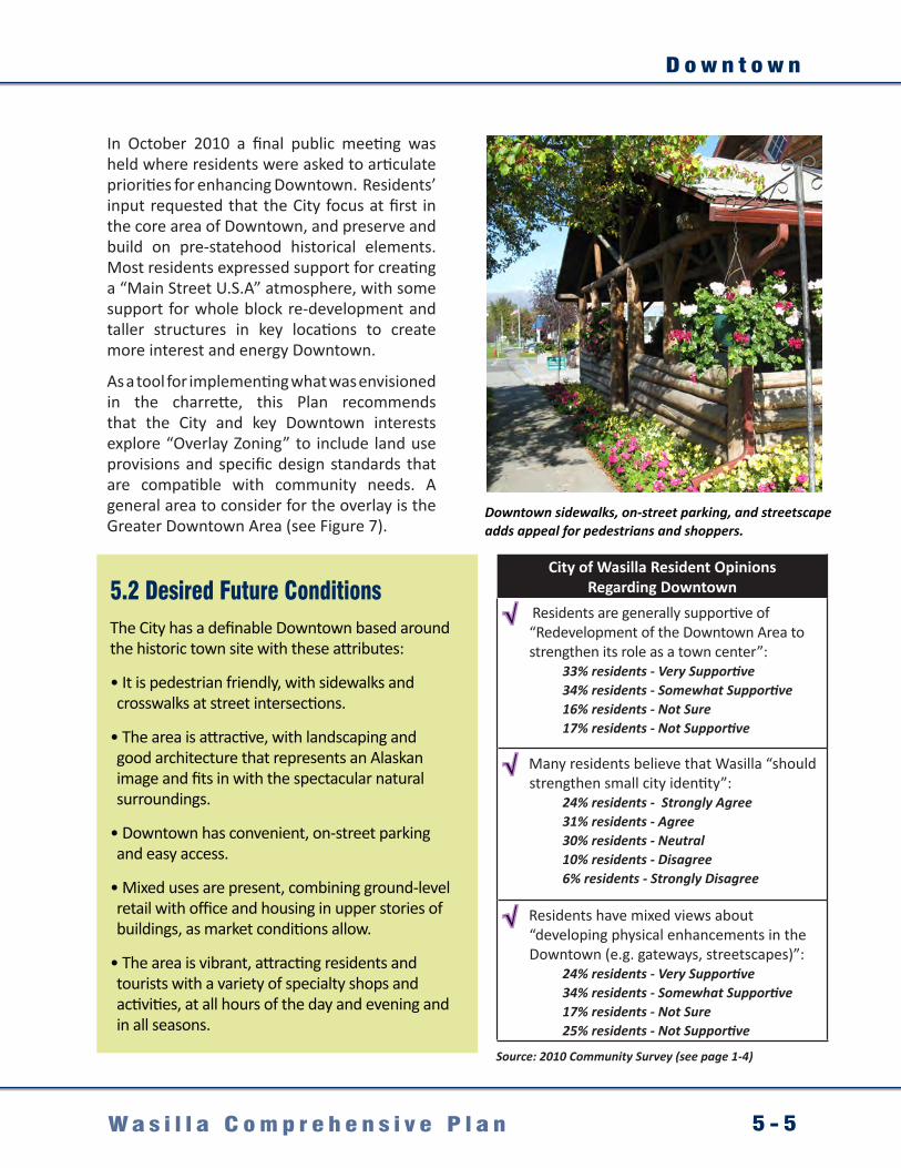
D o w n t o w n
5 - 5W a s i l l a C o m p r e h e n s i v e P l a n
In October 2010 a final public meeting was held where residents were asked to articulate priorities for enhancing Downtown. Residents’ input requested that the City focus at first in the core area of Downtown, and preserve and build on pre-statehood historical elements. Most residents expressed support for creating a “Main Street U.S.A” atmosphere, with some support for whole block re-development and taller structures in key locations to create more interest and energy Downtown.
As a tool for implementing what was envisioned in the charrette, this Plan recommends that the City and key Downtown interests explore “Overlay Zoning” to include land use provisions and specific design standards that are compatible with community needs. A general area to consider for the overlay is the Greater Downtown Area (see Figure 7).
Downtown sidewalks, on-street parking, and streetscape adds appeal for pedestrians and shoppers.
5.2 Desired Future ConditionsThe City has a definable Downtown based around the historic town site with these attributes:
• It is pedestrian friendly, with sidewalks and crosswalks at street intersections.
• The area is attractive, with landscaping and good architecture that represents an Alaskan image and fits in with the spectacular natural surroundings.
• Downtown has convenient, on-street parking and easy access.
• Mixed uses are present, combining ground-level retail with office and housing in upper stories of buildings, as market conditions allow.
• The area is vibrant, attracting residents and tourists with a variety of specialty shops and activities, at all hours of the day and evening and in all seasons.
City of Wasilla Resident Opinions Regarding Downtown
√ Residents are generally supportive of “Redevelopment of the Downtown Area to strengthen its role as a town center”:
33% residents - Very Supportive34% residents - Somewhat Supportive16% residents - Not Sure17% residents - Not Supportive
√ Many residents believe that Wasilla “should strengthen small city identity”:
24% residents - Strongly Agree31% residents - Agree30% residents - Neutral10% residents - Disagree6% residents - Strongly Disagree
√ Residents have mixed views about “developing physical enhancements in the Downtown (e.g. gateways, streetscapes)”:
24% residents - Very Supportive34% residents - Somewhat Supportive17% residents - Not Sure25% residents - Not Supportive
Source: 2010 Community Survey (see page 1-4)

C h a p t e r 5
5 - 6 W a s i l l a C o m p r e h e n s i v e P l a n
5.3 Goals, Objectives, and ActionsGoal 1. Promote and encourage development and redevelopment within the Downtown area.
Objective Actions
1.1 Adopt land use policies that encourage a mix of land uses in the Downtown area that create and establish a more vibrant town center, create a gathering place for residents and visitors, and a focus for business and cultural activities.
1.1.1 Create a Downtown overlay zoning district that incorporates Wasilla’s historic center (see Downtown overlay concept map). Develop land use regulations and development standards that encourage new development/redevelopment, appropriate land use patterns, and a cohesive town center.
1.1.2 Consider developing an incentive based policy or other solutions to help reduce lot fragmentation of potentially valuable commercial sites.
1.1.3 Support developer’s efforts to reconsolidate Downtown lots for high-quality development that will enhance the historic Downtown district.
1.1.4 Adopt land use policies that allow development of multi-story buildings with street-level commercial and office uses with upper-story residential units in the Downtown area.
1.2 Identify opportunities to develop civic investments that revitalize the Downtown area and reinforce its identity as an attractive civic center.
1.2.1 Support partnership approaches that leverage funding and community support to help build a new library, expanded Valley Performing Arts Theater, town square, streetscape, sidewalks, and lighting in the Downtown core.
1.2.2 Design and improve Downtown streets to encourage walking, on-street parking, covered walkways, and additional curbs and gutters.
1.2.3 Work closely with ADOT&PF on major road projects, including the Yenlo Street Extension/Main Street Couplet and the Parks Highway Alternative Route development, to ensure that roadway’s are upgraded to re-shape core area circulation for walkability, on-street parking, and to include streetscape design opportunities.
1.3 Improve pedestrian access in the Downtown area.
1.3.1 Work with roadway facility designers and community members to define basic functional and aesthetic parameters for streetscape improvements in the Downtown area.
1.3.2 Dedicate city, state, and federal resources as available to developing Downtown’s streetscape infrastructure, including wide sidewalks and pedestrian amenities.
1.3.3 Partner with Downtown business and property owners on improvement and management issues related to improving the Downtown pedestrian environment (parking needs, sidewalk upgrades, and regular snow clearing and maintenance).

D o w n t o w n
5 - 7W a s i l l a C o m p r e h e n s i v e P l a n
Wasilla’s business district in 1974 (aerial, above) was focused in a “node” at the major crossroads. Today, much of the main business activity has become linear in nature, and spread along the highway corridor, making it harder to identify Wasilla’s “Downtown.”
Goal 2. Build the partnerships and develop the community capacity required to transform Downtown. Objective Actions
2.1 Bring key stakeholders together to help mobilize implementation of a Downtown overlay zoning district.
2.1.1 Engage key stakeholders and involve them in creating and assisting with the implementation of the Downtown overlay zoning district, potentially through a Downtown Development committee.
2.2 Create public-private partnerships that can leverage resources to implement the Downtown overlay zoning district.
2.2.1 Encourage the creation of a business improvement district among core area businesses to supplement city services and invest in the Downtown’s maintenance, marketing, and the common improvements that help attract residents and visitors.


C o m m u n i t y A s s e t s
6 - 1W a s i l l a C o m p r e h e n s i v e P l a n
Chapter 6. Community Assets
6.1 Current Conditions and TrendsCommunity assets specifically include the many resources and attributes that the City develops, manages, and enhances for current and future residents. Cost effective infrastructure and services, upholding important quality of life issues that residents and visitors value, and enhancing future economic development opportunities are all critically important aspects of this planning element.
Currently, the resources to oversee and enhance community assets are largely provided by the City and are funded from a number of sources, with the largest contribution being from a municipal sales tax. It is the City’s mission to:
“Provide optimum service levels to the public as cost effectively as possible to ensure a stable and thriving economy, promote a healthy community, provide a safe environment and a quality lifestyle, and promote maximum citizen participation in government.”
City of Wasilla Mission Statement
For several years now, the City has been one of the fastest growing communities in the United States, and it is a real challenge for the City government to keep up with this growth. The increasing demand for services due to this growth must be met and the City must continue to work with federal, state, and local entities to meet these needs.
As part of this planning effort, residents were surveyed about the City. This statistically valid input provides important feedback about investments into public services. Major areas of support from residents include:
Most Important Interests for the City to Address: • improve roadways and transportation (56%)• more employment opportunities (47%)• increase public safety (32%)• expand school services (30%)
Level of Satisfaction with Major City Services: • public safety services (71%)• parks and recreation programs/facilities (55%)• customer service from city employees (52%)• maintenance of city streets/facilities (52%)
Public FacilitiesThe City has a number of important community public facilities, which are all generally located Downtown, including City Hall, the Wasilla Public Library, Post Office, and the Dorothy Page Museum.
City services will be needed to serve a population anticipated to grow at a 3.1% rate through 2034.
Improved roadways are a top priority of residents.

C h a p t e r 6
6 - 2 W a s i l l a C o m p r e h e n s i v e P l a n
Over the life of this Plan, key issues related to facilities are expected to include:• Ongoing repair and maintenance, limited space, a lack of elevator access, and insufficient
parking. In a number of cases, new facility space may be more cost effective or necessary, especially in undersized facilities such as the existing Wasilla Public Library.
• Considering the role of location and visibility for public facilities. This includes finding ways to gain value by being willing to sell valuable real estate and at the same time, investing in real estate in ways that can leverage future civic uses in a cost effective manner.
Water, Sewer and Utility Networks
City water and sewer currently serves approximately 1,100 and 800 customers (respectively) within the general area shown on the Community Assets Map in Appendix C. These systems are expected to be adequate in terms of their future capacity and able to support a full build out of the City within its current boundaries, with planned upgrades (City of Wasilla Public Works, 2011). Planning for regional systems is underway, and land will need to be purchased to support key collection and distribution sites. In the meantime maintaining current infrastructure will need to be a priority to extend the life of the existing systems.
Other utility networks including gas, electric, and telecommunications are in place, and are adequate for the community’s needs. However, efforts should be continued in concert with private providers to ensure that new commercial and economic enterprises have adequate service. Another priority is reservation of rights-of-way and finding ways to fund future utility and public works projects.
Recreation and Parks
City parks and recreational resources are valued assets, used both by residents and the growing regional population. During the public process, many comments were generated about individuals’ appreciation for City parks and facilities, and the desire to take good care of the existing stock, especially the “gems.” A 2009 survey undertaken within this planning effort found a general level of satisfaction with the City’s existing parks and recreation services.
Key park issues over the life of this Plan include:• Finding ways to stretch limited resources.• Creating realistic funding priorities.• Recognizing that it is counter-productive to compete with
the private sector by providing expensive equipment and facilities for more specialized sports that serve a limited population of users. Support the private sector in meeting this demand on a “pay to play” basis, while using City dollars to serve the largest populations of user needs.
• Allow the private sector to help generate income for parks. • Do strategic planning for key facilities with income
generating potential such as the Curtis D. Menard Memorial Sports Center to determine the most cost-effective balance of programming. Consider non-recreational uses for these facilities and regional event opportunities that help generate direct tax revenue.
Parks, recreation, and open space are valued by residents.
© Mike Criss

C o m m u n i t y A s s e t s
6 - 3W a s i l l a C o m p r e h e n s i v e P l a n
TrailsA 2007 Wasilla park master planning survey identified that more than half of the City’s residents are using City trails. Enhancing motorized and non-motorized trail connections can provide more recreation opportunities community wide, on a year-round basis, with important health, transportation, and recreation benefits. Key trail issues over the life of this plan include:
• Finding resources to extend and improve the existing system.
• Addressing use incompatibilities and improve safety.
• The need for regionally connected networks for both motorized and non-motorized trail use, and diverse recreational user groups.
Historic, Cultural and Educational Assets
The City has exceptional assets that support learning around history and culture. These assets, located on the Community Assets Map (Appendix A) include a mix of City-owned, private and Borough facilities; many are non-profits. City support for these entities over the life of this Plan will help enhance Wasilla as a regional center, attract visitors (who contribute sales tax), and attract employers by enhancing residents’ education and community life.
Natural and Scenic ResourcesThe City is located within a spectacular setting with ample natural resources that contribute to the area’s quality of life and potential visitor appeal. Retaining and enhancing these assets can be a challenge as the City grows and develops. Over the life of this Plan, working with private landowners and community partners will be vital to maintaining them for future generations.
Community Character and IdentityAn intangible, yet critical asset of any community is its overall character and identity. Although difficult to manage, community planning and public projects should consider ways to “re-frame” and enhance perceptions of the City. This could include creating highly visible landmarks, buildings and enhancements along the Parks Highway, revitalizing Downtown, community branding, and outreach through the Wasilla Chamber of Commerce and other tourism agencies.
Community assets include trails, historic relics and visitor attractions.

C h a p t e r 6
6 - 4 W a s i l l a C o m p r e h e n s i v e P l a n
6.2 Desired Future ConditionsWasilla’s Public Facilities are attractive, safe, functional and provide value to the community.
Adequate water, sewer and utility networks serve residents and new growth, including economic enterprise and commercial uses.
Recreation and parks are cost-effectively run and enhance local health and quality of life.
A regionally linked network of trails serves diverse users safely and enjoyably.
Historic, cultural and educational assets are enhanced for residents and visitors.
Natural and scenic resources are preserved and maintained for the future.
Wasilla enjoys an enhanced community character and identity.Community Asset
Supplementary Documents
This comprehensive plan chapter presents a broad vision, intended for incremental implementation over the next 10 or more years. Please consult other documents and sources, including those listed below, for more specific and up to date information such as capital improvement lists, design standards, and project criteria.
City of Wasilla Resident Survey Opinions Regarding Community Assets
√ Improved utilities and infrastructure are important community priorities:
39% residents - Very important40% residents - Somewhat important12% residents - Not Sure9% residents - Not important
√ Most City residents are generally satisfied with Wasilla’s Parks and Recreation Programs and Facilities:
11% residents - Very Satisfied44% residents - Satisfied33% residents - Neutral10% residents - Dissatisfied 8% residents - Very Dissatisfied
√ There is broad support for a City system of recreational trails and greenbelts connect the community:
39% residents - Very Supportive33% residents - Somewhat Supportive10% residents - Neutral18% residents - Not Supportive
© North Star Multimedia © North Star Multimedia © North Star Multimedia © North Star Multimedia © North Star Multimedia
© North Star Multimedia
© North Star Multimedia
© North Star Multimedia
Source: 2010 Community Survey (see page 1-4)
City of Wasilla Official Streets and Highways PlanAirport Master PlanDraft Wasilla Area PlanParks Master PlanTrails PlanWater Master PlanSewer Master PlanStorm Water Master Plan

C o m m u n i t y A s s e t s
6 - 5W a s i l l a C o m p r e h e n s i v e P l a n
6.3 Goals, Objectives, and Actions
Goal 1. Provide essential services and facilities necessary to encourage new commercial, industrial, and manufacturing development.Objective Actions
1.1 Enhance capacity and connectivity of services needed for new commercial, industrial, and manufacturing investment.
1.1.1 Maintain and expand City infrastructure investments to adequately provide sewer services as the community grows.
1.1.2 Coordinate at the regional level to plan for and develop the regional sewer systems necessary to accommodate future growth.
1.1.3 Consider policies that require developers to anticipate future infrastructure connections in mind (conduit for utilities, pipe for water and sewer).
1.2 Anticipate and plan for new state and federal regulations regarding development, land use, and infrastructure requirements.
1.2.1 Update and maintain water, stormwater, and sewer master plans.
Goal 2. Enhance educational opportunities. Objective Actions
2.1 Support quality education and lifelong learning opportunities needed to develop a skilled workforce that will attract new employers.
2.1.1 Work with the Matanuska-Susitna Borough, the State of Alaska, and other partners to support development of a new library facility that can more adequately serve the region’s population.
2.1.2 Partner with the Matanuska-Susitna School District, Charter College, and other educational institutions to help them enhance their program delivery, and to work on mutual community goals (recreation, health, safe routes to school, crime prevention, etc.).

C h a p t e r 6
6 - 6 W a s i l l a C o m p r e h e n s i v e P l a n
Goal 3. Enhance recreational opportunities.
Objective Actions
3.1 Continue to provide and improve opportunities for community recreation.
3.1.1 Develop and protect important recreational trail corridors (e.g. Iditarod, Wasilla-Big Lake trails) and promote multiple-use trails year-round.
3.1.2 Maintain existing parks to a high standard and review options for new parks as deemed necessary or desirable by residents.
3.1.3 Adopt formal plans for Wasilla’s Parks, Trails, and the Multi-Use Sports Center to identify priority goals, projects, standards and implementation tools.
3.1.4 Assess the capacity and use of the recreational and park facilities to ensure sufficient capacity, maximum/multiple use, and additional facilities and parks where desired by the community.
3.1.5 Enhance City parks and recreation facilities; where possible, partner with volunteer, private, and not-for-profit organizations for improvements.
3.2 Identify missing trail links and address deficiencies and safety issues associated with the existing trail network.
3.2.1 Update the 1999 City of Wasilla Trails Plan using a public process that integrates Trail Management methods which can both address multi-use safety conflicts, and ensure that each user group has a usable network.
3.2.2 Identify, reserve, and purchase rights-of-way for trail routes that link Wasilla to regional networks and destinations (Big Lake Wasilla Trail) and that connect local residents to parks, educational centers, and commercial centers.
3.2.3 Determine access points for trails and trailheads that respect private property.
3.2.4 Develop or adopt a trail education, etiquette, and sign program to help trail users respect other users and trail neighbors.

C o m m u n i t y A s s e t s
6 - 7W a s i l l a C o m p r e h e n s i v e P l a n
Goal 4. Preserve and enhance the City’s unique community assets.
Objective Actions
4.1 Recognize, preserve, and showcase the City’s historic past.
4.1.1 Maintain, strengthen, and preserve the City’s historic town site and structures.
4.1.2 Seek to acquire, restore, and protect important historical resources with an emphasis on pre-statehood articles, buildings, and historic sites. Once acquired, provide interpretive and visitor facilities that support that attraction.
4.1.3 Provide support for the Dorothy Page Museum, and Museum of Alaska Transportation and Industry as important visitor and resident attractions.
4.2 Enhance the City’s visual appearance and identity.
4.2.1 Identify landmarks and features of visual interest to residents and visitors, and explore opportunities for enhancing access to them and/or framing views for the public (e.g. scenic overlooks, pullouts, site development that maintains and/or incorporates views.)
4.2.2 Work to tap community pride and owners’ self interest in enhancing properties along the Parks Highway by partnering with the Chamber of Commerce and other organizations on community beatification and cleanup efforts.
4.2.3 Collaborate with ADOT&PF to identify ways to preserve landscaping along state roadways and minimize dust pollution from winter maintenance.
4.3 Protect the City’s natural resources, including Wasilla Lake and Lake Lucille.
4.3.1 Seek mitigation opportunities and design solutions to balance recreational use of lands and preservation goals, particularly with ORV crossings of wetlands and anadromous streams.
4.3.2 Consider ways to better protect waterways from neighborhood septic tanks, use of damaging chemicals and fertilizers, and clearing of natural vegetation along the shoreline which both filters chemicals and provides important habitat for young Salmon and other fish.
4.3.3 Establish programs to improve and maintain the water quality in both Lucille Lake and Wasilla Lake.
4.3.4 Require curbs, gutter, and stormwater runoff control measures that help collect, filter, and enhance the quality of water quality returning to natural waterways.
4.4 Enhance access to natural areas.
4.4.1 As possible expand the public land base to include greenbelts, stream corridors, and open spaces that support groundwater, flood control, habitat, and community enjoyment values.
4.4.2 Work with landowners and other partners to enhance resident’s access to Cottonwood Creek, Lucille Lake and Wasilla Lake, and to create a connected trail system that features overlooks and interpretive materials pertaining to these important community resources.


E c o n o m i c V i t a l i t y
7 - 1W a s i l l a C o m p r e h e n s i v e P l a n
Chapter 7. Economic Vitality
7.1 Current Conditions and TrendsRegional Commercial and Service Center
The last decade has firmly established the City’s “crossroads” as the region’s major commercial center. This development, largely zoned Commercial, is focused along the Parks Highway, generally from the Palmer-Wasilla Highway to KGB Road. Commercial development is also radiating from this center along collector roads, including into areas with Rural Residential zoning.
As the region’s population grows, the City is beginning to reach a critical mass in terms of the size of the population served and the market’s ability to support a greater diversity of service and retail providers. For example, in the past decade it has attracted new large retailers and a number of service organizations and company branch offices including Target, South Central Foundation, and Providence Hospital.
As part of updating the Plan, in September 2009 a Wasilla Area Retail Office, Commercial, and Market Analysis Market Study (“Market Study”) was completed by the Gibbs Planning Group and is included in Appendix D. This analysis was completed so that future development plans reflect actual market conditions and potentials. The Market Study indicated that the City is in the midst of evolving from a bedroom community of Anchorage to a more self-sufficient community, meeting some regional retail needs. Moreover, the September 2009 study determined that in 2009 the City’s commercial district was serving a regional trade area population of around 90,000. State population projections indicate this could exceed 150,000 by 2034 (ADLWD 2010).
In terms of specific commercial and economic opportunities, the study points out that historic retailers have been convenience and neighborhood oriented in size and scale, but that the City has successfully attracted community scale retailers (Target, Sears, Walmart, Fred Meyer, etc.). Under current economic conditions, growth in retail development is anticipated to be able to support an additional 177,000 square feet of additional retail. See Table 10 for specific categories.
An Attraction for Residents and Visitors
A year-round recreation paradise, the City has historical ties to the renowned Iditarod Trail Sled Dog Race and is the home of the Tesoro Iron-Dog 2000, the world’s longest snowmobile race. Fishing, swimming, boating, hiking, and biking are popular activities during summer’s long daylight hours, and mountains, lakes, streams, wetlands, tundra, and boreal forests are within easy reach. The quality of life is excellent, the water is clean and abundant, the air is fresh, and the people are friendly. The City embodies the small-town values of family, community, and caring for neighbors. The unique locale appeals to those who seek an Alaskan lifestyle while raising a family, taking advantage of economic prospects, or retiring in comfort. In terms of City finances, total revenues and expenditures over a number of years show that the City is consistently in the black.
The City has become the region’s major commercial center.
© North Star Multimedia

C h a p t e r 7
7 - 2 W a s i l l a C o m p r e h e n s i v e P l a n
Work Where You Play
Although the City has a growing number of jobs related to its growth as a retail and service center, most residents’ jobs remain outside the community. During public meetings, and in the survey, City residents expressed support for expanding new industrial and employment areas and were excited about the prospect of shifting more jobs to the City. Specific ideas and opportunities for creating new enterprises and jobs in the City that emerged during the planning process include:
Multi-Modal Related Enterprises at the Airport
The City has industrially zoned land located at its airport. Enhanced rail, road and air transportation linkages can support a range of enterprises that could create local jobs, including the following: • New local product development and manufacturing;• Attracting high tech businesses that can take advantage of the technical skills and education
of former military and North Slope workers;• Material transport and resource storage/staging;
• Transit-oriented tourism and connectivity to the Museum of Alaska Transportation and Industry. This could include large scale Denali tour train passenger drop-offs, train and bus transfer, and shuttling or walking options to reach nearby private developments, which are proposed to include a large private hotel and convention center complex (west end of Jacobson Lake).
Regional Offices, Branches, and Service Centers
A number of commercial, financial, and government entities have realized that Wasilla serves as the central node for the Valley, the closest accessible point for all Valley residents and consumers. Just as shopping closer to home has brought significant resources into the local economy (see the demographics discussion) so would bringing business closer to home. This could provide win-wins allowing these entities to provide better services directly in the Borough’s population growth center, and to allow commuting employees the option of working in their community.
2009 WASILLA RETAIL, OFFICE AND LODGING MARKET ANALYSIS
Additional retail in the City supportable based on current demographics and trends
72,600 sf of general merchandise stores34,600 sf of dine in and carry out restaurants17,000 sf of apparel and accessories stores14,000 sf of hardware and lawn/garden retail9,000 sf of sporting goods and hobby retail6,600 sf of electronic and appliance retail5,900 sf of home furnishings3,900 sf of specialty food stores2,500 sf of health care and personal services1,400 sf of jewelry, luggage and leather retail9,500 sf of miscellaneous neighborhood retailers (e.g., florists, pet supplies, video and gift shops).Table 10. Supportable Additional Retail in the Wasilla Area (Source: Gibbs Planning Group Retail Office and Lodging Market Analysis, September 28, 2009).
The City has attracted major retailers including Sears, Walmart, Target, and Home Depot.
© Ron Day

E c o n o m i c V i t a l i t y
7 - 3W a s i l l a C o m p r e h e n s i v e P l a n
Gateway to Recreation
The City provides residents a virtual outdoor playground with access to some of Alaska’s most sought after year-round recreational spots just a short scenic drive from home including the Matanuska and Knik glaciers, Hatcher Pass, several state game refuges and recreation areas, world-class fishing rivers, and Denali National Park and Preserve. Moreover, Wasilla has a growing tourism sector, and could market itself as the affordable, fun, and logical place for Alaskans and visitors to stay while pursuing their recreational experiences.
Diverse regional recreational destinations are easily accessible to the City, and could be “packaged” in sample itineraries. Travel planning materials could help visitors locate lodging and other desired services to support their itinerary. Lodging in the City will place visitors that much closer to destinations.
This effort is largely a task of marketing and packaging and would need the marketing expertise of the Wasilla Chamber of Commerce, Matanuska-Susitna Convention and Visitors Bureau, and regional guides and outfitters.
The Valley’s Meeting and Convention Center
The Curtis D. Menard Memorial Sports Center has gained regional interest as a place to hold large public events, seminars, and small conventions. Income from these activities are a growing segment, and are helping to cover the high costs of operating the recreational aspects.
Additionally, new plans for a rail and road-based convention center, hotel, condos, and restaurant are being explored in the Jacobson Lake area. Although mainly intended to support the region’s growing meeting space needs, the facility could also bring out of state travelers by bus or eventually with rail service direct from the Ted Stevens Anchorage International Airport.
7.2 Desired Future ConditionsThe City’s economy in the future is more diverse and vibrant. The region’s commercial and service sectors provide competitive products keeping regional dollars in the local economy.
The City attracts additional residents and visitors. The population grows, as does the City’s tourism sector. The already high quality of life, in addition to a revitalized Downtown and enhanced community image, make the City a desirable place to live, visit, and play.
The City now has a stable and growing job sector that utilizes its well-qualified workforce. Every year, more and more commuters are shifting to employment in the local economy.
City of Wasilla Resident Survey Opinions Regarding Economic Vitality
√ Residents support City efforts to expand new industrial and employment areas:
52% residents - Very Supportive31% residents - Somewhat Supportive8% residents - Neutral9% residents - Not Supportive
√ City residents broadly support expanding Wasilla’s development areas (Airport, Downtown, Wasilla Heights, etc.):
36% residents - Very Supportive38% residents - Somewhat Supportive16% residents - Neutral11% residents - Not Supportive
√ Residents generally agree that Wasilla needs to strengthen its small city identity:
24% residents - Strongly Agree31% residents - Agree30% residents - Neutral10% residents - Disagree6% residents - Strongly Disagree
Source: 2010 Community Survey (see page 1-4)

C h a p t e r 7
7 - 4 W a s i l l a C o m p r e h e n s i v e P l a n
7.3 Goals, Objectives and ActionsGoal 1. Continue to promote and enhance the City’s future as the region’s major center for commerce, services, visitor hospitality, culture and arts, transportation and industry.Objective Actions
1.1 Adopt policies and programs that will ensure that the City remains the preferred place in the Valley for shopping, services, employment, arts, entertainment, sports, and culture.
1.1.1 Develop a strategic economic plan that considers how to secure Wasilla’s future as the leading commercial center given its location and proximity to growing population nodes, particularly Knik/Fairview.
1.2 Develop a plan to creating a more diverse economic base that will attract a wider range of employment opportunities.
1.2.1 Identify ways to ensure that the City continues to support appropriate development.
1.2.2 Continue to offer efficient and affordable permitting to foster improvements to and investments in the area’s housing stock and business properties.
1.2.3 Coordinate with non-City utility providers to expand services that will support new commercial, industrial, and manufacturing investment.
1.2.4 Identify key commercial and industrial areas of the City for development; promote the advantages for businesses to build or expand in these locations such as availability of City services, access to utilities, and the value of being adjacent to other businesses.
1.2.5 Encourage developers and investors to work with the comprehensive planning process to help formulate plans for community and economic development.
1.3 Encourage the development of new anchor developments, facilities, and attractions that generate economic activity.
1.3.1 Support community initiatives to strengthen the City as a regional center of art, culture, and education (e.g. Valley Performing Arts expansion, new Wasilla Library, new Sports Dome).
1.3.2 Promote opportunities for creating a destination hotel, restaurant, timeshare and convention center in areas such the multi-modal transit center and the Museum of Alaska Transportation and Industry and Wasilla Heights.
1.3.3 Promote and support new activities, festivals, and recreational opportunities that encourage visitors and tourists to visit the City (e.g., fishing derbies, new mining history display, winter festival, etc.).
1.4 Promote the City as a base for Valley recreation and a “Gateway to Adventure.”
1.4.1 Partner with the Mat-Su Convention and Visitors Bureau and Wasilla Chamber of Commerce and other recreation-oriented interests to promote the City’s visitor hospitality services and location as the gateway to recreational opportunities.
1.4.2 Identify opportunities for tourist attractions within the City.

E c o n o m i c V i t a l i t y
7 - 5W a s i l l a C o m p r e h e n s i v e P l a n
Goal 2. Diversify the economic base and attract new employment generators.Objective Actions
2.1 Continue to expand the City airport and encourage development of adjacent economic generators on City-owned land.
2.1.1 Identify ways to attract new product manufacturing and assembly plants, including focused on producing specialty items using local resources.
2.1.2 Seeks funds to be used for capital improvements that serve as an incentive to attract new employers to the City.
2.2 Encourage employment opportunities within the City to reduce commuting to Anchorage for jobs.
2.2.1 Reach out to commercial, financial, and government entities headquartered in Anchorage and Palmer and promote local branch Wasilla offices, both to provide better services directly in MSB’s population growth center, and to allow commuting employees the option of working in their community.
The Curtis D. Menard Memorial Sports Center has gained regional interest as a place to hold large public events, seminars, and small conventions.
Economic Vitality Element Supplementary DocumentsThis comprehensive plan chapter presents a broad vision, intended for incremental implementation over the next ten or more years. Please consult other documents, including those listed below, for more specific and up to date information, priorities and projects:
City of Wasilla Airport Master PlanWasilla Area PlansRetail, Office, and Lodging Market Analysis for the Wasilla Area
Matanuska-Susitna Borough Areawide PlansEconomic Development Strategic Plan © North Star Multimedia


I n t e r g o v e r n m e n t a l C o o r d i n a t i o n
8 - 1W a s i l l a C o m p r e h e n s i v e P l a n
Chapter 8. Intergovernmental Coordination
8.1 Current Conditions and TrendsMultiple-Levels of Government
The City is one of many government entities trying to serve citizens in the region. Moreover, the interrelationship of these layers is complex and changing, particularly around available funding, current priorities, and jurisdictional issues given the diversity of local cities, community councils, and “no local government” areas (see Figure 8). As a City with a defined mission, boundaries, and tax base, Wasilla has a limited ability to directly address many issues of importance to the City and region. Therefore, over the life of this Plan, it will be important for the City to work as a team player on regional goals.
Figure 8. Matansuka-Susitna Borough map showing the diversity of local cities, community councils, and “no local government” areas (see inset, white areas). Coordination to serve regional needs is vital to the City’s future.
!!
!
!
!
!
!
!
!!
!
!
!
!
!
Knik
WillowSutton
PalmerWasilla
Houston
Skwentna
Big LakeButte
Talkeetna
Chickaloon
Lake Louise
Petersville
Glacier View
Trapper Creek
E0 84 Miles
MSB Boundary
Susitna
River
Yentna River
Skwentna R iver
Matanuska
River
Susitna
RiverCh
ulitna
River
Tokositna River
Knik Ar
m
CookInlet
Knik RiverMSB Boundary
Denali Hwy
Glenn Hwy
Geo
rge
Park
sHw
y
Clos ed in Winter
AL
AS
KA
RA
NG E
TA
LK
EE
TN
AM
TS
C H U G A C H M T S
MSB
N. Wasil
la-Fish
hook
Rd.
S. O ld G lenn Hwy.
S.Glen
nHwy
.S. Knik
Goose Bay Rd.
W. Par ks Hwy E. Palmer-Wasilla Hwy.
Community CouncilBIG LAKE
BUFFALO/SOAPSTONE
BUTTE
CHASE
CHICKALOON
FARM LOOP
FISHHOOK
GATEWAY
GLACIER VIEW
KNIK-FAIRVIEW
LAZY MOUNTAIN
MEADOW LAKES
NORTH LAKES
PETERSVILLE
POINT MACKENZIE
SKWENTNA
SOUTH KNIK
SOUTH LAKES
SUSITNA
SUTTON
TALKEETNA
TANAINA
TRAPPER CREEK
WILLOW
CITY BOUNDARY MSB Information Technology Dept./GISMay 27, 2009
SEE DETAIL
Knik Arm
!!
!
!
!
!
!
!
!!
!
!
!
!
!
Knik
WillowSutton
PalmerWasilla
Houston
Skwentna
Big LakeButte
Talkeetna
Chickaloon
Lake Louise
Petersville
Glacier View
Trapper Creek
E0 84 Miles
MSB Boundary
Susitna
River
Yentna River
Skwentna R iver
Matanuska
River
Susitna
RiverCh
ulitna
River
Tokositna River
Knik Ar
m
CookInlet
Knik RiverMSB Boundary
Denali Hwy
Glenn Hwy
Geo
rge
Park
sHw
y
Clos ed in Winter
AL
AS
KA
RA
NG E
TA
LK
EE
TN
AM
TS
C H U G A C H M T S
MSB
N. Wasil
la-
Fishho
ok
Rd.
S. O ld G lenn Hwy.
S.Glen
nHwy
.
S. KnikGoose Bay Rd.
W. Par ks Hwy E. Palmer-Wasilla Hwy.
Community CouncilBIG LAKE
BUFFALO/SOAPSTONE
BUTTE
CHASE
CHICKALOON
FARM LOOP
FISHHOOK
GATEWAY
GLACIER VIEW
KNIK-FAIRVIEW
LAZY MOUNTAIN
MEADOW LAKES
NORTH LAKES
PETERSVILLE
POINT MACKENZIE
SKWENTNA
SOUTH KNIK
SOUTH LAKES
SUSITNA
SUTTON
TALKEETNA
TANAINA
TRAPPER CREEK
WILLOW
CITY BOUNDARY MSB Information Technology Dept./GISMay 27, 2009
SEE DETAIL
Knik Arm
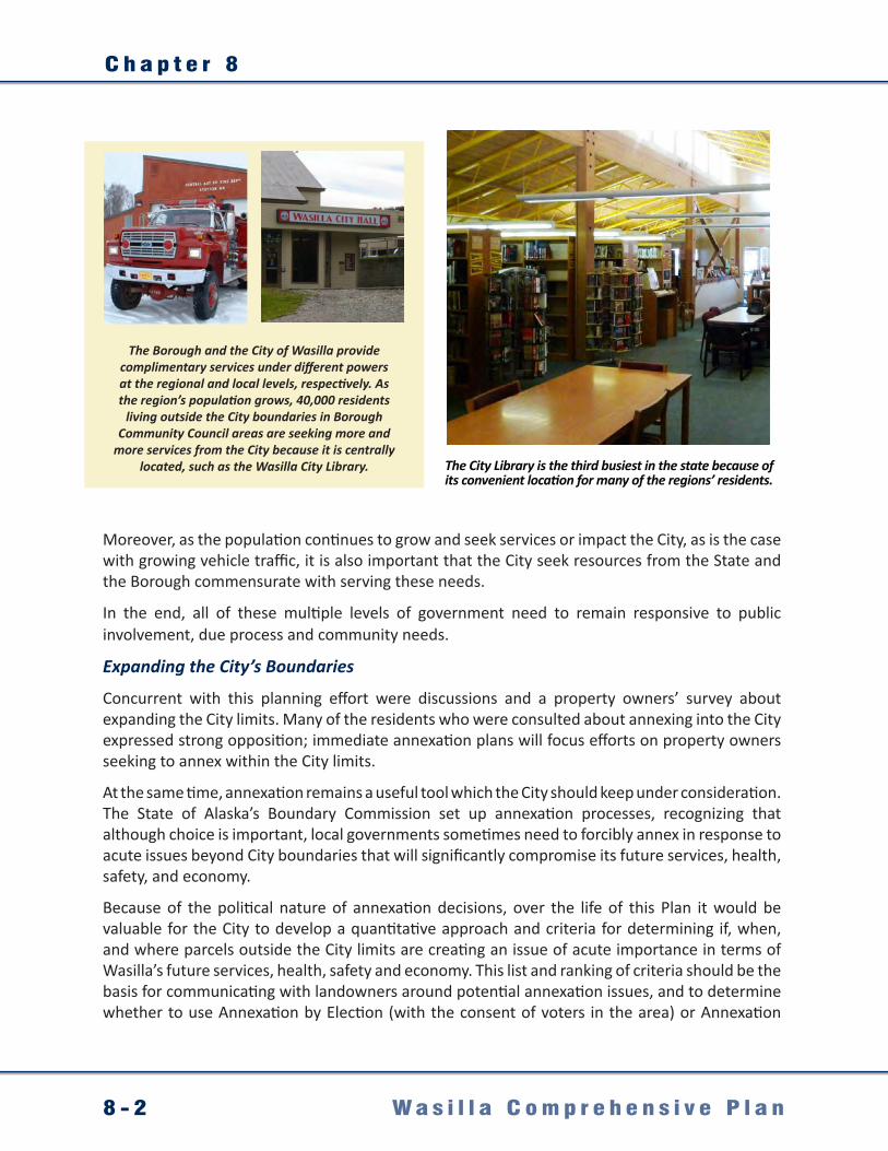
C h a p t e r 8
8 - 2 W a s i l l a C o m p r e h e n s i v e P l a n
The Borough and the City of Wasilla provide complimentary services under different powers at the regional and local levels, respectively. As the region’s population grows, 40,000 residents
living outside the City boundaries in Borough Community Council areas are seeking more and
more services from the City because it is centrally located, such as the Wasilla City Library.
Moreover, as the population continues to grow and seek services or impact the City, as is the case with growing vehicle traffic, it is also important that the City seek resources from the State and the Borough commensurate with serving these needs.
In the end, all of these multiple levels of government need to remain responsive to public involvement, due process and community needs.
Expanding the City’s Boundaries
Concurrent with this planning effort were discussions and a property owners’ survey about expanding the City limits. Many of the residents who were consulted about annexing into the City expressed strong opposition; immediate annexation plans will focus efforts on property owners seeking to annex within the City limits.
At the same time, annexation remains a useful tool which the City should keep under consideration. The State of Alaska’s Boundary Commission set up annexation processes, recognizing that although choice is important, local governments sometimes need to forcibly annex in response to acute issues beyond City boundaries that will significantly compromise its future services, health, safety, and economy.
Because of the political nature of annexation decisions, over the life of this Plan it would be valuable for the City to develop a quantitative approach and criteria for determining if, when, and where parcels outside the City limits are creating an issue of acute importance in terms of Wasilla’s future services, health, safety and economy. This list and ranking of criteria should be the basis for communicating with landowners around potential annexation issues, and to determine whether to use Annexation by Election (with the consent of voters in the area) or Annexation
The City Library is the third busiest in the state because of its convenient location for many of the regions’ residents.

I n t e r g o v e r n m e n t a l C o o r d i n a t i o n
8 - 3W a s i l l a C o m p r e h e n s i v e P l a n
by Legislative Review, under Alaska’s Administrative Code, 3 AAC 110.140, based on a vote of the State Legislature, without approval of the voters or property owners.
Finally, although currently annexation is not underway, over the life of this Plan at least two areas should be explored on a criteria basis:
• Health, Safety, Environment and Identity Criteria: Although they share a name, Wasilla Lake is largely out of City boundaries. To allow cohesive planning and enhanced water stewardship, annexing the lake and adjacent properties may be in the greater public interest.
• Safety and Economic Criteria: Properties outside the City proximate to the airport may be impacted by industrial and airspace activities, making it critical to coordinate development. Furthermore the City’s new economic activities in the area may generate a need for more commercial land uses that require infrastructure coordination and joint planning.
Intergovernmental coordination and potentially annexation will be needed to help the City address the basic health, safety and service needs of its residents and the large and growing population surrounding the City.
© North Star Multimedia © North Star Multimedia
© North Star Multimedia

C h a p t e r 8
8 - 4 W a s i l l a C o m p r e h e n s i v e P l a n
8.2 Desired Future ConditionsInto the future, the regions’ governmental interests carefully coordinate their efforts to more effectively serve residents’ needs.Citizens play a constructive role in helping their governments respond to the challenges and issues ahead.Wasilla respects the choice of property owners when it comes to expanding City limits, except where critical issues of health, safety and economy are involved.
Government Coordination NeedsAdequately serving both City and regional residents’ needs will require coordination and partnering on many governmental levels. Some of the most critical coordination needs identified in this planning effort are:
State of AlaskaADOT&PFGovernor’s OfficeARRC
Matanuska-Susitna BoroughNearby Cities:City of HoustonCity of PalmerMunicipality of Anchorage
Within and Surrounding the City:Community organizations Service providersNeighborhoodsCitizensPrivate landownersCommercial interestsPrivate utilities
© North Star Multimedia

I n t e r g o v e r n m e n t a l C o o r d i n a t i o n
8 - 5W a s i l l a C o m p r e h e n s i v e P l a n
8.3 Goals, Objectives, and ActionsGoal 1. Foster and encourage intergovernmental coordination between the City and the cities of Palmer and Houston, the Matanuska-Susitna Borough, and regional, state, federal and Native entities.
Objective Actions
1.1 Coordinate on land use proposals and planning.
1.1.1 Establish processes to review and provide comment on development proposals in the Borough near the City’s boundary.
1.2 Coordinate on new school proposals and planning.
1.2.1 Establish procedures to provide copies of rezoning and conditional use applications and other development applications that are pertinent to the School District staff for their information.
1.3 Encourage cooperation and coordination at many levels on mutually beneficial endeavors.
1.3.1 Consider mechanisms for fostering enhanced cooperation and coordination between the City, the Borough, interested citizens groups and advisory boards, and private organizations, regarding mutually beneficial endeavors.
Goal 2. Continue to promote the awareness and involvement of the residents in the planning processes for the City.
Objective Actions
2.1 Continue to advocate public participation in the planning processes for the City.
2.1.1 Continue to utilize an information exchange program, including the maintenance of an email mailing list and posting on the City’s web site as a means of communication between the City and all interested parties.
2.1.2 Maintain procedures to provide for the disseminating of proposals and alternatives for public inspection; opportunities for written comments; public hearings; open discussions; communication programs and information services; and the notification of real property owners for the adoption of the Comprehensive Plan, amendments to the Comprehensive Plan, and Comprehensive Plan Evaluation and Appraisal Reports, and other planning implementation efforts.
2.1.3 Continue to encourage public awareness of the Comprehensive Plan and the implementing regulations by providing for public education programs designed to promote a widespread understanding of the Plan’s purpose, intent and how citizens can be involved in the planning process and in all aspects of City government.
2.1.4 Seek involvement of local school and college students and staff in planning processes.


I m p l e m e n t a t i o n
9 - 1W a s i l l a C o m p r e h e n s i v e P l a n
Chapter 9. Implementation9.1 Immediate Priorities
This Plan outlines a road map for City action on issues that residents’ said were important during the course of this planning effort. Fully implementing this plan and its vision for the future of Wasilla will involve a significant work effort for City staff and officials, and also for its citizens in terms of additional public process and deeper-level problem solving around critical issues, and discerning best options (such as is the case with the Parks Highway Alternative). Moreover, a number of the goals, objectives and actions provided in this plan will take years to fully address, and will require careful and strategic cooperative effort to move forward.
Thus, the City will need to be flexible and realistic about implementation, and at any given time choose only to focus on priority elements that are within the City’s capacity in terms of leadership and the resources to move forward productively. At the same time, in order to build on the momentum and community goodwill that has been built over the course of this effort, there are immediate sets of priorities that the City will benefit from focusing on immediately after the adoption of this Plan:
• Transportation Objective 1.1 - The actions under this goal focus on addressing regional transportation network deficiencies, which are some of the more challenging to tackle, but should be top City priorities at the administrative and staff level. Roadway capacity limitations are a major public input concern, and this issue could become dire with continued population growth and state funding formula criteria that disfavor critically needed projects.
• Land Use Actions 2.1.1, and 3.2.2 - Title 16 will require minor revisions following adoption. Given projected growth, it would be good to move forward draft code revisions quickly after adopting this plan, and seek input from developers and property owners’ to create better code as a tool for consistent use as the City grows.
• Land Use Actions 3.1.1 and 4.2.1 - Currently neighborhood planning under code 16.08.050 is not functional because of the lack of procedures and City staff support. Procedures should be developed and implemented, and City staff should be encouraged to support them, as soon as possible to enable neighborhoods to participate more fully in developing strategies that better serve their needs and retain important qualities even as the population continues to expand.
• Downtown Goals 1 and 2 – Continue work on Downtown related efforts and build on the momentum that this planning process and the charrette generated.
New strategies and actions may need to be considered in addition to those in the Plan to fully achieve its goals.

C h a p t e r 9
9 - 2 W a s i l l a C o m p r e h e n s i v e P l a n
9.2 Measuring OutcomesThe heart of any comprehensive plan is its recommended goals, objectives, policies, and actions:
Goals are a broad statement of a future condition, desirable for the community.
Objectives are specific statements of desired results that help fulfill the goal.
Actions are the activities, programs, and projects that should be undertaken, continued, or modified to help achieve the established objectives and contribute to the fulfillment of the goals.
Once adopted, the goals, objectives, and actions recommended in City’s new Plan will serve as a strong foundation for land use planning in terms of:• Providing a legal foundation for the City’s Land Development Code (Title 16); • Justifying investment in capital improvement projects, including municipal systems
development (water and sewer), and trails, parks, etc.; • Helping to involve residents in important planning endeavors (e.g. creation of a Downtown
overlay district); and• Securing grant funding and partnerships.
Implementing the goals, objectives, and actions proposed in this Plan will help the City achieve those things and improve the quality of life in the City. In order to keep the Plan current and useful, it will need to be reviewed every few years to update the information, acknowledge outcomes and progress, and make any necessary revisions.
Currently, Section 2.60.010(B) of the Wasilla Municipal Code outlines specific Planning Commission responsibilities for review of the City’s comprehensive plan, as follows:• Undertake a general review of the comprehensive plan at least once every two years and
make recommendations to the council for amendments.• Annually, review one or more elements of the comprehensive plan, and make recommendations
for amendment to the council.Additionally, in order to ensure that the local planning process is not static, this Plan should be audited from time to time and the following performance standards should be considered:• Have the goals, objectives, and actions been implemented as outlined in the Plan? • Are there changing conditions in the City?• Does the Plan provide sufficient guidance to the local government regarding land development
regulations? • Are there new state and regional policies or planning studies that can provide guidance to the
City regarding land development decisions?• As the City gains more experience and understanding of the Plan, are there elements that
need clarification, or no longer reflect community goals?
Active dialogue on the efficacy of the Plan will enable more effective and focused problem solving and action around City goals and needs, and support implementation of this Plan.
B i b l i o g r a p h y
W a s i l l a C o m p r e h e n s i v e P l a n
ReferencesAlaska Department of Labor and Workforce Development (ADLWD). 2010. Alaska Economic
Trends: Population Projections 2009 - 2034. December Issue.
Alaska Department of Environmental Conservation (ADEC). 2002. Total Maximum Daily Load(TMDL) for Dissolved Oxygen in the Waters of Lake Lucille in Wasilla, Alaska. February 11.
Alaska Department of Transportation and Public Facilities (ADOT&PF). 2006. Wasilla Main Street Traffic Study. Project Number STP-0525(12)/54302. Prepared by Tryck Nyman Hayes, Inc. July 26, 2006.
__________. 2009. Mat-Su Valley Traffic Map.
__________. 2009. Parks Highway Traffic Safety Center Maps, 1977-2009.
Alaska Railroad Corporation. 2004. Wasilla Intermodal Facilities Alternatives Analysis. Prepared by HDR, Inc.
City of Wasilla. 1986. Comprehensive Plan.
__________. 1992 Comprehensive Plan. Prepared by B & B Environmental, Inc.
__________. 1996. Comprehensive Plan: City Approved Draft. April 1996.
__________. 1999. Wasilla Sewer Master Plan. Prepared by LCMF Incorporated and GV Jones and Associates, Inc. December 1.
__________. 1999. Wasilla Trails Plan. Prepared by a Trails Advisory subcommittee
__________. 2001. Water System Facilities Master Plan. Prepared by Gilfin Engineering and Environmental Testing, Inc. and MWH. July.
__________. 2005. City of Wasilla Official Streets & Highways Plan FY 2005-2025.
__________. 2007. Wasilla Parks Master Plan Draft. Prepared by Tryck Nyman Hayes, Inc.: Anchorage.
__________. 2008. Wasilla Area Plans, Public Review Draft. Prepared by URS Corp.
__________. 2010. Hazard Mitigation Plan Update.
__________. 2010. Wasilla Airport Master Plan Draft Update. Prepared by USKH.
City of Wasilla Public Works. Personal Communication with Archie Giddings, Director of Public Works (multiple dates, 2010).
Fall, James A. 1981. Traditional Resource Uses in the Knik Arm Area: Historical and Contemporary Patterns. Alaska Department of Fish and Game, Division of Subsistence. Accessed online January 16, 2010, at: http://www.subsistence.adfg.state.ak.us/TechPap/tp025.pdf.
Fall, James A., Kari, James and Alex, Mike. Shem Pete’s Alaska: The Territory of the Upper Cook Inlet Dena’ina / Edition 2. August 2003, University of Alaska Press.
Federal Transit Administration and Alaska Railroad Corporation. 2005. South Wasilla Track Realignment, NEPA Environmental Assessment. August.

B i b l i o g r a p h y
W a s i l l a C o m p r e h e n s i v e P l a n
Matanuska-Susitna Borough (MSB). 2005. Borough wide Comprehensive Development Plan Update.
__________. 2007. Core Area Comprehensive Plan Update.
__________. 2007. Official Streets and Highways Map. Prepared by HDR, Alaska.
__________. 2007. Long Range Transportation Plan. Prepared by HDR, Alaska.
__________. 2008. Mat-Su Comprehensive Economic Development Strategy Update.
__________. 2008. Matanuska-Susitna Borough Tourism Infrastructure Needs Study. Prepared by the McDowell Group.
__________. 2010. Economic Development Strategic Plan. Prepared by TIP Strategies.
National Resource Conservation Service (NRCS). 1998. Soil Survey of Matanuska-Susitna Valley Area, Alaska.
NRCS. 2002. Permafrost Zones. Map retrieved online July 25, 2007, at: http://efotg.nrcs.usda.gov/references/public/ak/permafrost8_02.pdf.
Oasis Environmental, Inc. (Oasis). 2006. 2005 Lake Lucille Water Quality Monitoring Report, Wasilla Alaska. April 12.
Potter, Louise. 1978. Early Days in Wasilla. Roger Burt Printing. Hanover, New Hampshire. First printed in 1963.
U.S. Census Bureau. 2000. Population Place Estimates. Accessed online June, 2010, at: http://labor.alaska.gov/research/pop/popest.htm
__________. 2010. Demographic information for the City of Wasilla and the Matanuska-Susitna Borough. Accessed online April 5, 2011, at: http://labor.alaska.gov/research/census/home.htm
U.S. Department of Agriculture (USDA). 1995. Soil Survey of Matanuska-Susitna Valley Area,Alaska. Natural Resources Conservation Service.
__________. 1998. Soil Survey of Matanuska-Susitna Valley Area, Alaska. Natural Resources Conservation Service.

APPENDICES
CITY OF
W A S I L L A• ALASKA •
A. MapsFuture Transportation Map (11x17) . . . . . . . . . . . . . . . . . . . . . . . . . . . . . . . . . . . . . . . . . . . . . . . . . . . . . . . . . . . . . . A-1
Future Land Use Map (11x17) . . . . . . . . . . . . . . . . . . . . . . . . . . . . . . . . . . . . . . . . . . . . . . . . . . . . . . . . . . . . . . A-2
Community Assets Map (11x17) . . . . . . . . . . . . . . . . . . . . . . . . . . . . . . . . . . . . . . . . . . . . . . . . . . . . . . . . . . . . . . A-3
B. Retail, Office, and Lodging Market Analysis
Introduction . . . . . . . . . . . . . . . . . . . . . . . . . . . . . . . . . . . . . . . . . . . . . . . . . . . . . . . . . . . . . . B-1
Trade Area Characteristics . . . . . . . . . . . . . . . . . . . . . . . . . . . . . . . . . . . . . . . . . . . . . . . . . . . . . . . . . . . . . . B-19
Summary of Findings . . . . . . . . . . . . . . . . . . . . . . . . . . . . . . . . . . . . . . . . . . . . . . . . . . . . . . . . . . . . . . B-23
Supporting Data . . . . . . . . . . . . . . . . . . . . . . . . . . . . . . . . . . . . . . . . . . . . . . . . . . . . . . . . . . . . . . B-28