1 drafting group on state of the environment and trends under wg d on reporting 4 th meeting, 1...
TRANSCRIPT

1
Drafting group on State of the Drafting group on State of the Environment and Trends under WG D Environment and Trends under WG D on Reportingon Reporting
4th meeting, 1 September 2006EEA Copenhagen

2
Task 1 – Clarification on reporting Task 1 – Clarification on reporting streamsstreams
• Version 2 edited on-line during the 2nd meeting in March 2006
• Final editorial checking undertaken• Version 3 sent out for final approval by
the group at this meeting

3
Task 2 – Review of existing Task 2 – Review of existing monitoring and reporting guidancemonitoring and reporting guidance
• Two small changes made to version 2 at last meeting
• Version 2.1 considered to be the final version

4
Task 3 – Scope of SOER parametersTask 3 – Scope of SOER parameters

5
Task 3 – Scope of SOER parametersTask 3 – Scope of SOER parameters
Two sections discussed at March meeting• The selection of monitoring stations to
obtain representative information for SOER types of EEA SOE assessments
• Reporting sheets for SOEComments received from AT, FI, HU, NL, SE, SK, UK, and JRC/IESExtensive review within EEA and ETC/WTR

6
Comments: selection of monitoring Comments: selection of monitoring stations - assessmentsstations - assessments
• EEA activities strongly supported particularly in relation to improving the comparability and reliability of underlying SOER-data and presented results
• Relation between assessment of state and compliance reporting – discussed in Task 1
• Role of water accounts, e.g. in economic analysis? – yes, this is one of its potential applications
• Guidance document should talk about the use of data – believe it does, indicators etc.

7
Comments: selection of monitoring Comments: selection of monitoring stations - Monitoring networks stations - Monitoring networks
• Determinands for operational monitoring will differ from place to place and only monitored whilst water body is “at risk”. Operational monitoring stations less suitable for SOE assessments – discussed in revised document
• Some determinands updated annually, many determinands not updated annually. Thus will not have a “new representative” picture on a yearly basis and a representative picture for the population as a whole may not be reached until a certain time period has past (in some cases 6 years) – this is recognised by EEA

Comments: selection of monitoring stations - Comments: selection of monitoring stations - Presentation of assessments Presentation of assessments
• Scale of reporting of data may depend on the type of determinand: for physicochemical data, station would be the best level, for biological information, water body may be more appropriate – agreed, in reporting sheets
• Stations should be used for the SOE reporting. To use “water body” instead will probably make comparisons difficult depending on differences in how the WFD-directive is implemented in different countries - agreed
• Lowest level of SoE assessments should be river basins per country, non-monitored water bodies are in that way not relevant – agreed but assessment will need to take account of all water bodies
• Figure 1: It would be preferable to use the terminology of the WFD: sub-basin, river basin and river basin district – Lookout box added to text

9
Comments: Options for the selection of Comments: Options for the selection of monitoring stations monitoring stations
• Option 1 favoured option by 5 (AT, FI, SE, NL, SK) out of 7 (making comments) most realistic, practical and cost-effective – text revised accordingly
• Questions about purpose and practicability of some types of station: reference stations; targeted pressure stations for thematic reports; flux stations would confuse harmonisation initiatives and reporting from the various regional commissions – station types revised
• Option 3 may lead to problems with interpretation of results because of differences in monitoring networks, amount of follow up quality assurance questions would be endless – option 3 not being developed

Comments: Reporting sheetsComments: Reporting sheets• Xml schemas should make reporting easier – Task 4• Avoid duplication reporting of information such as that reported
for Articles 3, 5, 8 – yes, believe we have• Repetition should be taken out and made easier to understand -
tried to remove repetition in revised sheets e.g. GEO_INF• Will WFD SOE reporting for water quality entirely replace
EIONET? – they will be the same• What will the data entry process be like? – Task 4/5• Not many reporting sheets developed for marine SOE reporting -
should be further developed (with assessments and indicators) in cooperation with the marine conventions – agreed, now sheets for transitional and coastal waters, marine within EMMA
• Should be one common data flow serving the needs of both the marine conventions and EEA – to be discussed in EMMA, part of WISE
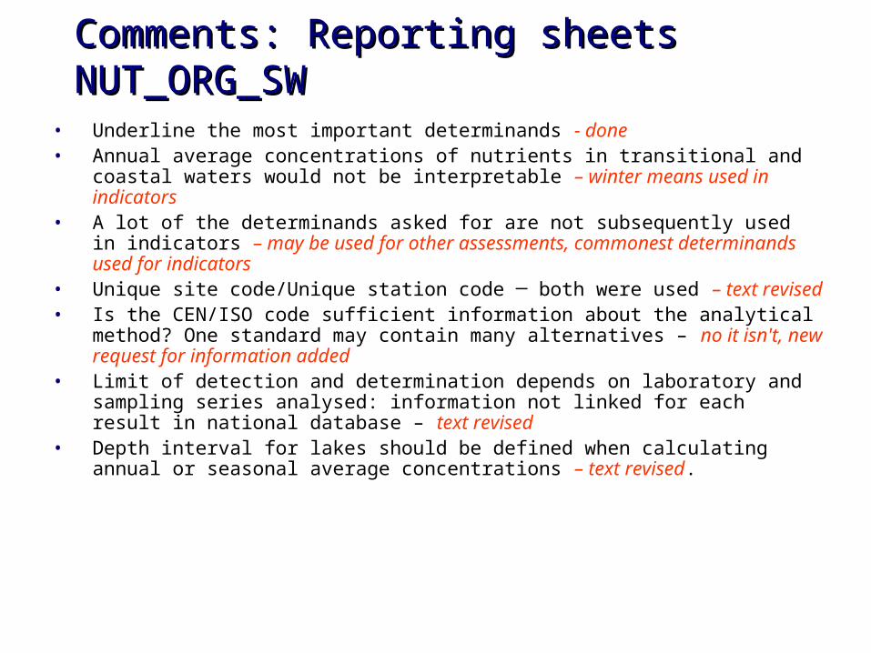
Comments: Reporting sheetsComments: Reporting sheetsNUT_ORG_SW NUT_ORG_SW
• Underline the most important determinands - done• Annual average concentrations of nutrients in transitional and
coastal waters would not be interpretable – winter means used in indicators
• A lot of the determinands asked for are not subsequently used in indicators – may be used for other assessments, commonest determinands used for indicators
• Unique site code/Unique station code ─ both were used – text revised• Is the CEN/ISO code sufficient information about the analytical
method? One standard may contain many alternatives – no it isn't, new request for information added
• Limit of detection and determination depends on laboratory and sampling series analysed: information not linked for each result in national database – text revised
• Depth interval for lakes should be defined when calculating annual or seasonal average concentrations – text revised.

12
Comments: Reporting sheetsComments: Reporting sheetsSTA_CHA_PRE STA_CHA_PRE
• Some of the characteristics may not be available for each lake in Finland- countries only expected to report what is available
• Mixing characteristics should be included for lakes though may not be directly available from data bases – will be added
• Proxy pressure information on the catchment upstream is not relevant for most of the marine monitoring stations and should be omitted - agreed

13
Comments: Reporting sheetsComments: Reporting sheetsNUT_GWNUT_GW
• What does 'Classification of samples taken’ mean? – explanation added
• Need to harmonise 'Statistical information accompanying disaggregated data' between sheets - done
• Statistical data associated with annual aggregates will not be possible for some sampling points because there will only be 1 sample/year - acknowledged
• Should selected water bodies be based on the given criteria, or all water bodies? – criteria given in revised paper

14
Comments: Reporting sheetsComments: Reporting sheetsHAZ_SW_BTA HAZ_SW_BTA
• For fish the concentration of the determinand should be for both wet weight and lipid weight – text revised
• Biota also are a relevant matrix for hazardous substances in rivers – agreed, sheet will need development
• Some countries will not have so detailed data for biota as it is specified in sheet – only report what is available

15
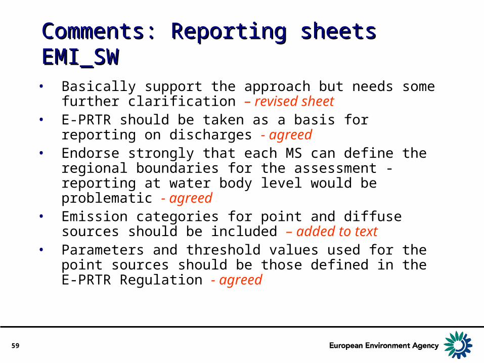
Comments: Reporting sheetsComments: Reporting sheetsEMI_SW EMI_SW
• Basically support the approach but needs some further clarification – revised sheet
• E-PRTR should be taken as a basis for reporting on discharges - agreed
• Endorse strongly that each MS can define the regional boundaries for the assessment - reporting at water body level would be problematic - agreed
• Emission categories for point and diffuse sources should be included – added to text
• Parameters and threshold values used for the point sources should be those defined in the E-PRTR Regulation - agreed
16
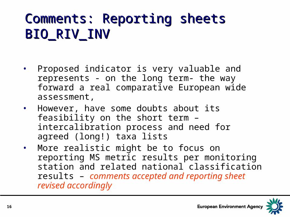
Comments: Reporting sheetsComments: Reporting sheetsBIO_RIV_INVBIO_RIV_INV
• Proposed indicator is very valuable and represents - on the long term- the way forward a real comparative European wide assessment,
• However, have some doubts about its feasibility on the short term – intercalibration process and need for agreed (long!) taxa lists
• More realistic might be to focus on reporting MS metric results per monitoring station and related national classification results – comments accepted and reporting sheet revised accordingly
17
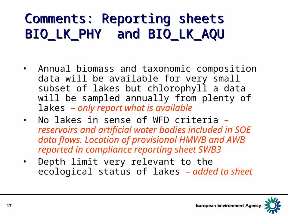
Comments: Reporting sheetsComments: Reporting sheetsBIO_LK_PHY and BIO_LK_AQU BIO_LK_PHY and BIO_LK_AQU
• Annual biomass and taxonomic composition data will be available for very small subset of lakes but chlorophyll a data will be sampled annually from plenty of lakes – only report what is available
• No lakes in sense of WFD criteria – reservoirs and artificial water bodies included in SOE data flows. Location of provisional HMWB and AWB reported in compliance reporting sheet SWB3
• Depth limit very relevant to the ecological status of lakes – added to sheet

18
New version of paperNew version of paper

19
Task 3 – Scope of SOER parametersTask 3 – Scope of SOER parameters
• Extensive changes and restructuring of paper
• Now one paper• 1 Introduction• 2 Monitoring stations to obtain
representative information for SOE assessments
• 3. Draft reporting sheets for SOE data and information

20
Monitoring stations to obtain Monitoring stations to obtain representative information for SOE representative information for SOE assessmentsassessments
• Three options given in previous paper for the stations to be used in SOER
• Option 1 (criteria for the selection of representative monitoring stations) was the favoured option
• New version written around that option• “Look out!” Boxes introduced

21
Monitoring stations to obtain Monitoring stations to obtain representative information for SOE representative information for SOE assessmentsassessments
2.1 EEA Assessments• State of, and trends, in the water
environment• Broader assessments of specific water
related issues e.g. eutrophication• Assessment of impact of specific
sectors (e.g. agriculture) on water, perhaps based on conceptual models such as water accounts
22
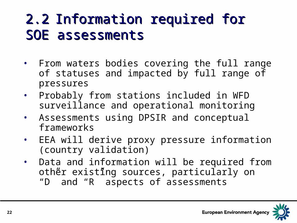
2.22.2 Information required for SOE Information required for SOE assessmentsassessments
• From waters bodies covering the full range of statuses and impacted by full range of pressures
• Probably from stations included in WFD surveillance and operational monitoring
• Assessments using DPSIR and conceptual frameworks
• EEA will derive proxy pressure information (country validation)
• Data and information will be required from other existing sources, particularly on “D” and “R” aspects of assessments

23
2.32.3 Relationship between monitoring Relationship between monitoring stations, determinands measured at stations, determinands measured at the station and water bodiesthe station and water bodies
• Data will in principle be reported at the station level
• Station level data may then be aggregated spatially and/or temporally in ways appropriate for the assessment being undertaken e.g. at water body level
• Spatial aggregation in coastal and marine waters, and in groundwater
• Number of different relationships between monitoring stations, quality elements measured at the station and the water bodies they represent

Stations Quality element
Water Bodies
Sub catchments
Catchments River Basin
Districts
QE1
QE2

25
2.32.3 Relationship between Relationship between monitoring stations, determinands monitoring stations, determinands measured at the station and water measured at the station and water bodiesbodies
• Reporting at station level will ensure maximum flexibility in how data are subsequently compiled, aggregated and analysed by the EEA
• Need supportive and interpretative information on how stations relate to water bodies and groups of water bodies

26
2.4 Surface waters: Criteria for the 2.4 Surface waters: Criteria for the monitoring stations to be used for monitoring stations to be used for EEA/SOE assessmentsEEA/SOE assessments
Required to• to provide a representative assessment of
the overall status of rivers, lakes, transitional and coastal waters within each catchment and subcatchments within each river basin district in the country, preferably apportioned according to the main pressures that determine the status.

27
2.4 Surface waters: Criteria for the 2.4 Surface waters: Criteria for the monitoring stations to be used for monitoring stations to be used for EEA/SOE assessmentsEEA/SOE assessments
Representative monitoring stations covering• All water categories (rivers, lakes, transitional,
coastal and marine waters)• All types of water body• Complete range of statuses present• All sizes• All types of pressure• Different stations for different quality elements• Stations may be from surveillance, operational and
other monitoring networks• Annual monitoring may be undertaken at the
stations for some of the determinands

28
2.5 Surface waters: Additional 2.5 Surface waters: Additional information to specify criteriainformation to specify criteria
• Monitoring stations representative of the significant pressures within each catchment and subcatchment.
• If possible, the stations/water bodies used will be subject to only one significant pressure
• Operational monitoring stations or from other networks
• Time-series may be variable• Additional meta information on the significant
pressure• Indicative list of pressures from Article 5
compliance reporting sheet

29
2.6 Groundwater: Criteria for the 2.6 Groundwater: Criteria for the monitoring stations to be used for monitoring stations to be used for EEA/SOE assessmentsEEA/SOE assessments
• distribution and number of monitoring stations used should provide a coherent and comprehensive overview of groundwater chemical and quantitative status within each river basin and aquifer catchment and,
• to detect the presence of long-term anthropogenically-induced upward/downward trends in pollution.
• Will be associated with a groundwater body and/or a group of groundwater bodies, and will provide representative information of the state of the water body(ies).

30
2.6 Groundwater: Criteria for the 2.6 Groundwater: Criteria for the monitoring stations to be used for monitoring stations to be used for EEA/SOE assessmentsEEA/SOE assessments
• Relevant groundwater bodies for Eionet-Water met at least 1 of 3 criteria• > 300 km² in area;• of regional, socio-economic or environmental
importance in terms of quantity and quality;• exposed to severe or major impacts, representing
different possible pressures.
• No explicit WFD guidance on how GW bodies should be delineated
• Proposed that SOER should be from all monitoring stations established for WFD and located in groundwater bodies that meet at least one of the Eionet-water criteria

31
Discussion of Task 3 Discussion of Task 3 Monitoring stations to obtain Monitoring stations to obtain representative information for SOE representative information for SOE assessmentsassessments

32
3.3. Draft Reporting Sheets for SOE Draft Reporting Sheets for SOE data and information data and information
Significant changes• Sheets for surface waters now split into
combined sheets for rivers and lakes, and combined sheets for transitional and coastal waters
• Sheets for marine waters to be discussed with EMMA group

33
3.3. Draft Reporting Sheets for SOE Draft Reporting Sheets for SOE data and informationdata and information
• 15 drafted• 10 of those currently in, or partially in,
Eionet-Water and Data Dictionary• 17 require future development

34
Draft reporting sheets for rivers and Draft reporting sheets for rivers and lakes lakes (those in red in Eionet-Water/Data Dictionary)(those in red in Eionet-Water/Data Dictionary)
• State of rivers and lakes • nitrogen, phosphorus, chlorophyll-a and organic
pollution determinands • Priority Substances and other hazardous
substances • benthic invertebrate fauna - rivers• Phytoplankton - lakes• other aquatic flora - lakes
• State and quantity of water resources• Loads, discharges and emissions of pollutants
to surface waters

35
Draft reporting sheets for Draft reporting sheets for groundwatergroundwater(those in red in Eionet-Water/Data Dictionary)(those in red in Eionet-Water/Data Dictionary)
• State of groundwaters in terms of nitrogen
• State of groundwaters in terms of Priority Substances and other hazardous substances

36
Draft reporting sheets for Draft reporting sheets for transitional and coastal waterstransitional and coastal waters(those in red in Eionet-Water/Data Dictionary)(those in red in Eionet-Water/Data Dictionary)
• State of transitional and coastal waters in terms of• Nitrogen, phosphorus and chlorophyll-a in
water• Priority Substances and other hazardous
substances in water• Priority Substances and other hazardous
substances in biota• biological quality elements – other aquatic
flora (seagrasses)

37
Draft reporting sheets for geographic, Draft reporting sheets for geographic, supportive and interpretative supportive and interpretative information for monitoring stations information for monitoring stations
• (those in red in Eionet-Water/Data Dictionary) • Surface waters and groundwaters• Station characteristics and proxy
pressure information • Geographic information - some in data
dictionary
38
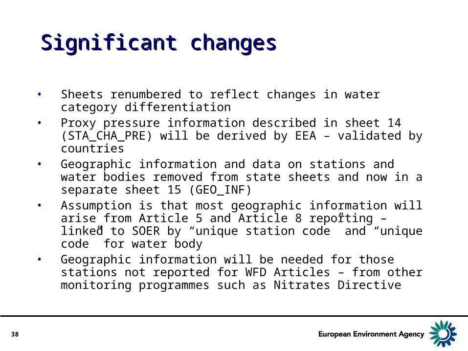
Significant changesSignificant changes
• Sheets renumbered to reflect changes in water category differentiation
• Proxy pressure information described in sheet 14 (STA_CHA_PRE) will be derived by EEA – validated by countries
• Geographic information and data on stations and water bodies removed from state sheets and now in a separate sheet 15 (GEO_INF)
• Assumption is that most geographic information will arise from Article 5 and Article 8 reporting – linked to SOER by “unique station code” and “unique code” for water body
• Geographic information will be needed for those stations not reported for WFD Articles – from other monitoring programmes such as Nitrates Directive

39
Significant changesSignificant changes
• “Look out!” – boxes added to sheets to highlight specific points
• Common structure on data aspects of sheets• Determinands• Quality of data• Temporal aggregation of data• Spatial aggregation of data• Information on stations used for SOE
reporting

Comments: Reporting sheetsComments: Reporting sheetsNUT_ORG_SW NUT_ORG_SW
• Underline the most important determinands - done• Annual average concentrations of nutrients in transitional and
coastal waters would not be interpretable – winter means used in indicators
• A lot of the determinands asked for are not subsequently used in indicators – may be used for other assessments, commonest determinands used for indicators
• Unique site code/Unique station code ─ both were used – text revised• Is the CEN/ISO code sufficient information about the analytical
method? One standard may contain many alternatives – no it isn't, new request for information added
• Limit of detection and determination depends on laboratory and sampling series analysed: information not linked for each result in national database – text revised
• Depth interval for lakes should be defined when calculating annual or seasonal average concentrations – text revised.

41
Comments: Reporting sheetsComments: Reporting sheetsNUT_GWNUT_GW
• What does 'Classification of samples taken’ mean? – explanation added
• Need to harmonise 'Statistical information accompanying disaggregated data' between sheets - done
• Statistical data associated with annual aggregates will not be possible for some sampling points because there will only be 1 sample/year - acknowledged
• Should selected water bodies be based on the given criteria, or all water bodies? – criteria given in revised paper

42
DeterminandsDeterminands
• Bolded when there are “priority” determinands
• Indication of those not currently in data dictionary

43
Quality of dataQuality of data
• Meta data or description of methods for AQC/QA in laboratories undertaking the chemical analysis for each determinand is to be reported.
• This is to be on a laboratory basis rather than on the basis of the measurement/analysis of each individual sample
• Not previously in Data Dictionary but collected separately from NRCs – Data Quality Index
• Will need to be reviewed according to requirements of the proposed “Commission Decision on minimum performance criteria for chemical monitoring methods and the quality of analytical results”.
44
Quality of dataQuality of data
• Laboratory identification• Laboratory accreditation
for the specified determinands
• Data control by a competent authority
• Analytical method used (CEN/ISO code);
• Definition of numerical accuracy targets for each determinand
• Production of laboratory performance test data/reports for their analytical systems
• Limits of detection and determination of analytical method used.
• Use of field blanks• Extraction recovery rate• Use of control charts • Frequency of control• Laboratory participation
in inter-laboratory studies
• Performance of the laboratory in the inter-laboratory studies
• Data screening
45
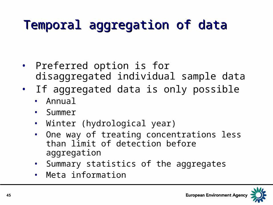
Temporal aggregation of dataTemporal aggregation of data
• Preferred option is for disaggregated individual sample data
• If aggregated data is only possible• Annual• Summer• Winter (hydrological year)• One way of treating concentrations less
than limit of detection before aggregation• Summary statistics of the aggregates• Meta information

46
Spatial aggregation of dataSpatial aggregation of data
• For each of the monitoring stations used for SOE reporting
• Width averaged aggregation for rivers• Depth averaged aggregation for lakes• Geographic grids for coastal and
marine waters• At the groundwater body level if
station data not available

47
Comments: Reporting sheetsComments: Reporting sheetsSTA_CHA_PRE STA_CHA_PRE
• Some of the characteristics may not be available for each lake in Finland- countries only expected to report what is available
• Mixing characteristics should be included for lakes though may not be directly available from data bases – will be added
• Proxy pressure information on the catchment upstream is not relevant for most of the marine monitoring stations and should be omitted - agreed
48
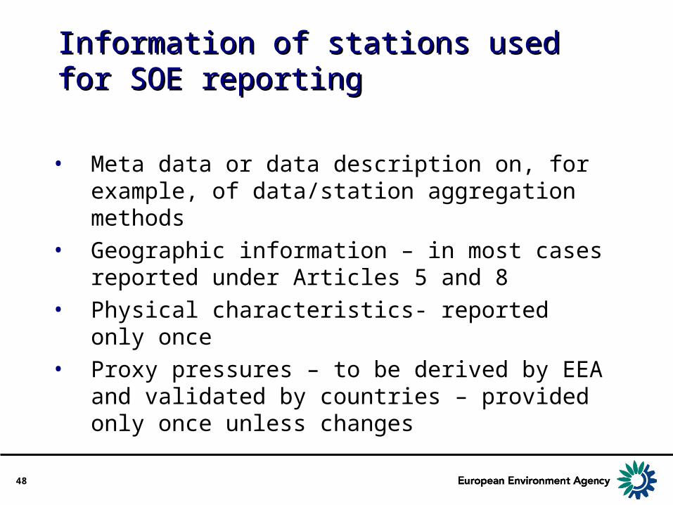
Information of stations used for SOE Information of stations used for SOE reportingreporting
• Meta data or data description on, for example, of data/station aggregation methods
• Geographic information – in most cases reported under Articles 5 and 8
• Physical characteristics- reported only once• Proxy pressures – to be derived by EEA and
validated by countries – provided only once unless changes

49
Comments: Reporting sheetsComments: Reporting sheetsBIO_RIV_INVBIO_RIV_INV
• Proposed indicator is very valuable and represents - on the long term- the way forward a real comparative European wide assessment,
• However, have some doubts about its feasibility on the short term – intercalibration process and need for agreed (long!) taxa lists
• More realistic might be to focus on reporting MS metric results per monitoring station and related national classification results – comments accepted and reporting sheet revised accordingly

50
Reporting sheets on biological Reporting sheets on biological quality elementsquality elements
• Detailed Comments received from JRC/IES particularly in relation to intercalibration process
• Also need to develop SEBI indicators e.g. seagrasses in transitional and coastal waters
• Focus now more on reporting of aggregated indices and/or derived metrics rather than long species/taxa lists

51
Presentation on biological quality Presentation on biological quality elements and intercalibrationelements and intercalibration
Sandra Poikane JRC/IES

52
State of river water bodies in terms State of river water bodies in terms of benthic invertebrate faunaof benthic invertebrate fauna
• The value of the national summary metric/aggregated index for each sample derived from, for example, the measured number of taxa and abundance, and taxa sensitivity data
• The equivalent national classification result for each sample and station
• Meta data or data description with details of metric and indices used for summarising and reporting the composition and abundance of the river benthic invertebrate fauna
• Should give comparable information within countries (hopefully!!), but not between

53
Comments: Reporting sheetsComments: Reporting sheetsBIO_LK_PHY and BIO_LK_AQU BIO_LK_PHY and BIO_LK_AQU
• Annual biomass and taxonomic composition data will be available for very small subset of lakes but chlorophyll a data will be sampled annually from plenty of lakes – only report what is available
• No lakes in sense of WFD criteria – reservoirs and artificial water bodies included in SOE data flows. Location of provisional HMWB and AWB reported in compliance reporting sheet SWB3
• Depth limit very relevant to the ecological status of lakes – added to sheet
54
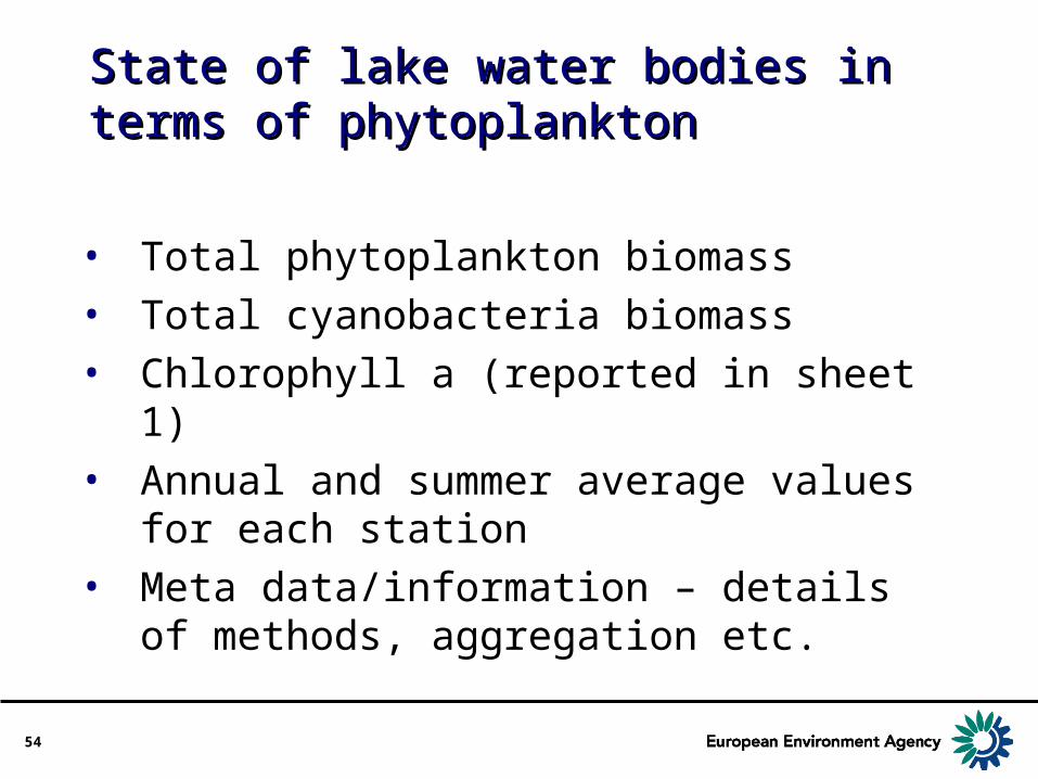
State of lake water bodies in terms State of lake water bodies in terms of phytoplanktonof phytoplankton
• Total phytoplankton biomass• Total cyanobacteria biomass• Chlorophyll a (reported in sheet 1)• Annual and summer average values for
each station• Meta data/information – details of
methods, aggregation etc.

55
State of lake water bodies in terms State of lake water bodies in terms of other aquatic flora (macrophytes)of other aquatic flora (macrophytes)
• Macrophyte coverage (% of the entire bottom area)
• Depth limit (maximum colonisation depth)• Average values at the time of maximum
biomass (~September-October)• Detailed description of macrophyte survey
method – reported once, unless changed

56
State of transitional and coastal State of transitional and coastal water bodies in terms of other water bodies in terms of other aquatic flora (seagrasses)aquatic flora (seagrasses)
• Use of seagrasses is also proposed for the Streamlining European 2010 Biodiversity Indicators (SEBI2010) initiative
• Composition (species) and abundance (numbers of individuals) of seagrasses
• [Note: ~6 Pan-European species]• Seagrass coverage (% of the water body);• Depth limit (maximum colonisation depth)• Individual sample data for each monitoring station and
aggregated value for water body for each sampling occasion
• Detailed description of survey method – reported once, unless changed

57
State and quantity of surface water State and quantity of surface water resourcesresources
Why is it needed?• EEA indicators
• Use values of a country’s annual renewable water resources
• Ways of producing comparable estimates of annual renewable water resources to be discussed between EEA and EUROSTAT
• Water accounting methodologies and integrated indicators
• Assessment of riverine fluxes• In relation to climate change, floods and
droughts

58
State and quantity of surface water State and quantity of surface water resourcesresources
• River discharge data• Daily data for subset of representative
stations• Monthly averages and other summary
statistics for representative stations• Long-term statistics: e.g. distribution of
return frequencies• Representative selection of national stations
(1 gauging station per 200 to 1000 km2
• Subset of representative stations (between 15 and 25 % of representative stations)
59
Comments: Reporting sheetsComments: Reporting sheetsEMI_SW EMI_SW
• Basically support the approach but needs some further clarification – revised sheet
• E-PRTR should be taken as a basis for reporting on discharges - agreed
• Endorse strongly that each MS can define the regional boundaries for the assessment - reporting at water body level would be problematic - agreed
• Emission categories for point and diffuse sources should be included – added to text
• Parameters and threshold values used for the point sources should be those defined in the E-PRTR Regulation - agreed

60
Loads, discharges and emissions of Loads, discharges and emissions of pollutants to surface waterspollutants to surface waters
• For the development of indicators of emissions for the assessment of pressures and state
• Loads of identified pollutants emitted from point and diffuse sources and transferred to surface water bodies, catchments and river basin districts
• Sheet proposes an interim method• will be developed taking into account streamlining of
data flows and incorporation into WISE • including reporting of pressures for WFD, UWWT
Directive, EPER, E-PRTR and ESTAT/OECD joint questionnaire

61
Loads, discharges and emissions of Loads, discharges and emissions of pollutants to surface waterspollutants to surface waters
• Nutrients (N and P), organic matter (TOC, BOD or COD) and Priority Substances
• Reported in terms of an assessment unit• Geographically aggregated areas• Preferably catchments around 5000 km2
• Maybe administrative units such as NUTS2 or 3• Later maybe water body level
• For defined categories (e.g urban) of point and diffuse sources
• Data description such as aggregation methods• Geographic and characteristics information on
each assessment unit – provided once

62
Task 3:Task 3:Discussion of revised reporting Discussion of revised reporting sheetssheets

63
Further TasksFurther Tasks
• Task 4: Guidance on data processing, handling and reporting
• Task 5: Requirements for technical integration