urban growth in south china and impacts on local...
TRANSCRIPT
Urban Growth in South China and Impacts on Local Precipitation, Fifth Urban Research Symposium 2009
1
Urban Growth in South China and Impacts on Local Precipitation
Karen C. Seto
Associate Professor Yale University
School of Forestry and Environmental Studies [email protected]
Robert K. Kaufmann
Professor Boston University
Department of Geography [email protected]
Summary Rapid and extensive urban land-use change has significant impacts on regional climate. Scientists have long known about the “urban heat island effect,” in which cities raise local temperatures, but the effect of urbanization on local rainfall is less clear. In South China, during one of the most rapid periods of economic growth, from 1988 to 1996, there was more than a tripling of urban land cover. In this paper, we evaluate the patterns of urban growth in the region and the impact of urbanization on regional climate using a combination of satellite imagery and climate data from local meteorological stations. A statistical analysis of the monthly climate data shows a relationship between urban land-use and precipitation. The results suggest that urban land cover change can cause a reduction in precipitation during the winter months, and are contrary to other results that show that urban areas may induce rainfall. We hypothesize that this reduction in precipitation caused by urban growth may be due to changes in surface hydrology and energy balance. Keywords Urban climate; urbanization; China; remote sensing; rainfall; land-cover change Introduction A significant amount of research over the last twenty years has shown a strong relationship between urban areas and climate. The “urban heat island” (UHI) is now well established, whereby urban areas have higher temperatures than surrounding regions. This urban heat island is stronger during the night than day and larger during the winter than summer months. Two of the principle causes of the UHI are the urban materials that absorb heat during the day and the modification of land cover that reduces vegetative cover and evapotranspiration in urban areas. The relationship between urban areas and the UHI have been extensively reviewed in the literature (Souch and Grimmond, 2006; Kanda, 2006).
Urban Growth in South China and Impacts on Local Precipitation, Fifth Urban Research Symposium 2009
2
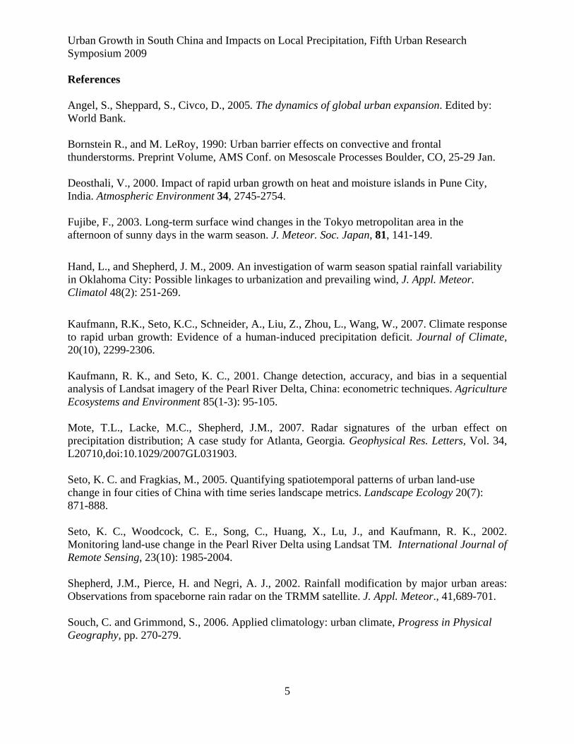
A second effect of urbanization on climate is the impact on rainfall. A number of studies have found an increase in rainfall in regions downwind of urban areas, with the increase as high as 25% in some areas (Shepherd et al, 2002, Mote et al., 2007, Hand and Shepherd 2009). This increase in rainfall downwind of major urban areas has been documented for cities around the world, including for Tokyo (Fujibe 2003) and New York City (Bornstein and LeRoy 1990). Few studies examine explicitly the impact of urban growth on precipitation (Tereshchenko and Filonov, 2001; Deosthali, 2000). In this study, we use satellite imagery to evaluate urban growth and develop statistical models to examine the relationship between observed urban land-cover patterns with in situ precipitation data from local meteorological stations. The study area is the Pearl River Delta of South China, a region that has undergone extensive urbanization over the last twenty years (Seto et al., 2002; Seto and Fragkias, 2005). Study Area The Pearl River Delta is one of the most economically vibrant regions in China (Figure 1). The Delta generates more than 70 percent of the provincial GDP and is home to 21 million people, nearly one-third of the province’s official population. Located in the southern province of Guangdong, the climate of the Delta is characterized by a dry season from November through April, and a rainy season from May through October. The summers are hot and humid, and maximum temperatures can reach 38˚C. The region has been settled since the Zhou Dynasty and has a strong agricultural history of rice and sugarcane production. The rich red alluvial soils support two to three crops per year, and the natural vegetation is dominated by pines and acacias. The region is anchored by two major cities: Guangzhou, the provincial capital, and Shenzhen, the first Special Economic Zone established by the Central Government in 1979. Located at the mouth of the Pearl River, it has a long-established park system and a rich assemblage of vegetation, especially in the older districts where dense tree cover is common. Traditionally, Guangzhou has been the cultural, economic, and industrial focal point of South China. It is also a transportation hub. It has an international airport, one of the most active regional seaports, and railroad connections to all regions of the country. In contrast, Shenzhen was just a small fishing village when it was declared a Special Economic Zone in 1979. Located on the Hong Kong-China border, Shenzhen has experienced some of the most dramatic economic growth and landscape changes in China. Regionally, it receives the bulk of foreign direct investment and has a large population of temporary workers, estimated to be between 5 and 10 million. Much of the area was used for agriculture prior to the economic reforms. Data and Methods To monitor urban expansion, we satellite data consisting of nine Landsat TM images, acquired annually between 1988 and 1996. The month in which the image is acquired varies by year, but all are acquired during the dry season, between October and March. From these images, we generated annual maps of urban extents for each year between 1988 and 1996 (Seto et al. 2002;
Urban Growth in South China and Impacts on Local Precipitation, Fifth Urban Research Symposium 2009
3
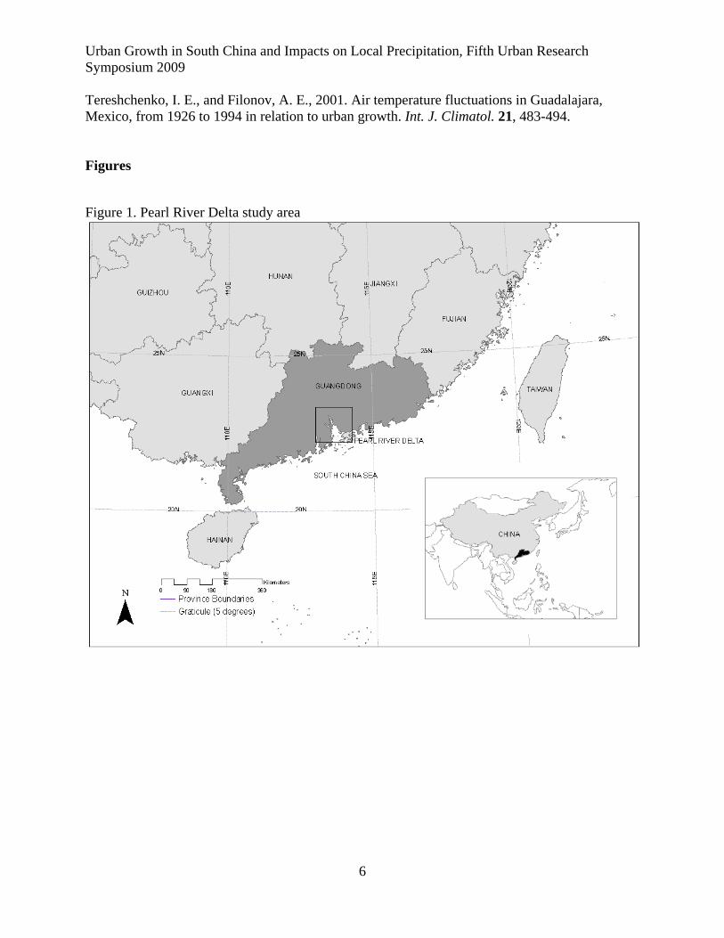
Kaufmann and Seto, 2001). Temperature and precipitation data are obtained from sixteen meteorological stations that are contained within area covered by the image (Figure 2). Monthly data for daily average temperature and total precipitation are compiled for winter (December – February), spring (March-May), summer (June-August) and autumn (September– November). Around each station, we establish three concentric buffers that have radii of 3km, 10km, and 20 km. Within each buffer, we track the fraction of total area that is urban for each year between 1988 and 1996. We also investigate whether the pattern of urbanization affects precipitation. We calculate two spatial metrics: urban edge density, which measures the total edge of the urban area relative to the total landscape and the landscape shape index, which measures the perimeter length of all urban areas within the buffer. Individual measures of urbanization are used as explanatory variables, along with time, temperature, and average temperature and precipitation in the other fifteen meteorological stations in a statistical equation that specifies seasonal rainfall at the meteorological station in the center of the buffer as the dependent variable (Kaufmann et al., 2007). By including temperature, we account for a possible link between the urban heat island and the effect of urbanization on precipitation. By including average temperature and rainfall from the other fifteen stations, we account for the effects of especially wet, dry, warm, or cool years. Results Between 1988 and 1996, nearly 7 percent of the PRD, or 1905 km2, was converted to urban uses. In 1988, there were only 720 km2 of urban land. By 1996, urban areas constituted 10 percent of the PRD, or 2625 km2 (Seto et al., 2002). The increase in urban areas has been achieved mainly through the conversion of agricultural land. A total of 1392 km2 of agricultural land – an area the size of San Francisco or Madrid – were converted to non-agricultural uses between 1988 and 1996. Four major types of agricultural land conversion have occurred. First, the construction of industrial centers, residential complexes, and factories has lead to the conversion of large tracts of agricultural land, upwards of 10 hectares. Second, on a smaller scale, improvement of houses owned by farmers and agricultural workers also reduces the amount of land available for agriculture. Third, highway development has divided agricultural plots and removed them from cultivation. Fourth, the flooding of fields for water reservoirs and dams has converted approximately 1 percent of the total study area (16 km2). With increases in water demand by the residential and industrial sectors, reservoirs and dikes have been constructed to provide support the booming region with an adequate water supply to residential and industrial sectors. The results of the statistical analysis show that the effect of urban growth on precipitation varies by season and area, but not how urbanization is measured. Urban growth reduces precipitation during winter, which the dry season in South China. During the dry season, precipitation is more easily affected by local conditions. The physical mechanism by which urbanization reduces rainfall is uncertain. Our study is a statistically-based analysis, and not a process-based model. The model evaluates the relationship between observed urban growth patterns and precipitation data as recorded by ground weather stations. Possible mechanisms for why urbanization drives a reduction in winter rainfall include changes surface properties, such as vegetation cover, roughness, or albedo. For example, replacing trees with asphalt reduces the amount of water
Urban Growth in South China and Impacts on Local Precipitation, Fifth Urban Research Symposium 2009
4
stored near the surface and reduces the amount of water put into the atmosphere. Alternatively, the urban precipitation deficit may be caused by human activities associated with urban areas. For example, the urban water management speeds run-off and therefore reduces water supply to the atmosphere. Rapid and extensive urbanization in South China has lead to wholesale conversion of the landscape, which in turn has significantly reduced evapotranspiration. The model results show that urban growth has no effect on rainfall during the spring, summer or fall, which are part of the rainy season. During these seasons, the local effects of urban growth may be eclipsed by large-scale regional atmospheric forces, such as the Asian Monsoon. The size of the urban area also influences the effect of urban expansion on precipitation. The causal relationship between urbanization and precipitation is present in buffers that have a radius of 10 km or 20 km—there is no effect in buffers that have a radius of 3km. This implies that new city development may need to reach a size of hundreds of square kilometers before it will affect local precipitation. Most large cities cover thousands of square kilometers. Finally, the shape of the urban area does not seem to play a significant role in the urban precipitation deficit. The presence or absence of a causal relationship between urbanization and precipitation is the same regardless of whether urbanization is measured by the fraction urbanized, the urban edge density, or the landscape shape index. Conclusions The most recent IPCC assessment (AR4) points to the need to understand how the urban environment affects the climate system. Critical to that understanding is documenting how urban land use change affects precipitation variability. This study is a first step towards that goal. A future step with this study is to incorporate a process-based model that describes the physical changes in atmospheric composition associated with urbanization. Additionally, many more studies are needed that explicitly track urban land-use patterns and associated impacts on precipitation. It has been estimated that globally, an area the size of California will be converted to urban areas in the coming two decades (Angel et al., 2005). The research shown here indicates that where future urban areas will grow and their rate of expansion will have important consequences on local climate systems.
Urban Growth in South China and Impacts on Local Precipitation, Fifth Urban Research Symposium 2009
5
References Angel, S., Sheppard, S., Civco, D., 2005. The dynamics of global urban expansion. Edited by: World Bank. Bornstein R., and M. LeRoy, 1990: Urban barrier effects on convective and frontal thunderstorms. Preprint Volume, AMS Conf. on Mesoscale Processes Boulder, CO, 25-29 Jan. Deosthali, V., 2000. Impact of rapid urban growth on heat and moisture islands in Pune City, India. Atmospheric Environment 34, 2745-2754. Fujibe, F., 2003. Long-term surface wind changes in the Tokyo metropolitan area in the afternoon of sunny days in the warm season. J. Meteor. Soc. Japan, 81, 141-149.
Hand, L., and Shepherd, J. M., 2009. An investigation of warm season spatial rainfall variability in Oklahoma City: Possible linkages to urbanization and prevailing wind, J. Appl. Meteor. Climatol 48(2): 251-269.
Kaufmann, R.K., Seto, K.C., Schneider, A., Liu, Z., Zhou, L., Wang, W., 2007. Climate response to rapid urban growth: Evidence of a human-induced precipitation deficit. Journal of Climate, 20(10), 2299-2306. Kaufmann, R. K., and Seto, K. C., 2001. Change detection, accuracy, and bias in a sequential analysis of Landsat imagery of the Pearl River Delta, China: econometric techniques. Agriculture Ecosystems and Environment 85(1-3): 95-105. Mote, T.L., Lacke, M.C., Shepherd, J.M., 2007. Radar signatures of the urban effect on precipitation distribution; A case study for Atlanta, Georgia. Geophysical Res. Letters, Vol. 34, L20710,doi:10.1029/2007GL031903. Seto, K. C. and Fragkias, M., 2005. Quantifying spatiotemporal patterns of urban land-use change in four cities of China with time series landscape metrics. Landscape Ecology 20(7): 871-888. Seto, K. C., Woodcock, C. E., Song, C., Huang, X., Lu, J., and Kaufmann, R. K., 2002. Monitoring land-use change in the Pearl River Delta using Landsat TM. International Journal of Remote Sensing, 23(10): 1985-2004. Shepherd, J.M., Pierce, H. and Negri, A. J., 2002. Rainfall modification by major urban areas: Observations from spaceborne rain radar on the TRMM satellite. J. Appl. Meteor., 41,689-701. Souch, C. and Grimmond, S., 2006. Applied climatology: urban climate, Progress in Physical Geography, pp. 270-279.
Urban Growth in South China and Impacts on Local Precipitation, Fifth Urban Research Symposium 2009
6
Tereshchenko, I. E., and Filonov, A. E., 2001. Air temperature fluctuations in Guadalajara, Mexico, from 1926 to 1994 in relation to urban growth. Int. J. Climatol. 21, 483-494. Figures
Figure 1. Pearl River Delta study area
Urban Growth in South China and Impacts on Local Precipitation, Fifth Urban Research Symposium 2009
7
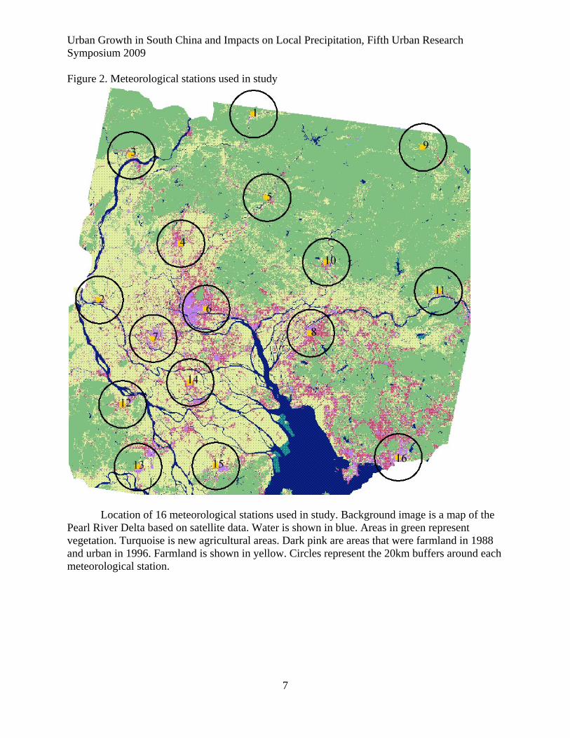
Figure 2. Meteorological stations used in study
Location of 16 meteorological stations used in study. Background image is a map of the Pearl River Delta based on satellite data. Water is shown in blue. Areas in green represent vegetation. Turquoise is new agricultural areas. Dark pink are areas that were farmland in 1988 and urban in 1996. Farmland is shown in yellow. Circles represent the 20km buffers around each meteorological station.