town of holly springs supplement #15 december 2018
TRANSCRIPT
General Information A Traffic Impact Analysis (TIA) scope
determination is required from the Department
of Engineering prior to scheduling a Concept
Plan Review Meeting. The Request for TIA
Scope, Form 8031 is available here:
www.hollyspringsnc.us/engineering. Please
contact the Department of Engineering at (919)
557-3938 for more information.
A Concept Plan Review Meeting must be held a
minimum of five (5) business days prior to but no
more than 8 weeks before the Petition Submittal
Deadline as specified on the appropriate
submittal calendar. Please email
[email protected] to schedule a
Concept Meeting. For more information,
contact the Department of Planning & Zoning at (919) 557-3908.
During the Concept Plan Review Meeting, it will be determined whether a request for Zoning Map Change to
a General Use District or Conditional Use District will be appropriate.
Submittal RequirementsAll information required as part of your petition must be provided in both hardcopy original and in PDF format
to the FTP website. (i.e. transmittal, applications, maps, special studies, etc.) with each review. Please submit
PDF as 1 file containing the complete submittal and name the file with the project name and date.
Link to FTP website: http://www.hollyspringsnc.us/PlanningFTP
Zoning Map Change: Submit the following number of copies:
(7) 8.5” x 11”
(1) PDF version
Comprehensive Plan Amendment: Submit the following number of copies:
(5) 8.5” x 11”
(1) PDF version
Zoning Map Change- General Use District:
The following items must be submitted with the Petition for Zoning Map Change to a General Use District to be
deemed a complete submittal:
Vicinity Map
Petition Form
Processing Fees (make check payable to: Town of
Holly Springs)
Statement of Zoning Compatibility
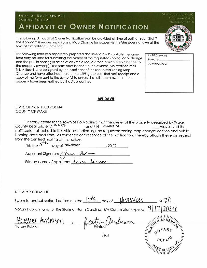
Affidavit of Owner Notification (required if
Applicant is not the property owner)
Traffic Impact Analysis
Property survey/legal description (required only if
request does not include the entire tax parcel) in
both hard copy and digital to the FTP website in
Word format. Note: All legal descriptions are to contain
references to inorganic monuments, and that all starting
references on surveys or legal descriptions describe a course
and distance from either the closest NCGS monument or Town
of Holly Springs monument, regardless of the distance thereto.
Waiver Request Forms (if being requested in
conjunction with Zoning Map Change Petition)
FOR MORE INFORMATION:
Current Planning & Zoning Petition Fee Schedule: http://www.hollyspringsnc.us/planning
Review Process: Town of Holly Springs Development
Procedures Manual (DPM)-
Zoning Map Change- Section 2.
Comprehensive Plan Amendment- Section 2.05
Review Calendar: See Town of Holly Springs Development
Procedures Manual (DPM) Appendix 1.
General Use Rezoning Schedule
Conditional Use Rezoning Schedule
The DPM is available for purchase in the Department of
Planning & Zoning or on-line at: http://www.hollyspringsnc.us/planning
General Use Rezoning, Conditional Use Rezoning, Comprehensive Plan Amendment,
and Unified Development Ordinance Amendment
TOWN OF HOLLY SPR INGS
REZONING, COMPREHENSIVE PLAN AMENDMENT,
& UDO AMENDMENT PACKET
DPM Appendi x #A.02
Supplement #15
December 2018
X
Zoning Map Change- Conditional Use District/PUD: The following items must be submitted with the Petition for Zoning Map Change to a Conditional Use District to
be deemed a complete submittal:
Vicinity Map
Petition Form
Processing Fees (make check payable to: Town of
Holly Springs)
Statement of Zoning Compatibility
Affidavit of Owner Notification (required if
Applicant is not the property owner)
Traffic Impact Analysis
Conditional Use Permit Restrictions Statement
Property survey/legal description (required only if
request does not include the entire tax parcel) in
both hard copy and digital to the FTP website in
Word format. Note: All legal descriptions are to contain
references to inorganic monuments, and that all starting
references on surveys or legal descriptions describe a course
and distance from either the closest NCGS monument or Town
of Holly Springs monument, regardless of the distance thereto.
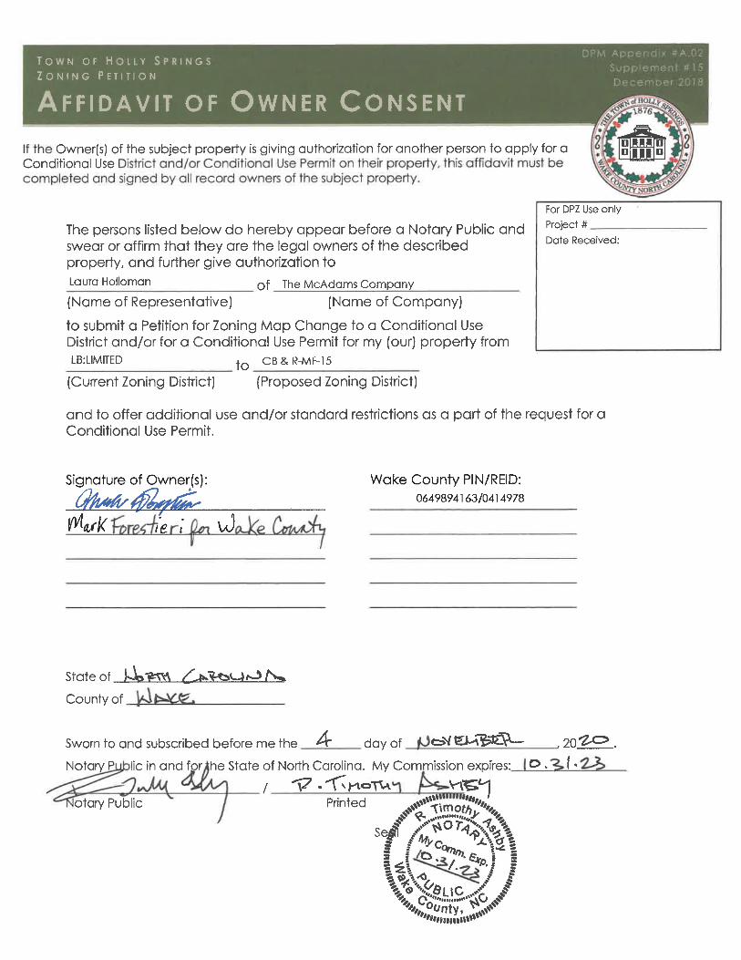
Affidavit of Owner’s Consent (if required)
Waiver Request Forms (if being requested in
conjunction with Zoning Map Change Petition)
Comprehensive Plan Amendment:
The following items must be submitted with the Petition for Comprehensive Plan Amendment to be deemed a
complete submittal:
Vicinity Map
Petition Form
Processing Fees (make check payable to: Town of
Holly Springs)
Statement of Comprehensive Plan Future Land Use
Plan Compatibility
Property survey/legal description (required only if
request does not include the entire tax parcel) in
both hard copy and digital to the FTP website in
Word format. Note: All legal descriptions are to contain
references to inorganic monuments, and that all starting
references on surveys or legal descriptions describe a course
and distance from either the closest NCGS monument or Town
of Holly Springs monument, regardless of the distance thereto.
UDO Text Amendment:
The following items must be submitted with the Petition for UDO Text Amendment to be deemed a complete
submittal:
Petition Form
Processing Fees (make check payable to: Town of Holly Springs)
Statement of Justification including:
Existing UDO language
Proposed UDO language (bold additions to the text and strikethrough text to be removed)
Justification for the amendment
Submittal Specifications:
Statement of Zoning Compatibility: (Zoning Map Change)
A written statement that includes a description of the proposed area for zoning map change and its
relationship to the surrounding land uses and zoning; the compatibility of the request with the Vision Holly
Springs: Town of Holly Springs Comprehensive Plan, Future Land Use Plan and associated objectives; and any
other supporting information regarding the request. The statement must provide evidence, not hearsay, on
how the current zoning is not the highest and best use for the property and that the proposed zoning is the
highest and best use for the property.
Statement of Comprehensive Plan Future Land Use Plan Compatibility: (Land Use Plan
Amendment)
A written statement that includes a description of the proposed area for land use designation modification
and its relationship to the surrounding future and existing land uses; the compatibility of the request with the
vision, intent and goal of Vision Holly Springs: Town of Holly Springs Comprehensive Plan, Future Land Use Plan
and associated objectives; and any other supporting information regarding the request. The statement must
provide evidence on how the current land use designation is not the highest and best use for the property and
XXX
XX
XX
To be submitted as development areas are finalized.
Per Dev. Services Director can be submitted at a later date.
DisclaimeriMaps makes every effort to produce and publish the most current and accurate information possible.However, the maps are produced for information purposes,and are NOT surveys. No warranties, expressed or implied,are provided for the data therein, its use,or its interpretation.
0 430 860215 ft
1 inch = 400 feet±
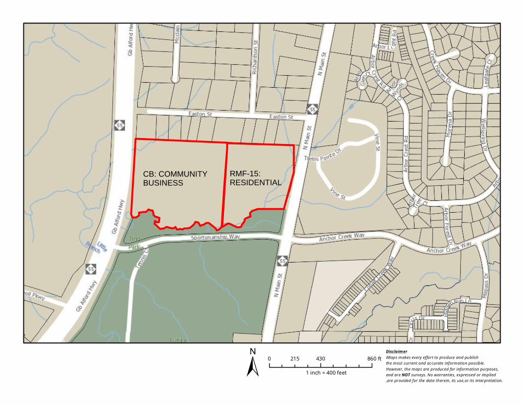
CB: COMMUNITYBUSINESS
RMF-15:RESIDENTIAL
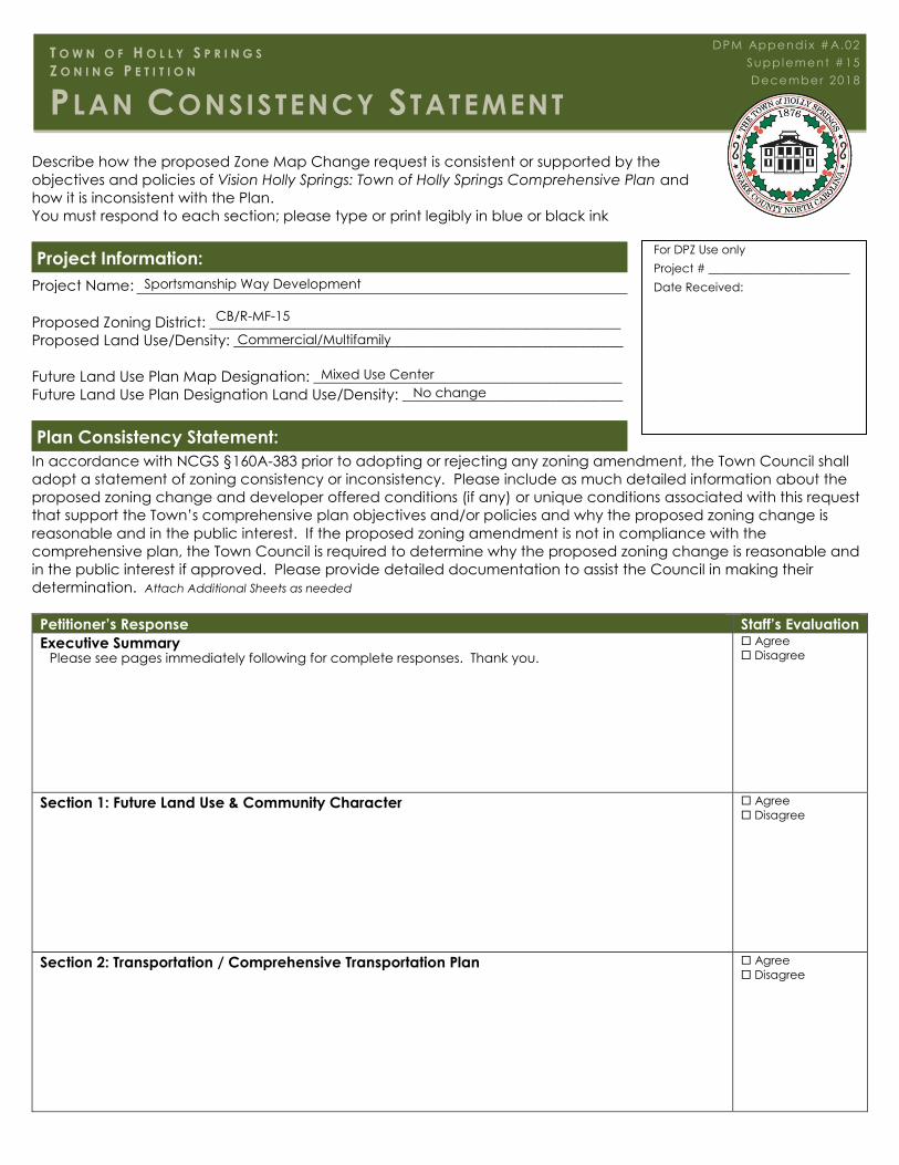
Describe how the proposed Zone Map Change request is consistent or supported by the
objectives and policies of Vision Holly Springs: Town of Holly Springs Comprehensive Plan and
how it is inconsistent with the Plan.
You must respond to each section; please type or print legibly in blue or black ink
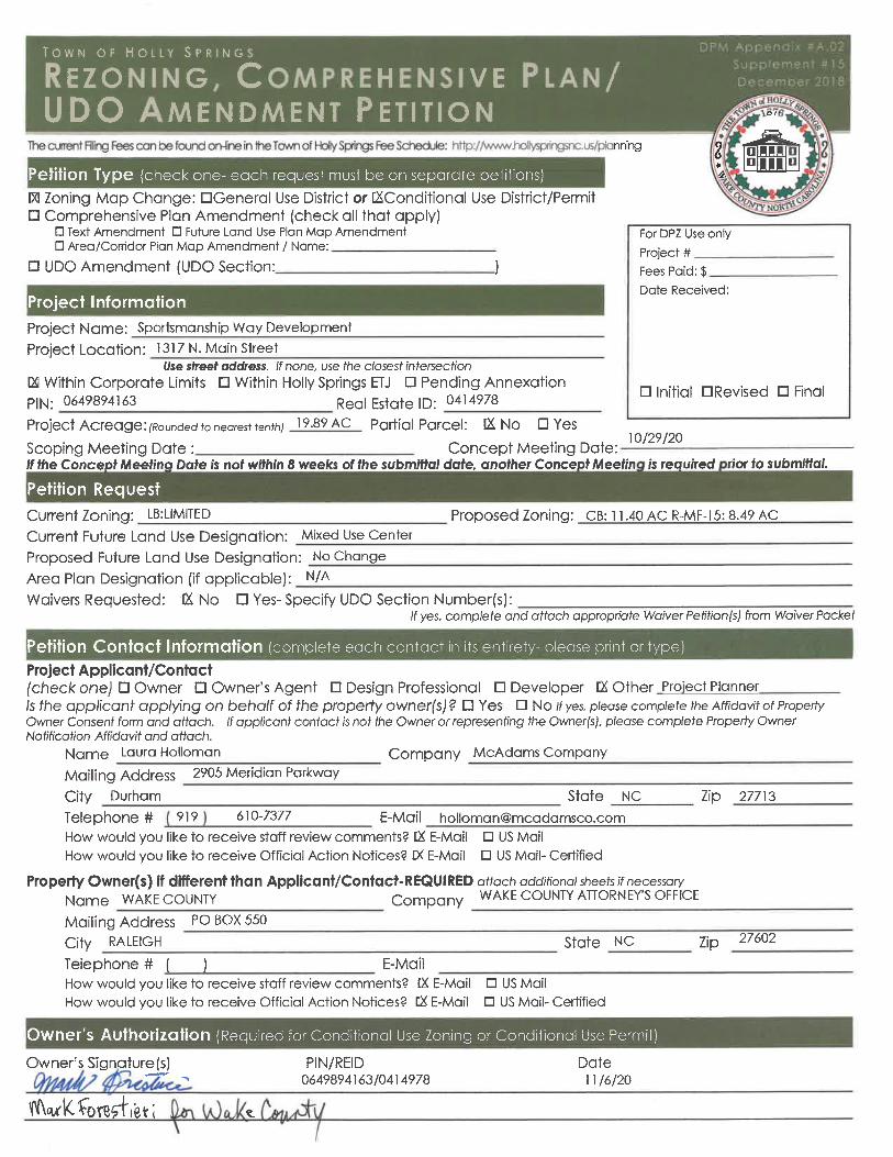
Project Information:
Project Name:
Proposed Zoning District: ________________________________________________________
Proposed Land Use/Density: _____________________________________________________
Future Land Use Plan Map Designation: __________________________________________
Future Land Use Plan Designation Land Use/Density: ______________________________
Plan Consistency Statement:
In accordance with NCGS §160A-383 prior to adopting or rejecting any zoning amendment, the Town Council shall
adopt a statement of zoning consistency or inconsistency. Please include as much detailed information about the
proposed zoning change and developer offered conditions (if any) or unique conditions associated with this request
that support the Town’s comprehensive plan objectives and/or policies and why the proposed zoning change is
reasonable and in the public interest. If the proposed zoning amendment is not in compliance with the
comprehensive plan, the Town Council is required to determine why the proposed zoning change is reasonable and
in the public interest if approved. Please provide detailed documentation to assist the Council in making their
determination. Attach Additional Sheets as needed
Petitioner’s Response Staff’s Evaluation
Executive Summary Agree
Disagree
Section 1: Future Land Use & Community Character Agree
Disagree
Section 2: Transportation / Comprehensive Transportation Plan Agree
Disagree
For DPZ Use only
Project # ________________________
Date Received:
T O W N O F H O L L Y S P R I N G S
Z O N I N G P E T I T I O N
PLAN CONSISTENCY STATEMENT
DPM Appendi x #A.02
Supplement #15
December 2018
Sportsmanship Way Development
CB/R-MF-15
Commercial/Multifamily
Mixed Use CenterNo change
Please see pages immediately following for complete responses. Thank you.

Section 3: Parks, Recreation & Open Space/Beyond the Green: A Parks & Recreation Master Plan Agree
Disagree
Section 4: Community Facilities Agree
Disagree
Section 5: Infrastructure and Utilities Agree
Disagree
Section 8: Natural Resources Agree
Disagree
Plan Consistency Response Prepared by:
Preparer’s Signature(s) Date
11/6/20
Petitioner’s Response
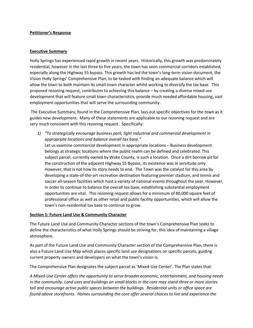
Executive Summary
Holly Springs has experienced rapid growth in recent years. Historically, this growth was predominately residential, however in the last three to five years, the town has seen commercial corridors established, especially along the Highway 55 bypass. This growth has led the town’s long-term vision document, the Vision Holly Springs’ Comprehensive Plan, to be tasked with finding an adequate balance which will allow the town to both maintain its small-town character whilst working to diversify the tax base. This proposed rezoning request, contributes to achieving this balance – by creating a diverse mixed use development that will feature small town characteristics, provide much needed affordable housing, vast employment opportunities that will serve the surrounding community.
The Executive Summary, found in the Comprehensive Plan, lays out specific objectives for the town as it guides new development. Many of these statements are applicable to our rezoning request and are very much consistent with this rezoning request. Specifically:
1) “To strategically encourage business park, light industrial and commercial development inappropriate locations and balance overall tax base.”Let us examine commercial development in appropriate locations – Business developmentbelongs at strategic locations where the public realm can be defined and celebrated. Thissubject parcel, currently owned by Wake County, is such a location. Once a dirt borrow pit forthe construction of the adjacent Highway 55 Bypass, its existence was in servitude only.However, that is not how its story needs to end. The Town was the catalyst for this area bydeveloping a state-of-the-art recreation destination featuring premier stadium, and tennis andsoccer all-season facilities which host a variety of national events throughout the year. However,in order to continue to balance the overall tax base, establishing substantial employmentopportunities are vital. This rezoning request allows for a minimum of 80,000 square feet ofprofessional office as well as other retail and public facility opportunities, which will allow thetown’s non-residential tax base to continue to grow.
Section 1: Future Land Use & Community Character
The Future Land Use and Community Character sections of the town’s Comprehensive Plan seeks to define the characteristics of what Holly Springs should be striving for, this idea of maintaining a village atmosphere.
As part of the Future Land Use and Community Character section of the Comprehensive Plan, there is also a Future Land Use Map which places specific land use designations on specific parcels, guiding current property owners and developers on what the town’s vision is.
The Comprehensive Plan designates the subject parcel as ‘Mixed-Use Center’. The Plan states that:
A Mixed-Use Center offers the opportunity to serve broader economic, entertainment, and housing needs in the community. Land uses and buildings on small blocks in the core may stand three or more stories tall and encourage active public spaces between the buildings. Residential units or office space are found above storefronts. Homes surrounding the core offer several choices to live and experience the
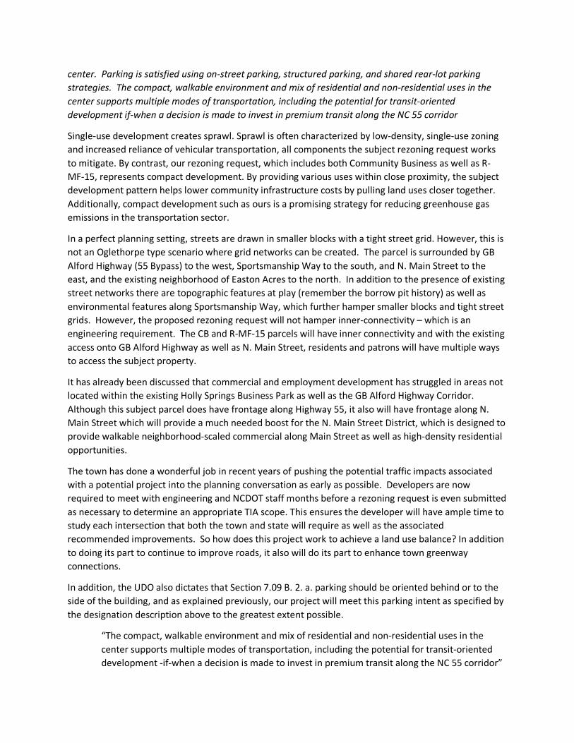
center. Parking is satisfied using on-street parking, structured parking, and shared rear-lot parking strategies. The compact, walkable environment and mix of residential and non-residential uses in the center supports multiple modes of transportation, including the potential for transit-oriented development if-when a decision is made to invest in premium transit along the NC 55 corridor
Single-use development creates sprawl. Sprawl is often characterized by low-density, single-use zoning and increased reliance of vehicular transportation, all components the subject rezoning request works to mitigate. By contrast, our rezoning request, which includes both Community Business as well as R-MF-15, represents compact development. By providing various uses within close proximity, the subject development pattern helps lower community infrastructure costs by pulling land uses closer together. Additionally, compact development such as ours is a promising strategy for reducing greenhouse gas emissions in the transportation sector.
In a perfect planning setting, streets are drawn in smaller blocks with a tight street grid. However, this is not an Oglethorpe type scenario where grid networks can be created. The parcel is surrounded by GB Alford Highway (55 Bypass) to the west, Sportsmanship Way to the south, and N. Main Street to the east, and the existing neighborhood of Easton Acres to the north. In addition to the presence of existing street networks there are topographic features at play (remember the borrow pit history) as well as environmental features along Sportsmanship Way, which further hamper smaller blocks and tight street grids. However, the proposed rezoning request will not hamper inner-connectivity – which is an engineering requirement. The CB and R-MF-15 parcels will have inner connectivity and with the existing access onto GB Alford Highway as well as N. Main Street, residents and patrons will have multiple ways to access the subject property.
It has already been discussed that commercial and employment development has struggled in areas not located within the existing Holly Springs Business Park as well as the GB Alford Highway Corridor. Although this subject parcel does have frontage along Highway 55, it also will have frontage along N. Main Street which will provide a much needed boost for the N. Main Street District, which is designed to provide walkable neighborhood-scaled commercial along Main Street as well as high-density residential opportunities.
The town has done a wonderful job in recent years of pushing the potential traffic impacts associated with a potential project into the planning conversation as early as possible. Developers are now required to meet with engineering and NCDOT staff months before a rezoning request is even submitted as necessary to determine an appropriate TIA scope. This ensures the developer will have ample time to study each intersection that both the town and state will require as well as the associated recommended improvements. So how does this project work to achieve a land use balance? In addition to doing its part to continue to improve roads, it also will do its part to enhance town greenway connections.
In addition, the UDO also dictates that Section 7.09 B. 2. a. parking should be oriented behind or to the side of the building, and as explained previously, our project will meet this parking intent as specified by the designation description above to the greatest extent possible.
“The compact, walkable environment and mix of residential and non-residential uses in the center supports multiple modes of transportation, including the potential for transit-oriented development -if-when a decision is made to invest in premium transit along the NC 55 corridor”

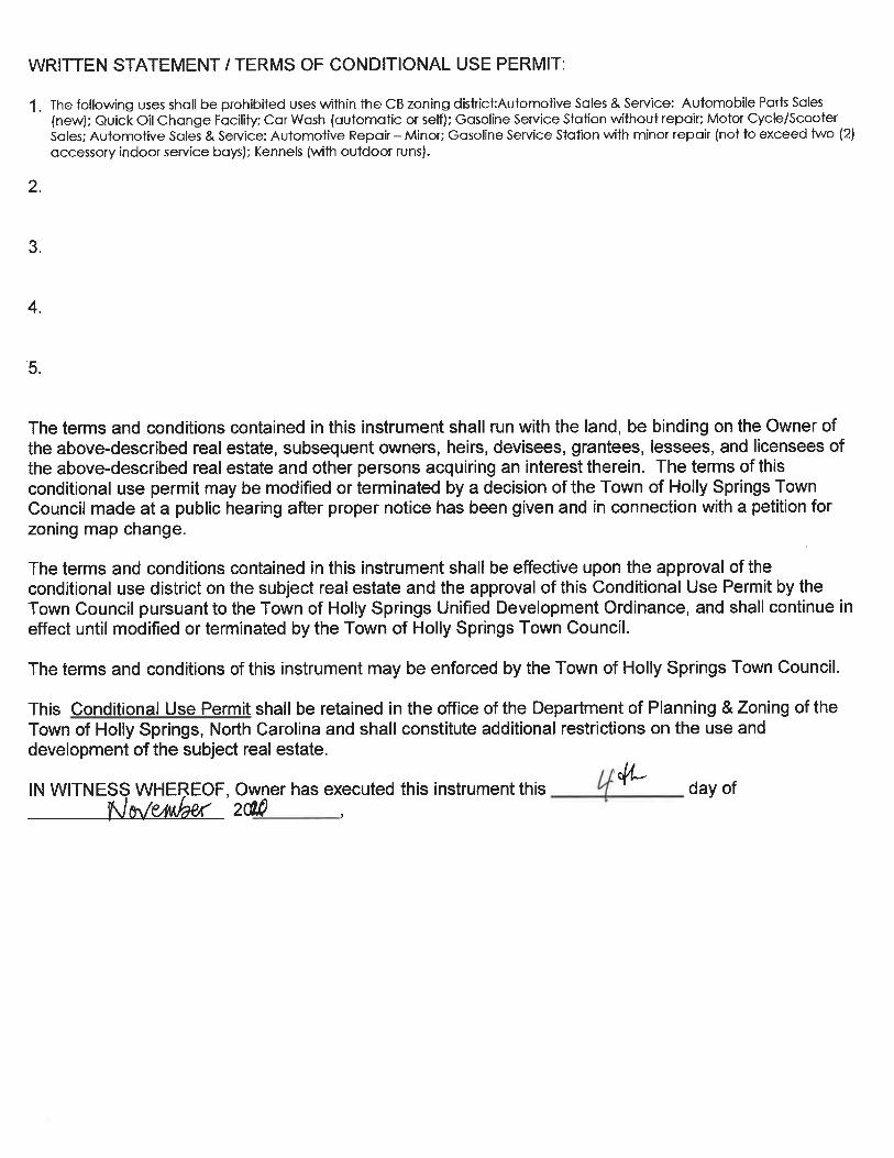
The proposed development will allow a walkable environment to take place. To the greatest extent possible, this project will connect sidewalk systems by constructing public sidewalks along its property frontage, on North Main Street. The project will be required to construct road improvements along their property frontage along North Main Street, that include bike lanes along their project frontage, in turn, the project will also have bike racks conveniently positioned throughout the development to encourage bicycle traffic. The transit element is now being met with the recent edition of Go Triangle peak-hour stop at Ting Park – just right across the street! Additionally, the developer has chosen to prohibit auto-oriented uses such as the following: Automobile Parts Sales (new); Quick Oil Change Facility; Car Wash (automatic or self); Gasoline Service Station without repair; Motor Cycle/Scooter Sale; Automotive Repair – Minor; Gasoline Service Station with minor repair (not to exceed two (2) accessory indoor service bays); which will further ensure emphasis will be on the pedestrian as well as convenient commercial uses that provide much needed employment and neighborhood supporting uses, rather than high turnover uses. The rezoning request meets the Vision Comprehensive Plan. When developed, this project will offer a walkable, modern compact design concept that will be a welcomed part of Holly Springs.
Section 2: Transportation / Comprehensive Transportation Plan As the town grows, traffic becomes more and more critical. As a new development, it is only fair that this potential project contributes to mitigate its potential traffic impacts. This is done through working with both the town’s engineering department as well as NCDOT. The developer must improve all adjacent roadways as per the approved Comprehensive Transportation Plan (CTP) and may also be responsible for any other nearby intersections that have been recommended by the Traffic Impact Analysis findings. Transportation The Comprehensive Plan strives to strike a balance between land use and effective transportation throughout town and has several objectives that suggest how that can be achieved. The proposed rezoning request can meet several of these, specifically: 1) “Promote a pedestrian -friendly environment by filling gaps and improving connectivity
throughout the sidewalk system and to key destination or activity nodes.”This project is critical to continue to kick start compact, smart growth development in theNorth Main Street corridor. With the development of these parcels in a cohesive manner,members of the community will be able to enjoy employment, recreational, residential andappropriately-scaled commercial uses within a walkable environment.Comprehensive Transportation PlanThe CTP outlines the same goals or objectives as the transportation section of theComprehensive Plan. The plan also proposes a multimodal transportation network thatfosters growth in a positive way to the surrounding environment. This is done through threedistinct elements: roadway, bicycle and pedestrian, and transit. This project is meeting theroadway element by building the recommended roadway improvements of North MainStreet, along the subject property frontage. These improvements will work to improve boththe existing traffic as well as take into account our project traffic. The bicycle and

pedestrian elements will be met through providing bike lanes within North Main as well as constructing sidewalk and crosswalks along our project frontage. The transit element is now being addressed through the recently added park and ride stop located adjacent to the site in Ting Park. For many years, the town has planned for the possibility of bus service to be added and that day has finally arrived!
Section 3: Parks, Recreation & Open Space/Beyond the Green: A Parks & Recreation Master Plan
The purpose of the Parks & Recreation Master plan is to acknowledge the importance of providing open space and active opportunities for all town residents. The master plan has several guiding principles, and our rezoning request meets the following: 1) “To enable all residents to live within walking distance of a neighborhood commercial
center and central civic space.”This project is in an area that contains perhaps the largest central civic space in town,Ting Park. Residents in the future multifamily component of the subject property as wellas employees of professional office will be able to access Ting Park. Additionally, thecommercial portion of the rezoning request will ultimately feature neighborhoodcommercial uses that will also allow patrons of the professional office as well as themultifamily portion. This will greatly improve the quality of life for the town.
2) “To physically unite the Town by connecting existing trails, sidewalks, and open spaces.”This project will continue to establish a pedestrian streetscape complete with sidewalkalong its frontage along N. Main Street. Additionally, there are also opportunities toconnect to planned greenway connections which will ultimately allow folks to traversefrom areas west of GB Alford Highway into the subject property as well as Ting Park.
Section 4: Community Facilities
Community facilities addresses the need to be mindful of the increased demand for public services as the town grows and develops. Community facilities can include fire, police, EMS, as well as public school facilities. The Comprehensive Plan contains several community facilities objectives, specifically our project achieves the following: 1) “Inform developers when proposing new subdivisions- of the need for residents’
access to community facilities and the importance to plan appropriately to enablethis access.”Although as a non-residential development, there is less demand for communityfacilities when compared to a traditional subdivision because there are commercialuses and not residential ones, community facilities may be used in a limitedcapacity. Developers plan for community facilities such as police, fire and EMS whendesigning a development. Drive isles are required to be designed to accommodatethe largest emergency response vehicle. The turning template is then submittedand reviewed by staff to ensure that the vehicle can safely maneuver through allaccess points and parking areas. Due to the infill location of this project, existingemergency response facilities are located within close proximity and no issues areperceived with regards to insufficient response time.
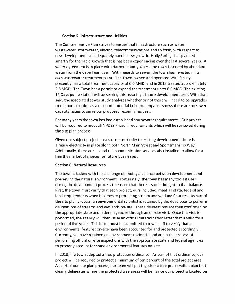
Section 5: Infrastructure and Utilities
The Comprehensive Plan strives to ensure that infrastructure such as water, wastewater, stormwater, electric, telecommunications and so forth, with respect to new development can adequately handle new growth. Holly Springs has planned smartly for the rapid growth that is has been experiencing over the last several years. A water agreement is in place with Harnett county where the town is served by abundant water from the Cape Fear River. With regards to sewer, the town has invested in its own wastewater treatment plant. The Town-owned and operated WRF facility presently has a total treatment capacity of 6.0 MGD, and in 2018 treated approximately 2.8 MGD. The Town has a permit to expand the treatment up to 8.0 MGD. The existing 12 Oaks pump station will be serving this rezoning’s future development uses. With that said, the associated sewer study analyzes whether or not there will need to be upgrades to the pump station as a result of potential build-out impacts. shows there are no sewer capacity issues to serve our proposed rezoning request.
For many years the town has had established stormwater requirements. Our project will be required to meet all NPDES Phase II requirements which will be reviewed during the site plan process.
Given our subject project area’s close proximity to existing development, there is already electricity in place along both North Main Street and Sportsmanship Way. Additionally, there are several telecommunication services also installed to allow for a healthy market of choices for future businesses.
Section 8: Natural Resources
The town is tasked with the challenge of finding a balance between development and preserving the natural environment. Fortunately, the town has many tools it uses during the development process to ensure that there is some thought to that balance. First, the town must verify that each project, ours included, meet all state, federal and local requirements when it comes to protecting stream and wetland features. As part of the site plan process, an environmental scientist is retained by the developer to perform delineations of streams and wetlands on-site. These delineations are then confirmed by the appropriate state and federal agencies through an on-site visit. Once this visit is preformed, the agency will then issue an official determination letter that is valid for a period of five years. This letter must be submitted to town staff to verify that all environmental features on-site have been accounted for and protected accordingly. Currently, we have retained an environmental scientist and are in the process of performing official on-site inspections with the appropriate state and federal agencies to properly account for some environmental features on-site.
In 2018, the town adopted a tree protection ordinance. As part of that ordinance, our project will be required to protect a minimum of ten percent of the total project area. As part of our site plan process, our team will put together a tree preservation plan that clearly delineates where the protected tree areas will be. Since our project is located on

lands previously farmed or used for residential uses, there are not large areas of forest remaining so some areas of re-forestation may be required as necessary to meet this requirement.
ZONING COMPATIBILITY STATEMENT
The town has acted as a development catalyst for this rezoning request. With the construction and opening of Ting Park, which contains state-of-the-art recreational facilities which attract national
tournaments and their families throughout the year, the highest and best use of the property north of Sportsmanship Way is clearly a conglomerate of uses that can benefit greatly from recreational uses
located just outside their front door. This highest and best use notion then translates into a significant professional office presence that provides activity throughout the workday, the presence of
neighborhood-scale business, which will provide goods and services to nearby employees and residents alike, as well as public arts facility that will provide community enrichment. This rezoning also will
answer a call that is being screamed across Wake County. The call for affordable housing. The proposed rezoning of the R-MF-15 portion will feature affordable multifamily units and will answer that call that
has gone on deaf ears for far too long.
These parcels are adjacent to existing residential neighborhoods – Easton Acres, Trellis Pointe, as well as Bridgewater all which feature a variety of residential types– however there is no nearby commercial and
office uses and although the North Main corridor has long since been established it has failed to ignite with the exception of the redevelopment of a self-storage facility. This rezoning will kickstart this area
for private non-residential development, which has long been the Town’s vision.
Currently, the existing zoning of parcels do not meet the Comprehensive Plan’s designation of Mixed Use Center. These parcels are zoned LB: Limited which was created as a band-aid fix from the
elimination of the O&I zoning district that was eliminated when the UDO was created in 2002. As a result, only educational, office/professional and residential uses are permitted as in conformance with
the LB zoning district. That does not allow for neighborhood scale commercial which will be featured as part of this rezoning request, just as the Mixed Use Center Comprehensive Plan designation specifies.
Nor does it allow for the emergence of a public arts facility for Holly Springs residents. In addition, residential is only allowed as upper-story which does not allow the desperate need for sizable affordable
housing to be realized, which has been identified as both a county and Town critical goal and need.
By rezoning these parcels to Community Business and R-MF-15 conditional use the parcels can now be developed to be in conformance with the town’s vision as outlined in the Comprehensive Plan.
Additionally, this project will continue to improve the adjacent major thoroughfare of North Main Street, by improving it in conjunction with the approved transportation and Traffic Impact Analysis
recommendations, which is also assured in the zoning conditions.
The Sportsmanship Way Development Conditional Zoning represents a mindful rezoning request that has strived to answer a critical need of substantial employment, neighborhood commercial, as well as affordable housing opportunities, and will become a community development area that everyone will
enjoy living, working and playing in.

NOTIFICATON TO PROPERTY OWNER
Thank you,
Signature of Applicant: Date:
___________________________________ _______________
Name Company
Mailing Address
City State Zip
Telephone # ( ) Fax # ( ) E-Mail
11/5/20
Laura Holloman The McAdams Company2905 Meridian Parkway
Durham NC 27713919 610-7377 [email protected]
Dear Property Owner,
I am requesting the Holly Springs Town Council to rezone your property
described by:
Wake County Real Estate ID# ______0414978_________________________________
_0649894163_______and PIN _ ___________________________________________________
located at _________1317 N. Main Street_________________________________________________
_LB:LIMITED______from _ ___________________________________ (existing zoning district) to
__________CB & R-MF-15_ ___________________________________ (proposed zoning district).
The public hearing before the Holly Springs Town Council on the matter will
be heard on ________________________ (date) at 7:00 PM.
Additional information can be obtained by contacting the Holly Springs
Department of Planning & Zoning at (919) 557-3908.
3/16/20