town of erwin planning board/board of adjustments …
TRANSCRIPT
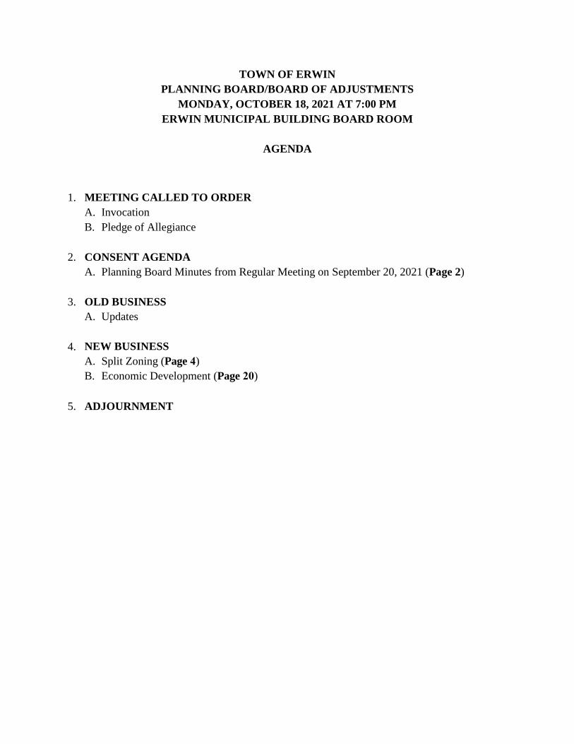
TOWN OF ERWIN PLANNING BOARD/BOARD OF ADJUSTMENTS
MONDAY, OCTOBER 18, 2021 AT 7:00 PM ERWIN MUNICIPAL BUILDING BOARD ROOM
AGENDA
1. MEETING CALLED TO ORDERA. InvocationB. Pledge of Allegiance
2. CONSENT AGENDAA. Planning Board Minutes from Regular Meeting on September 20, 2021 (Page 2)
3. OLD BUSINESSA. Updates
4. NEW BUSINESSA. Split Zoning (Page 4)B. Economic Development (Page 20)
5. ADJOURNMENT

PLANNING BOARD
MEETING MINUTES
MONDAY, SEPTEMBER 20, 2021
ERWIN, NORTH CAROLINA
The Town of Erwin Planning Board held its regular meeting in the Erwin Municipal Building Board Room 110 West F Street, Erwin NC on Monday, September 20th, at 7:00 PM.
Board members present were: Vice-Chairperson Pat Cameron, In Town Board Members Alan West, Joshua Schmieding, Judy Price, and Angela Gundersen, Out of Town Board Member Michael Shean, In Town Alternate Rebecca Kelly, and Out of Town Alternate William Morris.
Board members absent were: Chairperson Ronald Beasley, Out of Town Board Member Roger Brown, and In-Town Alternate Christa Reid.
Town Manager Snow Bowden and Town Clerk Lauren Evans were present.
Vice-Chairperson Pat Cameron called the meeting to order at 7:00 PM.
Vice-Chairperson Pat Cameron gave the invocation.
Board Member Alan West led the Pledge of Allegiance.
CONSENT ITEMS
Board Member Michael Shean made a motion to approve the minutes of August 16, 2021, and was seconded by William Morris. The Board voted unanimously.
OLD BUSINESS
Updates:
Town Manager Snow Bowden informed the Board that at our last Town Board meeting we did not have a quorum and were unable to proceed with our Public Hearings. He briefly updated the Board on some cases being brought to the Town Board at our October meeting.
NEW BUSINESS
ZT-2021-006:
Town Manager Snow Bowden stated this rezoning is for two lots off of 421 where the old White House Restaurant used to be. It has been zoned B-2 and RD. He stated the applicants are just trying to clean up this lot and are requesting to have both lots zoned B-2. There is a parliamentary plat in the packet.
Applicants, Guy Lampee and Terry Weatherton were present at the meeting.
2
Mr. Lampee came forward and addressed the Board. He introduced himself and Mr. Weatherton and offered to answer any questions.
Vice-Chairperson Pat Cameron asked if all the storage units will be climate controlled.
Mr. Lampee stated that the storage buildings will be primarily climate controlled but there may be a small section that is not.
Out of Town Alternate William Morris inquired whether the building will be multi-story.
Mr. Lampee stated they will be single-story units.
Out of Town Alternate William Morris asked if the entrance and exits are interior or exterior.
Mr. Lampee informed that there will be a gate going in and out of the property. For the one non-climate controlled building, it will be accessible from the outside but for the climate-controlled units, you have to go down a hallway and there will be a door. There will also be an onsite manager and cameras for security in addition to the gate.
Town Manager Snow Bowden stated that they give the Police and Fire their own unique code to access the property.
Board Member Michael Shean asked about the landscaping.
Mr. Lampee provided pictured to the Board to show the landscaping of their other buildings.
Out of Town Alternate William Morris made a motion to adopt the Statement of Consistency for ZT-2021-006 and was seconded by Michael Shean. The Board voted unanimously.
ADJOURNMENT
Out of Town Alternate William Morris made a motion to adjourn the meeting at 7:14 PM and was seconded by Judy Price. Motion unanimously approved.
Minutes recorded and typed by
Lauren Evans Town Clerk
______________________________ ______________________________
Ronald Beasley Lauren Evans
Chairperson Town Clerk
3
Erwin Planning BoardREQUEST FOR CONSIDERATION
To: Planning Board Members From: Snow Bowden, Town Manager Date: October 18, 2021 Subject: Split Zoning
In the past year, I have brought two rezoning cases to you due to the parcels having more than one zoning district located on the parcel. I have created a list of all of the parcels that I could find that have more than one zoning district located on the parcel to discuss. I have also included several maps from the Harnett County GIS data system.
Attachments:
• List of parcels
• Harnett County Data
New Business Item 4A
4
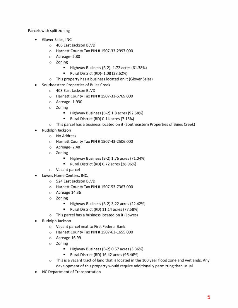
Parcels with split zoning
• Glover Sales, INC. o 406 East Jackson BLVD o Harnett County Tax PIN # 1507-33-2997.000 o Acreage- 2.80 o Zoning
Highway Business (B-2)- 1.72 acres (61.38%) Rural District (RD)- 1.08 (38.62%)
o This property has a business located on it (Glover Sales) • Southeastern Properties of Buies Creek
o 408 East Jackson BLVD o Harnett County Tax PIN # 1507-33-5769.000 o Acreage- 1.930 o Zoning
Highway Business (B-2) 1.8 acres (92.58%) Rural District (RD) 0.14 acres (7.15%)
o This parcel has a business located on it (Southeastern Properties of Buies Creek) • Rudolph Jackson
o No Address o Harnett County Tax PIN # 1507-43-2506.000 o Acreage- 2.48 o Zoning
Highway Business (B-2) 1.76 acres (71.04%) Rural District (RD) 0.72 acres (28.96%)
o Vacant parcel • Lowes Home Centers, INC.
o 524 East Jackson BLVD o Harnett County Tax PIN # 1507-53-7367.000 o Acreage 14.36 o Zoning
Highway Business (B-2) 3.22 acres (22.42%) Rural District (RD) 11.14 acres (77.58%)
o This parcel has a business located on it (Lowes) • Rudolph Jackson
o Vacant parcel next to First Federal Bank o Harnett County Tax PIN # 1507-63-1655.000 o Acreage 16.99 o Zoning
Highway Business (B-2) 0.57 acres (3.36%) Rural District (RD) 16.42 acres (96.46%)
o This is a vacant tract of land that is located in the 100 year flood zone and wetlands. Any development of this property would require additionally permitting than usual
• NC Department of Transportation
5
o No Address this is a road o Harnett County Tax PIN # 1507-53-2573.000 o Acreage 1.31 o Zoning
Highway Business (B-2) 0.26 acres (19.9%) Rural District 1.05 acres (80.1%)
o This is a public road owned by NCDOT • Dan H. Bryant and Nancy Starr
o No address this is a vacant tract of land o Harnett County Tax PIN # 1507-24-2813.000 o Acreage 16.72 o Zoning
Highway Business (B-2) 4.03 acres (24.13%) Rural District (RD) 12.68 acres (75.87%)
o This is a vacant tract of land it has been used as a business in the past from what I have been told. The Town had the old trailer that was on this site removed a few years ago.
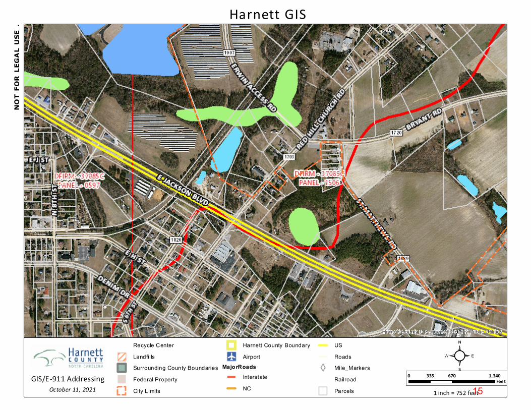
• Dan H. Bryant and David Brant Norris Trustee o 12 Red Hill Church Road o Harnett County Tax PIN # 1507-14-5776.000 o Acreage- 1.4 o Zoning
Highway Business (B-2) 1.19 acres (84.96%) Residential (R-10) 0.21 acres (15.04%)
o This tract of land has an existing home located on site • Pleasant Grove FWB Church
o 290 Red Hill Church Road o Harnett County Tax PIN # 1507-25-1462.000 o Acreage 7.22 o Zoning
Highway Business (B-2) 1.18 acres (16.36%) Residential (R-10) 1.72 acres (23.83%) Rural District (RD) 4.32 acres (59.81%)
o This parcel is separate by Bryant Road but it is one tract of land on it. The parcel has a church built on it with a parking lot.
• Mary Alice Penny and Hal D. Penny o 183 Red Hill Church Road o Harnett County Tax PIN # 1507-15-8560.000 o Acreage .97 o Zoning
Industrial (M-1) 0.8 acres (82.02%) Residential (R-10) 0.18 acres (17.98%)
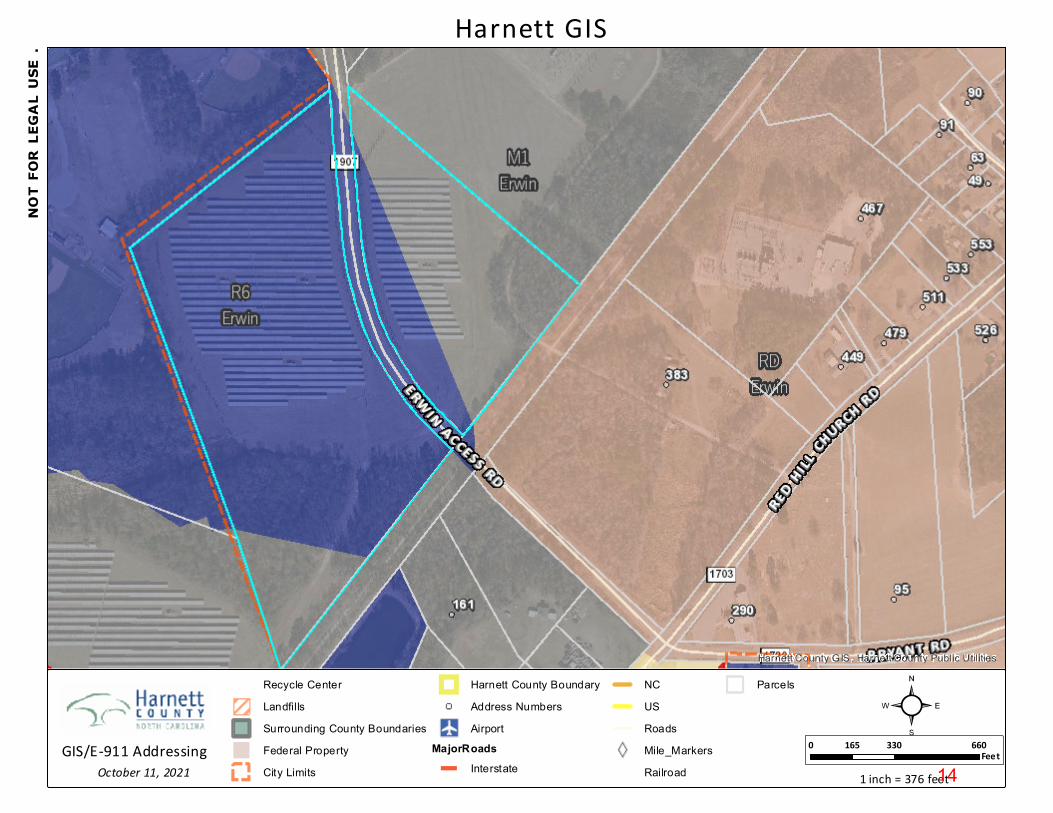
• Boat House Solar, LLC. o Vacant tract of land locate off of Erwin Access Road adjacent to Triton High School o Harnett County Tax PIN 1507-16-1715.000
6
o Acreage 29.56 o Zoning
Industrial (M-1) 8.84 Acres (29.92%) Residential (R-6) 20.72 acres (70.08%)
o This is one tract of land that is separate by Erwin Access Road. It is a solar farm. I imagine this property has been rezoned before the solar farm was installed. We will review this minutes but I wanted to include this in this packet in the case it had not be rezoned already.
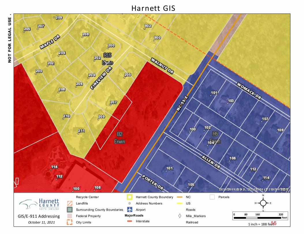
• Rick Steven Trader and Marth Ann Trader o 207 Pineview Drive o Harnett County Tax PIN # 0597-68-9975.000 o Acreage .72 o Zoning
Residential (R-15) .55 acres (77.26%) Highway Business (B-2) .16 acres (22.74%)
o This parcel is in a subdivision and has a single-family dwelling located on the parcel • Raymar 55 LLC
o 209 Pineview Drive o Harnett County Tax PIN 0597-68-8895.000 o Acreage .62 o Zoning
Residential (R-15) .41 acres (65.75%) Highway Business (B-2) .21 acres (34.25%) This parcel is in a subdivision and has a single-family dwelling located on the
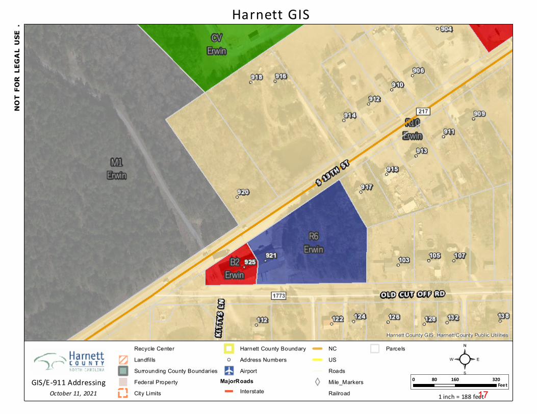
parcel o MPB Company, LLC.
921 South 13th Street Harnett County Tax PIN #0596-49-1854.000 Acreage 1.95 Zoning
• Residential (R-6) 1.95 acres (100%) This parcel is NOT A SPLIT ZONED LOT. However, it is part of a building that is
located on two separate parcels. The other section of this building has an address of 925 South 13th Street and is located in our Highway Business (B-2) Zoning District.
o Dianna Barefoot Jackson 825 South 13th Street Harnett County Tax PIN # 0597-50-2910.000 Acreage 3.36 Zoning
• Residential (R-10)- 3.19 acres (94.99%) • Residential (R-6) 0.17 acres (5.01%)
This parcel has an existing home located on site. o Dianna Barefoot Jackson
7
316 Moulton Springs Road Harnett County Tax PIN # 0597-51-3059.000 Acreage .90 Zoning
• Residential (R-10) .76 acres (84.7%) • Residential (R-6) .14 acres (15.3%)
This site had a home located on it that has recently been demolished o Dianna Barefoot Jackson
312 Moulton Springs Road Harnett County Tax PIN # 0597-51-3188.000 Acreage 0.90 Zoning
• Residential (R-10) .76 acres (84.66%) • Residential (R-6) .14 acres (15.34%)
This site had a home located on it that has recently been demolished o Kimber Group
308 Moulton Springs Road and 310 Moulton Springs Road Harnett County Tax PIN 0597-51-4363.000 Acreage- 2.10 Zoning
• Residential (R-10) 1.77 acres (84.19%) • Residential (R-6) 0.33 acres (15.81%)
This is an existing parcel with a two homes located on site. o Margaret Bradshaw
Vacant parcel next to 302 Moulton Springs Road Harnett County Tax PIN 0597-51-6406.000 Acreage .80 Zoning
• Residential (R-10) .55 acres (68.99%) • Residential (R-6) 31.01%)
This is a tract of land that has some accessory buildings located on site for 302 Moulton Springs Road
o Linda Lou Ryals Westbrook 309 Moulton Springs Road Harnett County Tax PIN 0597-51-7127.000 Acreage .36 Zoning
• Highway Business (B-2) .23 acres (64.43%) • Residential (R-6) .13 acres (35.57%)
An existing parcel with a home on it o Delauriel Deck Matthews
305 and 205 Moulton Springs Road Harnett County Tax PIN 0597-51-8217.000 Acreage 1.43 acres
8

Zoning • Highway Business (B-2) .42 acres (29.58%) • Residential (R-6) 1.01 acres (70.42%)
This parcel has two homes on the parcel. One of them is a mobile home based on Harnett County GIS data
o Vacant parcel in between 309 and 305 Moulton Springs Road
Harnett County Tax PNI 0597-51-7232.000 Acreage - .05 Zoning
• Highway Business (B-2) .01 acres (17.67%) • Residential (R-6) .04 acres (82.33%)
o James and Sara Tyndall 203 Moulton Springs Road Harnett County Tax PIN 0597-61-0564.000 Acreage .31 Zoning
• Highway Business .27 acres (88.1%) • Residential (R-6) .04 acres (11.9%)
This parcel has a home located on site and a few accessory buildings o Neil Parker
808 South 13th Street Harnett County Tax PIN 0597-51-9355.000 Acreage .44 Zoning
• Highway Business (B-2) .42 acres (95.71%) • Residential (R-6) .02 acres (4.29%)
This parcel has a commercial business located on site
9

Harnett County GIS , Harnett County Public Util ities
Harnett GIS
Recycle CenterLandfillsSurrounding County BoundariesFederal PropertyCity Limits
Harnett County BoundaryAddress NumbersAirport
MajorRoadsInterstate
NCUSRoadsMile_MarkersRailroad
Parcels
0 330 660165Feet
1 inch = 376 feet
²October 11, 2021
NOT
FOR
LEGA
L US
E .
GIS/E-911 Addressing 10

Harnett County GIS , Harnett County Public Util ities
Harnett GIS
Recycle CenterLandfillsSurrounding County BoundariesFederal PropertyCity Limits
Harnett County BoundaryAddress NumbersAirport
MajorRoadsInterstate
NCUSRoadsMile_MarkersRailroad
Parcels
0 330 660165Feet
1 inch = 376 feet
²October 11, 2021
NOT
FOR
LEGA
L US
E .
GIS/E-911 Addressing 11

Harnett County GIS , Harnett County Public Util ities
Harnett GIS
Recycle CenterLandfillsSurrounding County BoundariesFederal PropertyCity Limits
Harnett County BoundaryAddress NumbersAirport
MajorRoadsInterstate
NCUSRoadsMile_MarkersRailroad
Parcels
0 330 660165Feet
1 inch = 376 feet
²October 11, 2021
NOT
FOR
LEGA
L US
E .
GIS/E-911 Addressing 12

Harnett County GIS , Harnett County Public Util ities
Harnett GIS
Recycle CenterLandfillsSurrounding County BoundariesFederal PropertyCity Limits
Harnett County BoundaryAddress NumbersAirport
MajorRoadsInterstate
NCUSRoadsMile_MarkersRailroad
Parcels
0 330 660165Feet
1 inch = 376 feet
²October 11, 2021
NOT
FOR
LEGA
L US
E .
GIS/E-911 Addressing 13
Harnett County GIS , Harnett County Public Util ities
Harnett GIS
Recycle CenterLandfillsSurrounding County BoundariesFederal PropertyCity Limits
Harnett County BoundaryAddress NumbersAirport
MajorRoadsInterstate
NCUSRoadsMile_MarkersRailroad
Parcels
0 330 660165Feet
1 inch = 376 feet
²October 11, 2021
NOT
FOR
LEGA
L US
E .
GIS/E-911 Addressing 14
Harnett County GIS , Harnett County Public Util ities
Harnett GIS
Recycle CenterLandfillsSurrounding County BoundariesFederal PropertyCity Limits
Harnett County BoundaryAirport
MajorRoadsInterstateNC
USRoadsMile_MarkersRailroadParcels
0 670 1,340335Feet
1 inch = 752 feet
²October 11, 2021
NOT
FOR
LEGA
L US
E .
GIS/E-911 Addressing 15
Harnett County GIS , Harnett County Public Util ities
Harnett GIS
Recycle CenterLandfillsSurrounding County BoundariesFederal PropertyCity Limits
Harnett County BoundaryAddress NumbersAirport
MajorRoadsInterstate
NCUSRoadsMile_MarkersRailroad
Parcels
0 160 32080Feet
1 inch = 188 feet
²October 11, 2021
NOT
FOR
LEGA
L US
E .
GIS/E-911 Addressing 16
Harnett County GIS , Harnett County Public Util ities
Harnett GIS
Recycle CenterLandfillsSurrounding County BoundariesFederal PropertyCity Limits
Harnett County BoundaryAddress NumbersAirport
MajorRoadsInterstate
NCUSRoadsMile_MarkersRailroad
Parcels
0 160 32080Feet
1 inch = 188 feet
²October 11, 2021
NOT
FOR
LEGA
L US
E .
GIS/E-911 Addressing 17

Harnett County GIS , Harnett County Public Util ities
Harnett GIS
Recycle CenterLandfillsSurrounding County BoundariesFederal PropertyCity Limits
Harnett County BoundaryAddress NumbersAirport
MajorRoadsInterstate
NCUSRoadsMile_MarkersRailroad
Parcels
0 160 32080Feet
1 inch = 188 feet
²October 11, 2021
NOT
FOR
LEGA
L US
E .
GIS/E-911 Addressing 18

Harnett County GIS , Harnett County Public Util ities
Harnett GIS
Recycle CenterLandfillsSurrounding County BoundariesFederal PropertyCity Limits
Harnett County BoundaryAddress NumbersAirport
MajorRoadsInterstate
NCUSRoadsMile_MarkersRailroad
Parcels
0 160 32080Feet
1 inch = 188 feet
²October 12, 2021
NOT
FOR
LEGA
L US
E .
GIS/E-911 Addressing 19
Erwin Planning BoardREQUEST FOR CONSIDERATION
To: Planning Board Members From: Snow Bowden, Town Manager Date: October 18, 2021 Subject: Economic Development
A while back we talked about making some changes to our ordinances. We needed to get through the required updates to be in compliance with North Carolina General Statute 160D. Those changes have been approved and I would like to discuss some potential changes to our Highway Business (B-2) and our Central Business (CB) Zoning Districts. I would like to discuss potential options to help promote commercial growth in Erwin.
Attachments:
• Highway Business (B-2) Zoning District• Central Business (CB) Zoning District
New Business Item 4B
20
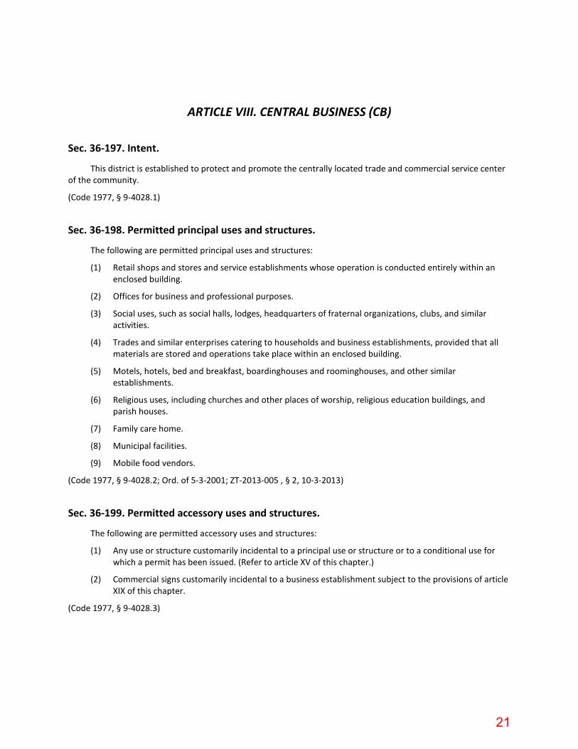
ARTICLE VIII. CENTRAL BUSINESS (CB)
Sec. 36-197. Intent.
This district is established to protect and promote the centrally located trade and commercial service center of the community.
(Code 1977, § 9-4028.1)
Sec. 36-198. Permitted principal uses and structures.
The following are permitted principal uses and structures:
(1) Retail shops and stores and service establishments whose operation is conducted entirely within an enclosed building.
(2) Offices for business and professional purposes.
(3) Social uses, such as social halls, lodges, headquarters of fraternal organizations, clubs, and similar activities.
(4) Trades and similar enterprises catering to households and business establishments, provided that all materials are stored and operations take place within an enclosed building.
(5) Motels, hotels, bed and breakfast, boardinghouses and roominghouses, and other similar establishments.
(6) Religious uses, including churches and other places of worship, religious education buildings, and parish houses.
(7) Family care home.
(8) Municipal facilities.
(9) Mobile food vendors.
(Code 1977, § 9-4028.2; Ord. of 5-3-2001; ZT-2013-005 , § 2, 10-3-2013)
Sec. 36-199. Permitted accessory uses and structures.
The following are permitted accessory uses and structures:
(1) Any use or structure customarily incidental to a principal use or structure or to a conditional use for which a permit has been issued. (Refer to article XV of this chapter.)
(2) Commercial signs customarily incidental to a business establishment subject to the provisions of article XIX of this chapter.
(Code 1977, § 9-4028.3)
21

Sec. 36-200. Special uses.
The following are conditional uses:
(1) Vehicular services.
(2) Convenience store.
(3) Multifamily dwellings (on upper floors of commercial buildings).
(4) Public facilities.
(5) Vehicular sales and rentals:
a. Minimum lot size shall be 0.5 acre.
b. Outdoor loudspeakers or audio system shall not be utilized. (Does not include special events.)
c. Balloons, signs, or other items shall not be attached to vehicles and prohibited from beingdisplayed outside the building.
d. Portable signs shall be prohibited.
e. Signs. See article XIX of this chapter.
(Code 1977, § 9-4028.4; Ord. of 5-3-2001; Ord. of 7-23-2009; Ord. of 11-20-2014; Res. No. 2021-2022-001 , 7-1-2021)
Sec. 36-201. Dimensional requirements.
The following regulations shall govern all conditional uses in the district:
(1) Minimum lot area: There shall be no minimum area requirement for lots in this district.
(2) Minimum lot width: There shall be no minimum width requirement for lots in this district.
(3) Minimum required front yard: The minimum front yard depth shall be the average of the front yard depths which have been established by buildings in one or both adjoining side lots; in all cases, there shall be sufficient setback from the street curb line to provide space for a minimum 12-foot sidewalk.
(4) Minimum required rear yard: Ten feet. No rear yard is required where a public alley abuts the rear property line.
(5) Minimum required side yard: There shall be no minimum side yard required.
(6) The maximum height of any structure shall be the same as required by the underlying zoning district unless otherwise stated herein. Non-residential buildings located within the areas identified Medium Intensity, High Intensity, Downtown, and Employment Center Land Use Classifications are exempt from the district height requirement if they conform to the following:
a. Highest point of the building shall not exceed 80 feet.
All setbacks shall be measured from either the property line or public right-of-way whichever is closer. If no public right-of-way exists then the measurement will be taken from the access easement line.
(Code 1977, § 9-4028.5; Ord. of 8-2-2012; Ord. No. 2019-2020-007 , 3-5-2020)
22
Sec. 36-202. Buffers.
(a) Buffer strips as herein defined shall be required in this district for all uses where they abut land which is zoned residential.
(b) The buffering requirement may be waived by the board of adjustment along any boundary which is naturally screened by evergreen plant materials or topography or may be deferred in isolated areas. Refer to article XV of this chapter for additional landscaping requirements.
(Code 1977, § 9-4028.6; Ord. of 12-10-2009)
Sec. 36-203. Off-street parking and loading.
Refer to article XVIII of this chapter.
(Code 1977, § 9-4028.7)
Sec. 36-204. Signs.
Refer to article XIX of this chapter.
(Code 1977, § 9-4028.8)
Sec. 36-205. Lights.
Refer to article XVII of this chapter.
(Code 1977, § 9-4028.9)
Sec. 36-206. General provisions.
Refer to article XV of this chapter.
(Code 1977, § 9-4028.10)
Secs. 36-207—36-235. Reserved.
ARTICLE X. HIGHWAY BUSINESS (B-2)
Sec. 36-271. Intent.
It is the purpose of this district to accommodate a wide variety of large commercial, wholesale, and retail businesses.
(Code 1977, § 9-4030.1)
23
Sec. 36-272. Permitted principal uses and structures.
The following are permitted uses and structures:
(1) Retail shops and stores and service establishments whose operation is conducted entirely within an enclosed building.
(2) Offices for business and professional purposes.
(3) Social uses, such as social halls, lodges, fraternal organizations, clubs, and similar activities.
(4) Trades and similar enterprises catering to household and business establishments.
(5) Motels, hotels, bed and breakfasts, boardinghouses and roominghouses, and other similar establishments.
(6) Religious uses, including churches and other places of worship, religious education buildings, and parish houses.
(7) Family care home.
(8) Municipal facilities.
(9) Mobile food vendors.
(10) Convenience store.
(Code 1977, § 9-4030.2; Ord. of 5-3-2001; ZT-2013-005 , § 2, 10-3-2013)
Sec. 36-273. Permitted accessory uses and structures.
The following are permitted accessory uses and structures:
(1) Any use or structure customarily incidental to a principal use or structure or to a conditional use for which a permit has been issued. (See article XV of this chapter.)
(2) Commercial signs customarily incidental to a business establishment subject to the provisions of article XIX of this chapter.
(Code 1977, § 9-4030.3)
Sec. 36-274. Special uses.
The following are conditional uses:
(1) Convenience store.
(2) Outdoor storage of vehicles, or equipment or material. See section 36-276.
(3) Vehicular services.
(4) Public facilities.
(5) Private recreation facilities for profit.
(6) Electronic gaming operations.
24
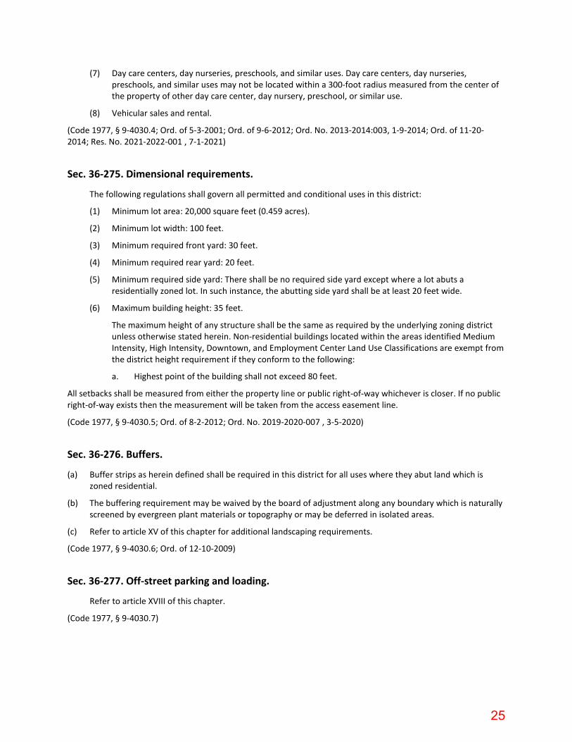
(7) Day care centers, day nurseries, preschools, and similar uses. Day care centers, day nurseries, preschools, and similar uses may not be located within a 300-foot radius measured from the center of the property of other day care center, day nursery, preschool, or similar use.
(8) Vehicular sales and rental.
(Code 1977, § 9-4030.4; Ord. of 5-3-2001; Ord. of 9-6-2012; Ord. No. 2013-2014:003, 1-9-2014; Ord. of 11-20-2014; Res. No. 2021-2022-001 , 7-1-2021)
Sec. 36-275. Dimensional requirements.
The following regulations shall govern all permitted and conditional uses in this district:
(1) Minimum lot area: 20,000 square feet (0.459 acres).
(2) Minimum lot width: 100 feet.
(3) Minimum required front yard: 30 feet.
(4) Minimum required rear yard: 20 feet.
(5) Minimum required side yard: There shall be no required side yard except where a lot abuts a residentially zoned lot. In such instance, the abutting side yard shall be at least 20 feet wide.
(6) Maximum building height: 35 feet.
The maximum height of any structure shall be the same as required by the underlying zoning district unless otherwise stated herein. Non-residential buildings located within the areas identified Medium Intensity, High Intensity, Downtown, and Employment Center Land Use Classifications are exempt from the district height requirement if they conform to the following:
a. Highest point of the building shall not exceed 80 feet.
All setbacks shall be measured from either the property line or public right-of-way whichever is closer. If no public right-of-way exists then the measurement will be taken from the access easement line.
(Code 1977, § 9-4030.5; Ord. of 8-2-2012; Ord. No. 2019-2020-007 , 3-5-2020)
Sec. 36-276. Buffers.
(a) Buffer strips as herein defined shall be required in this district for all uses where they abut land which is zoned residential.
(b) The buffering requirement may be waived by the board of adjustment along any boundary which is naturally screened by evergreen plant materials or topography or may be deferred in isolated areas.
(c) Refer to article XV of this chapter for additional landscaping requirements.
(Code 1977, § 9-4030.6; Ord. of 12-10-2009)
Sec. 36-277. Off-street parking and loading.
Refer to article XVIII of this chapter.
(Code 1977, § 9-4030.7)
25

Sec. 36-278. Signs.
Refer to article XIX of this chapter.
(Code 1977, § 9-4030.8)
Sec. 36-279. Lights.
Refer to article XVII of this chapter.
(Code 1977, § 9-4030.9)
Sec. 36-280. General provisions.
Refer to article XV of this chapter.
(Code 1977, § 9-4030.10)
Secs. 36-281—36-308. Reserved.
26