the commercial space operations center … commercial space operations center (comspoc) dan oltrogge...
TRANSCRIPT

1© Analytical Graphics, Inc. All rights reserved.© Analytical Graphics, Inc. All rights reserved.
The Commercial Space Operations Center (ComSpOC)Dan Oltrogge29‐30 May 2017
© Analytical Graphics, Inc. All rights reserved.
ITU Satellite Communication Symposium 2017, Bariloche, Argentina

2© Analytical Graphics, Inc. All rights reserved.
Agenda
• Today’s increasingly complex space environment• The Commercial Space Operations Center (ComSpOC)• ComSpOC sensor mix and data fusion• Proven ComSpOC performance• The Space Data Association (SDA) and new SDC 2.0

3© Analytical Graphics, Inc. All rights reserved.
Today’s increasingly complex space environment

4© Analytical Graphics, Inc. All rights reserved.
Anticipated sharp increase in RF spectrum usage• Many planned large constellations to be added
# Operator # S/C Altitude (km) Inclination (deg) S/C Hardbody SIZE (full
dimension in m)
Secondary's Hardbody SIZE (full
dimension in m)
Combined Hardbody Radius
(m)
1a Boeing V-band 1120 1200 45° 3* 0.1 1.55
1b Boeing V-band 828 1200 55° 3* 0.1 1.55
1c Boeing V-band 1008 1000 88° 3* 0.1 1.55
2 CubeSat 380 100 380 98.5° 0.3 0.1 0.2
3 CubeSat 600 (≈Planet) 100 600 98.5° 0.3 0.1 0.2
4 CubeSat 800 100 800 98.5° 0.3 0.1 0.2
5 Globalstar 40 1400 52° 9.7 0.1 4.9
6a Hawkeye 360 6 650 44° 0.4 0.1 0.25
6b Hawkeye 360 6 650 63.5° 0.4 0.1 0.25
6c Hawkeye 360 6 650 97° 0.4 0.1 0.25
7 Iridium 71 780 86.4° 4.27 0.1 2.19
8 LeoSat 140 1400 90° 2 0.1 1.05
9 OneWeb 648 1200 87° 2 0.1 1.05
10 Orbcomm 31 750 45° 10.5 0.1 5.3
11 Samsung 4600 900 ? 3* 0.1 1.55
12 SpaceX 4000 1100 90° 2 0.1 1.05
13 Spire 100 651 97.95° 0.3 0.1 0.2
Terra Bella 28 576 97.76° 1.5 0.1 0.8

5© Analytical Graphics, Inc. All rights reserved.
On top of which …• A proliferation of CubeSats projected
– Modern 3D printing techniques, CNC machining and satellite “kits” make it easier to manufacture, mass produce and operate satellites of modest capability
*Used by permission of author, Mr. Bill Doncaster of SpaceWorks*Used by permission of author, Dr. Michael Swartwout, St. Louis University

6© Analytical Graphics, Inc. All rights reserved.
Further: Russian “Luch”/Olymp satellite (40258)
• Launched 28 Sept 2014• Open‐source web reports it is a Sigint mission
• High‐interest object• Several station changes since arriving at GEO
• Eventually designated Kosmos‐2501

7© Analytical Graphics, Inc. All rights reserved.
Luch location history
Initial checkout
Second checkout location
Eastwarddrift
Various operating locations in the last 24 months
Long westward drift

8© Analytical Graphics, Inc. All rights reserved.
Luch post‐checkout activity
• Operational mission has included 4 proximity operations– Jun‐Sep 2015– Oct‐Dec 2015– Jan‐ Aug 2016– Sep 2016 – Present
• In each case, Luch parked within ~0.1 deg of its target• Chemical & electrical thrusters used for station changes

9© Analytical Graphics, Inc. All rights reserved.
Luch: current status
How does Luch know when you might maneuver toward it ?

10© Analytical Graphics, Inc. All rights reserved.
Shijian‐17 initial drift to station (prior to 12 Nov)
SJ-17 (cyan) & YZ-2 (upper stage in yellow)
• New Chinese technology demonstration satellite
– Space debris observation– Including rendezvous and
proximity operations– Low thrust technology
• Launched 3 Nov on Long March 5 inaugural flight
• ComSpOC has tracked and characterized SJ‐17 since launch
– Used open source info on LM‐5 trajectory for initial acquisition

• Click to edit Master text styles– Second level
• Third level– Fourth level
» Fifth level
© Analytical Graphics, Inc. All rights reserved.
The Commercial Space Operations Center

• Click to edit Master text styles– Second level
• Third level– Fourth level
» Fifth level
© Analytical Graphics, Inc. All rights reserved.
ComSpOC sensor data processing & fusion Sensor Sources
Traditional • SSN, SBSS • Fylingdales • Vardo• Sapphire • GRAVES• TIRA• ESTRACK (ESA)• ISTRACK (ISRO)• EISCAT• Chibolton• Other
Non‐traditional• Missile warning• Missile defense • Mission data • Hosted payloads• OPIR• Owner / operator• Telescopes
Sensor Measurements Ground
• 2‐way range• Bistatic range• Doppler• Az / El angles• RA / Dec angles• X / Y angles• Direction cosines• Phased array • Deep Space Network (DSN) • TDOA, FDOA• TDRS• GPS ground rcvr
Space based• RA / DEC angles • Az / El angles• Range• GPS• TDOA, FDOA • TDRS• Doppler• Ephemeris
Sensor Tracking Formats• SSN, B3• SLR (laser ranging)• RINEX (GPS)• NASA UTDF and GEOS‐C• DSN TRK‐2‐34• CCSDS Tracking Data Message
(TDM)• AFSCN• Tracking data reader • User defined / custom
13© Analytical Graphics, Inc. All rights reserved.
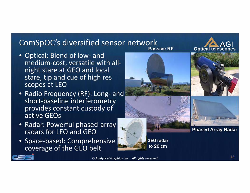
ComSpOC’s diversified sensor network• Optical: Blend of low‐ and medium‐cost, versatile with all‐night stare at GEO and local stare, tip and cue of high res scopes at LEO
• Radio Frequency (RF): Long‐ and short‐baseline interferometry provides constant custody of active GEOs
• Radar: Powerful phased‐array radars for LEO and GEO
• Space‐based: Comprehensive coverage of the GEO belt
Passive RF
GEO radar to 20 cm
Optical telescopes
Phased Array Radar

14© Analytical Graphics, Inc. All rights reserved.
ComSpOC & operator sensor data OD fusion• Optical cheaper, does well at GEO• Radar yields exquisite orbits in LEO• Passive RF yields exquisite orbits in LEO ‐ GEO• Operator transponder ranging fused as well …
Fusion of operator ranging & optical obsFusion of passive RF & optical obs

• Click to edit Master text styles– Second level
• Third level– Fourth level
» Fifth level
© Analytical Graphics, Inc. All rights reserved.
ComSpOC performance: 2016• Maintained a catalog of 9000+ objects
• Processed– 6.8 million tracks– 231 million measurements
• Found and characterized:– 18,800 maneuvers– 92% of these were in GEO

• Click to edit Master text styles– Second level
• Third level– Fourth level
» Fifth level
© Analytical Graphics, Inc. All rights reserved.
Sample LEO accuracy: SWARM‐B (SLR)
Best case TLE accuracy for a LEO
(Polar orbit, Alt ≤ 530 km)
Positional error (km)

• Click to edit Master text styles– Second level
• Third level– Fourth level
» Fifth level
© Analytical Graphics, Inc. All rights reserved.
Sample LEO accuracy: SWARM‐B (SLR) (expanded scale)
Positional error (km)

• Click to edit Master text styles– Second level
• Third level– Fourth level
» Fifth level
© Analytical Graphics, Inc. All rights reserved.
Sample GEO accuracy: MTSAT2 (SBAS)Tw
o orde
rs‐of‐
magnitude
im
provem
ent

19© Analytical Graphics, Inc. All rights reserved.
ComSpOC supports characterization• Maneuver Characterization
– Improved characterization of maneuvers for better track custody and collection planning
– Trending to determine “out of family” maneuvers– Detect previously uncharacterized S/C maneuver modes– Maneuver profile info (e.g. magnitude, direction, duration)
• Conjunction Characterization – Determine if GEO S/C systematically approaching each other– Displays history of TCAs for each “conjunction event”– Perform conjunction trending
• RFI Characterization – Determine if RF interference likely– Display history of RFI “conjunction events”– Perform RFI event trending

20© Analytical Graphics, Inc. All rights reserved.© Analytical Graphics, Inc. All rights reserved.
Space Data Association: SDC 2.0

www.space‐data.org 21
SDA: 34 participating operators, 615 satellites
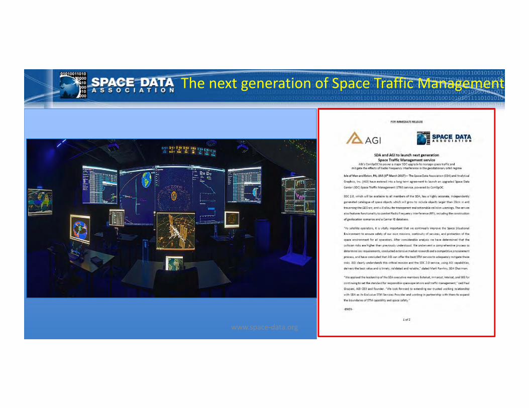
The next generation of Space Traffic Management
www.space‐data.org

SDC 2.0 recently announced• Utilizes highly accurate, independently‐generated space object catalog• Powered by ComSpOC• Catalog will grow to include objects larger than 20cm in and traversing
the GEO arc• Transparent, timely and actionable collision warnings• Functionality to combat Radio Frequency Interference (RFI), including
predictive RFI, optimal construction of geolocation scenarios and the Carrier ID database
• Positions SDA as the provider of the world’s authoritative systemwww.space‐data.org

Why SDC 2.0?• Collision risks much higher than previously understood
– Need protection from all threats– Protect/preserve the geostationary environment for the future
• Will provide needed operations‐oriented RF and RFI functionality• SDC 1.0 limitations:
– Inter‐system biases in operator systems– Availability & accuracy limitations of debris data, particularly for < 1m objects– Lack of transparency and consistent availability of government‐provided data
www.space‐data.org
SDC 2.0 – a new level of flight safety• High‐accuracy, independently‐generated ComSpOC
catalogue– Catalogue will evolve to include all objects >20cm– More extensive than public space catalogues
• Advanced non‐cooperative maneuver processing– Rapid recovery of orbits states after maneuvers
• Verification of maneuver plans• Realistic covariance of catalogue objects
– Yields actionable collision probability‐based warnings– Enables realistic geolocation error ellipses
• Inter‐system biases eliminated
• Radio Frequency Interference mitigation functionality:– More accurate geolocation solutions in shorter times – Direct data download into geolocation systems– RFI predictions and alerts
• Carrier ID database:– Central management of Carrier ID reference numbers
• Validated algorithms and processing• Commercial service agreement ensures:
– Transparency– Reliability– Timeliness – Independence from government data sources
www.space‐data.org 25
SDA will no longer rely on 3rd‐party catalog data – it will independently derive its own catalogue and generate actionable collision warnings

26© Analytical Graphics, Inc. All rights reserved.
Conclusions
• Collision risks in both LEO and GEO much higher than previously understood – need protection from all threats
• Increased RFI incidences very likely, given the developing large constellations and continued GEO growth
• Commercial SSA offers significant value for enhanced mission effectiveness
• High accuracy solutions and analyses improve the “signal‐to‐noise ratio” and allow customers to focus on their mission needs
27© Analytical Graphics, Inc. All rights reserved.
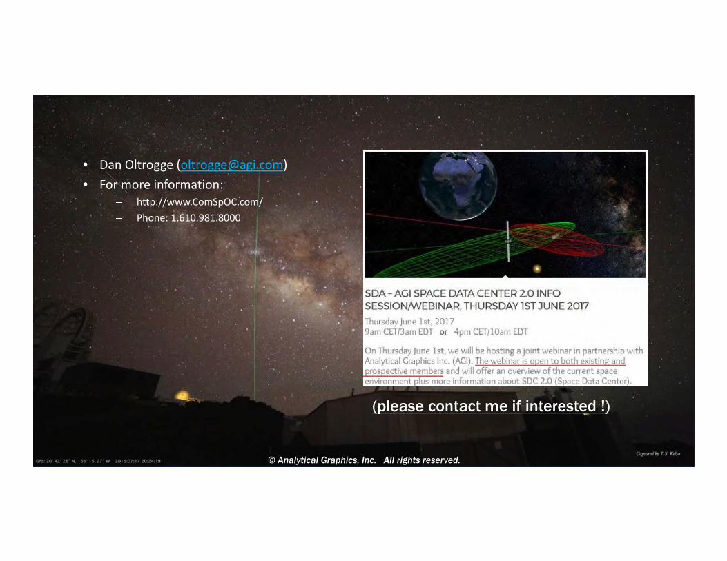
• Dan Oltrogge ([email protected])• For more information:
– http://www.ComSpOC.com/ – Phone: 1.610.981.8000
© Analytical Graphics, Inc. All rights reserved.
(please contact me if interested !)