surveying ii week 01
TRANSCRIPT
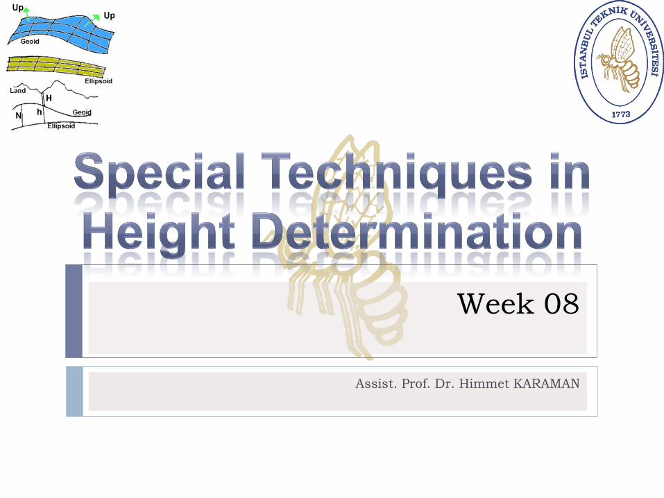
Week 08
Assist. Prof. Dr. Himmet KARAMAN
Topics
ISTANBUL TECHNICAL UNIVERSITY - DEPARTMENT OF GEOMATICS ENGINEERING
2
GPS Leveling
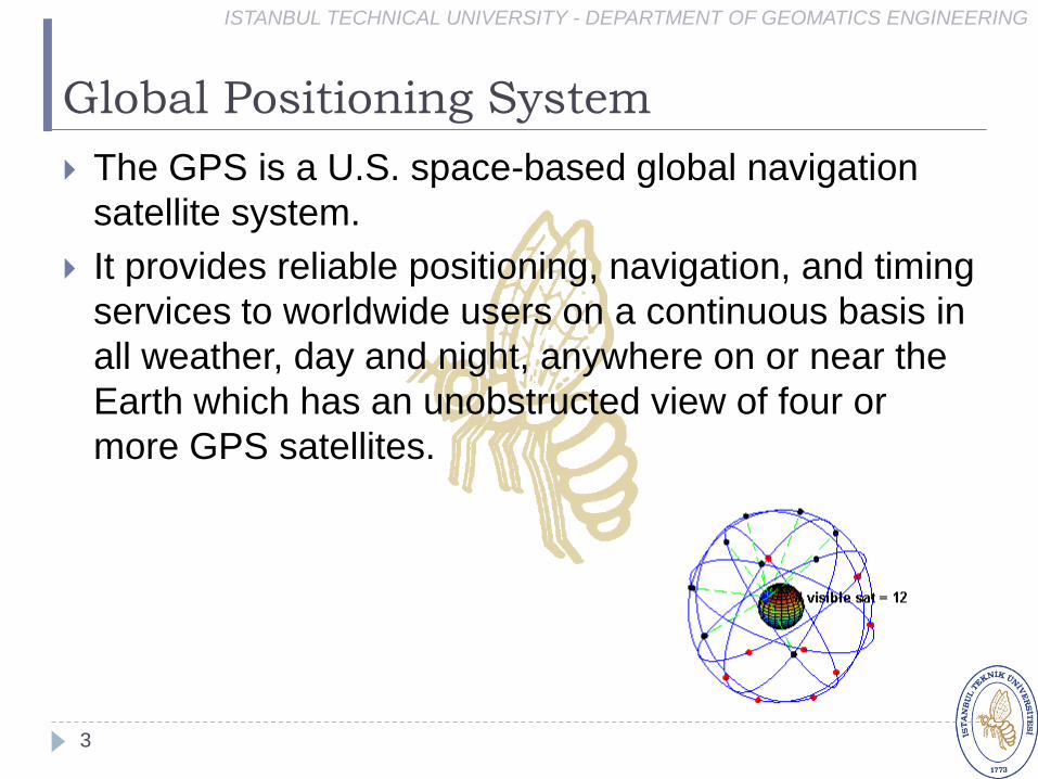
Global Positioning System
3
The GPS is a U.S. space-based global navigation
satellite system.
It provides reliable positioning, navigation, and timing
services to worldwide users on a continuous basis in
all weather, day and night, anywhere on or near the
Earth which has an unobstructed view of four or
more GPS satellites.
ISTANBUL TECHNICAL UNIVERSITY - DEPARTMENT OF GEOMATICS ENGINEERING
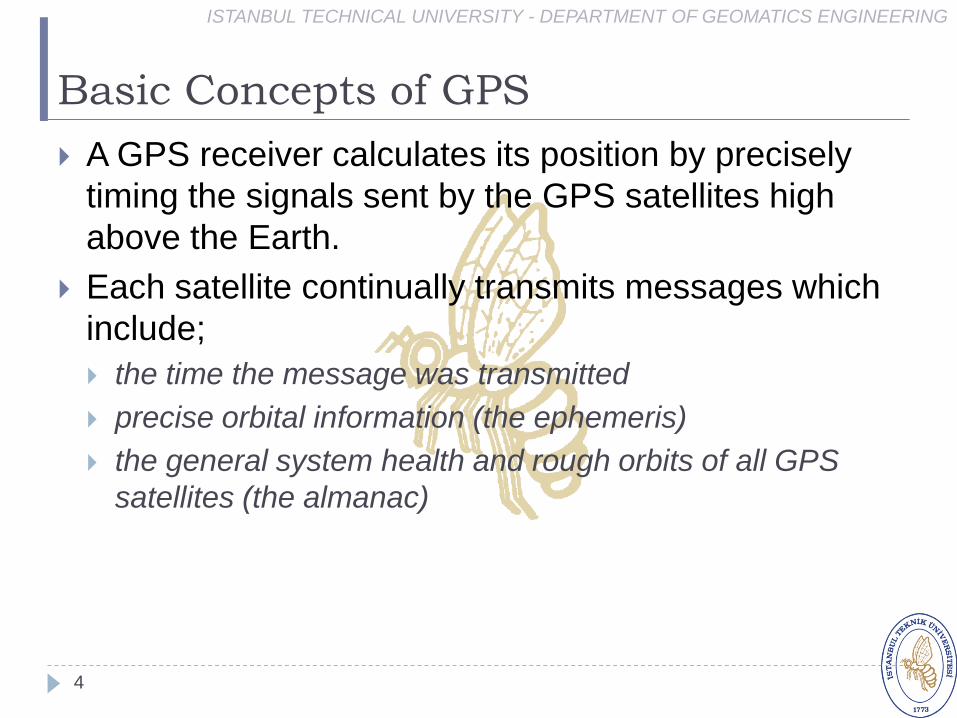
Basic Concepts of GPS
ISTANBUL TECHNICAL UNIVERSITY - DEPARTMENT OF GEOMATICS ENGINEERING
4
A GPS receiver calculates its position by precisely
timing the signals sent by the GPS satellites high
above the Earth.
Each satellite continually transmits messages which
include;
the time the message was transmitted
precise orbital information (the ephemeris)
the general system health and rough orbits of all GPS
satellites (the almanac)

GPS Surveying Techniques
ISTANBUL TECHNICAL UNIVERSITY - DEPARTMENT OF GEOMATICS ENGINEERING
5
Static survey
Rapid static survey
Stop and go survey
Continuous kinematics survey
Real-time kinematic (RTK) survey
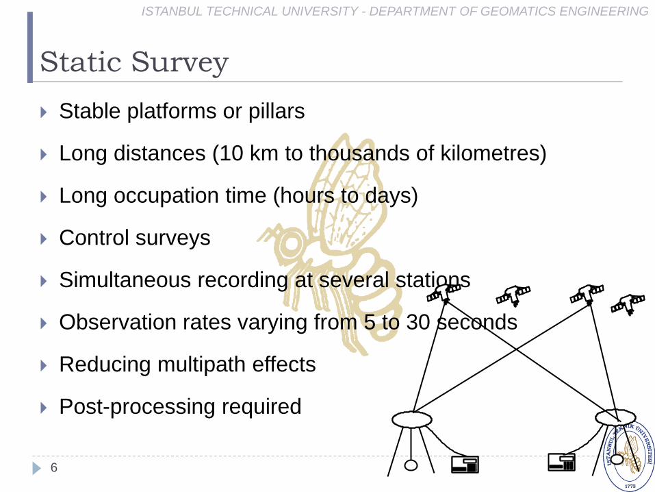
Static Survey
ISTANBUL TECHNICAL UNIVERSITY - DEPARTMENT OF GEOMATICS ENGINEERING
6
Stable platforms or pillars
Long distances (10 km to thousands of kilometres)
Long occupation time (hours to days)
Control surveys
Simultaneous recording at several stations
Observation rates varying from 5 to 30 seconds
Reducing multipath effects
Post-processing required
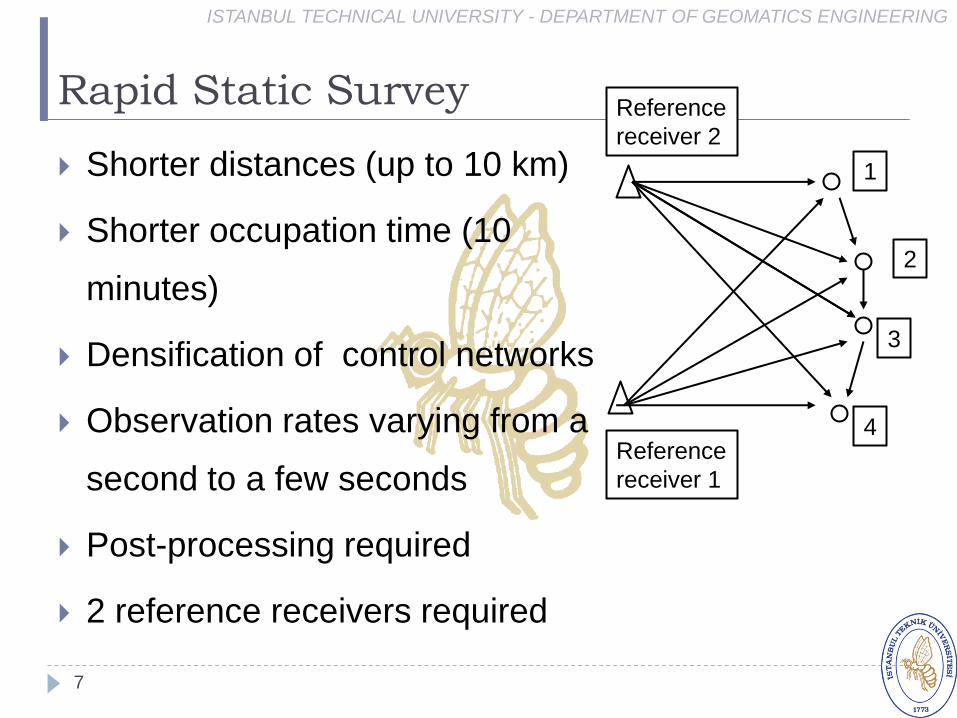
Rapid Static Survey
ISTANBUL TECHNICAL UNIVERSITY - DEPARTMENT OF GEOMATICS ENGINEERING
7
Shorter distances (up to 10 km)
Shorter occupation time (10
minutes)
Densification of control networks
Observation rates varying from a
second to a few seconds
Post-processing required
2 reference receivers required
Reference
receiver 1
Reference
receiver 2
1
2
3
4

Stop-and-Go Survey
ISTANBUL TECHNICAL UNIVERSITY - DEPARTMENT OF GEOMATICS ENGINEERING
8
Distances less than 1 km
1 minute occupation time
Observation rates of seconds
Initialisation required
Repeat initialisation when less than 4
satellites are being tracked
Reference receiverinitialisation
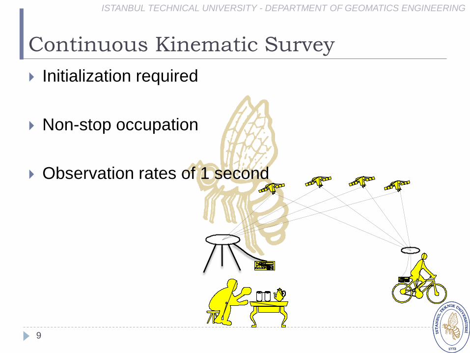
Continuous Kinematic Survey
ISTANBUL TECHNICAL UNIVERSITY - DEPARTMENT OF GEOMATICS ENGINEERING
9
Initialization required
Non-stop occupation
Observation rates of 1 second
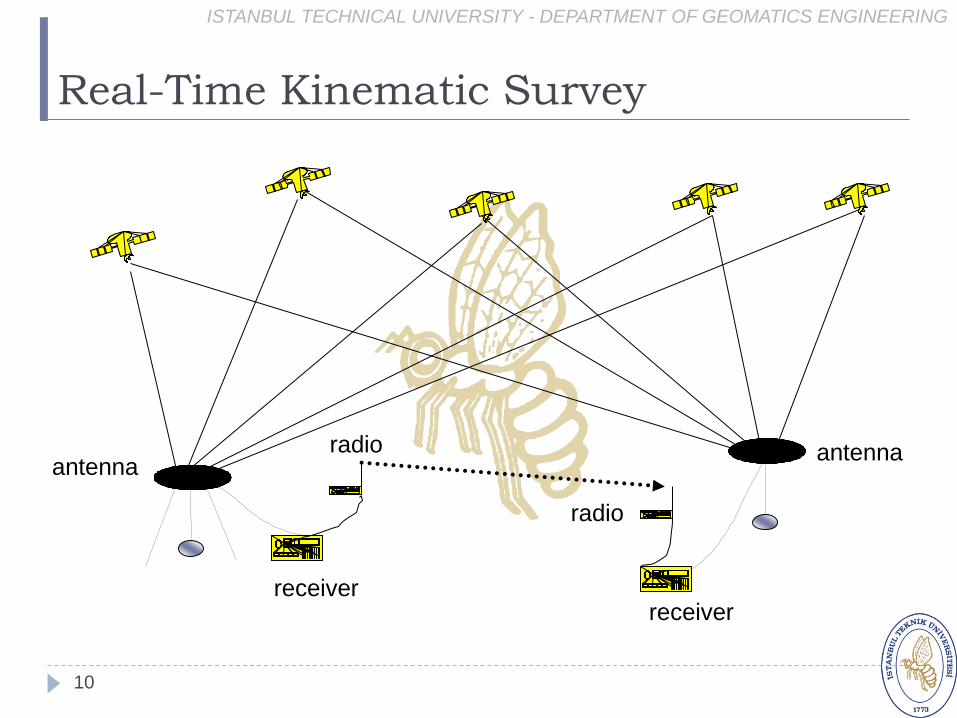
Real-Time Kinematic Survey
ISTANBUL TECHNICAL UNIVERSITY - DEPARTMENT OF GEOMATICS ENGINEERING
10
receiverreceiver
radio
radio
antennaantenna
GPS
ISTANBUL TECHNICAL UNIVERSITY - DEPARTMENT OF GEOMATICS ENGINEERING
11
The impact of the GPS is undeniable.
In the span of just a few years GPS has became the
leading positioning technology.
Generally, coordinate determination from GPS
measurements uses the known positions of satellites
and the measured distance between satellites and
the known points.
It is commonly considered as a three-
dimensional system (Latitude, Longitude, and
ellipsoidal height).
GPS Heights
ISTANBUL TECHNICAL UNIVERSITY - DEPARTMENT OF GEOMATICS ENGINEERING
12
The heights obtained from GPS are typically heights
above an ellipsoid model of the earth.
It is a geodetic height which purely geometrical
quantity, and represents the length of the normal
to the reference ellipsoid between the ellipsoid
and the point of interest.
These GPS ellipsoidal heights are not
consistence with leveled heights above mean
sea level (MSL), often known as orthometric
height.

GPS Leveling (1)
ISTANBUL TECHNICAL UNIVERSITY - DEPARTMENT OF GEOMATICS ENGINEERING
13
In determination of orthometric heights with GPS, the
accuracy of vertical positioning changes depending
on the application type and quality of the project.
The efforts and the attempts for using the system
practically and rentable especially engineering aimed
geodetic application have been increased for the last
decades.
It is known that the surveyor especially to constitute
and densification of the vertical geodetic networks,
traversing and similar applications use several
methods and technique.
GPS Leveling (2)
ISTANBUL TECHNICAL UNIVERSITY - DEPARTMENT OF GEOMATICS ENGINEERING
14
To achieve cm height accuracy, surveyors have been
examined alternative methods instead of static GPS
surveying methods with long session duration and
professionally processing and analyzing of the
collected data for long years.
As the result of the development in fast static, stop
and go, kinematic and other surveying methods,
GPS receivers, IGS and other regional and local
permanent GPS networks, it can be seen that it is
possible to obtain desired accuracy in very short
time interval by using single GPS receiver.

GPS Leveling (3)
ISTANBUL TECHNICAL UNIVERSITY - DEPARTMENT OF GEOMATICS ENGINEERING
15
Many countries throughout the world can make use
of active RTK networks that have been developed in
recent years for this purpose and resolve the vertical
positioning problem very economically, cheaply and
practically by means of multi-reference RTK
approach.
GPS derived ellipsoidal heights have geometric
meanings in practical engineering survey,
geophysics and in other applications, and they bear
no physical meanings.
GPS Leveling (4)
ISTANBUL TECHNICAL UNIVERSITY - DEPARTMENT OF GEOMATICS ENGINEERING
16
However, in many surveying and engineering
applications, orthometric heights are required.
To have ellipsoidal heights converted into
orthometric heights, precise geoid heights are
required.
The most effective technique used in practice
particularly for the determination of orthometric
heights is the GPS-leveling technique.
GPS Leveling (5)
ISTANBUL TECHNICAL UNIVERSITY - DEPARTMENT OF GEOMATICS ENGINEERING
17
With the GPS-leveling method, it is possible to
determine orthometric heights with cm accuracy.
Besides, this method is one that is accepted and
applied by the whole world due to its measurement,
ease of computation and its economic application.
GPS Leveling (6)
ISTANBUL TECHNICAL UNIVERSITY - DEPARTMENT OF GEOMATICS ENGINEERING
18
As the result of the observation, measurement and
evaluations, it can be said that Geometric Leveling
and Simultaneous Reciprocal Trigonometric Leveling
are the most accurately leveling techniques among
the all of them.
But these techniques require more surveyor,
instruments and time.
GPS Leveling (7)
ISTANBUL TECHNICAL UNIVERSITY - DEPARTMENT OF GEOMATICS ENGINEERING
19
Although Leap Frog Trigonometric Leveling and Unidirectional Trigonometric Leveling more practicability than the Geometric and Simultaneous Reciprocal Trigonometric Leveling, they have systematical effects due to refraction and precision of instruments.
Consequently these methods offer lower accuracy. It can be easily seen that the accuracy are depend on accuracy of the geoid model. Use of local geoid model instead of national or regional can supply an accuracy improvement between percentages 40 to 50.

GPS Leveling (8)
ISTANBUL TECHNICAL UNIVERSITY - DEPARTMENT OF GEOMATICS ENGINEERING
20
Orthometric heights obtained from 3 reference GPS
and local geoid model consist with the Geometric
Leveling 2.0cm, consist with Simultaneous
Reciprocal Trigonometric Leveling 2.7cm.
Moreover these methods have better consistency
than the Leap Frog Trigonometric Leveling and
Unidirectional Trigonometric Leveling.
GPS Leveling (9)
ISTANBUL TECHNICAL UNIVERSITY - DEPARTMENT OF GEOMATICS ENGINEERING
21
Both inner accuracy and consistency with other
leveling techniques can be satisfy expectations for
routine surveying applications.
On the other hand, GPS Leveling can be performed
by only one surveyor economically and practicability
versus other conventional leveling methods when
considered the surveying team, instruments and
expenses.
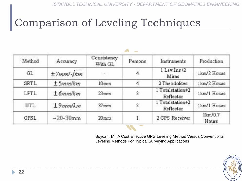
Comparison of Leveling Techniques
ISTANBUL TECHNICAL UNIVERSITY - DEPARTMENT OF GEOMATICS ENGINEERING
22
Soycan, M., A Cost Effective GPS Leveling Method Versus Conventional
Leveling Methods For Typical Surveying Applications

Advantages & Disadvantages (1)
ISTANBUL TECHNICAL UNIVERSITY - DEPARTMENT OF GEOMATICS ENGINEERING
23
One major difference is the network "geometry".
Because of the disadvantageous performance of the
equipments the classical leveling networks must run
along lines with benchmark separation less than 1
km.
The leveling loops are bounding larger areas without
benchmarks, it was not guaranteed that each
settlement got a benchmark.
In contrary the new GPS technology can produce a
network with evenly distributed benchmarks, each
settlement should have at least one point.
Advantages & Disadvantages (2)
ISTANBUL TECHNICAL UNIVERSITY - DEPARTMENT OF GEOMATICS ENGINEERING
24
One can put GPS-benchmarks anywhere (if
necessary up to peaks), this was not the case for
leveling.
The GPS-benchmarks must be monumented to
sites, where high quality GPS measurements can be
made any time.
The monumentation should not differ from the
classical, but its stability is much more emphasized!
The main monument has two excenters for security
reasons.
Advantages & Disadvantages (3)
ISTANBUL TECHNICAL UNIVERSITY - DEPARTMENT OF GEOMATICS ENGINEERING
25
Known 1st and 2nd order leveling points around the
actual working field also have to be included into the
GPS measurements, they will be the reference
markers for the geoid fit.
The more reference markers are included, the more
reliable will be the fitting procedure.

Advantages & Disadvantages (4)
ISTANBUL TECHNICAL UNIVERSITY - DEPARTMENT OF GEOMATICS ENGINEERING
26
The GPS data is processed on the field by a
commercial software checking the daily
measurements, the final GPS solution should be
produced by the a commercial software.
The production and the correct use of the GPS-
gravimetric geoid is a key element of the technology.
The GPS-gravimetric geoid have to be produced
using the best quality data.
If required, additional gravity survey have to be
performed.

GPS Leveling Procedure
ISTANBUL TECHNICAL UNIVERSITY - DEPARTMENT OF GEOMATICS ENGINEERING
27
GPS Leveling Procedure
ISTANBUL TECHNICAL UNIVERSITY - DEPARTMENT OF GEOMATICS ENGINEERING
28
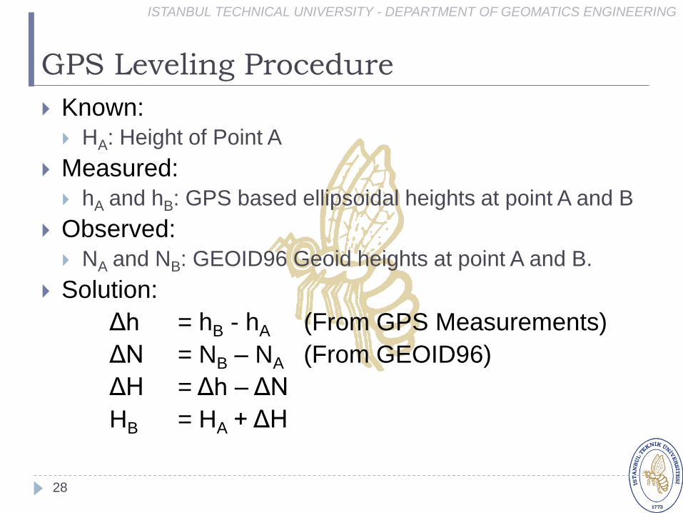
Known: HA: Height of Point A
Measured:
hA and hB: GPS based ellipsoidal heights at point A and B
Observed: NA and NB: GEOID96 Geoid heights at point A and B.
Solution:
Δh = hB - hA (From GPS Measurements)
ΔN = NB – NA (From GEOID96)
ΔH = Δh – ΔN
HB = HA + ΔH

GPS Leveling Procedure
ISTANBUL TECHNICAL UNIVERSITY - DEPARTMENT OF GEOMATICS ENGINEERING
29

ISTANBUL TECHNICAL UNIVERSITY - DEPARTMENT OF GEOMATICS ENGINEERING
30
GPS ile elde edilen yükseklikler, geleneksel yükseklikölçme yöntemleri (nivelman) ile elde edilenyüksekliklerden farklı bir yükseklik sistemindedir. GPS verilerinden elipsoidal yükseklik h kolaylıkla eldeedilebilir.
Bu yükseklik yeryuvarının basit bir elipsoit modelininüstünde yada altındadır ve elipsoidal yükseklik (h) olarak adlandırılır. Nivelman ölçmelerinden ortometrikyükseklikler (H) ortometrik düzeltme getirilerek eldeedilir.
Burada, N geoit yüksekliğidir. Yukarıdaki eşitlik GPS / Nivelman yöntemine göre geoit belirlemeyöntemini ifade eder. Eğer bir noktada ortometrikyükseklik (H) ve elipsoidal yükseklik (h) biliniyorsageoit yüksekliği (N) kolaylıkla bulunabilir.
ISTANBUL TECHNICAL UNIVERSITY - DEPARTMENT OF GEOMATICS ENGINEERING
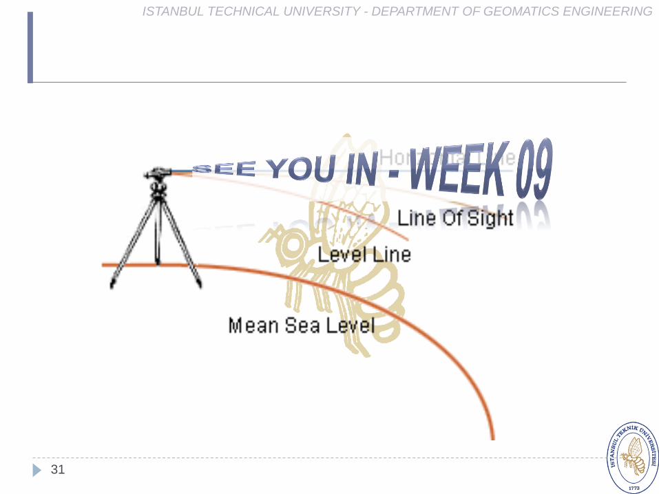
31