specifications and standards for each planning area
TRANSCRIPT

Specifications & Standards for Each Planning Area
Design Guidelines - 5/25/2018 1-37 Considerations For Each Planning Area
Architectural, Building Material, Site Planning and Landscape considerations discussed in the preceding
sections are general specifications that apply to the entire Dover Bay Community.
The individual Planning Area Specifications and Standards that follow are specific setback measurements
and other critical information you will need for site planning and designing your Dover Bay home.
Specifications and Standards For Each Planning Area

Specifications & Standards for Each Planning Area
Design Guidelines - 6/27/2006 1-38 Considerations For Each Planning Area

Specifications & Standards Planning Area 1A
Design Guidelines - 4/16/2008 1-39 Planning Area 1B
PLANNING AREA 1A: SUNSET SADDLE ESTATES SPECIFICATIONS AND STANDARDS Sunset Saddle Estates in Planning Area 1A is proposed as large-lot custom homes with private landscape, built upon single-family detached waterfront homesites.
House Square Footage Maximum: 6000' – Minimum: 3000'
Maximum Lot Coverage: 50%
Maximum Building Height 30' as determined by International Building Code; the vertical distance from the grade plane to the average height of the highest roof surface, excluding architectural projections
Federal Emergency Management Act (FEMA) The flood elevation level at Dover is between 2069.2 feet and 2070 feet as depicted on the FIRM map. Refer to the April 27, 2005, FEMA letter in Appendix 3 and current FEMA guidelines for a building elevation determination before you build.
Shoreline Protection Shoreline protection, as illustrated on page 1-36, may be required by the US Army Corps of Engineers and/or Dover Bay Development, LLC, to prevent erosion of your property.
Dock Location and Configuration: Docks, dock fingers or any structural or architectural projection shall not exceed 560 Square Feet and shall extend from Artificial High Water Mark (AHWM). Refer to Appendix 6.
1A
Varies

Specifications & Standards Planning Area 1A
Design Guidelines - 3/12/2020 1-40 Planning Area 1B
PLANNING AREA 1A – SPECIFICATIONS AND STANDARDS continued
SPECIFICATION ITEM STANDARD
Garage Driveway 16' maximum width x 25' minimum length with guest parking, wheel ribbons permitted. Driveway must be
paved.
Primary Street, Minimum Common Building Setback (property line)
25' house side, 25' garage; front, rear or side, 25' house front, 25' attached porch front
Minimum Side Building Setback
(property line to building)
15' exterior walls, 12' to projections
Minimum Setback to Wetlands 10’
Minimum Water Setback
(Artificial High Water Mark)
Lot No. 6 – 60’ setback, Lot No. 7 – 60’ setback,
Lot No. 8 – 70’ setback, Lot No. 9 – 80’ setback, Lot No. 10 – 85' setback, Lot No. 11 – 90' setback,
Lot No. 12 – 95' setback, Lot No. 13 – 85' setback,
Lot No. 14 – 95' setback, Lot No. 15 – 95' setback, Lot No. 16 – 95' setback, Lot No. 17 – Southeast to
Southwest closure at wetland delineation, 55' setback
Docks All docks are subject to a joint application and approval by Idaho Department of Lands, United
States Army Corps of Engineers and the DRB. Some
restrictions may apply.
Accessory Structures Gross square footage maximum ground level, not to
exceed 1,152. Gross square footage maximum upper
level not to exceed 750. Three structures total maximum. No structure exceeds two levels.
Porches Substantial porches are required on front and rear.
Side porches are encouraged.
Street and Front Yard Landscape One (1) mature shade tree (3-inch min caliper) per
2,000 sq. ft. of area and one (1) ornamental tree per
1,000 sq. ft. recommended. Ratio of turf to planting beds shall be 2:1 (max) to 4:1 (min).
Side and Rear Yard Landscape One (1) mature shade tree (3-inch min caliper) and one (1) ornamental tree per 3,000 sq. ft. of area
recommended. Ratio of turf to planting beds shall be
3:1 (max) to 6:1 (min).
Sport Courts, Spas and Pools All are permitted. Only kiddie blow-up pools
permitted above ground.
Automated Irrigation Systems Required.
1A

Specifications & Standards Planning Area 1A
Design Guidelines - 3/11/2020 1-41 Planning Area 1B
PLANNING AREA 1B: SUNSET SADDLE ESTATES SPECIFICATIONS AND STANDARDS
Sunset Saddle Estates in Planning Area 1B
is proposed as small-lot production homes
built upon single-family detached homesites
with private or common landscape.
House Square Footage
Maximum: 3600' – Minimum: 1500'
Maximum Lot Coverage:
50%
Maximum Building Height
30' as determined by International Building
Code; the vertical distance from the grade
plane to the average height of the highest
roof surface, excluding architectural
projections
Federal Emergency Management Act (FEMA)
The flood elevation level at Dover is
between 2069.2 feet and 2070 feet as
depicted on the FIRM map. Refer to the
April 27, 2005, FEMA letter in Appendix 3
and current FEMA guidelines for a
building elevation determination before
you build.
Dock Location and Configuration:
Docks, dock fingers or any structural or
architectural projection shall not exceed
560 Square Feet and shall extend from
Artificial High Water Mark (AHWM).
Refer to Appendix 6.
1B

Specifications & Standards Planning Area 1A
Design Guidelines - 3/11/2020 1-42 Planning Area 1B
PLANNING AREA 1B – SPECIFICATIONS AND STANDARDS continued
SPECIFICATION ITEM STANDARD
Garage Driveway 16' maximum width x 25' minimum length with
guest parking, wheel ribbons permitted.
Primary Street, Minimum Building Setback
(property line)
20' house side, 20' garage; front, rear or side,
20' house front, 20' attached porch front
Secondary Street, Minimum Building Setback
(property line)
5' building, 5' to projections,
5' detached garages, 5' attached porches
Minimum Side Building Setback
(property line to building)
8' exterior walls, 6' to projections
Minimum Rear Building Setback (property line) 10' exterior walls or porches, 7' to projections
Minimum Setback to Wetlands 10’
Accessory Structures Maximum levels of two. Ground level maximum of
872 square feet. Upper level maximum of 400
square feet. Total number of structures not to
exceed two.
Open See-through Fencing 48" high maximum for all rear or side yard fencing.
Porches Porches are required on street side of homes and
encouraged on back side.
Street and Front Yard Landscape One (1) mature shade tree (3 inch min caliper) per
2,000 sq. ft. of area and one (1) ornamental tree
per 1,000 sq. ft. recommended. Ratio of turf to
planting beds shall be 2:1 (max) to 4:1 (min).
Side and Rear Yard Landscape One (1) mature shade tree (3 inch min caliper) and
one (1) ornamental tree per 3,000 sq. ft. of area
recommended. Ratio of turf to planting beds shall
be 3:1 (max) to 6:1 (min).
Spas and Pools Spas are permitted. Pools are not.
Automated Irrigation Systems Required.
1B

Specifications & Standards Planning Area 2A
Design Guidelines - 3/11/2020 1-45 Planning Area 2A
PLANNING AREA 2A/2A2: ESTUARY FOREST/WEST BEACH COURT SPECIFICATIONS AND STANDARDS
Estuary Woods in Planning Area 2A is
proposed as community production homes
built upon single-family detached
homesites with private or common
landscape.
House Square Footage
Maximum: 3600' – Minimum: 1500'
Maximum Lot Coverage:
50%
Maximum Building Height
30' as determined by International
Building Code; the vertical distance from
the grade plane to the average height of the
highest roof surface, excluding
architectural projections
Federal Emergency Management Act (FEMA)
The flood elevation level at Dover is
between 2069.2 feet and 2070 feet as
depicted on the FIRM map. Refer to the
April 27, 2005, FEMA letter in Appendix 3
and current FEMA guidelines for a
building elevation determination before
you build.

Specifications & Standards Planning Area 2A
Design Guidelines - 3/11/2020 1-46 Planning Area 2A
PLANNING AREA 2A/2A2 – SPECIFICATIONS AND STANDARDS continued
SPECIFICATION ITEM STANDARD
Garage Driveway 16' maximum width x 25' minimum length with
guest parking, wheel ribbons permitted.
Primary Street, Minimum Building Setback (property
line)
20' house side, 20' garage; front, rear or side,
20' house front, 20' attached Porch front
Secondary Street, Minimum Building Setback (property
line)
5' building, 5' to projections
5' detached garages, 5' attached porches
Minimum Side Building Setback
(property line to building)
7' exterior walls, 5' to projections
Minimum Rear Building Setback (property line) 10' exterior walls or porches, 7' to projections
Minimum Setback to Wetlands 10’
Accessory Structures Maximum levels of two. Ground level maximum
of 872 square feet. Upper level maximum of 400
square feet. Total number of structures not to
exceed two.
Open See-through Fencing 48” high maximum for all rear or side yard
fencing.
Porches Porches are required on street side of homes.
Street and Front Yard Landscape One (1) mature shade tree (3 inch min caliper)
per 2,000 sq. ft. of area and one (1) ornamental
tree per 1,000 sq. ft. recommended. Ratio of turf
to planting beds shall be 2:1 (max) to 4:1 (min).
Side and Rear Yard Landscape One (1) mature shade tree (3 inch min caliper)
and one (1) ornamental tree per 3,000 sq. ft. of
area recommended. Ratio of turf to planting beds
shall be 3:1 (max) to 6:1 (min).
Spas and Pools Spas are permitted. Pools are not.
Automated Irrigation Systems Not required.
Docks Not allowed.

Specifications & Standards Planning Area 2B
Design Guidelines - 3/11/2020 1-47 Planning Area 2B
PLANNING AREA 2B: ESTUARY FOREST SPECIFICATIONS AND STANDARDS
Estuary Woods in Planning Area 2B is proposed as community production homes
built upon single-family detached
homesites with private landscape.
House Square Footage
Maximum: 3600' – Minimum: 1500'
Maximum Lot Coverage:
50%
Maximum Building Height
30' as determined by International
Building Code; the vertical distance from
the grade plane to the average height of the highest roof surface, excluding
architectural projections
Federal Emergency Management Act (FEMA)
The flood elevation level at Dover is
between 2069.2 feet and 2070 feet as
depicted on the FIRM map. Refer to the April 27, 2005, FEMA letter in Appendix
3 and current FEMA guidelines for a
building elevation determination before you build.

Specifications & Standards Planning Area 2B
Design Guidelines - 3/11/2020 1-48 Planning Area 2B
PLANNING AREA 2B – SPECIFICATIONS AND STANDARDS continued
SPECIFICATION ITEM STANDARD
Garage Driveway 16' maximum width x 25' minimum length with guest parking, wheel ribbons permitted.
Street Access Apron 11' minimum, 16' max. apron width at street.
Primary Street, Minimum Building Setback (property line)
20' house side, 20' garage; front, rear or side, 20' house front, 20' attached porch front
Secondary Street, Minimum Building Setback
(property line)
5' building, 5' to projections, 5' detached garages,
5' attached porches
Minimum Side Building Setback
(property line to building)
7' exterior walls, 5' to projections
Minimum Rear Building Setback (property line) 10' exterior walls or porches, 7' to projections
Minimum Setback to Wetlands 10’
Accessory Structures See CC&R's.
Open See-through Fencing 48” high maximum for all rear or side yard fencing.
Porches Porches are required on street side of homes.
Street and Front Yard Landscape One (1) mature shade tree (3 inch min caliper) per
2,000 sq. ft. of area and one (1) ornamental tree per 1,000 sq. ft. recommended. Ratio of turf to planting
beds shall be 2:1 (max) to 4:1 (min).
Side and Rear Yard Landscape One (1) mature shade tree (3 inch min caliper) and one (1) ornamental tree per 3,000 sq. ft. of area
recommended. Ratio of turf to planting beds shall
be 3:1 (max) to 6:1 (min).
Spas and Pools Spas are permitted. Pools are not.
Docks Not allowed (if future water course is created.)

Specifications & Standards Planning Area 2C
Design Guidelines - 3/11/2020 1-49 Planning Area 2C
PLANNING AREA 2C: REEDWALK SPECIFICATIONS AND STANDARDS
Reedwalk in Planning Area 2C is proposed as large-lot individual custom
homes built upon single-family detached
homesites with private landscape.
House Square Footage
Maximum: 4500' – Minimum: 2000'
Maximum Lot Coverage:
50%
Maximum Building Height
30' as determined by International
Building Code; the vertical distance from
the grade plane to the average height of the highest roof surface, excluding
architectural projections
Federal Emergency Management Act (FEMA)
The flood elevation level at Dover is
between 2069.2 feet and 2070 feet as
depicted on the FIRM map. Refer to the April 27, 2005, FEMA letter in Appendix
3 and current FEMA guidelines for a
building elevation determination before you build.

Specifications & Standards Planning Area 2C
Design Guidelines - 3/11/2020 1-50 Planning Area 2C
PLANNING AREA 2C – SPECIFICATIONS AND STANDARDS continued
SPECIFICATION ITEM STANDARD
Garage Driveway 16' maximum width x 25' minimum length with
guest parking, wheel ribbons permitted.
Primary Street, Minimum Building Setback (property line)
25' house side, 25' garage; front, rear or side, 25' house front, 25' attached porch front
Minimum Side Building Setback
(property line to building)
10' exterior walls; 20' on corner lots facing street,
7' to projections
Minimum Setback to Wetlands 10’
Minimum Water Setback
(Artificial High Water Mark)
40'
Accessory Structures Gross square footage maximum ground level, not
to exceed 864. Gross square footage maximum
upper level not to exceed 400. Three structures total maximum. No structure exceeds two levels.
Docks Not allowed.
Porches Substantial porches are required on front and rear. Side porches are encouraged.
Street and Front Yard Landscape One (1) mature shade tree (3 inch min caliper) per
2,000 sq. ft. of area and one (1) ornamental tree per 1,000 sq. ft. recommended. Ratio of turf to
planting beds shall be 2:1 (max) to 4:1 (min).
Side and Rear Yard Landscape One (1) mature shade tree (3 inch min caliper) and one (1) ornamental tree per 3,000 sq. ft. of area
recommended. Ratio of turf to planting beds shall
be 3:1 (max) to 6:1 (min). Yard area shall maintain a 60' minimum natural landscape zone at
inlet bay edge as wildlife corridor and Stormwater
Biofiltration.
Sport Courts, Spas and Pools Sport courts, spas and pools are permitted. Only
kiddie blow-up pools are permitted above ground.

Specifications & Standards Planning Area 2D
Design Guidelines - 3/11/2020 1-51 Planning Area 2D
PLANNING AREA 2D: REEDWALK SPECIFICATIONS AND STANDARDS
Reedwalk in Planning Area 2D is proposed as large-lot custom homes built
upon single-family detached homesites
with private landscape.
House Square Footage
Maximum: 4500' – Minimum: 2000'
Maximum Lot Coverage:
50%
Maximum Building Height
30' as determined by International
Building Code; the vertical distance from
the grade plane to the average height of the highest roof surface, excluding
architectural projections
Federal Emergency Management Act (FEMA)
The flood elevation level at Dover is
between 2069.2 feet and 2070 feet as
depicted on the FIRM map. Refer to the April 27, 2005, FEMA letter in Appendix
3 and current FEMA guidelines for a
building elevation determination before you build.

Specifications & Standards Planning Area 2D
Design Guidelines - 3/11/2020 1-52 Planning Area 2D
PLANNING AREA 2D – SPECIFICATIONS AND STANDARDS continued
SPECIFICATION ITEM STANDARD
Garage Driveway 16' maximum width x 25' minimum length with guest parking, wheel ribbons permitted.
Primary Street, Minimum Building Setback
(property line)
25' house side, 25' garage; front, rear or side,
25' house front, 25' attached porch front
Minimum Side Building Setback
(property line to building)
10' exterior walls, 7' to projections
Minimum Setback to Wetlands 10’
Minimum Water Setback
(Artificial High Water Mark)
Lot No. 1 – 190’ setback, Lot No. 2 – 170’
setback, Lot No. 3 – 150’ setback, Lot No. 4 –
130’ setback, Lot No. 5 – 120' setback, Lot No. 6 – 105' setback, Lot No. 7 – 85' setback, Lot No. 8 –
65' setback
Accessory Structures Gross square footage maximum ground level, not to exceed 864. Gross square footage maximum
upper level not to exceed 400. Three structures
total maximum. No structure exceeds two levels.
Docks Not allowed.
Porches Substantial porches are required on front and rear.
Side porches are encouraged.
Street and Front Yard Landscape One (1) mature shade tree (3 inch min caliper) per
2,000 sq. ft. of area and one (1) ornamental tree per
1,000 sq. ft. recommended. Ratio of turf to planting beds shall be 2:1 (max) to 4:1 (min).
Side and Rear Yard Landscape One (1) mature shade tree (3 inch min caliper) and
one (1) ornamental tree per 3,000 sq. ft. of area recommended. Ratio of turf to planting beds shall
be 3:1 (max) to 6:1 (min). Yard area shall maintain
a 60' minimum natural landscape zone at inlet bay edge as wildlife corridor and Stormwater
Biofiltration.
Sport Courts, Spas and Pools Sport courts, spas and pools are permitted. Only kiddie blow-up pools are permitted above ground.

Specifications & Standards Planning Area 2E
Design Guidelines - 3/11/2020 1-53 Planning Area 2E
PLANNING AREA 2E: REEDWALK SPECIFICATIONS AND STANDARDS
Reedwalk in Planning Area 2E is proposed as large-lot custom homes built
upon single-family detached homesites
with private landscape.
House Square Footage
Maximum: 4500' – Minimum: 2000'
Maximum Lot Coverage:
50%
Maximum Building Height
30' as determined by International
Building Code; the vertical distance from
the grade plane to the average height of the highest roof surface, excluding
architectural projections
Federal Emergency Management Act (FEMA)
The flood elevation level at Dover is
between 2069.2 feet and 2070 feet as
depicted on the FIRM map. Refer to the April 27, 2005, FEMA letter in Appendix
3 and current FEMA guidelines for a
building elevation determination before you build.

Specifications & Standards Planning Area 2E
Design Guidelines - 3/11/2020 1-54 Planning Area 2E
PLANNING AREA 2E – SPECIFICATIONS AND STANDARDS continued
SPECIFICATION ITEM STANDARD
Garage Driveway 16' maximum width x 25' minimum length with
guest parking, wheel ribbons permitted.
Primary Street, Minimum Building Setback (property line)
25' house side, 25' garage; front, rear or side, 25' house front, 25' attached porch front
Minimum Side Building Setback
(property line to building)
10' exterior walls; 20' on corner lots facing street,
7' to projections
Minimum Setback to Wetlands 10’
Minimum Water Setback
(Artificial High Water Mark)
Lot No. 1 – 65' setback, Lot No. 2 – 85' setback
Lot No. 3 – 105' setback, Lot No. 4 – 100' setback, Lot No. 5 – 145' setback, Lot No. 6 – 145' setback,
Lot No. 7 – 190' setback, Lot No. 8 – 220' setback,
Lot No. 9 – 220' setback
Accessory Structures Gross square footage maximum ground level, not
to exceed 864. Gross square footage maximum
upper level not to exceed 400. Three structures total maximum. No structure exceeds two levels.
Docks: Not allowed.
Porches Substantial porches are required on front and rear. Side porches are encouraged.
Street and Front Yard Landscape One (1) mature shade tree (3 inch min caliper) per
2,000 sq. ft. of area and one (1) ornamental tree per 1,000 sq. ft. recommended. Ratio of turf to
planting beds shall be 2:1 (max) to 4:1 (min).
Side and Rear Yard Landscape One (1) mature shade tree (3 inch min caliper) and one (1) ornamental tree per 3,000 sq. ft. of area
recommended. Ratio of turf to planting beds shall
be 3:1 (max) to 6:1 (min). Yard area shall maintain a 60' minimum natural landscape zone at inlet bay
edge as wildlife corridor and Stormwater
Biofiltration.
Spas and Pools Sport courts, spas and pools are permitted. Only
kiddie blow-up pools are permitted above ground.

Specifications & Standards Planning Area 3A, 3B, 3C & 3D
Design Guidelines - 6/27/2006 1-55 Planning Area 3A, 3B, 3C & 3D
PLANNING AREA 3A, 3B, 3C, 3D: DOVER MEADOWS SPECIFICATIONS AND STANDARDS Dover Meadows in Planning Area 3A, 3B, 3C and 3D is proposed as community production homes, built upon single-family detached patio homesites with common landscape.
House Square Footage Maximum: 2800' – Minimum: 1200'
Maximum Lot Coverage: 65%
Maximum Building Height 30' as determined by International Building Code; the vertical distance from the grade plane to the average height of the highest roof surface, excluding architectural projections
Federal Emergency Management Act (FEMA) The flood elevation level at Dover is between 2069.2 feet and 2070 feet as depicted on the FIRM map. Refer to the April 27, 2005, FEMA letter in Appendix 3 and current FEMA guidelines for a building elevation determination before you build.

Specifications & Standards Planning Area 3A, 3B, 3C & 3D
Design Guidelines - 3/11/2020 1-56 Planning Area 3A, 3B, 3C & 3D
PLANNING AREA 3A, 3B, 3C, 3D – SPECIFICATIONS AND STANDARDS continued
SPECIFICATION ITEM STANDARD
Garage Driveway 16' minimum width x 20' minimum length with parking
Street, Minimum Building Setback 10' house side, 10' garage; front, rear or side
15' house front, 10' attached porch front
Minimum Side Building Setback
(property line to building)
3' exterior walls,
3' to projections (unless one-hour rated),
0' detached garages (if one-hour rated)
Minimum Rear Building Setback
(property line to building)
10' building, 8' to projections, 5' detached garages
Minimum Setback to Wetlands 10’
Accessory Structures Gross square footage maximum not to exceed 576.
No structure exceeds one level. Two structures total
maximum.
Open See-through Fencing 48” high maximum for all rear or side yard fencing;
fencing must be a minimum of 5' from all open
space or community walks.
Porches Porches are required on front of homes fronting
Dover Bay Way.
Street and Front Yard Landscape One (1) mature shade tree (3 inch min caliper) per 2,000 sq. ft. of area and one (1) ornamental tree per
1,000 sq. ft. recommended. Ratio of turf to planting
beds shall be 2:1 (max) to 4:1 (min).
Side and Rear Yard Landscape One (1) mature shade tree (3 inch min caliper) and
one (1) ornamental tree per 3,000 sq. ft. of area
recommended. Ratio of turf to planting beds shall be 3:1 (max) to 6:1 (min).
Spas and Pools Spas are permitted. Pools are not.
Automated Irrigation Systems Required.

Specifications & Standards Planning Area 4A/4B
Design Guidelines - 3/11/2020 1-57a Planning Area 4B
PLANNING AREA 4A/4B: PARKSIDE BUNGALOWS SPECIFICATIONS AND STANDARDS
Parkside in Planning Area 4B is proposed
as production detached bungalows /
homes with common landscape. Covered
carports, 1 min. per home.
House Square Footage
Maximum: 2300' – Minimum: 600'
Maximum Lot Coverage:
N/A
Maximum Building Height
35' as determined by International
Building Code; the vertical distance from
the grade plane to the average height of
the highest roof surface, excluding
architectural projections
Federal Emergency Management Act (FEMA)
The flood elevation level at Dover is
between 2069.2 feet and 2070 feet as
depicted on the FIRM map. Refer to the
April 27, 2005, FEMA letter in Appendix
3 and current FEMA guidelines for a
building elevation determination before
you build.

Specifications & Standards Planning Area 4A/4B
Design Guidelines - 3/11/2020 1-58a Planning Area 4B
PLANNING AREA 4 – SPECIFICATIONS AND STANDARDS continued
SPECIFICATION ITEM STANDARD
Dock A single common area dock for a Home Owners
Association may exist subject to joint application and
approval by Idaho Department of Lands, United
States Army Corps of Engineers and DRB.
Accessory Structures, Sport Courts, Spas, Pools and
BBQs
Common area sport courts, spas and pools are
permitted as part of the Association. Other common
area structures such as BBQs, Garages, Clubhouses,
etc. may be proposed.

Specifications & Standards Planning Area 5A
Design Guidelines - 6/27/2006 1-59 Planning Area 5A
PLANNING AREA 5A: BAYSIDE NORTH SPECIFICATIONS AND STANDARDS Bayside North in Planning Area 5A is proposed as community production homes with common landscape, built upon single-family detached homesites.
House Square Footage Maximum: 2800' – Minimum: 1200'
Maximum Lot Coverage: 45%
Maximum Building Height 30' as determined by International Building Code; the vertical distance from the grade plane to the average height of the highest roof surface, excluding architectural projections
Federal Emergency Management Act (FEMA) The flood elevation level at Dover is between 2069.2 feet and 2070 feet as depicted on the FIRM map. Refer to the April 27, 2005, FEMA letter in Appendix 3 and current FEMA guidelines for a building elevation determination before you build.

Specifications & Standards Planning Area 5A
Design Guidelines - 3/12/2020 1-60 Planning Area 5A
PLANNING AREA 5A – SPECIFICATIONS AND STANDARDS continued
SPECIFICATION ITEM STANDARD
Garage Driveway 16' maximum width x 25' minimum length with
guest parking, wheel ribbons permitted.
Primary Street, Minimum Building Setback (property line)
10' house side, 10' garage; front, rear or side, 15' house front, 10' attached porch front
Comply with the CC&R’s.
Minimum Side Building Setback (property line to building)
5' exterior walls, 5' to projections (unless one-hour rated),
0' detached garages (if one-hour rated)
Minimum Side Yard Setback 5'
Minimum Rear Building Setback
(property line to building)
10' building, 8' to projections,
5' detached garages
Minimum Setback to Wetlands 16.6’
Accessory Structures Gross square footage maximum not to exceed 576.
No structure exceeds one level. Two structures
total maximum.
Stone Accents Required
Fencing None allowed except underground electronic dog
fencing
Porches Porches are required on street side of homes,
encouraged on waterfront side.
Street and Front Yard Landscape One (1) mature shade tree (3 inch min caliper) per 2,000 sq. ft. of area and one (1) ornamental tree per
1,000 sq. ft. recommended. Ratio of turf to
planting beds shall be 2:1 (max) to 4:1 (min).
Side and Rear Yard Landscape One (1) mature shade tree (3 inch min caliper) and
one (1) ornamental tree per 3,000 sq. ft. of area
recommended. Ratio of turf to planting beds shall be 3:1 (max) to 6:1 (min).
Docks Not allowed.
Spas and Pools Spas are permitted. Pools are not.
Automated Irrigation Systems Not required.

Specifications & Standards Planning Area 5B
Design Guidelines - 6/27/2006 1-61 Planning Area 5B
PLANNING AREA 5B: BAYSIDE NORTH SPECIFICATIONS AND STANDARDS Bayside North in Planning Area 5B is proposed as community production homes with common landscape, built upon single-family detached homesites.
House Square Footage Maximum: 2800' – Minimum: 1200'
Maximum Lot Coverage: 45%
Maximum Building Height 30' as determined by International Building Code; the vertical distance from the grade plane to the average height of the highest roof surface, excluding architectural projections
Federal Emergency Management Act (FEMA) The flood elevation level at Dover is between 2069.2 feet and 2070 feet as depicted on the FIRM map. Refer to the April 27, 2005, FEMA letter in Appendix 3 and current FEMA guidelines for a building elevation determination before you build.

Specifications & Standards Planning Area 5B
Design Guidelines - 3/12/2020 1-62 Planning Area 5B
PLANNING AREA 5B – SPECIFICATIONS AND STANDARDS continued
SPECIFICATION ITEM STANDARD
Garage Driveway 16' maximum width x 25' minimum length with
guest parking, wheel ribbons permitted.
Primary Street, Minimum Building Setback 10' house side, 10' garage; front, rear or side,
15' house front, 10' attached porch front
Minimum Side Building Setback (property line to building)
5' exterior walls, 5' to projections (unless one-hour rated),
0' detached garages (if one-hour rated)
Minimum Side Yard Setback 5'
Minimum Rear Building Setback
(property line to building)
10' building, 8' to projections ,
5' detached garages
Maximum Lot Coverage 45%
Minimum Setback to Wetlands 10’
Accessory Structures Gross square footage maximum not to exceed 576.
No structure exceeds one level. Two structures total maximum.
Open See-through Fencing 48” high max for all rear or side yard fencing.
Stone Accents Required.
Porches Porches are required on street side of homes,
encouraged on waterfront side.
Street and Front Yard Landscape One (1) mature shade tree (3 inch min caliper) per 2,000 sq. ft. of area and one (1) ornamental tree per
1,000 sq. ft. recommended. Ratio of turf to
planting beds shall be 2:1 (max) to 4:1 (min).
Side and Rear Yard Landscape One (1) mature shade tree (3 inch min caliper) and
one (1) ornamental tree per 3,000 sq. ft. of area
recommended. Ratio of turf to planting beds shall be 3:1 (max) to 6:1 (min).
Docks Not allowed.
Spas and Pools Spas are permitted. Pools are not.

Specifications & Standards Planning Area 5C
Design Guidelines - 6/27/2006 1-63 Planning Area 5C
PLANNING AREA 5C: BAYSIDE SPECIFICATIONS AND STANDARDS Bayside North in Planning Area 5C is proposed as community production or custom homes with common landscape, built upon single-family detached homesites.
House Square Footage Maximum: 1200' – Minimum: 2800'
Maximum Lot Coverage: 45%
Maximum Building Height 30' as determined by International Building Code; the vertical distance from the grade plane to the average height of the highest roof surface, excluding architectural projections
Federal Emergency Management Act (FEMA) The flood elevation level at Dover is between 2069.2 feet and 2070 feet as depicted on the FIRM map. Refer to the April 27, 2005, FEMA letter in Appendix 3 and current FEMA guidelines for a building elevation determination before you build.

Specifications & Standards Planning Area 5C
Design Guidelines - 3/12/2020 1-64 Planning Area 5C
PLANNING AREA 5C – SPECIFICATIONS AND STANDARDS continued
SPECIFICATION ITEM STANDARD
Garage Driveway 16' maximum width x 25' minimum length with
guest parking, wheel ribbons permitted.
Primary Street, Minimum Building Setback 10' house side, 10' garage; front, rear or side,
15' house front, 10' attached porch front
Minimum Side Building Setback (property line to building)
5' exterior walls, 5' to projections (unless one-hour rated),
0' detached garages (if one-hour rated)
Minimum Rear Building Setback (property line to building)
10' building, 8' to projections, 5' detached garages
Minimum Side Yard Setback 5'
Minimum Setback to Wetlands 10’
Accessory Structures Gross square footage maximum not to exceed 576.
No structure exceeds one level. Two structures
total maximum.
Open See-through Fencing 48” high max for all rear or side yard fencing.
Porches Porches are encouraged on waterfront.
Street and Front Yard Landscape One (1) mature shade tree (3 inch min caliper) per 2,000 sq. ft. of area and one (1) ornamental tree per
1,000 sq. ft. recommended. Ratio of turf to
planting beds shall be 2:1 (max) to 4:1 (min).
Side and Rear Yard Landscape One (1) mature shade tree (3 inch min caliper) and
one (1) ornamental tree per 3,000 sq. ft. of area
recommended. Ratio of turf to planting beds shall be 3:1 (max) to 6:1 (min).
Docks Not allowed.
Spas and Pools Spas are permitted. Pools are not.

Specifications & Standards Planning Area 6A
Design Guidelines - 6/27/2006 1-65 Planning Area 6A
PLANNING AREA 6A: BAYSIDE SOUTH SPECIFICATIONS AND STANDARDS Bayside South in Planning Area 6A is proposed as attached townhomes and multi-family homes with common landscape.
House Square Footage Maximum: 2500' – Minimum: 750'
Maximum Lot Coverage: 50%
Maximum Building Height 35' as determined by International Building Code; the vertical distance from the grade plane to the average height of the highest roof surface, excluding architectural projections
Federal Emergency Management Act (FEMA) The flood elevation level at Dover is between 2069.2 feet and 2070 feet as depicted on the FIRM map. Refer to the April 27, 2005, FEMA letter in Appendix 3 and current FEMA guidelines for a building elevation determination before you build.

Specifications & Standards Planning Area 6A
Design Guidelines - 6/27/2006 1-66 Planning Area 6A
PLANNING AREA 6A – SPECIFICATIONS AND STANDARDS continued
SPECIFICATION ITEM STANDARD
Garage Driveway 12' minimum width x 20' minimum length with guest parking Tenant and guest parking in 9 x 19' stalls as shown
Primary Street, Minimum Building Setback 20' house side, 20' garage; front, rear or side, 20' house front, 20' attached porch front
Secondary Street, Minimum Building Setback 5' building, 5' to projections, 5' detached garages, 5' attached porches
Minimum Side Building Setback (property line to building)
5' exterior walls, 3' to projections
Minimum Rear Building Setback 12' exterior walls or porches, 10' to projections
Minimum Setback to Wetlands 10’
Open See-through Fencing 42 inches high maximum fence or railing at all patios or decks
Porches Substantial porches on front and rear waterfront
Street and Front Yard Landscape One (1) mature shade tree (3 inch min caliper) per 2,000 sq. ft. of area and one (1) ornamental tree per 1,000 sq. ft. recommended. Ratio of turf to planting beds shall be 2:1 (max) to 4:1 (min).
Side and Rear Yard Landscape One (1) mature shade tree (3 inch min caliper) and one (1) ornamental tree per 3,000 sq. ft. of area recommended. Ratio of turf to planting beds shall be 3:1 (max) to 6:1 (min).
Docks Not allowed.
Accessory Structures, Sport Courts, Spas, Pools and BBQs
Common area sport courts, spas and pools are permitted as part of the Association. Other common area structures such as BBQs, Garages, Clubhouses, etc. may be proposed. Individual spas not permitted.
Automated Irrigation Systems Required.

Specifications & Standards Planning Area 6B
Design Guidelines - 10/31/2007 1-67 Planning Area 6B
PLANNING AREA 6B: BAYSIDE SOUTH SPECIFICATIONS AND STANDARDS Bayside South in Planning Area 6B is proposed as large-lot semi-custom homes with individual landscape, built upon wide, single-family detached waterfront homesites.
House Square Footage Maximum: 3500' – Minimum: 2200'
Maximum Lot Coverage: 50%
Maximum Building Height 30' as determined by International Building Code; the vertical distance from the grade plane to the average height of the highest roof surface, excluding architectural projections
Federal Emergency Management Act (FEMA) The flood elevation level at Dover is between 2069.2 feet and 2070 feet as depicted on the FIRM map. Refer to the April 27, 2005, FEMA letter in Appendix 3 and current FEMA guidelines for a building elevation determination before you build.
7’
7’

Specifications & Standards Planning Area 6B
Design Guidelines - 3/12/2020 1-68 Planning Area 6B
PLANNING AREA 6B – SPECIFICATIONS AND STANDARDS continued
SPECIFICATION ITEM STANDARD
Garage Driveway 16' maximum width x 25' minimum length with
guest parking, wheel ribbons permitted.
Primary Street, Minimum Building Setback 20' house side, 20' garage; front, rear or side, 20' house front, 20' attached porch front
Secondary Street, Minimum Building Setback 5' building, 5' to projections, 5' detached garages,
5' attached porches
Minimum Side Building Setback
(property line to building)
7' exterior walls, 5' to projections
Minimum Rear Building Setback 10' exterior walls or porches, 7' to projections
Minimum Setback to Wetlands 10’
Open See-through Fencing 42 inches high maximum fence or railing at all
patios and decks
Accessory Structures Gross square footage maximum ground level, not
to exceed 864. Gross square footage maximum
upper level not to exceed 400. Three structures total maximum. No structure exceeds two levels.
Porches At least two porches are required on appropriate
sides
Street and Front Yard Landscape One (1) mature shade tree (3 inch min caliper) per
2,000 sq. ft. of area and one (1) ornamental tree per
1,000 sq. ft. recommended. Ratio of turf to planting beds shall be 2:1 (max) to 4:1 (min).
Side and Rear Yard Landscape One (1) mature shade tree (3 inch min caliper) and
one (1) ornamental tree per 3,000 sq. ft. of area recommended. Ratio of turf to planting beds shall
be 3:1 (max) to 6:1 (min).
Docks Not allowed.
Sports Courts, Spas and Pools Sports courts, spas and pools are permitted.
No Access from Lakeshore Avenue.

Specifications & Standards Planning Area 8
Design Guidelines - 6/27/2006 1-69 Planning Area 8
PLANNING AREA 7: RIVERSIDE SPECIFICATIONS AND STANDARDS Riverside in Planning Area 7 is proposed as large-lot custom homes with private landscape, built upon single-family detached waterfront homesites. Homes may have private docks subject to joint approval by the Idaho Department of Land, United States Army Corps of Engineers and the DRB..
House Square Footage Maximum: 6000' – Minimum: 2500'
Maximum Lot Coverage: 50%
Maximum Building Height 30' as determined by International Building Code; the vertical distance from the grade plane to the average height of the highest roof surface, excluding architectural projections
Federal Emergency Management Act (FEMA) The flood elevation level at Dover is between 2069.2 feet and 2070 feet as depicted on the FIRM map. Refer to the April 27, 2005, FEMA letter in Appendix 3 and current FEMA guidelines for a building elevation determination before you build.
Shoreline Protection Shoreline protection, as illustrated on page 1-36, may be required by the US Army Corps of Engineers and/or over Bay Development, LLC, to prevent erosion of your property.
Dock Location and Configuration: Docks, dock fingers or any structural or architectural projection shall not exceed 560 Square Feet and shall extend from Artificial High Water Mark (AHWM). Refer to Appendix 6.
7

Specifications & Standards Planning Area 8
Design Guidelines - 3/12/2020 1-70 Planning Area 8
PLANNING AREA 7 – SPECIFICATIONS AND STANDARDS continued
SPECIFICATION ITEM STANDARD
Garage Driveway 16' maximum width x 25' minimum length with guest parking, wheel ribbons permitted.
Primary Street, Minimum Building Setback 25' house side, 25' garage; front, rear or side,
25' house front, 25' attached porch front
Minimum Side Building Setback
(property line to building)
15' exterior walls, 12' to projections
Minimum Water Setback (Artificial High Water Mark)
Lot 1 – 40', Lot 2 – 40', Lot 3 – 60', Lot 4 – 70', Lot 5 – 78', Lot 6 – 79', Lot 7 – 80', Lot 8 – 74',
Lot 9 – 80', Lot 10 – 75', Lot 11 – 60',
Lot 12 – 55', Lot 13 – 50'
Docks All docks are subject to a joint application and
approval by Idaho Department of Lands, United
States Army Corps of Engineers and the DRB. Some restrictions may apply.
Minimum Setback to Wetlands 10’
Accessory Structures Gross square footage maximum ground level, not to exceed 1,152. Gross square footage maximum
upper level not to exceed 750. Three structures
total maximum. No structure exceeds two levels.
Porches Substantial porches are required on front and rear.
Side porches are encouraged.
Street and Front Yard Landscape One (1) mature shade tree (3 inch min caliper) per 2,000 sq. ft. of area and one (1) ornamental tree per
1,000 sq. ft. recommended. Ratio of turf to
planting beds shall be 2:1 (max) to 4:1 (min).
Side and Rear Yard Landscape One (1) mature shade tree (3 inch min caliper) and
one (1) ornamental tree per 3,000 sq. ft. of area
recommended. Ratio of turf to planting beds shall be 3:1 (max) to 6:1 (min).
Sports Courts, Spas and Pools Sports courts, spas and pools are permitted.
7

Specifications & Standards Planning Area 8
Design Guidelines - 6/27/2006 1-71 Planning Area 8
PLANNING AREA 8: DOVER POINT SPECIFICATIONS AND STANDARDS Dover Point in Planning Area 8 is proposed as large-lot custom homes with private landscape, built upon single-family detached waterfront homesites. Homes may have private docks subject to joint approval by the Idaho Department of Land, United States Army Corps of Engineers and DRB.
House Square Footage Maximum: 8000' – Minimum: 2800'
Maximum Lot Coverage: 50%
Maximum Building Height 30' as determined by International Building Code; the vertical distance from the grade plane to the average height of the highest roof surface, excluding architectural projections
Federal Emergency Management Act (FEMA) The flood elevation level at Dover is between 2069.2 feet and 2070 feet as depicted on the FIRM map. Refer to the April 27, 2005, FEMA letter in Appendix 3 and current FEMA guidelines for a building elevation determination before you build.
Topographic Conditions Topographic conditions may warrant special considerations outside the specified guidelines, enabling more flexibility and creative design solutions in response. Driveway grades and locations may warrant exceptions.
Tramways Tramways or other conveyances to the Lake are permitted, subject to review and approval.
Dock Location and Configuration: Docks, dock fingers or any structural or architectural projection shall not exceed 560 Square Feet and shall extend from Artificial High Water Mark (AHWM). Refer to Appendix 6.
8

Specifications & Standards Planning Area 8
Design Guidelines - 3/12/2020 1-72 Planning Area 8
PLANNING AREA 8 – SPECIFICATIONS AND STANDARDS continued
SPECIFICATION ITEM STANDARD
Garage Driveway 16' maximum width x 25' minimum length with guest
parking. Heated drives on steeper grades suggested.
(Special topographic considerations may warrant variances.)
Primary Street, Minimum Building Setback 25' house side, 15' garage; front, rear or side,
25' house front, 25' attached porch front
Minimum Side Building Setback
(property line to building)
20' exterior walls, 17' to projections
Exceptions:
Lots No. 1 + 2 – 15' exterior walls, 12' to projections
Minimum Water Setback
(Artificial High Water Mark)
40' building, 40' to projections,
40' detached garages, 40' attached porches
Docks All docks are subject to a joint application and approval by Idaho Department of Lands, United States Army
Corps of Engineers and the DRB. Some restrictions may
apply.
Minimum Setback to Wetlands 10’
Accessory Structures Gross square footage maximum ground level, not to
exceed 1,152. Gross square footage maximum upper level not to exceed 750. Three structures total
maximum. No structure exceeds two levels.
Roof Forms Architecture, colors and materials should blend to background landform and attempt to not be evident.
Street and Front Yard Landscape One (1) mature shade tree (3 inch min caliper) per 2,000
sq. ft. of area and one (1) ornamental tree per 1,000 sq. ft. recommended.
Side and Rear Yard Landscape One (1) mature shade tree (3 inch min caliper) and one
(1) ornamental tree per 3,000 sq. ft. of area recommended.
Turf Diminished “enhanced turf landscape “ is preferred.
Spas Spas are permitted.
Interconnected Alarm System Lots No. 4, 5, 6, 7 and 8 shall have an interconnected
Fire and Smoke alarm system with battery backup approved by the Westside Fire Department.
8

Specifications & Standards Planning Area 9
Design Guidelines - 6/27/2006 1-73 Planning Area 9
PLANNING AREA 9: SANDY BEACH SPECIFICATIONS AND STANDARDS Sandy Beach in Planning Area 9 is proposed as large-lot custom homes with private landscape, built upon single-family detached waterfront homesites. Homes may have private docks subject to joint approval by the Idaho Department of Land, United States Army Corps of Engineers and the DRB.
House Square Footage Maximum: 4500' – Minimum: 2500'
Maximum Lot Coverage: 50%
Maximum Building Height 35' as determined by International Building Code; the vertical distance from the grade plane to the average height of the highest roof surface, excluding architectural projections.
Special Consideration Special consideration should be given to diminish the perception of verticality of the home because of the raised BFE condition.
Federal Emergency Management Act (FEMA) The flood elevation level at Dover is between 2069.2 feet and 2070 feet as depicted on the FIRM map. Refer to the April 27, 2005, FEMA letter in Appendix 3 and current FEMA guidelines for a building elevation determination before you build.
Shoreline Protection Shoreline protection, as illustrated on page 1-36, may be required by the US Army Corps of Engineers and/or Dover Bay Development, LLC, to prevent erosion of your property.
Dock Location and Configuration: Docks, dock fingers or any structural or architectural projection shall not exceed 560 Square Feet and shall extend from Artificial High Water Mark (AHWM). Refer to Appendix 6.

Specifications & Standards Planning Area 9
Design Guidelines - 3/12/2020 1-74 Planning Area 9
PLANNING AREA 9 – SPECIFICATIONS AND STANDARDS continued
SPECIFICATION ITEM STANDARD
Garage Driveway 16' maximum width x 25' minimum length with
guest parking, wheel ribbons permitted.
Primary Street, Minimum Building Setback 25' house side, 25' garage; front, rear or side, 25' house front, 25' attached porch front
Exceptions:
Lots No. 1, 2, 3, 6 + 7 – 20' street yard setback
Minimum Side Building Setback
(property line to building)
30' total to wall line; 10' on one side min. 20' min.
on the other side, 24' total to projections
Minimum Water Setback (Artificial High Water Mark)
40' building, 40' to projections, 40' detached garages, 40' attached porches
Minimum Setback to Wetlands 10’
Foundations No exposed concrete foundations walls accepted.
Docks All docks are subject to a joint application and
approval by Idaho Department of Lands, United
States Army Corps of Engineers and the DRB. Some restrictions may apply.
Accessory Structures Gross square footage maximum ground level, not
to exceed 1,152. Gross square footage maximum upper level not to exceed 750. Three structures
total maximum. No structure exceeds two levels.
Porches Substantial covered porches are required on front and rear.
Street and Front Yard Landscape One (1) mature shade tree (3 inch min caliper) per
2,000 sq. ft. of area and one (1) ornamental tree per 1,000 sq. ft. recommended. Ratio of turf to
planting beds shall be 2:1 (max) to 4:1 (min).
Side and Rear Yard Landscape One (1) mature shade tree (3 inch min caliper) and one (1) ornamental tree per 3,000 sq. ft. of area
recommended. Ratio of turf to planting beds shall
be 3:1 (max) to 6:1 (min).
Sport Courts, Spas and Pools Sport Courts, spas and pools are permitted.

Specifications & Standards Planning Area 10
Design Guidelines - 6/27/2006 1-75 Planning Area 10
PLANNING AREA 10: MARINA TOWN SPECIFICATIONS AND STANDARDS Marina Town in Planning Area 10 is proposed as townhomes and multi-family homes with common landscape.
Living Unit Square Footage Maximum: 3000' – Minimum: 750'
Maximum Lot Coverage: 60%
Maximum Building Height 45' as determined by International Building Code; the vertical distance from the grade plane to the average height of the highest roof surface, excluding architectural projections
Federal Emergency Management Act (FEMA) The flood elevation level at Dover is between 2069.2 feet and 2070 feet as depicted on the FIRM map. Refer to the April 27, 2005, FEMA letter in Appendix 3 and current FEMA guidelines for a building elevation determination before you build.
Shoreline Protection Shoreline protection, as illustrated on page 1-36, may be required by the US Army Corps of Engineers and/or Dover Bay Development, LLC, to prevent erosion of your property.

Specifications & Standards Planning Area 10
Design Guidelines - 6/27/2006 1-76 Planning Area 10
PLANNING AREA 10 – SPECIFICATIONS AND STANDARDS continued
SPECIFICATION ITEM STANDARD
Garage Driveway 12' minimum width x 20' minimum length with guest parking Tenant and guest parking in 9' x 19' stalls as shown
Primary Street, Minimum Building Setback 20' house side, 20' garage; front, rear or side, 20' house front, 20' attached porch front
Secondary Street, Minimum Building Setback 5' building, 5' to projections, 5' detached garages, 5' attached porches
Minimum Side Building Setback (property line to building)
8' exterior walls, 5' to projections
Minimum Rear Building Setback 10' exterior walls or porches, 7' to projections
Minimum Water Setback (Artificial High Water Mark)
40'
Open See-through Fencing 42 inches high maximum fence or railing at all patios or decks
Porches Porches are required on front, encouraged on another side
Street and Front Yard Landscape One (1) mature shade tree (3 inch min caliper) per 2,000 sq. ft. of area and one (1) ornamental tree per 1,000 sq. ft. recommended. Ratio of turf to planting beds shall be 2:1 (max) to 4:1 (min).
Side and Rear Yard Landscape One (1) mature shade tree (3 inch min caliper) and one (1) ornamental tree per 3,000 sq. ft. of area recommended. Ratio of turf to planting beds shall be 3:1 (max) to 6:1 (min).
Docks Not allowed.
Accessory Buildings, Sports Courts, Spas, Pools and BBQs
Common area sport courts, spas and pools are permitted as part of the Association. Other common area structures such as BBQs, Garages, Clubhouses, etc. may be proposed. Individual spas not permitted.
Automated Irrigation Systems Required.
Specifications & Standards Planning Area 11
Design Guidelines - 6/27/2006 1-77 Planning Area 11
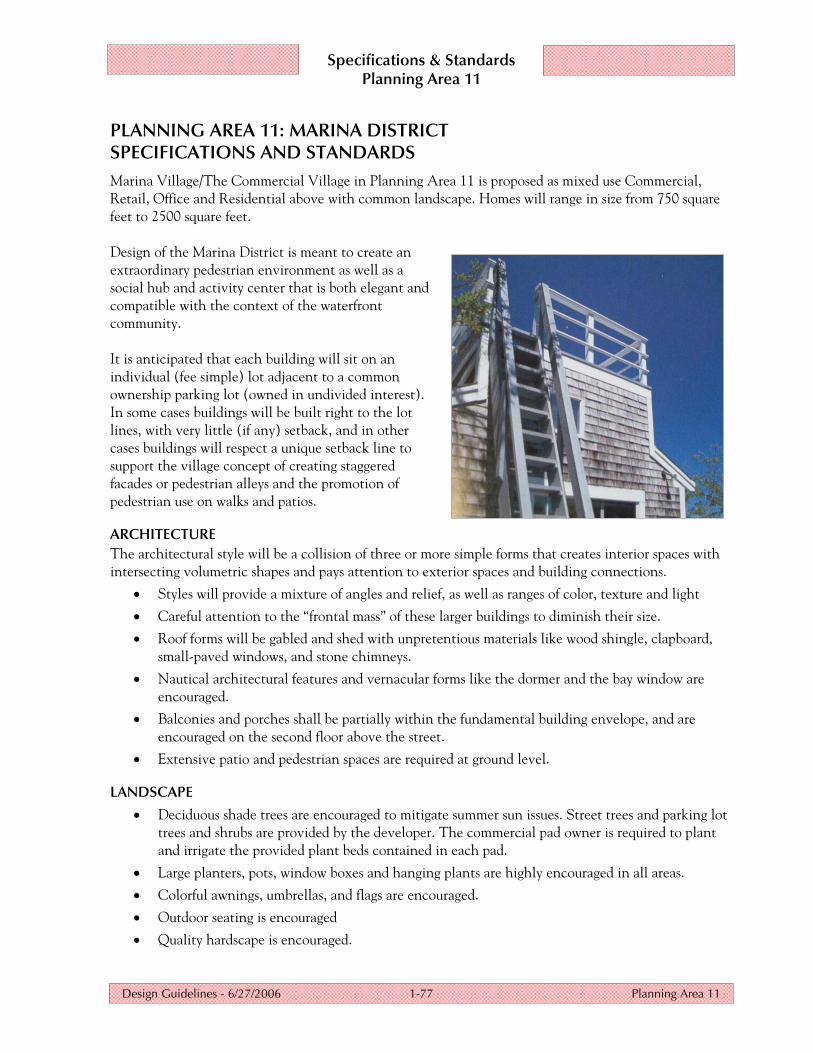
PLANNING AREA 11: MARINA DISTRICT SPECIFICATIONS AND STANDARDS Marina Village/The Commercial Village in Planning Area 11 is proposed as mixed use Commercial, Retail, Office and Residential above with common landscape. Homes will range in size from 750 square feet to 2500 square feet. Design of the Marina District is meant to create an extraordinary pedestrian environment as well as a social hub and activity center that is both elegant and compatible with the context of the waterfront community. It is anticipated that each building will sit on an individual (fee simple) lot adjacent to a common ownership parking lot (owned in undivided interest). In some cases buildings will be built right to the lot lines, with very little (if any) setback, and in other cases buildings will respect a unique setback line to support the village concept of creating staggered facades or pedestrian alleys and the promotion of pedestrian use on walks and patios.
ARCHITECTURE The architectural style will be a collision of three or more simple forms that creates interior spaces with intersecting volumetric shapes and pays attention to exterior spaces and building connections.
• Styles will provide a mixture of angles and relief, as well as ranges of color, texture and light
• Careful attention to the “frontal mass” of these larger buildings to diminish their size.
• Roof forms will be gabled and shed with unpretentious materials like wood shingle, clapboard, small-paved windows, and stone chimneys.
• Nautical architectural features and vernacular forms like the dormer and the bay window are encouraged.
• Balconies and porches shall be partially within the fundamental building envelope, and are encouraged on the second floor above the street.
• Extensive patio and pedestrian spaces are required at ground level.
LANDSCAPE
• Deciduous shade trees are encouraged to mitigate summer sun issues. Street trees and parking lot trees and shrubs are provided by the developer. The commercial pad owner is required to plant and irrigate the provided plant beds contained in each pad.
• Large planters, pots, window boxes and hanging plants are highly encouraged in all areas.
• Colorful awnings, umbrellas, and flags are encouraged.
• Outdoor seating is encouraged
• Quality hardscape is encouraged.

Specifications & Standards Planning Area 11
Design Guidelines - 6/27/2006 1-78 Planning Area 11
SITE PLANNING
• Setback lines have been established on each pad to create a building envelope. The expectation is that each building will comply with placing the building in these established building limits. Variances may be granted by the DRB on a case by case basis, subject to individual review.
• Established Floor Area Ratios, (FARs) for each lot cannot exceed 100%.
• Utilities will be provided to each property by the developer. Surface water runoff connections will also be provided by the developer.
• Slight variations in setbacks of buildings and patios from the street enhance neighborhood character and add dimension to the street scene by varying planes of shadow and light.
• Refuse, mechanical and meter issues must be screened on a case by case basis.
• Height limits do not include architectural features within the 45', such as cupolas or “widows watch” (accent towers).
Residential Square Footage Maximum: 3500' – Minimum: 750'
Maximum Lot Coverage: 100%
Maximum Building Height 45’ as determined by International Building Code; the vertical distance from the grade plane to the average height of the highest roof surface, excluding architectural projections
Federal Emergency Management Act (FEMA) The flood elevation level at Dover is between 2069.2 feet and 2070 feet as depicted on the FIRM map. Refer to the April 27, 2005, FEMA letter in Appendix 3 and current FEMA guidelines for a building elevation determination before you build.
Shoreline Protection Shoreline protection, as illustrated on page 1-36, may be required by the US Army Corps of Engineers and/or Dover Bay Development, LLC, to prevent erosion of your property.

Specifications & Standards Planning Area 11
Design Guidelines - 6/27/2006 1-79 Planning Area 11
PLANNING AREA 11 – SPECIFICATIONS AND STANDARDS continued
SPECIFICATION ITEM STANDARD
Driveway 25' minimum width; 9' x 19' standard stalls with 20% maximum compact stalls 7.5' x 15' minimum
Primary Street, Minimum Building Setback 10' building side, 10' building front, 0' attached porch front
Parking, Minimum Building Setback 5' building, 5' to projections, 5' attached porches
Minimum Side Building Setback 0' exterior walls, 0' to projections
Minimum Rear Building Setback (property line to building, if applicable)
0' exterior walls or porches, 0' to projections
Maximum Lot Coverage 100%
Minimum Water Setback (Artificial High Water Mark)
40'
Porches/Balconies Porches/balconies are required on street side of residences/offices.
Accessory Buildings, Sports Courts, Spas, Pools and BBQs
Common area sports courts, spas and swimming pools are permitted as part of the Association. Other common area structures such as BBQs, Garages, Clubhouses, etc. may be proposed. Individual spas are not allowed.
Automated Irrigation Systems Required.

Specifications & Standards Planning Area 11
Design Guidelines - 6/27/2006 1-80 Planning Area 11