south carolina geographic alliance global positioning systems for the classroom mark musselman...
Post on 21-Dec-2015
213 views
TRANSCRIPT

South Carolina Geographic Alliance
Global Positioning Systemsfor the Classroom
Mark MusselmanAudubon Center at
Francis Beidler ForestHarleyville, South Carolina

Where is the SC Geographic Alliance?
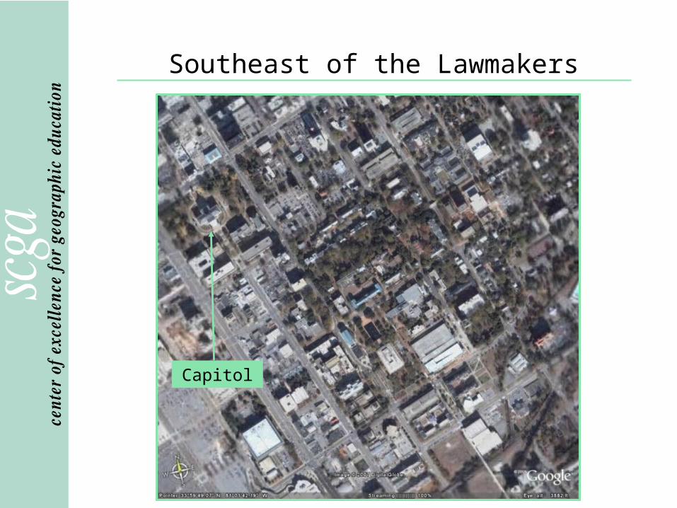
Southeast of the Lawmakers
Capitol

East of the Books
Library and reflecting pool
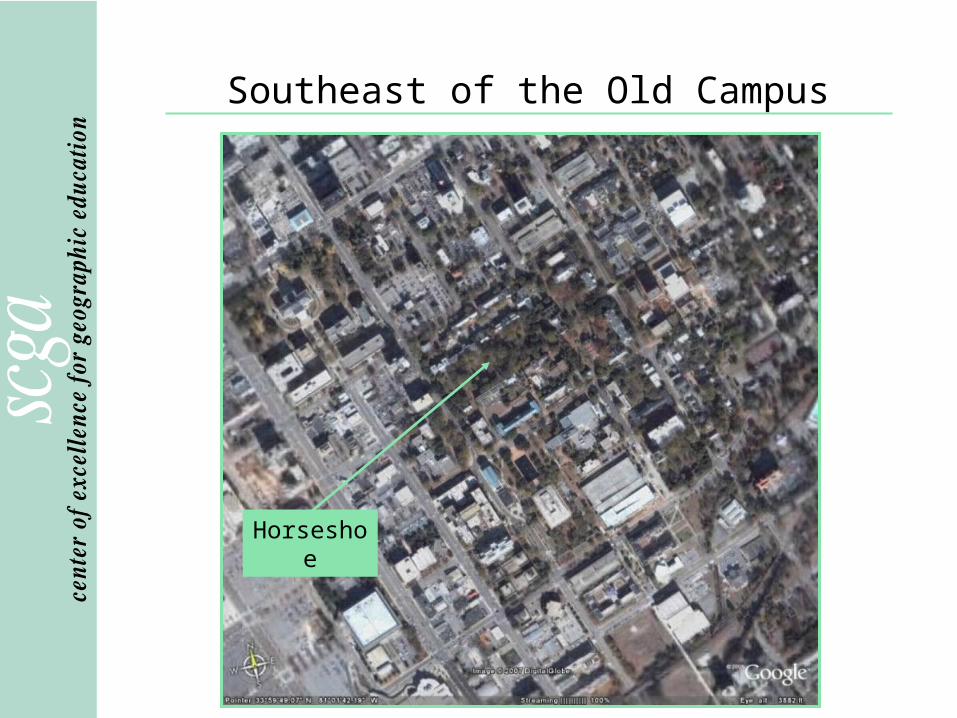
Southeast of the Old Campus
Horseshoe

Close to Campus Dining
Russell House
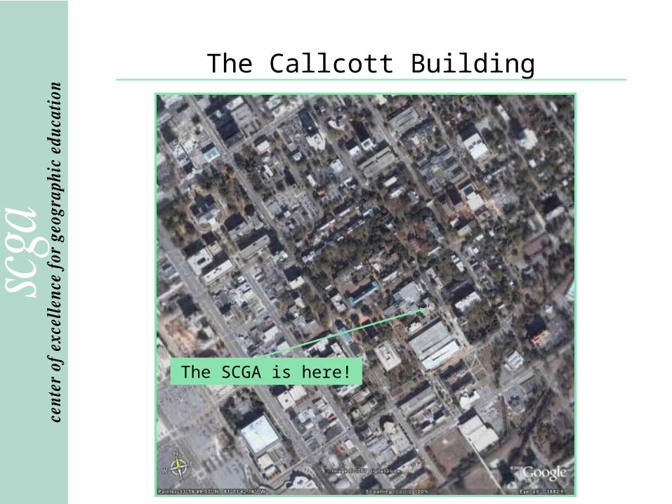
The Callcott Building
The SCGA is here!
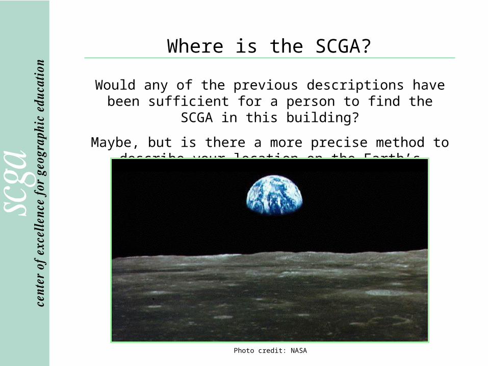
Where is the SCGA?
Would any of the previous descriptions have been sufficient for a person to find the SCGA in this building?
Maybe, but is there a more precise method to describe your location on the Earth’s surface?
Photo credit: NASA
Latitude and Longitude
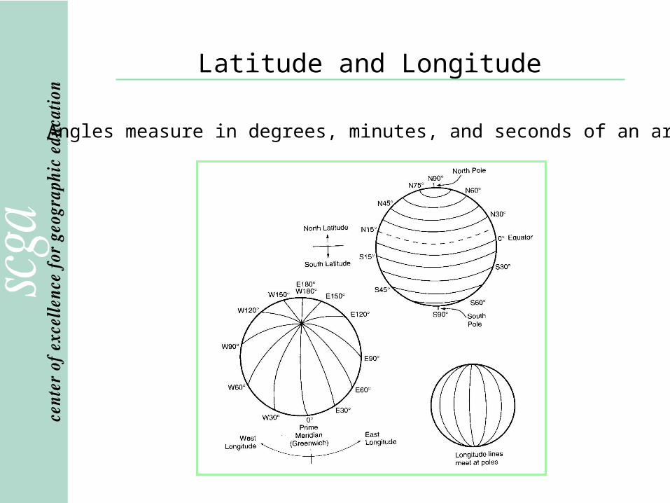
Angles measure in degrees, minutes, and seconds of an arc.
Latitude and Longitude
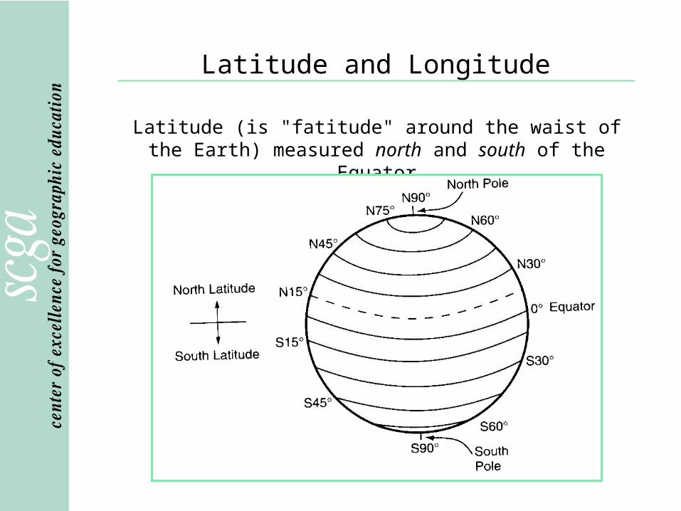
Latitude (is "fatitude" around the waist of the Earth) measured north and south of the Equator

Latitude and Longitude
Longitude measured east and west of the Prime Meridian

Latitude and Longitude
Minutes (represented as ' ) and seconds (represented as '' ) of arc are different than the
minutes and seconds on a clock.
1o=60'=3600''
In fact... 1 hour of Earth's rotation covers 15o longitude
(360o/24 hrs = 15o)

Latitude and Longitude
Key lines of latitude are:
Equator (0o) divides the Earth into theNorthern and Southern Hemispheres

Latitude and Longitude
Key lines of latitude are:
North Pole (actually, a point at 90oN)

Latitude and Longitude
Key lines of latitude are:
South Pole (actually, a point at (-90o or 90oS)

Latitude and Longitude
Key lines of latitude are:
Tropic of Cancer (23.5oN)

Latitude and Longitude
Key lines of latitude are:
Tropic of Capricorn (-23.5o or 23.5oS)
Latitude and Longitude
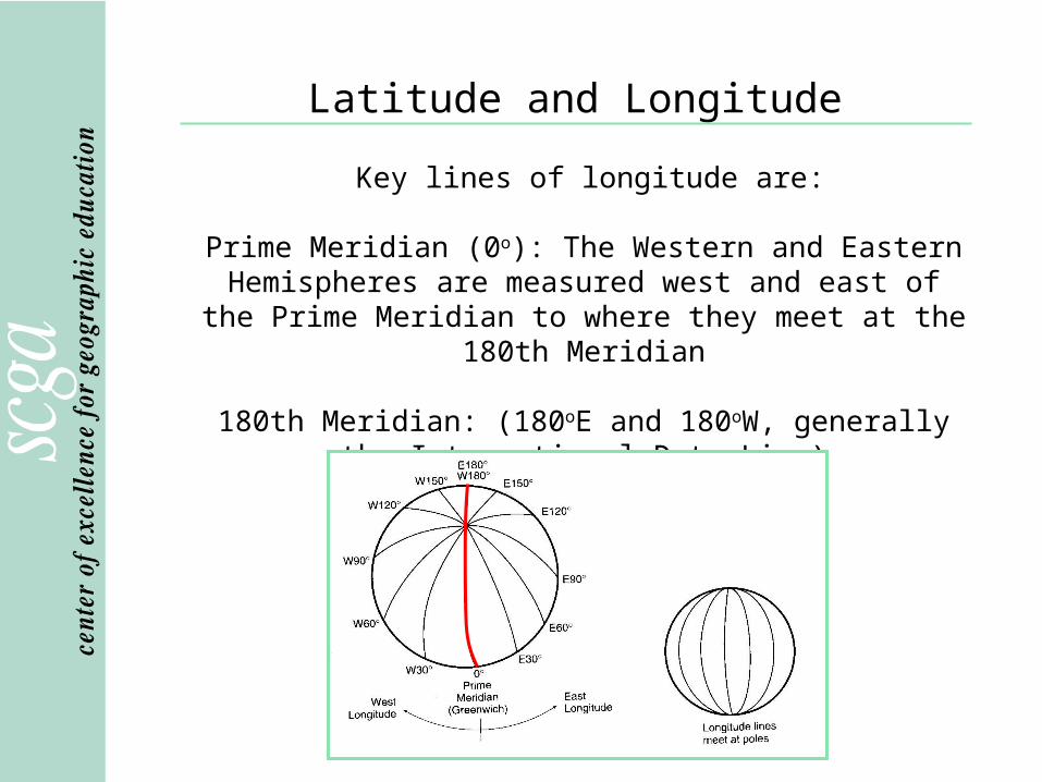
Key lines of longitude are:
Prime Meridian (0o): The Western and Eastern Hemispheres are measured west and east of the Prime
Meridian to where they meet at the 180th Meridian
180th Meridian: (180oE and 180oW, generally the International Date Line)

Latitude and Longitude
The combination of a latitude coordinate and a longitude coordinate designates a unique point on the surface of the Earth.
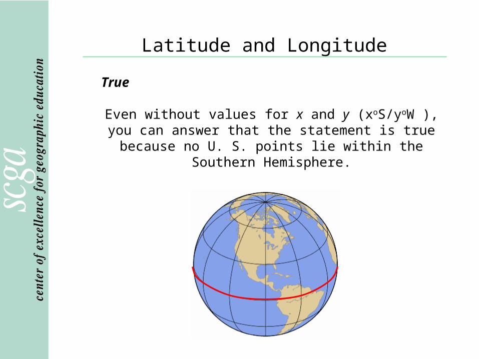
For example…True or false: xoS/yoW is not a point within the United States.
Latitude and Longitude
True
Even without values for x and y (xoS/yoW ), you can answer that the statement is true because no U. S. points
lie within the Southern Hemisphere.

Global Positioning System
The basis of GPS is triangulation from a selectionof the 24 satellites in known Earth orbit.
Global Positioning System
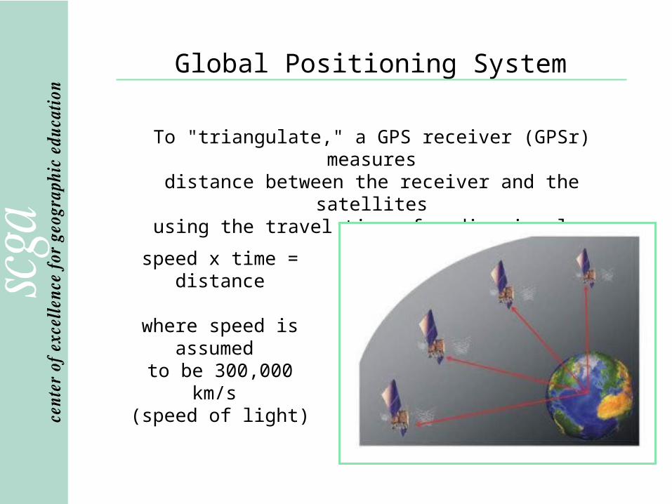
To "triangulate," a GPS receiver (GPSr) measuresdistance between the receiver and the satellites
using the travel time of radio signals.
speed x time = distance
where speed is assumed
to be 300,000 km/s (speed of light)

Global Positioning System
Mathematically four satellite ranges are needed to determine exact position. Three are enough if we reject
ridiculous answers (points in the center of the Earth or high in the atmosphere).
Global Positioning System
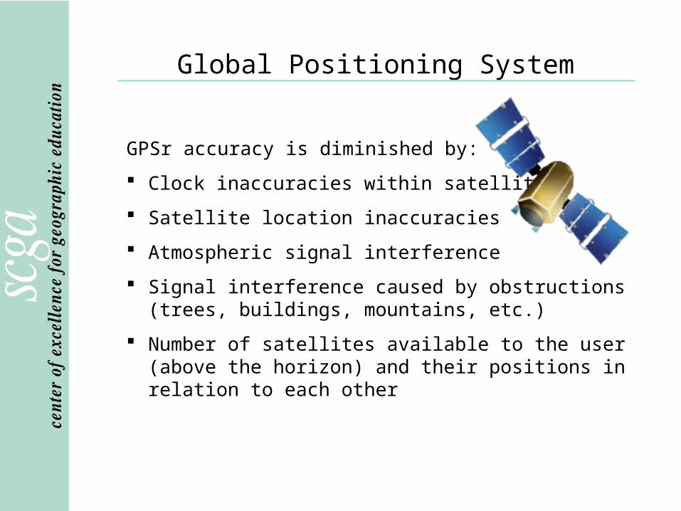
GPSr accuracy is diminished by:
Clock inaccuracies within satellites
Satellite location inaccuracies
Atmospheric signal interference
Signal interference caused by obstructions (trees, buildings, mountains, etc.)
Number of satellites available to the user (above the horizon) and their positions in relation to each other

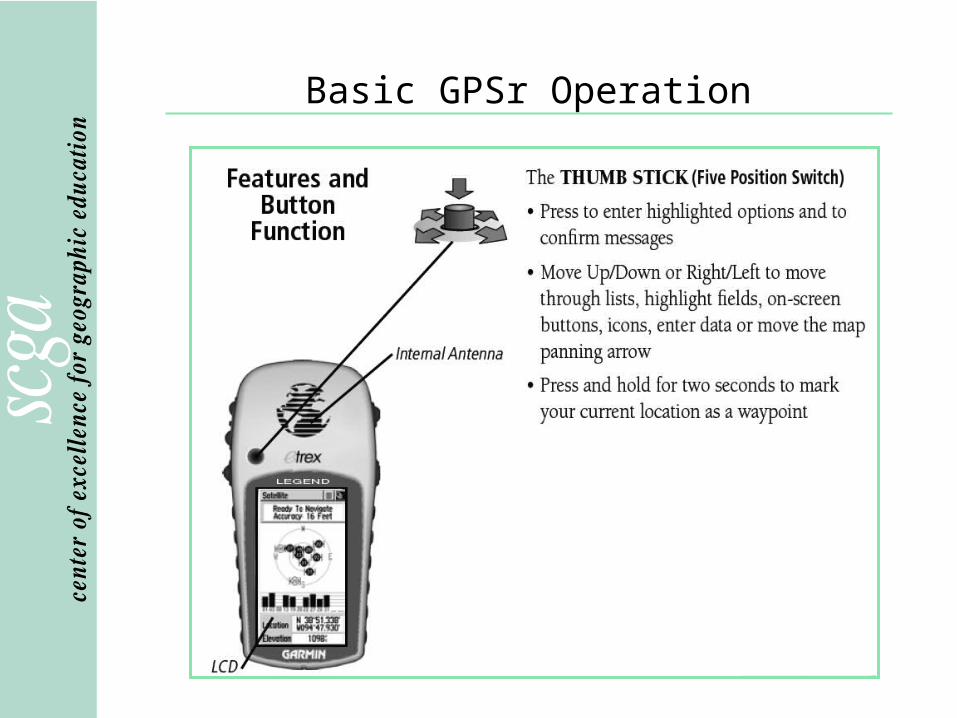
Basic GPSr Operation
How can I identify a GPSr?

Basic GPSr Operation
Power up!
Press and hold the bottom right button until the welcome
page appears.

Basic GPSr Operation
Getting started!
Press the top button three times.
The satellite page will appear.
Scroll through the pages by continuing to push this button.
Basic GPSr Operation

Basic GPSr Operation

Basic GPSr Operation
Satellite Page

Basic GPSr Operation
You are here
Basic GPSr Operation
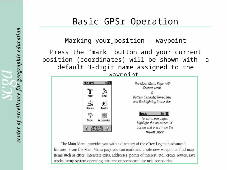
Marking your position – waypoint
Press the “mark” button and your current position (coordinates) will be shown with a default 3-digit name
assigned to the waypoint.

Basic GPSr Operation
Marking your position – waypoint
A waypoint is a “point along the way.” It may be somewhere you’ve never been or a place to which you wish to return.
Press OK to save the waypoint with the assigned name – in this case, it is 001.

Basic GPSr Operation
Marking your position –waypoint
To change the waypoint name, toggle down until 001 is highlighted.
Press the center of the thumb stick to reveal the keyboard.
Toggle across the keyboard to edit.

Basic GPSr Operation
Entering waypoints in advance
Waypoints can be downloaded directly from a computer using free software
such as EasyGPS at http://www.easygps.com, which
accommodates most GPS models.
For example, all 280 waypoints of the Foothills Trail in SC are available at
http://www.travelbygps.com/premium/foothills/foothills.php
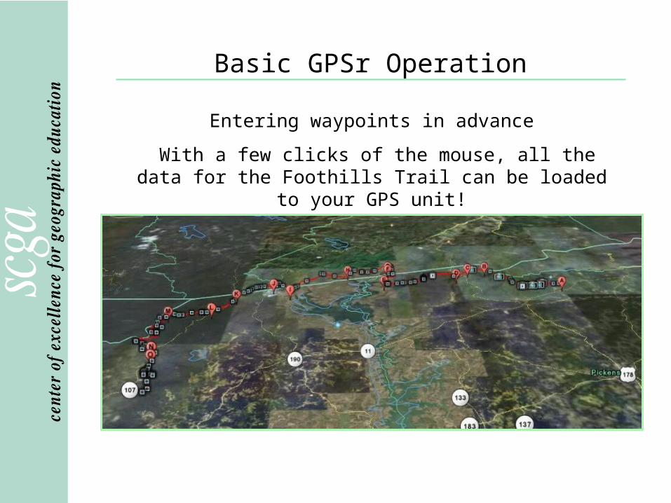
Basic GPSr Operation
Entering waypoints in advance
With a few clicks of the mouse, all the data for the Foothills Trail can be loaded to your GPS unit!

Basic GPSr Operation
Entering waypoints in advance
Pre-trip waypoints can be displayed on topographic
maps, which can be loaded to a GPS unit.
A desire for the easiest route is all the motivation one needs to understand
contour lines.
Basic GPSr Operation
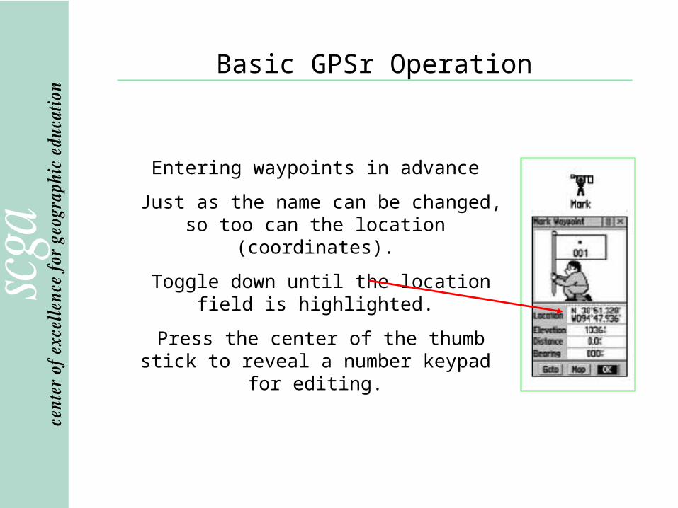
Entering waypoints in advance
Just as the name can be changed, so too can the location (coordinates).
Toggle down until the location field is highlighted.
Press the center of the thumb stick to reveal a number keypad for editing.

Basic GPSr Operation
Navigating to your waypoint
If you have a waypoint already displayed, simply toggle to the Goto button and press
the center of the thumb stick.
Basic GPSr Operation
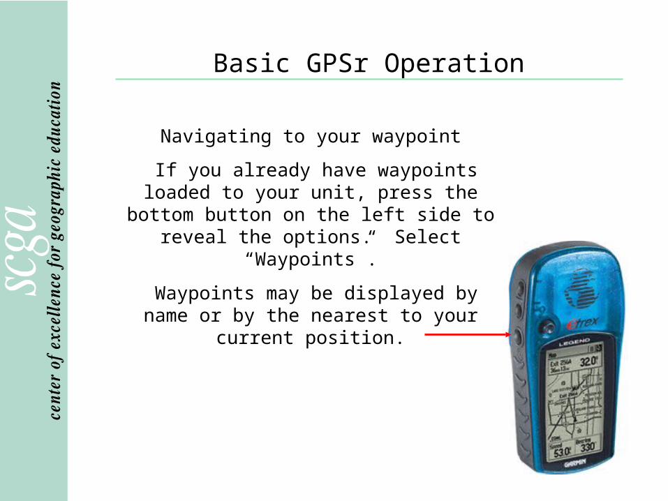
Navigating to your waypoint
If you already have waypoints loaded to your unit, press the bottom button on the left side to reveal the options. Select “Waypoints”.
Waypoints may be displayed by name or by the nearest to your current position.

Basic GPSr Operation
Navigation Page
Basic GPSr Operation
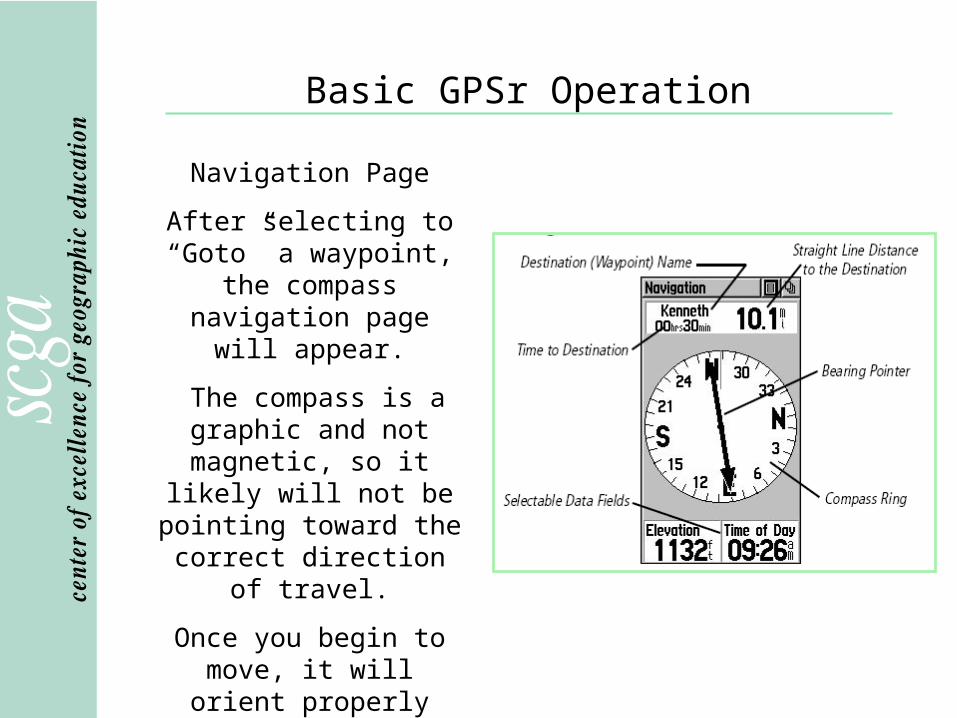
Navigation Page
After selecting to “Goto” a waypoint, the compass
navigation page will appear.
The compass is a graphic and not magnetic, so it
likely will not be pointing toward the correct direction of travel.
Once you begin to move, it will orient properly with the arrow pointing toward
the destination.

Basic GPSr Operation
Navigation Page
An inexpensive magnetic compass and a map are essential items in the event your GPS unit fails to operate.

Basic GPSr Operation
Navigation Page
Turn off the unit whenever practical to conserve battery life. Remember, batteries will ALWAYS fail at the most inconvenient
moment.
Push and hold button until screen clears.
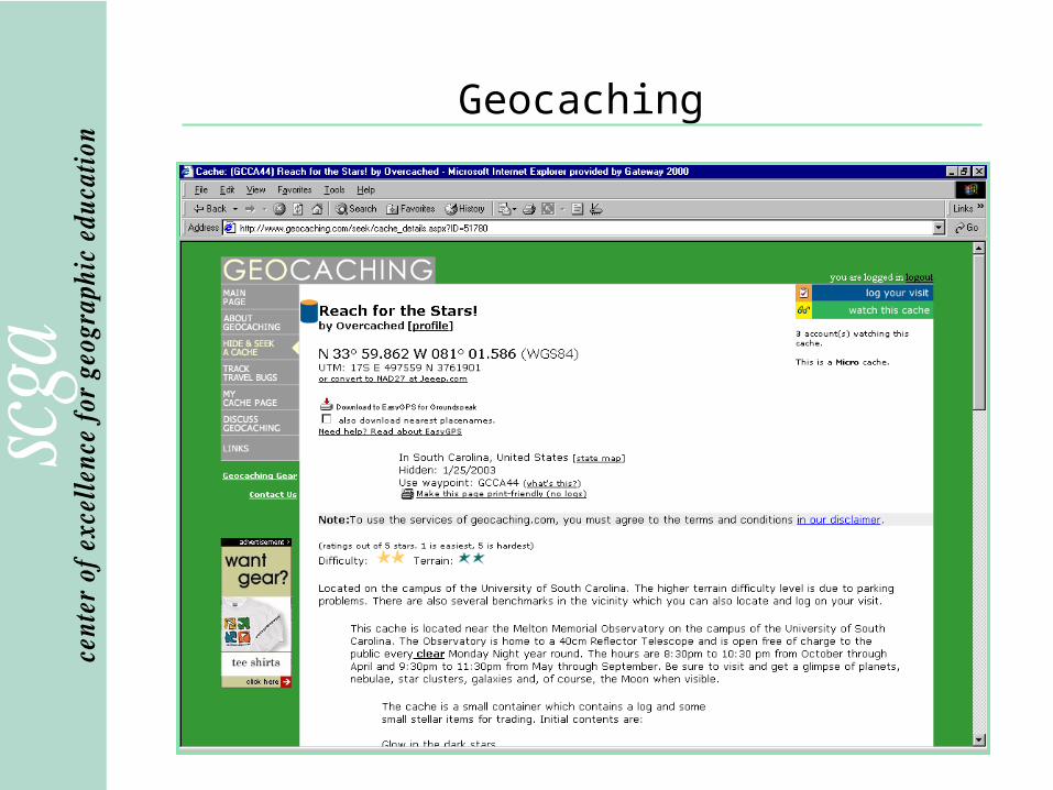

What is a Cache?
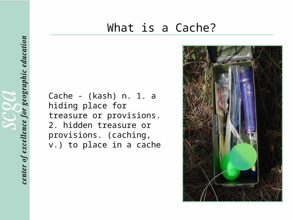
What is a Cache?
Cache - (kash) n. 1. a hiding place for treasure or provisions. 2. hidden treasure or provisions. (caching, v.) to place in a cache

Cache Name
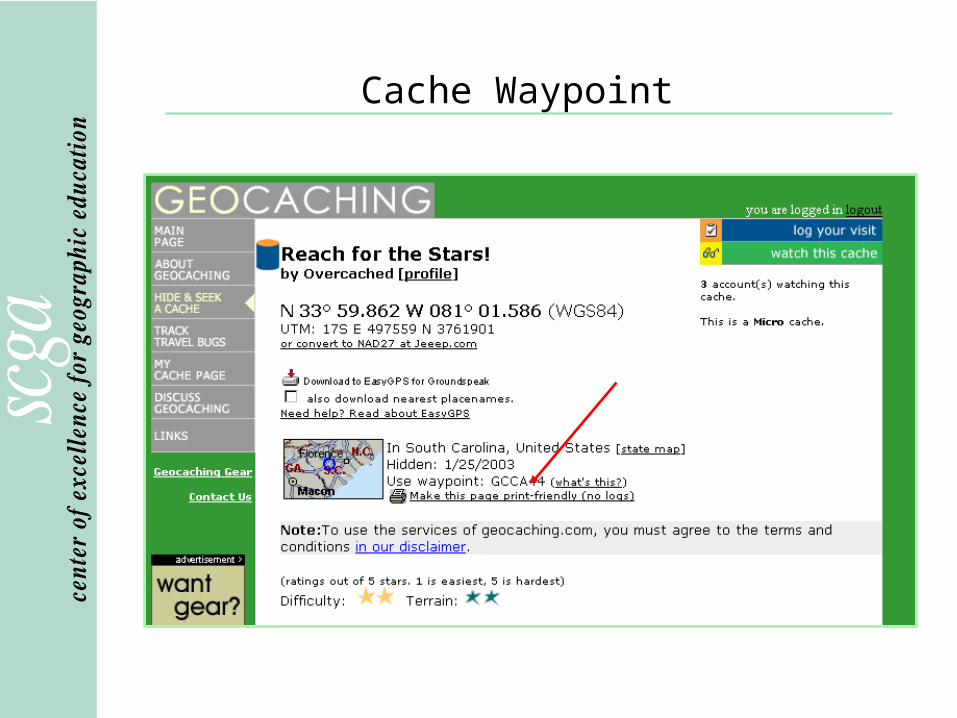
Cache Waypoint

Cache Coordinates

Cache Rating

Cache Size

Cache Information

Cache Clues and Links
Clue and key
Links
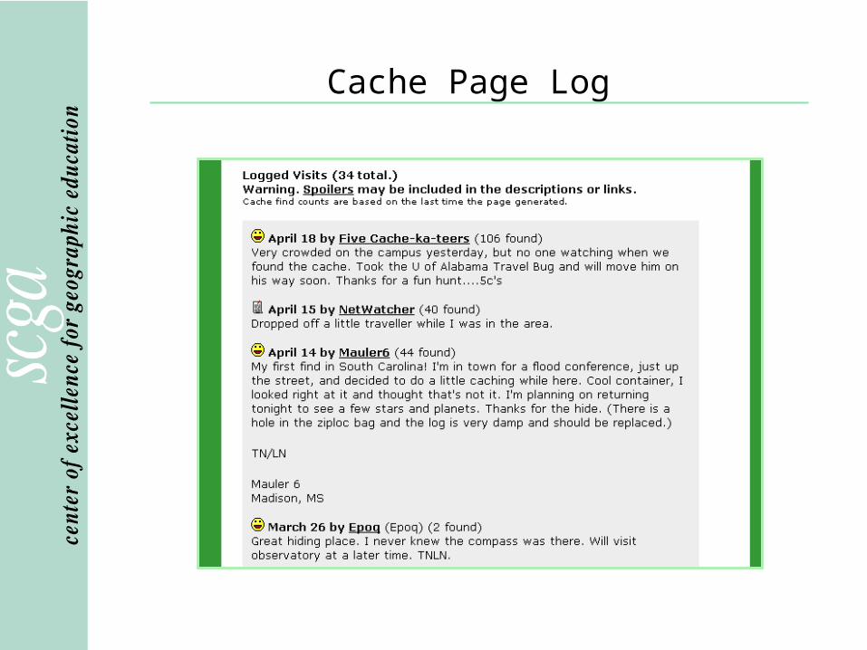
Cache Page Log
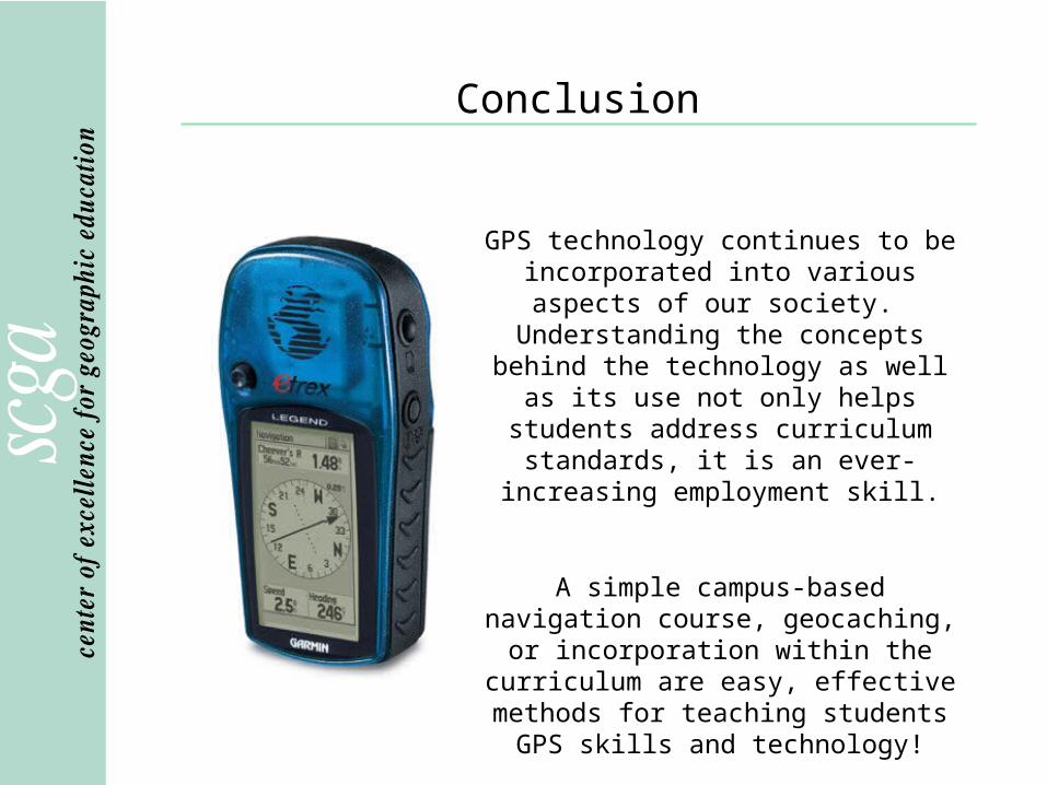
Conclusion
GPS technology continues to be incorporated into various aspects of our society. Understanding the concepts
behind the technology as well as its use not only helps students address
curriculum standards, it is an ever-increasing employment skill.
A simple campus-based navigation course, geocaching, or incorporation
within the curriculum are easy, effective methods for teaching students GPS skills
and technology!