socialization of colupsia project - cifor.org · planning (rencana tata ruang wilayah – rtrw) at...
TRANSCRIPT

Workshop Report
Socialization of CoLUPSIA Project
(Collaborative Land Use Planning and Sustainable Institutional Arrangement Project)
Marthina Tjoa, Thomas Silaya, Nining Liswanti
Ambon, 21 - 22 October 2010
Collaborative Land Use Planning and Sustainable Institutional Arrangements (CoLUPSIA) project 1
Contents
1. INTRODUCTION ........................................................................................................................ 2
1.1 Background ............................................................................................................................. 2
1.2 Objectives ............................................................................................................................... 2
1.3 Expected Results ..................................................................................................................... 3
2. WORKSHOP RESULT ............................................................................................................... 4
2.1. Workshop Day One, 21 October 2010 .................................................................................... 4
2.1.1. Welcome remark and Panel 1: The local government’s role in land use planning
process. ......................................................................................................................... 4
2.1.2. Panel 2. Introduction to Collaborative Land Use Planning and Sustainable
Institutional Arrangements - CoLUPSIA ...................................................................... 5
2.1.3. Panel 3. Legal aspects related to Land Use .................................................................. 6
2.1.4. Panel 4. Media Development (an instrument for increasing awareness and supporting
participation) ................................................................................................................. 7
2.2. Workshop Day Two, 22 October 2010 ................................................................................... 8
2.2.1. Panel 5. Identification and analysis of stakeholders ..................................................... 8
2.2.2. Discussion ..................................................................................................................... 9
2.2.3. Responses from the presenters .................................................................................... 10
3. CONCLUSION AND CLOSING .............................................................................................. 14
3.1. Conclusion ............................................................................................................................ 14
3.2. Closing .................................................................................................................................. 15

Collaborative Land Use Planning and Sustainable Institutional Arrangements (CoLUPSIA) project 2
1. INTRODUCTION
1.1 Background
The Collaborative Land Use Planning and Sustainable Institutional Arrangements
(CoLUPSIA) project is a research project focussed on land use and land tenure. The project is
being funded by the European Union, for a period of four years (2010 – 2013) and conducted
by CIRAD in collaboration with the Center for International Forestry Research (CIFOR),
TOMA, University Pattimura (UNPATTI), University of Gadjah Mada (UGM), HuMA and
Telapak. The CoLUPSIA project sites are located on three Indonesian islands: Kapuas Hulu
District (West Kalimantan), Seram Island (Central Moluccas) and Klaten District (Central
Java). The latter has been cancelled due to the eruption of Mount Merapi in Central Java.
Seram Island, in Central Mollucas, was selected as one of the project sites because forest
cover in this area is still in good condition. However, development activities such as
infrastructure, forest and land clearing by private companies in forestry and agriculture have
increased. In the context of land use planning, the challenge is how to use land use planning
to provide better land use allocation on Seram Island for the future.
The workshop was held in Ambon on 21 – 22 October 2010 and was organized by the
Ambon Provincial Planning and Development Agency (Badan Perencana Pembangunan
Daerah - BAPPEDA). All relevant stakeholders in developing land use planning were invited
to participate in this workshop (see agenda workshop on Annex 1). We held a similar
workshop in Kapuas Hulu District in September 2010.
Some 50 participants, representing various institutions and stakeholders, attended the
workshop. These included government institutions in Mollucas Province and Central
Mollucas, Universities, NGOs, private companies, and community leaders from Seram Island
(Annex 2).
1.2 Objectives
In July 2010, the project conducted a pre-visit and site orientation in Ambon and Seram
Island which aimed to introduce key stakeholders to the project. The main purpose of this
workshop was to provide a follow-up of the CoLUPSIA project activities in July 2010 and to
socialize the project activities to the relevant stakeholders in Maluku Province, particularly
Central Maluku (Seram Island). We also used the workshop to inform and to build
collaboration with all relevant stakeholders at the provincial and district levels. This will help
increase the success of project in Central Maluku. The expected result from this workshop
was that the relevant stakeholders related to land use planning would acknowledge and
support the project.
The workshop also described the general and specific objectives of the CoLUPSIA project, as
follow:
General objective: Avoid deforestation and environmental degradation by supporting the
development of sustainable institutional arrangements promoting land policies and
instruments involving local communities.

Collaborative Land Use Planning and Sustainable Institutional Arrangements (CoLUPSIA) project 3
Specific objective: Collaborative and equitable Land Use Planning (CLUP) and Natural
Resources Management (NRM) to be established, leading to the design and testing of new
institutional arrangements, environmental policies and pro poor financing instruments based
on more secure land tenure and community rights.
Several activities will be conducted in Central Maluku to achieve the above objectives and
the activities. These will include biophysical and socio economic aspects.
1.3 Expected Results
This project is expected to achieve the following results:
1. Key stakeholders have increased capacity to collectively design participatory
development actions, including implementing agreements on land tenure and rights
2. Collaborative assessment of land conditions, current management and possible future
trajectories established
3. Mutually agreed land allocation, CLUP/NRM plans and future-oriented participatory
development actions designed to ensure the legalization of communities’ rights to land
4. Specific pilot activities supporting pro-poor financing mechanisms for forest conservation
and sustainable management evaluated and begun
5. Public awareness of CLUP, land tenure and payment mechanism for ecosystem services
value raised

Collaborative Land Use Planning and Sustainable Institutional Arrangements (CoLUPSIA) project 4
2. WORKSHOP RESULT
2.1. Workshop Day One, 21 October 2010
2.1.1. Welcome remark and Panel 1: The local government’s role in land use planning
process.
By: Mr. Ir. M.Z. Sangadji M.Si (Head of BAPPEDA)
The head of BAPPEDA, Maluku Province, Mr. Sangaji, opened the two-day workshop in
Hotel Amboina. In his welcome remarks, he delivered a presentation on the general overview
of the Maluku Province and local government’s role in the land use planning process at the
provincial level. He also explained that the current status of the development of the spatial
planning (Rencana Tata Ruang Wilayah – RTRW) at the provincial level is now under the
principal agreement in Finance and Investment Agency (Badan Keuangan dan Penanaman
Modal - BKPM). Some problems related to land allocation in the forestry sector still need to
be finalized (land allocation of protected areas for other land use).
The goals of RTRW 2005-2025 in Maluku province are to establish the national RTRW by
integrating land use on islands and in coastal areas. This would be with support from
institutions and systems for regulating at the district level and active community participation.
According to Mr. Sangadji, the results of the RTRW will be socialized to all stakeholders
after the Ministry of Forestry (MoF) and House of Representatives (Dewan Perwakilan
Rakyat – DPR) have approved the document. The objective of RTRW is to increase the
regional economy and to reduce disproportion between the regions. This can be achieved by
optimizing the use of natural resources, reducing environmental degradation, natural disasters
and regional development of Maluku Province by managing the potential and opportunity of
the region.
He explained that the RTRW was developed to achieve: 1). better function of protected areas,
i.e. Northern of Seram region needs more attention, and 2). better protected areas, which has
to be agreed by the MoF. He is concerned that in developing land use for agricultural, the
current regulations governing agriculture and forestry need to be integrated, e.g., the MoF is
expected to give recommendations on suitable plant species for establishing nutmeg.
He also mentioned that many coastal areas and small islands, which have been designated as
protected areas, should be carefully considered if included in the development program. For
example, the potential oil and gas fields in Manusela NP, which have high economic value
and are now, being targeted for exploitation in Jakarta. Better mechanisms, and how to
include communities in the program, need to be discussed from the beginning.
He did not want the people in this region to have the same experience as the people in Aceh.
The rich natural resources in Aceh have been exploited but the local communities have not
received any benefits from the exploitation. He said we should learn from other countries
experiences, i.e. the development of salmon fishing in Norway, where later on they
recognized that the area had oil fields that were of high economic value for the country.
Norway is now one of the richest countries in the world. He emphasized that Maluku also had
high potential for agroforestry and fishery, which should be considered for future
development in this region.
Mr. Sangadji explained that according to the MoF, the community has a small participatory
role in developing RTRW in particular areas. Hence, he suggested that in the future, the

Collaborative Land Use Planning and Sustainable Institutional Arrangements (CoLUPSIA) project 5
community should be more involved in the implementation. Participation from the
community has actually been written into the nasional regulation, UU No 26 Year 2007 and
UU No 33 Tahun 2004, where it is stated that the community should give their input and
direction in developing provincial areas etc. External activities should not be adopted, i.e. if
the community has usually planted coconut or nutmeg, this practice should continue. Do not
introduce another commodity to replace the original to avoid future problems. It was
expected that problems related to socio culture should be handled carefully in developing
land use planning and must be adjusted to the local conditions.
Figure 1. Welcome remarks and presentation by Mr. Sangadji (the Head of BAPPEDA Maluku Province)
2.1.2. Panel 2. Introduction to Collaborative Land Use Planning and Sustainable
Institutional Arrangements - CoLUPSIA
By Dr. Yves Laumonier (CIRAD – CoLUPSIA Project Leader)
Mr. Laumonier explained in his presentation about the background of the project and the
activities in Central Maluku, especially on Seram Island. Why are some donors interested in
research conducted in Indonesia? This is due to the loss of many ecological functions with
many communities still highly dependent on the forest, which frequently leads to unavoidable
environmental degradation. Therefore, there is an urgent need for further action to avoid
more environmental degradation.
The main purpose of the project is to improve land allocation in land use planning. The
concern is not only related to conservation aspects but also how to provide better solutions
for land use allocation. The project activities also cover how to facilitate different
stakeholders to achieve better solutions in land use planning by using a collaborative process.
The CoLUPSIA activities will be implemented on three Indonesian islands, with the
expectation that the research results can provide an alternative solution.
Seram Island was selected because the forests in this area are still abundant, particularly in
Manusela National Park (MNP). Villages in MNP are located on the coast and the forests are
still extensive. The high biodiviersity in these forests is another interesting factor for this
research. The MNP is also an interesting area for developing participatory land use planning.
The adat culture in Maluku is still strong, providing a better mechanism with which to
collaborate with different stakeholders. The social organization in Maluku is also another
interesting aspect for research.
Collaborative Land Use Planning and Sustainable Institutional Arrangements (CoLUPSIA) project 6
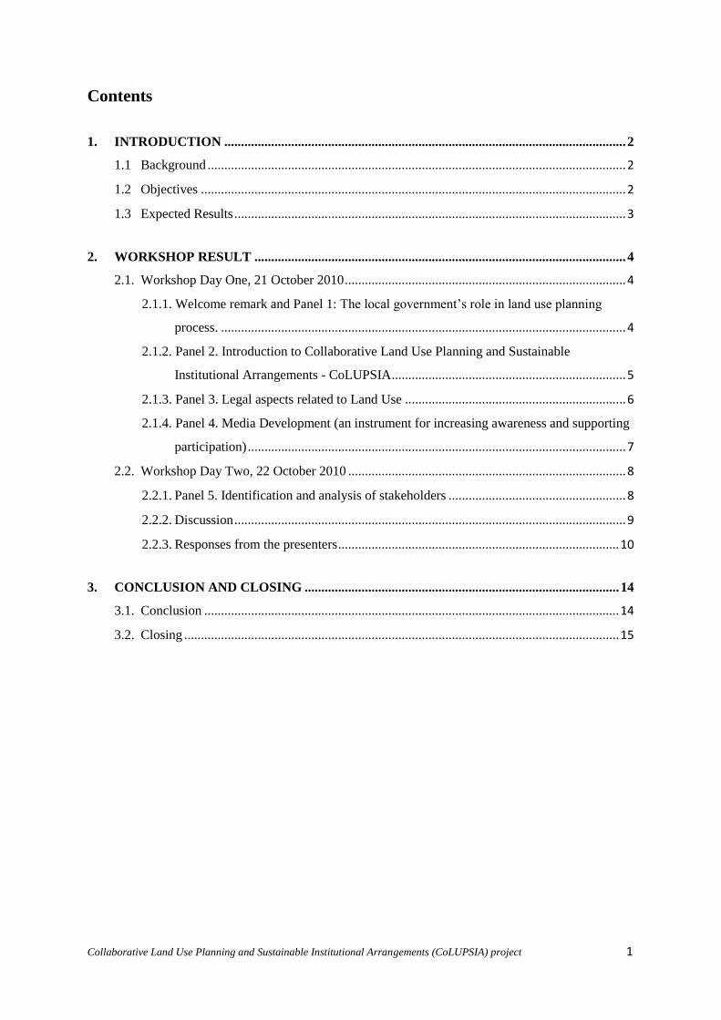
The research activities in the CoLUPSIA project will emphasize five important components:
1) studying the initial condition; 2) the collection of biophysical and socio data; 3) the
analysis of the data, models and legal aspects; 4) pilot study, implementation, advocation and
impact activities; and 5) public awareness of CoLUPSIA and ecosystem services. An
example study in Yamdena in Southeast Maluku (2003-2006) was described to give a better
overview of the collaborative planning process of the CoLUPSIA project. The study in
Yamdena covered both biophysical and socioial aspects.
Mr. Laumonier also explained that one of the weaknesses in mapping and spatial data is due
to the scale of the map (1:250.000), which will be less accurate for use in the field. Hence, we
need a map of larger scale and better spatial data, which can provide detailed information on
land cover, ecology, and socio data that need to be collected during the study.
Afterward, Mr. Yan (TOMA) continued to explain the socio economic study in the context of
the CoLUPSIA project, including how to collect the data and the methods to be used in this
study. He mentioned that information given by the community would be important in the
process of land use planning. The socio study at the village level will then be followed by a
workshop at the village level and district level as well as a meeting for the different villages.
By the end of the project, we should be able to acheive an agreement on land use planning to
be implemented together using participatory action, also for control and evaluation.
Figure 2. CoLUPSIA project presentation by Yves Laumonier (Project Leader)
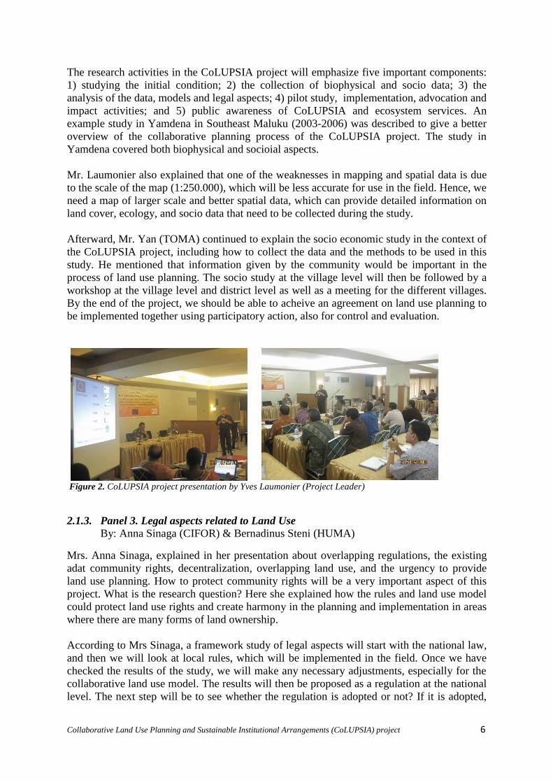
2.1.3. Panel 3. Legal aspects related to Land Use
By: Anna Sinaga (CIFOR) & Bernadinus Steni (HUMA)
Mrs. Anna Sinaga, explained in her presentation about overlapping regulations, the existing
adat community rights, decentralization, overlapping land use, and the urgency to provide
land use planning. How to protect community rights will be a very important aspect of this
project. What is the research question? Here she explained how the rules and land use model
could protect land use rights and create harmony in the planning and implementation in areas
where there are many forms of land ownership.
According to Mrs Sinaga, a framework study of legal aspects will start with the national law,
and then we will look at local rules, which will be implemented in the field. Once we have
checked the results of the study, we will make any necessary adjustments, especially for the
collaborative land use model. The results will then be proposed as a regulation at the national
level. The next step will be to see whether the regulation is adopted or not? If it is adopted,
Collaborative Land Use Planning and Sustainable Institutional Arrangements (CoLUPSIA) project 7
we need to know how the mechanism of managing and controlling the regulation will
function?.
The legal aspects will also cover several sectors such as spatial planning, natural resources,
environment, internal foreign affairs as well as law and regulations (LUP). However, all
regulations will refer to national regulations. It was also explained that from the local
regulations, we can see how the regulations can be synchronized with central regulations,
using the project model, using a traditional community pattern, and how this can be
implemented in the field.
The activities for this part of the project will include: land allocation, public participation, and
rights protection. Our target achievement will be collaborative land use planning as part of
land use planning at the district and provincial level. The legal team will produce several
products such as booklet (small book), a model for public participation and monitoring, and a
policy brief.
2.1.4. Panel 4. Media Development (an instrument for increasing awareness and
supporting participation)
By: Bob Purba (Telapak)
Bob Purba, the project partner from TELAPAK, delivered a presentation on media
development. This important component will conduct activities involving many stakeholders,
with the aim to build trust. The activities will be implemented by GECKO STUDIO in
collaboration with ASTEKI (Asosiasi Televisi Kerakyatan Indonesia). TELAPAK aims to
inform all stakeholders both communities and government at local and national level about
the CoLUPSIA project. It is expected that all stakeholders will be involved and collaborate in
the implementation process of the media activities.
The activities related to media development will be implemented based on the following
strategic steps:
1. Keys elements (4P): Problems, Public, Products, and Plans
2. Key activities: assessment, planning and design, test and trial, implementation, and
monitoring and evaluation. Then back to number one (process loop)
3. Scope of work: actor (direct stakeholders) analysis, target audience receiving
information, what kind of message, how to package the message, and what kind of media
products
4. Mapping the media: what kind of activities and ongoing activities they know/have, what
they need, their relationship with the local community and local government, their
working relations with other media, and
5. Channel of work: provide the right media products (factsheets, website, film/s, etc),
facilitate media trips (if needed), conduct regular meetings with the media, facilitate the
development of media tools (if needed), evaluate the impact of the resulting products
Prerequisites for this study will include: the need for us to collect input from all parties
(including government, communities, and academia), assessment, a communication strategy,
and further assessment to understand what we need to do.

Collaborative Land Use Planning and Sustainable Institutional Arrangements (CoLUPSIA) project 8
2.2. Workshop Day Two, 22 October 2010
On the second day, the workshop agenda focused on the identification and analysis of the
stakeholders that have a role in determining the process of land use planning.
We then explored the following questions:
What is the importance of land use planning? and
What are the roles, rights and responsibilities of the stakeholders?
Identification and analysis of stakeholders are quite important and about 35 people attended
the stakeholders’ analysis exercise, indicating that the interest for the project is high. In this
session, all participants were divided into five groups. Each group was required to identify
different stakeholders to address the following questions: who are the primary, secondary and
tertiary stakeholders? What is their interest, their roles and responsibilities? What is their
importance and how influential are they? Examples of this session’s are given in Table 1.
One facilitator led each group and the results were presented and discussed with all
participants.
Table 1. Matrix analysis stakeholders
2.2.1. Panel 5. Identification and analysis of stakeholders
By: Mrs Moira Moeliono (CIFOR)
Mrs. Moeliono explained the need to conduct identification and analysis of stakeholders. She
gave an example in one area, where there were several activities such as the collection of
forest products, watershed, adat areas, bio fuel, oil, livestock, settlements, etc. But who wants
all of this? Many stakeholders will be interested. What are the driving factors? All of this
information is needed in land use planning. For instance for migration, district policies,
foreign investments, land pressure, tourism development, land tenure regimes,
decentralization , land power relations, market prices, etc.
It was explained that beyond the above there is some influences on a second level, which will
have an impacted on land use, including climate change. Therefore, this project is complex,
as we must also consider these types of factors. However, we emphasize that the community
will feel the impact most. Hence, the community roles are important. That said, we must be
clear about the roles the community will, or can play and how.
She also explained about the roles the communities could play and the procedures for
community participation. Community participation is defined in the regulation, UU No. 26 of
Pihak Kepentingan Peran Hak Tanggung
Jawab
Collaborative Land Use Planning and Sustainable Institutional Arrangements (CoLUPSIA) project 9
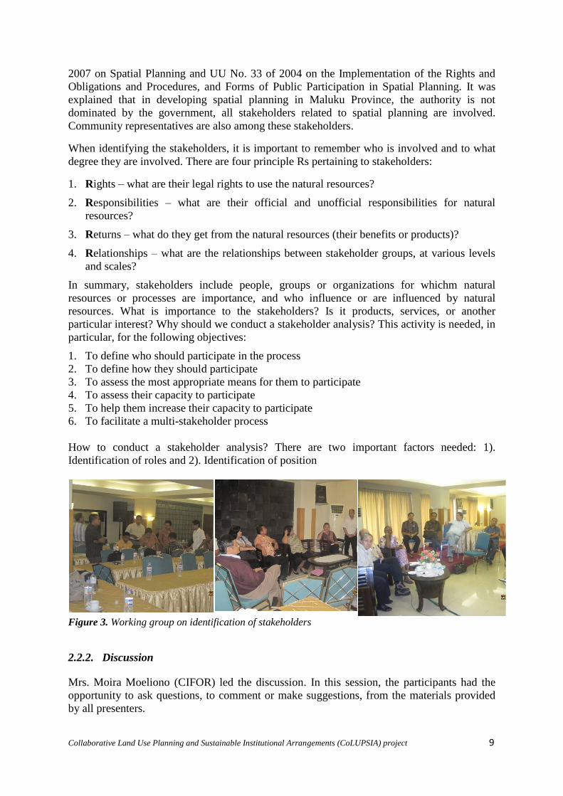
2007 on Spatial Planning and UU No. 33 of 2004 on the Implementation of the Rights and
Obligations and Procedures, and Forms of Public Participation in Spatial Planning. It was
explained that in developing spatial planning in Maluku Province, the authority is not
dominated by the government, all stakeholders related to spatial planning are involved.
Community representatives are also among these stakeholders.
When identifying the stakeholders, it is important to remember who is involved and to what
degree they are involved. There are four principle Rs pertaining to stakeholders:
1. Rights – what are their legal rights to use the natural resources?
2. Responsibilities – what are their official and unofficial responsibilities for natural
resources?
3. Returns – what do they get from the natural resources (their benefits or products)?
4. Relationships – what are the relationships between stakeholder groups, at various levels
and scales?
In summary, stakeholders include people, groups or organizations for whichm natural
resources or processes are importance, and who influence or are influenced by natural
resources. What is importance to the stakeholders? Is it products, services, or another
particular interest? Why should we conduct a stakeholder analysis? This activity is needed, in
particular, for the following objectives:
1. To define who should participate in the process
2. To define how they should participate
3. To assess the most appropriate means for them to participate
4. To assess their capacity to participate
5. To help them increase their capacity to participate
6. To facilitate a multi-stakeholder process
How to conduct a stakeholder analysis? There are two important factors needed: 1).
Identification of roles and 2). Identification of position
Figure 3. Working group on identification of stakeholders
2.2.2. Discussion
Mrs. Moira Moeliono (CIFOR) led the discussion. In this session, the participants had the
opportunity to ask questions, to comment or make suggestions, from the materials provided
by all presenters.

Collaborative Land Use Planning and Sustainable Institutional Arrangements (CoLUPSIA) project 10
The following are responses from the presenters regarding the entire questions, comments,
and suggestions from the participants during the discussion session. A detailed list of
questions is available in the Annex 3.
Figure 4. Questions and comments from participants
2.2.3. Responses from the presenters
The Head of BAPPEDA (Mr. Sangadji)
In his presentation, Mr. Sangadji promised that his department/office would try to balance the
development program between inland and coastal areas, which they have already included in
the plan, at the provincial level. The cultivation of seaweed is easy and there are now 50
useful species of seaweed, especially for the cosmetic and food industries. Meanwhile, the
community was not interested in fish cultivation. As a solution, BAPPEDA has developed a
new concept where fishermen will be treated as partners not just collectors. BAPPEDA will
help to find good partners for the fishermen, i.e. the banks, which can help to find the right
market. In terms of the collection of illegal forest products, this is because their income from
certain commodities is not enough to cover their daily needs; hence, the communities fall
back on the forest.
In eastern Indonesia, many spice trees are potentially important. The ministry of agriculture
could support the cultivation of such trees. At present, the quality of such commodities is low
due to poor processing and post harvesting. Replacing these commodities with another
product (e.g., cacao) could be worthwhile if the product can provide farmers with good
benefits, but we should prioritize, the main benefits should be for the communities not the
industries.
Regarding Mr. Abraham’s question (see Annex 3), the rules are made to reduce the loss of
natural resources. High forest exploitation in Air Besar (traditional village) has resulted in the
community losing their water resources. We need more discussion regarding traditional land
rights.
Certain commodities, such as nutmeg, still have problems because the total volume per
month is unclear. Nevertheless, BAPPEDA has tried to keep this common commodity in this
region, and then added other commodities that can provide benefits for the communities. We
(BAPPEDA) have also helped to find partners for the communities so they can find better
markets for their products.
Collaborative Land Use Planning and Sustainable Institutional Arrangements (CoLUPSIA) project 11
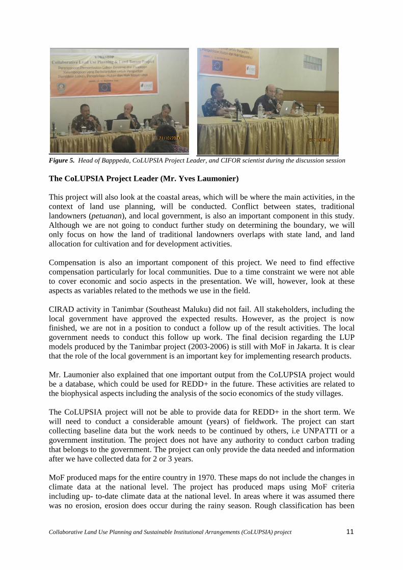
Figure 5. Head of Bapppeda, CoLUPSIA Project Leader, and CIFOR scientist during the discussion session
The CoLUPSIA Project Leader (Mr. Yves Laumonier)
This project will also look at the coastal areas, which will be where the main activities, in the
context of land use planning, will be conducted. Conflict between states, traditional
landowners (petuanan), and local government, is also an important component in this study.
Although we are not going to conduct further study on determining the boundary, we will
only focus on how the land of traditional landowners overlaps with state land, and land
allocation for cultivation and for development activities.
Compensation is also an important component of this project. We need to find effective
compensation particularly for local communities. Due to a time constraint we were not able
to cover economic and socio aspects in the presentation. We will, however, look at these
aspects as variables related to the methods we use in the field.
CIRAD activity in Tanimbar (Southeast Maluku) did not fail. All stakeholders, including the
local government have approved the expected results. However, as the project is now
finished, we are not in a position to conduct a follow up of the result activities. The local
government needs to conduct this follow up work. The final decision regarding the LUP
models produced by the Tanimbar project (2003-2006) is still with MoF in Jakarta. It is clear
that the role of the local government is an important key for implementing research products.
Mr. Laumonier also explained that one important output from the CoLUPSIA project would
be a database, which could be used for REDD+ in the future. These activities are related to
the biophysical aspects including the analysis of the socio economics of the study villages.
The CoLUPSIA project will not be able to provide data for REDD+ in the short term. We
will need to conduct a considerable amount (years) of fieldwork. The project can start
collecting baseline data but the work needs to be continued by others, i.e UNPATTI or a
government institution. The project does not have any authority to conduct carbon trading
that belongs to the government. The project can only provide the data needed and information
after we have collected data for 2 or 3 years.
MoF produced maps for the entire country in 1970. These maps do not include the changes in
climate data at the national level. The project has produced maps using MoF criteria
including up- to-date climate data at the national level. In areas where it was assumed there
was no erosion, erosion does occur during the rainy season. Rough classification has been

Collaborative Land Use Planning and Sustainable Institutional Arrangements (CoLUPSIA) project 12
conducted at the national level. However, for land allocation, which needs soil data, more
detail at a scale of 1:50.000 is required.
The final product from this project will be a model for land use mapping at a larger scale that
includes the ecosystem conditions on Seram Island. Hence, we do not refer to the MoF
criteria for big islands such as Kalimantan. The output of the key results from this project will
be the work methods and land use model, which can be used as the main study results and to
revise spatial planning areas, which is usually conducted every 5 years.
Figure 6. CoLUPSIA project presentation (Project Leader) and participants during the workshop
Legal Aspect and Media Development (Mrs. Ana Sianaga & Mr. Bob Purba)
Gecko studio which belongs to TELAPAK has developed a partnership with many local
media with no additional charge to the partner, although there is always a contribution from
both parties. This system will also apply in the CoLUPSIA project.
Positive responses and new information have been given to this project concerning adat law
and the land ownership system in Central Maluku and Maluku in general. Several cases in the
communities in relation to claims of land ownership will be used by the project to decide the
appropriate steps and strategies for implementation in the field.
Stakeholder Analysis (Mrs. Moira Moeliono)
From the group discussion the participants proposed a media exercise for stakeholders to
identify who are involve in land use planning. In the process, it is not only the existing
participants in the discussion or meeting who have rights to determine the direction and
policy on spatial planning, but also other stakeholders including local communities.
The audience was very concerned about the implementation of this project. In particular:
How the project could be better implemented in order to help the local communities to
increase their wellbeing, by taking into consideration the land status (mostly traditional
land);
How the data and information could be shared with the local government and other
stakeholders;
How the project could develop better collaborative land use planning in these areas; and
What is actually the final product of this project related to land allocation

Collaborative Land Use Planning and Sustainable Institutional Arrangements (CoLUPSIA) project 13
Nevertheless, many participants showed their interest in this project and were willing to
support and to collaborate in the implementation.
Figure 7. Presentation results from the group discussion and participants during the workshop

Collaborative Land Use Planning and Sustainable Institutional Arrangements (CoLUPSIA) project 14
3. CONCLUSION AND CLOSING
3.1. Conclusion
In general, the workshop was deemed successful. In the discussions both in the morning and
afternoon sessions, many participants from the province, district (Kabupaten) and sub-district
(Kecamatan) were very actively engaged. Some questions were mostly concerned with the
commodities such as what suitable plant species could be developed in this region that could
help local people to improve their income (e.g. oil palm, nutmeg, clove, or seaweed). Other
participants concerns were with utilizing natural resources in a more sustainable way; there is
a need to think of the right indicators for sustainable management, which should include
economics, socio, institutions, and technology. Hence, collaboration with the right
stakeholders will be the key to the success of this project.
In general, the workshop agenda received serious attention from the participants. This was
obvious from the participation; the first day (52 participants) and the second day (40
participants).
The workshop material, presented, also received positive responses from the participants.
Questions, comments, and suggestions were very interesting, resulting in a very dynamic
workshop. Questions and comments were also useful and positive, and will help to strengthen
the CoLUPSIA project. While the suggestions have helped the project team to understand
the characteristics of the community in Seram Island and Maluku in general, and to
understand the existing conditions of the area. This will be useful for strengthening the
CoLUPSIA project strategy in the future implementation of the project in the field.
Several parts of the project activities were not very clear for the participants, such as the
methods and data analysis, as we could not explain in detail during the presentations due to a
time constraint and the complexity of the materials. The final product of this project was also
unclear for some participants although the presenter explained in detail. This is
understandable as only those stakeholders using similar methods were able to understand the
methods used so far in determining land use policy and function of particular areas.
Therefore, through this workshop and the implementation of the CoLUPSIA project, slowly
we will transfer the knowledge for better land use planning to all stakeholders involved.
More than half the participants expected the project to build good communications with local
authorities and communities and to document baseline data/information related to the
communities, such as adat rules and norms, and help to strengthen the adat institutions. Some
participants were enthusiastic about seeing the results of the project and hoped that the
methods could be adopted in other areas as well.
In addition, the participants also expressed their higher expectations for this project. It was
explained that the project has limited resources, time and costs, that need to be understood.
Ideally, there would be complementarity between the CoLUPSIA project and technical
institutions and agencies. The role of local governments in following up the project work
both products, methods, and the agreement on LUP will be an important part in filling the
existing limitations.
With the completion of the workshop, it was expected that the CoLUPSIA project could be
known. The communications between the the project and the parties that participated in this

Collaborative Land Use Planning and Sustainable Institutional Arrangements (CoLUPSIA) project 15
workshop can be continued. Better coordination and cooperation can be built together to
design land use that is most suitable for the conditions of the small islands in the Moluccas.
This requires methods and a land use planning system specifically for the area, which may be
quite different to other regions in Indonesia.
3.2. Closing
TOMA Lestari closed the workshop and we thanked the participants for their positive
participation during the workshop, their comments, questions and for providing very useful
inputs that will all help improve the CoLUPSIA project strategies in the future.
An Indonesian version of the report has been sent to BAPPEDA who facilitated the workshop
and the University of Pattimura (Forestry Department) who helped in the preparation
implementation of workshop.
It was explained that this workshop was the first of other workshops, to be held in the future.
As a follow-up, we will conduct a workshop in Central Maluku District in Masohi (March
2011). The next workshop will involve more parties involved in land use planning.
This workshop report is created as a form of responsibility to the appropriate authorities,
policy makers and donors who have funded these activities.

Collaborative Land Use Planning and Sustainable Institutional Arrangements (CoLUPSIA) project 16
Annex 1. The agenda for the two-day CoLUPSIA workshop in Ambon
Day – 1: Workshop on CoLUPSIA Project
09.00 – 09.25 Registration
09.25 – 09.30 Opening
09.30 – 10.15 Welcome Remark & Panel 1. The local government’s role in land use
planning process
By : Mr. I. Sangadji (Head of Bappeda Province in Maluku)
10.15 – 11.00 Panel 2. Introduction to Collaborative Land Use Planning and
Sustainable Institutional Arrangements (CoLUPSIA)
By : Mr. Yves Laumonier (CoLUPSIA Project Leader – CIRAD)
11.00 – 12.30 Discussion Panel 1 & Panel 2
12.30 – 13.45 Break and Lunch
13.45 – 14.15 Panel 3. Legal aspect related to Land Use Planning
By : Mrs. Ana Sinaga (CIFOR)
15.00 – 15.30 Panel 4. Public awareness in supporting better decision making related
to land use planning process
By : Mr. Bob Purba (TELAPAK)
15.30 – 16.00 Discussion Panel 3 & Panel 4
16.00 – 16.15 Coffee break
16.15 – 16.30 Closing remark by CoLUP Project Staff
16.30 – 16.35 Closing
Day – 2: Stakeholder identification and analysis
09.00 – 09.15 Registration
09.15 – 09.30 Introduction
09.30 – 10.30 Group discussion
10.30 – 11.30 Plenary
11.30 – 11.10 Closing

Collaborative Land Use Planning and Sustainable Institutional Arrangements (CoLUPSIA) project 17
Annex 2. List of participants
INSTITUTIONS No. Name
Government of the Province
Regional Development Planning Board (BAPPEDA)
Moluccas Province
1 M. Z. Sangadji
2 J. Matakena
3 Lizda Eli
4 Guntur Napitupulu
5 R W. Datier
6 Debora Y. Manuhutu
7 Budi Dj. Kiat
8 Anton Lailossa
9 Ilham Tauda
10 Sandra Tarumaselej
Regional Environmental Impact Management Agency
(BAPEDALDA) Moluccas Province
11 Anita Pattiselano
12 Karelise Hogendorp
Agricultural Dept. (DEPTAN) Moluccas Province 13 M. B. Patinama
14 L. Heluat
15 Haikal Badila
16 Pasang Palulun
Forest Area Management Board (BPKH Wil IX)
Ambon
17 Budiharto
Natural Resources Conservation Agency (BKSDA)
Moluccas
18 Ben Saroy
Energy and Mineral Resources Agency (DESDM)
Moluccas Province
19 B Tualeka
Public Works Agency (PU) Moluccas Province 20 Happy Mulya
Culture and Tourism Agency (DINPAR) Moluccas
Province
21 Voni
Central Moluccas District Government
Vice Bupati Central Moluccas 22 Ir. I. Seipala MS
Office of Environmental Management (KPLH) Central
Moluccas
23 L. Parera
Manusela National Park Agency 24 J. F. Lilipory
Forestry and Estate Crops Agency (DISHUT) Central
Moluccas
25 Ch. L. Wuritimur
Head of Sub-District (Camat)
Sub-district Tehoru 26 A. M. Ohorella

Collaborative Land Use Planning and Sustainable Institutional Arrangements (CoLUPSIA) project 18
Sub-district Amahai 27 Nova Anakota
Sub-district Seram Utara 28 Drs. A. R. Tehuayo
Sub-district Tel. Elpaputih 29 Chr. Lailossa
Sub-district Tel. Elpaputih 30 Ris Y.B. Lailossa
Sub-district Seram Utara 31 Dj. Rumadan
University Pattimura/UNPATTI
Faculty of Agriculture 32 Jimmi J. frans
33 Fanny Soselisa
34 Ir. Ronny Lopies
35 Ir Lily Pelupessy MS
36 Dr. Dun Mardiatmoko
MP
37 J. P. Haumahu
38 P. Papilaya
39 Debby Pattimahu
40 H. Lellolteri
41 Jopie Hitipeuw
42 Th. Silaya
43 C. K. Pattinasarany
44 L. Siahaya
45 Sofia Mustamu
Natural Resource Management Department 46 A. A. Tulalessy
Local NGO
Pameri 47 Kostansius Kolatfeka
Pameri 48 Andre Pattinama
Nuduasiwa 49 Jan. W. Hatulesila
CoLUPSIA project
CIRAD 50 Yves Loumonier
CIFOR 51 Nining Liswanti
CIFOR 52 Moira Moeliono
CIFOR 52 Esther Mwangi
CIFOR 53 Masatoshi Sasaoka
CIFOR 54 Ana Siregar
TELAPAK 55 Bob Purba
TOMA Lst. 56 Yan Persulessy

Collaborative Land Use Planning and Sustainable Institutional Arrangements (CoLUPSIA) project 19
Annex 3. The questions, comments, and suggestions from the participants during the
discussion session
Questions from the participants during the discussion session
1. Vice Bupati of Central Maluku (Mr. Imanuel Seipala)
The Head of BAPPEDA emphasized that we need to focus on developing seaweed
cultivation. Therefore, Mr. Seipala suggested that coastal areas are also important
to include in the development program. Conservation in the coastal areas will also
need to be considered. He said that the growth of seaweed will likely disturb the
marine ecology, so what will happen to the fishermen and the communities in
coastal areas that still need forests as they need to collect forest products illegally to
reduce poverty? I hope that the seaweed cultivation program will not have an
adverse affect on the community.
The entire national park area in Seram belongs to the state. In fact, the community
has claimed that the forest belongs to them based on their traditional rights. The
communities have exploited the forest and this has created conflict between the
clans (traditional landowners) and the authorities. Many clans who have traditional
land rights use natural boundary between villages, but official boundaries have not
been cleared. This has become a common problem in Central Maluku and has
created conflict over land management.
2. Unpatti/ Head of PSL (Mr. Abraham Tulalessy)
There is no free land anymore in Maluku. The entire land has been claimed by the
communities as traditional lands they have had for many generations. Nevertheless,
since the forests officially belong to the country; this means the community rights
have been lost, as all forestland has been designated for particular purposes. Who
will be responsible for this? Officially, the traditional land has been ignored and
there is no compensation for this. Perhaps this issue can be raised at the national
level. Lesson learnt from Yamdena case study, regarding conflict over land rights
was actually not successfully solved. Although the community still own the land
traditionally, there is no legal support from the government.
3. Local NGO Pameri (Mr. Andre Patinama)
Many areas in this region are dominated by the multifunction of plants (oil palm)
and local commodities (nutmeg, clove, etc). The areas are clearly designated for
specific use, but the villagers sometimes cannot accept. This might be related to
political aspects, and to advocate this issue, it may have an adverse affect on the
local communities.
4. Unpatti (Mrs. Debi Patimahu)
The CoLUPSIA project is interesting especially for some proposed activities such
as analyzing stakeholders, socio study, etc. However, how can the natural resources
be managed sustainably? It needs indicators for sustainable management, including
socio economic, institutions, and technological aspects, in order to see stakeholders
that have a positive or negative influence. The project will succeed if we have the
right stakeholders.

Collaborative Land Use Planning and Sustainable Institutional Arrangements (CoLUPSIA) project 20
Questions from the participants during the discussion session
5. Kepala Balai KSDA (Mr. Ben)
Clarification of data from BAPPEDA is needed, mainly concerning the total area of
land and sea. While related to the future spatial planning, some conservation areas
have been allocated for other functions, and this is a pity because many medicinal
plants are found in these areas and cannot be found anywhere else. BAPPEDA is
expected to consider this. In addition, the management of species is also important,
as it was not mentioned in the presentation.
The presentation by Mr. Laumonier did not include socio economic variables,
which will be implemented in the study villages. For the information, the
conservation methods from the community can be adopted in this project, e.g.
traditional conservation (sasi), sacred areas, etc. In addition, indicators for analysis
must also be clear.
6. Unpatti (Mr. Tommy Silaya)
According to the communities, the CIRAD Program activity in Tanimbar was not a
success. The local government and CIRAD need to do further evaluation if a
similar project will be implemented in Central Maluku. The question is whether it
is true that the project failed? If it did fail, what factors caused it to fail? To what
degree will the local government evaluate this project, so it will not be a repeat of
the project in Tanimbar?
There is often a dichotomy of land ownership, so which rules are we going to
follow? Adat forest is part of the country, as long as the constitution remains
unchanged, we still refer to this. On the other hand, there is a rule, which
acknowledges traditional (adat) rules, so which rules do we choose, related to the
management of traditional rules.
7. Faperta Unpatti (Mr. Gun Mardiatmoko)
In terms of community rights and strengthening capacity, it was explained that
there were state forests and traditional forest, e.g.,: the case of Untik River where
the villages along the river were affected by a concession. In the end, MoF gave
the community the rights to manage the forest. Therefore, if this project can also
help communities like that, at least for the next 5 years, i.e. target five villages in
each district. Based on experienced, the community already hold land certification
in a MoF program. However, to obtain the best market value, it is better to eco-
label products, or could they be included in the REDD+ program.
In terms of media: is there related media information? In the case of UNPATTI,
there was an additional charge for broadcasting although we were partners. Is it
possible for Gecko to facilitate UNPATTI with no additional charge? Can we apply
this to other areas, not only in Seram? Or at least what is the procedure?
8. Unpatti (Mr. Yohanes Haumahu)
How about the analysis for the juridical aspects? Will the project also conduct a
study about traditional conservation or sasi?
If the context of legal aspects will be implemented in Central Maluku, then it will
be impossible, because the system in Maluku uses negeri for village and hamlet
(dusun). Each has a different hierarchy. State has strong traditional law, while in

Collaborative Land Use Planning and Sustainable Institutional Arrangements (CoLUPSIA) project 21
Questions from the participants during the discussion session
the hamlet the traditional law is difficult to manage legally. The village community
never knows the law. The island areas in Maluku have four systems of landowner:
Dati, Negeri, Pusaka and Pribadi. The problem is in the regulations, particularly
about the total areas, it will never be the same in different institutions because they
use land area to find funding. The risk is central regulations on land use, which are
still in use on the bigger islands, hence if we implemented them on the small
islands there will be a problem due to the landownership system on the small
islands. Therefore, the hierarchy of law needs to include traditional law.
9. Dishut Maluku Tengah (Mr. Christian)
Investment in infrastructure the budget does not balance and this has influenced the
community wisdom. In the northern areas, landownership is with the clans, but
currently it is possible to own land personally. Therefore, we need to protect the
current system, particularly the government. It is better for landownership to
remain with the clans.
10. Dishut Prop Maluku (Mr. Reka Badilla)
Related to land use in Maluku, the forestry agency refers to forest cover map. Study
of forestland use uses indicators such as topography, rainfall, and erosion. Hence,
whoever will study land use needs to refer to those indicators.
Related to traditional forest, officially there is only state owned forest. Traditional
forest is included in the state forest. If we have to change the function, this means
change the regulation, implications on this is to change the constitution. Therefore,
this study needs to refer to the RTRW (National).
11. Camat Amahai (Mr. Nova)
Most sub-district heads are still confused about this project, where is the project
going? Concerning legal aspects and development, in Central Maluku, particularly
on Seram Island, there are normative and traditional laws. In the autonomy concept,
the country gave authority to the region to use local culture in using the local term,
such as negeri for village and King for head of village. The important question is
what is the mechanism and how it be implemented. It should provide collaboration
between normative and traditional law. It was suggested that if this project starts, it
should follow the current mechanism. There are Village rules including community
rights and clan rights. The local government has been trying to accommodate the
traditional rules.
12. Camat Teluk Elpaputih (Mr. Chris)
The traditional rules (unwritten) are still applied in the community and they do not
know any other regulation on the forestry sector, i.e. UU No. 41. Hence, if we are
talking about the protected forest, they might not understand. For example in
Masihulan (Protected Forest), the communities are not allowed to collect forest
products, while the communities in coastal areas are allowed. Traditional
communities only need to be respected. We need to build the same perception in
line with local wisdom.
Until recently, the communities have not been involved in the process of land use
planning. There was also a complaint from the communities in southern of Seram
where they have difficulty to get a permit for collecting forest products, while in
Collaborative Land Use Planning and Sustainable Institutional Arrangements (CoLUPSIA) project 22
Questions from the participants during the discussion session
Northern of Seram the communities find it easy to get the permit because the forest
is traditional forest.
13. Dishut Maluku Tengah (Mr. Christian)
The forest areas have been allocated for protected forest, conversion forest,
production forest, which will be enforced with the forest boundaries. Afterwards, it
will be socialized to the communities with certain areas excluded if it’s the
communities try to claim them. In Maluku, there are two-forest management units
(Kesatuan Pengelolaan Hutan – KPH), this is the first model of KHP in Central
Maluku.
14. BPKH (Mr. Budi Harto)
There is no a correct method on land use planning in the regulation. If this project
is about the methods, then it is ok. However, if the products will influence land use
change, then we will be worried. Will the community not be confused? It would be
better for BAPPEDA to implement this project, which will be more legitimate and
stronger and the community will not be confused.
The forest management in this region refers to the forest cover map in Maluku
Province. The land use planning for forest and water areas have been applied since
5 years ago, and this includes community land. This is why there is conflict over
land use and it is difficult to get the rights for managing the forest.