scgis state outreach and strategic plan: follow-on work · pdf filethis document is a...
TRANSCRIPT
SCGIS State Outreach
And Strategic Plan:
Follow-on Work
Talking Points Case Study
Marketing Communications Outline
Prepared By:
Originally Developed August 2009

Foreword
South Carolina’s history in the development and use of Geographic Information Systems (GIS) spans a period of more than 30 years. There is a well-developed GIS community of stakeholders that includes distinguished public and private sector participants, and leading academicians.
The current strategic planning process has been focused on outreach to stakeholders from all sectors, to develop a plan with statewide relevance. This effort was supported with assistance from Cooperative Agreements Program (CAP) of the Federal Geographic Data Committee (FGDC) as part of the Fifty States Initiative to advance the National Spatial Data Infrastructure (NSDI).
The South Carolina Geographic Information Council (SCGIC) administered the project, and the State GIS Coordinator provided support and direction. The work would not have been possible without the input contributed by GIS stakeholders across different levels of government and different geographic regions within South Carolina.
Distribution Notice
This document may be redistributed to any and all interested parties as needed.
Contact Information and Feedback
Feedback is welcome. To provide feedback, please contact Tim De Troye, State GIS Coordinator, via phone (803-734-3894) or email [email protected]. You may also get additional information on this project, as well as other activities of the SC Geographic Information Council, and freely available data sets, and other resources and GIS information at http://www.gis.sc.gov.

Table of Contents
1 INTRODUCTION............................................................................................................................... 4 2 TALKING POINTS ............................................................................................................................ 5
2.1 GETTING THROUGH: MAKING YOUR POINT ............................................................................... 5 2.2 WHAT TO SAY TO DIFFERENT AUDIENCES ................................................................................... 6
3 CASE STUDY ................................................................................................................................... 12 3.1 BACKGROUND ............................................................................................................................ 12 3.2 GRANITEVILLE GEOSPATIAL CONSIDERATIONS ......................................................................... 13
4 MARKETING COMMUNICATIONS PLAN ............................................................................... 17 4.1 PERSONAL COMMUNICATION ..................................................................................................... 17 4.2 NONPERSONAL COMMUNICATION .............................................................................................. 18 4.3 PRIORITIZED MARKETING ACTIVITIES ....................................................................................... 19
APPENDIX A: TABLE OF TALKING POINTS ................................................................................... 21 APPENDIX B: SOURCES ........................................................................................................................ 23 APPENDIX C. DOCUMENT HISTORY ................................................................................................ 24

SCGIS State Outreach and Strategic Plan: Follow-on Communications Material
SC Geographic Information Council - Version 2, October 2009 4
11 IINNTTRROODDUUCCTTIIOONN This document is a companion piece to the SCGIS State Outreach and Strategic Plan, and focuses primarily on strategic goal #5, “Establish, manage, and provide outreach and educational programs and services.” The subject effort in support of this goal was mindful of the findings and recommendations of the overall outreach and strategic planning process. There are three components to this follow-on work, including:
• Talking Points: These are intended for GIS stakeholders throughout the state to use when talking about the benefits of GIS to executives and other influential people.
• Case Study: This examines the Graniteville train wreck and chlorine gas release through the lens of how the current GIS pilot projects will produce data and methods that will assist the state in being better prepared for such events.
• Marketing Communications Plan: This is an outline that describes specific items that can be addressed to facilitate ongoing outreach to the GIS community in SC about the State’s efforts to coordinate and build awareness of GIS programs.
Each of these above mentioned items are intended to either directly or indirectly support the goals of the GIS State Outreach and Strategic Plan, and the activities related to it, including the pilot projects. Briefly, the pilot projects emanating from the Strategic Plan, are as follows:
• Complete fully routable street centerlines for all roads in the state, to apply toward the enhancement of economic development and public safety, in conjunction with the SC B&CB (E911 roads), SCDOT (state maintained roads) and other state agency stakeholders
• Build a web-based parcel map pilot for a multi-county area; local stakeholders in Lexington County are supporting this effort, which will benefit both the street centerlines and address points pilot initiatives, with value to SCDOR and other state and regional entities
• Support a web-based orthoimagery service for statewide access in collaboration with SCGS for the benefit of all state agencies
• Nurture a quid pro quo between state agencies and local governments on sharing more accurate address points (e.g. for the precise location of data of mutual interest, such as hazardous waste sites, critical infrastructure, etc.); more accurate address points will enhance the value of the web-based geocoding service pilot
• Provide a web-based geocoding service for statewide access, leveraging the expertise at DHEC for this purpose, and utilizing more accurate address points where available and not restricted

SCGIS State Outreach and Strategic Plan: Follow-on Communications Material
SC Geographic Information Council - Version 2, October 2009 5
22 TTAALLKKIINNGG PPOOIINNTTSS The idea for “talking points” came out of the regional outreach workshops. There was a common belief that GIS practitioners often talk too much about the technology, and not enough about the benefits. And yet, GIS professionals are part of everyday communities all over the state. This presents ample opportunity to talk to friends, neighbors, and officials in many situations and settings. When given a consistent and relevant message to deliver at appropriate times, GIS professionals can have a positive effect on the support and understanding shown by non-GIS people toward GIS programs and initiatives. Taking a campaign-type approach is a notion that emerged from the workshops, in terms of the consistency and content of messaging by GIS professionals. The purpose of this section is to provide some general advice on how to be more effective in “getting through” to people when talking about GIS, and also to provide some specific talking points on the messages to convey.
2.1 Getting Through: Making Your Point The best way to be successful when talking about GIS is know your audience and tailor your message to the audience. For example, the audience may be decision-makers or other influential people, who are leaders in their fields, but not familiar with the capabilities of GIS. The following outline provides some general advice on “how to say it,” and will be followed with specific advice about “what to say.”
1) Understand who you are talking to, and what information will be of interest and
helpful to them. a. Gauge the image of GIS (how do people feel about it?) b. Show interest in what they do, and ask them about it c. Have a message that is understandable to a layman (i.e., non-GIS person) d. Avoid “GIS-speak” (i.e., technical jargon) e. Go light on the technology f. Emphasize the benefits
i. Adds value (e.g. will save time and money) ii. Promotes progress (e.g. will support better decisions)
iii. Builds trust and understanding (e.g. will bring transparency to how resources are distributed and utilized, geographically)
2) Build awareness and knowledge of GIS in a positive light.
a. Describe GIS in terms of success stories b. Create recognition for jobs well done (GIS “good deeds”) c. Convey some meaningful information about applying GIS
i. The relationship to maps, location-based services, and modern on-line tools (such as Google Maps)
ii. The flexibility and versatility of the technology (can be applied to many problems)
iii. The public sector as an essential data source

SCGIS State Outreach and Strategic Plan: Follow-on Communications Material
SC Geographic Information Council - Version 2, October 2009 6
3) Be prepared to deliver your message in different settings and formats: a. Conversation b. Correspondence c. One-on-one “briefing” sheets d. PowerPoint presentations for groups e. Collateral materials (e.g., whitepapers)
2.2 What to Say to Different Audiences This section provides some talking points and themes aimed at different audiences. While there are some points that are relevant to multiple audiences, certain ones resonate more with one group than another. In general, “GIS” is not a self-explaining as a term. Even when spelled-out as “geographic information systems,” most people might not understand it until they hear “map” mentioned in the same context. In recent years, the term “geospatial” has been increasingly used as a self-explaining term, but most non-GIS people do not instantly understand what that means, either. Since people do not necessarily understand what you are talking about when you use terms such as GIS or geospatial, it is important to take the time to communicate in terms that will help them understand. The challenge is how to simplify without trivializing the subject matter. Nonetheless, sometimes making an analogy between GIS concepts and familiar items can be effective. Most people understand what you mean when you say “map.” The National States Geographic Information Council (NSGIC) came to this conclusion when they discussed the best way to increase the awareness and visibility of GIS amongst non-GIS audiences. NSGIC retained a marketing consultant to help with a messaging campaign for the states to use, and the term “map” is prominent, because most people immediately know what you mean when they see or hear it. ESRI, the leading provider of GIS software, is also a source of messaging materials, including many books they have published on a wide variety of GIS subjects, from simple to sophisticated. ESRI is often associated with the GIS layering concept, which was perhaps first articulated in Design with Nature (1969) by Ian McHarg. This concept has been used ever since to explain GIS. The following depiction of this concept is courtesy of the Urban Regional Information Systems Association (URISA).

SCGIS State Outreach and Strategic Plan: Follow-on Communications Material
SC Geographic Information Council - Version 2, October 2009 7
GIS Layering Concept (c/o URISA):
On a “fun” note, Jefferson County, Kansas published a “How GIS Works” paper, in which they compared the GIS layering concept to the following food: Neapolitan cheesecake; pizza with toppings; and a club sandwich! There may be situations in which these food analogies are appropriate. The following discussion provides some guidance for talking to particular audiences. 1) Senior level agency managers and decision makers This audience is often focused on saving time and money, doing more with less, and streamlining government. They are also responsible in many cases for understanding complex matters that may relate to policy decisions or regulatory authority, such as water resources, public health, and energy, which require expert advice and support. GIS is a proven tool for supporting science-based research in this regard; and as such, is more than a map. It is important to explain to this audience the benefits of using GIS to consolidate reams of data into digestible maps and reports, with answers to questions. They can appreciate being able to consume large quantities of information at-a-glance, and this is where the

SCGIS State Outreach and Strategic Plan: Follow-on Communications Material
SC Geographic Information Council - Version 2, October 2009 8
old adage applies, “A picture is worth a thousand words” – and that is a distinct benefit that a well-designed map can provide. It is important also to understand that each agency has distinct responsibilities and “culture”, including critical business processes and work flows. Showing how GIS can positively impact such work flows is a critical part of communicating with this audience. It is also relevant to mention the importance of accurate and current data. Everyone seems to be familiar with a service such as Google Maps, where you can get directions to the address of where you might want to go. This type of service is widely accessible and easy-to-use, but there is a common misperception about where the data comes from. The data comes mostly from public sources, and is then integrated and enhanced by private companies that supply Google and others with data. The largest such companies are NAVTEQ (owned by Nokia, a Finish company) and TeleAtlas (owned by TomTom, a Dutch company). However, there is a lag between when the public sources update their street centerline files and when the data actually appears in a commercial service or product. This lag is commonly believed to be about two years, which is unacceptable for many government applications. Talking Points for Senior-Level Agency Managers and Decision-Makers
• Make complex data manageable and presentable with GIS • Gain insights at-a-glance through GIS query and visualization tools • Use GIS as a work-force multiplier • Do more with less by sharing data and using powerful analytical capabilities • Improve decision-support with the analytical capabilities of GIS • Perform repeatable analyses with the most current geospatial data • Model complex processes with GIS, such as the movement of plumes of
contamination, or disease • Get maps-on-demand with GIS for different themes and purposes • Support the development and maintenance of accurate and current data, for
better decision-support and executive information systems • Understand that Google data is often not the best or most current data, and
that it typically originates from public sources 2) State legislators and their staff This audience is often focused on responding to citizen constituents and special interest groups. They are also interested in things that are in the public eye, such as floods and droughts when they happen, or foreclosures and job losses. For example, urban areas are facing serious water constraints, and this has an impact on growth as well as sustaining current levels of consumption. These issues benefit from the application of GIS, as do most public health and environmental matters that require science-based research. If another storm of the same magnitude as Hurricane Hugo (1989) was to strike South Carolina, it would certainly be in the public eye. Being prepared for evacuation, emergency response, and damage assessment and mitigation, is an important responsibility, shared by all levels of government. Positioning GIS in the minds of

SCGIS State Outreach and Strategic Plan: Follow-on Communications Material
SC Geographic Information Council - Version 2, October 2009 9
legislators as an essential part of preparedness for when something dramatic happens is appropriate and worthwhile. The Graniteville incident (2005) is another example of this. Another important consideration for talking to legislators is their role in allocating funding. Anecdotes that are backed-up with factual information that quantifies the positive impact of GIS can convince them (and help them to convince others) to fund GIS programs. Simple facts such as levels of demand for GIS services and data (data usage statistics) are useful, as is more formal analysis of potential cost savings or beneficial impacts on issues critical to each legislator (economic development, emergency management, transportation planning, environmental protection). Showing a positive Return on Investment (ROI) for an existing or planned program increases the impact of communication with this audience. Talking Points for State Legislators and Their Staff • Map constituent issues and concerns with GIS • Be better prepared for disasters, and for assessing and mitigating damages, using GIS • Support First Responders and search and rescue operations with GIS maps and tools,
such as E911 • Understand that geospatial data development and maintenance supports core state
responsibilities for both regulation and the provision of services to citizens • Recognize that, in the 21st Century economy, citizens and businesses benefit from and
expect access to GIS websites and maps • Leverage the large investment in geospatial data with applications for economic
development • Use GIS to attract business to the state • Know that the GIS industry has been a bright spot in the economy, and that the US
Department of Labor forecasts Geospatial technology to be one of the top job generators over the next 10 years (along with Nano-technology and Bio-technology)
• Use GIS to create maps of census and other socio-economic data • Display voting districts and voting results on maps with GIS • Map crimes and other incidents in support of law enforcement and public safety • Map important infrastructure, such as broadband, utilities, and transportation with
GIS 3) Local political officials GIS can help local officials take care of everyday government, by providing timely information to support faster, better decisions. If it is accessible to citizens on-line, GIS can help cut down on trips to county offices, by making access to government resources and information more convenient and responsive. Accurate, large-scale (i.e., detailed) data is most often produced at the local level, where issues such as property taxation, public works, and public safety drive the demand for GIS. Not only are most local officials aware of GIS, they know they need it, and they see the benefits every day. For example, they can appreciate the obvious benefit of sharing a consistent base map across departments, thereby eliminating duplication of effort. The notion of “map once, use many times” resonates with most local officials.

SCGIS State Outreach and Strategic Plan: Follow-on Communications Material
SC Geographic Information Council - Version 2, October 2009 10
Talking Points for Local Political Officials • Enable faster and more efficient service to citizens with GIS • Enhance local law enforcement and emergency response with map-enabled
dispatching and routing, helping to save lives and reduce property losses • Help improve everyday government functions, such as taxation and planning, with
GIS for viewing properties and measuring areas • Coordinate and schedule projects for construction, improvements, or maintenance and
repairs and make notification to abutters easier with GIS • Add energy and ‘pizzazz’ to presentations with GIS visualization capabilities, both
2D and 3D • Local response to mass casualty events, such as the Graniteville train wreck in 2005,
benefit from GIS data and analytical capabilities • Collaborating with neighboring communities, whether for mutual aid in emergencies
or economic development, can include sharing geospatial data 4) Educators The opportunity for applying geographic information to education and preparing children for the future is a great one. South Carolina is fortunate to have one of the premier GIS programs in the country at the university level, and this is a resource that can also benefit K-12. Bringing GIS to the classroom should happen more than once a year on GIS Day, but that is at least one time to make sure it is presented. This is where GIS professionals can help across the state, by volunteering to talk about GIS to teachers and schoolchildren on GIS Day. It is an opportunity to help create a GIS-friendly atmosphere in the classroom, by providing teachers with maps of the local area, to which students can relate. It is also an opportunity to provide posters that illustrate GIS concepts in ways that students can appreciate and understand. Talking Points for Educators • Bring excitement to teaching geography and social studies by using GIS • Help school children identify with their neighborhoods and communities with maps • Prepare students for job opportunities in GIS and Location-Based Services (LBS)
industries by teaching geospatial concepts • Use GIS in teaching science, to show the geographic distribution of various
phenomena, such as bird migration, seed dispersal, or eco-regions • Use GIS in higher education as a data modeling and research tool • Encourage parents to learn more about maps and GIS to support teachers 5) Media people Journalists are often interested in human interest stories. Where has GIS helped people? What’s a “GIS good deed” that touched people? The added benefit of getting through to media people is that they can reach many others through their publications, talk shows, or news reports. A tragic event such as the Graniteville train collision and subsequent chlorine release is obviously newsworthy, but what is the GIS angle, and is there a story there? Hurricane Hugo happened 20 years ago, in 1989, 30 years after Hurricane Gracie, in 1959. What if a storm of similar magnitude was to hit in this hurricane season – what
SCGIS State Outreach and Strategic Plan: Follow-on Communications Material
SC Geographic Information Council - Version 2, October 2009 11
is SC’s GIS readiness? These are just some high-profile examples of potential stories, but there are many others to be uncovered at the local level, associated with everyday things. Topics that may be of interest to media people are included in the talking points, below. Talking Points (Potential Stories) for Media People
• The use of GIS to support taxation and economic development • GIS for emergency response, search and rescue, and damage assessment • Better community planning with GIS • Public works maintenance and repair coordination and scheduling with GIS • Tracking disease and public health with GIS • Water resource planning with GIS • Monitoring sea-level rise and storm surge • Business relocation and site selection • Getting the word out to the public about threats and hazards on maps
SCGIS State Outreach and Strategic Plan: Follow-on Communications Material
SC Geographic Information Council - Version 2, October 2009 12
33 CCAASSEE SSTTUUDDYY There are events that occasionally occur that provide lessons for improving readiness, in case something similar happens, again. Some events can serve as proxies for many possible situations that might occur, whether manmade or natural. One such event was the well-documented train derailment in Graniteville (Aiken County, SC) that resulted in the accidental release of toxic chlorine gas. A list of sources for this case study is included in Appendix B. The objective in this case study is to look at the Graniteville event strictly as a proxy for any such event that might occur; and, in particular, to view it from a GIS support perspective. For example, how will the pilot initiatives that have come out of the GIS State Outreach and Strategic Planning effort improve readiness for responding to another dramatic mass casualty event?
3.1 Background For anyone not familiar with the train derailment and chlorine gas release that occurred on January 6, 2005, a brief synopsis of the incident is included here. It happened in Graniteville, an unincorporated area of Aiken County (SC). Two Norfolk Southern trains collided due to a switching error, whereby a moving train was routed into a stationary train on a spur line. Between 42 and 60 tons of chlorine escaped into the air when a tank car was ruptured in the collision. This chlorine release created a toxic gas cloud, causing casualties in the vicinity of the event, including Avondale Mills, the Graniteville commercial district and residential areas. There were 9 deaths at the time of the incident, 71 hospitalized, and over 500 people treated for exposure. Of those hospitalized, some suffered acute lung injury, and are still being monitored by health officials. Unlike a hurricane where there is usually some warning in advance of the storm, the Graniteville train wreck and chlorine release was a no-notice situation. It was only after the event occurred that first responders could assess the situation and determine appropriate action. Best practices of the time were followed, and improvements where appropriate were recommended, in after-action reports. This is a good proxy event for several reasons:
• It is well-documented • People still remember it • It was an event of national significance (i.e., the largest chlorine release in a
populated community on record) • It involved many local, state, and federal responder and stakeholder agencies (110
by one estimate), as well as volunteer agencies, academic institutions, and commercial companies

SCGIS State Outreach and Strategic Plan: Follow-on Communications Material
SC Geographic Information Council - Version 2, October 2009 13
• It had numerous geospatial aspects that relate to the readiness and usefulness of GIS to support the response and follow-up to such events (which will be the focus of this case study)
Photo of the Graniteville Train Wreck in 2005:
Image Source: Aiken County GIS
3.2 Graniteville Geospatial Considerations There are many aspects of emergency response that can benefit from GIS. In the case of the Graniteville chlorine release, many maps produced by the Aiken County GIS staff were used in the response, for example, to show the extent of the evacuation and curfew zones. However, the county’s GIS resources were not automatically called upon as part of best practices at the time. Nonetheless, they quickly came into play soon after the event, and throughout the duration of the emergency. One of the after-action recommendations by first responders was that GIS capabilities be integral to any response plan going forward, and that GIS personnel be on the first round call list for Emergency Operations Center (EOC) activation.

SCGIS State Outreach and Strategic Plan: Follow-on Communications Material
SC Geographic Information Council - Version 2, October 2009 14
The following is a list of maps that were created by the Aiken County GIS staff during the emergency (list courtesy of Frank Bishop, Aiken County GIS Manager, who participated in the response):
• General road maps • Aerial maps • Buffer maps for “hot” zones, evacuation and curfew zones • Road block maps • Search zone maps • Re-occupation zone maps • Building corrosion areas • Animal and pet retrieval maps
Initially, via reverse-911, residents were notified by telephone to shelter-in-place. In other words, they were told to stay at home and take specific precautions. Once it was clear that people should evacuate, and it was determined what the distance from the event should be for the evacuation zone, another notification was given for people to leave if they were within a certain distance of the event. As Jerry Mitchell of the University of South Carolina stated in his EIIP Remarks (March 22, 2006):
“It is highly probable that residents did not know where they were in relation to the accident site and its accompanying mandatory evacuation order. Without a map or extensive local knowledge, residents could not determine where the crash site was located and how far their home was from that site.”
The following is a list of geospatial considerations that were either implied or suggested by the various after-action reports that were written, or based on descriptions of the issues that first responders and affected populations faced during and after the event. Related geospatial considerations are grouped, as follows:
1) Populations at risk • Day/night and seasonal variations in population, and enumeration units
(e.g. census blocks) • Location of exposure • Location of victims requesting assistance • Location of residents remaining at home (shelter-in-place) • Location of special needs populations (people and pets) • Location of sensitive receptors (e.g. day care centers, nursing homes,
hospitals, prisons, schools)
2) Plume predictions • Field monitoring stations (tracking atmospheric contaminants, direction,
and concentration) • Weather reports (including wind speed and direction) • Terrain and building landscapes • Atmospheric transport and dispersion models and consequence assessment
SCGIS State Outreach and Strategic Plan: Follow-on Communications Material
SC Geographic Information Council - Version 2, October 2009 15
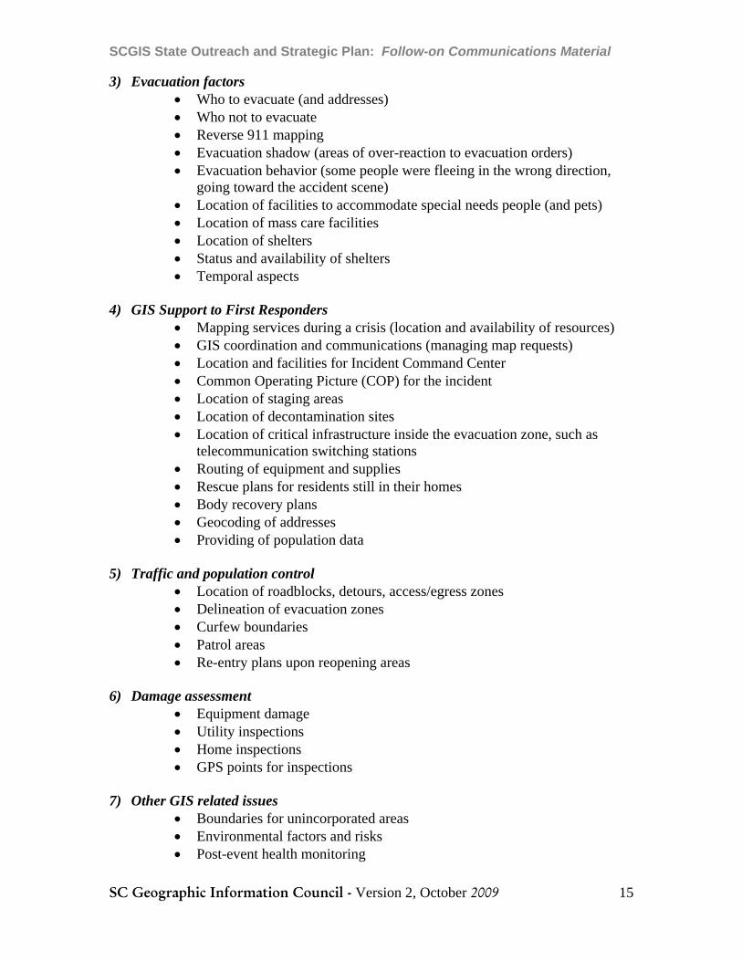
3) Evacuation factors • Who to evacuate (and addresses) • Who not to evacuate • Reverse 911 mapping • Evacuation shadow (areas of over-reaction to evacuation orders) • Evacuation behavior (some people were fleeing in the wrong direction,
going toward the accident scene) • Location of facilities to accommodate special needs people (and pets) • Location of mass care facilities • Location of shelters • Status and availability of shelters • Temporal aspects
4) GIS Support to First Responders • Mapping services during a crisis (location and availability of resources) • GIS coordination and communications (managing map requests) • Location and facilities for Incident Command Center • Common Operating Picture (COP) for the incident • Location of staging areas • Location of decontamination sites • Location of critical infrastructure inside the evacuation zone, such as
telecommunication switching stations • Routing of equipment and supplies • Rescue plans for residents still in their homes • Body recovery plans • Geocoding of addresses • Providing of population data
5) Traffic and population control • Location of roadblocks, detours, access/egress zones • Delineation of evacuation zones • Curfew boundaries • Patrol areas • Re-entry plans upon reopening areas
6) Damage assessment • Equipment damage • Utility inspections • Home inspections • GPS points for inspections
7) Other GIS related issues • Boundaries for unincorporated areas • Environmental factors and risks • Post-event health monitoring

SCGIS State Outreach and Strategic Plan: Follow-on Communications Material
SC Geographic Information Council - Version 2, October 2009 16
The following matrix shows the dependency of the aforementioned geospatial considerations to the type of data being developed or shared via the pilot projects related to the GIS State Outreach and Strategic Planning process.
Table of Graniteville Geospatial Considerations Related to State Pilot Initiatives
State Pilot Initiatives – Data Types
Graniteville GIS Considerations Streets ParcelMaps Orthos Address
Points Geocoding
Populations at Risk x x x x
Plume Predictions x x
Evacuation Factors x x x x
GIS Support to First Responders x x x x x
Traffic and Population Control x x x x
Damage Assessment x x x x x
General Mapping and Monitoring
x x x x x

SCGIS State Outreach and Strategic Plan: Follow-on Communications Material
SC Geographic Information Council - Version 2, October 2009 17
44 MMAARRKKEETTIINNGG CCOOMMMMUUNNIICCAATTIIOONNSS PPLLAANN Two of the key aspects of a good Marketing Communications (MarCom) Plan were described in the context of “Talking Points,” earlier in this document. Namely, it is essential to know your audience(s), and to tailor your message, accordingly. This section will focus on delivering the message. It was once said many years ago by a popular scholar that “the medium is the message” (Marshall McLuhan, 1964). Although he did not live to see the commercialization of the Internet during the 1990s and the advent of Social Media since the new Millennium, his hypothesis has proven valid in many media studies since his death in 1980. The set of delivery mechanisms put forth in the section on “Talking Points” is reiterated here, for easy reference:
• Conversation • Correspondence • One-on-one “briefing” sheets • PowerPoint presentations for groups • Collateral materials (e.g., whitepapers)
The set above can be delivered to target audiences via two broad media channels of communication, personal and nonpersonal, as follows.
4.1 Personal Communication Personal communication is characterized by direct contact with other human beings. To get personal communication channels to work on behalf of the SC State Outreach and Strategic Plan goals, there are a number of courses to follow, including:
• Identify individuals that are influential and willing to persuade others o Seek opinion leaders and supply them with good arguments for
supporting GIS o Get feedback from these people to refine your arguments
• Identify leaders of communities of interest (such as planners and assessors) and bolster their GIS awareness
• Collect testimonials and success stories from beneficiaries of GIS support (and show your interest in their applications and stories)
• Develop GIS examples that are high in credibility and conversation value • Analyze GIS programs to
o Quantify types demand for and benefits created by GIS data and initiatives (e.g., data usage statistics, cost and time savings associated with work flows using GIS, impact of improved decisions resulting from GIS, savings, expanded service creation, and so forth)
o Compare benefits with costs and estimate the ROI of GIS investments

SCGIS State Outreach and Strategic Plan: Follow-on Communications Material
SC Geographic Information Council - Version 2, October 2009 18
There are three types of personal channels that the individuals and leaders mentioned above might fit into, as follows:
1) Advocate Channel: GIS professionals already aware of and knowledgeable about GIS, who can help deliver the message about GIS benefits and applications to decision-makers and other authorities who make or influence decisions about GIS resources.
2) Expert Channel: These are non-GIS professionals who can be enlisted to make statements to decision-makers and other authorities about GIS benefits and applications.
3) Social Channel: This consists of word-of-mouth influence, comprising neighbors, friends, family members and other associates who may have opportunities to communicate with decision-makers and other authorities. If they know more about GIS, they can be more effective in their communications.
4.2 Nonpersonal Communication Nonpersonal communication does not involve direct contact. Instead, it relies on outreach through three types of channels:
1) Mass and Selective Media: This consists of newspapers, magazines, radio, television, and other forms of reaching a public audience. Each of these types of media have a mass (undifferentiated) appeal, and a selective (segmented) appeal. In the context of the state’s GIS program, it is not proposed that the state spend any money on media placements. However, free coverage is sometimes available, and can be beneficial. For example, the radio or newspaper media may seek an interview on a newsworthy subject that gets their attention, such as the location of hazardous waste sites across the state or lessons-learned from the Graniteville train wreck and chlorine release.
2) Atmosphere: The GIS community is a wealthy source of maps and other visualizations of issues and the environment. Just as doctors and dentists put up posters in their workplace to communicate confidence and conviction in their work, so can GIS shops. This creates an atmosphere that reinforces the results that can be achieved. To the extent that the State GIS Coordinator can make such materials available to others, the potential exists to place GIS “cookie crumbs” in offices and schools all over the state. For example, perhaps the State GIS Coordinator could publish and distribute a GIS calendar for the state, using examples of project output contributed by GIS practitioners for each month of the year.
3) Events: Participation in events is an important way to show commitment to the communities sponsoring the events, or a way to attract the community to participate in state-sponsored affairs. Specific examples in South Carolina include meetings hosted by influential organizations, such as GAASC, SCARC, Regional User Groups, the Municipal Association, and the County Association. Also, the Strategic Plan identifies the possible value of conducting a “GIS Show and Tell” event for state legislators and their staff, as an example of a state-sponsored affair.

SCGIS State Outreach and Strategic Plan: Follow-on Communications Material
SC Geographic Information Council - Version 2, October 2009 19
4.3 Prioritized Marketing Activities Building awareness of the findings of the state’s outreach efforts for GIS coordination needs go beyond GIS circles. Some of the ideas that came out of the workshops for promoting GIS in the state include:
• Collect and share success stories • Present on statewide pilot initiatives at non-GIS events • Provide support to “show and tell” days for the Legislature • Develop a set of talking points for all GIS stakeholders to use when speaking to
non-GIS leadership people and potential supporters, including the benefits
Program Element Description ScheduleMessage Development and Talking Points
Refine the ideas presented in this document to create bulleted talking sheets for personal communication channels
Oct-Dec 2009
Identify and Prioritize Target Audiences
This is done in conjunction with developing the Talking Points
Oct-Nov 2009
Collect Success Stories and Testimonials;
This is part of ongoing outreach to GIS practitioners across the state, as well as the officials that they serve; the stories and testimonials become input to refined talking points as well as future collateral materials that can support both personal and nonpersonal communication channels
Oct-March 2010
Evaluate Impacts of GIS
Ongoing analysis of GIS program impacts such as enumeration of data usage by different groups, quantification of benefits (money saved, efficiency gained), or financial analysis (ROI) of GIS initiatives, could produce additional input for talking points and collateral materials
Oct-June 2010
Develop Collateral and Outreach Materials
Begin development of materials that will help tell the story and build level of awareness for the pilot projects (using the format established for the “South Carolina Address Program”)
Jan-June 2010
Ongoing Communication/Public Relations Activities
Includes media outreach, coordination of list serves, and upkeep of SCGIS website
2009-2010
Calendar for Workshops, Presentations, Meetings
Identify speaking opportunities and events to participate in over next two years
2009-2010
Special “GIS Show and Tell” for Legislators in Year
This event would be planned to show results of the pilot initiatives emanating from the GIS State Outreach and Strategic
Mid-to-late 2010

SCGIS State Outreach and Strategic Plan: Follow-on Communications Material
SC Geographic Information Council - Version 2, October 2009 20
Program Element Description ScheduleTwo Plan; this should be scheduled in
consideration of when the Legislature is likely to be available, and when selected pilot results are ready to show, and in collaboration with the Budget & Control Board (B&CB)

SCGIS State Outreach and Strategic Plan: Follow-on Communications Material
SC Geographic Information Council - Version 2, October 2009 21
AAPPPPEENNDDIIXX AA:: TTAABBLLEE OOFF TTAALLKKIINNGG PPOOIINNTTSS
Five audiences and things to say to each of them (i.e. “Talking Points”): 1) Senior level agency managers and decision-makers
• Make complex data manageable and presentable with GIS • Gain insights at-a-glance through GIS query and visualization tools • Use GIS as a work-force multiplier • Do more with less by sharing data and using powerful analytical capabilities • Improve decision-support with the analytical capabilities of GIS • Perform repeatable analyses with the most current geospatial data • Model complex processes with GIS, such as the movement of plumes of
contamination, or disease • Get maps-on-demand with GIS for different themes and purposes • Support the development and maintenance of accurate and current data, for
better decision-support and executive information systems • Understand that Google data is often not the best or most current data, and
that it typically originates from public sources 2) State legislators and their staff
• Map constituent issues and concerns with GIS • Be better prepared for disasters, and for assessing and mitigating damages,
using GIS • Support First Responders and search and rescue operations with GIS maps
and tools, such as E911 • Understand that geospatial data development and maintenance supports core
state responsibilities for both regulation and the provision of services to citizens
• Recognize that, in the 21st Century economy, citizens and businesses benefit from and expect access to GIS websites and maps
• Leverage the large investment in geospatial data with applications for economic development
• Use GIS to attract business to the state • Know that the GIS industry has been a bright spot in the economy, and that
the US Department of Labor forecasts Geospatial technology to be one of the top job generators over the next 10 years (along with Nano-technology and Bio-technology)
• Use GIS to create maps of census and other socio-economic data • Display voting districts and voting results on maps with GIS • Map crimes and other incidents in support of law enforcement and public
safety • Map important infrastructure, such as broadband, utilities, and transportation
with GIS

SCGIS State Outreach and Strategic Plan: Follow-on Communications Material
SC Geographic Information Council - Version 2, October 2009 22
3) Local political officials • Enable faster and more efficient service to citizens with GIS • Enhance local law enforcement and emergency response with map-enabled
dispatching and routing, helping to save lives and reduce property losses • Help improve everyday government functions, such as taxation and planning,
with GIS for viewing properties and measuring areas • Coordinate and schedule projects for construction, improvements, or
maintenance and repairs and make notification to abutters easier with GIS • Add energy and ‘pizzazz’ to presentations with GIS visualization capabilities,
both 2D and 3D • Local response to mass casualty events, such as the Graniteville train wreck in
2005, benefit from GIS data and analytical capabilities • Collaborating with neighboring communities, whether for mutual aid in
emergencies or economic development, can include sharing geospatial data 4) Educators
• Bring excitement to teaching geography and social studies by using GIS • Help school children identify with their neighborhoods and communities with
maps • Prepare students for job opportunities in GIS and Location-Based Services
(LBS) industries by teaching geospatial concepts • Use GIS in teaching science, to show the geographic distribution of various
phenomena, such as bird migration, seed dispersal, or eco-regions • Use GIS in higher education as a data modeling and research tool • Encourage parents to learn more about maps and GIS to support teachers
5) Media people (potential stories) • The use of GIS to support taxation and economic development • GIS for emergency response, search and rescue, and damage assessment • Better community planning with GIS • Public works maintenance and repair coordination and scheduling with GIS • Tracking disease and public health with GIS • Water resource planning with GIS • Monitoring sea-level rise and storm surge • Business relocation and site selection • Getting the word out to the public about threats and hazards on maps

SCGIS State Outreach and Strategic Plan: Follow-on Communications Material
SC Geographic Information Council - Version 2, October 2009 23
AAPPPPEENNDDIIXX BB:: SSOOUURRCCEESS Bishop, Frank, “GIS in an Emergency Situation,” SC GIS Conference Presentation (2006)
Drociuk, Dan, “Experiences in the Use of Non-Traditional Data Sources in a Rural State – South Carolina,” South Carolina Department of Health and Environmental Control (c. 2006)
“Emergency Response Issues: What Went Wrong in Graniteville,” from ChemicalSpill.org website (January 2005)
Frommer, P.N., “The Graniteville Train Disaster: How Accreditation Shape Public Safety,” Commission on Accreditation for Law Enforcement Agencies (CALEA) Conference (November 2005)
Gellatly, M., “Study Uses Graniteville Accident as Focal Point,” Aiken Standard (December 31, 2008)
“Going Back to Graniteville,” Augusta Chronicle (January 4, 2009)
“Graniteville, SC January 6, 2005: Norfolk Southern Train Derailment and Chlorine Release Lessons-Learned,” SC DHEC (c. 2006)
Koffman, Hunter, Buckley, and Addis, “Savannah River National Laboratory (SRNL) Capability for Atmospheric Contaminant Releases,” SRNL (2006)
Kotler, P., Principles of Marketing, Prentice-Hall, 1980.
Mitchell, Cutter, and Edmonds, “Improving Shadow Evacuation Management: Case Study of the Graniteville, SC Chlorine Spill,” Journal of Emergency Management (2007)
Mitchell, J.T., “The Graniteville South Carolina Chlorine Spill: A Study of Evacuation Behavior,” Emergency Information Infrastructure Partnership (EIIP) Virtual Forum Presentation Transcript (March 22, 2006)
“Norfolk Southern Derailment, Graniteville, South Caroline,” Emergency Response and Removal Branch, Oil and Hazardous Substances, US Environmental Protection Agency (c.2006)
“Public Health Consequences from Hazardous Substances Acutely Releases During Rail Transit – South Carolina,” Morbidity and Mortality Weekly Report (MMWR), Center for Disease Control (January 28, 2005)
“Remembering Graniteville: One Year Later,” WRW-TV News 12 transcript, Augusta, GA (January 2006)
“SCGIS State Outreach and Strategic Plan,” SCGIC (May 2009)
“Technical Memorandum for Federal Highway Administration on Case Studies: Assessment of State of the Practice and State of the Art in Evacuation Transportation Management,” USDOT FHWA (February 2006)
Van Sickel, D., et. al., “Acute Health Effects after Exposure to Chlorine Gas Released after a Train Derailment,” The American Journal of Emergency Medicine (January 2009)

SCGIS State Outreach and Strategic Plan: Follow-on Communications Material
SC Geographic Information Council - Version 2, October 2009 24
AAPPPPEENNDDIIXX CC.. DDOOCCUUMMEENNTT HHIISSTTOORRYY
Version #
Date
Description
Responsible Party
1.0 08/31/09 Draft Follow-on Document (RE: Talking Points, etc.)
AppGeo
2.0 10/4/09 Minor edits SC State GIS Coordinator
NOTES: