sam houston spring -
TRANSCRIPT

CULTURAL RESOURCE MANAGEMENT Si RVEY OF THESAM HOUSTON SPRINGS PROJECT AREA,
PART OF THE TRINITY RIVER INTERPRETIVE AREA,GREAT TRINITY FOREST, DALLAS COUNTY, TEXAS.
byAaron J. Naumann
Marsha Prior, Ph.D.Natalie Thomas
Christopher Goodmaster
Principal InvestigatorDuane E. Peter
forBrown Reynolds Watford Architects
3535 Travis StreetSuite 250 LB-102Dallas, TX 75204
TEXAS ANTIQUITIES PERMIT NUMBER 4211
MISCELLANEOUS REPORTS OF INVESTIGATIONSNUMBER 436
Geo-Marine, Inc.2201 K Avenue, Suite A2
Plano, Texas 75074
May 2009

ABSTRACT
This report presents the results of an archeological inventory and historical survey for the SamHouston Springs project area in Dallas County, Texas. The property is part of the City of DallasMaster Plan for the Pemberton Hill Road. Brown Reynolds Watford Architects contracted Geo-Marine, Inc., to conduct the necessary cultural resources studies as required by the State of TexasAntiquities Code. An archeological inventory of the 37.25-acre tract was conducted betweenAugust 16 and September 6th, 2006, under Texas Antiquities Permit # 4211, in conjunction witha review of the historical record and land owner interviews.
The property was reportedly identified to have one archaeological site 41DL72 within itsboundaries. The project area is also one of the potential locations for the original Beeman cabin,who were the first settlers of the City of Dallas. Therefore, the . main purpose of thisarchaeological inventory was to revisit a known archaeological site, assess the property forevidence of the Beeman cabin, while additionally assessing the property for previously unknowncultural resources. The historical survey for the property included an investigation of the relevanthistorical records and land owner interviews, as a means of researching reviewing the historicalsignificance of the property. Historic and archival sources were synthesized in order to moreclearly understand the movements of Sam Houston while making his journey through this area.While historic sources offer tantalizing suggestions of the events and places associated with thisjourney, the precise identities of people and places involved are merely suggestive rather thanscientifically conclusive. It is the conclusion of this research that Sam Houston most likely didnot visit this property.
The cultural resources management survey discovered that the majority of the contextual integrityof the landscape has been compromised by historic mining and Army Corps of Engineeractivities, but four localities within the project boundaries were observed to possess limited intactsoils. Two of these localities produced evidence attributable to the prehistoric archaeological site41DL72,but,_unfortunately,_noevidence was unearthed to support the_identification or location ofthe Beeman cabin. There were other cultural materials observed on the property, but thesematerials are of more recent historic association and are deemed to be ineligible for inclusion inthe National Register of Historic Places (NHRP) or for designation as a State ArchaeologicalLandmark (SAL).
All materials collected and generated from this project will be curated at the Texas ArcheologicalResearch Laboratory (TARL) in Austin.
iii

TABLE OF CONTENTS
ABSTRACT.................................................................................................................................... iii
ACKNOWLEDGMENTS xi
1. INTRODUCTION ...................................................................................................................... 1
2. ENVIRONMENTAL BACKGROUND ..................................................................................... 3
3. CULTURAL SETTING .............................................................................................................. 7PreviousInvestigations ............................................................................................................ 7PrehistoricChronological Framework ................................................................................... 10Paleo-Indian Period ................................................................................................................10ArchaicPeriod .......................................................................................................................11LatePrehistoric Period ...........................................................................................................13ProtohistoricPeriod and Historic Native American Groups ..................................................15HistoricBackground ..............................................................................................................17Project-
Specific Background ................................................................................................. 21
4. METHODOLOGY ................................................................................................................... 23ArchaeologicalInvestigations ................................................................................................ 23HistoricalInvestigation .......................................................................................................... 25
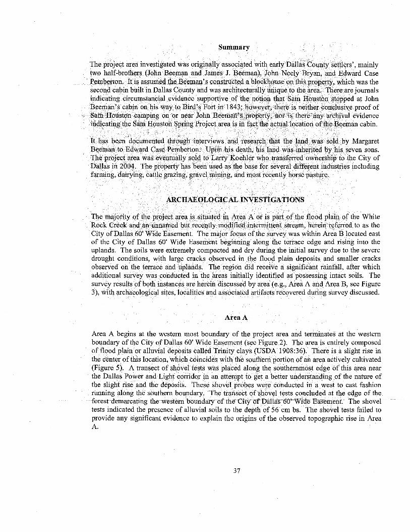
5. SURVEY RESULTS ................................................................................................................ 27HistoricContext ..................................................................................................................... 27Introduction............................................................................................................................ 27BeemanOwnership ................................................................................................................ 31PembertonOwnership ............................................................................................................ 35Summary................................................................................................................................ 3 7ArchaeologicalInvestigations ................................................................................................ 37AreaA ....................................................................................................................................37AreaB....................................................................................................................................39ArchaeologicalSite ................................................................................................................ 46
41DL72........................................................................_..................................................... 46SouthernTopographic High ................................................................................................... 49NorthernLow Terrace ............................................................................................................ 50
v

LIST OF FIGURES
1. Location of the Sam Houston Springs project area ................................................................... 22. Location of survey areas and initial shovel tests ..................................................................... 243. Itinerary of Sam Houston and his company from Crockett, Texas, on August 1, 1843,
tothe treaty negotiations at Bird's Fort ................................................................................... 294. A traditional two-story blockhouse ......................................................................................... 335. Area A: active agricultural field with rise in the distance ...................................................... 386. Area A: accumulation of tires ................................................................................................ 397. Boundary between Areas A and B: intermittent stream within the City of Dallas
60' wide easement .................................................................................................................... 408. Area B: terrace toe slope and floodplain ................................................................................ 409. Area B: terrace slope .............................................................................................................. 4110. Location of initial shovel tests (indicated by "T"/"ST") and intensive shovel tests
(number only) in the Southern Topographic High area ........................................................... 4211. Location of initial shovel tests (indicated by "T"/"ST") and intensive shovel tests
(number only) in the Northern Low Terrace area .................................................................... 4312. Location of initial shovel tests (indicated by "T"/"ST") and intensive shovel tests
(number only) in the Spring and Eastern Uplands areas ......................................................... 4413. Area B: capped sewer ............................................................................................................. 4514. Location of disturbed areas within the project area ................................................................. 4715. Area B: Southern Topographic High ...................................................................................... 4916. Area B: Northern Low Terrace ............................................................................................... 5117. Area B: 1934 concrete well head in the Northern Low Terrace ............................................. 5118. Area B: walnut tree with spike indicating the height of 1908 flood waters ........................... 5219. Area B: circular structure ....................................................................................................... 5320. Area B: Low Northern Terrace old pecan grove .................................................................... 5421. Area B: interior-of Spring Complex .......: ......... ......... ......... ......... ......... ........ .......... 5522. Area B: exterior of Spring Complex ....................................................................................... 5623. Area B: burn pile on the southern edge of the Spring Complex ............................................. 5624. Area B: large oak tree in Spring Complex ............................................................................. 5725. Area B: Eastern Uplands ........................................................................................................ 58
vii

LIST OF TABLES
1. Native American Chronology for the Upper Trinity River Basin ...........................................102. Itinerary of Sam Houston and His Company from Montgomery, Texas, on July 29,
1843, to the Treaty Negotiations at Bird's Fort ....................................................................... 30
ix

ACKNOWLEDGMENTS
The author would like to express his appreciation and gratitude to the many individuals whocontributed to the successful completion of this report. Many thanks go to the interviewees, Mr.Billy Ray Pemberton and Mrs. Lois Billingsly. The first hand information provided by theseindividuals concerning the Pemberton family history and their activities within the project area iscritical to our understanding of the landscape and its role in the regional historic sequence. Theauthor would like to especially thank Mr. Billy Ray Pemberton for his insight into the project areaand the information about the use history of the land, because without his knowledge manyaspects of the property would be unexplained. There are many Geo-Marine, Inc., personnel inneed of mention, including Mr. Duane Peter the cultural resources vice-president, served as thePrinciple Investigator on the project and was instrumental in the editing process. Ms. MissiGreen, the culture resource division manager, was very generous with her time when we werestrategizing the approach of the archaeological survey. Ms. Marsha Prior, an ethnologist, and Ms.Natalie Thomas, an architectural historian, combined forces to investigate the historical recordand synthesize these findings with the information provided via landowner interviews. Theirwork has assisted greatly in our understanding of the historical significance of the property. Mr.Steve Hunt, laboratory supervisor, needs to be given many kudos for assisting in conducting theinitial field work under stressful conditions. He also supervised the data entry and artifactprocessing with assistance from the sole Geo-Marine, Inc., intern Mr. Sam Barrick. Mr. ShaunPhillips supported the GPS aspect of the project and created all of the maps for this report. Hewas especially tested when the GPS technology failed during data collection, which he was ableto thankfully recover. Text, copy editing and report production were overseen by Mr. Naumannand Ms. Sharlene Allday. Final formatting and report layout were both performed by Ms. DenisePemberton.
xi

CHAPTER 1INTRODUCTION
This report presents the findings of the cultural resources survey for the Sam Houston Springsproject area, which is situated within the proposed development area for the Trinity RiverInterpretive area within the Great Trinity Forest within southeast Dallas (Figure 1). Geo-Marine,Inc. (GMI), as a member of the Brown Reynolds Watford Architects team, was tasked with theresponsibility for the cultural assessment of this property in partial fulfillment of the city'sobligation under the State of Texas Antiquities Code to ensure that major projects do notinadvertently destroy archaeological or architectural properties that are historically significant.GMI conducted this work (GMI project # 30428.00.03) as a subcontractor to the City of Dallas.Duane Peter, GMI Senior Archaeologist, served as the Principle Investigator. Additional GMIpersonnel who participated in these investigations included: Aaron Naumann and ChristopherGoodmaster, Project Archaeologists; Marsha Prior, Senior Ethnologist; Natalie Thomas,Architectural Historian; and Steve Hunt, Archaeologist.
The results of previous archival research (Peter et al. 2003) indicated that one knownarchaeological site (41DL72) was contained within the bluff portion of the eastern portion of theproject area. This research also reported the high potential of the property being the location ofthe frontier cabin belonging to Mr. John Neely Bryan and Mrs. Margaret Beeman Bryan, thefounders of the City of Dallas.
Therefore, the scope of this survey was to investigate the property to determine the presence ofhistoric features (foundations, cellars etc.), to assess the extent and integrity of the previouslyrecorded prehistoric archaeological site (41DL72), and to assess the potential of the property toadditionally contribute to our understanding of prehistory or history. Historic and archivalsources were synthesized in order to more clearly understand the movements of Sam Houstonwhile making his journey through this area. While historic sources offer tantalizing suggestionsof the events and places associated with this journey, the__ precise identities of _people and_place&-.. _---involved are merely suggestive rather than scientifically conclusive. These examinationsincluded a strategy incorporating both archaeological survey methods and historical researchmethods. The Project Area includes approximately 37.25 acres of land presently under theownership of the City of Dallas.
1

CHAPTER 2ENVIRONMENTAL BACKGROUND
Dallas County is part of the Texan biotic province defined by Blair (1950) as an intermediatezone between the forests of the Austroriparian and Carolinian provinces and the grasslands of theKansan, Bai_conian, and Tamaulipan provinces. Some species reach the limits of their range inthe Texan province. Almost all of Dallas County falls within the Blackland Prairie, one ofseveral tall grass prairies present in this part of Texas. Grasses in the uplands dominate thevegetation in the Blackland Prairie, with woodlands being restricted to stream courses and riverbottoms. Prior to the disturbances associated with the historic period, the project area would havebeen covered with a water oak-elm-hackberry forest, with occasional grassy clearings andshallow water marshes and ponds (McMahan et al. 1984). Today, this bottomland forest caninclude cedar elm, american elm, willow oak, southern red oak, white oak, black willow,cottonwood, red ash, sycamore, pecan, bois d'arc, flowering dogwood, dewberry, coral-berry,dallisgrass, switchgrass, rescuegrass, bermudagrass, eastern gamagrass, Virgina wildrye,Johnsongrass, giant ragweed, yankeeweed, and Leavenworth eryngo (McMahan et al. 1984:22),and most of these were probably present prehistorically. Also possibly present were cherry,sweetgum, hawthorn, hickory, blackberry, sedge, Indiangrass, giant cane, and beaked panicum(United States Department of Agriculture [USDA] 1980:50, 92). Although the faunal communityin this region has undergone changes due to the expansion of the Dallas-Fort Worth metroplex,species of wildlife which previously inhabited the area would have included bobwhite, quail,pheasant, meadowlark, field sparrow, sage grouse, lark bunting, various species of turtles,cottontail, swamp rabbit, squirrel, muskrat, raccoon, gray fox, red wolf, and white-tailed deer(Schmidly 1983; USDA 1980:50).
The region has a warm temperate, subtropical, and humid climate that is generally mild, withperiods of extremely hot and cold weather being limited in duration. Yearly rainfall is fairlyevenly distributed, with the maximum rainfall occurring in April and May and the minimum inAugust. Much of the rainfall occurs in the -form _of heavy thunderstorms, with -the -rapid runoff-allowing only limited absorption of water by the soil. Snowfall is rare, with an average of lessthan 2.5 cm (1 in) falling per year. The snowfall is generally present for less than one week. Theprevailing winds are southerly. Temperatures remain above 0° C (32° F) approximately 240 dayseach year (USDA 1964:72-73, 1969:51-52).

exposes the sub-soil. The surface layer is general grayish brown fine sandy loam extending to adepth of 0.1 m. The next layer is a medium acid, reddish brown sandy clay loam that can rangeto a depth of 0.3 m. Below that, to a depth of 1.03m is a strongly acid, yellowish red sandy clayloam, which is underlain by a strongly acid, reddish yellow loamy fine sand that can be upwardsof 2m deep (USDA 1980:33).
Trinity clay, frequently flooded is a deep nearly level, somewhat poorly drained soil on thefloodplain. The soil is typically flooded two or three times a year, and the floodwaters rangefrom shallow to moderately deep. The surface layer is moderately alkaline, dark clay nearly0.18 min depth. The following layer is a moderately alkaline, dark grayish brown clay that can be0.5 m in depth. The next layer is a moderately alkaline, very dark gray clay extending to a depthof 1.13 m; followed by a moderately alkaline, dark grayish brown clay extending to a depth of1.7 m (USDA 1980:36).
5

CHAPTER 3CULTURAL SETTING
PREVIOUS INVESTIGATIONS
The history of archeological investigations within the upper Trinity River drainage and theculture-historical framework for the area are aptly summarized in three, relatively recent majorreports concerning the archeology of the upper Trinity River basin (Peter and McGregor 1988;Prikryl 1990; Yates and Ferring 1986). Although the combined efforts of professional andavocational archeologists have resulted in the documentation of numerous sites, much researchremains to be done. As noted by McGregor (1988:27-29), much of the excavation efforts withinthe upper Trinity River basin have focused on reservoir development, especially along the ElmFork (Brown and Lebo 1991; Crook and Harris 1957, 1958, 1961; Ferring and Yates X1997, 1998;Lebo 1995a, 1995b; Lebo and Brown 1990; Skinner 1982a, 1982b; Skinner and Baird 1985) andthe East Fork (Dawson and Sullivan 1973; Lorrain and Hoffrichter 1968; Lynott 1975; Ross1966). Investigations at Joe Pool Lake (Jurney et al. 1988; Peter and McGregor 1988) and testexcavations at the River Bend site, 41TR68 (Peter et al. `1987), have provided the initial dataassemblage necessary for understanding prehistoric adaptations along the West Fork of theTrinity River.
Reservoir studies along the East Fork have included work at Lake Ray Hubbard and Lake Lavon,east and northeast of Dallas, respectively. Lake Lavon was surveyed in 1949 with testexcavations conducted at the Campbell Hole (41COL10) and Hogge Bridge (41COL1) sites(Stephenson 1949a). Additional excavations at the Hogge Bridge site resulted in the formaldefinition of the Wylie focus —a Late Prehistoric manifestation believed to be characterized byarrow points, flexed burials, large pits, and trade pottery from cultures to both the east and west(Stephenson 1952). Later excavations were undertaken by Southern Methodist University (SMU)as a result of the planned enlargement of Lake Lavon (Dawson and Sullivan 1973; Lynott 1975).Lake .Ray Hubbard was surveyed with the help of. members ofthe Dalla& Archeological Society(DAS) in 1963 (Harris and Suhm 1963). Subsequent excavations were conducted at the Glen Hill(41RW4) and Upper Rockwall (41RW2) sites (Ross 1966), and the Lower Rockwall site(41RW1; Lorrain and Hoffrichter 1968). Much of this work concentrated on excavations at siteswith "Wylie focus pits" in an effort to better comprehend the function of these large features. Alow level of professional work continues within the East Fork basin, most of which is incompliance with the requirements of the National Historic Preservation Act (Austin 1993a; Cliff
7

In addition to these large projects, many smaller cultural resources investigations have beenconducted near the current project area. In the 1940s, R. King Harris investigated numerous sitesin the area, including sites 41DL66, 41DL72, 41DL73, and 41DL97. These sites were recordedas prehistoric lithic scatters with ceramic components. Sites 41DL66 and 41DL97 were locatedin close proximity to the project area, but unfortunately have apparently been destroyed bycontinuing urban development in the years since their discovery. During 1974 and 1975, NorthTexas State University (now known as the University of North Texas) conducted an archeologicalreconnaissance within the flood plain of Fivemile Creek (McCormick 1976). Six sites wereinvestigated during this project, two of which, 41DL80 (designated .w 41-DA-5 NTSU) and41DL102 (designated 41-DA-6 NTSU), are within the Dallas Floodway Extension. In 1981,Environment Consultants, Inc., undertook a survey for the Dallas Floodway Extension (Bennett etal. 1981) that included a large area south and west of the project area that extended to the railroadtracks. Twenty-two sites were investigated during this project, of which 13 (sites 41DL69,41DL70, 41DL73, 41DL80, 41DL84, 41DL91, 41DL99, 41DL104, 41DL204, 41DL205,41DL206, 41DL208, and 41DL220) are located within the present Dallas Floodway Extensionproject. None of these sites, however, are within approximately one mile (1.6 km) of the currentproject area.
In 1990, AR Consultants conducted an archeological survey for the Rochester Park Levee, andtwo previously recorded sites, 41DL69 and 41DL70, were investigated. In addition, archivalresearch was conducted for the project area and an oral history of the nearby Metzger Dairy wasrecorded (Skinner et al. 1990). Also in 1990, AR Consultants began a cultural resources surveyof a proposed new levee and associated borrow pits at the Central Wastewater Treatment Plant(Skinner et al. 1991), after which AR Consultants continued to monitor the sites found at theCentral Wastewater Treatment Plant (Skinner and Whorton 1995). Sites 41DL318, 41DL319,41DL337, 41DL338, 41DL355, 41DL356, and 41DL357 were all recorded during theseinvestigations. AR Consultants again visited the area in 1993 for an archeological survey aroundLittle Lemmon Lake (Skinner and Whorton 1993). Two sites (41DL350 and 41DL351) werelocated, both of which are within the Floodway Extension Area of Potential Effects (APE).Finally, between 1995 and 1997, AR Consultants monitored several construction projects withinthe Dallas Floodway (Skinner, Whorton, and Trask 1996; Trask et al. 1997). Two historic sites,41DL370 and 41DL371, were recorded during one of these projects (Skinner, Whorton, andTrask 1996).
In 1997, GMI conducted an archeological, architectural, and geoarcheological evaluation of thearea of the proposed Dallas Floodway Extension, which is to run from the existing DallasFloodway south to Interstate 20. GMI concluded that a strong possibility exists that buried,stratified archeological sites dating to the late Holocene could be preserved in the study area,particularly near the former channel of the West Fork (Cliff et al. 1998). GMI also conductedtesting and evaluation of seven prehistoric sites (41DL318, 41DL319, 41DL357, 41DL337,41DL338, 41DL355, and 41DL356) and an evaluation of the research potential of site 41DL320,the old Forest Avenue Dump, located along the Trinity River near its intersection with Interstate45, in -200-Q. Based on- testing operations- it was determined -that- the seven prehistoric sites- beconsidered ineligible for inclusion in the National Register of Historic Places (NRHP). Thecurrent plans for the Dallas Floodway Extension did not impact site 41DL320; therefore, noaddition archeological investigations were conducted (Buyssee 2000). Most recently, floodwatererosion of site 41DL350, located near Little Lemmon Lake, revealed that burials are presentwithin the flood plain sites of the Elm Fork (Dalbey 2003).

hearths, and a low density of artifacts, including a Clovis point (Crook and Harris 1957, 1958,1961). Although the original radiocarbon dates from the hearths suggested an anomalous earlyage for Clovis points (ca. 37,000 B.P.), more recent work by the Smithsonian Institution(Stanford 1981) appears to have resolved the date controversy. Stanford has demonstrated thatthe presence of naturally occurring lignite--either as a fuel in these hearths or as an inadvertentinclusion—contaminated the radiocarbon samples. Consequently, the commonly accepted date of10,000-12,000 B.P. for Clovis-period occupations is probably a reasonable estimate for the firsthuman occupation of Northcentral Texas.
An exception to the generally limited data on Paleo-Indian sites in Northcentral Texas is thedeeply buried Clovis-age Aubrey site (41DN479), located on the Elm Fork of the Trinity Rivernorth of Dallas (Ferring 1989). The discovery of this site, buried approximately 7-8 m belowthe top of the Elm Fork flood plain just below the Lake Ray Roberts dam, suggests that well-preserved Paleo-Indian sites in Northcentral Texas can only be located through the examinationof deeply stratified Holocene alluvium in modern flood plain situations.
Despite the lack of extensive data relating to the early Paleo-Indian period in Northcentral Texas,some have attempted to generalize settlement mobility and intensity of site occupation bydrawing on local data and on comparisons with other areas. For instance, a number of researchershave seen evidence for a high degree of group mobility in the broad distribution of Paieo-Indianartifacts over the landscape and in the, variety of nonlocal lithic raw materials employed in artifactproduction (Meltzer and Smith 1986; Shafer 1977; Story 1990b: 77). Likewise, the well-documented exploitation of megafauna by Paleo-Indians in the western United States, coupledwith the presence of similar species in Northcentral Texas between 11,000 and 9,000 years ago(see Slaughter and Hoover 1963), has resulted in the popular (and logical) conclusion that "biggame hunting" was part of the Paleo-Indian subsistence strategy in Northcentral Texas.However, the recent important excavations at the Aubrey site have indicated that subsistenceefforts did not focus on big game animals alone. Rather, the entire range of prairie and forestspecies was utilized by the occupants of the site. These included bison, deer, rabbit, squirrel, fish,and abundant turtle (Ferring 1989; Ferring and Yates 1997). Although mammoth remains arepresent, their exploitation has not been substantiated (Ferring and Yates 1997). Whether thispattern of a more generalized foraging subsistence system is characteristic of Clovis adaptationson the fringes of the Eastern Woodlands and the focus on now extinct, big game species is morecharacteristic of a Plains adaptation remains to be documented. However, Ferring and Yates(1997:5) suggest that, in general, the Clovis people probably employed "very flexible adaptivestrategies."
Archaic Period
The Archaic period in Northcentral Texas is tentatively dated between 6500 B.C. and A.D. 700.As is true for many areas, a threefold division of the Archaic period, which consists of early,middle, and late "subperiods," has been applied in Northcentral Texas (Prikryl 1990). Thus, theEarly Archaic has been dated from 6500 to 4000 B.C., the Middle Archaic from 4000 to 1500B.C., and the Late Archaic from 1500 B.C. to A.D. 700. Recent overviews that cover the Archaicin this portion of Texas include Hoffman (1989a), Prikryl (1990); and Story (1985, 1990b).Archaic remains are usually found in upland settings and are frequently mixed with later material.As with the Paleo-Indian period, the initial discussion of the Archaic period in Northcentral Texas(Crook and Harris 1952, 1954), which defined the Carrollton and Elam foci, was based upon
11

seasonal basis. Faunal remains indicate that Late Archaic populations exploited a mix of prairie,forest, and riparian species, with white-tailed deer, rabbits, turtles, and mussels being primaryfood resources (Ferring and Yates 1997:6). The results of investigations at a number of LateArchaic sites at Lake Ray Roberts are summarized by Ferring and Yates (1997:305):
The most substantial occupations of the project area took place in the later part (post-3,000 yr bp) ofthe [Late Archaic] period. This is clearly a broad regional trend ... although poor site exposurelimits our understanding of earlier periods. Late Archaic sites here uniformly register mobile foragersthat exploited all habitats available to them. Residential mobility . . . is implied. Repeatedoccupations at multiple sites were characterized by use of rock-lined and unlined hearths. On stablesurfaces these are recorded as rock middens. In aggrading environments, discrete hearth constructionevents are clear. Import and curation of chert tools is evident, and contrasts with core-biface curationin the [Middle Archaic] period. Chert was preferentially used for straight, expanding and corner-notched points, while local raw materials were reduced on-site and dominate the contracting-stemmedforms. Despite quite good resource availability, dietary stress is recorded from skeletal and dentalanalyses...
A human burial dating to the Late Archaic has been found in a flood plain context. Site41DL350 is a stratified site located on the banks of the Trinity River near Little Lemmon Lake.Five features, mostly consisting of fire cracked rock and burned clay, were found in the sedimentslocated above the burial. Quantities of lithics and bison and deer bone were also found in thefeatures. One radiocarbon sample, taken from an organically stained, charcoal rich soil deposit72 cm above the human remains returned a date of 610 ± 70 BP. A rib skeletal sample returned adate of 930 ± 40 BP. The skeleton apparently dates to AD 970-1040 (2 sigma calibration), whilethe feature dates to AD 1270-1430 (2 sigma calibration [Dalbey 2003]). The burial site probablyrepresents an occupation location ` that was occupied repeatedly from 900 to ` 600 years ago(Dalbey 2003).
The documentation of large pits associated with Late Archaic period sites in the Richland Creekand Chambers Creek drainages (Bruseth and Martin 1987) also suggests that importantsociopolitical changes may have occurred during this time period. Unfortunately, the significanceof these pits remains an enigma despite their excellent documentation.
Late Prehistoric Period
The beginning of what is called the Late Prehistoric period in the upper Trinity River basin (ca.A.D. 700-1700) is marked by the initial appearance of arrow points. The A.D. 700 date for thestart of this period is based upon dated contexts for similar material in the Brazos River drainageto the west. Both Lynott (1977) and Prikryl (1990) have proposed that the Late Prehistoric periodbe divided into an early and a late phase, with the early phase reflecting a continuation of theforaging subsistence system of the preceding Late Archaic period and the late phase reflectingSouthern Plains influences. In this view, the early phase dates between A.D. 700 and 1200 and ischaracterized by saner and grog-tempered ceramics and Scallorn, Steiner, Catahoula, and Albaarrow points (Lynott 1977; Prikryl 1990). The late phase dates from A.D. 1200 to 1600 and isassociated with the appearance of shell-tempered ceramics, various unstemmed triangular points(e.g., Maud, Fresno, Harrell, Washita), and Perdiz points (Lynott 1977; Prikryl 1990). Evidenceof horticulture and bison procurement also appears in sites of this period (Harris and Harris 1970;Morris and Morris 1970).
13

century (Stephenson 1952:305), but the dating of these remains has always been uncertain(Prikryl 1990:77). As late as 1993, the available data allowed Fritz (1993:241) to state that, apartfrom Cobb-Pool, Late Prehistoric sites in Northcentral Texas seemed to show a generalizedadaptation in which the most important plant foods were nuts, wild seeds, fruits, and theproblematic, possible tuber that might be a species of Psoralea. Since then, several small projectshave shed additional light on the introduction of maize horticulture into Northcentral Texas. TheHarbor Pointe site (41DL369), located on Rowlett Creek (a tributary of the East Fork of theTrinity River) yielded remains of at least four individuals dated by AMS analysis of bonecollagen to cal A.D. 1010 (1035) 1165. No pottery was recovered with these remains, althoughshell beads and a shell gorget were present, and a stable carbon isotope ratio of -21.6%o indicatesthat the group's diet contained little or no maize (Cliff et al. 1996; cf. Lynott et al. 1986:Figure 2).More recently, a disturbed burial (41DL373), located on Spring Creek (a tributary of RowlettCreek), was dated by AMS analysis of bone collagen to cal. A.D. 1155 (1220) 1275, with a stablecarbon isotope ratio of -17.8 %0 (Peter and Clow 1999). This value is similar to stable carbonisotope values believed to represent the initial introduction of maize agriculture in New Yorkaround A.D. 1000 (van der Merwe and Vogel 1977) and is comparable to values of -18.0%o to-20.0%o for initial maize-consuming Caddo populations in Arkansas (Rose and Hoffman 1989).Assuming that (1) these carbon isotope ratios directly reflect changes in the C4 plant contributionto the human diet (see Herz 1990 for a discussion of other possibilities), and (2) these burials arerepresentative of more regional changes in prehistoric dietary patterns, then maize horticulturemay have been introduced into Northcentral Texas around A.D. 1200.
Protohistoric Period and Historic Native American Groups
Within Northcentral Texas, the time from A.D. 1600 to 1800 has been designated theProtohistoric period. Prior to the founding of New Mexico in 1598, the European presence in theSouthwest and on the Southern Plains had been sporadic at best—Coronado in 1540-1541, theRodriguez-Chamuscado party in 1581, and Espejo in 1582-1583, among others. After 1598,however, Spanish influence was never absent from the Southern Plains, although actual contactwith Europeans continued to be limited and there are only brief records of journeys into orthrough the area (Hofman 1989b; John 1975). Despite this, it was not until the beginning of thenineteenth century that the physical presence of Europeans on the Southern. Plains becamecommonplace—the result of increasingly peaceful relations between the Spanish in Texas and thePlains Indians to the north, and the acquisition of Louisiana by the United States in 1803. Prior toabout 1725-1750, Apachean ` groups appear to have dominated the western portion of theSouthern Plains, known as the High Plains, while after this time the area was increasinglycontrolled by the Comanche and Kiowa. On the eastern portion of the Southern Plains, within thearea now known as the Lower Plains and Northcentral Texas, the Wichita tribes becamedominant (Bell et al. 1967; Hofman 1989b91).
Unfortunately, since good historical documentation is very sparse for the upper Trinity Riverbasin during- the Protohistoric period, it- is not -clear -which specific 'aboriginal- groups wereresiding in the Dallas area at the beginning of this period. What is clear is that the Protohistoricperiod in Northcentral Texas was a time of population fluctuation, movement, and amalgamation(see Newcomb 1993). Available data suggest that many, if not all, of the aboriginal occupants ofthe eastern margin of the Great Plains, which includes Northcentral Texas, were Caddoan-language speakers, from the Ankara in the north to the Wichita and Kichai in the south. In thislight, it is worth noting that it has also been suggested that the Socoatino, encountered by the
15

day Menard County. For the next 117 years, they waged intermittent warfare against first theSpanish, then the Mexicans, the Texans, and, finally, the United States (Webb and Carroll1952:1:385). The Comanches were signatories to the 1867 Medicine Lodge Treaty with theUnited States, in which they agreed to cede all of their territory except for a 5,546-square-milereservation in southwestern Oklahoma. Following a general uprising by the Comanche andKiowa in 1874, they were defeated by the United States army in 1875 and permanently confinedto their Oklahoma reservation (Webb and Carroll 1952:1:385).
Archeological remains that can be associated with these Protohistoric groups are rare compared tothe remains of earlier periods. Within the upper Trinity River basin, and in Dallas County itself,little evidence of these historic Indian groups has been found, with the exception of a few NativeAmerican sites with European items (Sollberger 1953). In actuality, all of these groups are betterrepresented in the regions that surround the upper Trinity River valley.
Groups of the Wichita Confederacy, being Plains Villagers, have left much more substantialarcheological remains. A number of villages belonging to historic Wichita groups have beenidentified and investigated in Oklahoma, within Northcentral Texas, and along the boundary ofNorthcentral Texas and Northeast Texas (Bell 1984; Fox 1983:41-46). On the basis ofexcavations at the Pearson site in Rains County, Texas, due east of Dallas County, the Nortenofocus has been proposed for these historic Wichita components (Duffield and Jelks 1961). Themost extensive archeological work has been done at several sites along the Red River in Texasand Oklahoma, near the present-day Texas town of Spanish Fort, northwest of Dallas County,which is believed by some to be the site of the village attacked by Parilla in 1759 (Bell et al.1967). The excavations at the Longest site (34Jf-1) in Oklahoma documented the presence of afortified enclosure and circular grass-covered lodges. Artifactual material recovered from theseWichita sites shows a mixture of artifacts of Native American manufacture and of materialsobtained in trade with the French or the Spanish. Artifacts of Native American manufactureinclude triangular arrow points (i.e., Fresno, Harrell, and Washita), thick end scrapers on flakes,diamond-shaped beveled knives, T-shaped perforators, bifacial gun flints, bison scapula hoes,pottery elbow pipes, and Womack Engraved pottery. Trade artifacts found to be present atWichita sites include metal knives and knife handles; axes; splitting wedges; kettle fragments;awls; chisels; scissors; buttons; flintlock gun parts; bullets and shot; bridle parts; metal ornamentssuch as bells, finger rings, and bracelets; and numerous trade beads (Fox 1983:45).
HISTORIC BACKGROUND
The first presence of Europeans in North Central Texas may have occurred in 1542, when theremnants of the de Soto expedition, led by Luis de Moscoso de Alvarado, entered modern Texasin an effort to find a land route to New Spain. Some researchers believe that the expeditioncrossed North Central Texas (Lebo and Brown 1990:61), although others place the route muchfarther to the east and south (Bruseth and Kenmotsu 1991; Chipman 1992; Hudson 1986;Schambach 1989; -Weber 1992). A consistent presence in the region did not occur until the early1700s, when French traders from Louisiana began to move west along the Red River. TheSpanish considered this French incursion to be a threat to the security of New Spain, and theyresponded by redoubling efforts to counterbalance the French influence with the NativeAmericans in East and North Central Texas. These efforts continued until 1763, when Franceceded Louisiana to Spain under the Treaty of Paris. This reduced the perceived threat to thesecurity of New Spain and resulted in a reduction in Spanish investment in eastern and northern
17

Following the presidential election of 1860, Texas, in common with the rest of the South, beganto consider secession. In a February 23, 1861, referendum on the issue, Dallas County voted 741to 237 in favor of secession. Many county residents joined Confederate military units and, after a516 to 3 vote on the issue, Dallas County donated $5,000 in gold to the Confederate cause. TheDallas area provided foodstuffs to the Confederate army, and in 1862 a small arms andammunition factory opened in Lancaster, south of Dallas. Although the fighting never reachedNorth Central Texas, the region was gradually impoverished by the war. Many of thecommodities that were imported to the region became difficult to obtain and expensive, while theprice of food had risen between two and four times its 1861 levels by September 1863. TheDallas Herald was forced to cease publication between September 30, 1863, and July 2, 1864,due to a lack of newsprint. Following Lee's surrender, the Federal Army occupied Texas andannounced the emancipation of Texas' slaves on June 19, 1865 (WPA 1992:55-58).
Although the Dallas area suffered economically in the aftermath of the Civil War, it was not asbadly affected as other areas of the former Confederacy. This greater economic vitality wasfueled in part by streams of immigrants from the rest of the country, who were hoping to make afresh start in the as yet unsettled West. Other elements in the economy included Dallas' locationnear one of the cattle trails to Kansas and its role as a center of the buffalo hide market. In 1872,the Dallas economy received a major boost when the Houston & Texas Central Railroad reachedthe city from the south, while, in 1873, the Texas & Pacific Railway provided important access topoints east. After the arrival of the railroads, Dallas began to acquire many of the trappings of amajor city, including the beginning of a water distribution system (1873), gas lighting (1874), aprivate telegraph company (1875), the telephone (1880), and electricity (1882) (WPA 1992: 60-70).
An early dream of the Dallas business community was to gain water transport along the TrinityRiver. The problems associated with this effort included the seasonal fluctuations in the level ofthe Trinity River, as well as the many snags and rafts that had to be removed. The first effort inthis respect occurred in 1866, when the state legislature chartered the Trinity Slack WaterNavigation Company to provide the improvements required for navigation from Galveston toDallas. Under the terms of the charter, the company was to receive 5,000 acres of public land forevery lock and dam completed. Unfortunately, the company never started work on the project.In 1867, Captain J.M. McGarvey agreed to bring his Job Boat No. 1 from Galveston to Dallas.The journey required seven months, with much of the time being spent removing obstructionsfrom the river channel. Although Captain McGarvey claimed that the Upper Trinity was superiorto both the upper Red River and the upper Mississippi River, his proposal to provide regularservice to Dallas did not prove practical. Following his arrival, construction began in Dallas onthe steamer Sallie Haynes, which made three trips down river before being sunk; there are norecords, however, of the Sallie Haynes making the voyage all the way to Galveston. After therailroads arrived in Dallas, interest in river navigation began to wane, although several smallsteamers continued to ply the Trinity, some of which are thought to have made the trip fromGalveston to Dallas. In 1881, the state government was asked for $75,000 to remove obstructionsfrom the r-iver. --During- the 1890s interest in Trinity River navigation revived,- and the TrinityRiver Navigation Company was formed in 1891. The company built two steamers, Dallas andThe Dallas, and purchased the H.A. Harvey, Jr., in New Orleans. The Harvey made its way upthe river in 1893, arriving in Dallas on May 13. A dam was built at McCommas Bluff to providesufficient water for the steamer, and it spent the next few years carrying cargo between Dallasand the dam. In 1898, the Harvey and the remains of Dallas were sold to a Galveston firm, andthe Harvey made a four-month voyage downriver to Galveston. In 1899, the U.S. Army Corps of
19

The economy of Dallas, and of the nation as a whole, did not begin to recover from theDepression until the mobilization for World War II began. After the war, the Dallas economycontinued to grow along with the rest of the nation. Dallas' image was shattered by the Kennedyassassination on November 22, 1963, and it took many years to recover from this blow. A majoreconomic downturn occurred in the late 1980s, when a drop in oil rices and the collapse of thereal estate market dealt a severe blow to the Texas economy. This forced the Dallas region todiversify economically, investing heavily in the modem high-tech industries.
PROJECT-SPECIFIC BACKGROUND
Although archeological surveys and archival research show that the Trinity River flood plain wasoccupied historically, little is known about settlement patterns, land use, social and economicdevelopment, historic structures, and the extent to which ethnic diversity may have existed in thearea. Resources for historical data which pertain to Dallas County are widely available (see Graffet al. 1977), but data which pertain specifically to the project area are scarce and sometimesdifficult to trace. Previous research and archeological surveys indicate that development in thisarea was limited, due in part to the frequent, unpredictable flooding of the Trinity River and itstributaries (Bennett et al. 1981:31, 38). The historic structures and sites that were present,however, indicate that the river played an important role in the activities that did occur. Miller'sFerry, Cockrell's Bridge, and Lock and Dam No. 1 all indicate that fording and navigating theriver were important considerations for earlier inhabitants (U.S. Army Corps of Engineers, FortWorth District [USACE-FW] 199; Yates and Ferring 1986:156). Ferries and bridges becamevenues for connecting settlements that developed on either side of the river--Dallas and Hord'sRidge (which later became known as Oak Cliff). And as the town of Dallas grew to become amercantile center with county farmers producing marketable crops, such as cotton and wheat,inhabitants dreamed of establishing shipping connections between Dallas and Galveston via theTrinity River. However, in spite of attempts to channelize the river and to maintain a navigablelevel of water, an established water route between Dallas and Galveston never materialized(Bennett et al. 1981:41; McElhaney 1995; Saunders 1991; WPA 1992:150-153). Since the areawas not highly developed, it did not receive the same attention from early chroniclers, as did themore prominent areas. The early history of the downtown district, for example, is welldocumented as it was the center of social, economic, and political activities and was the site thatJohn Neely Bryan chose for the original town (American Illustrating Company 1922; Greene1973, 1984:59-61).
21
CHAPTER 4METHODOLOGY
Prior to fieldwork, initial background research was conducted by Geo-Marine Inc. (GMI), andthis historical archival research reported the project area as being the assumed location of thefrontier cabin belonging to Mr. John Neely Bryan and Mrs. Margaret Beeman Bryan, who arepart of the original founding settlers of the City of Dallas. The background research alsoindicated a portion of a previously documented archaeological site (41DL72) as extendingthroughout the eastern portion of the project area.
ARCHAEOLOGICAL INVESTIGATIONS
The project area was arbitrarily delineated based on a combination of natural and presentlyobservable human modifications to the landscape such as drainages, roads, or fence lines;resulting in the sub-division of the project area into three areas (Figure 2). The three areasrunning west to east are Area A, City of Dallas 60' Wide Easement, and Area B. The City ofDallas 60' Wide Easement represents the streambed for an unnamed intermittent tributary ofWhite Rock Creek (see Figures 1 and 2), and is also a convenient feature to base the subdivisionof the project area into smaller subsections. Area A is located to the west of the City of Dallas 60'Wide Easement, and is a combination of the floodplains for White Rock Creek and its unnamedintermittent tributary. Area B refers to the area east of the City of Dallas 60' Wide Easementextending to the eastern boundary of the project area.
The central portion of the project area or the area referred to as the City of Dallas 60' WideEasement, consists of roughly 9.5 acres. It was investigated by way of walkover survey forobservable structural evidence. There were no shovel tests conducted in this central location,because it appears to be largely disturbed as a result of the intermittent stream and the associatedrealignment-activities-conducted by the ny Corp of Engineers. -
Area A is the larger of the two areas and contains 15.67 acres, but the nature of the alluvialdeposits and the drought conditions make it near impossible to accurately assess withoutmachinery (USDA 1980:36). The survey conducted throughout Area A included a combinationof limited and judgmental shovel tests in addition to walkover survey where ground visibility wasgreater than 30 percent. Spacing for the walkover survey area was set to a distance of 30 meters
23

in east-west orientated transects within an active agricultural field. This area was not as intenselytested as Area B because alluvial deposits tend to be deep, and without the assistance ofmachinery subsoil could not be observed.
Area B accounts for 12.08 acres of the project area, and is the area with the highest potential ofyielding significant cultural materials. Previous research indicated it is the location of one knownarchaeological site (41DL72), and is the proposed location of the Beeman cabin (Peter et al.2003). Area B was initially systematically shovel tested in 30 m intervals by east-west transectsrunning the entire length of the terrace, in order to determine the extent and location of intact soilsbecause the area is widely known to have been disturbed by modern activities. Once these initialtests identified locations within the project area possessing intact deposits and the region receiveda significant precipitation event, more intensive shovel testing was conducted using both 10 msystematic intervals and judgmental shovel tests. The majority of this area was disturbed as aresult of graveling operations.
The shovel tests excavated during this survey were approximately 30 cm in diameter. Wherepossible, the shovel tests were excavated in 20 cm arbitrary levels to subsoil or to a maximumdepth of 80 cm. Some areas during the initial excursion into the field were extremely compactedand dry due to recent drought conditions. These conditions forced some of the initial shovel testunits to be truncated prior to 80 cm below surface (bs). The maximum depth achieved during theinitial fieldwork was 56 cm bs, with most of the shovel tests averaging between 30 to 35 cm bs.Once the area received a significant rainfall, the locations in Area B identified as possessingstratigraphic integrity were reinvestigated using revised systematic shovel testing methods oradditional judgmental shovel tests. Area A was not retested as the alluvial deposits we too deepto allow for hand held testing methods to reach the bottom of the deposits. The shovel testsexcavated in Area B after the significant rainfall averaged deeper than those previously excavated(40 to 45 cm bs), and greatly improved the survey resolution of areas with intact soils within AreaB (Appendix A). All of the soils excavated during testing were processed through 6.35 mm (1/4inch) hardware cloth. Any artifacts recovered through shovel testing were collected and bagged.Both survey conditions and the cultural properties discovered were documented using digitalphotography.
HISTORICAL INVESTIGATION
Primary resources that were valuable to this investigation were discovered at several differentrepositories and agencies. Newspaper articles, maps, memoirs, and census documents were foundat the Texas/Dallas History Archives Division at the Dallas Public Library. Additional resourceswere found at the Dallas Historical Society, Plano Public Library and Dallas County DeedRecords website.
Two interviews were conducted. Both interviewees were selected based on their relationshipwith Edward Case Pemberton (an earlyproperty owner of the project area). The purpose of-theinterviews was to obtain information regarding the early history of the project area, its land use,structures, and events. Billy Ray Pemberton is the grandson of Edward Case Pemberton and LoisE. Billingsly is the great-granddaughter of Edward Case Pemberton. Both Billy Pemberton andLois Billingsly grew up on land that was adjacent to the project area and were instrumental indetermining ownership and land use. Billy Ray Pemberton was interviewed on his property at911 Pemberton Hill Road in Dallas, Texas. The interview was performed by Dr. Marsha Prior
25
CHAPTER 5SURVEY RESULTS
The cultural management survey conducted for this project was done so in two stages. The firststage was a review of the historical record for information relating to the historical significance orcontext of the property. The specific goal of this historical research was to investigate theassociation of the property and its potential for being the location of the original Beeman cabin byreviewing historical documents and interviewing descendants of the second landowner. Thesecond step in this survey was to conduct an archaeological inventory of the property withespecial consideration paid to the locations of the previously known archaeological site 41DL72and the proposed location of the Beeman cabin. This chapter presents both the historical contextand the archaeological inventory of the Sam Houston Springs Project area.
HISTORIC CONTEXT
Introduction
The project area is associated with early Dallas County settlers, primarily two half-brothers (JohnBeeman and James J. Beeman), John Neely Bryan, and Edward Case Pemberton. The areaincludes a springs, which has gone through several name changes over the years including BigSprings, and is now referred to as Bryan Springs or Sam Houston Springs. The springs have beennamed after the founder of the city of Dallas, John Neely Bryan and the President of the Republicof Texas, Sam Houston. It is speculated that Sam Houston passed through the area and campednear the springs.
First owned and patented by John Beeman, the project area was later inherited by his oldestdaughter, Margaret Beeman upon his death. Margaret lived in thecabin with-her-husband JohnNeely Bryan and in the late 1800s, she sold the property to Edward Case Pemberton. When CasePemberton passed away, his seven sons inherited equal portions of the property. Today theproject area is owned by the City of Dallas.
27

' HILL SURMOUNTED BY A LOFTY
— "-- —^ OF ROCK"
GUSTO
AWAITING THE ARRIVAL
i AM HOUSTON"
AUG UST7
FORT HOUSTONjy AUGUST 7
1> •
BROKEN AND HILLY COUNTRY'
AUGUST 6
CROCKETTAUGUST 1-5
C
Journal entry location
Frontier Fort
Project area
StreamRiver
0 5 10 20 Miles
0 10 20 40 Kilometers
Source: NHD, NED, Sam Street 1900
Ft. t f.T ^: re v^^.
'V c
_ 4 3 is
^.,a W
GRAPEVINE_ CREEK
AUGUST 18 -24
ELM FORK•BANK
AuOUST25-30 ;BIRD'S FORT • `mil
CEDAR SPRINGSl AUGUST 14-17 "e_ ~̂ r+
)F I P'!NIf Y RIYE_R p A PI SINGOPEN IN G...''--^, OF THE 1 E.AST FORK
WHITE ROCK SPRING __ AUGUST 12
AUGUST 13 ',,
KIN GS BO DOAUGUST 12
' ^C xCekfirz . i
•: t P
Figure 3. Itinerary of Sam Houston and his company from Crockett, Texas, on August 1, 1843, to the treaty negotiationsat Bird's Fort (reconstructed from archival sources).
29

Table 2 (cont'd)
Date Event
12 August The company continued one mile to the abandoned "Kingsbord [Kingsborough;formerly King's Fort, present-:ay Kaufman], then on to "Brushey creek" (Parkinsonnd:7). In this area, they intersected numerous buffalo trails and became lost,eventually taking a "northwest by west" course and reached Buffalo Creek, a branch ofthe East Fork of the Trinity. From here, the group fought through dense brush andcame out on a rise south of the East Fork of the Trinity River to fmd "Cook's Armyroad" (Parkinson nd:8). After a difficult experience fording the East Fork, the grouprealized that they crossed 0.5 miles too far downstream. The group then set up campnext to East Fork (Parkinson nd:9).
13 August The company cleared a path through thickets for two miles and camped at White RockSprings, one mile from confluence of White Rock Creek and Trinity River (Parkinsonnd:10).
14 August The company was met by "settlers from the colony," with whom they crossed WhiteRock Creek. After they arrived to one of the colonist's cabins, they are "regaled withan acceptable and plentiful supply of buttermilk" (Parkinson nd:10). Due to injuriessustained by his horse in crossing the river, Parkinson spent the night with this colonist(Parkinson nd:10), while the rest of the company moved on to Cedar Springs,(Parkinson nd: 11).
15-16 August The rest of the cohort recuperated at Cedar Springs while Parkinson rested at thecolonist's cabin (Parkinson nd:11).
15-17 August Parkinson visited John Neely Bryant's cabin, where he conversed with Bryant abouthis ideas for the future of his settlement (modem-day Dallas) and spent two nights(Parkinson nd:11).
18 August Parkinson crosses Elm Fork [Middle Fork of the Trinity River] and learned that therest of the group was at Grapevine Springs. Parkinson traveled six miles north to jointhem (Parkinson nd: 13).
19-24 August The group spent "some five or six days rather monotonous" at Grapevine Springs.Houston became irritated at the delay in amassing the Native Americans and decidedto return to Washington-on-the-Brazos (Parkinson nd:13), leaving General E. H.Tarrant and George W. Terrill, with John H. Reagan as pilot and Colonel Thomas L.Smith as commander of the escort, to effect a treaty of peace (Dallas Morning News, 2Jan 1902).
25-30 August The group, sans Houston, relocated to an area 15 miles downstream on the east bank ofthe Elm Fork for better grazing pastures where they were joined by Colonel Eldridge(Parkinson nd: 14).
1 September By this time, Houston had returned to Washington-on-the-Brazos and wrote a letter toMargaret (Roberts 1996:288-291).
Beeman Ownership
In 1840, John and Emily Beeman, with their children, moved from Calhoun County, Illinois, toBowie County, Texas. They first stopped in Old Boston, near New Boston today and continuedto travel to Bird's Fort. Bird's Fort was located approximately twenty-two miles northwest of thecurrent City of Dallas and was constructed in early 1840 by Captain John Bird and his companyof Rangers (Brown 1887). During their journey, the Beemans traveled with Hampton Rattan and
31
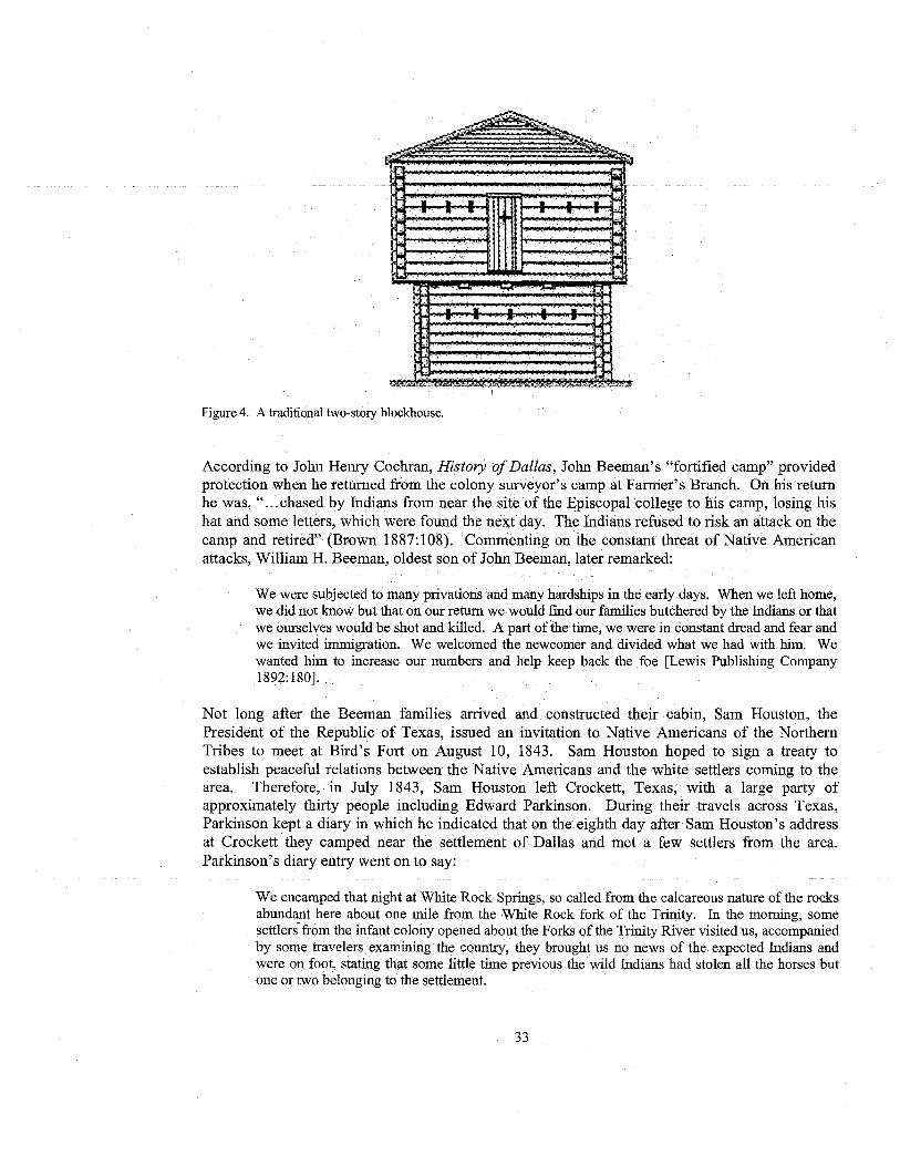
Figure 4. A traditional two-story blockhouse.
According to John Henry Cochran, History of Dallas, John Beeman's "fortified camp" providedprotection when he returned from the colony surveyor's camp at Farmer's Branch. On his returnhe was, "...chased by Indians from near the site of the Episcopal college to his camp, losing hishat and some letters, which were found the next day. The Indians refused to risk an attack on thecamp and retired" (Brown 1887:108). Commenting on the constant threat of Native Americanattacks, William H. Beeman, oldest son of John Beeman, later remarked:
We were subjected to many privations and many hardships in the early days. When we left home,we did not know but that on our return we would fmd our families butchered by the Indians or thatwe ourselves would be shot and killed. A part of the time, we were in constant dread and fear andwe invited immigration. We welcomed the newcomer and divided what we had with him. Wewanted him to increase our numbers and help keep back the foe [Lewis Publishing Company1892:180].
Not long after the Beeman families arrived and constructed their cabin, Sam Houston, thePresident of the Republic of Texas, issued an invitation to Native Americans of the NorthernTribes to meet at Bird's Fort on August 10, 1843. Sam Houston hoped to sign a treaty toestablish peaceful relations between the Native Americans and the white settlers coming to thearea. Therefore, in July 1843, Sam Houston left Crockett, Texas, with a large party ofapproximately thirty people including Edward Parkinson. During their travels across Texas,Parkinson kept a diary in which he indicated that on the eighth day after Sam Houston's addressat Crockett they camped near the settlement of Dallas and met a few settlers from the area.Parkinson's diary entry went on to say:
We encamped that night at White Rock Springs, so called from the calcareous nature of the rocksabundant here about one mile from the White Rock fork of the Trinity. In the morning, somesettlers from the infant colony opened about the Forks of the Trinity River visited us, accompaniedby some travelers examining the country, they brought us no news of the expected Indians andwere on foot, stating that some little time previous the wild Indians had stolen all the horses butone or two belonging to the settlement.
33

Nacogdoches hoping to create a new county with the seat being in Dallas. Upon arriving inNacogdoches, Bryan was not sure how to proceed. He returned home and organized a meetingwhere the men of the area voted John Beeman as the representative of their proposed county(Rogers 1951). Beeman then traveled to Austin to meet with the legislature there, and after aseries of problems, the representative for Robertson County gave Beeman his assistance. At theconclusion of the session, John Beeman was able to return to Dallas with assurances from theRobertson County Representative that all was well John Beeman's oldest son, William, thenroad the 140 miles to Franklin, the seat of Robertson County, to ` obtain a court order for thecreation of Dallas County, with the town of Dallas being designated as the temporary seat (Brown1887). He later reminisced about the trip saying,
I rode a mustang and went alone. It was an Indian country then, and the trip was attended withconsiderable risk. 'I camped out each night. When I was returning home one night on the otherside of Richland creek, I saw a herd of buffaloes [Lewis Publishing Company 1892:179].
After John Beeman passed away, in the early 1850s, the property was given to his daughter,Margaret Beeman, who at the age of 16 had married John Neely Bryan. Around 1885, MargaretBeeman sold, the property to Edward Case Pemberton a relative of Gideon Pemberton, one of thefirst settlers of Dallas County (Billingsly, 2006; Pemberton 2006).
Pemberton Ownership
Most of the information presented below on the Pemberton family and their ownership of theproperty was gathered from interviews with Bill Pemberton and Lois Billingsly. Bill Pembertonis the grandson of Edward Case Pemberton while Lois Billingsly is the great-granddaughter ofEdward Case Pemberton (also referred to more simply as Case' Pemberton).
Although the relationship between Case and Gideon Pemberton is unknown, Lois Billingsly,based on family research, believes that he was the cousin or nephew of Gideon and that he movedhere from Illinois sometime in the late 1800s. Gideon is listed as moving to the area, andworking as a wagon maker before 1848, while Case Pemberton is listed as a farmer in 1881(Brown 1887:89; Cochran 1928:171). Case Pemberton chose to purchase the Beeman property in1885 because of the springs located on the property (Billingsly 2006). The springs, known at thattime as Big Springs, was ideal for Case Pemberton's dairy farming operation. He would takebuttermilk into town by wagon and sell it for five cents a gallon. He also owned a mercantilestore near his farm where he sold a variety of goods. It is unclear whether Case Pemberton livedin the Beeman cabin before he constructed his own; however, Case later told his family that all ofhis children were born in a log cabin except for his youngest son, Edward (Pemberton 2006).During the interview with Lois Billingsly, she stated that Case had built a home on the propertybut it was later torn down (Billingsly 2006).
Case married three times; his first wife died in childbirth in Illinois. After she passed away, Casemarried her cousin, Katherine. They had three children Claude, Fred, and Hubert. WhenKatherine passed away, Case again remarried, this time to a woman named Elizabeth and hadfour more sons, Luther, Oliver, Otto, and Edward (Billingsly 2006; Pemberton 2006).
35
Summary
The project area investigated was originally associated with early Dallas County settlers', mainlytwo half-brothers (John Beeman and James J. Beeman), John Neely Bryan, and Edward CasePemberton. It is assumed the Beeman's constructed a blockhouse on this property, which was thesecond cabin built in Dallas County and was architecturally unique to the area. There are journalsindicating circurnstancial evidence supportive of the notion that Sam Houston stopped at JohnBeeman's cabin on his way to Bird's Fort in 1843; however, there is neither conclusive proof ofSam Houston camping on or near John Beeman's property, nor is there any archival evidence'indicating the Sam Houston Spring Project area is in fact the actual location of the Beeman cabin.
It has been documented through interviews and research that the land was sold by MargaretBeeman to Edward Case Pemberton. Upon his death, his land was inherited by his seven sons.The project area was eventually sold to Larry Koehler who transferred ownership to the City ofDallas in 2004. The property has been used as the base for several different industries includingfarming, dairying, cattle grazing, gravel mining, and most recently horse pasture.
ARCHAEOLOGICAL INVESTIGATIONS
The majority of the project area is situated in Area A or is part of the flood plain of the WhiteRock Creek and an unnamed but recently modified intermittent stream, herein referred to as theCity of Dallas 60' Wide Easement. The major focus of the survey was within Area B located eastof the City of Dallas 60' Wide Easement beginning along the terrace edge and rising into theuplands. The soils were extremely compacted and dry during the initial survey due to the severedrought conditions, with large cracks observed in the flood plain deposits and smaller cracksobserved on the terrace and uplands. The region did receive a significant rainfall, after whichadditional survey was conducted in the areas initially identified as possessing intact soils. Thesurvey results of both instances are herein discussed by area (e.g., Area A and Area B, see Figure3), with archaeological sites, localities and associated artifacts recovered during survey discussed.
Area A
Area A begins at the western most boundary of the project area and terminates at the westernboundary of the City of Dallas 60' Wide Easement (see Figure 2). The area is entirely composedof flood plain or alluvial deposits called Trinity clays (USDA 1908:36). There is a slight rise inthe center of this location, which coincides with the southern portion of an area actively cultivated(Figure 5). A transect of shovel tests was placed along the southernmost edge of this area nearthe Dallas Power and Light corridor in an attempt to get a better understanding of the nature ofthe slight rise and the deposits. These shovel probes were conducted in a west to east fashionrunning along the southern boundary. The transect of shovel tests concluded at the edge of theforest demarcating the western boundary ofthe City of Dallas 60' Wide Easement. The shoveltests indicated the presence of alluvial soils to the depth of 56 cm bs. The shovel tests failed toprovide any significant evidence to explain the origins of the observed topographic rise in AreaA.
37

Figure 6. Area A: accumulation of tires.
AREA D
Area B begins east of the vegetation associated with the City of Dallas 60 Wide Easement(Figure 7). Area B extends to the east by first opening into a cleared portion of the flood plain,and then, quickly gives way to the toe slope of the terrace (Figure 8). The terrace then risestwenty feet and begins to become more level upon reaching the edge of the uplands at the easternmost edge of the project area (Figure 9). The soils in Area B are dominated by arent, loamy, hillyremnants of mining operations, but despite the extensive disturbance there were four locations ofintact deposits. These four locations include a southern topographic high demarcated by one lonemesquite tree (Figure 10), a low terrace in the northeast near the present Rodriquez propertyboundary (Figure 11), the eastern upland near the Pemberton property boundary (Figure 12), andthe area immediately around the largest trees near the springs (see Figure 12).
Area B is the area with the highest potential of y ielding significant cultural materials. The areawas reported to contain the majority of the formerly identified archaeological site 41DL72. Itwas also the proposed location for theBeeman cabin, one of the-first homes constructed in thearea and owned by some of the founders of the City of Dallas. The Beeman cabin is also rumoredto have been a way station for Mr. Sam Houston's entourage during his expedition to negotiate atreaty with Native Americans at Fort Bird in 1843 (see Figure 3). The investigations of Area Bdiscovered materials associated with the archaeological site 41DL72, but failed to identify anyevidence of the Beeman cabin.
39
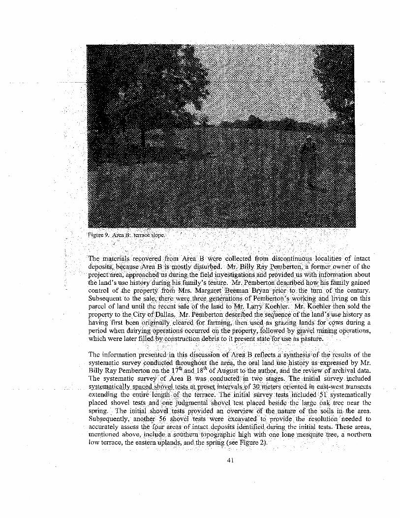
Figure 9. Area B: terrace slope.
The materials recovered from Area B were collected from discontinuous localities of intactdeposits, because Area B is mostly disturbed. Mr. Billy Ray Pemberton, a former owner of theproject area, approached us during the field investigations and provided us with information aboutthe land's use history during his family's tenure. Mr. Pemberton described how his family gainedcontrol of the property from Mrs. Margaret Beeman Bryan prior to the turn of the century.Subsequent to the sale, there were three generations of Pemberton's working and living on thisparcel of land until the recent sale of the land to Mr. Larry Koehler. Mr. Koehler then sold theproperty to the City of Dallas. Mr. Pemberton described the sequence of the land's use history ashaving first been originally cleared for farming, then used as grazing lands for cows during aperiod when dairying operations occurred on the property, followed by gravel mining operations,which were later filled by construction debris to it present state for use as pasture.
The information presented in this discussion of Area B reflects a synthesis of the results of thesystematic survey conducted throughout the area, the oral land use history as expressed by Mr.Billy Ray Pemberton on the
17th and 18 `x' of August to the author, and the review of archival data.
The systematic survey of Area B was conducted in two stages. The initial survey includedsyste atically spaced shovel tests - at preset intervals of 30.. meters_oriented.in_ east-west transectsextending the entire length of the terrace. The initial survey tests included 51 systematicallyplaced shovel tests and one judgmental shovel test placed beside the large oak tree near thespring. The initial shovel tests provided an overview of the nature of the soils in the area.Subsequently, another 56 shovel tests were excavated to provide the resolution needed toaccurately assess the four areas of intact deposits identified during the initial tests. These areas,mentioned above, include a southern topographic high with one lone mesquite tree, a northernlow terrace, the eastern uplands, and the spring (see Figure 2).
41

• Positive shovel test T Well
O Negative shovel test Walnut tree
O Disturbed shovel test LI Project boundary
0 20 40 60 N
Feet
Source: TerraServer0 10 20 Meters Urban Area, 2001
4
^ ^ _ _ • ^^^^__^^ U. fluLl4 l IIuv I LcSLS IIlu1eaLeu oy I 'i I ) ana intensive shovel tests (number only) hi i.heNorthern Low Terrace area.
43

Prior to the discussion of archaeological site 41DL72 and the four formerly identified locations ofintact soils, the historic disturbances in Area B need to be discussed, because these activitiesimpact the entire site area. These activities were described to us by Mr. Billy Ray Pemberton,indicated in the aerial photograph and corroborated by the initial shovel tests. The floodplain areawas described by Mr. Pemberton as being disturbed by activities undertaken by the Army Corpsof Engineers when they realigned the unnamed intermitted stream and created a corridor for asewer line (Figure 13). The initial project design was reportedly going to adversely impact thespring, but Mr. Pemberton with the assistance of other interested members of the publicnegotiated to have the construction pushed further to the west. The end result of these activities isthat the majority of the property located within the floodplain near the foot of the terrace has beendisturbed by recent modifications, and shovel tests in this area confirmed this assessment.
Figure 13. Area B: capped sewer.
Additional large scale alterations to the landform was described by Mr. Pemberton as beingassociated with gravel mining operations undertaken by his uncle in the mid-1900s. Mr.Pemberton mentioned the majority of the terrace in the project area beginning near the spring andcontinuing- to the eastand southeast had been mined for gravel. He described how only the areasconsisting of the topographical high in the southern portion where one lone mesquite treepresently stands, the low northern terrace along the western boundary of the present Rodriquezproperty, and part of the area upslope to the east near the present western boundary of hisproperty were spared from the mining operations.
45
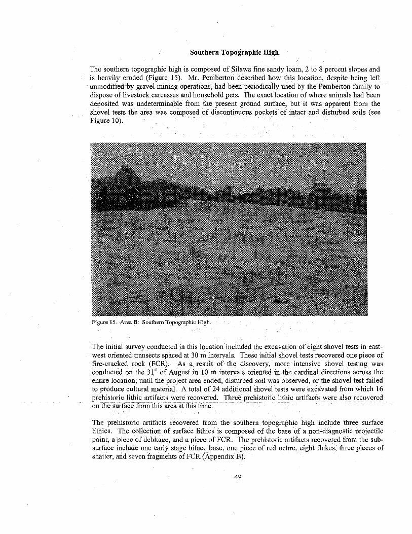
Southern Topographic High
The southern topographic high is composed of Silawa fine sandy loam, 2 to 8 percent slopes andis heavily eroded (Figure 15). Mr. Pemberton described how this location, despite being leftunmodified by gravel mining operations, had been periodically used by the Pemberton family todispose of livestock carcasses and household pets. The exact location of where animals had beendeposited was undeterminable from the present ground surface, but ` it was apparent from theshovel tests the area was composed of discontinuous pockets of intact and disturbed soils (seeFigure 10).
Figurr 1.'. Area B: Southern Topographic High.
The initial survey conducted in this location included the excavation of eight shovel tests in east-west oriented transects spaced at 30 m intervals. These initial shovel tests recovered one piece offire-cracked rock (FCR). As a result of the discovery, more intensive shovel testing wasconducted on the
31st of August in 10 in intervals oriented in the cardinal directions across the
entire location; until the project area ended, disturbed soil was observed, or the shovel test failedto produce cultural material. A total of 24 additional shovel tests were excavated from which 16prehistoric lithic artifacts were recovered. Three prehistoric lithic artifacts were also recoveredon the surface from this area at this time.
The prehistoric artifacts recovered from the southern topographic high include three surfacelithics. The collection of surface lithics is composed of the base of a non-diagnostic projectilepoint, a piece of debitage, and a piece of FCR. The prehistoric artifacts recovered from the sub-surface include one early stage biface base, one piece of red ochre, eight flakes, three pieces ofshatter, and seven fragments of FCR (Appendix B).
49

Figure 17. Area B: 1934 concrete well head in the Northern Low Terrace.
51
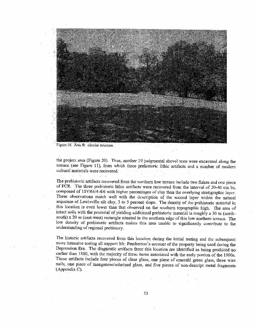
a lrui tom. £ i a 1J. L L%,U1a1 JL!ULiLUCC.
the project area (Figure 20). Thus, another 19 judgmental shovel tests were excavated along theterrace (see Figure 11), from which three prehistoric lithic artifacts and a number of moderncultural materials were recovered.
The prehistoric artifacts recovered from the northern low terrace include two flakes and one pieceof FCR. The three prehistoric lithic artifacts were recovered from the interval of 20-40 cm bs,composed of 1 OYR4/4-4/6 with higher percentages of clay than the overlying stratigraphic layer.These observations match well with the description of the second layer within the naturalsequence of Lewisville silt clay, 3 to 5 percent slope. The density of the prehistoric material inthis location is even lower than that observed on the southern topographic high. The area ofintact soils with the potential of yielding additional prehistoric material is roughly a 30 m (north-south) x 20 m (east-west) rectangle situated in the southern edge of this low northern terrace. Thelow density of prehistoric artifacts makes this area unable to significantly contribute to theunderstanding of regional prehistory.
The historic artifacts recovered from this location during the initial testing and the subsequentmore intensive testing all support Mr. Pemberton's account of the property being used during theDepression Era. The diagnostic artifacts from this -location are identified as being produced noearlier than 1880, with the majority of these items associated with the early portion of the 1900s.These artifacts include four pieces of clear glass, one piece. of emerald green glass, three wirenails, one piece of manganese/solarized glass, and five pieces of non-descript metal fragments(Appendix C).
53

The Spring Complex is ringed by a combination of drainage ditches incorporating white PCPculverts of 8" diameter or greater, and soil revetments (Figure 22). It is unclear the function ofthis construction, but regardless, regular maintenance of the Spring Complex is evident from thecombination of these materials.
There is also a large trash pile on the southern edge of the Spring Complex (Figure 23). = The trashpile, or more likely burn pile, consists of a large tractor tire, tree trunks and other modern debris.The area is assumed to be periodically burned, based on the presence of large piles of ash,charcoal and burned earth..
There is a large oak tree with a diameter of at least 5', near the center of the Spring Complex(Figure 24). The exact age of the tree is undetermined, but it is estimated to be 150-200 yearsold. Mr. Pemberton described how the area around the large oak tree had been left undisturbedduring graveling operations, as a conservation effort and attempt to appease family membersunsupportive of the decision to mine the terrace.
Mr. Pemberton also remarked the spring had been dredged a number of times by himself andother members of his family. He and others reportedly dredged up such materials as wagonwheels and other early historic artifacts from the depths of the springs. When asked where thesematerials were presently located, Mr. Pemberton could not recall.
55

Figure 24. Area B: large oak tree in Spring Complex,
Mr. Pemberton also recounted an old story he was told of how the bedrock around the springswas modified by Native People. He said it was rumored Native Peoples hollowed out basins inthe limestone bedrock to allow for the impoundment of water, after these impoundments filledwith spring water the Native Peoples would then dip pottery vessel into them, collecting water totransport for use elsewhere. The local bedrock was unobservable during the time of this survey,thus this oral tradition is unsubstantiated.
Four systematically placed shovel tests and one judgmental shovel test were initially excavated inand around the spring (see Figure 12). These tests indicated the soil was mostly fill, except forthe location near the large oak tree, which was intact but yielded no cultural materials.Subsequent testing included the excavation of five additional judgmental shovel tests, all ofwhich were disturbed except for one (see Figure 12). The eastern most shovel test indicated anintact stratigraphic sequence, but failed to produce any cultural materials. The shovel test wasplaced next to an old rotting pecan tree trunk. Thus, it appears that the entire area springscomplex is disturbed, except for those areas immediately surrounding the largest and oldest trees.
57

There are many different speculations on the original location of the Beeman cabin, but we doknow the following about this particular location of the Sam Houston Springs Project area. Mr.Pemberton described the land use history of this location as being the starting point for the fillingin of the gravel pit. He stated the contractors working on repairing Pennsylvania Avenueroceeded with his- - ennission to hum the construction waste -into the avet it First -the "p p p p y
would dump the materials onto the ground, and then use a bulldozer to push the materials into theopen pit, until eventually the entire pit was filled. Thus, if there were intact deposits in this areaprior to the filling of the gravel pit, they were subsequently scraped into the gravel pit. Theobservations made in the field support this claim, because of the area not observed to be directfill, a weak to heavily eroded topsoil was observed throughout the majority of this location.
Mr. Pemberton also described a turn of the century dairying operation on the property at or nearthis location. There were a number of fragments of broken crockery, assumedly used to holdmilk, scattered on the surface near the fence line between his property and the project area. Therewas also a fragment of a machined brick with the letters "EN" located at the fence line. Theseartifacts were not recovered as they were positioned on Mr. Pemberton's present property and notfully contained with the project area, but they support the presence of an early dairying operation.
The initial survey of the area included five shovel tests (see Figure 12). The majority of theseshovel tests indicated disturbed deposits or areas of fill. The shovel test T4ST2 indicated a weaktopsoil of less than 5cm in thickness and produced artifacts of recent historic origins. Twoadditional shovel tests were conducted along the fence line to clarify the nature of the deposits inthis area. This location through the processes of access road building, gravel mining and fillinghas been largely disturbed. There are pockets of good soil near the fence line, but the majority ofthese soils seem to rest in the western edge of the current Pemberton property.
The artifacts recovered from the eastern uplands include one piece of clear glass, an ash tintedglass fragment, and olive tined glass fragment, two pieces of non-descript metal, and one non-descript glass fragment. The olive tinted glass fragment is potentially associated with the 1700s,and therefore could be related in time to the Beeman cabin. It is considered to be highly unlikelythough, given the fact, the other materials recovered from this location are no earlier than 1880(Appendix C).
The eastern uplands is the origin point for the filling in of the gravel pit, which means through acombination of machine track disturbance and scraping activities the majority of the topsoils havebeen either removed or disturbed. There are some intact soils near the fence forming theboundary between the Pemberton's property and the project area. The majority of these artifactsare attributable to circa 1900 or later, and likely represent wash eroding down from thehistorically known buildings uphill on the Pemberton property. Therefore it is recommended thislocation is unable to provide any additional evidence toward the understanding of the history ofthe area.
59

CHAPTER 6SUMMARY AND RECOMMENDATIONS
The cultural resources investigation documented in this report was undertaken with three primarymanagement goals in mind:
1 to locate all historic and prehistoric cultural resources occurring within the designatedproject area;
2. to evaluate the significance of these resources in regard to their potential for inclusion inthe. NRHP or for designation as a SAL; and
3. to make recommendations for the treatment of these resources in relation to the proposedundertaking, based on their NRHP evaluations.
NATIONAL REGISTER OF HISTORIC PLACES CRITERIA
The assessment of significance of cultural resources properties is based on federal guidelines.The criteria to evaluate properties for inclusion in the NRHP are codified under the authority ofthe National Historic Preservation Act of 1966, and the, Advisory Council on HistoricPreservation has set forth the following regulations to define the significance and to determineeligibility of cultural resources:
The quality of significance in American history, architecture, archeology, engineering, and culture ispresent in districts, sites, buildings, structures, and objects that possess integrity of location, design,setting, material, workmanship, feeling, and association and
(a) ` that are associated with events that have made a significant contribution to the broad patternsof our history; or
(b) that are associated with the lives of_ persons_ significant in.our past; or(c) that embody the distinctive characteristics of a type, period, or method of construction, or that
represent the work of a master, or that possess high artistic values, or that represent asignificant and distinguishable entity whose components may lack individual distinction; or
(d) that have yielded or may be likely to yield, information important in prehistory or history [39CFR Part 60].
61

the central portion of the site. One of these locations is referred to as a southern topographic highand the other is situated in the center of a low terrace north of the spring. There were nodiagnostic materials recovered from either location, but both locations produced insitu culturalmaterials and possess deposits with the potential of providing additional data. The densities ofthe material recovered from these two locations and lack of diagnostic materials make it highlyunlikely these areas will produce materials with the ability to assist in the understanding ofregional prehistory. Thus, this archaeological survey recommends that no further formal testingof these two areas needs to occur, nor is the site eligible for inclusion into the NRHP.
The historic component of the northern low terrace supports the claim made by Mr. Pembertonthat his family utilized the area during the Depression Era. Based on the observations madeduring the survey, the land use history told by Mr. Pemberton, and the relative recent origins ofthe cultural material recovered, it is recommended that the historical component of this terracecontains no additional information relevant to our understanding of historic developments in thisarea and is therefore recommended as ineligible for inclusion in the NRHP or designation as aSAL.
There was no archeological evidence recovered to substantiate the location of the Beeman cabin.Several proposed locations were examined in great detail including the eastern portion of theproject area, in and around the spring, and two groves of pecan trees. These locations are mostlydisturbed as a result of gravel mining operations, and failed to produce cultural materialsattributable to the Beeman cabin. The only location with a potential to yield evidence lies alongthe eastern edge of the project area, just inside of the western edge of the present Pembertonproperty, but at present this remains outside the scope of this report. Thus, it is therecommendation of this survey there is no longer any evidence relating to the original Beemancabin present within the project area, if it existed here at all.
Historic and archival sources were synthesized in order to more clearly understand themovements of Sam Houston while making his journey through this area. While historic sourcesoffer tantalizing suggestions of the events and places associated with this journey, the preciseidentities of people and places involved are inconclusive. Our reconstruction of the Sam Houstontrip to north central Texas suggests that Sam Houston's party never visited this property. It isrecognized that the reliability of historic sources and the relocation of historic landmarksmentioned in historic accounts is often challenging at best. In this case, however, thediscrepancies between Parkinson and J.J. Beeman's accounts, the fact that the Houston party hadalready crossed White Rock Creek before being greeted by the colonists, and all colonists (withthe exception of Bryant) remain anonymous in Parkinson's account suggest that no conclusiveevidence supports the contention that Sam Houston's party visited this property. Historical datasupporting the presence of a cabin on this property in 1843 is also lacking.
In summary, the result of the archaeological inventory for the Sam Houston Springs propertyindicates two small sections of site 41DL72 remain intact. These two locations are composed ofextremely low density areas with limited ability to provide additional important to anunderstanding of the prehistory of the region. There were historical materials recovered withinthe project area, but these are of either modern association or attributable to known outbuildingspreviously constructed on the property, and are therefore considered to be ineligible for inclusionin the NRHP or designated as a SAL. Therefore, the archeological properties within the SamHouston Springs project area are deemed ineligible for inclusion in the NHRP or for designationas a SAL.
63

REFERENCES CITED
Acheson, S.1977 Dallas Yesterday. JNO. E. Owens Memorial Foundation Publication, SMU Press,
Dallas, Texas.
Beeman, J. J.1886 Memoirs of James J. Beeman. On file, Texas/Dallas History and Archives Division,
Dallas Public Library.
Brown, J. H.1887 History of Dallas County, Texas: From 1837 to 1887. Milligan Cornett & Farnham,
Printers.
Census RecordsVarious Census Records cover dates from 1850 to 1920. On file, Texas/Dallas History
and Archives Division, Dallas Public Library.
Civil War Field Fortifications Digital Research Library2004 "Blockhouse." Civil War Field Fortifications Dictionary.
<http://civilwarfortifications.com/dictionary/xgb-017.html> August 30.
Cochran, J. H.1928 Dallas County A Record of its Pioneers and Progress Early Settlers and Their
Families. Arthur S. Mathis, Dallas, Texas.
Dallas County Deed RecordsVariousDeed records cover 2004. On file, County Records Building, Dallas.
Dallas Daily Harold(On file, Texas/Dallas History and Archives Division, Dallas Public Library)
1949 Settlers' Descendants Reclaim Old Cemetary
65

Toyer, M. C.200 "Bryan & Houston." Dallas History Message Board <http://www.dallashistory.org/
cgi-bin/webbbs_config.pl?noframes;read =4536> November 8.
ObituariesBeeman, Scott
1929a Death Claims Scott Beeman. On file, Dallas Historical Society.
1929b Last Member of First Family in Peters' Colony, Now Dallas, Will Go to Grave NearHome. On file, Dallas Historical Society.
1929c Same Plot His Home 88 Years, Scott Beeman, Son of First White Woman in County,Dies. On file, Dallas Historical Society.
1929d The Youth of Dallas. On file, Dallas Historical Society.
InterviewsBeeman, Scott. Dallas, Texas. April 14-27, 1927. by Sarah Horton Cockrell. On file, Dallas
Historical Society.
Billingsly, Lois. September 5, 2006. Phone Interview by Natalie Thomas.
Pemberton, Billy Ray. August 22, 2006. Interview at 911 Pemberton Hill Road Dallas, Texas byMarsha Prior and Natalie Thomas.
67

APPENDIX A
DETAILED SHOVEL TEST INFORMATION

The following table indicates the evidence observed during shovel testing of the Sam HoustonSprings cultural survey. The table is separated into locations corresponding with the discussionsin Chapter 5 of this report. The locations are then further subdivided the time periods when theshovel tests were conducted. The initial shovel tests were conducted on the 16 th and 17 th ofAugust under severe -drought conditions. These shovel tests confirmed the locations of intactdeposits and recovered limited cultural materials. The subsequent, intensive shovel tests wereconducted after a significant precipitation on the 31 St of August and the 6 th of September. Thesetests were conducted to delineate the archaeological site 41DL72, and to further probe forevidence of the Beeman cabin.
The table provides information relating to the depths per shovel test, depth when sub-soils wereobserved, and a summary of the presence or absence of cultural materials. The design of thistable allows the observer to access general stratigraphic and artifactual information based onlocality. If the reader would like to know the detailed information about the cultural materialobserved in a specific shovel test, then the reader needs to review Appendix B for prehistoricmaterials or Appendix C for historic materials.
A-3

Geo-Marine, Inc.Cultural Resources Survey of the Sam Houston Springs Project Area GMI# 30428.00.03
Detailed Shovel Tests Information(N.C. = not collected in field, Dist. = disturbed)
Page: 1
Site and Shovel Depth Depth to Artifacts Recovered by level (cm below surface)Test (ST) Number (cm) clay (cm) 0-20 21-40 41-60 61-80
Site 41DL72 — Southern Topographic HighInitial Shovel Tests
Trans #1 ST #4 18 -- No -- -- --Trans #1 ST #5 10 -- NoTrans #1 ST #6 20 -- No - -Trans #1 ST #7 20 -- Dist. -Trans #1 ST #8 23 -- No No -- --Trans #2 ST #5 10 -- Dist. -- -- --Trans #2 ST #6 15 -- YesTrans #2 ST #7 10 -- No -- - --
Intensive Shovel TestsST #1 40 40 No Yes -- --ST #2 40 34 Yes Yes -- --ST #3 40 -- No Yes -- --ST #4 34 26 Dist. Dist. -- --ST #5 43 No Yes -- --ST #6 14 Surface Dist. -- -- --ST #7 24 21 Yes No -- --ST #8 26 20 Dist. Dist. -- --ST #9 30 20 Dist. Dist. -- --ST #10 24 13 Dist. Dist. -- --ST #11 30 12 No No -- --ST #12 22 14 Yes No -- --ST #13 23 16 No No -- --ST #14 30 20 Dist. to No --
20cm bsST #15 37 -- Dist. Dist. -- --ST #16 26 20 Dist. to No -- --
15cm bsST #17 30 22 Dist. Dist. -- --ST #18 24 16 Yes NoST #19 29 20 Dist. Dist. -- --ST #20 30 20 Yes No -- --ST #21 25 13 Yes No -- --ST #22 36 -- Dist. to No -- -
28 cm bsST #23 29 Surface Dist.ST #24 50 -- Dist. Yes - Dist. Dist. --
Site 41DL72 — Northern Low TerraceInitial Shovel Tests
Trans #5 ST #1 30 -- Yes (N.C.) No -- --Trans #5 ST #2 25 -- No No -- --
Trans #6 ST #1 10 -- Dist. -- -- --Trans #6 ST #2 25 -- Yes -- -- --
A-5

Geo-Marine, Inc.Cultural Resources Survey of the Sam Houston Springs Project Area GMI# 30428.00.03
Detailed Shovel Tests Information(N.C. = not collected in field, Dist. = disturbed)
Page: 3
Site and Shovel Depth Depth to Artifacts Recovered by level (cm below surface)Test (ST) Number (cm) clay (cm) 0-20 21-40 41-60 61-80
Locality — Eastern UplandsInitial Shovel Tests
Trans #3 ST#1 27 -- No No -- -Trans #3 ST#2 20 -- Dist. Dist. -- --Trans #4 ST#1 15 -- No -- -- --Trans #4 ST#2 5 5 Yes -- -- --Trans #4 ST#3 25 -- Dist. Dist. -- --
Intensive Shovel TestsST #1 35 -- Dist. Dist. -- --ST #2 32 28 No Yes -- --ST #3 25 16 Yes No -- --
I:dl

DEFINITIONS OF LITHIC ARTIFACT ANALYSIS TERMS,CLASSES OF CHIPPED STONE ARTIFACTS
COLLECTED DURING THE PROJECT,AND SUMMARY TABLE OF ARTIFACTS