rjw cartography reflections
TRANSCRIPT
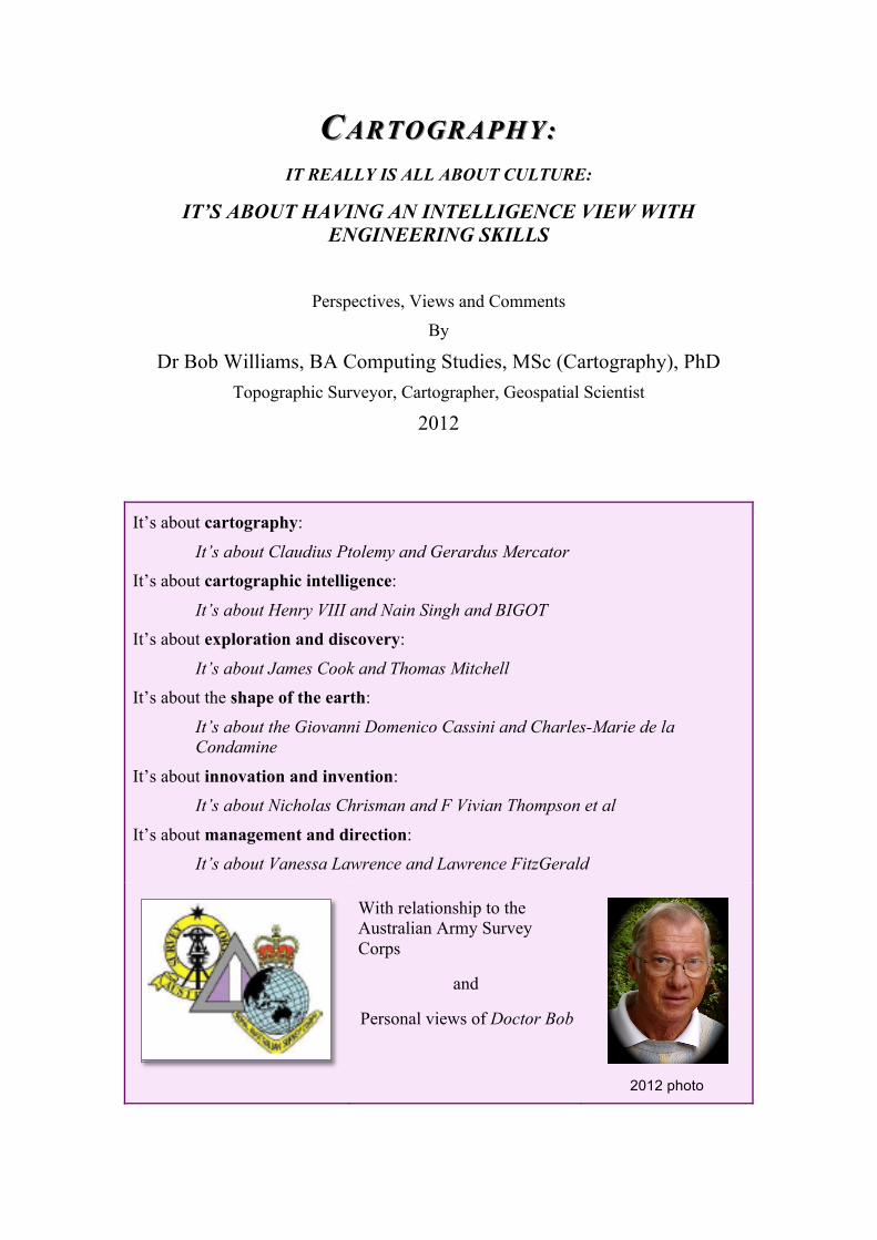
CC ARTOGRAPHY:ARTOGRAPHY:
IT REALLY IS ALL ABOUT CULTURE:
IT’S ABOUT HAVING AN INTELLIGENCE VIEW WITH
ENGINEERING SKILLS
Perspectives, Views and Comments
By
Dr Bob Williams, BA Computing Studies, MSc (Cartography), PhD
Topographic Surveyor, Cartographer, Geospatial Scientist
2012
It’s about cartography:
It’s about Claudius Ptolemy and Gerardus Mercator
It’s about cartographic intelligence:
It’s about Henry VIII and Nain Singh and BIGOT
It’s about exploration and discovery:
It’s about James Cook and Thomas Mitchell
It’s about the shape of the earth:
It’s about the Giovanni Domenico Cassini and Charles-Marie de la
Condamine
It’s about innovation and invention:
It’s about Nicholas Chrisman and F Vivian Thompson et al
It’s about management and direction:
It’s about Vanessa Lawrence and Lawrence FitzGerald
With relationship to the
Australian Army Survey
Corps
and
Personal views of Doctor Bob
2012 photo

2
It’s about INNOVATION and INVENTION:
It’s about Nicholas Chrisman and F. Vivian Thompson et al.
NICHOLAS CHRISMAN
• Geographer
• Mathematician
• A legend in the field of geographic
information systems
2005 photo
Nick Chrisman has been Professor of Geomatics Sciences at the Université Laval
since January 2005. His main assignment is to serve as Scientific Director of the
GEOIDE Network, a Network of Centres of Excellence.
His research has concentrated on time in GIS, data quality testing and the social and
institutional aspects of GIS.
From 1987-2004 he was Professor of Geography at University of Washington.
From 1982-87 he was Assistant Professor in the Department of Landscape
Architecture at the University of Wisconsin-Madison. In this job, he participated in a
multidisciplinary team applying GIS to soil erosion planning. This project helped
provide the impetus for the Wisconsin Land Records Committee that led to the
current state-wide GIS program.
From 1972-82 he was a programmer at the Harvard Lab for Computer Graphics.
He participated in the design of prototype GIS software (ODYSSEY). The
ODYSSEY system was developed by a team the Laboratory for Computer Graphics
and Spatial Analysis at the Harvard Graduate School of Design starting in the mid-
1970s. A vector GIS that provided spatial analysis, ODYSSEY became a prototype
for modern GIS software – 1970s
His PhD is from the University of Bristol (UK) based on research on error and
statistics for categorical maps. For thirty years, his writing has tried to connect the
technical details of GIS to larger issues of philosophy and culture.
Personal reflections: the Royal Australian Survey Corps, CSIRO’s Bruce Cook, and the
Harvard connection
During 1983-85, I was an officer in the Royal Australian Survey Corps and was fortunate to be able to study at the University of Wisconsin (UW) at Madison in the USA for the award of Master of Science (Cartography).
Whilst at the UW I participated in several courses lectured by Nick Chrisman, who had recently arrived from Laboratory of Computer Graphics, Harvard University. In addition, being an Australian and having practical experience in digital mapping, Nick invited me to participate in working groups and forums, either as an observer or as a

3
student and to provide opinions on initiatives:
• Observer participant on the Dane County Land Records Project; • Observer participant on Working Group II of the U.S. National Committee for
Digital Cartographic Data Standards – known as the Data Quality; • Student on seminar program titled “The Modernisation of Land Records in
North America”; • Paper and presentation at Auto-Carto 7 Conference titled “Enquiry Systems
for the Interrogation of Infrastructure” in a Session titled “Digital Representation of Spatial Knowledge”.
Nick emailed “I have no doubts that Bob Williams had great ideas ahead of the crowd… Who
else would have demonstrated a hierarchical network path algorithm LIVE at AC7 (live on
an Apple II of course…)
From [email protected]
Date Wed, Jan 4, 1995 4:17 AM
My knowledge of Harvard’s work in GIS actually commenced a few years prior to me going to UW Madison.
During the period 1977-79 I was fortunate to be able to study at the Canberra College of Advanced Education for the award of Bachelor of Arts in Computing Studies (Cartography major). Whilst at the CCAE I participated in several courses lectured by Waldo (Wally) Wasserman. From my recollection Wally acquired a full set of Proceedings: First International Advanced Study Symposium on Topological Data Structures for Geographic Information Systems, Laboratory of Computer Graphics and Spatial Analysis, Harvard University, October 17-21, 1977 after a visit to Canberra by Tiecholz and Dutton.
Because I was in the Army I was ‘obligated’ to work through the academic breaks. During the period December 1978 – February 1979 I (then) SSGT Bob Williams, a member of the Royal Australian Survey Corps (RASVY), worked in collaboration with the Directorate of Engineers – Army, the Joint Exercise Planning Staff (JEPS), and Dr Joe Walker and his staff at CSIRO’s Division of Land Use Research to digitize terrain pattern maps
1 compiled by CSIRO and using software written by CSIRO’s Dr Bruce
Cook to form the basis of Trafficability Overprints for the Shoalwater Bay Training map. A series of overlays that showed GO-NO areas under a range of environmental conditions and a series of overlays that showed FIRE RISK areas were compiled for use by JEPS (Joint Exercise Planning Staff) but these were never published.
For information, Bruce was an Australian participant at the Harvard Symposium (mentioned above). Cook first developed a topological data structure for representation of plane region maps in 1967 at CSIRO’s Division of Land Research
2.
He gave a poster session at an international Land Evaluation Symposium in Canberra in 1968. Roger Tomlinson, the so-called ‘father of GIS’, was also there and invited Cook to join him on his Canadian Geographic Information System (CGIS) project in Ottawa where Cook developed a graphic input system for CGIS using manual tracing on a table digitizer.
So, I was, probably, one of the first technicians in the world to work on digital terrain analysis products for military applications.
1 Based on the South Coast Data Bank/Mapping System developed in CSIRO Division of Land Use
Research during 1978 for the CSIRO South Coast Project. The project had the aim of developing and
demonstrating a methodology for land use planning at a regional scale.
2 B.G.Cook (1967), “A Computer Representation of Plane Region Boundaries”, The Australian
Computer Journal, November 1967.

4
F. VIVIAN THOMPSON
• Royal
Engineers
EDGAR H.
THOMPSON
• Royal
Engineers
C. N.THOMPSON
• Royal
Engineers
H. HAMSHAW
THOMAS
• Royal Air
Force
Top Left
F. Vivian Thompson, LT RE 1880-1917
Top Right
Edgar H. Thompson 1910-1976
Bottom Right
H. Hamshaw Thomas, MBE, FRS, FLS 1885-1962
F. VIVIAN THOMPSON
In 1908 F. VIVIAN THOMPSON, a Captain in the Royal Engineers, invented a
stereo-plotter for terrestrial photographs, named “stereoplanigraph”. His concept was
a rigorous mathematical-mechanical solution employing a stereocomparator3.
Had its design been carried to completion, the instrument could have permitted
continuous plotting of map features; however, the proposal remained filed away and
unavailable for publication until 1974.
3 F.Vivian Thompson (1908). “Stereo-Photo Surveying”, The Geographical Journal, Royal
Geographical Society.
5
H. HAMSHAW THOMAS
During WWI HUGH HAMSHAW THOMAS served a Photographic Officer in the
Royal Flying Corps (RFC) in Europe and the Middle East. Captain H.H. Thomas of
the Royal Flying Corps conducted investigations on the Sinai that, by the start of
1918, had produced a workable system of mapping from aerial photographs. Thomas4
described his work at the Afternoon Meeting of the Royal Society, 12 January 1920.
“The system of stereo-surveying described by the late Colonel F.Vivian Thompson in
the Geographical Journal for 1908 is applicable with some modifications to air
photography”.
At first almost singlehanded, he was responsible for the mapping which enabled
General Allenby to direct his campaign against the Turks with such accuracy.
Not content, however, with the full-time job of a photographic officer, working under
the greatest difficulties, with the questing mind of the scientist Hamshaw Thomas was
impelled to search for more and more information in his photographs. His discoveries
of the best ways of doing this were some of the earliest efforts leading to the
development of the art and science of photographic interpretation. For his work
at this time he was twice mentioned in as being awarded the Order of the Nile.
After the war, when he returned to his academic career, his interest in aerial
photography persisted, and in 1920, when he delivered the Cantor Lectures before the
Royal Society of Arts, he took as his subject Aircraft Photography in War and Peace.
During the Second World War, he was a photographic interpreter (PI) at RAF
Medmenham with the rank of Wing Commander, where he worked on the
interpretation of aerial reconnaissance photographs. Whilst being shown around the PI
centre at Medmenham, after being at a meeting including Hamshaw Thomas,
afterwards, out of earshot, South African Prime Minister Jan Smuts turned to his
companion and said; "Do you know, that fellow" - (referring to Hamshaw Thomas) -
"is the world's leading palaeobotanist" - Smuts was a renowned botanist himself. As
"Chief of Third Phase Interpretation", in 1943 it was Hamshaw Thomas who was
responsible, along with his Army opposite number, Major Norman Falcon, for
initiating the Allied investigation of the German research centre at Peenemünde.
Personal reflections: the Australian Survey Corps, UK Ordnance / Military Survey and
Egypt
The evolution in thinking within British military circles by 1915, regarding the need for and best means of producing highly accurate operational maps, meant that it was not long before authorities in Australia altered their view about releasing survey personnel for active service abroad. The first surveyor to make the move was
4 H. Hamshaw Thomas, M.B.E., M.A., F.G.S., Captain R.A.F., Fellow of Downing College,
Cambridge, Geographical Reconnaissance By Aero-Plane Photography, With Special Reference To
The Work Done On The Palestine Front , Read at the Afternoon Meeting of the Royal Society , 12
January 1920

6
Warrant Officer Shiels. Shiels arrived in Egypt on 16 January 1916 and was attached to the Topographical Section that formed part of the Intelligence Branch at General Headquarters, Egyptian Expeditionary Force. He was promoted Lieutenant in December 1917 and played a commendable role in assisting Captain H.H. Thomas of the Royal Flying Corps in conducting investigations that, by the start of 1918, had produced a workable system of mapping from aerial photographs5
.
EDGAR H. THOMPSON
Great Britain’s survey institutions had refrained until about 1945 from participation in
the European modernization of surveying practices in the belief that the heavy
continental plotters could not meet the Empire’s requirements for small-scale
mapping in its colonial territories. The pioneering efforts of two outstanding British
surveyors, Henry Fourcade and F. Vivian Thompson, had therefore ended in
disappointment. After World War II, the world’s atlas was being considerably
revised, and British scientists and practitioners became energetic partners in the
photogrammetric community.
EDGAR H. THOMPSON, a graduate of the Royal Military Academy at Woolwich
and of Downing College in Cambridge, was research officer in the War Office Air
Survey Committee from 1934 to 1938. He then became assistant to Martin Hotine, the
author of “Stereoscopic Examination of Air Photographs”. In Hotine’s company,
Thompson became thoroughly acquainted with photogrammetry. In 1951 Thompson
became Professor of Photogrammetry at the University College, London, which was
the first academic chair in the country teaching science.
Among Thompson’s many contributions are: a series of publications on the evaluation
of aerial photographs; design of the first Barr & Stroud projection plotter; design of
Cambridge stereocomparator; and design of the Thompson-Watts Plotter, which
were used extensively used by the British Ordnance Survey.
His finest contributions were made to analytical (matrix algebra and procedural)
processes, reseau techniques, and aerotriangulation by the method of independent
models. He edited the British journal “Photogrammetric Record” for fourteen years.
The father of British photogrammetry
Edgar H. Thompson invented the Cambridge Stereocomparator in 1937
5 C.D. Coulthard-Clark, Australia’s Military Mapmakers, Oxford University Press, Melbourne, 2000

7
“The triangulation and aerial mapping, for instance, of what later became the
battlefield of El Alamein, ..owed much to his inventive mind and his manner of
presenting his ideas. As a consequence, when the subsequent battle was fought there,
photogrammetric methods of target location were immensely speeded up”.
In Memoriam, Photogrammetric Record 1976
Oct 1974: letter in response to editorial on Remote Sensing
‘Now it is quite legitimate to use photographs for interpretation and other
allied processes: and there is no reason why these activities should not be
pursued within photogrammetric societies: but this does not turn
interpretation into photogrammetry.’
Professor Thompson was an enthusiastic educator and a pioneer in his field6.
‘Thompson inspired a belief in old fashioned scholarship, a love of
elegance and beauty in mathematics and in language and a faith that every
problem has a solution, given sufficient thought.’
6 I was fortunate to study cartography under Waldo (Wally) Wassermann at the Canberra College of
Advanced Education). Wally loved calculus and covering his blackboard with equations. Wally also
believed in old fashioned scholarship, a love of elegance and beauty in mathematics and in language
and a faith that every problem has a solution, given sufficient thought.’

8
Reflections: the Australian Survey Corps, UK Ordnance / Military Survey
In 1961 University College London formed a Department of Photogrammetry and Surveying. The driving force in setting up this department was Edgar Hynes Thompson. Thompson was Professor of Photogrammetry and Surveying from 1951 to 1976 and Head of the Department of Photogrammetry and Surveying.
RASVY sent senior technicians (including WOs Jim Mitchell and Mick Dempster) circa 1970 to study photogrammetry at Summer Courses under Professor Thompson. One topic of interest was the computation of aerial triangulation-independent model method.

9
Reflections: the Australian Survey Corps, UK Ordnance / Military Survey
As a Corporal in RASVY in 1968 I became one of the earliest technicians in Australia to operate, under the direction of (then) WO1 Frank Bryant
7, a CAMBRIDGE stereo-
comparator. This instrument permitted accurate observations to be measured on aerial photography for the purpose of aero-triangulation of strips of photography. It was used as ‘proof of concept’ for analytical photogrammetry
8
and the production of point positioning datasets.
In 1974 I again worked with (then) LT Frank Bryant to experiment with digital stereophotogrammetric plotting. Frank had received permission to modify a WILD B8 stereo-plotter by adding a tri-axis locator and a mini-computer. This configuration enabled encoding topographic features (roads, rivers, contours, etc) in 3-dimensional [x, y, z] coordinates using stereo-photogrammetric techniques. The success of this experiment led to the acquisition, by the Royal Australian Survey Corps, of the first computer mapping system in Australia. I became the first technical supervisor of the Input Sub-System of the Australian Army’s AUTOMAP System in 1976.
I was the first technical supervisor of the Input Sub-System of AUTOMAP 1 and experienced difficulty in verifying exactly where plotting had been done. Scientists from WRE (Weapons Research Establishment) DSTO (Defence Science and Technology Organisation) visited Army Headquarters Survey Regiment at Bendigo to initiate a series of trials), WRE’s successor, Defence Research Centre, Salisbury, prototyped graphical superimposition of vector data through a WILD B8 stereoplotter. This invention was implemented on RASVY’s AUTOMAP II system (below) in 1984.
7 Frank Bryant was at the forefront of research into computer cartography at the Survey Regiment in
the 1960s and 1970s. In 1969, Francis Bryant was made a member of the Order of the British Empire
(MBE) for his services to photogrammetry.
8 Photogrammetry is the science and art of obtaining reliable measurements by means of photographs.

10
AUTOMAP II had numerous other innovations including raster scanning and plotting, ‘production quality’ output to photographic film on precision plotters (suitable for map publication using lithographic printing), and voice input for workstation operation. The project had many amendments to contract and (probably in early 1985) a decision was made (probably by Mat Br - Army) to remove the Relational Database Management System (RDMS) from the acquisition as a cost saving option. A Purchase Description for AUTOMAP III was written in 1986. Significant content was dedicated to describing “database design” issues and “areas of application”. The project was rejected by Mat Br – Army and this led to the initiation of Project PARARE.
C. N.THOMPSON
In 1986, MAJOR GENERAL C.N.THOMPSON, Director of Military Survey
UK,was instrumental in UK Military Survey’s transition towards a digital geographic
information capability.
He noted9 that “production of an increasing range of digital geographic products
requires that we:
a. identify and analyse the defence requirement for digital geographic
information.
b. design and develop appropriate digital products.
c. establish standards for the exchange of data and digital products.
d. develop and implement appropriate production capability, the "multi-product
operation".
When we talk of the defence requirement for geographic information we look
fundamentally at the terrain, and the impact that the terrain can have on military
operations. The terrain is not only the land surface but the natural and manmade
features on or beneath the surface. All these we can describe by attribute or attribute
value, and we can also add related military or air information pertinent to the conduct
of the battle. The schematic of the terrain in the Figure below illustrates this concept.
The military therefore requires knowledge about the terrain in one or more of the
following forms:
a. in descriptive form such as a map or display where the image is clear and
unambiguous to the human eye.
b. as discrete positional data, where the relationship established between two
points or a number of points is unambiguous, as in navigation systems or
elevation models
c. as relational terrain data, enabling its analysis and evaluation with other data
pertinent to the conduct of military operations.
The emerging applications for the use of digital geographic information can be
summarised under the following four headings:
9 In “Managing the Transition to Supporting the Production of Digital Geographic Products in Military
Survey”, Proceedings – Auto-Carto London, Volume 2, Digital Mapping and Spatial Information
Systems, September 14-19, 1986

11
a. Navigation and Guidance. The requirement here is for positional data and
map displays which support the navigation of the air or ground vehicle, and
which will be linked to the integral navigation system of the vehicle which
may include terrain referenced navigation systems.
b. Surveillance, Targeting and Weapons. The requirement in the first instance
is terrain data to support surveillance of the battlefield for the acquisition of
targets. Once identified the relative position of the target to the weapons
system must be determined. Additionally terrain data is required in planning
the siting of some weapons systems.
a. Command, Control and Communications. The state of the art in
information technology itself is driving this requirement for army and air force
command and control systems. The need extends from simple background
map displays to the sophistication of terrain analysis databases.
b. Training Simulators. The use of simulators for training (eg the Tornado
simulator for which DLMS was developed) offers better training at reduced
cost for many weapons systems and battle group trainers. The data required
includes elevation data, map displays and radar or visual simulation”.

12
Personal reflections: the Royal Australian Survey Corps, UK Military Survey, Australian
Defence Organisation
A draft version of Major-General Thompson’s paper was made available to the Director of Survey – Army in 1985 through the Five Nations MC&G (Mapping, Charting and Geodesy) Directors Forum.
In 1986, the Chief of the General Staff instituted a review of the Royal Australian Survey Corps. The officer selected for the task was Brigadier J.S.Baker, the Deputy Chief of Operations (DCOps) and one of the Army’s up-and-coming figures who within eight years would be Australia’s top soldier as Chief of the Defence Force. His terms of reference required him to examine the corps’ present and future role and tasks; analyse the capabilities it required; develop options for its size, structure, equipment, and manning; and recommend a course of action for any restructuring that included identified manpower savings. Soon afterwards Baker was promoted. Initially Baker took the review to his new job but it was subsequently realised that this was not practical and carriage was passed to his successor Brigadier J.K.Byrnes. Byrnes’ report, completed three months later, agreed that “changes should be made to planning for AUTOMAP 3 on the grounds that the need being met for a MULTI-PRODUCT DATABASE
10 within a GEOGRAPHIC INFORMATION SYSTEM was
essentially an ADF one, not simply an Army requirement, and on that basis he argues for PROJECT PARARE to be converted into a JOINT submission. __________________
In 1993 I researched and produced a report for the Australian Defence Organisation titled “Digital Geographic Information Exchange Standards and their Relevance to the Australian Defence Force”.
I used extracts from Thompson’s paper to introduce my report.
In its broadest terms, any information that can be indexed by geographic descriptors is considered to be Geographic Information. Such geographic descriptors are coordinate systems which fix the absolute (and relative) position of features. In universal terms, this is usually latitude and longitude or, in the Australian context, grid coordinates in the Australian Map Grid (AMG) system. A third dimension is usually provided by the height (or depth) of the feature. In this respect, the datum in Australia is the Australian Height Datum (AHD) or more simply mean sea level.
More simply, geographic information is that type of information that can be represented on a map, and, generally, the intent of a map is to show "what" and "where" things are. Maps describe "where" things are, both in relation to other nearby things and in relation to abstract coordinate systems. Maps describe "what" things are either through symbology or through text annotations.
Military geographic information
Military geographic information can be considered to be a part of the overall requirement for intelligence by the military, along with strategic and economic intelligence to assess the intentions of potential enemies and intelligence about an enemy's capabilities and equipment. The geographic information requirement can broadly be divided into three areas, namely:
Infrastructure information, primarily about man-made features but with a geographic location,
Terrain intelligence, primarily concerned with the natural features of the terrain, and
Environmental data, such as climate and weather.
10 A Multi-Product Database requires a topologically structured relational, or object-oriented,
database.

13
Up until now, the third area, that of environmental data, has not generally been included as a component in geographic information systems and, although it is recognised that this component will become important in the future, it will not be addressed further in this paper. Thompson (1986)
11 suggests that "when considering defence requirements for
geographic information, the knowledge of terrain and its impact on military operations is viewed as fundamental. The terrain is not only the land surface but the natural and man-made features on or beneath the surface; features which can be described with attributes pertinent in assessing the conduct of battle. The defence force therefore requires knowledge about the terrain in one or more of the following forms:
in descriptive form such as a map or display where the image is clear and unambiguous to the human eye;
as discrete positional data, where the relationship established between two points or a number of points is unambiguous, as in navigation systems and elevation models;
as relational terrain data, enabling its analysis and evaluation with other data pertinent to the conduct of military operations.
The emerging applications for the use of digital geographic information can be summarised as:
Navigation and guidance. The requirement is for positional data and map displays which support the navigation of an air or ground vehicle or sea vessel and which is linked to the integral system of the vehicle which may include terrain referenced navigation systems.
Surveillance, targeting and weapons. The requirement is for terrain data to support surveillance of the battlefield for the acquisition of targets. Terrain data is also required in planning and siting of some weapon systems.
Command, control and communications. The state of the art in information technology itself is driving this requirement for army and air force command and control systems. The need extends from simple background map displays to the sophistication of terrain analysis databases.
Intelligence. Military geographic information can be considered to be a part of the overall requirement for intelligence by the military, along with strategic and economic intelligence, to assess the intentions of potential enemies and intelligence about an enemy's capabilities and equipment".
In summary, geographic information, from a general defence perspective, also includes spatial data used in weapon systems, navigation systems or command, control, communications and intelligence systems. Many of these systems need data in a digital form. Further, in order, to populate the databases associated with the systems, data has to to be exported from data gathering systems and imported into the operational systems in 'standardised' formats. My report addressed the modelling of geographic information, issues concerned with exchange of digital geographic information, emerging exchange standards and a comparison of competing standards, the relationship of the initiatives to geographic information system technology, and the relevance to military digital data formats and systems requirements. The paper then makes recommendations and notes effects, ramifications and benefits.
11 At the time of writing his paper, Major General C.N.Thompson was Director of Military Survey,
Ministry of Defence, United Kingdom.
14
It’s about INNOVATION and INVENTION:
It’s about analysing the challenges of operational needs and applications.
It’s about embracing other scientific disciplines to invent new technological
solutions.
REFERENCES
Yolande Hodson and Alan Gordon, An Illustrated History of 250 Years of Military Survey, UK Military Survey Defence Agency, 1997
C.D.Coulthard-Clark, Australia’s Military Mapmakers, Oxford University Press, Melbourne, 2000
http://en.wikipedia.org/wiki/Hugh_Hamshaw_Thomas
www.flightglobal.com/pdfarchive/view/1962/1962%20-%201296.html