report on photo-interpretation of the yampi, charnley ... · o ams wee ou wok ies i eai, meio is...
TRANSCRIPT

COMMONWEALTH OF AUSTRALIA
DEPARTMENT OF NATIONAL DEVELOPMENT
BUREAU OF MINERAL RESOURCES GEOLOGY AND GEOPHYSICS
RECORDS:
1965/87
fGEO~H~S;~:ARt ct~~~~~ ~ ~ B ,w Ref .' , ... .... . ... ' ..... " ............................... . ............... .
REJPOR'l' ON PHClPO-IN'11@RPRJ';TAfl'Hfi'J' O!:i' tl'HJ,; YA!r;P[, CHARNLJiJY, PHINCE HI~GfW.\fT-OAj\m:ffil'J ~30Ui;f:O, MON'l'AGUill SOUND, ASWl'ON, '10KfDOND.81ffiY-DH.Yi3DAIE,
AND MOUj\j~:' bJLIZABE)'J.1lJ: 1 :250,000 SKH;H;'11 AR~;AS, Knm~JJ:n.rtY DIVISIOKf, WJ'JSTgH.N AUS'I:ftALIA.
----------------_._---_ .. -.',.,--
503001 by
W.J.Perry, R .Riohal\1., Bureau of Mine:t'al Reso1J.rco s. Imlti tut Francais du Petrole
NON· LENDING CO"
NOT TO' BE REMOVID FROM UIIWII
The information contained in this report has been obtained by the Department of National Development, as part of the policy of the Commonwealth Government, to assist in the exploration and development of mineral resources. It may not be published in any form or used in a company prospectus without the permission in writing of the Director, Bureau of Mineral Resources, Geology and Geophysics.

. .
REPORT ON PHOTO-INTERPRETATION OF THE YAMPI, CHARNLEY, PRINCE REGENT-CAMDEN SOU,ND,
MONTAGUE SOUND, ASHTON, LONDONDERRY-DRYSDALE, AND MT. ELIZABETH 1:250,000 SHEET AREAS, KIMBERLEY DIVISION, WESTERN AUSTRALIA
' . by
W.J. Perry R. Richard Bureau of Mineral Resources Institut Francais du Petrole
Records No. 1965/87
CONTENTS
SUHMARY INTRODUCTION
YAMPI . Physiography Description of Photogeologica1 Units Structure
CHARNLEY Physiography Description of Photo~eological Units Structure
PRINCE REGENT-CAMDEN SOUND Physiography Description of Photogeo1ogical Units Structure·
MONTAGUE SOUND Physiography Description of Photogeo1ogica1 Units S trll c til re
ASHTON Physiography Description of Photogeo1ogical Units Structure
LONDONDERRY-DRYSDALE Physiography Description of Photo~eologica1 Units S trl..l c ture
MT. ELIZABETH Physiography Descripti~n of Photogeo1ogica1 Units Struoture
REFERENCES ILLUSTRATIONS
Figllre 1 Structural Sketch Map ) Photo~eo1ogica1 Maps ) In attached folder
.. Page 1
1
2 2 2 3 4 4 4 5 6
6 6 6 7
7 7 7 7 7 7 8
8
8 9 9
10 10 10 11
12
The information oontained in this report has been obtained by the Department of National Development, as part of the polioy :0£ 'the Commonwealth Government, to assist in the exploration and development of mineral resources. It may not be published in any form or used in a company prospectus without the permission in ~Titing of the Director, Bureau of Mineral Resources, Geology and Geophysics.
',' "

SUMMARY
Photo-interpretation of nine 1:250,000 Sheets in theKimberley Division, Western Australia has been carried out withthe purpose of assisting in the planning and execution offield work scheduled in the area during 1965 and 1966.^TheSheets interpreted are Yampi, Charnley, Prince Regent-CamdenSound, Montague Sound, Ashton, Londonderry-Drysdale andMt. Elizabeth.
A north-west trending belt of dominantly igneousrocks, of Proterozoic age, the Lamboo Complex, crops out onYampi and Charnley Sheets. This is overlain unconformably bya younger Proterozoic succession of sandstone, siltstone andinterbedded volcanics, the Kimberley Group, which extends atleast in part on to all the Sheets studied.^This successionis intruded in places by dolerite, and is overlain unconformablyby the Walsh Tillite and Mt 4 House Beds.^Devonian rocksare found on Charnley and Yampi Sheets, and Cretaceous rockscrop out in the west of Yampi Sheet.
The Kimberley Group succession is broadly foldedexcept on Yampi Sheet, where strong folding with probable over-turning and important faulting is present.^Elsewhere faultingseems to be minor, but great lineaments trending north-westand north-east are impressive features.
Because the volcanics in the Kimberley Group and theintrusive dolerite have a similar photographic appearance, itis difficult, where they are adjacent, to locate the boundarybetween them.^Other important problems requiring solutioninclude the nature of the structure of the strongly folded areain the west of Yampi Sheet, and the elucidation of the strati-graphy of the Lamboo Complex.
INTRODUCTION
Photo-interpretation of the above sheets at 1:250,000scale in the Kimberley Division, Western Australia has beencarried out with the purpose of providing a sound basis for
planning and executing the field work scheduled for 1965 and1966.^An existing geological map by J.E. Harms at 10 miles.to an inch (Harms, 1959) has served as the basis for thegeological interpretation.
The results are, in broad outline, the same as thoseof Harms; where our work differs in detail, mention is madein the body of the report.
The air photographs used were taken by the R.A.A.F.in 1949 and are of only fair quality.^Planimetric compilationsby the Royal Australian Survey Corp on stable material at1:250,000 scale were available, and the centre points on thesewere used to locate reduced scale prints of annotated photooverlays, to make the photo-geological compilation.^Seriousdistortions, apparently in the original slotted templet lay-down, were encountered on Prince Regent between Run 14, Photos5195-5185, and Run 15, Photos 5120-5129, and at the junctionbetween Yampi and Charnley on Run 15. In places, distortionsof the stereoscopic model, evident particularly in the MontagueSound photos, for example Run 12, Photos 5131-2, make theestimation of direction and the amount of dip of stratasubject to gross error.

TABLE OF PHOTOGEOLOGICAL UNITS
The following table lists all the units encountered in thewhole area; references on individual map Sheets includeonly those units found in the particular Sheet.
PHOTOGEOLOGICAL CHARACTER^SYMBOL POSSIBLE GEOLOGICAL
INTERPRETATION
Dark toned, smooth surface,low relief
River and coastal QUATERNARY calluvium^ AO
IZCz^Residual soil,sand UNDIFFER-
includes some lat- ENTIATED^Ierite.^ C
Medium grey toned, low relief^K CRETACEOUS MZE0SIOC
' Medium grey toned, rough sur-^ )^P. face, low relief, bedded^D2^Napier Formation)^AZ
Medium grey toned, smooth^Dl^Patterson Con-^DEVONIAN^LOAI
surface, soft appearance,^glomeratebedding rare^ )^EC
0
Medium grey toned, smoothsurface, well bedded^Bill^Mt. House Beds^)Dark toned, smobth surface,bedding uncommon^Bt^Walsh Tillite
Light to medium toned, striated Btm^Mendena Form- BASTIONpattern^ ation^GROUP
_ Dark toned, soft unit, forms^Bdh^Hart Dolerite% depressions within sandstone
---- ^-: .Dark toned, well bedded^Bkp^Pentecost Sand- )
,
stone^ ii
) E
Medium grey toned, smooth^ ) VIsurface, low relief^'Eke^Elgee Siltstone ) B
Dark toned, low relief Bkw1
Volcanic rocks^i) R
Light toned, scarp forming,^Bkw^Warton Sandstone i'3 )bedded̂ ) Y^? R
)Grey toned, soft foration^Ekcl)^ 0Grey toned, soft with hard^Bkc') Carson Volcanics ) Gintercalations, relief lowto moderate^
)^ Z) 0 ) R
^ ) U
Light toned, rough surface,^Bkl^King Leopold^) P
bard appearance, bedded,^Sandstonemuch jointed
Dark toned with light tonedsmooth areas in places, forms^17rounded billsDark toned, well bedded, strongly folded B6Dark toned, generally massive formation B5with high relief . Dark toned, linear form^ B4. Medium grey toned, forms rounded hills, E3jointed-Dark toned, forms steep sided hills with E2- rounded tops, jointedLight grey toned, low relief^El^ i
U^Undetermined
0
0
(-F

124°00 Fig.1123°0O'^ PHYSIOGRAPHIC SKETCH MAP16°00'
1 7°00'
101■11 1■1■1
0 10 20MILES
c?;'vate;12.^.4)
qa:2s0Cockatoo
(
qza^tVb^
COLLIERel24^kTh
Ranges.
Plains.
Uplands.
YAMPI
17° 0 0'
■

2.
Previous work in the area is summarized by Harms(1959). The stratigraphic nomenclature used follows thatadopted by Bureau of Mineral Resources geologists working
-
^
^on the Lissadell (Dunnet & Plumb, 1964) and Cambridge GulfSheets (see Table).
The boundary between the Carson Volcanics and theoverlying Warton Sandstone.is drawn at the base of the mainscarp, though field inspection showed beds of sandstoneprobably interbedded with shale or soft volcanics for somedistance below the base of the scarp.^On Prince Regent andAshton Sheets this lower boundary is also shown by a dashedline.
YAMPIPhysiography
Considered in relation to the Kimberley area as awhole, the position of the Yampi area is of particular interest.It occupies the extreme end of the western branch of the Vmade by the Lamboo Complex and forms a strongly indentedpeninsula fringed by many islands.
Three physiographic divisions are proposed: theRanges, the Uplands and the Plains, each of which correspondsto the broad geological provinces (Fig. 1).
The Ranges occupying the northern and western areasof the peninsula, are characterized by long ranges trendingnorth-west, separated by steep valleys or sea inlets thatgenerally emphaise the position of soft rocks.^Stronglyfolded rocks are found in this unit, which also includes the'islands.
The Uplands occupy the triangle made in the centre ofthe peninsula by the Loyqboo Complex..
The Plains for?. the southern area of the peninsula,and are also a part of the northern edge of the FitzroyBasin.^The part of the Dampier Peninsula which extends intothe western part of the Yampi Sheet is included within thePlains.
Description of Photo-geological Units.
The Lamboo Complex is divided into several litbologicalsubdivisions based on the type of erosion.^As the manner oferosion, and hence the photogeological character can beinfluenced by the structural attitude of a formation, some ofthe boundaries drawn may be within a single rock unit.
E6 .shows a well-bedded character and seems to circleother more granular looking formations (granite, gneiss, ...)that are probably older.
•E7 is possibly granite or a similar rock, and isthought to be intrusive.^During a brief field visit it wasnoticed that the smooth photo pattern normally associated withgranite can be produced by anticlines in folded gneiss.
Three areas - Run 3, Photo 5107, Run 4, Photos5122-24, and Run 5, Photo 5177 - have been designated asBkcl because of their erosion pattern.^The areas seem tocover rocks stratigraphically below the Warton Sandstone, andwe have therefore considered them as Carson Volcanics. However,the probable presence of E7 (and several dykes) in the first ofthese areas may mean that Ekcl is quite different from theCarson Volcanics.

3 .
As mentioned in the Introduction, the basal limit ofthe Warton Sandstone has been placed at the bottom of themain scarp.^During a brief field inspection on Charnley itwas noticed that there are beds of sandstone with probableshale interbeds between the Carson Volcanics and the base ofthe main scarp.^This part of the section was not observed onYampi.
The Elgee Siltstone was also not recognised on YampiSheet; however, the Yampi Beds of Harms (1959) have been .shownas Pentecost Sandstone, more because of its photogeologicalcharacter than its stratigraphical position, and it may includeEke and Bkpi
A sbft forMation lying unconforthably on the Proter-ozoic units Mkl-Bkc-Bkw has been mapped near the centre of theSheet.^It is assigned to Di because of the similarity of itspattern to that of D1 on Charnley Sheet, and because itsprobable extension can be followed under cover from the ,south-east coiner of the Sheet as indicated by the symbols Cz/D1.
Two areas of outcrop in the south-east corner of theSheet have been labelled U: the directiOn of trend lineswithin these areas is roughly north and it is possible thatthey belong to younger formations than D2.
In Dampier Peninsula, south of Deepwater Point(Run 11, Photo 5163 and Run 12, Photo 5149) a strongly foldedformation is exposed i two places.^It is considered morelikely to be a Proterozoic formation than Cretaceous, as isshown on previous geological maps.
Structure
The main feature, in this area, appears to be thewest-north-west trending fault system which passes close tethe photo-centres 5027 Ibm 7 and 5177 Run 7A.^It probablycontinues to the west, giving rise to the sudden change thataffects the general direction of the outcrops, (Run 6,Photo 5198) and also to the east as suggested by trend linesshowing through the cover.
North of this fault system the structures are almostregular and well outlined by the B6, Bkc, or Bkp.^South ofthe fault system the structures are very complicated, and themain problem was to separate the King Leopold Sandstone fromthe Warton Sandstone.^Where the Carson Volcanics could beidentified this was easy, but elsewhere there are probablyabnormal contacts between these two sandstones due to secondaryfaults or overturned structures.^South of the fault systembut east of the Robinson River, the rocks are mantled by Cz.
On the Dampier Peninsula the very poor quality of thephotos prevents definite correlation of the folded rocks therewith Proterozoic rocks of the Yampi area.
As indicated in the section on Photogeological Units,B7 is regarded as probably intrusive.^Besides the main areaof Lamboo Complex it has been mapped on Run 4, Photo 5121, inthe Svriday Islands, and on Run 8, Photos 5071-73.
Attention is drawn to the scattered outcrops of 1.7on Run 9A, Photo 5217, Run 10, Photo 5017, and Run 11,Photo 5091; these outcrops are surrounded by P6, and maybelong at depth to the same mass.
Probably one of the main problems is the confirmationor otherwise of the fault system referred to above.
7

4.
CHARNLEYEllzalgilanta
In the soutb-westtbe Lamboo Complex forms a triangleof hilly terrain that joins with the "Uplands" division onYampi.^Immediately north-east of the Lamboo Complex, theKing Leopold Sandstone and Hart Dolerite form a belt of ridge-and-valley topography with probably the highest relief in thearea.^The King Leopold Sandstone elsewhere forms an erodedrough-surfaced plateau with, here and there, irregulardepressions occupied by dolerite.^By comparison, the CarsonVolcanics are lt!'w lying, with many cuestas, particularly nearthe base of the formation.^The Warton Sandstone forms agenerally scarp-bounded plateau standing above the level ofthe Carson Volcanics.
Descri tion of Photo-geological Units
The subdivisions of the Lamboo Complex are an exten-sion of those on Yampi Sheet, and as previously explained, aremore lithological than stratigraphical. Only the El, E2, 1339E6 and E7 divisions appear on Charnley.
The crystalline Precambrian is overlain unconformablyby a thin bedded unit with medium grey tone (Ekl).^This isconsidered tó be an arenite and is probably the equivalent ofone of the arenites below the base of the King Leopold Sand-stone in the Lansdowne area; the lutites present in thatarea are not present here, being apparently obscured by anintrusion of thick and massive dolerite (Pdh).
The Ekl proper usually has a grey toned rough surfacewith a hard appearance; it is bedded but in some places this44 dtfqcult to observe except near the contact with the Ar. .r'1.Sti P4' C'4 6.1i ltrda1111.0 g ktitt) . where '1) 4:41:1)41,0 tit rtn'ftlAY u.s rsite.
-'41).e&Pkb has a dull grey aspettail&toetlle#04W
conformably.^On Run 9, Photo 5083, isolated outcrops Ofsediments seem to be interbedded with the volcanics near thebase of the unit.^Interbedded sediments are also present onRun 14, Photo 5055, and on Run 11, Photo 5196, where they arenear the top of the Rice.^In places, where the Ekc is adjacentto the Rdh, the contact is difficult to define because theappearance of the two units is so similar (for example onRun 12, Photo 5160, Run 15, Photo 5036, Run 4, Photo 5112,and Run 5, Photo 5050).
In most places the sediments overlying the CarsonVolcanics form a prominent scarp bordering a plateau thatstands at a higher altitude than the volcanics.^These sed-iments form a unit here designated as Warton Sandstne (Pkw)but which corresponds to Harms' Harding Sandstone.^ThePkw is generally light toned and less jointed than the KingLeopold Sandstone, but the difference is not distinctive, thatis, they cannot be positively identified in isolated outcrop.Overlying the lkw in two places, one in the Synnot Range, theother in the Harding Range, is a dark-toned unit of low relieflabelled Pkwl; this has the appearance of volcanic rocks, andhas been assigned to the "Mornington" Volcanics by Harms.gfwever, it definitely overlies the Ekw and seems to bestructurally conformable.^A section through the Pkw from theEkc to the Ekwl can be examined in the creek on the west sideof Run 11, Photo 5192, and another section through the Ekwcan be seen on Run 11, Photo 5194.
In the south-east of Charnley Sheet , a bedded grey-tened unit with a smooth surface lies unconformably on the Lac.This unit is regarded as belonging to the Mt. House Beds (Em).

The symbol Edb is applied to a unit of dark tonecommonly found within valleys and depressions in the 2k1,but oacurring also within the Ekw.^Although shown in Edhcolour, parts of these areasare mantled by Cz and scree, and areincluded because of theirmorphology. In places the Edh is continuous with dykes thatintrude the Ekl, Ekc, and Ekw.
Two Devonian units D1 and D2, identified by continuitywith formations on the Lennard River Sheet (Guppy and Others,1958) pass across the south-west corner of Charnley on to YampiSheet.^D1 (Patterson Conglomerate) has a characteristic softappearance without bedding; D2 (Napier Formation) is bedded witha hard-looking rough surfaces
Structure
The basal Ekl sediments dip moderately to steeplyoff the crystalline Precambrian Lamboo Complex in the south-west; and in the King Leopold and Isdell Ranges the Eklshows folds of the order of a few miles in length trendingsub-parallel to the margin of the Lamboo Complex.^Elsewheredips are low except near faults and the margins of dolerite
intrusions where the rocks are folded into broad anticlinesand synclines.^These trend north-east in the Harding,Artesian and Synnot Ranges; north-west in the Phillips Range,and wet in the Mt. Barnett area.^In the south central partof the Sheet near Bamboo Creek a probable anticline in theEkl trends north.
Two important fault zones trending east of northcross the Edkins Range; south of Rijn 5 the western fault aneturns and parallels the Artesian Range.^These zones, which arein the north of the Sheet, are quartz-filled, but there appearsto have been little displacement.^Three major fractures orlineaments trend rougy north-wesf across the Sheet, thelongest extending fr,.:JA the Phillips Range to Doubtful Bayand containing a basic ayke for part of its length.^OnRun 5, Photo 5058, a basic dyke trending north-west cuts aquartz-filled nacture trending north-east, and so is laterin time.^South of Doubtful Bay, normal faults trending northof east bring Warton Sandstone into contact with King LeopoldSandstone.^On Run 6, Photo 5026, a basic dyke with a north-west trend cuts a probable dolerite sill.
Where Ekc and dolerite come together, the uncertaintyof locating the boundary precisely makes for uncertainty inthe structural interpretation.^For example, on Run 7, Photo5172, the map shows dolerite apparently terminating on theeast side of a fault and/Ekc on the west.^This situation isinterpreted to mean that the fault is post Ekc but pre-dolerite;however, if dolerite is found on the west side of the faultone could conclude that the faulting is post-dolerite.^OnRun 6, Photo 5011, a fault trending north-north-east appears tobe later than the dolerite.
The Bk1 is much jointed or fractured and it isdifficult to tell from the air photos in most places whethermovement has occurred along these lineaments.^The Ekw is alsojointed but less so than the Ekl.

6 .
PRINCE REGENT & CAMDEN SOUND Pbysiography
The western part of this area is characterised bya succession of cuestas.^These are steep within the sandstonebut low within the volcanics except where the latter areinterstratified with hard sedimentary rocks.^Cuestas arealso present in the north-eastern area but only within thevolcanic rocks.
The central area covered by the King Leopold Sandstonemay be considered as a plateau with rounded bills in placesand crossed by very steep canyons, mainly in the vicinity ofthe Prince Regent River.
The broken nature of the coastline and the manyoffshore islands suggest that the last significant earth move-ment was one of submergence.
Descri tion of Photo- ,geological Units
The units on these Sheets have all been previouslydescribed but certain problems should be mentioned.
In the extreme western area where Pentecost Sandstoneis shown on the map, a soft formation previously shown asdolerite, has been included in the Bkp; in part it may bethe Eke.
Difficulty has been experienced in locating the limitbetween Carson Volcanics and Hart Dolerite wherever thepostulated dolerite is extensive, and particularly in thesouth-east corner (Run 13, Photo 5056-62).
On Run 15, Photo 5114, the peninsula was mapped byHarms (1959) as Harding Sandstone, but because of the structureit is considered as Ecag Leopold Sandstone.^The abnormalcontact between the two 2:9,ndstones Ekl and Dkw is regardedas being due to faultim;,
Structure
This area was very strongly affected by intrusivedolerite, in the form of dykes and sills.^The dykes occuralong parts of the fracture in which the Prince Regent Riverruns, and intersecting this are two long dykes trending north-north-east; shorter dykes are found elsewhere, particularlywithin the western outcrop of Carson Volcanics.
Certain of the broad outcrops of dolerite have thestructure of sills, for example, on Run 14, Photo 5193.
In some places the dolerite may be laccolithic becauseit appears to have domed up the sediments it intrudes, forexample, Run 1A, Photo 5205, Run 11, Photo 5162.
North of George Water a broad anticline is marked bythe appearance of Bk1 within the Eke.^North of this the Bkwis folded into a broad syncline and to the west anothersyncline occurs in the Bkw and Dkp.
East of the long fracture system trending more or lessnorth, there are many small anticlines, possibly because of theintrusive activity of dolerite.^The synclines are marked bythe presence of Ekc.
10

7 .
The main fracture directions are north-west, north-east and north, the most important being the one in whichthe Prince Regent River runs.^Many of the small fracturesseem to be due to the dolerite activity.^To the west ofGeorge Water is the important fault system that brings theBkleand Bkw into abnormal contact.
MONTAGUE SOUNDPhysiography
In the west the King Leopold Sandstone (Bk1) formsa rough surfaced plateau with irregularly distributed smallvalleys floored with Bdh or Cz, while in the south-east thecuesta topography of the Carson Volcanics continues fromPrince Regent Sheet.^The Bkc is partly covered by mesas oflaterite.^Much of tbe drainage system within the Bkl isjoint-controlled.^The many i slands and deep indentationsare characteristic of a drowned coastline.
Description of Photo-geological Units.
The King Leopold Sandstone (Bkl); the CarsonVolcanics (Bkc); possibly the Warton Sandstone (BRw); and theHart Dolerite (Bdh), are found on Montague Sound Sheet, andtheir nature has already been described in connection withCharnley Sheet.^Bkw has been applied to isolated (?)sandstonesoverlying the Bkc in the Osborne Islands, but these could bethb equivalents of sediments interbedded in the volcanics ason Charnley.
Structure
The Bkl forms a more or less sub-horizontal plateauthat is warped in the east into a north-trending synclinesome 16 miles wide.^The syncline is occupied by Bkc, whichhas an estimated thickness of 900 feet.^The master jointsor lineaments in the 2,.,c1 trend north-north-east and west-north-west.
ASH TONPtUi2ELLELY
The Pentecost Sandstone which covers about half theSheet is characterised by a succession of benches or low scarps,and in the north-east corner forms a plateau.^The CarsonVolcanics and the Elgee Siltstone form relatively low topo-graphy; mesas are well developed where laterite covers theCarson Volcanics.
The main river draining the area is the Drysdale,which heads in the south-west and flows generally north-north-east.
Description of Photo-geological Units
The complete succession from the King LeopoldSandstone to the Pentecost Sandstone is present on this Sheet,and all units except the latter have been described previously.
The Pentecost Sandstone (Bkp) is a dark toned well-bedded unit.
There is the usual difficulty of locating the limitbetween the Carson Volcanics (Bkc) and the Hart Dolerite (Ddh).
8.
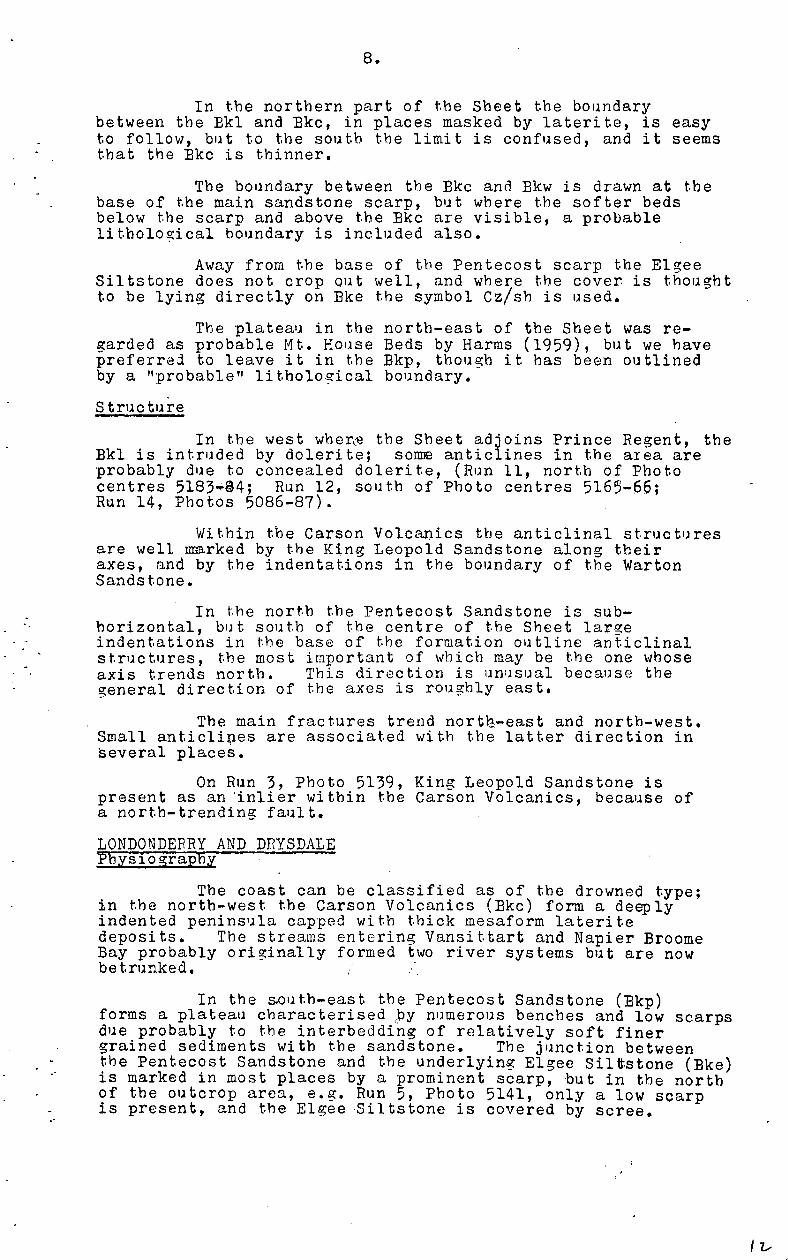
In the northern part of the Sheet the boundarybetween the Bkl and Bkc, in places masked by laterite, is easyto follow, but to the south the limit is confused, and it seemsthat the Bkc is thinner.
The boundary between the Bkc and Bkw is drawn at thebase of the main sandstone scarp, but where the softer bedsbelow the scarp and above the Bkc are visible, a probablelithological boundary is included also.
Away from the base of the Pentecost scarp the ElgeeSiltstone does not crop out well, and where the cover is thoughtto be lying directly on Eke the symbol Cz/sh is used.
The plateau in the north-east of the Sheet was re-garded as probable Mt. House Beds by Harms (1959), but we havepreferred to leave it in the Bkp, though it has been outlinedby a "probable" lithological boundary.
Structure
In the west wher(e the Sheet adjoins Prince Regent, theBkl is intruded by dolerite; somm anticlines in the area areprobably due to concealed dolerite, (Run 11, north of Photocentres 5183..44; Run 12, south of Photo centres 5165-66;Run 14, Photos 5086-87).
Within the Carson Volcanics the anticlinal structuresare well marked by the King Leopold Sandstone along theiraxes, and by the indentations in the boundary of the WartonSandstone.
In the north the Pentecost Sandstone is sub-horizontal, but south of the centre of the Sheet largeindentations in the base of the formation outline anticlinalstructures, the most important of which may be the one whoseaxis trends north.^This direction is unusual because thegeneral direction of the axes is roughly east.
The main fractures trend north.-east and north-west.Small anticlines are associated with the latter direction inseveral places.
On Run 3, Photo 5139, King Leopold Sandstone ispresent as an 'inlier within the Carson Volcanics, because ofa north-trending fault.
LONDONDERRY AND DRYSDALE Ilivsiography^•
The coast can be classified as of the drowned type;in the north-west the Carson Volcanics (Bkc) form a deeplyindented peninsula capped with thick mesaform lateritedeposits.^The streams entering Vansittart and Napier BroomeBay probably originally formed two river systems but are nowbetrunked.
In the south-east the Pentecost Sandstone (Bkp)forms a plateau characterised by numerous benches and low scarpsdue probably to the interbedding of relatively soft finergrained sediments with the sandstone.^The junction betweenthe Pentecost Sandstone and the underlying Elgee Siltstone (Eke)is marked in most places by a prominent scarp, but in the northof the outcrop area, e.g. Run 5, Photo 5141, only a low scarpis present, and the Elgeeliltstone is covered by scree.
I z,

A zone of Cz cover generally obscures the contactbetween the Elgee Siltstone and the Warton Sandstone (Bkw)in the relatively low lying area below the Pentecost scarp.
The Warton Sandstone forms another prominent scarpat its contact with the Carson Volcanics; the latter unitgives rise to hilly topography, generally at a lower altitudethan the Warton Sandstone.^The mesas of laterite on thevolcanics form high isolated hills, e.g. Oombrai Hill,Putairta Hill.
In the west and north the King Leopold Sandstone(Bkl) forms a rough-surfaced plateau with, in places,irregularly shaped depressions occupied by Hart Dolerite (Bdh).
Description of Photo-geological Units
All units on Londonderry-Drysdale have been mentionedin connection with the Ashton Sheet and only particularproblems will be referred to here.
Near the base of the Carson Volcanics, sediments(probably sandstone) are interbedded with the volcanic rocks(Run 1, Photo 5161; Run 14, Photo 5074; Run 15, Photo 5026);possible sediments also occur on Run 6, Photo 5128; andRun 7, Photo 5169 within the Carson Volcanics. At the topof this formation on Run 11, Photo 5060, extra sedimentarybeds may be present at the junction of the Carson Volcanicsand the Warton Sandstone.^On Run 1, Photo 5157, and on Run 2,Photo 5004, laterite is developed apparently on thin volcanicsoverlying the Warton Sandstone.
Good exposures of Elgee Siltstone have been observedon Run 13, Photo 5024, and a suitable place to measure asection through the Unit should be found on Run 9, Photo 5141.Bedding trends in the Siltstone are distinct on Run 7, Photo5159i and this may indicate the presence of dolomite whichhas been observed in tnis stratigraphic position on Lissadelland Lansdowne Sheets (K. Plumb, pers. comm.).
The lithology of the rocks shown as Hart Doleriteshould be checked in the field as Harms (1959) has mapped themas "Mornington" Volcanics.
Structure
Broad gentle warping is typical of the area, thelargest fold being the syncline in the Pentecost Sandstone,Elgee Shale and Warton Sandstone.^Most fold axes trend northor east of north, but a few cross-folds trend west ornorth-west.
The major lineaments form a conjugate set trendingabout 330 and 055 degees respectively.^The numerous jointsalso show these directions, and there is a third importantset of joints well developed in the Pentecost and Warton Sand-stone whose direction, approximately 280 degrees, almostbisects the angle made by the conjugate set.^The straighttrace of most joints indicates that they dip steeply. Move-ment along the lineaments has been minor.
Basic dyke S have been mapped within the King LeopoldSandstone, particularly along lineaments in the 055 direction.

10:
MT. ELIZABETHPhysiography
The area is drained by three important rivers;the Durack and Chapman rise in the south-east and south-central part respectively; flow north-east and join nearthe northern boundary of the Sheet; they flow over thegently warped surface of the Pentecost Sandstone (Bkp).The Hann River rises in the north-west and follows anarcuate course generally south; it crosses the fold structuresof the Barnett Range, and further south, the Phillips Range,and because of this discordance with structure it is regardedas a superimposed stream.^Possibly the Durack and ChapmanRivers are also superimposed, though the evidence is notcompelling, ad their northerly path could have been producedby slight regional tilt.
The eastern half of the Sheet and part of the westis occupied by the Pentecost Sandstone, which forms anundulating plateau with numerous benches and low scarps.A prominent scarp marks the Contact with the Elgee Siltstone(Bice), which formation, away from the foot of the scarp, isconcealed in most places by Cz; this also masks the contactbetween the Elgee Siltstone and Warton Sandstone (Bkw).The Warton Sandstone makes a scarp at its junction with theCarson Volcanics (Bkc); The Volcanics are low-lying relativeto the Sandstone, and they are commonly drained by strikestreams such as Harris Creek and North Creek.
In the north-west the rough surfaced plateau of theKing Leopold Sandstone (Bkl) continues from Charnley Sheet;in the south-west the Phillips Range is formed by a fold inthe King Leopold Sandstone.
Description of PheJ(1-geological Units
All unit ,3 of the 1imber1,3y Group are present onthe Mt. Elizabeth Sh-, and the Hart Dolerite, the MendenaFormation of the Bastin Group, the Walsh Tillite and Mt.House Beds are found also.
The Mendena Formation overlies the PentecostSandstone conformably.^In the east the unit has beenextended to Mt. Elizabeth Sheet from the previously mappedLissadell Sheet (Dunnet & Plumb, 1964), and it probablyoccurs in the south-east also.^The Mendena Formation islighter in tone than the Pentecost Sandstone, and has astriated pattern.due to the alternation of bard and soft beds.
The Walsh Tillite (Bt) occupies an area drainedby the headwaters of the Traine River, the Chapman River andthe creek. that flows through Police Valley.^It is a dark-toned soft unit with a smooth surface; bedding is observedin only a few places near the base, which rests unconformablyon the Pentecost Sandstone and older formations of theKimberley Group, with the exception of the King LeopoldSandstone. Harms (1959, Part II, p.41) reports an areaof some acres of glaciated bedrockof the PentecostSandstonein the vicinity of Lat. 16 52'E, Long.126 25'S.^In placesthe boundary of the Tillite with the Pentecost Sandstoneis difficult to distinguish, particularly east of the HarrisRange.
All other units have been referred to previously,and only particular points will be mentioned.

11.
The Mt. House Beds (Em) conformably overlie theWalsh Tillite; in the air photos they appear as a beddedgrey-.toned smooth surfaced unit whose main area of distri-bution is east and north-east of the Phillips Rage.
An area on Run 5, Photo 5164, south of Karunjie,is assigned to the Hart Dolerite (Bah) because of its photocharacter, though it is probably mainly soil covered.^OnHarms' map it is shown as "Mornington" Volcanics, and berefers to it as "doleritic rock interbedded with or intrudingthe Pentecost Sandstone" (Harms, 1959, Part III, p.33).^Healso reports dolerite in an area west of the Salmond River,Run 8, Photo 5013, but this is shown as Cz on our map.
Structure
Broad gentle folding is typical of the whole area,and particularly of the Pentecost Sandstone, which occupiessomewhat more than the eastern half of the Sheet.^Steeperdips are found in the Phillips Range, where the King LeopoldSandstone forms the core of a well defined east-plunging anti-cline.^Intrusive dolerite in the vicinity of the crest hasapparently pushed up the sediments, and is responsible for thevarying trend of the axis.^North of this anticline is acomplementary syncline with a core of Pentecost Sandstone.Near the western end of the syncline, within the PentecostSandstone is a complex structure whose nature is not understood;several steeply dipping probable sandstone beds are disposedin a roughly radial fashion round a central low hill, thephoto character of which appears the same as that of theadjacent sandstone beds.^The structure is tentativelyregarded as an intrusive centre.
Just south of this structure the Pentecost Sandstoneand subjacent Elgee Siltstone are folded into a small anti-cline, but the sout"imb of the complementary syncline isconsidered to be fa^d out,^A lormal fault, with north-east block down is poF. lated, followed by erosion of ElgeeShale and Pentecost S21'stone from the south-west block,then reverse movement along the same fault line, producingthe present attitudes of the units.
.Small folds in the King Leopold Sandstone and theCarson Volcanics are present north of Barnett River Gorgel
Faulting is widespread, but it seems of minorimportance in that no large relative movements are involved.On Run 10, Photo 5123, and Run 12, Photo 5170, the WalshTillite appears to be faulted down into, the Warton Sandstoneand Pentecost Sandstone respectively, or the tillite wasdeposited against existing fault scarps in these formations.
Important trend directions of lineaments and jointsare approximately 050 and 325 degrees, and a third directionof 275 degrees, which almost bisects the angle between theother two.^Of interests in the Pentecost Sandstone in thesouth-east part of the Sheet are the curved lineaments whichapparently dip at shallow angles relative to those withstrailt traces.

12.
REFERENCES
DUNNET, D., & PLUMB, K.A., 1964 - Explanatory Noteson the Lissadell 1:250,000 GeologicalSheet SE52-2, Bur.Min.Rosour.Aust.Rec.1964/70 (unpubl.)
GUPPY, D.J., LINDNER, A.W., RATTIGAN, J.H., & CASEY, J.N.,1958 - The Geology of the Fitzroy Basin,Western Australia, Bur.Min.Resour.Aust.
Bull. 36.
HARMS, J.E., 1959 - The Geology of the Kimberley Division,Western Australia, and of an adjacent areaof the Northern Territory, M.Sc. thesis,Univ. of Adelaide, (unpubl.).
w-

BUREAU OF MINERAL RESOURCES, GEOLOGY AND GEOPHYSICS
Compiled by Ine Burea~ of Minerai Resources, Geology and GeophysIcs
')efOiI adjusted to compilation prepared by tile Royal AustraluJn Survey Corps
Ai!rldl photo<;lrophy by Royal Austrolian Air Force ,complete vertical cOllerage Of 1.48,000
Tron.ver'se Mer~otor Projection scole
'.-.
~:::;---~ /, '" '-{JJ
.~
I
•• v'
- ~."'c.' ~ >
, " ,:"~" I , "
MOUNT ELIZABETH WESTERN AUSTRALI A
SCALE 1:250,000
15 MILES I
='E5====~~2G KILOMETRES
INDEX TO ADJOINING SHEETS
ASHTON MEDUSA BO,NKS
I PRINCE
I REGENT !-----+----+------~
I cHARNLEY EL~~UB~~H LlSSADELL ; ~ ___ +-__ ...l-__ .. __ _
LENNARD RIVER
LANSDOWN9 DIXON RANGE
AUSTRALIA (:250,000 PHOTOGEOLOGICAL SHEET SE52-1
P!'1oto-lnlerpretahon by the Photogeologrcol Group
Bureau of Mineral RHOU"ces, Geology and Geophysici
1~lerpreted b~ W.J Perry
E52/A1/2
1965
RE FERENCE
Photogeotogical Character
Q
Dark fone,smooth surface,low relief Cz
Medium grey toned,smooth surface ,wei! bedded em
Dark toned ,smooth surface ,beddim; uncommon
Light to medium roned ,slnaled pattern elm
Dark toned, soft unll • forms depreSSIons Within sandstone
Dark loned ,well bedded ,._---" L!~"-J
MBdlum grtly toned. smoolh surface. low rtllief
Dark toned ,scarp forming ,bedoed
Grey loned,sofl wffh hard mtercoloftOns ,relief low to m01(frote I l ___ --' eke
Light toned, rough surface, hard appearance _,bedded ,much JOinted
~ Litholo~ICOI boundary
~ ___ / Proboble Iitholo';l'cci bOU"Idory
-t-- AntiClinal O~IS
Foull
Probable fcult
___ Ed~e of bed
_-_ Probable edQe of oed
~ Ed~e of bed upreHed os seci P
Estimated dips
--r Horizontal
~- IItf'1 low
, • Low
1- ... Medium
-+ Vertn:al
-~-~- JOint pattern
C::----'" Laferi1e (L), Terrace (T), Scree (S)
Possible Geological Interpretation
AllUVium
Reslduol SOll,sond,includes some laterite.
Mt House Bec:ls
Walsh Tillite
Mendena Formation
Hart Dolerite
Pentecost Sondstone
Elgee Siltstone
Warton Sandstone
COrson VolcaniCS
KmQ Leopold Sandstone
+--- -. _~ ROliwoy line
Telephone line
rence
Slate boundary
Homestead
lad
Wtndpump
}
QUATERNARY
UNDIFFERENTIATED
PROTEROZOIC
:f 't Airport or Airfield. Londln9 ground
.Ii Bore
.r Tcnk
.w Well
.5 SPflnO
WH Waterhole
.D!.. Dam
Photo - centre pOints
:t Photo-centre poil"lt!)-adjoining sheet
H
j

BUREAU OF MINERAL RESOURCES
GEOLOGY AND GEOPHYSICS
'24°:<:' '6o~f:'" -- ---
DOUBTFUL
BAY
WALCOTT I/IILET
Complied by the Bureau of Mmeral Resources, Geologj' cnd GeophysIcs
Detail adjusted to cOMpilation prepared by the Royal Austrelian Survey Corps
Aerlol phofography by Royal Australian Air Force, complete lIertlccl coverage QI I 48,000 scole
Transverse Merca!or F'rojectlOn .. 5
=~
CHARNLEY WESTERN AUSTRAL~
SCALE 1:250,000
o 5 y- = '0 15 MILES
- -,
5EH=<==E3=C:EE33:.0====:::i5====~IOC====':E5=====~20 KilOMETRES
INDEX TO ADJOINING SHEETS
CAMDEN PRINCE SOUND REGENT ASHTON
YAMPI CHARNLEY MT ELIZABETH
DERBY LENNAR:J LANSDOWNE RIVER
AUSTRALIA 1:250,000
PHOTOGEOLOGICAL SHEET SE 51-4
P"O'c- r'I~e'prelotlon by the Photogeologicol Group. 9c,'e:::L. :::~ 'Jrnerol Resources, Geology and Geoph)'SiC$,1964. ~'ec;J'e'eJ by 'N.J. Perry
E51/A4i'
REFERENCE
Photogeological Character
Dark toned, smooth SIJT/ace, low- relief Cz
Medium grey /oneq rouqh sl)rfac~ low relief, bedded ~
Medium grey toned, smooth surface, soft oppeoro'1ce, beddmr; absent ~
Medium grey toned, smooth surface, well bedded Pm
Dark toned, soft IJnd, forms depressions wllhin sandstone [ ~dh
Dark toned, low relref
Light toned, scarp forming, bedded
Grey toned, soft WIth hard intercolations, relie! low 10 moderate
Grey 101U1f~ rough SIJ;toce, hord appearanCe, bedded, much Jomted
Dark toned wtln light toned smooth areas rn places,
forms rounded Mils
Dark toned, well bedded, slront)/y folded
Medwm grey IOood, forms rounded hll/s, jointed
Dark toned, forms steep Sided 1IIIIs wdh rounded tops, jeJ/nted
Light grey toned, low rel;ef
-------..... Lithological bounder\!
~-.._ ..... Probable lithological bound(lry
--+- Anticlinal axis
--+- Synclinal aXIs
FOuif
Probable fault
--- Edge of bed
_-- Probable edge of bed
~ Edge of bed 81lpressed as scarp
Estimated dips
+ HOrIZontal
........ Very low
__ I-----. Low
__ ...... Medium
__ .... Steep
.... Vertical
=::::::-::::::: Trend line
, ~--",,;-, JOint pattern
.....--..... Topographic scarp
c:;::::::) Lot.rlte (Ll, Terrace (T), Scrlle (5)
~Dyke
E'kw1
Possi ble Geologica I Interpretation
River 00:1 Coastal alluvium
Residuol lioil,sand Includes some Icterite
Napier Formation
Patierson Conglomerate
Mt House Beds
Hart Dolertre
Volcanic rocks
Warton Sandstone
Corsen VOlconJ(~5
King Leopold Sandstone
Lamboo Complex
Undetermined
Pnnclpal rood
Minor roods end trocks
•• ,,, ,-.' 00 +-==<> ROllwey line
Telephone hne
fel1ce
State bOlllOor'y
• Hom.sleed
::J Yard
! Windpump
QUATERNARY
UNDIFFERENTIATED
PROTEROZOIC
ffi 'f" Airport or Airfield, Landi~ ground
.8 Bore
.T Tonk
.w Well
.5 Spnng
WH Wotff'nole
.O;j Dam
• Photo-centre point,
III Pooto - centrA points - adjoining ,h.,t
} ~ t! z
" "
j
z
" '" m
" " U W cr a.

BUREAU OF MINERAL RESOURCES,
GEOLOGY AND GEOPHYSICS
o , 12600
ComPIled by the Bureau of Mineral Resources. Geology and Geophysics.
Detail adjusted to compiklfion prepared by the Royal Australian Survey Corps
Aerial photoqraphy by Royal Australian Air Force; complete vertical covel'OQe at 1:4apoO scole Transverse Mercator Projection.
-
, , ~--
/
t ----/-.~,-
'c-I I
ASHTON WESTERN AUSTRALIA
Cz /~
SCALE I: 250,000
.5~a=~==~~==30===============5E:============~I~O===============~15 MILES ia E3:=E3EDE3=i°,====::i5=====,IO,====="'S,===;:i2,,,O KILOMETRES.
INDEX TO ADJOINING SHEETS
MONTAGUE MEDUSA IIRYSOAL£ SOUND BANKS
PRINCE CAMBRIDGE
REGENT ASHTON GULF
CHAi<NLEY ~EIJZA8ETH lISSAOELL
AUSTRALIA 1'250,000
PHOTOGEOLOGICAL SHEET SO 52-13
PhOfl)-1 nter,""'iofI by the PhotogeOloglool Group. Bur.au of Mllleral R.sources, Geology and Geophyliel, 1964 Interp ...... b,'R .ltkmard Inltitut Fr~11 du NtroIt.
052,4\13/2
REFERENCE
Phologeologicol Character Possible Geological Interpretation
~ River cnd coastol alluvium
Darlr fon«J~$m()()th sud~,low '~/6f ,l __ c_,_ Residual soil, sond including loterit.
Dark 10fHId ,soIl unil,lorms deprtlsslOns wllhin sandsfone E Hart QQterit.
Durll tOf1lM,wel1 iJedd«l 8 Pentecost Sand.tone
Medium grey ton9fi,smooth surfactl,low r91iel ~ Elg .. Sandstone
Ught fon8d,scarp formill!J,bedded ~ Warton Sandstone
Grey ton8d,soff ",jth hard mterc%tions,relitlffow to moderate ~ Corson Volcanics
Light toned,rough surfocs,hal'doppearance,bfHided,mtJchjointHi ~ Kin9 Leopold Sandstone
------........- LitholoQical bOllndary
-----_._--'-"----- - ---.... ___ / Probable litholoQical bOllndory ====== Minor roads and frocks
.. " .. not, ..
---+- Anticlinal axis of-o::::::O Railway line
Telephone line --t-- Synclinal axis
Fence
Fault State boundary
Probable fault Mine
___ EdQe of bed • Homesteu<l
,,--.-- ~robable edge of bed o y,,,, ~ EdQe of bed expressed as scarp ! Windpump
('!7 't Airport or AIrlieId, Lonclinl1 ground
Estimatet:l dips .8 Bore
+ Horizontal _T Tank
......,. Very law .W Well
...... 1-----* Low .5 Spring
........ I-------<> ~edium WH 'Nat,rhol.
__ ......, Steep .04 Dam
-+- Verticol • Photo - centre points
ID Photo - cen're points # adjoining lheet
=:::::.:::::;: Trend line
-::..:.~~- Joint pattern
~ Topographic scarp
~ laterite (L), Terrace (T), Scree (5)
QUATERNARY}"
UNDIFFERENTIATED I
PROTEROZOIC

BUREAU OF MINERAL RESOURCES
GEOLOGY AND GEOPHYSICS
o 12300'
16° 00' ------
15'
~u
15' T
!
, CAFFARHLI I.
o 3/S1/4
•
I':
TWt RIP SE TWIN I
"" '~~':"',. , ,-c, I, ~-. Pk!"': ' " ' '~-
'1 t g,)~' ___ }-u 19
30' rl'----~'!-·~j I
f~' -,1l!U m:r I
CYGNE T
B4Y
[JEiPWAUIl pr
/
,. 0
t7° Oo'~ ___ • __ 12300
o 60
•
o
&<.
o 62
~~' .~' / ,1'0 P-t r"' '10 1;1 ~~:... ~e '.1[ .
Ct Qa . \ "--" L "__________ " ___ .L' _________ , __ ,,'
Compiled by the Bureau of Minerai Resourc.,. G~~ and GeophysIcs
Detail adjusted 10 compilation prepared by 'he Royal Auslrohon Survey Corps.
Aerial phot09ropny by Royal Ausfralian Ai F~ce .compl~e vertical eOYer~ at I 48,000 scale
Trans".,-.. "",-I:o'or Projection
ClIFT.
•
,:'4SCAD/.
-, -l.\:~, ~"
30' -----,----
_L ________ _ 30'
o 77
YAMPI WESTERN AUSTRALIA
,
•
1'"o,.,."~nf Spd.
~.-------
o
.. ,
o 55
$~kp
•
SCALE I: 250,000
o 5 10 1:5 MILES
= 'EE33::::::JF3F3:::::1F3,a0~===::i5~===.:IOC===:::iI5'===o=~20 KILOMETRES
~I'" !.
, ,~
• E!kp
. ./
• •
• •
.,1 •
o .3
•
IS'
I • I-
I i I
Coli \~r
INDEX TO ADJOINING SHEETS I CAMO£N PRIJttC[ I
SOUNO R£8£Nr
PENDER VAMPI CHARNLEY
BROOME - u:_o .. ."IR
•
AUSTRALIA 1:250,000
PHOTOGEOLOGICAL SHEET SE 51- 3
J/c·--t , I •
o 12430' 1--'l'6°00'
Pkw ' ,
• FO~'" PASs
Ok. C9.UH.F
Phoeo- Interpretation br ... Phd m 'i at Group,
8w.ou of Mineral RHoure .. , Gec»oqJ and G-aphysici 1964. ...... po e .. d by: R RiChard. Institut Fron~ai. du Ntrole.
E 51/A3/1
REFERENCE
Photog.ologleol Character
Medium grey toned, low re/Rf.
Medium gr_y tomld, smoo/h surfactl, soft appearance, beddlfl(} rOl'" •.
Dorff fOfN!d, soft umt, forms depreSSIons wlthm sondstone
Dork toned, well bfldd,d
LiUh! toned, scarp formmg, bedded.
Grey foned,soft formation .
Grey fontld, soft with hord interca/allons, rtl/let 10111 to moderofe.
Light ton,d, rough surFactl, hard appearance, bedded, much joinftld.
Dark toned with light toned smooth areas in places, forms rounded IIIIIs.
Dark toned, well beddtld, strongly folded.
Dark toned I generally mossive formation wdh high rrJlief
Dark toned, linear f,' ·-m
Medium grey toned, forms rounafld hl//s, jOinted
Oork toned, forms sleep sided IJllls WIth rounded tops,jOlflfed
Llg!tl qrey toned, 10111 relIef
-------..... Lithological boundary
--___ / Probable lithalogicol boundary
-+- Anticlinal axis
-+- Synclinal oxis
Foult
Probable foult
__ Edge of bed
.--.- Probable edge of bed
~ Edge of bed upruud as scarp
Estimated dips
+ Hom.onlal
.- 1---0 Low
.- ...... Medium
__ ..... Steep
..... Vertical
=::::::::::::::. Trend line
-~,-~- Joint pattern
....--...... Topoqraphic Icarp
~ Laterite (L)t Terrace (T), Sc"". (5)
DIm>- Dyke
K
I D2 I
~
Pdh
Pkw
.&
.5
P4
P2
u
Possible Geological Interpretation
River and coastal alluvium
Residual soil, sand, includes some laterite
Napier Formation
Patterson Conglomerate
Hort Dolerite
Pentecost Sandstone
Worton Sandstone
Corson Volcanics
King Leopold Sandstone
Lambaa Complex
Undetermined
Pnnclpal road
Minor roads and frocks
~,.. , .. " ... ...-==0 Railway line
Telephone line
Fen~.
5101. boundary
• Homestead
c Va"
f
QUATERNARY
UNDIFFERENTIATED
CRETACEOUS
} DEVONIAN
PROTEROZOIC
Airport or Airfield. Landin9 groynd
.8 Bore
.r Tonk
.w Wen
.s Spring
WH Waterhale
Dam
• • Photo· centre poIntl· odlointno lheet
J
Sd o N o U)
'" "

BUREAU (fF MINERAL RESOURCES,
GEOLOGY AND GEOPHYSICS
cl
CAMDEN
Holl
Prior PI
Compiled by the Bureau of Mineral Resources,GeolooY and Geophy.ic.
.""
SOUND
Detoll -'iullid to compi6etion prepered by the Royal Au'frolion Survey Corpl.
•
Aerial phot09raphy by Royal Au.frolion Air Fore.; complete vertical coveroge of 1:48,000 scole
TrO/WVer.1 Mercator Projection.
•
....
I 'U
• J Lucas I.
E>kc ~ ~' '" Onfontcnnes I I.'k.~. •
~IB""",illni I E'ke
D'A.RCOLE IS.
.'" 90
PI.
"'-ElI ~~~PkW ~nc'L
"
George Wafer
') ,-'~KJ
CAMDEN SOUND-PRINCE REGENT
•
5
1 ... o ....
WESTERN AUSTRALIA
. ... . Prinot! FrtldtiJriCk Harbour
."
• • Soirlf GBOrgt'
o
"eas;"
• "
SCALE
5
5 ==~I0~,,=,,=,,=,,=,,=,.;Ijr MILES
,==;IO~",,=,=,~'1i5,=====20~=,-= ... ;3i25 KILOMETRES
1-\
.,""
INqEX TO ADJOINING SHEETS
CAMO N
SOUNP
YAWPI
MONTAGUE
SOUND
PRINCE REO£NT
DRYSDALE
ASHTON
CHARHLfY ~,EUZABrTH
~USTRALIA I' 250,000
PHOTOGEOLOGICAL SHEET 051-15,16
• --<'Cz I?kl
/ ,,~/
\
, , ' -) ,'(
'-f, -;/ ( , r " '
I,' /-', -,I _ L.: , _
__ .LL~ __
C,
Photo. Interpretation by thl Phot: II logical Group, Bureau of Mineral RelOUrcu. Geolo;y and Geophysics 1964.
Interpreted by: R. Rlchord, In,tltut FrOnta" du !'ttroll.
051-AI6-1
REFERENCE
Photogeological Interpretation Possible Geologicol Interpretation
~ River and coastal alluvlulTI
Dork toned ,smooth surface ,low relief 0 Residual soil> sond, Includes some latente
Dark toned, soft jJmt,/orms depressions WIthin sandstone G Hart Dolerl'e
Dark fOfled,well beddea ~ Pentecost ScwJstone
Dar/( toned,scarp forming ,beddlild G Warton Sandstone
Grey .Ioood,soff wtl/! /ror,1 'rdercafat;ons ,relIef low to moderale ~ Corson VOlcQn'cs
Light loned,fCur;fI surf'1ce,hordapPMratlce,bl!:dded,much JOinted G King leo?olct Sanes'one
_/ Lithological boundary
Probable litl'lologicol boundary MillO' roods and tracks .. RQI way !;ne Anliclinoi 0)(15
t--- SynClinal O~IS
Fence
Fault State boundary
Probable fault
____ Edge of bed Homestead
,-- ___ Probable edge of bed Yard
......--.--.-- Edge of bed e~pre5sed os scorp Wmdpump
Airport or Airfield, Londing ground
Estimoted dips .B Bore
+ HOrIZontal .r Tonk
Very low .w Well
Low .S Spring
f ... Medium WH Waierhole
f..,. Steep .0 ~ Dam
-111- Vertical • Photo - centre points
Photo- centre points - odJoining sheet
=::::::---< Trend line
~~---. Topographic scarp
C;---) Laterite (L), Terroce (T), Scree ($)
=>--- Dyke
QUATERNARY }~
UNO"'EAEN1IATED I
PROTEROZOIC

BUREAU OF MINERAL RESOURCES,
GEOLOGY AND GEOPHYSICS
13'1>5' ~------------<Pr::_-Troughton I.
! i .,4/10
Ir rr'''k' '
115'~\I:~-'--
I \~
, ",E'kl
Compiled oy the I::!ureou of Minerai Re'3ources, Geolo9~ and GeophysIcs
Detail adjusted to compIlation prepared by the Royal Australian Survey Corps
15'
Aerial photography by Royal Austrollan A.r Force, complete vertical coverm~e at 1_48,000 scale
Tnms\lerse Mercetor PrOlectlon_
•
NT
(,JLiJ
S A
LONDONDERRY AND DRYSDALE
o
W ESTE RN AUSTRALIA
• 12/69
Sandy I. ~ o
Scale 1 : 250,000
10 15
•
Q
Ie
2':-,
.. -66
1':0 M'Lo.S
~=
15'
AUSTRALIA 10250,000
PHOTOGEOLOGICAL SHEET SO 52-5-9
---- -----------~
------------------i--
e 13/~3
TIMOR
IUOEX TO ADJOINING SHEETS ----- -
1 LONDONDERR'
MONTAGUE DRYSDALE MEDUSA SOUND '~~j
PRINCE ASHTON
CAMBRIDGE REGENT GULF
OR ARArURA SEA
Photo-interpretation by the Phologeoloo;lical Group
Bureau of Minercl Resources, Geology and GeophysicS 1964
Interpreted by' W J Perry
D52/A9/1
REFERENCE
Photogeological Character POSSible Geological Interpretation
~ River and coastal allUVium
Dark toned, smooth 5urfaCtJ, kw relief I Cz ReSidual SOIl, sand IncludinQ lotente
Oork tOf/ed, soft unit, forms depressions wlthm sandstone ~ Hort Dolente
Dark fOl1tId,well btJdd6d ~ Pentecost Sandstone
~ q"'Y toneJ,smoofll surloce,low relief ~ Elgee Sandstone
Light toned, scarp Iormmg,btKfded E Warton Sandstone
Grey toned, soft willi fIOrd intercalations I relief low IrJ moderateL:k~ ___ J Corson VolcaniCS
... _-J "~.J.J~.J. Mo--< [ Pkl -_-] '''0 Leopold Sandstone Light toned, tVl.J9h surfvce,lfVfU appe:1rance,VCfJf.If:U1 much ;OIfl,V<.1 _
~ ~ UtholoQlcal boundary PrinCipal rood
~~ __ / Probable lithological boundary Minor roads and trocks
'.".0 ".,0 • •• .;_~.:() Railway tine
-+- Anticlinal axis Telephone line
--+- Syncllnel o~is Fence
Foull Siale boundary
Probable fault Mme
____ Edge of bed • Homestead
,.--- Probable edge of bed o Yard
............... Edge of bed expressed as scarp ! Wmdpump
ffl + Airport or Airfield, Landing r;Jround
Estimated dips .8 Bore
+ Horizontal .T Tonk
I--+t Very low .w Well
....... I--t Low .S Spring
__ .--... Medium WH Waterhole
I--lIt Steep .D <1 Dam
..... Verticol • Photo - centre points
ill Photo· cenfre points· adjoinino sheet
::::::::::::;. Trend line
-:..;-:..;~ Joint pattern
............--- Tapaorophic ,corp
C.-::-) Laterite (U, Terrace (T), Scree (5)
QUATERNARY } ~
UNDIFFERENTIATED ~
f PROTEROZOIC
i ,

" ,~OO' a 1~~O~0' __ , ____________________________ , _____ , ________ ~'~24~o~o~' _____ ' __________________________________________________________ T ____________ __ '3 30 1-"
127°30' ------- - - -------'-----------------'------,-------------------------------, 13° 30'
I '. . -CAPE LONDONDERRY
I '4"00' f-' ----------- -----------------
I
---___________________ L-__ , ______ , ___________________________________________________ -----1--------------------------------------------------------"------'---~~?1~1;~~~~~,-------~/F~·~Ll~~---------1~'(~---(~--~~~~~~~~~=_~~~~~~.~~~~--~~_l 14~O'
i
'.
-"", ~4:l o~ " ....
•
YORK
SOUND
MONTAGUE
SOUND
BAr ~I~
~~~,' ADMIRALTY
GULF
,~odL----------------------------------,I-------------------------~~c-~~~~j_~~~---~~~c;~~~~t-~~~~~~&f~----;~~~~~~~~-~~~~-------~~~,,~--~-~_H-~~---+__-------,-~--I~~~, -------~
~~
CAMDEN
SOUND
IGOOOI~---------------------------------------------------~~--------------t_----------------------------~
COLLIER
BAY
KING
SOUND
BRUNSWICK
BAY
P"
Pki
1. » ~E'dh
t
Pki
~Pkl
... "'" .....
.....
q-~ tiP". ~
Pk!
, , , ,
, Pdn
~ "'"
"", J--
-----
--- --......,.--~ -
Pkp
Pkp
... "
\ \ \
...
15°00'
STRUCTURAL SKETCH MAP TO ACCOMPANY
REPORT ON PHOTO - INTERPRETATION OF AN AREA IN THE KIMBERLEY DIVISION,
WESTERN AUSTRALIA
SCALE
'~~~:::~:E'=::E;;;O:c,::: __ :::, ===~''Eo~===~20======330 MILES
REFERENCE
~ } CAINOZOIC
I K I L-.-J CRETACEOUS } MESOZOIC
~ DEVONIAN } PALAEOZOIC
~ Mt House Beds
E Walsh Tillite
E Mendeno FormatIOn
E Hart Dolente •
Z
E Pentecost Sandstone « 0::
~ CD
Eigee Sillstone PROTEROZOIC ::::;;
« ~
u w 0::
E <l. Worton Sandstone
I E'k' I Corson Volcanics - --"' ~-,-- ---, ,
[ E'k~ King Leopold Sandstone
~ Lomboo Complex
U Undefermined
Lithological boundary
! Anticline
I Syncline
--- Fault or lineament
PlanimetriC detail from Geologlcol Mop of the Kimberleys 8 Western Northern Territory by J.E.Horms, The B H.P. Co Ply. Ltd,
LOCATION DIAGRAM
ASHTON REGENT I
,
CHARNLEY '1"'; ELIZABETH

BUREAU OF MINERAL RESOURCES, GEOLOGY AND GEOPHYSICS
15'r-----------------------------j------- - --
'I
~" --V Colbret t.rQ
.... ' C1 D--- ekc--C\
Keroudren !.~.'.' ~'. '-J \l-0!1 • 1:Qlit
Compiled by the Bureau of Mineral Resources, Geology and Geophysics
Detoil adjusted to compilation prepared by the Royal Australian Survey Corps.
Aerial photography by Royal Australian Air Force; complete vertical co .... eroge at 1:48,000 scale
Transverse Mercalor Projection.
Q
~''c'''' 'y 0
MARET IS.
"~ '~'
CORONATION IS.
EEl Port ,. Nelson
I
EO Il/sOSJ
C. Pond
MONTAGUE SOUND WESTERN AUSTRALIA
W. Montoli\let I. l!i.rc.:\ E!~ f j eke
'" .. .. 'It I S2
Augereou l·
YO R K
sou N D
SCALE I: 250,000
5E=~==~5L==~~O==============~5~============~,0C===~========~15 MILES
5;" ... 3::::1&3=<=&3,..:0=========5'=========3'0=====',,5======,=,2,;0 KI LO ... E TRES - =
.. f6~Baudin I
.. ..
INDEX TO ADJOINING SHEETS
-r LONDOND~Y
MONTAGUE DRYSDALE SOUND
-- -
CAMDEN PRINCE i ASHTON SOUND REGENT i
.. "
,s
AUSTRALIA 1:250,000
PHOTOGEOLOGICAL SHEET S051-12
..rf KINGSMILL IS.
VlE'k'~ 2j!J2OC
I. ~STITUT is
PI.
..
.. "
AEMIRALTr
_, IJ L F
Crystal Head
Ptiolo-illtetpreto:tion by Ihe Photogeological Group
Buor.-ou qf ..... 01 Resources, Geology and Geophysics 1964 trt,.,prtII!d by: W, J, Perry
REFERENCE
Photogeological Character
Oorlr toned, smoolh s/JrtOCf!, 10" reh'(1f
f)ork toned, soft lI/tIf forms depressions .. II/lin sandstone fdh
Ught toned, scarp forming, b~dtHd fkw
Grey toned, sol' with hard intercalations, reliel /Otl! /0 modero'e
Light toned. rough surface, hard appearance, bedded, much jOin/eli
________ LitholoQicOI boundary
-... ____ / Probable lithoJo<lical boundary
-+- Anticlinel OXI5
----+- Synclinal axis
roult
Probable fault
__ Edge of bed
_-- Probable edge of bed
Possible Geological fnterpretotiot1
River and coos tal aJluVlum
Residual soil, sand, il'lCludes some laterite
Hart Dolerite
Worton Sand!tont
Carson Volcanics
Kino Leopold Sandstone
PrlnClpol rood
Minor rood'!; and tracks
"," ,.' "' t-=--~ Radway line
Telephone line
fence
State boundary
c Yard
QUATERNARY } ~ ~
UNDIFFERENT1ATED ~
PROTEROZOIC
~ Edge of bed expressed os scarp Windpump
Estimated dips
+ Horizontal
I--+t Very law
_ I---> Low
....... ~ Medium
__ """"" Steep
.... Vertical
:::::::::::;::::: Trend line
-~-~- Joint pattern
............... Topographic scarp
~ Laterite (ll, Terrace (T), Scr •• (S)
.:fj + Airport or Airfield, Landing ground
rB Bono
.r Tank
.w Well
.s _
WH WoterlwMt
.o.(l Dam
.. Photo- centre pOints
Photo - centre points - odjoinino sheet