planning board bryant h. womack march 11, 2021 …
TRANSCRIPT
PLANNING BOARD MARCH 11, 2021
5:30 PM
BRYANT H. WOMACKBUILDING
40 COURTHOUSE ST.COLUMBUS, NC 28756
1. Call to Order
A. In order to maintain the safety of County residents, the Planning Board and Staff, thePlanning Board Meeting scheduled for 5:30 p.m. Thursday, March 11, 2021 will beavailable for the public to call in and listen to the meeting. Call – 1-301-715-8592,Meeting ID – 821 9144 8792, Password – 876874. To ensure the public is able tosafely participate in the Planning Board meeting and the Public Comments portion ofthe meeting, you may submit a public comment by email to [email protected], or bycalling the Planning and Zoning Department at 828-894-2732 by 4:30 p.m. onWednesday, March 10, 2021. Please include the following information: First andLast Name, Address, and Comment. Comments will be read into record by the Clerkduring the Planning Board meeting. There will also be a chance during the PublicComments portion of the meeting to present comments live via telephone. If youhave any questions, please contact the Planning and Zoning department at 828-894-2732.
2. Approval of Agenda
3. Approval of Minutes
A. Approval of Minutes from December 3, 2020
B. Approval of Minutes from February 11, 2021
4. Mobile Home Park Ordinance
5. Subdivision Ordinance
6. Other Business
7. Public Comments
8. Adjournment
Page 1 of 102

POLK COUNTY PLANNING BOARD
AGENDA ITEM
MARCH 11, 2021 REGULAR MEETING
Agenda Item#: A.
ATTACHMENTS:Description Type Upload DatePB Minutes 12.3.2020 - DRAFT Exhibit 3/4/2021
Page 2 of 102
PLANNING BOARDDecember 3, 2020 - 5:30 PM
Bryant H. Womack Building40 Courthouse StreetColumbus, NC 28722
MINUTES
Members Present: Warren Watson (Chair), Edward Daniel, John Rose, GeraldPack, Neal Barton, Wayne HorneMembers Present via Zoom: Alexander HagertyMember(s) Absent: Lee BarkerStaff Present: Cathy Ruth (County Planner), Hannah Lynch (Secretary)
1. Call to Order - Special Meeting
A. A. In order to maintain the safety of County residents, the Planning Boardand Staff, the Planning Board Meeting scheduled for 5:30 p.m. Thursday,December 3, 2020 will be available for the public to call in and listen to themeeting. Call – 1-301-715-8592, Meeting ID – 821 9144 8792,Password – 876874. To ensure the public is able to safely participate inthe Planning Board meeting and the Public Comments portion of themeeting, you may submit a public comment by email [email protected], or by calling the Planning and Zoning Department at828-894-2732 by 4:30 p.m. on Wednesday, December 2, 2020. Pleaseinclude the following information: First and Last Name, Address, andComment. Comments will be read into record by the Clerk during thePlanning Board meeting. There will also be a chance during the PublicComments portion of the meeting to present comments live via telephone.If you have any questions, please contact the Planning and Zoningdepartment at 828-894- 2732.
John Rose (Vice-Chair) called the meeting to order at 5:34 PM in WarrenWatson's (Chair) absence. He explained this would be a meeting where Zoomwas being utilized by one member (Alexander Hagerty) to attend, due to theCOVID-19 pandemic. Warren Watson later arrived after the approval of theagenda and took over the meeting as Chair.
2. Approval of Agenda
A motion to approve the agenda was made by Gerald Pack, seconded byEdward Daniel. A vote was taken and all present were in favor. AlexanderHagerty was also in favor, via Zoom. The motion carried unanimously.
3. Mobile Home Park Ordinance
Cathy Ruth presented proposed changes to the Mobile Home Ordinance, ashighlighted in yellow in the meeting packet.
December 3, 2020 Minutes Page 1 of 3 Page 3 of 102
The Board discussed changes to the issuance of an operating permit. Theyagreed to issue an authorization letter when the mobile home park is approvedby the Planning Board, and have the Zoning Administrator issue a complianceletter when all improvements are in. This would be the final step beforerecording the final plan. The Board also discussed the need for yearly testing of well water at a mobilehome park. They agreed it would be prudent to have this testing and discussedhow to enforce this. The Board agreed to have mobile home park owners havethe testing yearly and issue the results to all mobile home park inhabitants, aswell as sign an affidavit for the Zoning Department that this was completedalong with a copy of the results. Cathy Ruth agreed to also speak withEnvironmental Health about enforceable measures that could potentially betaken to ensure any issues with the well water were addressed. Warren Watson asked about underpinning being required on all mobile homeswithin a park before occupancy. Cathy Ruth stated she would talk with BuildingInspections to see if this is a building code requirement or not, and also if this issomething that can be addressed within the Mobile Home Park Ordinance. The Board discussed screening of a mobile home park. They agreed to requirescreening and discussed how best to ensure it remains adequate throughoutthe year. They decided to allow for either evergreen screening or privacy fences(of at least 6' in height). If a mobile home park owner decided to useevergreens, they must be 4' tall at the time of planting and grow to 6' within thetwo years. They also agreed to add a stipulation that the screening must bemaintained. Cathy Ruth agreed to draft the changes that were discussed and bring thisordinance back at the next meeting on December 10 for further review.
4. Subdivision Ordinance
Cathy Ruth presented changes to the Subdivision Ordinance, as required byNCGS 160D. She reminded the Board the Subdivision Ordinance is about theland itself that is being divided, rather than the use of the land. The Board discussed several wording changes that were required by 160D, aswell as allowing the Polk County Board of Adjustment to handle all appeals andvariances of the Subdivision Ordinance. Cathy Ruth gave the Board an example of a "pan-handle lot" and the reason forthem in the county. She explained as Administrator, she reviews smallsubdivisions within the office and believes it would be prudent to also be able toapprove the use of pan-handle lots within these smaller subdivisions, rather thanhaving the applicant come before the Planning Board. The Board agreed tothis. Cathy Ruth presented new definitions added to the ordinance, and remarkedthat "administrative hearing" should be added. Neal Barton also let her know the
December 3, 2020 Minutes Page 2 of 3 Page 4 of 102
word "standards" at the top of Article 5 throughout that section of the ordinanceis misspelled. Cathy Ruth agreed to make these required changes, and bring this ordinanceback at the next Planning Board meeting with additional suggested changes.
5. Other Business
Cathy Ruth explained to the Board at the next meeting on December 10, 2020,they would decide then about having a meeting on December 17, 2020 or not.She asked the four members cycling off soon if they would be willing to stay onthrough July, they agreed. Cathy Ruth said she would discuss with the attorneyand county manager options to see if this is feasible. Neal Barton mentioned adding a statement to plats to address controlmonuments on plats and whether they are tied to grid control, or in the absenceof that, if they are tied to other appropriate natural monuments or landmarks.Cathy Ruth agreed she would get him a copy of state standards to present toNeal to look at.
6. Public Comments
None.
7. Adjournment
Warren Watson adjourned the meeting at 6:37 PM.
December 3, 2020 Minutes Page 3 of 3 Page 5 of 102

POLK COUNTY PLANNING BOARD
AGENDA ITEM
MARCH 11, 2021 REGULAR MEETING
Agenda Item#: B.
ATTACHMENTS:Description Type Upload DatePB Minutes 2.11.2021 - DRAFT Exhibit 2/25/2021
Page 6 of 102
PLANNING BOARDFebruary 11, 2021 - 5:30 PM
Bryant H. Womack Building40 Courthouse StreetColumbus, NC 28722
MINUTES
Members Present: Warren Watson (Chair), John Rose, Neal Barton, GeraldPack, Alexander Hagerty, Edward Daniel, Wayne HorneMember(s) Absent: Lee BarkerStaff Present: Cathy Ruth (County Planner), Hannah Lynch (Secretary), JanaBerg (County Attorney - via Zoom)
1. Call to Order
A. In order to maintain the safety of County residents, the Planning Boardand Staff, the Planning Board Meeting scheduled for 5:30 p.m. Thursday,February 11, 2021 will be available for the public to call in and listen to themeeting. Call – 1-301-715-8592, Meeting ID – 821 9144 8792,Password – 876874. To ensure the public is able to safely participate inthe Planning Board meeting and the Public Comments portion of themeeting, you may submit a public comment by email [email protected], or by calling the Planning and Zoning Department at828-894-2732 by 4:30 p.m. on Wednesday, February 10, 2021. Pleaseinclude the following information: First and Last Name, Address, andComment. Comments will be read into record by the Clerk during thePlanning Board meeting. There will also be a chance during the PublicComments portion of the meeting to present comments live via telephone.If you have any questions, please contact the Planning and Zoningdepartment at 828-894-2732.
Warren Watson called the meeting to order at 5:32 PM. He explained this was ameeting where, due to the COVID-19 pandemic, Zoom was being utilized asan option for Board Members and members of the public, and Jana Berg(County Attorney) would be utilizing it.
2. Approval of Agenda
A motion to approve the agenda was made by Gerald Pack, seconded by JohnRose. A vote was taken and all were in favor. The motion carried unanimously.
3. Approval of Minutes
A. Approval of Minutes from December 3, 2020
The Board looked over the minutes from the December 3, 2020 meeting.Cathy Ruth explained staff is still working with Neal Barton to update hiscomments regarding scale factor, and the Board agreed to table the approval ofthese minutes to the next meeting.
February 11, 2021 Minutes Page 1 of 3 Page 7 of 102
B. Approval of Minutes from December 10, 2020
A motion to approve the minutes from December 10, 2020 was made byEdward Daniel, seconded by John Rose. A vote was taken and all were in favor.The motion carried unanimously.
4. Group Development Application - William Nichols
Hannah Lynch presented the application for a Group Development. The Board discussed the project. A motion was made by Wayne Horne toapprove the Group Development permit as proposed, seconded by JohnRose. A vote was taken and all were in favor. The motion passed unanimously.
5. Mobile Home Park Ordinance
Cathy Ruth presented changes to the Mobile Home Park Ordinance, along withspecific questions from the Planning Board's last meeting for Jana Berg,County Attorney. The Board discussed water well testing. The Board discussed including the Fire Marshall approval for site design, andrequested adding this to the draft ordinance. The Board discussed addressing open space and buffers, and requestedincluding this to the draft ordinance. Cathy Ruth also agreed to speak with Environmental Health about how manywells can be utilized for one unit, and how the amount of water needed for a unitis determined.
6. Mobile Home Ordinance
This was originally the 7th item on the agenda, however this was moved up tothe 6th to be discussed after the Mobile Home Park Ordinance. Cathy Ruth presented the Polk County Mobile Home Ordinance changes.TheBoard discussed the draft ordinance. A motion to approve the recommendationof drafted changes to the Polk County Mobile Home Ordinance with the planconsistency was made by Alexander Hagerty, seconded by Neal Barton. Themotion carried unanimously.
7. Subdivision Ordinance
Cathy Ruth presented drafted changes to the Subdivision Ordinance and wentthrough highlighted ones which were added since the last Planning Boardmeeting. The Board discussed the proposed updates to the draft ordinance. The Boardrequested additional updates to setbacks, buffers, discretionary decisions byadministrator, marginal access street, right-of-ways, easements, and agreed to
February 11, 2021 Minutes Page 2 of 3 Page 8 of 102

have staff address and draft changes to this to bring back to the next meeting.
8. Other Business
None.
9. Public Comments
None.
10. Adjournment
Warren Watson adjourned the meeting at 7:24 PM.
February 11, 2021 Minutes Page 3 of 3 Page 9 of 102
Mobile Home Park Ordinance
Adopted Board of Commissioners December 1995; Amended 01/06/03 Draft 160D.3.11.2021
1
Mobile Home Park Ordinance
Polk County, North Carolina
Draft: 160D – 12/10/2020
Page 10 of 102
Mobile Home Park Ordinance
Adopted Board of Commissioners December 1995; Amended 01/06/03 Draft 160D.3.11.2021
2
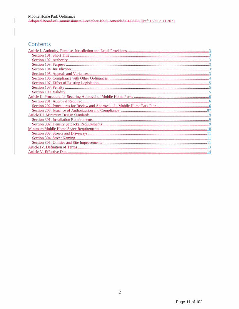
Contents Article I. Authority, Purpose, Jurisdiction and Legal Provisions ................................................................................... 3
Section 101. Short Title ............................................................................................................................................. 3 Section 102. Authority ............................................................................................................................................... 3 Section 103. Purpose ................................................................................................................................................. 3 Section 104. Jurisdiction ............................................................................................................................................ 3 Section 105. Appeals and Variances .......................................................................................................................... 3 Section 106. Compliance with Other Ordinances ...................................................................................................... 4 Section 107. Effect of Existing Legislation ............................................................................................................... 5 Section 108. Penalty .................................................................................................................................................. 5 Section 109. Validity ................................................................................................................................................. 5
Article II. Procedure for Securing Approval of Mobile Home Parks ............................................................................ 6 Section 201. Approval Required ................................................................................................................................ 6 Section 202. Procedures for Review and Approval of a Mobile Home Park Plan ..................................................... 6 Section 203. Issuance of Authorization and Compliance ....................................................................................... 87
Article III. Minimum Design Standards ......................................................................................................................... 9 Section 301. Installation Requirements...................................................................................................................... 9 Section 302. Density Setbacks Requirements ............................................................................................................ 9
Minimum Mobile Home Space Requirements ............................................................................................................. 10 Section 303. Streets and Driveways ......................................................................................................................... 11 Section 304. Street Naming ..................................................................................................................................... 11 Section 305. Utilities and Site Improvements .......................................................................................................... 11
Article IV. Definition of Terms ................................................................................................................................... 13 Article V. Effective Date ............................................................................................................................................. 14
Page 11 of 102
Mobile Home Park Ordinance
Adopted Board of Commissioners December 1995; Amended 01/06/03 Draft 160D.3.11.2021
3
Article I. Authority, Purpose, Jurisdiction and Legal Provisions
Section 101. Short Title
This ordinance shall be titled Mobile Home Park Ordinance, Polk County, North Carolina, and may be
cited as the Mobile Home Park Ordinance.
Section 102. Authority
Polk County hereby exercises its authority to adopt and enforce a mobile park ordinance under the
provision granted by North Carolina General Statute 153A-121 and 153A-340 & 347, 160D-901 & 910.
Section 103. Purpose
The purpose of this ordinance is to promote the protection of the health, safety and welfare of the
community and to provide an acceptable environment for what are in fact small communities of mobile
homes. This ordinance is designed to accomplish the following objectives:
a. To further the orderly layout of mobile home parks;
b. To secure safety from fire, panic and other dangers;
c. To provide adequate light and air circulation;
d. To insure that facilities for vehicular circulation, parking, water supply and sewerage facilities,
and recreation facilities are provided for mobile home park residents.
Section 104. Jurisdiction
These regulations shall govern the establishment of each and every mobile home park established after
the effective date of this ordinance. Additionally, these regulations shall govern the alteration or
expansion of existing mobile home parks after the effective date of this ordinance. These regulations
apply to all lands lying within the territorial jurisdiction of Polk County and within the planning
jurisdiction of any municipality whose governing body by resolution agrees to such regulation. No person
or persons may locate or cause to be located, in regard to property under his possession or control, more
than two (2) mobile homes on a tract of land without complying with the provisions of this ordinance.
Mobile home sales lots shall not be subject to this ordinance.
Owners of existing mobile home parks shall register their park with the County Planning Department
within six months of the enactment of this ordinance.
Section 105. Appeals and Variances
The Planning Board may authorize a variance from these regulation when, in the Board's opinion, undue
hardship may result from strict compliance with this Ordinance. No variance shall be granted unless the
Planning Board finds:
1. That there are special circumstances or conditions affecting said property such that the strict
application of the provisions of this Ordinance would deprive the applicant of the reasonable use
of his land.
Page 12 of 102
Mobile Home Park Ordinance
Adopted Board of Commissioners December 1995; Amended 01/06/03 Draft 160D.3.11.2021
4
2. That the variance is necessary for the preservation and enjoyment of a substantial property right
of the petitioner.
3. That the circumstances giving rise to the need for the variance are peculiar to the parcel and are
not generally characteristic of other parcels in the jurisdiction of this Ordinance.
4. That the granting of the variance will not be detrimental to the public health, safety and welfare,
or injurious to other property in the territory in which said property is situated.
A. Appeals
Appeals may be taken by any person aggrieved, or by any official or board of Polk County affected by,
any ruling or decision of the ordinance administrator to the Board of Adjustment. Such appeal shall be
taken within 30 days of ruling or decision, as provided by the rules of the Board of Adjustment, by filing
with the ordinance administrator and with the secretary of the Board of Adjustment a notice of appeal
and specifying the grounds thereof. The ordinance administrator shall forthwith transmit to the Board of
Adjustment all papers constituting the record upon which the action appealed from was taken. An appeal
stays all proceedings in furtherance of the action appealed from unless the ordinance administrator
certifies to the Board of Adjustment, after the notice of appeal shall have been filed with him, that by
reason of facts stated in the certificate a stay would, in his opinion, cause imminent peril to life or
property, in which case proceedings shall not be stayed otherwise than by a restraining order which may
be granted by the Board of Adjustment or by a court of record on application, on notice to the ordinance
administrator and on due cause shown.
B. Variances
When unnecessary hardships would result from carrying out the strict letter of a zoning regulation, the
Board of Adjustment shall vary any of the provisions of the zoning regulation upon a showing of all of
the following:
(1) Unnecessary hardship would result from the strict application of the regulation. It shall not be
necessary to demonstrate that, in the absence of the variance, no reasonable use can be made of
the property.
(2) The hardship results from conditions that are peculiar to the property, such as
location, size, or topography. Hardships resulting from personal circumstances, as well as
hardships resulting from conditions that are common to the neighborhood or the general public,
may not be the basis for granting a variance. A variance may be granted when necessary and
appropriate to make a reasonable accommodation under the Federal Fair Housing Act for a
person with a disability.
(3) The hardship did not result from actions taken by the applicant or the property owner.
The act of purchasing property with knowledge that circumstances exist that may justify the
granting of a variance shall not be regarded as a self-created hardship.
(4) The requested variance is consistent with the spirit, purpose, and intent of the regulation,
such that public safety is secured and substantial justice is achieved.
(5) Any variance that is authorized is required to be entered in writing in the minutes of the
Planning Board meeting and recorded with the final plan.
Section 106. Compliance with Other Ordinances
All proposed mobile home parks shall comply with all the requirements of any officially adopted
ordinance in effect in the proposed area.
Page 13 of 102
Mobile Home Park Ordinance
Adopted Board of Commissioners December 1995; Amended 01/06/03 Draft 160D.3.11.2021
5
The sale of lots for the purpose of a mobile home park shall constitute a subdivision and; therefore, shall
comply with the standards and procedure set forth in the Polk County Subdivision Ordinance.
Section 107. Effect of Existing Legislation
Where this Ordinance conflicts with existing ordinances, statutes, or regulations effective in the
jurisdiction of this Ordinance and enacted by the County, State, or Federal government or their agencies,
then the ordinance, statute or regulation requiring the higher standard shall apply.
Section 108. Penalty
Any person violating the provisions of this ordinance shall be guilty of a misdemeanor and shall be
subject to fine and/or imprisonment as provided by General Statute 14-4. Each day's continuing violation
of this ordinance shall be a separate and distinct offense. Nothing in this Section shall be construed to
limit the use of remedies available to the County.
Section 109. Validity
Should any section or provision of this ordinance be declared by the courts to be unconstitutional or
invalid, such declaration shall not affect the validity of the ordinance as a whole or any part thereof other
than the part so declared to be unconstitutional or invalid.
Section 109. Effective Date
Effective date of this ordinance shall be January 1, 1996
Adopted this ______ day of ____________, 19__.
Polk County Board of Commissioners
________________________________
Timothy J. McCormack, Chairman
Attest:
___________________________________
Pam Thomas
Clerk to the Board
Page 14 of 102
Mobile Home Park Ordinance
Adopted Board of Commissioners December 1995; Amended 01/06/03 Draft 160D.3.11.2021
6
Article II. Procedure for Securing Approval of Mobile Home Parks
Section 201. Approval Required
No mobile home park within the territorial jurisdiction of Polk County shall be established, altered or
expanded until a permit has been issued by the Administrator, authorizing such construction.
Section 202. Procedures for Review and Approval of a Mobile Home Park Plan
Prior to the construction of a new mobile home park or the alteration or the expansion of an existing
mobile home park, the Developer shall make application to the Administrator for a permit to construct or
expand such a park. The application shall be accompanied by four (4) seven (7) copies of the proposed
park plan. The Administrator may or may not require the park plan to be drawn by a registered surveyor.
If anyone is grieved by the Administrator requiring a registered surveyor to draw a park plan, an appeal
may be made to the Planning Board. The application must be received at least ten (10) twenty-one (21)
days prior to a regularly scheduled meeting of the Polk County Planning Board, if the application and
proposed park plan is to be reviewed by the Planning Board at that time. The Planning Board shall
review the proposed plan for compliance with the design standards set forth in this Ordinance.
The park plan shall be drawn at a scale of twenty (20) feet to one (1) inch or larger and shall include the
following information:
General Information:
1. Proposed name of mobile home park.
2. North arrow, graphic scale, and written scale.
3. Name of record owner, developer, and surveyor or engineer.
4. Vicinity map showing location of park.
5. Authorized signature of a Polk County Health Department representative verifying the
representatives on-site visitation and consultation with the developer concerning the
location of well and septic systems, if applicable.
Existing Site Data:
1. Total tract boundaries of the park, and a statement of total acreage of the property.
2. All existing rights-of-way, easements, sewer lines, fire hydrants, utility transmission
lines, storm water drainage systems, water courses, buildings, wooded areas, and all
other significant man-made or natural features within the proposed park and within fifty
(50) feet from the boundaries of the park.
Page 15 of 102
Mobile Home Park Ordinance
Adopted Board of Commissioners December 1995; Amended 01/06/03 Draft 160D.3.11.2021
7
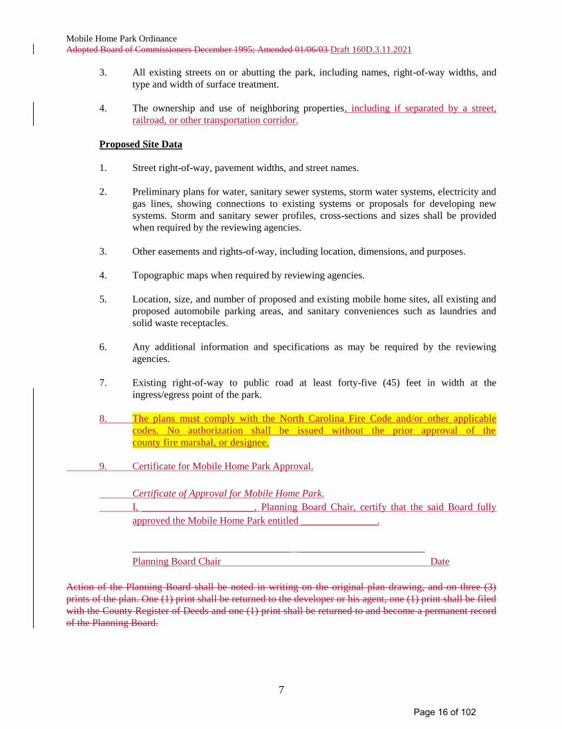
3. All existing streets on or abutting the park, including names, right-of-way widths, and
type and width of surface treatment.
4. The ownership and use of neighboring properties, including if separated by a street,
railroad, or other transportation corridor.
Proposed Site Data
1. Street right-of-way, pavement widths, and street names.
2. Preliminary plans for water, sanitary sewer systems, storm water systems, electricity and
gas lines, showing connections to existing systems or proposals for developing new
systems. Storm and sanitary sewer profiles, cross-sections and sizes shall be provided
when required by the reviewing agencies.
3. Other easements and rights-of-way, including location, dimensions, and purposes.
4. Topographic maps when required by reviewing agencies.
5. Location, size, and number of proposed and existing mobile home sites, all existing and
proposed automobile parking areas, and sanitary conveniences such as laundries and
solid waste receptacles.
6. Any additional information and specifications as may be required by the reviewing
agencies.
7. Existing right-of-way to public road at least forty-five (45) feet in width at the
ingress/egress point of the park.
8. The plans must comply with the North Carolina Fire Code and/or other applicable
codes. No authorization shall be issued without the prior approval of the
county fire marshal, or designee.
9. Certificate for Mobile Home Park Approval.
Certificate of Approval for Mobile Home Park.
I, ______________________, Planning Board Chair, certify that the said Board fully
approved the Mobile Home Park entitled _______________.
_______________________________ _________________________
Planning Board Chair Date
Action of the Planning Board shall be noted in writing on the original plan drawing, and on three (3)
prints of the plan. One (1) print shall be returned to the developer or his agent, one (1) print shall be filed
with the County Register of Deeds and one (1) print shall be returned to and become a permanent record
of the Planning Board.
Page 16 of 102
Mobile Home Park Ordinance
Adopted Board of Commissioners December 1995; Amended 01/06/03 Draft 160D.3.11.2021
8
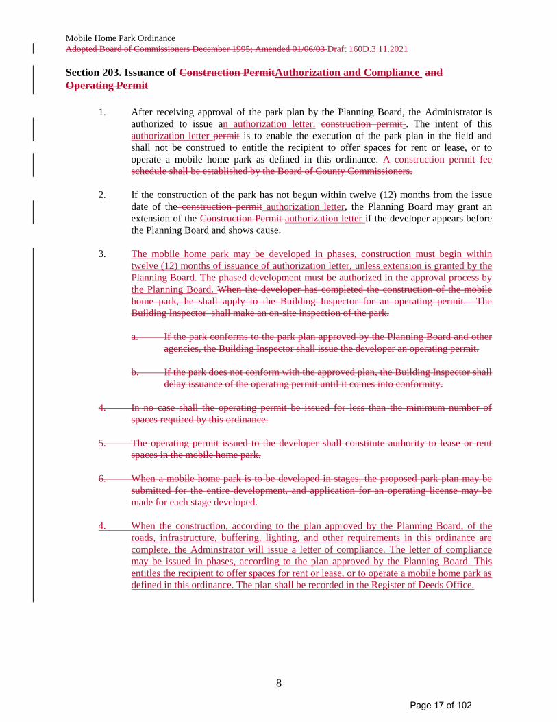
Section 203. Issuance of Construction PermitAuthorization and Compliance and
Operating Permit
1. After receiving approval of the park plan by the Planning Board, the Administrator is
authorized to issue an authorization letter. construction permit-. The intent of this
authorization letter permit is to enable the execution of the park plan in the field and
shall not be construed to entitle the recipient to offer spaces for rent or lease, or to
operate a mobile home park as defined in this ordinance. A construction permit fee
schedule shall be established by the Board of County Commissioners.
2. If the construction of the park has not begun within twelve (12) months from the issue
date of the construction permit authorization letter, the Planning Board may grant an
extension of the Construction Permit authorization letter if the developer appears before
the Planning Board and shows cause.
3. The mobile home park may be developed in phases, construction must begin within
twelve (12) months of issuance of authorization letter, unless extension is granted by the
Planning Board. The phased development must be authorized in the approval process by
the Planning Board. When the developer has completed the construction of the mobile
home park, he shall apply to the Building Inspector for an operating permit. The
Building Inspector shall make an on-site inspection of the park.
a. If the park conforms to the park plan approved by the Planning Board and other
agencies, the Building Inspector shall issue the developer an operating permit.
b. If the park does not conform with the approved plan, the Building Inspector shall
delay issuance of the operating permit until it comes into conformity.
4. In no case shall the operating permit be issued for less than the minimum number of
spaces required by this ordinance.
5. The operating permit issued to the developer shall constitute authority to lease or rent
spaces in the mobile home park.
6. When a mobile home park is to be developed in stages, the proposed park plan may be
submitted for the entire development, and application for an operating license may be
made for each stage developed.
4. When the construction, according to the plan approved by the Planning Board, of the
roads, infrastructure, buffering, lighting, and other requirements in this ordinance are
complete, the Adminstrator will issue a letter of compliance. The letter of compliance
may be issued in phases, according to the plan approved by the Planning Board. This
entitles the recipient to offer spaces for rent or lease, or to operate a mobile home park as
defined in this ordinance. The plan shall be recorded in the Register of Deeds Office.
Page 17 of 102
Mobile Home Park Ordinance
Adopted Board of Commissioners December 1995; Amended 01/06/03 Draft 160D.3.11.2021
9
Article III. Minimum Design Standards
This section sets forth minimum design standards which are stated as follows:
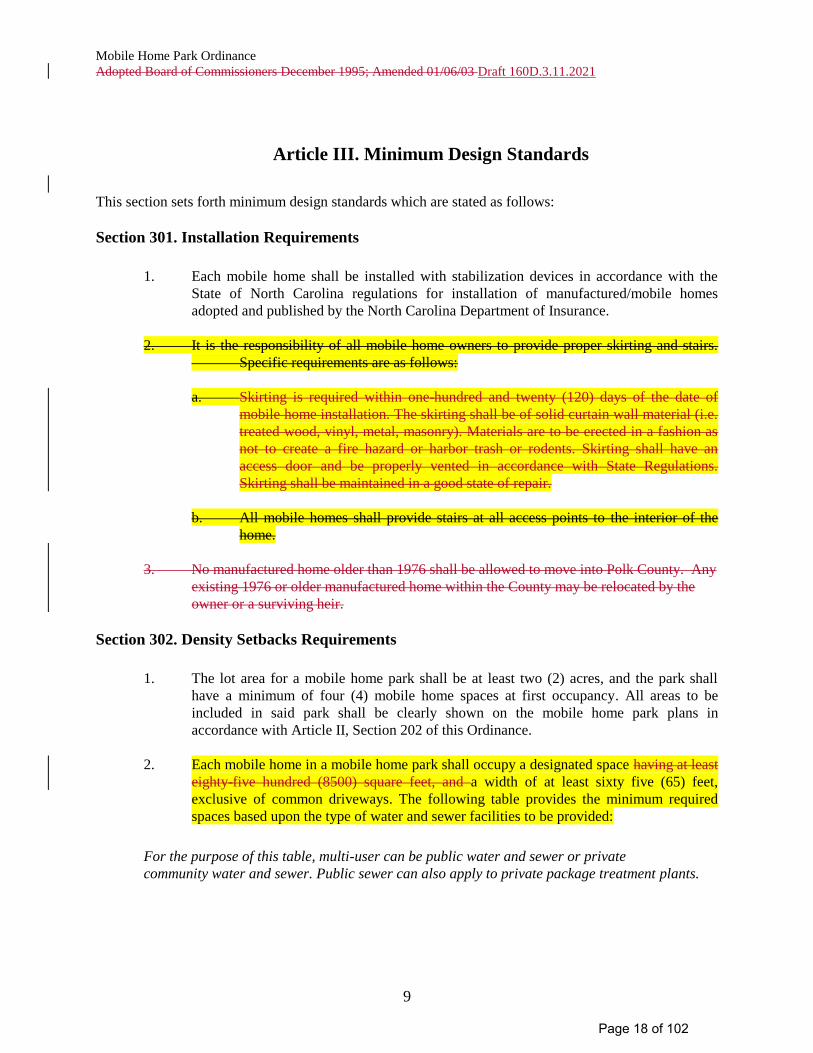
Section 301. Installation Requirements
1. Each mobile home shall be installed with stabilization devices in accordance with the
State of North Carolina regulations for installation of manufactured/mobile homes
adopted and published by the North Carolina Department of Insurance.
2. It is the responsibility of all mobile home owners to provide proper skirting and stairs.
Specific requirements are as follows:
a. Skirting is required within one-hundred and twenty (120) days of the date of
mobile home installation. The skirting shall be of solid curtain wall material (i.e.
treated wood, vinyl, metal, masonry). Materials are to be erected in a fashion as
not to create a fire hazard or harbor trash or rodents. Skirting shall have an
access door and be properly vented in accordance with State Regulations.
Skirting shall be maintained in a good state of repair.
b. All mobile homes shall provide stairs at all access points to the interior of the
home.
3. No manufactured home older than 1976 shall be allowed to move into Polk County. Any
existing 1976 or older manufactured home within the County may be relocated by the
owner or a surviving heir.
Section 302. Density Setbacks Requirements
1. The lot area for a mobile home park shall be at least two (2) acres, and the park shall
have a minimum of four (4) mobile home spaces at first occupancy. All areas to be
included in said park shall be clearly shown on the mobile home park plans in
accordance with Article II, Section 202 of this Ordinance.
2. Each mobile home in a mobile home park shall occupy a designated space having at least
eighty-five hundred (8500) square feet, and a width of at least sixty five (65) feet,
exclusive of common driveways. The following table provides the minimum required
spaces based upon the type of water and sewer facilities to be provided:
For the purpose of this table, multi-user can be public water and sewer or private
community water and sewer. Public sewer can also apply to private package treatment plants.
Page 18 of 102
Mobile Home Park Ordinance
Adopted Board of Commissioners December 1995; Amended 01/06/03 Draft 160D.3.11.2021
10
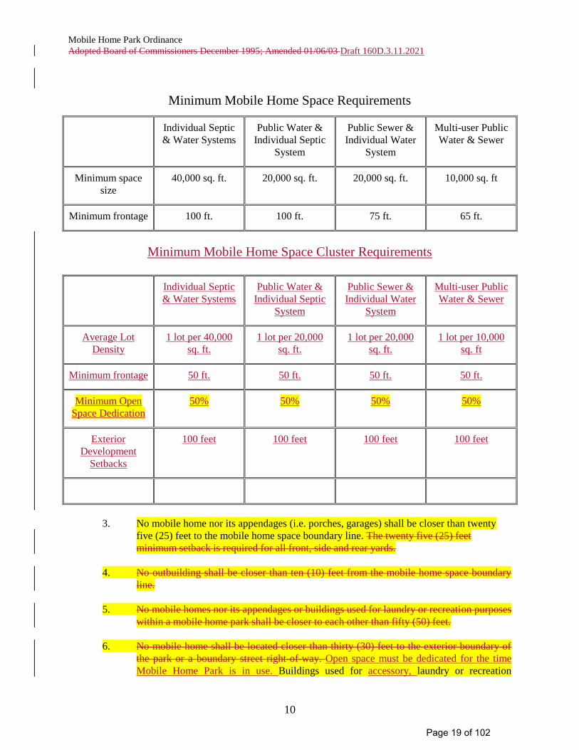
Minimum Mobile Home Space Requirements
Individual Septic
& Water Systems
Public Water &
Individual Septic
System
Public Sewer &
Individual Water
System
Multi-user Public
Water & Sewer
Minimum space
size
40,000 sq. ft. 20,000 sq. ft. 20,000 sq. ft. 10,000 sq. ft
Minimum frontage 100 ft. 100 ft. 75 ft. 65 ft.
Minimum Mobile Home Space Cluster Requirements
Individual Septic
& Water Systems
Public Water &
Individual Septic
System
Public Sewer &
Individual Water
System
Multi-user Public
Water & Sewer
Average Lot
Density
1 lot per 40,000
sq. ft.
1 lot per 20,000
sq. ft.
1 lot per 20,000
sq. ft.
1 lot per 10,000
sq. ft
Minimum frontage 50 ft. 50 ft. 50 ft. 50 ft.
Minimum Open
Space Dedication
50% 50% 50% 50%
Exterior
Development
Setbacks
100 feet 100 feet 100 feet 100 feet
3. No mobile home nor its appendages (i.e. porches, garages) shall be closer than twenty
five (25) feet to the mobile home space boundary line. The twenty five (25) feet
minimum setback is required for all front, side and rear yards.
4. No outbuilding shall be closer than ten (10) feet from the mobile home space boundary
line.
5. No mobile homes nor its appendages or buildings used for laundry or recreation purposes
within a mobile home park shall be closer to each other than fifty (50) feet.
6. No mobile home shall be located closer than thirty (30) feet to the exterior boundary of
the park or a boundary street right-of-way. Open space must be dedicated for the time
Mobile Home Park is in use. Buildings used for accessory, laundry or recreation
Page 19 of 102
Mobile Home Park Ordinance
Adopted Board of Commissioners December 1995; Amended 01/06/03 Draft 160D.3.11.2021
11
purposes may be located in the open space area.shall be located no closer than forty (40)
feet to the exterior boundary of the park or the right-of-way of a bounding street.
7. At least two hundred (200) square feet of recreational space for each mobile home space
shall be reserved within each mobile home park as common recreation space for the
residents of the park. Such areas shall, along with driveways and walkways, be
adequately lighted for safety.
8. Structures permitted within the mobile home park site plan area shall be limited to
mobile homes, their accessory structures, recreation area structures and mobile home
park facilities.
Section 303. Streets and Driveways
1. Each mobile home space shall abut a driveway or interior street within the park. Said
driveways or interior streets shall be graded and surfaced with not less than four (4)
inches of crushed stone or other suitable material on a compacted subbase. All driveways
shall be a minimum width of six (6) feet ten (10) feet, and all interior streets shall be a
minimum width of twenty (20) feet.
2. Two (2) off-driveway parking spaces per space required. with not less than four (4)
inches of crushed stone or other suitable material on a compacted subbase shall be
provided for each mobile home space. Required parking spaces may be included within
the minimum mobile home space requirements.
3. The entrance to the park shall be graded and surfaced with not less than four (4) inches
of crushed stone or other suitable material on a compacted subbase to a minimum width
of thirty (30) forty (40) feet.
Section 304. Street Naming
1. In order to lessen confusion which could hamper the response time for emergency
vehicles, the name of the mobile home park and the roads shall not duplicate nor closely
approximate the name of an existing park, subdivision and roads within Polk County. All
roads and street addresses shall be in accordance with the Polk County Uniform Street
Naming Property Address Ordinance.
Section 305. Utilities and Site Improvements
1. An accessible, adequate, safe and potable supply of water shall be provided in each
mobile home park. Where a municipal water supply is available, connection shall be
made thereto and its supply used exclusively. When a municipal water supply is not
available, individual wells or a central community water supply system shall be
developed, and its supply used exclusively in accordance with the standards of
applicable County and State agencies. All community water systems shall be tested by
the Polk County Health Department and registered annually with the County Building
Inspections Office.
Page 20 of 102
Mobile Home Park Ordinance
Adopted Board of Commissioners December 1995; Amended 01/06/03 Draft 160D.3.11.2021
12
The provisions of Article IV, Section 404(2) of the Subdivision Ordinance for Polk
County, North Carolina shall apply to new mobile home parks of six (6) or more lots and
to additions of six (6) or more lots or units to existing mobile home parks.
2. Adequate and safe sewage disposal facilities shall be provided in all mobile home parks.
Such facilities shall include private package treatment plants, shared septics, and/or
individual septics. Collection and sewage treatment systems complying with applicable
requirements of County and State agencies shall be provided. Where a municipal sewer
system is available, connection shall be made thereto and its supply used exclusively.
3. All streets shall be illuminated from sunset to sunrise. Light poles shall be located
approximately along the right-of-way lines of interior streets. Street lamps shall be a
minimum of 175 watt mercury vapor or its equivalent, spaced at intervals of not more
than three hundred (300) feet.
4. Lighting shall be located to illuminate the entrance street at its intersection with the
public right-of-way. Light poles shall be located outside the public right-of-way and shall
not cast light or glare onto the public road of such intensity as to impair the vision of
motorists or interfere with the operation of vehicles. Adequate lighting shall be placed in
the areas used for vehicular/pedestrian access including, but not limited to; recreational
areas, stairs, sidewalks, crosswalks, intersections, or changes in grade. Lighting
mitigation is required.
5. Cluster Box Units for mail delivery are required. Consult your local Post Office to meet
required standards.
6. Screening – All mobile home parks shall be bounded by a buffer area with a minimum of
ten (10) feet in depth as measured at right angles to the tract boundary lines. This space
shall be used for no other purpose but landscaping, except where access roads cross it.
Buffer areas shall be landscaped and consist of evergreens. All landscaping shall be at
least four (4) feet in height at the time of planting, growing to six (6) feet within a year
and maintained. A solid visual barrier fence, six (6) feet minimum in height, may be
accepted as an alternate buffer.
Page 21 of 102
Mobile Home Park Ordinance
Adopted Board of Commissioners December 1995; Amended 01/06/03 Draft 160D.3.11.2021
13
Article IV. Definition of Terms
For the purposes of this ordinance, certain terms or words used herein shall be defined as follows:
1. Administrator: The person or persons appointed by the Polk County Board of Commissioners
to administer and enforce the provisions of this ordinance.
Cluster Mobile Home Park: A type of mobile home park that is intended is to allow smaller
than minimum space size with dwelling units clustered in smaller areas in order to preserve
larger areas of open space and environmental resources.
2. Construction Permit: A permit issued by the Administrator authorizing the mobile home park
developer to construct a mobile home park in accordance with a park plan approved by the Polk
County Planning Board.
3. Developer: Any person, firm, trust, partnership, association, or corporation engaged in
development, or proposed development, of a mobile home park.
Lighting Mitigation. Mitigating the impact of outdoor lighting fixtures in order to
protect neighboring properties and roads from direct glare or hazardous interference of
any kind. Lighting mitigation typically involves directing lighting fixtures away from
adjacent properties but may also include the installation of planted buffers, screens, walls,
etc.
4. Mobile Home/Manufactured home. - A structure, transportable in one or more sections, which
in the traveling mode is eight body feet or more in width, or 40 body feet or more in length, or,
when erected on site, is 320 or more square feet; and which is built on a permanent chassis and
designed to be used as a dwelling, with or without permanent foundation when connected to the
required utilities, including the plumbing, heating, air conditioning and electrical systems
contained therein.
For manufactured homes built before June 15, 1976, "manufactured home" means a portable
manufactured housing unit designed for transportation on its own chassis and placement on a
temporary or semipermanent foundation having a measurement of over 32 feet in length and over
eight feet in width. "Manufactured home" also means a double-wide manufactured home, which
is two or more portable manufactured housing units designed for transportation on their own
chassis that connect on site for placement on a temporary or semipermanent foundation having a
measurement of over 32 feet in length and over eight feet in width.
: A portable manufactured housing unit designed for transportation on its own chassis and
placement on a temporary or semipermanent foundation having a measurement of over thirty-two
(32) feet in length and over eight (8) feet in width. Mobile home shall also mean double wide
mobile home which is two or more portable manufactured housing units designed for transportation
on their own chassis, which connect on site for placement on a temporary or semipermanent
foundation having a measurement of over thirty-two (32) feet in length and over eight (8) feet in
width. Mobile home shall be designed to be used as a dwelling and provide complete, independent
Page 22 of 102
Mobile Home Park Ordinance
Adopted Board of Commissioners December 1995; Amended 01/06/03 Draft 160D.3.11.2021
14
living facilities for one (1) family, including permanent provisions for living, sleeping, eating,
cooking, and sanitation. A mobile home shall actually be used, or held ready for use, as a dwelling.
5. Mobile Home Park: A parcel or contiguous parcels of land which have been so
designated and improved that it contains four (4) or more manufactured/mobile home lots
available to the general public for placement thereon of manufactured /mobile homes for
occupancy.
6. Mobile Home Park Plan: A plan of a proposed mobile home park, prepared by the
developer in accordance with Article II, Section 202, and presented to the Polk County
Planning Board for approval.
7. Mobile Home Space or Lot: A piece of land within a mobile home park:
a. whose boundaries are delineated in accordance with the requirements of this
Ordinance;
b. that is designed and improved in accordance with the requirements of this
Ordinance or the Subdivision Regulations if the lot is to be offered for sale.
8. Operating Permit: A permit issued by the County Building Inspector to a mobile home
park owner or operator upon the installation of a mobile home park plan which conforms
to the requirements of this Ordinance.
9. Shall: When used in this Ordinance, it is intended to indicate a mandatory requirement.
10. Stabilizing Devices: All components of the anchoring and support systems such as piers,
footers, ties, anchoring equipment and any other equipment which supports the mobile home and
secures it to the ground.
Article V. Effective Date
This ordinance, and any amendment to it, shall take effect and be in force from and after its adoption by
the Board of County Commissioners of Polk County, North Carolina.
Effective date of this ordinance shall be day of , 20.
Adopted this day of, 20.
_______________________________________
Chair of the Board of Commissioners
ATTEST:
__________________________________
Clerk to the Board of Commissioners
Page 23 of 102

Mobile Home Park Ordinance
Adopted Board of Commissioners December 1995; Amended 01/06/03 Draft 160D.3.11.2021
15
Approved as to content & form:
__________________________________
County Attorney
Page 24 of 102
POLK COUNTY
Subdivision
Ordinance November 21, 2011
Amendment April 7, 20141; July 16, 20182;
October 7, 20193
Draft 3.11.2021
Page 25 of 102
11/21/11; 4/7/14; 7/16/18; 10/7/19 Page 1-2 draft. 3.11.2021Article 1
ARTICLE 1 PURPOSE AND APPLICABILITY
Section 1.1 Title ......................................................................................................... 1-3
Section 1.2 Purpose .................................................................................................. 1-3
Section 1.3 Comprehensive Plan............................................................................... 1-3
Section 1.4 Jurisdiction .............................................................................................. 1-4
Section 1.5 Authority, Adoption, and Effective Date .................................................. 1-4
Page 26 of 102
11/21/11; 4/7/14; 7/16/18; 10/7/19 Page 1-3 draft. 3.11.2021Article 1
ARTICLE 1. PURPOSE AND APPLICABILITY
SECTION 1.1 TITLE This Ordinance shall be known and may be cited as the Subdivision Ordinance for Polk County, North Carolina, and may be referred to as the Subdivision Ordinance. SECTION 1.2 PURPOSE The purpose of this Ordinance is: (A) To establish standards and procedures for the subdivision and resubdivision of land within
the territorial jurisdiction of Polk County. (B) To provide for the orderly and harmonious growth and development of the County. (C) For the coordination of streets and roads within proposed subdivisions with existing and
planned streets and highways, and with other public facilities. (D) For the dedication or reservation of recreation or open space areas serving residents of
the immediate neighborhood within the subdivision and of rights-of-way or easements for streets and utilities.
(E) For the distribution of population and traffic in a manner that will avoid congestion and
overcrowding and will create conditions essential to public health, safety, and general welfare.
(F) To further facilitate adequate provisions of water, sewerage, parks and schools. (G) To facilitate the further resubdivision of larger tracts into smaller parcels of land. (H) To protect Polk County’s natural assets/environment. (I) To preserve Polk County’s rural atmosphere. SECTION 1.3 COMPREHENSIVE PLAN This Ordinance is based, in part, on the Comprehensive Plan and its goals and objectives. It should be noted that due to: severe topographic conditions, inadequate road access, distance from services, unique natural areas, soils that do not easily support soil drainage systems and/or the proximity to existing and incompatible land uses/zoning, all land may not be suitable to be subdivided for the purpose of dense development. The reviewing agency should take into consideration the goals and objectives of the Comprehensive Plan when reviewing subdivisions.
Page 27 of 102
11/21/11; 4/7/14; 7/16/18; 10/7/19 Page 1-4 draft. 3.11.2021Article 1
ARTICLE 1. PURPOSE AND APPLICABILITY
SECTION 1.4 JURISDICTION This Ordinance, the regulations, and the procedures contained herein shall apply to and govern the creation of each and every lot, parcel or tract of land within the County of Polk, outside the jurisdiction of any incorporated municipality or an incorporated municipality’s extraterritorial jurisdiction (ETJ). SECTION 1.5 AUTHORITY, ADOPTION, AND EFFECTIVE The Polk County Board of Commissioners hereby adopt this Ordinance pursuant to the authority and provisions conferred by the General Statutes of the State of North Carolina, Chapter 153A, Article 18, Part 2. 160D, Article 8. This Subdivision Ordinance shall take effect and be in force from and after its adoption by the Board of Commissioners of Polk County this the 7th day of October, 2019. This Subdivision Ordinance is duly adopted by the Board of Commissioners of Polk County, North Carolina, this the 7th day of October, 2019. ________________________________ ________________________________________ Clerk Chairman, Polk County Board of Commissioners Approved as to Form: _________________________________
County Attorney
Page 28 of 102
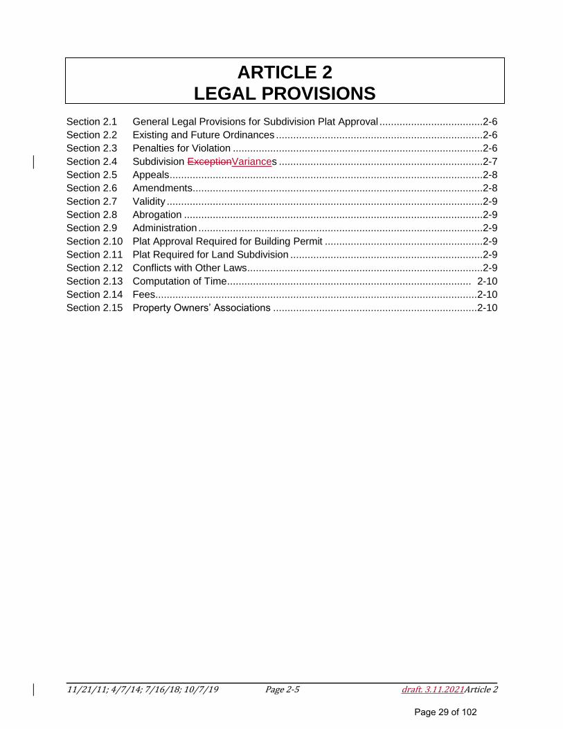
11/21/11; 4/7/14; 7/16/18; 10/7/19 Page 2-5 draft. 3.11.2021Article 2
ARTICLE 2 LEGAL PROVISIONS
Section 2.1 General Legal Provisions for Subdivision Plat Approval ....................................2-6
Section 2.2 Existing and Future Ordinances ........................................................................2-6
Section 2.3 Penalties for Violation .......................................................................................2-6
Section 2.4 Subdivision ExceptionVariances .......................................................................2-7
Section 2.5 Appeals .............................................................................................................2-8
Section 2.6 Amendments .....................................................................................................2-8
Section 2.7 Validity ..............................................................................................................2-9
Section 2.8 Abrogation ........................................................................................................2-9
Section 2.9 Administration ...................................................................................................2-9
Section 2.10 Plat Approval Required for Building Permit .......................................................2-9
Section 2.11 Plat Required for Land Subdivision ...................................................................2-9
Section 2.12 Conflicts with Other Laws ..................................................................................2-9
Section 2.13 Computation of Time ..................................................................................... 2-10
Section 2.14 Fees................................................................................................................ 2-10
Section 2.15 Property Owners’ Associations ....................................................................... 2-10
Page 29 of 102
11/21/11; 4/7/14; 7/16/18; 10/7/19 Page 2-6 draft. 3.11.2021Article 2
ARTICLE 2. LEGAL PROVISIONS
SECTION 2.1 GENERAL LEGAL PROVISIONS FOR SUBDIVISION PLAT APPROVAL
(A) After the effective date of this Ordinance, no plat of a subdivision of land within Polk
County’s jurisdiction shall be filed or recorded until it has been submitted to and approved
by Polk County and until this approval is entered in writing on the face of the plat by the
Chairman of the Planning Board or the Administrator.
(B) The Register of Deeds shall not file or record a plat of a subdivision of land located within
the planning jurisdiction of the County that has not been approved in accordance with
these provisions, nor shall the Clerk of Court order or direct the recording of a plat if the
recording would be in conflict with this Ordinance.
SECTION 2.2 EXISTING AND FUTURE ORDINANCES
All proposed subdivisions of land must comply in all respects with the requirements of all Polk
County, state, and federal regulations and requirements.
SECTION 2.3 PENALTIES FOR VIOLATION
(A) It shall be a violation of this Ordinance, for any person who being the owner or the agent
of the owner of any land located within the territorial jurisdiction of this Ordinance, to
subdivide his land in violation of this Ordinance or transfers or sells land by reference to,
exhibition of, or any other use of a plat showing a subdivision of the land before the plat
has been properly approved under the terms of this Ordinance and recorded in the Office
of the Polk County Register of Deeds. The description by metes and bounds in the
instrument of transfer or other document used in the process of selling or transferring land
shall not exempt the transaction from this penalty. The County, through its attorney or
other official designated by the Polk County Board of Commissioners, may enjoin illegal
subdivision, transfer or sale of land by action for injunction. Violators of this Ordinance
shall not be guilty of a Class III misdemeanor nor subject to fine and/or imprisonment as
provided by NCGS 14-4.
(B) The violation of any provision of this Ordinance shall subject the offender to a civil penalty
in the amount of 100 dollars to be recovered by the County. Violators shall be issued a
written citation which must be paid within 10 days. Each day’s continuing violation of this
Ordinance shall be a separate and distinct offense.
(C) This Ordinance may be enforced by appropriate equitable remedies issuing from a court
of competent jurisdiction.
(D) Nothing in this section shall be construed to limit the use of remedies available to the
County. The County may seek to enforce this Ordinance by using any one, all, or a
combination of remedies.
Page 30 of 102
11/21/11; 4/7/14; 7/16/18; 10/7/19 Page 2-7 draft. 3.11.2021Article 2
ARTICLE 2. LEGAL PROVISIONS
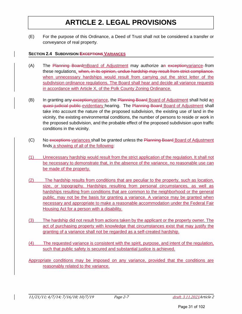
(E) For the purpose of this Ordinance, a Deed of Trust shall not be considered a transfer or
conveyance of real property.
SECTION 2.4 SUBDIVISION EXCEPTIONS VARIANCES
(A) The Planning BoardmBoard of Adjustment may authorize an exceptionvariance from
these regulations. when, in its opinion, undue hardship may result from strict compliance.
when unnecessary hardships would result from carrying out the strict letter of the
subdivision ordinance regulations. The Board shall hear and decide all variance requests
in accordance with Article X, of the Polk County Zoning Ordinance.
(B) In granting any exceptionvariance, the Planning Board Board of Adjustment shall hold an
quasi-judicial public evidentiary hearing. The Planning Board Board of Adjustment shall
take into account the nature of the proposed subdivision, the existing use of land in the
vicinity, the existing environmental conditions, the number of persons to reside or work in
the proposed subdivision, and the probable effect of the proposed subdivision upon traffic
conditions in the vicinity.
(C) No exceptions variances shall be granted unless the Planning Board Board of Adjustment
finds a showing of all of the following:
(1) Unnecessary hardship would result from the strict application of the regulation. It shall not
be necessary to demonstrate that, in the absence of the variance, no reasonable use can
be made of the property.
(2) The hardship results from conditions that are peculiar to the property, such as location,
size, or topography. Hardships resulting from personal circumstances, as well as
hardships resulting from conditions that are common to the neighborhood or the general
public, may not be the basis for granting a variance. A variance may be granted when
necessary and appropriate to make a reasonable accommodation under the Federal Fair
Housing Act for a person with a disability.
(3) The hardship did not result from actions taken by the applicant or the property owner. The
act of purchasing property with knowledge that circumstances exist that may justify the
granting of a variance shall not be regarded as a self-created hardship.
(4) The requested variance is consistent with the spirit, purpose, and intent of the regulation,
such that public safety is secured and substantial justice is achieved.
Appropriate conditions may be imposed on any variance, provided that the conditions are
reasonably related to the variance.
Page 31 of 102
11/21/11; 4/7/14; 7/16/18; 10/7/19 Page 2-8 draft. 3.11.2021Article 2
ARTICLE 2. LEGAL PROVISIONS
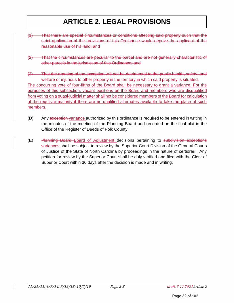
(1) That there are special circumstances or conditions affecting said property such that the
strict application of the provisions of this Ordinance would deprive the applicant of the
reasonable use of his land; and
(2) That the circumstances are peculiar to the parcel and are not generally characteristic of
other parcels in the jurisdiction of this Ordinance; and
(3) That the granting of the exception will not be detrimental to the public health, safety, and
welfare or injurious to other property in the territory in which said property is situated.
The concurring vote of four-fifths of the Board shall be necessary to grant a variance. For the
purposes of this subsection, vacant positions on the Board and members who are disqualified
from voting on a quasi-judicial matter shall not be considered members of the Board for calculation
of the requisite majority if there are no qualified alternates available to take the place of such
members.
(D) Any exception variance authorized by this ordinance is required to be entered in writing in
the minutes of the meeting of the Planning Board and recorded on the final plat in the
Office of the Register of Deeds of Polk County.
(E) Planning Board Board of Adjustment decisions pertaining to subdivision exceptions
variances shall be subject to review by the Superior Court Division of the General Courts
of Justice of the State of North Carolina by proceedings in the nature of certiorari. Any
petition for review by the Superior Court shall be duly verified and filed with the Clerk of
Superior Court within 30 days after the decision is made and in writing.
Page 32 of 102
11/21/11; 4/7/14; 7/16/18; 10/7/19 Page 2-9 draft. 3.11.2021Article 2
ARTICLE 2. LEGAL PROVISIONS
SECTION 2.5 APPEALS
Appeals from decisions of the Administrator or the Planning Board making an Administrative
decision shall be taken to the Planning BoardBoard of Adjustment. The Board of Adjustment shall
hear and decide appeals in accordance with Article X, of the Polk County Zoning Ordinance.
Appeals from the administrative decisions of the Planning Board shall be taken to the Polk County
Board of Commissioners; appeals from the quasi-judicial decisions of the Planning Board shall
be taken to the Court of Record as provided by Law (see Section 3.8). Appeals must be filed
within thirty (30) days from the date of the respective order or decision is issued.
Appeals from quasi-judicial decisions shall be subject to review by the superior court by
proceedings in the nature of certiorari. The owner or other party shall have 30 days from receipt
of the written notice of the determination within which to file an appeal. Any other person with
standing to appeal shall have 30 days from receipt from any source of actual or constructive notice
of the determination within which to file an appeal. In the absence of evidence to the contrary,
notice given pursuant to G.S. 160D-4-3(b) by first-class mail shall be deemed received on the
third business day following deposit of the notice for mailing with the United States Postal Service.
SECTION 2.6 AMENDMENTS
(A) Authority. This ordinance may be amended by the Board of Commissioners by approval,
in the usual form, of an ordinance specifying the changes to be made.
(B) Planning Board and Administration Review; Recommendation.
(1) All proposed amendments to this Ordinance, except those initiated by the Planning
Board, shall be submitted to the Planning Board for its recommendations as to
approval, approval with specified alterations, or denial. Unless such
recommendation is forthcoming within 60 days of submittal, except if a longer
period is agreed upon in writing by the person initiating the proposal, the Board of
Commissioners may proceed to act without a recommendation.
(2) Prior to acting, the Planning Board shall afford the County Manager, on behalf of
the administrative branch of the county government, the opportunity to submit
comments upon the proposed amendment.
(C) Public Legislative Hearing and Notice. No proposed amendment to this Ordinance shall
be acted upon by the Board of Commissioners until after a public hearing thereon. A
notice of the public hearing shall be published once a week for two successive calendar
weeks in a newspaper having general circulation in the county. The notice shall be
published the first time not less than ten days nor more than 25 days before the date set
for the hearing. In computing such period, the day of publication is not included, but the
day of the hearing shall be included.
Page 33 of 102
11/21/11; 4/7/14; 7/16/18; 10/7/19 Page 2-10 draft. 3.11.2021Article 2
ARTICLE 2. LEGAL PROVISIONS
(D) Limitation on Resubmittal. Except when initiated by the Board of Commissioners or the
Planning Board, no proposed amendment to this Ordinance failing of approval shall be
considered in substantially the same form within one year of the date of failure to win
approval.
SECTION 2.7 VALIDITY
Should any section or provision of this Ordinance be decided by a court of competent jurisdiction
to be unconstitutional or invalid, such decision shall not affect the validity of this Ordinance as a
whole or any part thereof other than the part so declared to be unconstitutional or invalid.
SECTION 2.8 ABROGATION
This Ordinance shall neither repeal, abrogate, annul, impair or interfere with any existing
subdivisions, the plats of which are properly recorded in the Office of Register of Deeds prior to
the effective date of this Ordinance nor with the existing easements, covenants, deed restrictions,
agreements or permits previously adopted or issued pursuant to law prior to the effective date of
this Ordinance.
SECTION 2.9 ADMINISTRATION
The County Manager or his designee is hereby appointed to serve as the Administrator until such
time the County Commissioners create a separate position of Administrator.
SECTION 2.10 PLAT APPROVAL REQUIRED FOR BUILDING PERMIT
No building permit may be issued for any construction on any proposed lot shown on a
development plan until a final plat has been approved and recorded, except that a building permit
may be issued for one (1) structure on one (1) lot shown on any approved development plan prior
to recordation of a final plat. The Building Inspector shall deny building permits for subdivision
lots created in violation of the terms and conditions of this Ordinance. Denial of a building permit
based on a subdivision violation may be appealed to the Planning Board Board of Adjustment for
interpretation of the subdivision ordinance violation.
SECTION 2.11 PLAT REQUIRED FOR LAND SUBDIVISION
All subdivision of parcels requires recordation of a plat. Parcels may not be subdivided by deed
alone.
SECTION 2.12 CONFLICT WITH OTHER LAWS
In interpreting and applying the provisions of this ordinance, they shall be held to be the minimum
requirements for the promotion of the health, safety, morals or general welfare of Polk County.
Page 34 of 102
11/21/11; 4/7/14; 7/16/18; 10/7/19 Page 2-11 draft. 3.11.2021Article 2
ARTICLE 2. LEGAL PROVISIONS
Where the provisions of any other statute or local ordinance are in conflict, the more restrictive or
that imposing the higher standards shall govern.
SECTION 2.13 COMPUTATION OF TIME
Unless otherwise specifically provided, the time within which an act is to be done shall be
computed by excluding the first and including the last day. If the last day is a Saturday, Sunday,
or legal holiday, that day shall be excluded. When the period of time prescribed is less than seven
days, intermediate Saturdays, Sundays, and holidays shall be excluded.
SECTION 2.14 FEES
(A) Reasonable fees sufficient to cover the cost of administration, inspection, publication of
notice and similar matters may be charged to applicants for all permits issued under this
ordinance. The amount of fees charged shall be set forth in the County’s fee schedule as
established by the Board of Commissioners and filed in the office of the Clerk to the Board.
(B) All fees shall be paid upon submission of any signed application required by this
Ordinance.
SECTION 2.15 PROPERTY OWNERS’ ASSOCIATIONS
(A) No preliminary plat for a subdivision for which a property owners’ association will exist
shall be approved until all required legal instruments have been reviewed by the County
as to legal form and effect and approved by the County.
(B) Property owners’ associations or similar legal entities that are responsible for the
maintenance and control of open space areas and common areas, including roads and
infrastructure/drainage easements, shall be established by the developer who shall record
in the Register of Deeds a declaration of covenants and restrictions that will govern the
association or similar legal entity. All such agreements shall comply with applicable North
Carolina state statutes. A copy of the recorded document shall be provided to the
Administrator and such document shall include, but not be limited to, the following:
(1) Provision for the establishment of the association or similar entity is required before
any lot in the development is sold or any building occupied and membership shall
be mandatory for each homeowner and any successive buyer.
(2) The association or similar legal entity has clear legal authority to maintain and
exercise control over such common open space areas.
(3) The association or similar legal entity has the power to compel contributions from
residents of the development to cover their proportionate shares of the costs
Page 35 of 102
11/21/11; 4/7/14; 7/16/18; 10/7/19 Page 2-12 draft. 3.11.2021Article 2
ARTICLE 2. LEGAL PROVISIONS
associated with the maintenance and upkeep of such common areas. Further,
assessments levied can become a lien on the property if allowed in the master
deed establishing the property owners’ association or similar legal entity.
(4) The open space restrictions must be permanent, not just for a period of years.
(5) The association or similar legal entity must be responsible for liability insurance,
applicable taxes, and the maintenance of open space, recreational facilities,
private streets, infrastructure, and other facilities under its control.
(6) The association or similar legal entity must be able to adjust the assessment to
meet changing needs.
(7) Covenants for maintenance assessments shall run with the land.
(8) Provision insuring that control of such association will gradually be vested in the
property owners’ association.
(9) All lands so conveyed shall be subject to the obligation of the grantee or grantees
to enforce maintenance and improvement of all common facilities.
(C) The association shall be responsible for maintaining all public storm water drainage
systems, private streets, easements, infrastructure and open space not being maintained
by the County, State or other approved entity. The cost of such maintenance shall be an
obligation of the association.
(D) The developer shall place in a conspicuous manner upon the final plat of the subdivision
prior to final plat approval a notation concerning control of all common areas
owned/controlled by the association.
(E) In the case of common ownership by a property owners’ association, the restrictive
covenants shall provide that, in the event the property owners’ association fails to maintain
the areas in common ownership according to the standards of this Ordinance, the County
may, following reasonable notice, demand that deficiency of maintenance be corrected,
or enter the open space to maintain it. The cost of such maintenance shall be charged to
the property owners’ association.
(F) It shall be expressly stated within the restrictive covenants/property owners’ association
documents that it will be the responsibility of the developer or successors or assigns to
enforce such covenants or restrictions until such time as control has been transferred to
the Property Owners’ Association Board of Directors. It shall be the sole responsibility of
the developer, successor or assigns to correct any deficiencies prior to transfer of control
over to the Property Owners’ Association Board of Directors.
Page 36 of 102
11/21/11; 4/7/14; 7/16/18; 10/7/19 Page 3-13 draft.3.11.2021Article 3
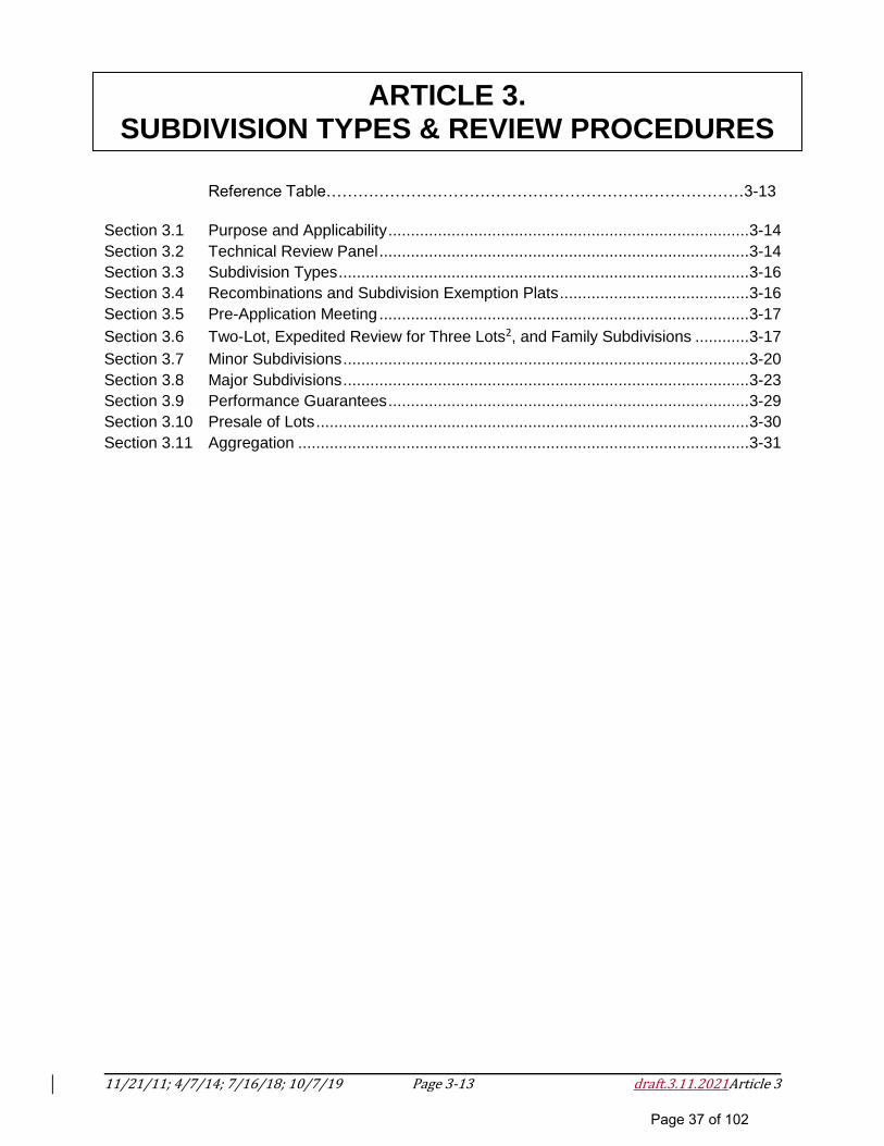
ARTICLE 3. SUBDIVISION TYPES & REVIEW PROCEDURES
Reference Table…………………………………………………….………………3-13
Section 3.1 Purpose and Applicability ................................................................................ 3-14
Section 3.2 Technical Review Panel .................................................................................. 3-14
Section 3.3 Subdivision Types ........................................................................................... 3-16
Section 3.4 Recombinations and Subdivision Exemption Plats .......................................... 3-16
Section 3.5 Pre-Application Meeting .................................................................................. 3-17
Section 3.6 Two-Lot, Expedited Review for Three Lots2, and Family Subdivisions ............ 3-17
Section 3.7 Minor Subdivisions .......................................................................................... 3-20
Section 3.8 Major Subdivisions .......................................................................................... 3-23
Section 3.9 Performance Guarantees ................................................................................ 3-29
Section 3.10 Presale of Lots ................................................................................................ 3-30
Section 3.11 Aggregation .................................................................................................... 3-31
Page 37 of 102
11/21/11; 4/7/14; 7/16/18; 10/7/19 Page 3-14 draft.3.11.2021Article 3
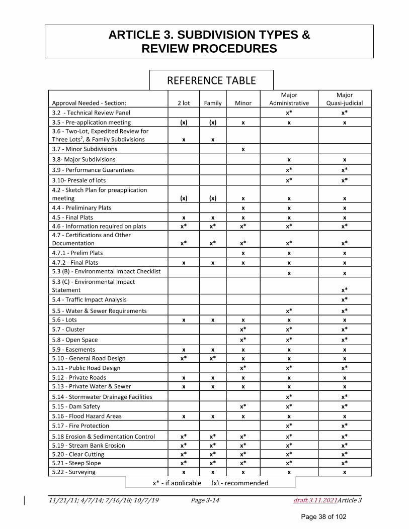
ARTICLE 3. SUBDIVISION TYPES & REVIEW PROCEDURES
Approval Needed - Section: 2 lot Family Minor Major
Administrative Major
Quasi-judicial
3.2 - Technical Review Panel x* x*
3.5 - Pre-application meeting (x) (x) x x x
3.6 - Two-Lot, Expedited Review for Three Lots2, & Family Subdivisions x x
3.7 - Minor Subdivisions x 3.8- Major Subdivisions x x
3.9 - Performance Guarantees x* x*
3.10- Presale of lots x* x*
4.2 - Sketch Plan for preapplication meeting (x) (x) x x x
4.4 - Preliminary Plats x x x
4.5 - Final Plats x x x x x
4.6 - Information required on plats x* x* x* x* x*
4.7 - Certifications and Other Documentation x* x* x* x* x*
4.7.1 - Prelim Plats x x x
4.7.2 - Final Plats x x x x x
5.3 (B) - Environmental Impact Checklist x x
5.3 (C) - Environmental Impact Statement
x*
5.4 - Traffic Impact Analysis x*
5.5 - Water & Sewer Requirements x* x*
5.6 - Lots x x x x x
5.7 - Cluster x* x* x*
5.8 - Open Space x* x* x*
5.9 - Easements x x x x x
5.10 - General Road Design x* x* x x x
5.11 - Public Road Design x* x* x*
5.12 - Private Roads x x x x x
5.13 - Private Water & Sewer x x x x x
5.14 - Stormwater Drainage Facilities x* x*
5.15 - Dam Safety x* x* x*
5.16 - Flood Hazard Areas x x x x x
5.17 - Fire Protection x* x*
5.18 Erosion & Sedimentation Control x* x* x* x* x*
5.19 - Stream Bank Erosion x* x* x* x* x*
5.20 - Clear Cutting x* x* x* x* x*
5.21 - Steep Slope x* x* x* x* x*
5.22 - Surveying x x x x x
x* - if applicable (x) - recommended
REFERENCE TABLE
Page 38 of 102

11/21/11; 4/7/14; 7/16/18; 10/7/19 Page 3-15 draft.3.11.2021Article 3
ARTICLE 3. SUBDIVISION TYPES & REVIEW PROCEDURES
SECTION 3.1 PURPOSE AND APPLICABILITY
The purpose of this Article is to establish an orderly subdivision process for Polk County. It is
also the intent of this Article to provide a clear and comprehensive approval process that is fair
and equitable to all interests including the petitioners, affected neighbors, County staff, related
agencies, the Planning Board, and the Board of Commissioners. Approved plans shall be the
guiding documents for final approval and permitting.
SECTION 3.2 TECHNICAL REVIEW PANEL
(A) Purpose. The purpose of the Technical Review Panel (TRP) is to facilitate communication
and coordination of administrative review and comment between departments and
additional technical resources as requested by the Administrator.
(B) Powers and Duties. At the discretion of the Administrator, the TRP shall review
applications for major subdivision preliminary plats and amendments including major
cluster subdivisions. The Administrator shall provide TRP recommendations to the
Planning Board.
(C) Composition:
(1) The members constituting the TRP, in any case where the Administrator exercises
discretion under Section 3.2(B) to require TRP review, shall be selected by the
Administrator, at the Administrator’s discretion. Such members may be selected
by the Administrator from:
County Departments:
Administrator (Planning Department)
County Manager
Building and Fire Inspections
Sheriff’s Department
Health Department
Social Services Department
Polk County Agricultural Economic Development Director
Consulting Engineer (as designated by the County Manager)
Other County representatives appointed by the County Manager
Page 39 of 102
11/21/11; 4/7/14; 7/16/18; 10/7/19 Page 3-16 draft.3.11.2021Article 3
ARTICLE 3. SUBDIVISION TYPES & REVIEW PROCEDURES
Others, at the discretion of the Administrator, may include:
County Attorney
Professionally Recognized Technical Experts
Utilities Providers
Polk County Board of Education
Isothermal Planning & Development Commission
NC Department of Transportation (NCDOT)
NC Department of Environmental Quality (NCDEQ) 2
NC Division of Water Quality
NC Wildlife Resources Commission
US Army Corps of Engineers
US Department of Agriculture
Any Other Agencies or Officials Designated by the Administrator and/or the
Planning Board
(2) The Administrator shall coordinate the TRP review process, document the
process, and may request the participation of professional experts or a
representative from an adjacent municipality, county, regional or state agency if
the Administrator determines that such entities can provide expertise concerning
the proposed development.
(3) Determinations regarding new street names or changes in street names must be
reviewed by the Polk County 911 Administrator.
(D) Administrative Procedures.
(1) Meetings of the TRP participants may be scheduled and held when necessary.
(2) The applicant and representatives may be invited by the Administrator to
participate in the review process.
(3) Individual reviews may occur by TRP members and comments individually
submitted to the Administrator.
(4) The Administrator shall provide TRP recommendations in writing to the applicant
and appropriate body.
Page 40 of 102
11/21/11; 4/7/14; 7/16/18; 10/7/19 Page 3-17 draft.3.11.2021Article 3
ARTICLE 3. SUBDIVISION TYPES & REVIEW PROCEDURES
SECTION 3.3 SUBDIVISION TYPES
The following subdivision types, each of which is defined in Article 6 of this Ordinance, shall be
administered in accordance with the provisions specified herein: two-lot subdivisions, expedited
review for three lots2, family subdivisions, minor subdivisions, major subdivisions, and cluster
development subdivisions. In addition, any other subdivision of land which does not fall within a
category designated above shall be subject to review by the Planning Board pursuant to
procedures reasonably necessary to ensure compliance with this Ordinance.
SECTION 3.4 RECOMBINATIONS AND SUBDIVISION EXEMPTION PLATS
For plats implementing the recombination of previously subdivided land or for plats that do not
meet the definition of a subdivision as set forth in Article 6, the following shall apply:
(A) Review Process. The Administrator shall confirm that the plat does not meet the definition
of a subdivision, and that minimum zoning lot sizes are met, if applicable.
(B) Recombination and Exemption Plat Special Requirements.
(1) Prior to recording a plat for recombination, the applicant shall provide evidence to
the Administrator that the recombination of all or portions of parcels of previously
subdivided and recorded lands which have been recombined is in such a fashion
where the resultant number of parcels is less than or equal to the original number
of parcels and meets the requirements of this Ordinance, where applicable.
(2) Any plat or any part of a plat may be vacated by the owner at any time before the
sale of any lot in the subdivision by a written instrument to which a copy of such
plat shall be attached, declaring the same to be vacated. Such an instrument shall
be approved by the same agencies as approved the final plat. The governing body
may reject any such instrument which abridges or destroys any public rights in any
of its public uses, improvements, streets or alleys. Such an instrument shall be
executed, acknowledged or approved, and recorded and filed in the same manner
as a final plat; and being duly recorded or filed shall operate to destroy the force
and effect of the recording of the plat so vacated, and to divest all public rights in
the streets, alleys, and public grounds, and all dedications laid out or described in
such plat.map review officer.
Page 41 of 102
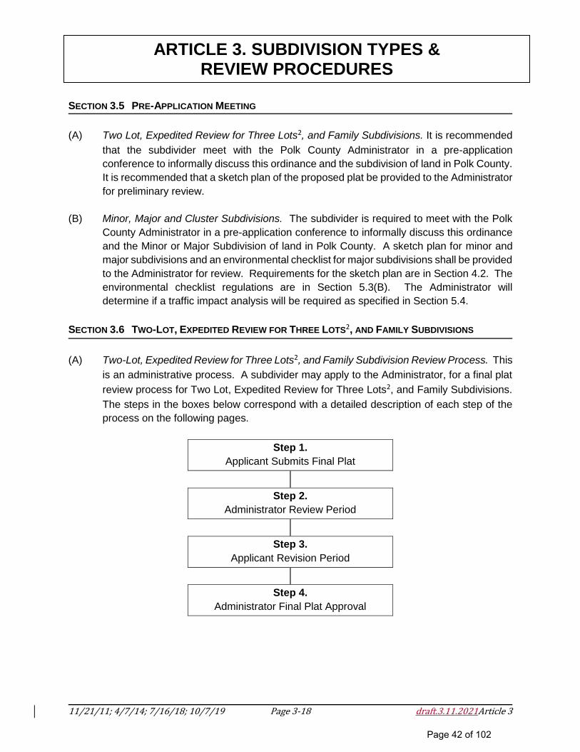
11/21/11; 4/7/14; 7/16/18; 10/7/19 Page 3-18 draft.3.11.2021Article 3
ARTICLE 3. SUBDIVISION TYPES & REVIEW PROCEDURES
SECTION 3.5 PRE-APPLICATION MEETING
(A) Two Lot, Expedited Review for Three Lots2, and Family Subdivisions. It is recommended
that the subdivider meet with the Polk County Administrator in a pre-application
conference to informally discuss this ordinance and the subdivision of land in Polk County.
It is recommended that a sketch plan of the proposed plat be provided to the Administrator
for preliminary review.
(B) Minor, Major and Cluster Subdivisions. The subdivider is required to meet with the Polk
County Administrator in a pre-application conference to informally discuss this ordinance
and the Minor or Major Subdivision of land in Polk County. A sketch plan for minor and
major subdivisions and an environmental checklist for major subdivisions shall be provided
to the Administrator for review. Requirements for the sketch plan are in Section 4.2. The
environmental checklist regulations are in Section 5.3(B). The Administrator will
determine if a traffic impact analysis will be required as specified in Section 5.4.
SECTION 3.6 TWO-LOT, EXPEDITED REVIEW FOR THREE LOTS2, AND FAMILY SUBDIVISIONS
(A) Two-Lot, Expedited Review for Three Lots2, and Family Subdivision Review Process. This
is an administrative process. A subdivider may apply to the Administrator, for a final plat
review process for Two Lot, Expedited Review for Three Lots2, and Family Subdivisions.
The steps in the boxes below correspond with a detailed description of each step of the
process on the following pages.
Step 1.
Applicant Submits Final Plat
Step 2.
Administrator Review Period
Step 3.
Applicant Revision Period
Step 4.
Administrator Final Plat Approval
Page 42 of 102
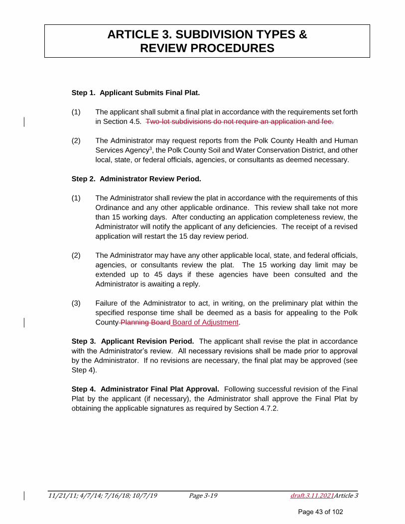
11/21/11; 4/7/14; 7/16/18; 10/7/19 Page 3-19 draft.3.11.2021Article 3
ARTICLE 3. SUBDIVISION TYPES & REVIEW PROCEDURES
Step 1. Applicant Submits Final Plat.
(1) The applicant shall submit a final plat in accordance with the requirements set forth
in Section 4.5. Two-lot subdivisions do not require an application and fee.
(2) The Administrator may request reports from the Polk County Health and Human
Services Agency3, the Polk County Soil and Water Conservation District, and other
local, state, or federal officials, agencies, or consultants as deemed necessary.
Step 2. Administrator Review Period.
(1) The Administrator shall review the plat in accordance with the requirements of this
Ordinance and any other applicable ordinance. This review shall take not more
than 15 working days. After conducting an application completeness review, the
Administrator will notify the applicant of any deficiencies. The receipt of a revised
application will restart the 15 day review period.
(2) The Administrator may have any other applicable local, state, and federal officials,
agencies, or consultants review the plat. The 15 working day limit may be
extended up to 45 days if these agencies have been consulted and the
Administrator is awaiting a reply.
(3) Failure of the Administrator to act, in writing, on the preliminary plat within the
specified response time shall be deemed as a basis for appealing to the Polk
County Planning Board Board of Adjustment.
Step 3. Applicant Revision Period. The applicant shall revise the plat in accordance
with the Administrator’s review. All necessary revisions shall be made prior to approval
by the Administrator. If no revisions are necessary, the final plat may be approved (see
Step 4).
Step 4. Administrator Final Plat Approval. Following successful revision of the Final
Plat by the applicant (if necessary), the Administrator shall approve the Final Plat by
obtaining the applicable signatures as required by Section 4.7.2.
Page 43 of 102
11/21/11; 4/7/14; 7/16/18; 10/7/19 Page 3-20 draft.3.11.2021Article 3
ARTICLE 3. SUBDIVISION TYPES & REVIEW PROCEDURES
(B) Family Subdivision Special Requirements.
(1) The subdivider shall submit with his application for a Family Subdivision written
evidence that the subdivision is a division of land by a property owner among his
immediate family, to wit: spouse, children, or their lineal descendants or
ascendants, or the lineal descendants or ascendants of said property owner as a
gift, or as a settlement of the property owners estate.
(2) The family subdivision shall provide that each lot or parcel of land shall have direct
access from an existing recorded right-of-way or shall have a recorded access
easement from a public road. If a grantor has a recorded access easement, it must
transfer along with the property.
(C) Expedited Review for Three Lots2
(1) The Administrator Applicant shall submit an application with require only a plat for
recordation for the division of a tract or parcel of land in single ownership if all of the
following criteria are met:
a. The tract or parcel to be divided is not already exempt according to the
Subdivision definition
b. No part of the tract or parcel to be divided has been divided in the 10 years
prior to the division
c. The entire area of the tract or parcel to be divided is greater than five acres
d. After division, no more than three lots result from the division
e. After division, all resultant lots comply with all of the following:
i. Any lot dimension size requirements of the applicable land-use
regulations, if any
ii. The use of the lots is in conformity with the applicable zoning
requirement, if any
iii. A permanent means of ingress and egress is recorded for each lot.
Page 44 of 102
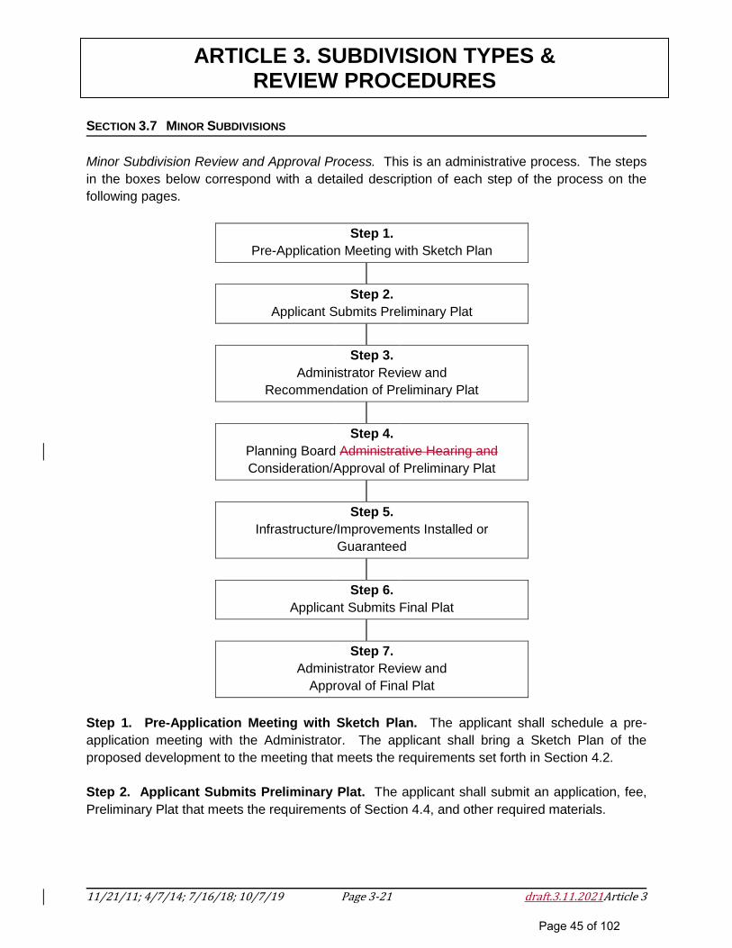
11/21/11; 4/7/14; 7/16/18; 10/7/19 Page 3-21 draft.3.11.2021Article 3
ARTICLE 3. SUBDIVISION TYPES & REVIEW PROCEDURES
SECTION 3.7 MINOR SUBDIVISIONS
Minor Subdivision Review and Approval Process. This is an administrative process. The steps
in the boxes below correspond with a detailed description of each step of the process on the
following pages.
Step 1.
Pre-Application Meeting with Sketch Plan
Step 2.
Applicant Submits Preliminary Plat
Step 3.
Administrator Review and
Recommendation of Preliminary Plat
Step 4.
Planning Board Administrative Hearing and
Consideration/Approval of Preliminary Plat
Step 5.
Infrastructure/Improvements Installed or
Guaranteed
Step 6.
Applicant Submits Final Plat
Step 7.
Administrator Review and
Approval of Final Plat
Step 1. Pre-Application Meeting with Sketch Plan. The applicant shall schedule a pre-
application meeting with the Administrator. The applicant shall bring a Sketch Plan of the
proposed development to the meeting that meets the requirements set forth in Section 4.2.
Step 2. Applicant Submits Preliminary Plat. The applicant shall submit an application, fee,
Preliminary Plat that meets the requirements of Section 4.4, and other required materials.
Page 45 of 102
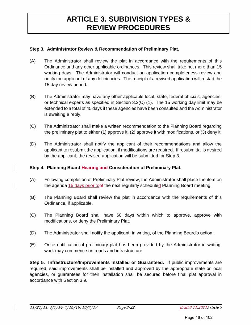
11/21/11; 4/7/14; 7/16/18; 10/7/19 Page 3-22 draft.3.11.2021Article 3
ARTICLE 3. SUBDIVISION TYPES & REVIEW PROCEDURES
Step 3. Administrator Review & Recommendation of Preliminary Plat.
(A) The Administrator shall review the plat in accordance with the requirements of this
Ordinance and any other applicable ordinances. This review shall take not more than 15
working days. The Administrator will conduct an application completeness review and
notify the applicant of any deficiencies. The receipt of a revised application will restart the
15 day review period.
(B) The Administrator may have any other applicable local, state, federal officials, agencies,
or technical experts as specified in Section 3.2(C) (1). The 15 working day limit may be
extended to a total of 45 days if these agencies have been consulted and the Administrator
is awaiting a reply.
(C) The Administrator shall make a written recommendation to the Planning Board regarding
the preliminary plat to either (1) approve it, (2) approve it with modifications, or (3) deny it.
(D) The Administrator shall notify the applicant of their recommendations and allow the
applicant to resubmit the application, if modifications are required. If resubmittal is desired
by the applicant, the revised application will be submitted for Step 3.
Step 4. Planning Board Hearing and Consideration of Preliminary Plat.
(A) Following completion of Preliminary Plat review, the Administrator shall place the item on
the agenda 15 days prior toof the next regularly scheduled Planning Board meeting.
(B) The Planning Board shall review the plat in accordance with the requirements of this
Ordinance, if applicable.
(C) The Planning Board shall have 60 days within which to approve, approve with
modifications, or deny the Preliminary Plat.
(D) The Administrator shall notify the applicant, in writing, of the Planning Board’s action.
(E) Once notification of preliminary plat has been provided by the Administrator in writing,
work may commence on roads and infrastructure.
Step 5. Infrastructure/Improvements Installed or Guaranteed. If public improvements are
required, said improvements shall be installed and approved by the appropriate state or local
agencies, or guarantees for their installation shall be secured before final plat approval in
accordance with Section 3.9.
Page 46 of 102
11/21/11; 4/7/14; 7/16/18; 10/7/19 Page 3-23 draft.3.11.2021Article 3
ARTICLE 3. SUBDIVISION TYPES & REVIEW PROCEDURES
Step 6. Applicant Submits Final Plat. The applicant shall submit a Final Plat that meets the
requirements of Section 4.5. This submittal shall include copies of any required NCDEQ2 or
NCDOT permit approvals.
Step 7. Administrator Review & Approval of Final Plat.
(A) The Final Plat shall be submitted not more than one year after the date on which the
Preliminary Plat was approved; otherwise, such Preliminary Plat approval shall be null and
void unless a written extension of this limit is granted by the Planning Board on or before
the one (1) year anniversary of the approval.
(B) The Administrator shall review the plat in accordance with the requirements of this
Ordinance and any other applicable ordinances. If the final plat conforms to the approved
preliminary plat, all preliminary conditions of approval, and all other applicable
requirements, the Administrator shall administratively approve the final plat within 15
working days from receipt of a complete final subdivision submittal. All required
improvements shall be complete or a performance guarantee package shall be submitted
in accordance with Section 3.9 and subsequently approved by the Planning Board.
(C) The final plat must be recorded within fourteen (14) days and a copy of the recorded plat
submitted to the Administrator.
SECTION 3.8 MAJOR SUBDIVISIONS
Page 47 of 102
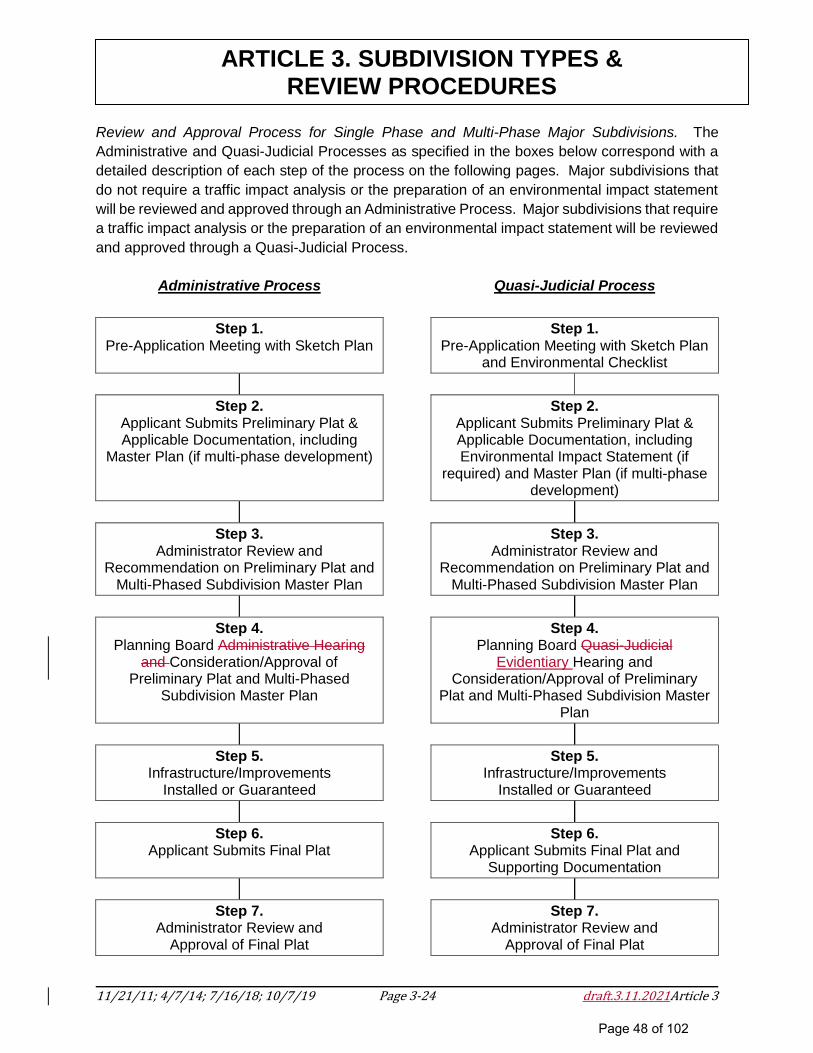
11/21/11; 4/7/14; 7/16/18; 10/7/19 Page 3-24 draft.3.11.2021Article 3
ARTICLE 3. SUBDIVISION TYPES & REVIEW PROCEDURES
Review and Approval Process for Single Phase and Multi-Phase Major Subdivisions. The
Administrative and Quasi-Judicial Processes as specified in the boxes below correspond with a
detailed description of each step of the process on the following pages. Major subdivisions that
do not require a traffic impact analysis or the preparation of an environmental impact statement
will be reviewed and approved through an Administrative Process. Major subdivisions that require
a traffic impact analysis or the preparation of an environmental impact statement will be reviewed
and approved through a Quasi-Judicial Process.
Administrative Process
Quasi-Judicial Process
Step 1.
Pre-Application Meeting with Sketch Plan
Step 1.
Pre-Application Meeting with Sketch Plan and Environmental Checklist
Step 2.
Applicant Submits Preliminary Plat & Applicable Documentation, including
Master Plan (if multi-phase development)
Step 2.
Applicant Submits Preliminary Plat & Applicable Documentation, including Environmental Impact Statement (if
required) and Master Plan (if multi-phase development)
Step 3.
Administrator Review and Recommendation on Preliminary Plat and
Multi-Phased Subdivision Master Plan
Step 3.
Administrator Review and Recommendation on Preliminary Plat and
Multi-Phased Subdivision Master Plan
Step 4. Planning Board Administrative Hearing
and Consideration/Approval of Preliminary Plat and Multi-Phased
Subdivision Master Plan
Step 4.
Planning Board Quasi-Judicial Evidentiary Hearing and
Consideration/Approval of Preliminary Plat and Multi-Phased Subdivision Master
Plan
Step 5. Infrastructure/Improvements
Installed or Guaranteed
Step 5.
Infrastructure/Improvements Installed or Guaranteed
Step 6.
Applicant Submits Final Plat
Step 6.
Applicant Submits Final Plat and Supporting Documentation
Step 7.
Administrator Review and Approval of Final Plat
Step 7.
Administrator Review and Approval of Final Plat
Page 48 of 102
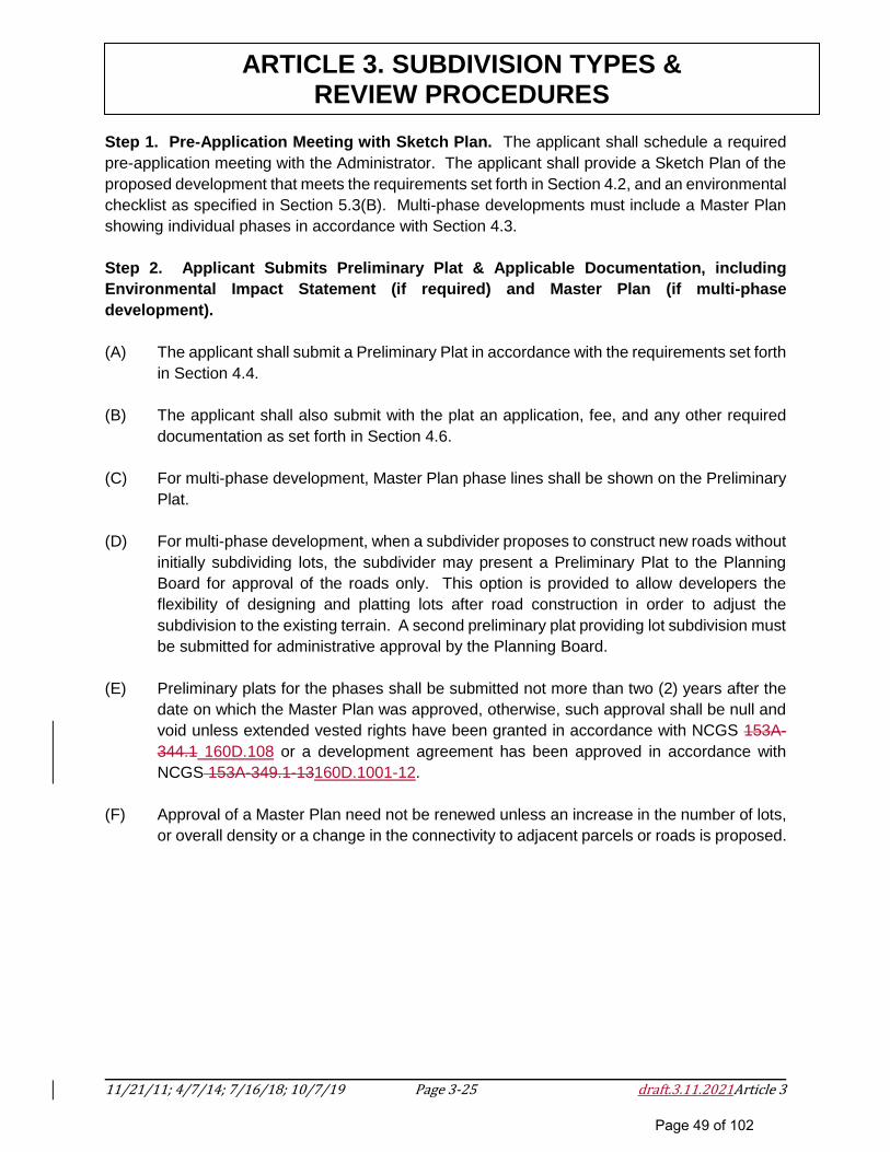
11/21/11; 4/7/14; 7/16/18; 10/7/19 Page 3-25 draft.3.11.2021Article 3
ARTICLE 3. SUBDIVISION TYPES & REVIEW PROCEDURES
Step 1. Pre-Application Meeting with Sketch Plan. The applicant shall schedule a required
pre-application meeting with the Administrator. The applicant shall provide a Sketch Plan of the
proposed development that meets the requirements set forth in Section 4.2, and an environmental
checklist as specified in Section 5.3(B). Multi-phase developments must include a Master Plan
showing individual phases in accordance with Section 4.3.
Step 2. Applicant Submits Preliminary Plat & Applicable Documentation, including
Environmental Impact Statement (if required) and Master Plan (if multi-phase
development).
(A) The applicant shall submit a Preliminary Plat in accordance with the requirements set forth
in Section 4.4.
(B) The applicant shall also submit with the plat an application, fee, and any other required
documentation as set forth in Section 4.6.
(C) For multi-phase development, Master Plan phase lines shall be shown on the Preliminary
Plat.
(D) For multi-phase development, when a subdivider proposes to construct new roads without
initially subdividing lots, the subdivider may present a Preliminary Plat to the Planning
Board for approval of the roads only. This option is provided to allow developers the
flexibility of designing and platting lots after road construction in order to adjust the
subdivision to the existing terrain. A second preliminary plat providing lot subdivision must
be submitted for administrative approval by the Planning Board.
(E) Preliminary plats for the phases shall be submitted not more than two (2) years after the
date on which the Master Plan was approved, otherwise, such approval shall be null and
void unless extended vested rights have been granted in accordance with NCGS 153A-
344.1 160D.108 or a development agreement has been approved in accordance with
NCGS 153A-349.1-13160D.1001-12.
(F) Approval of a Master Plan need not be renewed unless an increase in the number of lots,
or overall density or a change in the connectivity to adjacent parcels or roads is proposed.
Page 49 of 102
11/21/11; 4/7/14; 7/16/18; 10/7/19 Page 3-26 draft.3.11.2021Article 3
ARTICLE 3. SUBDIVISION TYPES & REVIEW PROCEDURES
Step 3. Administrator Review and Recommendation on Preliminary Plat and Multi-Phased
Subdivision Master Plan (if required).
(A) The Administrator shall review the plat and multi-phased subdivision master plan in
accordance with the requirements of this Ordinance and any other applicable ordinances.
This review shall take not more than 15 working days. The Administrator will conduct an
application completeness review and notify the applicant of any deficiencies. The receipt
of a revised application will restart the 15 day review period.
(B) The Administrator may have the TRP review the plat and multi-phased subdivision master
plan. The 15 working day limit may be extended to a total of 45 days if these agencies
have been consulted and the Administrator is awaiting a reply.
(C) The Administrator shall make recommendations in writing to the Planning Board to
approve, approve with modifications, or deny the Preliminary Plat and Multi-Phased
Subdivision Master Plan (if required). If the quasi-judicial approval process applies, the
recommendations shall be presented to the Planning Board as evidence at the quasi-
judicial public evidentiary hearing by the Administrator. If the administrative approval
process applies, the preliminary plat shall be presented to the Planning Board as specified
in Section 3.7, Step 4.
Step 4. Planning Board Quasi-Judicial Approval Process (if required).
(A) Major subdivision preliminary plat approvals are quasi-judicial decisions approved by a
simple majority vote of the Planning Board.
(B) Once a recommendation of the Administrator on the preliminary plat, environmental
impact statement, and master plan (if required) has been prepared, or the 45-day period
elapses without a recommendation, the Planning Board shall hold an quasi-judicial public
evidentiary hearing to consider action of the preliminary plat at its next regularly scheduled
meeting. A quorum of the Planning Board is required for this hearing. In addition, notice
shall be given to other potentially interested persons by publishing a notice once a week
for two successive calendar weeks in a newspaper having general circulation in the area.
The first notice shall be not less than ten (10) or more than twenty-five (25) days prior to
the hearing. All owners of the proposed subdivision parcel(s) and all owners of parcels of
land abutting the proposed subdivision parcel(s) as shown on the Polk County tax listing
shall be mailed a notice of the public hearing by first class mail at the last address listed
for such owners on the Polk County tax abstracts.
(C) In approving a preliminary plat, the Planning Board may attach fair and reasonable
conditions to the approval. The petitioner will have a reasonable opportunity to consider
Page 50 of 102
11/21/11; 4/7/14; 7/16/18; 10/7/19 Page 3-27 draft.3.11.2021Article 3
ARTICLE 3. SUBDIVISION TYPES & REVIEW PROCEDURES
and respond to any additional requirements prior to approval or denial by the Planning
Board. In no instance shall any of these conditions be less restrictive than any
requirements which would pertain to that particular subdivision.
(D) The applicant has the burden of producing competent, material and substantial evidence
to establish the facts and conditions relating to preliminary subdivision plat approval
including, but not limited to, an environmental impact statement, if required.
(E) The Planning Board shall approve the preliminary plat if it has evaluated the application
for approval through a quasi-judicial process and determined that the applicant has
demonstrated the following:
(1) The proposed subdivision complies with all applicable standards and regulations
of the ordinance and with all other applicable federal, state and county regulations.
(2) The proposed subdivision is in harmony with the County’s currently adopted
Comprehensive Plan as well as other plans adopted by the Board of
Commissioners.
(3) Adequate facilities exist or will be provided prior to the time they are needed. For
the purposes of this section, adequate facilities constitute those necessary for the
functionality of the subdivision in compliance with this Ordinance and include,
without limitation, roads, utilities, stormwater management, and waste and
wastewater treatment facilities.
(4) The proposed subdivision shall not result in significant negative environmental
impacts, whether direct, secondary, or cumulative. When making this
determination, the Board shall give due consideration to any appropriate effective
mitigating action(s) proposed or agreed to by the applicant.
(5) The road system in the subdivision will connect to segments of the public road
system with adequate capacity to handle the projected traffic flow, both on an
average basis and at peak hours. Furthermore, the subdivision shall be so located
and designed as to provide direct access to the subdivision without creating
substantial additional traffic in residential neighborhoods outside the subdivision.
(6) From a hydrological perspective, the proposed subdivision is not expected to
interfere with any presently existing legal use of water nor is it expected to impact
the long-term sustainable supply of groundwater. Any discharges of wastewater
to surface waters or to the ground shall meet the pretreatment requirements of the
state, as well as any requirements of a municipality if the discharge is going to a
municipal treatment facility.
Page 51 of 102
11/21/11; 4/7/14; 7/16/18; 10/7/19 Page 3-28 draft.3.11.2021Article 3
ARTICLE 3. SUBDIVISION TYPES & REVIEW PROCEDURES
In making these determinations, the Planning Board may take into consideration any fair
and reasonable conditions imposed pursuant to Step 4(C), above.
(F) The Planning Board shall have up to 60 days to approve, approve with modifications, or
deny the Preliminary Plat.
(G) The Administrator shall notify the applicant, in writing, of the Planning Board’s action.
Once Preliminary Plat has been approved, work may commence on roads and
infrastructure.
(H) Evidence/Presentation of Evidence at Quasi-Judicial Public Evidentiary Hearing. The
provisions of this section apply to all quasi-judicial evidentiary hearings.
(1) All persons who intend to present evidence to the Planning Board shall be sworn
in by the Chairman at the beginning of the hearing.
(2) All findings and conclusions necessary to the issuance or denial of the requested
preliminary plat shall be based upon competent evidence (evidence admissible in
a court of law).
(3) The Planning Board Chair has the authority to limit testimony that is irrelevant.
(4) The entirety of an quasi-judicial evidentiary hearing and deliberation shall be
conducted in open session.
(5) Parties to an quasi-judicial evidentiary hearing have a right to cross-examine
anyone presenting evidence.
(6) Factual findings must not be based on hearsay evidence which would be
inadmissible in a court of law.
(7) If a Planning Board member has prior or specialized knowledge about a case, that
knowledge shall be disclosed to the rest of the Board and parties present at the
beginning of the hearing.
(8) Members of the Planning Board must act in the public interest and not to advance
their own financial interests. If the outcome of the vote is Areasonably
likely to have a direct, substantial, and readily identifiable financial impact on the
member, the member must not vote on it. When a member is disqualified for a
conflict of interest, that member must not participate in the hearing in any way,
neither asking questions, nor debating, nor voting on the case.
Page 52 of 102
11/21/11; 4/7/14; 7/16/18; 10/7/19 Page 3-29 draft.3.11.2021Article 3
ARTICLE 3. SUBDIVISION TYPES & REVIEW PROCEDURES
Members of appointed boards shall not vote on any advisory or legislative decision regarding a
development regulation where the outcome of the matter being considered is reasonably
likely to have a direct, substantial, and readily identifiable financial impact on the
member.
Quasi-Judicial Decisions. - A member of any board exercising quasi-judicial functions shall not
participate in or vote on any quasi-judicial matter in a manner that would violate affected
persons' constitutional rights to an impartial decision maker. Impermissible violations of
due process include, but are not limited to, a member having a fixed opinion prior to
hearing the matter that is not susceptible to change, undisclosed ex parte
communications, a close familial, business, or other associational relationship with an
affected person, or a financial interest in the outcome of the matter.
(9) The Planning Board, in conducting the hearing, has the authority to issue
subpoenas to compel testimony or the production of evidence deemed necessary
to determine the matter.
(I) Modification of Application at Hearing.
(1) In response to questions or comments by persons appearing at the hearing or to
suggestions or recommendations by the Planning Board, the applicant may agree
to modify the request for preliminary plat approval, including the plans and
specifications submitted.
(2) Unless such modifications are so substantial or extensive that the Planning Board
cannot reasonably be expected to perceive the nature and impact of the proposed
changes without a revised preliminary plat, the Planning Board may approve the
preliminary plat with the stipulation that the plat will not be approved until plans
reflecting agreed upon changes are submitted to the Administrator within 45 days.
Step 5. Infrastructure/Improvements Installed or Guaranteed. Prior to approval of the final
plat, the subdivider shall have installed the improvements specified in this Ordinance or
guaranteed their installation as provided in Section 3.9.
Step 6. Applicant Submits Final Plat. The applicant shall submit a Final Plat that meets the
requirements of Section 4.5.
Step 7. Administrator Review and Approval of Final Plat.
(A) The Final Plat shall be submitted not more than two (2) years after the date on which the
Preliminary Plat was approved through either the administrative or quasi-judicial approval
Page 53 of 102
11/21/11; 4/7/14; 7/16/18; 10/7/19 Page 3-30 draft.3.11.2021Article 3
ARTICLE 3. SUBDIVISION TYPES & REVIEW PROCEDURES
process, otherwise, such approval shall be null and void unless a written extension of this
limit (not to exceed six months) is granted by the Planning Board on or before the two (2)
year anniversary of the approval. Final plat approval may occur in stages, not exceeding
four (4) final plat recordings per each subdivision phase.
(B) The Administrator shall review the Final Plat for compliance with the approved Preliminary
Plat and Master Plan (if applicable), verify that all required infrastructure improvements
have been completed or guaranteed in accordance with Section 3.9, and ensure that the
Final Plat meets the requirements of Section 4.5.
(C) The final plat must be recorded within fourteen (14) days and a copy of the recorded plat
submitted to the Administrator.
SECTION 3.9 PERFORMANCE GUARANTEES
In lieu of requiring the completion, installation and dedication of all improvements prior to final plat
approval, Polk County may enter into an agreement with the subdivider whereby the subdivider
shall agree to complete all required improvements as specified by the approved preliminary plat
for that portion of the subdivision to be shown on the final plat within a mutually agreed upon
specified time period not to exceed one (1) year. Once agreed upon by both parties and the
security required herein is provided, the final plat may be approved by the Polk County Planning
Board, if all other requirements of this Ordinance are met. The Planning Board shall require a
certified cost estimate from a licensed contractor or engineer for the cost of completion of such
improvements.
(A) The subdivider shall provide one of the following Performance Guarantees, elected at the
subdivider’s discretion, in lieu of installation:
(1) Surety Performance Bond(s). The subdivider shall obtain a performance bond(s)
from a surety bonding company authorized to do business in North Carolina. The
bond(s) shall be payable to Polk County, and shall be in an amount not to exceed
1 ¼ times the entire cost, as estimated by the subdivider in conjunction with the
Planning Board, and approved by the Planning Board for installing all required
improvements. The duration of the bond(s) shall be until such time as the
improvements are completed and accepted as such by Polk County.
(2) Cash or Equivalent Security. The subdivider shall deposit cash, an irrevocable
letter of credit, or other instrument readily convertible into cash at face value, either
with the County or in a non-interest bearing escrow account with a financial
institution designated as an official depository of the County. The use of any
instrument other than cash shall be subject to the approval of the Planning Board.
The amount of deposit shall not exceed 1 ¼ times the cost, as estimated by the
Page 54 of 102
11/21/11; 4/7/14; 7/16/18; 10/7/19 Page 3-31 draft.3.11.2021Article 3
ARTICLE 3. SUBDIVISION TYPES & REVIEW PROCEDURES
subdivider in conjunction with the Planning Board for installing all required
improvements. If cash or other instrument is deposited in escrow with a financial
institution as provided above, then the subdivider shall file with the Planning Board
an agreement between the financial institution and himself guaranteeing the
following:
(1) That said escrow account shall be held in trust until released by the
Planning Board and may not be used or pledged by the subdivider in any
other matter during the term of the escrow; and
(2) That in the case of a failure on the part of the subdivider to complete said
improvements, the financial institution shall, upon notification by the
Planning Board and submission by the Planning Board to the financial
institution of an engineer’s estimate of the amount needed to complete the
improvements, immediately either pay to Polk County the funds estimated
to complete the improvements, up to the full balance of the escrow account,
or deliver to the county any other instruments fully endorsed or otherwise
made payable to the County.
(B) Upon default, meaning failure on the part of the subdivider to complete the required
improvements in a timely manner as spelled out in the performance bond or escrow
agreement, then the surety, or the financial institution holding the escrow account shall, if
requested by the County, pay all or any portion of the bond or escrow fund to Polk County
up to the amount needed to complete the improvements based on an engineering
estimate. Upon payment, the Polk County Board of Commissioners, in its discretion, may
expend such portion of said funds as it deems necessary to complete all or any portion of
the required improvements. The County shall return to the subdivider any funds not spent
in completing the improvements.
(C) The Planning Board may release a portion of any security posted as the improvements
are completed and recommended for approval by the Administrator. Within thirty (30)
days after receiving the Administrator’s recommendation, the Planning Board shall
approve or not approve said improvements. If the Planning Board approves said
improvements, then it shall immediately release any security posted.
SECTION 3.10 PRESALE OF LOTS
Pre-sale and pre-lease contracts are allowed only after a preliminary plat has been approved.
The closing and final conveyance of lots subject to pre-sale and pre-lease contracts may not occur
until after the final plat is approved and recorded. The buyer must:
(A) Be provided a copy of the preliminary plat at the time the contract is executed;
Page 55 of 102
11/21/11; 4/7/14; 7/16/18; 10/7/19 Page 3-32 draft.3.11.2021Article 3
ARTICLE 3. SUBDIVISION TYPES & REVIEW PROCEDURES
(B) Be notified that no final plat has been approved;
(C) Be advised that there is no guarantee that changes will not be made to the plat before
final approval;
(D) Be provided a copy of the final plat before final approval by the county; and
(E) Be informed that the contract or lease may be terminated by the buyer/leasee if the final
plat differs in any material way from the preliminary plat.
SECTION 3.11 AGGREGATION
Two or more subdivisions shall be aggregated and treated as a single subdivision under this
ordinance when (1) they are determined to be part of a unified plan of development, (2) they are
physically proximate to one another and (3) there is a reasonable closeness in time between the
completion of some or all of one subdivision and the submission of an application for authorization
of another subdivision which is indicative of a common developmental effect. Each of the criteria
listed below is indicative of a unified plan of development. Whenever one or more are found to
exist, the reviewing authority may, but is not required to, determine that two or more projects are
part of a unified plan of development.
(A) The same person has control of the developments;
(B) The same person has ownership or a significant legal or equitable interest in the
developments;
(C) There is common management controlling the form of physical development or disposition
of parcels of the development;
(D) A master plan or series of plans or drawings exists covering the developments sought to
be aggregated;
(E) There is a voluntary sharing of infrastructure that is indicative of a common development
effort or is designated specifically to accommodate the developments sought to be
aggregated;
(F) There is a common advertising scheme or promotional plan in effect for the developments
sought to be aggregated.
Page 56 of 102
11/21/11; 4/7/14; 7/16/18; 10/7/19 Page 4-33 draft.3.11.2021Article 4
ARTICLE 4. SUBDIVISION PLAN REQUIREMENTS
Section 4.1 Purpose .......................................................................................................... 4-33
Section 4.2 Sketch Plans for Pre-Application Meetings...................................................... 4-33
Section 4.3 Master Plans for Phased Major Subdivisions .................................................. 4-33
Section 4.4 Preliminary Plats for Minor and Major Subdivisions ......................................... 4-33
Section 4.5 Final Plats for All Subdivisions ........................................................................ 4-34
Section 4.6 Information to be Provided on Sketch Plans/Preliminary & Final Plats ............ 4-34
Section 4.7 Certifications and Other Documentation .......................................................... 4-37
Page 57 of 102
11/21/11; 4/7/14; 7/16/18; 10/7/19 Page 4-34 draft.3.11.2021Article 4
ARTICLE 4. SUBDIVISION PLAN REQUIREMENTS
SECTION 4.1 PURPOSE
The purpose of this Article is to establish the requirements for plat and plan submittal for
Subdivisions in accordance with the processes set forth in Article 3.
SECTION 4.2 SKETCH PLANS FOR PRE-APPLICATION MEETINGS
Sketch Plan Contents. A Sketch Plan shall be required for the pre-application meeting with the
Administrator. Two (2) copies of the Sketch Plan shall be submitted for the pre-application
meeting. The plan shall be scaled and show the approximate proposed layout of streets, lots,
buildings, open spaces, and other features in relation to existing conditions. The Sketch Plan
shall contain the information specified in Section 4.6.
SECTION 4.3 MASTER PLANS FOR PHASED MAJOR SUBDIVISIONS
(A) Master Plan Contents. All phased Major Subdivision Master Plans shall include the
information provided in Section 4.6.
(B) Master Plan Submittal Requirements. Three (3) full-size copies for staff review; three (3)
full-size copies and one (1) reduced (11 x 17) copy for the Planning Board.
(C) Master Plans shall be submitted with the Preliminary Plat for the initial phase.
SECTION 4.4 PRELIMINARY PLATS FOR MINOR AND MAJOR SUBDIVISIONS
(A) Preliminary Plat Contents. The Preliminary Plat shall depict or contain the information
provided in Section 4.6. Where “proposed/actual” is noted, the proposed information shall
be shown on the preliminary plat and the actual information shall be shown on the Final
Plat. Preliminary Plats shall be clearly and legibly drawn at a scale of not less than two
hundred (200) feet to one (1) inch acceptable to the Register of Deeds of Polk County.
(B) Certificates and Other Documentation. All preliminary plats shall contain the certifications
outlined in Section 4.7.
(C) Preliminary Plat Submittal Requirements. Three full-size copies for staff review; three (3)
full-size copies and one (1) reduced (11 x 17) copy for the Planning Board.
Page 58 of 102
11/21/11; 4/7/14; 7/16/18; 10/7/19 Page 4-35 Article 4
ARTICLE 4. SUBDIVISION PLAN REQUIREMENTS
SECTION 4.5 FINAL PLATS FOR ALL SUBDIVISIONS1
(A) Final Plat Contents. The final plats shall depict or contain the information provided in
Section 4.6. Final plats shall be clearly and legibly drawn by a registered land surveyor
currently licensed in the State of North Carolina by the NC State Board of Registration for
Professional Engineers and Land Surveyors. The plat shall also be drawn at a scale of
not less than two hundred (200) feet to one (1) inch and shall be drawn on a sheet
acceptable to the Register of Deeds of Polk County.
(B) Certifications. The final plat shall contain the certifications outlined in Section 4.7.
(C) Minor and Major Subdivision Final Plat Submittal Requirements. Three (3) full-size paper
copies for staff review; three (3) full-size paper copies and one (1) reduced (11 x 17) copy
for distribution to the Planning Board; one (1) copy for signature; and one (1) full-size copy
of the recorded plat.
SECTION 4.6 INFORMATION TO BE PROVIDED ON SKETCH PLANS/PRELIMINARY & FINAL PLATS1
The sketch plan, preliminary plat, and final plats shall depict or contain the information indicated
in the following table. An X indicates that the information is required.
Information
Sketch
Plan
Master
Plan
Preliminary
Plat
Final
Plat
Name of proposed development
X
X
X
X
Location (including township, county, and state)
X
X
X
X
Name and address of owner of record
X
X
X
North arrow
X
X
X
X
Boundaries of the property, distinctly and accurately
represented with all bearings and distances shown (drawn to
scale)
X
X
X
X
Tax map number(s) of the property
X
X
X
X
Adjacent property owners and tax map numbers
X
X
X
X
The zoning classifications of the property to be developed and
of adjoining properties (if applicable)
X
X
X
Existing topographic conditions of the property
X
X
X
Water courses, watershed, floodplain, and preserved areas
X
X
X
Date(s) of survey(s)
X
X
Original submittal date
X
X
Revision dates
X
X
Page 59 of 102
11/21/11; 4/7/14; 7/16/18; 10/7/19 Page 4-36 Article 4
ARTICLE 4. SUBDIVISION PLAN REQUIREMENTS
Information
Sketch
Plan
Master
Plan
Preliminary
Plat
Final
Plat A sketch vicinity map showing the relationship between the
proposed development and surrounding area
X
X
X
X
Scale of drawing in feet per inch in words or figures (no smaller
than 1" = 200')
X
X
X
Graphic bar scale
X
X
X
X
Phase lines
X
X
X
Proposed timetable for development
X
X
X
Proposed lot lines and corners, lot and block numbers and
other dimensions including acreage
X
X
X
Name, address, and registration number of registered land
surveyor
X
X
Adjacent property owner names and parcel numbers
X
X
Building setbacks in table format
X
X
X
Existing buildings or structures, railroads, and bridges on the
property
X
X
X
Boundaries of floodplains or note stating that property is not
within the floodplain
X
X
X
X
Designation of slopes greater than 50%
X
A statement regarding the proposed amount of grading to take
place (see Section 5.18)
X
A statement regarding the proposed method of stormwater
management
X
X
Existing uses of the land within the proposed subdivision
X
X
Proposed school sites, parks, or other open spaces
X
X
X
Environmental assessment checklist (see Section 5.3)
X
Environmental impact statement (see Section 5.3)
X
Landscaping plan, if applicable
X
Lighting plan, if applicable
X
The following data concerning streets:
Existing street layout and right-of-way width
X
X
X
Proposed street types
X
X
Proposed street types, including cross-sections
X
X
Road name(s) and designation of private or public
dedication
X
X
NCDOT written approval of any public road plans, if
applicable
X
Page 60 of 102
11/21/11; 4/7/14; 7/16/18; 10/7/19 Page 4-37 Article 4
ARTICLE 4. SUBDIVISION PLAN REQUIREMENTS
Information
Sketch
Plan
Master
Plan
Preliminary
Plat
Final
Plat
For Family Subdivisions, a road maintenance
agreement signed by all affected parties
X
Subdivision Roads Disclosure Statement prepared in
accordance with NCGS 136-102.6(f)
X
Utilities:
Utility and other right-of-ways or easements of record
on and abutting to the subdivision
X
X
Transmission lines
X
X
Approximate location of natural gas lines
X
X
Approximate location of water and sanitary sewers
existing, size and plans for connection to private
community or public community or public systems
X
X
Storm sewers, culverts, detention ponds, and other
drainage facilities, if any (proposed/actual)
X
X
Other infrastructure details deemed necessary by the
Administrator
X
X
Site calculations:
Total acreage
X
X
X
X
Total number of lots and/or units
X
X
X
X
Area of each lot in acres
X
X
X
Proposed acreage in street right-of-way
X
X
X
Proposed acreage & percent of overall development
in open space
X
X
Proposed acreage in parks, lakes, or other public land
usage
X
X
Average lot size
X
X
Overall density per acre
X
X
Overall percentage and acreage of open space
X
X
Location of control corners
X
Location and description of all monuments, reference markers
and property and lot corners designation of any and all
wetlands
X
Page 61 of 102
11/21/11; 4/7/14; 7/16/18; 10/7/19 Page 4-38 Article 4
ARTICLE 4. SUBDIVISION PLAN REQUIREMENTS
SECTION 4.7 CERTIFICATIONS AND OTHER DOCUMENTATION
4.7.1 Preliminary Plats for Minor and Major Subdivisions
(A) Certificate of Approval for Preliminary Plat. This certifies that the Polk County Planning
Board approved the preliminary plat of the _________________________________
subdivision on the _____ day of ________________, 20___.
______________________________________
Chairman, Polk County Planning Board
(B) Grading and Erosion Control Plan and a North Carolina Department of Environmental
Quality (NCDEQ) 2 written approval, if applicable.
(C) NCDEQ2 written approval for a community or public sanitary sewer system, if applicable.
(D) NCDEQ2 written approval for a public or community water system, if applicable.
(E) A written statement, if applicable, that:
“The Polk County Health and Human Service Agency3 has expressed no opinion as to the
suitability of private septic systems or water systems on this property. Each lot is subject
to individual inspection and approval of septic systems.”
(F) A copy of any required NCDOT driveway permit application.
(G) Any other information considered by the subdivider, the Planning Board, the TRPC, and/or
Administrator to be pertinent to the review of the plat.
4.7.2 Final Plats for All Subdivisions1
(A) Certificates for All Plats. The following certificates shall appear on all final subdivision
plats. Refer to Section 4.7.2(B), (C), (D), and (E) for additional certificates required
depending upon subdivision type.
(1) Certificate of Survey and Accuracy. I, ____________________________, certify
that this plat was drawn under my supervision from an actual survey made under
my supervision (deed description recorded in Book ______, page______ etc.)
(other); that the boundaries not surveyed are clearly indicated as drawn from
information found in Book ___, page ___ that the ratio of precision or positional
accuracy as calculated is 1:___, that this plat was prepared in accordance with
G.S. 47-30 as amended. Witness my original signature, license registration
number and seal this ______ day of _____________________A.D., 20___.
_______________________________ Official Seal
Page 62 of 102
11/21/11; 4/7/14; 7/16/18; 10/7/19 Page 4-39 Article 4
ARTICLE 4. SUBDIVISION PLAN REQUIREMENTS
Professional Registered Land Surveyor
____________________
Registration License Number
____________________ County, North Carolina
(2) Certificate of Ownership and Dedication. I hereby certify that I am (we are) the
owner(s) of the property shown and described hereon, and that I (we) hereby adopt
this plan of subdivision with my (our) free consent, and dedicate all roads and other
easements to public use, where applicable.
_______________________________ _________________________
Owner(s) Date
(3) Certification of Private Water/Septic Systems (if applicable). If the Health
Department has not approved private water or septic systems, then the following
written statement shall be included on the Plat:
“The Polk County Health and Human Services Agency3 has expressed no opinion
as to the suitability of private septic or water systems on this property. Each lot is
subject to individual inspection and approval of septic systems.”
(B) Certificates for Two-Lot, Expedited Review for Three Lots2, and Family Subdivisions.
(1) Certificate of Approval for Recording Final Plat. I hereby certify that the subdivision
plat shown hereon has been found to comply with the Polk County, North Carolina
Subdivision Ordinance and that this plat has been approved for recordation with
the Polk County Register of Deeds.
_______________________________ _________________________
Administrator Date
(C) Certificates for Minor Subdivision Final Plats.
(1) Certificate of Approval for Recording Final Plat. I, ______________________,
Administrator, certify that the said Board fully approved the final plat of the
Subdivision entitled _______________.
_______________________________ _________________________
Administrator Date
(D) Certificates for Major Subdivision Final Plats.
Page 63 of 102
11/21/11; 4/7/14; 7/16/18; 10/7/19 Page 4-40 Article 4
ARTICLE 4. SUBDIVISION PLAN REQUIREMENTS
(1) Certificate of Approval of Design and Installation of Streets, Utilities, and Other
Required Improvements (if applicable). I hereby certify that all streets, public
utilities and other required improvements have been installed in an acceptable
manner and according to NC Department of Transportation and/or Polk County
specifications and standards or as otherwise provided for in this Ordinance, or that
guarantees for the installation of the required improvements in an amount and
manner satisfactory to Polk County have been submitted.
_______________________________ _________________________
Professional Engineer Date
______________________ Official Seal
Registration Number
(2) Private Road Maintenance Statement (if applicable). A maintenance statement for
private roads shall be submitted to the Planning Board with the Final Plat and
recorded at the Register of Deeds at the time the Plat is recorded.
(3) Watershed Certificate of Approval for Recording. I certify that the plat shown
hereon complies with the County’s Watershed Protection requirements and is
approved by Polk County for recording in the Register of Deeds office.
________________________________ __________________________
Administrator Date
NOTICE: This property is located within a Public Water Supply Watershed-
development restrictions apply.
(4) Flood Damage Prevention Certificate of Approval for Recording. I certify that the
plat shown hereon complies with the County’s Flood Damage Prevention
Ordinance requirements and is approved by Polk County for recording in the
Register of Deeds office.
________________________________ __________________________
Administrator Date
(5) Certificate of Approval for Recording Final Plat. I, ______________________ ,
Administrator, certify that the said Board fully approved the final plat of the
Subdivision entitled _______________.
_______________________________ _________________________
Administrator Date
Page 64 of 102
11/21/11; 4/7/14; 7/16/18.; 10/7/19 Page 5-41 draft.3.11.2021Article 5
ARTICLE 5. SUBDIVISION DESIGN STARDARDS
Section 5.1 Purpose .......................................................................................................... 5-42
Section 5.2 General Provisions .......................................................................................... 5-42
Section 5.3 Environmental Impact Statement .................................................................... 5-43
Section 5.4 Traffic Impact Analysis .................................................................................... 5-46
Section 5.5 Water and Sewer Requirements ..................................................................... 5-51
Section 5.6 Lots ................................................................................................................. 5-51
Section 5.7 Cluster Developments ..................................................................................... 5-54
Section 5.8 Open Space .................................................................................................... 5-54
Section 5.9 Easements ...................................................................................................... 5-57
Section 5.10 General Provisions for Road Design ............................................................... 5-57
Section 5.11 Public Road Standards ................................................................................... 5-59
Section 5.12 Private Roads ................................................................................................. 5-60
Section 5.13 Private Water and Sewer ................................................................................ 5-61
Section 5.14 Stormwater Drainage Facilities ....................................................................... 5-62
Section 5.15 Dam Safety ..................................................................................................... 5-62
Section 5.16 Flood Hazard Areas ........................................................................................ 5-62
Section 5.17 Fire Protection ................................................................................................ 5-63
Section 5.18 Erosion and Sedimentation Control ................................................................. 5-63
Section 5.19 Stream Bank Erosion ...................................................................................... 5-63
Section 5.20 Clear Cutting ................................................................................................... 5-63
Section 5.21 Steep Slope .................................................................................................... 5-64
Section 5.22 Surveying ........................................................................................................ 5-65
Page 65 of 102
11/21/11; 4/7/14; 7/16/18.; 10/7/19 Page 5-42 draft.3.11.2021Article 5
ARTICLE 5. SUBDIVISION DESIGN STARDARDS
SECTION 5.1 PURPOSE
The purpose of this Article is to establish the requirements for subdivision lot configuration, lot
access, roadway layout, easements, and utilities to ensure sustainable and adequate subdivision
design.
SECTION 5.2 GENERAL PROVISIONS
(A) Each subdivision shall contain the improvements specified in this article, which shall be
installed in accordance with the requirements of this Ordinance or guaranteed pursuant to
an approved performance guarantee pursuant to Section 3.9 of this Ordinance.
(B) Land shall be dedicated and reserved in each subdivision as specified in this Article.
(C) Each subdivision shall be constructed in accordance with minimum county, state and
federal design standards, as applicable.
(D) In order to lessen possible confusion which could hamper the response time for
emergency vehicles, the name of a subdivision shall not duplicate nor closely approximate
the name of an existing subdivision within Polk County. The applicant is required to check
with the Administrator prior to submission of the preliminary plat to avoid name
duplication/similarity issues.1
(E) Air Quality. As required by NCGS Chapter 143, Article 21, all subdivisions shall show
proof of compliance, if applicable, with air quality guidelines established by the Division of
Environmental Management and NCDEQ2.
(F) Farmland Preservation District Setback. Where a major subdivision of land occurs, a
minimum 100 foot setback for all buildings or other structures is required from any
Farmland Preservation District. The County strongly encourages any subdivision located
adjacent to a Farmland Preservation District to use the Conservation Subdivision Option
(NCGS 200A-86, Conservation Subdivisions (Option)). The minimum 100 foot setback
from Farmland Preservation Districts, where applicable, must be noted on development
plans and final plats.
(G) Notice of Farmland Preservation District. If the property proposed for a major subdivision
lies within one-half (1/2) mile of any land in a Farmland Preservation District, the applicant
must submit an affidavit certifying that the applicant is aware of existing Farmland
Preservation Districts as identified on maps provided by the Polk County Office of the
Natural Resource Conservation Service. In addition, a note on the final plat for a major
subdivision shall state that the property lies within one-half (1/2) mile of land in a Farmland
Preservation District.
Page 66 of 102

11/21/11; 4/7/14; 7/16/18.; 10/7/19 Page 5-43 draft.3.11.2021Article 5
ARTICLE 5. SUBDIVISION DESIGN STANDARDS SECTION 5.3 ENVIRONMENTAL IMPACT STATEMENT
(A) Preserving Environmental Quality. In concert with enhancing and preserving
environmental quality, the policy of Polk County shall be to use all practicable means and
measures to create and maintain conditions under which man and nature can exist in
productive harmony and fulfill the social, economic, and other requirements of present and
future generations. Every citizen has a responsibility to contribute to the preservation and
enhancement of the quality of the environment. There is a need to understand the
relationship between the maintenance of high-quality ecological systems and the general
welfare of the people of Polk County, including their enjoyment of the natural resources of
the County. Social, economic, and environmental factors shall be considered together in
reaching decisions on proposed activities. In order to carry out the provisions of this
chapter, it is the continuing responsibility of the County to use all practicable means,
consistent with other essential considerations, to improve and coordinate plans, facilities,
programs, and resources to the end that the County may:
(1) Fulfill the responsibilities of each generation as trustee of the environment for
succeeding generations;
(2) Assure for all citizens safe, healthful, productive and aesthetically and culturally
pleasing surroundings.
(3) Attain the widest range of beneficial uses of the environment without degradation,
risk to health or safety or other undesirable and unintended consequences;
(4) Preserve important historic, cultural, and natural aspects of the County’s heritage,
and maintain, wherever possible, an environment which supports diversity and
variety of individual choice;
(5) Achieve a balance between growth and resource use which will permit high
standards of living and wide sharing of life’s amenities; and
(6) Enhance the quality of renewable resources and approach the optimum attainable
recycling or sustaining of depletable resources; and.
(7) Support the implementation of the County’s currently adopted Comprehensive
Plan.
(B) Environmental Impact Statement Required. An environmental impact statement is
required at the Preliminary Plat stage for all Major Subdivisions, if indicated by the
following environmental checklist.
Page 67 of 102
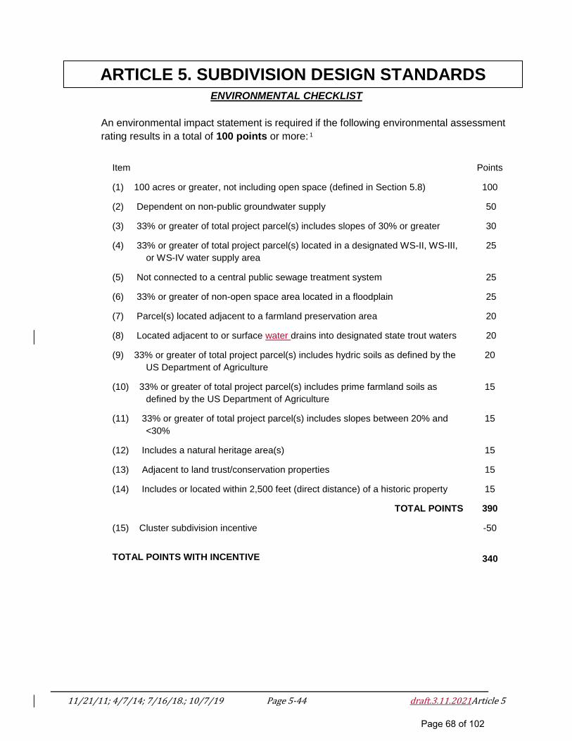
11/21/11; 4/7/14; 7/16/18.; 10/7/19 Page 5-44 draft.3.11.2021Article 5
ARTICLE 5. SUBDIVISION DESIGN STANDARDS ENVIRONMENTAL CHECKLIST
An environmental impact statement is required if the following environmental assessment
rating results in a total of 100 points or more: 1
Item
Points
(1) 100 acres or greater, not including open space (defined in Section 5.8)
100
(2) Dependent on non-public groundwater supply
50
(3) 33% or greater of total project parcel(s) includes slopes of 30% or greater
30
(4) 33% or greater of total project parcel(s) located in a designated WS-II, WS-III,
or WS-IV water supply area
25
(5) Not connected to a central public sewage treatment system
25
(6) 33% or greater of non-open space area located in a floodplain
25
(7) Parcel(s) located adjacent to a farmland preservation area
20
(8) Located adjacent to or surface water drains into designated state trout waters
20
(9) 33% or greater of total project parcel(s) includes hydric soils as defined by the
US Department of Agriculture
20
(10) 33% or greater of total project parcel(s) includes prime farmland soils as
defined by the US Department of Agriculture
15
(11) 33% or greater of total project parcel(s) includes slopes between 20% and
<30%
15
(12) Includes a natural heritage area(s)
15
(13) Adjacent to land trust/conservation properties
15
(14) Includes or located within 2,500 feet (direct distance) of a historic property
15
TOTAL POINTS
390
(15) Cluster subdivision incentive
-50
TOTAL POINTS WITH INCENTIVE
340
Page 68 of 102
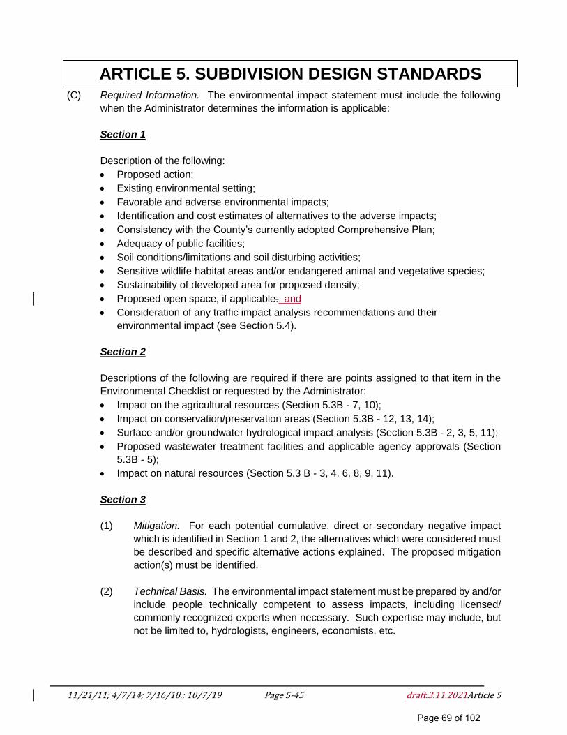
11/21/11; 4/7/14; 7/16/18.; 10/7/19 Page 5-45 draft.3.11.2021Article 5
ARTICLE 5. SUBDIVISION DESIGN STANDARDS (C) Required Information. The environmental impact statement must include the following
when the Administrator determines the information is applicable:
Section 1
Description of the following:
Proposed action;
Existing environmental setting;
Favorable and adverse environmental impacts;
Identification and cost estimates of alternatives to the adverse impacts;
Consistency with the County’s currently adopted Comprehensive Plan;
Adequacy of public facilities;
Soil conditions/limitations and soil disturbing activities;
Sensitive wildlife habitat areas and/or endangered animal and vegetative species;
Sustainability of developed area for proposed density;
Proposed open space, if applicable.; and
Consideration of any traffic impact analysis recommendations and their
environmental impact (see Section 5.4).
Section 2
Descriptions of the following are required if there are points assigned to that item in the
Environmental Checklist or requested by the Administrator:
Impact on the agricultural resources (Section 5.3B - 7, 10);
Impact on conservation/preservation areas (Section 5.3B - 12, 13, 14);
Surface and/or groundwater hydrological impact analysis (Section 5.3B - 2, 3, 5, 11);
Proposed wastewater treatment facilities and applicable agency approvals (Section
5.3B - 5);
Impact on natural resources (Section 5.3 B - 3, 4, 6, 8, 9, 11).
Section 3
(1) Mitigation. For each potential cumulative, direct or secondary negative impact
which is identified in Section 1 and 2, the alternatives which were considered must
be described and specific alternative actions explained. The proposed mitigation
action(s) must be identified.
(2) Technical Basis. The environmental impact statement must be prepared by and/or
include people technically competent to assess impacts, including licensed/
commonly recognized experts when necessary. Such expertise may include, but
not be limited to, hydrologists, engineers, economists, etc.
Page 69 of 102
11/21/11; 4/7/14; 7/16/18.; 10/7/19 Page 5-46 draft.3.11.2021Article 5
ARTICLE 5. SUBDIVISION DESIGN STANDARDS SECTION 5.4 TRAFFIC IMPACT ANALYSIS
(A) Purpose. A traffic impact study shall be required for any major subdivision generating
more than 800 trips per day, as defined by the most current edition of Trip Generation
(Institute of Transportation Engineers). The study will enable Polk County to assess the
impact of a proposed subdivision on the highway system when that system is at or near
capacity or a safety problem exists. Its purpose is to einsure that proposed developments
do not adversely affect the highway network and to identify any traffic problems associated
with access from the subdivision to the existing transportation network. The purpose of
the study is also to identify solutions to potential problems and to present improvements
to be incorporated into the proposed development.
(B) Conduct. A traffic impact study shall be prepared by a qualified professional traffic
engineer and/or certified transportation planner with previous traffic study experience. The
procedures and standards for the traffic impact study are set forth in Section 5.4(E) of this
Article.
Prior to the preparation of a traffic impact study, a scoping meeting shall be held, including
the planning staff, the applicant, and the preparer of the study. The discussion at this
meeting should set the study parameters, including the study area, planned and
committed roadway improvements (by NCDOT or others), road links and intersections to
be analyzed, preliminary traffic distribution, other planned developments to be considered,
traffic growth rate, available data, periods for which analysis is to be performed, and other
staff concerns. The qualifications of the preparer may be discussed at or prior to this
meeting.
(C) Exemptions. Subdivisions that produce more than 800 trips per day traffic may be
exempted from the requirements to prepare and submit a traffic impact study if: (1) a traffic
impact study has previously been prepared for this particular subdivision, or (2) material
is submitted to demonstrate that traffic created by the subdivision when adding to existing
traffic will not result in a need for transportation improvements. The Planning Board and
Board of Commissioners will review material submitted in support of an exemption and
will determine from that material whether or not to grant the exemption. All exemptions
shall be concurred with by the NCDOT Division 14 Office. If an exemption is granted,
documentation of the exemption will be submitted as part of the staff recommendation.
Polk County may require any application for subdivision approval to be accompanied by
a traffic impact study when a road capacity or safety issue exists. If one is required, the
County will notify the applicant of the reason for the requirement.
(D) Capacity Analysis of the Existing System. An indication of the adequacy of the existing
street system is a comparison of traffic volumes versus the ability of the streets to move
Page 70 of 102
11/21/11; 4/7/14; 7/16/18.; 10/7/19 Page 5-47 draft.3.11.2021Article 5
ARTICLE 5. SUBDIVISION DESIGN STANDARDS traffic freely at a desirable speed. The ability of a street to move traffic freely, safely, and
efficiently with a minimum delay is controlled primarily by the spacing of major devices
utilized. Thus, the ability of a street to move traffic can be increased by restricting parking
and turning movements, using proper sign and signal devices, and by the application of
other traffic engineering strategies.
Capacity is the maximum number of vehicles which has a “reasonable expectation” of
passing over a given section of roadway, during a given time period under prevailing
roadway and traffic conditions. The relationship of traffic volumes to the capacity of the
roadway will determine the level of service (LOS) being provided. Six levels of service
have been selected for analysis purposes. They are given letter designations from A to F
with LOS A representing the best operating conditions and LOS F the worst.
(1) LOS A. Describes primarily free flow conditions. The motorist experiences a high
level of physical and psychological comfort. The effects of minor incidents of
breakdown are easily absorbed. Even at the maximum density, the average
spacing between vehicles is about 528 feet or 26 car lengths.
(2) LOS B. Represents reasonably free flow conditions. The ability to maneuver
within the traffic stream is only slightly restricted. The lowest average spacing
between vehicles is about 330 feet or 18 car lengths.
(3) LOS C. Provides for stable operations, but flows approach the range in which
small increases will cause substantial deterioration in service. Freedom to
maneuver is noticeably restricted. Minor incidents may still be absorbed, but the
local decline in service will be great. Queues may be expected to form behind any
significant blockage. Minimum average spacings are in the range of 220 feet or
11 car lengths.
(4) LOS D. Borders on unstable flow. Density begins to deteriorate somewhat more
quickly with increasing flow. Small increases in flow can cause substantial
deterioration in service. Freedom to maneuver is severely limited, and the driver
experiences drastically reduced comfort levels. Minor incidents can be expected
to create substantial queuing. At the limit, vehicles are spaced at about 165 feet
or nine car lengths.
(5) LOS E. Describes operation at capacity. Operations at this level are extremely
unstable, because there are virtually no usable gaps in the traffic system. Any
disruption to the traffic stream, such as a vehicle entering from a ramp, or changing
lanes, requires the following vehicles to give way to admit the vehicle. This can
establish a disruption wave that propagates through the upstream traffic
flow. At capacity, the traffic stream has no ability to dissipate any disruption. Any
incident can be expected to produce a serious breakdown with extensive queuing.
Vehicles are spaced at approximately six car lengths, leaving little room to
maneuver.
Page 71 of 102
11/21/11; 4/7/14; 7/16/18.; 10/7/19 Page 5-48 draft.3.11.2021Article 5
ARTICLE 5. SUBDIVISION DESIGN STANDARDS
(6) LOS F. Describes forced or breakdown flow. Such conditions generally exist
within queues forming behind breakdown points.
(E) General Requirements and Standards. The traffic impact study shall contain the following
information:
(1) General Site Description. The site description shall include the size, location,
proposed land uses, number of units and gross square footage by land use,
existing land use and zoning, construction staging, and completion date of the
proposed subdivision to the extent known or able to be described at the time the
application is prepared. Types of dwelling units and number of bedrooms shall
also be included. A brief description of other major existing and proposed land
developments within the study area shall be provided. The general site description
shall also include probable socio-economic characteristics of potential site users
to the extent that they may affect the transportation needs of the site (i.e., number
of senior citizens).
(2) Transportation Facilities Description. The description shall contain a full
documentation of the proposed internal and existing external transportation
system. This description shall include proposed internal vehicular, bicycle, and
pedestrian circulation; all proposed ingress and egress locations; all internal
roadway widths and rights-of-way, turn lanes, parking conditions, traffic
channelizations; and any traffic signals or other intersection control devices at all
intersections within the subdivision.
The report shall describe the entire external roadway system within the study area.
Major intersections in the study area and all intersections or driveways adjacent to
or within 800 feet of the site shall be identified and sketched. All existing and
proposed public transportation services and facilities within one-mile of the site
shall also be documented. Future highway improvements, including proposed
construction and traffic signalization, shall be noted. All proposed traffic signals
shall be approved by the NCDOT Division 14 Office. This information shall be
obtained from North Carolina’s Transportation Improvement Program and the Polk
County Thoroughfare Plan. Any proposed roadway improvements due to
proposed surrounding developments shall also be noted.
(3) Existing Traffic Conditions. Existing traffic conditions shall be documented for all
roadways and intersections in the study area. This shall include documentation of
traffic accident counts as recorded by the NC Department of Transportation District
Engineers Office, County law enforcement, and the NC Highway Patrol. Existing
traffic volumes for average daily traffic, peak highway hour(s) traffic, and peak
development generated hour(s) traffic, if appropriate, shall be recorded. Manual
traffic counts at major intersections in the study area shall be conducted,
encompassing the peak highway and development generated hour(s), if
Page 72 of 102
11/21/11; 4/7/14; 7/16/18.; 10/7/19 Page 5-49 draft.3.11.2021Article 5
ARTICLE 5. SUBDIVISION DESIGN STANDARDS appropriate, and documentation shall be included in the report. Existing average
daily or peak-hour traffic counts made within one year of the study date may be
used subject to Administrator approval. A volume/capacity analysis based upon
existing volumes shall be performed during the peak highway hour(s) and the peak
development generated hour(s), if appropriate, for all roadways and major
intersections expected to be impacted by development traffic. Levels of service
shall be determined for each signalized intersection or roadway segment analyzed
above.
This analysis will determine the adequacy of the existing roadway system to serve
the current traffic demand. Roadways and/or intersections experiencing levels of
service E or F shall be noted as congestion locations (see Section 5.4(D)).
(4) Transportation Impact of the Development. Estimation of vehicular trips to result
from the proposed subdivision shall be completed for the average weekday, the
average daily peak hours of highway travel in the study area, and if appropriate,
the peak hour of traffic generation by the subdivision. Vehicular trip generation
rates to be used for this calculation shall be obtained from an accepted source
such as the most current edition of Trip Generation (Institute of Transportation
Engineers). These subdivision-generated traffic movements, as estimated, and
the reference source(s) and methodology followed shall be documented. These
generated volumes shall be distributed to the study area and assigned to the
existing roadways and intersections throughout the study area. Documentation of
all assumptions used in the distribution and assignment phase shall be provided.
All average daily traffic link volumes within the study area shall be shown
graphically. Peak hour turning movement volumes shall be shown for signalized
and other major intersections, including all access points to the development.
Pedestrian and bicycle volumes at school crossings and as otherwise applicable
shall be reported. Any characteristics of the subdivision that will cause trip
generation to vary significantly from average rates available in published sources
shall be documented, including such factors as diversion of passer-by traffic,
internal capture, staggered work hours, or use of transit.
(5) Analysis of Transportation Impact. The total traffic demand that will result from
construction of the proposed subdivision shall be calculated. This demand shall
consist of the combination of the existing traffic, traffic generated by the proposed
subdivision, and traffic due to other developments and other growth in traffic that
would be expected to use the roadway at the time the proposed subdivision is
completed. If staging of the proposed subdivision is anticipated, calculations for
each stage of completion shall be made. This analysis shall be performed for
average weekday traffic, the peak highway hour(s) and, if appropriate, peak
development-generated hour(s) for all roadways and major intersections in the
study area. Volume/capacity calculations shall be completed for all major
intersections. It is usually at these locations that capacity is most restricted.
Page 73 of 102
11/21/11; 4/7/14; 7/16/18.; 10/7/19 Page 5-50 draft.3.11.2021Article 5
ARTICLE 5. SUBDIVISION DESIGN STANDARDS
All access points and pedestrian crossings shall be examined for adequate sight
distance and for the necessity of installing traffic signals. The traffic signal
evaluation shall compare the projected traffic and pedestrian volumes to the
warrants for traffic signal installation.
(6) Conclusions and Recommended Improvements. Levels of service for all roadways
and signalized intersections serving 10% or more of peak-hour project traffic shall
be reported. All roadways and/or signalized intersections showing a level of
service below D in urban or developed areas or below C in rural areas shall be
considered deficient, and specific recommendations for the elimination of these
problems shall be listed (see Section 5.4(D)). This listing of recommended
improvements shall include, but not be limited to, the following elements: internal
circulation design, site access location and design, external roadway and
intersection design and improvements, traffic signal installation and operation
including signal timing, and transit service improvements. All physical roadway
improvements shall be shown on the preliminary plat.
(F) Submission and Implementation. The traffic impact study will be submitted to the
Administrator with, and as a part of, the major subdivision preliminary plat. The
Administrator and such other agencies or officials as may appear appropriate in the
circumstances of the case shall review the traffic impact study to analyze its adequacy in
solving any traffic problems that will occur due to subdivision proposed on the preliminary
plat. The Administrator may recommend that certain improvements on or adjacent to the
site or on roadways or intersections for which the improvements are needed to adequately
and safely accommodate subdivision traffic are mandatory for preliminary plat approval
and may recommend that these improvements be included on the approved preliminary
plat. The traffic impact analysis and its recommendations will be submitted as evidence
at the quasi-judicial public evidentiary hearing.
Page 74 of 102
11/21/11; 4/7/14; 7/16/18.; 10/7/19 Page 5-51 draft.3.11.2021Article 5
ARTICLE 5. SUBDIVISION DESIGN STANDARDS SECTION 5.5 WATER AND SEWER REQUIREMENTS
Any major subdivision which has either a public water system or public sewage disposal system
or both legally available or to be made available within 500 feet of its boundary as measured along
a public right-of-way and/or easement shall have the available systems extended by the
developer, at their cost, to provide service to each lot in the subdivision. Water and sewer
installations shall be in accordance with the standards of Polk County. When not in conflict with
these standards, fire hydrants shall be installed at intervals consistent with the North Carolina Fire
Code along the water lines. Where public water and/or sewer are not made available to each lot,
service shall be provided as specified in Section 5.13.
SECTION 5.6 LOTS
(A) All lots shall abut on a dedicated public or private street except that up to two lots may be
accessed by a private driveway easement that accesses a public or private street. In the
case of a Family Subdivision, see Section 5.9(D).
(B) Lot lines may be drawn to the right-of-way or the center of the road of any adjacent road
except where an existing property line is drawn within an existing road right-of-way.
(C) All lots identified in a watershed must also meet the requirements of the County’s
Watershed Protection Ordinance.
(D) The Planning Board or Subdivision Administrator (two-lot, three-lot expedited, or family
subdivisions) may approve the limited use of pan handle lots where it is impractical to
serve an isolated lot by an existing or proposed road. A pan handle lot shall have a
minimum road frontage of 35 feet for an access strip to an isolated building site. The
access strip should not exceed 300 feet in length and the access strip shall not be used
to calculate the minimum lot area unless such strip exceeds 70 feet in width.
(E) Subdivision Lot Standards. The following indicates minimum lot size, road frontage2 and
setbacks for zoned and unzoned areas of the County, as applicable.
Page 75 of 102
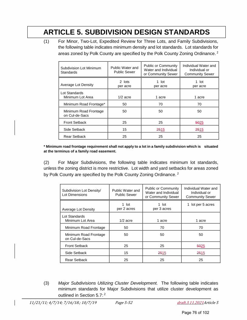
11/21/11; 4/7/14; 7/16/18.; 10/7/19 Page 5-52 draft.3.11.2021Article 5
ARTICLE 5. SUBDIVISION DESIGN STANDARDS (1) For Minor, Two-Lot, Expedited Review for Three Lots, and Family Subdivisions,
the following table indicates minimum density and lot standards. Lot standards for
areas zoned by Polk County are specified by the Polk County Zoning Ordinance. 2
Subdivision Lot Minimum Standards
Public Water and
Public Sewer
Public or Community Water and Individual or Community Sewer
Individual Water and
Individual or Community Sewer
Average Lot Density
2 lots
per acre
1 lot
per acre
1 lot
per acre Lot Standards Minimum Lot Area
1/2 acre
1 acre
1 acre Minimum Road Frontage*
50
70
70
Minimum Road Frontage on Cul-de-Sacs
50
50
50
Front Setback
25
25
5025
Side Setback
15
2515
2515
Rear Setback
25
25
25
* Minimum road frontage requirement shall not apply to a lot in a family subdivision which is situated
at the terminus of a family road easement.
(2) For Major Subdivisions, the following table indicates minimum lot standards,
unless the zoning district is more restrictive. Lot width and yard setbacks for areas zoned
by Polk County are specified by the Polk County Zoning Ordinance. 2
Subdivision Lot Density/ Lot Dimensions
Public Water and
Public Sewer
Public or Community Water and Individual or Community Sewer
Individual Water and
Individual or Community Sewer
Average Lot Density
1 lot
per 2 acres
1 lot
per 3 acres
1 lot per 5 acres
Lot Standards Minimum Lot Area
1/2 acre
1 acre
1 acre Minimum Road Frontage
50
70
70
Minimum Road Frontage on Cul-de-Sacs
50
50
50
Front Setback
25
25
5025
Side Setback
15
2515
2515
Rear Setback
25
25
25
(3) Major Subdivisions Utilizing Cluster Development. The following table indicates
minimum standards for Major Subdivisions that utilize cluster development as
outlined in Section 5.7: 2
Page 76 of 102
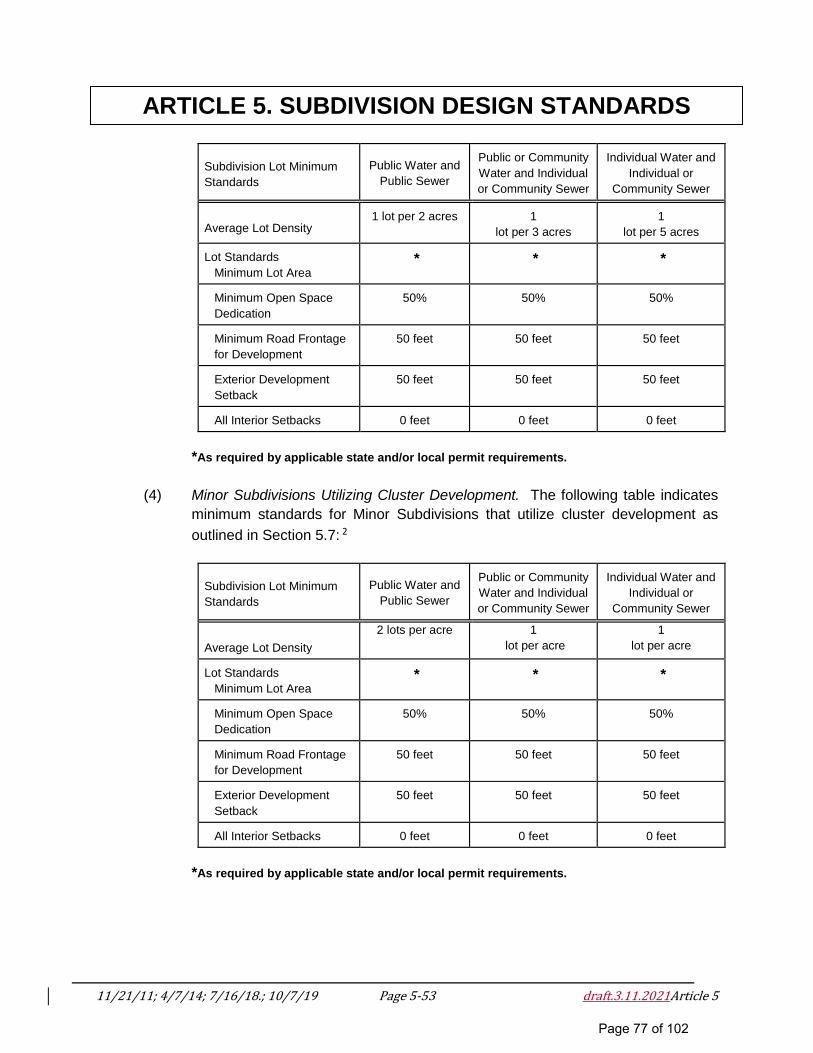
11/21/11; 4/7/14; 7/16/18.; 10/7/19 Page 5-53 draft.3.11.2021Article 5
ARTICLE 5. SUBDIVISION DESIGN STANDARDS
Subdivision Lot Minimum
Standards
Public Water and
Public Sewer
Public or Community
Water and Individual
or Community Sewer
Individual Water and
Individual or
Community Sewer
Average Lot Density
1 lot per 2 acres
1
lot per 3 acres
1
lot per 5 acres Lot Standards
Minimum Lot Area
*
*
*
Minimum Open Space
Dedication
50%
50%
50%
Minimum Road Frontage
for Development
50 feet
50 feet
50 feet
Exterior Development
Setback
50 feet
50 feet
50 feet
All Interior Setbacks
0 feet
0 feet
0 feet
*As required by applicable state and/or local permit requirements.
(4) Minor Subdivisions Utilizing Cluster Development. The following table indicates
minimum standards for Minor Subdivisions that utilize cluster development as
outlined in Section 5.7: 2
Subdivision Lot Minimum
Standards
Public Water and
Public Sewer
Public or Community
Water and Individual
or Community Sewer
Individual Water and
Individual or
Community Sewer
Average Lot Density
2 lots per acre 1
lot per acre
1
lot per acre
Lot Standards
Minimum Lot Area
*
*
*
Minimum Open Space
Dedication
50%
50%
50%
Minimum Road Frontage
for Development
50 feet
50 feet
50 feet
Exterior Development
Setback
50 feet
50 feet
50 feet
All Interior Setbacks
0 feet
0 feet
0 feet
*As required by applicable state and/or local permit requirements.
Page 77 of 102
11/21/11; 4/7/14; 7/16/18.; 10/7/19 Page 5-54 draft.3.11.2021Article 5
ARTICLE 5. SUBDIVISION DESIGN STANDARDS SECTION 5.7 CLUSTER DEVELOPMENTS
(A) The intent of a cluster development is to allow smaller than minimum lot sizes in order to
preserve larger areas of open space and environmental resources.
(B) Within subdivisions utilizing cluster development, the minimum lot size may be reduced in
accordance with the table contained in Section 5.6 provided the average lot density per
acre does not exceed that which is allowed without the use of such cluster development
regulations. 2
(C) In a cluster development, a minimum of 50% of the total area of the parcel being
subdivided shall be dedicated to open space.
(D) If individual sewer or water is to serve the building lots, the owner of the subdivision must
obtain written approval from the Polk County Health and Human Services Agency3 that
these systems are adequate to serve the building lots. If there is any sharing of water and
sewer facilities between the building lot owners, a maintenance plan of these facilities
must be filed with the County.
SECTION 5.8 OPEN SPACE
(A) General Provisions for Open Space.
(1) Land designated as open space on the approved development plan shall be
maintained as open space and may not be separately sold, subdivided, or
developed.
(2) Access from a dedicated public or private street, greenway, or trail shall be
provided to all designated open space with a minimum 15 foot wide access to the
open space area. Lakes used as open space shall provide adequate community
access beyond this 15 foot minimum as determined by the Planning Board.
(3) Open space shall be contiguous wherever possible.
(4) County plans, particularly park and open space plans shall be considered when
evaluating proposals for dedication.
(B) Minimum Open Space Dedication. Open space shall be dedicated in accordance with
subsection 5.8(C). Percentages are based on total development area.
(C) Types of Open Space. All required open space shall be classified in accordance with this
Section. Dedicated open space shall fit into one of the following categories and be
classified as private common area open space or public open space.
Page 78 of 102
11/21/11; 4/7/14; 7/16/18.; 10/7/19 Page 5-55 draft.3.11.2021Article 5
ARTICLE 5. SUBDIVISION DESIGN STANDARDS (1) Playground. Playgrounds are for active recreational use and provide sunny and
shaded play equipment and play areas for children as well as open shelter with
benches. Playgrounds may be part of other types of open space, such as parks,
or may stand alone. Minimum Size: 10,000 square feet.
(2) Square. Squares are areas for passive recreational use. Squares shall be
bounded by streets on a minimum of 50% of their perimeter. Squares are
encouraged to be entirely bounded by streets and/or lanes. Squares shall be
planted parallel to all streets and shall contain canopy trees along street frontages.
Minimum size: 2,000 square feet.
(3) Park. Parks may be designed for passive and/or active recreational use. Parks
shall be bounded by streets on a minimum of 10% of their perimeter. Large parks
should create a central open space which services an entire neighborhood or
group of neighborhoods; or incorporates physical features which are an asset to
the community (i.e., lake or river frontage, high ground, significant stands of trees).
Undergrowth should be limited and landscaping shall be installed in a manner that
promotes attractiveness and safety. Parks may be combined with greenways and
greenbelts and may include golf courses and community gardens. Minimum size:
1 acre.
(4) Green. The green is an open space which is more natural. Like the square, it is
small and surrounded by buildings. Unlike the square, it is informally planted and
may have irregular topography. Greens are usually landscaped with trees at the
edges and open lawns at the center. Greens should contain no structures other
than benches, pavilions, and memorials; paths are optional. Minimum size: 20,000
square feet.
(5) Greenway. Greenways are large, irregular open spaces designed to incorporate
natural settings such as creeks and significant stands of trees within and between
neighborhoods. Greenways are typically more natural and may contain irregular
topography. Greenways shall be used for certain active recreational uses
including, at a minimum, trails for walking, jogging, equestrian pursuits and biking.
Greenways shall connect points of interest in the community such as schools,
parks, and other civic uses.
(6) Greenbelt. Greenbelts run along the perimeter of a neighborhood, and serve to
buffer a neighborhood from surrounding non-compatible uses such as a highway
corridor or industrial district, or a developed area from agricultural areas or
adjacent towns. Greenbelts differ from the other types of open spaces in that they
are left natural, and are not intended for recreational use.
(7) Agricultural Preserve. Open spaces designated as Agricultural Preserves shall be
used for active bona fide farms in the form of crop cultivation, the keeping of
livestock, or equestrian facilities. Agricultural Preserves are encouraged to protect
Page 79 of 102
11/21/11; 4/7/14; 7/16/18.; 10/7/19 Page 5-56 draft.3.11.2021Article 5
ARTICLE 5. SUBDIVISION DESIGN STANDARDS areas of agricultural and rural heritage and promote compatible active agricultural
operations. Minimum size: 5 acres.
(8) Nature Preserve. Open spaces designated as Nature Preserves shall be left
largely undisturbed except for the optional clearing of underbrush for the provision
of a walking trail (mulch or other natural material only). Nature Preserve areas are
encouraged to protect large stands of trees, wildlife, and natural water features.
Nature Preserves are the preferred form of open space for steep slopes in excess
of 25% grade. Minimum size: 3 acres.
(D) Open Space Ownership & Maintenance.
(1) Open space may be owned or administered by one or a combination of the
following methods:
Ownership by a unit of government or private non-profit land conservancy;
Ownership by Homeowners Association;
Ownership by all individual property owners within the subdivision;
By individual private ownership such as a farmer, developer or other private
entity that maintains the open space in accordance with the purposes of
this Article (i.e., farming, equestrian facility, etc., excluding confined
livestock operations);
Deed restricted open space easements on individual private properties.
(2) The Polk County Board of Commissioners shall have the authority to accept or
reject land dedications made as a requirement of this Section. They shall also
have authority to sell land accepted pursuant to this section with the proceeds of
such sale used only for the acquisition, expansion or improvement of recreation,
park, or open space sites.
(3) The developer will provide proof of registration of the Articles of Incorporation as
specified in Section 2.15 with the appropriate state agency for the formation of the
Property Owners’ Association to the Planning Department.
Page 80 of 102
11/21/11; 4/7/14; 7/16/18.; 10/7/19 Page 5-57 draft.3.11.2021Article 5
ARTICLE 5. SUBDIVISION DESIGN STANDARDS SECTION 5.9 EASEMENTS
(A) Utility Easements. Utility easements shall be provided, where necessary, preferably
centered on the side or rear lot lines and shall be at least ten (10) feet wide.
(B) Buffer Easement.
(1) The Administrator may require a buffer easement not exceeding ten (10) feet in width
adjacent to a major street or between dissimilar uses of land.
(2) The Administrator also may require that the subdivider either arrange for, or be
responsible for, the grading and planting of said buffer easement.
(C) Crosswalk Easement. A crosswalk easement of at least ten (10) feet in width shall be
provided if required by the Administrator.
(D) Family Subdivision Road Easements. All lots within a family subdivision may be accessed
by a minimum access 30’ easement providing a road maintenance agreement is signed
by all affected parties and recorded with the family subdivision plat.
(E) Two-lot and Expedited Subdivision Driveway Easements. An minimum of 30’ easement
that allows access to not more than three two lots from an approved public or private road.
(F) Water Course and Drainage Easements.
(1) Where a subdivision is traversed by a water course, drainage way, channel, or
stream, there shall be provided a storm water easement or drainage right-of-way
conforming substantially to the lines of such water course.
(2) If an easement is required for physical improvements to control drainage it must
be shown on the final plat, including access to the easement for repairs.
(3) Said drainage way shall be of sufficient width to carry storm water runoff from a
10-year storm.
SECTION 5.10 GENERAL PROVISIONS FOR ROAD DESIGN
(A) Marginal Access Streets. Where a tract of land to be subdivided joins a principal arterial
street, the subdivider may be required to provide a marginal access street parallel to the
arterial street or reverse frontage on a minor street for the lots to be developed adjacent
to the arterial. Where reverse frontage is established, private driveways shall be prevented
from having direct access to the principal arterial.
Page 81 of 102
11/21/11; 4/7/14; 7/16/18.; 10/7/19 Page 5-58 draft.3.11.2021Article 5
ARTICLE 5. SUBDIVISION DESIGN STANDARDS (B) Access to Adjacent Properties. Where in the opinion of the Planning Board, it is necessary
to provide street access to an adjoining property, proposed streets shall be extended to
the boundary of such property and a temporary turn-around provided.
(C) Blocks. The lengths, widths and shapes of blocks should be determined with due regard
to: provision of adequate building sites suitable to the special needs of the type of use
contemplated; local ordinances; needs for vehicular and pedestrian circulation and control
of street traffic; and limitations and opportunities of topography.
(D) Intersections.
(1) Subdivision streets shall be laid out so as to intersect as nearly as possible at right
angles, and no street shall intersect any other street at an angle less than 60
degrees.
(2) Right-of-ways at street intersections shall be rounded with a minimum radius of 20
feet. At an angle of intersection of less than 75 degrees, a greater radius may be
required.
(3) Where public and private streets intersect, the design standards of the NCDOT
Division of Highways, Subdivision Roads, Minimum Construction Standards shall
apply.
(4) Offset intersections are to be avoided unless exception is granted by the Planning
Board. Intersections which cannot be aligned should be separated by a minimum
length of 200 feet between survey centerlines.
(5) Intersections with arterial, collectors, and thoroughfares (major intersections) shall
be at least 1,000 feet from centerline to centerline, or more if required by the
Planning Board.
(E) Cul-De-Sacs.
(1) Permanent dead end streets should not exceed 2,500 feet in length unless
necessitated by topography or property accessibility.
(2) When cul-de-sacs are required to exceed 2,500 feet in length, vehicle turn-arounds
shall be provided at 1,000 foot intervals. Required turn-arounds shall have an
unobstructed roadway radius of not less than a 35 feet.
(3) If the road length does not exceed 300 feet and if construction difficulties will not
permit a turnaround, the use of “Y” or a “T” or other turning space of a design which
will allow a vehicle with a wheel base of at least 25 feet to complete a turning
movement with a maximum of one (1) backing movement, shall be permitted.
Page 82 of 102
11/21/11; 4/7/14; 7/16/18.; 10/7/19 Page 5-59 draft.3.11.2021Article 5
ARTICLE 5. SUBDIVISION DESIGN STANDARDS
(4) Cul-de-sacs shall not be used to avoid the extension a road, unless an exception
is granted by the Planning Board.
(F) Through Traffic. Streets shall be designed or walkways dedicated to assure convenient
access to parks, playgrounds, schools or other places of public assembly.
(G) Street Names.
(1) Proposed streets which are obviously in alignment with existing streets shall be
given the same name.
(2) In assigning new names, duplication of existing names shall be avoided, and in no
case shall the proposed name be phonetically similar to existing names in the
County irrespective of the use of a suffix such as street, road, drive, place, court,
etc. Street names shall be subject to the approval of the E911 Addressing Property
Address Administrator.
SECTION 5.11 PUBLIC ROAD STANDARDS
(A) Minor and Major Subdivision Public Road Design
(1) All road design must comply with the Polk County Fire Code. All roads proposed
for public use shall be annotated “public” on plans and plats and shall be designed
and constructed in accordance with the standards necessary to make the roads
eligible to be put on the State Highway Maintenance System at a later date. Such
standards, hereafter referred to as “State Road Standards”, are contained in a
publication of the North Carolina Department of Transportation, Division of
Highways, titled, “Subdivision Roads - Minimum Construction Standards”, a copy
of which is available for review in the office of the Administrator. Designation as
public shall be presumed an offer of dedication to the public; however, this does
not guarantee that NCDOT will accept the proposed public roads or agree to
assume the maintenance responsibility of the proposed public road. Pursuant to
GS 136-102.6(d) the NCDOT District Engineer’s office must sign a certificate of
approval of the design of the public road provided on the face of the final plat for
any subdivision where public roads are proposed prior to County approval of the
final plat.
(2) If a request for dedication of public roads is made, inspection and approval by the
NCDOT must have taken place, and roads must be inspected and approved by
NCDOT, but acceptance is not required, before the final plat can be approved by
the Planning Board.
(B) Public Road Dedication and Maintenance.
Page 83 of 102
11/21/11; 4/7/14; 7/16/18.; 10/7/19 Page 5-60 draft.3.11.2021Article 5
ARTICLE 5. SUBDIVISION DESIGN STANDARDS
(1) All roads proposed for public use by the developer and seller, including those
proposed streets which are not eligible to be placed on the State Highway System
because there are too few lots or residences, shall be dedicated to the public and
shall be designed and constructed in accordance with the standards necessary to
make the streets eligible to be put on the state system at a later date.
(2) A written maintenance agreement sufficient for recording in the Office of the
Register of Deeds shall be submitted with the final plat. Said maintenance
agreement will provide for the subdivider or a property owner’s association to
maintain the street, drainage facilities, and right-of-way until such time as the street
is accepted for maintenance by the state.
SECTION 5.12 PRIVATE ROADS
(A) Private Roads Defined.
(1) All new private roads shall directly connect to a state-maintained road or shall
connect to a state maintained road by way of a private road/recorded access
easement, meeting the standards of this section, unless an exception variance is
granted pursuant to this Ordinance.
(2) New roads within a subdivision may be designated by the subdivider as private,
provided all streets proposed for private use shall be limited to the following:
Streets providing exclusive access to residential subdivisions and private
resort developments.
Streets in subdivisions or portions of subdivisions serving too few lots for
inclusion into the State Secondary Road System.
Streets providing exclusive access to family subdivisions.
(3) A private Local Subdivision Road includes:
Cul-de-sac or Dead end roads less than 2,500 feet in length.
Short roads that connect blocks.
Other roads that do not connect to thoroughfares or serve major traffic
generators.
(4) A private Subdivision Collector Road includes:
Cul-de-sac or Dead end roads more than 2,500 feet in length.
Page 84 of 102
11/21/11; 4/7/14; 7/16/18.; 10/7/19 Page 5-61 draft.3.11.2021Article 5
ARTICLE 5. SUBDIVISION DESIGN STANDARDS
Connecting roads between the local residential subdivision roads and the
thoroughfare system.
Loop roads more than 5,280 feet (1 mile) in length.
Other roads having a “collector” type function in the thoroughfare system.
(B) All private road design must comply with the Polk County Fire Code and be constructed
to NCDOT “Subdivision Roads - Minimum Construction Standards”.
(C) Maintenance of Private Roads. All subdivision plats which include private roads shall be
accompanied by a disclosure statement (NCGS 136-102.6) for recording, which provides
for the maintenance of any kind and all private streets designated within a subdivision by
a property owner’s association.
(D) Two Lot, Expedited Review for Three Lots2, and Family Subdivisions. All lots with two lot,
expedited review for three lots, and family subdivisions must abut a public or private road
or be provided access to a public or private road via a recorded access easement meeting
the requirements of the State Fire Code, where applicable. See easement requirements.
SECTION 5.13 PRIVATE WATER AND SEWER
(A) Submittal Requirements and Approval.
(1) If the subdivision in question is to have a community sewage disposal system other
than one connected to a municipal system, the following is required:
Depiction of the system and its location with sufficient area for repair if
needed.
An engineered plan as to the system.
Sealed approval of the local Polk County Health and Human Services
Agency3.
(2) The local Health Department shall certify that the soil conditions are suitable to
support a septic system.
(3) All Preliminary Plats which will require the installation of any water and/or
sewerage systems prior to final plat approval shall be accompanied by a written
application and/or notice submitted to the appropriate state or local agency
responsible for approving the particular system or systems.
(B) Subdivisions with Individual Water and Sewage Disposal Systems. Individual septic
systems and individual wells shall conform to those requirements as set forth by the local
Health Department or agency currently in authority as to sewer disposal. There shall be
no requirement as to a well or septic system being in place prior to sale of any lot or parcel.
Page 85 of 102
11/21/11; 4/7/14; 7/16/18.; 10/7/19 Page 5-62 draft.3.11.2021Article 5
ARTICLE 5. SUBDIVISION DESIGN STANDARDS (C) Water Quality and Quantity Standards.
(1) No water supply system shall deliver water without first having said water tested
by a certified laboratory and such test approved by the State and/or agency thereof
having responsibility for Water Quality Assurance. (This provision shall not apply
to an individual well providing water to a single-family residence located on the
property of the well.)
(2) Any and all Water Systems including but not limited to individual wells shall comply
with the appropriate Standards set forth by the State and/or any agency granted
authority to regulate and/or otherwise enforce regulations.
SECTION 5.14 STORMWATER DRAINAGE FACILITIES
The Preliminary Plat shall be accompanied by evidence satisfactory to the Planning Board as to
the proposed method of providing for stormwater drainage. If a DENR NCDEQ stormwater
management permit is required, such permit shall be submitted with the Preliminary Plat.
SECTION 5.15 DAM SAFETY
Any dam constructed within a subdivision which is greater than fifteen (15) feet in height
(measured from the lowest point on downstream top of the dam to the highest point on the fill)
and is also greater than ten (10) acre-feet in area (measured from the top of the dam) shall comply
with the North Carolina Dam Safety Law of 1967 and the North Carolina Administrative Code Title
15, Subchapter 2K.
SECTION 5.16 FLOOD HAZARD AREAS
In areas of flood hazard, identified on the Flood Insurance Rate Map of Polk County, North
Carolina, as Zones A and AE, all subdivisions shall be designed to minimize flood damage in
accordance with the provisions of the Polk County Flood Damage Prevention Ordinance.
Page 86 of 102
11/21/11; 4/7/14; 7/16/18.; 10/7/19 Page 5-63 draft.3.11.2021Article 5
ARTICLE 5. SUBDIVISION DESIGN STANDARDS SECTION 5.17 FIRE PROTECTION
In major subdivisions without a public water supply and having one or more lots more than one
road mile from the nearest state approved fire water source, the developer shall provide a fire
water source or sources within the subdivision meeting state specifications in such a manner that
no lot is located more than one road mile away from such a fire water source.
SECTION 5.18 EROSION AND SEDIMENTATION CONTROL1
The Preliminary Plat shall be accompanied by a written statement from the North Carolina
Department of Environmental Quality (NCDEQ) 2, or the Administrator, as the case may be, that
any required soil erosion and sedimentation control plan has been approved, if required.
SECTION 5.19 STREAM BANK EROSION
Stream banks and channels downstream from any land disturbing activity shall be protected from
increased degradation by accelerated erosion caused by increased velocity of runoff from the
land disturbing activity in accordance with the North Carolina Sedimentation Pollution Control Act,
NCGS 143.34.12, Chapter 113A, Article 4, and the North Carolina Administrative Code Title 15,
Chapter 4, and any locally adopted erosion and sedimentation control ordinances.
SECTION 5.20 CLEAR CUTTING
This Section shall not apply to two-lot or family subdivisions.
(A) Standard. Properties shall not be clear-cut during the conduct of forestry activities. To
maintain the visual character of the site from adjoining properties and right-of-way, a
vegetated perimeter buffer shall be maintained while tree harvesting for forestry occurs.
A 32-foot wide buffer of naturally existing vegetation shall be maintained along all
boundaries of the property being forested that adjoin other properties. Along public rights-
of-way, a 50-foot buffer of naturally existing vegetation shall be maintained, exclusive of
areas required for access to the site.
(B) Penalties. Site plans proposing development of properties that failed to maintain such a
buffer during forestry activities shall be denied for a period of three years from the date of
clearing.
Page 87 of 102
11/21/11; 4/7/14; 7/16/18.; 10/7/19 Page 5-64 draft.3.11.2021Article 5
ARTICLE 5. SUBDIVISION DESIGN STANDARDS SECTION 5.21 STEEP SLOPE
(A) Purpose. The primary purpose for the slope protection standards is to minimize grading,
land instability and the removal of vegetation in order to:
(1) Protect the quality of wetlands and water courses below the slope from increased
sedimentation;
(2) Protect steep slope plant and animal habitat from disturbance and development;
and
(3) Preserve the aesthetic quality of the natural terrain.
(B) Steep Slope Areas.
(1) Slope is the relationship of vertical rise to horizontal run, expressed as a
percentage. Steep slope areas shall be defined as land areas that:
(a) Have a grade of 40% or more; and
(b) Have an area of 5,000 square feet or greater.
(2) Steep slope areas refer to natural grades and shall not include man-made grades.
Slope calculations shall use the smallest contour interval for which maps are
available. Steep slope areas shall be determined irrespective of tract boundaries.
(3) Steep slope areas shall be clearly indicated on all site plans, development plans,
preliminary plats and final plats. When a property owner or developer believes
that the presence or location of a steep slope area is different than what is shown
on the appropriate topographic map, the Development Review Board shall have
the authority to determine the location or presence of the moderate or steep slope
area for purposes of meeting the requirements of this section.
(C) Steep Slope Development Limitations. Development and land disturbing activity on steep
slope areas shall be conducted only in accordance with the following requirements.
Compliance with these requirements shall be determined by the approving authority.
(1) Development shall be designed and constructed in order to minimize disturbance
to the natural landform as much as possible. Development shall demonstrate
appropriate terrain-adaptive design and construction techniques. An inability to
design a particular development without significant disturbance to the natural
landform may indicate that the site should not accommodate the full amount of
proposed development. Alternate site design and construction measures shall be
encouraged to mitigate the effects of development on steep slopes. The grade of
Page 88 of 102
11/21/11; 4/7/14; 7/16/18.; 10/7/19 Page 5-65 draft.3.11.2021Article 5
ARTICLE 5. SUBDIVISION DESIGN STANDARDS reconstructed slopes shall not exceed 50%. Non-load bearing retaining walls shall
be encouraged in order to reduce the amount of disturbance to the natural slope.
(2) On any tract proposed for construction, no more than 15% of the steep slope area
on the tract shall be graded. For purposes of this calculation, the land areas of
individual steep slope areas on the tract shall be added together to establish the
total steep slope area for the tract.
(3) Development shall be designed and arranged in order to minimize the impact of
street construction on steep slope areas. Proposed right-of-way for major
thoroughfares, minor thoroughfares and collector streets shall be exempt from the
steep slope area grading limits of this section, provided that the Development
Review Board determines that proposed rights-of-way are designed and arranged
in order to minimize the impact on steep slope areas.
SECTION 5.22 SURVEYING
Prior to the approval of the Final Plat, permanent reference points shall have been placed in
accordance with the following requirements:
(A) Subdivision Corner Tie. At least one corner of the Subdivision shall be designated by
course and distance (tie) from a readily discernible reference marker. If a corner is within
2,000 feet of a U.S. Coast and Geodetic Station or North Carolina Grid System
coordinated monument, then this corner shall be marked with a monument so designated
by computed X & Y coordinates which shall appear on the map with a statement identifying
this station or monument. When such a monument or station is not available, the tie shall
be made to some pertinent and readily recognizable land marker or identifiable point,
physical object or structure.
(B) Monuments. Within each block of a subdivision at least two (2) monuments designed and
designated as control corners shall be installed. The surveyor shall employ additional
monuments if and when required. All monuments shall be constructed of concrete and be
at least four (4) inches in diameter or square and not less than three (3) feet in length.
Each monument shall have imbedded in the top or attached by a suitable means a metal
plate of noncorrosive materials and marked plainly with the point, the surveyor’s
registration number, the month and year it was installed, and the word “Monument” or
“Control Corner”. A monument shall be set at least 30 inches in the ground with at least
six (6) inches exposed above the ground unless this requirement is impractical.
Page 89 of 102
11/21/11; 4/7/14; 7/16/18 ; 10/7/19 Page 6-66 draft.3.11.2021Article 6
ARTICLE 6. DEFINITIONS
Section 6.1 Word Interpretation ............................................................................................ 6-67
Section 6.2 Acronyms .......................................................................................................... 6-67
Section 6.3 General Definitions ............................................................................................ 6-68
Page 90 of 102
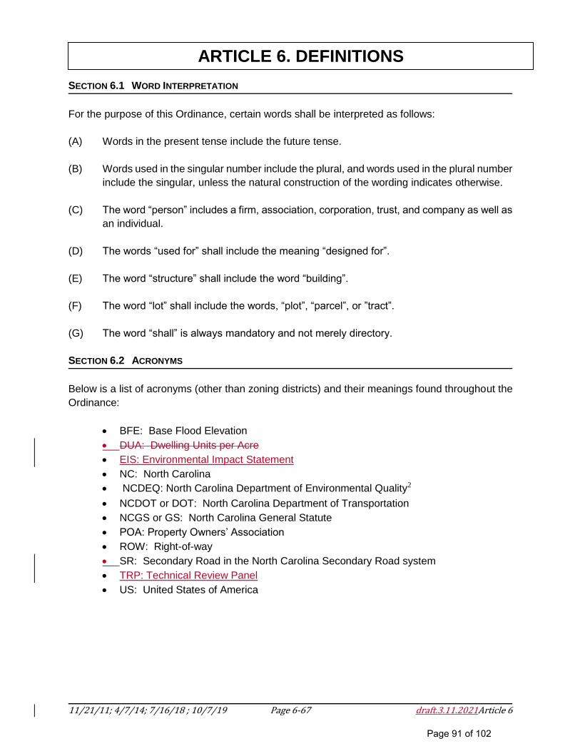
11/21/11; 4/7/14; 7/16/18 ; 10/7/19 Page 6-67 draft.3.11.2021Article 6
ARTICLE 6. DEFINITIONS
SECTION 6.1 WORD INTERPRETATION
For the purpose of this Ordinance, certain words shall be interpreted as follows:
(A) Words in the present tense include the future tense.
(B) Words used in the singular number include the plural, and words used in the plural number
include the singular, unless the natural construction of the wording indicates otherwise.
(C) The word “person” includes a firm, association, corporation, trust, and company as well as
an individual.
(D) The words “used for” shall include the meaning “designed for”.
(E) The word “structure” shall include the word “building”.
(F) The word “lot” shall include the words, “plot”, “parcel”, or ”tract”.
(G) The word “shall” is always mandatory and not merely directory.
SECTION 6.2 ACRONYMS
Below is a list of acronyms (other than zoning districts) and their meanings found throughout the
Ordinance:
BFE: Base Flood Elevation
DUA: Dwelling Units per Acre
EIS: Environmental Impact Statement
NC: North Carolina
NCDEQ: North Carolina Department of Environmental Quality2
NCDOT or DOT: North Carolina Department of Transportation
NCGS or GS: North Carolina General Statute
POA: Property Owners’ Association
ROW: Right-of-way
SR: Secondary Road in the North Carolina Secondary Road system
TRP: Technical Review Panel
US: United States of America
Page 91 of 102
11/21/11; 4/7/14; 7/16/18 ; 10/7/19 Page 6-68 draft.3.11.2021Article 6
ARTICLE 6. DEFINITIONS
SECTION 6.3 GENERAL DEFINITIONS
A
Administrator
The County Manager or any other person designated by the Polk County Manager to administer
and enforce this Ordinance.
Applicant
A person, firm or corporation submitting an application for development or subdivision and upon
whom final responsibility for ensuring compliance with the terms and conditions of the Ordinance
rests.
B
Board of Commissioners
The Polk County Board of Commissioners.
Bona Fide Farm
The production and activities relating, or incidental to, the production of crops, fruits, vegetables,
ornamental and flowering plants, dairy, livestock, poultry, and all other forms of agricultural
products having a domestic or foreign market, as defined by NCGS 106-581.1.
C
Cluster Subdivision Incentive
A fifty (50) point deduction from the environmental checklist (Section 5.3) if the proposed major
subdivision will be a cluster subdivision.
D
Dedicated Greenway or Trail
Greenways are large, irregular open spaces designed to incorporate natural settings such as
creeks and significant stands of trees within and between neighborhoods.
Dedication
A gift, by the owner, of a right of use of land for a specified purpose or purposes. Because a
transfer of property rights is entailed, dedication must be made by written instrument, and is
completed with an acceptance.
Page 92 of 102
11/21/11; 4/7/14; 7/16/18 ; 10/7/19 Page 6-69 draft.3.11.2021Article 6
ARTICLE 6. DEFINITIONS
Disclosure Statement
A separate and distinct document prepared by the applicant and approved by the Planning Board
which fully and completely discloses the status of any street or road upon which the house, lot, or
parcel fronts. A copy of the Disclosure Statement shall be provided to the purchaser of the subject
real estate.
Dwelling Unit
A building, or portion thereof, providing complete and permanent living facilities for one family.
E
Easement, Buffer
An easement not less than ten (10) feet in width adjacent to a major street, or between dissimilar
uses of land which may be required by the Planning Board for new developments.
Easement, Driveway
A private access easement to one or two proposed or recorded lots which meet the lot standards
of this Ordinance for area and dimensions. A driveway easement may be paved or unpaved,
platted or described by metes and bounds, or may be otherwise described or shown as an
easement or right-of-way. Any drive, access, road, easement or right-of-way proposed or
designed to serve more than two lots shall be defined as a public or private street.
Easement (Right-of-Way)
A grant by the property owner of a strip of land for a specified purpose and use by the public, a
corporation, or persons, including access easements.
Environmental Impact Statement (EIS)
An EIS is prepared if the potential impacts of a project are likely to be significant. An EIS provides
an extensive evaluation of a project’s direct, secondary, and cumulative impacts, and confirmation
that such impacts have been avoided, or otherwise mitigated.
Evidentiary Hearing
A hearing to gather competent, material, and substantial evidence in order to make findings for a
quasi-judicial decision required by a development regulation.
F
Farmland Preservation District
A farmland preservation district includes any Voluntary Agricultural District or Enhanced Voluntary
Agricultural District which has been approved under the Polk County Agricultural District
Ordinances.
Page 93 of 102
11/21/11; 4/7/14; 7/16/18 ; 10/7/19 Page 6-70 draft.3.11.2021Article 6
ARTICLE 6. DEFINITIONS
G
Groundwaters
Those waters occurring in the subsurface under saturated conditions.
H
Hydrological Assessment
An analysis which considers the impact of a proposed action on the movement of water through
the environment on, above, or below the surface of the Earth. The hydrological assessment must
include the following:
The proximity of the proposed water source to the area of use or application;
All impoundments, streams, groundwater sources, or watercourses that receive water runoff
from the proposed actions and any anticipated impact on those waters;
All economically and technically feasible alternatives to the proposed source, including, but
not limited to, conservation, reuse of nonpotable reclaimed water and stormwater, and aquifer
storage and recovery;
The potential environmental impacts that may result from the transport and use of water from
the proposed source, and the potential environmental impacts that may result from use of the
other water sources identified;
Whether existing and reasonably anticipated sources of water and conservation efforts are
adequate to supply water for existing legal uses and reasonably anticipated future needs of
the water supply planning region in which the proposed water source is located;
Consultations with local governments affected by the proposed transport and use;
The value of the existing capital investment in water-related infrastructure made by the
applicant;
If a groundwater supply will be utilized, an assessment of the environmental/public benefits
impact of individual wells versus central/community wells;
Actions proposed to preserve surface water quality;
Whether the proposed action will have an impact on the long-term sustainable supply of
groundwater.
I
Impacts, Cumulative
Those effects that result from the incremental effects of the original direct impact combined with
the impacts of other past, present, and reasonably foreseeable projects in the area. By itself, a
proposed project may not constitute a significant stressor; however, multiple development
Page 94 of 102
11/21/11; 4/7/14; 7/16/18 ; 10/7/19 Page 6-71 draft.3.11.2021Article 6
ARTICLE 6. DEFINITIONS
activities, which individually may be insignificant, can collectively degrade the surrounding
ecosystem beyond its ability to recover.
Impacts, Direct
Those effects caused by a project that occur at the same time and place. Direct impacts result
from project construction and the project itself. Some examples include:
Wetlands that are filled and wetland acreage lots when a new road is built through a
wetland;
Cleared forested areas for a project’s construction cause mortality or displacement of
wildlife; and
Cleared forested areas cause impacts to water quality and aquatic life from exposed soils
running off of the construction site into adjacent wetlands, streams, or reservoirs.
Impacts, Secondary
Those effects which are removed in distance as a result of the project’s construction and
operation. Secondary impacts are sometimes thought of as “chain reaction” effects. In such
cases, an initial project can cause changes in land use, population density, and growth rates that
may affect air, water, or other natural cultural systems. The effects of these chain reactions (e.g.,
commercial/subdivision development in rural areas) may add to other impacts already occurring
in the vicinity of the initial project. There are two types of secondary impacts and a project may
include one or both of these:
Encroachment-Alteration Effects: The physical presence of the project may affect the
function of natural systems through a series of secondary effects.
Growth-Inducing Effects: The presence of a project may affect the pattern or density of
development. Some projects are proposed to serve development that is already present, or
planned, some are planned to attract new growth, and others will serve a combination of
both. These changes in the pattern or density of development would not occur if the
project is not implemented.
Impacts, Significant Negative
A reasonable likelihood of more than a moderate (reasonable/not excessive) adverse impact on
physical or social environmental quality. Significance is a measure of relevance to the
environment (context and intensity) and does not lend itself to a formula or quantifiable test. The
context may vary with the physical location/setting. Intensity depends on the magnitude and
duration of an impact. The severity of an impact should be weighed along with the likelihood of
its occurrence. An impact may be significant if its chance of occurrence is not great, but the
resulting environmental impact would be severe if it occurred.
J
Page 95 of 102
11/21/11; 4/7/14; 7/16/18 ; 10/7/19 Page 6-72 draft.3.11.2021Article 6
ARTICLE 6. DEFINITIONS
K
L Legislative Hearing
A hearing to solicit public comment on a proposed legislative decision.
Lot
A parcel of land whose boundaries have been established by some legal instrument such as a
recorded deed or a recorded map and which is recognized as a separate legal entity for purposed
of transfer title.
Lot Size
The total horizontal area within the lines of a lot.
M Marginal Access Street
A strip of land, owned publicly or privately, set aside primarily for vehicular service access to the
back side of properties otherwise abutting a street, an alley.
Master Plan
A tentative plan showing the proposed development of a tract of land for which platting and
development is to be carried out in two or more stages.
Mitigation (Mitigative Measures)
The use of any or all of the following actions listed in descending order of preference: (1) avoiding
the impact by not taking a certain action; (2) minimizing the impact by limiting the degree or
magnitude of the action by using appropriate technology or by taking affirmative steps to avoid or
reduce the impact; (3) rectifying the impact by repairing, rehabilitating, or restoring the affected
critical area or buffer; (4) reducing or eliminating the impact over time by preservation or
maintenance operations during the life of the development proposal; (5) compensating for the
impact of replacing, enhancing, or providing substitute critical areas and environments; and (6)
monitoring the impact and taking appropriate corrective measures.
N
Natural Resources
Existing natural elements including slope, water supply (ground and surface water), watersheds,
floodplains, state designated Trout waters, hydric soils, and/or air quality.
O
Page 96 of 102
11/21/11; 4/7/14; 7/16/18 ; 10/7/19 Page 6-73 draft.3.11.2021Article 6
ARTICLE 6. DEFINITIONS
Open Space
Area to provide for a predominately pervious land surface providing spaces for landscaping and
other visual enhancements, pedestrian circulation, and wildlife habitat. The following are not
designated open space: vehicular use area such as drives, parking lots and service areas, and
buildings. Pedestrian amenities, both pervious and impervious are permitted in open spaces.
P
Performance Guarantee
An unconditional written understanding, approved by the Planning Board whereby a guarantor
agrees that the developer, subdivider or applicant will pay the costs of stated construction
improvements if performance is not made as stated.
Plan
A graphic representation or map of the tract of land to be developed indicating all proposed
divisions of land, their uses, improvements, and other information as may be required to fully
disclose the applicant’s intentions. The purpose of a plan is to provide general and specific
information and is not intended to be a recordable document.
Plat
A map or plan of a parcel of land which is to be subdivided and is intended to be a recordable
document.
Plat, Final
A plat which conforms with the provisions of this Ordinance, the mapping requirements set forth
in G.S. 47-30 and The Manual of Practice for Land Surveying in North Carolina. The final plat
shall be prepared in accord with this Ordinance and in such a fashion as to be suitable for
recording by the Polk County Register of Deeds.
Plat, Preliminary
A tentative plat, including supporting data, indicating a proposed subdivision design, prepared by
a NC licensed land surveyor in accordance with this Ordinance and the statutes of the state of
North Carolina.
Public Facilities
Facilities owned and operated by a public agency including but not limited to the school system,
health care, recreation, emergency services, Sheriff, fire, or other facilities to which the public has
access.
Q Quasi-Judicial – see Evidentiary Hearing.
R
Page 97 of 102
11/21/11; 4/7/14; 7/16/18 ; 10/7/19 Page 6-74 draft.3.11.2021Article 6
ARTICLE 6. DEFINITIONS
Recombination
The combining of portions of previously subdivided and recorded lots if the total number of lots is
not increased as established by this Ordinance.
Road or Street, Private
A dedicated private right-of-way which affords access to abutting properties and conforms to the
requirements of Section 5.12 of this Ordinance.
Road or Street, Public
A dedicated public right-of-way for vehicular traffic which affords access to abutting properties
and conforms with the requirements of Section 5.11 of this Ordinance. A public street is intended
to be taken over by the NC Department of Transportation upon completion.
Road, Subdivision Collector
A local road within a major subdivision which serves as a connector street between local
residential streets and the thoroughfare system and includes cul-de-sac or dead end roads more
than 2,500 feet in length, connecting roads between the local residential subdivision roads and
the thoroughfare system, loop roads more than 5,280 feet (1 mile) in length, and other roads
having a “collector” type function in the thoroughfare system.
Road, Subdivision Local
A local road within a major subdivision which serves to access individual parcels of land and
includes Cul-de-sac or Dead end roads less than 2,500 feet in length, short roads that connect
blocks, other roads that do not connect to thoroughfares or serve major traffic generators.
S
Setback
The distance from an established property boundary or other line defined in this Ordinance that
established the buildable area on the lot.
Sewage Disposal System, Public
Any sewer system owned and operated by a local government or authority established by
governmental authority.
Sewer System, Community
Any privately owned sewer system serving more than one residence.
Sewer System, Individual
Any septic tank or ground absorption system serving a single source or connection and approved
by the Polk County Health and Human Services Agency3.
Page 98 of 102

11/21/11; 4/7/14; 7/16/18 ; 10/7/19 Page 6-75 draft.3.11.2021Article 6
ARTICLE 6. DEFINITIONS
Sketch Plan
A sketch preparatory to the preliminary plat to enable the subdivider to save time and expense in
reaching general agreement with the Administrator as to the form of the plat and the objectives of
this Ordinance.
Subdivider
Any person, firm or corporation who subdivides or develops any land deemed to be a subdivision
as herein defined.
Subdivision
All divisions of a tract or parcel of land into two or more lots, building sites, or other divisions when
any one or more of those divisions are created for the purpose of sale or building development
(whether immediate or future) and includes all division of land involving the dedication of a new
street or a change in existing streets; however, the following is not included within this definition
and is not subject to any regulations enacted pursuant to NCGS Chapter 153A, Part 2.
(1) The combination or recombination of portions of previously subdivided and recorded lots
if the total number of lots is not increased and the resultant lots are equal to or exceed the
standards of the county as shown in its subdivision regulations.
(2) The division of land into parcels greater than 10 acres if no street right of-way dedication
is involved.
(3) The public acquisition by purchase of strips of land for widening or opening streets or for
public transportation system corridors.
(4) The division of a tract in single ownership the entire area of which is no greater than two
acres into not more than three lots, if no street right-of-way dedication is involved and if
the resultant lots are equal to or exceed the standards of the county as shown by its
subdivision regulations.
(5) The division of a tract into parcels in accordance with the terms of a probated will or in
accordance with intestate succession under Chapter 29 of the General Statutes2.
All divisions of a tract or parcel of land into two or more lots, building sites, or other
divisions when any one or more of those divisions is created for the purpose of sale or
building development, whether immediate or future, and shall include all divisions of
land involving the dedication of a new street or a change in existing streets; but the
following shall not be included within this definition nor be subject to the regulations
authorized by this Article:
(1) The combination or recombination of portions of previously
subdivided and recorded lots where the total number of lots is not
Page 99 of 102
11/21/11; 4/7/14; 7/16/18 ; 10/7/19 Page 6-76 draft.3.11.2021Article 6
ARTICLE 6. DEFINITIONS
increased and the resultant lots are equal to or exceed the standards of
the local government as shown in its subdivision regulations.
(2) The division of land into parcels greater than 10 acres where no street
right-of-way dedication is involved.
(3) The public acquisition by purchase of strips of land for the widening
or opening of streets or for public transportation system corridors.
(4) The division of a tract in single ownership whose entire area is no
greater than 2 acres into not more than three lots, where no street right-
of-way dedication is involved and where the resultant lots are equal to
or exceed the standards of the local government, as shown in its
subdivision regulations.
(5) The division of a tract into parcels in accordance with the terms of a
probated will or in accordance with intestate succession under Chapter
29 of the General Statutes.
Subdivision, Cluster Development
A type of major or minor subdivision that is intended is to allow smaller than minimum lot sizes
with dwelling units clustered in smaller areas in order to preserve larger areas of open space and
environmental resources.
Subdivision, Expedited Review for Three-Lot2
(1) The Administrator shall require only a plat for recordation for the division of a tract or
parcel of land in single ownership if all of the following criteria are met:
a. The tract or parcel to be divided is not already exempt according to the
Subdivision definition
b. No part of the tract or parcel to be divided has been divided in the 10 years
prior to the division
c. The entire area of the tract or parcel to be divided is greater than five acres
d. After division, no more than three lots result from the division
e. After division, all resultant lots comply with all of the following:
i. Any lot dimension size requirements of the applicable land-use
regulations, if any
ii. The use of the lots is in conformity with the applicable zoning
requirement, if any
iii. A permanent means of ingress and egress is recorded for each lot.
Subdivision, Family
A subdivision containing no more than eight lots for the purpose of conveying the resulting parcels
or lots to a grantee or grantees who are in any degree of lineal kinship to the grantor, or to a
grantee or grantees who are within three degrees of collateral kinship to the grantor. Degrees of
kinship shall be computed in accordance with NCGS 104A-1. Lots can be conveyed as a gift, as
Page 100 of 102
11/21/11; 4/7/14; 7/16/18 ; 10/7/19 Page 6-77 draft.3.11.2021Article 6
ARTICLE 6. DEFINITIONS
settlement of the property owner's estate or for a nominal consideration. This term also includes
the conveyance of a lot or tract for the purpose of dividing lands among the tenants in common,
all of whom, by intestacy or by will, inherited the land from a common ancestor.
Subdivision, Major
A subdivision of land by a property owner into 9 or more lots or parcels for the purpose of sale or
development (whether immediate or future).
Subdivision, Minor
A subdivision of land by a property owner into 8 or fewer but more than two (2) lots or parcels for
the purpose of sale or development (whether immediate or future).
Subdivision, Two-Lot
A subdivision that involves not more than two (2) lots.
T
U
V
W
Wastewater Treatment Facility
The facility or group of units used for the treatment of industrial or domestic wastewater for sewer
systems and for the reduction and handling of solids and gases removed from such wastes,
whether or not such facility or group of units is discharging into state waters. Wastewater
treatment plant specifically excludes any facility or group of units used for pre-treatment,
treatment, or handling of industrial water, wastewaters, reuse waters, and wastes which are not
discharged into state waters. Such facilities have been approved by the appropriate state
agencies.
Water Supply System, Public
A municipal water supply system or a system for the provision to the public of piped water for
human consumption that serves 15 or more service connections or which regularly serves 25 or
more individuals. The term includes:
Any collection, treatment, storage, distribution facility under the control of the operator of the
system and used primarily in connection with the system; or
Page 101 of 102
11/21/11; 4/7/14; 7/16/18 ; 10/7/19 Page 6-78 draft.3.11.2021Article 6
ARTICLE 6. DEFINITIONS
Any collection or pretreatment storage facility not under the control of the operator of the
system that is used primarily in connection with the system.
Water System, Community
Any privately owned water system serving 15 or more residential connections or serving more
than 25 year-round residents. Plans and specifications for any community water system require
written approval from the North Carolina Department of Environment, Health and Natural
Resources, Division of Health Services, Water Supply Branch.
Water System, Individual
A source of water serving a single connection.
Water System, Private
Any water system serving from two (2) to 14 connections, inclusively or 25 or less year-round
residents.
X
Y
Z
1Subdivision Ordinance Amendment-Editorial-BOC 4.7.14
Page 102 of 102