pilot navigation
DESCRIPTION
PILOT NAVIGATION. Senior/Master Air Cadet. 4. MAP READING. Introduction. We have seen that despite the development of very accurate navigation systems there is still no substitute for map reading. - PowerPoint PPT PresentationTRANSCRIPT
PILOT NAVIGATION
Senior/Master Air Cadet
4. MAP READING
Introduction
We have seen that despite the development of very accurate navigation systems there is still
no substitute for map reading
However all of the errors that can be made on the ground are just as likely to
be made in the air
Introduction
The extreme mental pressures in the airborne environment demand that decisions have to
be made promptly
Therefore it is rare to navigate by map reading alone - other equipment is used as
well
Weather
Is a major influence on the accuracy of map reading, and at times may
prohibit its use

Weather
The lower the visibility, and the greater the cloud cover, the more difficult the map reading will be. At high altitude even
moderate cloud cover can make map reading impossible
Aircraft Altitude
Has a major effect on map reading requirements and
technique
Features which are ideal at low level are useless at high level,
& vice versa

GOOD
BAD
Low LevelAt low level it is important to chose features that have vertical extent
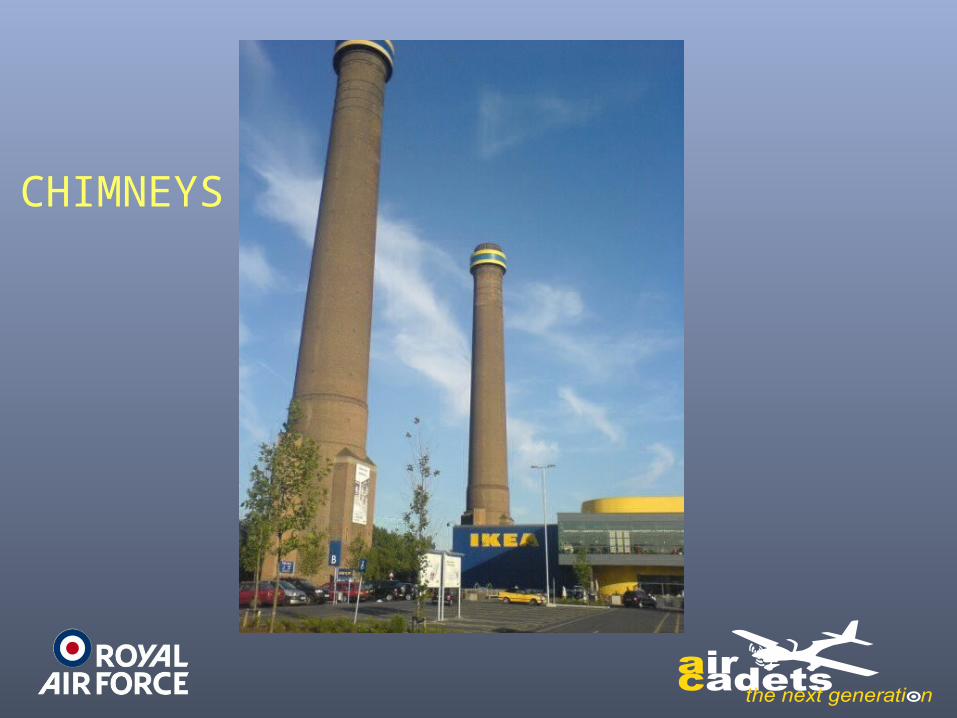
CHIMNEYS
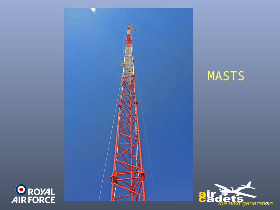
MASTS
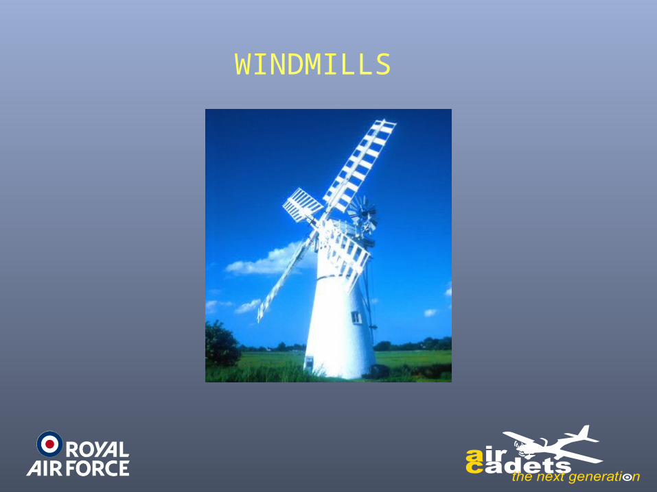
WINDMILLS
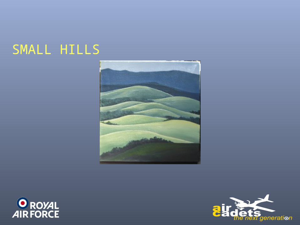
SMALL HILLS
This is to enable them to be seen before the aircraft arrives overhead the feature
High Level
At high level it is important to chose large features that have definition and contrast
to stand out from a background
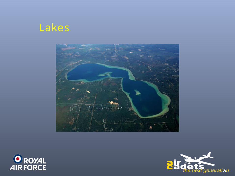
Lakes
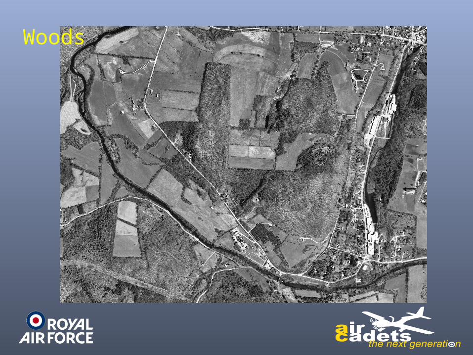
Woods
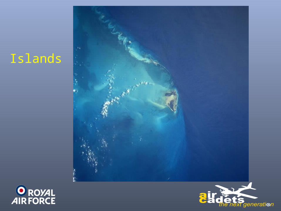
Islands
A further consideration is the difficulty at high level of obtaining an “on top” fix with an aircraft of limited downward visibility
Unique Features
Very large errors can be introduced into map reading simply by confusing one feature on
the map with another
For this reason villages are rarely used
We need more unique features
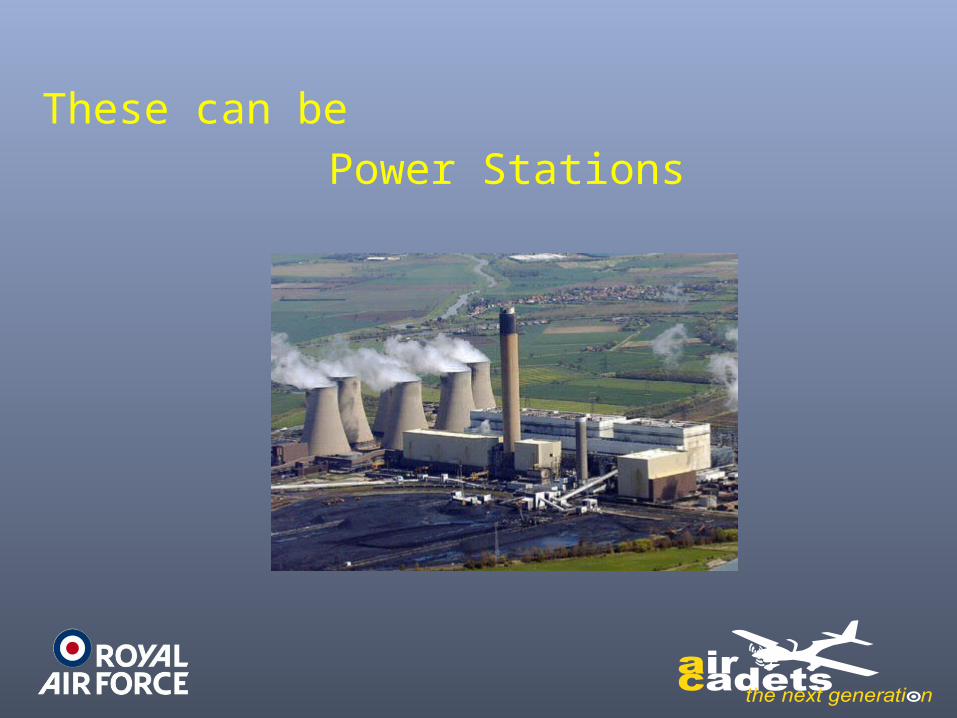
These can bePower Stations
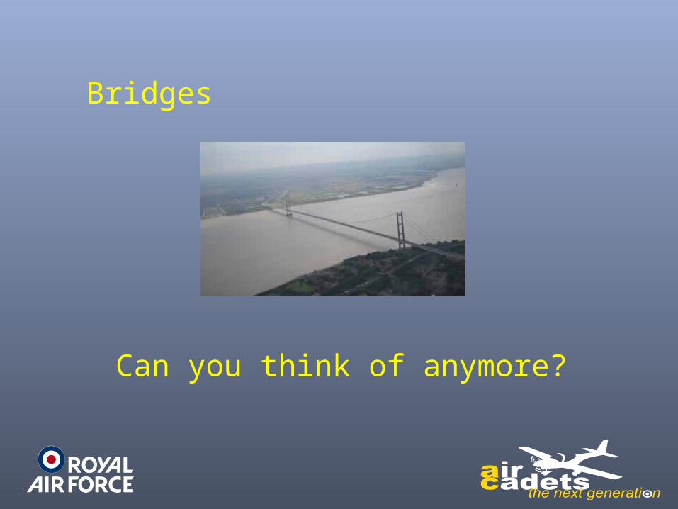
Bridges
Can you think of anymore?
Colour, Contrast & Season
Of all natural features, rivers and coast lines are the most useful, especially in
poor weather
This is because they show the greatest contrast & colour between themselves &
the land
Why?
Many land areas seen as ideal change their appearance with the seasons.
A wood in the summer will not be as obvious in the winter
A wooded area whichwas used as a turning-point during
Summer Camp would be much more difficult to identify in the winter when its
leaves had fallen
Snow changes everything including man made features
Snow has a dramatic effect onthe landscape, eliminating many
features and rendering many of the man-made line-features, such as
roads and railways, virtually invisible
Map Scales
In both military & civil aviation special maps are produced for map reading
from the air
These differ from OS maps in that they place more emphasis on those features
which are more easily identified from the air, such as airfields, towns, railway tracks and
masts.
HOWEVER THEY MUST BE UP TO DATE !
HOWEVER THEY MUST BE UP TO DATE !
HOWEVER THEY MUST BE UP TO DATE !
The choice of scale of your chosen map will depend on the speed of your aircraft
Most aircrew use the 1:500,000, widely known as the “half million”.
In general, the slower you fly, and the more detail you require, the larger scale
map you will use
For high-flying, long-range aircraft the opposite is true
Here, smaller scale maps reduce the number of sheets required
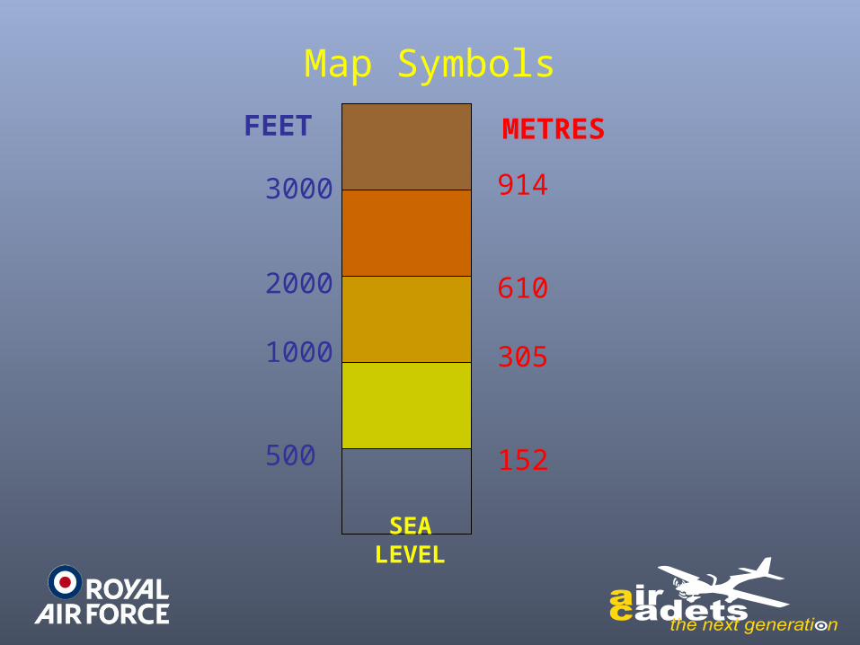
Map Symbols
SEA LEVEL
3000
2000
1000
500
914
610
305
152
FEET METRES
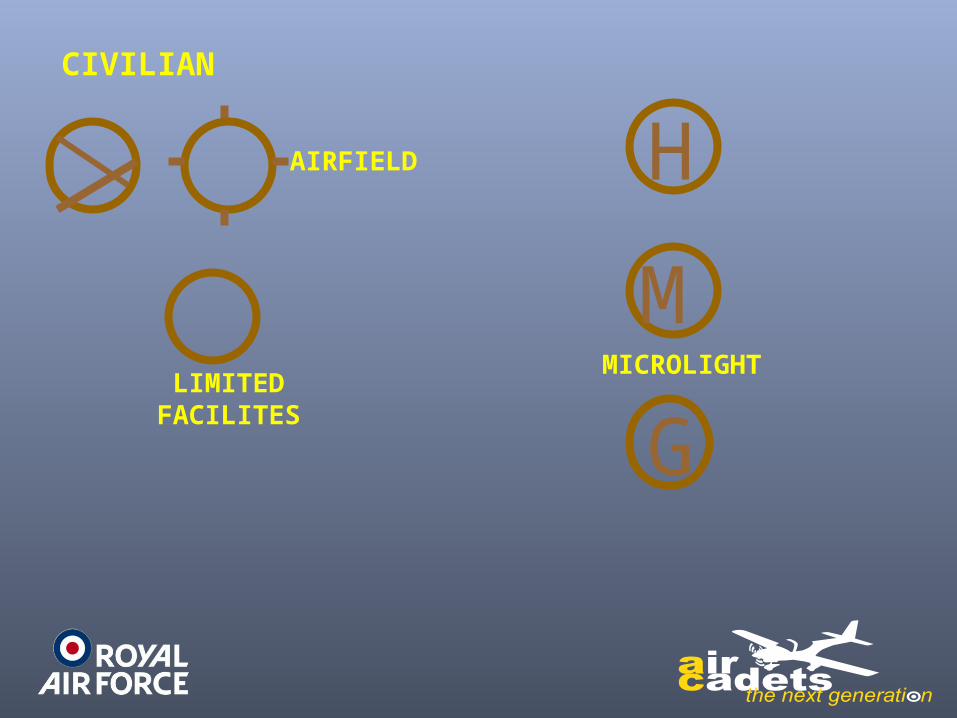
CIVILIAN
LIMITEDFACILITES
AIRFIELD
M
H
MICROLIGHT
G
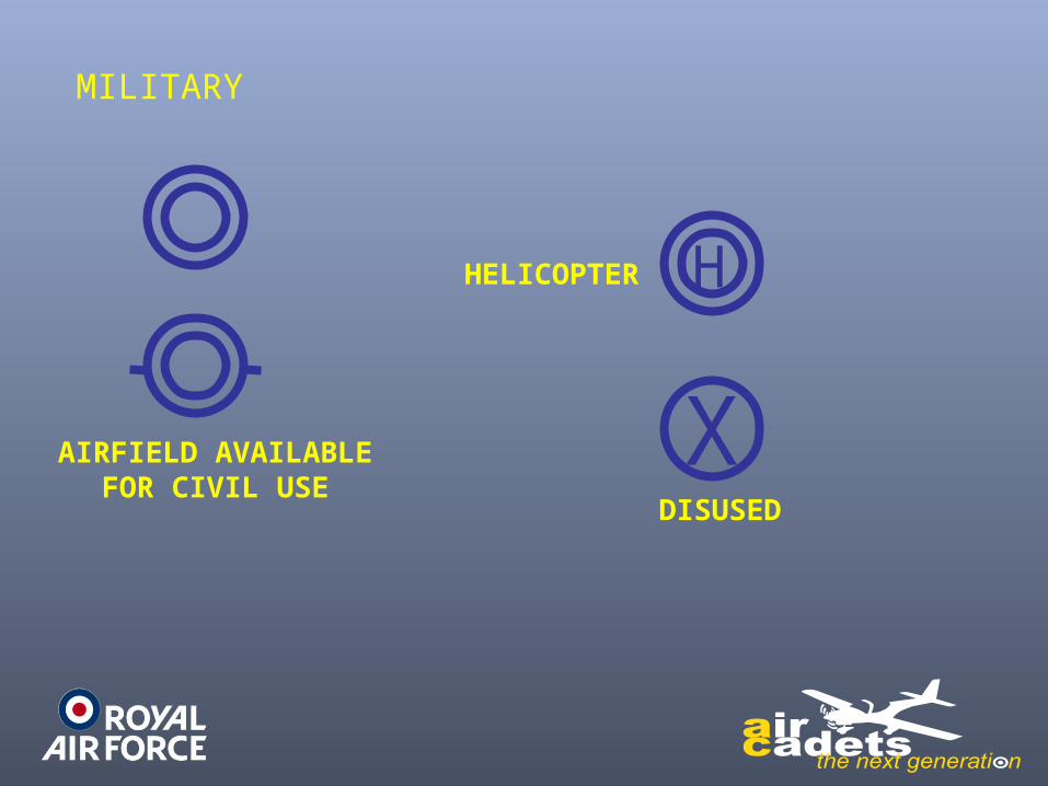
MILITARY
AIRFIELD AVAILABLEFOR CIVIL USE
XDISUSED
HHELICOPTER
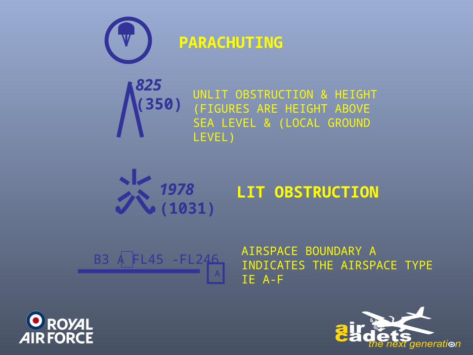
825(350)
1978(1031)
B3 A FL45 -FL246
PARACHUTING
UNLIT OBSTRUCTION & HEIGHT (FIGURES ARE HEIGHT ABOVE SEA LEVEL & (LOCAL GROUND LEVEL)
LIT OBSTRUCTION
AIRSPACE BOUNDARY A INDICATES THE AIRSPACE TYPE IE A-FA
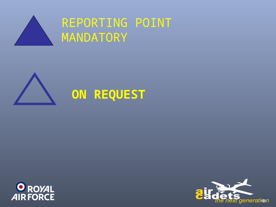
REPORTING POINTMANDATORY
ON REQUEST
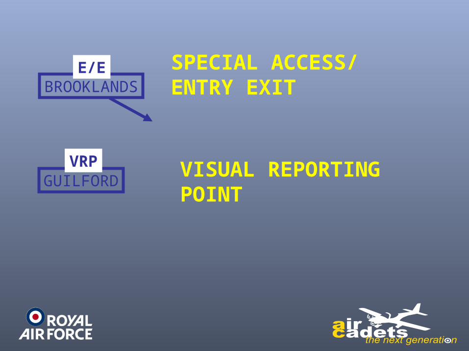
BROOKLANDSE/E
GUILFORDVRP
SPECIAL ACCESS/ ENTRY EXIT
VISUAL REPORTINGPOINT

VOR
DME
TACAN
NON-DIRECTIONALRADIO BEACON
Timing Marks
In a modern sophisticated aircraft the navigation equipment will tell you where
to look if you become temporarily uncertain of your position (i.e. lost!)
In a simple aircraft we will not have this equipment and so rely on the stopwatch and
map
When planning a map reading flight it is normal to put marks along each leg at a
set time - such as 2 minutes
If you lose your place along track while map reading, consult your watch, work out your time in minutes since the last point, and that will tell you where to look on the
map.

2
4
6
8
A Tutor is flying from the railway junction near Stowmarket via the mast
South West of East Dereham to the lighthouse at Cromer

A route on a 1:50,000 map from an initial point (IP) at to a target on the river
near Allanton
Conclusion
In common with so many aspects of aviation , successful map reading will
benefit greatly from the amount of advanced planning
this will give you the best chance of recovery when you lose your way
Through study of the route
detailed preparation of your route
and the careful selection of the unique features on the ground