nws grand rapids national weather service ... cha er townshi mid d city rapids c;edar springs...
TRANSCRIPT
NWS Grand Rapids www.weather.gov/grr
National Weather Service Grand Rapids
@NWSGrandRapids
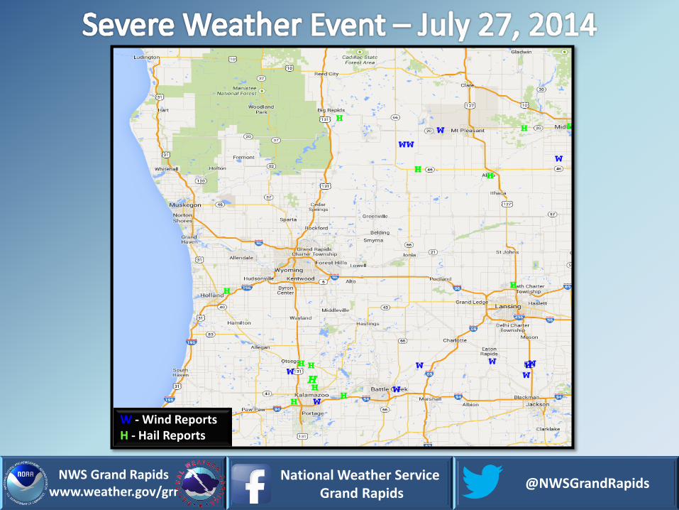
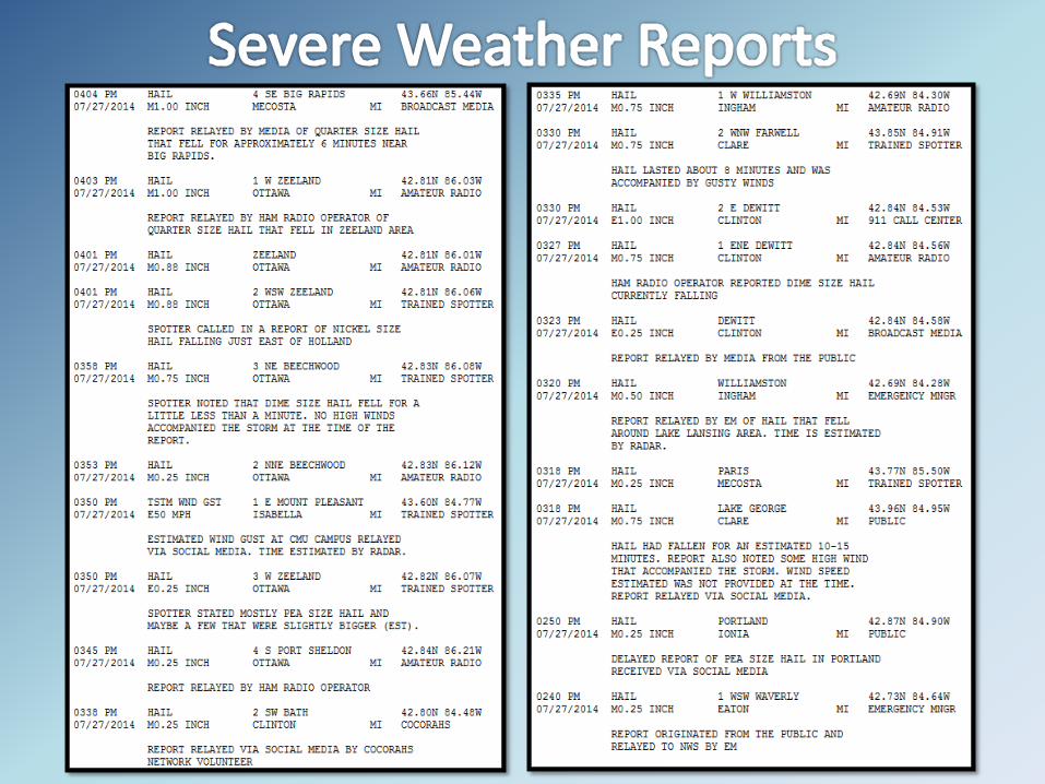
W - Wind Reports H - Hail Reports
NWS Grand Rapids www.weather.gov/grr
National Weather Service Grand Rapids
@NWSGrandRapids
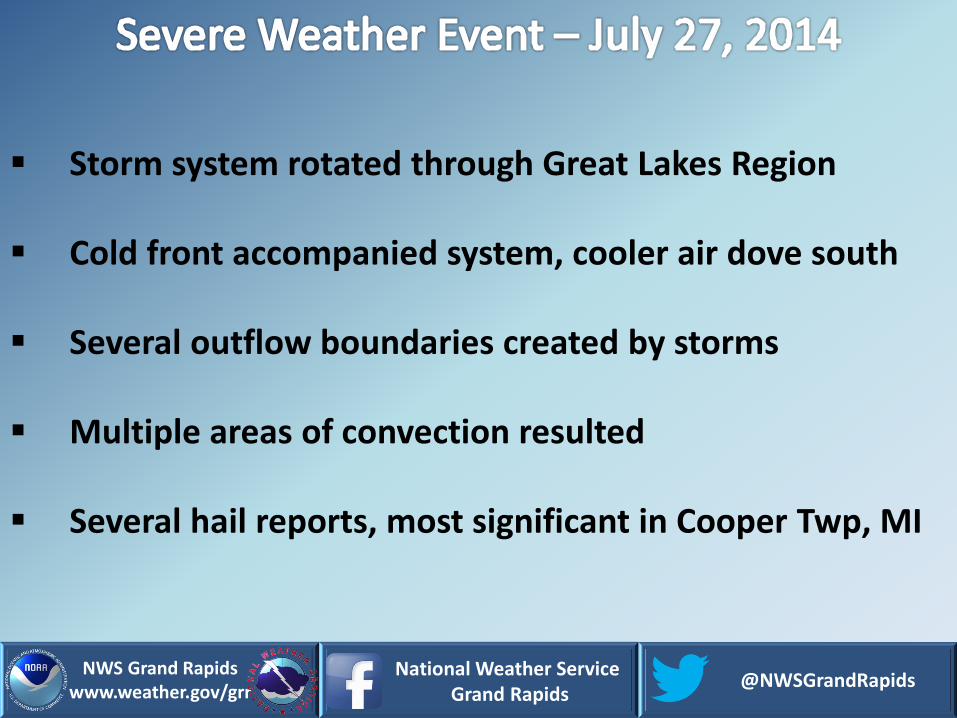
Storm system rotated through Great Lakes Region
Cold front accompanied system, cooler air dove south
Several outflow boundaries created by storms
Multiple areas of convection resulted
Several hail reports, most significant in Cooper Twp, MI

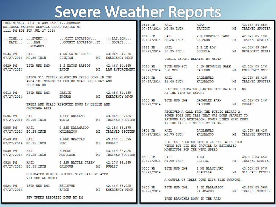
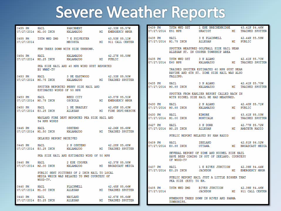
2:15 p.m. First cluster north of Grand Rapids produced the day’s first reports. Additional development in this area as well as near Lansing and Battle Creek produced reports.
4:40 p.m. Some areas were repeatedly hit with additional development (Reed City area). Biggest producer was the storm near Kalamazoo (in Cooper Twp) with 2 inch hail.

4:58 p.m. Several outflow boundaries formed, helping to create numerous areas of development. As a result, storms near Alma produced hail.
5:32 p.m. Continuing outflow created additional clusters as it traveled south. Storms continued east and moved out of the forecast area by 7:30 p.m.
Outflow

Courtesy: Brian Perkins Cooper Township
DeWitt Area Eaton Rapids Area
Leslie Area
Courtesy: LA Harrison Au Battle Creek
Farwell Area