noaa satellite proving ground - goes-r · goes fls algorithm products ... herramientas de...
TRANSCRIPT

Training and User Engagement
Update July 2012
NOAA Satellite Proving Ground
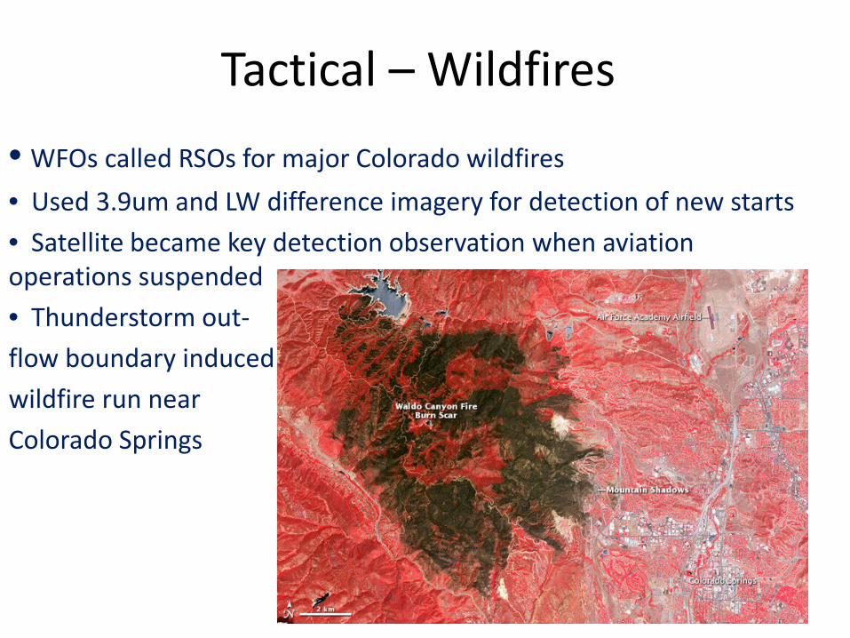
Tactical – Wildfires • WFOs called RSOs for major Colorado wildfires • Used 3.9um and LW difference imagery for detection of new starts • Satellite became key detection observation when aviation operations suspended • Thunderstorm out- flow boundary induced wildfire run near Colorado Springs

Tactical – Before and After • Derecho Blackout Suomi NPP DNB (Image: NASA Earth Observatory) • http://earthobservatory.nasa.gov/IOTD/view.php?src=eoa-iotd&id=78445)
GOES FLS Algorithm Products • GOES FLS Products Training Reviewed • Will replace existing IR AWIPS Difference Product • Implementation likely in AWIPS 1 and 2 • “Blazing” AWIPS2 path with SEC and FOTE Sites • VISIT team working with Mike Pavolonis to develop national training • Need to coordinate activities with Chad, Amanda, and others at CR in KC • Need to include other regions • Defining path to national test/ops, ATAN, OSIP, SREC
Coming Soon • NWS TD working NOAA SSW and OCWWS tasker for national satellite training analysis • WMO and EUMETSAT will be hosting an RGB Imagery Workshop in September
• US participants expected: NWS, NRL, SSEC, SPoRT
• Review and final versions of HWT SE ‘12 training • Need to capture training completions in NOAA CLC
• NESDIS Blended Polar Precip. Rate available soon • Target date was end of July, working on data flow to NWS
• NOAA NDE Team (NWS and NESDIS) produced test package for RT NPP data to flow on AWIPS in October
Coming Soon • Tracking GOES Incident Report for GOES-East pixel offset • AWIPS 1 mod. for displaying full-resolution WV imagery from GOES-West • Global Geo Rainrate from NESDIS – needs operational support/demand • Hazard Services (Next Generation Warning Tool) Development Continues
GOES Training Update Recap FY2011/2012 for GOES PO User Engagement at Mission CDR
6-21-2012 Brian Motta
NWS Forecast Decision Training Branch COMET/VISIT/SHyMet/SPoRT

FY12 Satellite-specific Training Modules by COMET with complete or partial NESDIS funding Funding also supports conference participation to promote the materials and interact with experts
• GOES-R ABI, summer 2012 • Monitoring the Climate System with Satellites (with
EUMETSAT) • Satellite Feature Identification: Atmospheric Rivers (with MSC) • Atmospheric Dust • Microwave Remote Sensing: Overview, 2nd Edition • Remote Sensing Using Satellites, 2nd Edition, summer 2012 • Polar-Orbiting Nighttime Applications, work underway • Monitoring Atmospheric Composition with Satellites (with
EUMETSAT) summer 2012 • Imaging with VIIRS: A Convergence of Technologies and
Experience, 2nd Edition • Suomi NPP: A New Generation of Environmental Monitoring
Satellites • The Environmental Satellite Resource Center Website
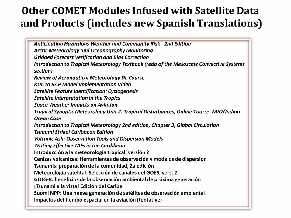
Other COMET Modules Infused with Satellite Data and Products (includes new Spanish Translations)
Anticipating Hazardous Weather and Community Risk - 2nd Edition Arctic Meteorology and Oceanography Monitoring Gridded Forecast Verification and Bias Correction Introduction to Tropical Meteorology Textbook (redo of the Mesoscale Convective Systems section) Review of Aeronautical Meteorology DL Course RUC to RAP Model Implementation Video Satellite Feature Identification: Cyclogenesis Satellite Interpretation in the Tropics Space Weather Impacts on Aviation Tropical Synoptic Meteorology Unit 2: Tropical Disturbances, Online Course: MJO/Indian Ocean Case Introduction to Tropical Meteorology 2nd edition, Chapter 3, Global Circulation Tsunami Strike! Caribbean Edition Volcanic Ash: Observation Tools and Dispersion Models Writing Effective TAFs in the Caribbean Introducción a la meteorología tropical, versión 2 Cenizas volcánicas: Herramientas de observación y modelos de dispersion Tsunamis: preparación de la comunidad, 2a edición Meteorología satelital: Selección de canales del GOES, vers. 2 GOES-R: beneficios de la observación ambiental de próxima generación ¡Tsunami a la vista! Edición del Caribe Suomi NPP: Una nueva generación de satélites de observación ambiental Impactos del tiempo espacial en la aviación (tentative)
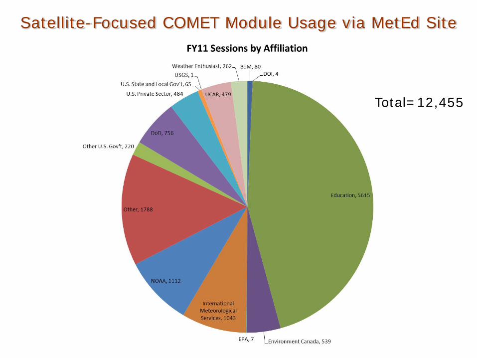
Total=12,455
Satellite-Focused COMET Module Usage via MetEd Site

FY11-12 Live Training Sessions (develop/revise date)
Synthetic Imagery in Forecasting Orographic Cirrus (January 2011) Synthetic Imagery in Forecasting Severe Weather (February 2011) Objective Satellite-Based Overshooting Top and Enhanced-V Anvil Thermal Couplet Signature Detection (February 2011) Volcanoes and Volcanic Ash Part 2 (March 2011) GOES-15 Becomes GOES-West (December 2011) VISIT Satellite Chats (short, interactive discussions, Q&A, monthly since February 2012) Topics: Fog and Low-Cloud Detection from Satellite (2-22-2012) Water Vapor Imagery (3-21-2012) Satellite Related Severe Weather Products (4-25-2012) Fire Weather Imagery and Products (5-23-2012) Mesoscale Convective Vortices (6-27-2012)
Synthetic Imagery in Forecasting Low Clouds and Fog (April 2012) Pseudo GOES Lightning Mapper (May 2012) Tropical Cyclone Intensity Model Guidance Used by NHC (June 2012, updated) Tropical Cyclone Track Model Guidance Used by NHC (June 2012, updated) Convective Cloud Top Cooling and UW Convective Initiation Algorithm (July 2012)
Virtual Institute for Satellite Integration Training

GOES Convective Initiation and Severe Weather Detection Training
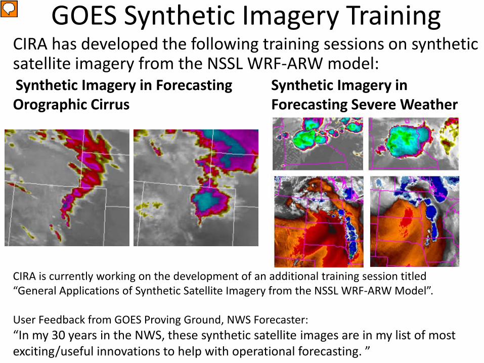
GOES Synthetic Imagery Training CIRA has developed the following training sessions on synthetic satellite imagery from the NSSL WRF-ARW model:
CIRA is currently working on the development of an additional training session titled “General Applications of Synthetic Satellite Imagery from the NSSL WRF-ARW Model”. User Feedback from GOES Proving Ground, NWS Forecaster: “In my 30 years in the NWS, these synthetic satellite images are in my list of most exciting/useful innovations to help with operational forecasting. ”
Synthetic Imagery in Forecasting Severe Weather
Synthetic Imagery in Forecasting Orographic Cirrus
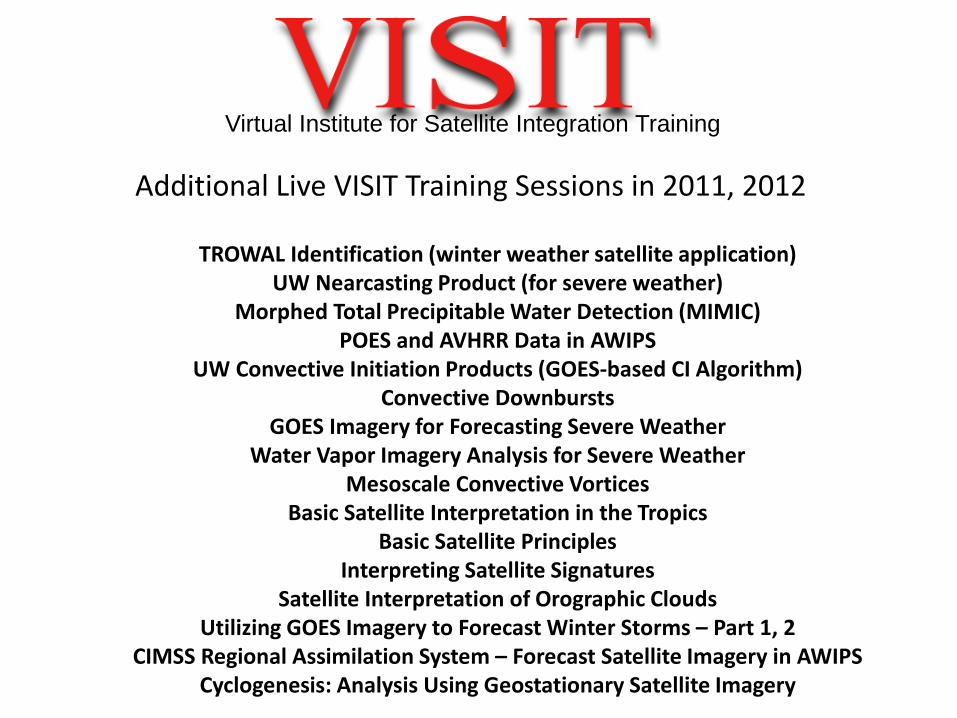
Additional Live VISIT Training Sessions in 2011, 2012
TROWAL Identification (winter weather satellite application) UW Nearcasting Product (for severe weather)
Morphed Total Precipitable Water Detection (MIMIC) POES and AVHRR Data in AWIPS
UW Convective Initiation Products (GOES-based CI Algorithm) Convective Downbursts
GOES Imagery for Forecasting Severe Weather Water Vapor Imagery Analysis for Severe Weather
Mesoscale Convective Vortices Basic Satellite Interpretation in the Tropics
Basic Satellite Principles Interpreting Satellite Signatures
Satellite Interpretation of Orographic Clouds Utilizing GOES Imagery to Forecast Winter Storms – Part 1, 2
CIMSS Regional Assimilation System – Forecast Satellite Imagery in AWIPS Cyclogenesis: Analysis Using Geostationary Satellite Imagery
Virtual Institute for Satellite Integration Training

GOES Training at NOAA Testbeds Hazardous Weather Testbed
• Converted all but on-the-job training to distance learning for delivery and completion prior to the EWP experiment • Increased experimental forecasting time by 20% over last year when training was done on Day1 at HWT • Provided awareness-level training to field personnel and managers on the analysis techniques, data assimilation, and algorithm products under review and consideration in EWP. (Tales from HWT)
16
Building a Weather-Ready Nation