msc hydrographic surveying brochure 2013 - · pdf filefor entry in september 2013 civil,...
TRANSCRIPT

UCL/PLA MSc in Hydrographic Surveying
MSc inHydrographicSurveying
Taught jointly by University College Londonand the Port of London Authority
For entry in September 2013
CIVIL, ENVIRONMENTAL AND GEOMATIC ENGINEERING

UCL/PLA MSc in Hydrographic Surveying
i
Contents
1 Introduction .......................................................................... 1
2 Structure of the programme.................................................... 2
3 History of the MSc programme ................................................ 2
4 Aims and Strengths of the course ............................................ 4
5 The Institutions ..................................................................... 9
6 Research Environment...........................................................11
7 Equipment and Facilities ........................................................14
9 Review procedures................................................................26
10 Entry Requirements.............................................................28
11 Assessment........................................................................29
12 Examples of individual MSc projects ......................................31
13 Careers and Student Profiles ................................................33
14 Final Remarks.....................................................................39

UCL/PLA MSc in Hydrographic Surveying
1
1 Introduction
The MSc in Hydrographic Surveying at UCL is a full-time twelve-monthcourse that is run jointly by University College London and the Port of LondonAuthority. It builds on the strengths of the two institutions, combining thesound research-led teaching of UCL with the state of the art hydrographicfacilities of one of the most advanced ports in the world.
The course is recognised as a Category A course by the InternationalHydrographic Organisation (IHO), the International Federation of Surveyors(FIG) and the International Cartographic Organisation (ICO). This is aninternationally recognised qualification that enables graduates of the courseto gain employment at the highest level. It is increasingly required byemployers around the world. The course is also recognised as offeringspecialised training and education in the following standard specialisms:
Optional Unit 1 (Nautical Charting Hydrography); Optional Unit 2 (Hydrography to Support Port Management and
Coastal Engineering); Optional Unit 4 (Offshore Construction Hydrography).
This document gives a full description of the course for prospective studentsand employers. It includes details of the aims and strengths of the course,the institutions that are offering it, the entry requirements, the facilitiesavailable, the research environment and individual projects, and profiles ofthe careers of some of our students.
The MSc in Hydrographic Surveying is an internationally recognised degreeoffered by two outstanding institutions. Our graduates are much in demandand have gone on to have interesting and rewarding careers around theworld.
We hope that you find the information that you’re looking for here. If you areinterested in joining us then we look forward to hearing from you.
Dr Jonathan Iliffe, Senior Lecturer, Head of Geomatic and GeotechnicalEngineering, Course Director.
Captain John Pinder, Port Hydrographer, Port of London Authority.
Mr John Dillon-Leetch, Deputy Port Hydrographer, Port of London Authority,Course Coordinator.

UCL/PLA MSc in Hydrographic Surveying
2
2 Structure of the programme
The overall length of the programme is 12 months, split into a first term fromSeptember to December, with the modules assessed in early January; asecond term runs from January to late March, with assessment in late April/early May. The final part is the individual project, running from May toSeptember.
There are three sections to the course, each given equal weight: the firstterm taught material; the second term taught material; and the individualproject. Each of these is worth 60 credits.
The first term is organised into four 15 credit modules as:
Data Analysis GIS Principlesand Technology
Principles andPractice ofSurveying
MappingScience
The second term is organised as:
Positioning Ocean andCoastal ZoneManagement
HydrographicApplications
Management/Group Project
The individual project runs from mid-May to mid-September.
It is possible for students to graduate with a Postgraduate Diploma afterfollowing the taught part of the course but not doing the individual project.However, only the full programme, leading to an MSc, is recognised by theRICS and the IHO/FIG/ICO.
3 History of the MSc programme
The initial decision to offer jointly an MSc in Hydrographic Surveying wastaken by UCL and PLA in 1998, and following this the masters programmewas first run in the academic session 1999 – 2000. It was initially accreditedby the IHO/FIG/ICA board at their 2001 meeting in Trieste.
At the time of the initial establishment of the course, it was based in theDepartment of Geomatic Engineering at UCL.

UCL/PLA MSc in Hydrographic Surveying
3
The MSc in HydrographicSurveying has always beenstrongly integrated with othergeomatics masters programmesin the department, in particularthe course in (Land) Surveying,but also sharing genericelements with courses in GISand Remote Sensing. Soalthough the programme hasonly been running since 1999, itsits within a structure ofgeomatics MSc programmes
that have been running for over 60 years.
In 2007 the Department of Geomatic Engineering ceased to exist as anindependent department and merged with Civil Engineering to become thenew Department of Civil, Environmental & Geomatic Engineering. In terms ofthe Hydrographic programme, the main effect has been the strengthening ofties that already existed in the delivery of the engineering aspects of theocean and coastal zone module – in future it is likely to mean strongercollaboration and overlap with MSc programmes in marine and coastalengineering.
This gives an overview of how the course was established and the academiccontext in which it sits. However, central to all of this has been thecollaboration between UCL and the PLA: this was initially established througha memorandum of understanding signed at the highest level between the twoinstitutions. Since then, it has been cemented by the joint practicalexperience of collaborating on the MSc, with the strong professional andpersonal ties that thisengenders; it has alsobeen enhanced bydiversification beyond thenarrow aim of coursedelivery to encompassother collaborativeprojects. For example,UCL has participated inthe GPS observationcampaign for Thamestide gauges, bothorganisations havecollaborated with theOrdnance Survey on theuse of their OSNet system, the PLA has been a pioneer in the use of VORF,and so on.

UCL/PLA MSc in Hydrographic Surveying
4
We believe that this is a unique partnership between an academic institutionand a public or private organisation that is involved day-to-day in thepractice of hydrographic surveying. The benefits are obvious, in that it isclear that UCL is bringing its wealth of experience in teaching, its outstandingfacilities, its research leadership, whilst the PLA is bringing not only a fleet ofstate of the art survey vessels but also the accumulated practical experienceof its surveyors.
4 Aims and Strengths of the course
Overall aims
The UCL/PLA hydrographic programme aims to provide a broadly basededucation in hydrographic surveying, combined with a strong practicalelement. It is a feature of the teaching in the department that we aim tomove rapidly from a theoretical classroom-based exposition of a subject toits practical implementation. This practical element might take the form ofexercises aboard survey vessels, or it might involve acquisition andprocessing of GPS data, or handling digital mapping and charting data, oreven using a pencil and paper to work out the functional link between anobservational type and parameters to be derived by least squares.
By the term “broadly based” we mean firstly that we do not restrict ourselvesto any particular area of hydrographic surveying: the participation of a portauthority is an important feature of the course, but our remit is not restrictedto ports and harbours. We involve professional offshore surveyors in thecourse delivery, but it should also be noted that several of the staff of thePLA have themselves had a background in offshore surveying before joiningthe organisation.
Secondly, we mean that the hydrographic surveying programme is groundedfirmly in a general geomatics framework. There are obvious practical reasonsfor this, in that it enables some elements of the course to be taught inparallel with material delivered to other programmes at UCL. However, it hasthe dual effect of both making the hydrographic students aware of how thesubject fits within the wider framework of geomatics and exposing morestudents to important concepts related to surveying at sea. So, for example,hydrographic surveyors study GPS alongside surveyors and are aware ofproblems related to the use of satellite systems in many dynamic situations,not just the ship-borne ones, whilst all students at UCL who are onprogrammes in the geomatics area have to study at least some aspects ofmarine datums. This means that a student of GIS who ends up working ondata related to the coastal zone has a much stronger understanding ofbathymetric datums than would generally be the case.

UCL/PLA MSc in Hydrographic Surveying
5
Strengths and specialisms
Why come to UCL? What are the specialist areas that the UCL/PLA MScprogramme will give students over and above what they would expect to findon any hydrographic course. We believe that these are:
Practical work carried out aboard working PLA hydrographic vessels, incollaboration with professional surveyors and crews;
Deep study of error theory, least squares analysis and quality control; In depth study of GNSS, geodesy, and coordinate reference systems
(including in combined areas such as study of the VORF project); Links between electronic charting and the GIS research group in the
department; Study of maritime boundaries related to real world examples that have
been analysed in the department; Opportunity to carry out an in-depth study into one particular topic as
part of the individual research project.
These particular strengths can best be illustrated with direct examples.
Practical work aboard PLA vessels
The Port of London Authority (PLA)has the busiest port hydrographicdepartment in the UK with sixqualified surveyors and support staffcomprising 14 employees in total.The department has three dedicatedsurvey craft fitted with RESONMultibeam Echo Sounder Systems.
In addition to planning and conductingat least 3 bathymetric MBES surveysduring the practical part of the course,students will also use dual frequencysingle beam and side scan sonar. Thesoftware used for acquisition andprocessing (Hypack, Geodas, CadcorpGIS, Fledermaus) is available at thecollege so that the students can becomefamiliar with it and produce their ownreports.

UCL/PLA MSc in Hydrographic Surveying
6
Study of error theory
Error theory and quality control are taught through the Data Analysismodule, and further reinforced through applications in the Positioningmodule. For one of the practical assignments in the Data Analysis module thestudents are given a scenario of a rig being towed offshore from the yardwhere it was constructed, and its movement along a precisely defined pathbeing monitored. Students are required to devise an observational schemethat meets certain pre-defined requirements for precision and reliability(expressed in terms of the marginally detectable errors being within adefined limit). This has to be simulated mathematically, with the studentsbeing responsible for the derivation of all the relevant equations and theirimplementation in Excel. Having devised the appropriate algorithms, theythen refine the observational scheme to meet the quality criteria with theminimum number of observations.
Study of Global Navigation Satellite Systems
One example of student work involves calculating a position fix from GPSpseudo-ranges. Students are given five pseudo-ranges measured by a GPSreceiver at the site of Herstmonceux Castle in Sussex at the epoch 2001 9 1413 45 0.00, as well as the satellite positions in WGS84 at the epoch of signaltransmission and the approximate location of the receiver. The students aretold to estimate the position (in ECEF Cartesian coordinates) of the receiver,and the receiver clock offset, using all the pseudo-ranges. They are alsoinstructed to assume that the standard deviation of a pseudo-rangemeasurement in metres is the cosecant of the satellite elevation angle. The
students have to set up theappropriate observation equations,carry out a linearisation and invertfor updated coordinates, usingseveral iterations. The students thenconvert the answer to latitude,longitude and height. The quality ofthe position fix must be assessed(analysis of residuals, estimation ofvariance factor, scaling of covariancematrix) and the GDOP, PDOP, HDOPand VDOP values are to becalculated from the variance-covariance matrix.
Another example of the depth to which students study GNSS is from a labclass in the Positioning module, in which students carry out a linearisation ofdouble differenced phase observations. The purpose of this exercise is to aid

UCL/PLA MSc in Hydrographic Surveying
7
the understanding of the standard procedures for processing GPS phasedata. The calculation that the students are asked to carry out is asimplified version of what is done in mainstream GPS manufacturers’software such as Geo-Office (Leica Geosystems), TGO (TrimbleGeomatics Office), Ashtech Solutions and TGPS (Topcon). The students aresupplied with L1 carrier phase data observed at two stations and at twoepochs 15 minutes apart. They are also supplied with satellite antenna phasecentre positions in ECEF coordinates at the epochs of signal transmission,along with precise coordinates of one station, and approximate coordinates ofthe other. The task in the lab is to form double differenced observations,linearise the system of equations, solve for float phase ambiguities, fix theseto integers and then estimate the precise coordinates of the second station.The whole task is carried out in Excel, and the students are directed todetermine the standard deviations of all parameters at each stage (assumingthe variance factor is unity for this small dataset).
Electronic charting and GIS
The professional aspects of electronic chart production are taught by the PLAas part of the Hydrographic Applications module, as they are the ones thatare involved in day-to-day production of S57 charts. However, it is alsoimportant to realise that this builds on a foundation laid down in the firstterm as part of the GIS Principles and Technology module taught by UCL.Thus, students get a very fundamental grounding in the principles ofhandling digital data before going on to the specialist marine applications.
An example of the advantages of this approach would be in the MSc projecton Risk Analysis for Submarine Cable Burial carried out by Mr AndrewPalmer-Felgate, a student on the course. This took a very fundamentalapproach to the way that data acquired with multibeam is analysed andprocessed, examining the advantages and disadvantages of differentmethods of interpolation onto grids, such as inverse distance weighting,kriging, splines, and so on.
Study of maritime boundaries
The study of maritime boundary delimitation forms part of the Ocean andCoastal Zone Management module. An exercise that is carried out by thestudents is as given in the following specification:
You work for an oil company that is intending to negotiate with theIsraeli government for several offshore exploration licences in theEastern Mediterranean Sea. At present Israel does not have any formalmaritime boundary agreements with its Mediterranean neighbours, butyour company wishes to know about any risks associated withpurchasing licences in particular areas – where is the boundary likely

UCL/PLA MSc in Hydrographic Surveying
8
to end up? Where might areas of particular uncertainty or dispute lie?Where are we going to need extra data?
They have assigned you to a team that is going to spend a dayexploring this issue. At the end of the day (literally, rather thanfiguratively) you will aim to have derived provisional maps andcoordinates of the maritime boundaries of Israel. You will also havedeveloped ideas about the particular problem areas, and will make apresentation to the directors of the company in which you explain yourmethodology, its possible limitations, and what you see as thepotential problem areas.
Students then work on this problemfor a day, using digital mapping of thecoastlines from which Thiessenpolygons are derived, assisted bycharts of more detailed areas,software to carry out ellipsoidalcomputations, reference to onlinesources such as Google Earth,published international agreements,and so on.
Individual MSc projects
Individual MSc projects form one third of the total credit value of the course,and are a means through which students can demonstrate a deepunderstanding of the subject. The aim of the project is to produce work thathas a research element and is in principle of interest to a wider communitythan those immediately involved. That is, the MSc project is somethingdistinct from a routine professional job and is intended to launch students tosome extent into the unknown: in several cases it has led to publishedpapers. In most cases it fosters resourcefulness, as they are expected to actas the liaison point between their academic supervisors and other bodiesinvolved (such as the Port of London or industrial sponsors). In all cases itencourages students to think deeply about their chosen field, to researchwidely in published literature, and to write clear and concise reports.
This is a significant part of the course – there is a separate section givingexamples of students’ individual projects.

UCL/PLA MSc in Hydrographic Surveying
9
5 The Institutions
The collaboration between UCL and the PLA to run a combined MScprogramme represents a combination of two London based organisations thatboth have an outstanding international reputation.
University College London
In 2009 UCL climbed to fourth place in the annualTimes Higher Education - QS World UniversityRankings, confirming its standing as London’s globaluniversity. The meteoric progression up the tables inrecent years reflects the outstanding quality of UCL’scommunity of academics and students. The universityis one of the foremost in the UK for research andinnovation, and is dedicated to harnessing itsexceptional research for positive social and economicbenefit: no fewer than 21 Nobel prizewinners havecome from the UCL community.
This community continues to pursue the highest standards of academicrigour and has earned admiration in the higher education domain for itsstrategies to pool research expertise across a wide range of disciplines, todeliver the highest standards in teaching, and to attract the brighteststudents from all over the globe. Student life at UCL is rich and challenging;we provide the opportunities and leadership in teaching, research,entrepreneurship, volunteering and overseas study. 34% of UCL studentscome from outside the UK, from approximately 140 countries around theworld, and our research reaches the farthest corners of the globe; from theconservation of antiquities in Iraq to the transformation of engineeringresearch in Kazakhstan.
UCL was founded in 1826 as a secular alternative to the universities ofOxford and Cambridge. Prior to this, the benefits of a university education inEngland were restricted to men who were members of the Church ofEngland. UCL was founded to challenge this discrimination, providing aradical alternative to Oxbridge’s social exclusivity, religious restrictions andacademic constraints, thus opening up English higher education for the firsttime to people of all beliefs and social backgrounds. Today, it remainsfervently progressive and is one of the world’s leading multidisciplinaryuniversities, with a global reach and global vision.

UCL/PLA MSc in Hydrographic Surveying
10
The Port of London Authority
The Port of London Authority was established under the Port London Act of1908, for the purpose of administering, preserving and improving the Port ofLondon and for other purposes including the conservancy of the tidalThames. Those powers have been extended in subsequent Acts and Orders,the last of significance being the Port of London Act 1968 (as amended),which gives very wide powers and duties to the PLA in the improvement andconservancy of the Thames including:
Regulation of navigation by means of River Byelaws, GeneralDirections and other associated Byelaws;
Licensing of river works and dredging; Hydrographic Surveying; Inspection and licensing of commercial vessels; Removal of sunken vessels and other hazards to navigation; Licensing of watermen and lightermen.
The Port of London is the second largest port in the UK in terms of tonnagehandled and number of shipping movements.
The area of responsibility extends from the tidal limit of the Thames aboveRichmond in the west, right out to the southern North Sea in the east, adistance of 140 Km and an area of 1000 sq Km. The estuary has 3 mainshipping channels and many complex sand banks which need constantmonitoring
The Hydrographic Service of the PLA, as already mentioned, is the largestport survey department in the UK, producing over 300 surveys a year. It isaccepted as a centre of excellence in the field of port surveying and hasrecently gained a reputation for innovative use of high resolution multibeamfor engineering and diver support. It produces its own large scale ENC andworks closely with the UKHO and MCA on chart production and nationalinterest mapping.

UCL/PLA MSc in Hydrographic Surveying
11
Collaboration arrangements
Physically, the two institutions are located approximately 25 miles from eachother, with UCL being sited near the centre of London and the hydrographicservice of the PLA being down the River Thames at Gravesend. PLA stafftravel to London to deliver lectures, a journey that can now be accomplishedwithin around 30 minutes door-to-door with the opening of the new highspeed train service. Students either travel to Gravesend to join surveyvessels or board closer to the centre of the city when it can be integratedwith the PLA’s work flow.
Formally, the degrees are awarded by UCL. The PLA take primaryresponsibility for two of the modules and for the practical work, however,staff from both organisations work together on the planning process for thedegree.
6 Research Environment
UCL is a research intensive university. In a department such as Civil,Environmental & Geomatic Engineering, the annual income from research isaround £5 million. Rather than being seen as a distraction from teachingstudents, the philosophy at UCL is that the whole learning experience isenriched by contact with academic staff who are clearly at the forefront oftheir fields. This is true for staff involved in the MSc in HydrographicSurveying as it is for all staff, and students on the course come into contactwith research into the latest developments in the field.
To give a very brief flavour of this, some examples are given below of currentor recent projects in the department that are relevant to the hydrographiccourse.
GNSS positioning aboard vessels
A recent project led by Professor Paul Cross, and involving PhD student AlexParkin, and running from 2005 to 2009 has examined the future positioningrequirements of the IMO (resolution A.915) and tested the acquisition andprocessing of data in a marine environment against the IMO requirements.
A data collection exercise was held in Harwich Harbour, in collaboration withTrinity House, and saw THV Alert navigate into the harbour whilst GPS datawas acquired on board and at reference stations on shore. In addition, totalstations at shore based reference stations were used to track the vessel andprovide a truth model.
UCL/PLA MSc in Hydrographic Surveying
12
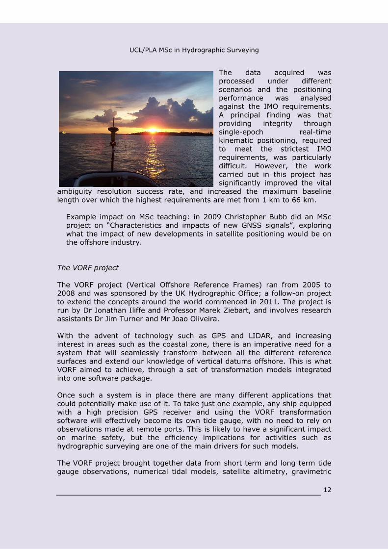
The data acquired wasprocessed under differentscenarios and the positioningperformance was analysedagainst the IMO requirements.A principal finding was thatproviding integrity throughsingle-epoch real-timekinematic positioning, requiredto meet the strictest IMOrequirements, was particularlydifficult. However, the workcarried out in this project hassignificantly improved the vital
ambiguity resolution success rate, and increased the maximum baselinelength over which the highest requirements are met from 1 km to 66 km.
Example impact on MSc teaching: in 2009 Christopher Bubb did an MScproject on “Characteristics and impacts of new GNSS signals”, exploringwhat the impact of new developments in satellite positioning would be onthe offshore industry.
The VORF project
The VORF project (Vertical Offshore Reference Frames) ran from 2005 to2008 and was sponsored by the UK Hydrographic Office; a follow-on projectto extend the concepts around the world commenced in 2011. The project isrun by Dr Jonathan Iliffe and Professor Marek Ziebart, and involves researchassistants Dr Jim Turner and Mr Joao Oliveira.
With the advent of technology such as GPS and LIDAR, and increasinginterest in areas such as the coastal zone, there is an imperative need for asystem that will seamlessly transform between all the different referencesurfaces and extend our knowledge of vertical datums offshore. This is whatVORF aimed to achieve, through a set of transformation models integratedinto one software package.
Once such a system is in place there are many different applications thatcould potentially make use of it. To take just one example, any ship equippedwith a high precision GPS receiver and using the VORF transformationsoftware will effectively become its own tide gauge, with no need to rely onobservations made at remote ports. This is likely to have a significant impacton marine safety, but the efficiency implications for activities such ashydrographic surveying are one of the main drivers for such models.
The VORF project brought together data from short term and long term tidegauge observations, numerical tidal models, satellite altimetry, gravimetric

UCL/PLA MSc in Hydrographic Surveying
13
geoid models, datum corrector surfaces and specially commissioned GPSobservations to many remote tide gauges.
Example impact on MSc teaching: in 2012 James Johnston did an MScproject on how VORF could be extended around the world, combiningsatellite altimetry data with coastal tide gauges, and using a study area ofthe west coast of France.
Example of VORF observation campaigns: these pictures are from a VORFexpedition to the uninhabited island of Sule Skerry, west of the Orkneys, whereobservations were made to tie the Chart Datum to ETRF89. MV Bounteous Seawas chartered for the expedition.
Morphological seabed modelling
This is a project involving Professor Richard Simons and PhD student AnnaBakare. It develops and investigates the applicability of a statistical methodfor morphological modelling of the seabed that is able to account for spatialmorphological properties and external forcing conditions. The statisticalmethod is a spatial functional regression model. It has been applied toidealised scenarios of morphological behaviour and evolution that simulatereal morphological properties as the seabed evolves over time. In addition,the model has been applied two study sites off the English coastline thathave different morphodynamic characteristics. The sites are the GreatYarmouth sandbanks and the nearshore zone of Poole Bay.
Results from the applications show that the model is able to identifymorphological behaviour and evolution properties. For the idealised scenarioswith temporal periodicity, stochastic effects and noise, it was able togenerate predictions with accuracies of 0.02m against mean observedvariability of 0.14m. For the study sites accuracies of 1.79m and 0.75m wereobtained respectively where the mean observed variability was

UCL/PLA MSc in Hydrographic Surveying
14
A B
approximately 1.73m and 1.16m respectively. On including theenvironmental forcing information in the modelling process the predictionerrors are reduced. Therefore the spatial functional regression model is anapplicable method for morphological modelling applications.
Observed bathymetric surface at Great Yarmouth study site for 2006 (a) andpredicted bathymetric surface for 2006 (b).
Example impact on MSc teaching: in 2012 Marilyn Eghan carried out anMSc project on the use of the MIKE software to model sediment transportin a selected area of the Thames.
7 Equipment and Facilities
At the Port of London Authority:
Survey vessels:
Verifier: 25 m monohull.
Yantlet: 14 m catamaran.
Galloper: 8 m catamaran.
Sonar equipment:
Reson 7125, 8125, 8101 multibeam systems.

UCL/PLA MSc in Hydrographic Surveying
15
CMax- CM2 Dual Frequency Side-scan Sonar.
Odom echotrack dual frequency single beam echosounder.
RDI Seahorse ADCP
Positioning equipment:
Applanix POSMV on each vessel.
Software:
Hypack/Hysweep for data acquisition.
Fledermaus for post-processing and reporting.
Applanix POSPAK for post processed kinematic.
GeoDAS for sidescan and mosaicing.
Cadcorp GIS for chart production.
SevenCs for ENC production.
Seazone Geospatial/Oracle for data archiving.
At University College London:
The Civil, Environmental & Geomatic Engineering department at UCL has asuite of dedicated hydrographic software including Hypack, GeoDAS,Fledermaus and Cadcorp. In addition to this specialist software, students alsohave access to AutoCAD, ArcGIS, GeoOffice and Starnet in the department.Students are introduced to, and trained in this software throughout theteaching terms and utilise the suite in their individual research projects in thethird term.
The department also maintains a store of standard survey equipment. Thisincludes levelling kit, total stations, static and RTK GPS receivers, andhandheld MobileMappers. The hardware capabilities within the departmenthave been enhanced with the recent acquisition of five new reflectorless totalstations and a new laser scanner. The reflectorless total stations have beenused in MSc Hydrographic Surveying projects to monitor embankment andbridge deformation (as control for underwater multibeam observations), andthe GPS kit is frequently used to tie projects into national coordinatesystems. As with the software, students are trained in the surveying kit inthe first and second terms before using the equipment when undertakingtheir projects in the summer.

UCL/PLA MSc in Hydrographic Surveying
16
8 Staff
A number of academic staff from within the Department and hydrographicsurveyors from the Port of London Authority are involved in delivering taughtmodules, providing support in the field and supervising MSc projects.
UCL staff
Paul Groves
Paul Groves joined UCL in 2009 after 12 years at DERA andQinetiQ. He leads a programme of navigation and positioningresearch within UCL’s Space Geodesy and NavigationLaboratory. Paul specializes in the integration andmathematical modelling of all types of navigation system. Heis interested in all aspects of navigation and positioning,including multi-sensor integrated navigation, robust GNSSunder challenging reception conditions, and novel positioningtechniques. Current research projects include GNSS
multipath mitigation, positioning using signals of opportunity, pedestrianmotion modelling for aiding indoor and outdoor positioning, novel GNSS-based positioning techniques for urban canyons and ultra-low-cost inertialsensors integrated with multi-antenna GNSS.
He is an author of about 40 technical publications, including the bookPrinciples of GNSS, Inertial and Multi-Sensor Integrated Navigation Systems.He holds a BA/MA and a DPhil in physics from the University of Oxford. He isa Fellow of the Royal Institute of Navigation and an associate editor of bothNavigation: Journal of the ION and IEEE Transactions on Aerospace andElectronic Systems.
Paul runs the Positioning module and contributes to the Data Analysis andMapping Science modules.
Muki Haklay
Muki Haklay is Professor of Geographic Information Science and thedirector of UCL Extreme Citizen Science group. The group is dedicatedto allowing any community, regardless of their literacy, to usescientific methods and tools to collect, analyse, interpret and useinformation about their area and activities. His research interestsinclude Public access and use of Environmental Information; Human-Computer Interaction (HCI) and Usability Engineering aspects of GIS;

UCL/PLA MSc in Hydrographic Surveying
17
and Societal aspects of GIS use - in particular, participatory mappingand Citizen Science.
He contributes to the Mapping Science module.
Jonathan Iliffe
Jonathan Iliffe's expertise lies in the area of geodesy, andspecifically those issues that relate to coordinate referencesystems – national or local, on land or at sea. Current orvery recent research projects include determining theheight corrector surfaces for use in the British Isles(transforming GPS data to the local height system in eachcountry), the UKHO-sponsored VORF project(transforming GPS data to the different coordinatereference systems used on land and at sea) and thedevelopment of the SnakeGrid system (which gives near-
unity scale factor along very large linear engineering projects such asrailways, highways and pipelines). He acts as a consultant on internationalland and maritime boundary delimitations, and advises governments, surveyand engineering companies, and railway organisations on the geodeticaspects of large infrastructure projects. In 2008 Jonathan Iliffe was awardedthe Richard Carter Prize (Geospatial Engineer 2008) by the Institution of CivilEngineering Surveyors, for his work on SnakeGrid and projects such asOSGM02 and VORF.
Jonathan is the programme director for the Surveying and HydrographicSurveying courses and contributes to the teaching on Data Analysis; MappingScience; Principles and Practice of Surveying; Hydrographic Applications andOcean and Coastal Zone Management.
Richard Simons
Richard's main research interests lie in the field of CoastalEngineering, where he has made a major contribution to thestudy of wave-current interaction, providing an insight intofundamental fluid processes and related interactions with theseabed. Richard oversaw commissioning and management ofthe UK’s National Coastal Research Facility at Wallingford,and was influential in the introduction of the UK coastal wavemonitoring programme WaveNet (now managed within theUK Coastal Monitoring & Forecasting Service). He has aparticular interest in marine aggregate dredging and
supervised a recent project using a new cellular automata model to predictthe long-term behaviour of the seabed and benthos after dredging. In the

UCL/PLA MSc in Hydrographic Surveying
18
broader field of coastal morphology, another project has applied novelstatistical methods to predict long-term morphological development of theseabed. In the field of fluid-structure interaction, extensive tests are beingperformed to train and validate a neural network model of 3D wave effectsaround submerged breakwaters, advanced 3D flow measurements are beingmade to assess the stability of scour protection for various levels of rockmisalignment, and an EngD project with HR Wallingford is investigating scouraround complex foundations relevant to the marine renewables industry.
Richard contributes to the Ocean and Coastal Zone Management module.
Marek Ziebart
Space Geodesy - this is the science and engineering of usingsatellites in orbit around planets to measure dynamiccharacteristics, such as the gravity field, sea level and ice capvariations, as well as plate tectonics. In 2007, GPS Worldnamed him as one of the 50 Leaders to Watch for hiscontributions to the global navigation and positioningindustry. He holds a PhD in Satellite Geodesy andAstrodynamics, and is a member of the NASA/CNES OceanSurface Topography Science Working Team. He is a
contributor to news items and documentaries on BBC Radio 1, BBC Radio 4(Today programme), BBC Radio 5live, BBC News 24 and the World Service.He has carried out numerous consultancies and research contracts, includingfor the UK Hydrographic Office, the European Space Agency, Tritech Rail,NASA, US Air Force, QinetiQ, and Ordnance Survey.The UCL Satellite Geodesy and Navigation Research Group has 12 members:4 academics, 3 PDRAs and 5 PhD students.
Marek contributes to the Positioning, Principles and Practice of Surveying,Ocean and Coastal Zone Management, and Hydrographic Applicationsmodules.
Claire Ellul
Claire Ellul joined the department as a lecturer in GeographicInformation Science in 2010, following a 10-year career as aGIS consultant in the UK, Europe and the Middle East. She isinterested in technical and data-related research in GIS, andspecializes in spatial databases and software development.Current research themes include three-dimensional GIS,spatial data management, data quality and metadata and sheis conducting research into how to persuade non-GIS research
UCL/PLA MSc in Hydrographic Surveying
19
teams to capture and use spatial metadata, the use of GIS in Citizen Scienceand Community Engagement, teaching GIS principles to researchers fromother disciplines.
Claire contributes to the Mapping Science module in Term 1.
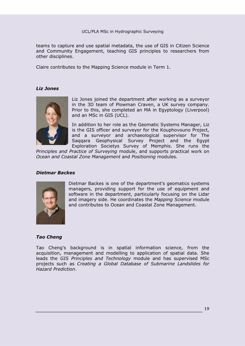
Liz Jones
Liz Jones joined the department after working as a surveyorin the 3D team of Plowman Craven, a UK survey company.Prior to this, she completed an MA in Egyptology (Liverpool)and an MSc in GIS (UCL).
In addition to her role as the Geomatic Systems Manager, Lizis the GIS officer and surveyor for the Kouphovouno Project,and a surveyor and archaeological supervisor for TheSaqqara Geophysical Survey Project and the EgyptExploration Societys Survey of Memphis. She runs the
Principles and Practice of Surveying module, and supports practical work onOcean and Coastal Zone Management and Positioning modules.
Dietmar Backes
Dietmar Backes is one of the department’s geomatics systemsmanagers, providing support for the use of equipment andsoftware in the department, particularly focusing on the Lidarand imagery side. He coordinates the Mapping Science moduleand contributes to Ocean and Coastal Zone Management.
Tao Cheng
Tao Cheng’s background is in spatial information science, from theacquisition, management and modelling to application of spatial data. Sheleads the GIS Principles and Technology module and has supervised MScprojects such as Creating a Global Database of Submarine Landslides forHazard Prediction.

UCL/PLA MSc in Hydrographic Surveying
20
Stuart Robson
Stuart Robson’s research focus is in traceable on-line dynamic 3D co-ordination and monitoring of engineering, medical and cultural objects andstructures using photogrammetric image networks and sequences, visionmetrology and laser scanning. He contributes to the module on Principles andPractice of Surveying.
Jan Boehm
Jan Boehm has a background in Computer Science, for which he holds aMasters’ degree from the University of Massachusetts, Dartmouth, USA, anda Diploma degree from the University of Stuttgart, Germany. He holds a
doctoral degree from the department of AerospaceEngineering and Geodesy at the University of Stuttgart.Since 2010 has been a lecturer in Photogrammetry and 3DImaging at University College London. He activelyparticipates in the International Society forPhotogrammetry and Remote Sensing (ISPRS), where heregularly serves on organising and programme committeesand as a reviewer for related journals. He is co-chair of theISPRS working group on Image-based and range-based 3Dmodelling. He serves on the VDI panel for optical
metrology, where he works on the the VDI/VDE 2634 guidelines.
He has published more than 50 papers on the topics of close-rangephotogrammetry, three-dimensional point cloud processing and robotics. Hiscurrent research projects include creating building information models (BIM)from point clouds, detailed façade modelling from terrestrial and mobile laserscanning and developing a human measurement system from low costnatural user interface sensors.
Jan contributes to the teaching on Mapping Science.
UCL/PLA MSc in Hydrographic Surveying
21
Port of London Authority Staff
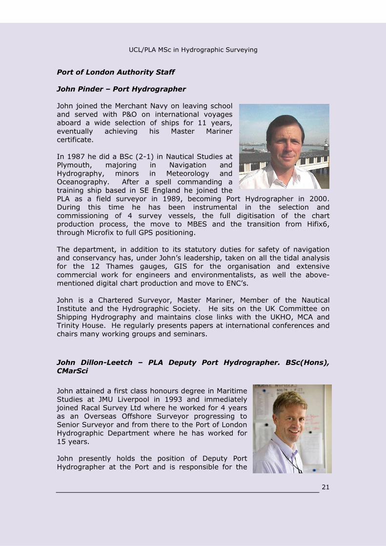
John Pinder – Port Hydrographer
John joined the Merchant Navy on leaving schooland served with P&O on international voyagesaboard a wide selection of ships for 11 years,eventually achieving his Master Marinercertificate.
In 1987 he did a BSc (2-1) in Nautical Studies atPlymouth, majoring in Navigation andHydrography, minors in Meteorology andOceanography. After a spell commanding atraining ship based in SE England he joined thePLA as a field surveyor in 1989, becoming Port Hydrographer in 2000.During this time he has been instrumental in the selection andcommissioning of 4 survey vessels, the full digitisation of the chartproduction process, the move to MBES and the transition from Hifix6,through Microfix to full GPS positioning.
The department, in addition to its statutory duties for safety of navigationand conservancy has, under John’s leadership, taken on all the tidal analysisfor the 12 Thames gauges, GIS for the organisation and extensivecommercial work for engineers and environmentalists, as well the above-mentioned digital chart production and move to ENC’s.
John is a Chartered Surveyor, Master Mariner, Member of the NauticalInstitute and the Hydrographic Society. He sits on the UK Committee onShipping Hydrography and maintains close links with the UKHO, MCA andTrinity House. He regularly presents papers at international conferences andchairs many working groups and seminars.
John Dillon-Leetch – PLA Deputy Port Hydrographer. BSc(Hons),CMarSci
John attained a first class honours degree in MaritimeStudies at JMU Liverpool in 1993 and immediatelyjoined Racal Survey Ltd where he worked for 4 yearsas an Overseas Offshore Surveyor progressing toSenior Surveyor and from there to the Port of LondonHydrographic Department where he has worked for15 years.
John presently holds the position of Deputy PortHydrographer at the Port and is responsible for the
UCL/PLA MSc in Hydrographic Surveying
22
day to day activity of the fleet of three multibeam survey craft andassociated personnel.
As part of his present role - John manages the Port of London HydrographicDepartment’s commercial services provision which has tripled turnover since2005 and gained recognition for the department as “experts” in the field ofhigh resolution multibeam surveys.
John is a Chartered Marine Scientist through IMarEST and a member of theHydrographic Society. He regularly presents papers at internationalconferences, most recently at Port and Terminal Technology 2011,Rotterdam. Pipeline Integrity Summit, 2012, Aberdeen.
Previous to attaining his surveying qualifications John worked in the USA inconstruction project management and previous to that in yacht delivery. Hehas also worked as a general manager of a start up IT marketing company.John holds an RYA Yacht Masters Certificate
Since 2003, John has been keenly involved with the delivery of theMSc/PgDip Hydrographic Surveying at University College, London.
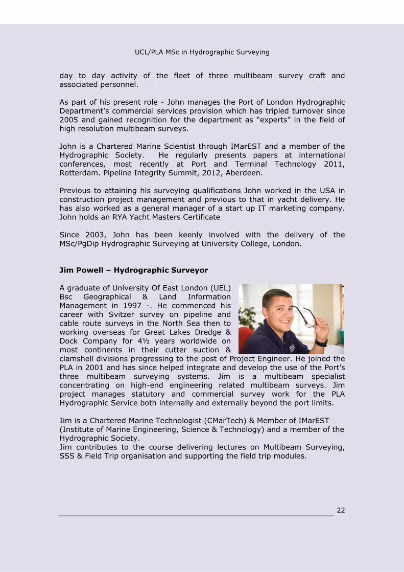
Jim Powell – Hydrographic Surveyor
A graduate of University Of East London (UEL)Bsc Geographical & Land InformationManagement in 1997 -. He commenced hiscareer with Svitzer survey on pipeline andcable route surveys in the North Sea then toworking overseas for Great Lakes Dredge &Dock Company for 4½ years worldwide onmost continents in their cutter suction &clamshell divisions progressing to the post of Project Engineer. He joined thePLA in 2001 and has since helped integrate and develop the use of the Port’sthree multibeam surveying systems. Jim is a multibeam specialistconcentrating on high-end engineering related multibeam surveys. Jimproject manages statutory and commercial survey work for the PLAHydrographic Service both internally and externally beyond the port limits.
Jim is a Chartered Marine Technologist (CMarTech) & Member of IMarEST(Institute of Marine Engineering, Science & Technology) and a member of theHydrographic Society.Jim contributes to the course delivering lectures on Multibeam Surveying,SSS & Field Trip organisation and supporting the field trip modules.
UCL/PLA MSc in Hydrographic Surveying
23
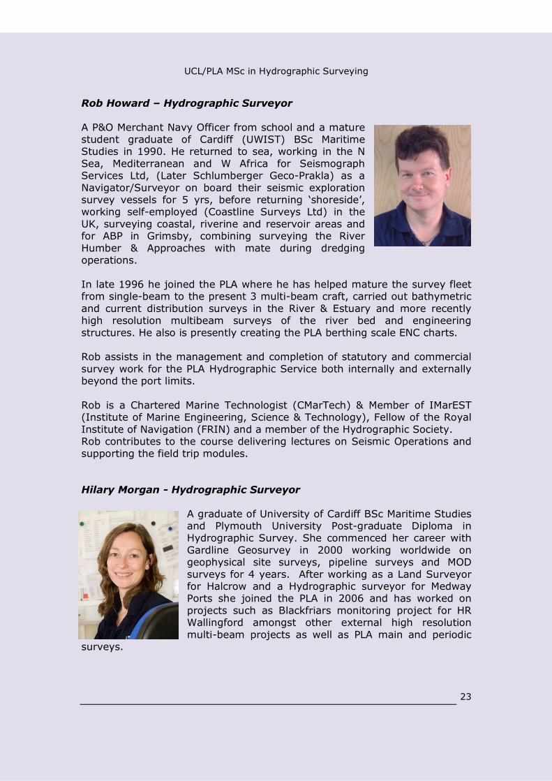
Rob Howard – Hydrographic Surveyor
A P&O Merchant Navy Officer from school and a maturestudent graduate of Cardiff (UWIST) BSc MaritimeStudies in 1990. He returned to sea, working in the NSea, Mediterranean and W Africa for SeismographServices Ltd, (Later Schlumberger Geco-Prakla) as aNavigator/Surveyor on board their seismic explorationsurvey vessels for 5 yrs, before returning ‘shoreside’,working self-employed (Coastline Surveys Ltd) in theUK, surveying coastal, riverine and reservoir areas andfor ABP in Grimsby, combining surveying the RiverHumber & Approaches with mate during dredgingoperations.
In late 1996 he joined the PLA where he has helped mature the survey fleetfrom single-beam to the present 3 multi-beam craft, carried out bathymetricand current distribution surveys in the River & Estuary and more recentlyhigh resolution multibeam surveys of the river bed and engineeringstructures. He also is presently creating the PLA berthing scale ENC charts.
Rob assists in the management and completion of statutory and commercialsurvey work for the PLA Hydrographic Service both internally and externallybeyond the port limits.
Rob is a Chartered Marine Technologist (CMarTech) & Member of IMarEST(Institute of Marine Engineering, Science & Technology), Fellow of the RoyalInstitute of Navigation (FRIN) and a member of the Hydrographic Society.Rob contributes to the course delivering lectures on Seismic Operations andsupporting the field trip modules.
Hilary Morgan - Hydrographic Surveyor
A graduate of University of Cardiff BSc Maritime Studiesand Plymouth University Post-graduate Diploma inHydrographic Survey. She commenced her career withGardline Geosurvey in 2000 working worldwide ongeophysical site surveys, pipeline surveys and MODsurveys for 4 years. After working as a Land Surveyorfor Halcrow and a Hydrographic surveyor for MedwayPorts she joined the PLA in 2006 and has worked onprojects such as Blackfriars monitoring project for HRWallingford amongst other external high resolutionmulti-beam projects as well as PLA main and periodic
surveys.

UCL/PLA MSc in Hydrographic Surveying
24
Hilary is a Member of IMarEST (Institute of Marine Engineering, Science &Technology).
Alex Mortley – Marine Conservancy Manager
Alex attained a first class honours undergraduatemasters degree in Oceanography at SouthamptonUniversity in 2007, specialising in marinesedimentology and geophysics.
Alex joined the Port of London Authority in 2007 as aTechnical Coordinator on the London Gateway projectwith specific responsibility for environmental datamanagement and supervision of maritime archaeologyprogramme. Following a period of time as aHydrographic Surveyor at the port, Alex is now thePLA’s lead on river hydraulics and geomorphology responsible for dredging,tidal monitoring and prediction. He is heavily involved in the major capitalprojects of London Gateway, Thames Tideway Tunnel and Crossrail.
Alex is a fellow of the Geological Society of London and member of theHydrographic Society and regularly presents papers at regional and nationalconferences together with chairing the Thames Estuary Partnership’s workinggroup on the sediment quality. Alex also holds the Mountain Leader awardand has extensive experience in leading mountaineering expeditions in theUK and European Alps, with a keen interest in glacial geology.
He has also maintained strong academic links being involved in postgraduateteaching from practical demonstration and field course coordination tolecturing and supervision of numerous postgraduate student projects in manyfacets of marine sedimentology.
Jed Green- Hydrographic Surveyor
A graduate of Southampton University BSc MarineScience. He commenced his career with Emu Limited in2002 working in the UK and worldwide on inshoresurveys. Jed moved to work on the Humber as a PortHydrographic surveyor for ABP in Hull. He joined the PLAin 2008 and has worked on projects such as Blackfriarsmonitoring project for HR Wallingford amongst otherexternal high resolution multi-beam projects as well asPLA main and periodic surveys.
UCL/PLA MSc in Hydrographic Surveying
25
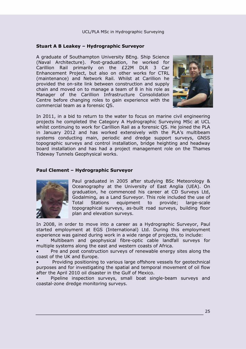
Stuart A B Leakey – Hydrographic Surveyor
A graduate of Southampton University BEng. Ship Science(Naval Architecture). Post-graduation, he worked forCarillion Rail primarily on the £22M DLR 3 CarEnhancement Project, but also on other works for CTRL(maintenance) and Network Rail. Whilst at Carillion heprovided the on-site link between construction and supplychain and moved on to manage a team of 8 in his role asManager of the Carillion Infrastructure ConsolidationCentre before changing roles to gain experience with thecommercial team as a forensic QS.
In 2011, in a bid to return to the water to focus on marine civil engineeringprojects he completed the Category A Hydrographic Surveying MSc at UCLwhilst continuing to work for Carillion Rail as a forensic QS. He joined the PLAin January 2012 and has worked extensively with the PLA’s multibeamsystems conducting main, periodic and dredge support surveys, GNSStopographic surveys and control installation, bridge heighting and headwayboard installation and has had a project management role on the ThamesTideway Tunnels Geophysical works.
Paul Clement – Hydrographic Surveyor
Paul graduated in 2005 after studying BSc Meteorology &Oceanography at the University of East Anglia (UEA). Ongraduation, he commenced his career at CD Surveys Ltd,Godalming, as a Land Surveyor. This role included the use ofTotal Stations equipment to provide; large-scaletopographical surveys, as-built road surveys, building floorplan and elevation surveys.
In 2008, in order to move into a career as a Hydrographic Surveyor, Paulstarted employment at EGS (International) Ltd. During this employmentexperience was gained during work in a wide range of projects, to include:• Multibeam and geophysical fibre-optic cable landfall surveys formultiple systems along the east and western coasts of Africa.• Pre and post construction surveys of renewable energy sites along thecoast of the UK and Europe.• Providing positioning to various large offshore vessels for geotechnicalpurposes and for investigating the spatial and temporal movement of oil flowafter the April 2010 oil disaster in the Gulf of Mexico.• Pipeline inspection surveys, small boat single-beam surveys andcoastal-zone dredge monitoring surveys.

UCL/PLA MSc in Hydrographic Surveying
26
Paul started his employment with the Port of London authority in October2012 and is currently involved with the PLA periodic and main surveys aswell as high-resolution multibeam surveys for external clients.
Other staff
Besides the contribution from UCL and PLA staff, we have several importantcollaborations with colleagues from industry.
In a typical year these include lectures on underwater positioning from JonMartin of Sonardyne; lectures on applications of multibeam technology fromDuncan Mallace of Netsurvey; practical demonstrations of sidescan sonarsoftware from C-Max; and lectures on ROVs and other offshore activitiesfrom colleagues from Fugro.
9 Review procedures
In addition to the accreditation of the programme by the IHO/FIG/ICA, thereare many different procedures in place to ensure the quality of theprogramme offered.
In common with other geomatics MSc programmes in the department, theMSc in Hydrographic Surveying is recognised by the Royal Institution ofChartered Surveyors (RICS). This means that passing at MSc level affords anentry route into that institution for graduates of the programme. In order togain this accreditation, details of the syllabus are supplied to the RICS, andthen on an annual basis further information is supplied on qualifications ofentrants, destinations of graduates, and so on. There is also an annual“partnership” meeting between the RICS and university representatives, withinvited attendees from industry.
The programme, the department itself, and UCL more widely, are subject toa hierarchy of quality control procedures. These start at the level of theindividual modules, with a consideration of the marks awarded and anyproblems encountered, and then work their way up through a considerationof the programme as a whole, the department, and finally UCL itself beingsubject to external review of its quality control apparatus.
Student feedback into these procedures takes several forms, includingquestionnaires and round table discussions, but as with any surveying coursethe experience of working together on field courses means there are manyopportunities for students to comment on the programme.

UCL/PLA MSc in Hydrographic Surveying
27
The Crown and Thistle in Gravesend is the traditional venue for the commencementof the field course
Separately to all of this process there is a system of external examiners toensure that the academic standards of the degree match the national andinternational norms. Thus, all exam papers are sent to the external examinerfor review before being signed off, they have access to all student work andreview the marking, and they are present at the final examiners’ meeting atwhich degrees are awarded.
The start of the course in September 2011, with students from the UK, Norway,Spain, Slovenia, Kazakhstan, Ghana, Malaysia and Hong Kong.

UCL/PLA MSc in Hydrographic Surveying
28
10 Entry Requirements
The minimum entry requirement for the MSc in Hydrographic Surveying is anupper second class honours degree in a cognate subject at undergraduatelevel (generally a BSc). Entrants should also have an appropriate level ofbackground mathematical knowledge.
Examples of cognate degrees would include geography, civil engineering,mathematics, marine sciences, physics, archaeology and geology. Theessential point is that before embarking on the MSc in HydrographicSurveying students should already have followed a programme of study thatprepares them for scientific analysis, report writing, the statistical analysis ofdata, and so on.
The UCL Registry has extensive knowledge and experience of overseasinstitutions and their marking schemes, and is able to provide an assessmentfor any applicant of how they compare against UK university standards.
Preparatory reading for entrants
It is an aim of the MSc that students achieve a basic level of competence inseamanship, and are able to acquit themselves well aboard survey vessels.No specific prior qualifications are required for this, but all students areexpected to purchase and read the following book before starting on thecourse:
“RYA Manual of Seamanship” (Hardcover) by Tom Cunliffe
Students are expected to have read this before entry onto the course;however, for those students for whom this is not possible library copies willbe available at UCL.
For the appropriate level of mathematics, the advice given to students is thata British “A Level” in mathematics would certainly be sufficient preparationfor the course. However, given that not all applicants are likely to have this,more specific specifications are available about the level of backgroundknowledge and the subjects that should be revised before embarking on thecourse. Essentially, these advise the students that they are expected to havea basic familiarity with algebra (manipulation of equations, solution ofsimultaneous equations, quadratic equations, etc); geometry (properties ofcircles, concepts of angular measure); trigonometry (definitions andapplications of basic functions, expansions of compound angles, applicationof sine and cosine rules for plane triangles); calculus (differential calculusincluding application to standard functions); matrices (definitions, simplealgebraic functions such as addition, subtraction and multiplication, inversionof small matrices). Students are advised to prepare themselves for theprogramme by studying these subjects as much as possible before arrival; it

UCL/PLA MSc in Hydrographic Surveying
29
is then possible to give a fairly rapid summary of these subjects beforeimmediately proceeding to apply them in practice. An example of acomprehensive mathematics text book to revise from would be:
“Engineering Mathematics” (paperback) by Stroud
Other text books are available if the above is not available locally. Anotheroption would be:
“Maths for Map Makers” (paperback) by Arthur Allan
Average age of students on this MSc
It is worth pointing out that although the minimum age for enrolling on theMSc is 21 (this being the effective minimum for a graduate of a Britishundergraduate degree) in practice the average age is generally a bit olderthan this. Some graduates have come to us either with a few years ofgeneral experience of work – for example in the IT industry – or have morespecific experience of working in hydrographic surveying and are comingback to university to gain the Category A accreditation. However, there areplenty of others who have come straight onto the course without anyprevious experience.
11 Assessment
At the programme level, the minimum standards required are:
MSc Pass:
50% weighted course average in ALL taught modulesand
No more than 30 credit points at less than 50% (‘condoned fail’grades may be granted between 40-49% at Board of Examiners’discretion). No marks below 40% are allowed
and 50% (minimum) in Dissertation
MSc Merit
60% credit-weighted average over ALL modules (includingDissertation)
and 65% (minimum) in Dissertation

UCL/PLA MSc in Hydrographic Surveying
30
and No marks below 50%, no condoned fails, no re-sits, and all
marks are based on first attempts.
MSc Distinction:
70% credit-weighted average over ALL modules (includingdissertation)
and 70% (minimum) in Dissertation
and No marks below 50%, no condoned fails, no re-sits, and all
marks are based on first attempts
N.B The taught modules have a weight of 120 credit points. TheDissertation has a weight of 60 credit points.
Individual modules may be assessed either by coursework or by an unseenwritten examination or by a combination of the two.
A summary of the method of assessment of each module, together withdetails of the nature of the examination (where assessed by a written exam)or of how many pieces of coursework need to be submitted and what theircredit value is (where assessed by coursework) is given in the table below.
Module Title Credit value Assessment
First Term
GIS Principles &Technology
15 100% Coursework
Mapping Science 15 100% Exam
Data Analysis 15 100% Coursework
Principles & Practice ofSurveying
1550% Exam and 50%
Coursework
Second Term
Ocean and Coastal ZoneManagement
15 60% Exam and 40%Coursework
Management/GroupProject
1550% Exam and 50%
Coursework
Hydrographic Applications 1560% Exam and 40%
Coursework
Positioning 1550% Exam and 50%
Coursework

UCL/PLA MSc in Hydrographic Surveying
31
12 Examples of individual MSc projects
Some examples of MSc projects that have been carried out by students onthe MSc in Hydrographic Surveying are given below. Where a projectillustrates a particular point about the range of subjects studied or had otherfeatures of particular interest, more details are given.
Andrew Palmer-Felgate, UK
A risk analysis of submarine cable burial operation.
Analysed instances where plough failure had occurred indifferent types of terrain, and compared with the errorsinvolved in the acquisition, processing and presentation.Work sponsored by Alcatel Submarine Networks Ltd; ledto a publication in Hydro International.
Lam Lik Shan,Hong Kong
Combination of Photogrammetric and Bathymetrictechniques in monitoring of marine rubble-moundstructures.
Led to a publication in Hydro International.
Thomas Lowe, UK Assessing the potential of LIDAR / Bathymetryintegration within the Thames Estuary.
Thai Low Ying-Huang, Singapore
Dynamic Tide: Real-Time tidal corrections in electronicnavigational charts for the Port of London.
Cheminade Jean-Philippe, UK
The Applications of Synthetic Aperture Sonar to theHydrographic Surveying Industry.
Richard Day, UK Modelling multipath errors in widebandunderwater acoustic transponders.
Work carried out in collaboration with Sonardyne Ltd.
Andrew Lessnoff,UK
Calibration of Altimetry Satellite Measurements.
Elizabeth Petrie,UK
Vertical offshore datums.
An early study of the requirements for deriving a verticaloffshore reference frame that then contributed to theformulation of the VORF project.
Ben Thompson,UK
Analysis of Multibeam Echosounder Backscatter Data forSeabed Classification.
Marie Ceccaldi, Autonomous Underwater Gliders.

UCL/PLA MSc in Hydrographic Surveying
32
FranceDerivation of equations for positioning of buoyancypropelled gliders through Extended Kalman Filtering.
Malik Chibah, UK Creating a Global Database of Submarine Landslides forHazard Prediction.
Project carried out in collaboration with Arup ConsultingEngineers.
Laurence Letki,France.
Harmonic Analysis of Satellite Altimetry Data.
Siddhi Joshi, UK Research into the Use of Multibeam Backscatter forAccurate Riverbed Classification.
This student was sponsored by the Marine AggregateLevy Sustainability Fund (MALSF) bursary scheme, andthis project was carried out in collaboration with theCentre for Environment, Fisheries and AquacultureScience (CEFAS) and with the Port of London Authority.
Christopher Bubb,UK
Characteristics and impacts of new GNSS signals.
Richard Clarke,UK
Mean Sea Level Studies in the Persian Gulf.
Darren Murphy Vessel headings derived from GPS.
Project carried out in collaboration with Sonardyne.
MohamedAbdelghafar
A comparison of beam distribution patterns’ performancein high resolution multibeam echosounders.
Project carried out in collaboration with Reson Ltd andthe PLA.
Steinar Aasheim Sounding selection algorithms.
Project carried out in collaboration with the UKHydrographic Office.
Stuart Leakey Investigation of performance and benefits of a Dopplervelocity log aided inertial positioning solution forhydrographic surveying in the port environment.
Project carried out in collaboration with IXBlue, PLA andTeledyne RD Instruments.

UCL/PLA MSc in Hydrographic Surveying
33
13 Careers and Student Profiles
The range and quality of the career options that have opened up before ourgraduates – from national hydrographic organisations to offshore surveycompanies, from port authorities to PhD programmes – are an excellentadvert for the quality in depth of this masters programme.
There are exceptionally good career prospects for graduates ofthe Hydrographic Surveying programme, and all students have so far foundrelevant and well paid jobs even in the recent economic downturn. Many ofour graduates go on to work for offshore surveying companies - recentexamples have included Fugro, Gardline, Schlumberger, Horizon and StoltOffshore. This usually involves extended time aboard survey vessels, which iswell paid work and generally ideal for the young and free. Others havepreferred shore based jobs, or those that offer more of a mixture of time inthe office and aboard survey vessels - examples of these have includedGEMS Survey and Netsurvey, or port authorities such as the Port of Londonor Singapore and Hong Kong (who have sent their personnel on the MScprogramme). Others have gone to work for equipment manufacturers suchas Sonardyne or cable companies such as Alcatel (even jobs like these ofteninvolve short periods at sea or aboard exploration rigs) or for nationalhydrographic offices such as the UKHO or its counterpart overseas. Someof our graduates are now pursuing research careers.
The very varied career paths that our students have followed sincegraduating from the course are illustrated below with some sample studentprofiles. [NB: most of these are as written in 2009].
Elizabeth Petrie (2004 – 2005) Research
I took the MSc in Hydrographic Surveying at UCL in 2004-2005. In the following year I did some contract hydrographicsurveying work (including 2 months as a temporary marinegeophysics technician with the British Antarctic Survey, whichwas a fantastic experience). After that I started a PhD insatellite geodesy at Newcastle University, which I am aboutto finish. I did the MSc to change career direction and think itwas very successful, providing me with an excellentfoundation in the discipline and combining both theoretical
and practical aspects.
Malik Chibah (2006 – 2007) Manufacturing
I studied at UCL from 2006 to 2007 taking the Hydrographic Surveyingmaster’s degree course. Immediately following the course I joinedSonardyne International, a producer of underwater acoustic positioning

UCL/PLA MSc in Hydrographic Surveying
34
systems. I have been involved in testing new systems, supporting customersand demonstrating new products. My role has regularly taken me offshore tovarious destinations worldwide. I am now managing the development of thecompany’s inertial navigation system for subsea positioning applications. Ifound the course to be ideal preparation for my current career; particularly inthe mix of subjects covered and the close links with external organisationssuch as the Port of London, which allowed us to gain Hydrographic surveyexperience in a realistic environment during the course. The links also leddirectly to me finding employment with Sonardyne at the end of the course.
Marie Ceccaldi (2005 – 2006) Offshore
I did my MSc in Hydrographic Surveying atUCL in 2005-2006. After graduation I founda job as a navigation support in CGG whichis a French seismic company based inMassy, France; after few months I foundout that I would rather get an offshoreposition instead of an office job, so I joinedFugro Geoteam, another seismic companybased in Oslo, Norway, as a navigator, andI’ve been there now for 2 years. The jobconsists of 5 weeks rotations (5 on, 5 off).It offers a very comfortable salary with some opportunities for advancement.
The MSc in Hydrographic Surveying is one of the best courses you could do ifyou wished to be hired as a navigator on a seismic vessel; even though theycould hire electronics and IT engineers, it’s always a bonus for them to getsomeone who has knowledge of surveying.
Andy Palmer-Felgate (2000 – 2001) Cable laying
After studying the MSc Hydrographic Surveying at UCLfrom 2000-2001 I returned to work for AlcatelSubmarine Networks who had sponsored me throughthe course. I worked on surveys for underwatertelecommunications cables in the Mediterranean andAtlantic and was also involved in developing their GIS.
Following the 'dot com crash' work dried up intelecoms, and I was offered an 18 month research postat Imperial College. This involved planning andexecuting a small boat survey off the south coast of theUK to investigate morphology of the seabed in areas
that once were land prior to sea-level rise. The research was so successfulmyself and three others had a paper published in the journal Nature entitled

UCL/PLA MSc in Hydrographic Surveying
35
'Catastrophic flooding origin of shelf valley systems in the EnglishChannel' and a feature on the BBC news.
I returned to Alcatel in 2004 to work on a cable project from France toSingapore and subsequently a scientific observatory network in the Pacificcalled NEPTUNE.
At the end of 2006 I was offered a new job at Verizon, the largest carrier ofphone and internet traffic in the US. For the last 3 years I've been Co-Chairman of the marine technical committee responsible for delivering theTrans-Pacific Express Cable on behalf of a consortium of nine Asian and UStelecoms companies. The $500M project to cross from America to China,Taiwan, Korea and Japan was a big challenge but has now been completed.In addition to surveying this work included permitting, legal disputes, cableinstallation and protection, project management and contract negotiations.
All my current work relies on having a quality survey as the starting point forall that follows, so the skills gained on the MSc course have put me in verygood stead.
Siddhi Joshi (2007 – 2008) Research
I studied the course in 2007-2008 and am now oneyear into a PhD at the National University ofIreland, Galway. Coming from a marine sciencebackground, I am presently studying multibeam andLiDAR data from the INFOMAR programme tounderstand the sediment transport processes inGalway Bay. The MSc course gave me a solidgrounding of the technical skills required ingeomatics, both in industry and in academia. Sincegraduating, I have found this qualification and theskills provided are greatly valued by employers insurveying, as well as by those involved in researchin seabed mapping- related disciplines.
Highlights from the course I especially remember include producing our ownnautical charts, working with the PLA during the field course, ocean remotesensing , learning how to apply least squares estimation to solve real-worldland surveying problems and GPS positioning. Benefiting from strong linkswith industry, our course also provided practical training in areas such asproject management as required in industry. My MSc project during the thirdterm allowed me to further expand on seabed characterisation usingmultibeam backscatter, working jointly with the PLA, Cefas and MALSF. Thiscourse is one of the few courses in Europe which combines the diversesubject of geomatic engineering with a special emphasis on its hydrographicapplications.

UCL/PLA MSc in Hydrographic Surveying
36
Christopher Bubb (2008 – 2009) Offshore
I studied at UCL between 2008 and 2009and started working for Gardline, the world’slargest independent surveying company assoon as my Hydrographic Surveying MSc wascompleted. My job title is “OffshoreSurveyor” where I am expected to work onboats around the world for periods of up totwo months at a time. I am finding the workstimulating and diverse and theHydrographic Surveying Masters from UCL
gave me an excellent grounding in the required surveying discipline and waswell regarded by employers and work colleagues.
JP Cheminade (2003 – 2004) Offshore and Ports
I completed an MSc in Hydrographic Surveyingat University College London in 2004,following a BSc in Marine Biology at theUniversity of Liverpool which I completed in2001.
Upon completion of a thesis project entitled"The Applications of Synthetic Aperture Sonarto the Hydrographic Surveying Industry" Ibegan work as an offshore surveyor in theMiddle East for Horizon Survey FZC in October2004. This job involved predominantly RigMoves, Geophysical Site Surveys, Pipeline Route Surveys (Prelay/Lay/Post-Lay) and Hazard Surveys for the oil and gas industry in Qatar, UAE, Bahrain,Oman & Iran.
In late 2005 I moved on to hold a position as Hydrographic Surveyor at thePort of London Authority in the UK. This post involved the production ofhydrographic charts for navigation in the River Thames estuary on a field-to-finish basis. This involved the planning, execution and processing of surveydata, and subsequent publication of IHO standard bathymetric surveys fornavigation.
In October 2007 I moved over to join NetSurvey Ltd, a specialist companyoffering advanced hydrographic survey services using multibeam technology.From SOLAS charting surveys to marine habitat survey, port surveysincluding quay wall inspection to multibeam specialist services for pipelineand site surveys, NetSurvey provide the highest quality and most

UCL/PLA MSc in Hydrographic Surveying
37
technologically advanced solutions. Our multibeam specialist personnel arethe best in the business and can install, calibrate, acquire and process datafrom any portable multibeam system. Products for the client range from fullyinteractive 3D visualisation scenes to traditional sounding and contour chartsor alignment sheets. Recent advances have included advanced backscatterprocessing and Out-of-straightness pipeline visualisation. [Since writing thisJP has moved on to work for Sydney Ports Corporation].
Donald Chan (2005 – 2006) Port Authority
I qualified as a Chartered Surveyor in 1996 and wassponsored by my employer (the Hong Kong Government)to study the MSc in Hydrographic Surveying at UCL in2005-2006 as a specialised training. After completion ofthe course I've been serving as a government surveyorresponsible for provision of hydrographic surveyingservices for fairway dredging works and construction andmaintenance of marine structures in Hong Kong.
I find the course useful as it has provided me with thenecessary knowledge and qualifications to discharge my
duties effectively. The course content was comprehensive and was wellpresented by some experienced and competent teaching staff in a structuralway. In particular, the topics on the theory and technique of echo soundingsurvey, GNSS positioning and IHO Standard have proved to be very usefulfor my work regarding implementation and management of survey systems,drafting of contract specifications and quality control of survey products.
Laurence Letki (2006 – 2007) National Hydrographic Office
I studied at UCL in 2006-2007 and after that I worked for the FrenchNational Hydrographic Office. I spent most of my time onboard doing varioushydrographic and geophysical surveys, both in shallow water and in deepwater, around France as well as abroad. Since March2009, I have been working for WesternGeco, in theseismic processing department, at Gatwick. The jobis completely different and the extent of thetechnical knowledge to acquire is challenging. I alsowork in contact with the clients. Next year, I will betransferred to the Research & Engineeringdepartment.
The beginning of my career is thus varied, technical,challenging and promising. I am convinced I willnever get bored! Studying at UCL was a key in the

UCL/PLA MSc in Hydrographic Surveying
38
success of the beginning of my career, as it enables me to adapt tocompletely different positions and to acquire specific technical knowledgevery quickly using the strong basis learned during the MSc.
Thomas Lowe (2001 – 2002) National Hydrographic Office
I took a job as an offshore surveyor with Norwegiancompany Stolt Offshore (now Acergy). Within thisrole I worked in a number of countries (Norway,Egypt) on a number of platforms (survey ships,pipelay ships and barges, oil rigs). My main role wasas an online surveyor and involved, for example,positioning work, multi-beam survey and divesupport. I then moved to the UK Hydrographic Officeas a data manager. At the UKHO my theoretical andpractical experience in geodesy became invaluable (Ihave only one person to thank for that...UCL and
JCI!) and put me in a good position to progress. I was promoted quickly (forthe civil service and my age!) and became a key member of HydrographicDatabase (HDB) development team, with a mixture of technical, testing andproject management responsibilities. Here I worked with commercialcontractors (EDS, CARIS & LSC Group) to develop a geospatial database andworkflow management system to manage and create paper and electronicchart products: basically a replacement to the UKHOs chart productionsystems. Understanding of geodesy has been absolutely vital for me in myjob, and given me the stand-out competency to progress.
Now I've moved to the family firm (UK Solutions Ltd) as a Director,delivering premium datacentre space and network solutions.
Richard Day (2004 – 2005) Offshore
I studied at UCL in 2004-2005. Since then I have worked in the offshorepositioning sector, and I am currently a navigator on a seismic streamerboat. The Port of London Authority surveyors gave us a good overview ofcareers in this area, and I didn't know about my present role before thecourse. The job is a tremendous challenge, and what I like about it the mostis the five week crew rotation - more time off than most people get in a year!

UCL/PLA MSc in Hydrographic Surveying
39
Alex Ewart (2010 – 2011) Offshore
I came from a background in structural engineering,having a BEng from Durham. Although I had asuccessful few years as an engineer, I wasn’tparticularly happy about basing a career in that field,so I always kept an eye out for a Master’s programthat would tick enough boxes for enjoyment andusefulness. The geomatics courses at UCL caught myattention, and although I was wary about the prospectof life offshore it sounded adventurous and exciting (itis) and I was quickly swayed. The course has verygood exposure to people like the Port of LondonAuthority and industry-leading companies, and thereare plenty of good opportunities to ask them all about life offshore and to gethelp for your studies. I have now become employed as a hydrographicsurveyor at Netsurvey, a highly-specialist company, and work seems to behow I hoped. The course is certainly more highly regarded than others, and itwas pleasing to feel I had a variety of options open to me when it came tojobs. For those who take the course, I’d recommend starting the jobhunt/research early on, not just to make sure you know what you’re gettingyourselves in for (it’s not for everyone), but to allow you to shop around andfind the best jobs first! [Since writing this Alex has moved on to be amaritime project officer with Headland Archaeology].
14 Final Remarks
The UCL and PLA MSc programme has been running almost 14 years. In thattime we have built a reputation for producing graduates who are capable andcompetent, with a sound grasp of the principles and practice of hydrographicsurveying. You will find UCL surveyors around the world, working aboardsurvey vessels, in ports and harbours, or aboard oil rigs; you will comeacross our graduates in research laboratories, working for equipmentmanufacturers, or producing charts in national survey offices. It’s a big,global, and dynamic industry, and our course is respected by employersaround the world.
We have tried in this brochure to give as much information as is feasibleabout the scope of the course, its particular strengths, the staff whocontribute, and the facilities available. If you do need to know more, thenhave a look at our web site or do feel free to contact us.
Otherwise, if you are thinking of applying to do the course, or if you haveemployees that you are planning to send here for further training, or if youare looking for well trained graduates to join your organisation – then welook forward to hearing from you.