monitoring techniques for the study of deformations caused
TRANSCRIPT
Monitoring techniques for the study of deformations caused by land subsidence phenomena: a review of practical issues
through cases in Spain
Dr. Roberto Tomás Jover – [email protected]
Introduction
Decline of groundwater level causes an increase ofeffective stress that induces vertical and horizontalshortening of soil layers causing settlements anddistortions on infrastructures.
It is of paramount importance to measure the spatialevolution of the involved variables along time
MONITORING

Introduction
More than 10areas affected
Maximumsubsidence ratein Europe: > 10cm/año 2,5 m(1992-2012):Lorca
Sevilla
Madrid
Upadated from: Tomás, R., Romero, R., Mulas, J., Marturià, J.J., Mallorquí, J.J., Lopez-Sanchez,
J.M., Herrera, G., Gutiérrez, F., González, P.J., Fernández, J., Duque, S., Concha-Dimas, A.,
Cocksley, G., Castañeda, C., Carrasco, D. & Blanco, P. 2014. Radar interferometry techniques
for the study of ground subsidence phenomena: a review of practical issues through cases in
Spain. Environmental Earth Sciences, 71, 163-181

Introduction
Key questions
Land subsidencemonitoring
Why?The aim
What?Parameters
When?Frequency
Where?“Points” of monitoring
How?Methods
How many?Cost

Why?
Key questions
Land subsidencemonitoring
Why?The aim
What?Parameters
When?Frequency
Where?“Points” of monitoring
How?Methods
How many?Cost

Why?
Ensure safety
Minimize damage caused by land subsidence
Control evolution of land subsidence
Improve aquifer management
Advance in the state of the art

What?
Key questions
Land subsidencemonitoring
Why?The aim
What?Parameters
When?Frequency
Where?“Points” of monitoring
How?Methods
How many?Cost
What?
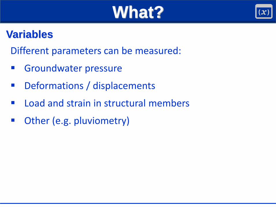
Variables
Different parameters can be measured:
Groundwater pressure
Deformations / displacements
Load and strain in structural members
Other (e.g. pluviometry)

What?
Variables
Different parameters can be measured:
Groundwater pressure
Deformations / displacements
Load and strain in structural members
Other (e.g. pluviometry)

What?
Displacements / deformations
On ground surface and subsurface
V - Vertical displacements (most important component)
H - Horizontal displacements (much lower)
Structures
- Settlement/uplift
S - Cracks/joints opening
- Tilts
H
V
S

How?
Key questions
Land subsidencemonitoring
Why?The aim
What?Parameters
When?Frequency
Where?“Points” of monitoring
How?Methods
How many?Cost

How?
Monitoring techniques used in Spain disp/deform.
GROUND
Surveying
GNSS
Remote Sensing
Geotechnical instrumentation
STRUCTURES
Surveying
Structural instrumentation
Remote Sensing

How?
Selection of the technique depends of:
The phenomenon (magnitude, extension, etc.)
Environmental conditions
Accessibility
Availability
Required accuracy, precision, conformance,resolution, sensitivity, etc.
Available budget (unfortunately!)
Surveying
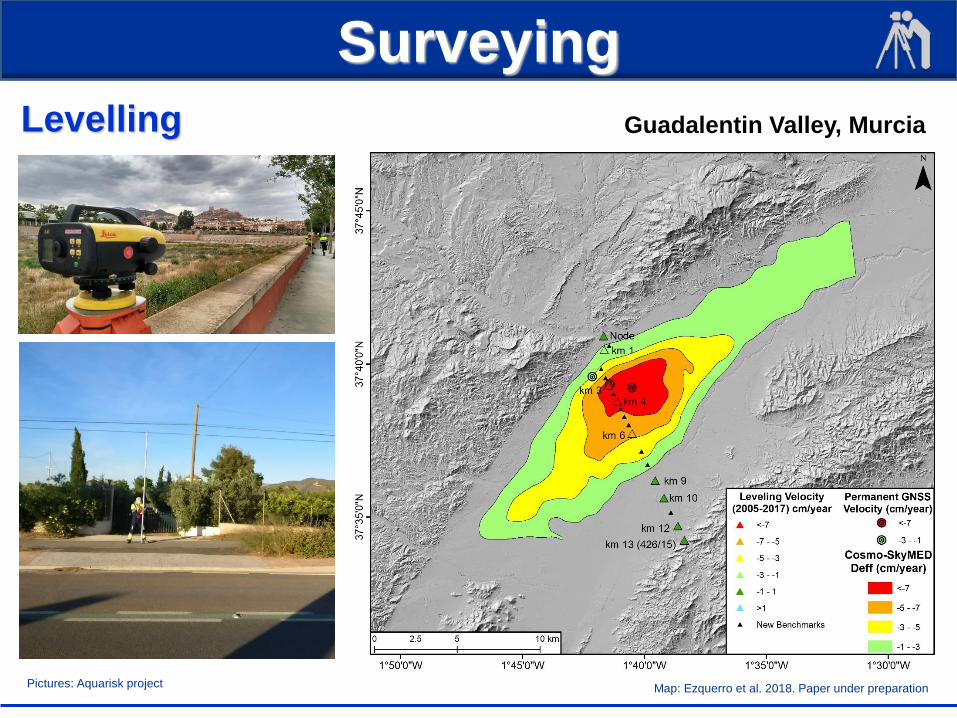
Levelling
Pictures: Aquarisk project Map: Ezquerro et al. 2018. Paper under preparation
Guadalentin Valley, Murcia

GNSS
Permanent and static rapid
Permanent station ORCA Pictures: Aquarisk project Map: Ezquerro et al. 2018. Paper under preparation
Guadalentin Valley, Murcia

Remote Sensing
InSAR
BonìR, Herrera G, Meisina C, Notti D, Béjar-Pizarro M, Zucca F, González PJ, Palano M, Tomás R, Fernández J, Fernández-Merodo JA, Mulas J, Aragón R, Guardiola-
Albert C and Mora O (2015) Twenty-year advanced dinsar analysis of severe land subsidence: The alto guadalentín basin (spain) case study. Engineering Geology 198: 40-
52. doi: http://dx.doi.org/10.1016/j.enggeo.2015.08.014
Guadalentin Valley, Murcia

Remote Sensing
Corner reflectors
La Unión, Murcia

Remote Sensing
Terrestrial Laser Scanner
Orihuela, Alicante

Remote sensing
Terrestrial Laser Scanner
t1 t2
Orihuela, Alicante

Geotechnical intrumentation
Borehole extensometers (magnetic probe)
Mulas, 2007/
Murcia
Mulas, J., Aragón, R., Clemente, A.A. (2010). La subsidencia del terreno en la ciudad y área metropolitana de Murcia. IGME y COPOT, 241 pp.

Geotechnical instrumentation
Borehole extensometers (magnetic probe)
Mulas, 2007/
Mulas, J., Aragón, R., Clemente, A.A. (2010). La subsidencia del terreno en la
ciudad y área metropolitana de Murcia. IGME y COPOT, 241 pp.

Geotechnical instrumentation
Borehole extensometers (rod extensometers)
Mulas, J., Aragón, R., Clemente, A.A. (2010). La subsidencia del terreno en la
ciudad y área metropolitana de Murcia. IGME y COPOT, 241 pp.

Surveying
Structural monitoring
Murcia
Díaz, E., Robles, P., Tomás, R. (2018). Multitechnical approach for damage assessment and reinforcement of buildings located on subsiding areas:
study case of a 7-story RC building in Murcia (SE Spain). Engineering Structures, 173, 744-757.

Surveying (x,y)
Structural monitoring
Díaz, E., Robles, P., Tomás, R. (2018). Multitechnical approach for damage assessment and reinforcement of buildings located on subsiding areas:
study case of a 7-story RC building in Murcia (SE Spain). Engineering Structures, 173, 744-757.

Settlement evolution (surveying)
Díaz, E., Robles, P., Tomás, R. (2018). Multitechnical approach for damage assessment and reinforcement of buildings located on subsiding areas:
study case of a 7-story RC building in Murcia (SE Spain). Engineering Structures, 173, 744-757.
Structural monitoring

Structural monitoring
Crack-meters
Murcia
Murcia
Orihuela, Alicante
Y
Z
X
MurciaLa Unión, Murcia

Structural monitoring
Clinometer
Murcia

Settlement evolution and distribution
Herrera G, Tomás R, Monells D, Centolanza G, MallorquíJJ, Vicente F, Navarro VD, Lopez-Sanchez JM, Sanabria M, Cano M and Mulas J (2010) Analysis of
subsidence using terrasar-x data: Murcia case study. Engineering Geology 116: 284-295.
Structural monitoring
Envisat 2008-2010
Pixel: 60 m x 60 m
Where?
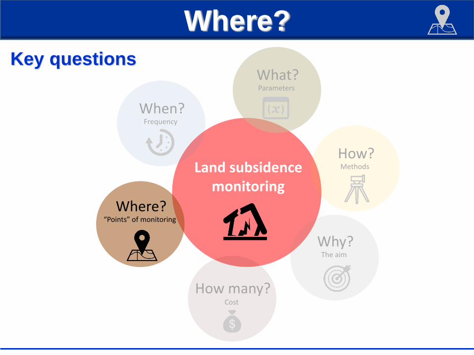
Key questions
Land subsidencemonitoring
Why?The aim
What?Parameters
When?Frequency
Where?“Points” of monitoring
How?Methods
How many?Cost
Where?
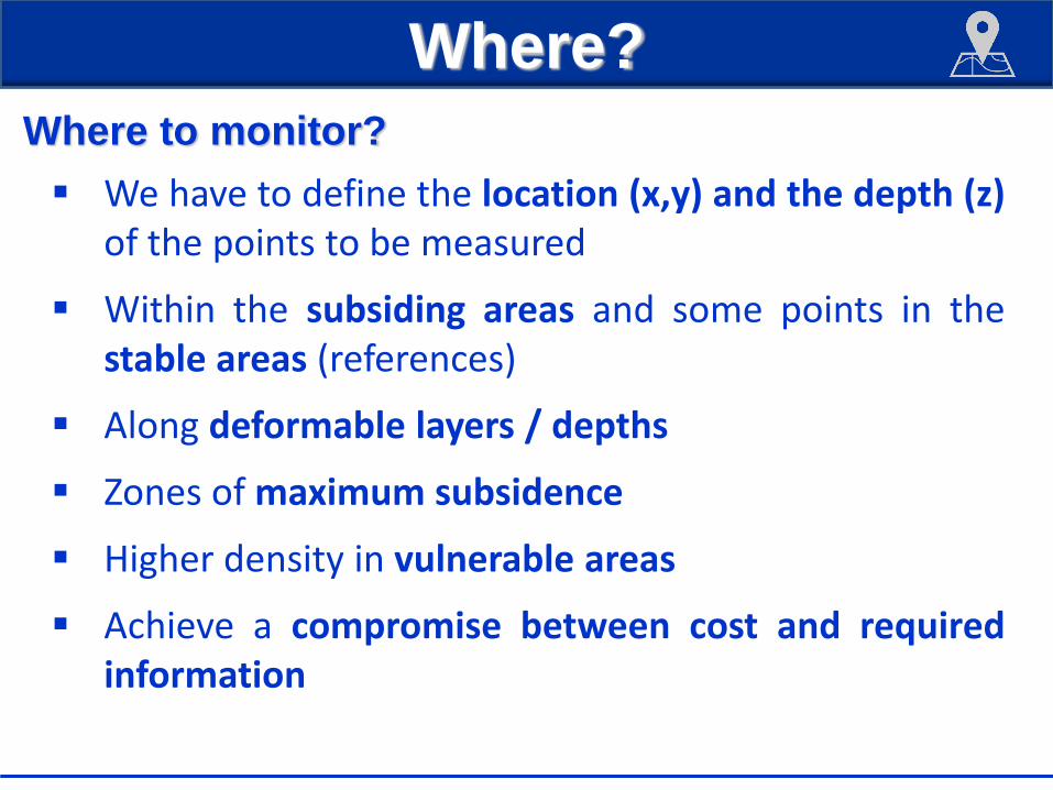
Where to monitor?
We have to define the location (x,y) and the depth (z)of the points to be measured
Within the subsiding areas and some points in thestable areas (references)
Along deformable layers / depths
Zones of maximum subsidence
Higher density in vulnerable areas
Achieve a compromise between cost and requiredinformation

When?
Key questions
Land subsidencemonitoring
Why?The aim
What?Parameters
When?Frequency
Where?“Points” of monitoring
How?Methods
How many?Cost

When?
Frequencies
Repetitiveness introducesa new variable in themonitoring process: time(t)
Two options:
Continuous
Discrete (days, months,years)
Highly depends on thevelocity of the process. Tomás R, Romero R, Mulas J, Marturià JJ, MallorquíJJ, Lopez-Sanchez JM,
Herrera G, Gutiérrez F, González PJ, Fernández J, Duque S, Concha-Dimas A,
Cocksley G, Castañeda C, Carrasco D and Blanco P (2014) Radar interferometry
techniques for the study of ground subsidence phenomena: A review of practical
issues through cases in spain. Environmental Earth Sciences 71: 163-181. doi:
10.1007/s12665-013-2422-z

How many?
Key questions
Land subsidencemonitoring
Why?The aim
What?Parameters
When?Frequency
Where?“Points” of monitoring
How?Methods
How many?Cost

How many?
Cost
Equipments
& materials
Survey
Maintenance
Post-processing
Tomás R, Romero R, Mulas J, Marturià JJ, MallorquíJJ, Lopez-Sanchez JM, Herrera G, Gutiérrez F, González PJ,
Fernández J, Duque S, Concha-Dimas A, Cocksley G, Castañeda C, Carrasco D and Blanco P (2014) Radar
interferometry techniques for the study of ground subsidence phenomena: A review of practical issues through cases in
spain. Environmental Earth Sciences 71: 163-181. doi: 10.1007/s12665-013-2422-z

Final remarks
Monitoring is of paramount importance for landsubsidence studies and management.
Multitechnique approaches more efficient.
Using limited available information we have to “writea story” about what’s happening.
This “story” will allow to improve the knowledge andmanagement of the aquifer system.

Monitoring techniques for the study of deformations caused by land subsidence phenomena: a review of practical issues
through cases in Spain
Dr. Roberto Tomás Jover – [email protected]

Surveying
Structural monitoring
Díaz, E., Robles, P., Tomás, R. (2018). Multitechnical approach for damage assessment and reinforcement of buildings located on subsiding areas:
study case of a 7-story RC building in Murcia (SE Spain). Engineering Structures, 173, 744-757.

Amenaza creciente “oculta”.
Elevados costes económicos y sociales.
Necesidad de gestión integrada.
Structural monitoring
G. Herrera, M.I. Á lvarez Fernández, R. Tomás, C. González-Nicieza, J. M. Lopez-
Sanchez, A.E. Á lvarez Vigil. Forensic analysis of buildings affected by mining
subsidence based on Differential Interferometry (Part III). Engineering Failure
Analysis 24, 67-76, 2012.