mesoscale circulations during vtmx
DESCRIPTION
Mesoscale Circulations during VTMX. John Horel Lacey Holland, Mike Splitt, Alex Reinecke [email protected]. Overview. Temporal and spatial context for VTMX IOPs Synoptic and mesoscale conditions during IOPs. October 1999. 500 mb geopotential height. October 1999. - PowerPoint PPT PresentationTRANSCRIPT
Mesoscale Circulations during VTMX
John Horel
Lacey Holland, Mike Splitt,
Alex Reinecke
Overview
• Temporal and spatial context for VTMX IOPs
• Synoptic and mesoscale conditions during IOPs
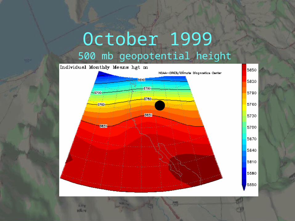
October 1999500 mb geopotential height
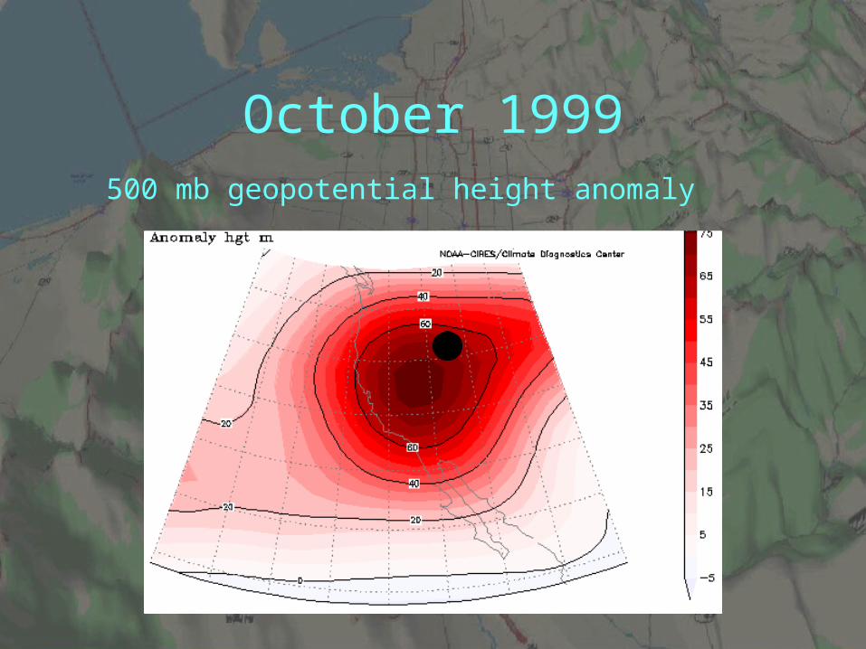
October 1999500 mb geopotential height anomaly
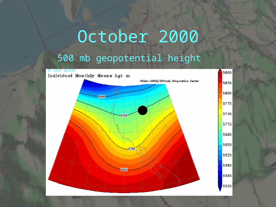
October 2000500 mb geopotential height
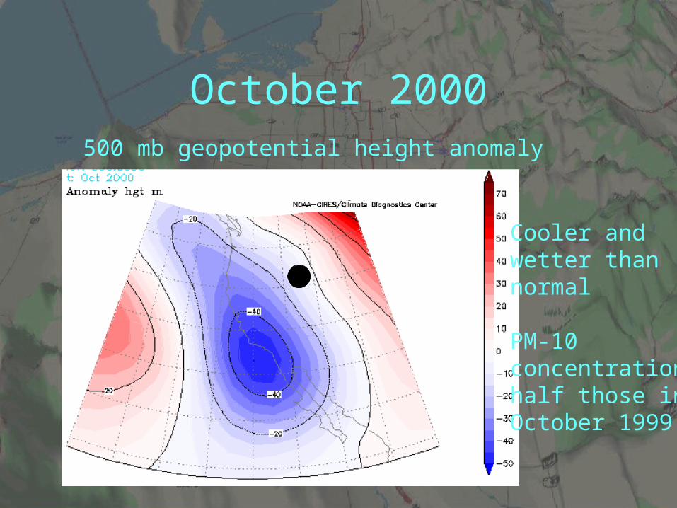
October 2000500 mb geopotential height anomaly
Cooler and wetter thannormal
PM-10 concentrationshalf those inOctober 1999
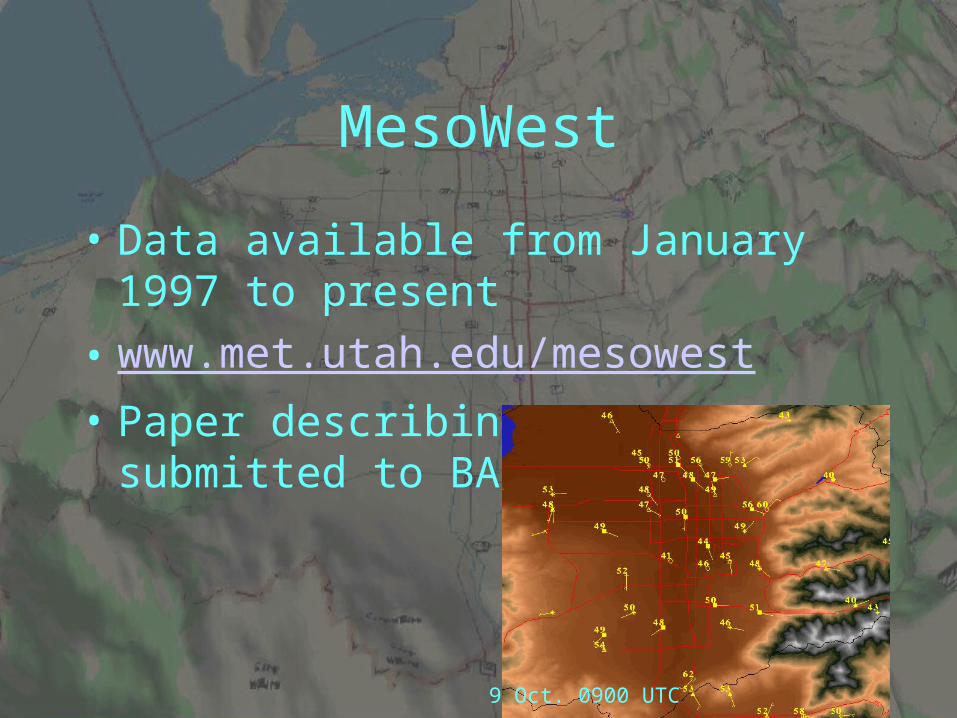
MesoWest
• Data available from January 1997 to present
• www.met.utah.edu/mesowest
• Paper describing MesoWest submitted to BAMS
9 Oct. 0900 UTC
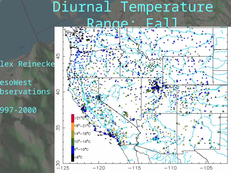
Diurnal Temperature Range: Fall
Alex Reinecke
MesoWestObservations
1997-2000
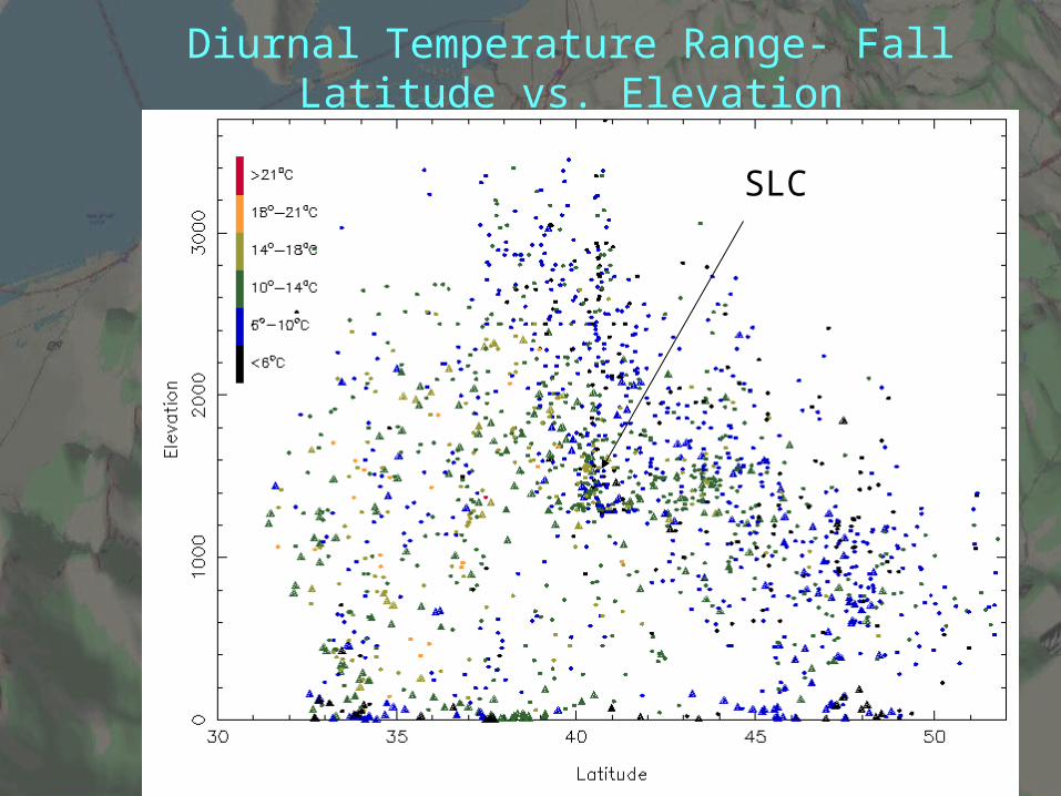
Diurnal Temperature Range- FallLatitude vs. Elevation
SLC
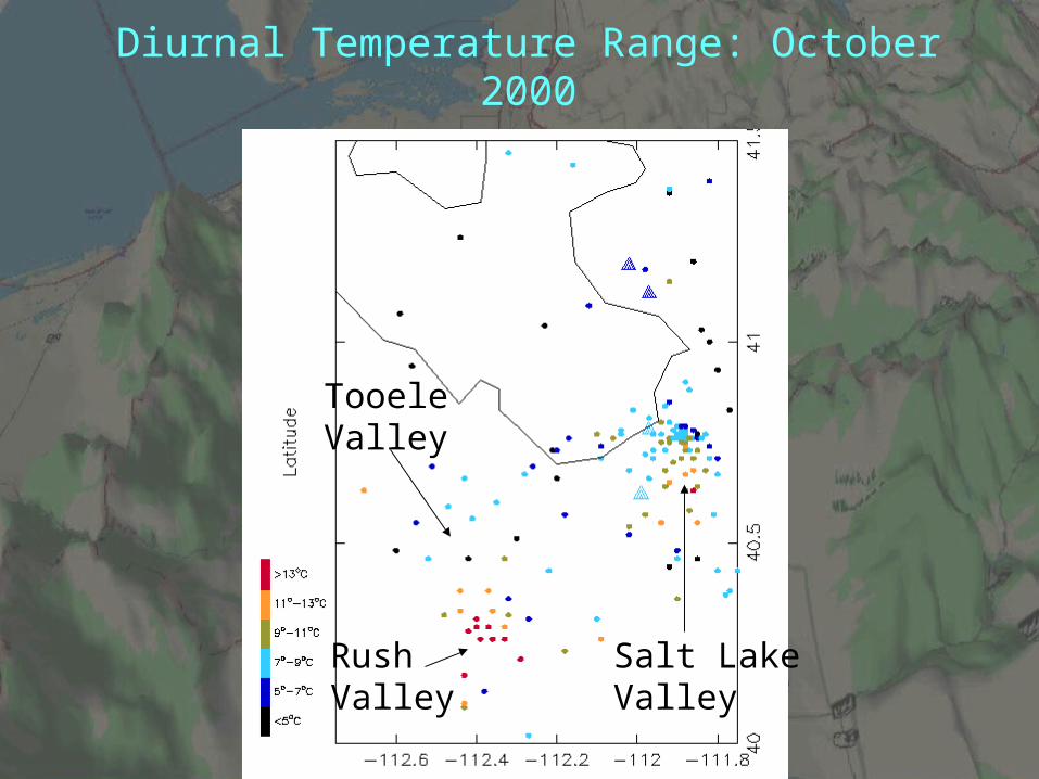
Diurnal Temperature Range: October 2000
RushValley
TooeleValley
Salt LakeValley
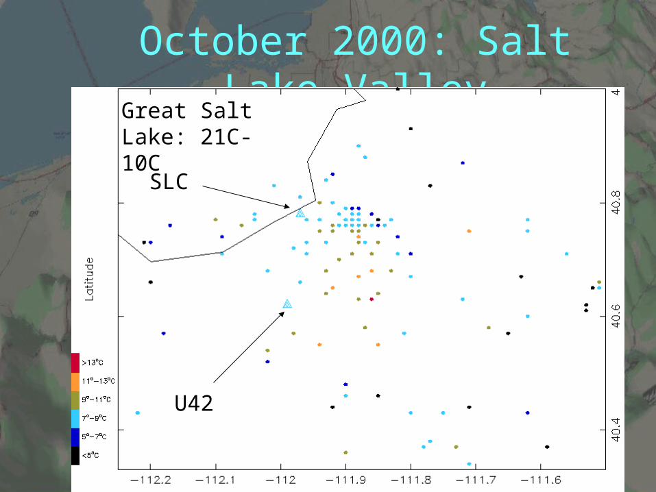
October 2000: Salt Lake Valley
SLC
U42
Great Salt Lake: 21C- 10C
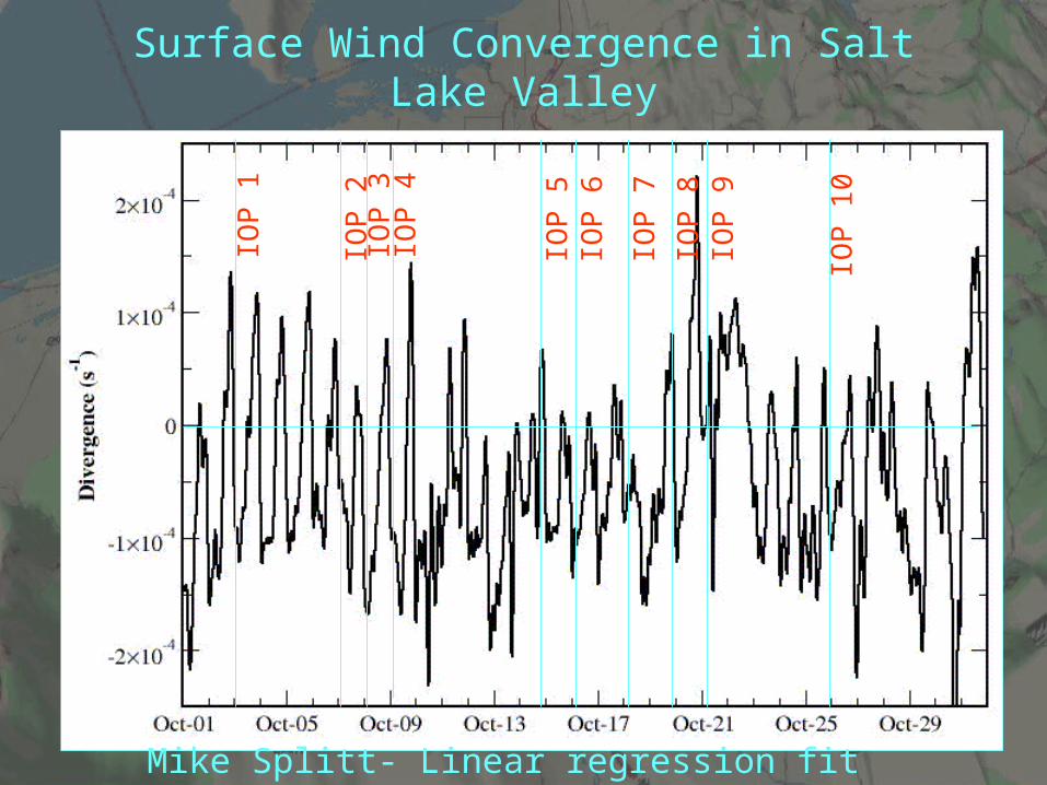
Surface Wind Convergence in Salt Lake Valley
IOP
1
IOP
2IO
P 3
IOP
4
IOP
5IO
P 6
IOP
7
IOP
8IO
P 9
IOP
10
Mike Splitt- Linear regression fit
Stability and Wind
• Surface-based inversions (greater than 5C in the lowest 100 mb) observed during 15 of the 31 morning (1200 UTC) soundings at the Salt Lake City International Airport
• Weak surface inversions with stable layers aloft below the crest of the Wasatch Mountains on 5 other mornings
• Well-mixed conditions present during the other 11 mornings
• Winds at 700 mb (near the crest of the Wasatch Mountains) were less than 10 m/s in 19 of the 31 morning soundings.
IOPs with Well-Developed Drainage Circulations
• 5 (14-15 October)• 6 (15-16 October)• 8 (19-20 October) • Clear skies, weak winds aloft at crest level, strong
nocturnal radiational inversions• Limited moisture in the boundary layer• Pronounced drainage flow into the Salt Lake Valley from
the west, south, and east• Surface based inversions and drainage circulations
developed after sunset and persisted without significant interruption until sunrise

IOP-8: 9 UTC 20 October
SLC
500 mb
700 mb
IOPs Modulated by Synoptic and Mesoscale Systems
• IOP 1 ( 2-3 October) • Test operational procedures • During evening:
– clear skies with drainage flows developing as the evening progressed• Synoptic-scale northerly pressure gradient developed overnight
– Northerly winds penetrated into northern end of the Salt Lake Valley before midnight
– Eventually reversed the down-valley (southerly) flow through the center of the valley
– Drainage circulations down into the valley from the Oquirrh and Wasatch Mountains were largely unaffected
IOPs modulated by synoptic and mesoscale weather systems
• IOP 4 (8-9 October), IOP 7 (17-18 October) • Similar boundary-layer structure to that in IOPs 5,
6, 8 until early morning• Prior to that time, clear skies, weak winds aloft,
and strong surface-based radiational inversions • As a result of approaching upper-level troughs
from the west, the nocturnal inversions eroded both by surface heating and by mixing due to the downward penetration of southerly winds

IOP-4 9 October
SLC
500 mb
700 mb
Wheeler
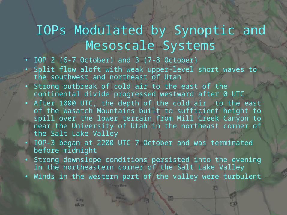
IOPs Modulated by Synoptic and Mesoscale Systems
• IOP 2 (6-7 October) and 3 (7-8 October)• Split flow aloft with weak upper-level short waves to the southwest and
northeast of Utah• Strong outbreak of cold air to the east of the continental divide
progressed westward after 0 UTC• After 1000 UTC, the depth of the cold air to the east of the Wasatch
Mountains built to sufficient height to spill over the lower terrain from Mill Creek Canyon to near the University of Utah in the northeast corner of the Salt Lake Valley
• IOP-3 began at 2200 UTC 7 October and was terminated before midnight
• Strong downslope conditions persisted into the evening in the northeastern corner of the Salt Lake Valley
• Winds in the western part of the valley were turbulent
IOPs Modulated by Synoptic and Mesoscale Systems
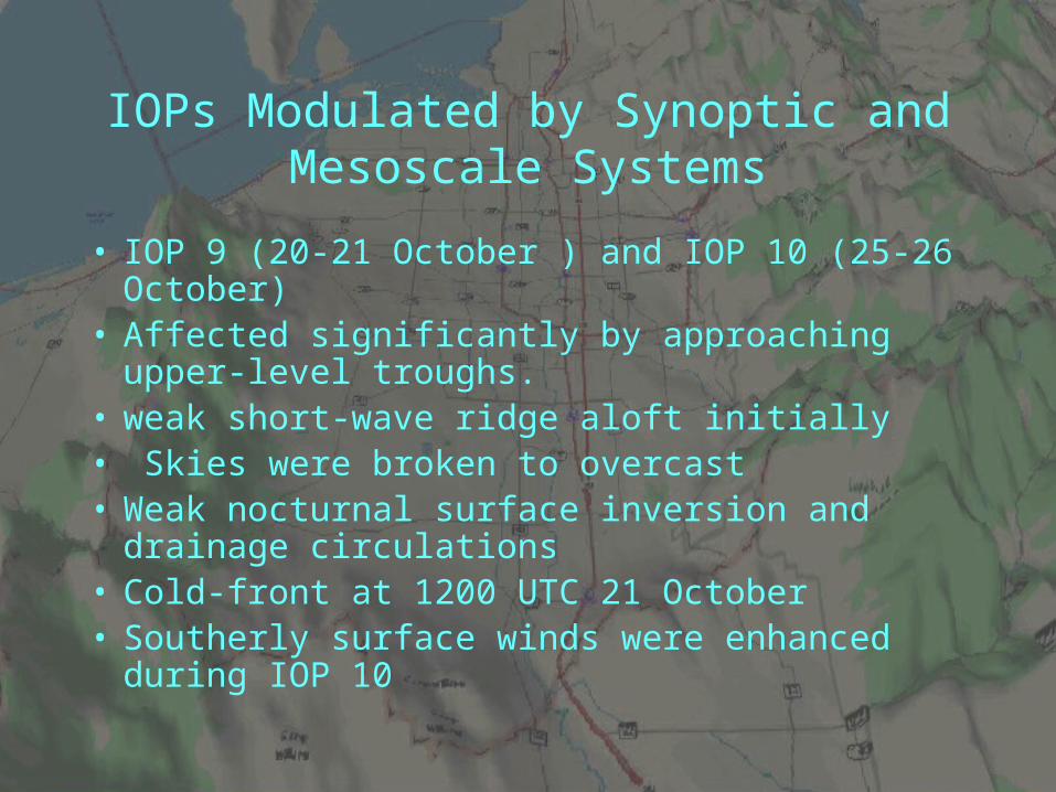
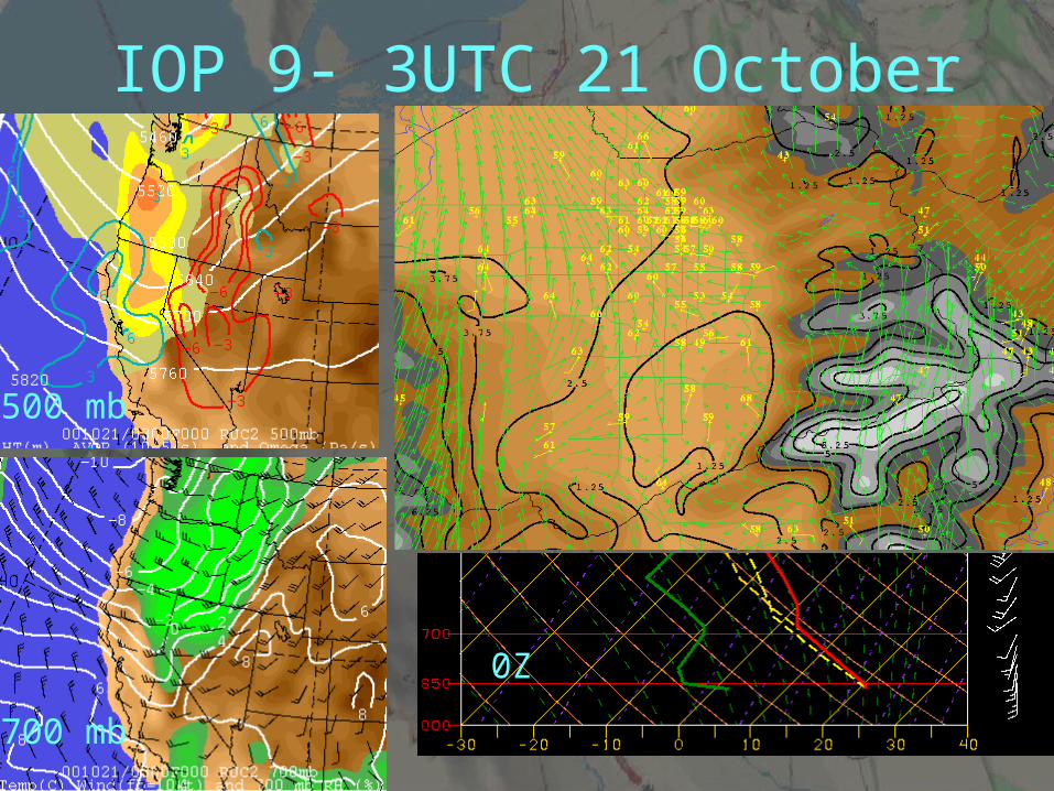
• IOP 9 (20-21 October ) and IOP 10 (25-26 October) • Affected significantly by approaching upper-level
troughs. • weak short-wave ridge aloft initially• Skies were broken to overcast • Weak nocturnal surface inversion and drainage
circulations • Cold-front at 1200 UTC 21 October • Southerly surface winds were enhanced during IOP
10
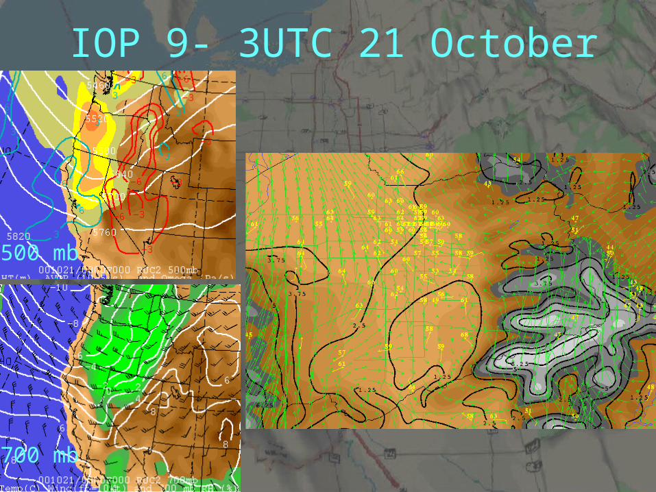
IOP 9- 3UTC 21 October
500 mb
700 mb
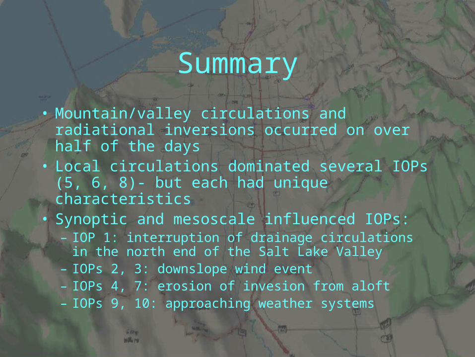
Summary
• Mountain/valley circulations and radiational inversions occurred on over half of the days
• Local circulations dominated several IOPs (5, 6, 8)- but each had unique characteristics
• Synoptic and mesoscale influenced IOPs:– IOP 1: interruption of drainage circulations in the north
end of the Salt Lake Valley– IOPs 2, 3: downslope wind event– IOPs 4, 7: erosion of invesion from aloft– IOPs 9, 10: approaching weather systems
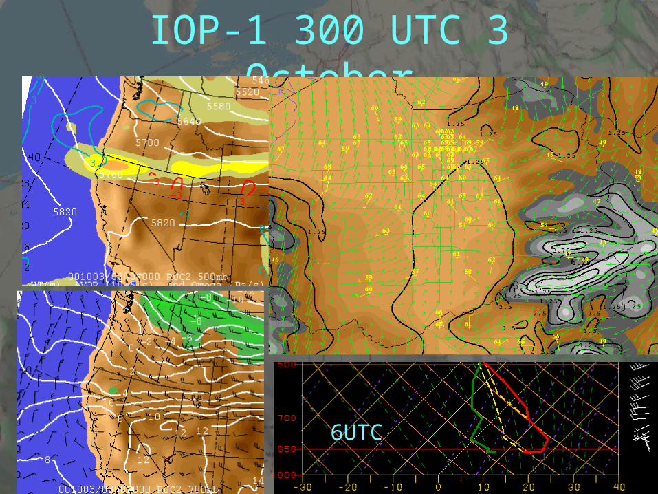
IOP-1 300 UTC 3 October
6UTC
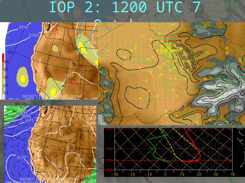
IOP 2: 1200 UTC 7 October
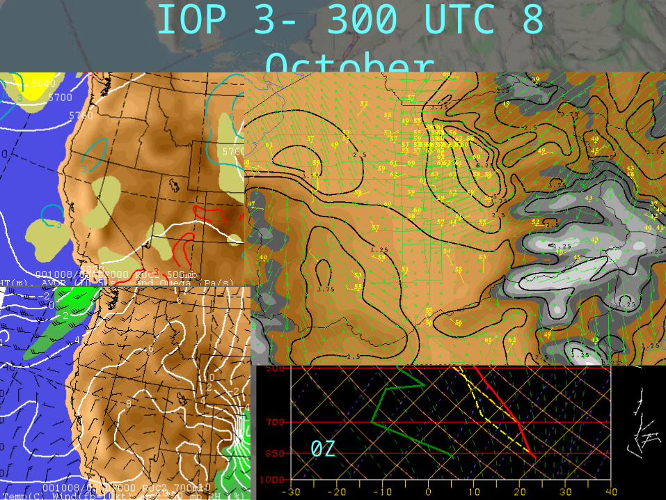
IOP 3- 300 UTC 8 October
0Z
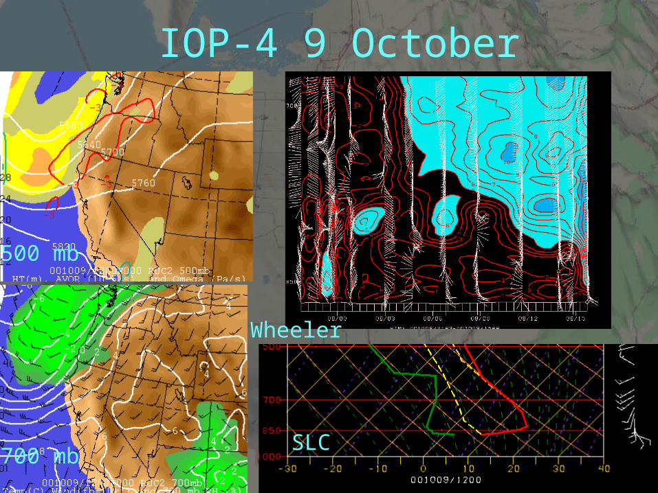
IOP-4 9 October
SLC
500 mb
700 mb
Wheeler
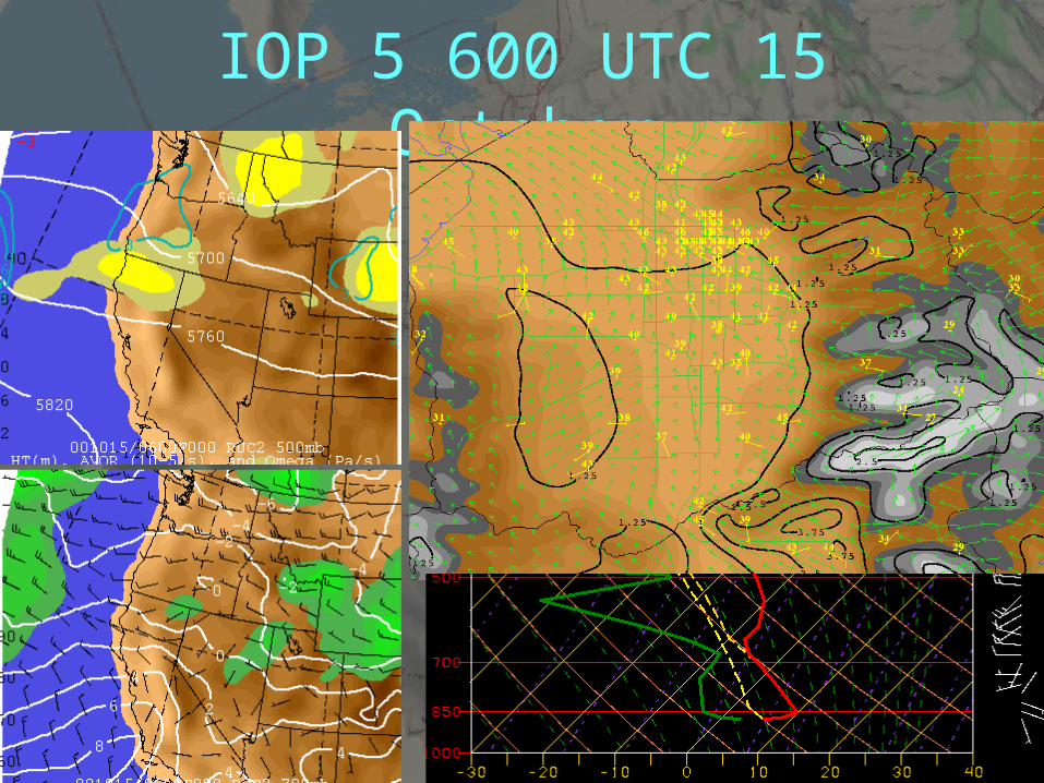
IOP 5 600 UTC 15 October
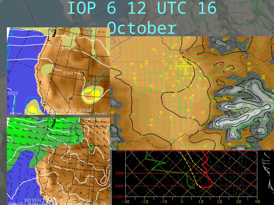
IOP 6 12 UTC 16 October
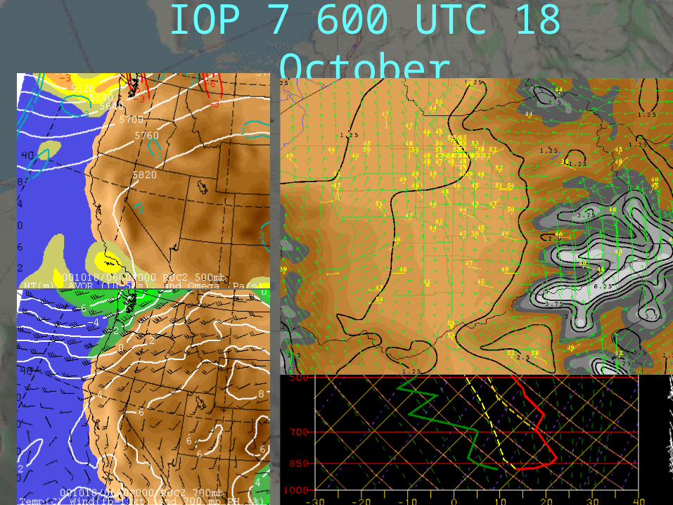
IOP 7 600 UTC 18 October
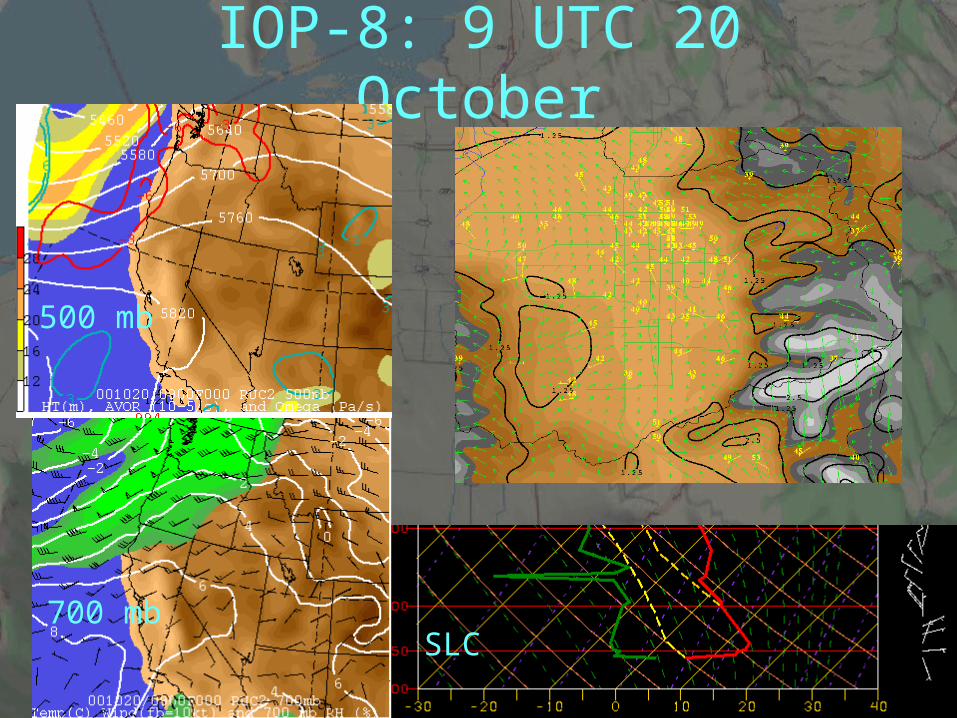
IOP-8: 9 UTC 20 October
SLC
500 mb
700 mb
IOP 9- 3UTC 21 October
500 mb
700 mb
0Z
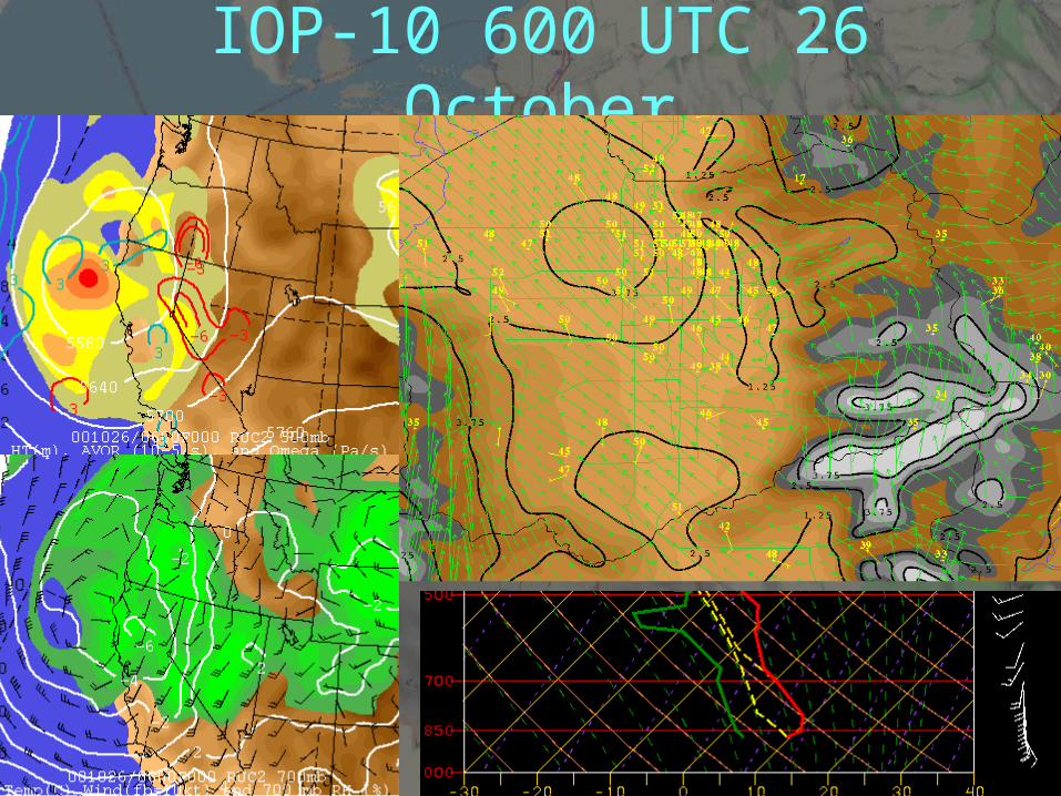
IOP-10 600 UTC 26 October