long distance volunteering
TRANSCRIPT

Spatial Analysis of Continental Divide Trail Spatial Analysis of Continental Divide Trail Volunteers’ Home TownsVolunteers’ Home Towns
Kerry ShakarjianGEOG 3120GIA Final ProjectMay 2009

Introduction
• Where do the volunteers come from?
• Is the distribution of their home towns related to the CDT?
• Hypothesis: The volunteers most likely live in the states that the CDT occupies, therefore are clustered around the CDT.
Background
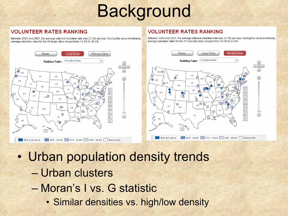
• Urban population density trends– Urban clusters – Moran’s I vs. G statistic
• Similar densities vs. high/low density

Methods
• Study Area– USA (48 states)– Continental Divide States
• Data– 2008 Project Volunteers spreadsheet– City, States, CDT shapefile

Methods-Analysis
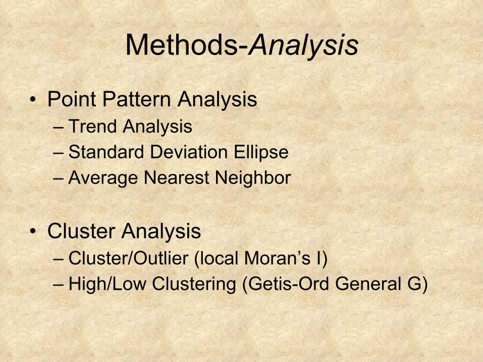
• Point Pattern Analysis– Trend Analysis– Standard Deviation Ellipse– Average Nearest Neighbor
• Cluster Analysis– Cluster/Outlier (local Moran’s I)– High/Low Clustering (Getis-Ord General G)

Results
Geostatistical
Trend Analysis

Results Cont.- SD Ellipse
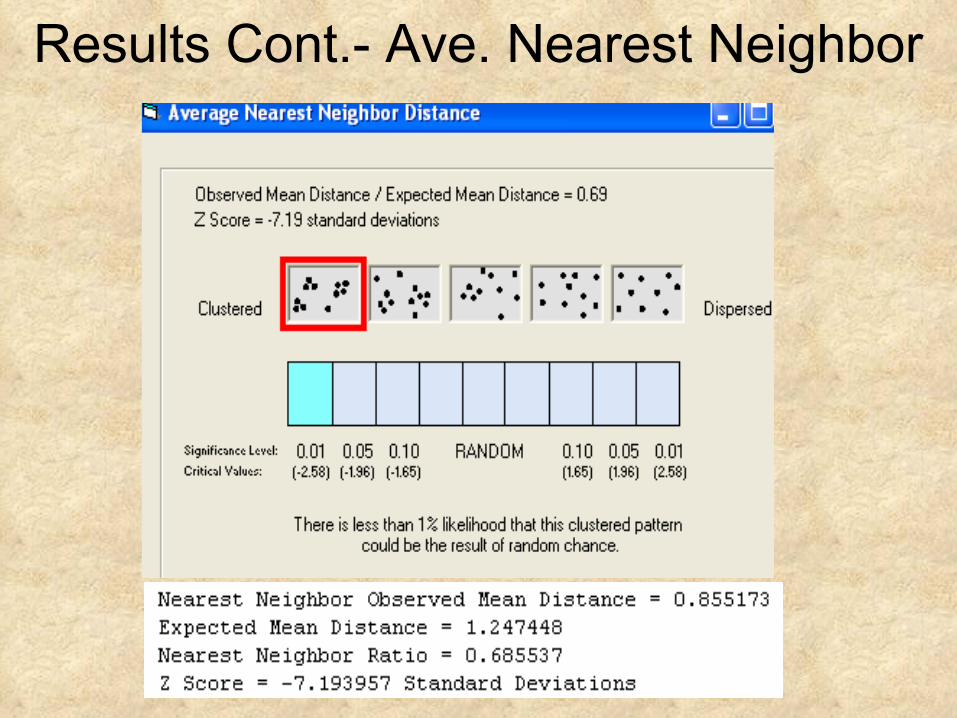
Results Cont.- Ave. Nearest Neighbor

Results Cont.- High/Low Clustering
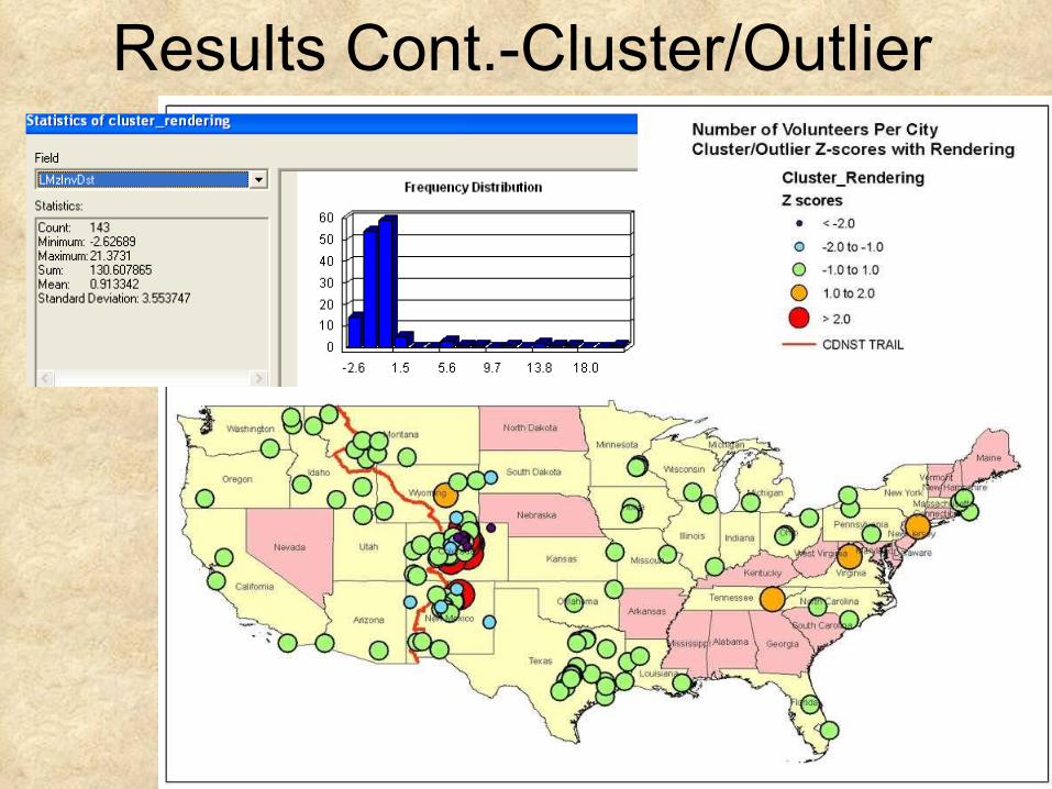
Results Cont.-Cluster/Outlier
Discussion/Conclusion
• Null hypothesis = completely random pattern -> rejected
• Alt. hypothesis = clustered within states occupying the CDT -> not rejected
• Volunteer’s home cities have higher cluster patterns near the CDT and more dispersed the farther from the CDT.

Questions?
“The Continental Divide Trail brings us together as a people and a country. It’s an experience that binds us to the history and promise of the land we cherish. It gives focus to shared experiences, values, promises and achievements”.
Source: http://www.cdtrail.org/