kimball mapping sciences pennsylvania workshop 2004 26 august 2004 commonwealth gis/gt: a new...
Post on 21-Dec-2015
214 views
TRANSCRIPT
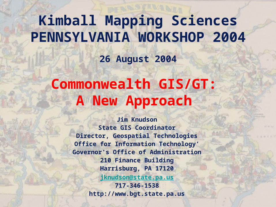
Kimball Mapping SciencesPENNSYLVANIA WORKSHOP 2004
26 August 2004
Commonwealth GIS/GT: A New Approach
Jim KnudsonState GIS Coordinator
Director, Geospatial TechnologiesOffice for Information Technology’Governor’s Office of Administration
210 Finance BuildingHarrisburg, PA [email protected]
717-346-1538http://www.bgt.state.pa.us
The Commonwealth
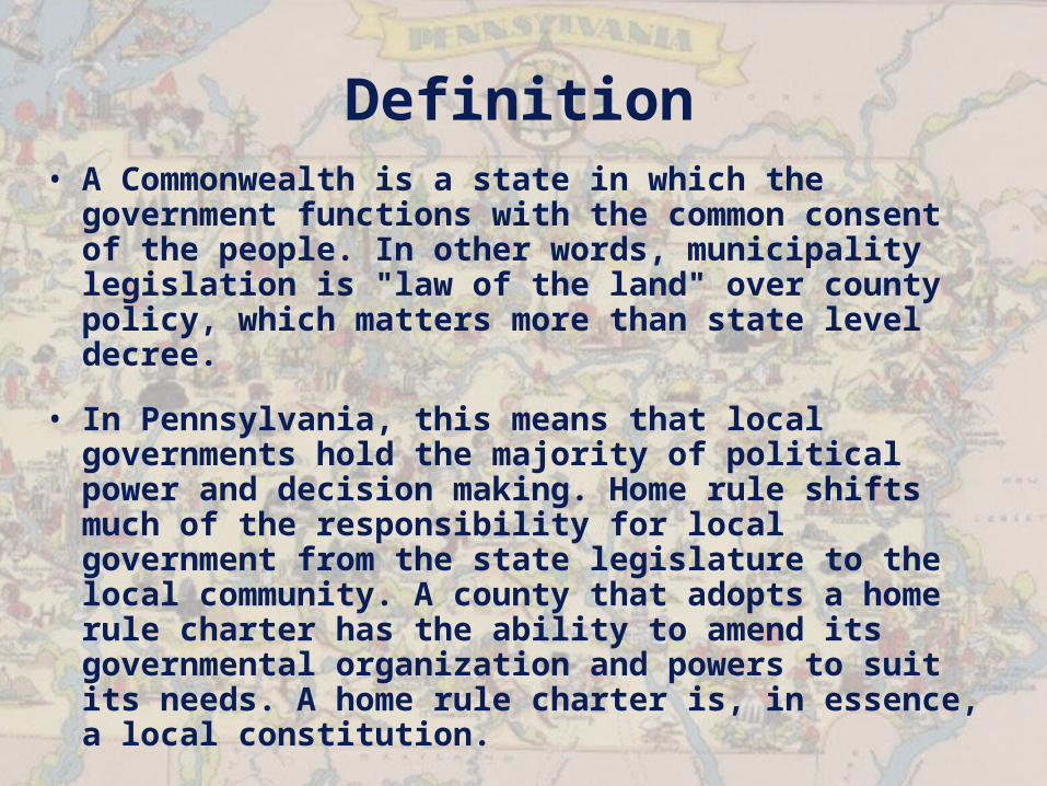
Definition• A Commonwealth is a state in which the
government functions with the common consent of the people. In other words, municipality legislation is "law of the land" over county policy, which matters more than state level decree.
• In Pennsylvania, this means that local governments hold the majority of political power and decision making. Home rule shifts much of the responsibility for local government from the state legislature to the local community. A county that adopts a home rule charter has the ability to amend its governmental organization and powers to suit its needs. A home rule charter is, in essence, a local constitution.
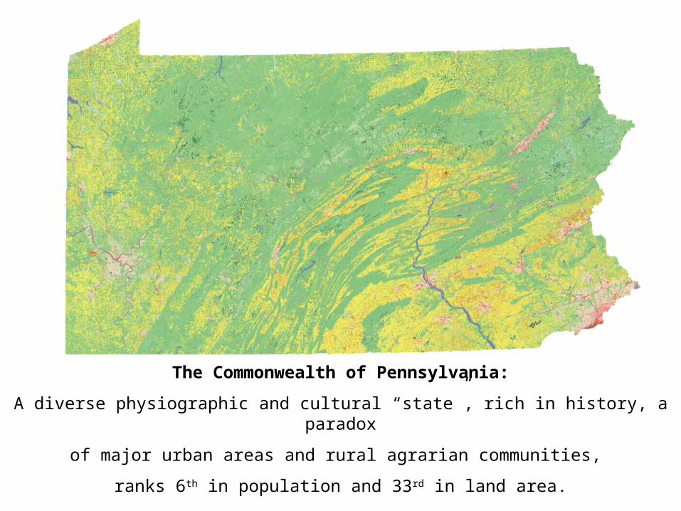
The Commonwealth of Pennsylvania:
A diverse physiographic and cultural “state”, rich in history, a paradox
of major urban areas and rural agrarian communities,
ranks 6th in population and 33rd in land area.
Commonwealth GIS/GT
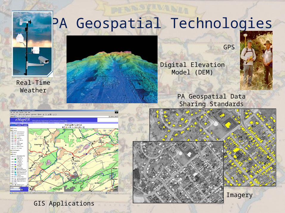
PA Geospatial Technologies
Real-Time Weather
Digital Elevation Model (DEM)
GIS Applications
PA Geospatial Data Sharing Standards
Imagery
GPS
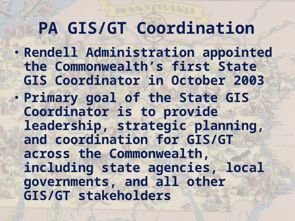
PA GIS/GT Coordination• Rendell Administration appointed
the Commonwealth’s first State GIS Coordinator in October 2003
• Primary goal of the State GIS Coordinator is to provide leadership, strategic planning, and coordination for GIS/GT across the Commonwealth, including state agencies, local governments, and all other GIS/GT stakeholders
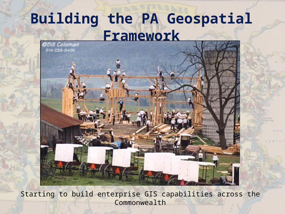
Building the PA Geospatial Framework
Starting to build enterprise GIS capabilities across the Commonwealth
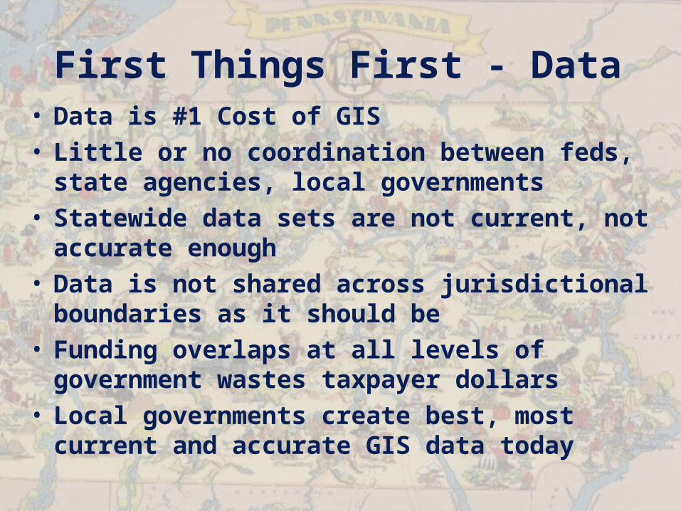
First Things First - Data• Data is #1 Cost of GIS• Little or no coordination between feds,
state agencies, local governments• Statewide data sets are not current,
not accurate enough• Data is not shared across jurisdictional
boundaries as it should be• Funding overlaps at all levels of
government wastes taxpayer dollars• Local governments create best, most
current and accurate GIS data today
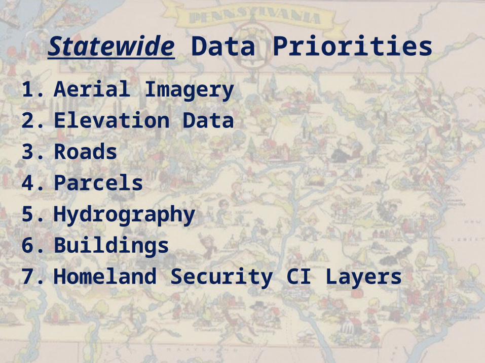
Statewide Data Priorities
1. Aerial Imagery2. Elevation Data3. Roads4. Parcels5. Hydrography6. Buildings7. Homeland Security CI Layers
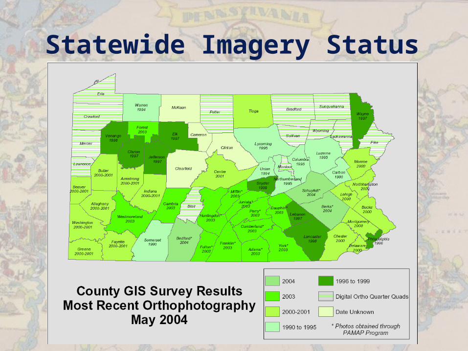
Statewide Imagery Status
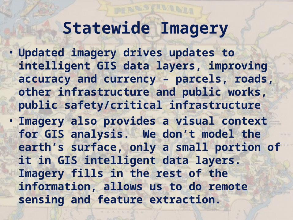
Statewide Imagery• Updated imagery drives updates to
intelligent GIS data layers, improving accuracy and currency – parcels, roads, other infrastructure and public works, public safety/critical infrastructure
• Imagery also provides a visual context for GIS analysis. We don’t model the earth’s surface, only a small portion of it in GIS intelligent data layers. Imagery fills in the rest of the information, allows us to do remote sensing and feature extraction.
Statewide Imagery
• Only statewide imagery asset today are Digital Ortho Quarter Quads, dated 1993-1999, 1:12,000 scale, 1m pixels, black and white imagery
• NAIP 2004 – Partnering with USDA/FSA this summer to do a complete statewide flight, LEAF-ON, delivery by 12/2004. 1:12,000 scale, 1m pixels, color infrared imagery

Statewide Imagery• PAMAP Imagery – next generation
imagery for the Commonwealth– Accuracy Standards: 1:2,400 scale
minimum, 2ft pixel minimum – OR BETTER– 3 year cycle of imagery – complete
imagery statewide in next 3 years, if we can raise enough money
– State agencies to pay for statewide imagery and elevation data, saving counties and municipalities money, allowing them to concentrate on data creation
– Data sharing – counties share parcels, roads, buildings, hydro, etc.
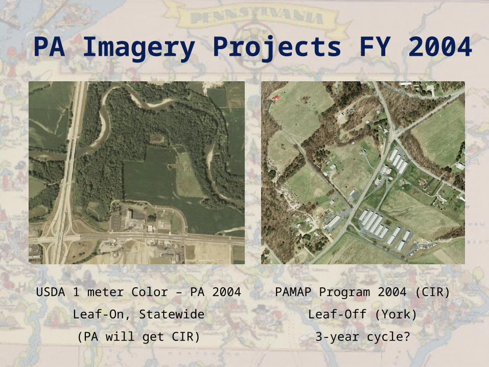
PA Imagery Projects FY 2004
USDA 1 meter Color – PA 2004
Leaf-On, Statewide
(PA will get CIR)
PAMAP Program 2004 (CIR)
Leaf-Off (York)
3-year cycle?
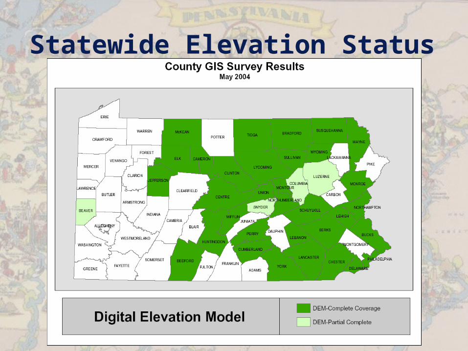
Statewide Elevation Status

Statewide Elevation Status
Statewide Elevation Data• Current statewide elevation data sets
are 30 meter grid size. Most used statewide Digital Elevation Model has been 10-year old DEM derived from scanning topographic quad sheets – which dated from the 60’s and 70’s. Incomplete 10m DEM derived from same old and inaccurate topo data. Shuttle Radar Topography Mission (SRTM) data from 2000 is also 30m, more accurate and current, but not good enough to generate 5’ contours statewide.

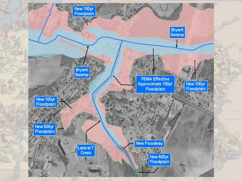
Statewide Elevation Data• Flooding is PA’s #1 hazard• Hundreds of millions of dollars in
damages every year• Current elevation data does not allow
us to accurately define 100 year and 500 year floodplains
• Citizens paying for flood insurance (NFIP) who don’t need it, some people who need it can’t get it because of inaccurate elevation data. Need 2’ data for river basins.
• Also required for economic development siting, landuse, public lands preservation, state water budget, etc.

County Parcels Status

County Road Centerlines w/Addresses Status
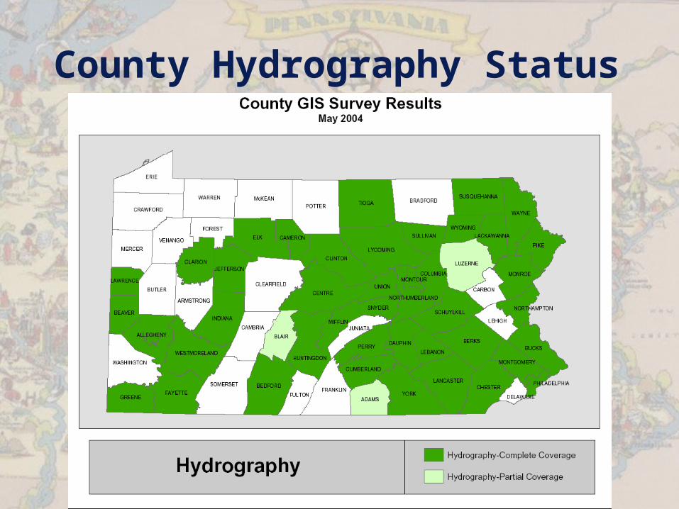
County Hydrography Status
Statewide GIS Data Sets
• Statewide data are required for:– Homeland Security/Public Safety– Economic Development– Landuse/Sustainable Development– Asset Management– General Government Operations

GIS/GT Coordination

Commonwealth GIS/GT Coordination
• 20 Agencies• 67 Counties• 2565 Municipalities• Other stakeholders - Academia,
business, environmental groups, PASDA, etc.
• Enterprise Licensing• Statewide data priorities• Procurement reviews• Buy/build once, share as possible, data
standards• Leadership, strategic direction for the
Commonwealth

20 Agency GIS Users Today1. Administration1
2. Aging4
3. Agriculture4
4. Community/Economic Development1
5. Conservation and Natural Resources2
6. Education1
7. Emergency Management3
8. Environmental Protection2
9. Fish and Boat2
10. Game Commission2
11. General Services1
12. Health4
13. Historical and Museum Commission2
14. Insurance1
15. Labor and Industry1
16. Military and Veterans Affairs (PA Guard)3
17. PENNDOT2/3
18. PENNVEST2
19. Public Welfare4
20. State Police3
More added quarterly – expect 4 new agencies in 2004
CoP Key
1 – GGO
2 – Environ
3 – PubSaf
4 – HHS
Agency Key
eGov Enterprise
Growing eGov
Desktop
Pretty Pictures

GT Strategic Planning

GT Strategic Planning• GIS Data Priorities and Strategies• Federal, state, local government
coordination and priorities• Commonwealth GIS Data Sharing
Standards• Data sharing – mechanics and strategy• Geospatial Enterprise Architecture• Homeland Security GIS• Enterprise Licensing• Enterprise Assets• Understanding of local government
business, issues, needs, and priorities
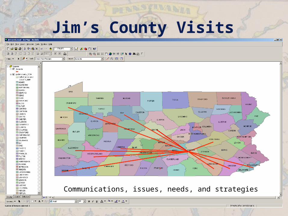
Jim’s County Visits
Communications, issues, needs, and strategies
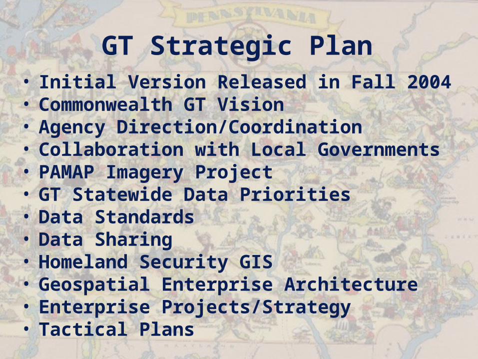
GT Strategic Plan• Initial Version Released in Fall 2004• Commonwealth GT Vision• Agency Direction/Coordination• Collaboration with Local Governments• PAMAP Imagery Project• GT Statewide Data Priorities• Data Standards• Data Sharing• Homeland Security GIS• Geospatial Enterprise Architecture• Enterprise Projects/Strategy• Tactical Plans

PA Geospatial Data Sharing Standards
• Version 1.0 Data Standards will reflect PAMAP/TNM Data Layers (Digital Topo)
• Highest Common Denominator for data sharing, horizontally and vertically
• V 1.0 leveraging investments by PAMAGIC in PAMAP Data Standards initiatives and best practices for local government handbook
• Incorporating additional fields for use cases, HSIP, classifications, etc.
• Draft in 2004
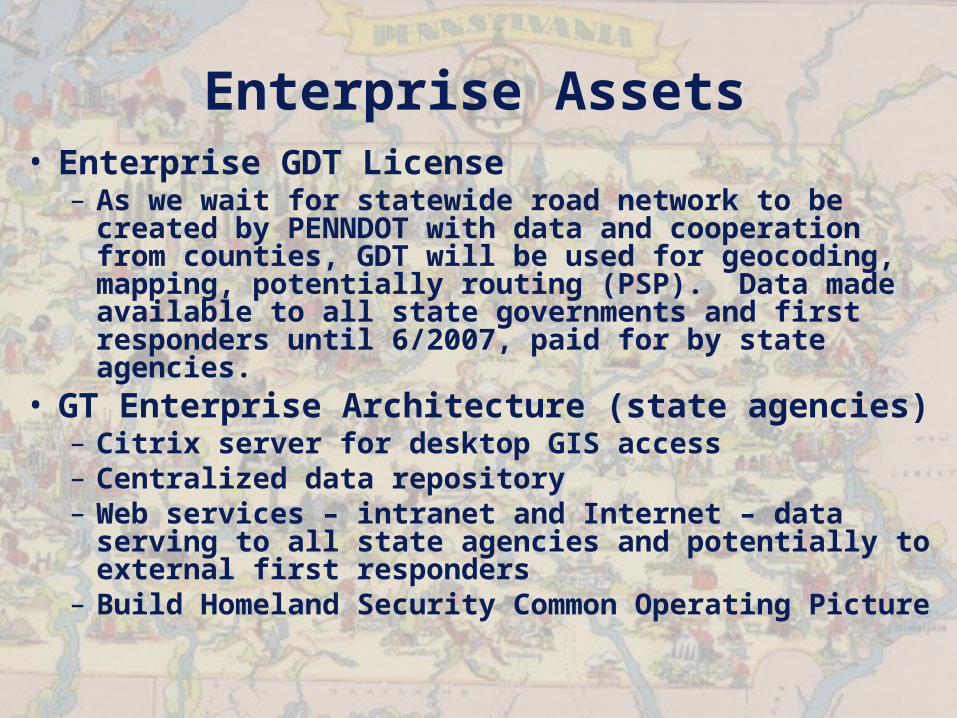
Enterprise Assets• Enterprise GDT License
– As we wait for statewide road network to be created by PENNDOT with data and cooperation from counties, GDT will be used for geocoding, mapping, potentially routing (PSP). Data made available to all state governments and first responders until 6/2007, paid for by state agencies.
• GT Enterprise Architecture (state agencies)– Citrix server for desktop GIS access– Centralized data repository– Web services – intranet and Internet – data
serving to all state agencies and potentially to external first responders
– Build Homeland Security Common Operating Picture
Centralized Geospatial Data Architecture
Web Services layer - WMS, WFS, LBS
Oracle
GeospatialServer
GeospatialDatabase
BasemapFeatures
Oracle
GeospatialServer
GeospatialDatabase
GeocodingServer
Oracle
GeospatialServer
GeospatialDatabase
ImageryServer
Oracle
GeospatialServer
GeospatialDatabase
WeatherServer
Oracle
GeospatialServer
GeospatialDatabase
DEMServer
Oracle
GeospatialServer
GeospatialDatabase
Secure HSCI Server
FirewallNon-Secure Data Secure Data
Application Users
GISDesktop
User
HealthNEDDSServer
DEPPAIRSServer
PSPIIMS
Server
PEMAPEIRSServer
OtherAgency
Application
CTC/ESF

HS Real-Time Weather Project
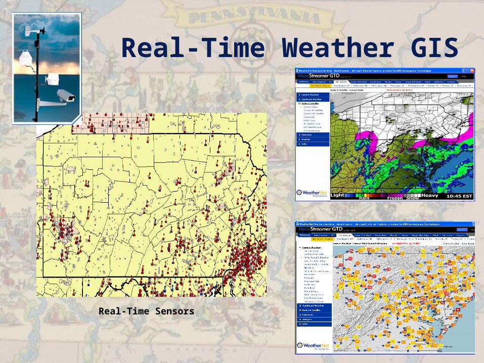
Real-Time Weather GIS
Real-Time Sensors
Statewide Real-Time Weather Data
• Recent experience – 3 tornadoes, hurricane season, flooding, major transportation accidents in 2004 due to fog and snow/ice
• Required for severe weather events, natural disasters, SARA facility toxic releases, terroristic WMD/CBRNE events, etc.
• Need for REAL-TIME weather data in PA to provide local conditions to PEMA, other state agencies, and county EMAs
• Enterprise license, best-of-breed solution being pursued for real-time GIS weather data, including real-time sensor network in PA, GIS data servers in multiple locations for inclusion in GIS applications and plume models.
Statewide Real-Time Weather Data
• Includes NOAA/NWS forecast data and imagery in addition to real-time data for NEXRAD storm cells, composite radar imagery, satellite imagery, surface observations, current conditions, etc.
• Tied in with State 800 MHz radio system/AVL• Proximity alerts, severe weather alerts,
current conditions, forecasts, and nowcasting• Internet browser (non-GIS) tools and GIS data
servers• Plume modeling – HPAC/CATS, NARAC, etc.
Require real-time, local data sensors for best results and analysis
Homeland Security GIS
Homeland Security GIS• HS GIS Task Force – exercises to
prioritize the 120 CI layers• Enterprise Architecture for
Common Operating Picture• Statewide data creation
– NAIP Imagery– PAMAP Imagery– GDT/PENNDOT Statewide Roadway– NHD/DEP SLIMS

Other Statewide/Enterprise Projects

BGT Projects in 2005 Budget Request
• Homeland Security GIS CI Mapping• Enterprise Vehicle Tracking Application• GEARS Project• State GIS Clearinghouse
Commonwealth GIS/GT Summary

Commonwealth GIS/GT Summary
• New approach toward enterprise/Commonwealth GIS/GT
• We all have to work together and share our data to be successful and protect our homes
• State will work to procure and maintain statewide data sets with help from local governments
• Coordination and collaboration will allow us to be more efficient and productive with the same funding levels
• State GIS Coordinator will be looking out for local governments as well as state agencies

Questions?
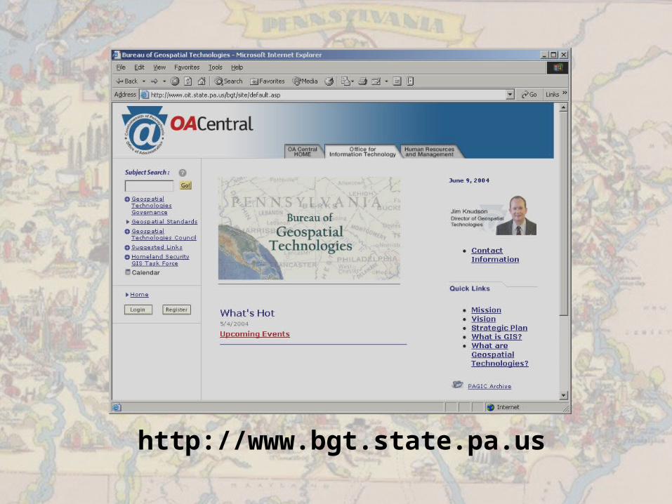
http://www.bgt.state.pa.us