commonwealth of pa gis strategy & c2k 18 august 2004 jim knudson state gis coordinator director,...
Post on 20-Dec-2015
213 views
TRANSCRIPT

Commonwealth of PA
GIS Strategy & C2K18 August 2004Jim Knudson
State GIS CoordinatorDirector, Geospatial TechnologiesOffice for Information Technology’Governor’s Office of Administration
210 Finance BuildingHarrisburg, PA [email protected]
717-346-1538http://www.bgt.state.pa.us
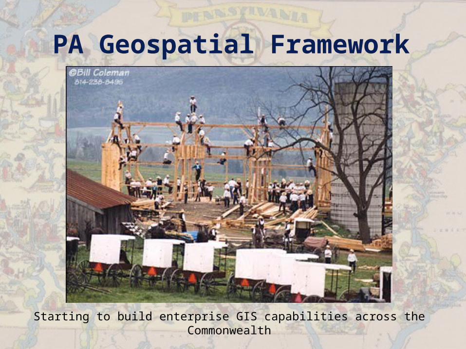
PA Geospatial Framework
Starting to build enterprise GIS capabilities across the Commonwealth
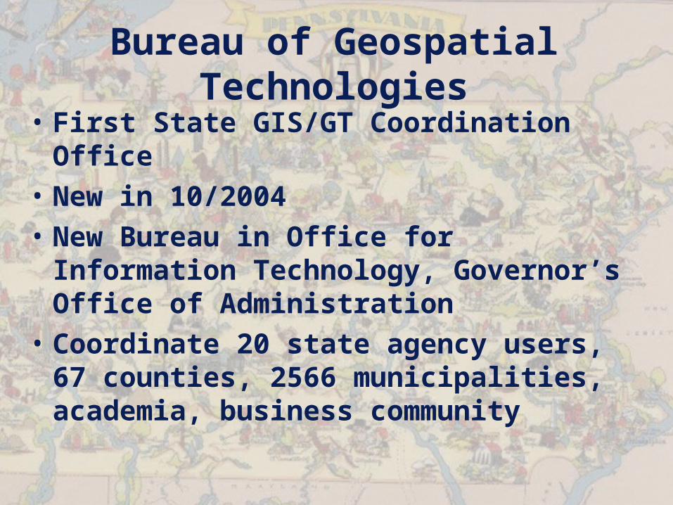
Bureau of Geospatial Technologies
• First State GIS/GT Coordination Office
• New in 10/2004• New Bureau in Office for
Information Technology, Governor’s Office of Administration
• Coordinate 20 state agency users, 67 counties, 2566 municipalities, academia, business community
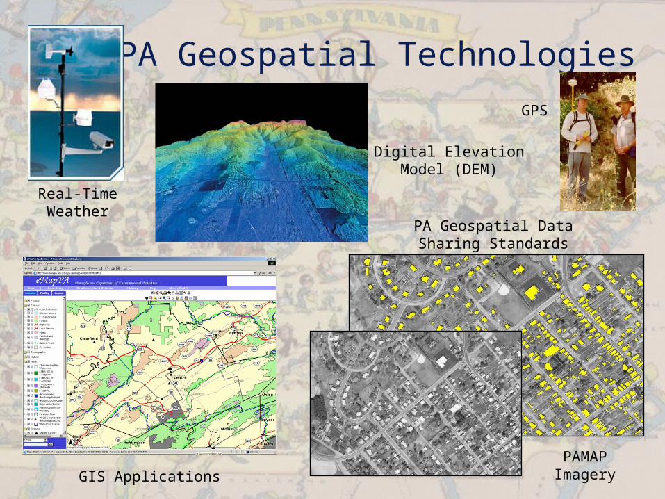
PA Geospatial Technologies
Real-Time Weather
Digital Elevation Model (DEM)
GIS Applications
PA Geospatial Data Sharing Standards
PAMAP Imagery
GPS
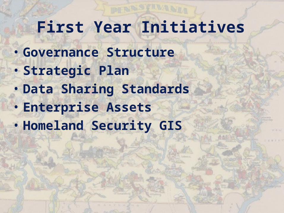
First Year Initiatives
• Governance Structure• Strategic Plan• Data Sharing Standards• Enterprise Assets• Homeland Security GIS
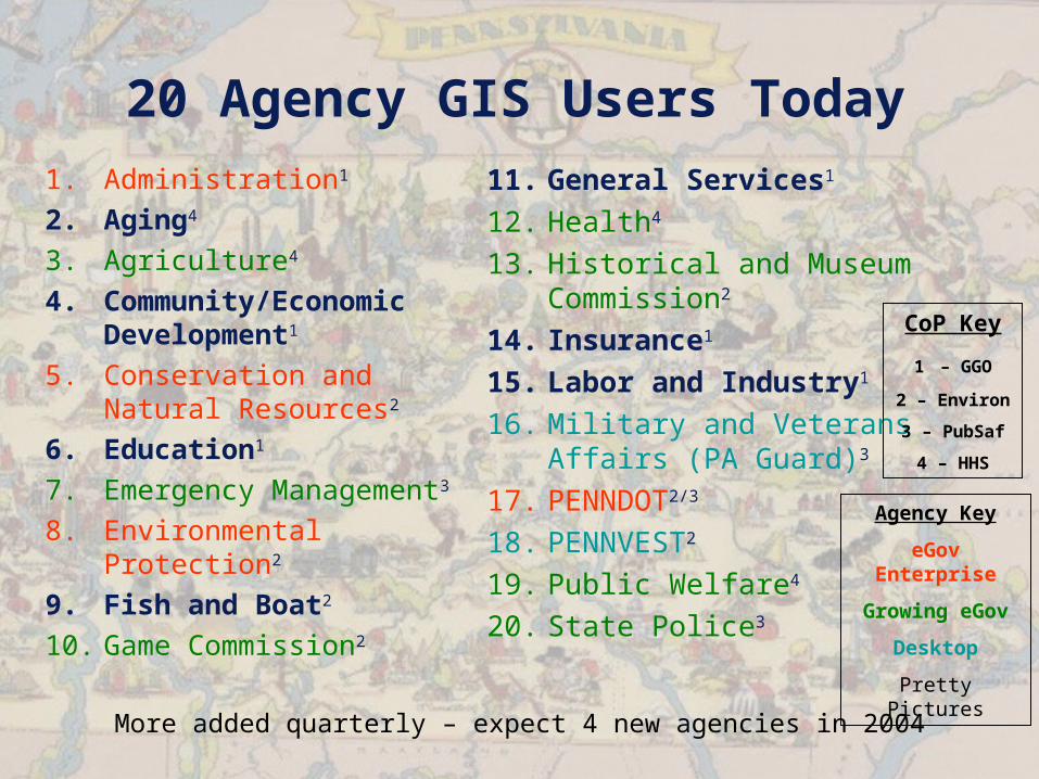
20 Agency GIS Users Today1. Administration1
2. Aging4
3. Agriculture4
4. Community/Economic Development1
5. Conservation and Natural Resources2
6. Education1
7. Emergency Management3
8. Environmental Protection2
9. Fish and Boat2
10. Game Commission2
11. General Services1
12. Health4
13. Historical and Museum Commission2
14. Insurance1
15. Labor and Industry1
16. Military and Veterans Affairs (PA Guard)3
17. PENNDOT2/3
18. PENNVEST2
19. Public Welfare4
20. State Police3
More added quarterly – expect 4 new agencies in 2004
CoP Key
1 – GGO
2 – Environ
3 – PubSaf
4 – HHS
Agency Key
eGov Enterprise
Growing eGov
Desktop
Pretty Pictures
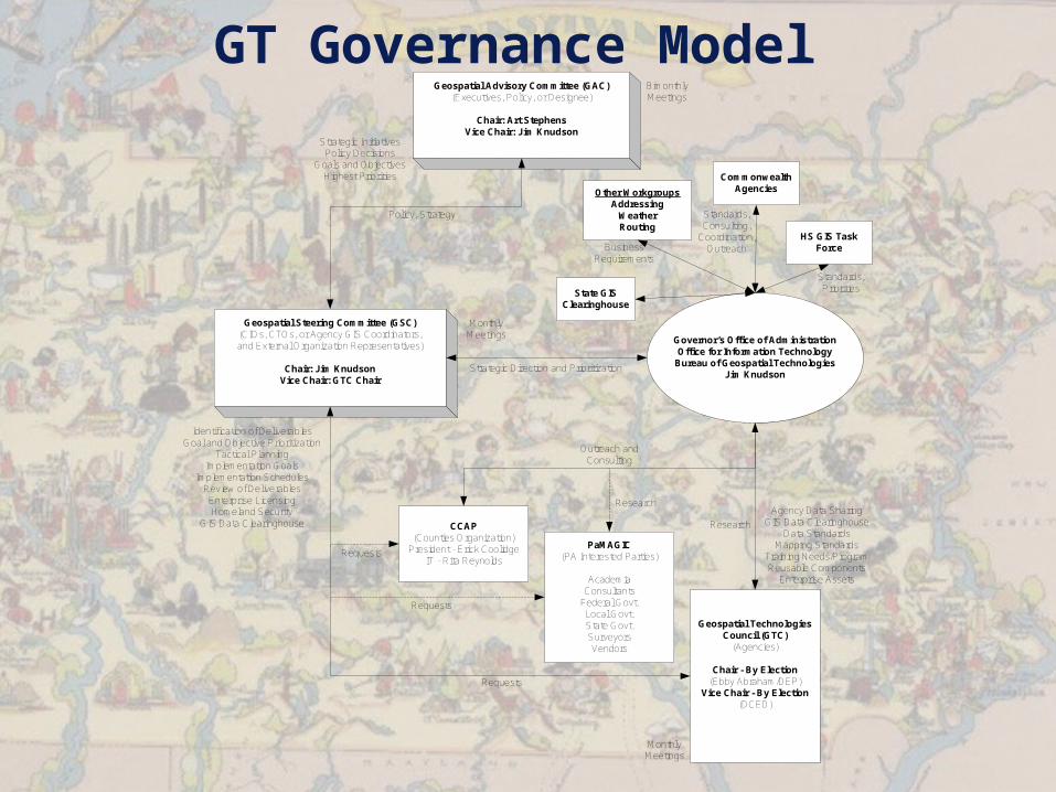
GT Governance Model
Geospatial Steering Committee (GSC)(CIOs, CTOs, or Agency GIS Coordinators,and External Organization Representatives)
Chair: Jim KnudsonVice Chair: GTC Chair
Geospatial Advisory Committee (GAC)(Executives, Policy, or Designee)
Chair: Art StephensVice Chair: Jim Knudson
Governor’s Office of AdministrationOffice for Information Technology
Bureau of Geospatial TechnologiesJim Knudson
CCAP(Counties Organization)
President - Erick CoolidgeIT - Rita Reynolds
PaMAGIC(PA Interested Parties)
AcademiaConsultants
Federal Govt.Local Govt.State Govt.SurveyorsVendors
Geospatial TechnologiesCouncil (GTC)
(Agencies)
Chair - By Election(Ebby Abraham/DEP)
Vice Chair - By Election(DCED)
OIT/Geospatial Technologies Governance Model Draft
Policy, Strategy
Strategic Direction and Prioritization
Outreach andConsulting
Requests
Requests
Requests
Strategic InitiativesPolicy Decisions
Goals and ObjectivesHighest Priorities
BimonthlyMeetings
MonthlyMeetings
MonthlyMeetings
Identification of DeliverablesGoal and Objective Prioritization
Tactical PlanningImplementation Goals
Implementation SchedulesReview of Deliverables
Enterprise LicensingHomeland Security
GIS Data ClearinghouseAgency Data Sharing
GIS Data ClearinghouseData Standards
Mapping StandardsTraining Needs/ProgramReusable Components
Enterprise Assets
Research
Research
CommonwealthAgencies
Standards,Consulting,
Coordination,Outreach
HS GIS TaskForce
Standards,Priorities
Other WorkgroupsAddressing
WeatherRouting
BusinessRequirements
State GISClearinghouse
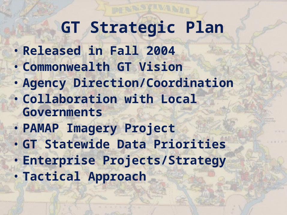
GT Strategic Plan• Released in Fall 2004• Commonwealth GT Vision• Agency Direction/Coordination• Collaboration with Local
Governments• PAMAP Imagery Project• GT Statewide Data Priorities• Enterprise Projects/Strategy• Tactical Approach
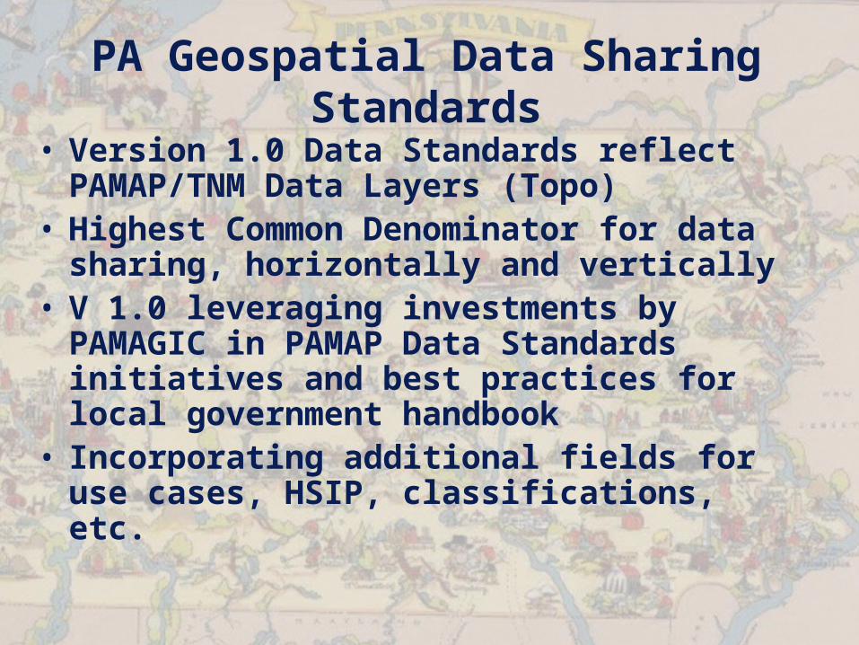
PA Geospatial Data Sharing Standards
• Version 1.0 Data Standards reflect PAMAP/TNM Data Layers (Topo)
• Highest Common Denominator for data sharing, horizontally and vertically
• V 1.0 leveraging investments by PAMAGIC in PAMAP Data Standards initiatives and best practices for local government handbook
• Incorporating additional fields for use cases, HSIP, classifications, etc.
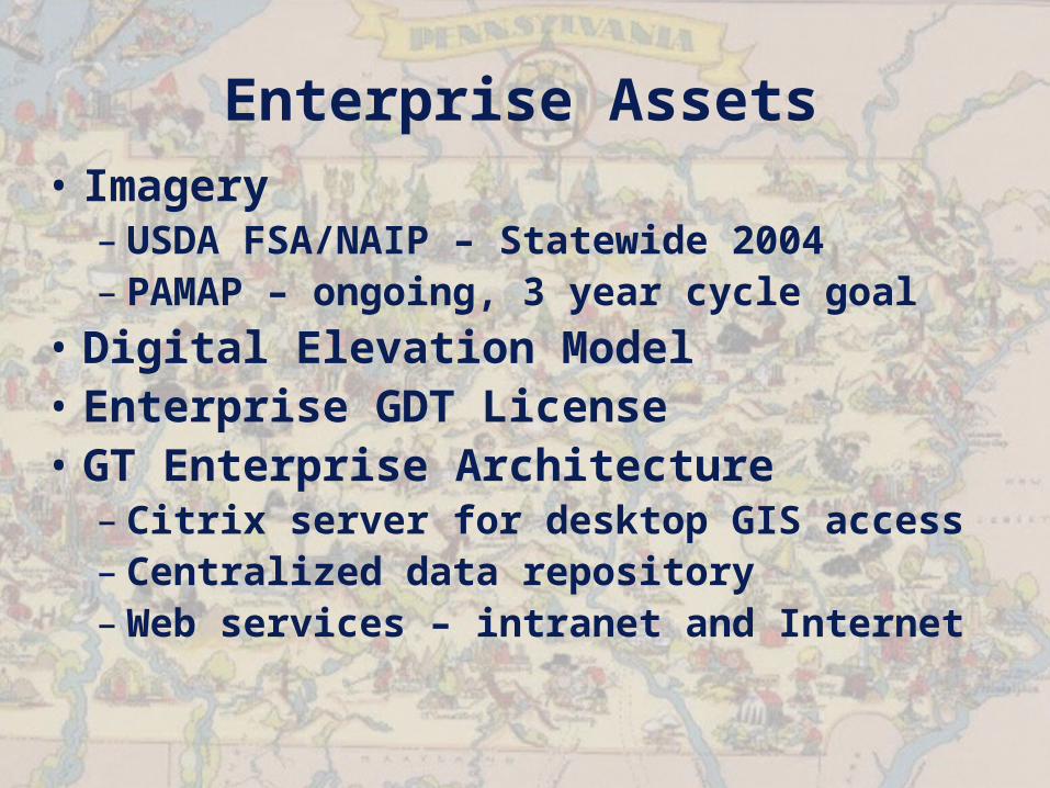
Enterprise Assets• Imagery
– USDA FSA/NAIP – Statewide 2004– PAMAP – ongoing, 3 year cycle goal
• Digital Elevation Model• Enterprise GDT License• GT Enterprise Architecture
– Citrix server for desktop GIS access– Centralized data repository– Web services – intranet and Internet
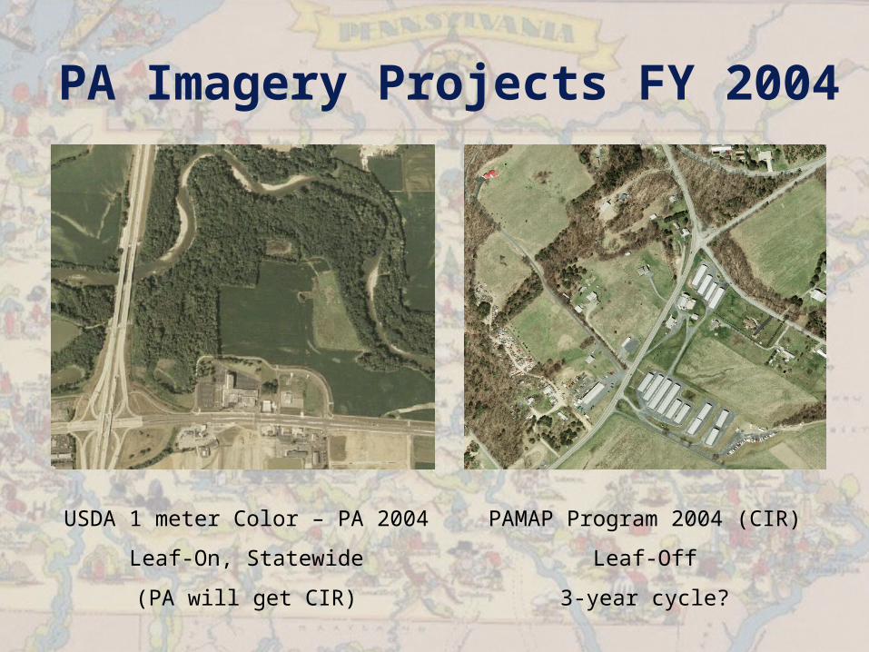
PA Imagery Projects FY 2004
USDA 1 meter Color – PA 2004
Leaf-On, Statewide
(PA will get CIR)
PAMAP Program 2004 (CIR)
Leaf-Off
3-year cycle?
Centralized Geospatial Data Architecture
Web Services layer - WMS, WFS, LBS
Oracle
GeospatialServer
GeospatialDatabase
BasemapFeatures
Oracle
GeospatialServer
GeospatialDatabase
GeocodingServer
Oracle
GeospatialServer
GeospatialDatabase
ImageryServer
Oracle
GeospatialServer
GeospatialDatabase
WeatherServer
Oracle
GeospatialServer
GeospatialDatabase
DEMServer
Oracle
GeospatialServer
GeospatialDatabase
Secure HSCI Server
FirewallNon-Secure Data Secure Data
Application Users
GISDesktop
User
HealthNEDDSServer
DEPPAIRSServer
PSPIIMS
Server
PEMAPEIRSServer
OtherAgency
Application
CTC/ESF

Enterprise Assets
• Address Geocoding/Geolocating Server
• Routing/Trip Directions Server• State GIS Data Clearinghouse
(PASDA)• Commonwealth Agency Training
Program• Homeland Security GIS Common
Operating Picture
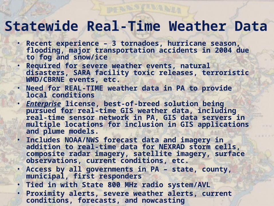
Statewide Real-Time Weather Data
• Recent experience – 3 tornadoes, hurricane season, flooding, major transportation accidents in 2004 due to fog and snow/ice
• Required for severe weather events, natural disasters, SARA facility toxic releases, terroristic WMD/CBRNE events, etc.
• Need for REAL-TIME weather data in PA to provide local conditions
• Enterprise license, best-of-breed solution being pursued for real-time GIS weather data, including real-time sensor network in PA, GIS data servers in multiple locations for inclusion in GIS applications and plume models.
• Includes NOAA/NWS forecast data and imagery in addition to real-time data for NEXRAD storm cells, composite radar imagery, satellite imagery, surface observations, current conditions, etc.
• Access by all governments in PA – state, county, municipal, first responders
• Tied in with State 800 MHz radio system/AVL• Proximity alerts, severe weather alerts, current
conditions, forecasts, and nowcasting
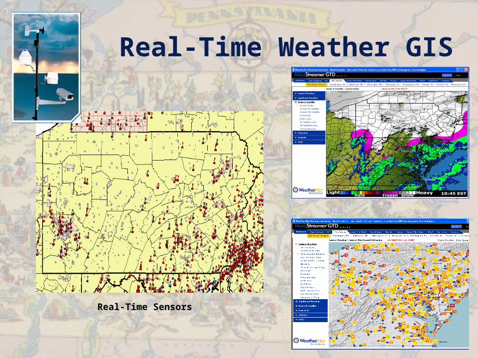
Real-Time Weather GIS
Real-Time Sensors
GT Workgroups• Multidisciplinary Workgroups – state
agencies, counties, RCTTF, academia, federal partners– HS GIS Task Force– Weather Workgroup– Addressing Workgroup – address
standardization, validation, geocoding– GIS Clearinghouse Advisory Board?– Routing Workgroup?
C2K - 2004• Enterprise GT Data Architecture• National Hydrography Database (NHD)• Streams and Lakes Information
Management System (SLIMS)• Landuse/Sustainable Development• Greenways GIS – riparian buffers, etc.• Enterprise GIS for Forestry• Weather project – runoff, flooding,
HAZMAT response

http://www.bgt.state.pa.us