1 delaware gis conference 2006 patterns of change the pennsylvania story jim knudson...
TRANSCRIPT
1
Delaware GIS Conference 2006
Patterns of ChangeThe Pennsylvania Story
Jim Knudson ([email protected]) Deputy CIO, Environmental Community of Practice
Stacey White ([email protected])Director, Geospatial Technologies Office

2
PA Patterns of Change• Change occurs in Commonwealth of Pennsylvania
Geospatial Community on a DAILY basis (mostly
good), making us all a little CRAZY!• At the state level, the following are occuring:
– Organizational Changes– Geospatial Responsibilities Grow– Governance Changes– Geospatial Shared Services Model– Geospatial Standards– Public Safety/Homeland Security Developments– Enterprise Geospatial Data Projects
• The Geospatial Evolution…

3
Organizational Changes• GTO survived a third OIT reorganization and a
third office move in April (3 moves in 30 months)• Did not get to hire any new staff (previously staffed
at 2, now 1.5, will hire 3 this next year)• Jim was promoted to Deputy CIO, Environmental
Community of Practice (EnviroCoP)• BGT was reorganized to become the Geospatial
Technologies Office, reports to EnviroCoP• Stacey White was promoted to GTO Director• Will be hiring a GT Project Manager, Senior
Application Developer, and Database/Systems Administrator in next 6 months

4
Organizational Changes• GTO Operational Budget dropped by more than 1/3
for next year, requiring program cuts• Line item for PAMAP costs in Budget for first time
($4M)• Recognition by Secretary of Administration and
Governor’s Office on importance of Geospatial Technologies (Governor’s office uses our legislative geocoding application DAILY!)
• No new HLS grants next year for GTO, but have plenty to complete this year
• Potential for new funding and staffing for FY 2007?

5
Geospatial Responsibilities• Coordination
– 30 Agencies in state government– County GIS Professionals formed– Coordination with local government associations– More coordination with surrounding states
• Planning– Strategic and Tactical Plans – 3 year Strategic Plan is on
GTO website– Geospatial Job Classifications
• Enterprise Geospatial Data Needs– Priorities– Strategy– Budget

6
Geospatial Responsibilities• Operations
– Geospatial Enterprise Server Architecture• Enterprise Geospatial Database• Geospatial Application Hosting Servers
– Geospatial Applications• HLS Geospatial Portals (GTO)• Agency Applications• OGC Mapping Services• Geospatial Web Services
• Policy/Standards
• Budget and Administrative Tasks

7
Geospatial Governance Changes• PA Geographic Information Council/Geospatial
Technologies Council voted to disband (user group)
• Geospatial Communities of Practice (GeoCoPa) continues in its place– Divided into four communities:
• Public Safety• Health and Human Services• Environmental• General Government Operations
– Will be project driven – standards, best practices, research and development, applications
– Opportunities for external entities to collaborate with state agencies
– Quarterly meetings, external participation invited

8
Governance Changes• Statewide Geospatial Council …coming…
– Reviewed several drafts of legislative language– Administration has concerns over policy vs. advisory,
funding, resources, prefers to “Do It Right” instead of “Do It Fast”, with consensus based approach
9
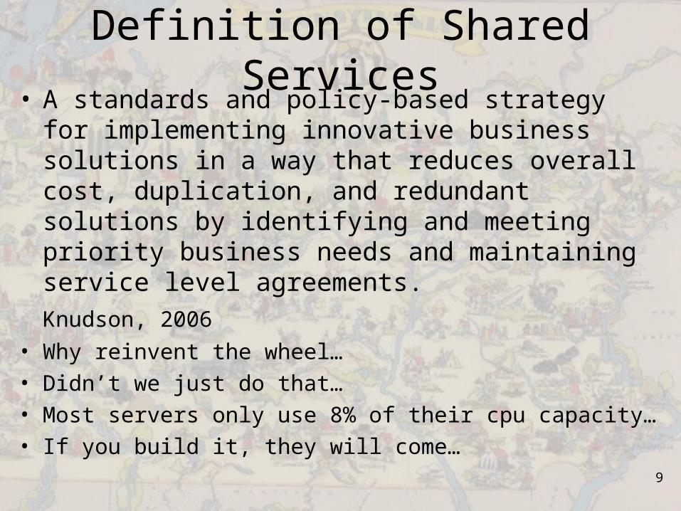
Definition of Shared Services• A standards and policy-based strategy for
implementing innovative business solutions in a way that reduces overall cost, duplication, and redundant solutions by identifying and meeting priority business needs and maintaining service level agreements.
Knudson, 2006
• Why reinvent the wheel…• Didn’t we just do that…• Most servers only use 8% of their cpu capacity…• If you build it, they will come…
10
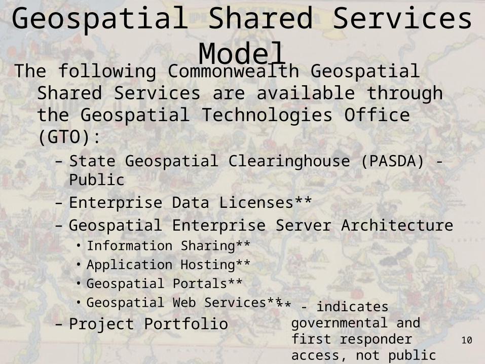
Geospatial Shared Services ModelThe following Commonwealth Geospatial Shared
Services are available through the Geospatial Technologies Office (GTO):
– State Geospatial Clearinghouse (PASDA) - Public– Enterprise Data Licenses**– Geospatial Enterprise Server Architecture
• Information Sharing**• Application Hosting**• Geospatial Portals**• Geospatial Web Services**
– Project Portfolio** - indicates governmental
and first responder access, not public access
11
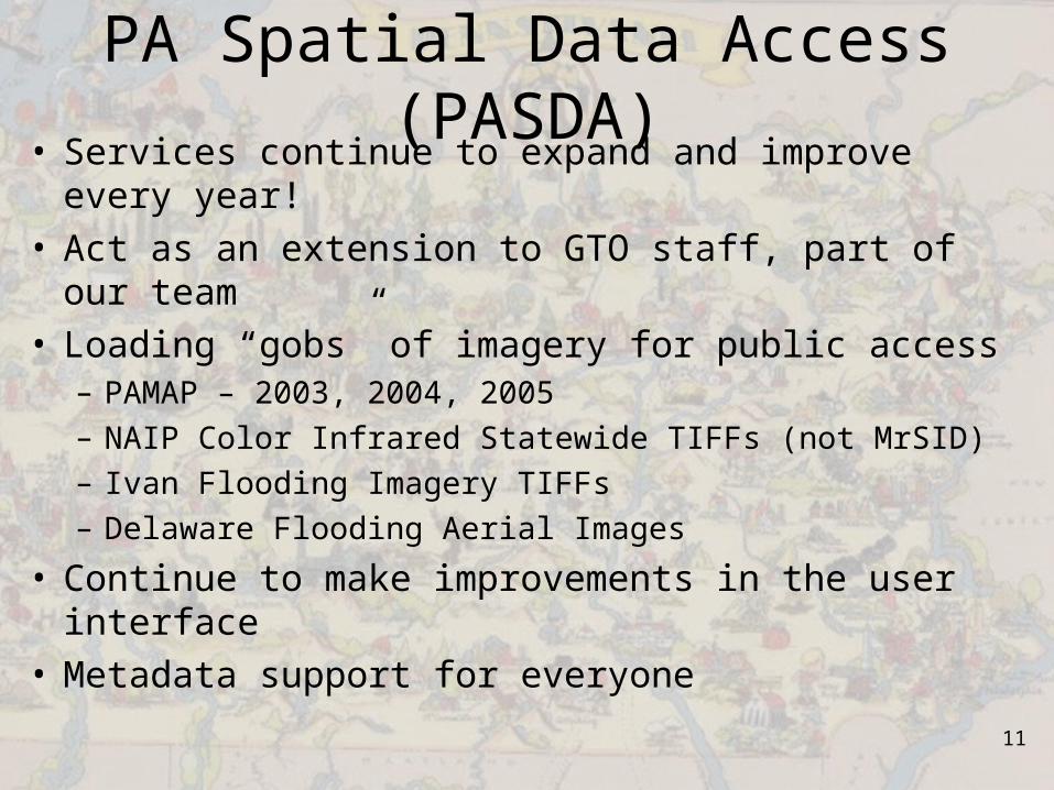
PA Spatial Data Access (PASDA)• Services continue to expand and improve every
year!• Act as an extension to GTO staff, part of our team• Loading “gobs” of imagery for public access
– PAMAP – 2003, 2004, 2005– NAIP Color Infrared Statewide TIFFs (not MrSID)– Ivan Flooding Imagery TIFFs– Delaware Flooding Aerial Images
• Continue to make improvements in the user interface
• Metadata support for everyone
12
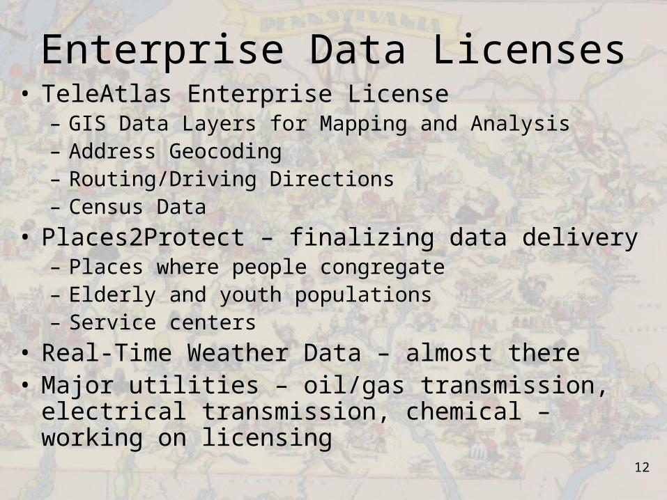
Enterprise Data Licenses• TeleAtlas Enterprise License
– GIS Data Layers for Mapping and Analysis– Address Geocoding– Routing/Driving Directions– Census Data
• Places2Protect – finalizing data delivery– Places where people congregate– Elderly and youth populations– Service centers
• Real-Time Weather Data – almost there• Major utilities – oil/gas transmission, electrical
transmission, chemical – working on licensing
13
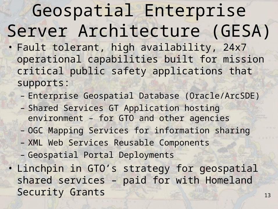
Geospatial Enterprise Server Architecture (GESA)
• Fault tolerant, high availability, 24x7 operational capabilities built for mission critical public safety applications that supports:– Enterprise Geospatial Database (Oracle/ArcSDE)– Shared Services GT Application hosting environment –
for GTO and other agencies– OGC Mapping Services for information sharing– XML Web Services Reusable Components– Geospatial Portal Deployments
• Linchpin in GTO’s strategy for geospatial shared services – paid for with Homeland Security Grants

ArcGISServerSOC
`
Oracle SANArcSDE
Repository/Oracle Cluster
Por
t 530
0
Port 5353 & 5052
Port 1521
State ArcGISDesktop and
Co-Location Users
ArcGIS CitrixMetaframe
Por
t 152
1
ArcSDE DirectConnections
Geospatial Enterprise Server Architecture
Port 80
ArcIMS Image andFeature Services
Port 5151 & 5152
Data LoadingOnly
IBMx346s
IBMx445DPs
IBMx346s
IBMx445DPs
Port 1521
MAN Access
Internal Services
ArcGISServerSOM
Port 135/D
CO
M
Port 135/DC
OM
Port 135/DCOM
Port 135/DCOM
Citrix SecureGateway
(OAREMOTE)
Internet MAN
Port 8
0
Por
t 80 P
ort 80
Port 80 Port 80
Port
80
Port 8
0
Hardware Load BalancedHTTP Servers/ArcIMS Connectors
and ArcGIS Server ADF
Hardware Load BalancedHTTP Servers/ArcIMS
Connectors
Por
t 530
0
Por
t 530
0
Por
t 445
Por
t 445
Por
t 445
IBMx445DPs
Port 5353 & 5052
Por
t 530
0
Por
t 530
0
Por
t 530
0
Por
t 445
Por
t 445
Por
t 445
Port 5353 & 5052
Port 5353 & 5052
Port 5353 & 5052
Port 1521
Port 1521 Por
t 152
1
Port 1
521
ArcIMS Application &Spatial Server
ArcIMS Application &Spatial Server
ArcIMS Application &Spatial Server
ArcIMS Application &Spatial Server
ArcIMS Application &Spatial Server
Port 1521
ArcIMS Application &Spatial Server
ArcSDEActive/Passive Cluster
Port 1521
Por
t 445
Port
445
Por
t 445
Por
t 445
Port
445
Por
t 445
Port 5353 & 5052
Updated: January 20, 2006

15
Geospatial Application Hosting Services
• GESA provides:– Direct access to enterprise geospatial database– Fault-tolerant, network load balanced application servers– Leverage GTO ESRI and other software licenses
(ArcSDE, ArcIMS, ArcGIS Server, Citrix server for a license pool containing ArcInfo, ArcEditor, ArcView, and most extensions for desktop environment)
– Managed Services environment (support)

16
Geospatial Application Hosting• GTO is hosting GTO applications and other agency
applications in the GESA:– Community and Economic Development– Governor’s Office– Health– Labor and Industry– PEMA
• Coming Attractions:– Agriculture?– Insurance?– OHS?– PSP?

17
Geospatial Portal Development• Leverages the IRRIS Geospatial Framework for
Pennsylvania (developed by GeoDecisions)– $15M Investment in IRRIS by the Military Surface
Deployment and Distribution Command Traffic Engineering Agency (SDDCTEA)
– Enables rapid deployment of portal applications– Being adopted by DHS and being used by other states
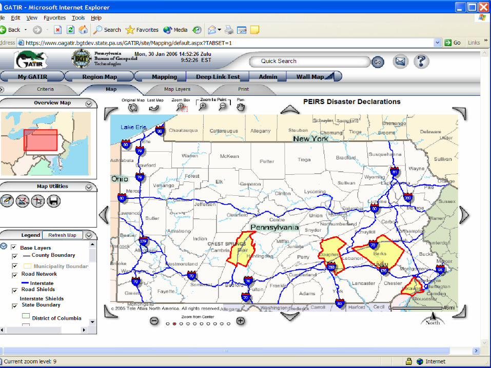
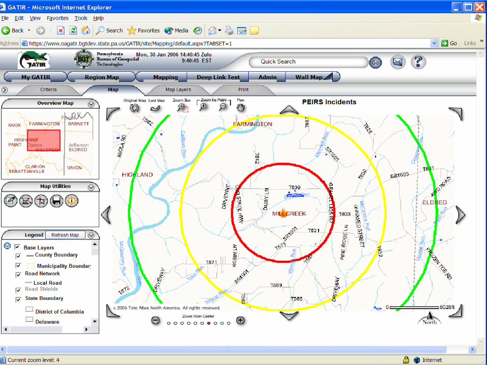
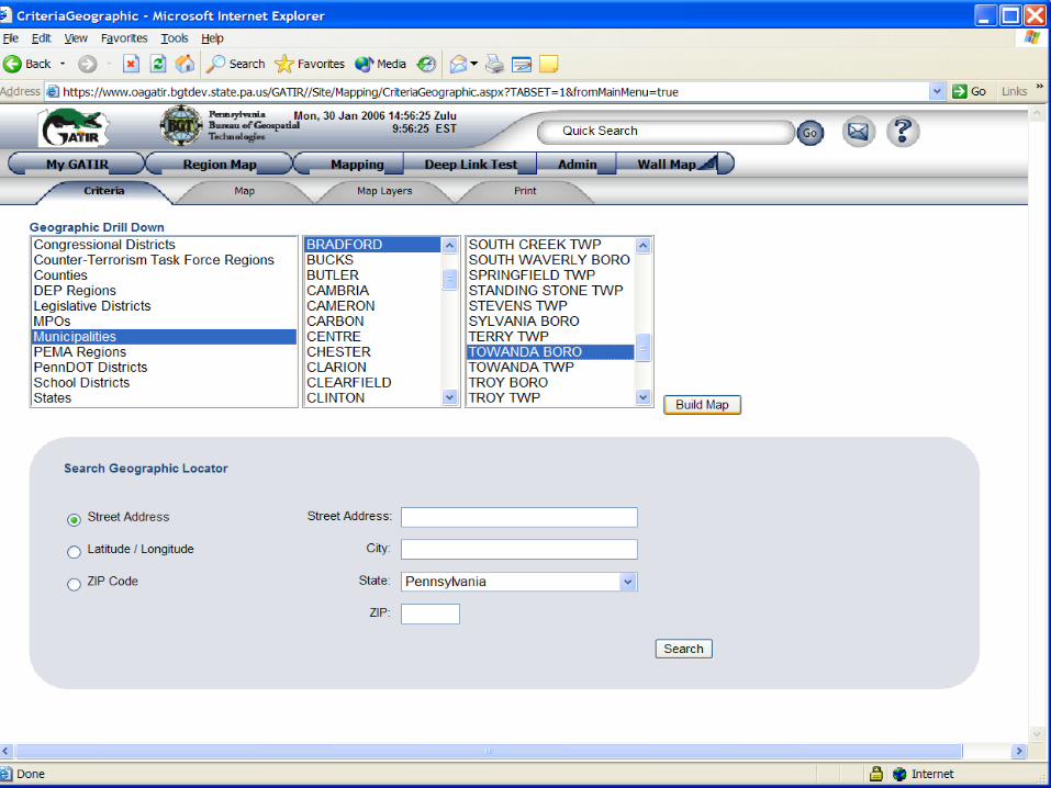
• First PA geospatial portal was the Geospatial Analysis of Threats and Incident Reports (GATIR)
• GATIR Enhancements Project will add more functionality, new GATIR Portals for Transportation and Health (SNS/Pandemic)

18
Geospatial Web Services• GTO currently offers XML web service applications
for:– Address Verification/Validation– Address Geocoding– Data Loading into ArcSDE (point features, using lat/long)– Boundary Geocoding– Mapping– Routing/Driving Directions
• Planning new web services for:– Spatial Search/Query– Gazetteer– Plume Modeling

19
Geospatial Web Services• Documented on GTO website under Enterprise GIS
Web Services Link – Developer Integration Guides (DIGs):• DIGs include how
to register for access to services, error messages, input and output XML interfaces, and sample source code on how to call services in VB.NET / ASP.NET
20
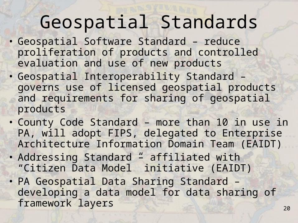
Geospatial Standards• Geospatial Software Standard – reduce proliferation
of products and controlled evaluation and use of new products
• Geospatial Interoperability Standard – governs use of licensed geospatial products and requirements for sharing of geospatial products
• County Code Standard – more than 10 in use in PA, will adopt FIPS, delegated to Enterprise Architecture Information Domain Team (EAIDT)
• Addressing Standard – affiliated with “Citizen Data Model” initiative (EAIDT)
• PA Geospatial Data Sharing Standard – developing a data model for data sharing of framework layers
21
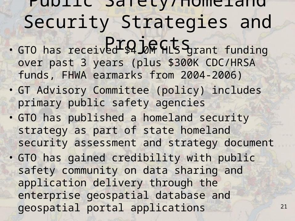
Public Safety/Homeland Security Strategies and Projects
• GTO has received $4.0M HLS grant funding over past 3 years (plus $300K CDC/HRSA funds, FHWA earmarks from 2004-2006)
• GT Advisory Committee (policy) includes primary public safety agencies
• GTO has published a homeland security strategy as part of state homeland security assessment and strategy document
• GTO has gained credibility with public safety community on data sharing and application delivery through the enterprise geospatial database and geospatial portal applications

22
Homeland Security Projects• SHSP 2004 – Severe
Weather Alerting and Plume Modeling ($1.5M)
• ITEP 2004 ($600K)– Competitive, Enterprise
Geospatial Technologies Data Architecture (EGTDA), Geospatial Analysis of Threats and Incident Reports (GATIR) portal, mapping services, web services
• SHSP 2005 ($1.87M)– PAMAP Funding– Federated GIS Project– PGDSS Local Roads
Pilot Project– GATIR Enhancements– Health Geospatial Portal
(SNS/Pandemic/Hospital Status)
– Utilities/Critical Infrastructure
– Places2Protect Enterprise License
23

24
25

26

27
Wall map slide
28
29

30

31
Information Sharing Strategy
Agencies andExternal Business
Partners
Enterprise GT Database
DataProviders
Data, metadata
Data, metadata
Public
PASDA Data, metadata, mapping services
Data, metadata, mapping services
ESRI and OGC Mapping Services
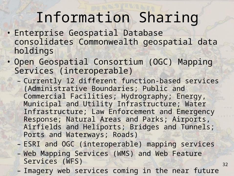
32
Information Sharing• Enterprise Geospatial Database consolidates
Commonwealth geospatial data holdings• Open Geospatial Consortium (OGC) Mapping
Services (interoperable)– Currently 12 different function-based services
(Administrative Boundaries; Public and Commercial Facilities; Hydrography; Energy, Municipal and Utility Infrastructure; Water Infrastructure; Law Enforcement and Emergency Response; Natural Areas and Parks; Airports, Airfields and Heliports; Bridges and Tunnels; Ports and Waterways; Roads)
– ESRI and OGC (interoperable) mapping services– Web Mapping Services (WMS) and Web Feature
Services (WFS)– Imagery web services coming in the near future
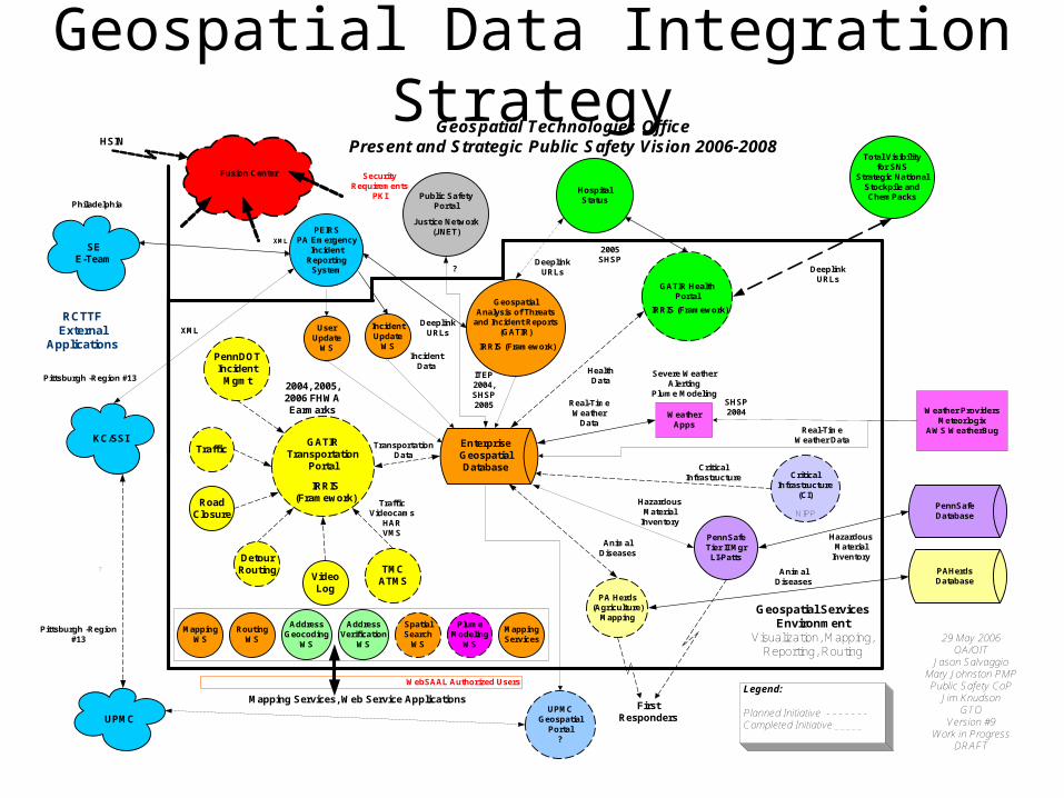
Geospatial Data Integration Strategy
WebSAAL Authorized Users
MappingWS
RoutingWS
AddressGeocoding
WS
AddressVerification
WS
SpatialSearch
WS
PlumeModeling
WS
MappingServices
EnterpriseGeospatialDatabase
Public SafetyPortal
Justice Network(JNET)
WeatherApps
SHSP2004
PennSafeDatabase
PennSafeTier II MgrLI-Patts
HazardousMaterial
Inventory
FirstResponders
SEE-Team
KC/SSI
UPMC
Pittsburgh -Region #13
XMLDeeplink
URLs
?
UPMCGeospatial
Portal?
PA Herds(Agriculture)
Mapping
Geospatial Technologies OfficePresent and Strategic Public Safety Vision 2006-2008
Weather ProvidersMeteorlogix
AWS WeatherBug
Philadelphia
Pittsburgh -Region#13 29 May 2006
OA/OITJason Salvaggio
Mary Johnston PMPPublic Safety CoP
Jim KnudsonGTO
Version #9Work in Progress
DRAFT
Legend:
Planned Initiative - - - - - - -Completed Initiative _____
AnimalDiseases
Severe WeatherAlerting
Plume Modeling
Real-TimeWeather Data
XML
?
NIPP
CriticalInfrastructure
(CI)
CriticalInfrastructure
PennDOTIncident
Mgmt
RoadClosure
DetourRouting
VideoLog
TMCATMS
TrafficVideocams
HARVMS
GATIRTransportation
Portal
Traffic
2004, 2005,2006 FHWAEarmarks
IRRIS(Framework)
DeeplinkURLs
UserUpdate
WS
IncidentUpdate
WS
HSIN
HospitalStatus
Total Visibilityfor SNS
Strategic NationalStockpile andChemPacks
GATIR HealthPortal
2005SHSP
IRRIS (Framework)
DeeplinkURLs
SecurityRequirements
PKI
Real-TimeWeather
Data
GeospatialAnalysis of Threats
and Incident Reports(GATIR)
ITEP2004,SHSP2005
IRRIS (Framework)
TransportationData
HealthData
IncidentData
Mapping Services, Web Service Applications
Geospatial ServicesEnvironment
Visualization, Mapping,Reporting, Routing
RCTTFExternal
Applications
PAHerdsDatabase
PEIRSPA Emergency
IncidentReporting
System
Fusion Center
HazardousMaterial
Inventory
AnimalDiseases

34
The Geospatial Evolution…• Dangermond’s Law: GIS/GT can never be mastered
because it is always changing.• Knudson’s Corollaries:
– Listen and learn, apply best practices– Continue to evaluate and prioritize your needs daily– Develop a long term vision, plan, and strategy– Work within the boundaries of your plan– Remain agile, roll with the changes– Evolve in the direction you choose, not chosen for you– Measure your results, never settle for status quo– Progress often cannot be measured daily, but small steps
must be made daily– Learn from your mistakes, document lessons learned
35
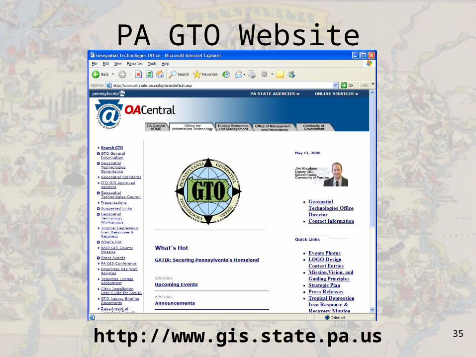
PA GTO Website
http://www.gis.state.pa.us